A collection of walks, discoveries, insights and pictures of exploring Dartmoor National Park
October 16, 2025
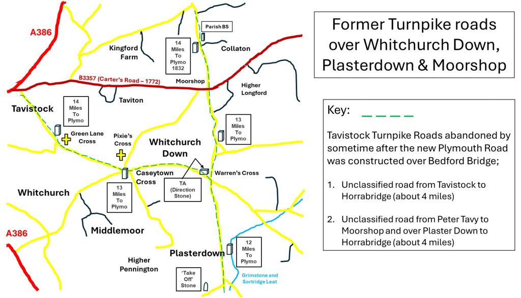
Former Tavistock Trust Turnpike roads over Whitchurch Down, Plasterdown and Moorshop Cross
In Britain, the roads in the 17th and 18th centuries were in a very poor state, thus was borne Turnpike trusts, which were set up by individual acts of Parliament, with powers to collect road tolls for maintaining the principal roads. These trusts started from the 17th century but their heydays were during the 18th and 19th centuries. At the peak, in the 1830s, there were over 1,000 trusts across Britain.
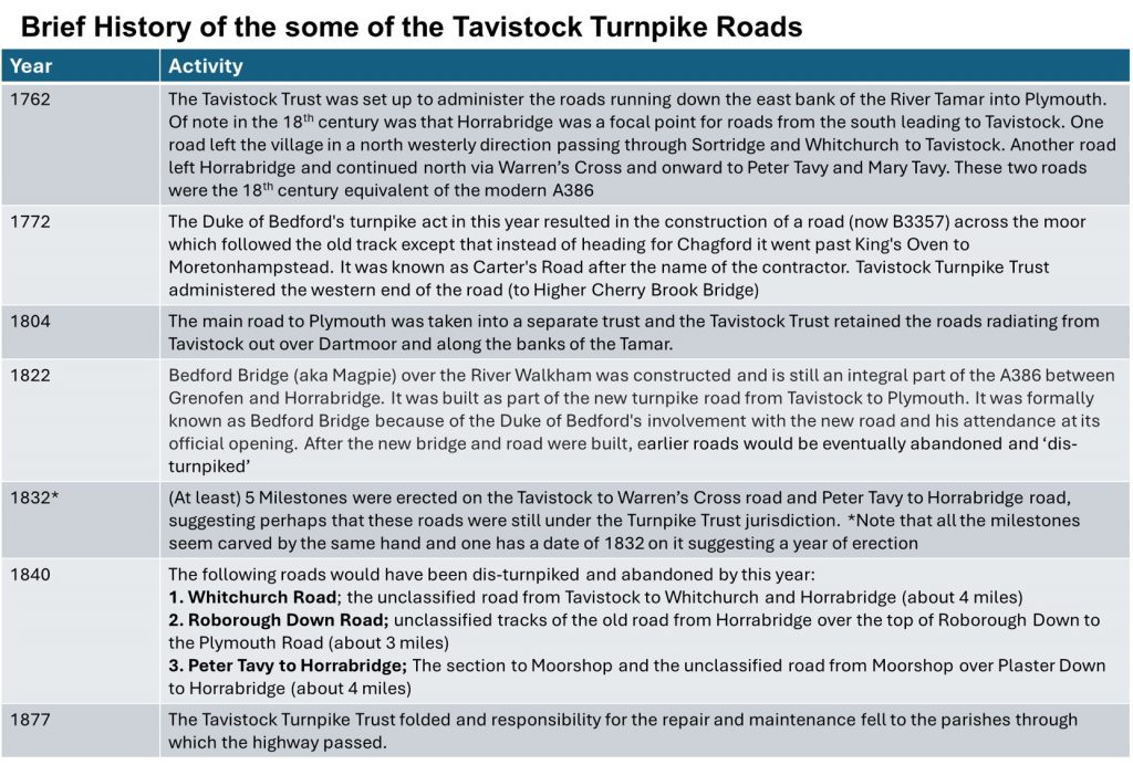
The Tavistock Turnpike Trust was set up in 1762 and just over 100 years later in 1877 had been disbanded. When created this trust purpose was primarily to administer the roads running down the east bank of the River Tamar into Plymouth. The main road to Plymouth in the 18th century was through Whitchurch, passed Sortridge and across the Walkham at Horrabridge before passing across Roborough Down.
In 1772, there was a major development of roads across Dartmoor following the Duke of Bedford’s turnpike act of this year resulted in the construction of a road (now B3357). The road followed the old trackways (in the main) except that instead of heading for Chagford it went past King’s Oven to Moretonhampstead. The road was known as Carter’s Road after the name of the contractor and the western end of the road (to Higher Cherry Brook Bridge) was administered by the Tavistock Turnpike Trust.
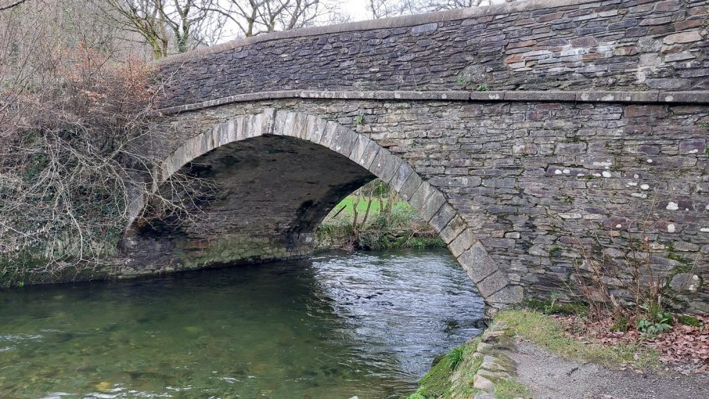
The next big change was in 1804 when following another act of Parliament, the main road to Plymouth was taken into a separate trust and the Tavistock Trust just retained the roads radiating from Tavistock out over Dartmoor and along the banks of the Tamar. Less than 20 years later in 1822, further improvements were made with the building of Bedford (aka Magpie) Bridge which provided a much needed downstream crossing of the Walkham to bypass Horrabridge. Many of the roads to the east of Tavistock were ‘disturnpiked’ (if there is such a word!) after this. This (‘disturnpiking’) was completed by early 1840s with the new main road (now A386) across Bedford Bridge now being administered by the Plymouth and Tavistock Turnpike Trust. The new road was accompanied by the construction of at least three Toll Houses between Roborough and Tavistock in the 1840s.
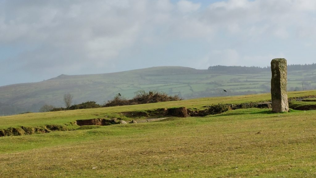
The roads east of Tavistock appear to have been ‘disturnpiked’ sometime between 1832 and early 1840s, as it appears that at least five milestones in 1832* were erected in this year by the Tavistock Trust. It is these milestones, (plus a possible directional stone at Warren’s Cross), located at Whitchurch Down, Plasterdown, Green Lane and at the lane leading to Collaton, which are the main subject of this post along with the three Toll Houses on the new (1822) road.
* The five milestones appear to have been inscribed by the same person (ie font is same) and one of the stones has the date of 1832. Furthermore, this is authenticated on the Historic Environment Record with entries by Tim Jenkinson of the Milestone Society
Martin Ebdon (2014) – The Turnpike Roads of Devon in 1840: Detailed Lists of the Roads with Maps.
Tim Jenkinson – (2007) Old Toll-houses of Dartmoor towns and villages Part 1: North and West Dartmoor Magazine No 87 Summer (Pages 25-27)
J. Kanefsky (1984) – Devon Toll Houses (University of Exeter)
Dr J. Kanefsky (2021) – Devon’s Tollhouses: A Gazetteer
Tim Jenkinson (2003 – 2005) – Peter Tavy to Horrabridge via Whitchurch & Plaster Down Unclassified (Report – Survey). SDV324156
E.N. Masson Phillips (1943) – Notes on Some Old Roadside Stones in South West Devon
Debbie Carmichael – Pers. Conv.
John Hudswell – Pers. Conv.
Mark Ebdon – Pers. Conv
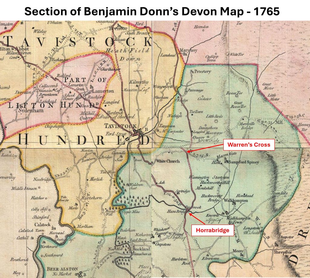
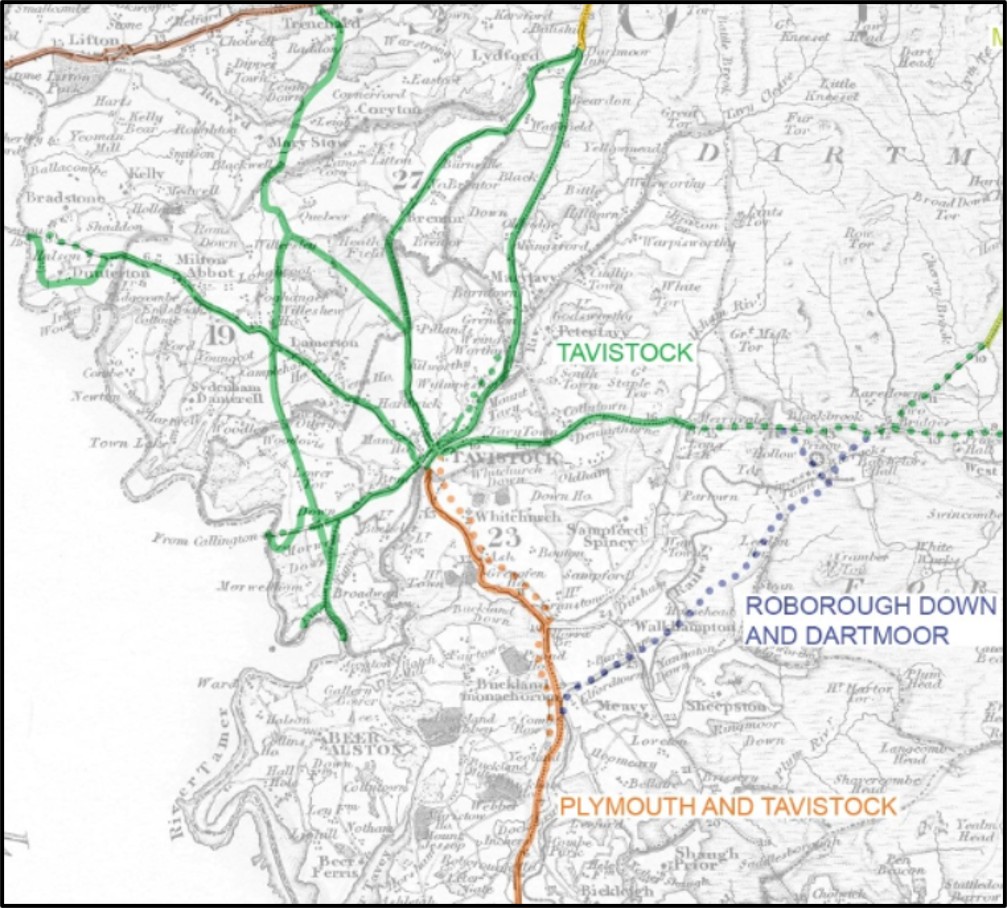
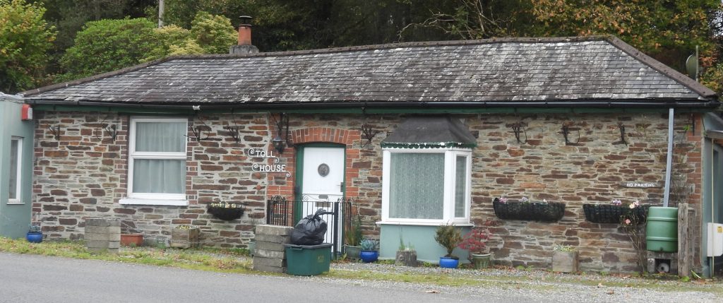
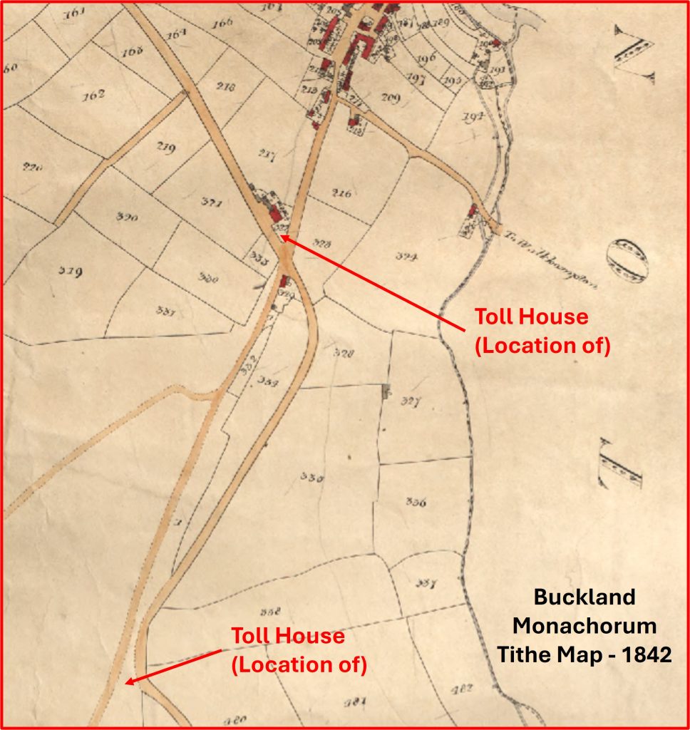
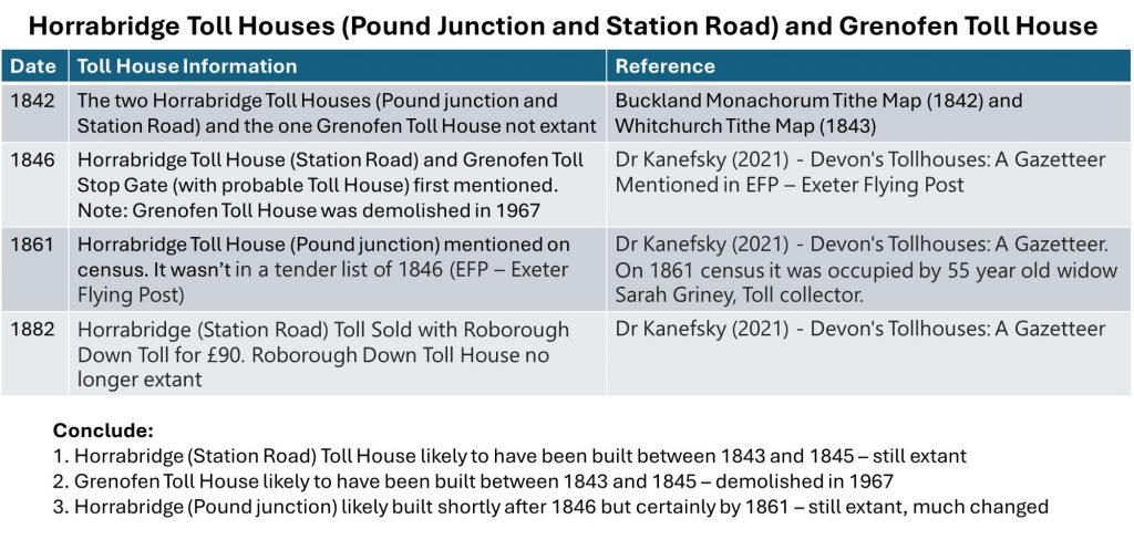
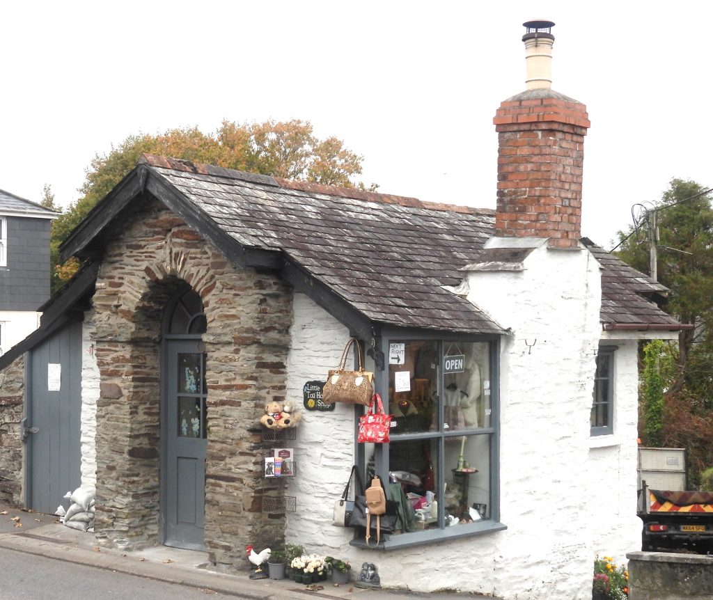
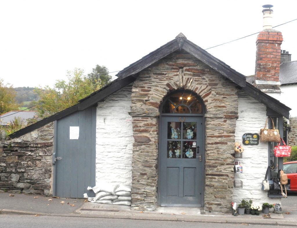
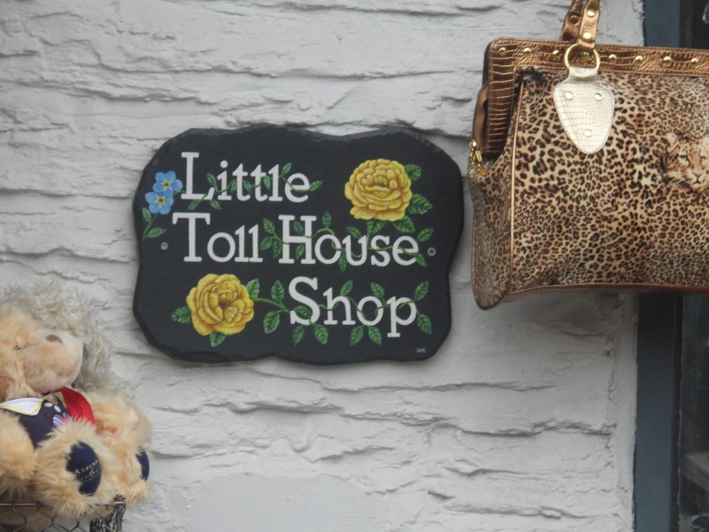
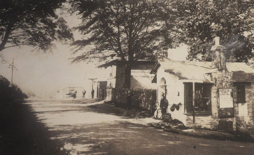
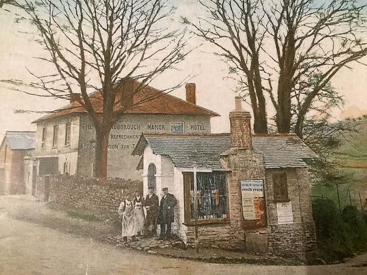
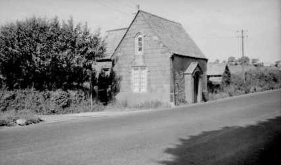
This sketch map shows the locations of the milestones, the directional stone plus other features shown in this postThis is a section of Benjamin Donn’s map of Devon dated 1765. This map was produced three years after the Tavistock Turnpike Trust was created. Of note from the map is that Horrabridge was a focal point for roads leading north from Plymouth, with one road leaving the village in a north westerly direction passing through Sortridge and Whitchurch to Tavistock. Another road left Horrabridge and continued north via Warren’s Cross and onward to Peter Tavy and Mary Tavy. These two roads were the 18th century equivalent of the modern A386This map shows the extent of the Turnpike Trusts around Tavistock from circa 1840s (ref: Mark Ebdon Maps). At this time, the roads around Whitchurch Down and Plasterdown had been clearly ‘disturnpiked’.This table shows the key years of the Tavistock Turnpike Trust during its 115 year life cycle between 1762 and 1877 On the A386, on the outskirts of Horrabridge next to the Buckland Monachorum turning is this long single storied building, which is a former Toll House. It was recorded by J.Kanefsky as quoted by Tim Jenkinson in a Dartmoor Magazine article from Summer 2007 (No. 87) – page 27 as having been constructed in c1790 thus making it probably one of the oldest Toll houses in Devon. That said, it has come to the authors attention that this date is incorrect and that it wasn’t constructed until after 1842 (date of the Buckland Monachorum Tithe). The current structure was built around the original cross-shaped structure at a much later date. Lets consider the evidence of the when this Toll House was built and others on the A386 on the new Turnpike (cut 1822)……This extract of the 1842 Buckland Monachorum Tithe shows neither the Toll House at the Buckland Monachorum (Pound) junction of the one at Station Road were extant in 1842. There were three toll houses built post 1842, namely: 1. At the Buckland Monachorum (Pound) junction, 2. At the junction of what is now Station Road and 3. At Grenofen opposite the former Halfway House Inn. All three were of the same design – a cross-shape (ref: John Hudswell) but the building at the junction to Buckland Monachorum (Pound) has been much altered since. John Hudswell suggests: “The reason for the three houses being built lay in the freeing of the other older turnpike routes. This reduced the income of the trust and highlighted the problem of traffic using sections of the new road for free by joining at points where historic routes crossed. So the three Toll houses were built at these junctions to intercept travellers, some time after 1843 based on the tithe map evidence”. Until then there appears only been toll houses at Roborough and Tavistock (junction of Pixon Lane). This summary has been created by using Tithe maps and from information supplied by courtesy of Martin Ebdon, which is based on two extracts from a Dr Kanefsky produced list in 2021, titled ‘Devon’s Tollhouses: A Gazetteer’. This combined information provide quite a narrow timeline for when the three Toll houses between Roborough and Tavistock were built. Dr Kanefsky conjectures that the Pound junction Toll house might have replaced the Station Road Toll houseThe second Horrabridge Toll house is on the junction of Station Road and the A386 and is known locally as ‘Saddlers’ (there is a Saddlers Cottage opposite and this building had once been a Saddlers). In 2025, it is called the ‘Little Toll House Shop’ and is a gift shop. Thought to be built between 1843 and 1845This second Horrabridge Toll house is ideally located at the top of the section of Station Road which leads down to the village and the major river crossing of Walkham (up to 1822). The ‘Little Toll House Shop’ signThe Toll house once had a hotel / rest house located behind it. Sometime after its life as a Toll house (it was sold in 1882 along with a Toll House at Roborough for a combined value of £90), the building became a Saddlers shop and the author has been told that horses rested here and running repairs to their tack took place whilst the travellers were resting up and getting their refreshments (ref: Debbie Carmichael)The hotel behind the Saddlers (ex-Toll house) was once called ‘The Roborough Manor Hotel’.Magpie Bridge is formally known as Bedford Bridge because of the Duke of Bedford’s involvement with the new road, this bridge and for his attendance at its official opening. After this new bridge and road were built (in 1822), earlier roads would be eventually abandoned by the Tavistock Trust and be ‘disturnpiked’
Grenofen Toll house which was opposite the old Halfway House Inn. It once had two storeys high and was demolished around 1967. The building was originally a cross-shaped structure which was built between 1843 and 1845
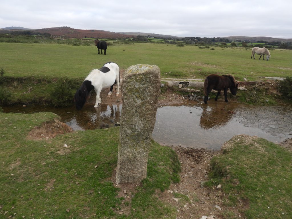
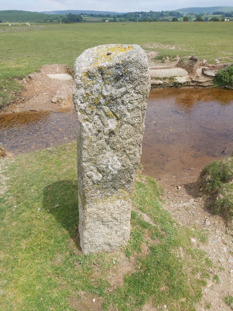
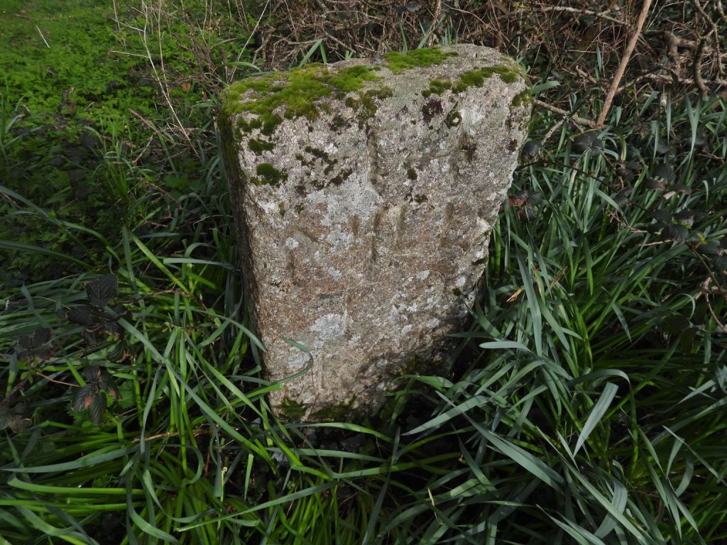
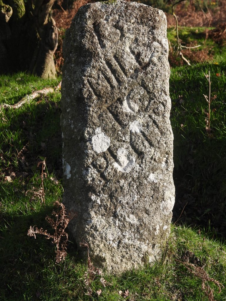
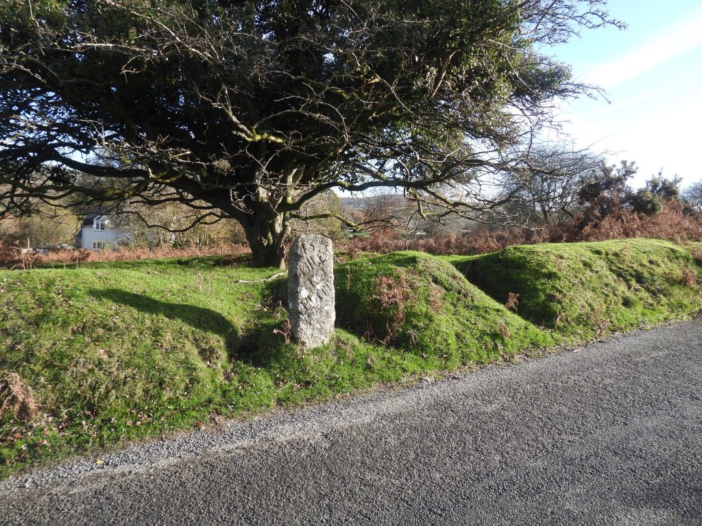
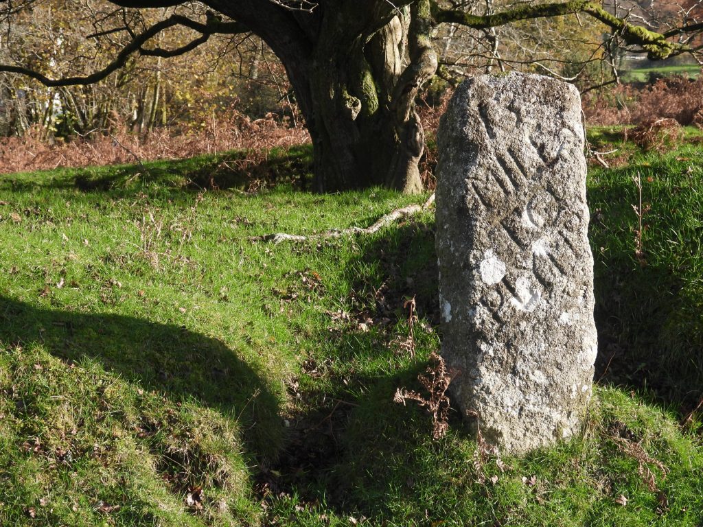
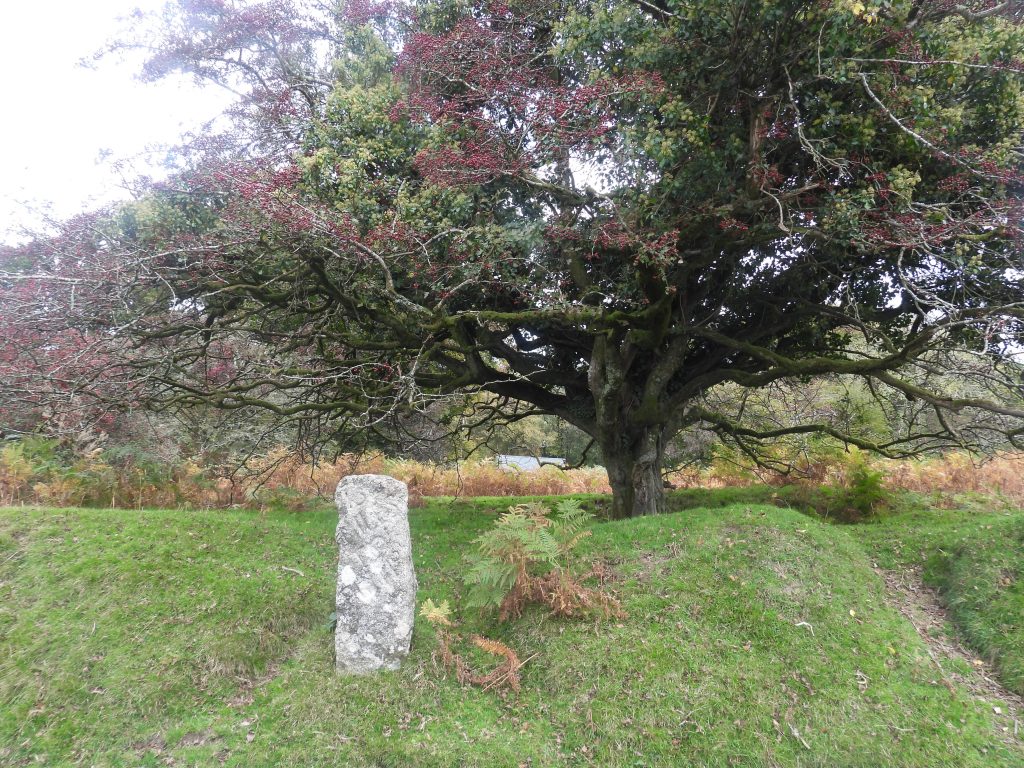
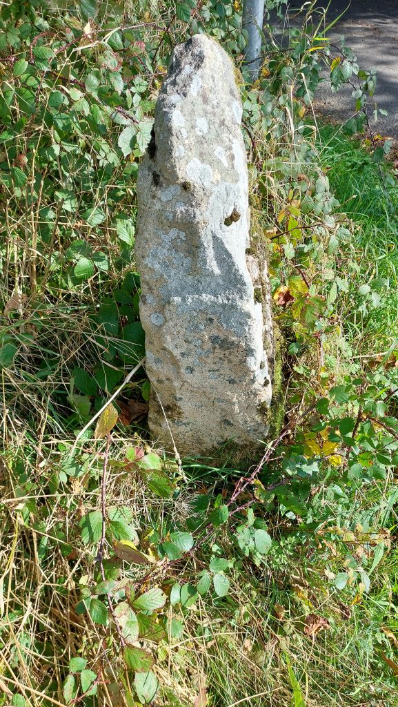
On Plasterdown, next to the Grimstone and Sortridge Leat is this milestone. It is inscribed ’12/MILES/TO/PLYMo’ and is unusually around 150m from the road, so most likely would have been moved. It is believed to have been (originally) erected in 1832, 10 years after Bedford Bridge was built and less that 10 years after the nearby road (the original main road north to Mary Tavy) was ‘disturnpiked’.
The Plasterdown (12 Mile) milestone between 1943 and 1976 would have been within the bounds of the Plasterdown (or Plaister Down) Camp. The camp had been built during the war years for the 115th Field Hospital Unit (U.S Army)
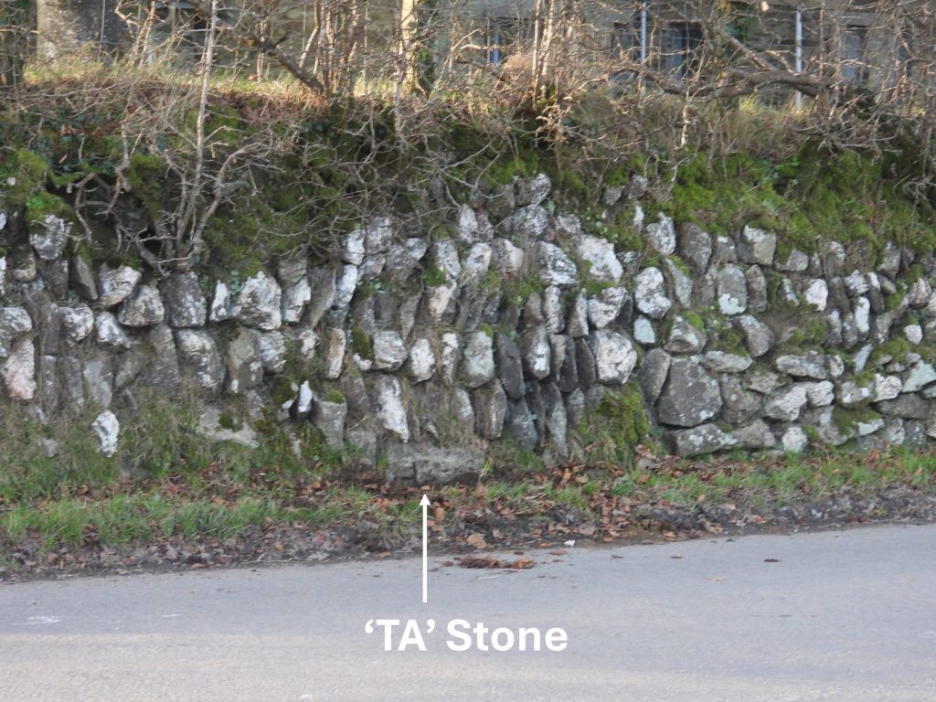
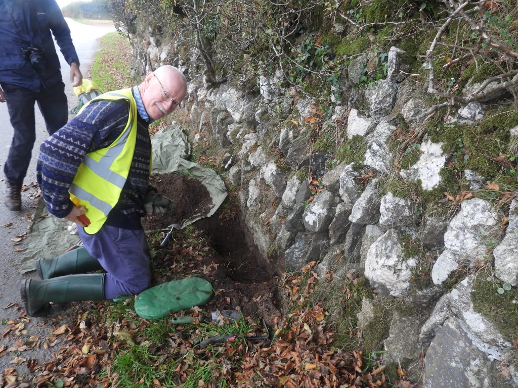
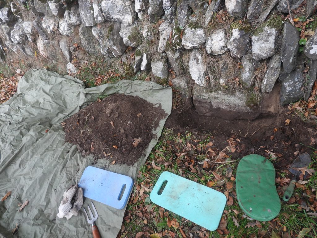
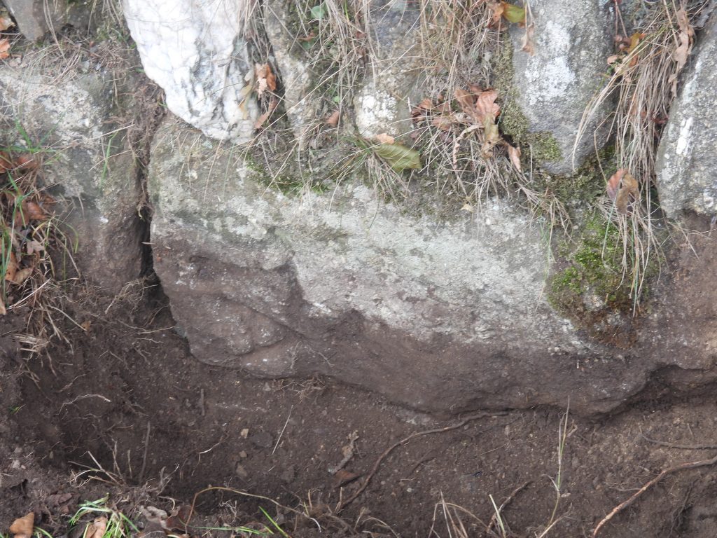
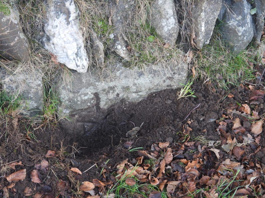
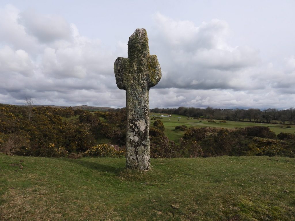
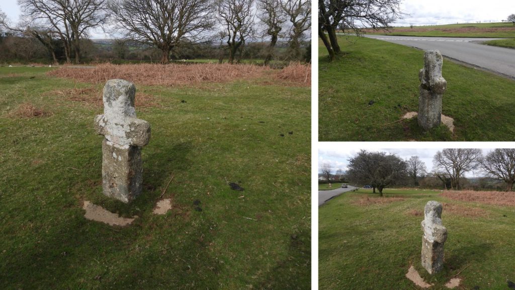
The milestone is 118cm tall and is located at SX51643 72379There is a ‘Take Off’ Stone at Fullamoor Farm near the Horrabridge – Warren Cross Road. The history of this and similar stones can be traced to 20th March 1800, when the Government limited the number of horses that could be used with specified wheel widths on waggon and carriages on turnpike roads. Examples included: a) a four-wheeled carriage with a wheel width of 9″ was not allowed anymore than 8 horses to draw it and b) a two-wheeled carried with a 9″ wheel width was allowed only up to 5 horses. The problem came when these carriages had a full load and they had a steep hill to climb. In these circumstances, there was an allowance where extra horses could be harnessed in order for the carriage to climb the hill. This was where a gradient rose more than 4 inches in a yard (or a 1 in 9). The point at where it was deemed possible to remove the extra horses was called the ‘Take Off Point’ and this was marked with a roadside stone called the ‘Take Off’ Stone. At this point all the extra horses were un-harnessed. (Ref: Legendary Dartmoor).The original site for this ‘Take Off’ stone is unknown (its current location being on a very flat section of road so wouldn’t meet the criteria for such stones). It is thought that this stone was found in a ‘job lot’ of stone bought in Tavistock and was used as part of the construction of this wall. The author speculates that the stone may have been erected originally around Horrabridge, perhaps on Jordan Lane or even Station Road or perhaps somewhere north of Tavistock. There are 4 known Tavistock Turnpike Trust ‘Take Off’ stones which remain and are believed to date from mid 1820s. More information can be found here: Tavistock Turnpike Trust “Take Off” Stones. – Dartmoor ExplorationsAt the base of a wall, around 7 paces from the corner, at Warren’s Cross, there is a stone inscribed ‘TA’. It is believed to have been a directional stone with ‘TA’ standing for Tavistock. Warren Cross stands at the crossroads with roads leading to/from Horrabridge, Sampford Spiney, Moorshop and Tavistock. Its location is annotated to the Benjamin Donn’s map of 1765 shown previously in this postWith permission from the owners of Warren Cross, the author and Simon Dell (pictured) conducted a dig around the ‘TA’ stone to establish if there were any other inscriptions and to confirm its exact dimensionsThe result of the dig concluded no further inscription (we thought there might have been a ‘V’ to make ‘TAV’ for Tavistock)The stone is 60cm wide by 30cm tall. Its depth is unknown. It does look like it has been splitAs a probable directional stone at this crossroads, the authors theory about the ‘TA’ stone at Warren’s Cross is that it is likely to be inscribed on other sides; maybe with ‘SS’ for Sampford Spiney, ‘MT’ for Mary Tavy and ‘H’ for Horrabridge as well as ‘TA’ for Tavistock. The author suspects it has a date of circa 1832 like the milestonesPixie’s Cross on Whitchurch Down is considered as “one of the best preserved and most visually impressive of all medieval wayside crosses on Dartmoor”. It had probably been extant for several hundred years when the Tavistock Turnpike Trust was formed. It has an incised cross between the arms on the western face. It is located at the edge of a disused quarry. The aesthetics of the cross are quite magnificent with two-thirds of shaft curving slightly to west-north-west and with crude stumpy arms aligned north-north-east by south-south-west. It lies on the old monastic route between Buckfast and Tavistock Abbeys.
Standing up against a wall near Caseytown Cross (near the old road to Tavistock) is another Milestone with the same inscribed design (slanted inscription ‘MILES TO PLYMo’) as the one on Plasterdown, except this one is the 13 mile marker. It clearly has been moved but it can’t be far from its original location. It is around 1.49 miles from the Plasterdown Milestone, which of course is likely, of course not to be in its original locationContextual picture of the ’13 mile’ milestone near Caseytown Cross – it is on a side road which leads to Caseytown, Birchey, Higher Statsford, Bleak House and Higher Pennington. This milestone, like the others was most probably inscribed and erected around 1832
The Caseytown Cross ’13 Mile’ milestone is located at SX50264 73421
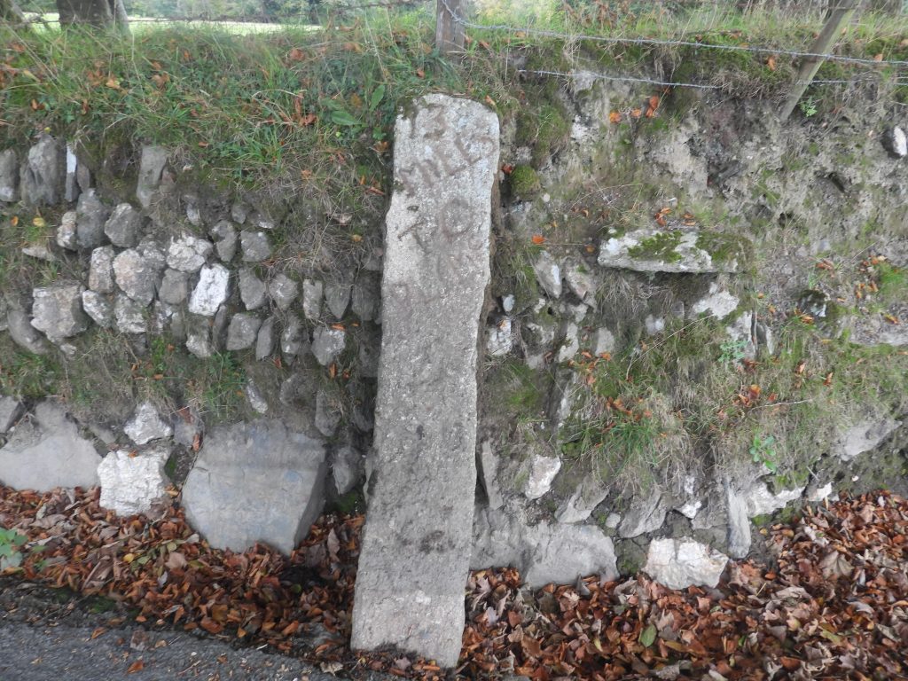
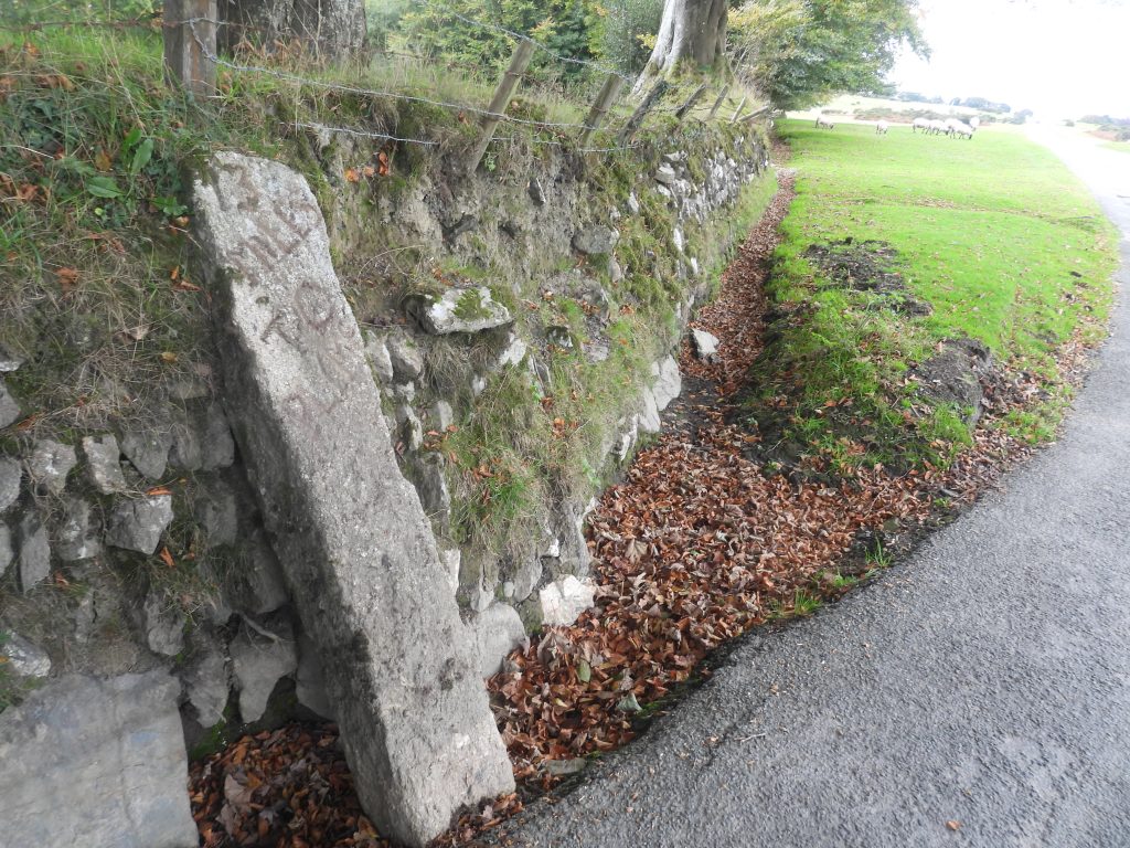
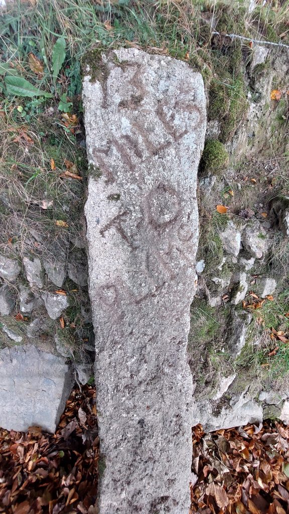
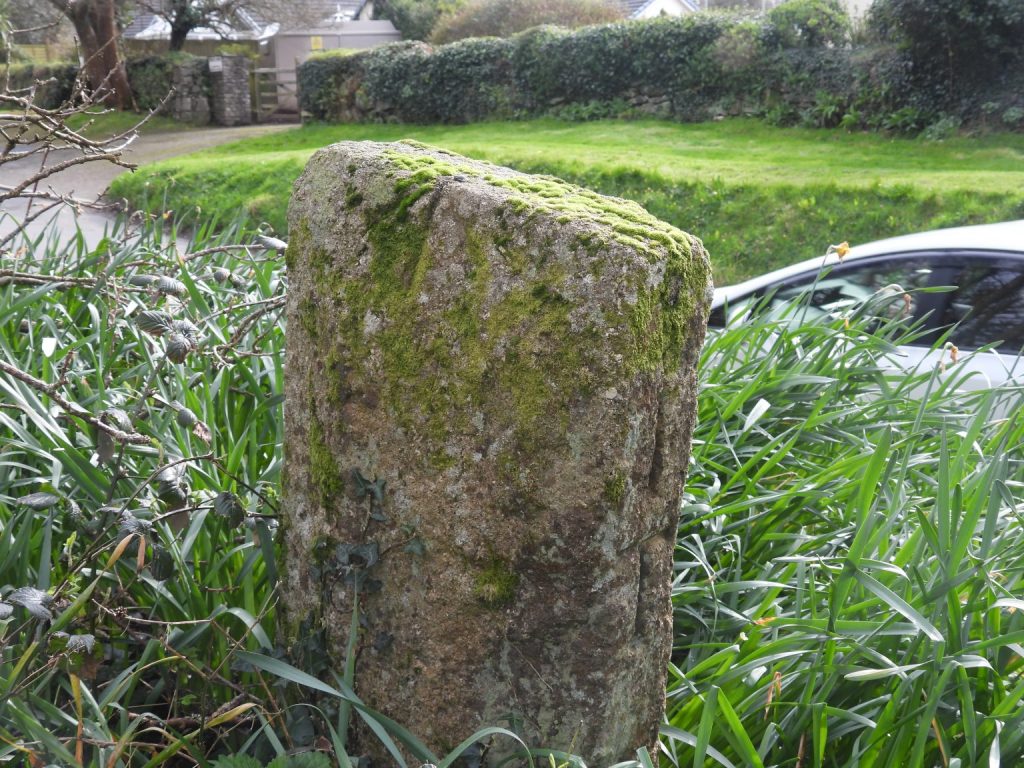
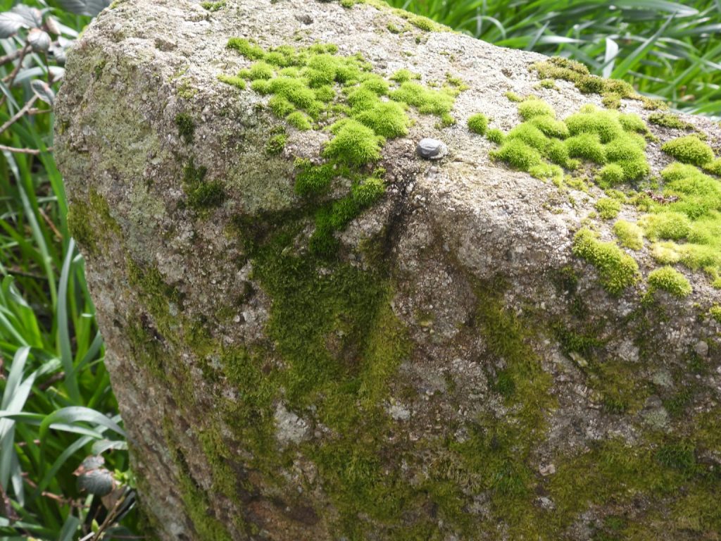
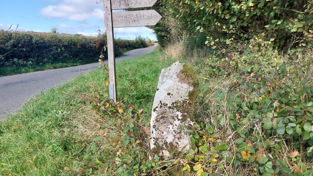
Green Lane Cross is medieval in origin an is located at the north-west end of Whitchurch Down, near the Tavistock golf clubhouse. It has been restored. It is located at SX49293 73851 on the 20th / 21st century parish boundaries of Whitchurch / Tavistock. It is located next to the former Turnpike road at the top of Green Lane as it descended into TavistockEntering Green Lane before the route descends into Tavistock, this milestone can be found. The inscription on the road side reads “14 MILES to PLYMo” on one face. It is believed this was erected in 1832 in the same year as the other milestones mentioned in this post.On the slim, north face of the milestone is the inscription ‘1 T’, which stands for one mile to Tavistock.The milestone also has an inscribed benchmark and rivet (bolt) on it. It is referenced as B.M 514.5 on 19th century maps suggesting it was inscribed between 1840 and 1860 (first geodetic period).
Travelling north from Warren’s Cross as the road descends to Pennycomequick (old road to Peter Tavy, Mary Tavy and beyond) there is another Milestone with the same inscribed design (slanted inscription ‘MILES TO PLYMo’) as the ones on Plasterdown and at Caseytown Cross. This one is another 13 mile marker.
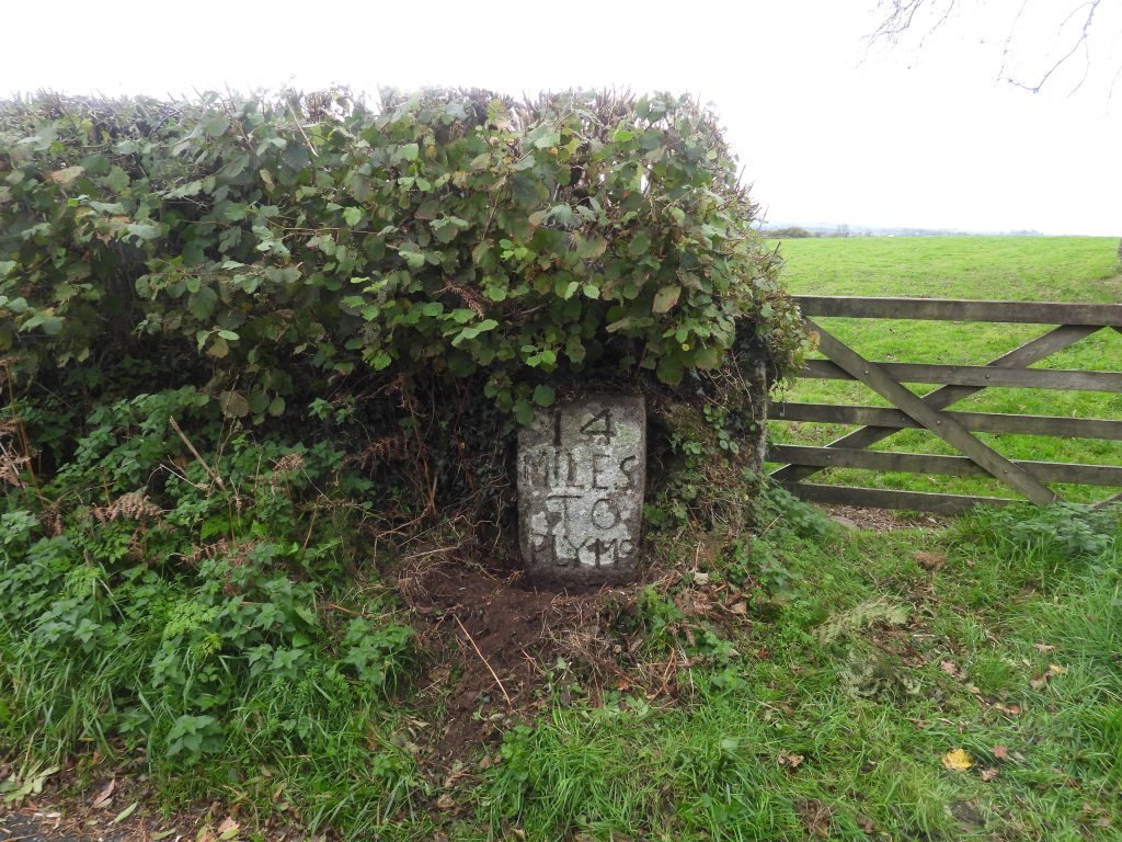
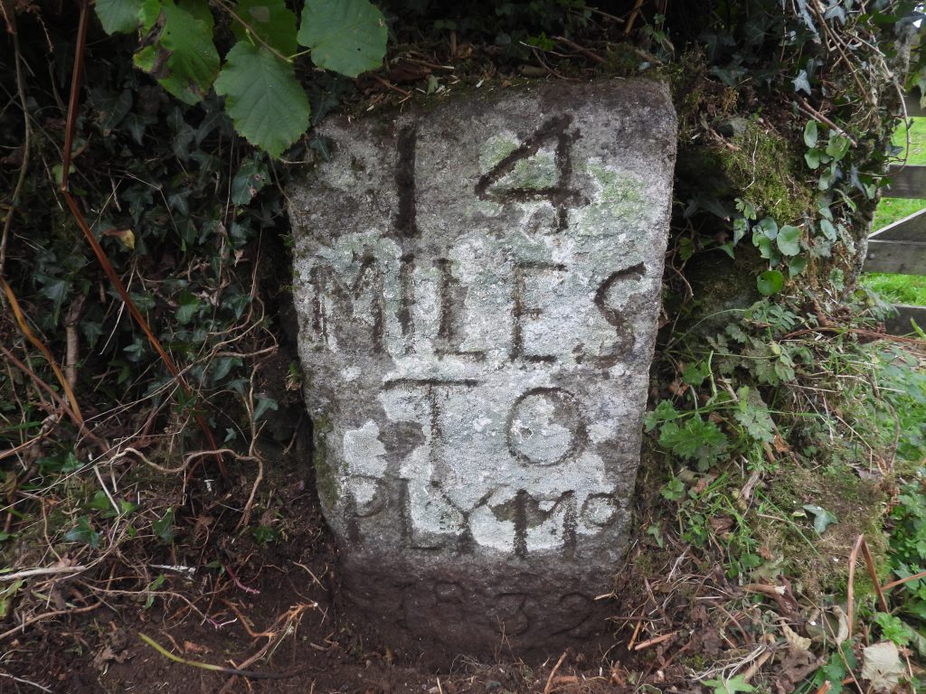
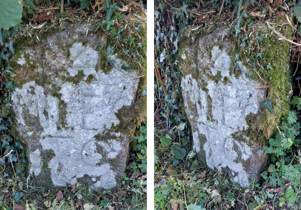
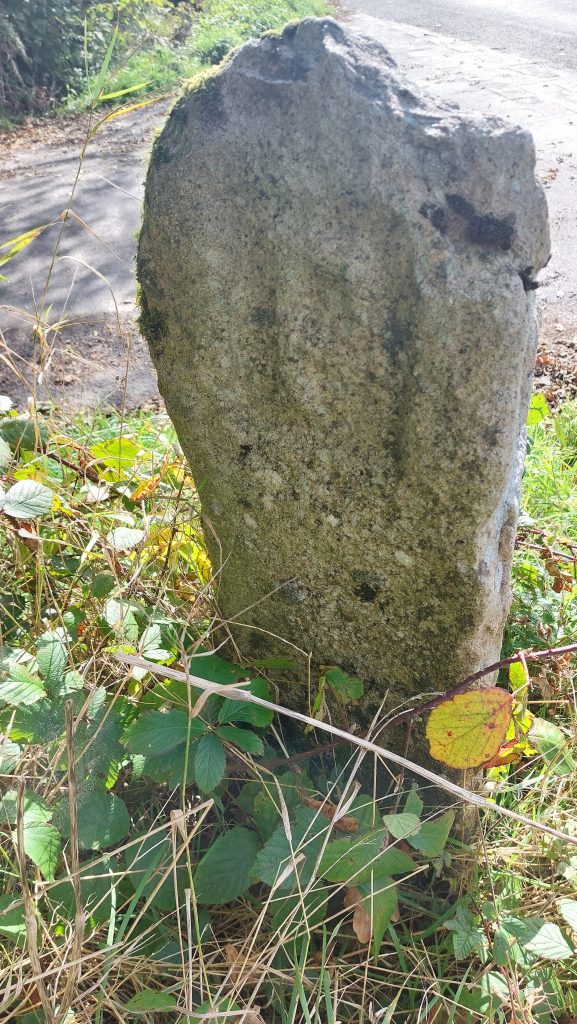
Contextual view of the 13 Mile milestone near Pennycomequick. In certain light, the inscription stands out very well. The milestone is just over a mile (1.08m) from the Plasterdown 12 Mile milestoneThe milestone at Pennycomequick is thought to date to 1832, the same as the others. It is located at SX51446 73922A survey in 2003 (Jenkinson) measured the milestone at 104cm tall, whereas a survey in 1932-3 (Tyler) measured the milestone at 1.35m tall. This granite milestone was erected by the Tavistock Turnpike Trust c1832 and is located next to a gate in a wall on the west side of the road opposite the turn to Collaton. It is located at SX51243 75164 and is annotated on modern OS maps
The stone is inscribed ’14/MILES/TO/PLYMo/1832′. The ‘1832’ part of the inscription lies below the current ground level ordinarily. It is this date, which has been used to consider all the other milestones in the area are from the same period. The unusual ‘PLYMo’ part is common to all the stones
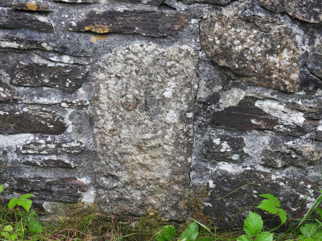
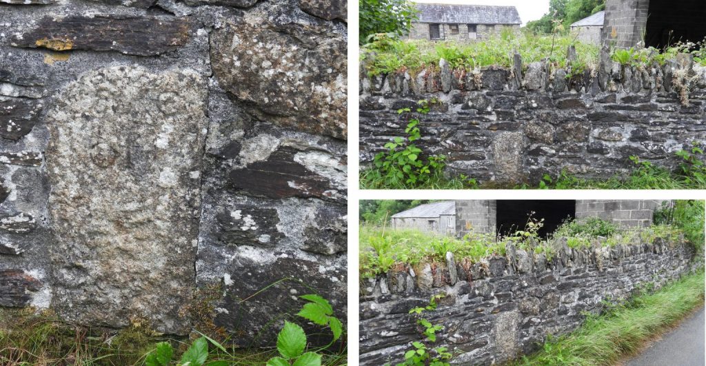
The milestone had slight damage to the edges and is covered in moss, ivy and lichen, thus could be easily missed when passing either on foot or in a carThis Parish Boundary stone is located at Collaton Lane virtually opposite the milestone about 1km north of Moorshop, on the lane to Harford Bridge. The stone lies on the boundary of three parishes (Peter Tavy, Whitchurch and Tavistock) and was erected in the 1820s. It has three initials, in relief (representing the respective parishes), on three sides. The stone has been repositioned after falling in 2004

Anne Emerson February 20, 2026
Excellent information. Thank you for all the work you do.
SteveGriggDartmoor February 20, 2026 — Post author
Hi Anne,
Thank you for your kind comment
Regards,
Steve (Dartmoor Explorations)