A collection of walks, discoveries, insights and pictures of exploring Dartmoor National Park
October 24, 2022
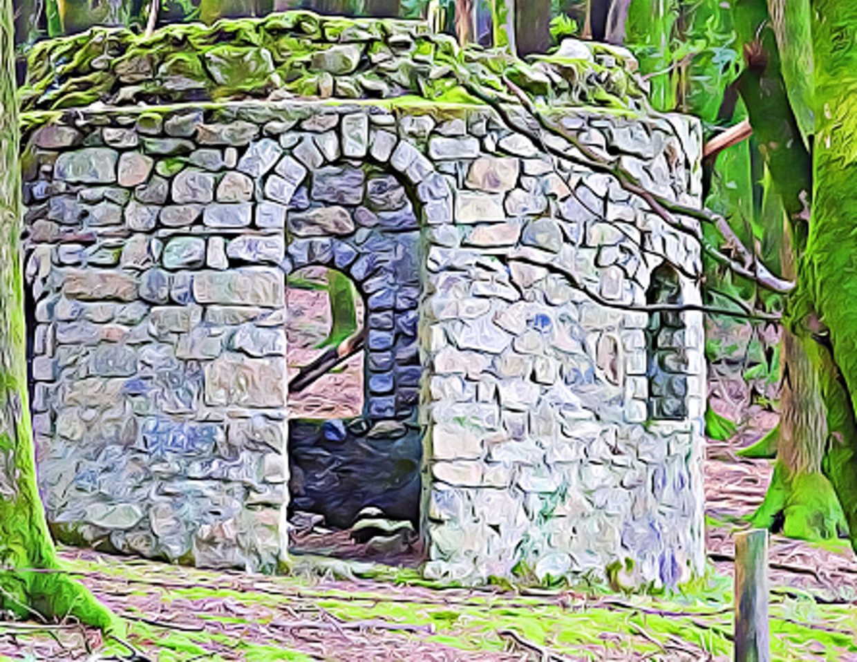
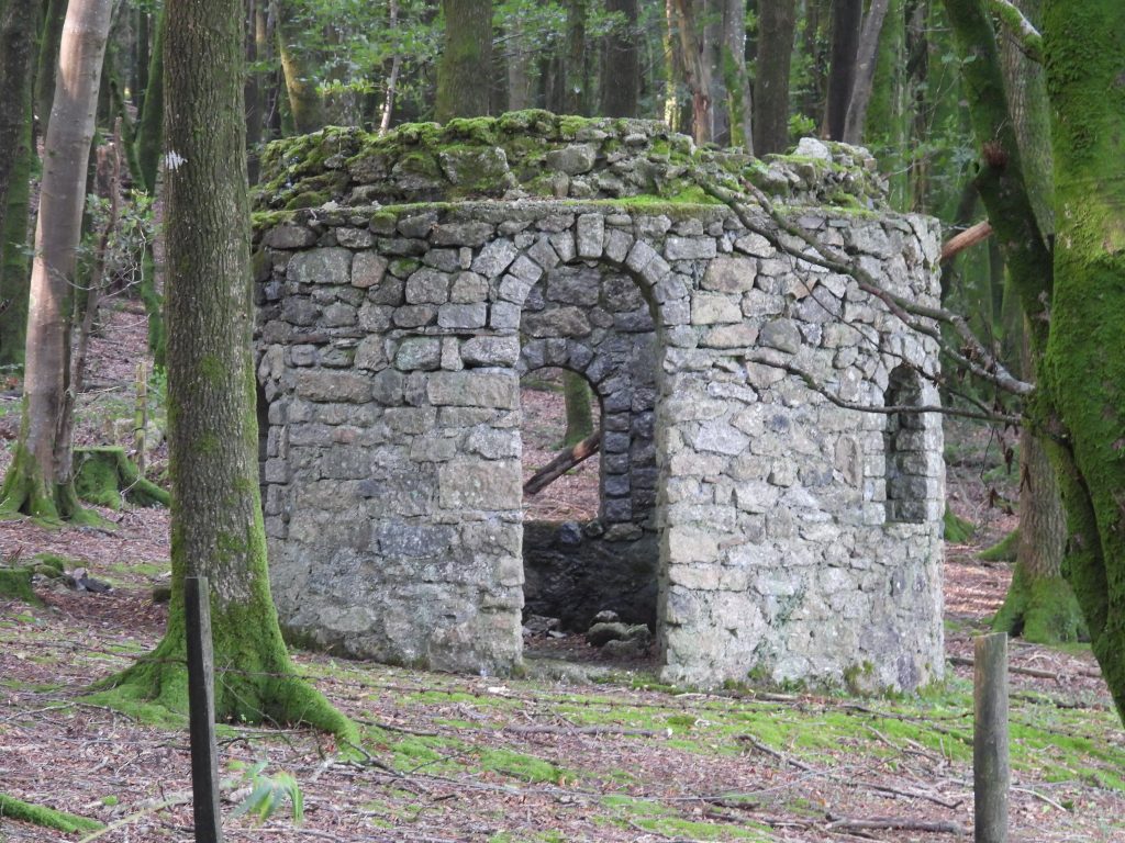
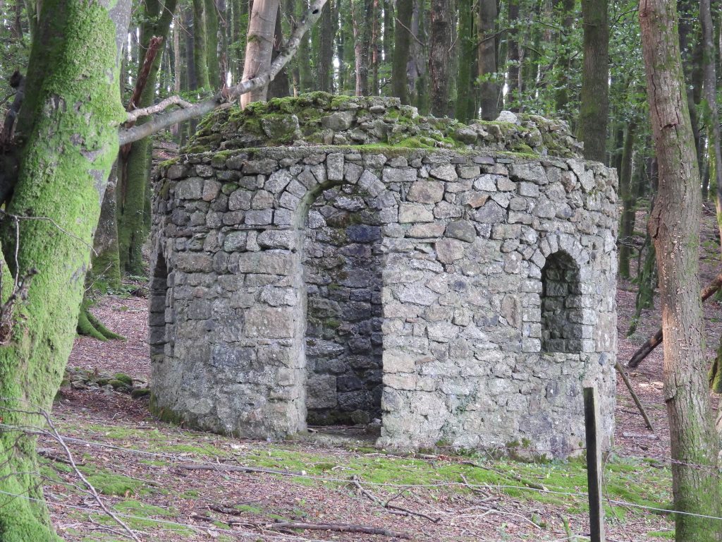
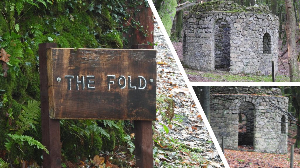
Folly at the Fold – Dousland Summerhouse
The “Folly at the Fold”, also known as Dousland Summerhouse is located next to the main Yelverton – Princetown (B3212) road in a small woodland called Dousland Plantation, which is on private property. The folly is a round (cylindrical) building which has no roof and tall rounded windows like a chapel and can be seen and photographed from the road. This post provides some information and details pertaining to the folly which the author researched from ‘Dartmoor Follies’ by Philip Knowling. The post also covers a couple of other features in the immediate area, namely and inscribed stone and a medieval cross which are worth a look.
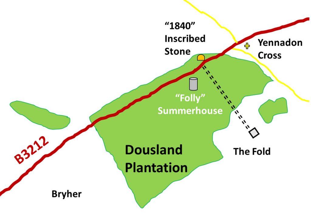
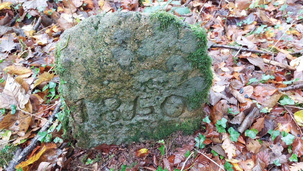
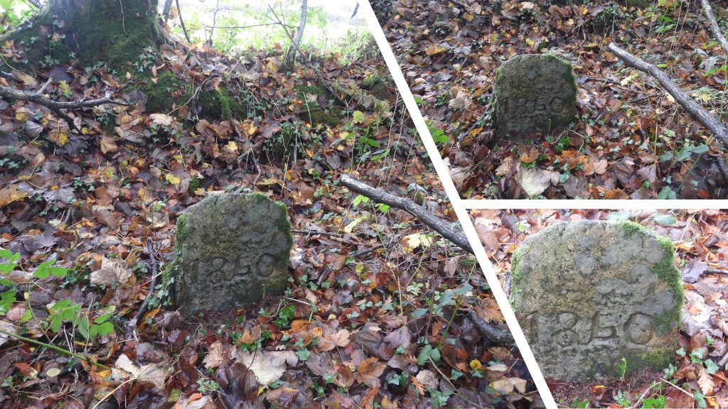
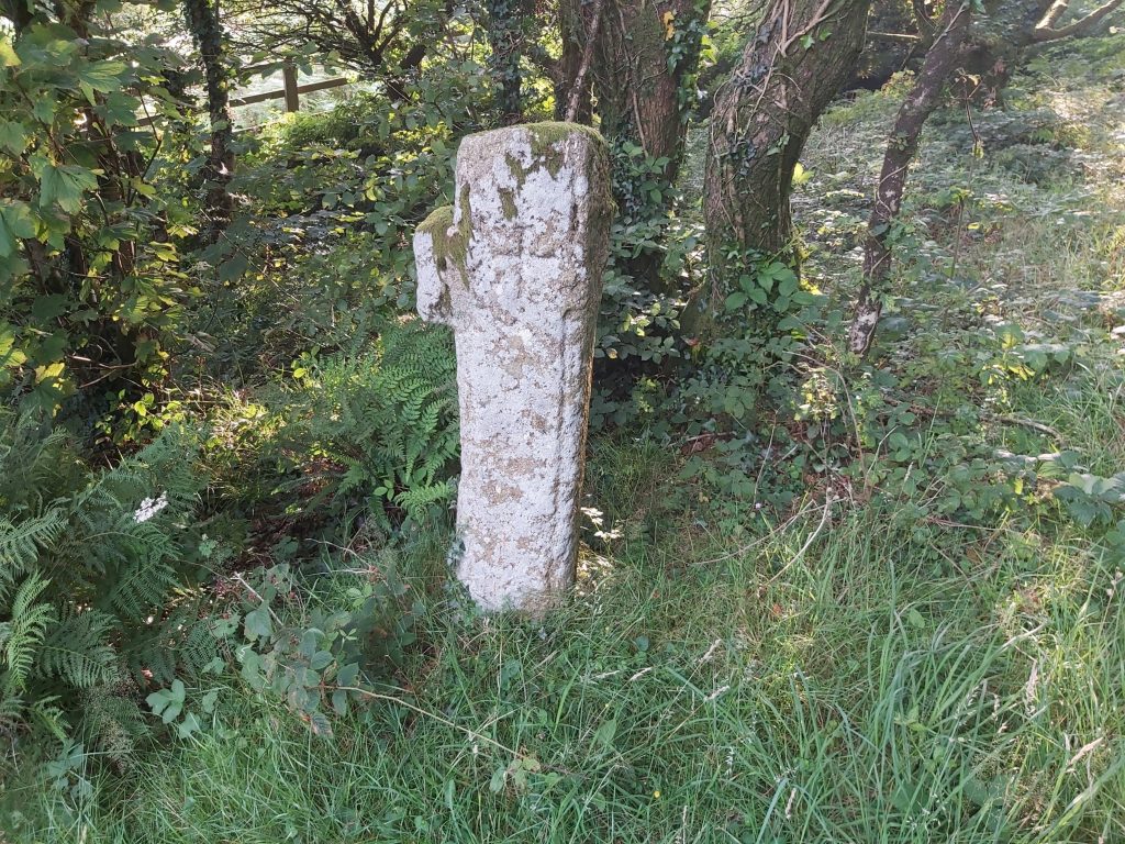
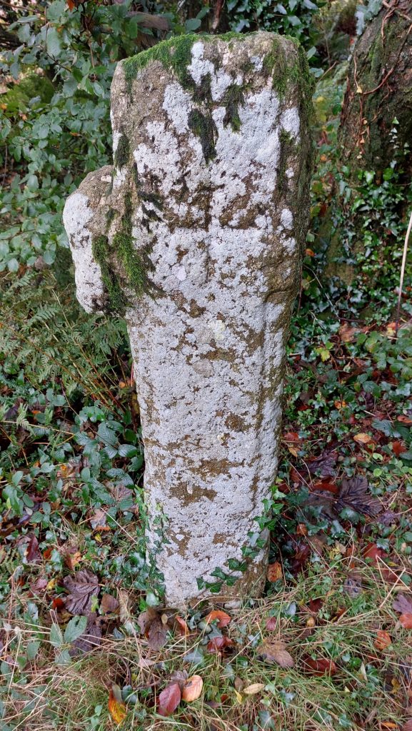
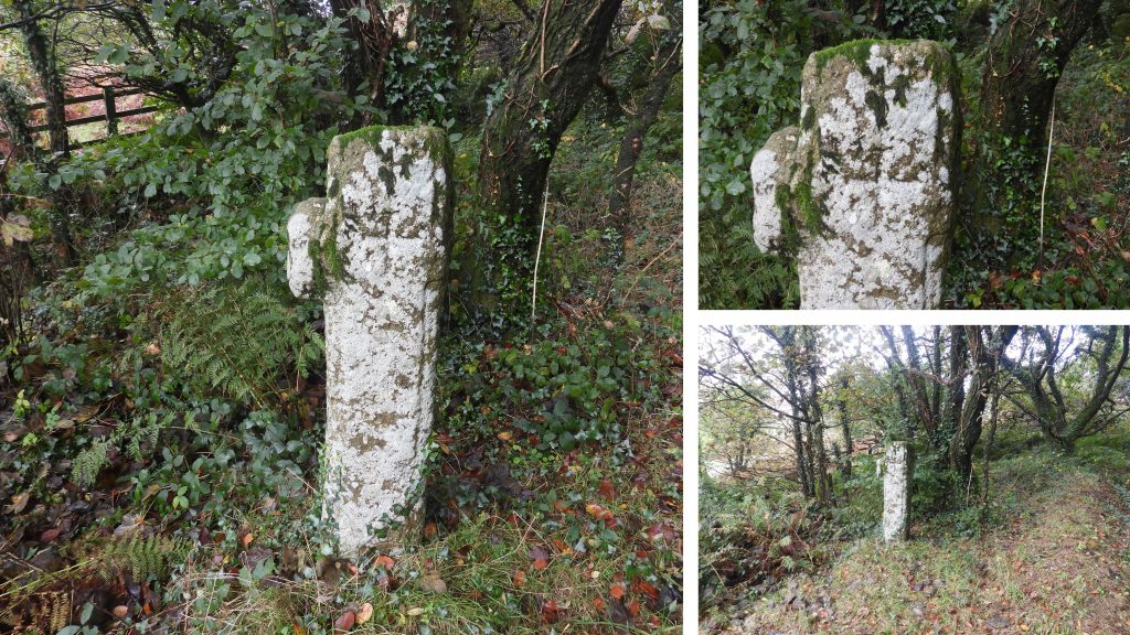
Sketch map showing the locations of the features covered in this post.It is thought that the ‘Fold’ was built between the wars around 1923-27. The folly was a summerhouse built by the owners of the Fold for their children. It is in an unusual location being away from the main property and having no views to speak of (the plantation was here in the 19th century and certainly when the folly was built). It is approx 3m tall and has three dooways and three windows. The folly / summerhouse would have originally had a thatched roof. The stone for the folly is thought to have originated from Leather Tor Farm.The Fold sign at the junction with the Yelverton – Princetown Road is the only indication of the main building which is located up a track towards Yennadon Down. Unusually, neither the Fold or the its folly are recorded on the Dartmoor HER.Opposite the entrance to The Fold, on the wide bank between the road and open fields is an intriguingly inscribed stone. It is deeply inscribed and the third character could be read in certain light conditions as a ‘4’, ‘5’ or ‘6’. That said, it is thought by any to read as a ‘4’, thus the date is 1840 and could therefore relate to the tithe (for Walkhampton). The ‘1840’ inscribed stone is located at SX54436 69419. There is no mention of this stone on late 19th century maps (national library of Scotland) of the the Dartmoor HER. The stone lies close to where the Plymouth and Dartmoor Tramway crossed the road but Little was carried on it other than granite and by 1840 traffic had dwindled considerably. The full history behind the stone remains a mystery to the author.Yennadon Cross is thought to have been a waymarker to Buckland Abbey and also possibly used as a boundary stone for the lands belonging to the Abbey. It is located close to the Princetown – Yelverton road, at a junction with a minor road leading to Yennadon Down and Burrator Reservoir. The author can remember passing this cross on night walks in late 80s / early 90s and the history of the cross being explained by the guide (Ted Burkett-Dixon).The cross has had one of its arms knocked off and has in former times been used as a gatepost. The author recorded the location as SX54520 69439The fantastic ‘Dartmoor Crosses’ website records the following: “William Crossing wrote that he found this cross built into one of the walls of the nearby Burham Farm. The actual farm is midway between the junction where the cross now stands and the village of Walkhampton. However, the cross was found in the roadside wall, on the right-hand side of the road from Dousland to Walkhampton. It was Mr Masson Phillips who, in 1974, arranged for it to be recovered and set up at its current site. It is quite probable that the socket stone now to be seen 600 yards down the road towards Dousland, at the entrance to the lane leading to Burham Farm, is the original belonging to this cross”. For more information: http://www.dartmoor-crosses.org.uk/yennadon.htm