A collection of walks, discoveries, insights and pictures of exploring Dartmoor National Park
December 2, 2025
Foggintor quarryman’s housing – Red Cottages (aka Mount Pleasant and West View Cottages)
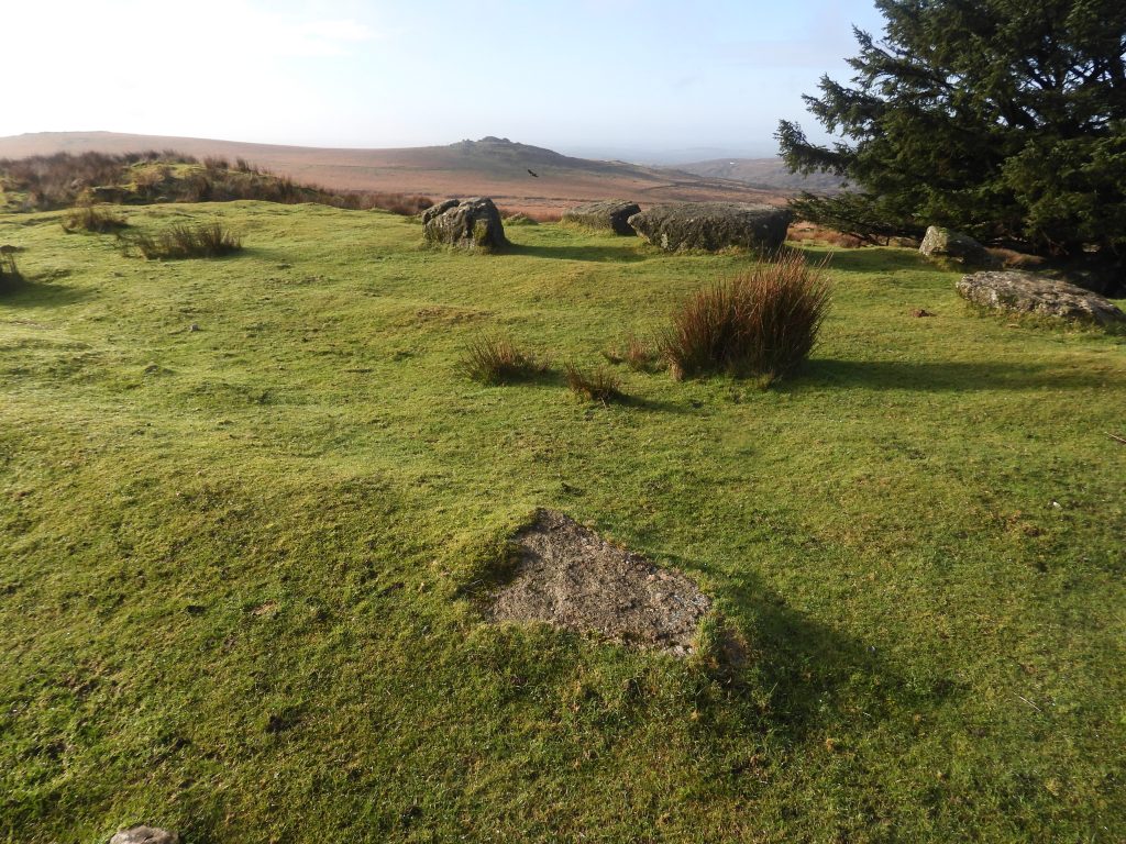
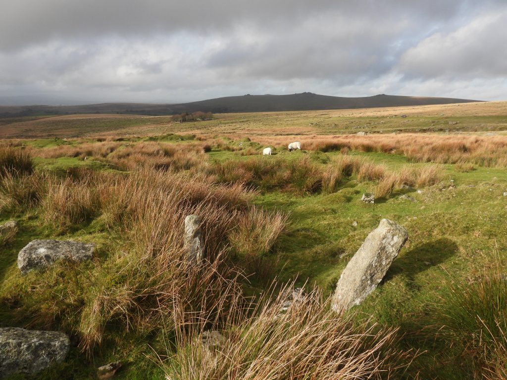
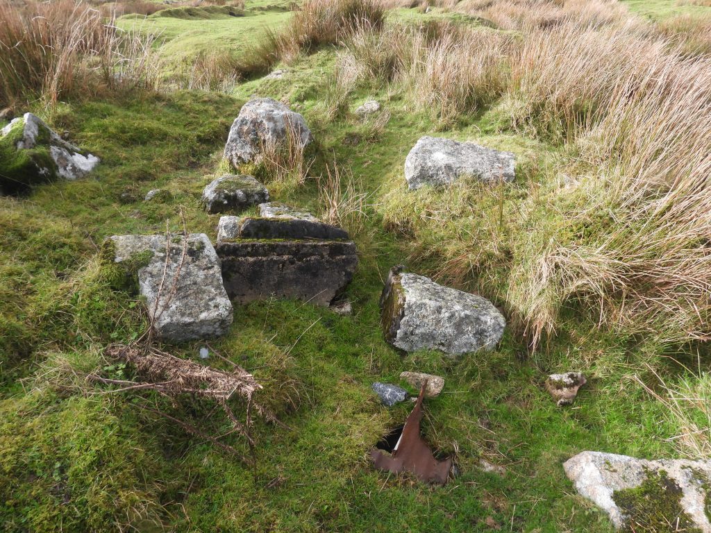
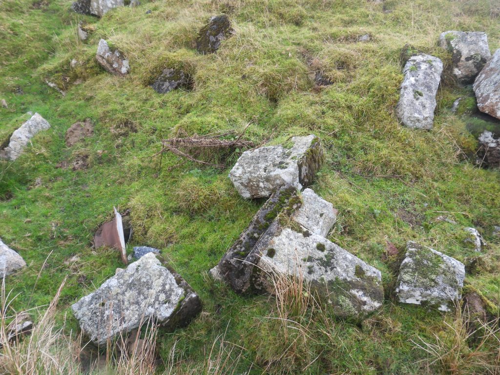
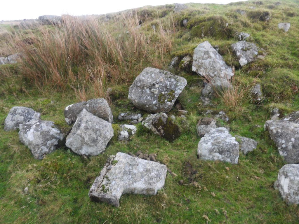
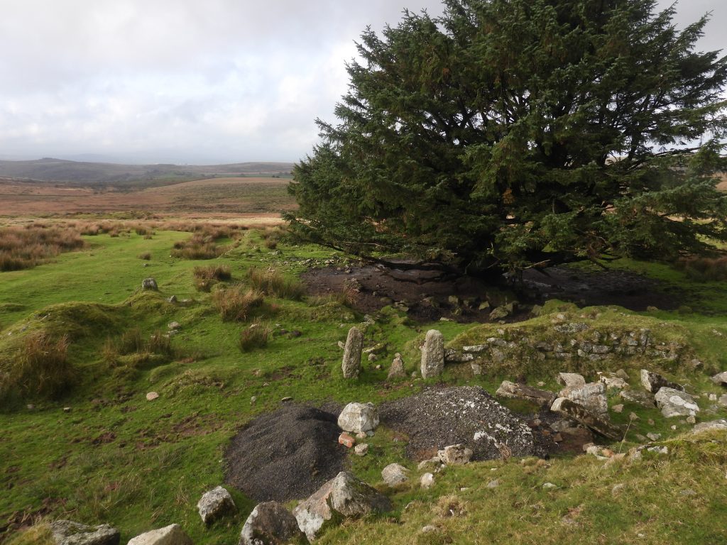
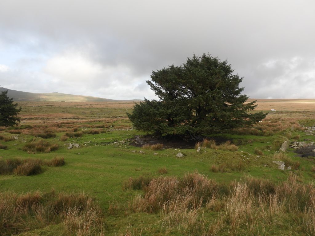
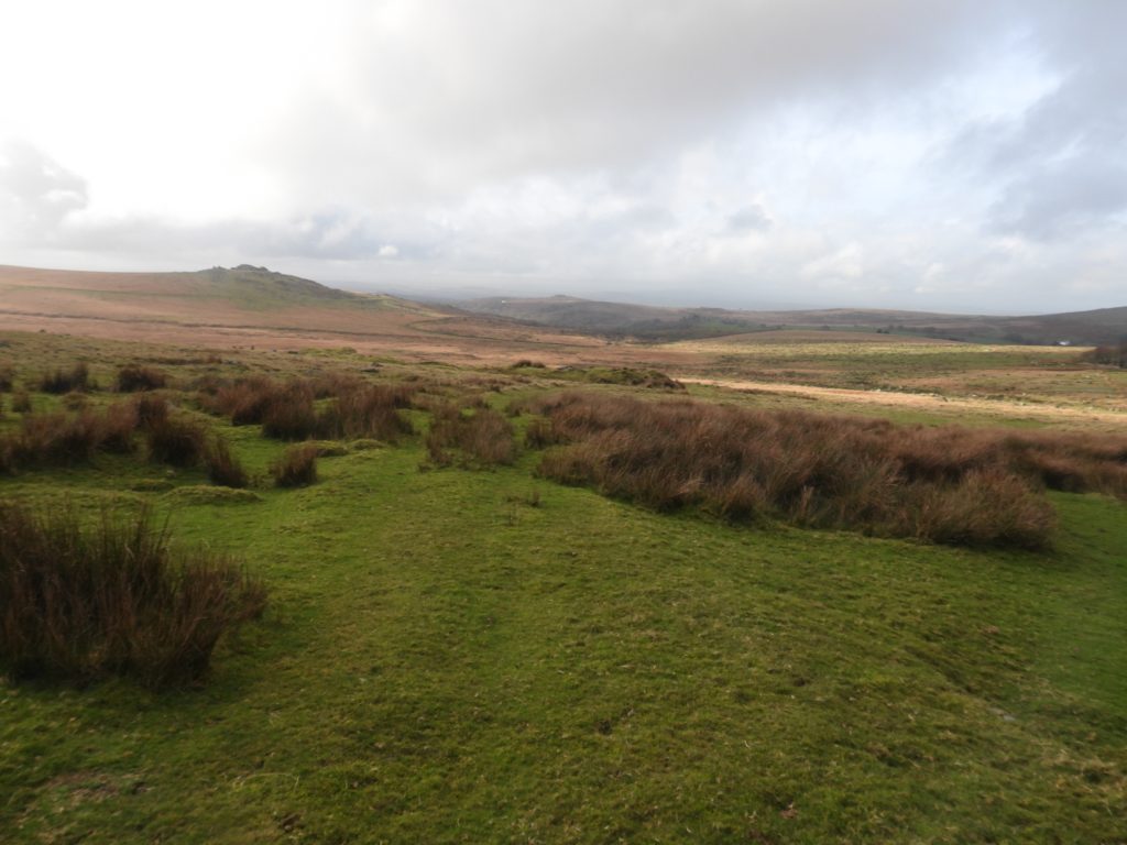
Adjacent to the track between the B3357 (near the head of the Pila Brook / Longash Brook and Pump House) and Yellowmeade Farm and Foggintor Quarry, there once stood six cottages (split into 12 rooms), which were constructed for the quarrymen (and their families) from Foggintor. Initially known as Mount Pleasant, they would later become known as either Red Cottages or West View Cottages. Today, very little remains of the actual cottages, however the walling of their associated gardens can still be seen and explored.
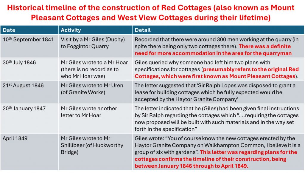
By 1841, when the Foggintor Quarry (also known as Royal Oak) was steadily increasing production and building up to its peak years, there was a desperate need for accommodation in the area as around 300 men were employed at the quarry and there were only two cottages in the immediate area. By January 1846, it is known that the (Mount Pleasant) cottages had been planned and by April 1849 they had been built. The cottages survived around 100 years as it is thought they were demolished around 1953, the same year as other housing (Hill Cottages) at Foggintor Quarry.
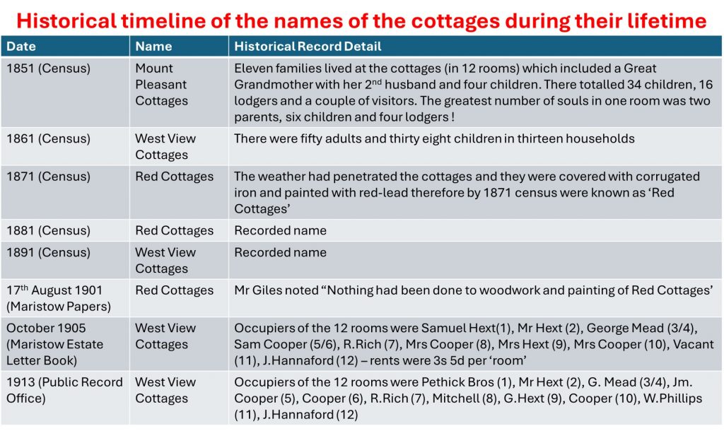
According to various censuses and records, they were originally known as Mount Pleasant until the 1850s, then alternated their name between either West View Cottages or Red Cottages through the latter part of the 19th century and through to the 20th century.
They were initially built with cob before being covered with corrugated iron and painted with red lead to protect them against the weather (this led to the name Red Cottages). In later years the cottages were actually black, having been covered with pitch, again to protect them against the weather.
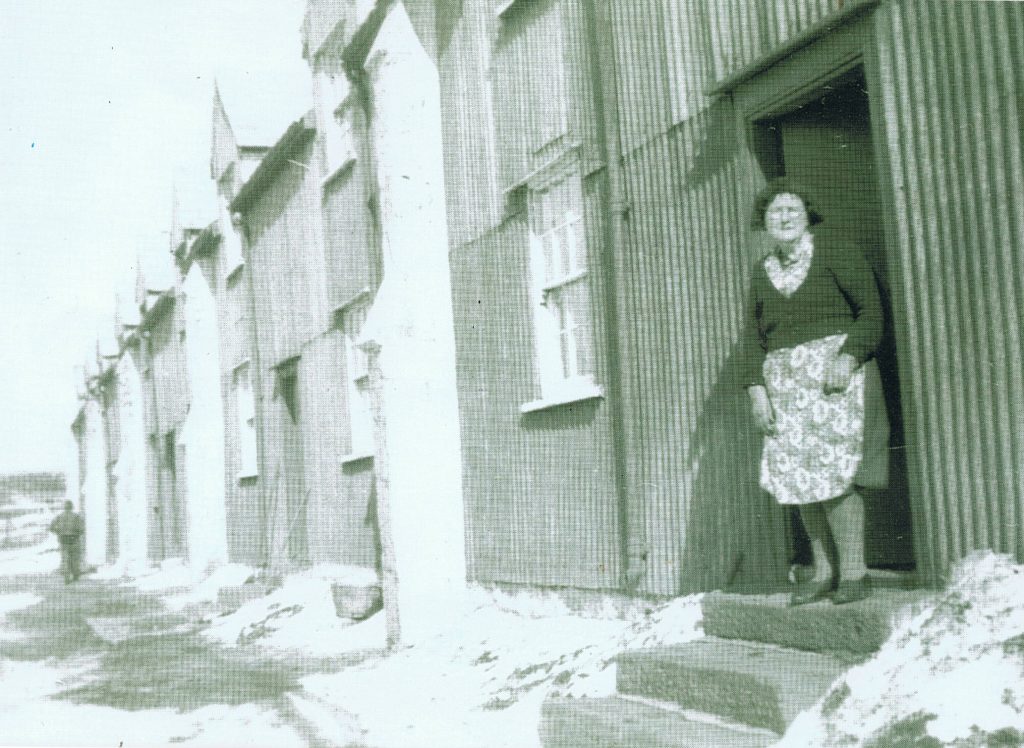
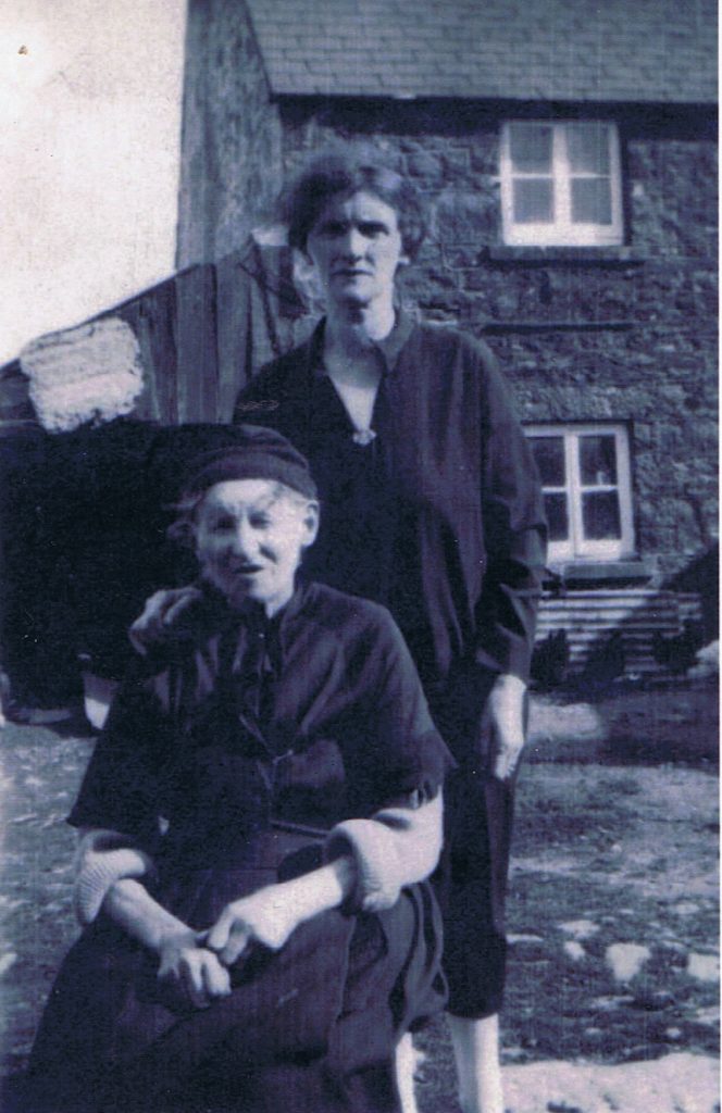
The majority of the information contained in this post comes from a fabulous book by Kath Brewer – “The Railways, Quarries and Cottages of Foggintor”. There is an old photograph in this post which the author was given, which was part of the Don Youngson collection, which the author suspects might be the only one taken of the cottages (unless any reader of this post has any of course?)
Bibliography
Kath Brewer – The Railways, Quarries and Cottages of Foggintor – Pages 94-99
Christopher Gardner-Thorpe – (2003) – The Book of Princetown, Thomas Tyrwhitt’s Dartmoor Town
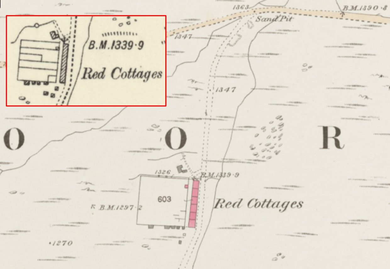
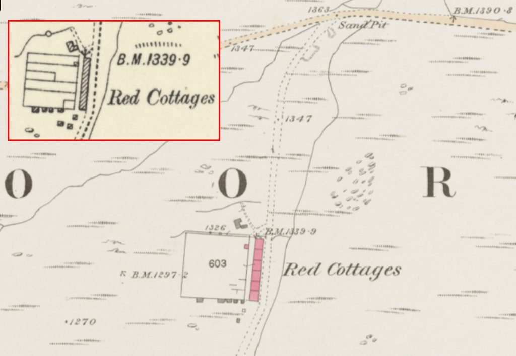
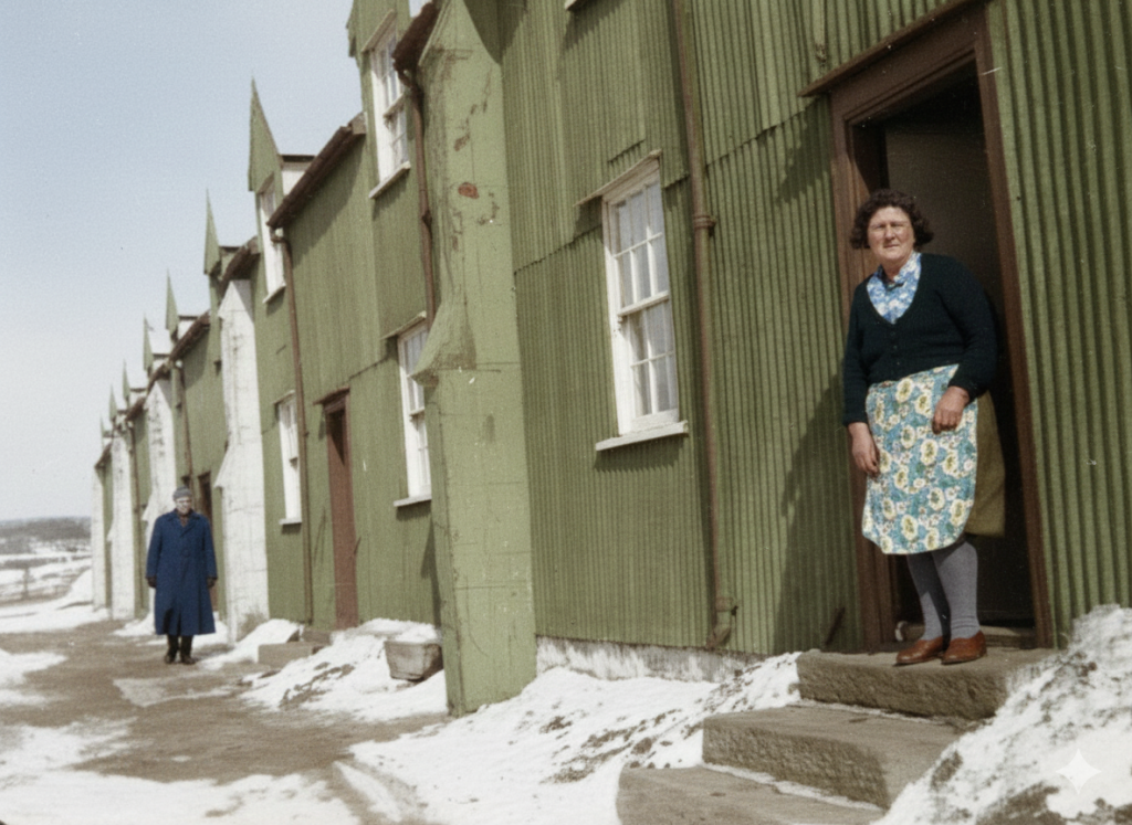
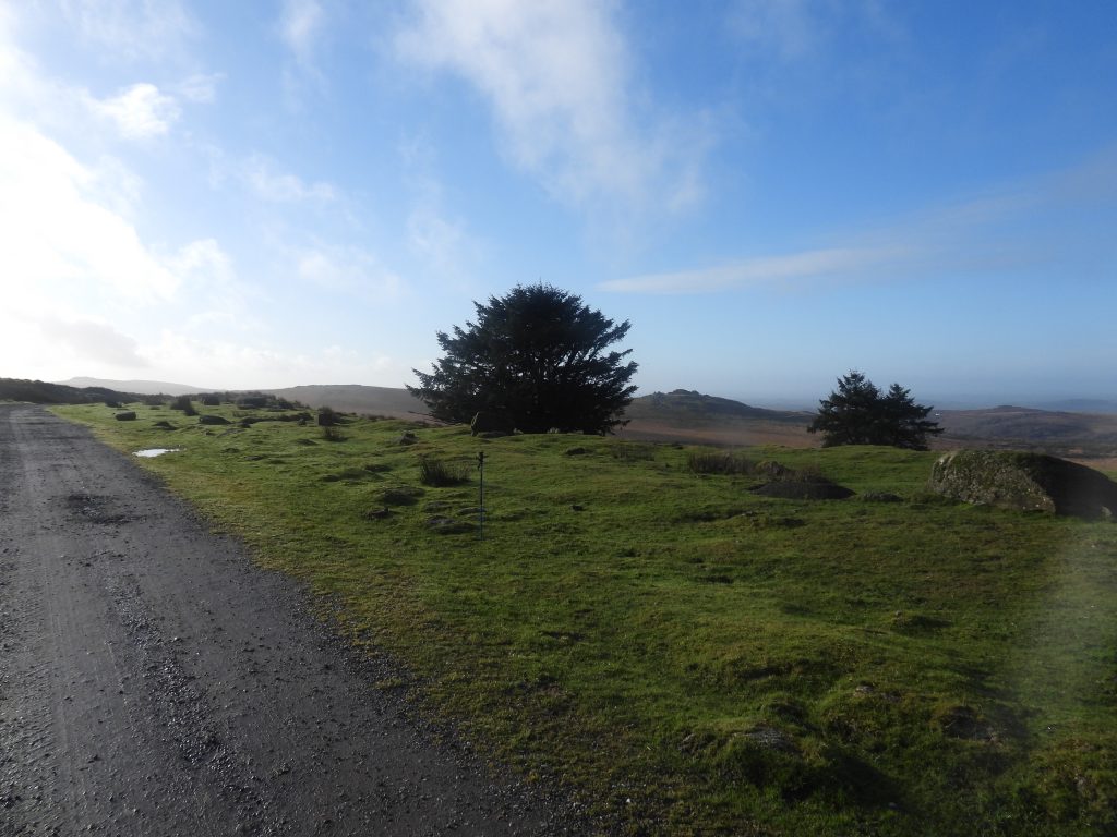
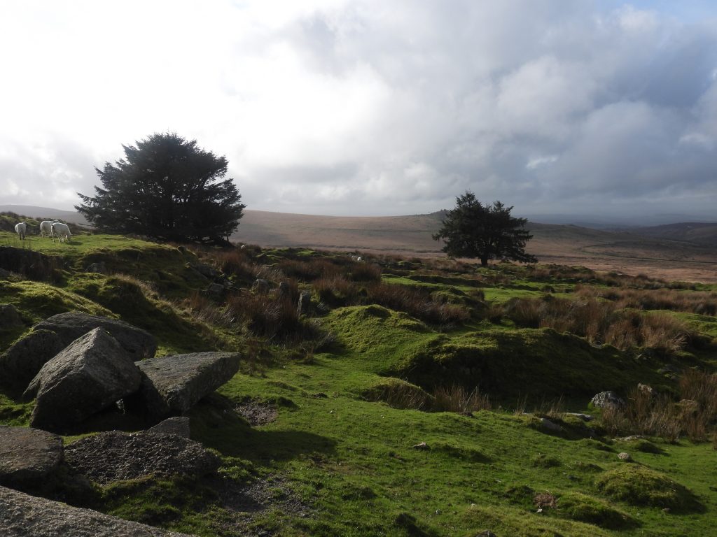
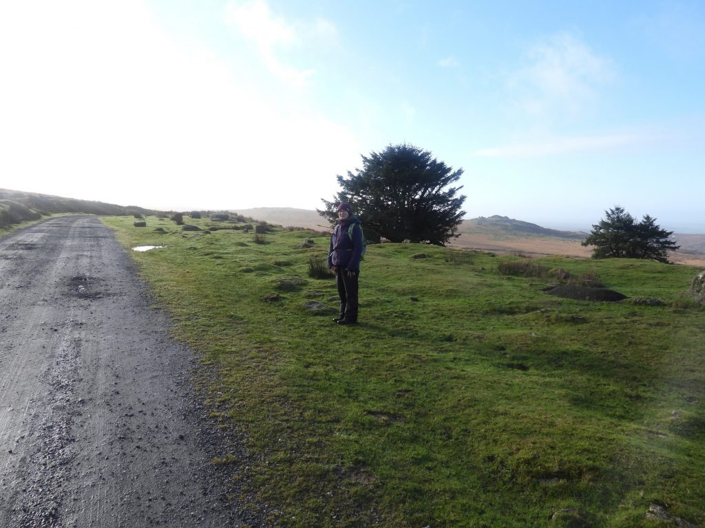
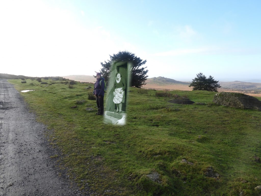
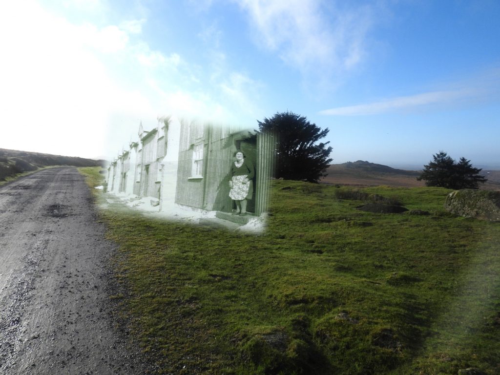
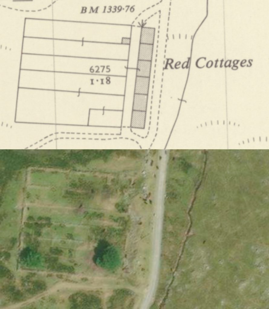
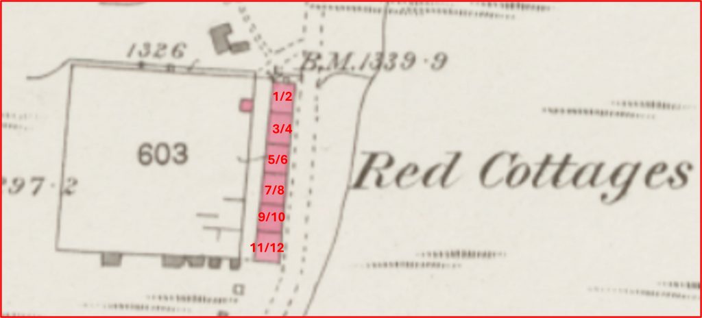
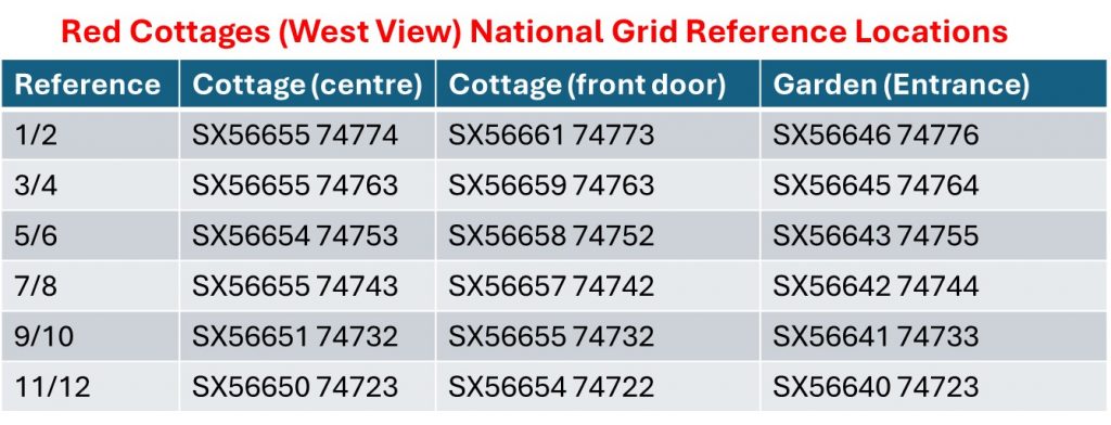
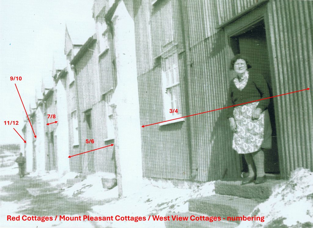
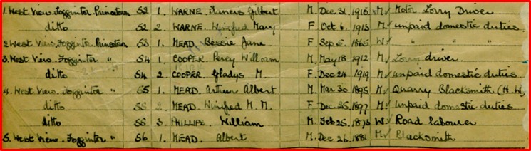
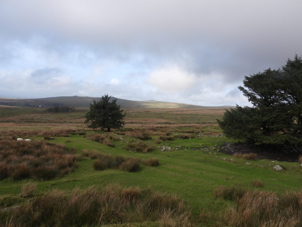
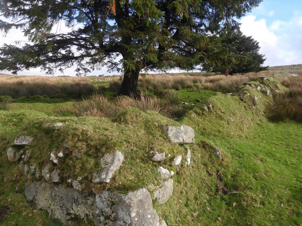
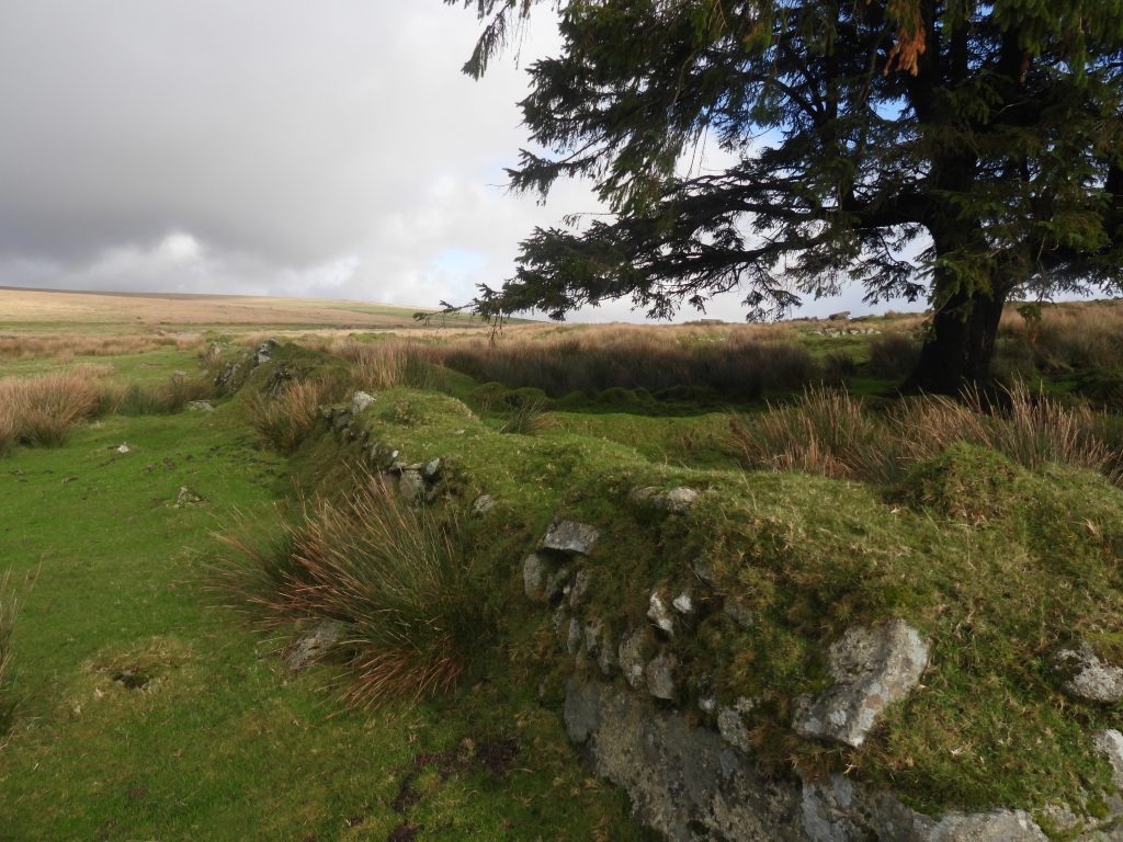
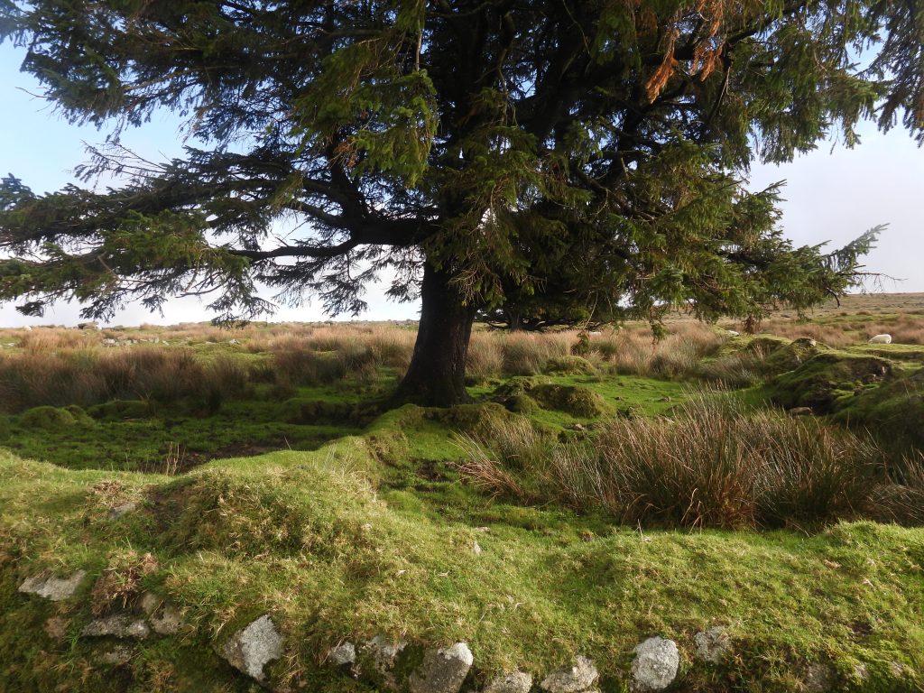
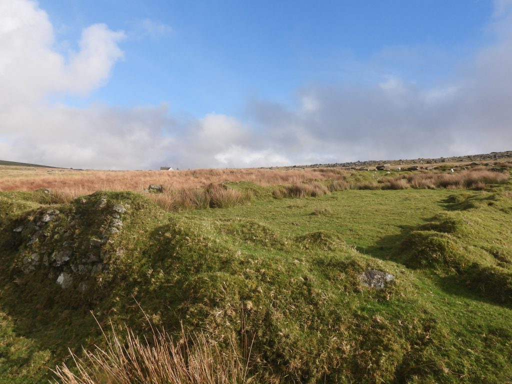
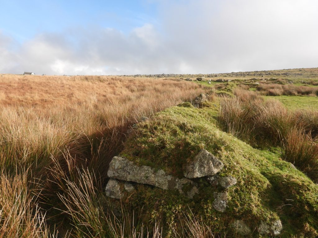
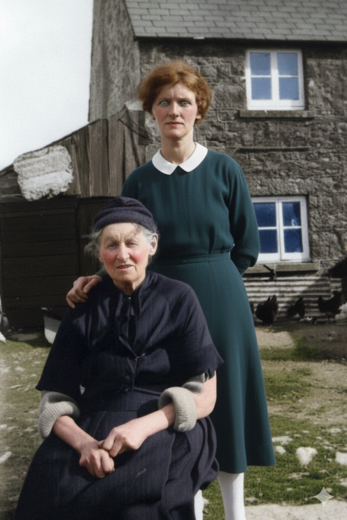
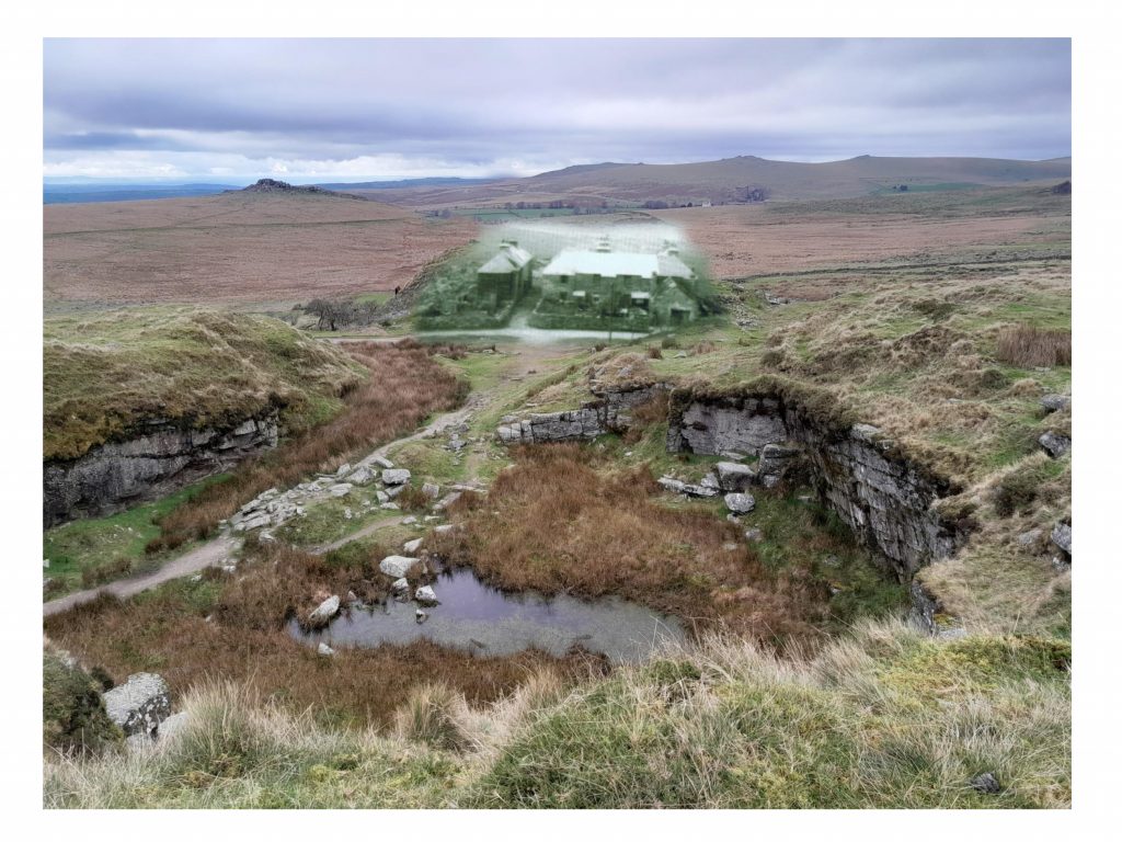
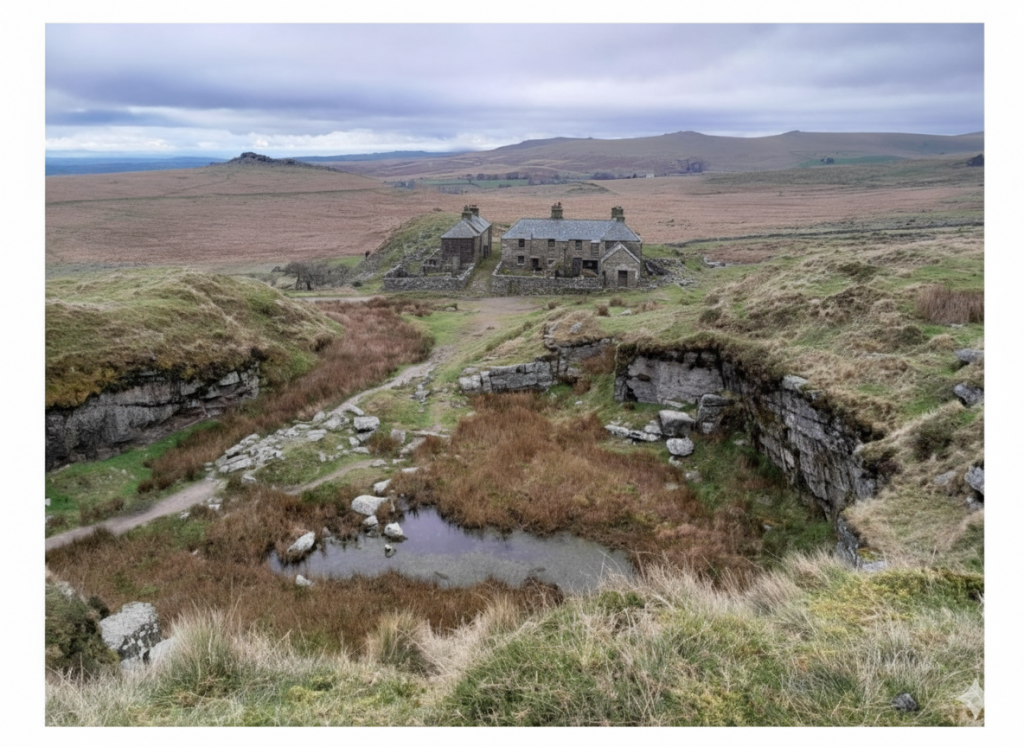
This map (and insert) date from 1870s and 1880s and shows the location of cottages, then known as ‘Red Cottages’ in relation to the road. There appears to be six distinct ‘squares’ which represented 12 dwellings each had a ground and first floor room. The enclosed area annotated ‘603’ were the gardens. The map also shows other grey ‘squares’ to the north and south of the gardens and a small red ‘square’ just to the west of the most northerly cottages. The area marked ‘sand pit’ is where there is a modern day car parkThis timeline has been extracted from Kath Brewer‘s book ‘The Railways, Quarries and Cottages of Foggintor’ – Pages 94-96. In October 1849, the lease for the cottages had been sent to the London Solicitors of the Haytor Granite Co. (Foggintor) with a few alterations which included acceptance of cutting ‘turf and vag’ although it was to be confined to ‘described portions of the common’The author acquired this picture from the Don Youngson collection and has been informed by Simon Dell that the lady in the picture was a Mrs Youngson. This is the only picture of Red Cottages the author is aware of and is a view looking north to south with Mrs Youngson outside the 2nd cottage from the north (numbered 3 and 4). There is a second figure at the south end of the cottages roughly between the 5th and 6th cottages. The date of the photograph certainly pre-dates when pitch was applied to the cottages and the author estimates 1930s as the Youngson’s (if the author has the right people) on a 1939 register were at Mount View – north of B3357 on Mis Tor Lane. Alexander and Pansy Youngson (nee Perkins) were married in the Tavistock district in 1913.Pansy Youngson – coloured using AIThe view of ‘Red Cottages’ from November 2025 with the walking pole located at the approx position where Mrs Youngson had been standing as shown in the previous picture. Note the lack of any very obvious foundations.This picture shows the back of the cottages (where the three sheep are), the narrow back lane between the cottages and their gardens and the top of the gardens (where the grass covered walling is). Note the pair of gateposts which mark the entrance to the garden to the west of the first cottage (numbered 1 and 2).This is a November 2025 version of Mrs Youngson (thanks to Sue for assisting in this composition)Sue standing alongside Mrs Youngson in more or less the correct locationThis then and now compilation was possible by knowing the grid reference for the front door of the second cottage (using National Library of Scotland maps) and overlaying Mrs Youngson to that position! The above map is from 20th century, when the cottages were still known as ‘Red Cottages’. Note the walling in the gardens (map and aerial photograph) and the leat running to the east of the trackThis annotated map shows the numbering for cottages. There are six cottages (one up, one down thus numbered 1-12). The author has assumed they were numbered from the north, but without definitive evidence they could easily have been numbered from the south. One way of checking to to find out where Mrs Youngson lived.Using the National Library of Scotland maps, grid references can be obtained. This table shows the location (probably to within a metre or two) of the centre of the cottages, the front doors and the entrance to the gardens. Mrs Youngson would have been standing at SX56659 74763This annotated photograph complements that of the annotated map, showing how the author has numbered the visible cottages. The first cottage (1/2) obviously is out of shot. Each cottage frontage was around 10 metres wideTimeline indicating the names given to the cottages from 1851 through to the 20th century. That said, in spite of the name ‘West View Cottages’ being used by various record offices in the 20th century, OS maps appeared to still call them ‘Red Cottages’. The timeline has been extracted from Kath Brewer‘s book ‘The Railways, Quarries and Cottages of Foggintor’ – Pages 97-99. The cottage foundations looking south westOutside the 5th cottage (numbered 9 and 10)View of the cottages from the south looking to Great Mis Tor in the distance. From 1918 to 1920 nine of the twelve properties were occupied by the family and relatives of Bernard Hext: Gran and Grandad Hext (a stonecutter who finished work at Hill Quarry aged 60); Aunt Bess and George Mead (a blacksmith at Swell Tor); Aunt Celia and Sam Cooper (steam engine driver for the council); Dickie Rich (a quarryman at Swell Tor); Albert and Kate MItchell (a stonecutter at Swell Tor); Aunt Hext and Albert Mead (a blacksmith at Merrivale Quarry); Gran Cooper (mother of Gran Hext); Bill Phillips (known as ‘Garlic’, at Halfyard Builders); Albert and Beat Cole (known as ‘Yobby’, part-time quarryman and farmer who worked at the prison in his later years).
This 1939 record, shows the occupants of five (ten rooms) of the cottages when they were known as ‘West View’. The record doesn’t include cottage 6 (11/12).
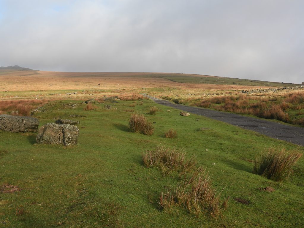
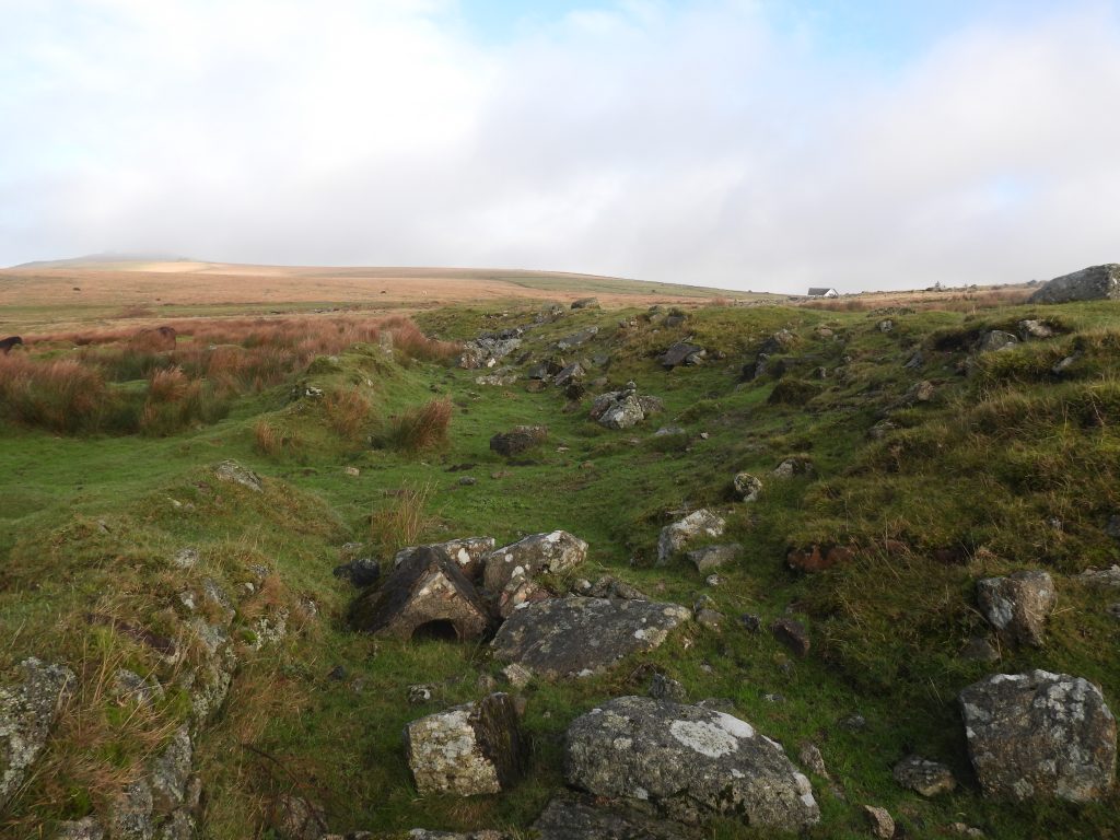
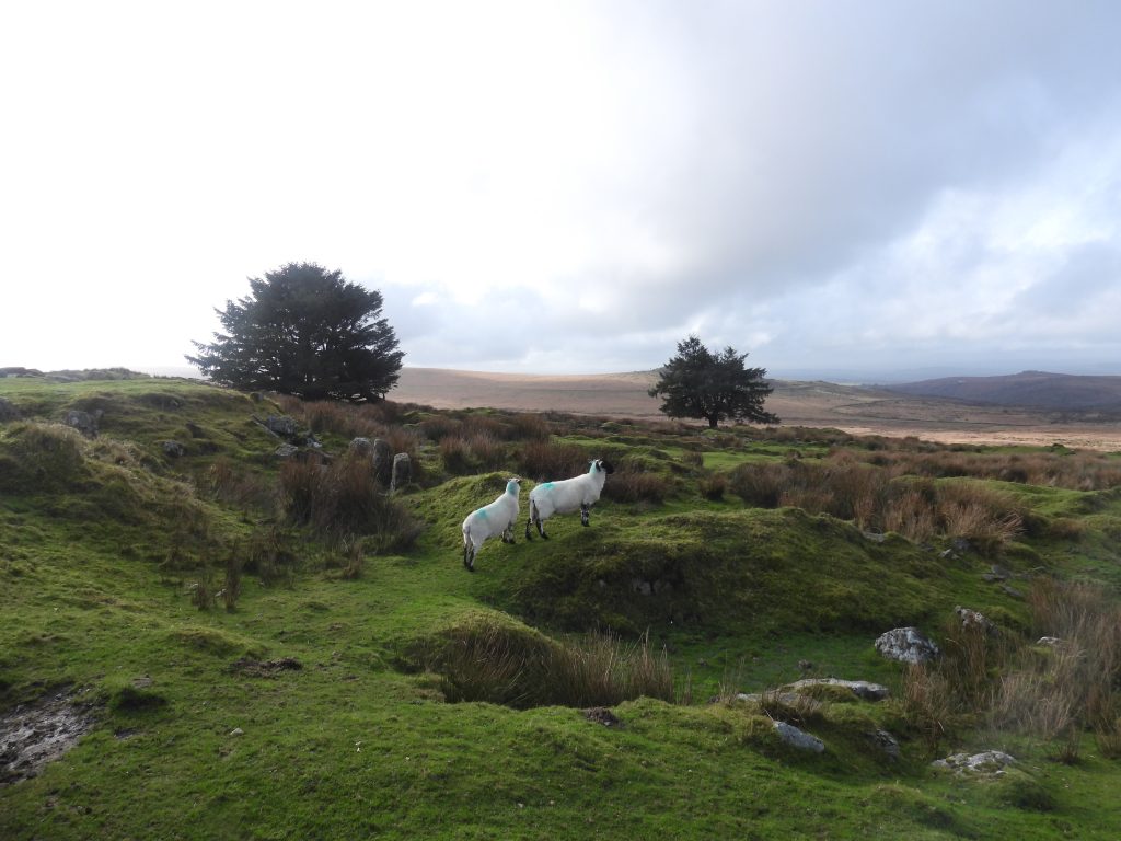
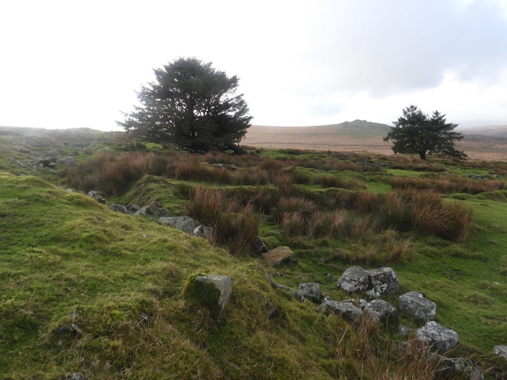
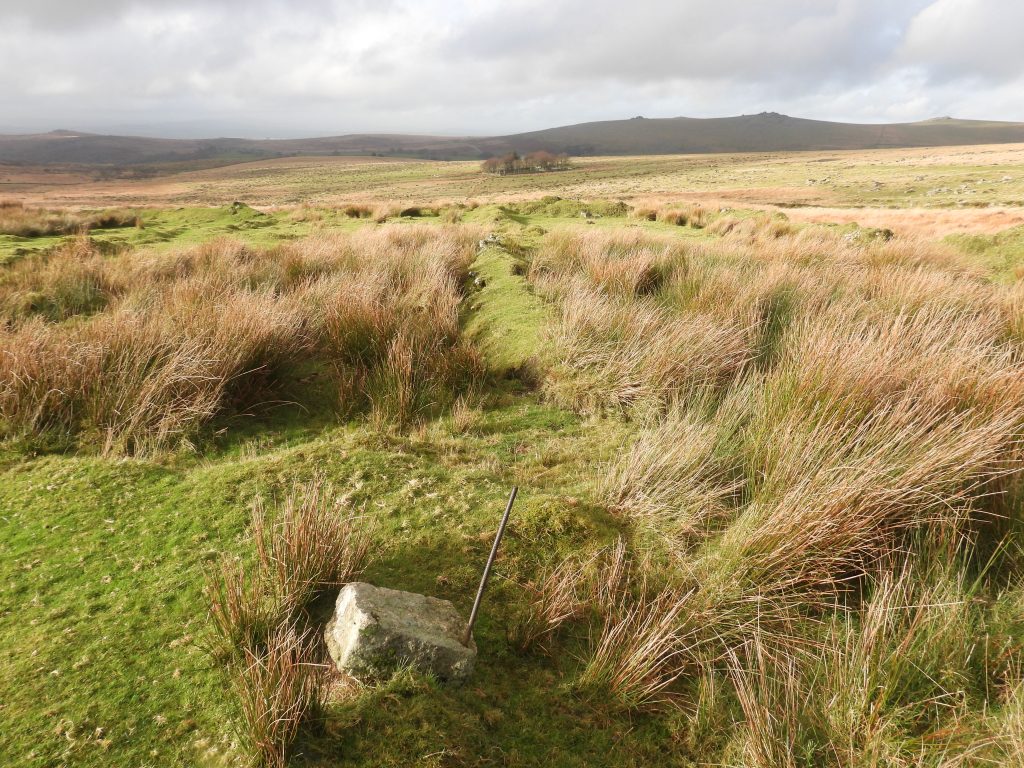
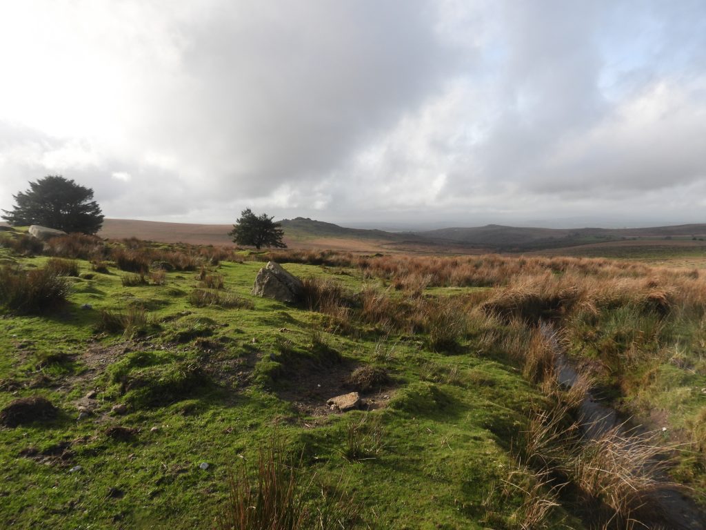
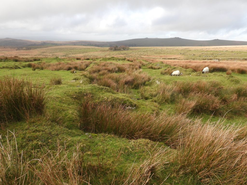
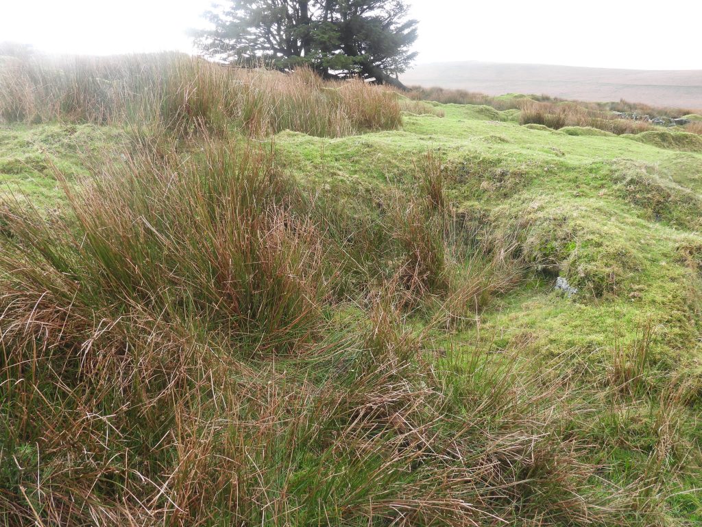
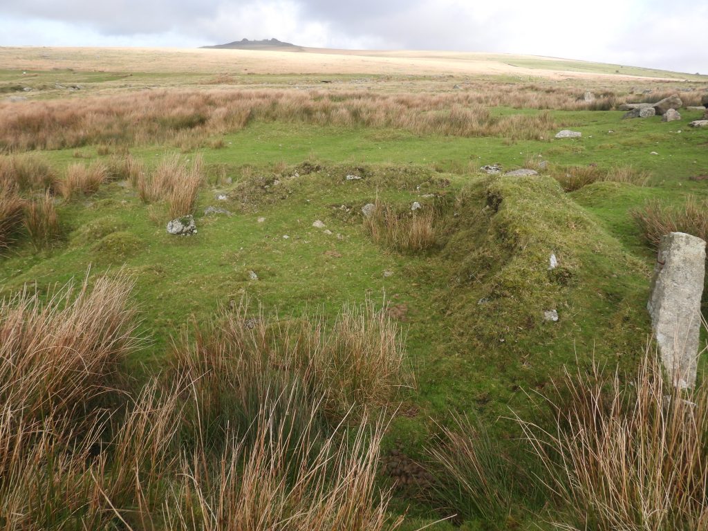
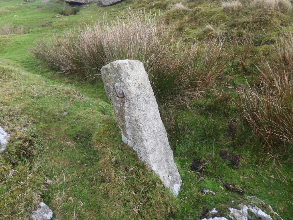
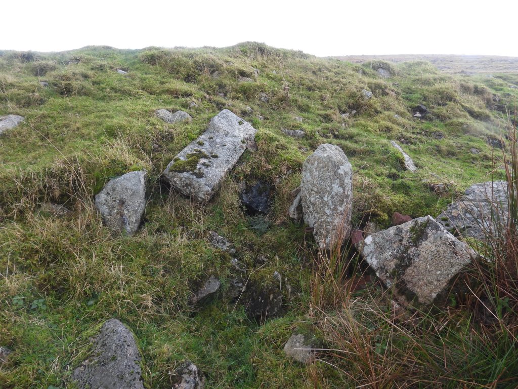
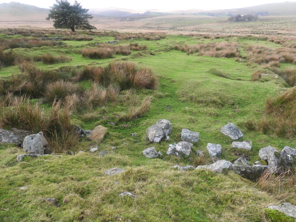
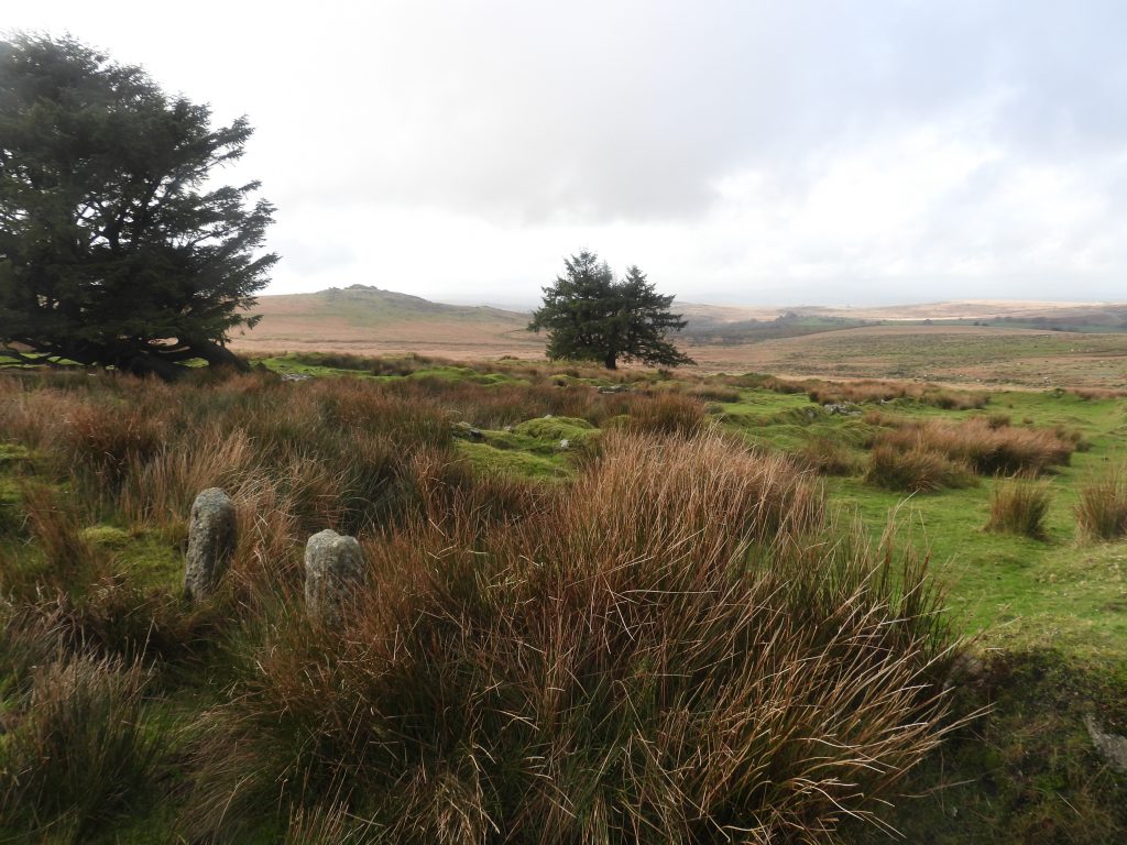
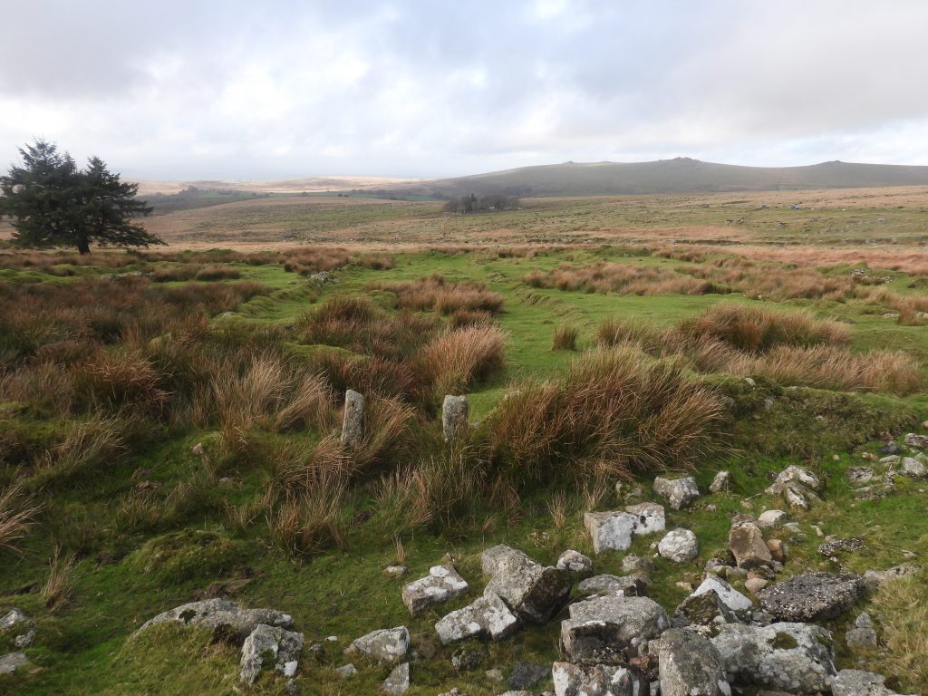
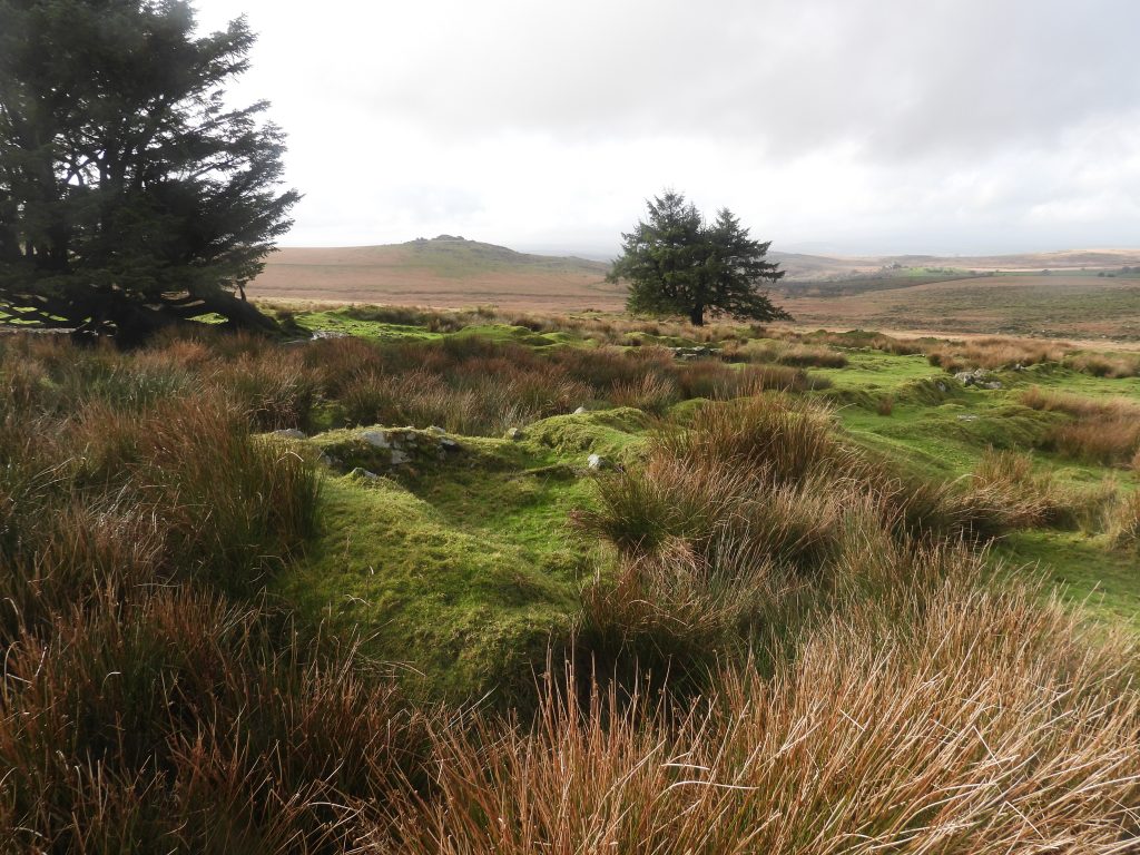
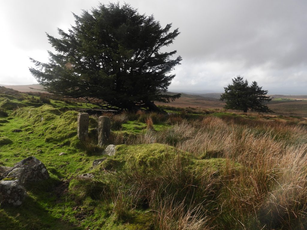
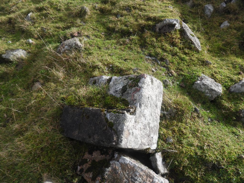
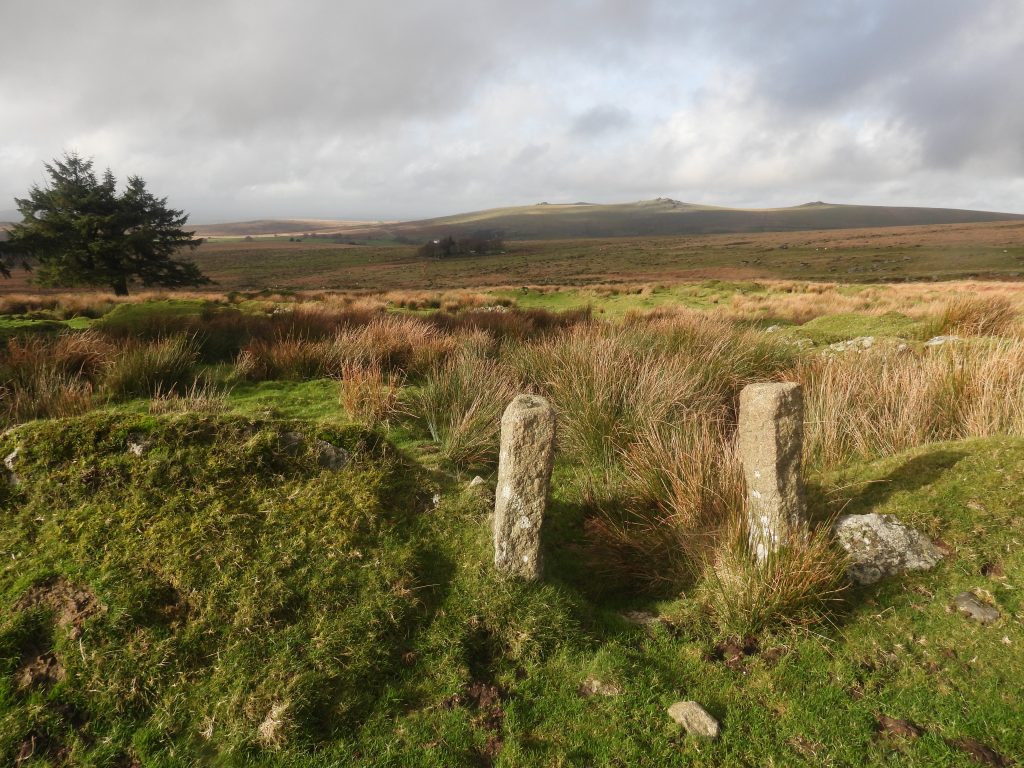
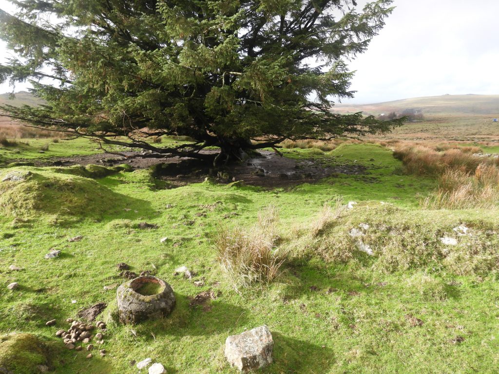
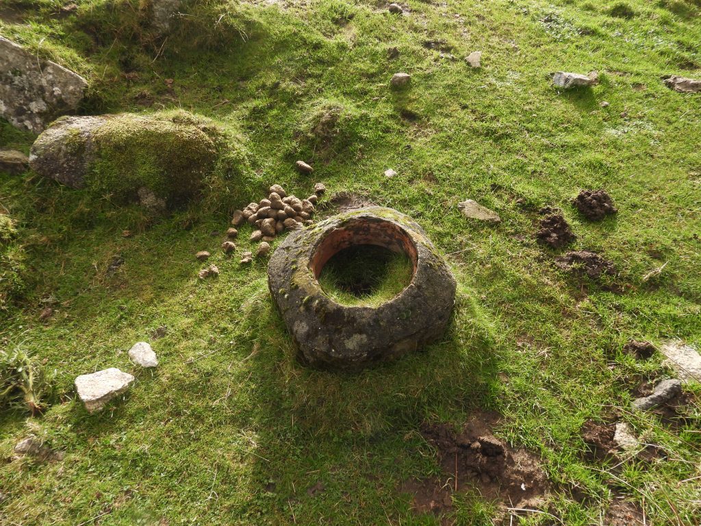
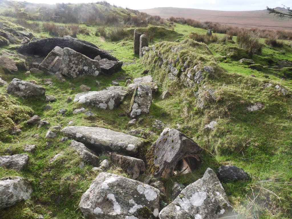
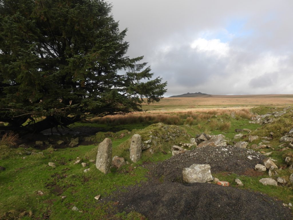
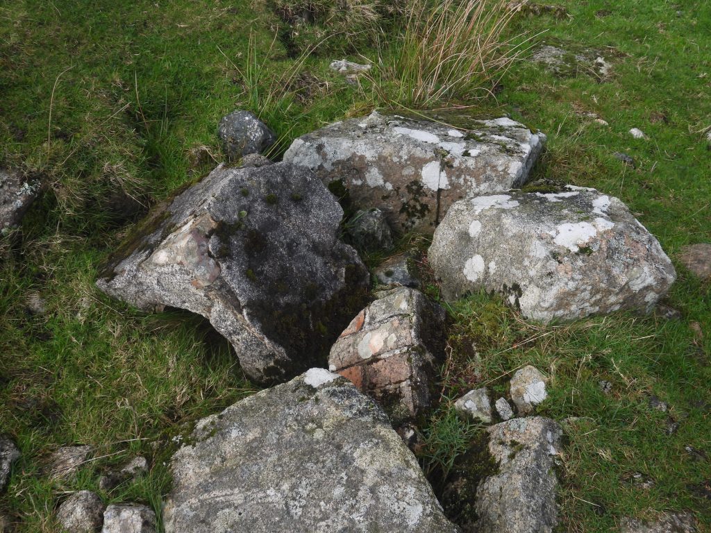
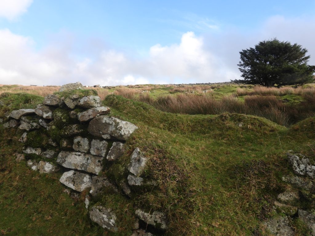
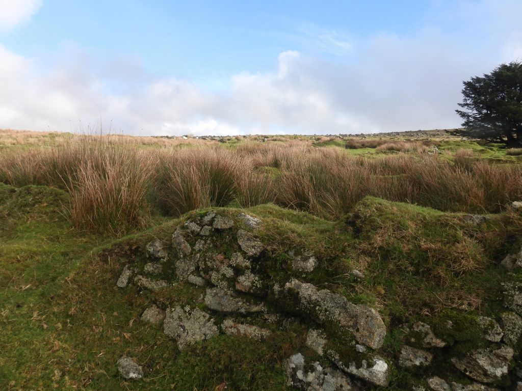
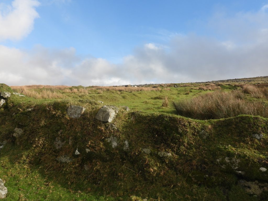
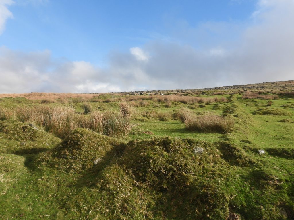
The back lane between the cottages and their gardens as viewed from the southThe back lane between the cottages and their gardens as viewed from the north with the sheep on the north east corner walling of the gardensNorth east end of the cottages, back lane and gardensConcrete block with embedded metal pole near north east corner of gardens. Four Winds trees can be seen mid horizon with the Staple Tors and Roos Tor beyondTo the north of the cottages there is a stream which may well have been one source of water, albeit there is a leat to the east of the track adjacent to the cottages, which ran from the spring north of the pump house. The leat on 19th century maps is shown as having a spur running underneath the track (east to west) then alongside the most northerly of the cottages and gardens. This spur was probably through a ‘bulls eye’ stone (about an inch across), which limited the amount of water. The leat ran southwards to Yellowmeade Farm and Foggintor Quarry (Hill Cottgages)Gateposts to the garden for the first cottage (1/2). Each garden is said to have been 1/2 acreDebris in the back lane behind the first cottage, no doubt remains from that cottageMore debris behind the first cottageMore debris behind the first cottageThis square structure appears to be in the garden of the first cottage (1/2). It is shown on a map from the 1870s as a ‘red square’ indicating it was once roofed. Was this the W.C ?The square feature (W.C ?) is located at SX56644 74771Top (east) end of the garden for the first cottage (1/2)Close up of gatepost leading to the garden for the first cottage – the gate hanger still survivesThe gateposts leading to the garden for the second cottage (3/4). No doubt Mrs Youngson would have been very familiar with theseMrs Youngson’s gardenGateposts for the garden for the third cottage (5/6)Garden for the third cottageOverlooking the garden to the third cottage towards King’s TorGateposts for the garden from fourth cottage (7/8)Debris in the back lane from fourth cottage, possibly a front door stepThe garden gateposts from the fourth cottage looking north west (ish) towards Four Winds, the Staple Tors and Roos TorEntrance (with no extant gateposts) to the garden from fifth cottage (9/10)Was this a chimney pot – behind fifth cottage in the back laneDebris in back lane behind fifth cottageGateposts to the most southerly garden behind the sixth cottage (11/12)The garden for the sixth cottage with a spruce tree now growing in itThe south east corner of the garden plots. Note the track running east – west, which was the access to West Mead Quarry, which post dates the cottages, dating from 1941The track to West Mead Quarry. The quarry closed in 1966More debris on the south side of the cottagesTrack to West Mead Quarry which is shown in the photograph (mounds)South west corner of the gardens (sixth cottage)Back wall of the gardens from the south west cornerRear of the garden of sixth cottage (11/12)Walling behind the garden of the fifth cottageWalling behind the garden of the fourth cottageWalling behind the garden of the third cottageWalling behind the garden of the second cottage (3/4) – Mrs YoungsonWalling behind the garden of the first cottageNorth west corner of the garden walls
Another picture from the Don Youngson collection. This is thought to be Mrs Youngson and Fanny Hext either at Hill Cottages (adjacent to Foggintor Quarry) or at Mount View (Mis Tor Lane)
Coloured AI Image
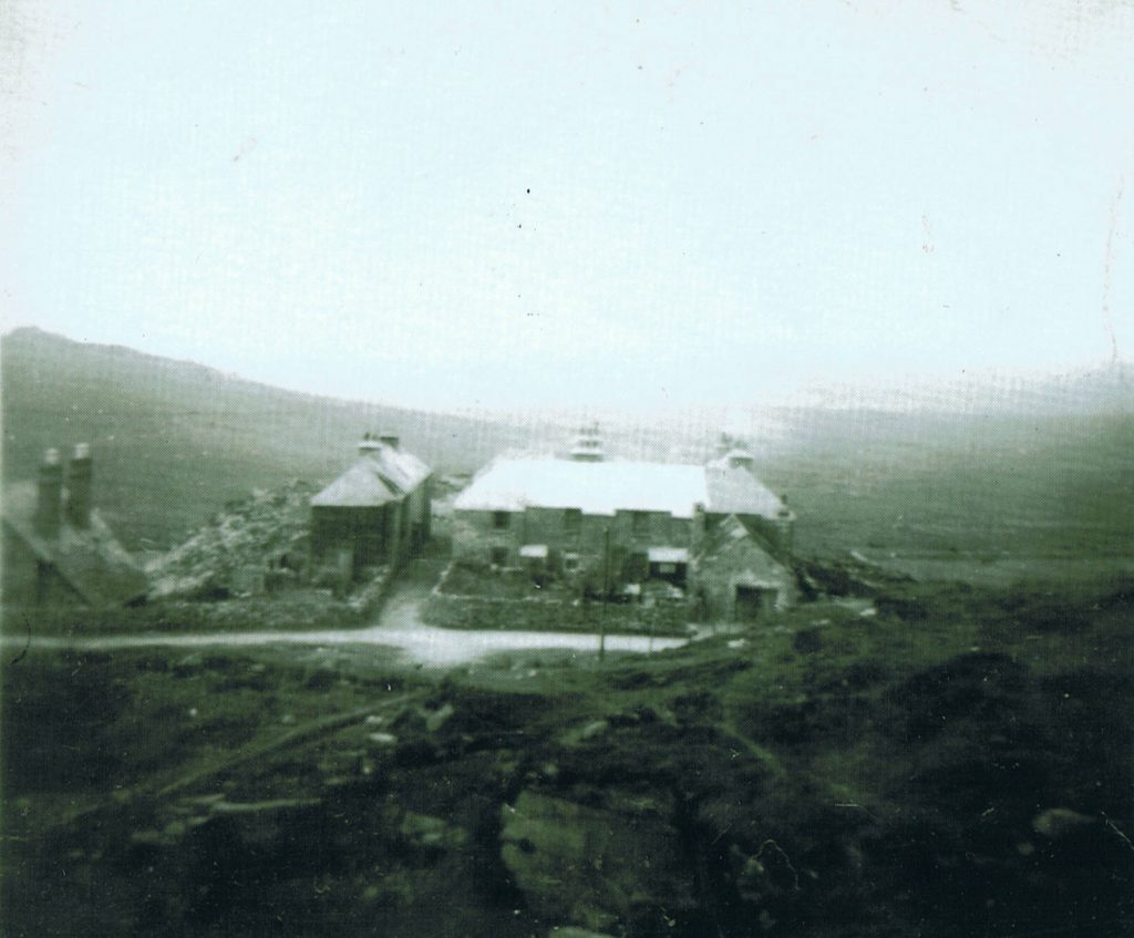
Hill Cottages at Foggintor, like ‘Red Cottages’ were built for the quarrymen. These appear to have been labelled 13-26 with 27 being the Managers House (double chimney of the left of the photograph) by the Maristow Estate. The labelling no doubt following on from 1-12 for ‘Red Cottages’. If this is correct then perhaps it confirms the numbering was from north to south as previously suggested by the author. These cottages look to have been more substantially built than ‘Red Cottages’ and were built probably at the same time or just afterwards them as they appear on a 1851 census. They were demolished in 1953. There was a chapel here which is the wide doorway with gable end facing the camera – it was once used as a school