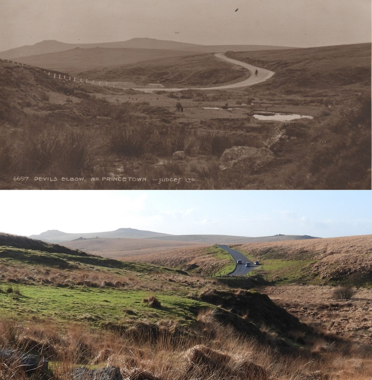
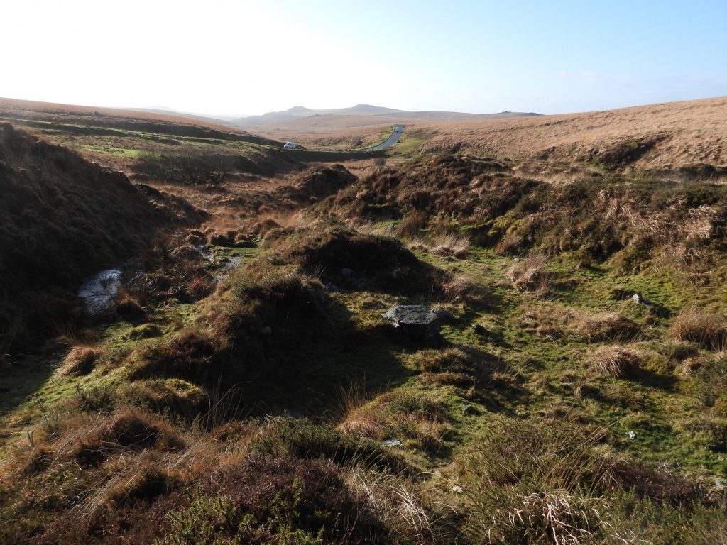
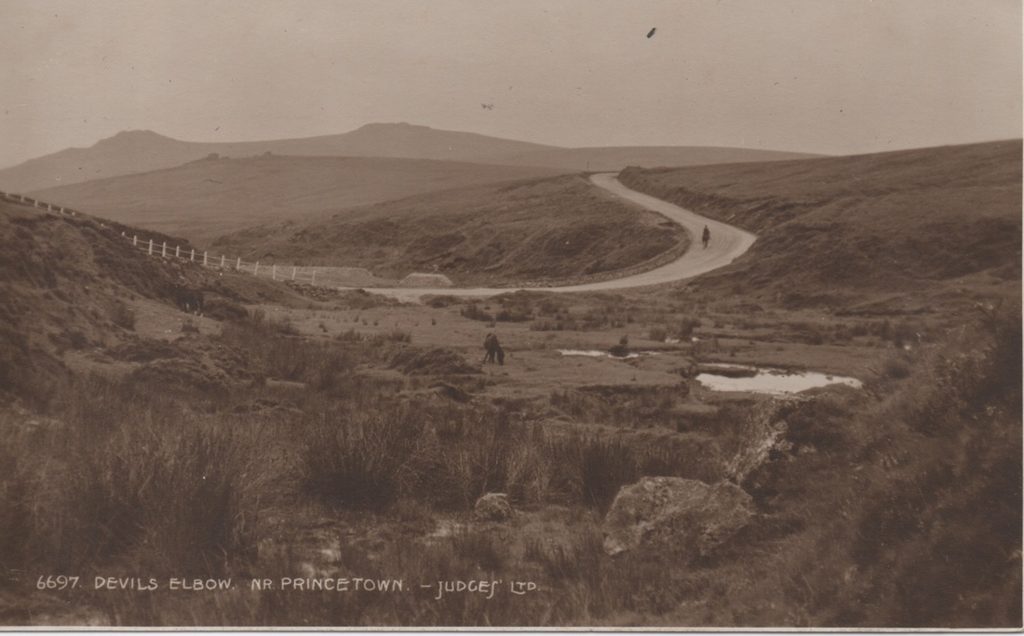
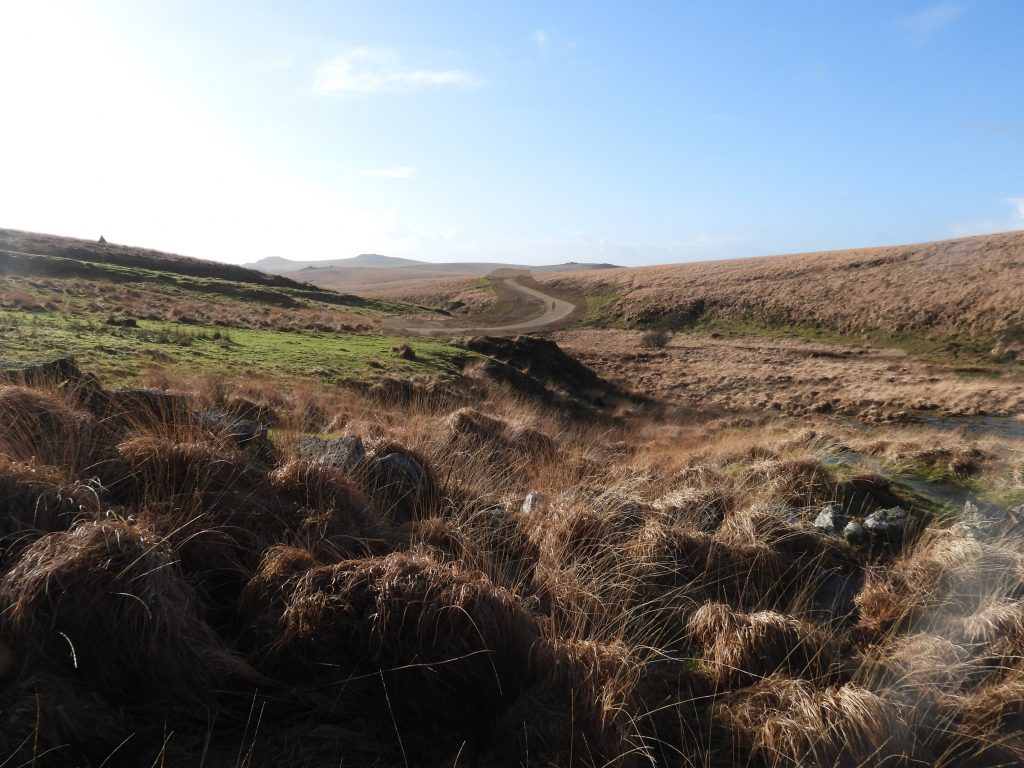
The ‘bend and dip’ in the road known as Devil’s Bridge to the south west of Princetown will, no doubt, be familiar to anyone venturing onto Dartmoor.
Devils Bridge (known to some as Devils Elbow) is merely a culvert which runs under the B3312 just a few hundred metres from Princetown where the infant River Meavy runs under the road. It was a nickname given by workman in the area, probably due to its (once, but not longer) ‘Devil’ of an ‘S’ bend.
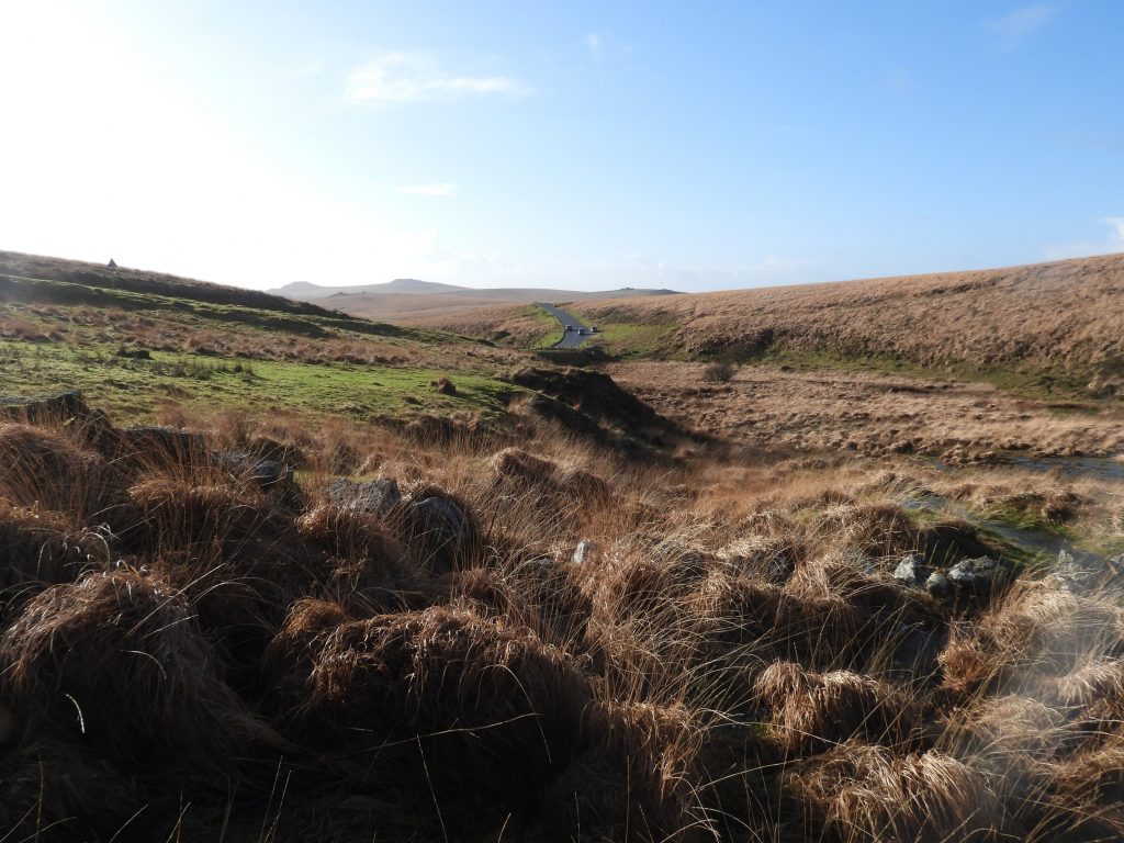
Of course, the ‘bend’ is now less severe than it once was and has been significantly straightened out
Pictures courtesy of Nigel Machin
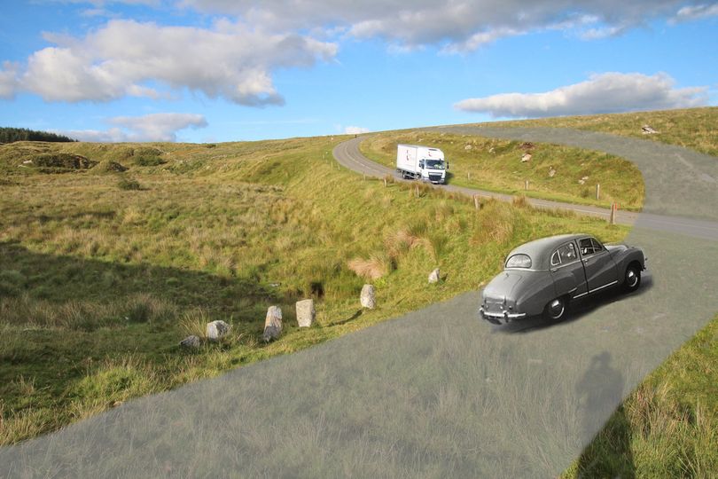
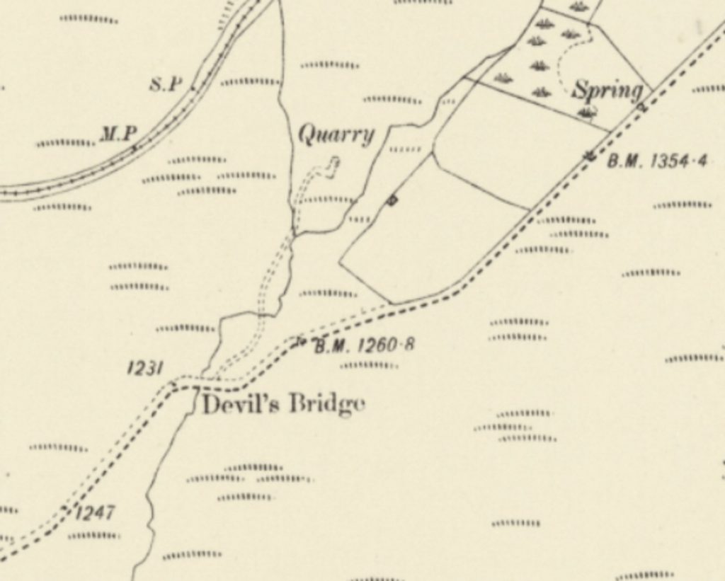
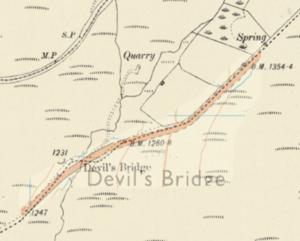
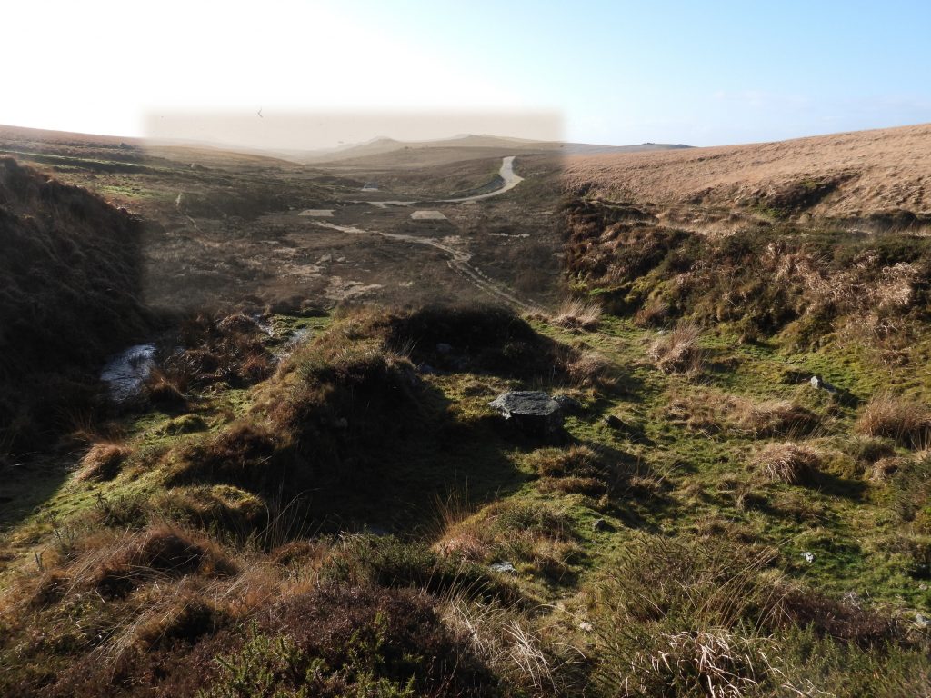
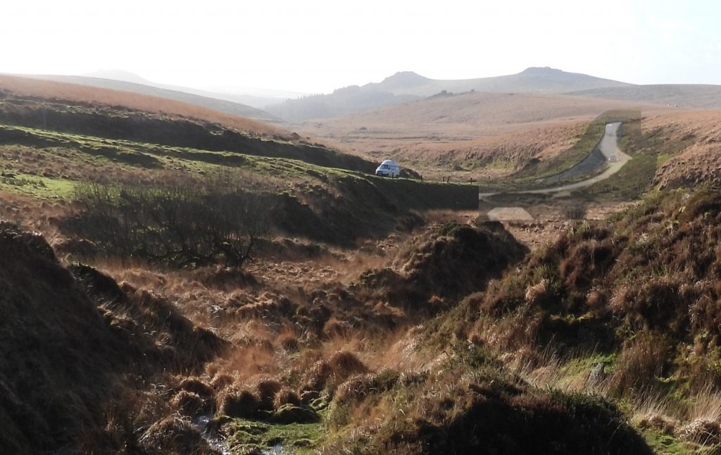
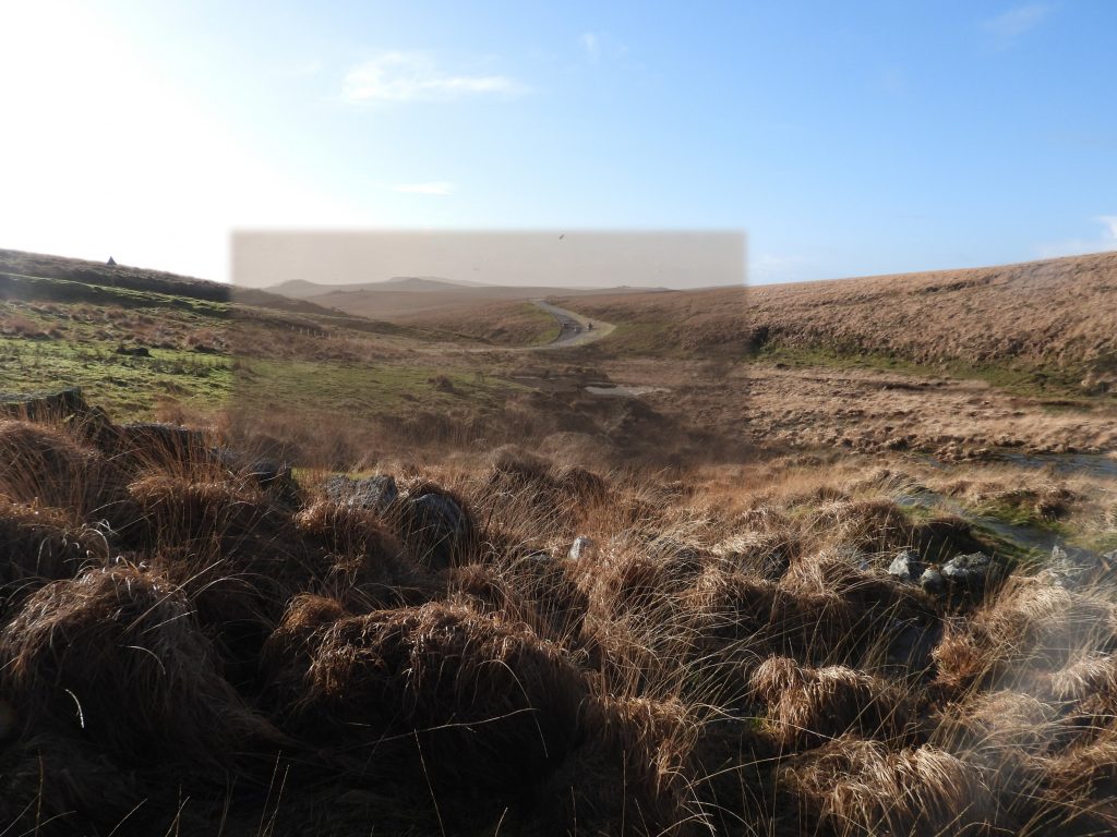
Looking east. Devil’s Bridge (Elbow) was straightened in the 1960s. To help imagine what it once looked like the old road from the 1906 map has been traced through Google Earth. It seems to show that the row of posts now running almost perpendicular to the modern road for no apparently good reason may well have run down the side of the old road. The picture shows a ‘painted on’ road and car, with what it might have looked like around 1950. The thing that is striking is how steep the climb would have been onto what is now a bank the other side of the road. It must have soon become impassible in ice and snow.
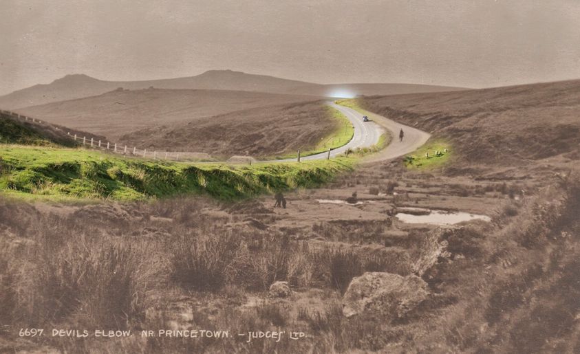
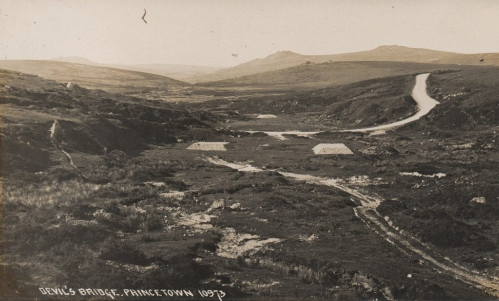
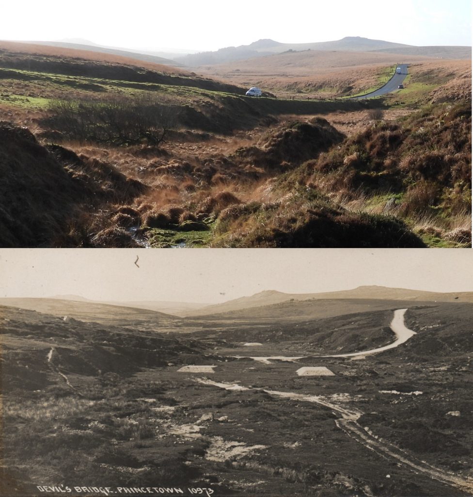
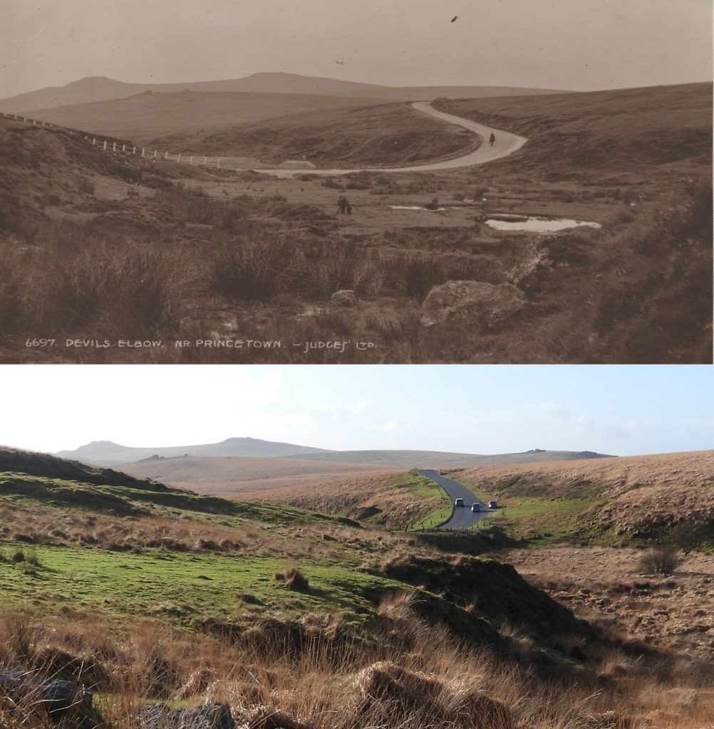
Looking west. Further to the ‘painted’ on the old elbow bend in the first picture, it was assumed that a row of posts well away from the modern road went down the side of the old road. Comparing a photo taken around 1920 with the modern road and, although the posts weren’t there then, it does seem to confirm that they were indeed put alongside the old bend later to stop cars ending up in the mire. The most significant feature is not so much the ‘elbow’ but the steep climb up from it (left) towards Princetown compared to the modern gentle incline.
Total Page Visits: 3802 - Today Page Visits: 3
Peter Marks February 26, 2024
I have an oil painting of Devils bridge by A. F. de Breanski 1877-1945.
He has overdramatised the hills behind but it does show the clear route of the old road.
I can send you a photo, if you wish.
SteveGriggDartmoor February 26, 2024 — Post author
Hi Peter,
If you could send a photograph that would be great. Thank you.
Kind Regards,
Steve