A collection of walks, discoveries, insights and pictures of exploring Dartmoor National Park
June 9, 2022
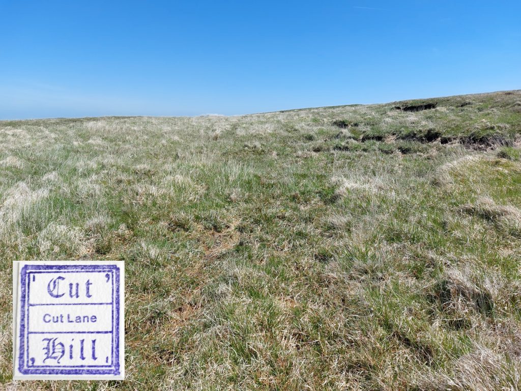
Cut Hill
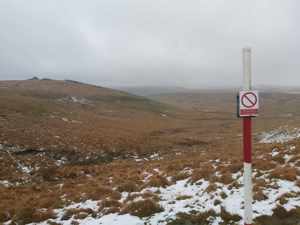
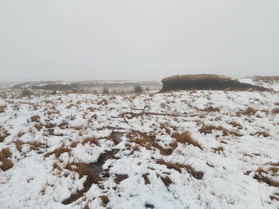
Cut Hill was once stated as being the remotest point in England, south of Northumberland. Certainly, when the military observation post OP15 was still accessible by car in the early 2000’s, there was no denying that Cut Hill was one of the remotest points on Dartmoor, which to many, especially the letterboxing fraternity, was its allure . Today, with most of the military ring road around OP15 on Okement Hill now closed off to public traffic, the remotest point on Dartmoor has shifted to the north by a couple of km (to south end of Black Ridge Peat Pass). That said, the allure of Cut Hill, to the author is still there, due in the main to: its fabulous 360 deg views from its peak, the intriguing history surrounding its four “peat passes”, its guide stones, its ditched barrow, its 4th millennium b.c stone row, its inscribed rocks plus other features, the latter which some would consider a human detritus but nevertheless all have their story to tell. Cut Hill is quite an ugly duckling in many ways, with all its mis-shapen peat hags, ankle tugging tussocks of grass and often wet boggy ground and does not appeal to everyone. However, its remoteness and uniqueness in the northern morass should be visited by Dartmoor lovers at least once so they can decide for themselves if its an ugly duckling or beautiful swan.
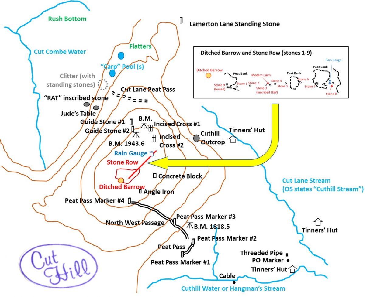
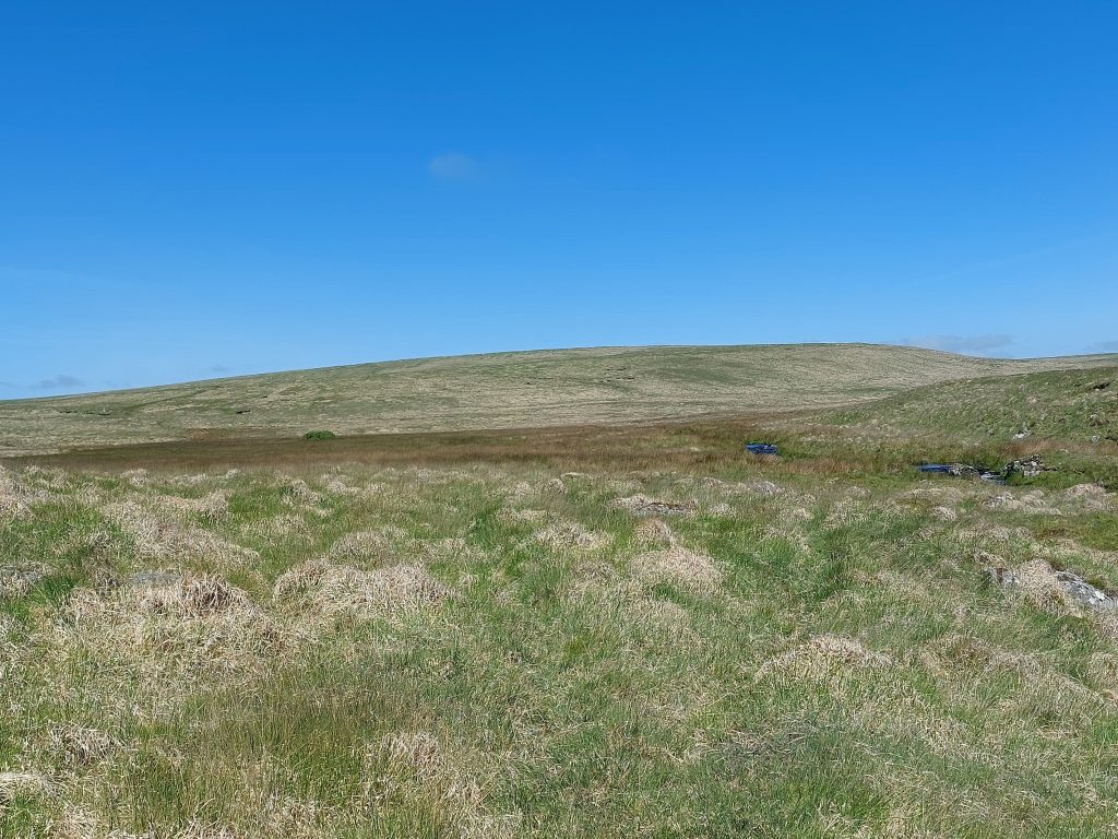
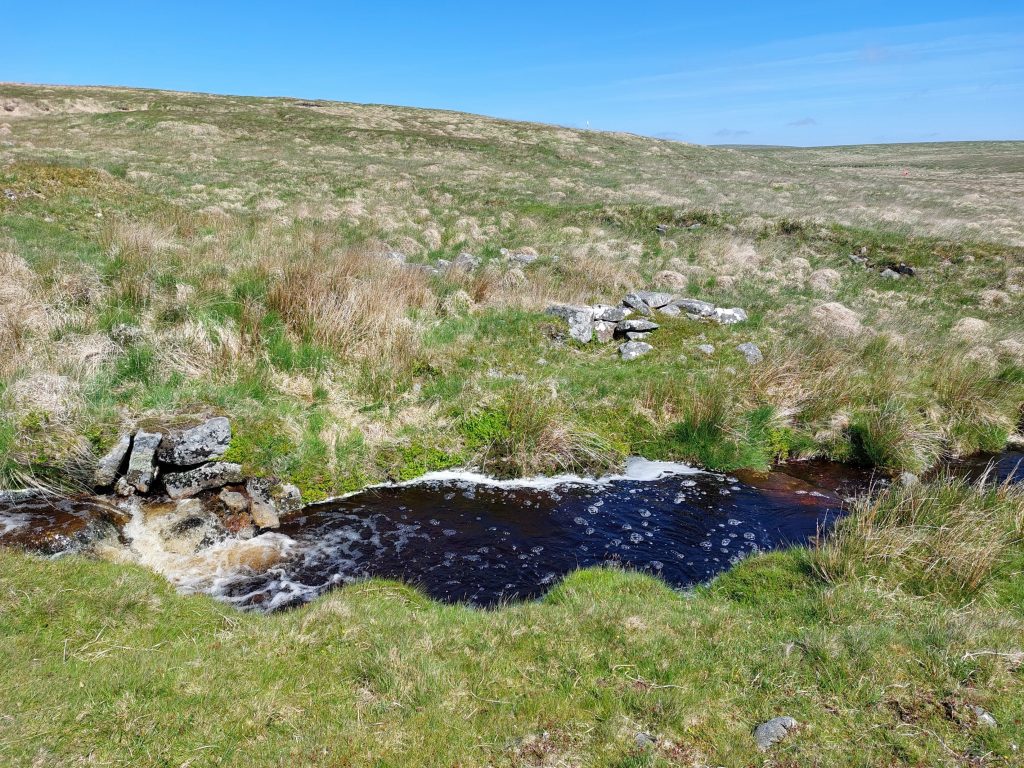
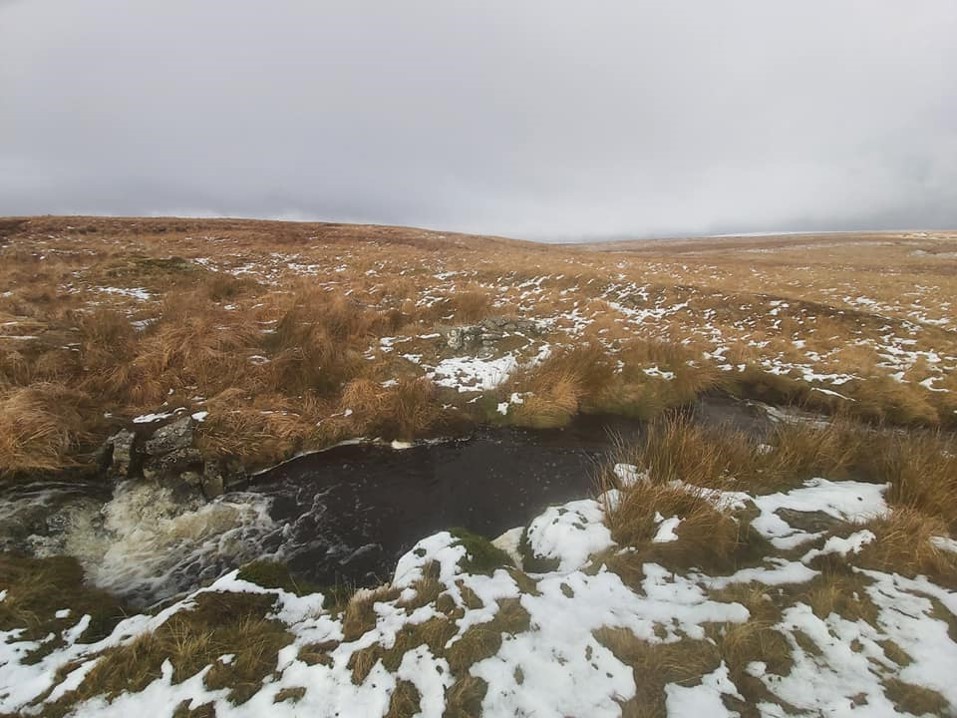
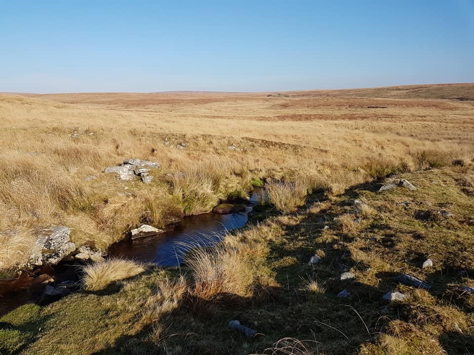
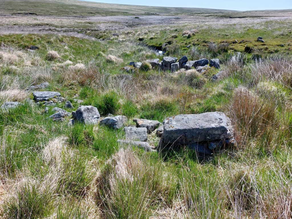
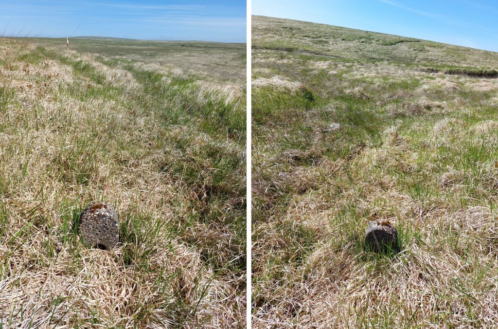
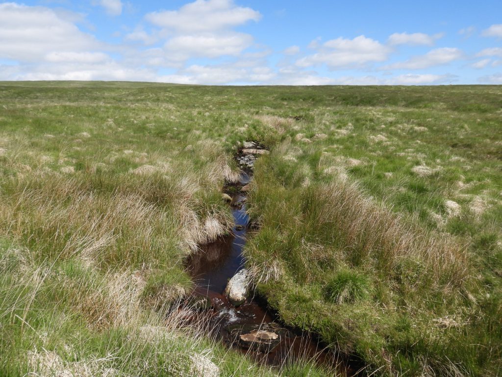
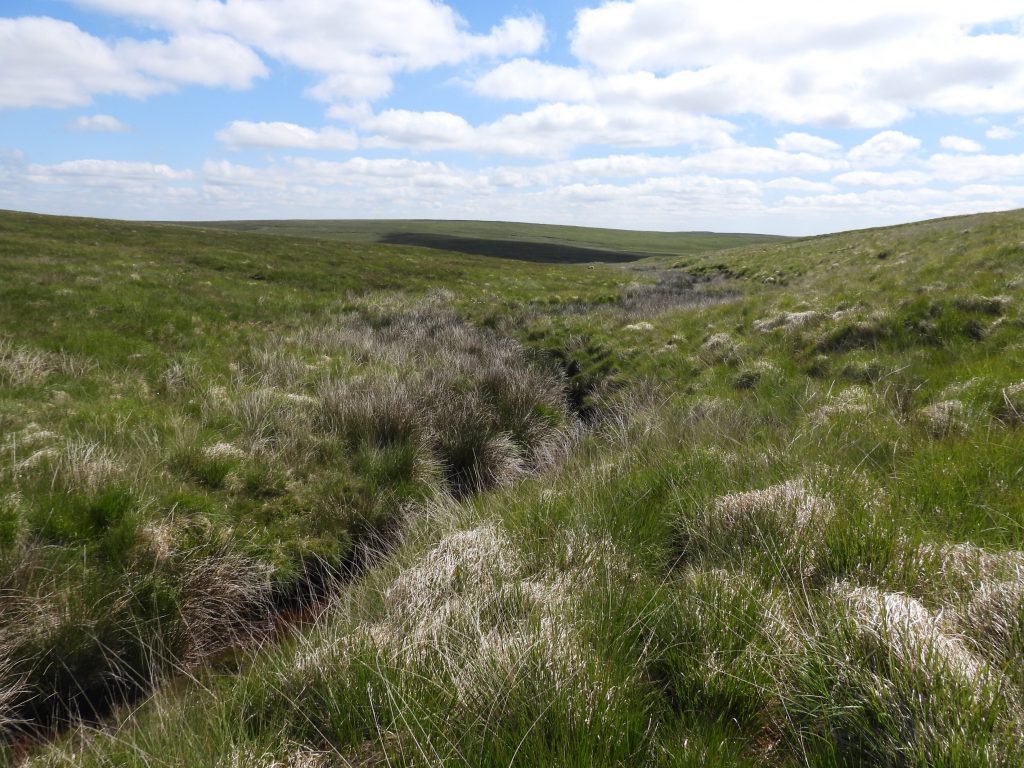
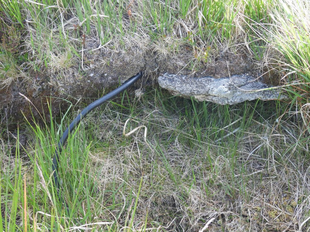
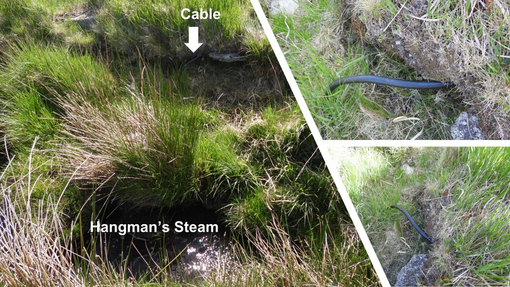
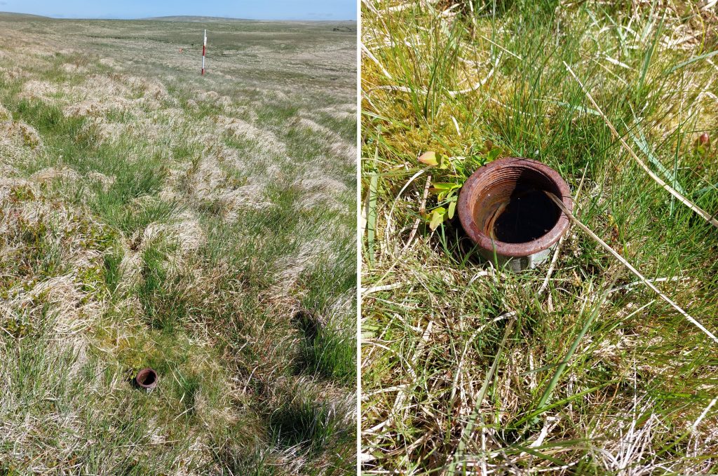
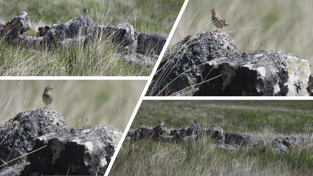
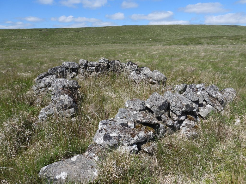
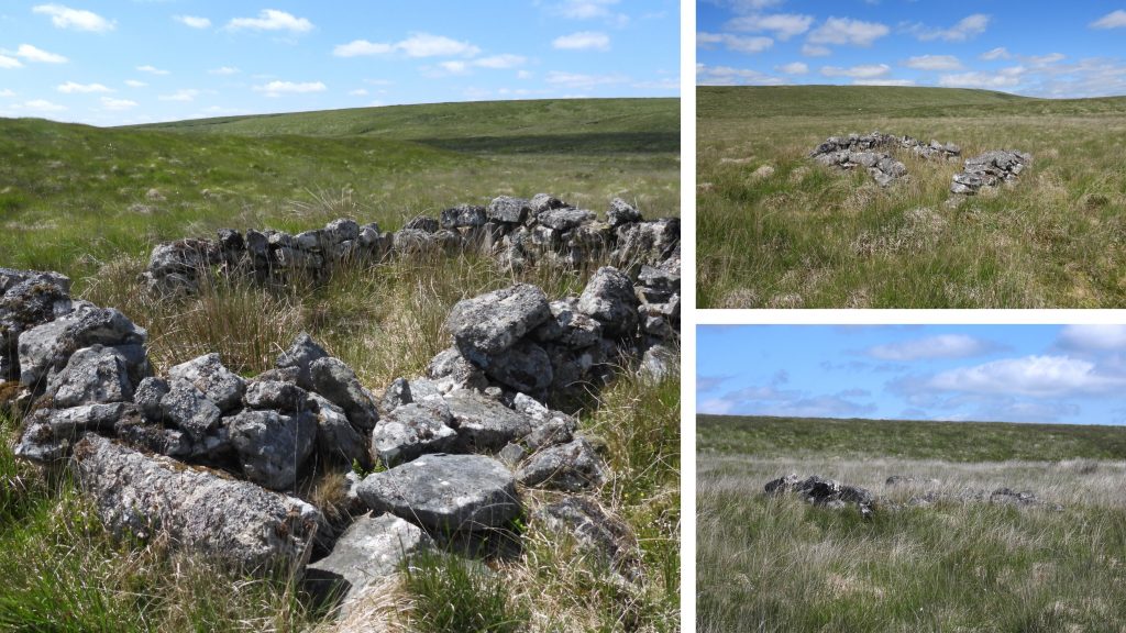
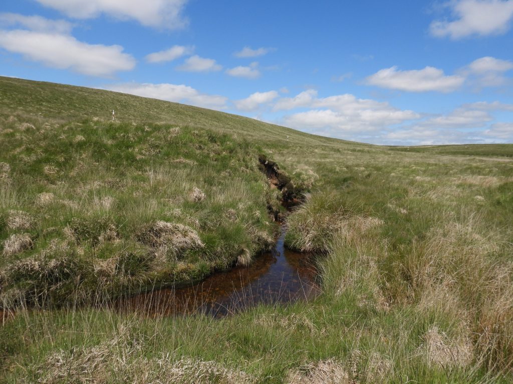
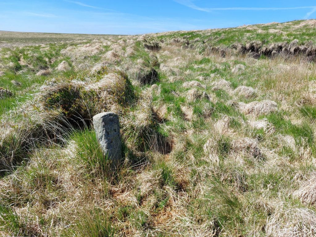
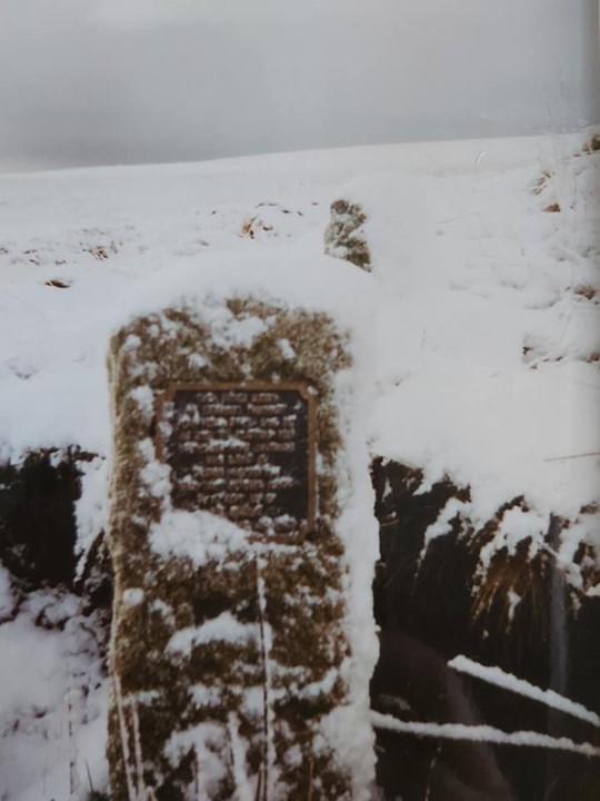
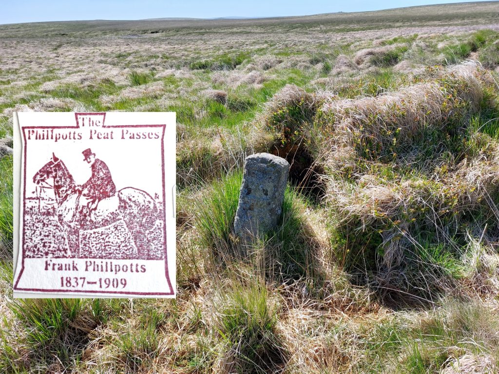
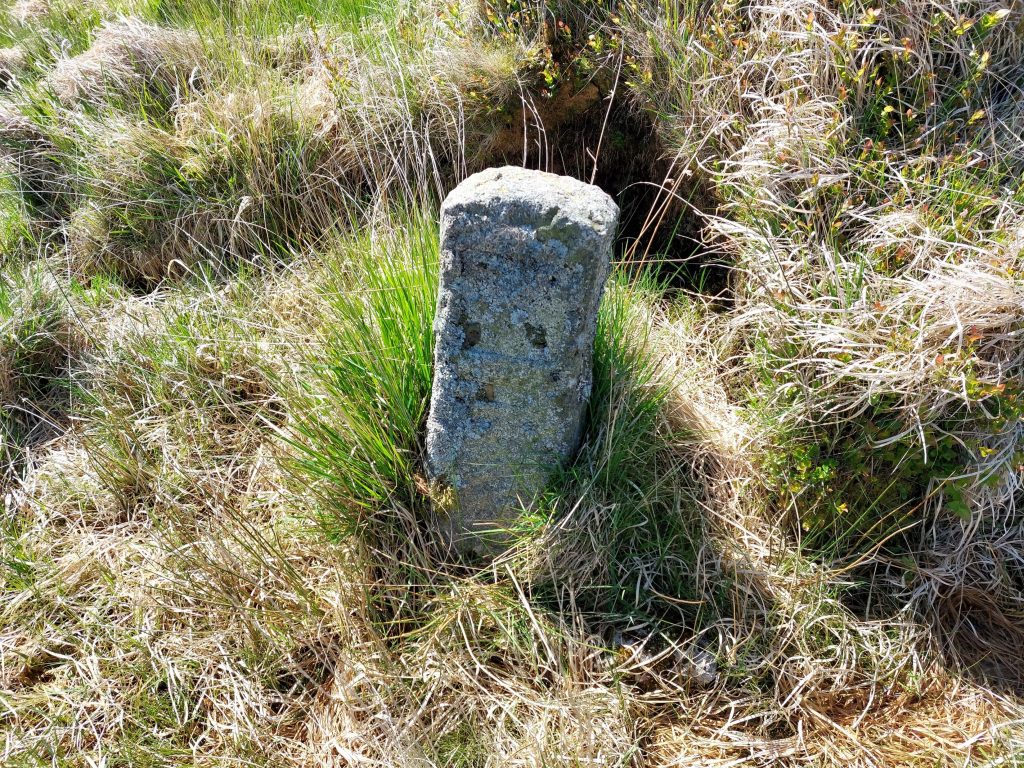
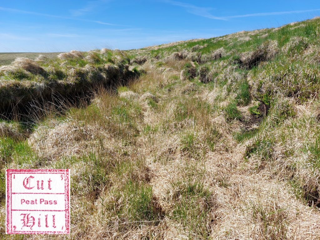
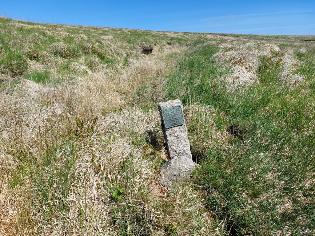
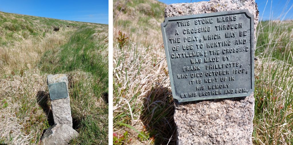
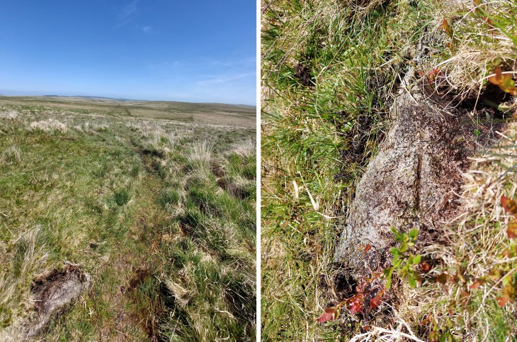
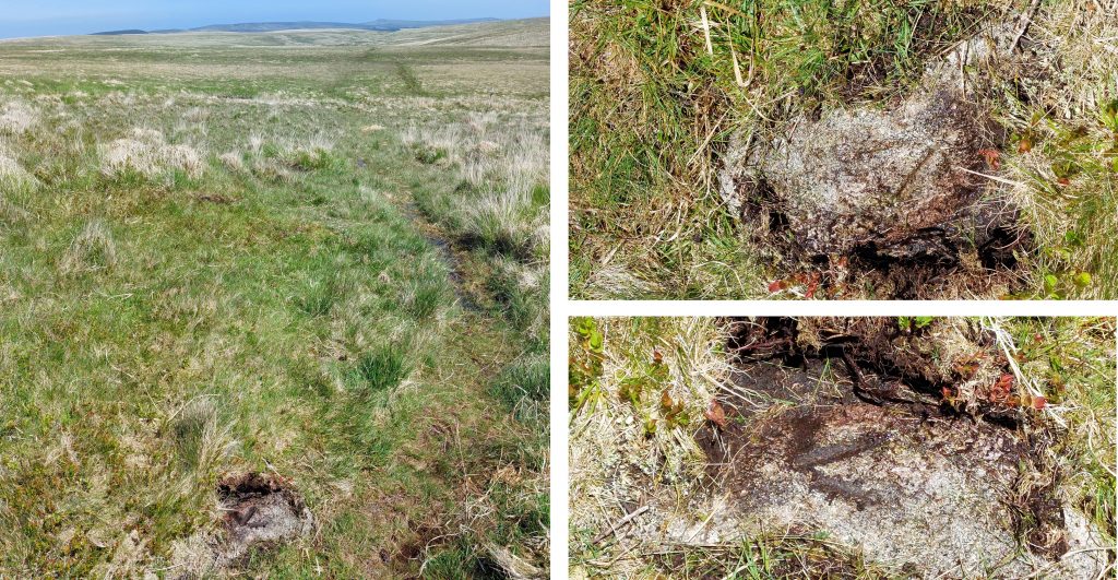
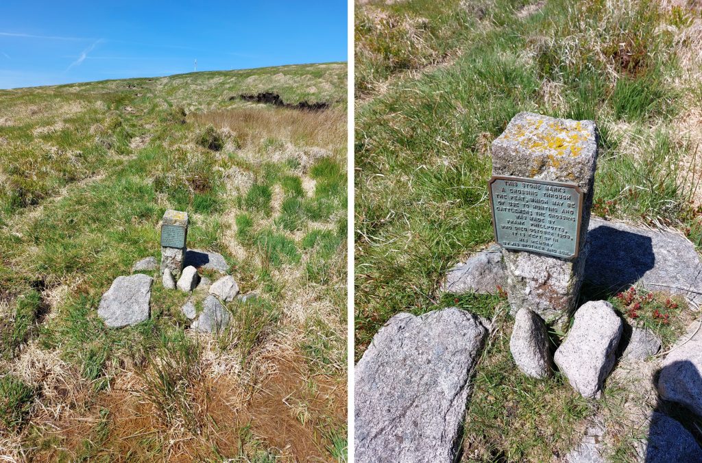
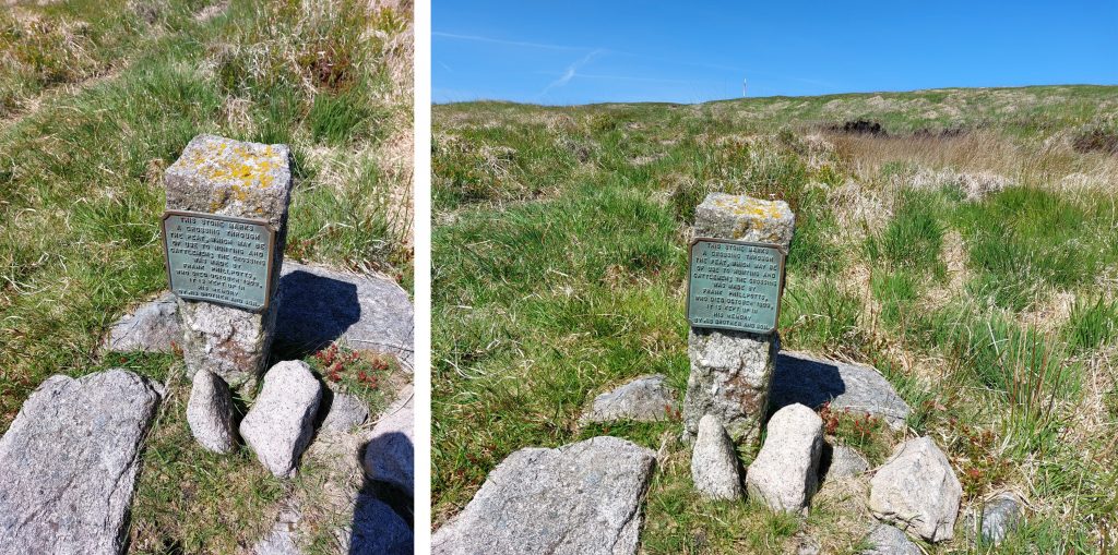
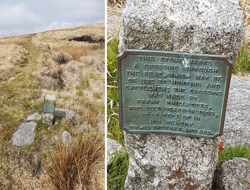
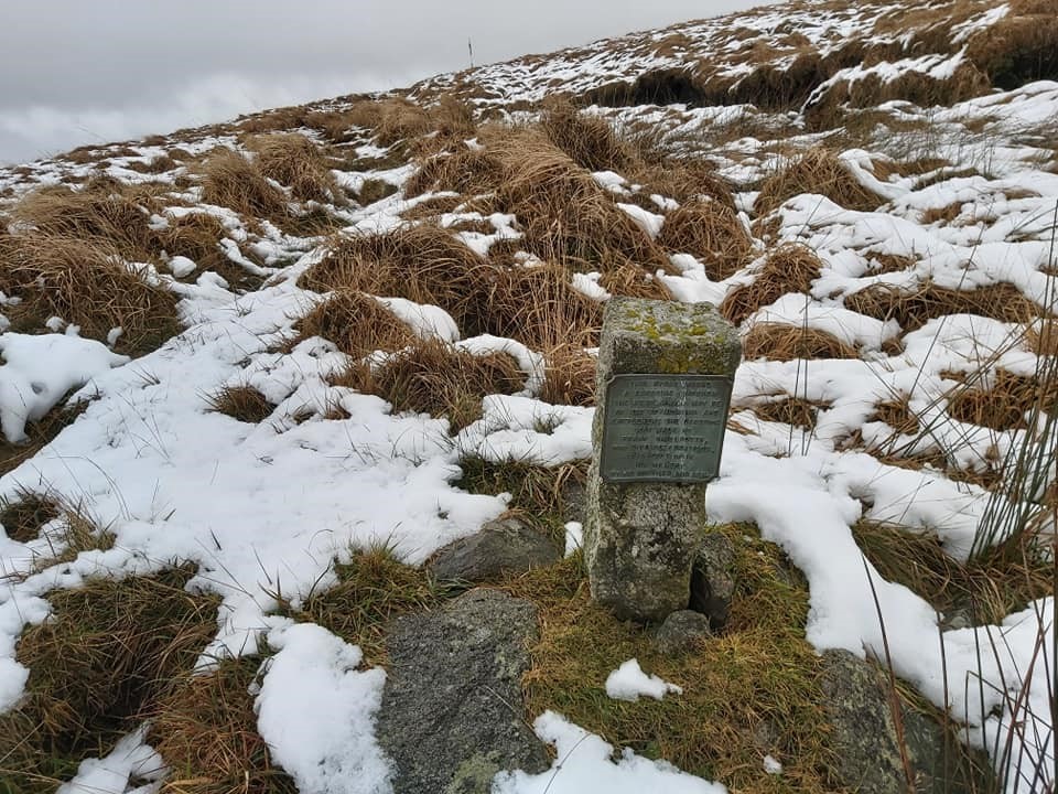
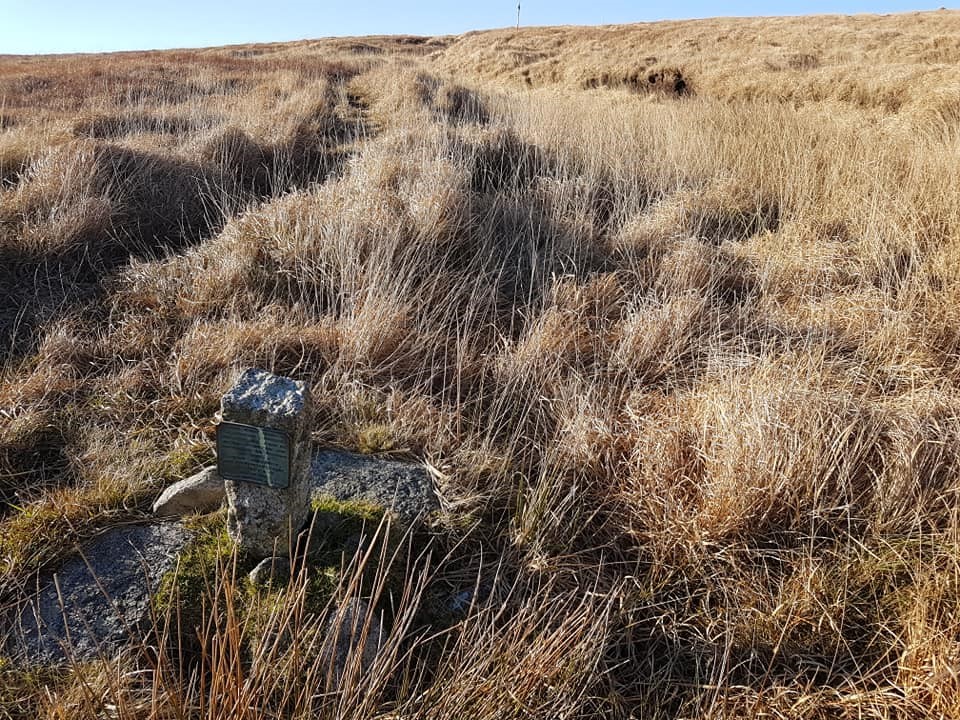
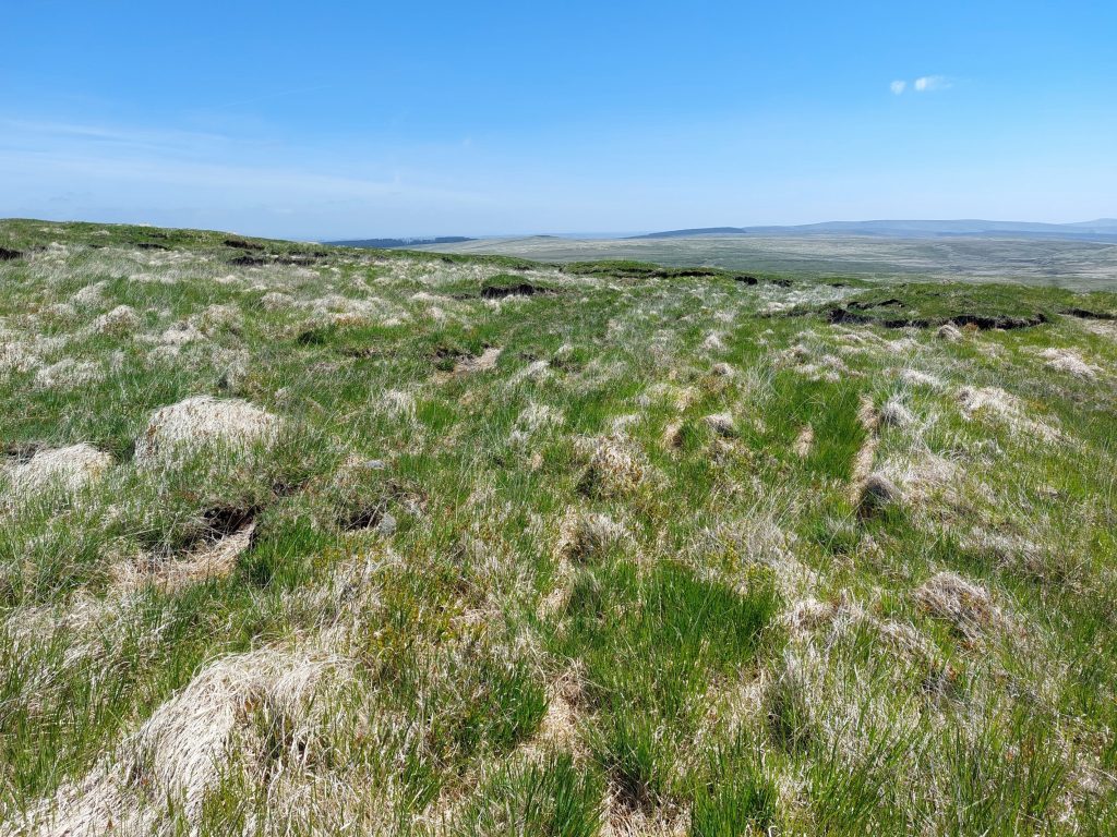
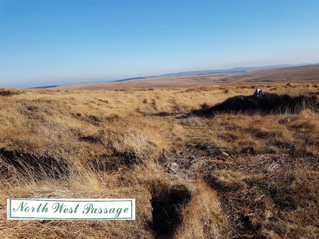
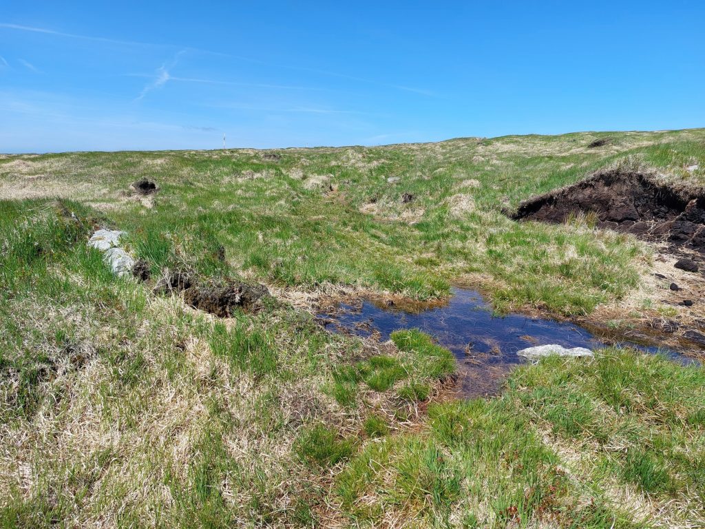
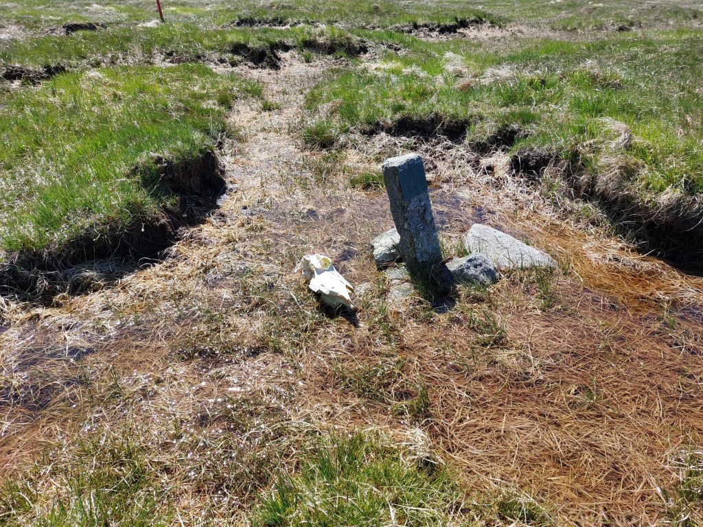
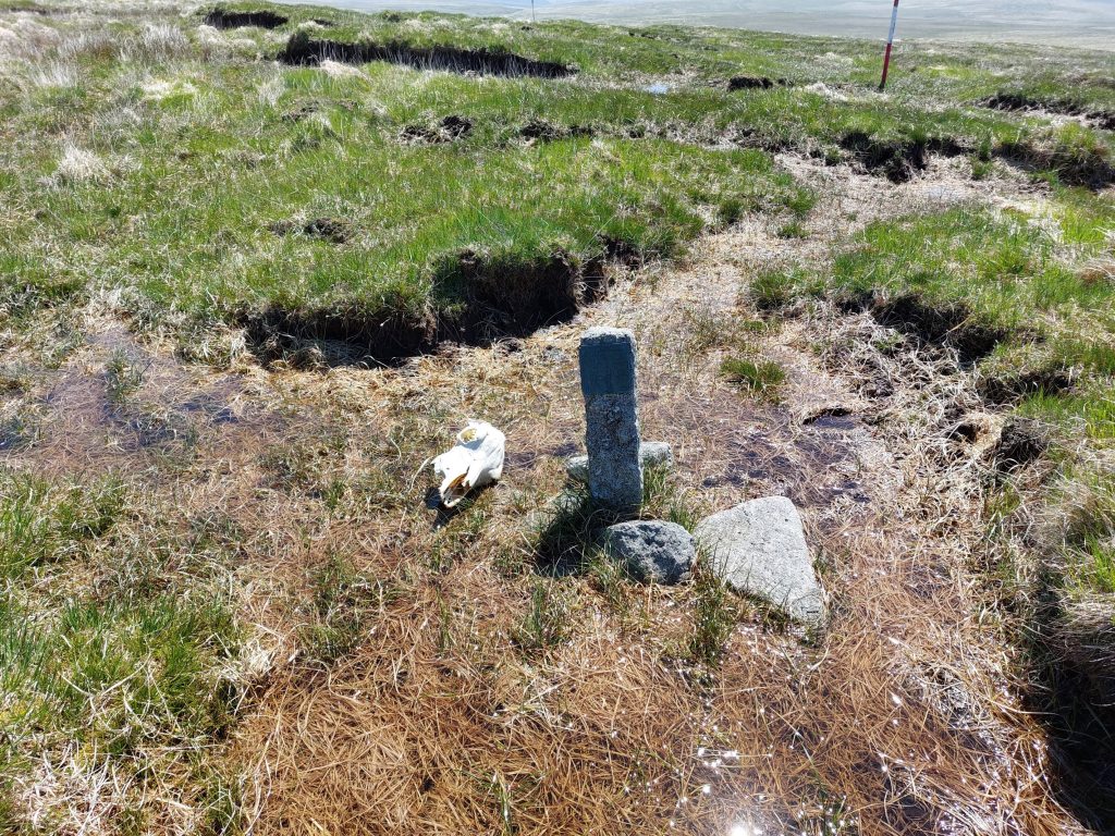
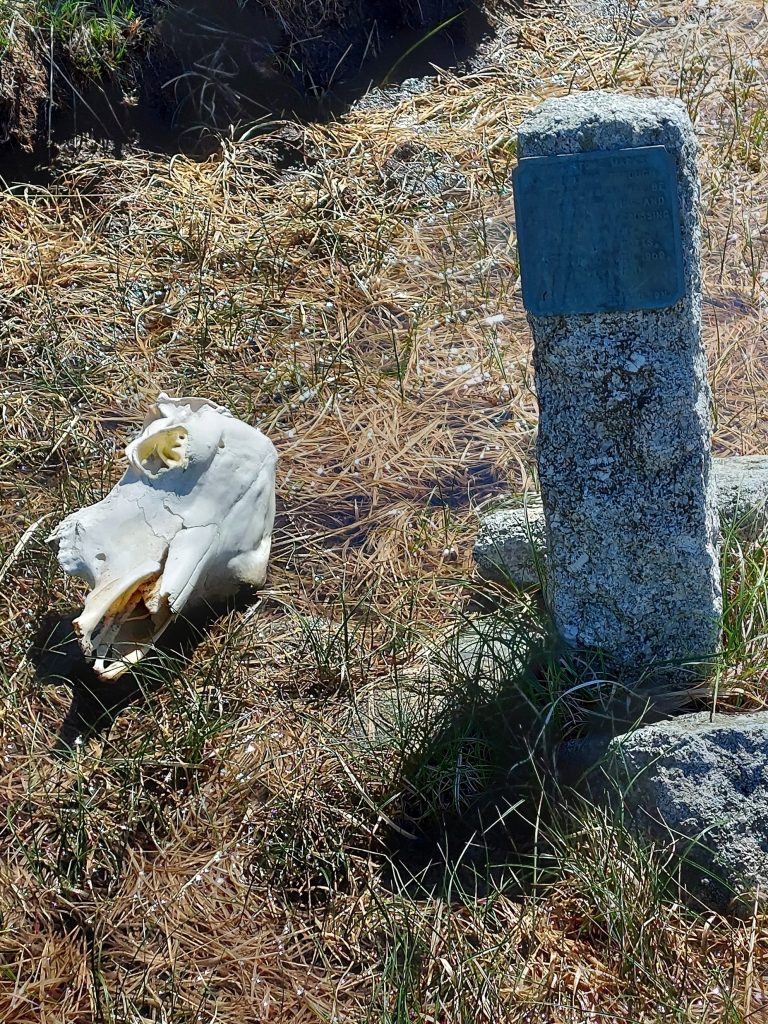
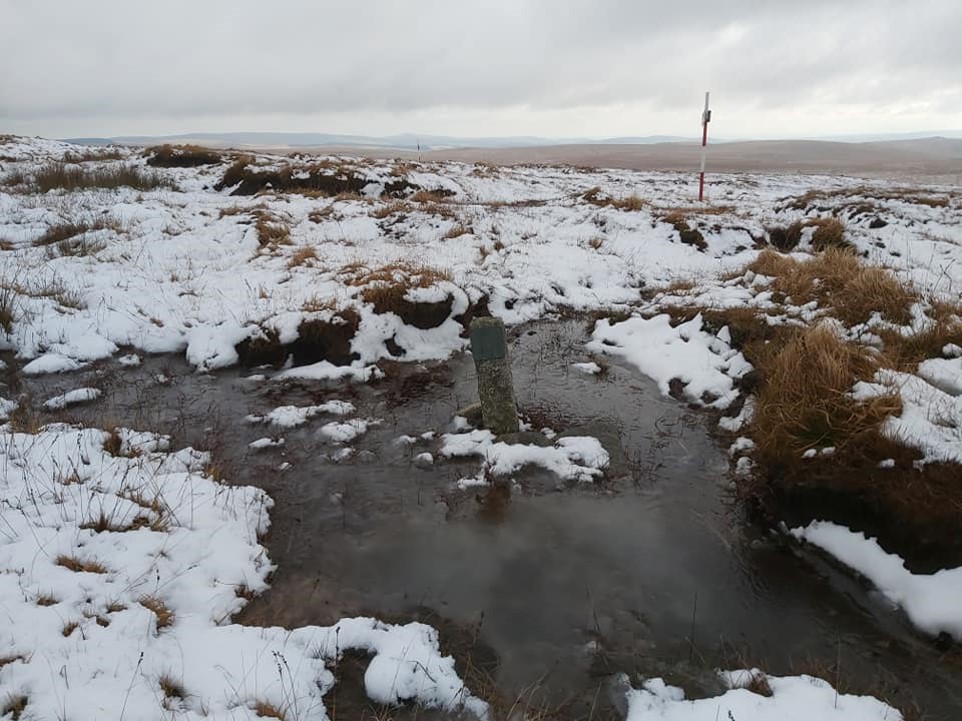
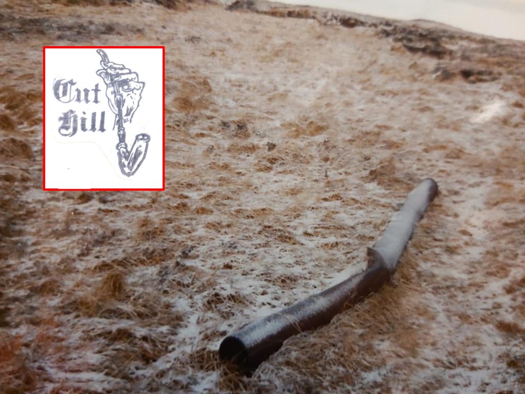
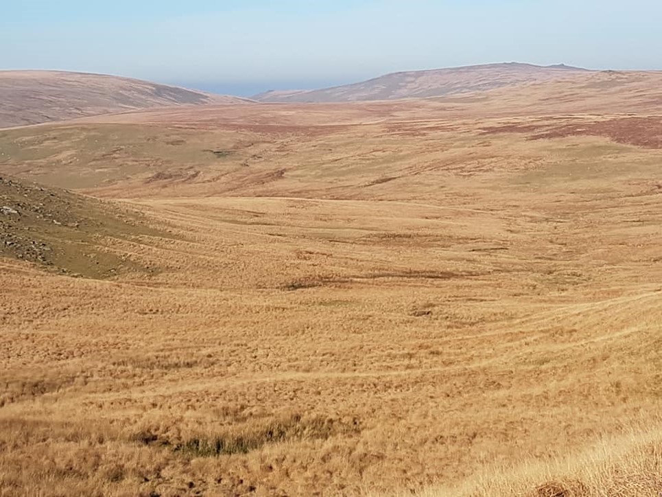
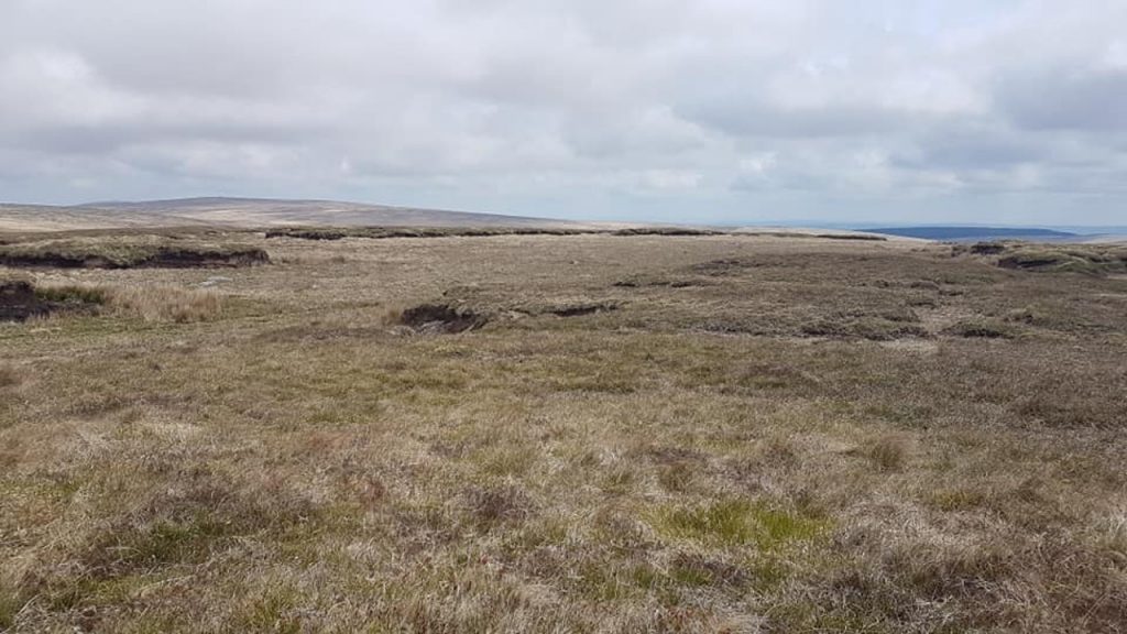
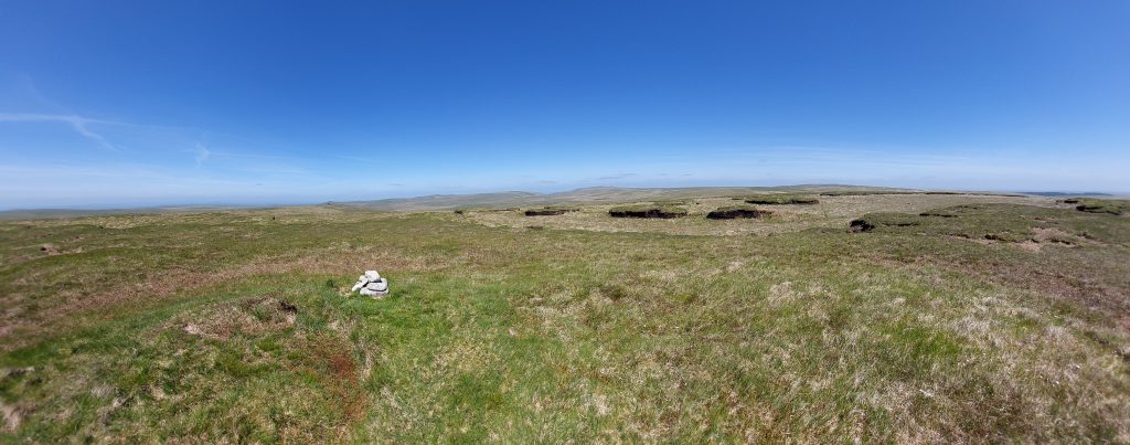
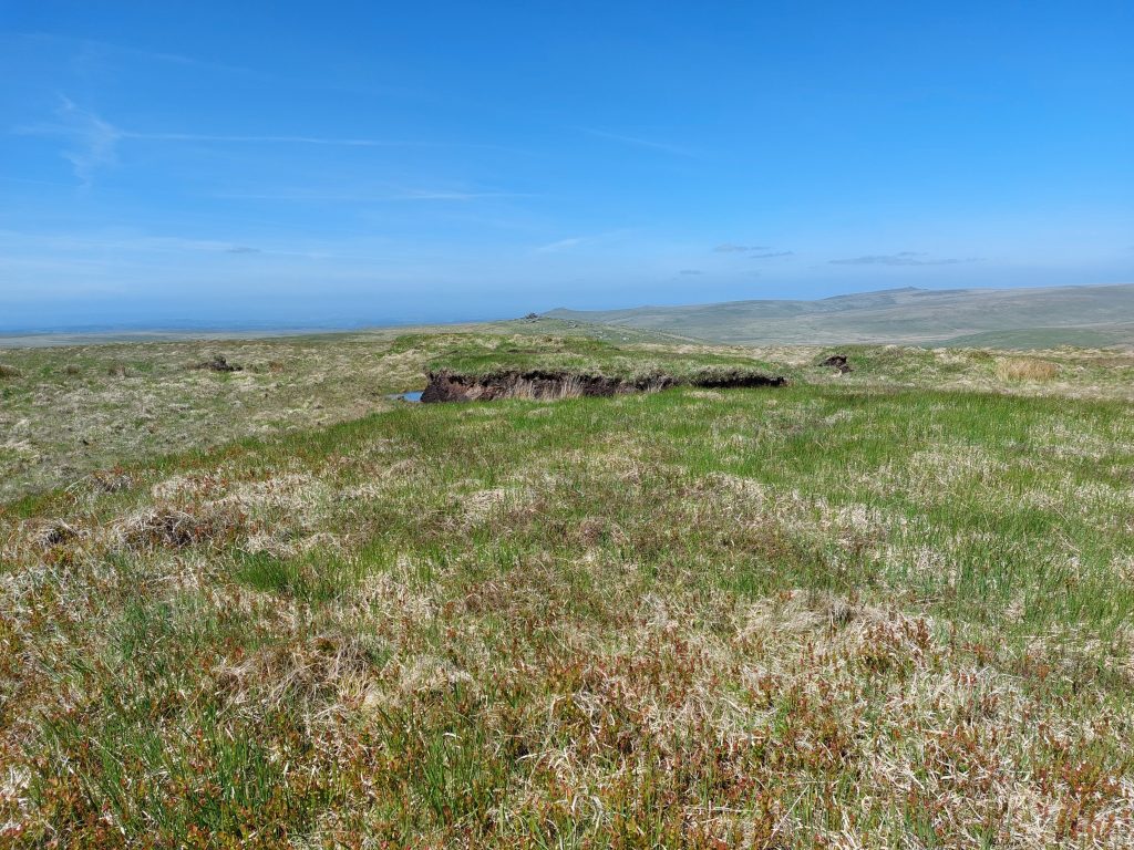
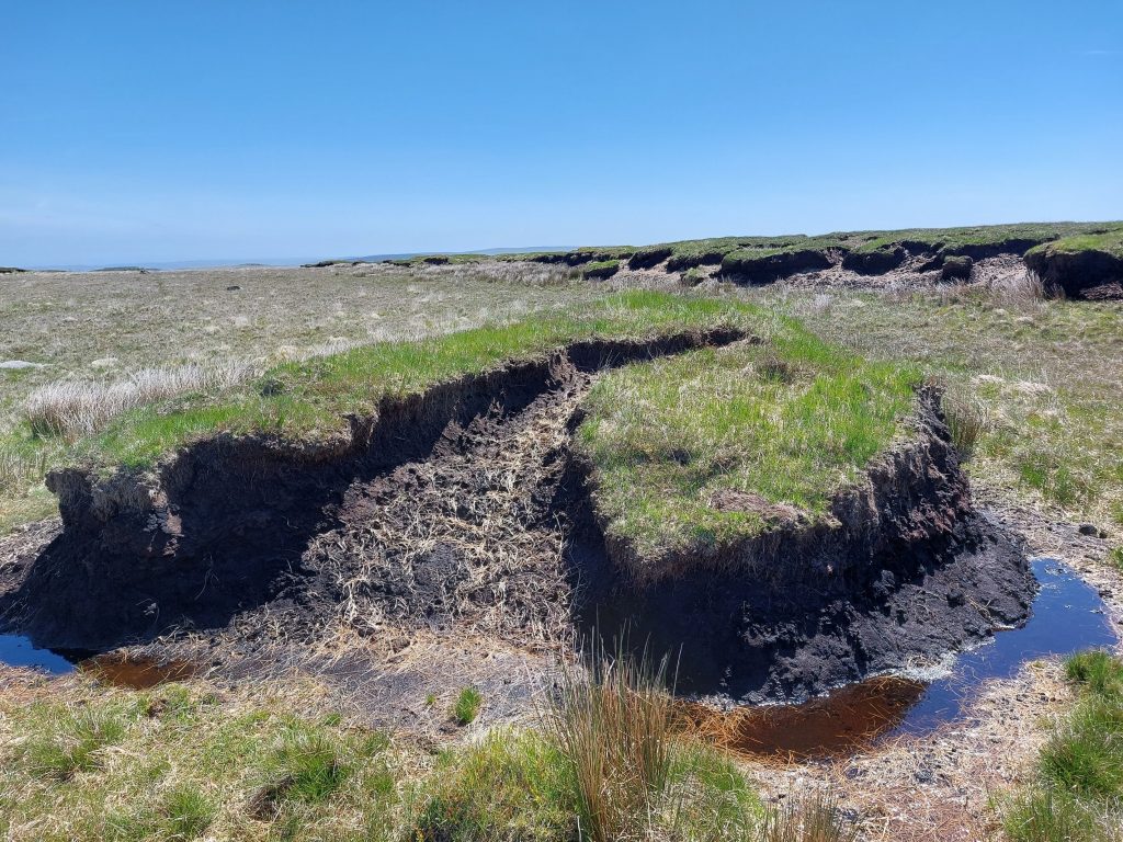
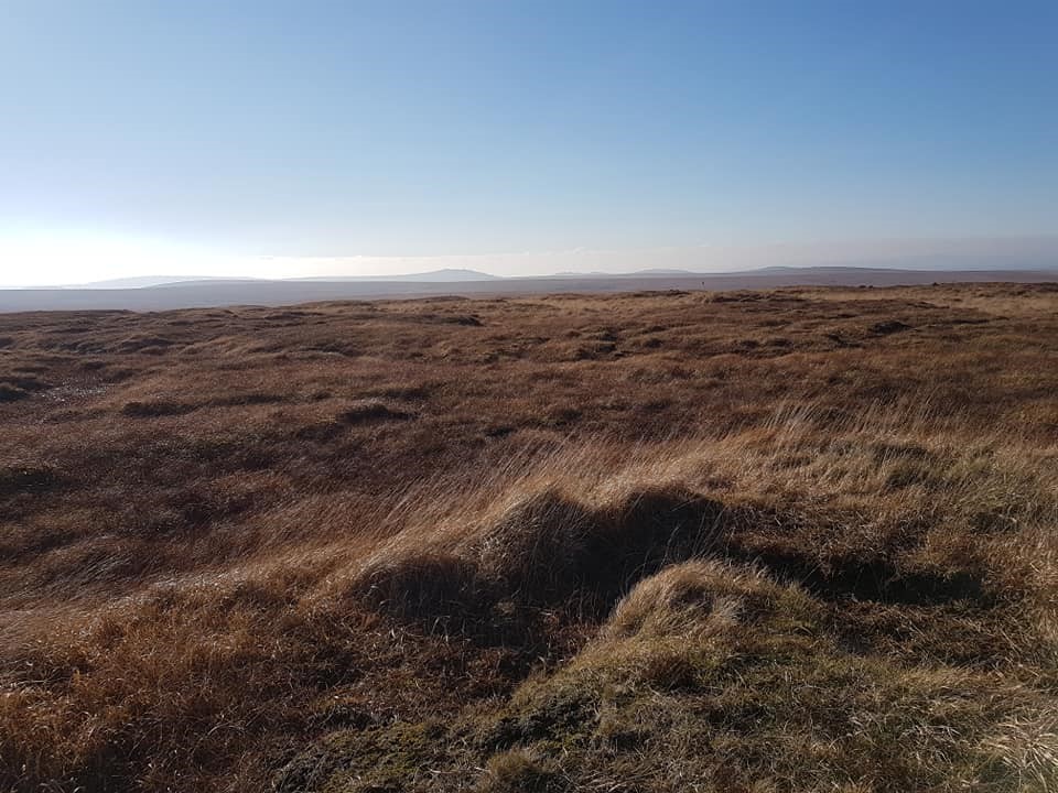
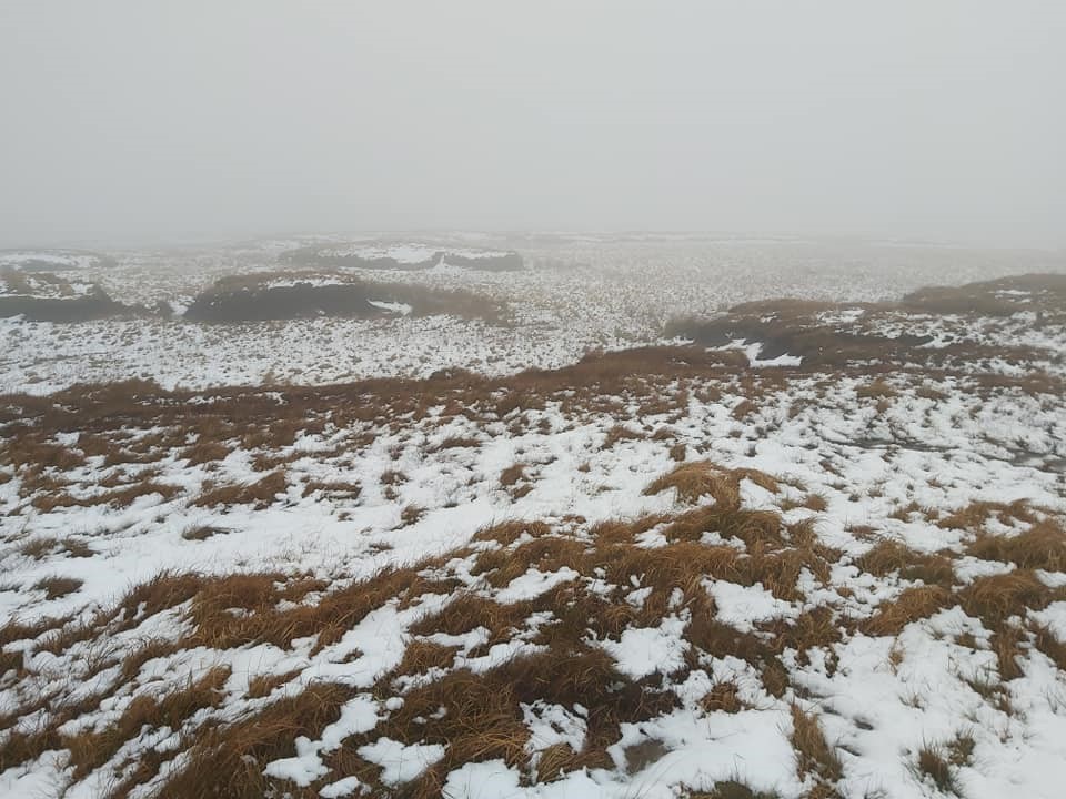
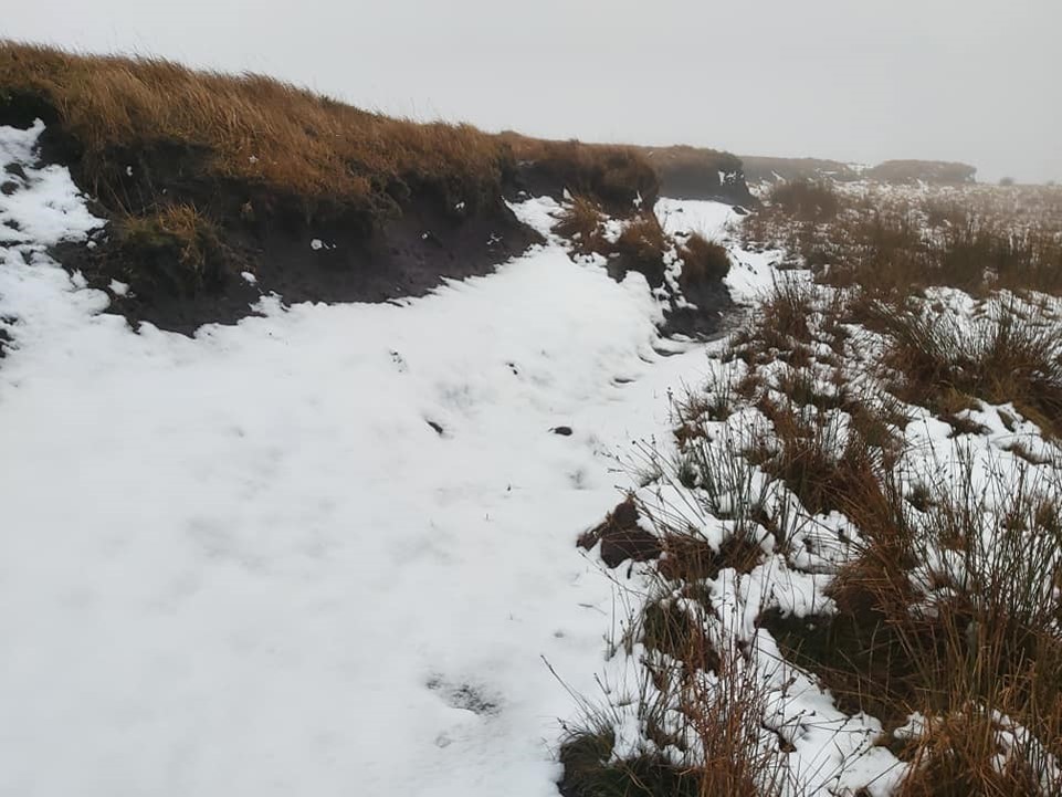
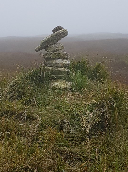
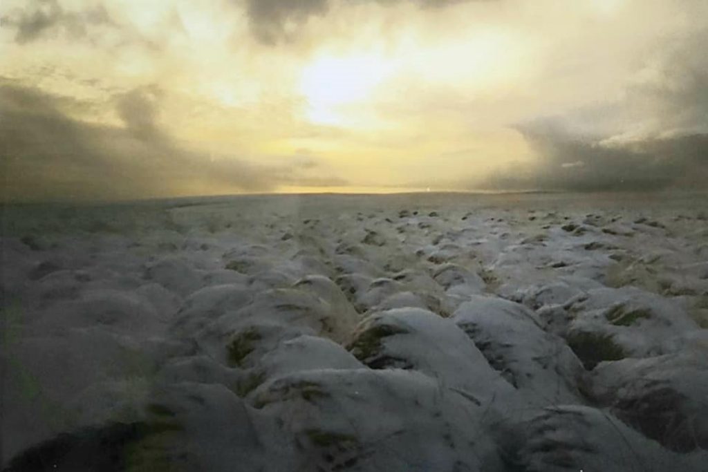
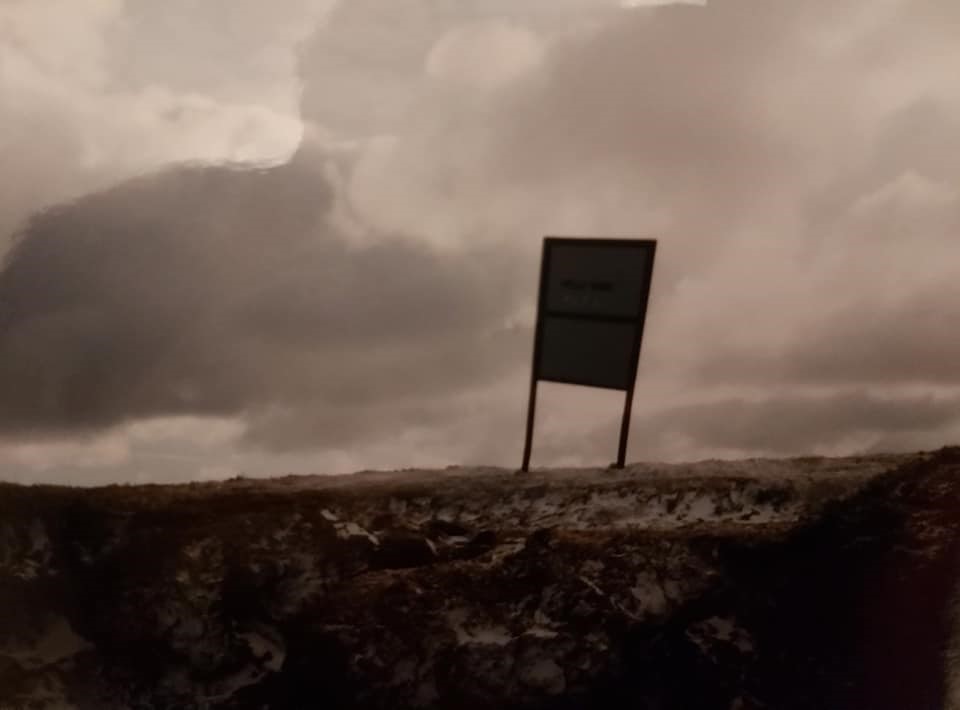
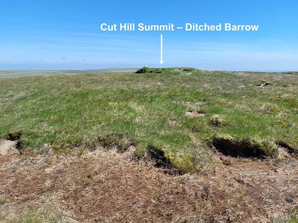
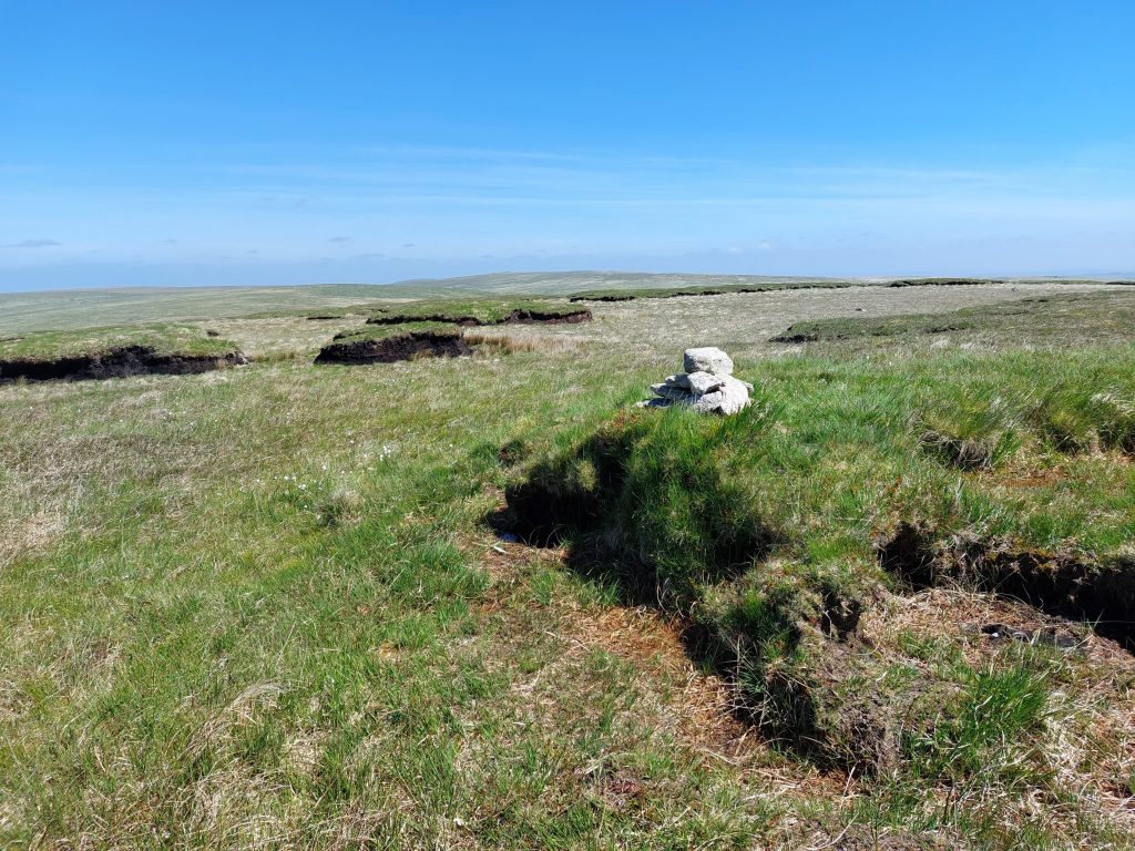
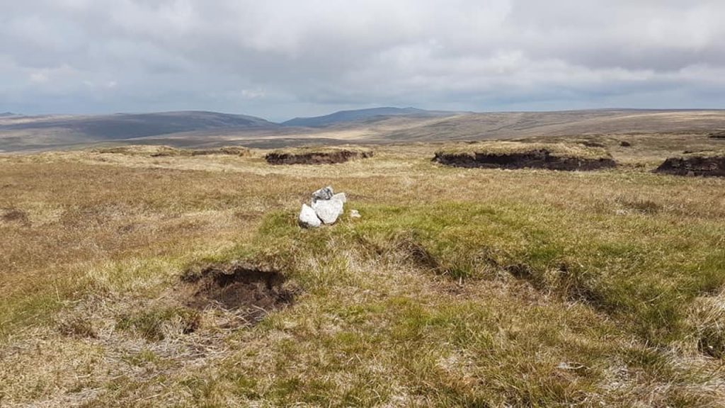
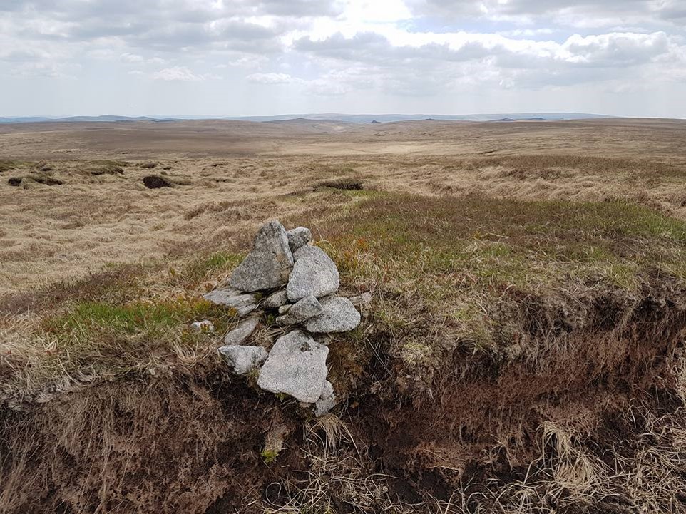
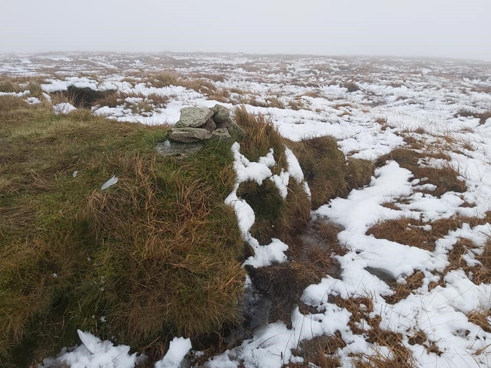
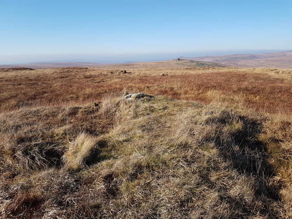
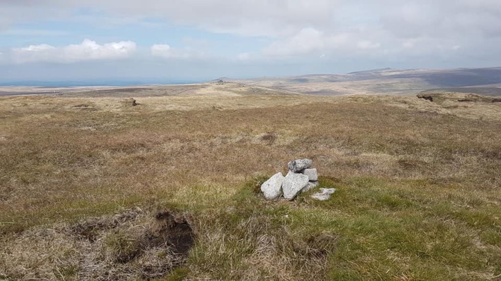
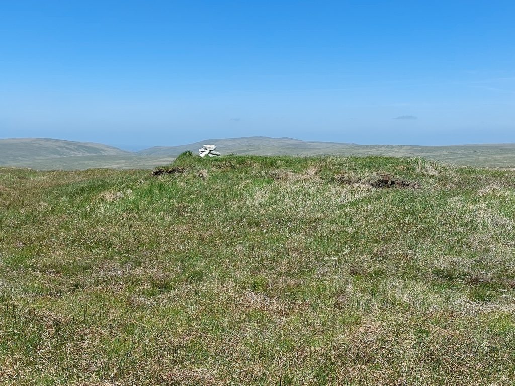
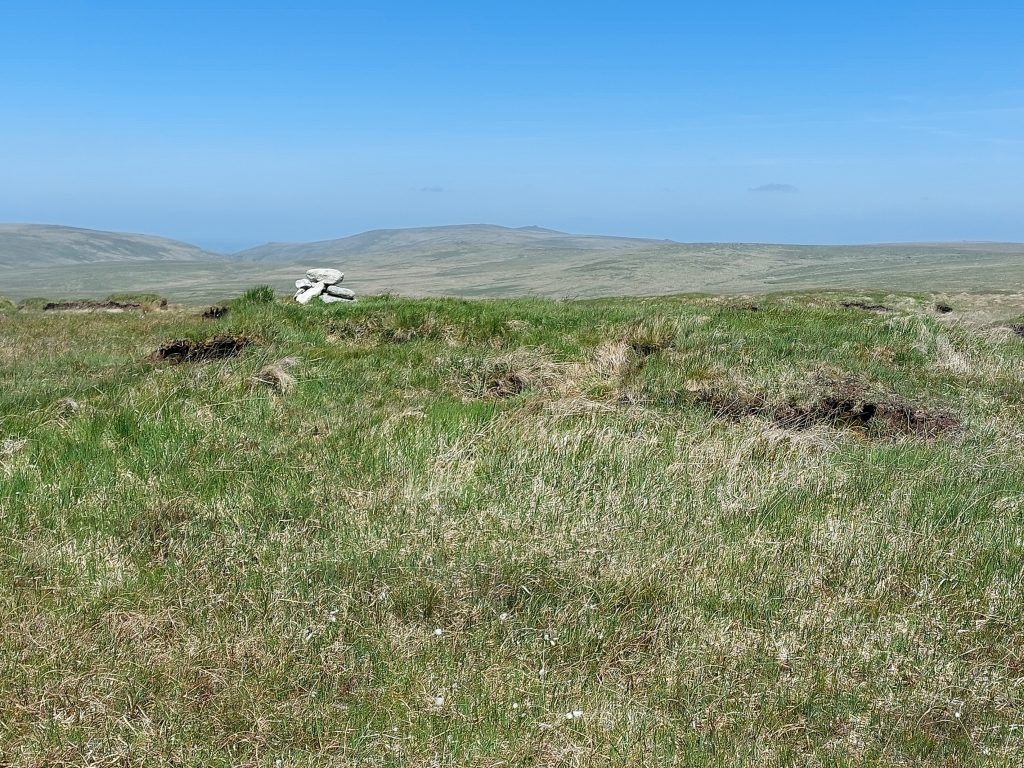
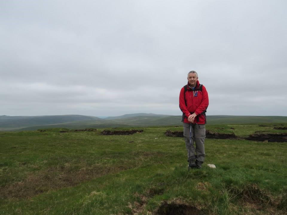
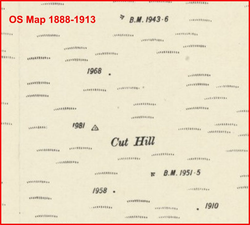
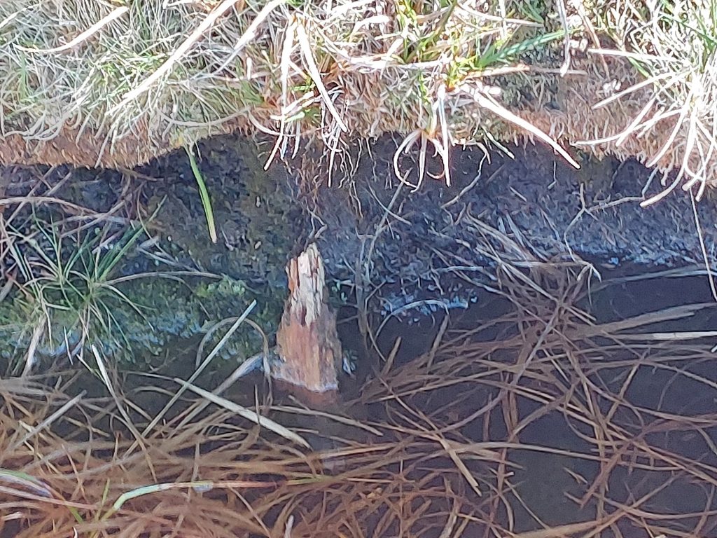
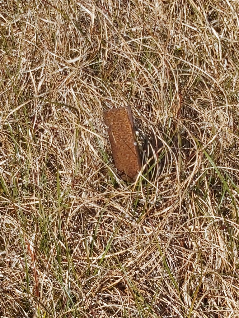
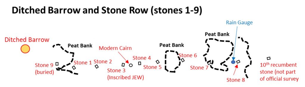
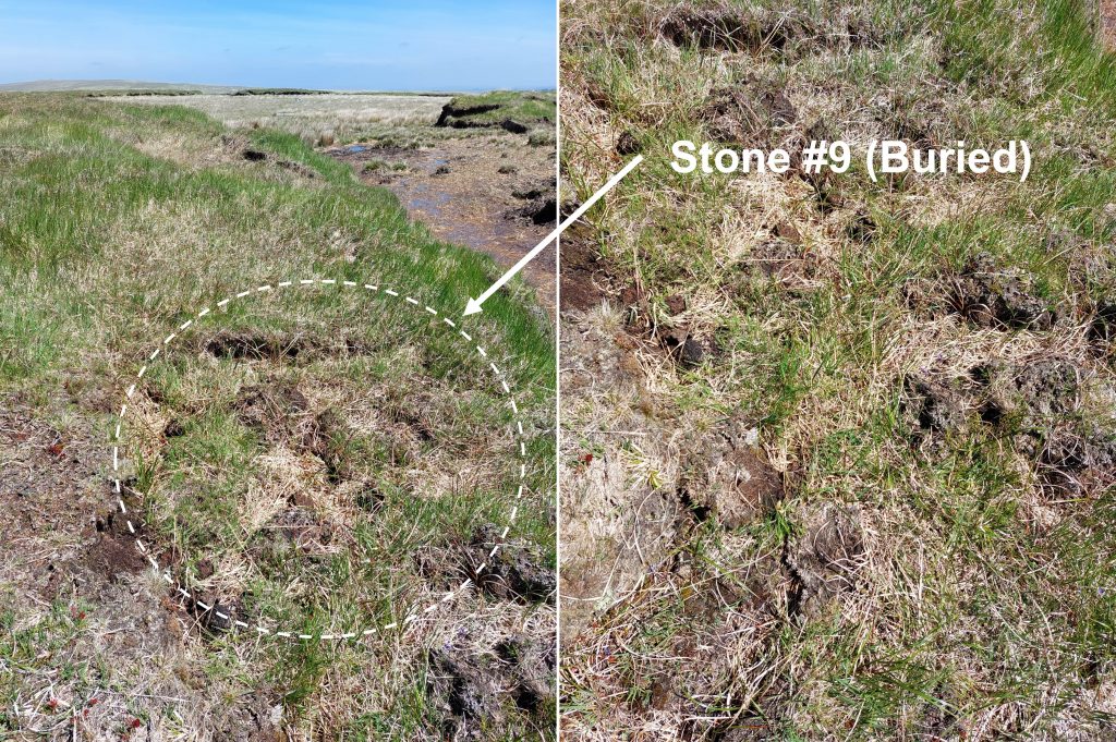
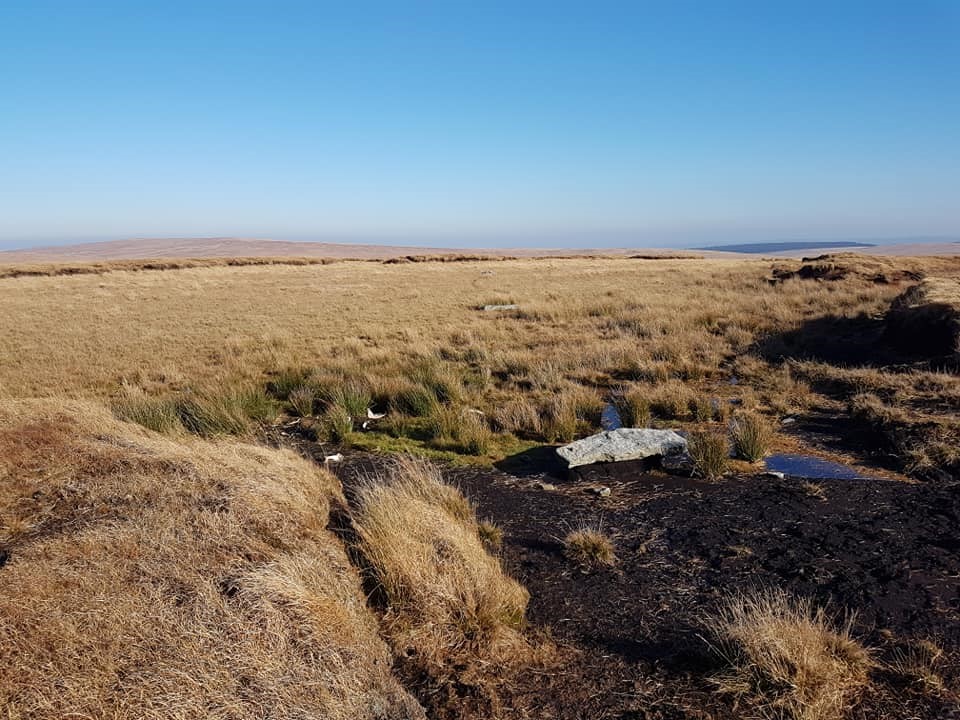
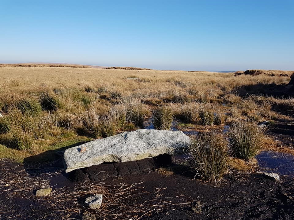
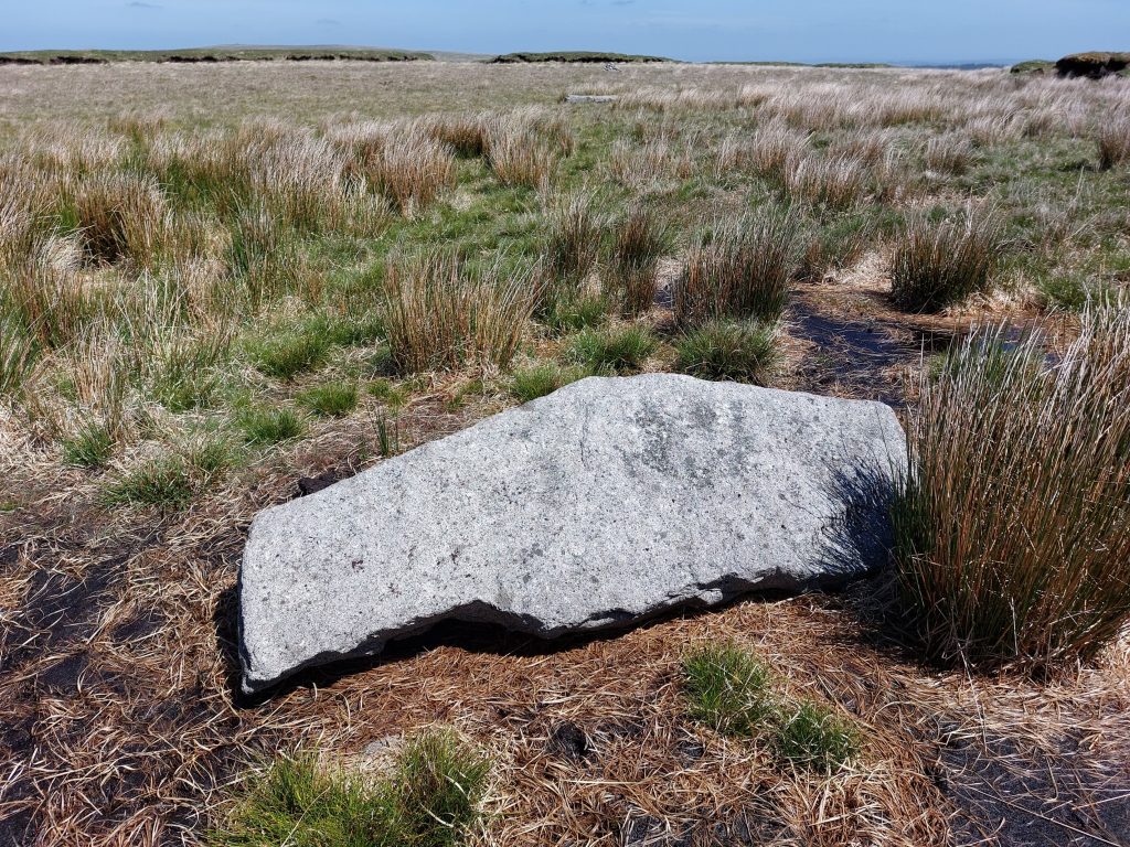
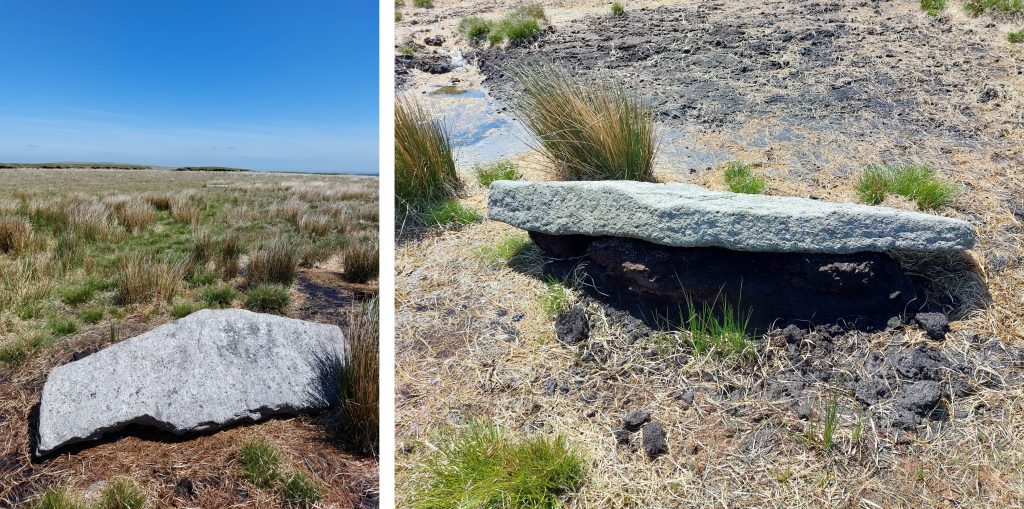
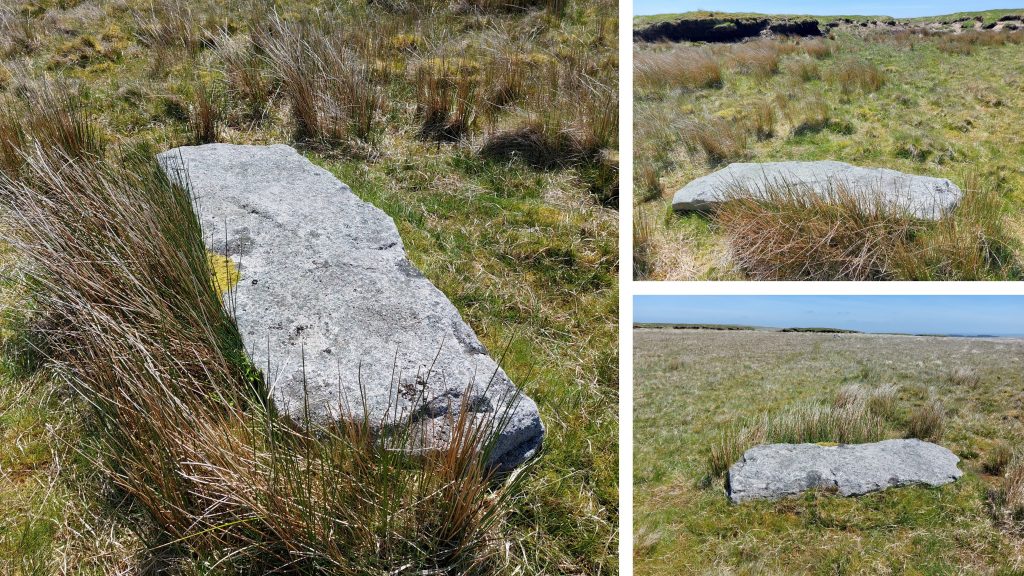
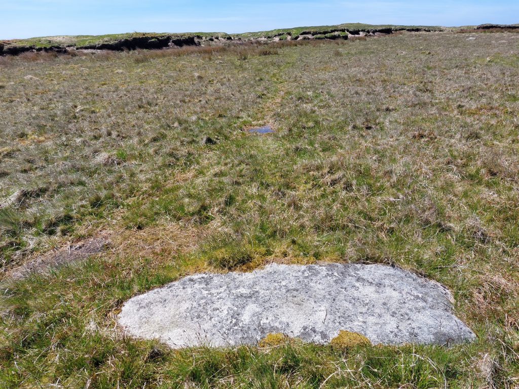
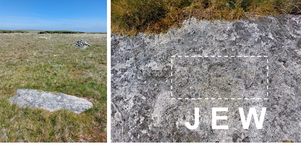
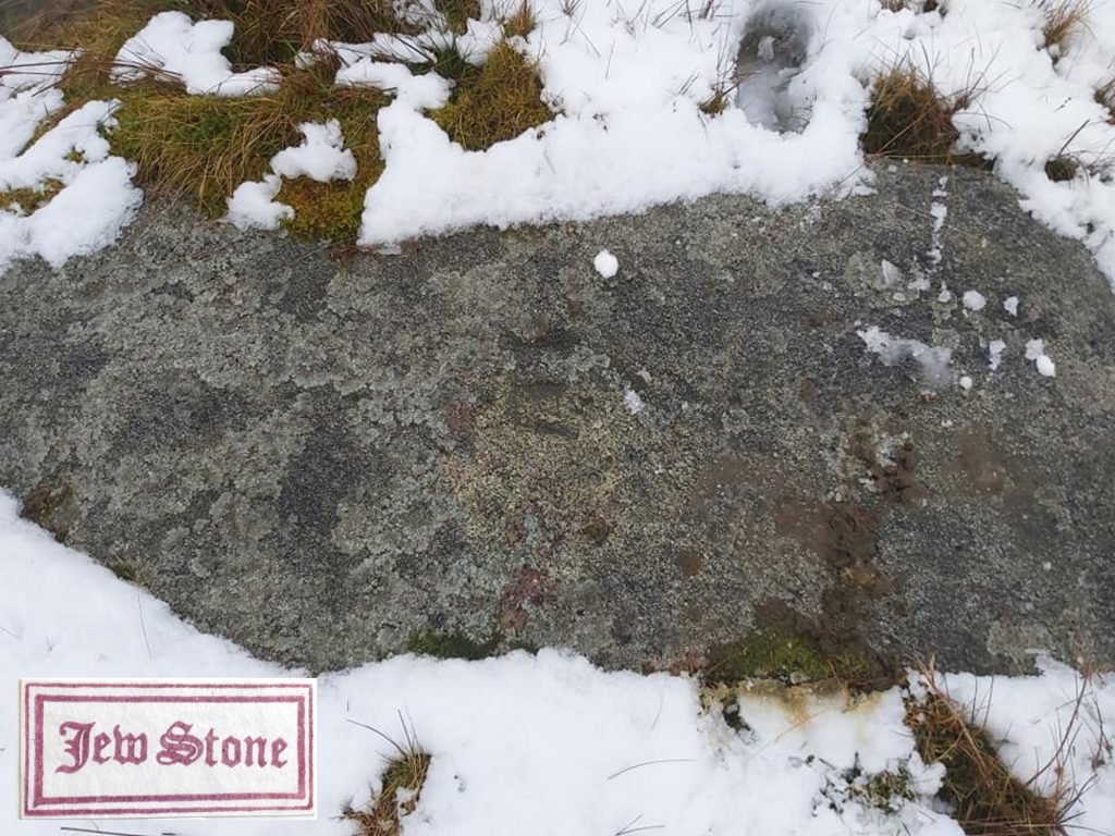
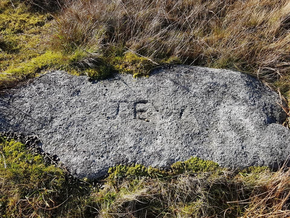
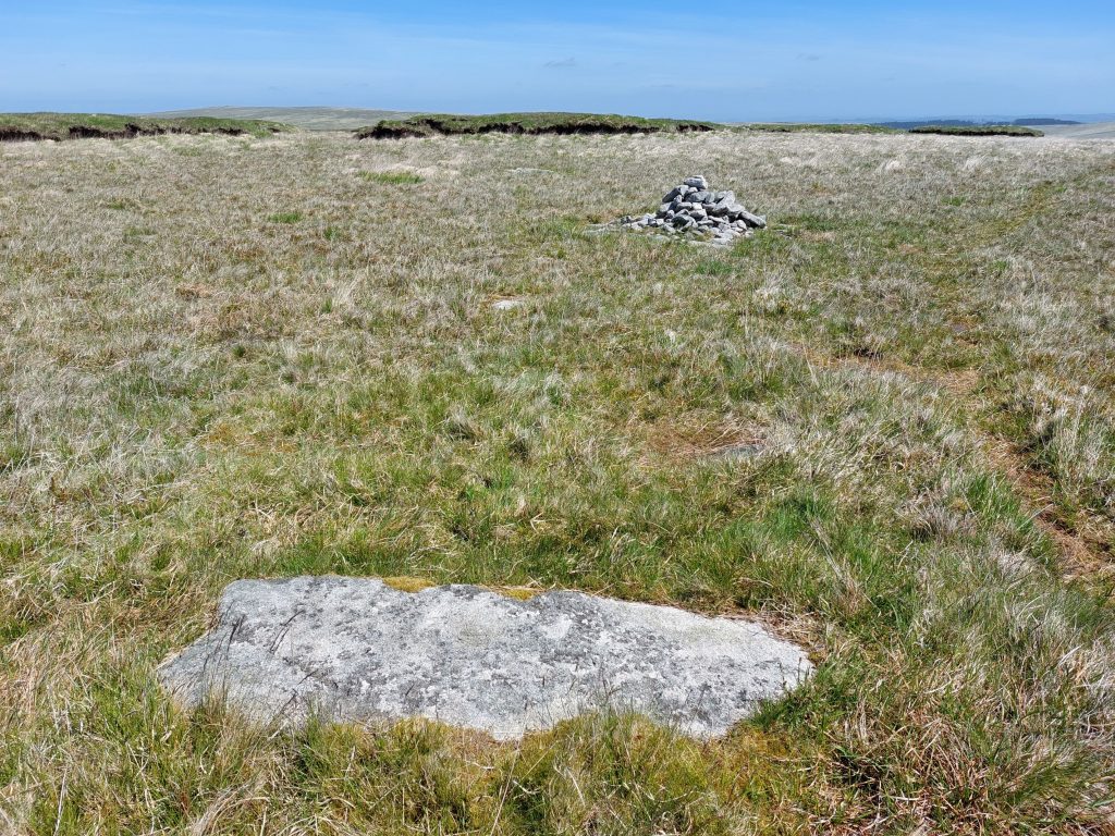
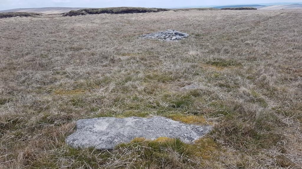
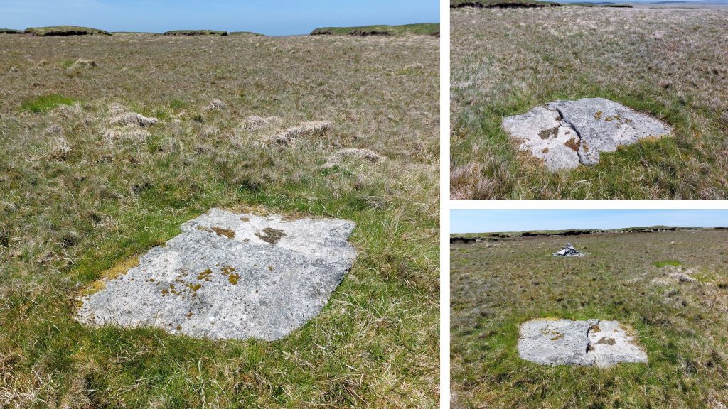
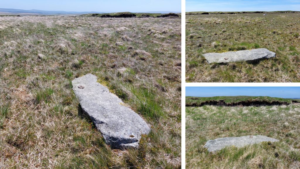
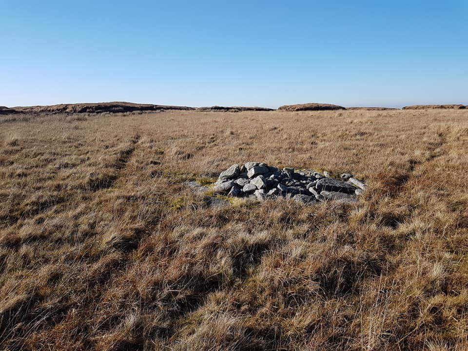
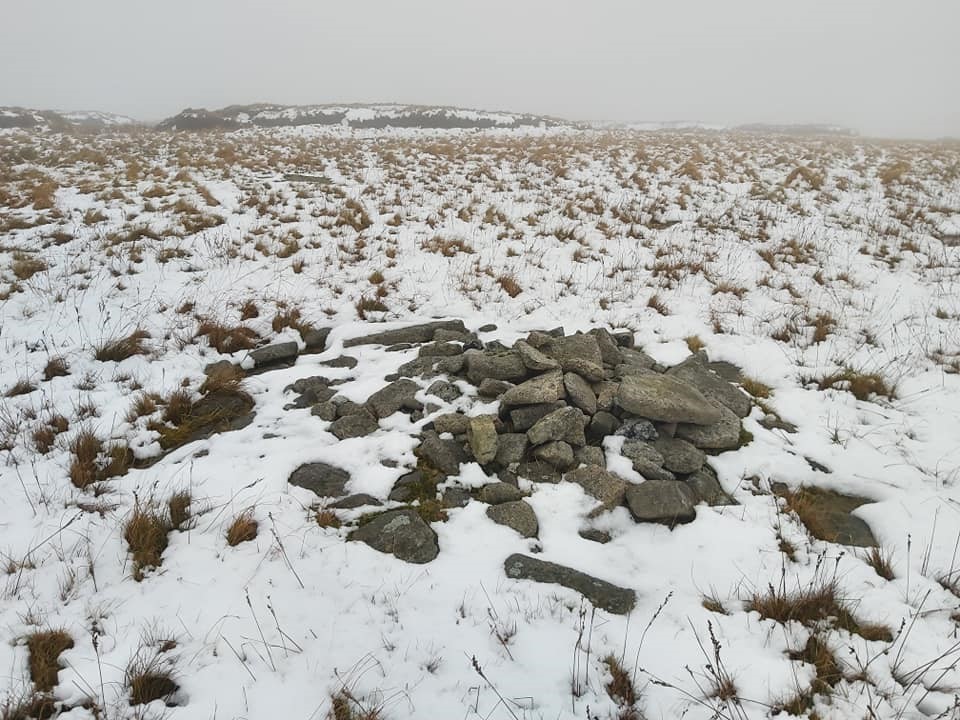
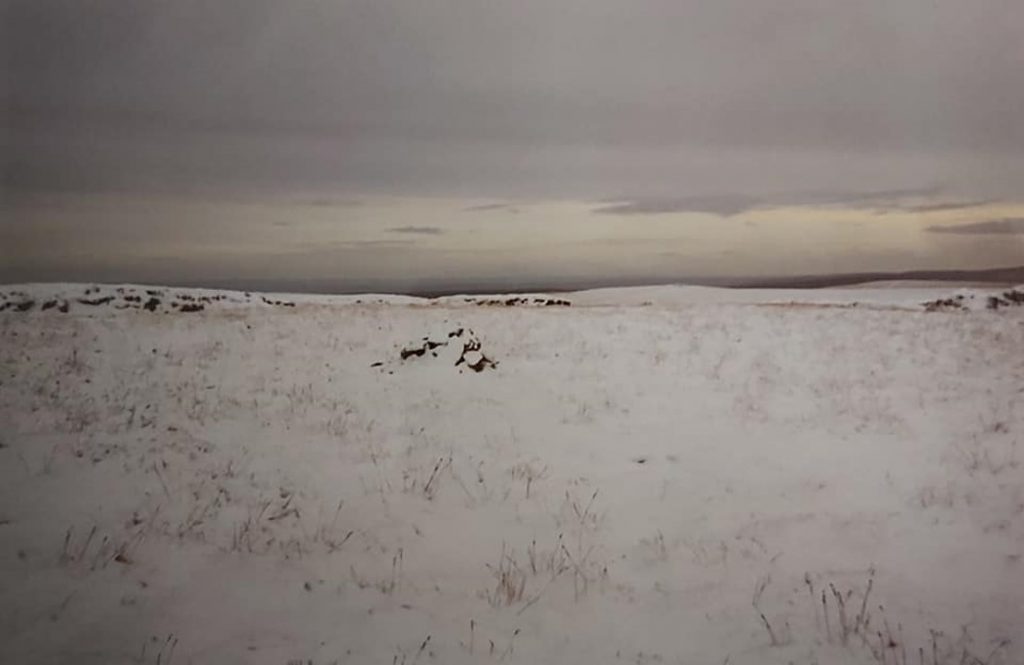
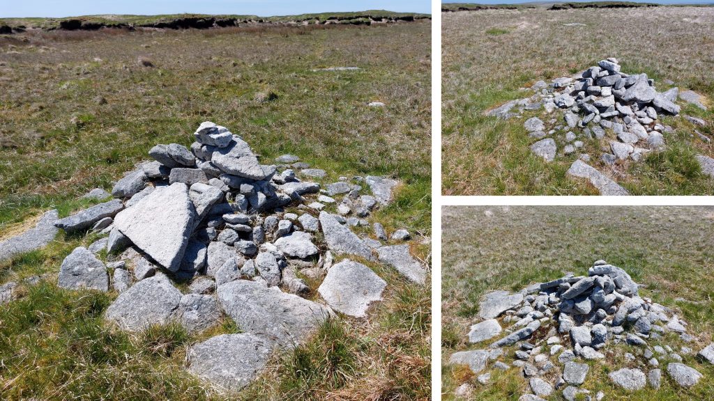
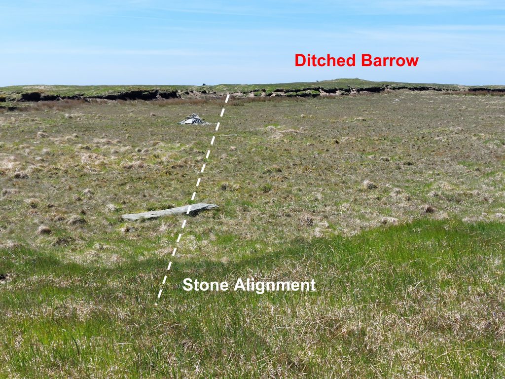
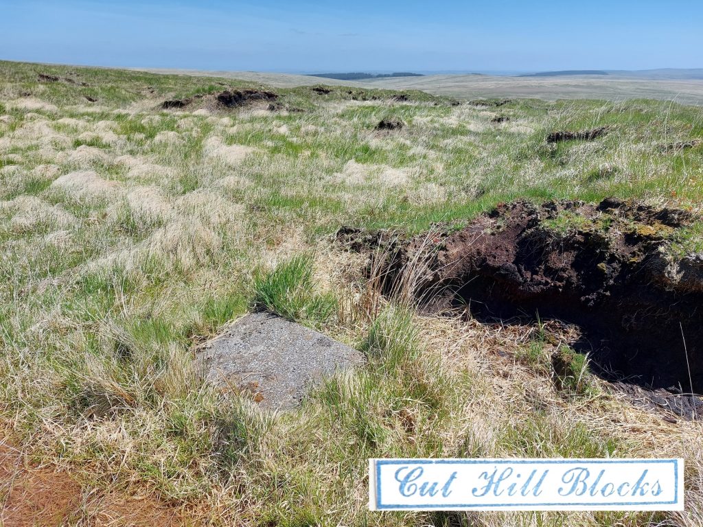
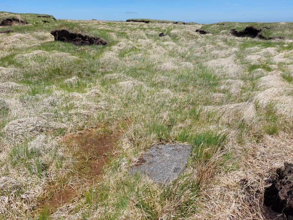
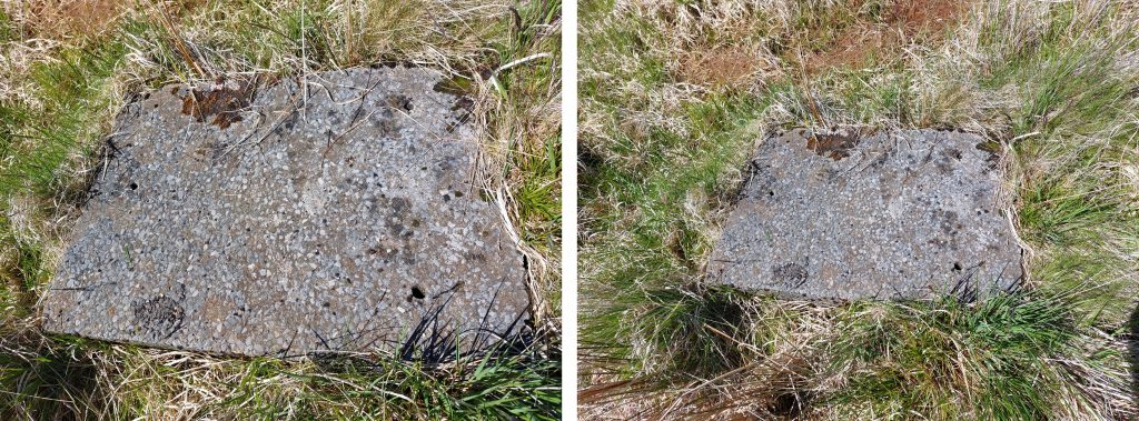
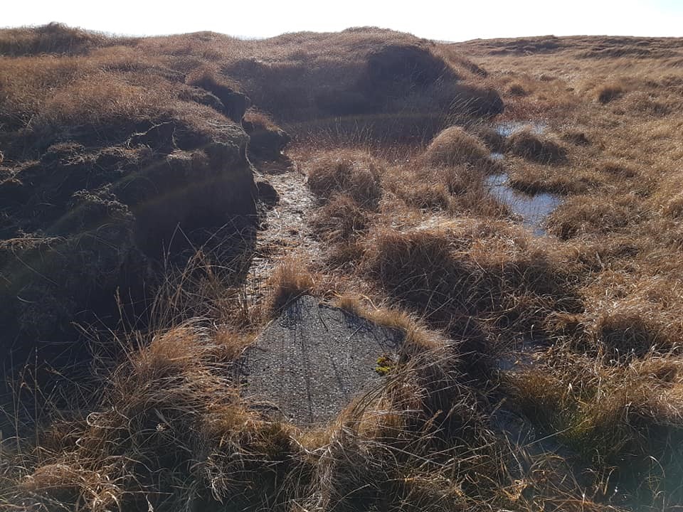
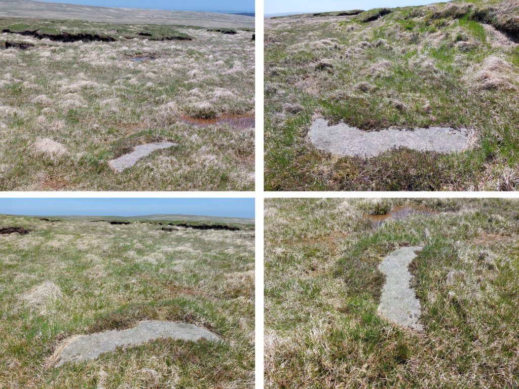
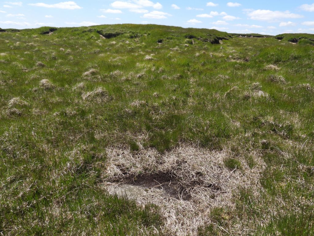
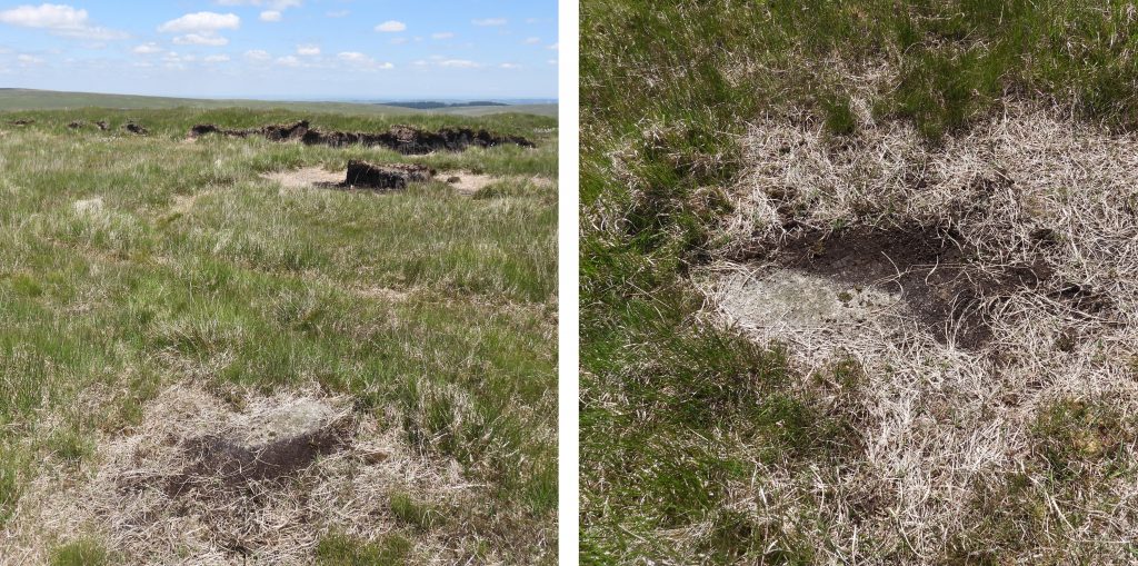
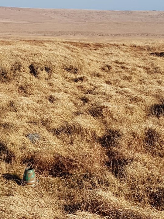
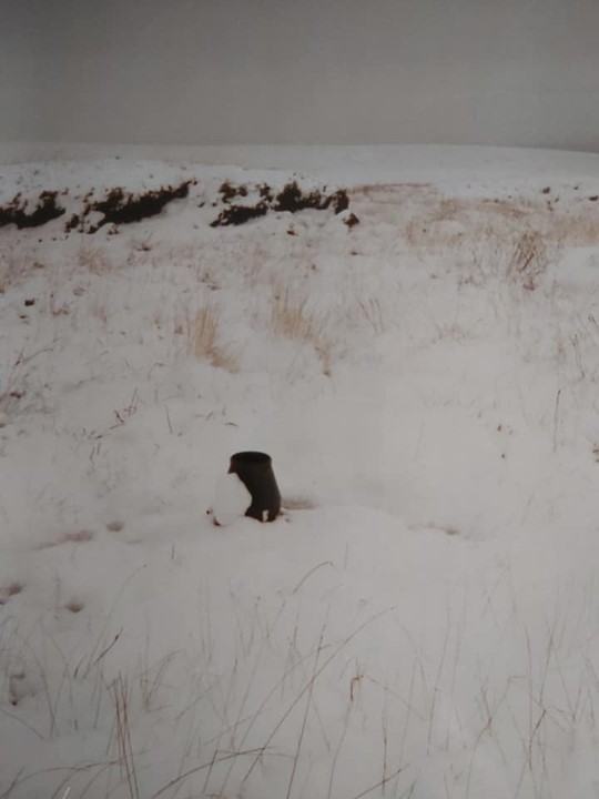
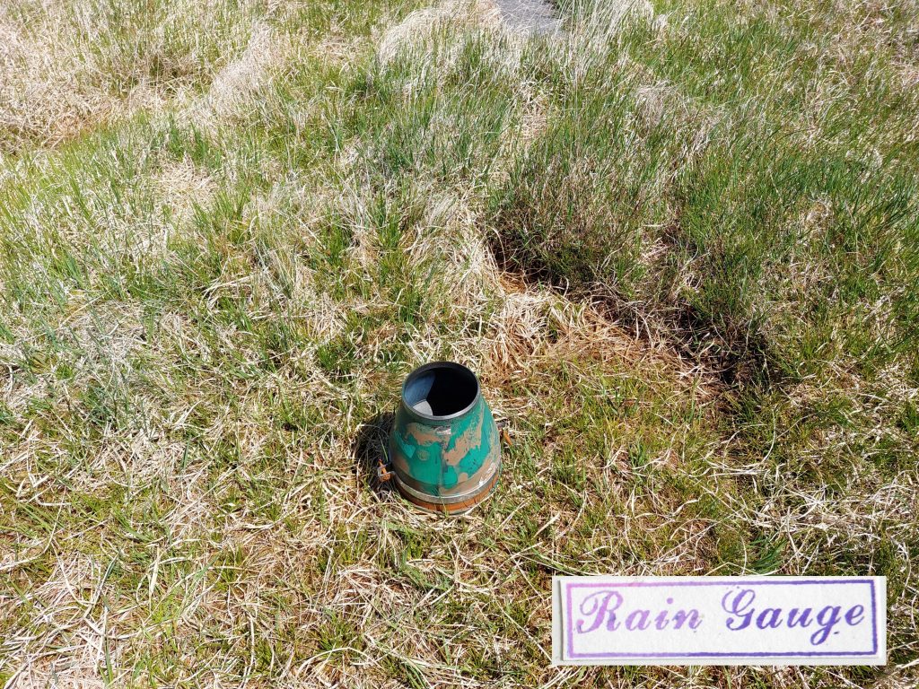
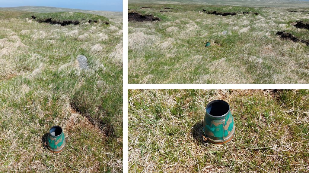
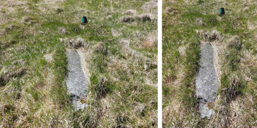
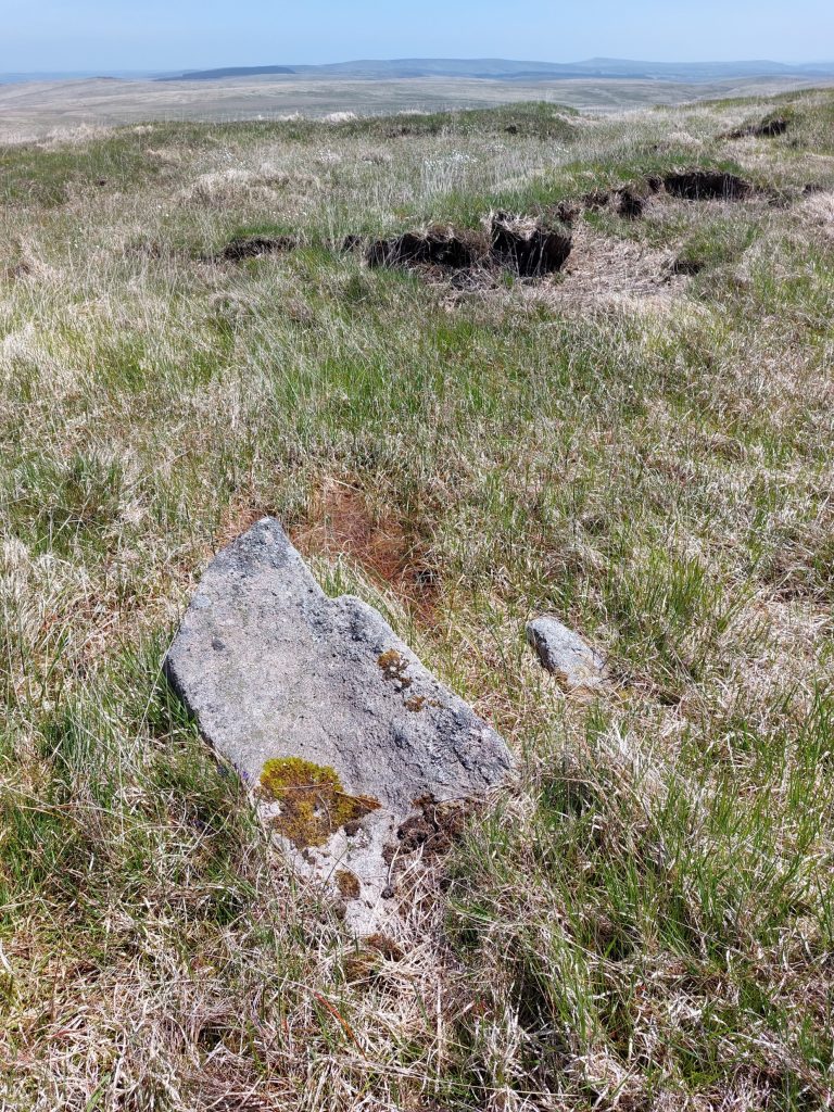
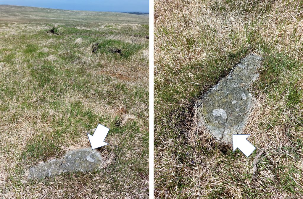
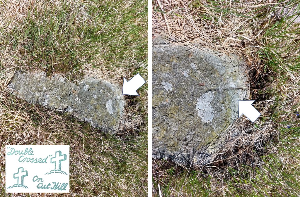
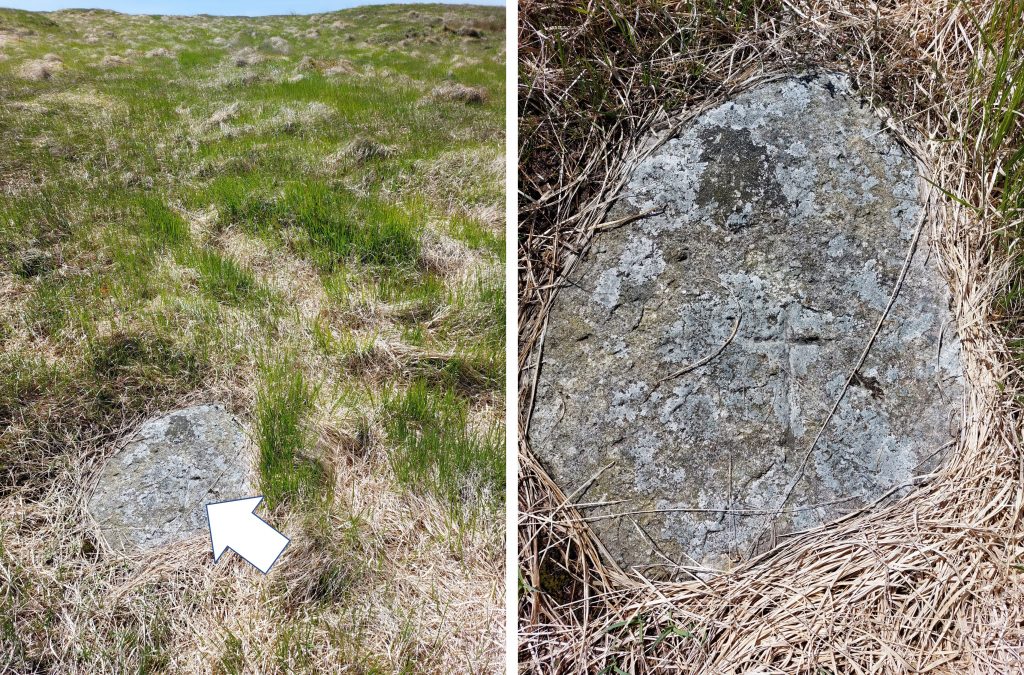
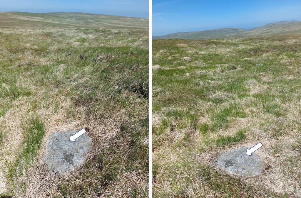
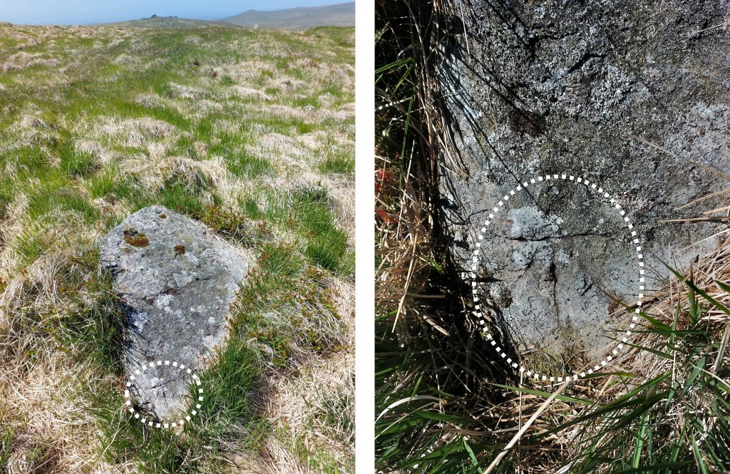
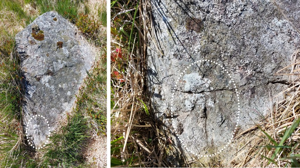
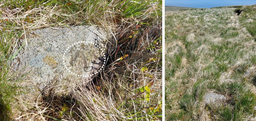
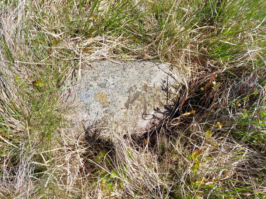
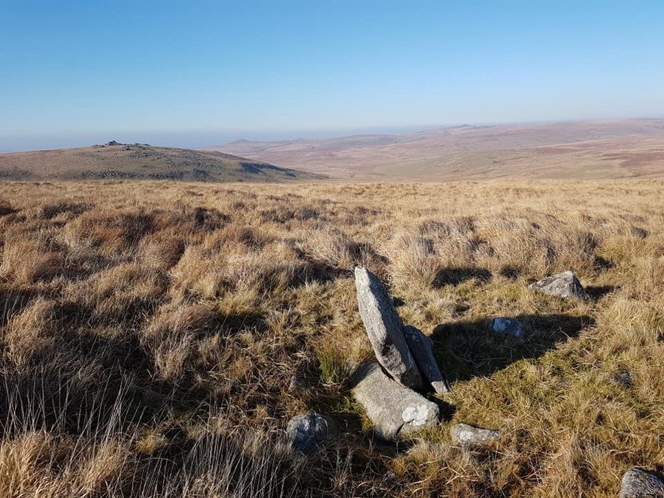
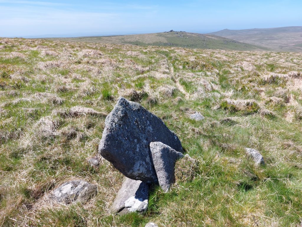
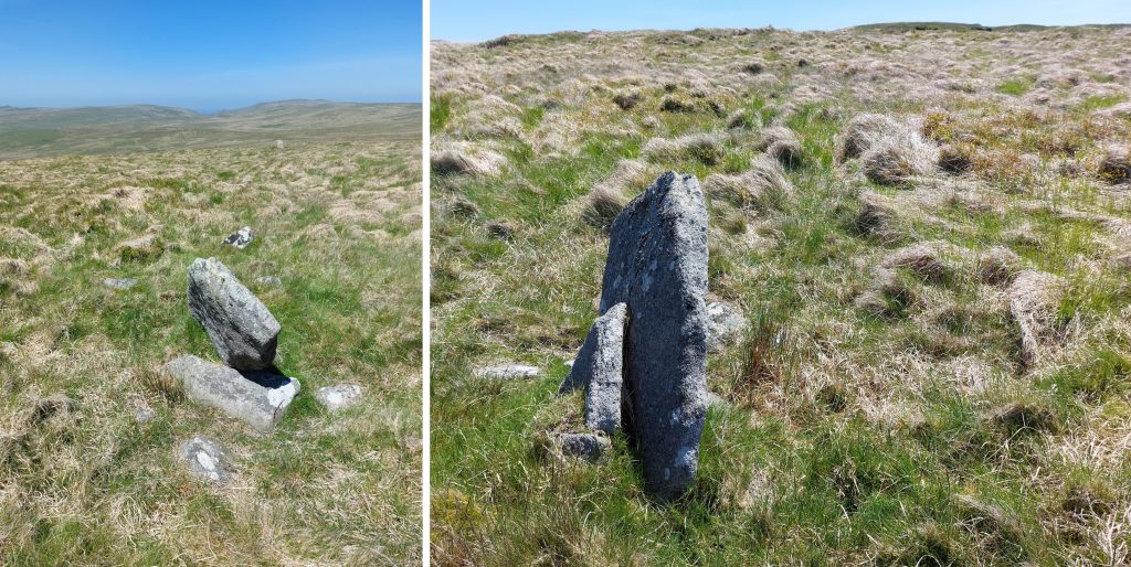
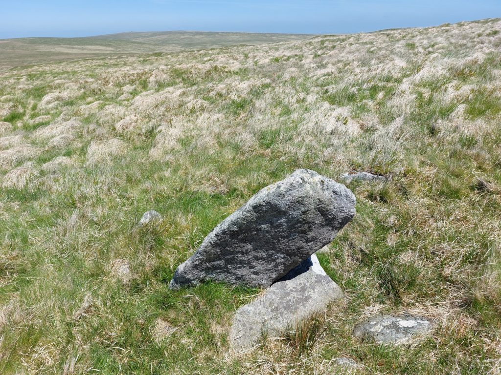
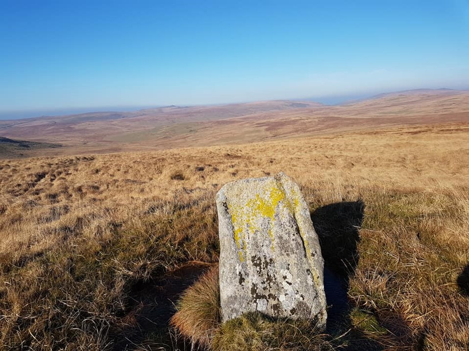
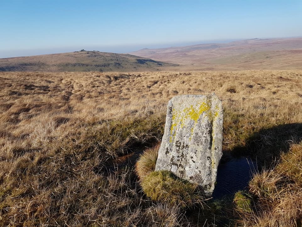
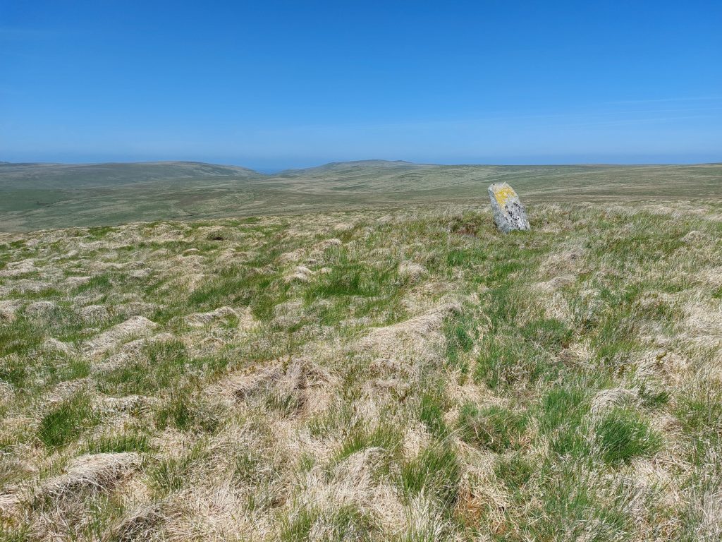
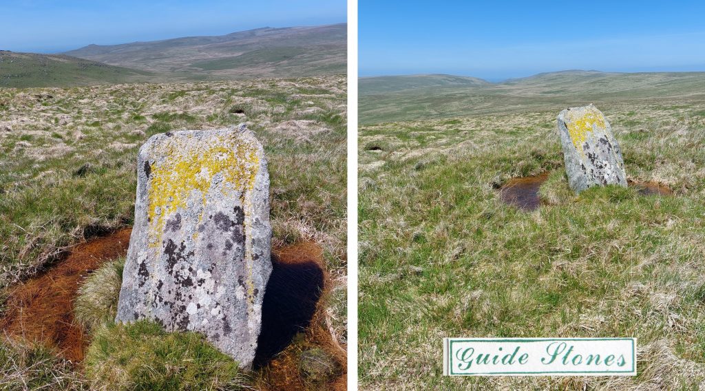
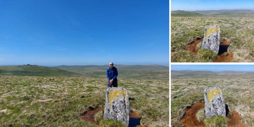
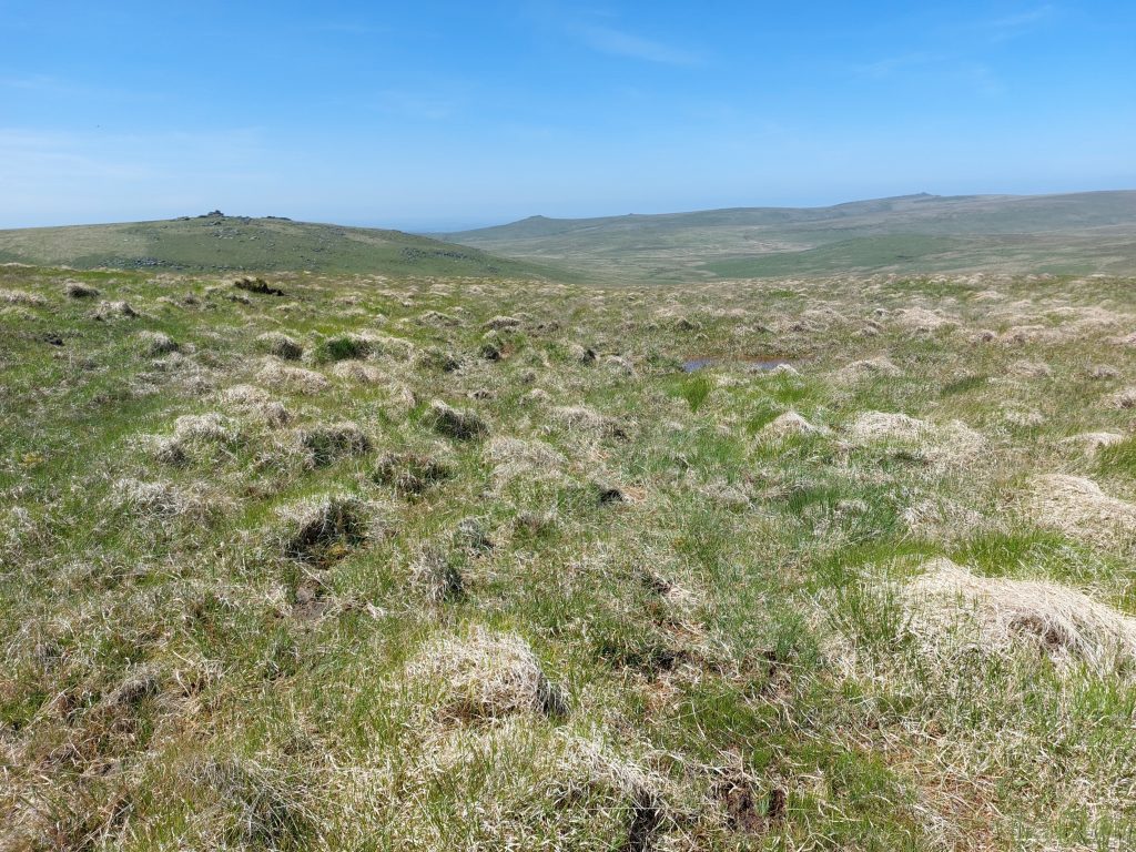
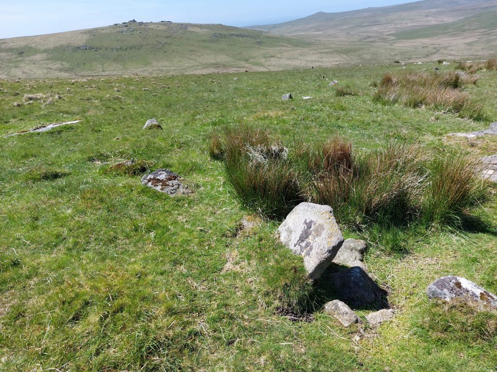
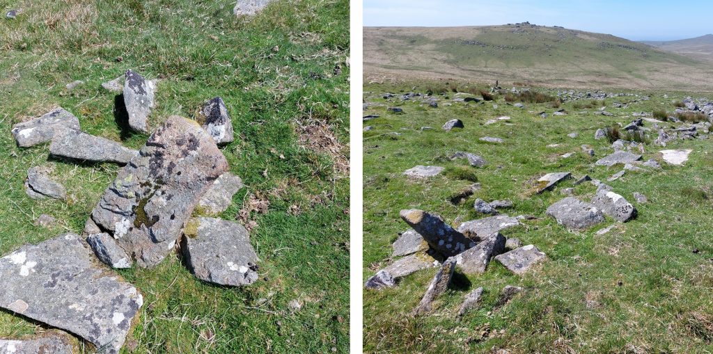
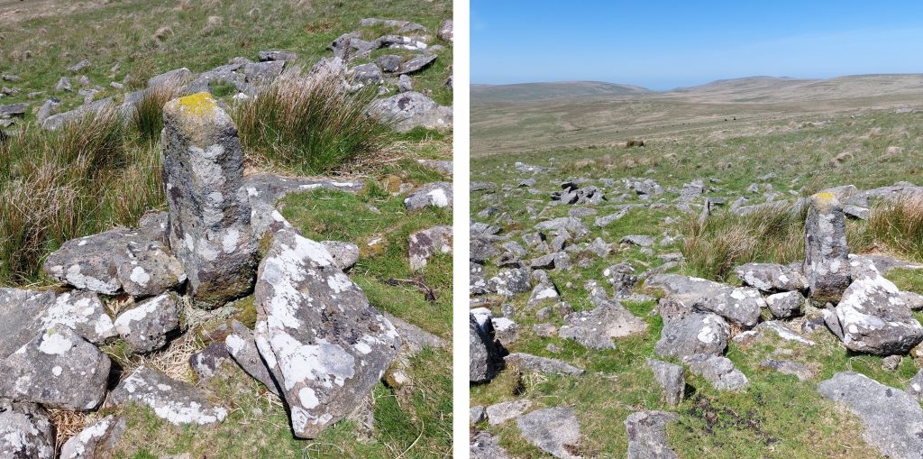
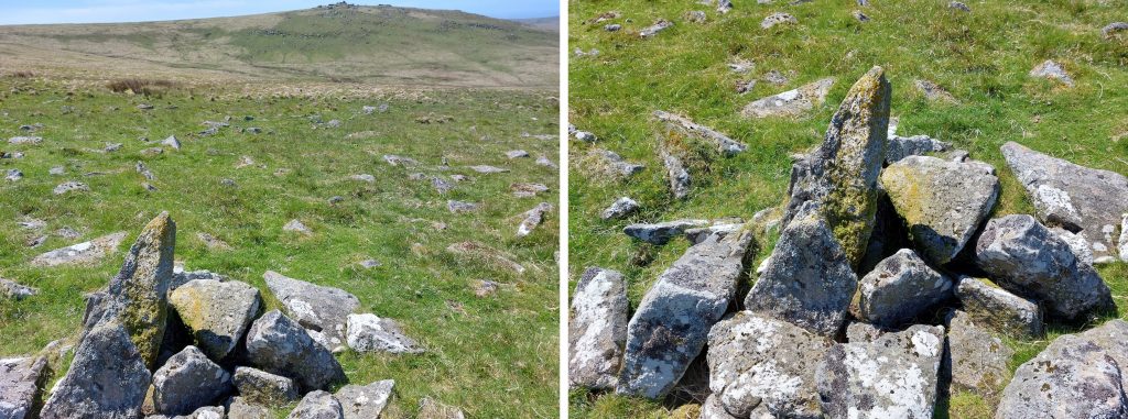
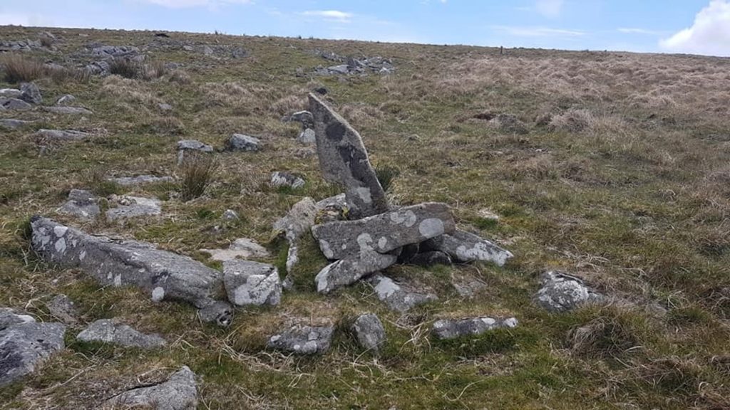
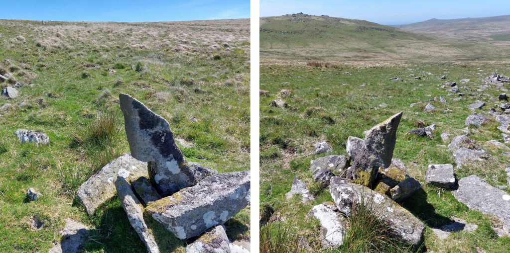
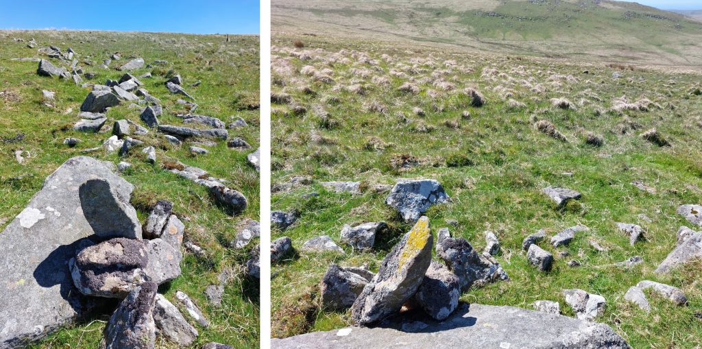
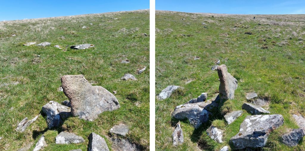
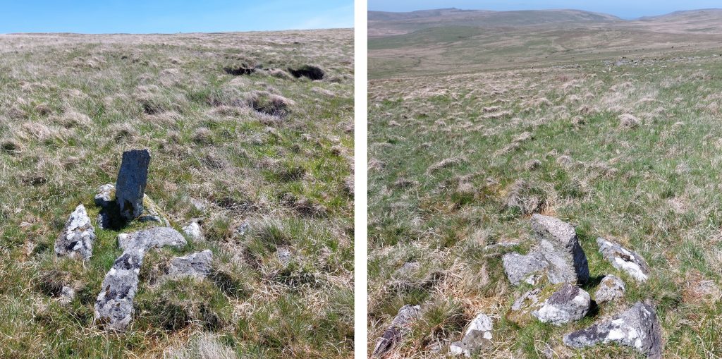
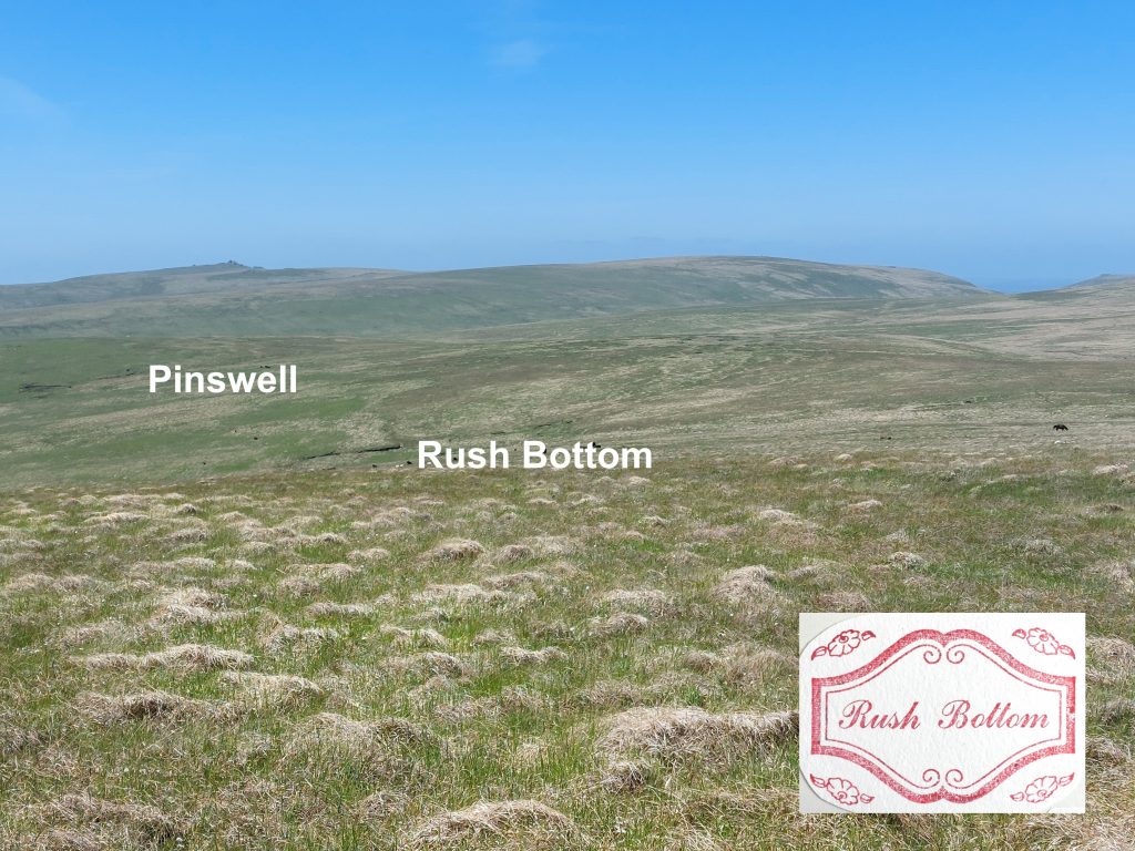
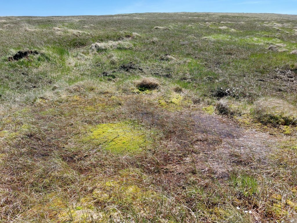
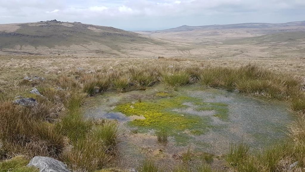
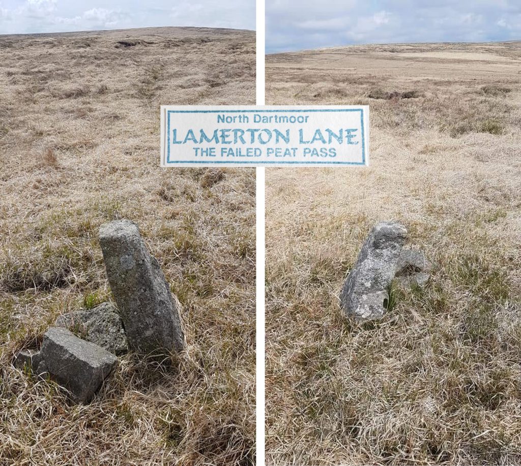
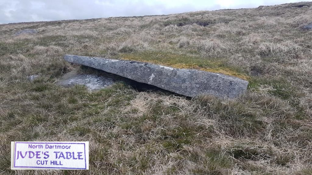
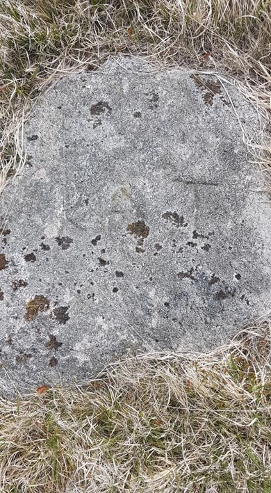
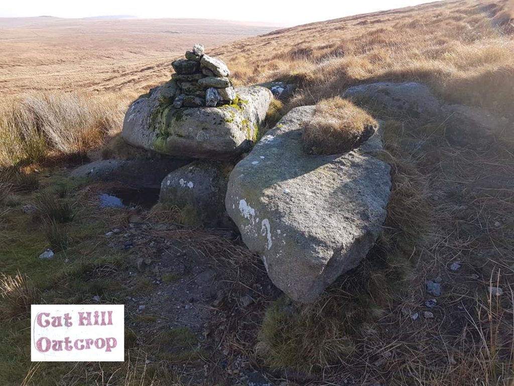
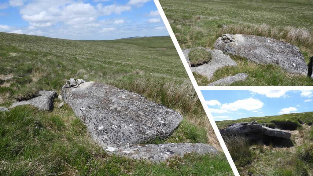
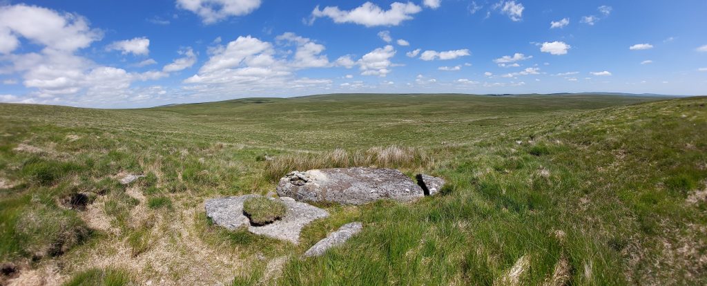
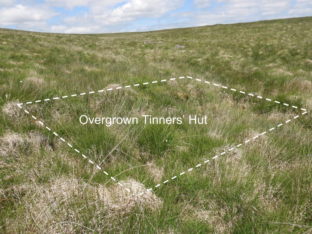
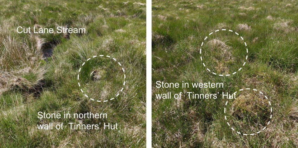
The above sketch map shows most of the features covered in this post. Of particular note is the stone row (or stone alignment) which was first discovered by Dr Tom Greeves and Elisabeth Stanbrook on 4th April 2004, with the first survey taking place one week later on 11th April. At that time 6 stones were recorded. Dr Ralph Fyfe has also surveyed the stone row and his joint paper published with Dr Greeves suggests there are a total of 9 stones (minimum). The author has been fortunate enough to have been on the hill on two occasions when Dr Ralph Fyfe was there and is grateful to him for passing on some fabulous snippets of information which are recorded in this post. The author has included a few letterbox stamp impressions alongside the pictures covered in this post as a nod to the popularity of this hill in the late 1980’s and early 1990’s.Approaching Cut Hill from the south east near Kit Steps on the East Dart. From this angle “the hill” belies that fact that it is Dartmoor’s 3rd (equal) highest peak at 603m (behind High Willhays and Yes Tor – ignoring Hampster Tor as its on the High Willhays ridge). This stream is called “Cut Hill Water” on modern OS maps but it was known as “Hangman’s Stream to the old moormen. On the north bank lies a tinners’ hut.Hangman’s Stream and tinners’ hut with a dusting of early Winter snow. The area of the upper East Dart River and its tributaries has extensive and well preserved Medieval or later streamworks, This tinners’ hut is one of 8 in the area associated with these streamworks..Hangman’s Stream and tinners’ hut in late Autumnal sunshine.According to the National Monument Record, 2016, Pastscape, (ref SDV359354) the tinners’ hut has internal measurements of 2.7 metres by 4.3 metres and probably dates to pre-1700. Its walls are coursed moorstone blocks and are 0.5 metres wide and 0.7 metres high. It is located at SX60970 82088.Assumed military detritus (concrete PO Marker), which possibly marked buried communication cables. Located about 100m from the Hangman’s Stream tinners’ hut at SX60914 82161Hangman’s Stream – splendid isolationHangman’s Stream – In certain light conditions the grass in places has a lovely purple hue.Cable protruding out of a peat bank at Hangman’s Stream. Almost certainly military originDetail of the cable location next to Hangman’s Stream. It can be found at SX60574 82013About 15-20m from the PO Marker is a pipe with an (internal) thread. Most probably of military origin and could have been for the erection of a range pole or similar.Tinners’ Hut between Cut Lane Stream and East Dart river with resident female skylark The tinners’ hut between Cut Lane Stream and the East Dart river is quite a substantial ruin. It measures 2.7m (north-south) x 3.8m (east-west). The entrance is on the southern wall. The walls are between 0.5m and 1.0m high. The eastern end has a small annexe / enclosure. The lower slopes of Cut Hill can be seen in the background.Tinners’ Hut between Cut Lane Stream and East Dart river is located at SX61111 82390.Cut Lane Stream. The author saw a couple of small fish here.Peat pass marker (without its bronze plaque – see later) at the north end of a small grassy corridor, which is considered as being an extension to the more well known North West Passage Peat Pass a short distance away. The peat pass marker is labelled #2 on the sketch map.Peat Pass Marker #2 taken on 1st January 1992 in the snow, thus time with its bronze plaque.Peat Pass Marker #2 bronze plaque (now missing) made reference to William Francis (Frank) Phillpotts, who had a number of passes on the north moor constructed between 1895-1905, under his direction. Phillpotts was the grandson of the Bishop of Exeter and a distant relation of the famous Dartmoor author Eden Phillpotts.Peat Pass Marker #2 is located at SX60266 82263This peat pass is quite deep and narrow and partly choked with fallen peat. The letterbox stamp dates from 1990’s. Phillpotts was a keen huntsman and knew if his fox quarry ran into the peaty fen it could make good its escape. He good knowledge of the northern fen and where the peat had been eroded down to the granite bedrock. He had the idea to link up these “eroded” areas by cutting away the intervening peat thus forming a ’causeway’ (Ref. Legendary Dartmoor). At the southern end of the (approx 50m) peat pass is a second peat pass marker (#1 on map). The bronze plaque on this marker is extant. it is located at SX60247 82220.As with most of the “Phillpotts” peat passes on the north moor, the plaque on the marker explains the purpose and some history of the pass. The bronze plaque was made by Vickers, Maxim and Co (ref: Legendary Dartmoor).Benchmark B.M. 1818.5 is located near to the lower end of the North West Passage peat pass and is shown on 19th century maps (courtesy of National Library of Scotland – side by side).Benchmark B.M. 1818.5 is located at SX60256 82384.Peat Pass Marker #3 (with a Phillpotts bronze plaque) is located near the southern end of the North West Passage.Another view of the bottom Phillpotts peat pass in North West Passage. Phillpotts was well educated (Winchester College and New College) and had a fondness for field sports, especially shooting and hunting. With his passion of horse riding he would often visit Devon to compete in local point-to point races or ride with the hunt. (Ref. Legendary Dartmoor). From these beginnings he has left a legacy on the moor which can be seen to this day.All the peat pass granite markers were cut at Duke’s Quarry (Merrivale) and transported to the moor by George French and his pack-horse. (Ref: Legendary Dartmoor). Frank Phillpotts brother was Rev. J. S Phillpotts and his son was Ralegh Phillpotts. Ralegh was involved with the failed peat pass at Lamerton Lane in the 1920s (which is covered later in this post).Peat Pass Marker #3 after a light dusting of early winter snow.The North-West Passage is recorded on the Dartmoor HER as being located between SX602824 and SX598827.The North West Passage in early Summer.The North West Passage in late Autumn.The name “North West Passage” is said to have been given to the cut by Mr Sam Adams who was master of the Lamerton Hunt from 1896 -1904.The top (highest) Phillpotts peat pass marker at North West Passage. From this point through the of two sections of peat pass (ie North West Passage and the side peat pass), there is a combined length of about 457 yards (Ref: Dartmoor HER).The top Phillpotts peat pass marker of North West Passage in early Summer.This Phillpotts peat pass marker is located at SX59793 82544.Early Winter at the top Phillpotts peat pass marker at North West Passage.Top of the North West Passage in Autumn. To conclude the Phillpotts story, he was winning point-to-points at the age of 65 and still competing at the age of 71. He died at the age of 72 in October 1909. (Ref: Legandary Dartmoor).This iron pipe was probably the largest piece of detritus to have ever been on Cut Hill. It was located in an unusual location near the top of the North West Passage and its use is unknown to the author. The picture dates from the early 1990s. The pipe is no longer there and subsequently not shown on the sketch map in this post.Cut Combe, looking towards Pinswell in the foreground and West Okement valley in the distance.Top of Cut Combe, on the col between Fur Tor and Cut Hill.The Cut Hill mis-shapen peat hags seem to be more pronounced in these snowy and poor visibility conditions.The flat plateau of Cut Hill looking east.The panorama of the Cut Hill plateau looking northCut Hill top looking west. In the picture the tors (amongst others) which can be seen are Fur Tor, Hare Tor, Sharp Tor and Great Links Tor.One of many peat hags found on top of Cut Hill. On the top plateau of Cut Hill, there is a 100m-wide strip of ground is lower than the surrounding peat which has been totally removed. The peat removal is said to have probably been done by “human agency” since medieval times when peat was cut for charcoal production, exposing an old, presumably prehistoric, land surface. It is believed that peat development on Cut Hill began during the early to mid-sixth millennium BC. The average rate of accumulation of peat her has been suggested as being 1cm every 40 years. (Ref: Dartmoor Magazine, Issue 84, Page 6 – Dr Tom Greeves).Top of Cut Hill looking SouthFog and a light covering of snow in early Winter makes Cut Hill a rather foreboding place to visit unless well prepared.Snow covered peat hag.Someone balancing of rocks (not the author) on top of Cut Hill.Snow covered grass tussocks on the hill.This rather dark picture shows one (of two) range notice boards which were on top of Cut Hill in the 1990s. On the peak of Cut Hill lies a prehistoric (ditched) barrow which measures circa 20 metres overall diameter.The top of Cut Hill has been (for some years) marked with a small cairn of stones.The barrow on the top of ‘Cut Hill’ (at 603 metres) was observed during a field visit by Tom Greeves in April 2004.The barrow is recorded as having a 1.5 metres high circular mound and surface erosion has exposed a turf/peat core with a few stones.The barrow in early Winter snow.The top at 603m. Fur Tor is 572m.Top of Cut Hill, looking west towards Fur Tor and beyond.The barrow has a surrounding ditch and ring bank which is over 1 metre wide and filled with waterlogged vegetation (ref: Dartmoor HER).The barrow sits on top of one of the many peat hags on Cut Hill rather than the exposed, prehistoric land surface. It is no longer aligned with the stone row (if it ever was?).The author stood atop the ditched barrow on Cut Hill taken during a hike between all the Dartmoor 600m (+) peaks. At one time there was also an old wooden OS trig point on Cut Hill as suggested by 19th century maps.On the ditched barrow, just under the rim of the top level of peat, the author for many years has observed a wooden post (see picture). This post is slowly eroding. Is is possible that this was part of the 19th century OS trig point ? The author has seen other pieces of wood from structures of similar age still extant (e.g old wooden rail on Zeal Tor Tramway – mid 19th century), so it might be possible.More (moor) detritus. An iron stake at SX59915 82620Dr Tom Greeves and Dr Ralph Fyfe produced a survey report titled: “The date and context of a stone row: Cut Hill, Dartmoor, south-west England”. Within Figure 2 of the report is a sketch map showing the locations of 9 stones which form the stone row. The above sketch is adapted from the original. There is a 10th stone to the north of stone #8, which is recorded in this post. The author is not suggesting this 10th stone is part of the row but is just making an observation that there is another stone which seems aligned with the others. The spacing of the stones on Cut Hill is much greater than elsewhere on Dartmoor, being between 19m and 34.5m apart. The 9 stones are over a total of 215m in length. The stone row discovery is over 100m higher than the previous highest stone row recorded on Dartmoor (at Conies Down).On a visit to the hill, by happen chance the author met Dr Ralph Fyfe, who showed him the location of what is believed to be first stone in the row, albeit it being buried (the picture shows where the stone has been previously unearthed). It can be found at SX59853 82738 and is labelled as Stone #9 in the official survey report. It is recorded as measuring 2.0m x 0.7m. This stone was discovered in September 2007 and analysis by Dr Fyfe has suggested the stone fell over by 3200 BC and was “overwhelmed” by peat by 2400 BC.Stone #1, which was first recorded by Dr Tom Greeves in 2004. The picture (taken in 2020) shows the stone on a “plinth” of peat, which has eroded somewhat since.Stone #1 is recorded as measuring 2.3 x 0.9m. This stone, when first recorded had evidence of packing stones set into the peat at one end. After the original survey by Dr Greeves in 2004, Dr Ralph Fyfe (University of Plymouth) and Vanessa Straker (English Heritage) sampled peat from around the stones in August 2005.The stone #1 picture was taken in May 2022, showing the “plinth” of peat has now collapsed on one side. It is mind blowing to think that the carbon date of the first peat sample taken from the underside of this stone (with 95% probability) is from 3700 – 3540 B.C, the Neolithic period. Source: Dartmoor Magazine, Issue 84 (page 6). The Neolithic Period is when ancient humans switched from hunter/gatherer mode to agriculture and food production. Observers of other Dartmoor stone rows suggest they date from the Bronze Age in the period around 2500 – 2300 B.C), so theoretically this stone alignment could pre-date others on the moor by over 1000 years ! Stone #1 is located at SX59870 82755. Analysis of this stone, suggests it (along with the others) became submerged in the peat by the twenty-fifth to twenty-third centuries BC (by about 1m) before being exposed again by probable “human agency” during medieval times when peat was cut for charcoal production. Stone #2 measures 2.4m x 0.8m and is located at SX59893 82773.Stone #3 looking south west along the stone alignment. This stone has an inscription on it which can just about be made out in the photograph. The inscription is “JEW”.This stone measures 1.85 x 0.7m and is known as the ‘Jew Stone’.It has been speculated that “JEW” might have been the initials of a 19th century moorman / farmer. The letterbox stamp dates from 1990s.This photograph shows the “JEW” initials being caught with good light / shadow conditions. The stone is located at SX59913 82790Stone #3 (JEW Stone) position in relation to the “modern cairn”.Another view of Stone #3 (JEW Stone) in relation to the “modern cairn”.Stone #4 measures 1.9 x 1.2m. It is located at SX59926 82804.Stone #5 measures 2.6m x 0.7m and is located at SX59942 82816This pile of stones is barely mentioned in any survey relating to the stone row and is labelled as a “modern cairn” on the Dr Greeves / Dr Fyfe research survey referenced by the author.The “modern cairn” in early Winter snow.Snow covered top of Cut Hill in Winter 1991. The “modern cairn” is almost covered.The “modern cairn” is located at SX59920 82794. It is not in direct alignment with the stone row, being located to the east of the gap between stone #3 and stone #4.The stone row alignment is approximately ESE/WNW. The picture was taken atop the peat bank between stone #5 and stone #6. An unusual facet of the Cut Hill stone row is that it is unlike any other found on the moor, but does morphologically resemble other rows in Cornwall such as St. Columb, Cardinham Moor and at East Moor. There is a concrete block which can be found just off the top of the hill on the east side. The letterbox stamp is from 1990s and has the word “blocks” suggesting more than one. The author has (very) vague recollections that there were two blocks here 30-40 years ago (but can’t be 100% certain as to his memory being correct).The author suggests that the block was at one time used to weigh something down such as a military communications aerial. If anyone has other ideas or knows exactly what it was used for in this rather remote location, the author would be grateful to be contacted.Closer inspection of the concrete block yields three drilled holes on the exposed face.The concrete block can be found at SX60021 82731The author was shown Stone #6 over a decade ago by Dr Fyfe. It is located to the north-west of the main part of the row (over a peat bank) and measures 2.1m x 1.05m. It is located at SX59960 82833.The author believes the stone pictured is stone #7. In the survey report by Dr Greeves and Dr Fyfe, stone #7 is recorded as being partly buried and measuring 1.8m x 1.1mThe (probable) stone #7 is located at SX59968 82848The rain gauge on Cut Hill must be one of the most remote on Dartmoor and is one of numerous dotted around the moor by the Environmental Agency.This photograph was taken on New Years Day (probably 1992) and shows the rain gauge in deep snow.In 2021, the rain recorded at Cut Hill was 2770mm (109.1 inches) compared with Yarner Wood at only 1494mm (58.8 inches). Source: Dartmoor Magazine, Spring 2022 issue (page 5). The rain gauge can be found at SX60007 82882.In 2021, the driest month was April (12mm / 0.47 inches) and was the 2nd driest in 45 years. By comparison the wettest month was May (441.9mm / 17.4 inches), making it wetter than December ! Source: Dartmoor Magazine, Spring 2022 issue (page 5)Stone #8 in the alignment is just a metre or two away from the rain gauge (assuming the author has correctly identified it). Its size is recorded as measuring 1.53m x 0.5m. The stone pictured is consistent with the official survey measurements. It is located at SX60008 82883.To the north-west of stone #8 lies a 10th recumbent stone. Could this also be part of the stone row on Cut Hill? One assumes that Dr Greeves and Dr Fyfe have seen this stone and it was dismissed as being part of the row. It is located at SX60035 82895.There are two incised crosses on flat rocks which can be found on the north side of Cut Hill between the rain gauge and Cut Lane. These are most likely a modern (20th century) and have no real significance. The picture above show the eastern most of the incised crosses.A letterbox stamp dating from the 1990s alluded to these two incised crosses. This eastern most incised cross can be found at SX60021 82981The western incised cross approx 30-40 metres away from the eastern incised cross.This western most incised cross can be found at SX59987 83042This benchmark doesn’t appear to be on 19th century, albeit it is close to B.M. 1943.6 and is recorded on Dartefacts at http://dartefacts.co.uk/dartefact/b-m-on-cut-hill/This benchmark is located at SX59951 83061Benchmark B.M. 1943.6 can be located at SX59894 83001Benchmark B.M. 1943.6 is shown on 19th century maps (courtesy of National Library of Scotland – side by side).There are two large guide stones to the south of Cut Lane. The author has always known the stone in the picture to be known as the Cut Hill “upper guide stone”. Fur Tor can be seen in the distance.Cut Hill upper guide stone with Fur Tor (mid distance) and Hare and Sharp Tors (far distance).Cut Hill upper guide stone can be found at SX59877 83039Cut Hill upper guide stone with the East Dart valley in the distance and the ridge of Hangingstone Hill and Whitehorse Hill.The author has always known the stone in the picture to be known as the Cut Hill “lower guide stone”. The two “guide stones” (upper and lower) are mentioned by Eric Hemery in High Dartmoor (page 965) where it is stated: “The most ancient, and in some ways most intriguing, of these passes is Cut Lane. The link path from E. Dart country ascends to the water divide and enters the pass through the fen, where the way is marked on the west side by two set, square slabs…….”Cut Hill lower guide stone can be found at SX59862 83085Cut Hill lower guide stone looking north west towards West Okement Valley.Cut Hill lower guide stone with a 1990s letterbox stamp. The view from this stone is one of the authors favourites across the whole of the National Park, so much so, he has been to this location over 50 times.The author at Cut Hill lower guide stone.Cut Lane with view to Fur Tor. Picture was taken in late Autumn.The ancient cut of “Cut Lane” links what Eric Hemery called Tavy country and East Dart country. Hemery surmises in “Walking Dartmoor’s Ancient Tracks” (page 54) that Cut Lane is perhaps “Dartmoor’s oldest peat pass” and dates from medieval times. The cut certainly pre-dates the Frank Phillpotts peat passes of late 19th and early 20th centuries. Cut Lane was part of the ancient South- North track from Harford Moor Gate to Moor Gate (Okehampton).Cut Lane peat pass runs from approx. SX600832 in the east to SX597832 in the west and is over 200m long.To the north-west of Cut Lane is an area of clitter, within which there are a number of upright stones (at least 8), which probably were guide stones for the medieval “cut” (Cut Lane) further uphill to guide the traveller from Tavy country in the west to Dart country in the east. This upright stone is located at SX59758 83350. To distinguish this stone from other in the area, the author will call this “Cut Hill clitter standing stone #1”.“Cut Hill clitter standing stone #2” is located at SX59703 83354. Eric Hemery mentions the cluster of standing stones in High Dartmoor (pages 965/6) where it is stated: “As the way descends towards the foot of Cut Combe, it is marked by small granite posts set in little stone heaps, or cairns. The ancient route to Okehampton (North-South Track), crossing a right-bank feeder (Rush Bottom), ran along the south foot of Pinswell…”“Cut Hill clitter standing stone #3” is located at SX59685 83358“Cut Hill clitter standing stone #4” is located at SX59657 83346This upright stone to the north-west of Cut Lane is known as the Cut Hill “Notched Guide Stone”. To distinguish this stone from other in the area, the author will call this “Cut Hill clitter standing stone #5 (notched)”.The notched guide stone is located at SX59672 83339.“Cut Hill clitter standing stone #6” is located at SX59680 83337“Cut Hill clitter standing stone #7” is located at SX59706 83312.“Cut Hill clitter standing stone #8” is located at SX59724 83288Rush Bottom is named in Mike Brown’s gazetteer (SX594 839). The “bottom” contains a small feeder stream for Cut Combe Water. There are at least two dew ponds on the northern flanks of Cut Hill, which the author has heard some call “Carp Pools” (reason unknown). This pool is located at SX59829 83449.Another pool is located at SX59745 83404In the 1920’s a Ralegh Phillpotts attempted to create a new “cut” (peat pass) from the East Dart across to the col between Cut Hill and Black Hill to Rush Bottom near Little Kneeset. The “cut” was called the ‘Lamerton Lane’ as it led to what was known as Lamerton Hunt country. This cut was not completed and was abandoned until 1958/9 when further (failed) attempts were made to open the peat pass. Ralegh Phillpotts was the son of Frank Phillpotts. The cut is marked by a solitary standing stone located at SX60198 83744This large piece of granite on the western slopes of Cut Hill is known to some as “Jude’s Table”. The author believes this relates to a letterboxer from 1980’s / 90’s whose nom de plume was “Jude the Obscure”. The granite “table” can be found at SX59748 83176The “RAT” stone is most likely a modern inscription. It can be found at SX59566 83210.Cut Hill and its environs has only one “sizeable lump or lumps” of granite on the east side, which is known as Cut Hill Outcrop. The letterbox stamp in the picture dates from the 1990’s. The outcrop can be found at SX60303 82983Panorama from Cut Hill Outcrop looking NE (ish) over Cut Lane Steam towards the area of Whitehorse Hill and beyond.This tinners’ hut is very difficult to find as it is very overgrown. Recorded as probably being 18th century or earlier it is approx. 5m x 2.5m with its long axis set at right angles to Cut Lane Stream. The walls of the tinners’ hut are very indistinct. There are a couple of exposed stones which are the tell-tale signs of there being a tinners’ hut here. The tinners’ hut is not shown on modern OS maps and can be found at SX60579 82968.
In November 1966 I walked with a companion from Lydford to Postbridge, sleeping the night in a bivi bag, covered with frost in the morning, on the north western slope of Cut Hill. Crossing the summit in the morning I came upon what seemed the residue of the electronics of an aircraft crash. I still have the pieces. Anyone else familiar with this? Because Dartmoor is featureless I walked on a compass bearing for 12 hours, proud when came out within a few metres of planned location.
Good Morning, the nearest aircrash site (I believe)is at Cowflop Bottom Grid Ref:- 612 819. There is a deep pool there caused by a Royal Navy Sea Vixen No:- XN 648 plunging into the peat in May 1965. Both pilots ejected and landed safely. Items of wreckage can clearly be found around the pool area.

Mark June 13, 2022
Excellent work.
SteveGrigg1961 June 13, 2022 — Post author
Thank you Mark. I will be adding to the post soon.
If there is anything you have please do let me know.
Regards,
Steve
Tony Biebuyck December 8, 2022
In November 1966 I walked with a companion from Lydford to Postbridge, sleeping the night in a bivi bag, covered with frost in the morning, on the north western slope of Cut Hill. Crossing the summit in the morning I came upon what seemed the residue of the electronics of an aircraft crash. I still have the pieces. Anyone else familiar with this? Because Dartmoor is featureless I walked on a compass bearing for 12 hours, proud when came out within a few metres of planned location.
ANTHONY BLYTH April 26, 2023
Good Morning, the nearest aircrash site (I believe)is at Cowflop Bottom Grid Ref:- 612 819. There is a deep pool there caused by a Royal Navy Sea Vixen No:- XN 648 plunging into the peat in May 1965. Both pilots ejected and landed safely. Items of wreckage can clearly be found around the pool area.