A collection of walks, discoveries, insights and pictures of exploring Dartmoor National Park
April 13, 2026
Chagford Golf Club – Meldon Hill
In the Autumn 1989 edition of the Dartmoor Magazine an article by Luke Darlington was published on the old (early 20th century) Chagford Golf Course on Meldon Hill. It was titled : ‘Meldon Fore Run (or The Course of Time). Shortly after the publication (circa 1990), the author visited the hill, and managed to find a few Tees and Greens. However, it wasn’t until 30 years later (July 2020), the author conducted a more major exploration with his walking buddy, Frank with the idea to create a post for the newly created ‘Dartmoor Explorations’ website. July was a poor choice of time of year to visit as parts of the course are overwhelmed with bracken and as such several features were missed or difficult to photograph. It wasn’t for another 6 years (April 2026) that the author returned (this time with Sue and Avril) to revisit all the Tees and Greens previously found and attempt to locate the missing ones from the 2020 visit. This post records a combination of the two visits which records all the Greens and 8 of the 9 Tees with the 7th Tee proving elusive due to gorse. Grateful thanks to Frank, Sue and Avril for their help and patience !
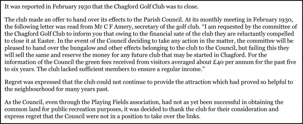
The golf course was opened on Whit Monday 1908 (8th June) by the Hon. W F D Smith M.P and lasted until April 1930, when it had to close as it could not attract enough visitors or members (it only had around 30 members at the time). The first professional at the course was Mr E. Main. In 1930, the committee in charge failed to persuade the parish council to take the course over, one reason being the legal difficulties involved in converting common land to a different purpose. The course was set up 23 years earlier, by a team of groundsmen (employed in autumn 1907) to prepare the ground and they were congratulated on its good condition at the opening ceremony.
There was a wooden bungalow used as a club house / pavilion and there were 9 holes totalling 2,728 yards (approx 2.5km). As well as the aforementioned Dartmoor Magazine article, there is also a plethora of information on the course, which can be found through Chagford Local History Society and the website ‘golfsmissinglinks.co.uk’. As well as these sources of information, the author is also grateful to Claire Northmore for giving him a postcard of the plan of the course.
Bibliography
Luke Darlington, Dartmoor Magazine – (1989) – ‘Meldon Fore Run (or the Course of Time)’ article in Autumn 1989 edition (No. 16) of the Dartmoor Magazine, pages 22/23
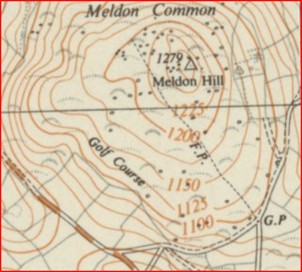
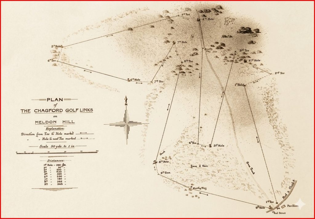
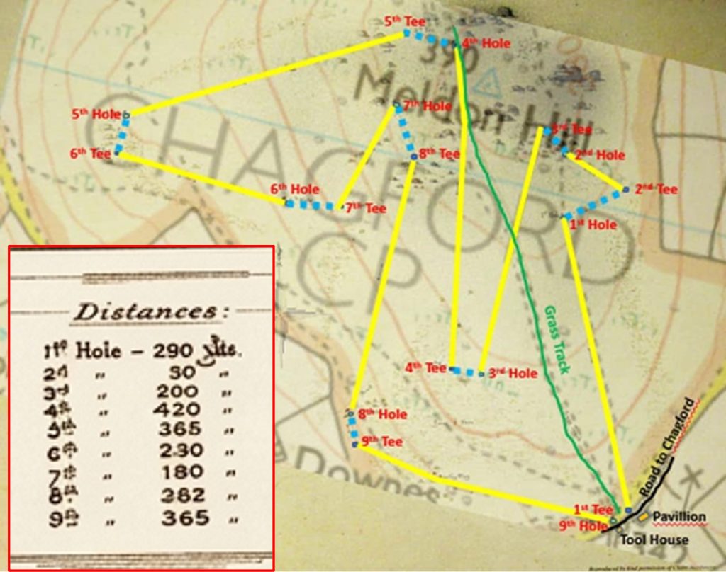
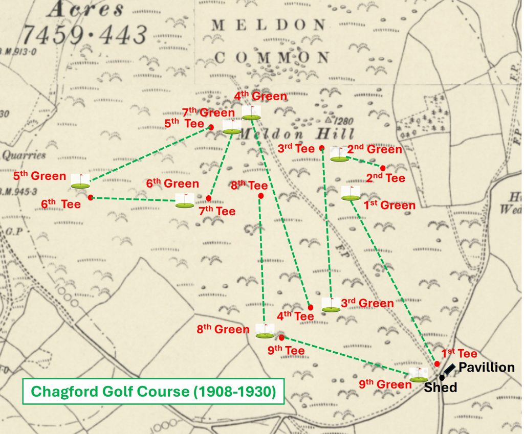
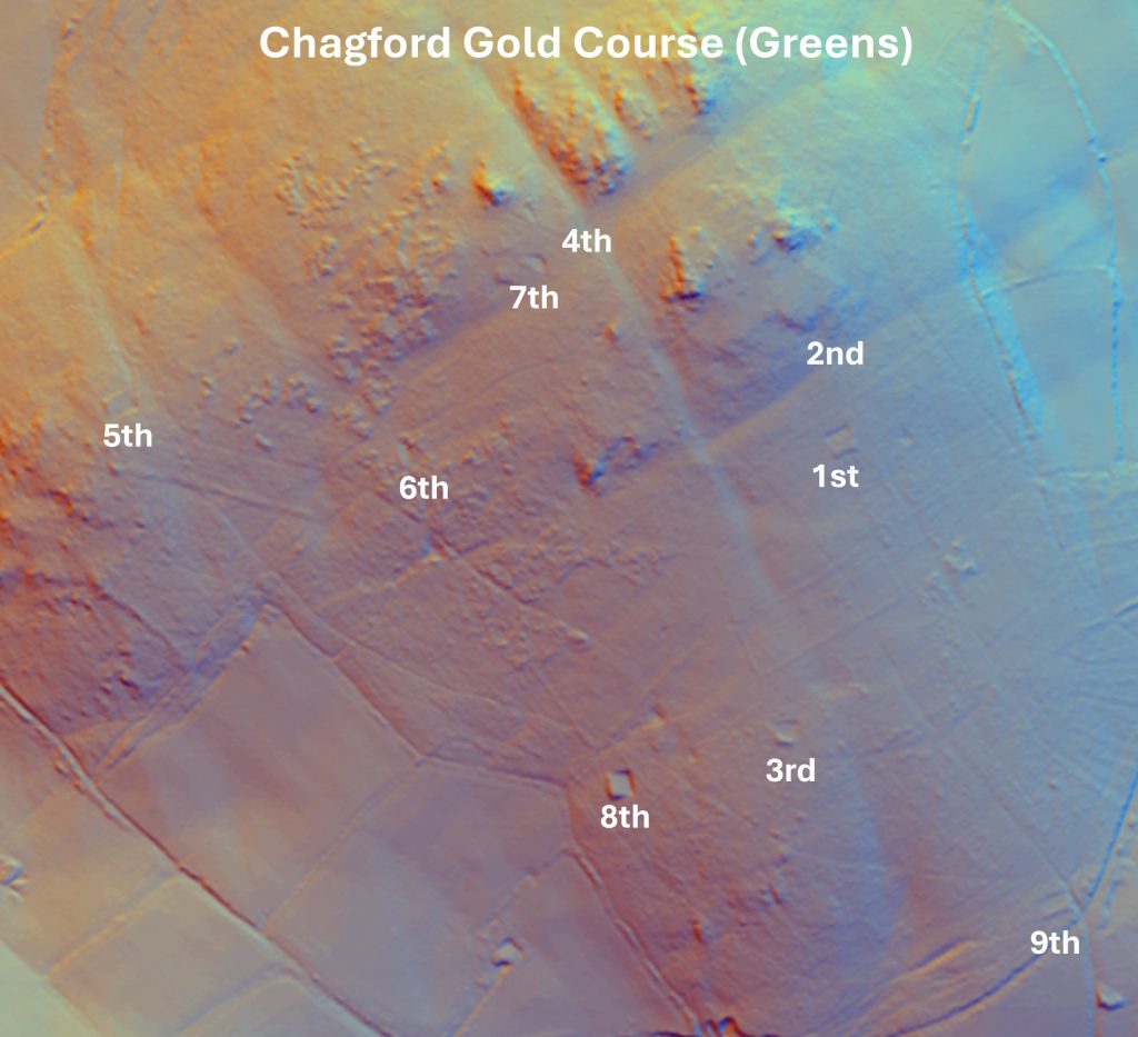
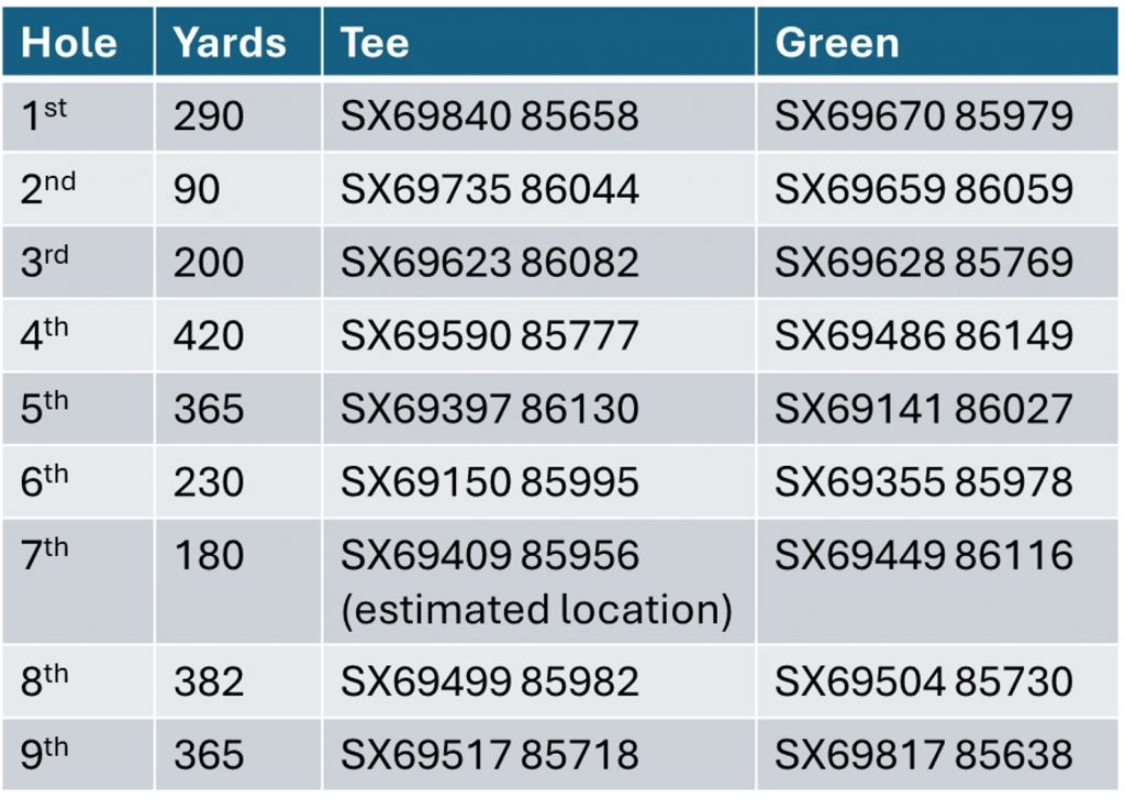
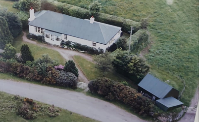
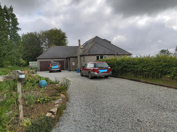
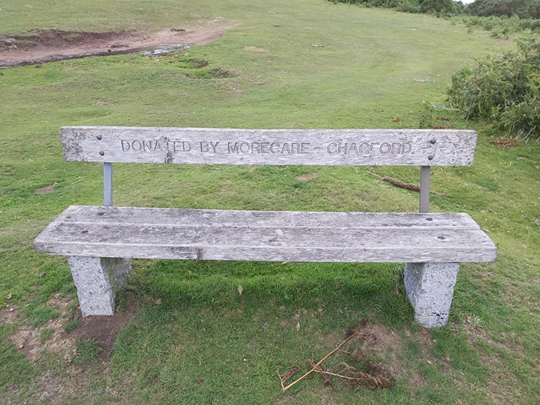
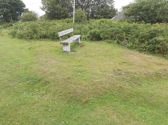
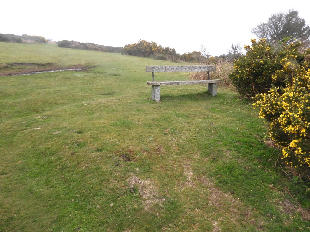
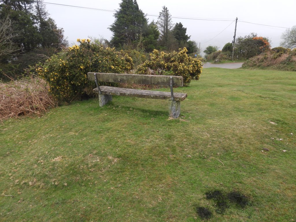
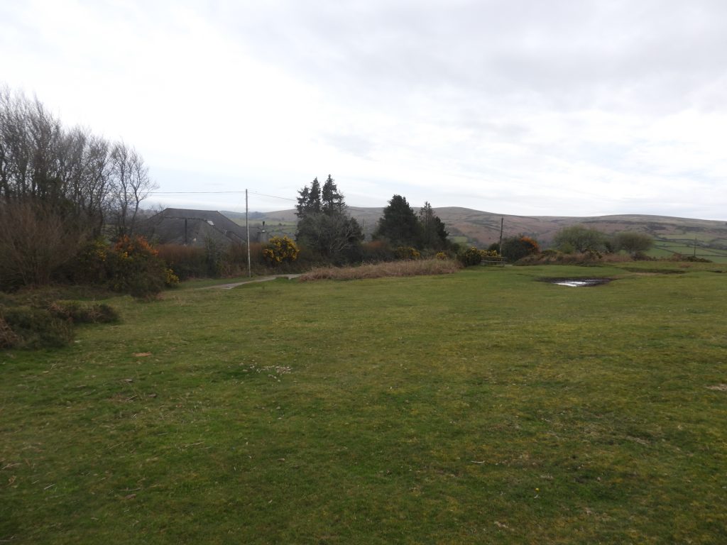
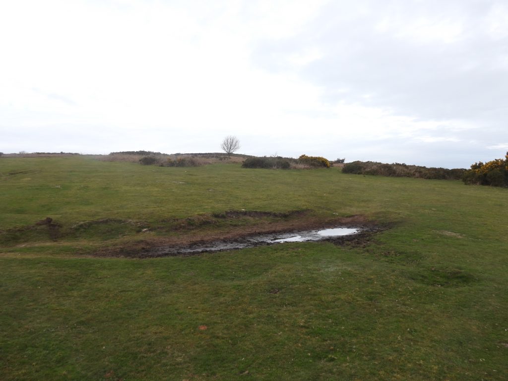
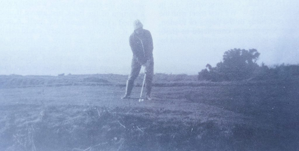
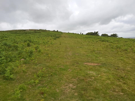
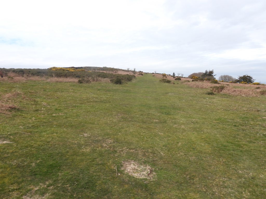
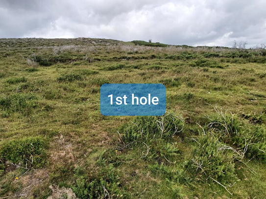
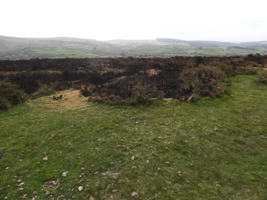
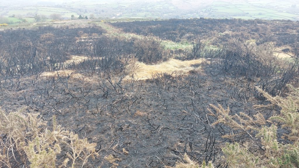
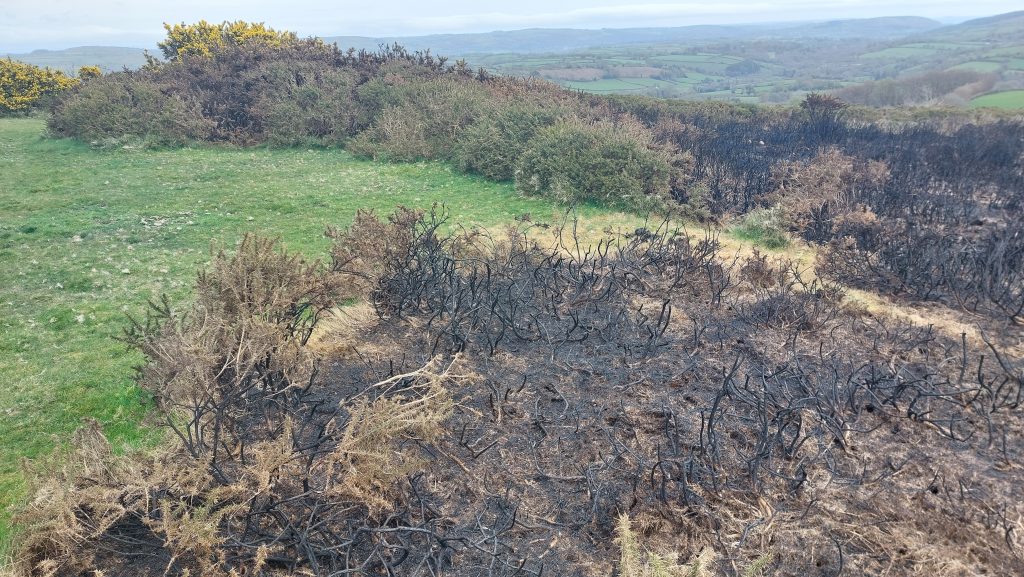
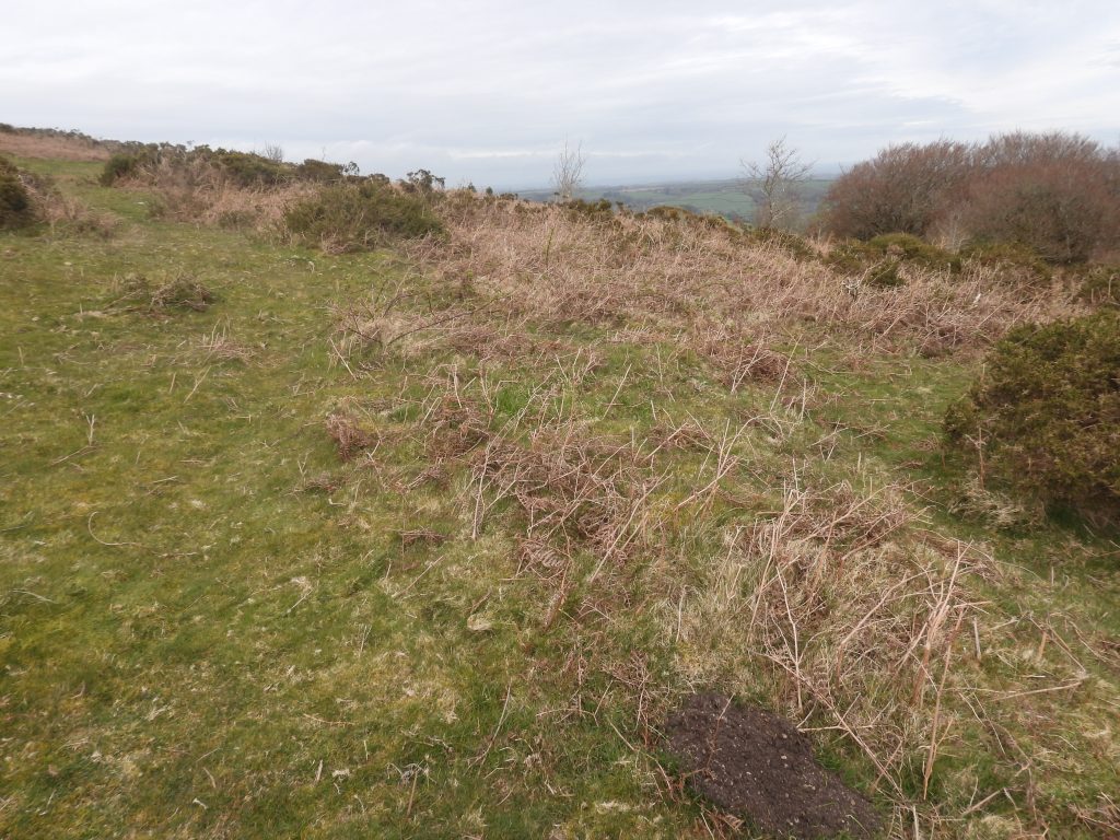
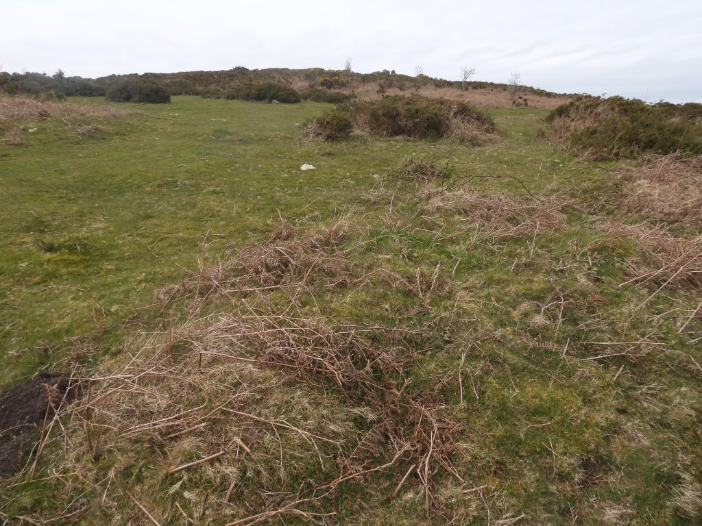
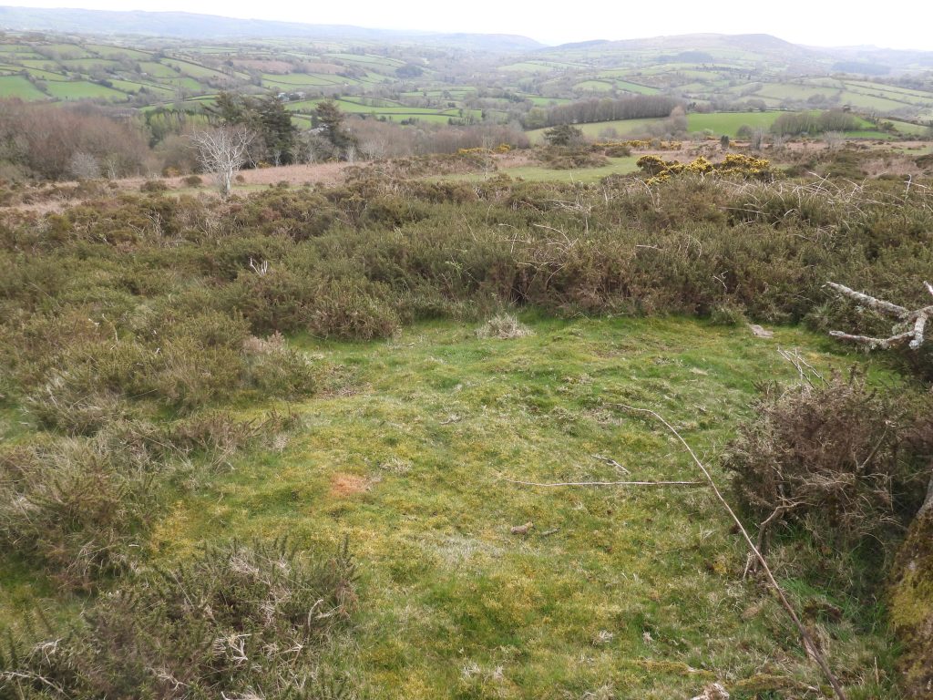
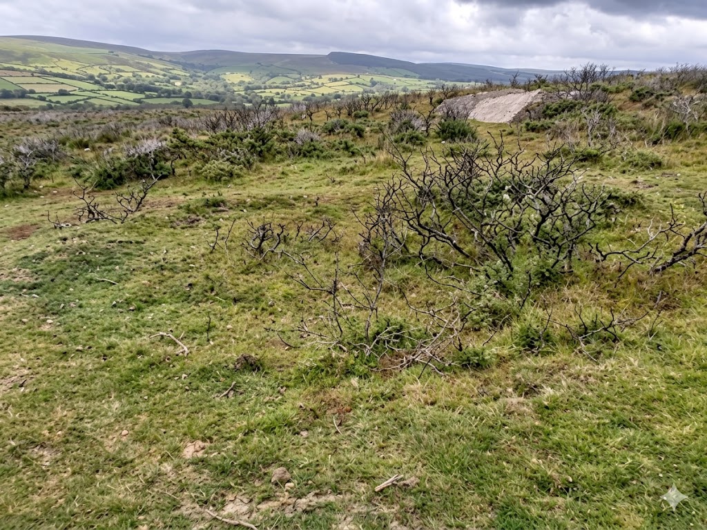
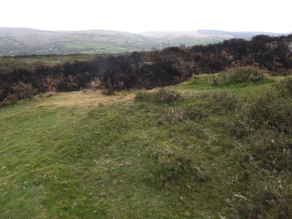
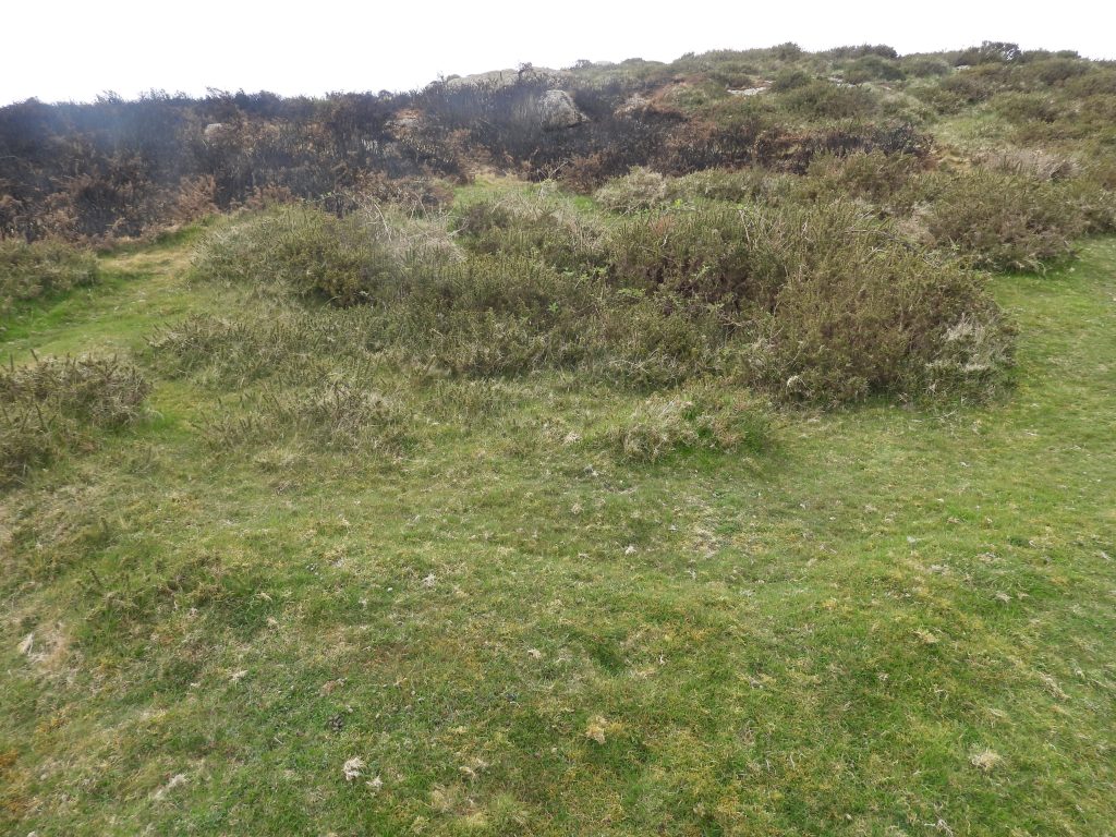
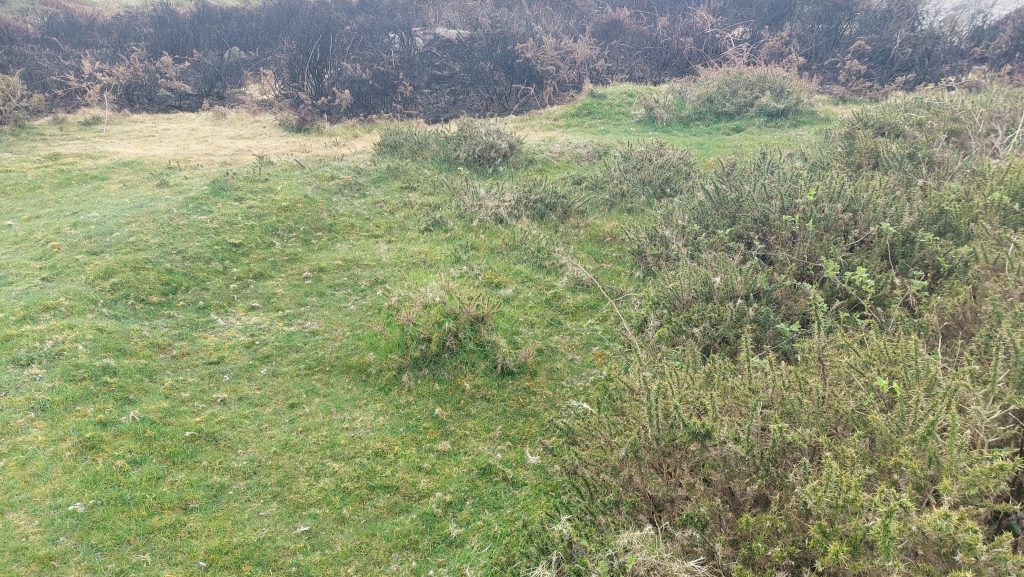
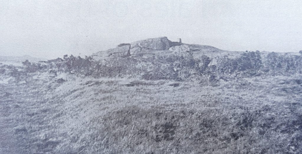
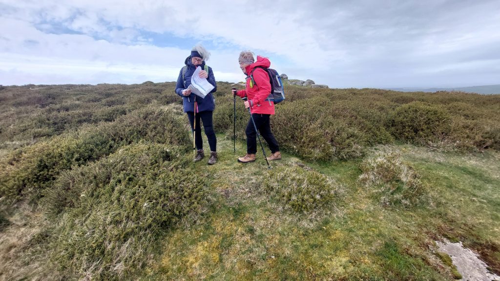
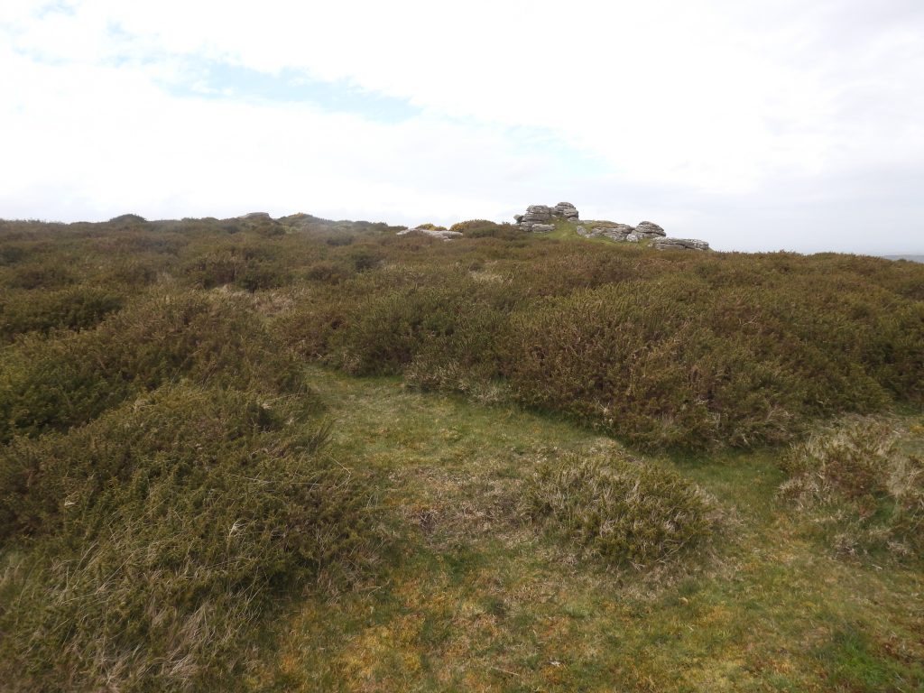
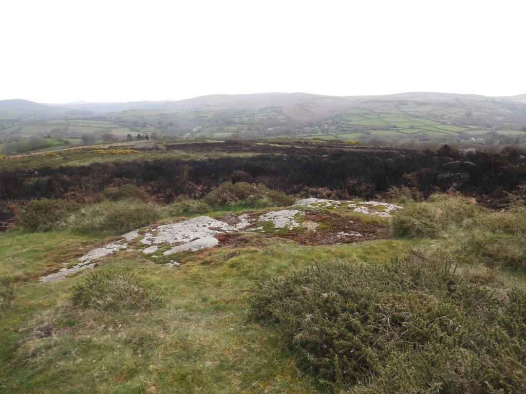
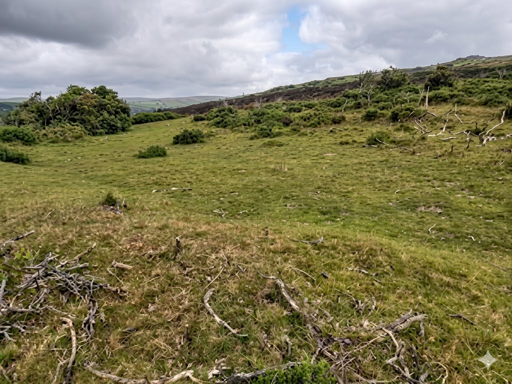
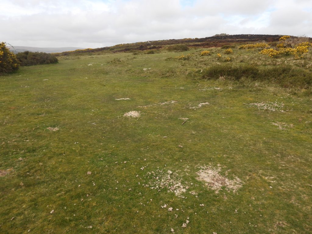
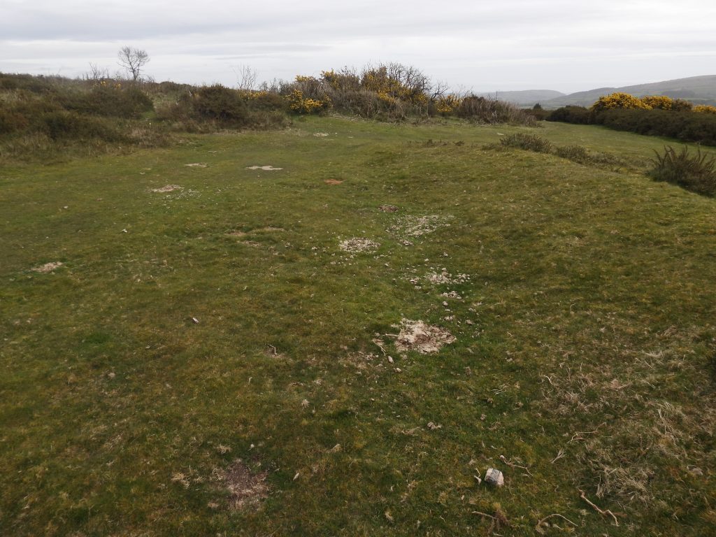
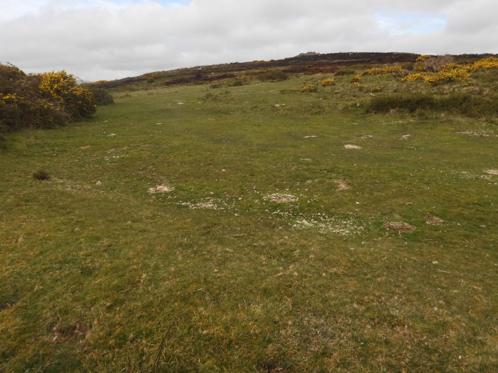
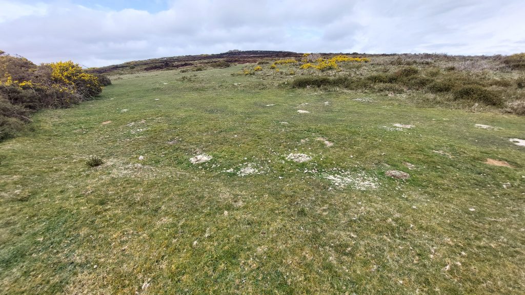
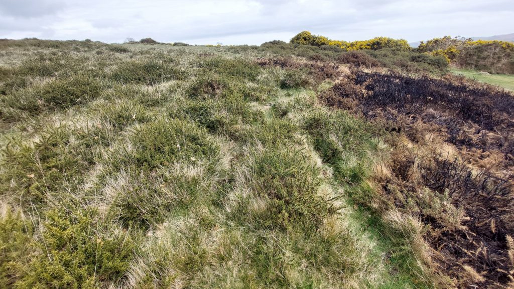
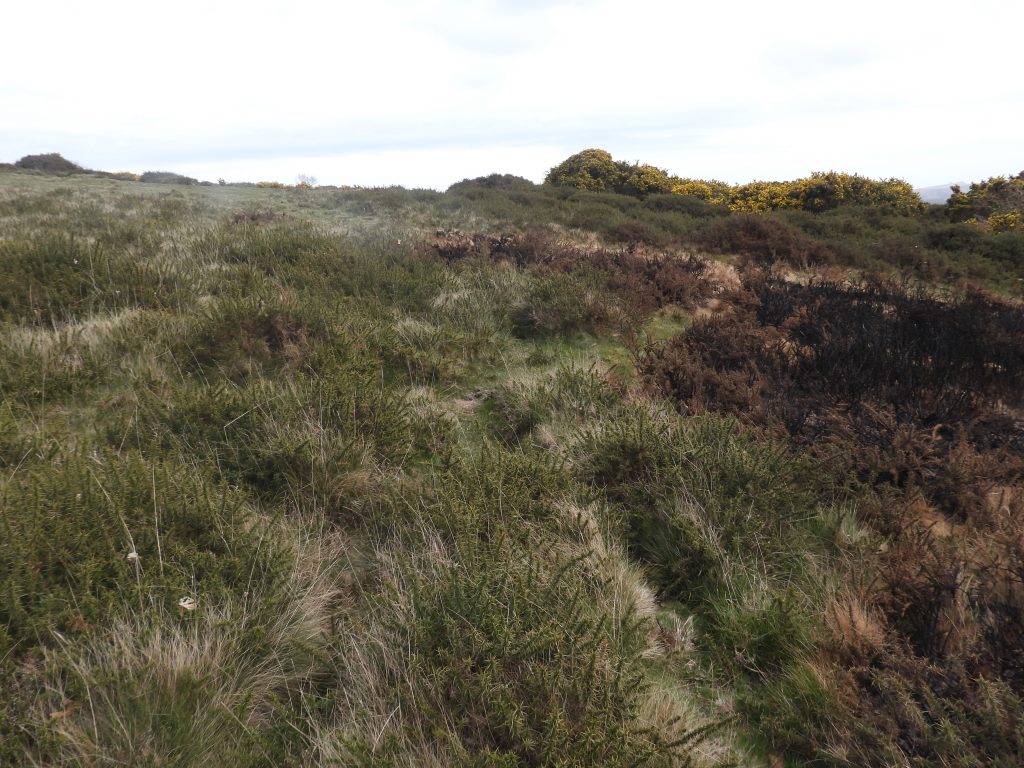
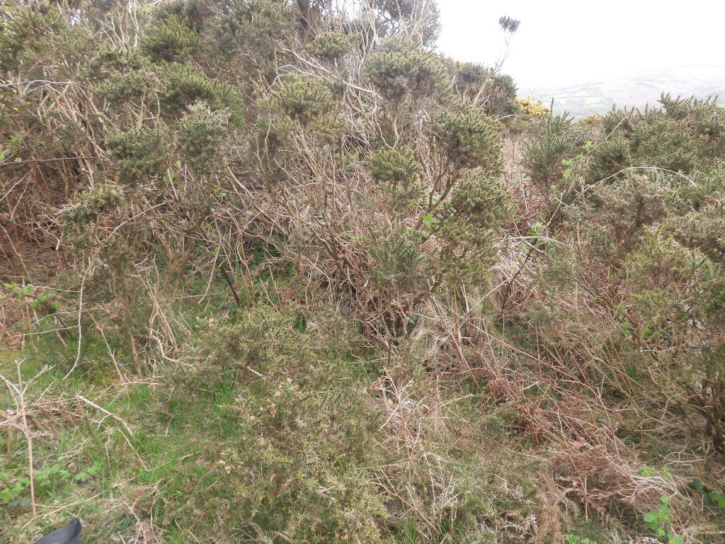
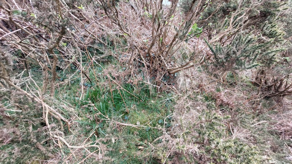
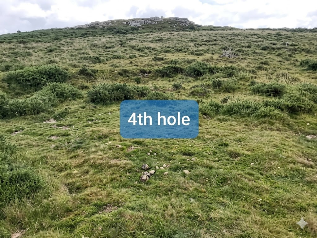
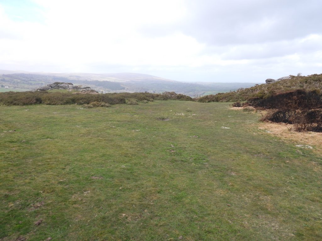
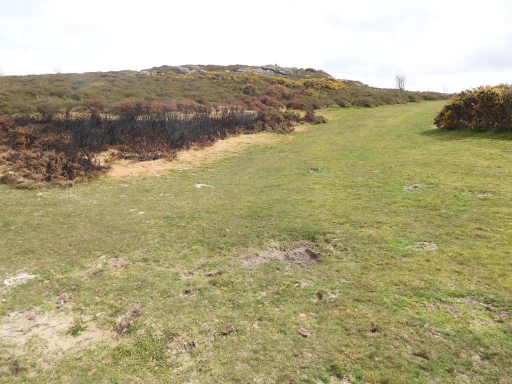
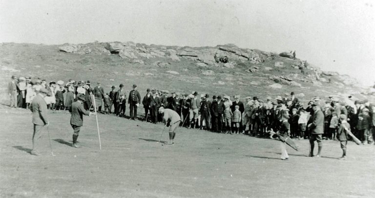
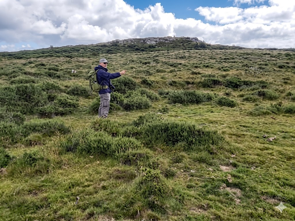
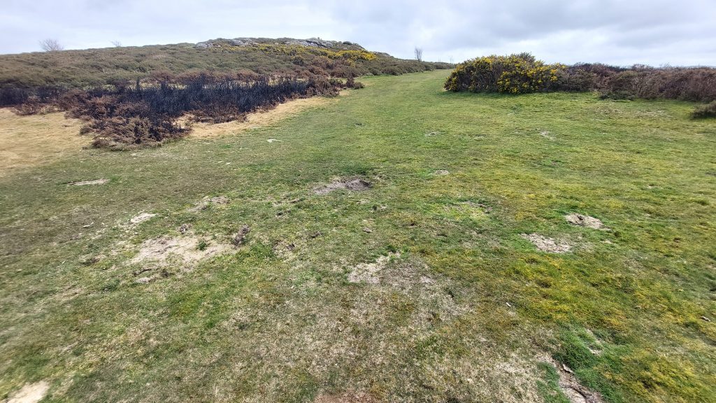
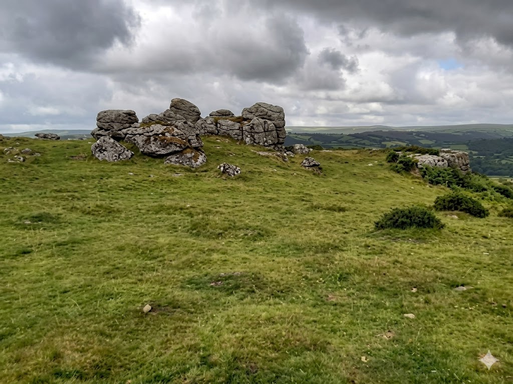
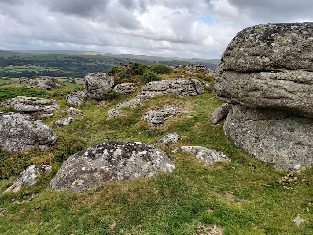
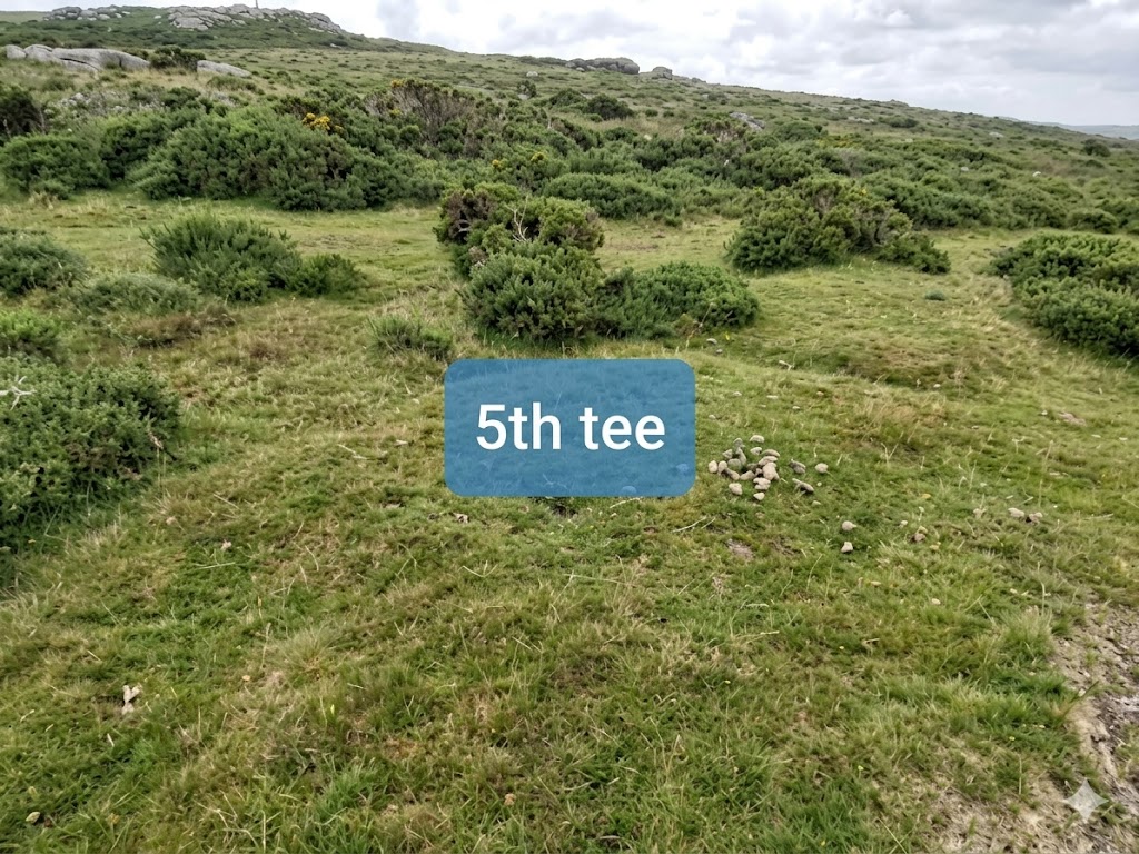
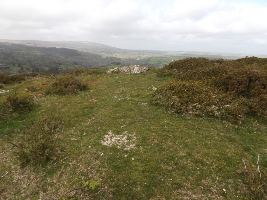
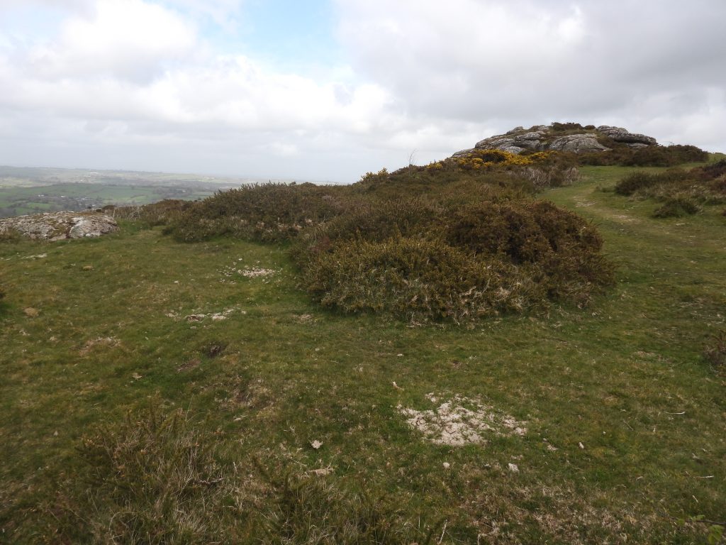
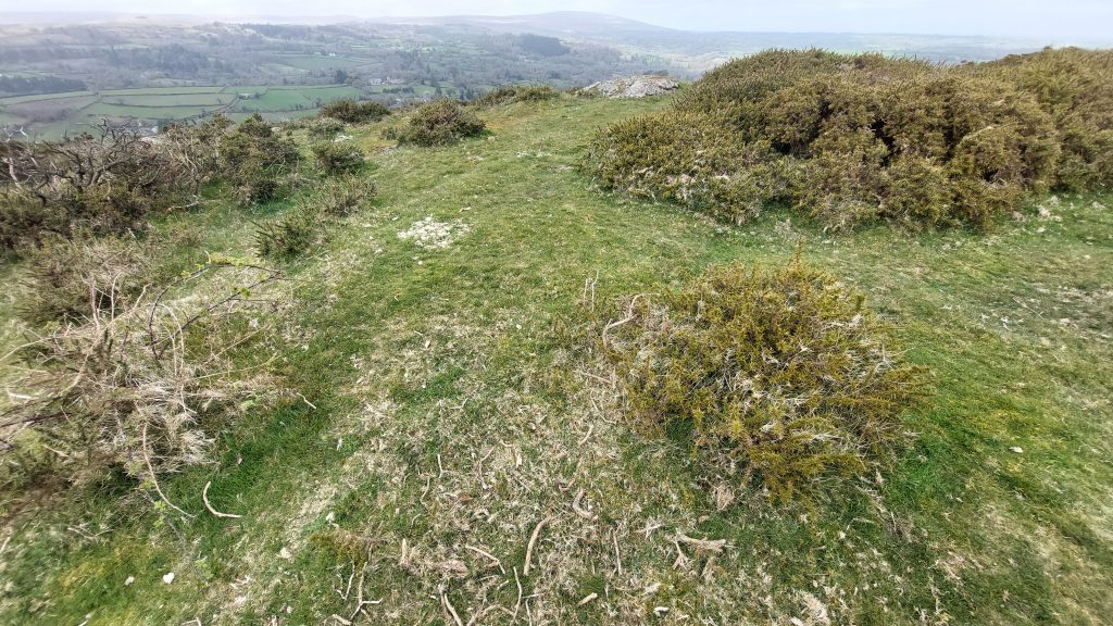
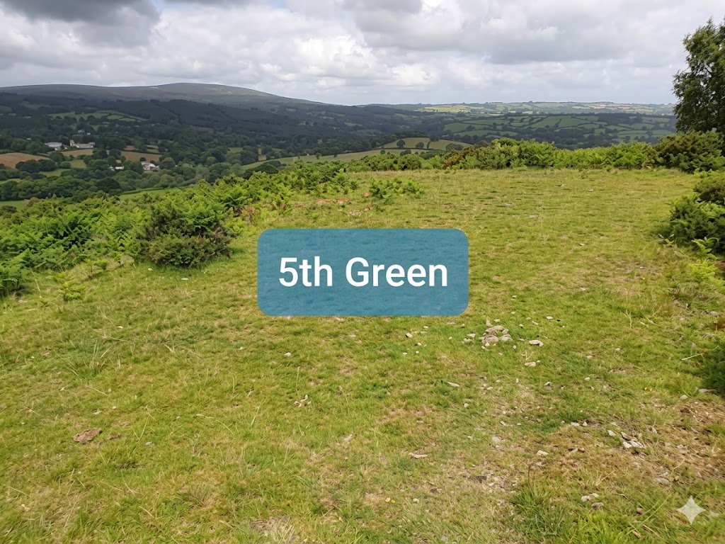
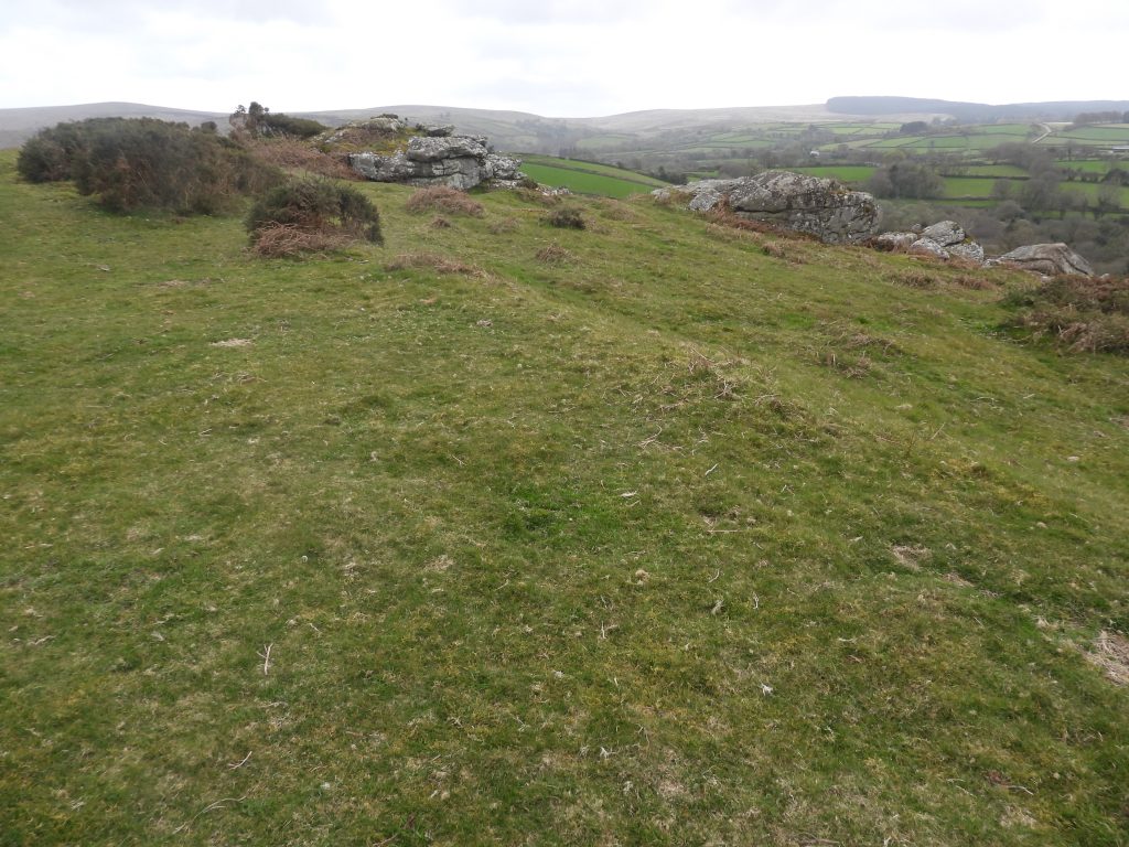
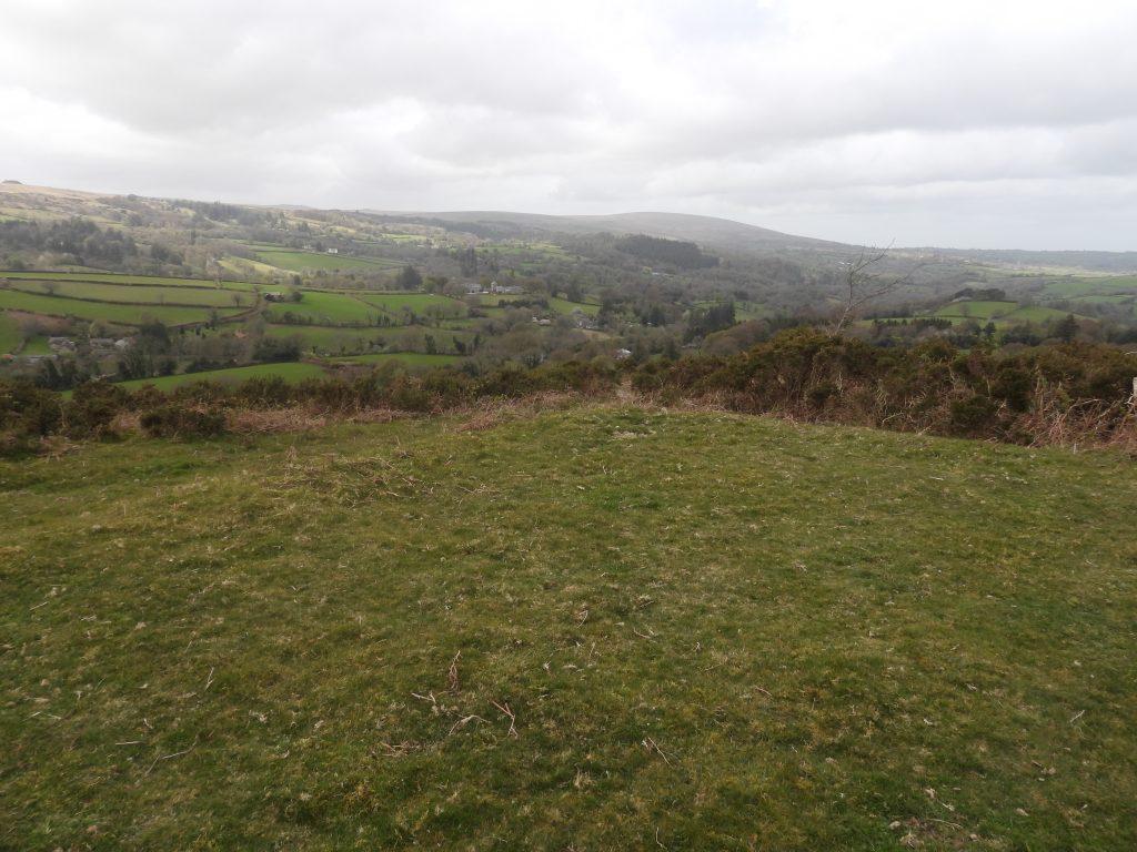
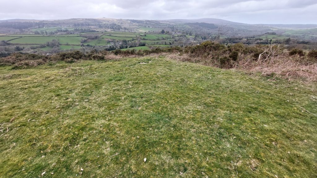
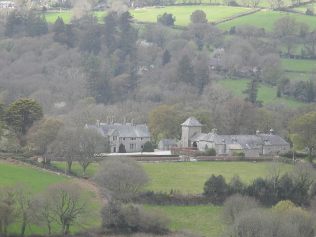
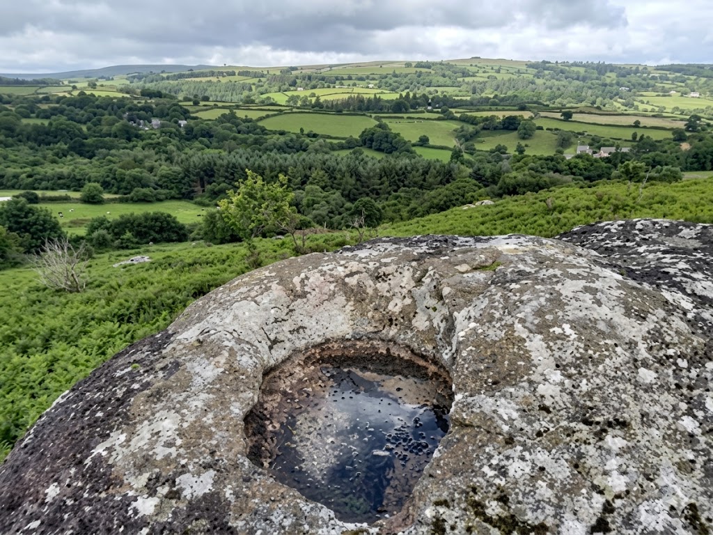
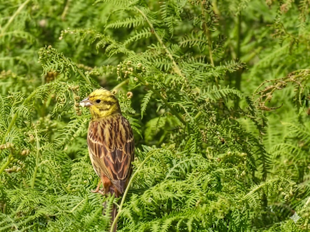
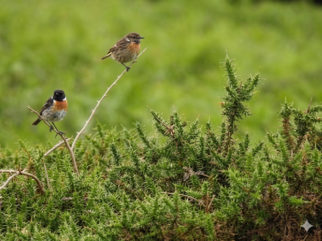
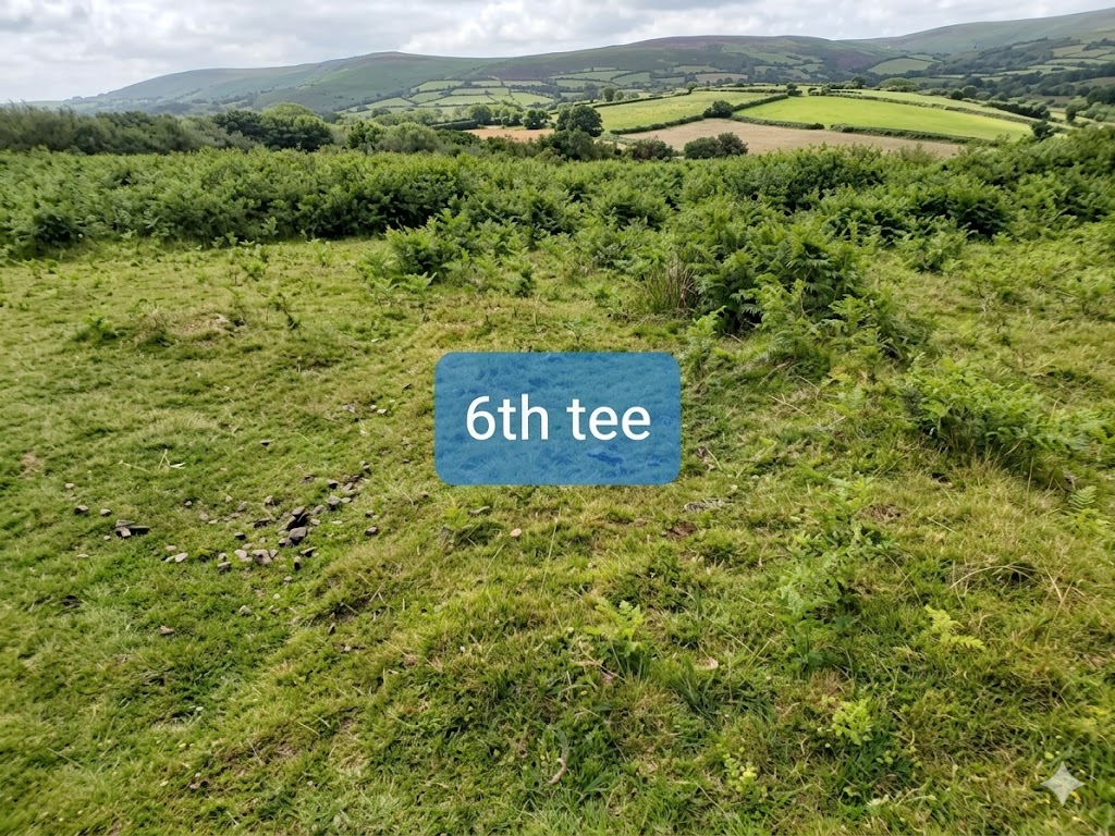
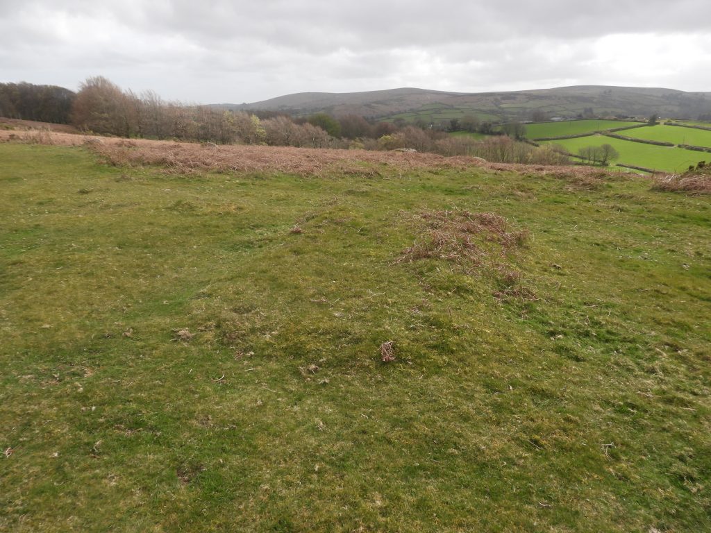
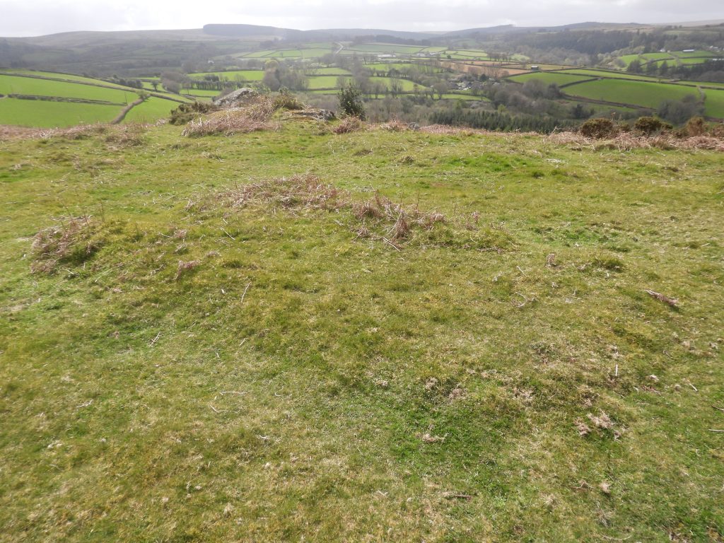
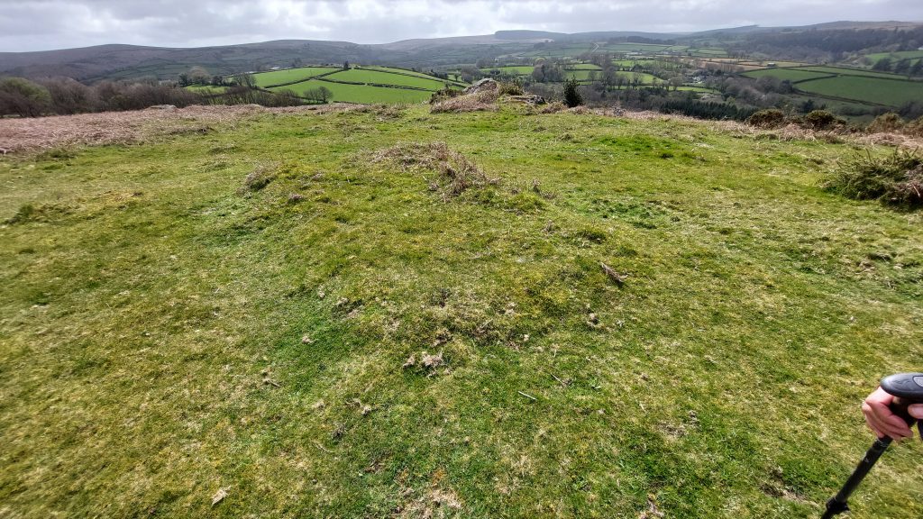
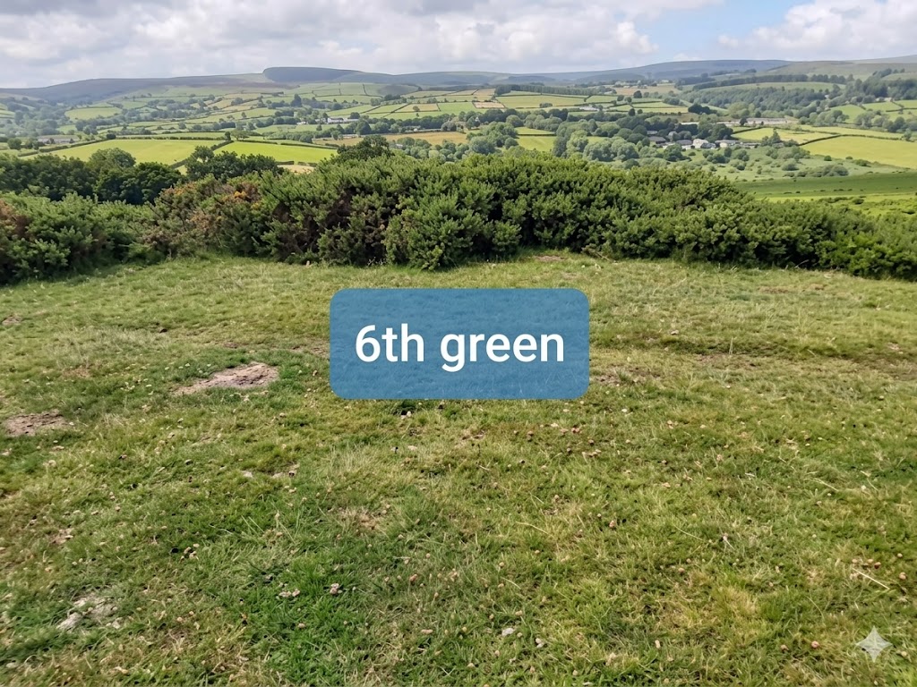
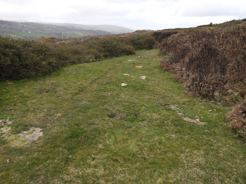
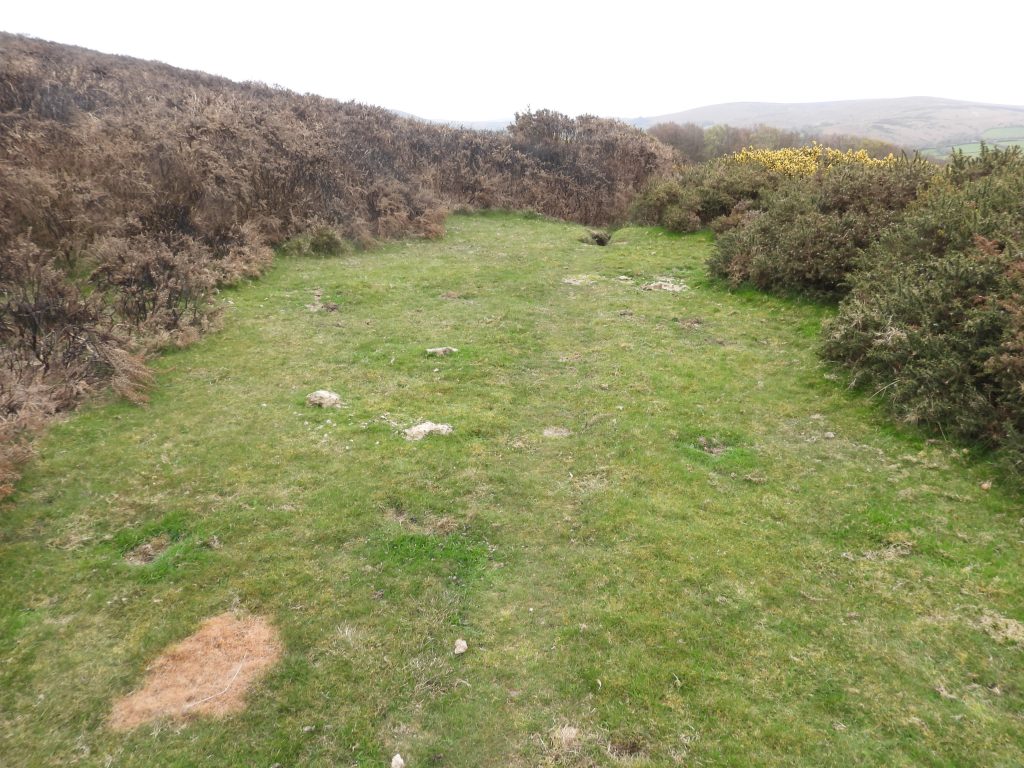
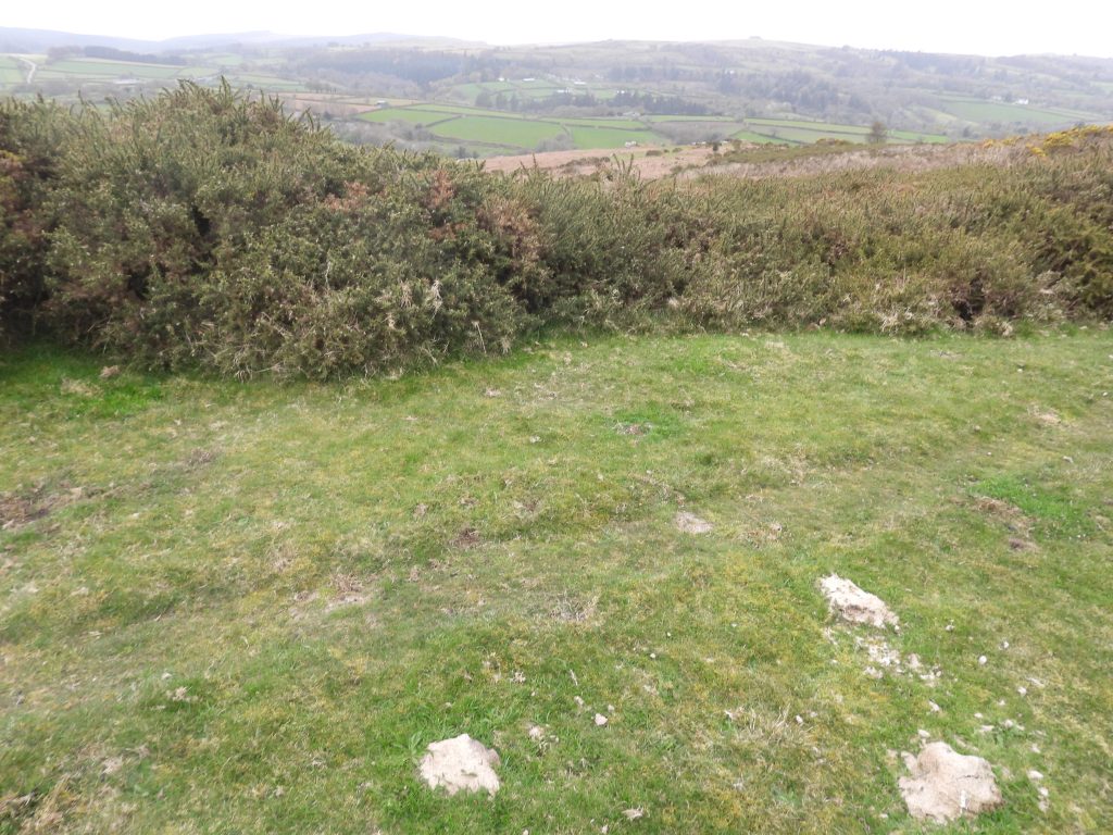
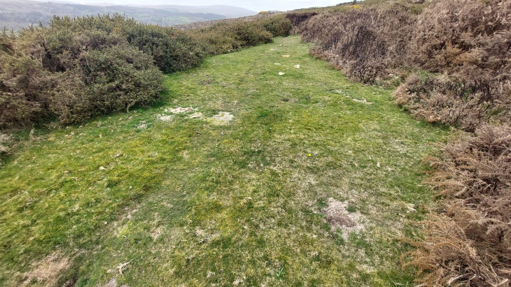
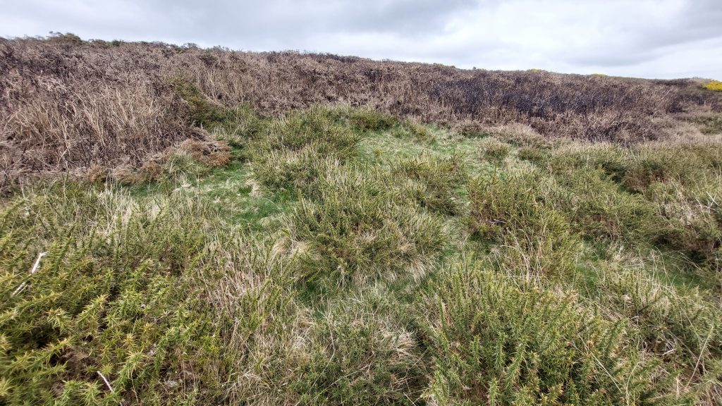
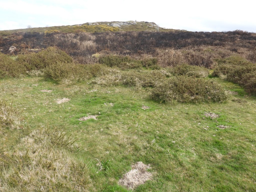
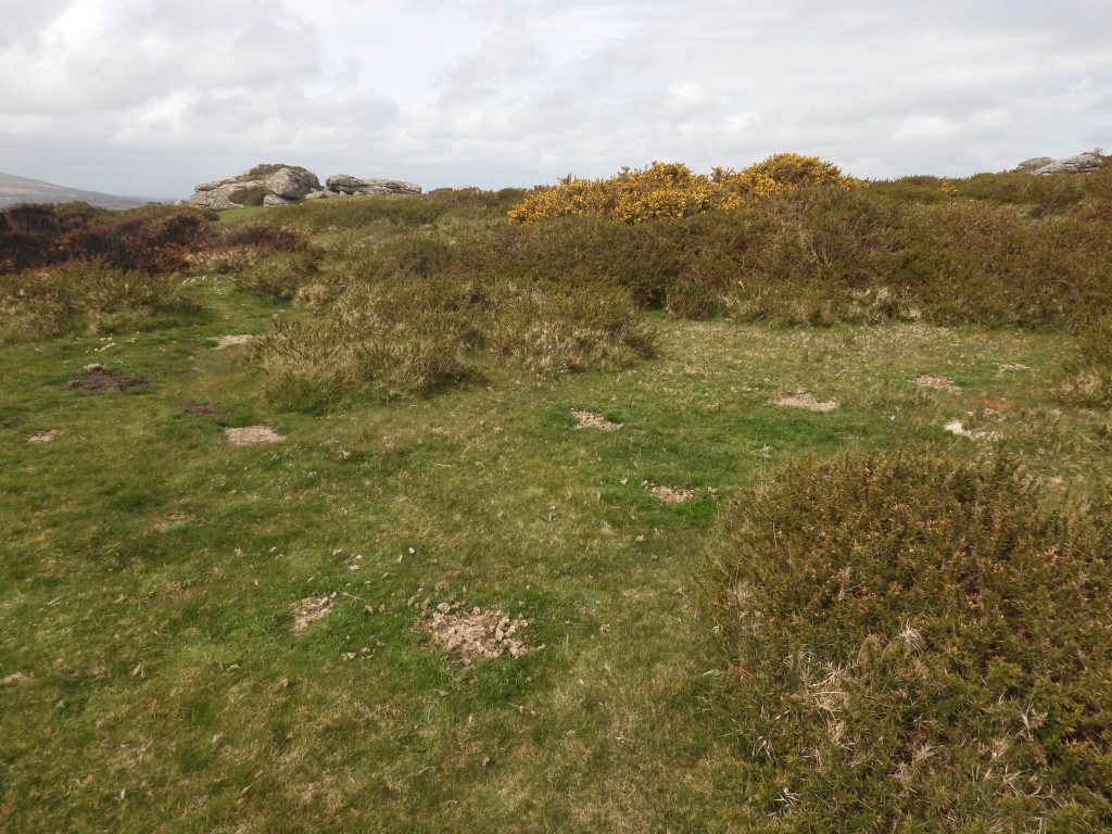
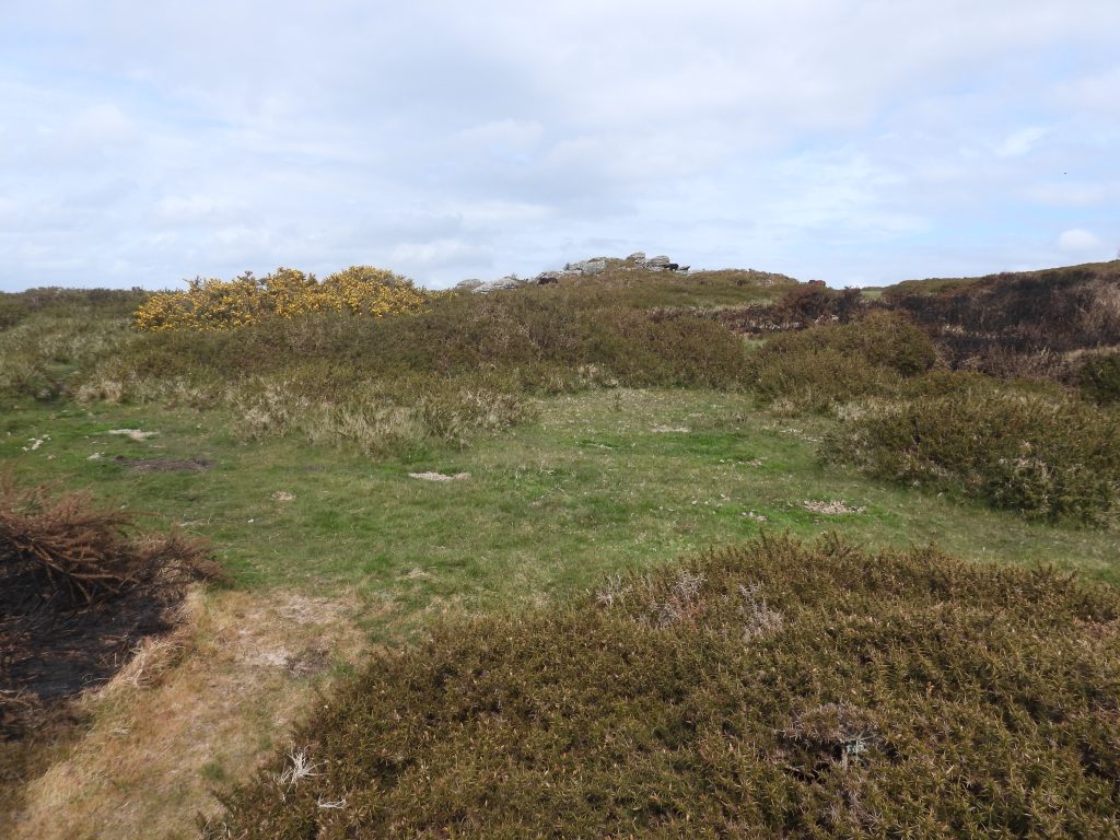
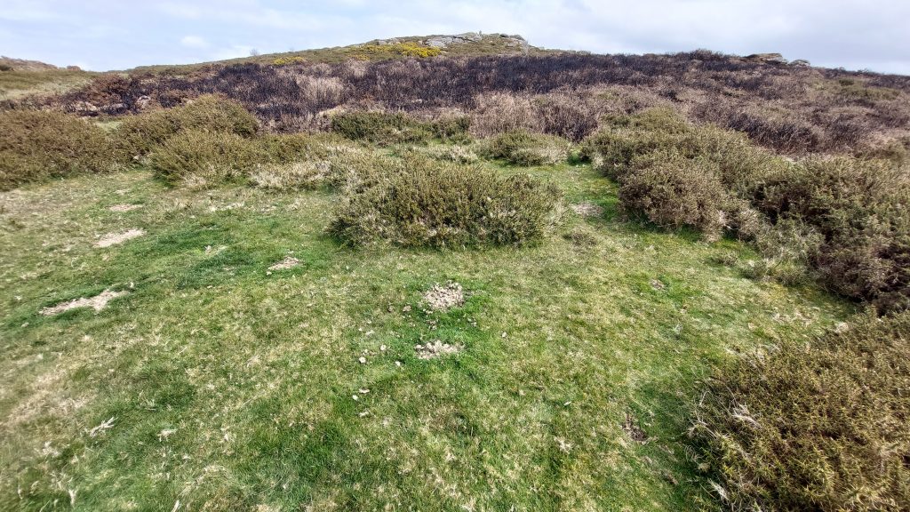
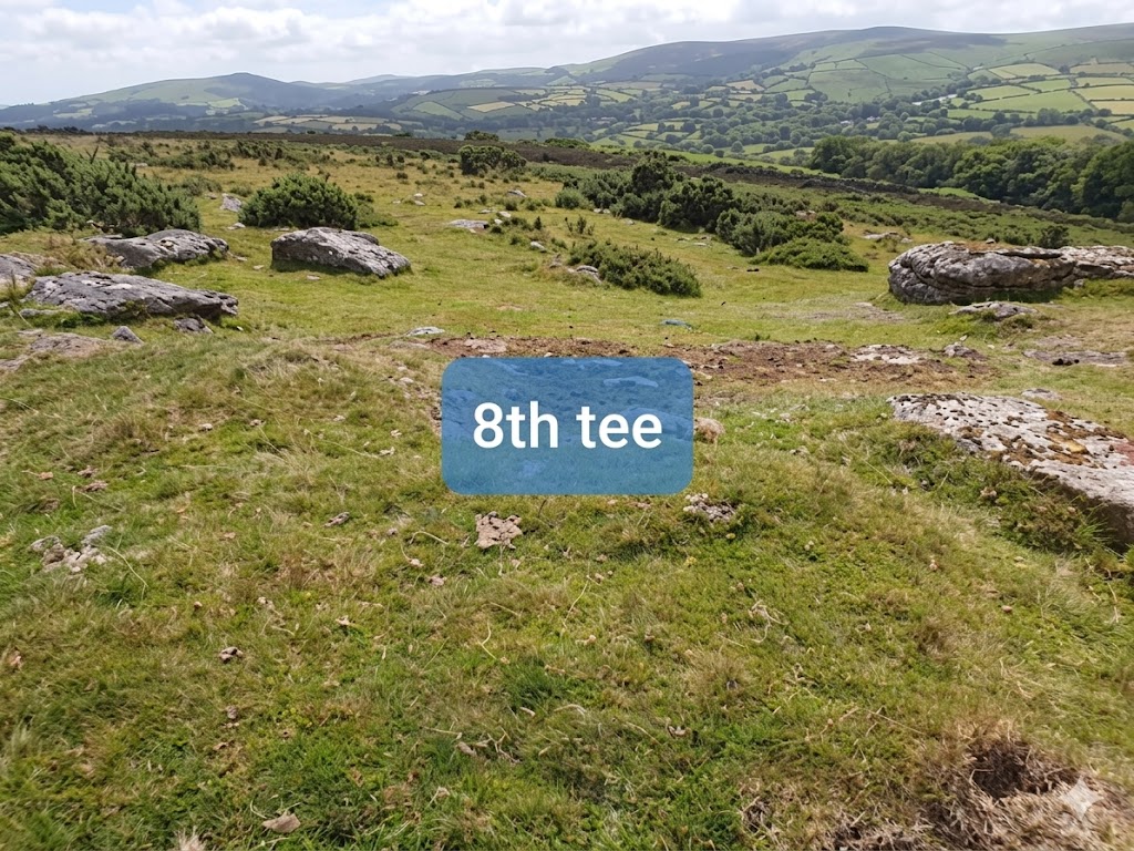
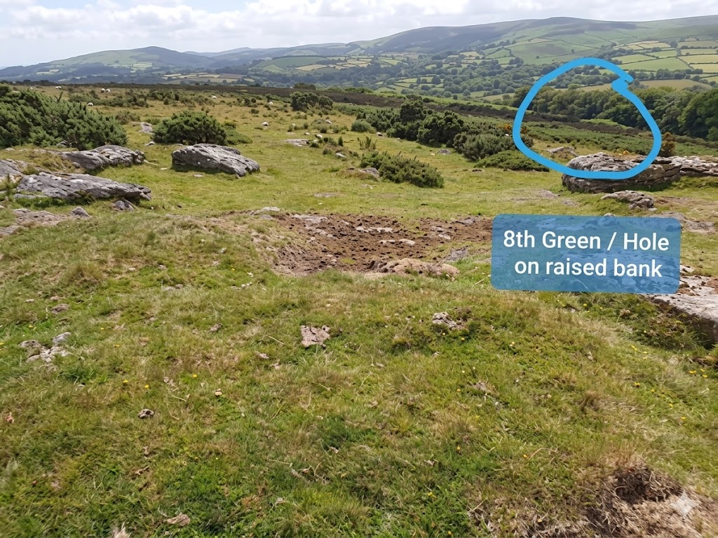
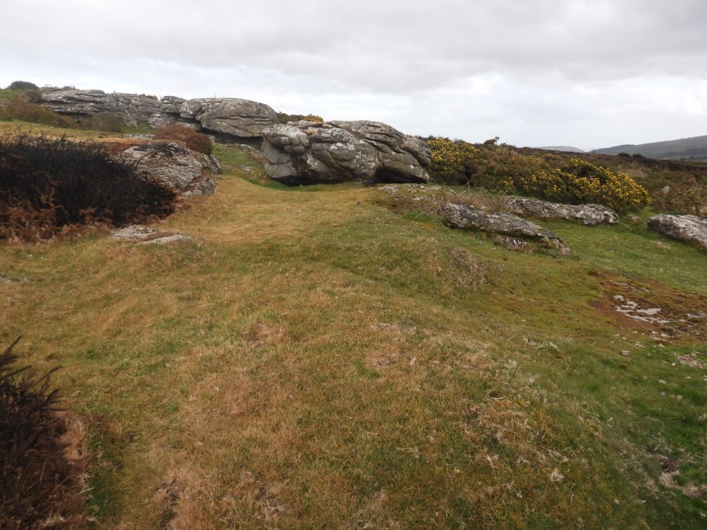
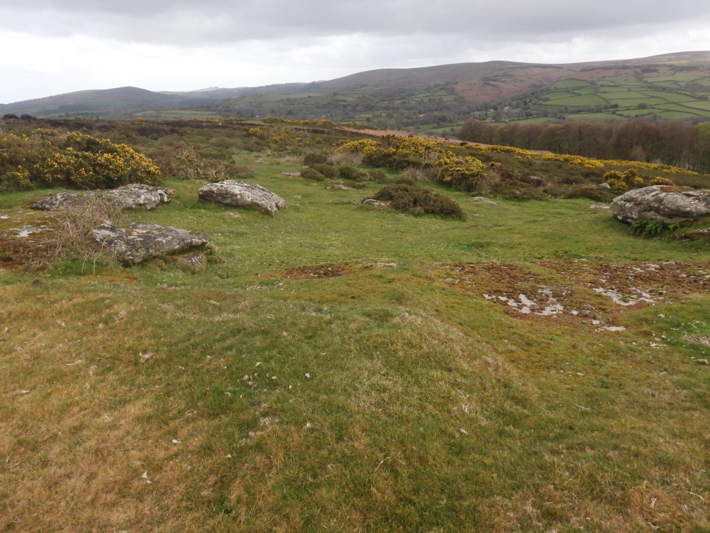
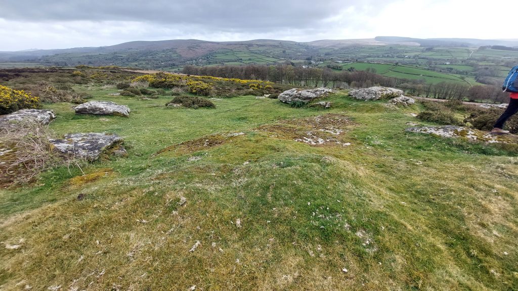
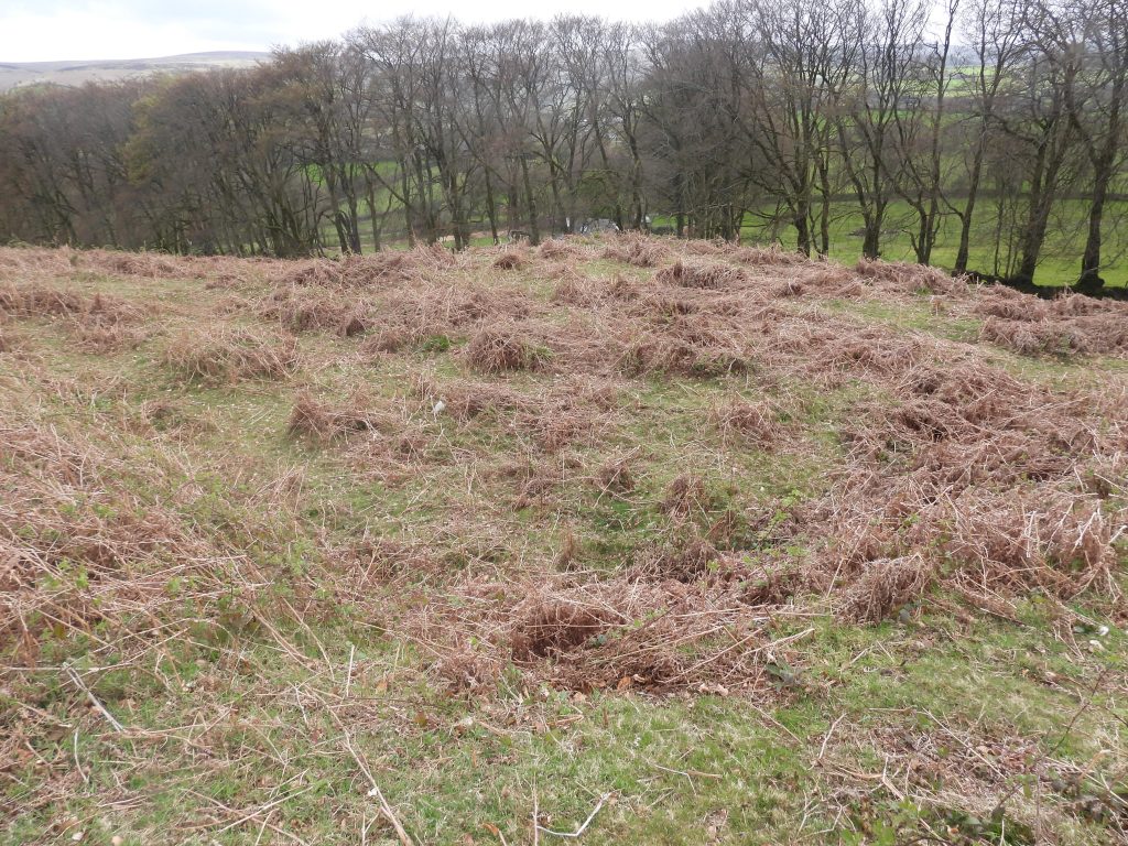
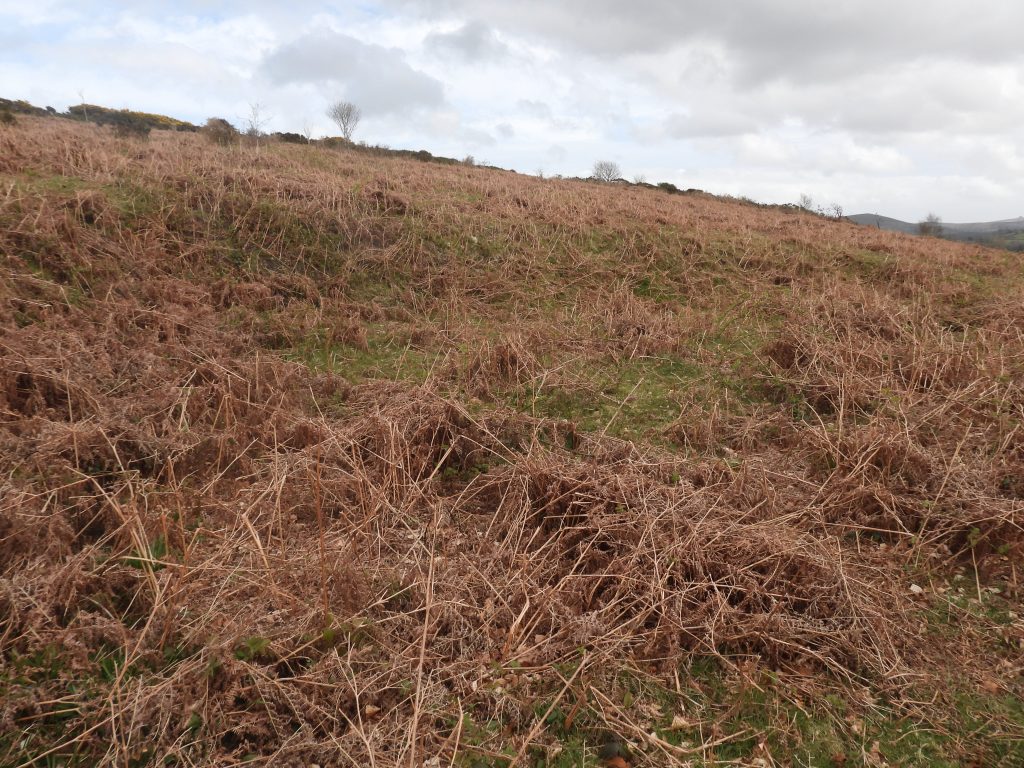
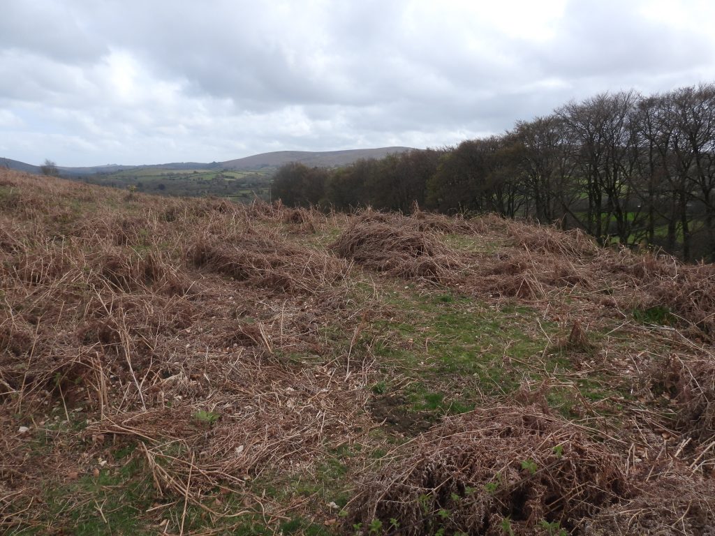
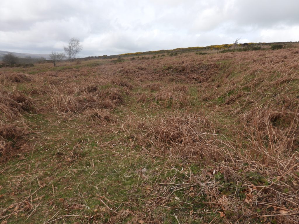
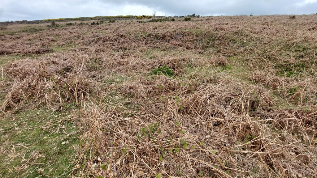
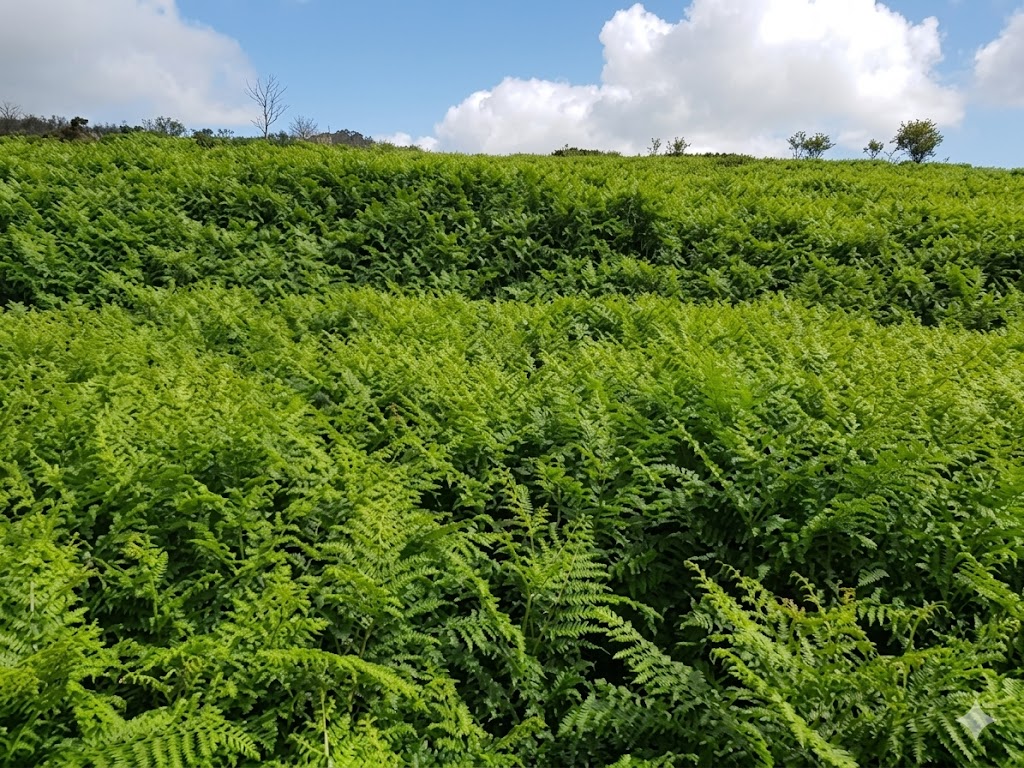
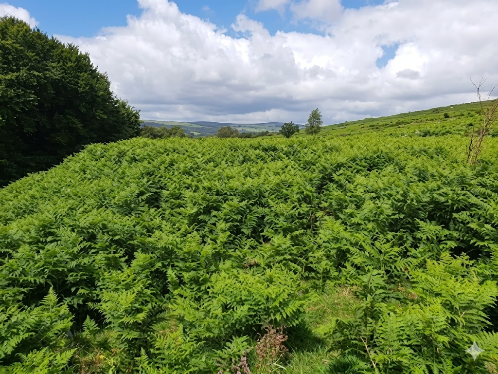
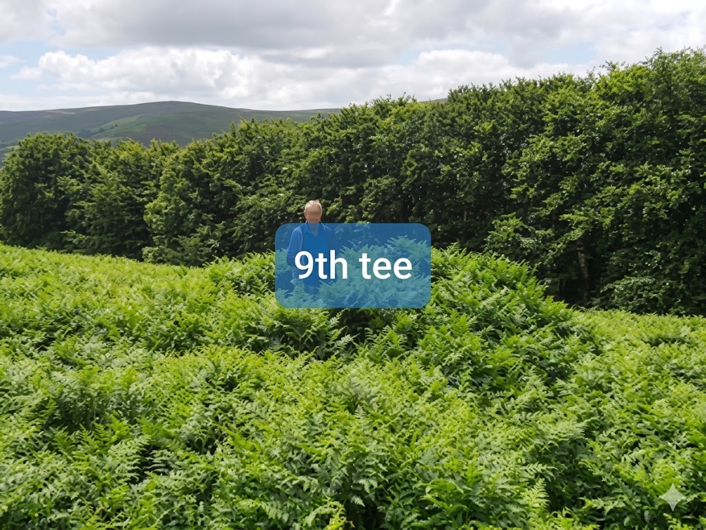
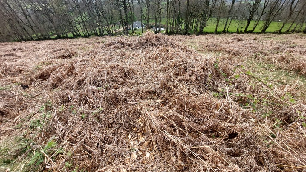
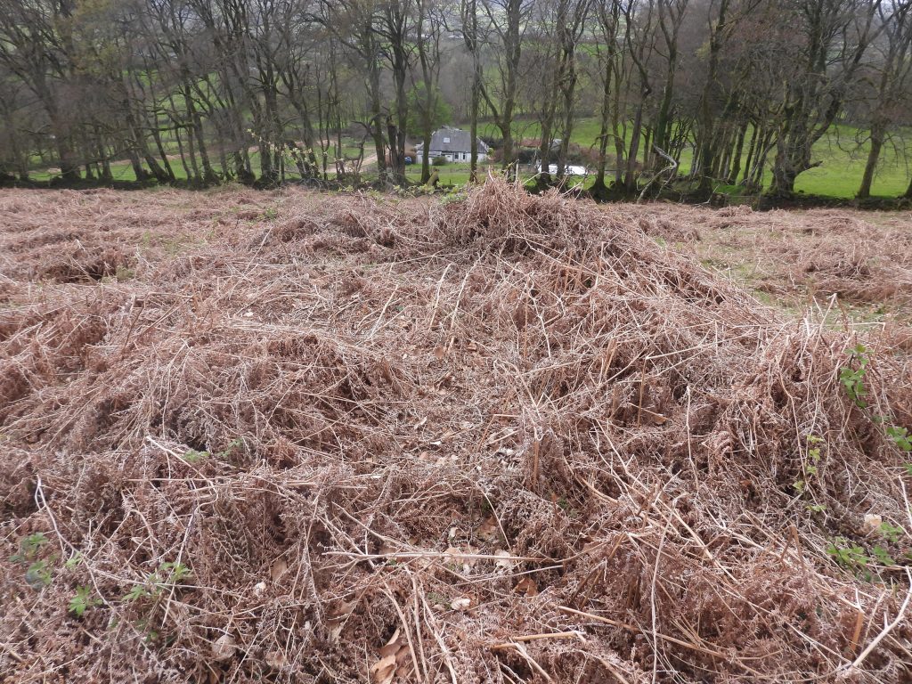
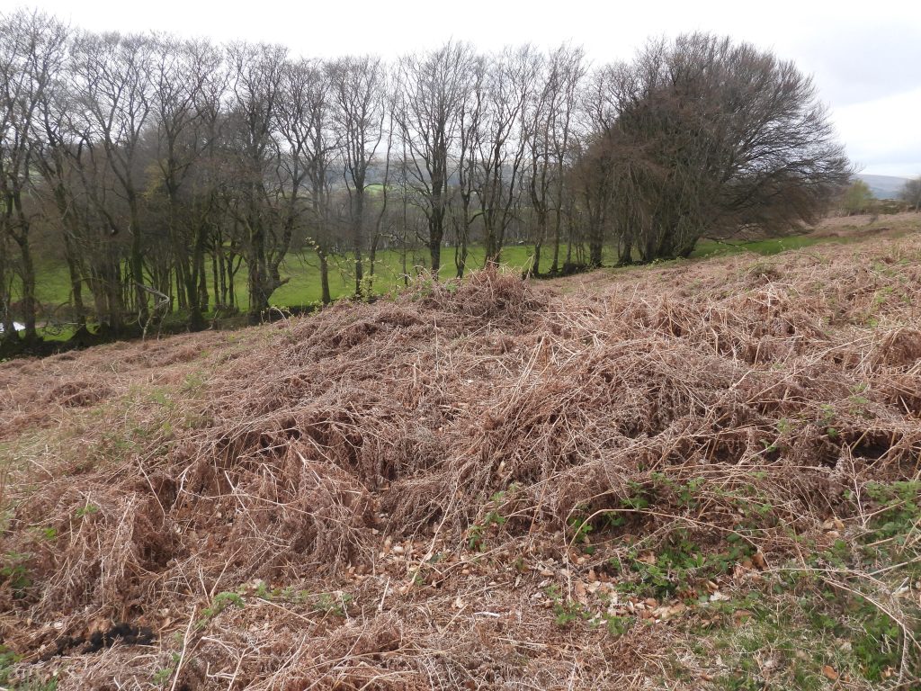
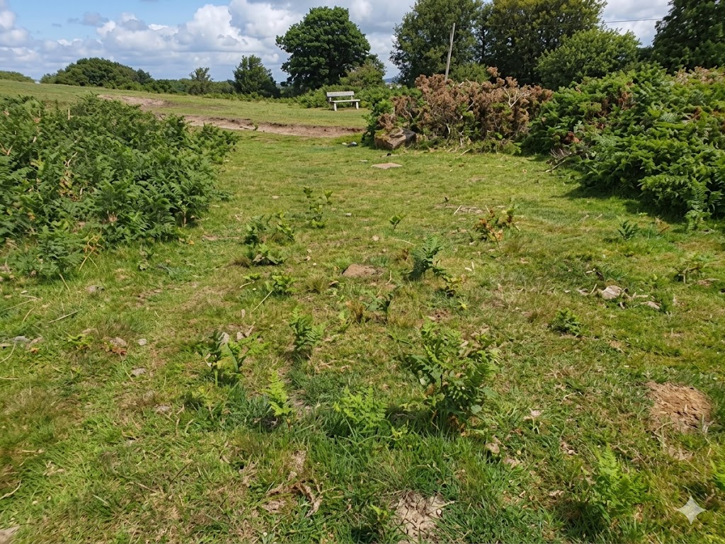
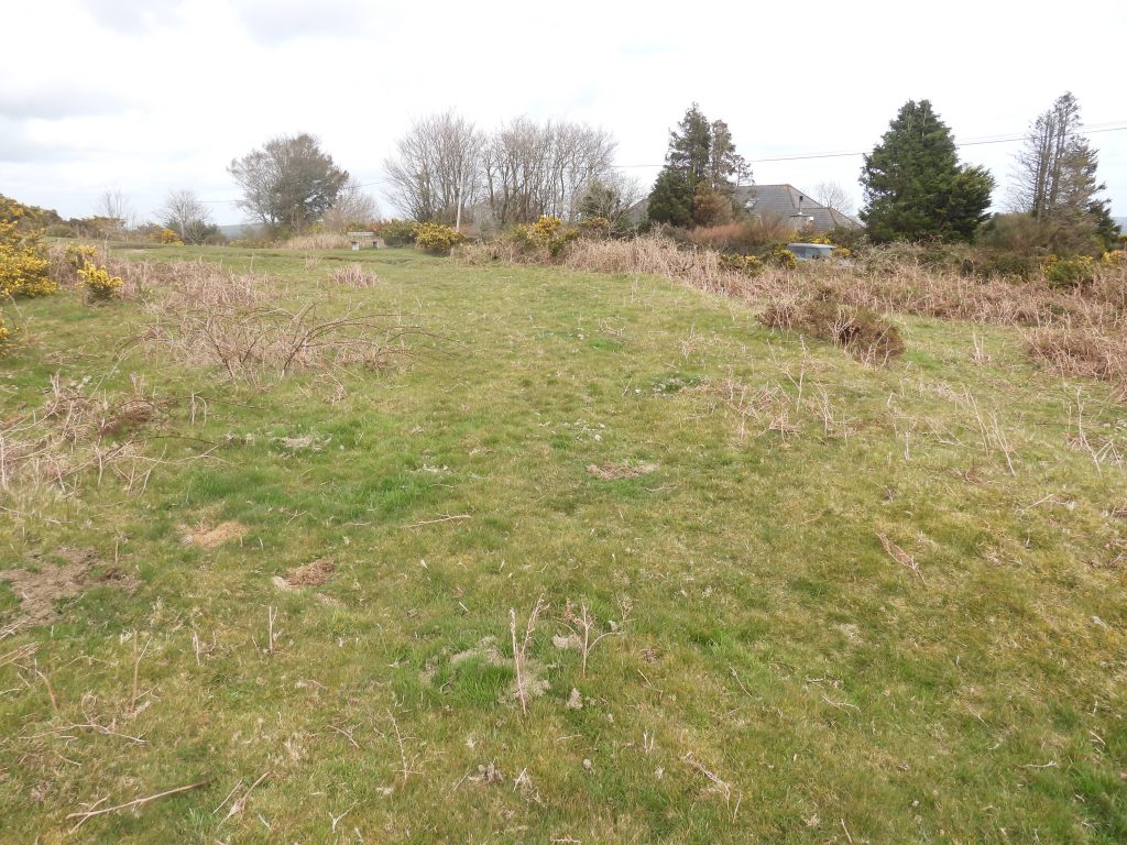
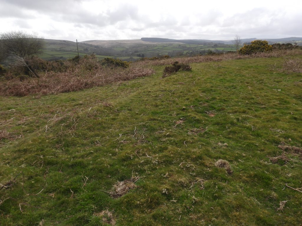
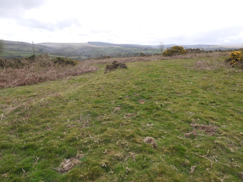
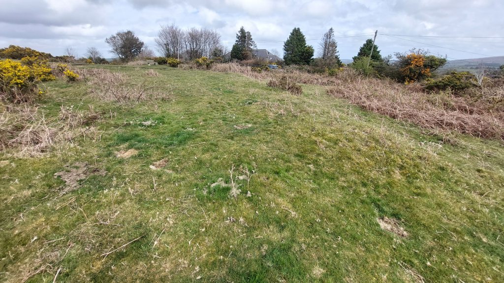
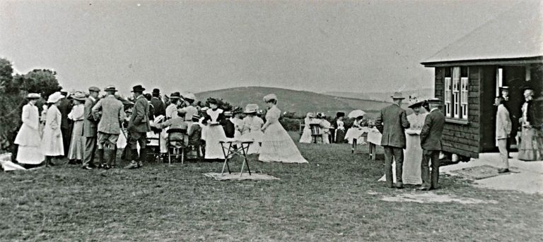
Chagford Golf course was recorded on the 1936 inch to a mile map of Dartmoor. The above map from National Library of Scotland is dated (1937-1961) but was published in 1956. The Golf Course is shown albeit the map isn’t 100% annotated correctly with part of the course being by the footpath (F.P) and up to Meldon Hill summit.A plan of the course (labelled here as ‘Golf Links’). The author was kindly given this plan on a post card by Claire Northmore and which can also be found at https://www.chagfordlocalhistorysociety.org.uk/commons-6/ The key points here are the Pavillion (now where Meldon Heights is located), the 1st Tee by the road and 4th Hole (Green) which is located near the summit of the hill. With these cardinal points the approx. location of each Tee and Hole (Green) of this 9 hole course can be worked out.This annotated map was the authors first attempt (in July 2020) at working out where all the Tees and Holes (Greens) were located. This attempt was quite accurate except for two factors. Firstly, trying to locate these features is best left to outside the summer months (due to bracken and gorse) and secondly the 7th Hole (Green) appears to be lower down the hill on the plan than it actually was in reality. With the subsequent use of LiDAR coupled with a visit in Spring 2026, the 7th Green was successfully located and is closer to the 4th Green and 5th Tee than indicated here.This annotated late 19th century map shows the locations of all the Tees and Greens found by the author in Summer 2020 and in Spring 2026. The one exception was the 7th Tee where the gorse is very thick and couldn’t be found. That said, using the known locations of the 6th and 7th Greens, with their grid references, and knowing the length of the 7th Hole (180 yards) by using simple mathematics the approx. the location of the 7th Tee can be determined…more of this later.Using a LiDAR (Light Detection And Ranging or Laser imaging, Detection, And Ranging), all the Greens from the Golf Course stand out. The 1st, 3rd, 5th, 6th, 7th, 8th and 9th Greens are the most prominent. The 4th Green is on a flattish area at the top of the hill and has little in the way of levelling or embankments so doesn’t stand out so well. The 2nd Green is quite small and is not so discernible on LiDAR. As previously mentioned, the 7th Green is higher up the hill than expected (using the Golf Course plan)This table summarises the locations of all the Tees and Greens as found by the author with the exception the 7th Tee, which is estimated. With the 7th Hole being 180 yards (or 164 metres) and the 7th Green being at SX69449 86116, an estimate for the 7th Tee is SX69409 85956, which is around 50 metres east of the 6th Green and 164 metres from the 7th Green. This is only an approximation but should be within a few 10’s of metres accuracy. If anyone has ever been to the 7th Tee and recorded its exact location, the author would be most grateful to hear from them.In July 2020, the author met by chance, Claire Northmore, who lives in the house which was the site of the original club house / pavillion. Claire kindly let me photograph this, which is a 1979 picture of the house (Meldon Heights). We believe the garage in the bottom right corner of the photograph was the location of the green keepers tool shed.With permission, the house in July 2020. Claire gave the author a postcard showing the course layout. Thank you so very much, it made my day.The above is from ‘golfsmissinglinks.co.uk’ website; When the course was officially opened in 1908 it was considered as being quite remote and the above was recorded. The record continued: “Amongst those attending the opening were; W F D Smith M.P; Captain Theed R.N; Captain Shirley R.N; The Revs W H Thornton, G L H Bey and E Gotto; O Bradshaw; H Fraser Cotterall; E Scott-James; Kenneth Macdonald (R.N.A St Andrews); J Collins; G H Reed, L Hill, W Aggett”. The 1st Tee, on which now sits a bench, donated by ‘Morecare – Chagford’. The slightly raised and levelled ground is the giveaway for there once having been a golf tee hereThe 1st Tee looking north eastThe 1st Tee looking south west towards the road and the lane to Yellands1st Tee and Meldon Heights (site of Pavillion) – the skies darkened briefly before a light showerLooking up the Fairway of the 1st HoleThis rather grainy image is of Luke Darlington, who wrote an article on the golf course in the Autumn 1989 (No 16) edition of the Dartmoor Magazine. He is on the 1st Tee. Luke was attempting to play the course using just three clubs; a wedge, a five iron and an old 2+ (whatever one of those is?). His idea was to simply hit the ball from the Tee to anywhere on the Green (ie no hole putting). In his article, he explained that although long shots were tempting, though this tended to get balls lost in gorse or simply took an unpredictable ‘ricochet’ off any granite in the area. He resorted to high chip shots into any bare patches he could see. His final score was 67, playing Winter rules (no penalty strokes). He lost 8 golf balls.An ‘AI’ enhanced picture of Luke in 1920s golfing gear. The AI has unfortunately inserted a hole hereThe Fairway of the 1st Hole. Tee to Green was 290 yards (265 metres)Climbing up the 1st Fairway. The course involved three climbs of the hill (the 1st, the 4th and the 7th holes), a distance of around 890 yards (815 metres). The golfers (or caddies) must’ve been fit.The 1st Hole (Green) taken in July 2020. It is not that far from the summit of the hillThe 1st Green in April 2026 looking south. The southern fringe of the 1st Green following recent swalingThe 1st Green is located at SX69670 85979 and easily discernible on LiDAR. Now onto the 2nd TeeThis grainy image is from Luke Darlington’s Dartmoor Magazine article. It shows a view of Nattadon Hill with the 2nd Tee in the foreground. The hedgeline and trees assisting this author in recognising its approx. locationThe 2nd Tee in April 2026. There is bracken here, which would make a summer visit more difficult. It is located at SX69735 86044The 2nd Tee looking up the fairway. Mid point of the 2nd fairway, looking back at the 2nd Tee from SX69672 860952nd Green, taken in July 2020. Far reaching views to Assycombe Hill. This was Luke Darlington’s best hole, taking just two shots from Tee to GreenThe 2nd Green is quite small, in comparison to the others, but the tell tale signs of a embanked and flattened area is the giveaway. It is only just discernible on LiDARThe 2nd Green is located at SX69735 86044, and is just 90 yards (82 metres)The 2nd Green in April 2026 was on the fringes of the swaling. Onto the 3rd Tee…..The above is from ‘golfsmissinglinks.co.uk’ website recording information about the course from 1914Luke Darlington’s picture of the 3rd TeeSue and Avril atop the 3rd Tee, looking to see where the 3rd Green might be. Note the gorse in the area in 2026 compared with that from Luke Darlington’s picture from 1989.The 3rd Tee is located at SX69623 86082View from the 3rd Tee looking south across the swaled area. Far reaching views to Hay Tor, Easdon Tor, King Tor and Hameldown3rd Green from July 2020. The picture was originally blurred but has been enhanced using Gemini AI3rd Green in April 2026. It is probably the most obvious Green and can be seen from quite a distance away. It is 200 yards from the TeeObvious downslope banking on the 3rd Green, which would have assisted the golfers as the ball was being struck from the tee uphill. It is located at SX69628 85769The 3rd Green is really obvious on LiDAR3rd Hole completed, now onto the 4th Tee…….Trying to locate the 4th Tee. It was suspected as being only around 30 metres from the 3rd Green in a westerly direction. The 3rd Green is behind the gorse (with yellow flowers) as shown in the photographNo 4th Tee here at SX69577 85802. Ah….a raised bank amongst the gorse. Is this the 4th Tee ?Not the best of photographs, but this small raised bank under the gorse at SX69590 85777 is probably the 4th Tee. It is around 30 metres from the 3rd GreenThe 4th Hole (Green) in July 2020. Its location relatively easy to find as there is a pre-WWI photograph of it.The 4th Green is 420 yards (384 metres) from the Tee and is the second climb up the hill for the golfers. It is on a flattish area in the centre of a ring of outcrops at the top of Meldon Hill. This hole was the one Luke Darlington took most shots – fourteenThe 4th Green location was most probably selected as it lies at the top of a footpath, which even appeared on 19th century maps. The Green can be discerned on LiDAR, albeit not as distinct as others as there is very little ground disturbance here (e.g embankments) This pre-WWI picture was taken on the 4th Green. Note the large crowd and the two boys (caddies) towards the right – Might this have been the opening day of the course (8th June 1908)? There is a distinct lack of gorse in the photograph, which may have been through the preparation of the course or simply it was managed at the beginning of the 20th centuryRecreating (from the pre-WWI picture) the holding of the 4th Green flag in July 2020. Encroachment of gorse onto the base of the tor is quite starkThe 4th Green is located at SX69486 86149. Onto the 5th Tee….Meldon Hill north west outcrop enroute to the 5th TeeMeldon Hill north west outcropThe 5th Tee from July 2020The 5th Tee in April 2026, located at SX69397 86130The 5th Tee with its adjacent outcropThe 5th Tee from which there are splendid views of the High Moors as far north as Cosdon BeaconThe above is from ‘golfsmissinglinks.co.uk’ website recording information about the course from 1920s to its closure in 1930The wide 5th Green taken in July 2020. The 5th Green is by Tunnaford Rocks. Note the slight bank which enabled the area to be flattened5th Green with views towards Cosdon Beacon. The Green is located at SX69141 860275th Green with views towards Cosdon Beacon. Tee to Green is 365 yards (334 metres)View from the 5th Green; Outer Down, a Grade 2 listed house built 1911 for a Miss Jameson of the Irish whiskey familyRock Basin at Tunnaford RocksYellow Hammer – July 2020Stone Chats – July 20206th Tee, taken in July 2020The 6th Tee in April 2026The 6th Tee is located near Tunnaford Rock at SX69150 85995Fine views from the 6th Tee. Views to Assycombe HillThe 6th Green from July 2020The 6th Green with encroaching gorse growth at SX69355 85978The 6th Green is 230 yards (210 metres) from the TeeThe 6th Green is easily discernible on LiDARThat the 6th done, now onto the 7th Tee……Searching for the 7th Tee. Luke Darlington in 1989 stated he had uncertainty about the location. In 2026, locating the Tee is virtually impossible due to the gorse (in spite of the swaling). The author estimates it is around SX69409 85956, taking into consideration the locations of the 6th and 7th Greens plus the length of the 7th Hole. This is where this photograph was takenThe 7th Green. The author could not find this in July 2020. However, by looking at LiDAR and taking a bearing from the 8th Tee, an obvious location was found with the tell tale signs of small embankmentsThe location of the 7th Green is SX69449 86116The 7th Green is higher up the hill than suggested on the (postcard) plan. That said, it is very discernible on LiDAR (with nothing to suggest it was lower down the hill) and is 180 yards (164 metres) from the estimated Tee location, which itself is approx due east from the 6th Green as expected.The 7th Green is very close to the 5th Tee and the 4th Green and represented the final climb of the hill for the golfers. Onto the 8th Tee…..The 8th Tee taken in July 2020, with fine views to the southThe 8th Green / Hole as seen from the 8th Tee. This is the only place where the Green can be viewed from the TeeSlightly raised banking of 8th TeeThe 8th Tee is located at SX69499 85982Views to Assycombe Hill, Water Hill, Hameldown and King Tor from the 8th TeeThe 8th Green seems to have required the most work to set it up.The 8th Green is located at SX69504 85730The 8th Green is 382 yards (349 metres) from the TeeThe 8th Green is the most discernible of all the Greens on LiDARThe 8th Green ‘cut in’ on the north side is very clear and must have taken a lot of effort in the preparation The 8th Green is very overgrown in Summer. This photograph was taken in July 2020Another view of the 8th Green in July 2020. Onto the 9th Tee……The 9th Tee in July 2020.The 9th Tee is quite an elevated bank, presumably so there was a reasonable line of sight to the GreenThe 9th Tee is located at SX69517 857189th Tee is located near the southern hedgeline of Meldon HillThe 9th (and final) Green from July 2020The 9th Green with Meldon Heights and 1st Tee beyondThe 9th Green is located at SX69817 85638The 9th Green can easily be seen on LiDARThe 9th Green. It is 365 yards (334 metres) from the TeeThis picture is taken from the Chagford website: (https://www.chagfordlocalhistorysociety.org.uk/commons-6/) and is labelled: “Tea outside the clubhouse at Meldon golf course, 25th July 1914” where “Mrs Norton gave tea on the golf links”. One assumes there was a golf tournament taking place. What is better than having a cup of tea after our 2,728 yard walk around the golf course!The final footnote on the course taken from ‘golfsmissinglinks.co.uk’ website which recorded information about the course when it closed in 1930. Thus ended 22 years of history from the north east corner of Dartmoor