A collection of walks, discoveries, insights and pictures of exploring Dartmoor National Park
June 1, 2022
Bellever Bridge and Cyclopean Bridge
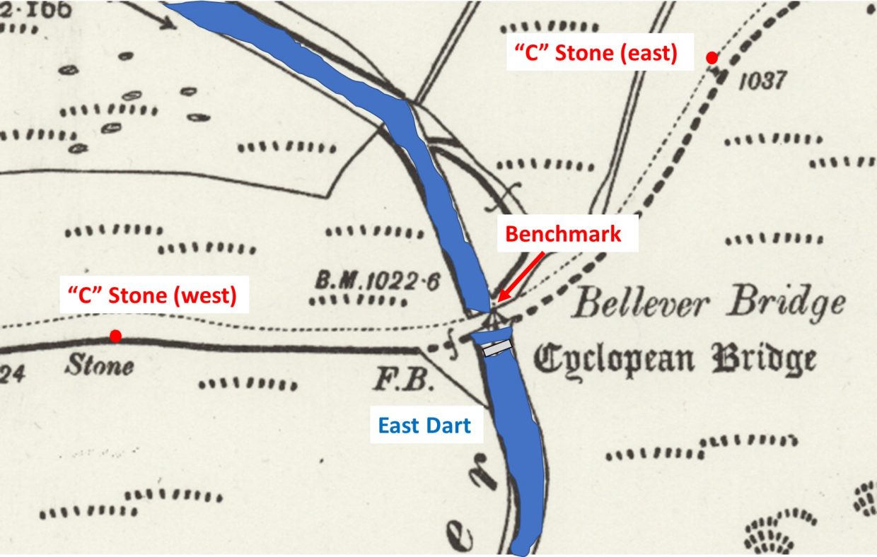
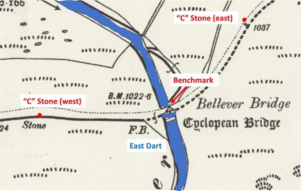
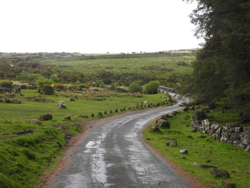
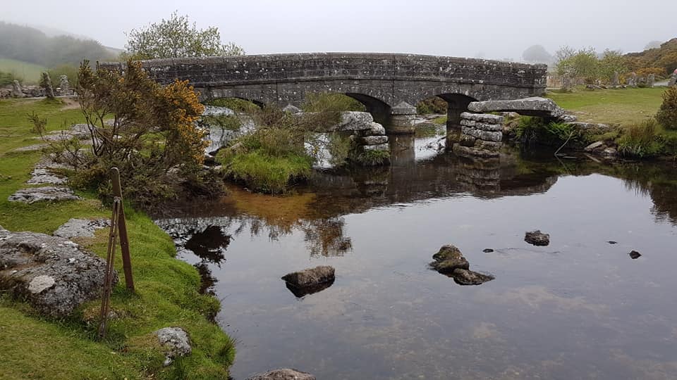
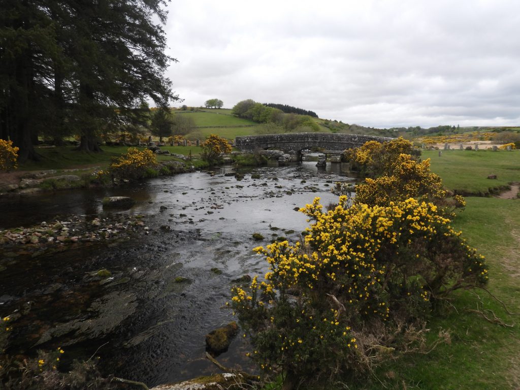
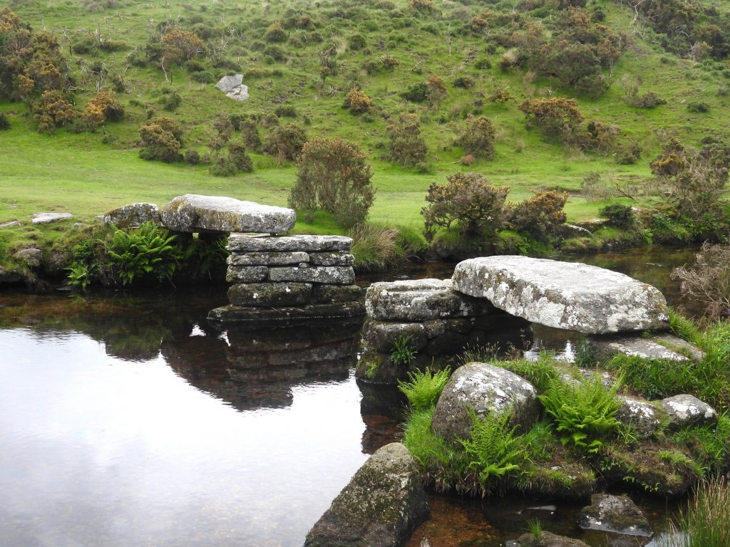
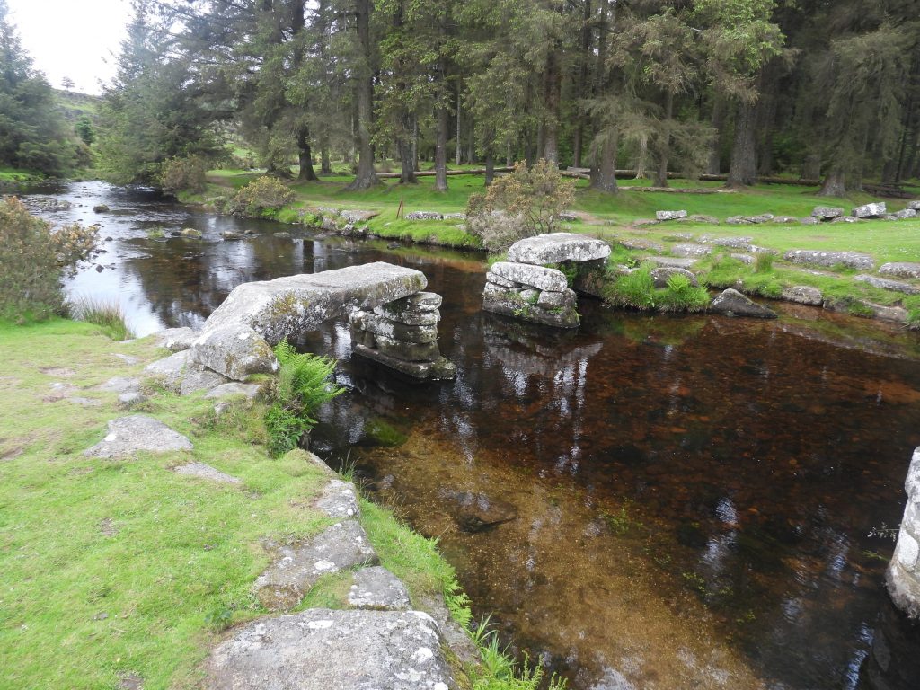
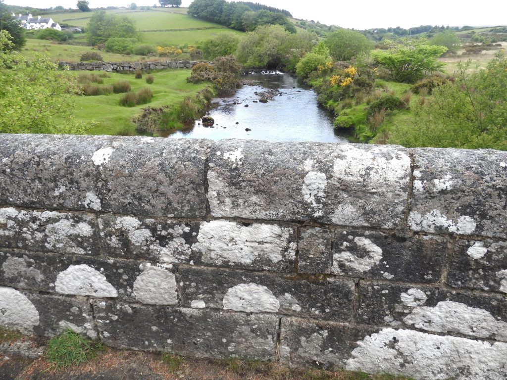
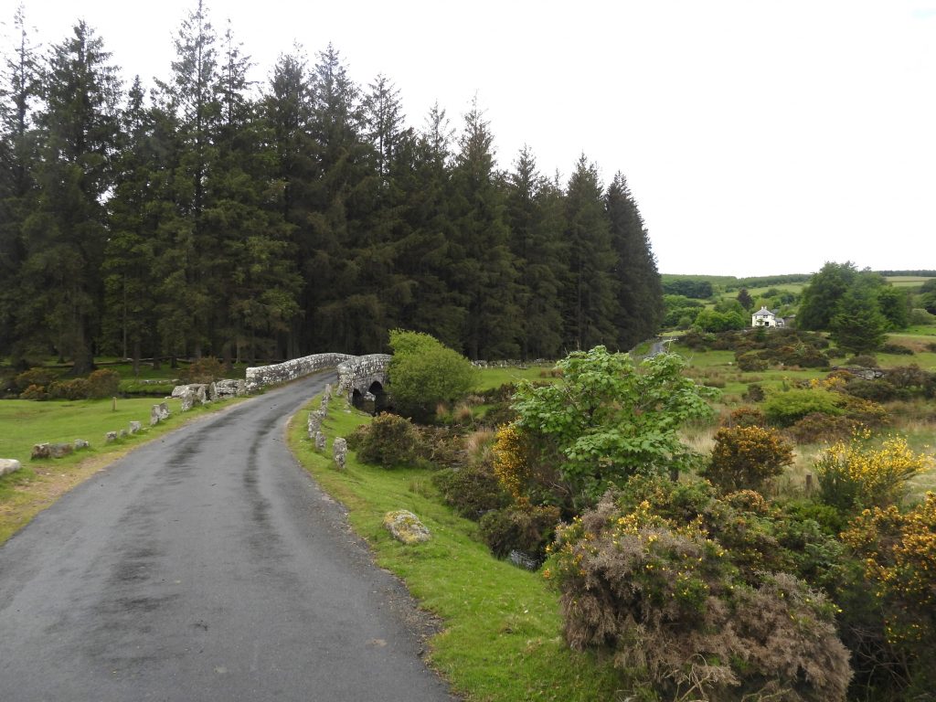
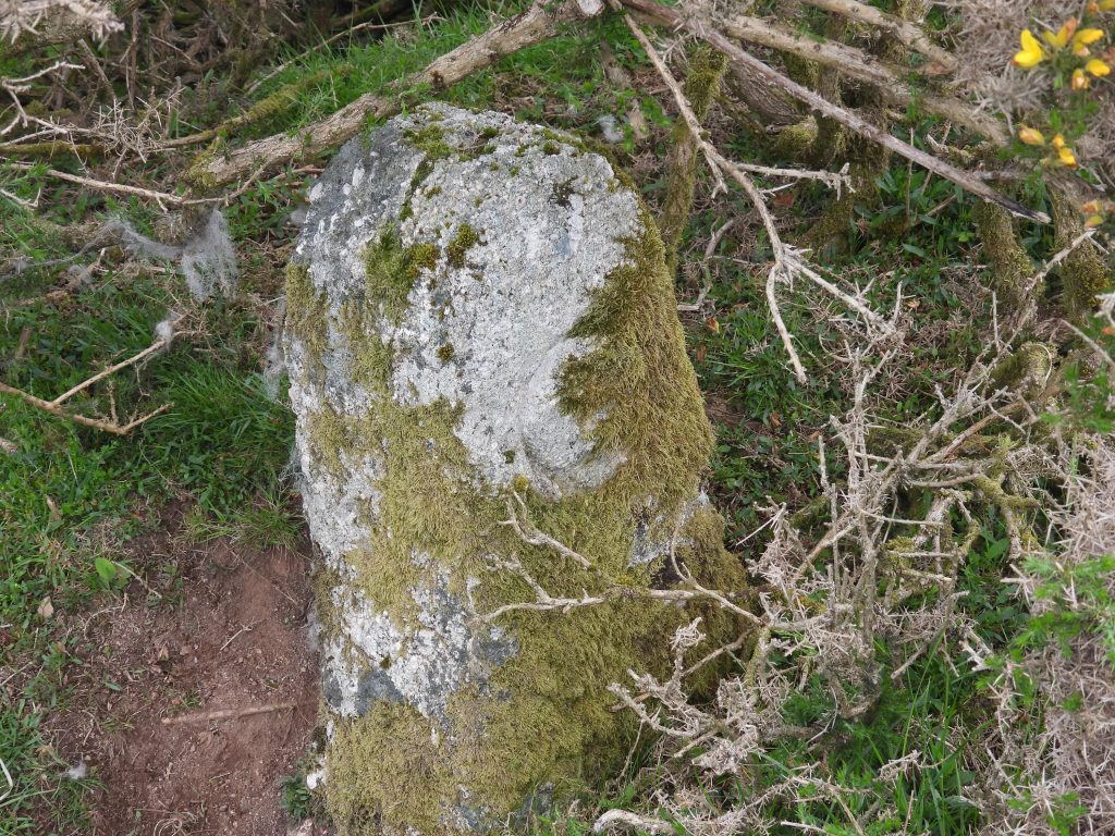
Bellever Bridge spans the East Dart and lies close to the hamlet of the same name. Bellever was formerly called Bellaford and was one of the ancient tenements to be found in this part of the moor. The current bridge dates from the early 19th century and is located alongside the remains of a medieval clapper bridge (or Cyclopean Bridge) which formerly carried the Postbridge to Widecombe track over the river. As with many bridges across the moor (and county) there are two “C” (for County) inscribed stones approx 100m from each end of the bridge identifying that the county was responsible for maintaining the bridge and approaches between the two stones. As with many bridges on the moor, there is a benchmark located on the bridge.
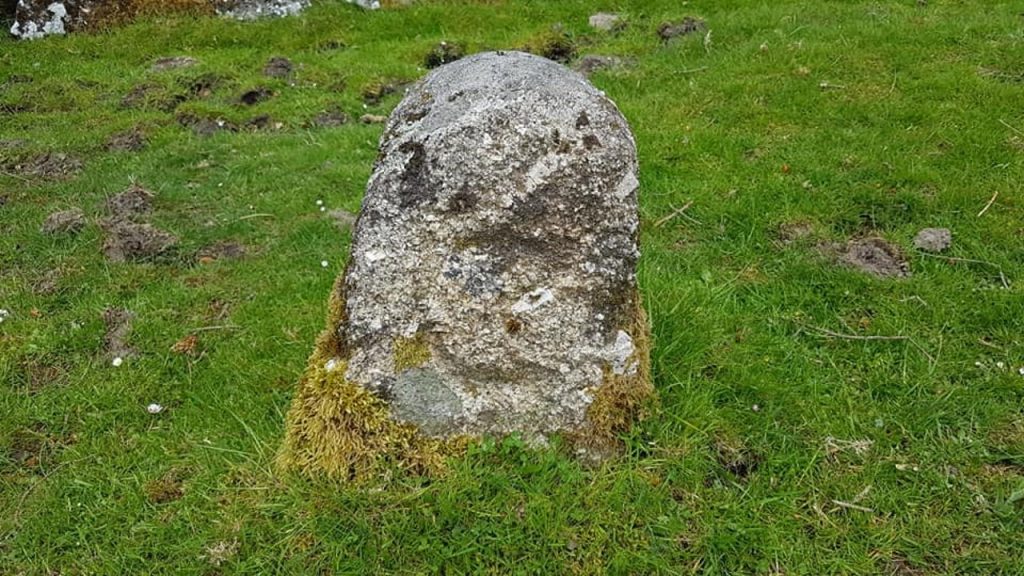
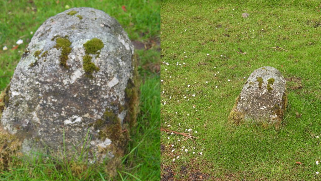
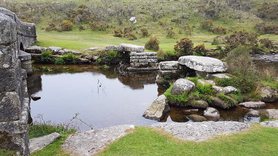
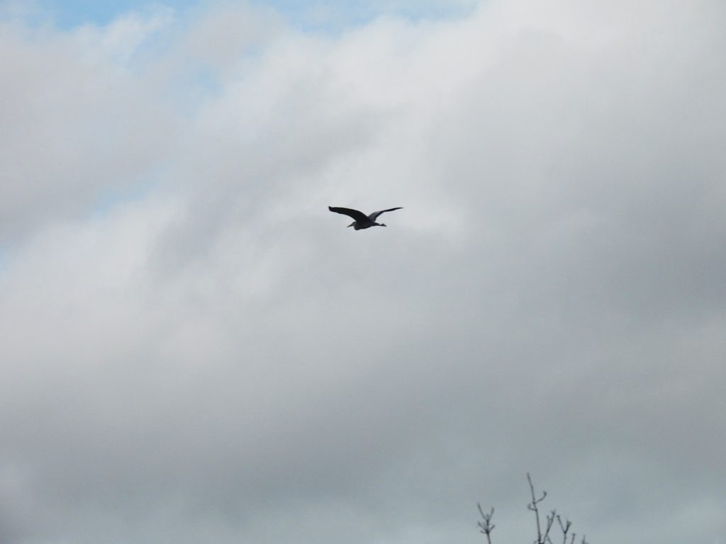
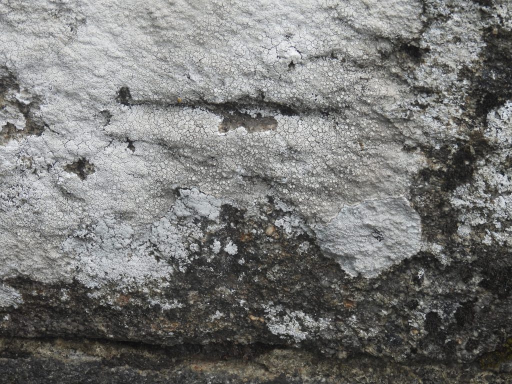
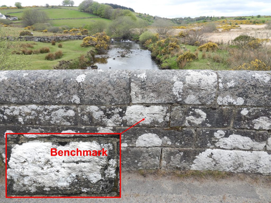
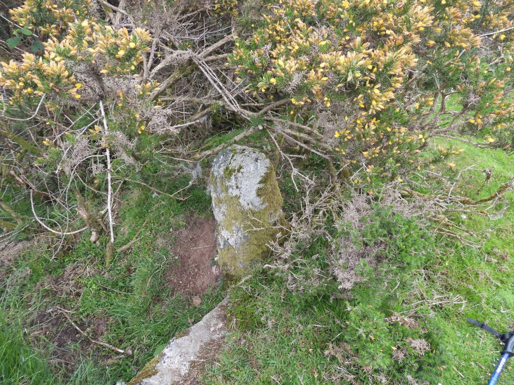
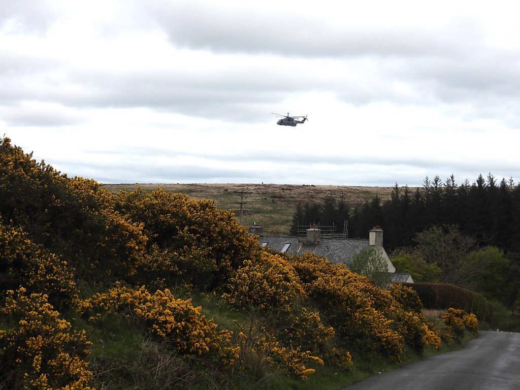
Bellever Bridge and environs from 19th century map. The eastern “C” stone wasn’t marked on the map and the clapper bridge was called a Cyclopean Bridge.The western most “C” stone is located on the south (forest) side of the road and is easy to miss as there is a row of standing stone here, presumably to prevent motorists parking or using the verge. The history of these stones dates from 1841 when Devon magistrates decided that the limits of their responsibility were to be marked by these boundstones “for 300ft on either approach should be similarly maintained”. Bellever Bridge “C” (County) Stone West is located at SX65737 77339The western approach to Bellever Bridge.The Clapper (Cyclopean) Bridge originally had four spans but only two preserve their lintels today. English Heritage state that this bridge is likely to have been on the medieval track known as the Lich (or Lych) way which led from the Ancient Tenements on the Forest to Lydford.The old and the new reflected in the East Dart. It is recorded in Amery, J. S., 1916 – 1917, The Chapel at Tor Royal, Part 1, 182 (Article in Serial) that the “modern” bridge was built at Bellever to “allow the Vicar of Widecombe to take services at the new Princetown church”. Source: Dartmoor HER.The author remembers walking the Lych Path (the “Way of the Dead” from Widecombe to Lydford) overnight in December 1990. On that occasion, whilst crossing the bridge, one of his walking companions dropped his torch into the river between the two bridges. To some amusement, the group watched the torch light slowly get dimmer and dimmer before it was finally extinguished after a couple of minutes. The group joked that the torch followed the “way of the dead” that night.The author believes there was probably four original slabs here with a central slab and a western slab on the side connecting the west bank to the rest of the bridge now missing.In the publication by Henderson, C. and Jervoise, E., Old Devon Bridges (1938), it is stated that the clapper bridge, in 1809 was still being used for foot passengers, but by about 1850 the central stone slab was missing. Source: Dartmoor HER. What happened to the central slab stone is unrecorded.Heron caught flying over the bridge(s) Benchmark on the north side of the bridgeClose up of the benchmarkThe benchmark reference number is B.M. 1022.6 (ref 19th century map) and is located at SX65843 77341The eastern approach to the Bellever bridge.The eastern most “C” stone is located on the north side of the road under a gorse bush. These county stones are “usually” about 3 feet high (there are exceptions to this rule such as at Norsworthy Bridge) with an incised “C” on one of the faces. It is said that at the time each stone cost 7/6d (35.5 pence) each to erect. Source: Legendary Dartmoor.Bellever Bridge “C” (County) Stone East is located at SX65904 77403Helicopter flying over Bellever and the bridge area a few days before Ten Tors weekend
Hi Steve,
I think you’ll find that there never was a central slab. If you look closely at the ends of the slabs (ideally when the sun is shining) you will see that there are three notches that I believe held three beams bridging the central section across which I guess planks would have been laid.
Regards, Nigel
Actually – I’ve just zoomed into your photos. I remembered wrong – the three notches that held the beams across the central span can be seen in the supports (not the slabs).
Nigel Machin June 2, 2022
Hi Steve,
I think you’ll find that there never was a central slab. If you look closely at the ends of the slabs (ideally when the sun is shining) you will see that there are three notches that I believe held three beams bridging the central section across which I guess planks would have been laid.
Regards, Nigel
Nigel Machin June 2, 2022
Actually – I’ve just zoomed into your photos. I remembered wrong – the three notches that held the beams across the central span can be seen in the supports (not the slabs).