A collection of walks, discoveries, insights and pictures of exploring Dartmoor National Park
August 25, 2026
Monastic Homestead on Dean Moor (usually submerged by Avon Reservoir)
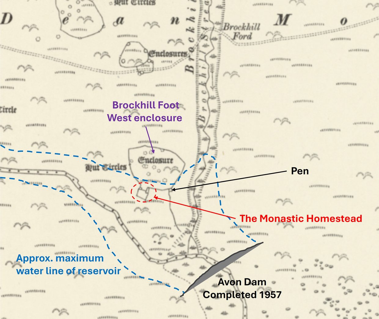
With the prolonged drought in the Summer of 2026, the water level of Avon reservoir dropped significantly enough to enable a ‘Monastic Homestead’ to be uncovered and to be explored. It is shown on old 19th century maps as a rectilinear structure to the south east of ‘Brockhill Foot West enclosure’ (a name penned by Jeremy Butler in the 1990’s in his Dartmoor Atlas of Antiquities – The South East). When the reservoir is full the homestead is normally around 30m from the waters edge.
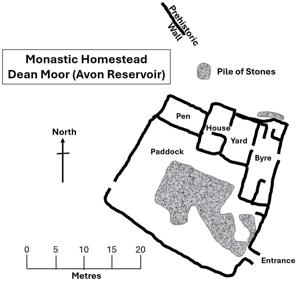
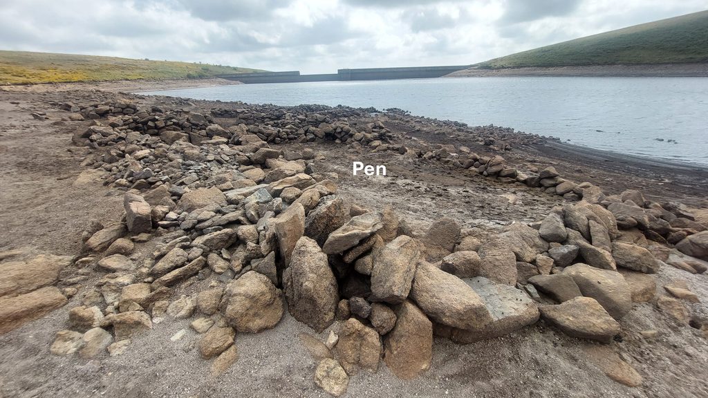
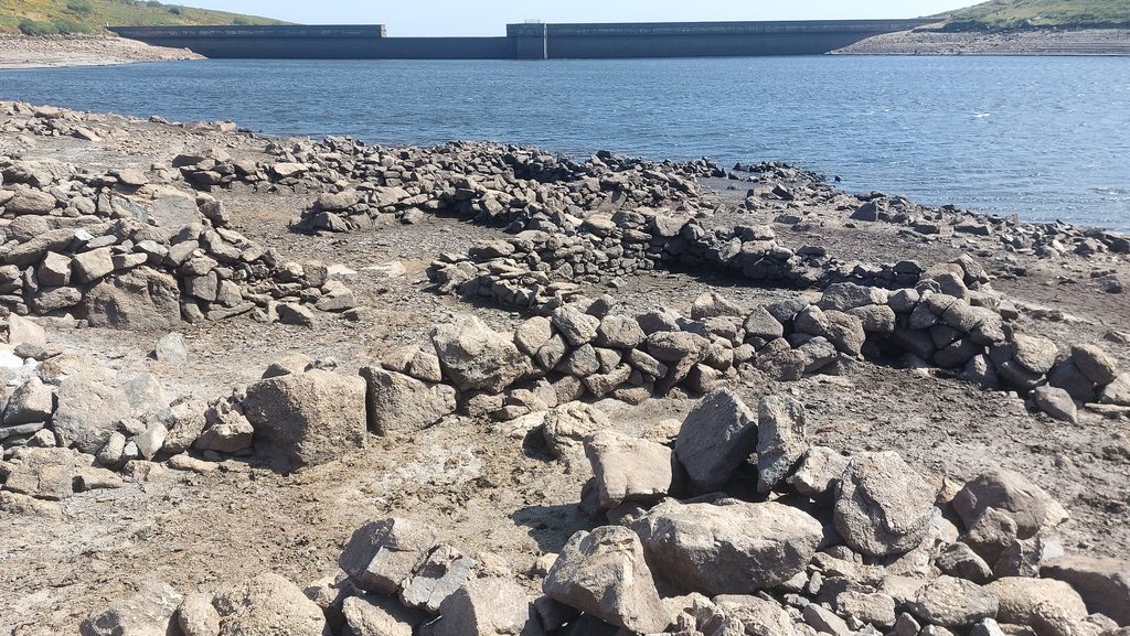
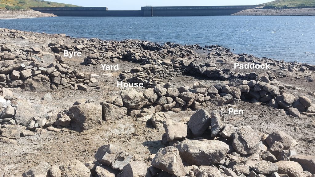
The homestead was excavated under the direction of Lady Aileen Fox* in 1956, before it was inundated with water from the River Avon as a result of the construction of the Avon Dam (which was completed in 1957). The homestead comprises four main compartments connected to a common northern wall and has an entrance to a southern courtyard (or paddock) in the south-east wall. The four main compartments are labelled ‘byre’, ‘yard’, ‘house’ and ‘pen’ with the ‘paddock’ to the south. The homestead is thought to date to the Medieval period an covers an area of some four acres.
During excavations in 1956, large numbers of artefacts (including pitchers, bowls, pots and even cider flasks) were identified and provided evidence of occupation during the 13th and 14th centuries (thought to be dated circa 1250-1350). One of excavators at this time suggested the site had once been occupied seasonally (transhumance). There is documentary evidence (Fox) that the homestead may have been run by a lay brother of Buckfast Abbey, hence it has been recorded as a ‘Monastic Homestead’. The conjecture is that the homestead was probably deserted around the time of the Black Death (1348-1349) having been occupied for around a century. Henry Walbrook, the last of the lay brothers is said to have set fire to the house as they departed for the final time (Butler). This post considers the ruins of the homestead and other features nearby which had been exposed by the receding waters in August 2026
Lady Aileen Fox – (1958) – A Monastic Homestead on Dean Moor, S. Devon, 141-157, plan (Article in Serial). SDV137725.
Jeremy Butler – (1993) – Dartmoor Atlas of Antiquities: Volume Four – The South-East, 147-150, Map 57, Figure 57.16 & 57.17
Helen Harris – (1968) – Industrial Archaeology of Dartmoor, page 138
Josephine Collingwood – (August 2026) – Dartmoor Information Exchange Facebook
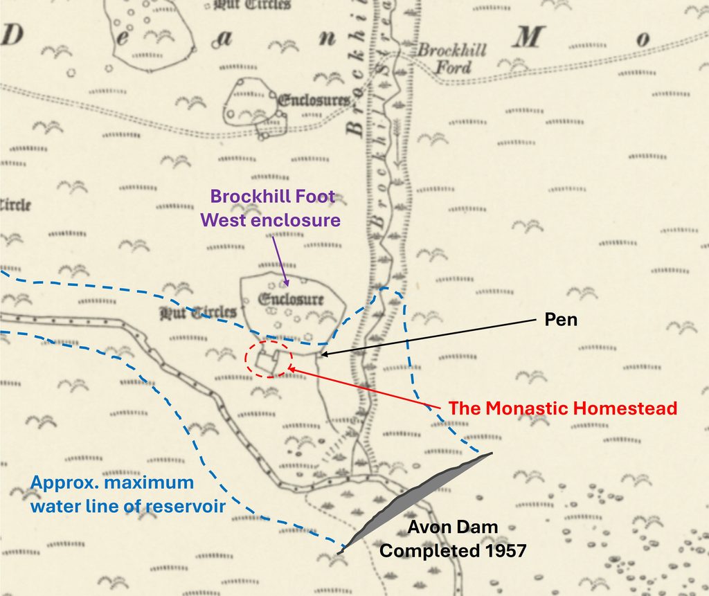
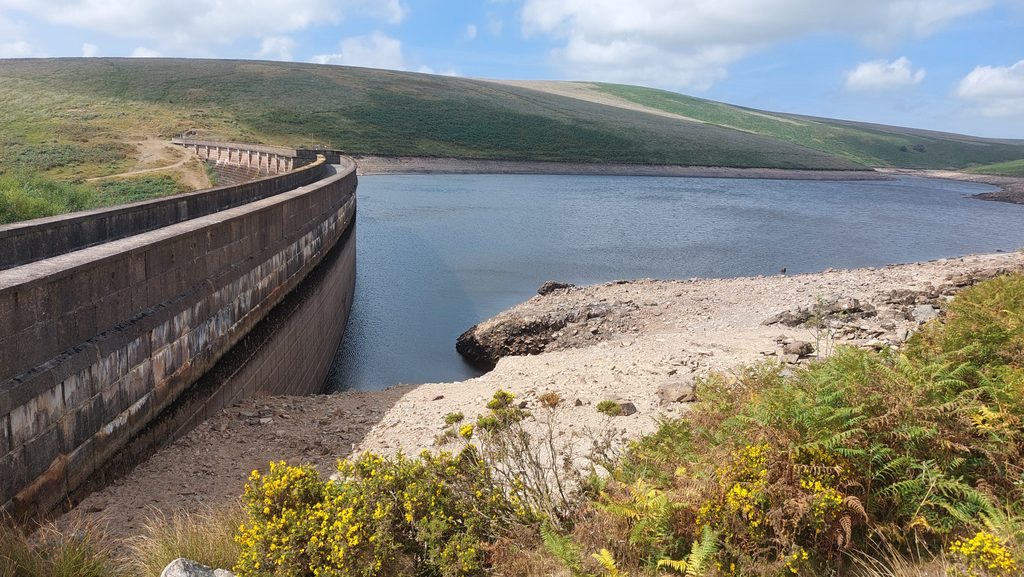
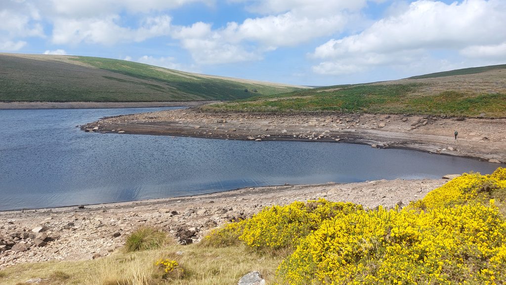
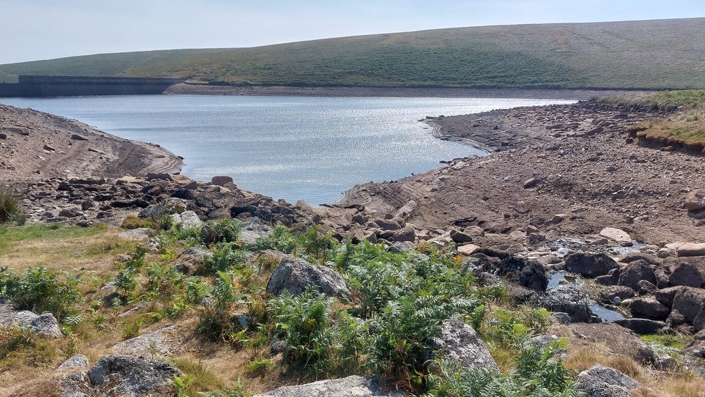
This annotated late 19th century map shows the location of the Monastic Homestead in relation to the Avon Dam and the extent of the reservoir when it is full. The north edge of the homestead is a at least 30 metres from the maximum water level shorelineThe dam on the Avon river was proposed in 1948 and approved by the government in 1950. Construction began in 1954 and was completed in 1957 (albeit some sources state 1959). The concrete gravity wall rises to the spillway, 94ft above the river level. The reservoir can hold 305 million gallons. The Dam has a total length of 870ft (265m), in plan it is 1200ft (365m) radius. The spillway is 120ft (36.5m) – the data was extracted from High Dartmoor by Eric Hemery (page 327).There is a small ‘bay’ at the foot of Brockhill Stream. The Monastic Homestead is just around the corner of the promontory shown in the pictureLow water conditions at Brockhill Stream Foot
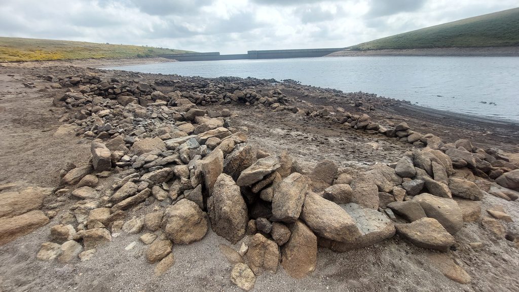
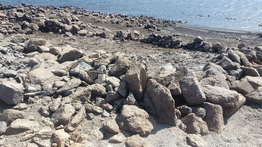
Walking the exposed shoreline this small ‘pen’ can be found. It lies to the south-east of ‘Brockhill Foot West enclosure’ at the junction of a boundary running south-east and the enclosure boundary (see annotated map in this post). It is shown on 19th century maps at SX67793 65394
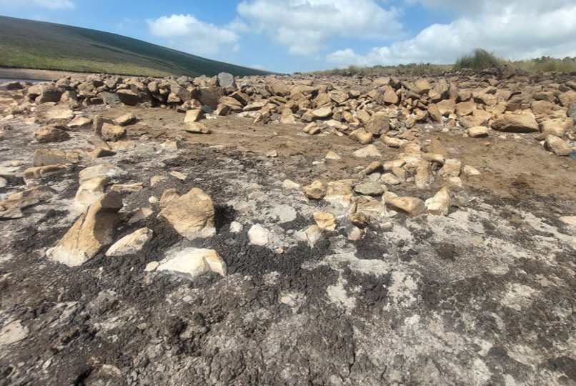
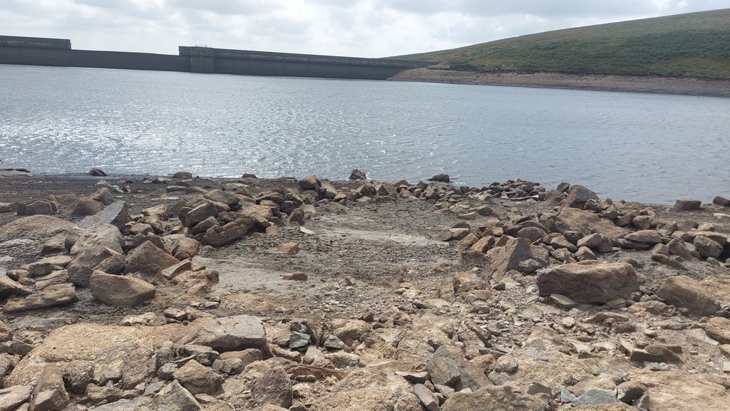
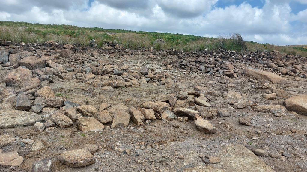
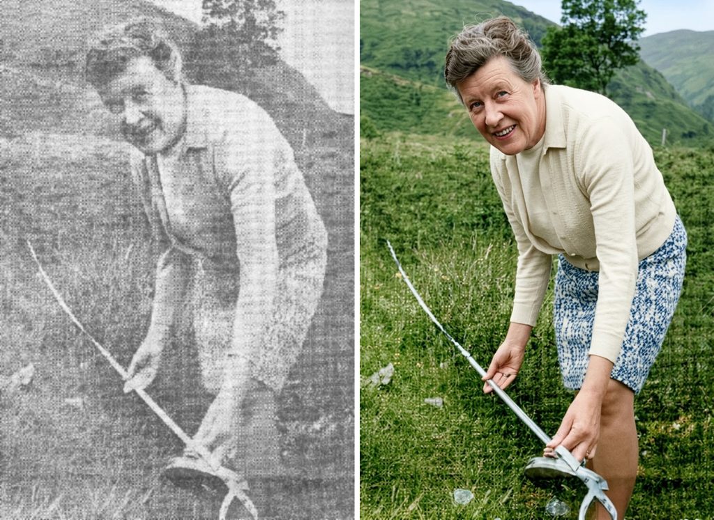
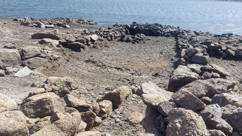
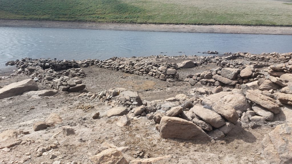
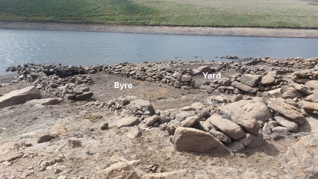
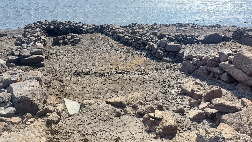
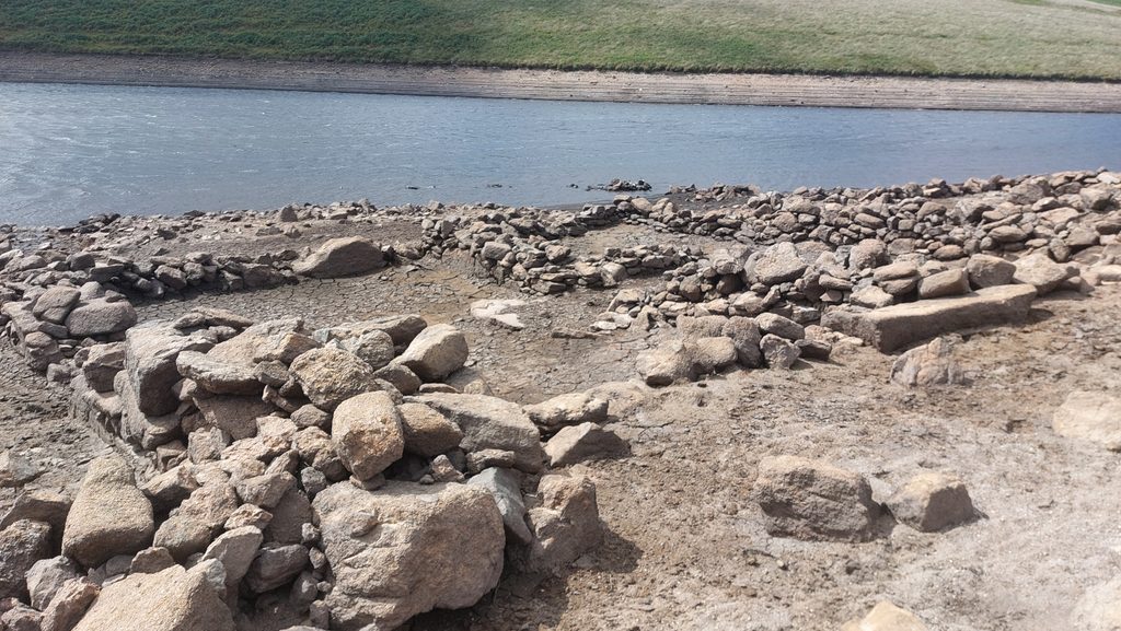
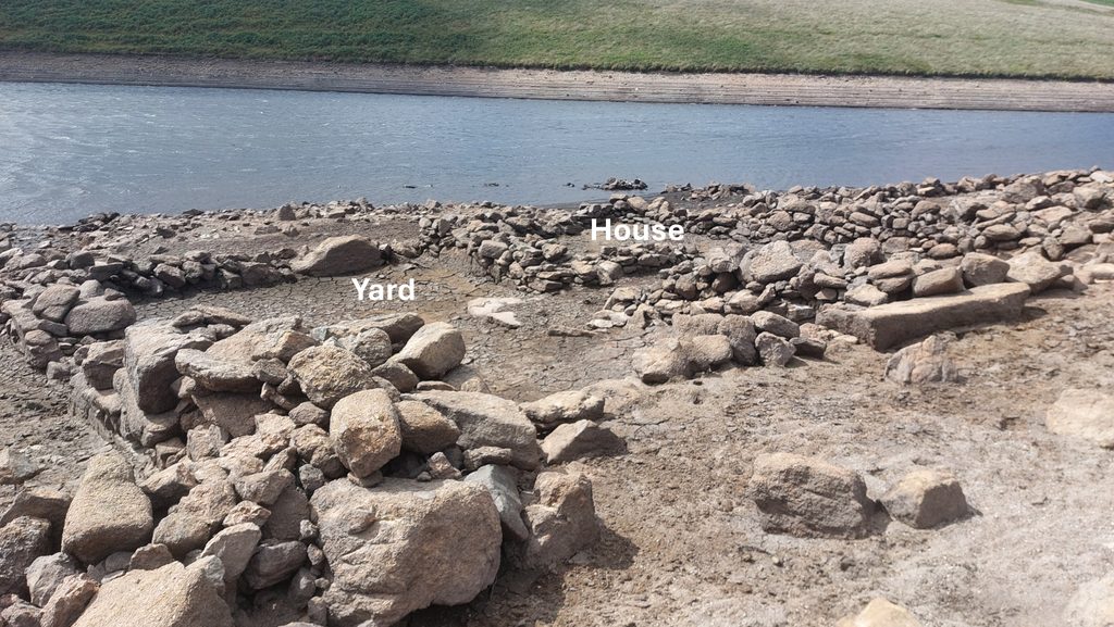
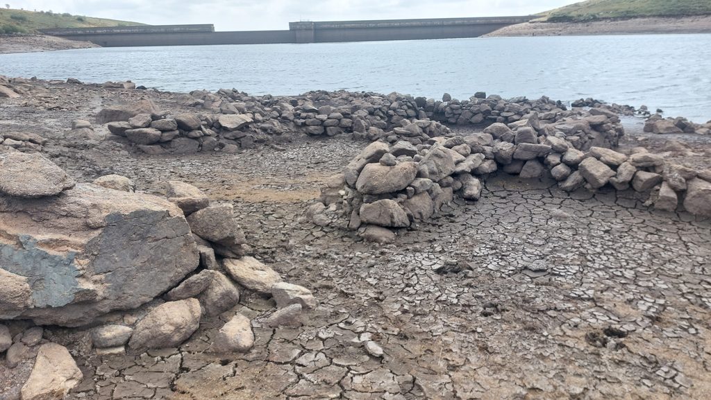
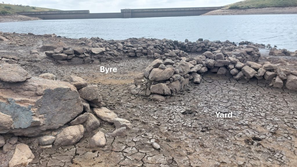
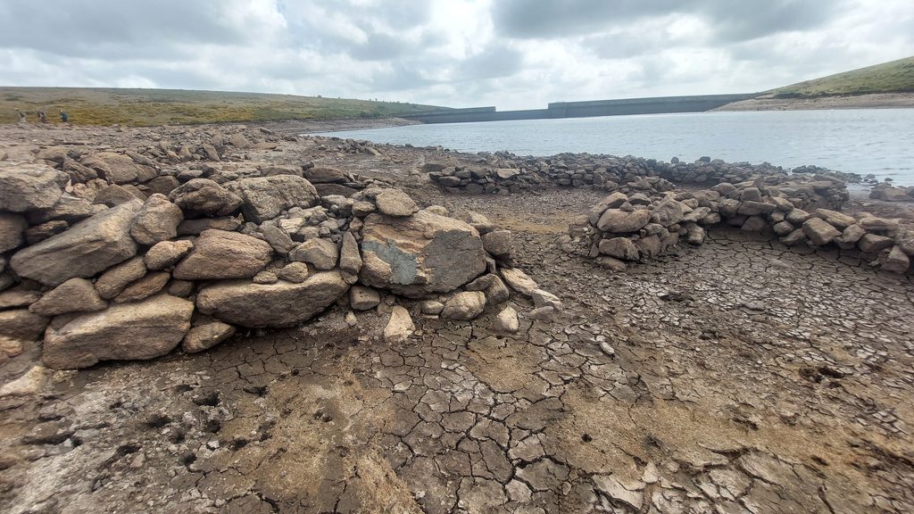
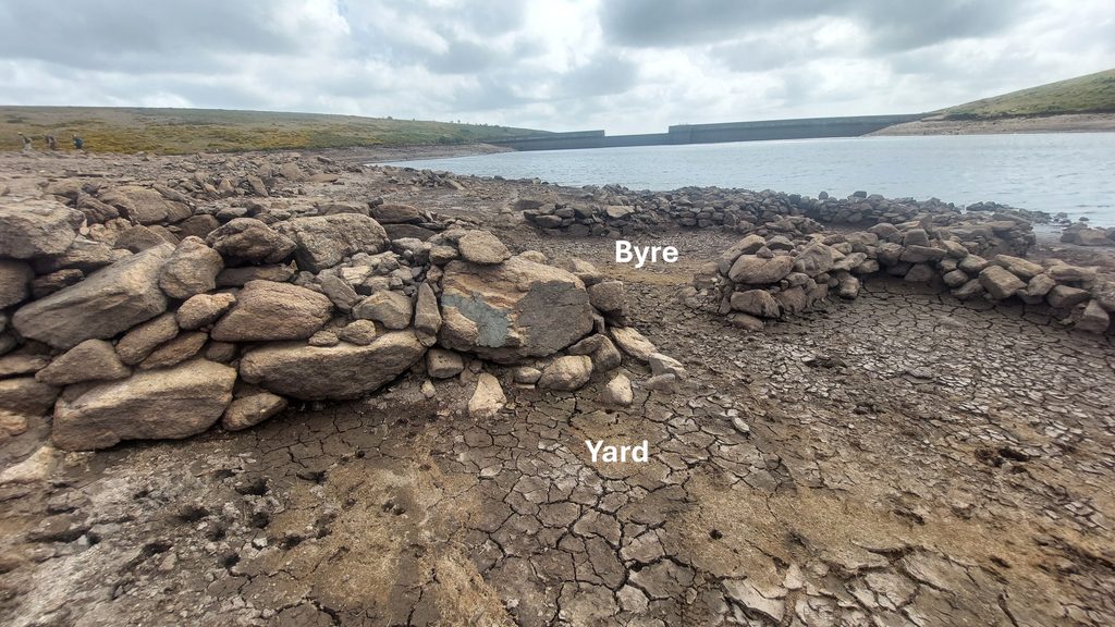
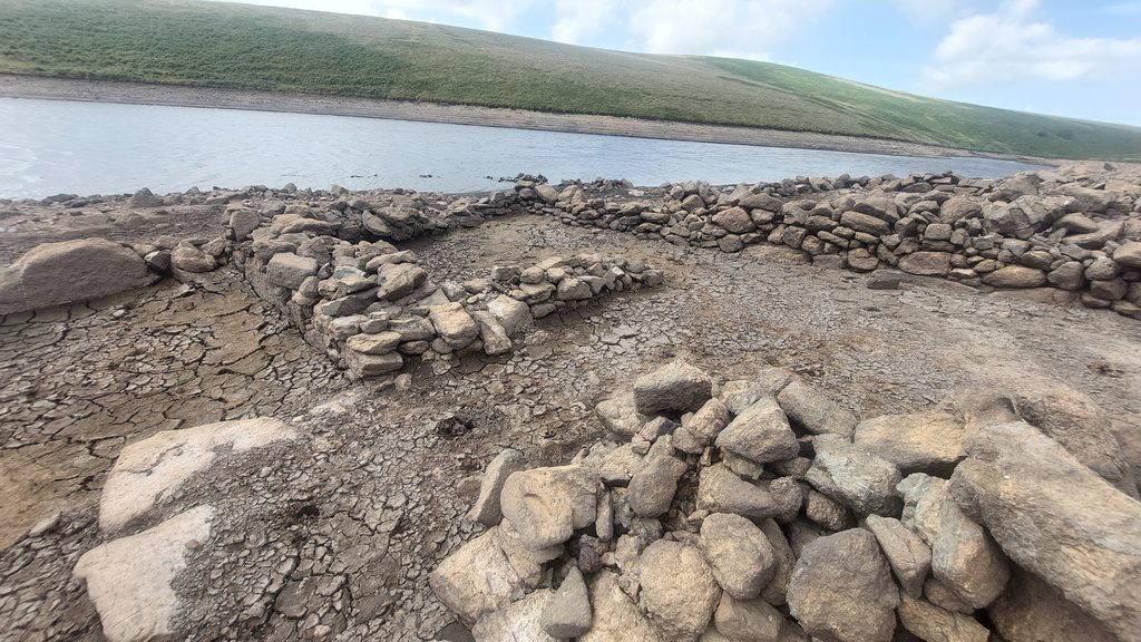
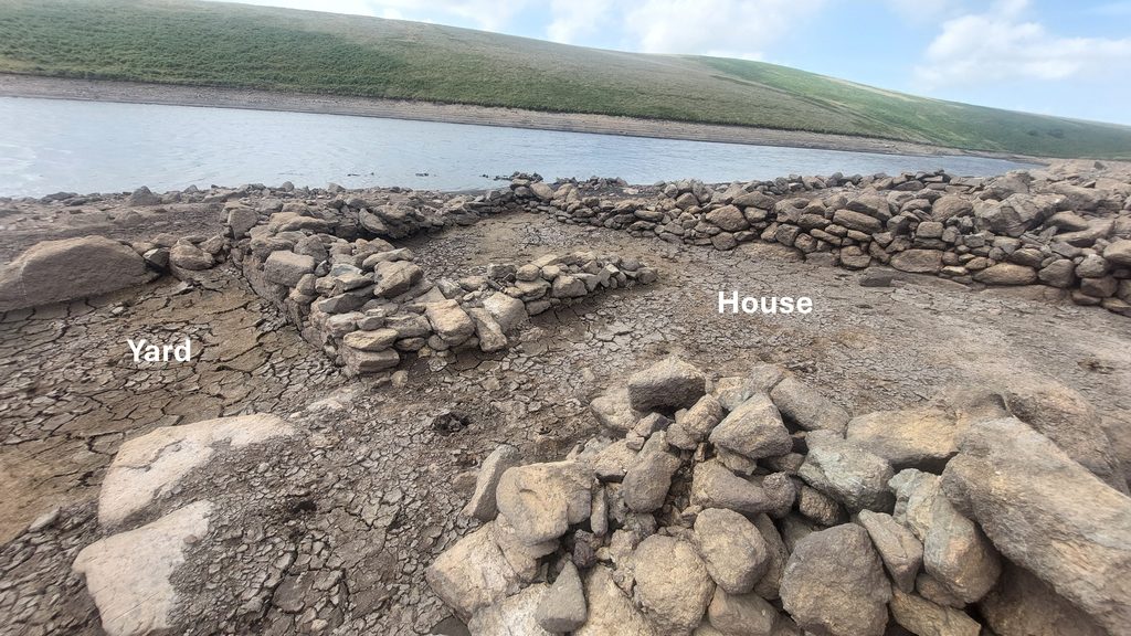
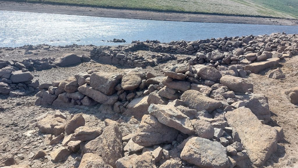
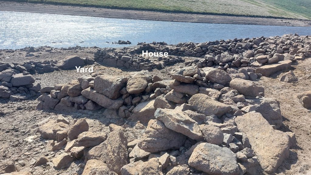
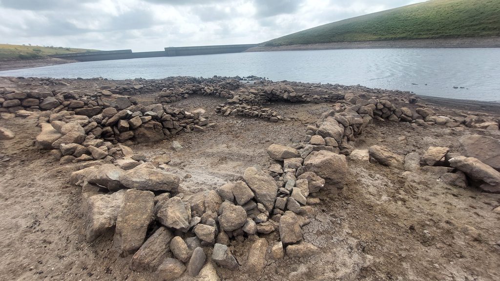
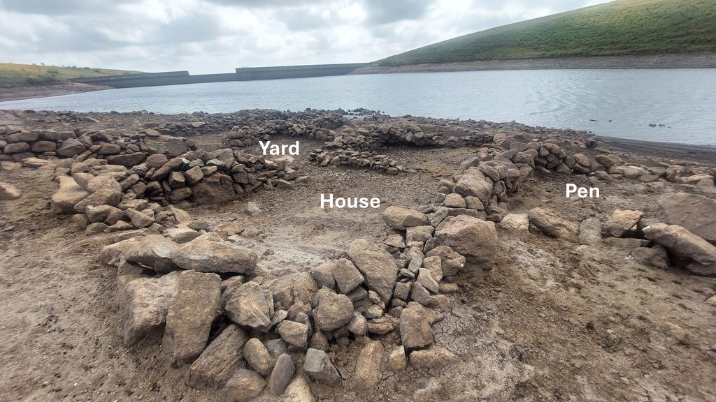
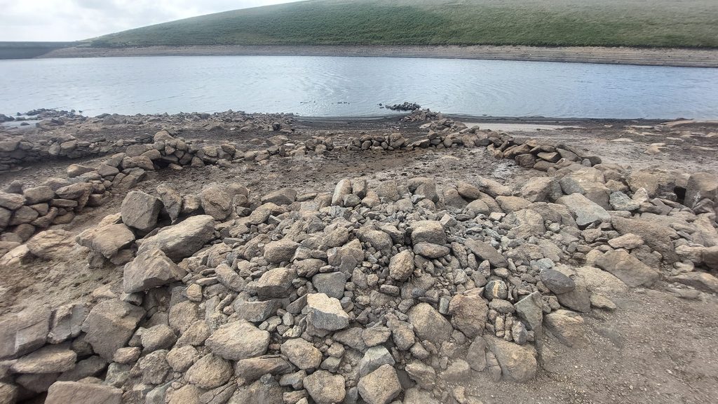
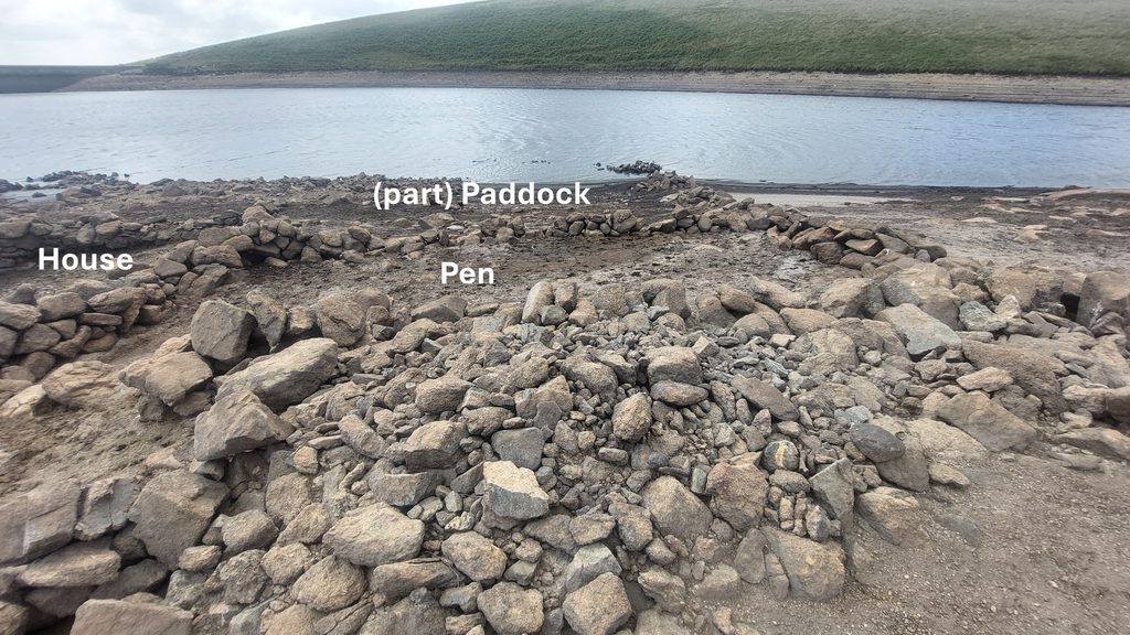
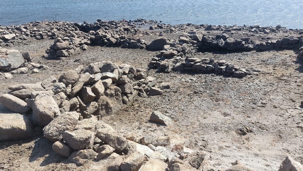
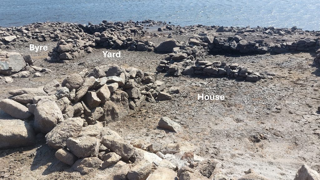
Walling leading south east from the ‘pen’Walling of Brockhill Foot West Enclosure. This is possibly either Hut Circle ‘8’ or Hut Circle ’13’ as described by Jeremy Butler in his Dartmoor Atlas of Antiquities (South East) on page 149. Unfortunately the author forgot to record a NGR for this location so cannot confirm. On the balance of probabilities this is probably Hut Circle ‘8’ which is circa 7.4 metres diameter and is the only building with a substantial interior wall separating off an inner room to the north. Onto the Monastic Homestead. The above sketch is based on figure 57.17 on page 150 of Jeremy Butler’s Dartmoor Atlas of Antiquities (South East). In August 2026, the ‘byre’, ‘yard’, ‘house’ and ‘pen’ were all exposed due to the drop in water level of the reservoir. Parts of the ‘paddock’ were also visible. All structures were built with drystone granite walling. The approx. location between the ‘yard’ and the ‘house’ is SX67725 65388 Lady Aileen Fox (29th July 1907 – 21st November 2005) who made major contributions to the archaeology community in South West England (as well as New Zealand)The ‘byre’. It measures 15m (n-s) and 4.3m (e-w)A ‘byre’ was effectively a longhouse, in which the living quarters are combined with the livestock and/or grain barn under the same roof. It is of typical Dartmoor longhouse form with opposing entrances.Annotations of the previous photograph. The ‘byre’ opposing entrances lead from outside the homestead (east) and into the ‘yard’ (west)Looking down the long axis of the ‘byre’ approx from north to south. The ‘yard’ is to the west (right)The ‘byre’ west entrance lead into the ‘yard’ and then the two roomed ‘house’Annotations of the previous photograph showing the ‘yard’ and the ‘house’ (two-roomed)Another view of the ‘yard’ (foreground) and ‘byre’ (background)Annotations of the previous photograph showing the entrance between ‘yard’ and the ‘byre’Another view of the ‘yard’ and the ‘byre’Annotations of the previous photograph showing the ‘yard’ and the ‘byre’The entrance between the ‘yard’ on the left (east) and the two-roomed ‘house’ on the right (west)Annotations of the previous photograph showing the ‘yard’ and the ‘house’.Overlooking the ‘yard’ and the ‘house’Annotations of the previous photograph showing the ‘yard’ and the ‘house’Overlooking the ‘yard’, ‘house’ and ‘pen’Annotations of the previous photograph showing the ‘yard’, ‘house’ and the ‘pen’The ‘pen’ and part of the ‘paddock’ from the pile of stones (as shown in the sketch in this post)Annotations of the previous photograph showing the ‘pen’ and the (part) ‘paddock’. There does not appear to be an obvious entrance into the ‘pen’The ‘pen’Annotations of the previous photograph showing the ‘pen’Another view of the ‘pen’. Lady Aileen Fox recorded this as “a shed or pen butted up against the west side of the house”General view of all the main features within the Monastic Homestead – the ‘pen’, the ‘house’, the ‘yard’, the ‘byre’ and part of the ‘paddock’Annotations of the previous photograph showing all the main features within the Monastic Homestead – the ‘pen’, the ‘house’, the ‘yard’, the ‘byre’ and part of the ‘paddock’. Lady Aileen Fox conjectured that “The house may originally have been divided into living room and animal byre, with the separate byre being a later addition”.The ‘house’, ‘yard’ and ‘byre’. The house is clearly divided by a cross wall, which would have separated the upper storage (or sleeping quarters) in the foreground from what is thought to have been the kitchen in the lower chamber. During excavations charcoal around the hearth were identified as oak as were what remained of timber fittings (Butler)Annotations of the previous photograph showing the ‘house’, the ‘yard’, the ‘byre’
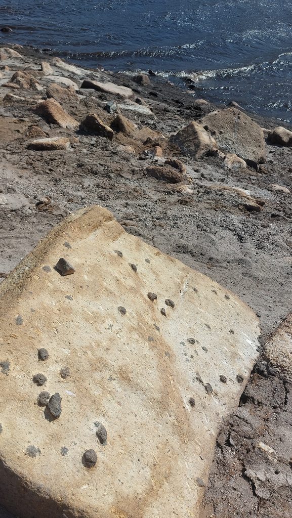
A short distance to the west of the Monastic Homestead, numerous granite rocks with intrusions can be found. Josephine Collingwood answering a request for information through the Dartmoor Information Exchange Facebook page explains: “The large feldspar crystals (milky white) clearly visible. The remaining quartz and mica components of the granite are fine grained like aplite (later fine grained granite intrusion) but with the feldspars it makes me think it has undergone secondary heating (possibly radiogenic), leading to feldspar megacrysts@.
Josephine Collingwood explanation continued: “The black crystals are almost certainly tourmaline nodules, formed when granite is altered and some alkaline feldspars and biotite mica are altered forming tourmaline (black schorl)”