A collection of walks, discoveries, insights and pictures of exploring Dartmoor National Park
June 19, 2026
An exploration of Auswell (Awsewell) Mine
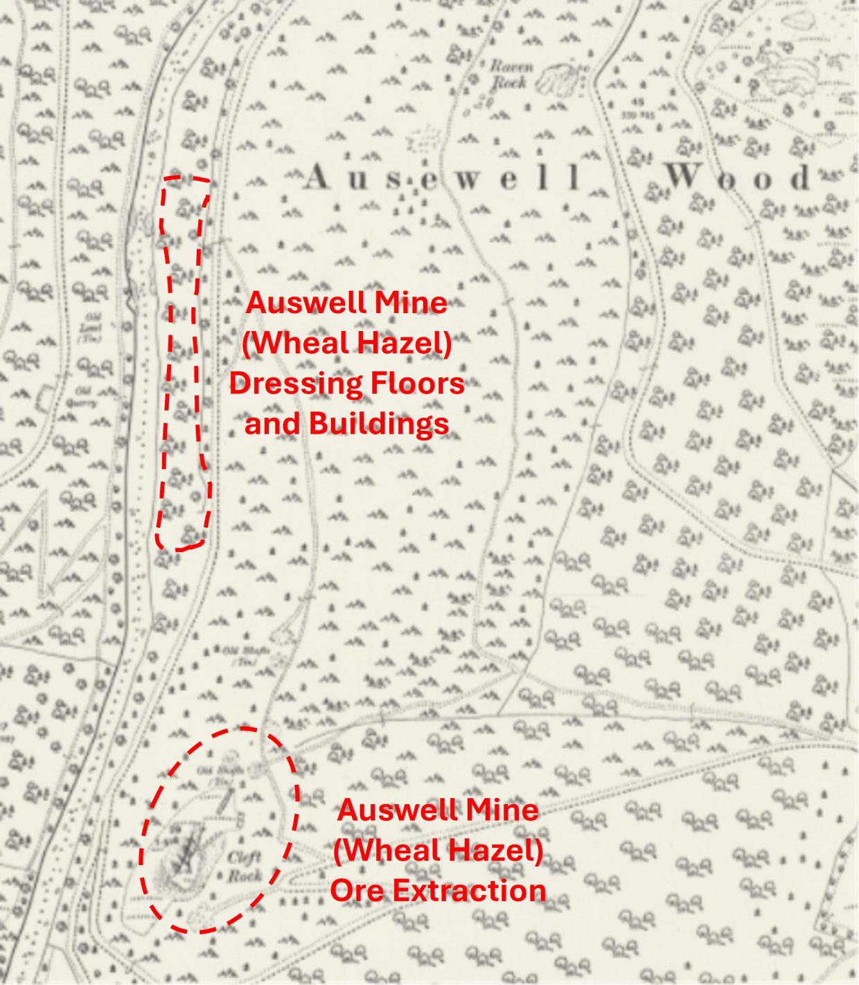
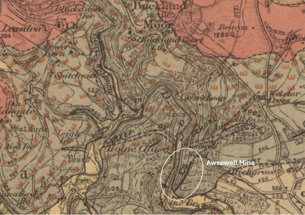
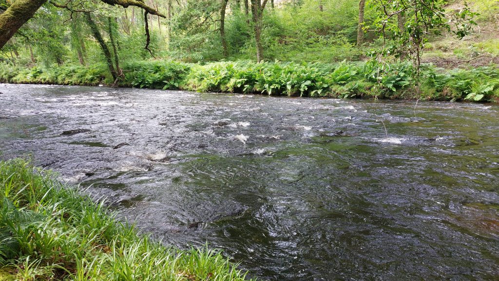
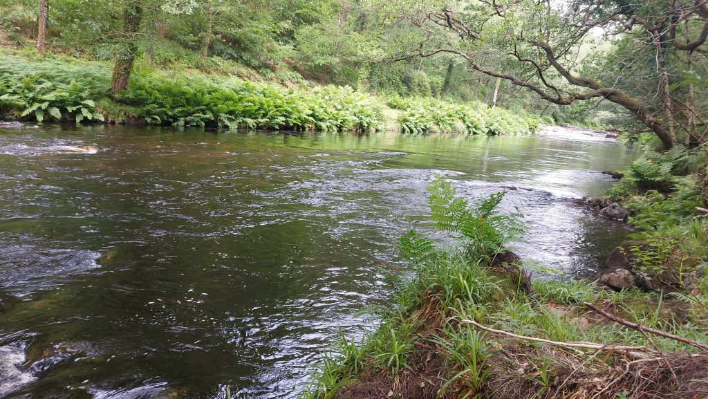
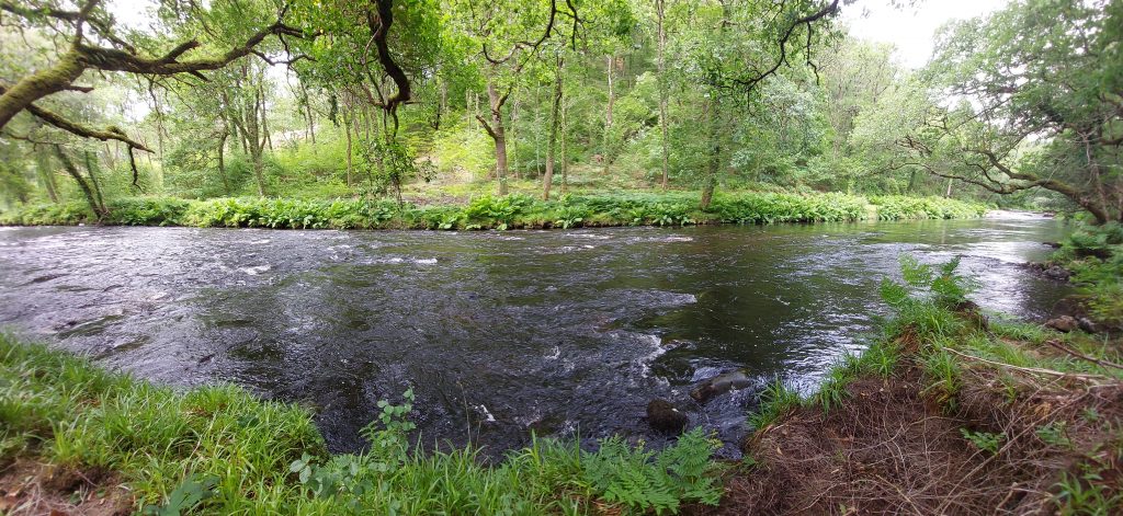
This mine is located high above and adjacent to the left (east) bank of the River Dart, around 1/4 mile north west of Holne Bridge. It comprises two parts; firstly a rocky eminence known as Cleft Rock, were there are two parallel Copper and Iron lodes which extend through the rock and have been developed as open gunnises and shafts nearby and secondly an Iron smelting works and other ore processing features which are located on a narrow strip of alluvium directly adjacent to the River Dart. There is also (a little speculative) evidence that the mine also yielded some Tin.
The history of the mine appears to extend over (at least) 250 years covering 17th to 19th centuries during which time the mine has variously been named as Awsewell, Ausewell, Ausewell wood, Hazwood Mine, or Wheal Hazel. It was originally part of Awsewell Manor, which in the 17th and 18th centuries was owned by absent, Lords, (living in Somerset, and then in Dorset , Hertfordshire and Avon). In 1799, the Manor was sold to the Buckland Estate and with it the mine.
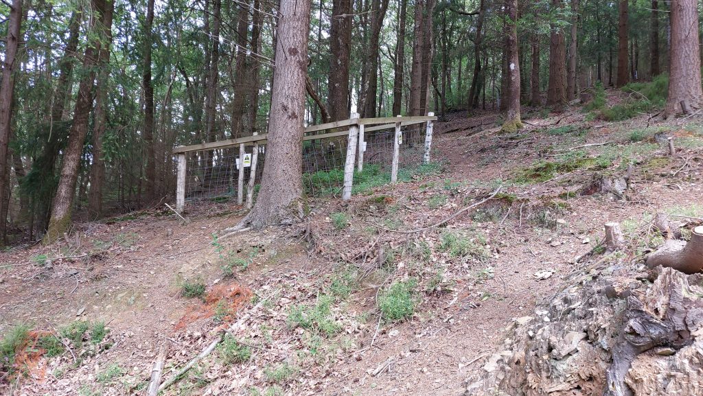
The mine is today (2026) accessible to the public, albeit many sections around Cleft Rock are now fenced off for safety reasons. Access to the site would have originally been via a track from Holne Bridge, but today any visitor must park near Auswell Cross and descend through the woods towards the River Dart. Although there are limited records, of special note is some superb research work conducted by Mike Brown (1997) which was followed by a fabulous survey conducted by Royal Commission on the Historical Monuments of England (RCHME), by Dr Phil Newman whose interpretation of the site has enabled this record of the visit to the site and photographs taken to be appropriately annotated. Our understanding of the mine is further enhanced by a survey conducted in 1725 (by Henrik Kahlmeter) specifically on copper extraction and in 1924 (by John Amery) in his ‘Presidential Address’ Report Transactions Devonshire Association following his excavation of the Iron smelting mill and blast furnace.
Bibliography
Royal Commission on the Historical Monuments of England – (1998) – Auswell Wood ore processing and smelting complex – An archaeological survey (Dr Phil Newman and M. Fletcher)
A.K. Hamilton Jenkin – (2005)– Mines of Devon, Pages 117/8
Mike Brown – (1997) – In Search of Awsewell Mine, an examination of the surviving documentary evidence – Transcripts & Guides for Dartmoor Researchers, volume 19
Henrik Kahlmeter – (1725) – Report and Survey on Awsewell
Geological Survey of England and Wales (Dartmoor Forest) Sheet 338 – 1912
Tom Greeves – (1987) – The Great Courts or Parliaments of the Devon Tinners, TDA 1987
Sherborne and Yeovil Mercury (Newspaper) 1st August 1763
West Devon Record Office – Lease of Awsewell Mine Sett 1791 (Ref 74/696/7)
Brooke Index – Ashburton Parish (transcribed by Dartmoor Chris)
Dartmoor Chris – Pers. Conv.
Paul Glanville – Pers. Conv.
Stephen Holley – Pers. Conv.
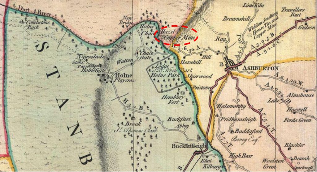
The relative locations of Cleft Rock (Ore Extraction) and the Dressing Floors / buildings adjacent to the Dart (on its left bank)Extract from Benjamin Donn’s Map of Devon dated 1765. The mine was then known as Hazel Copper Mine and must have had some prominence to have appeared on the map. As will be shown later, this map complements the observation of the mine by Henrik Kahlmeter some 40 years earlier, albeit the name changed from Awsewell Mine to Hazel Mine
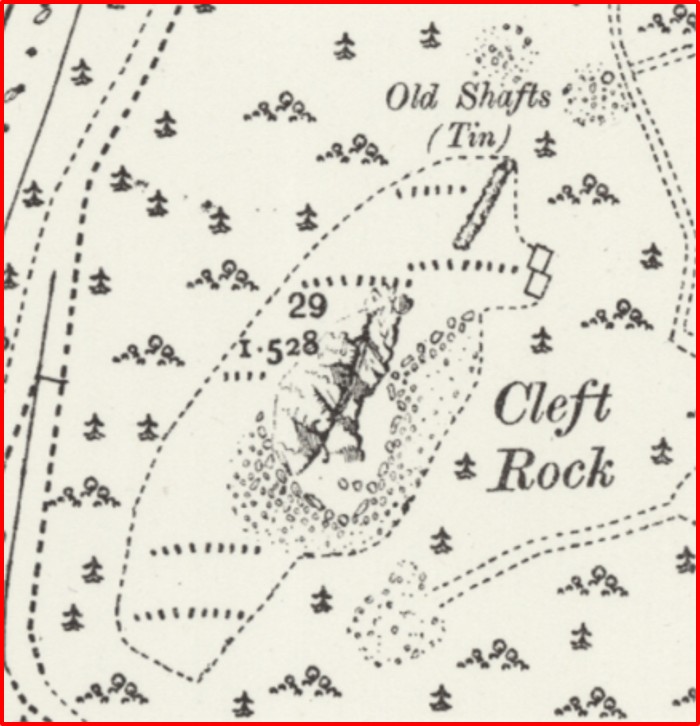
Snippet of 19th Century map of Cleft Rock where Iron and Copper ore were extracted. Of interest is that to the north there are old shafts labelled for Tin
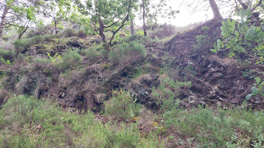
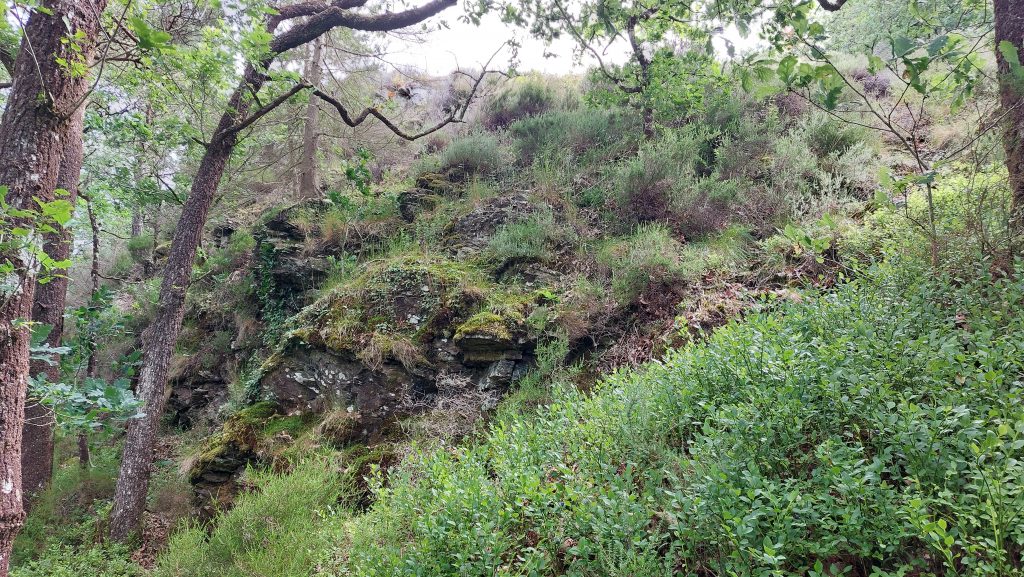
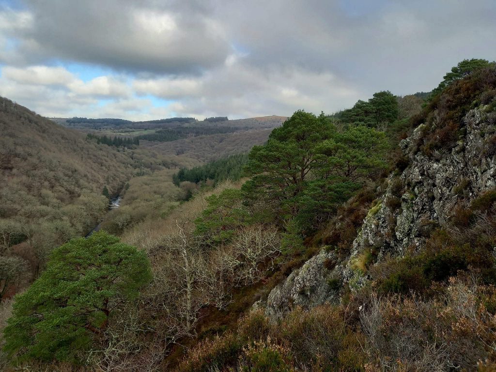
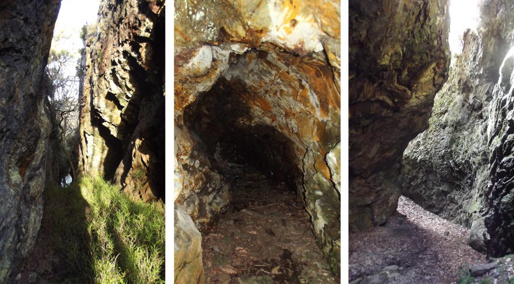
Buildings by Cleft Rock and the old Shafts (Tin). Picture courtesy of Paul Glanville Extract from the Geological Survey of England and Wales (Dartmoor Forest) Sheet 338 – 1912. Awsewell Mine is shown as lying on a Copper Lode (Black Line labelled Cu). Cleft Rock is argillaceous rock* of the Culm Measures (thick sequence of geological strata originating during the Carboniferous Period that occur principally in Devon and Cornwall), now metamorphosed into slates. The rock lies within the metamorphic aureole (rocks that have changed with exposure to heat, pressure, chemicals (minerals)). *Mindat definition: A sedimentary rock composed of clay-grade particles; i.e., composed of minute mineral fragments and crystals less than 0.002 mm in diameter; containing much colloidal-size material. In addition to finely divided detrital matter, argillaceous rocks consist essentially of illite, montmorillonite, kaolinite, gibbsite, and diaspore.South west corner of Cleft Rock from behind safety fenceWest side of Cleft Rock from behind safety fenceOn top of Cleft Rock looking north. Picture courtesy of Paul Glanville
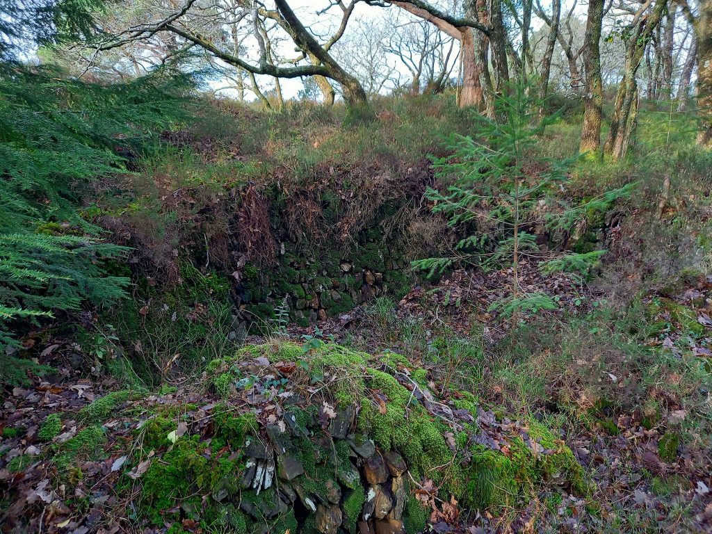
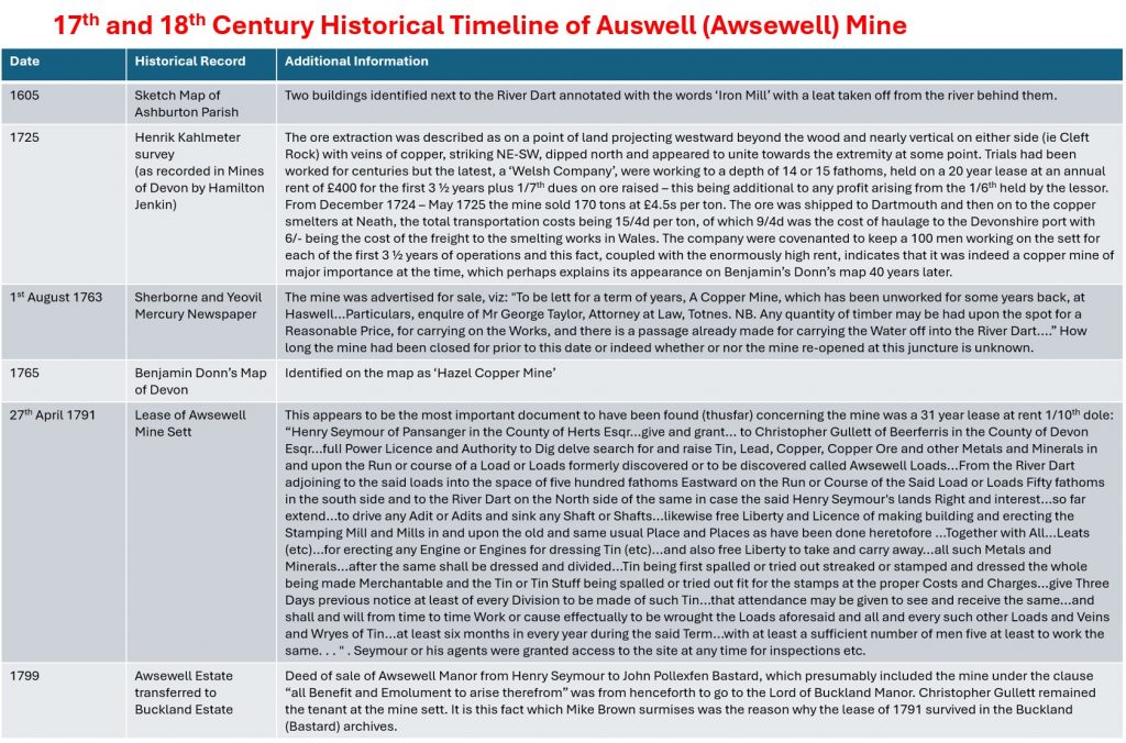
At Cleft Rock gunnis. This and the following three pictures are courtesy of Paul Glanville and were taken before the safety fence was erected
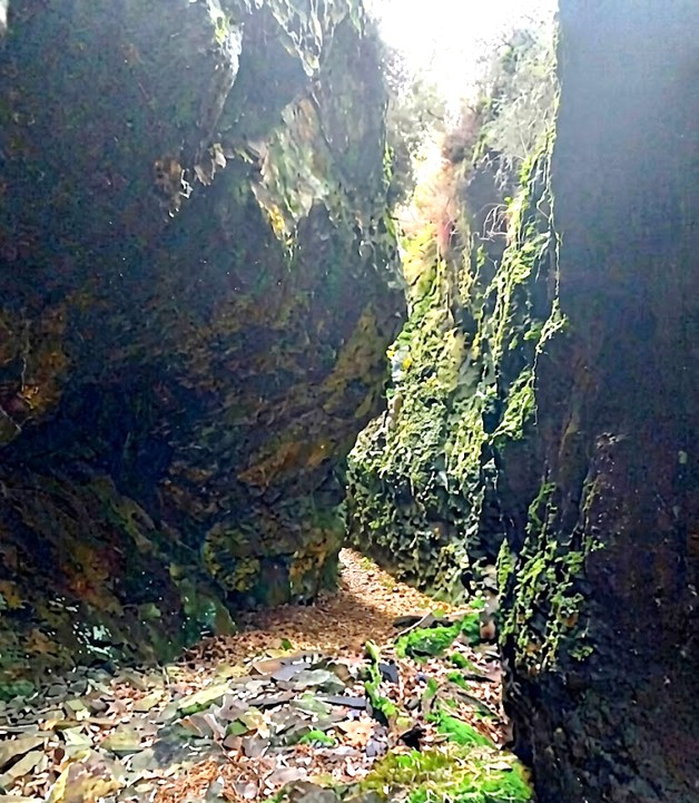
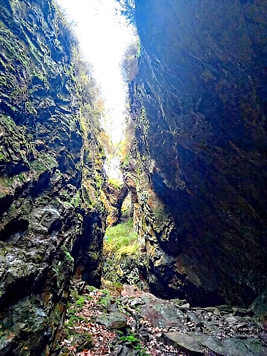
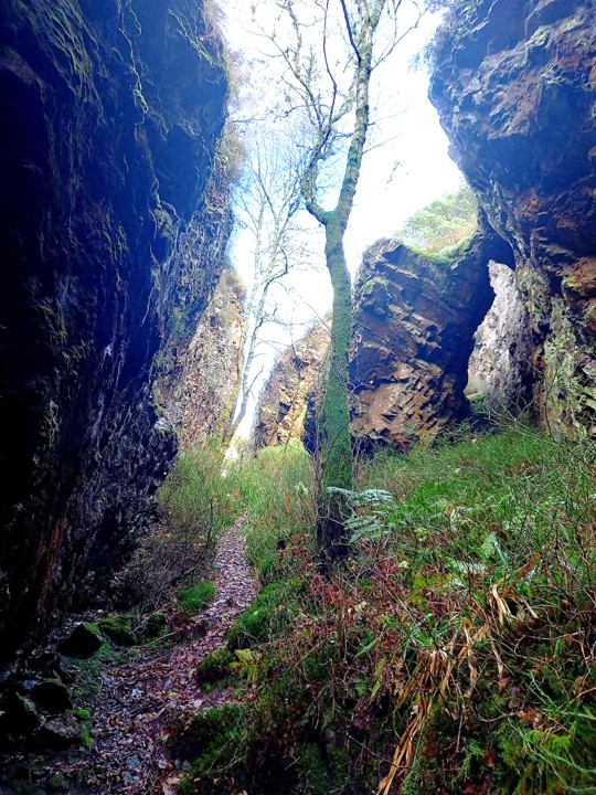
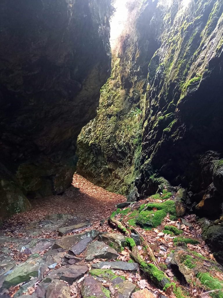
The cleft from whence the outcrop takes its name. There are two main gunnises strike roughly SW-NE, following two parallel lodes or veins. That said, Dines’ refers to a branch lode. His description of the mine is covered later in the post
Path through Cleft Rock
Cleft Rock gunnis, the main feature of the iron and copper mining ore extraction, from argillaceous rock
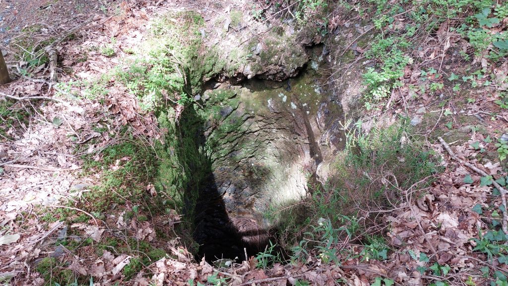
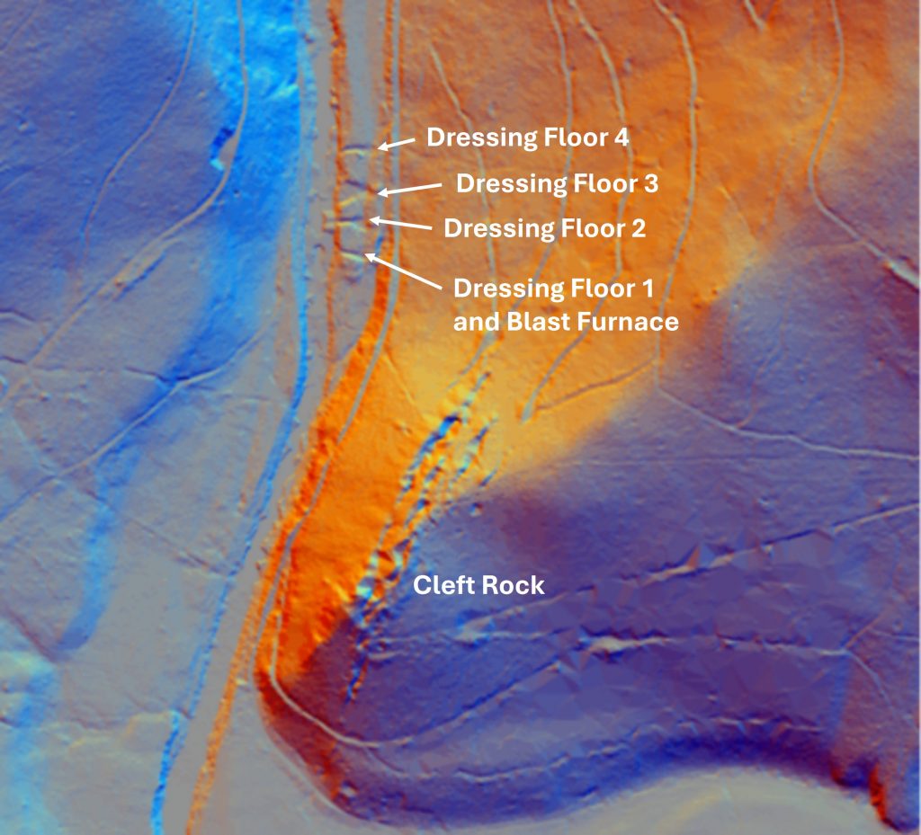
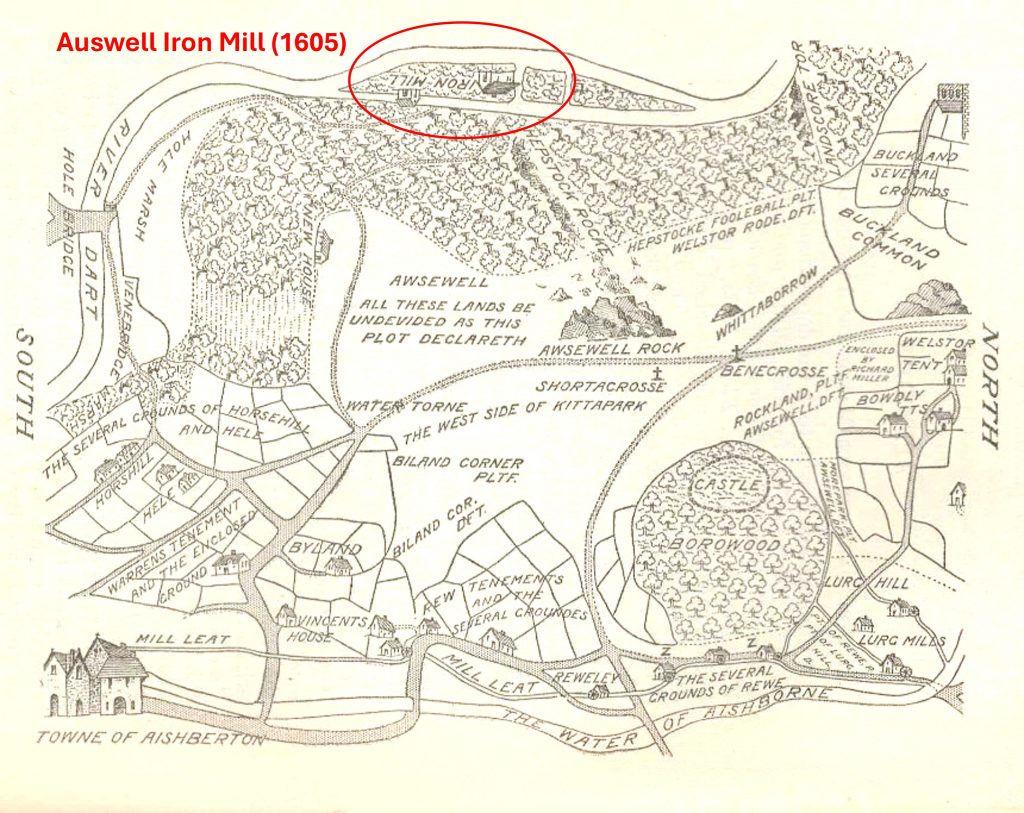
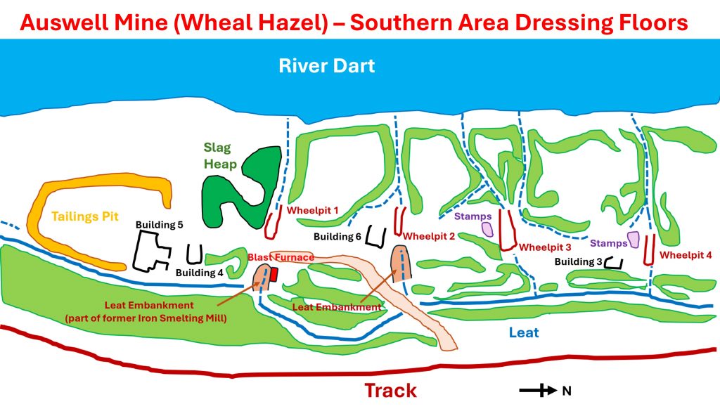
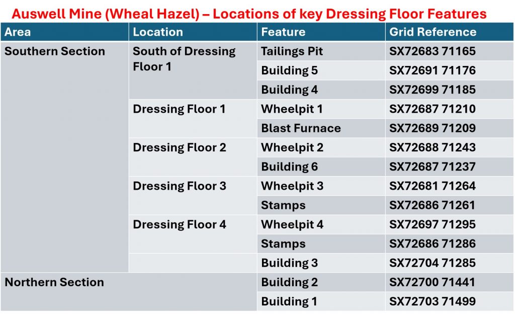
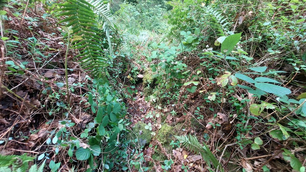
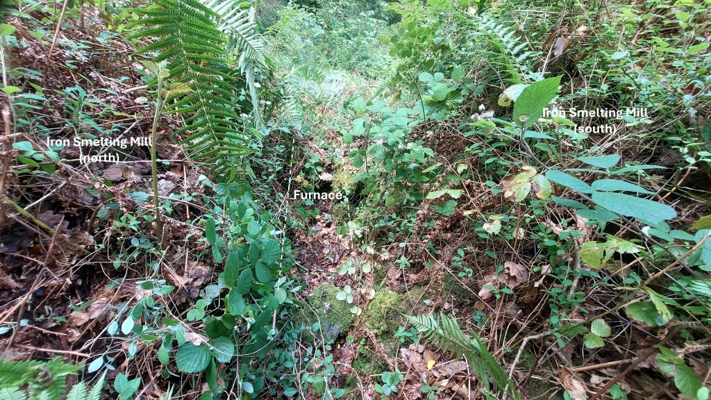
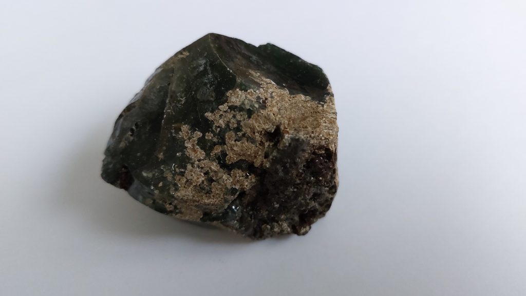
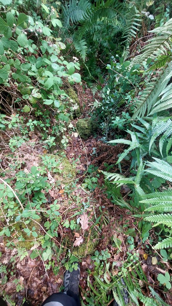
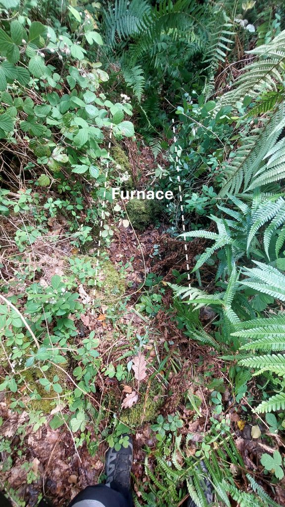
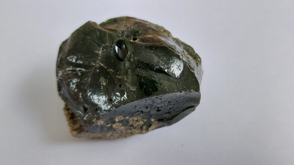
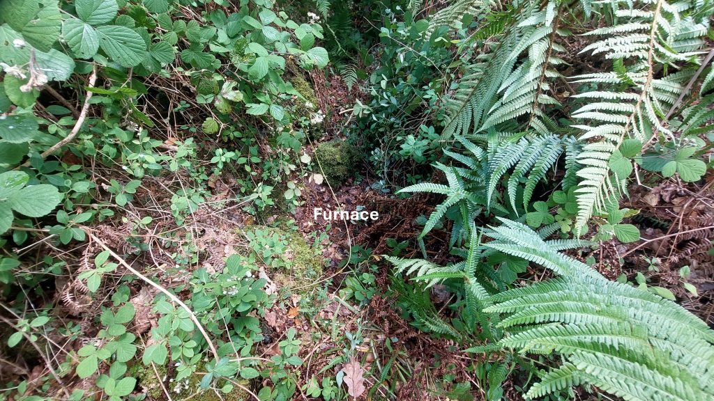
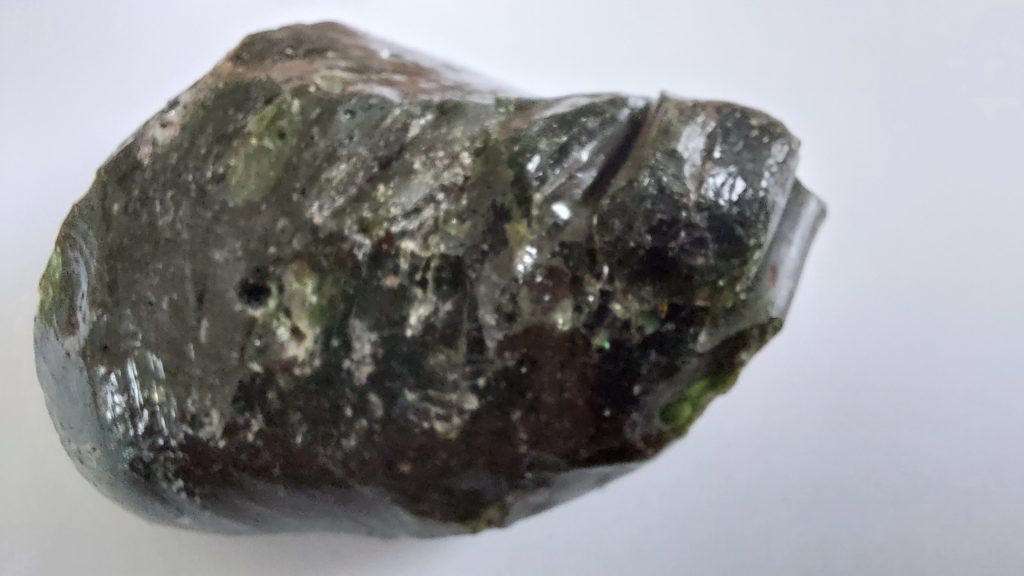
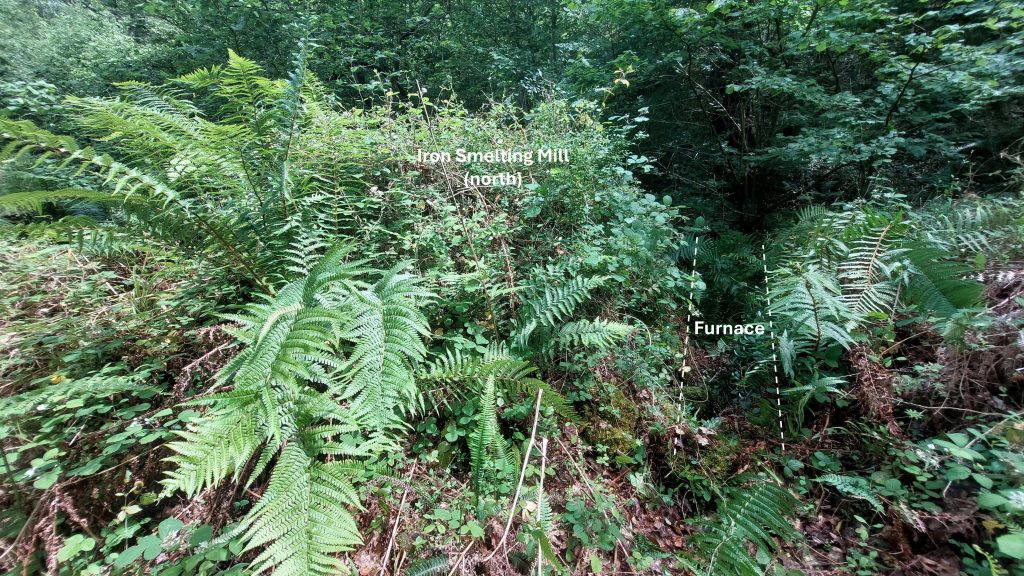
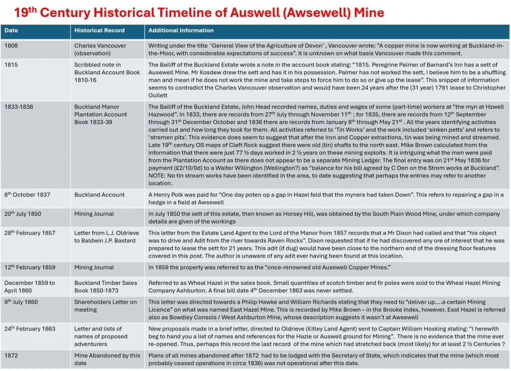
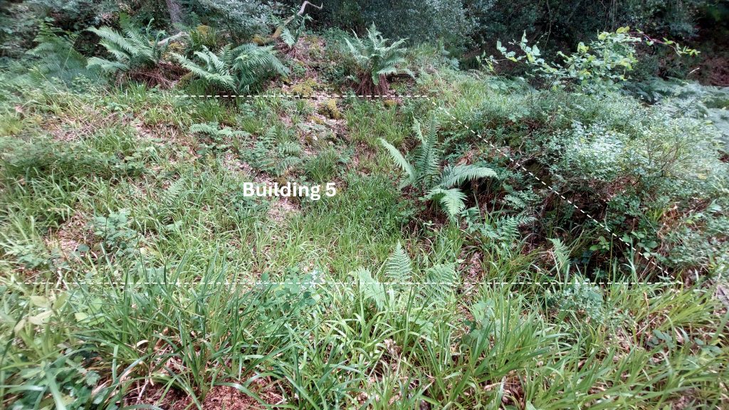
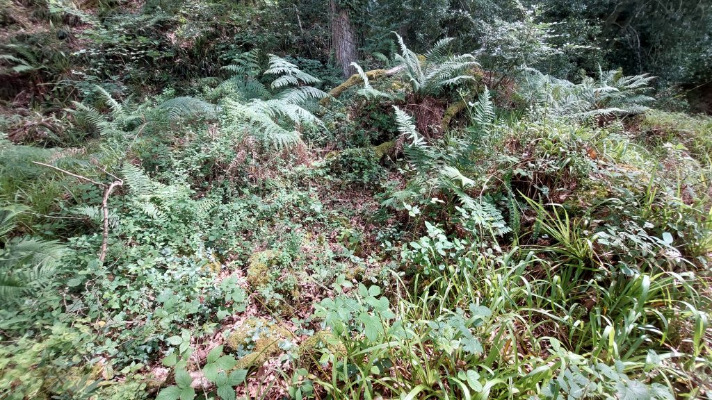
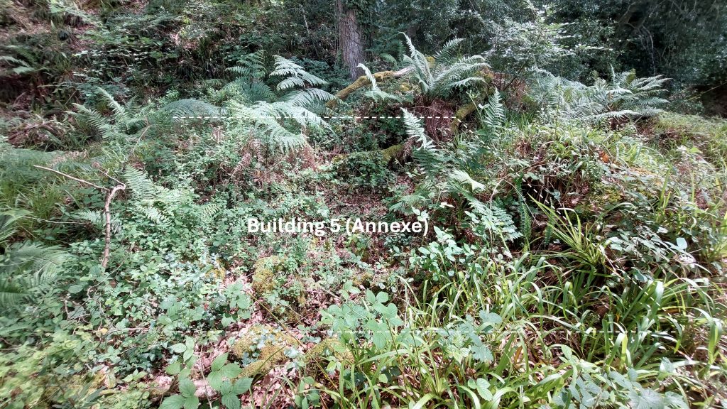
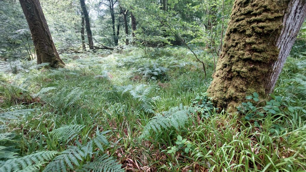
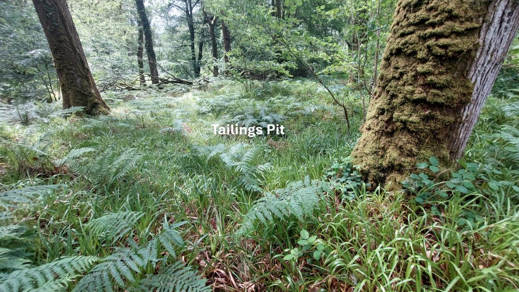
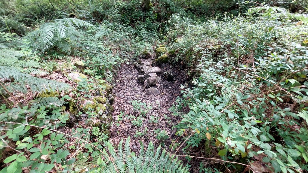
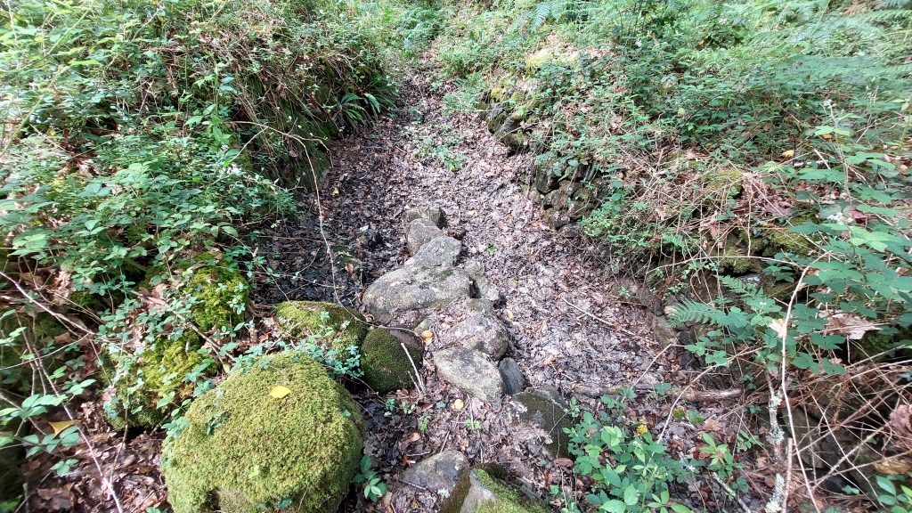
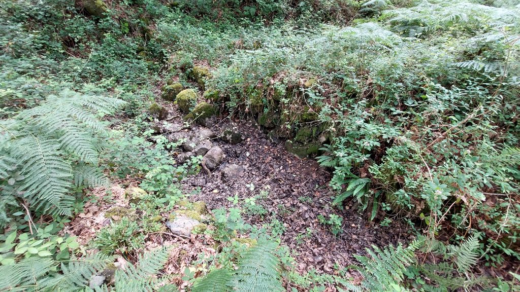
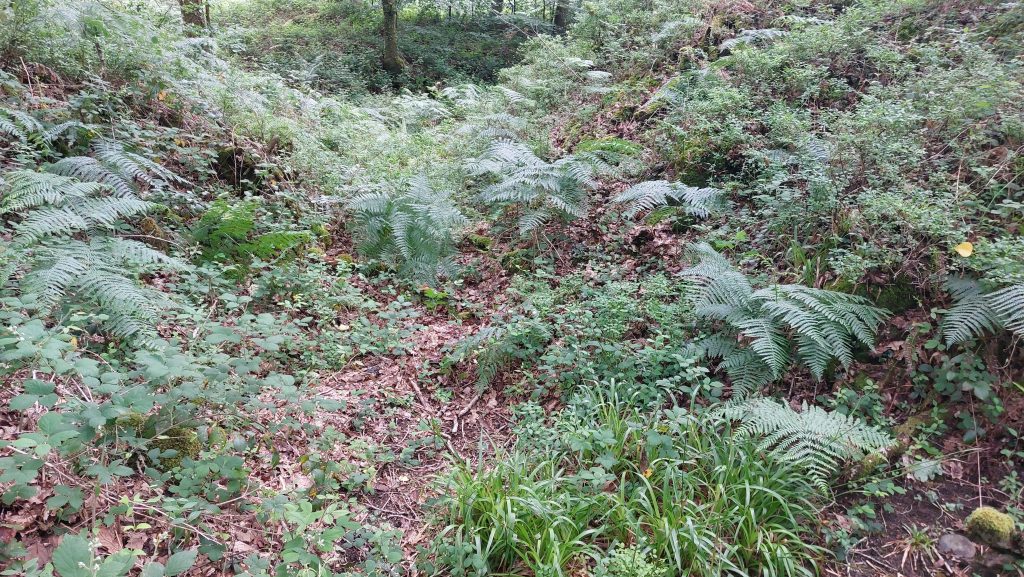
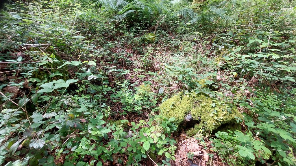
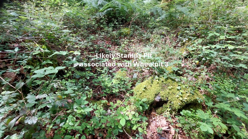
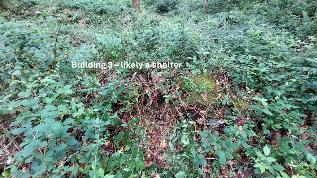
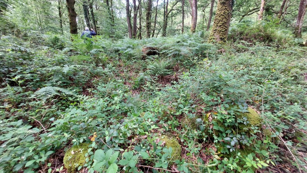
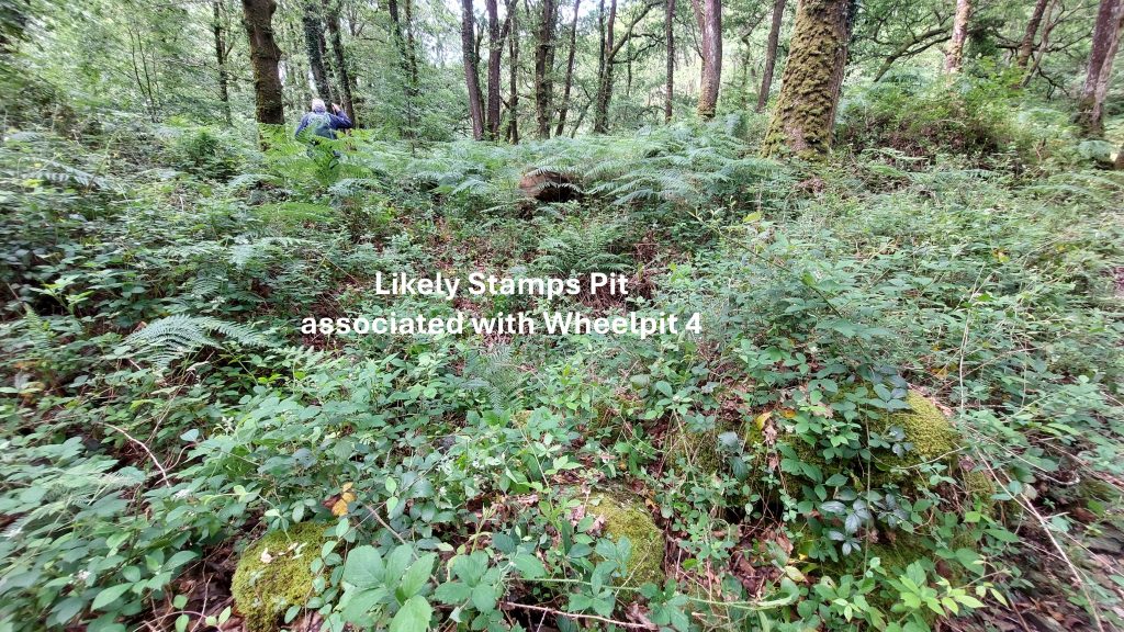
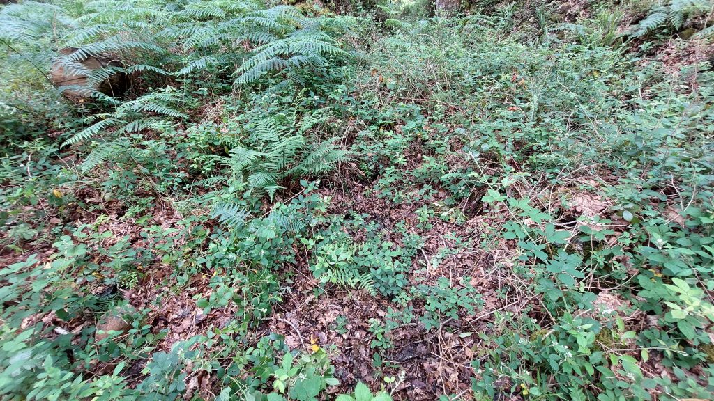
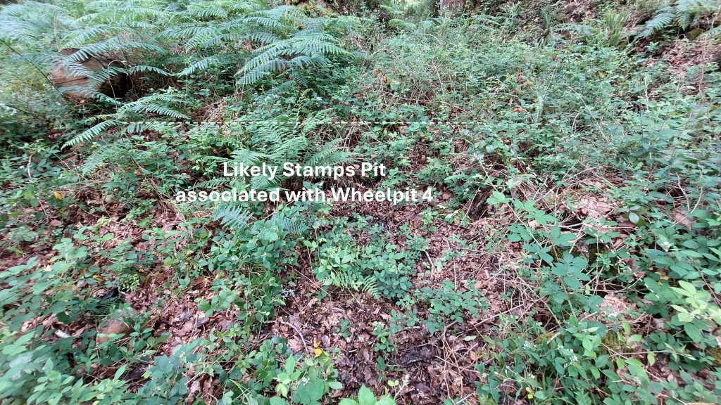
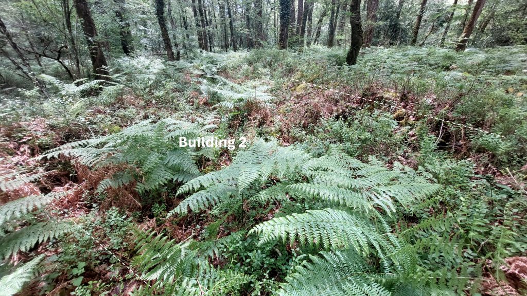
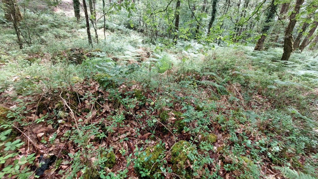
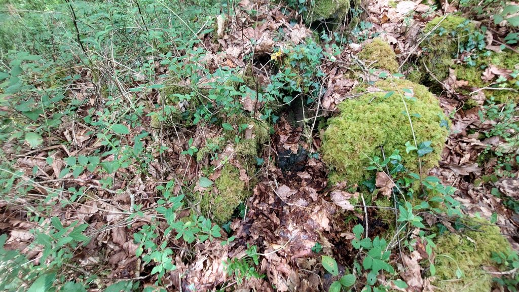
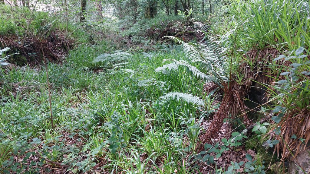
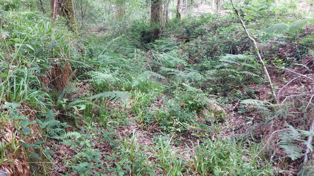
Cleft Rock pictures courtesy of Stephen HolleyThis historical timeline describes the activities of the mine in the 17th and 18th centuries. The two most informative entries are from 1725 when a Swedish surveyor (Henrik Kahlmeter) visited the mine and from 1791 in the description of a lease of the mine sett. The 1725 Kahlmeter information is usefully summarised by Hamilton Jenkin (Mines of Devon – pages 117/118) and the description of the 1791 lease from later in the century being recorded by Mike Brown in his paper : ‘In Search of Awsewell Mine, an examination of the surviving documentary evidence – Transcripts & Guides for Dartmoor Researchers, volume 19′. NOTE: Christopher Gullett (ref: 1791 lease and 1799 entry above) was the foreman who presided over the final sitting of the Tinners’ Stannary Court which took place in the White Hart Inn at Moretonhampstead on 11th December 1786This shaft lies to the south of Cleft Rock at SX72672 70804The shaft is quite square in profile and has rightfully been fenced off as the drop is around 3-4mOf note there is unusually no upthrust of earth surrounding this shaft. The author suspects this might have been just an exploratory shaft as it lies on the line of the known copper lode from Cleft Rock to the southDetails of Awsewell Mine by H.G. Dines (1956) in Metalliferous Mining Region of South West England Vol 2 – pages 737/8. Note Dines records that the ore dumps or slag spoil contains “quartz and olive green chloritic peach with pyrite, chalcopyrite generally irridescent (sic), and traces of mispickel”This LiDAR plot shows Cleft Rock (ore extraction) and the locations of four Dressing Floors next to the River Dart with the tail races from each of four wheelpits being very evident. This sketch is a rather fanciful map of Ashburton Parish from 1605. Note the two buildings next to the River Dart annotated with the words ‘Iron Mill’ with a leat taken off from the river behind them. William Crossing, Hansford Worth then John Amery all commented on the ruined building(s), variously described them as a blowing house, smelting house or iron mill. John Amery (in his presidential address 1924 for Transactions of Devonshire Association) correlated the map of 1605 upon with his excavations of the area identifying the site of the iron mill also identifying mounds of slag at the site which, when analysed, proved to be iron slag.This sketch map of the Southern Area Dressing Floors on the left (east) bank of the Dart is based on the fabulous RCHME original created by Dr Phil Newman following a survey in 1998. There are four wheelpits with associated tail races, a leat, remnants of a blast furnace, four buildings, two leat embankments, a tailings pit and two hollows where stamps may have originally been located. This table shows the Grid References recorded by the author of the key features at the southern and northern sections of the Dressing Floor and Buildings area which lie on the narrow strip of alluvium directly adjacent to the River DartThis rather non-descript photograph is of the blast furnace at SX72689 71209. The features at both the northern and southern parts of the operation next to the River Dart are rather overgrown. Therefore the author has provided two versions of the same photograph in this post – the first is un-annotated and the second annotated. A further visit to the site in the depths of winter is on the cards to see if the features are any better defined.This annotated photograph shows the location of the furnace and two masses of masonry. Worth (1981) on page 314, describes the location thus: “…old ‘Iron Mill’ on the bank of the Dart, under Hepstock and Awsewell Rocks…..it was used for iron-smelting…it was a blast furnace, in use in the year 1605. A part of its interest lies in the fact that the furnace is constructed between two masses of masonry, the permanent abutments of the perishable furnace, and the foundation of its chimney”. The north and south walls of the furnace building remain visible (through foliage) with the south wall seemingly remodelled as a launder / leat embankment when the dressing floor wheelpit was constructed. The leat behind (east) the Blast Furnace show how water flowed to the wheel over the wallingPiece of slag from the ‘huge’ (overgrown) slag spoil heap located between the Blast Furnace and the River Dart.
The Blast Furnace – the authors lower left leg and boot for scale
Unfortunately due to the foliage the hollow of the Blast Furnace does not photograph very well. The furnace was excavated by John Amery just over 100 years ago circa 1924.
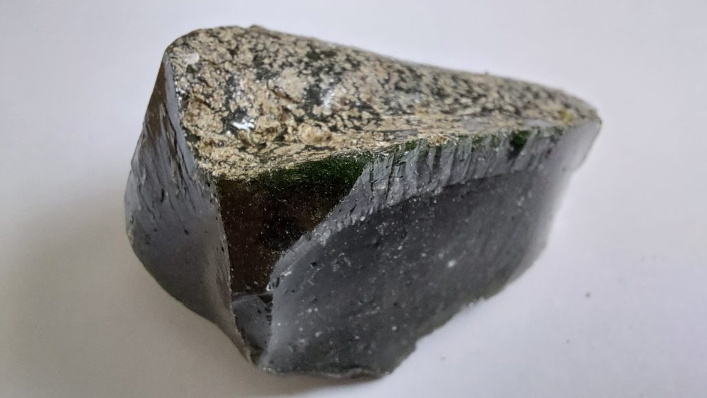
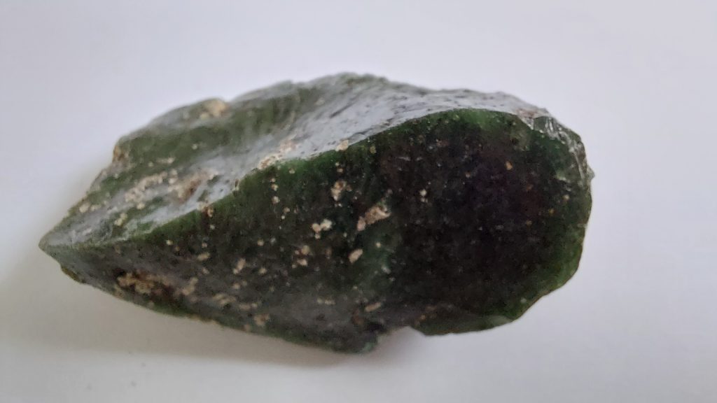
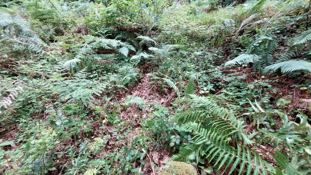
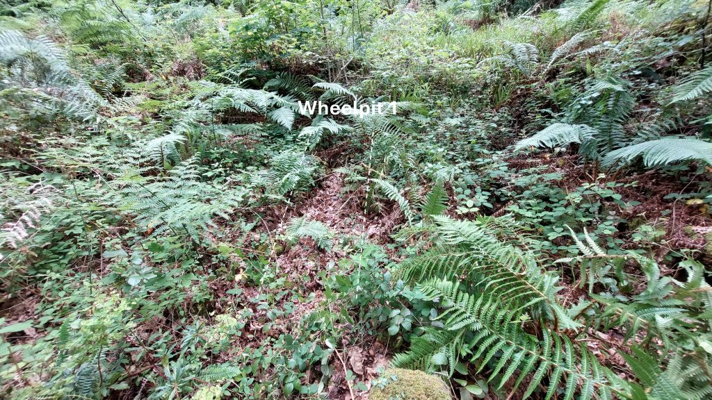
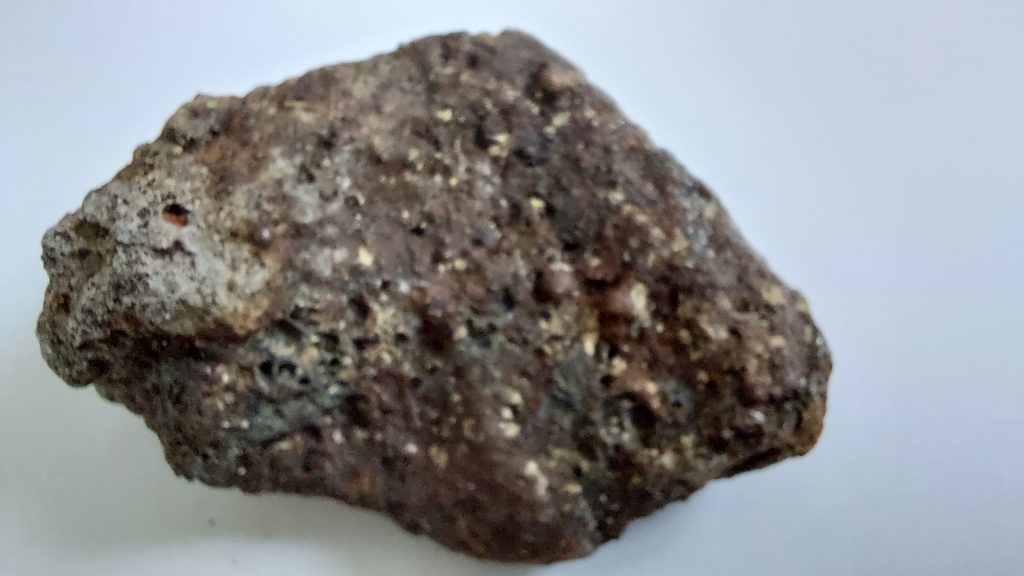
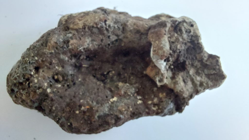
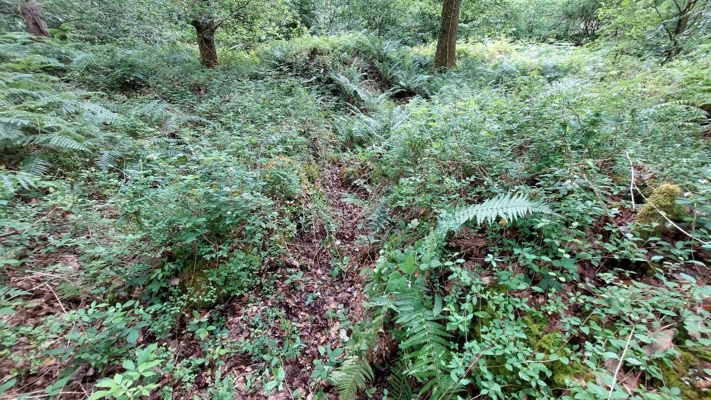
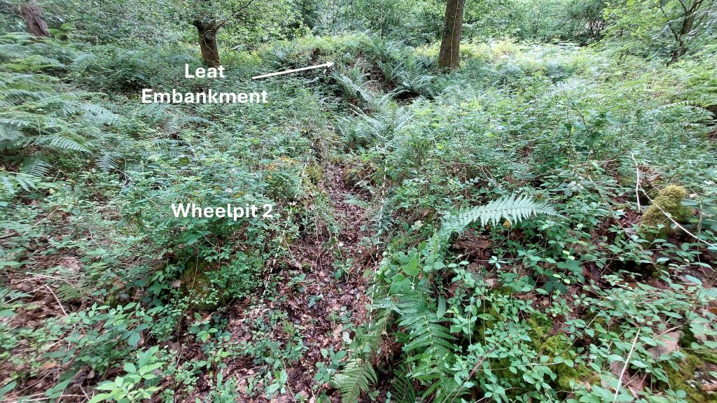
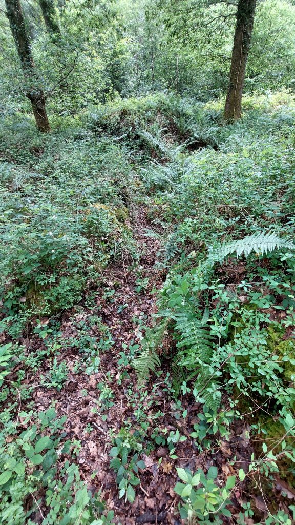
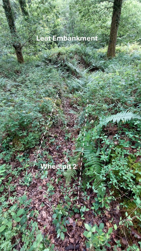
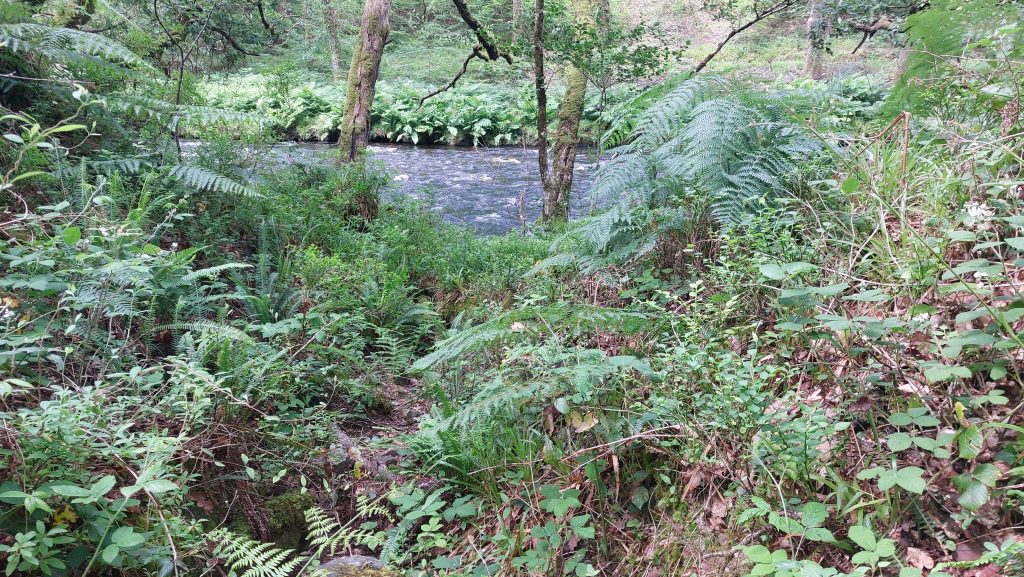
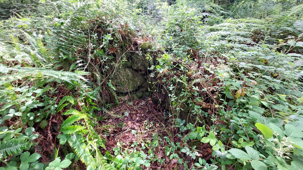
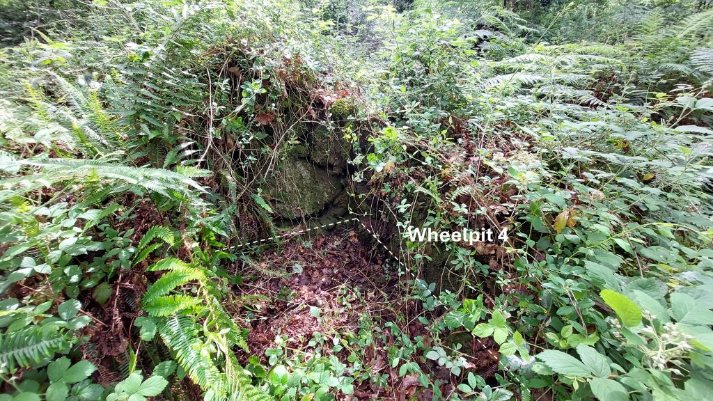
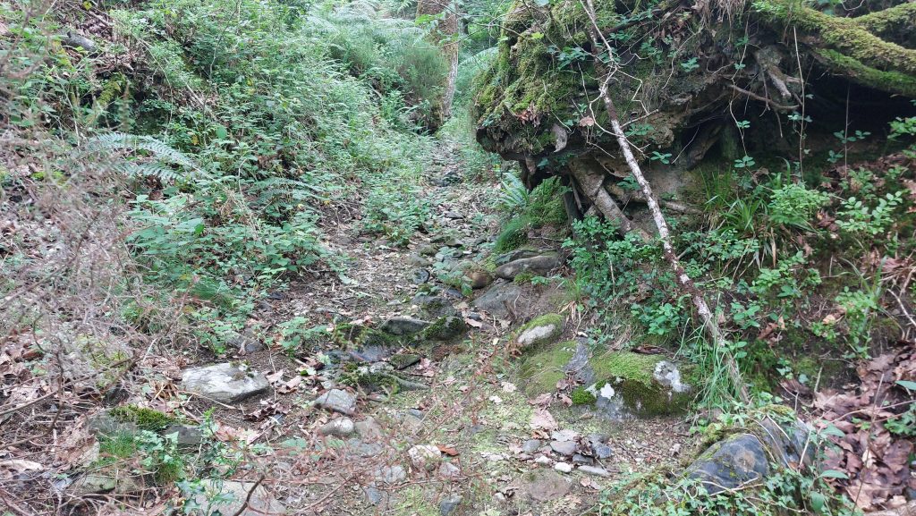
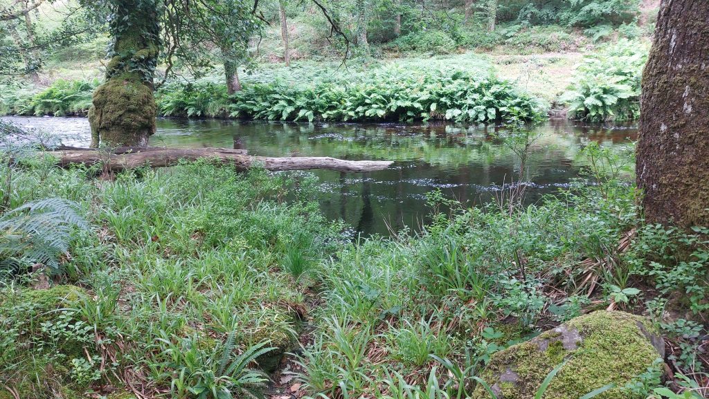
Another view of the same piece of slag previously shown in this post. One assumes this is the ‘olive green chloritic peach with pyrite’ as described by H.G. Dines. Most of the slag is of a ‘glassy’ (iridescent) character, varying in colour including greens and bluesAnother unannotated view of the Blast FurnaceThe Blast Furnace comprises two slightly concave sides, spaced around 0.7m apart. The height of the furnace is around 1.5m. More slag from the very large heapThe north walling section (left) and the gap where the Blast Furnace is locatedAnnotated picture of the northern walling and Blast Furnace. John Amery’s published plan shows an intact circular crucible, positioned between two walls.One of the ores mentioned by H.G Dines is Chalcopyrite. This is the main copper ore mineral (CuFeSr) and is mainly formed by hydrothermal activityAnother piece of slag from the heap near the Blast Furnace19th century historical timeline of Awsewell Mine. One suspects that the halcyon days of the mine were in the previous two centuries as the above information intimates. Any activity appears to have been minimal, albeit there is a possibility that Tin was also mined or streamed here, albeit the location of any streamworks is unknown. Note: In a conversation between Mike Brown and Tom Greeves it was considered that the name Walter Willington (1836 in the above table) might have been one and the same person as the Walter Wellington who was the tin smelter at Eylesbarrow Mine in the 1820sTo the south of the Blast Furnace there are two buildings. They are annotated Building 4 and Building 5 on the sketch map (as per RCHME designations). Building 5 is shown aboveBuilding 5 is located at SX72691 71176. The Building internal dimensions are 6.5m by 4.9m, standing to a maximum height of 1m. It has a small annexe to the northBuilding 5 annexeThe annex of Building 5 was probably an entrance porch. It measures 2m by 3m and is ruined to foundation level. The walls are constructed from killasThe second building south of the Blast Furnace is Building 4. It lies to the north of Building 5Building 4 internal dimensions are very approximately 4m by 2m. It is located at SX72699 71185Near Building 5 is a Tailings Pit (ref: RCHME). It comprises a low, sub-rectangular earthwork bank with an external ditch. Building 5 is built into the north-east corner of the earthworkThe Tailings Pit encloses a level silted area and measures around 25m by 30m with banks of 2.5 – 3m width. RCHME comment on this feature provides added interest: “……it is difficult to envisage how this water and waste material would have been diverted from the dressing areas to the settling pits without elaborate wooden launders running along the river edge”Back to Dressing Floor 1. Amongst this vegetation is Wheelpit 1 at SX72687 71210Water to Wheelpit was laundered from the ‘leat embankment’ which was constructed from the southern part of the furnace. The wheelpit is roughly 5m long by 1m wide with patches of masonryMike Brown’s report records that “The presence of pyrite, or iron pyrites FeS2, (Fool’s Gold), supports the contention that the lodes must be very near lie boundary of the rock types, as this is a mineral formed primarily by contact metamorphism, although it also occurs in hydrothermal deposits”.Dines also mentions Arsenopyrite (which he calls mispickel), FeAsS, which is found in Hydrothermal Veins. The author (not being geologist) is unaware of what the above piece of slag is. It too, was also found amongst the very large slag heap near Wheelpit 1 and the Blast FurnaceThis is Wheelpit 2 (to the north of Wheelpit 1). It has internal dimensions of 6.7m by 0.9m.Wheelpit 2 water was fed over an embankment before being laundered. It is located at SX72688 71243
Another view of Wheelpit 2 and Leat Embankment
The flat topped leat embankment has partial stone edging
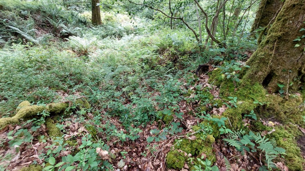
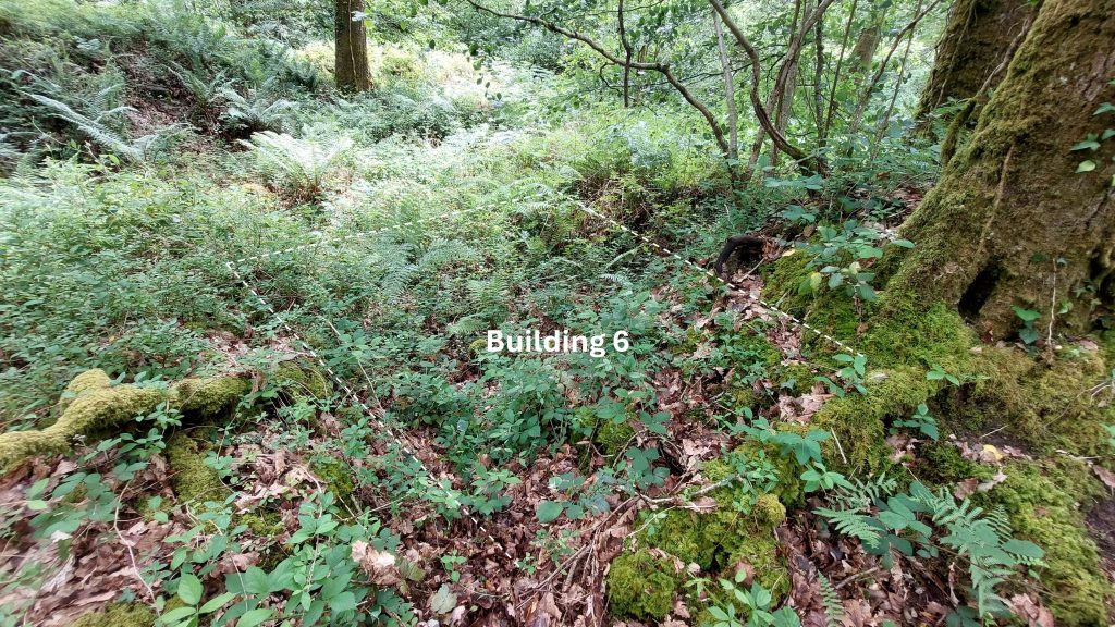
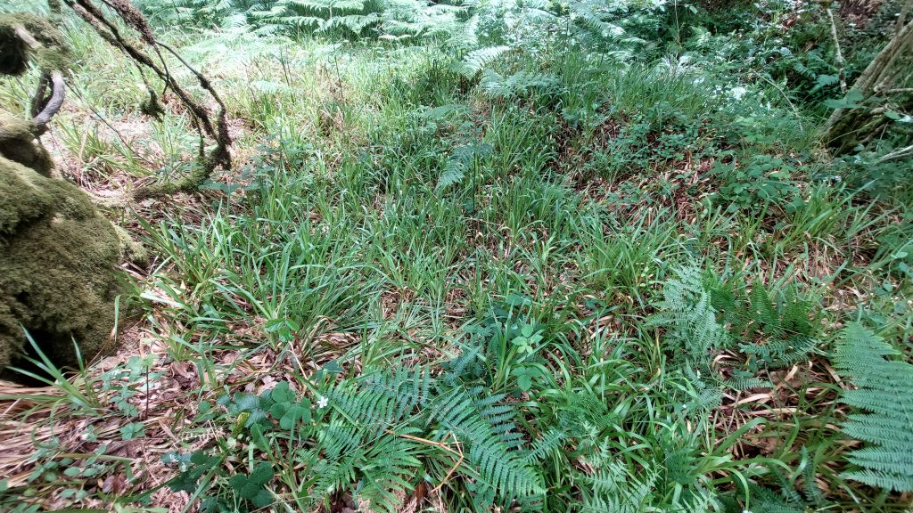
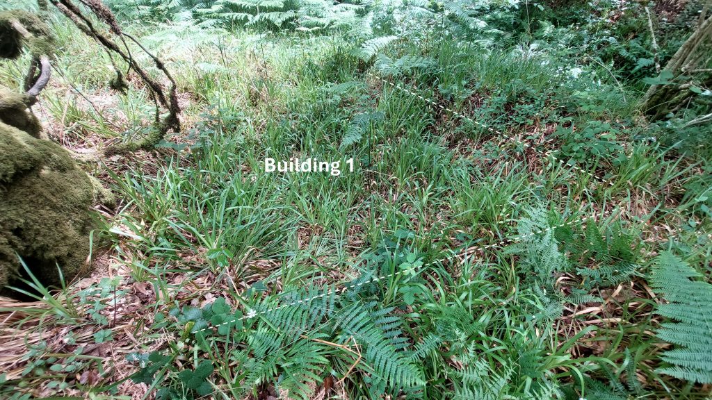
Next to the south side of Wheelpit 2 are remains on another probable Building (annotated as Building 6)Building 6 is ruined to just above foundation level. It is estimated that the internal dimensions would have been roughly 3m by 2.5m. It is located at SX72687 71237River Dart near the run-off from Wheel 2River Dart looking north, perfect place for a coffee or lunch stopPanoramic composition of River Dart. The Holne Chase estate is on the opposite bankWheelpit 3 is the largest of the four. The Wheelpit measures 8m by 2.5m, tapering to 1.5m at the western end. RCHME Interpretation makes for interesting reading: “This would apparently have housed an extremely wide waterwheel with a breast of approximately 2m, far larger than any other late 18th-century Dartmoor mines, so far recorded. A lengthways internal division in the wheelpit alternatively suggest that either the wheelpit housed two wheels, for which there is no known precedent on Dartmoor, or that it was modified at some point to house a smaller wheel”. The author surmises the smaller wheel adaptation as to the reason for the internal division.Wheelpit 3 is located at SX72681 71264Tailrace to the river from Wheelpit 3A secondary channel leading into the tailrace from Wheelpit 3. Was this water run-off from a Buddle?Slightly north (by a few metres) of Wheelpit 3, there is a outflow channel to the river, thus making five outflows (run-offs) from four dressing floors. The five outflows (run-offs) are shown on the sketch map and are obvious features on the LiDAR plot in this postJust to the south of Wheelpit 3 is a hollow with some stonework, which most likely was the location of stampsThe possible stamps area is located at SX72686 71261Deep in vegetation to the south of Wheelpit 4 is another Building (3), which is located at SX72704 71285It is approximately square at 2.5m x 2.5m. It is thought to have been a low, turf-roofed shelterWheelpit 4 has internal dimension of approximately 6m by 1m. Wheelpit 4 is located at SX72697 71295Tailrace from Wheel 4 is quite substantialRun-off from Wheel 4 at the riverImmediately to the south of Wheelpit 4 is a hollow where the stamps are likely to have been locatedStamps associated with Wheelpit 4 are located at SX72686 71286There are vestiges of masonry lining in the Stamps pit / hollow next to Wheelpit 4Annotation of the Stamps pit / hollowThe northern section of interest on the narrow strip of alluvium directly adjacent to the River Dart is located approx. 150m north of the Dressing Floor 4. The main features here are the outlines of two Buildings (1 & 2)Building 2 is the largest in the area and is located at SX72700 71441Building 2 is narrow and rectangular in shape and lies approx. 25m from the river. The outlines of the long axis walls are quite clear standing at around 0.7m. The building has approximate internal dimensions of 12m by 3.4mThere are small amounts of tumbled stone perhaps suggesting that the walls stood to no great height (especially as walls are only 0.5m thick). Therefore it was either a low-roofed building or perhaps just the support for a timber structureFragments of furnace lining lie within the tumbled stone. This perhaps assists in dating the structure with rocks coming from an earlier smelting phase, albeit there is no furnace hereBlack fragments of furnace lining amongst the rock tumble especially around the entrance at north west corner(Dry) leat running adjacent to the east side next to the modern trackAnother part of the leat, whose take off was adjacent to an island on the Dart and would have extended to the four Dressing Floors around 150m-200m to the southArtificial channel in the northern area.The final feature covered is Building 1 at SX72703 71499The Building is sub-rectangular measuring around 3.9m wide