A collection of walks, discoveries, insights and pictures of exploring Dartmoor National Park
January 6, 2026
Classiwell Farm
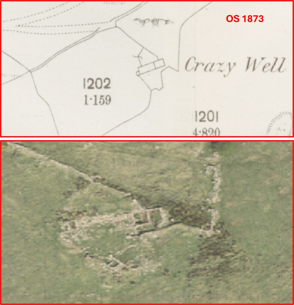
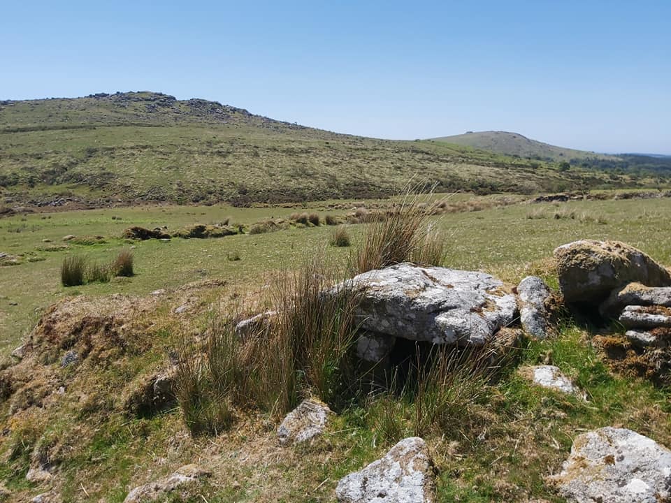
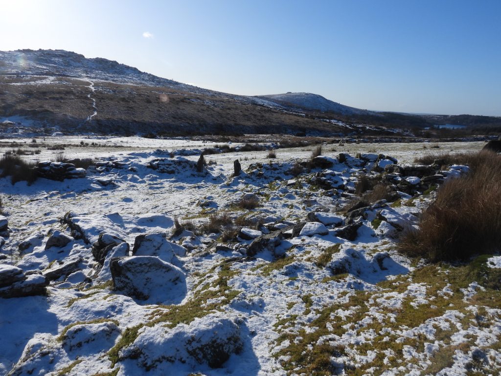
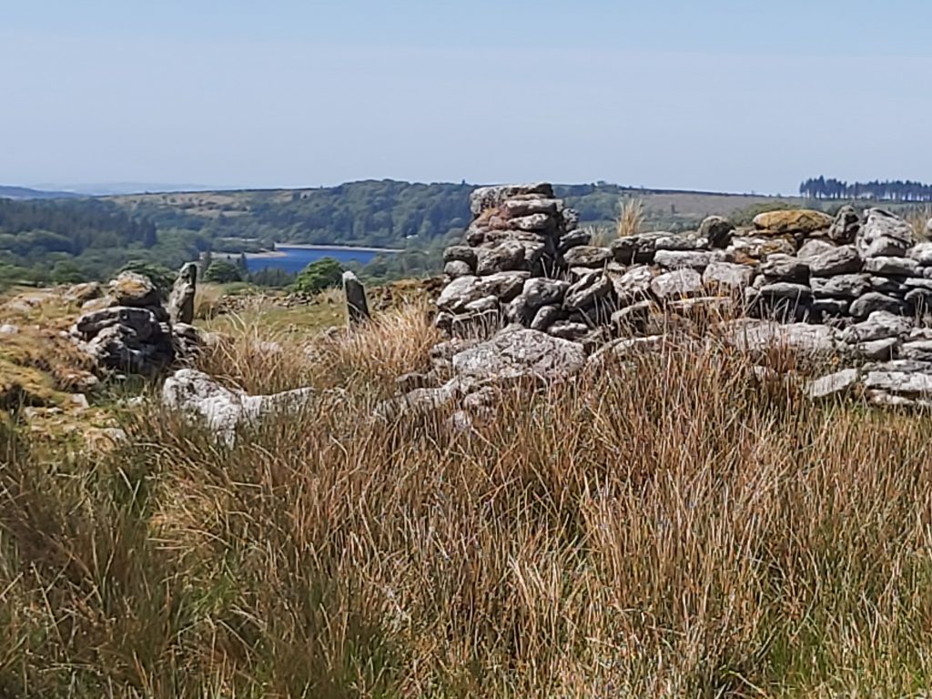
The enclosed medieval farmstead of Classiwell Farm overlooks Newleycombe Lake and Down Tor. It has variously over the centuries been also known as Crazy Well, Claseywell, Classywell, Clasiwell or even Claceywell. The modern word Crazywell seems to have been adopted in the late 19th century and may be as a result of the Ordnance Survey name of the nearby Crazwell Pool, which is a tinners water-filled openwork documented from at least early 17th century.
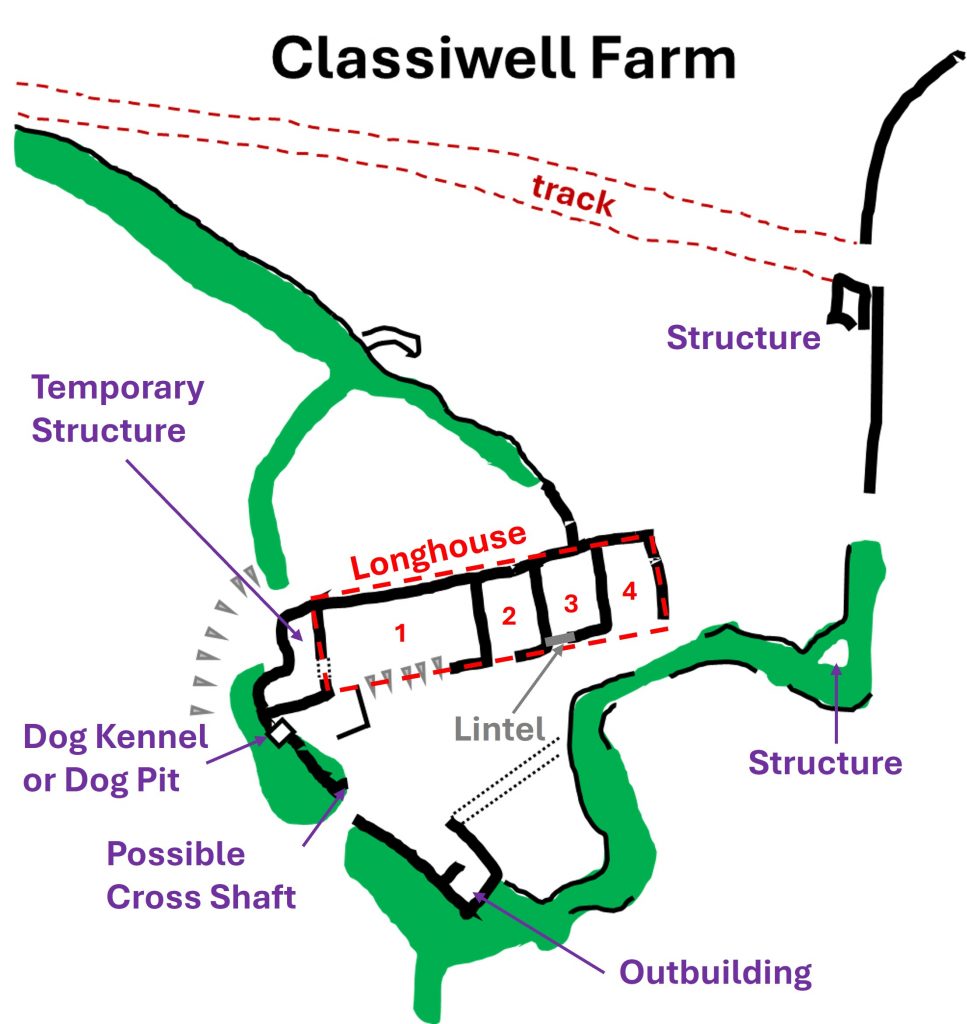
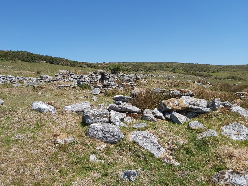
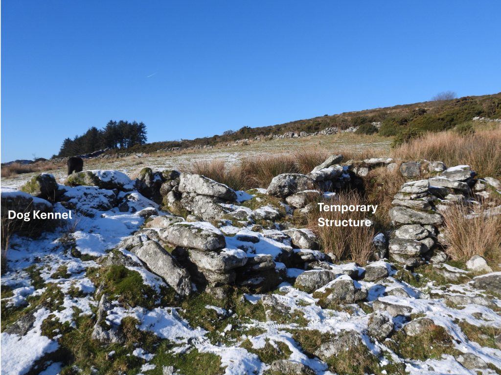
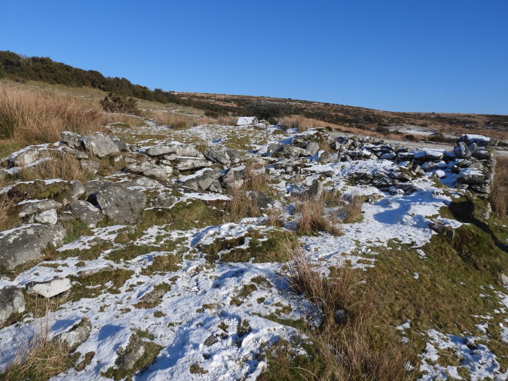
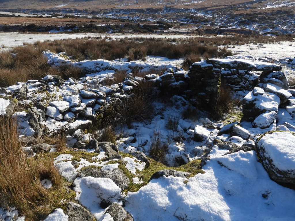
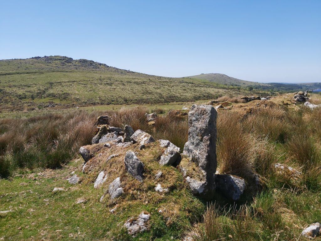
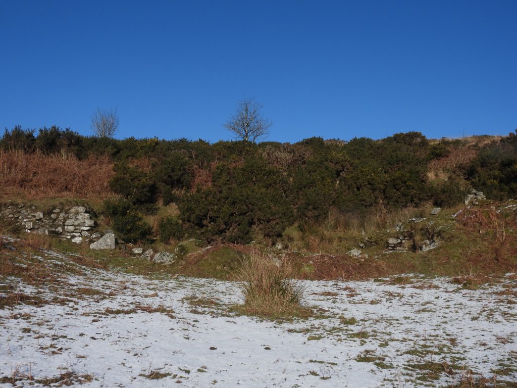
As to the farmstead, documentary evidence suggests there has been a occupation at Classiwell since 1575. The main farmstead has been interpreted as comprising a probable longhouse built across the slope to which other structures have been added over time. The farmstead is in a ruinous state, with the main ruined building (Longhouse) having been partitioned into four compartments. There is an structure to the west of the Longhouse, described as ‘temporary’ in one survey and there is a outbuilding or outhouse to the south. There are two other structures on the east side of the main farmstead area and other notable features include a possible dog pit kennel, a possible cross shaft and a possible quern. It thus has some interesting architectural features and is worth the short stroll uphill from Norsworthy Bridge for an exploration.
The farmstead is situated between Newleycombe Farm to the east, Kingsett Farm to the west, and Roundypark to the north. It is the smallest farmstead in the area but may have used another Longhouse (known as Colliers) to the north east. There was no census return from 1881, perhaps suggesting the farmstead fields had been absorbed into Kingsett Farm by that time. Unlike, Kingsett (Farmhouse – circa 1868) and Newleycombe (hedges / walling – circa 1830s), Classiwell does not appear to have been maintained by the Maristow Estate in the 19th century. William Crossing records in the early 20th century (1905) that Classiwell (Crazy Well) was one of four farms which were part of the Kingsett holding; Newleycombe and Roundy making up the four.
Paul Rendell – (2007) – Exploring around Burrator, a Dartmoor Reservoir
Eric Hemery – (1983) – High Dartmoor, page 141
William Crossing – (1986) – Gems in a Granite Setting, Beauties of the lone land of Dartmoor (Facsimile version)
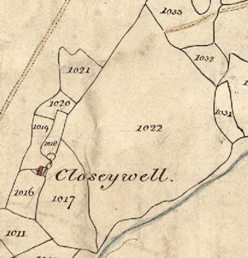
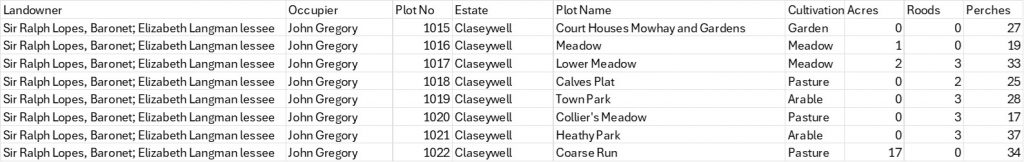
Classiwell is shown as Claseywell on the tithe map. The apportionments were 1015 through to 1022. The old lane from Older Bridge through Cockle’s Gate and onto Norsworthy can be seen (top left) on the map
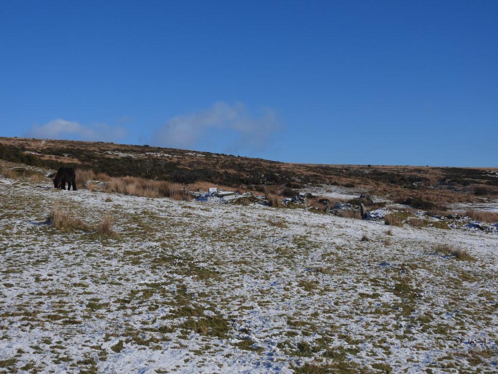
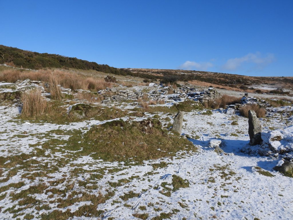
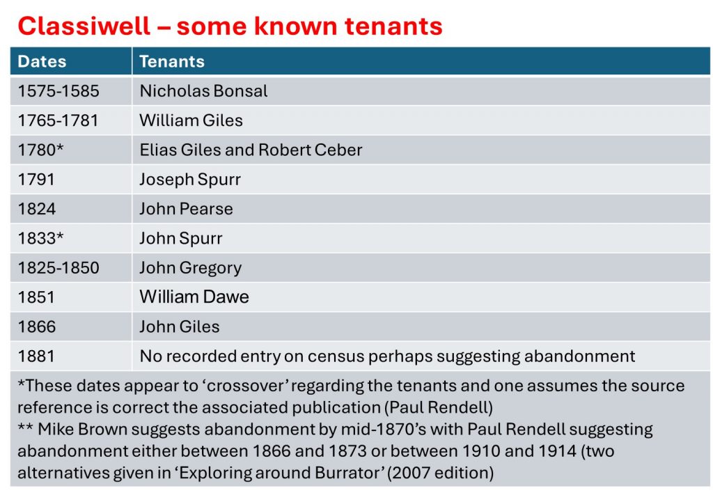
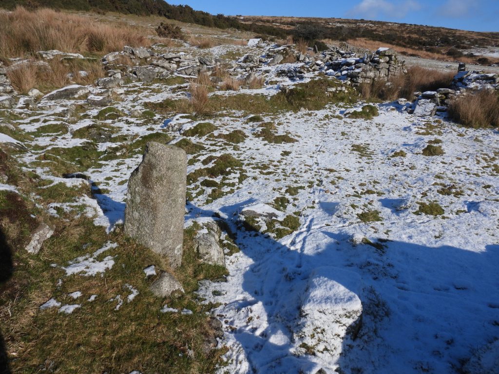
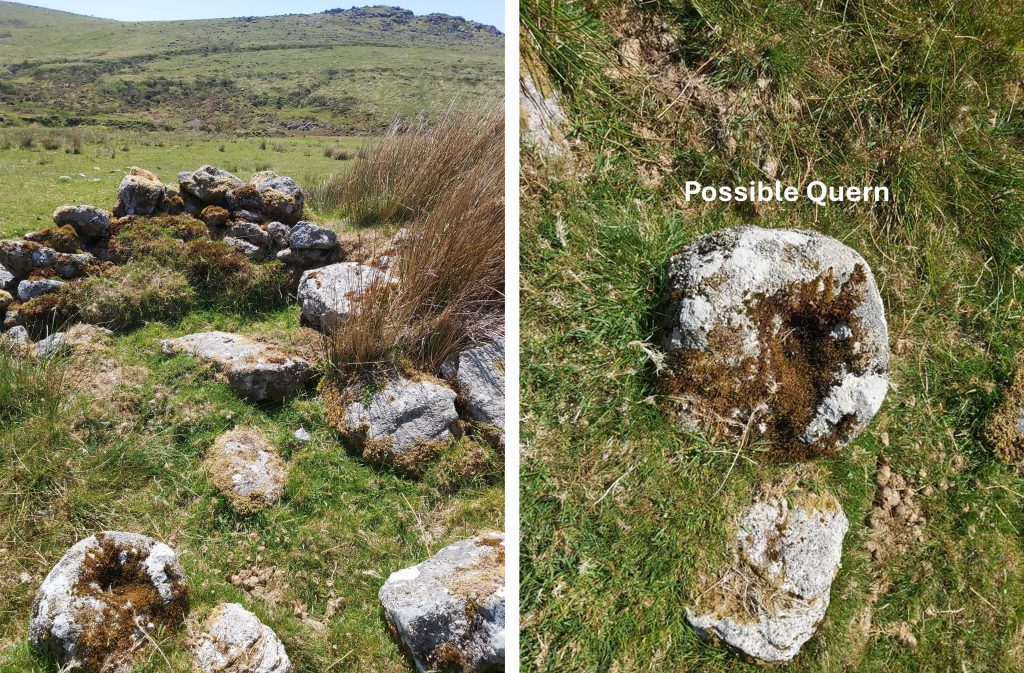
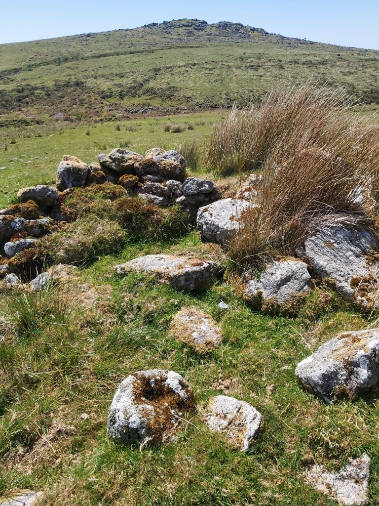
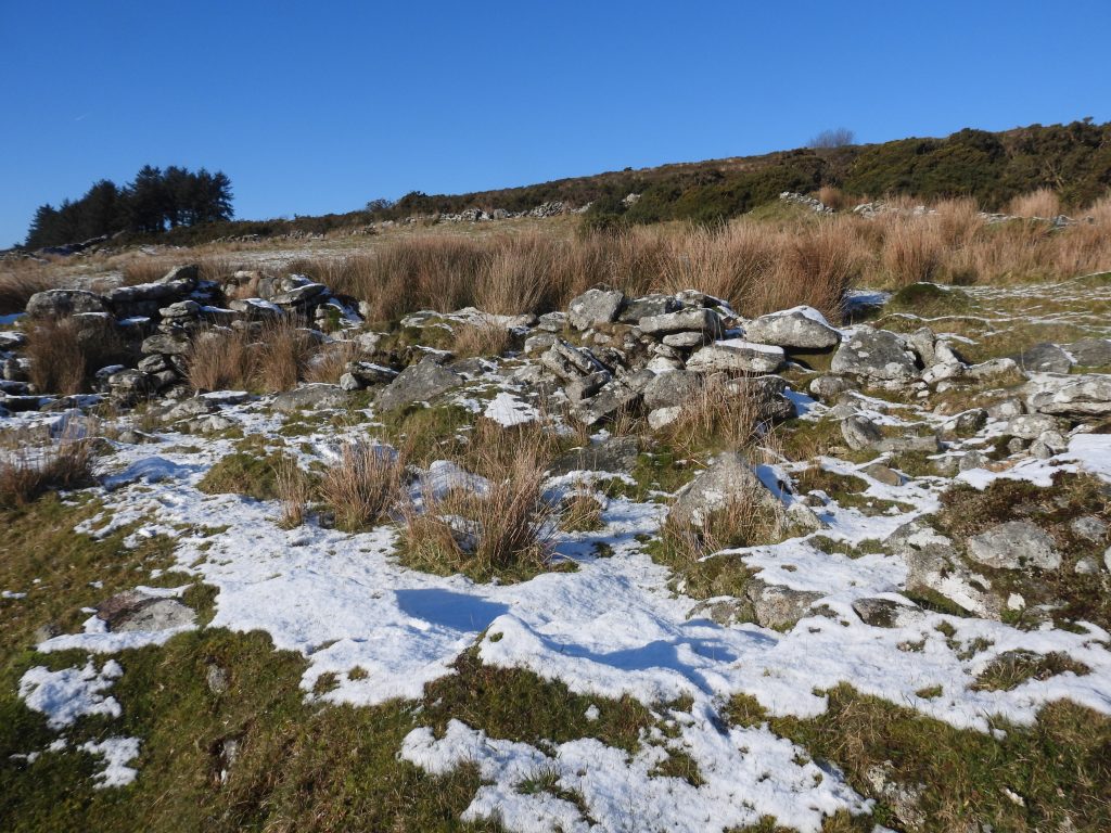
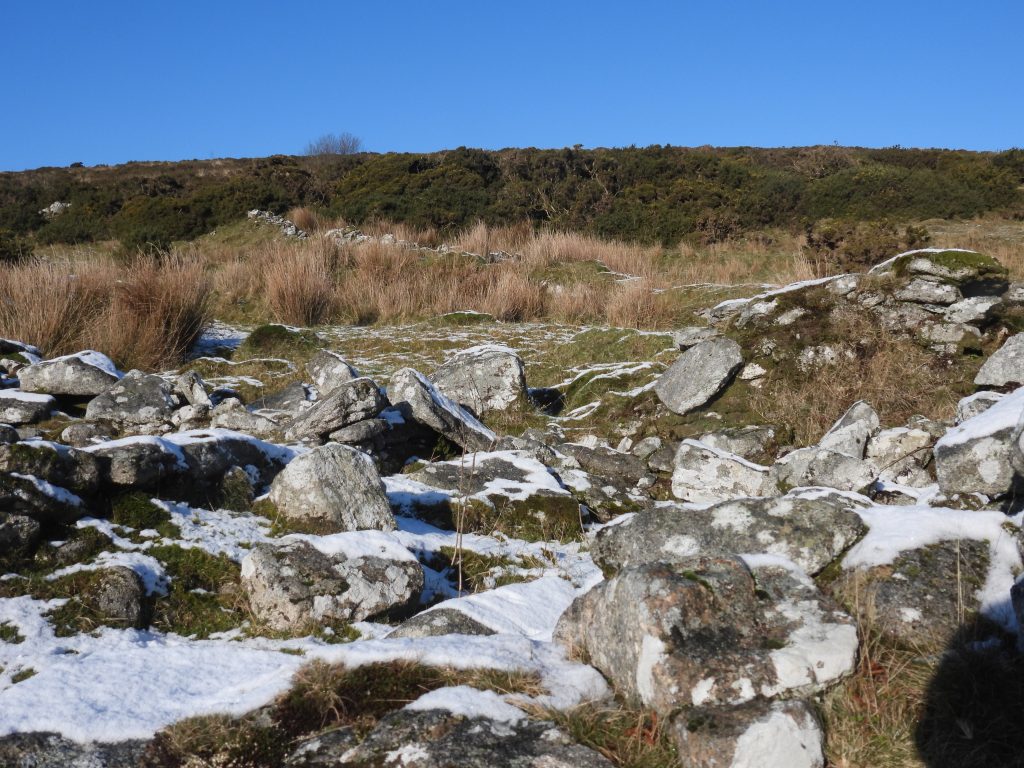
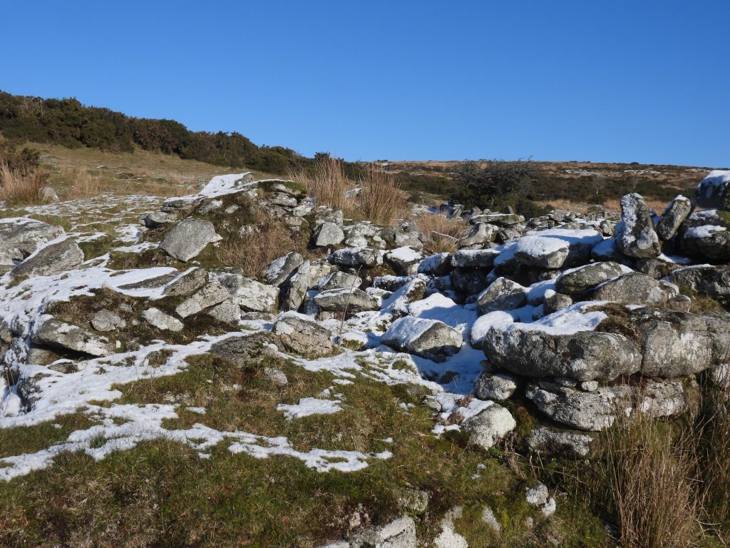
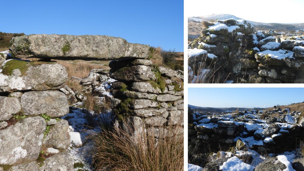
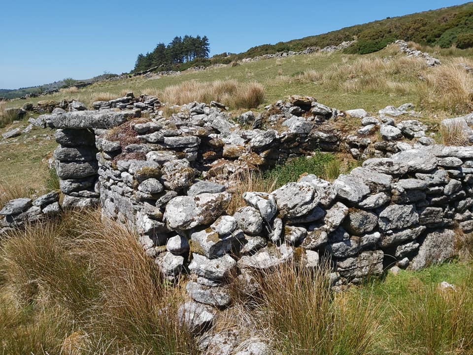
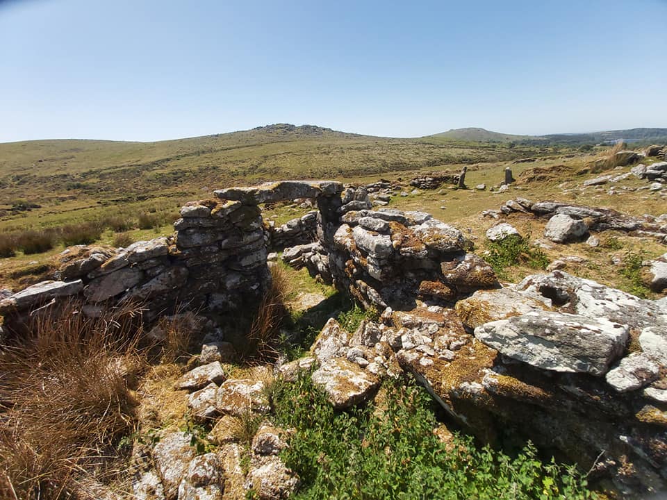
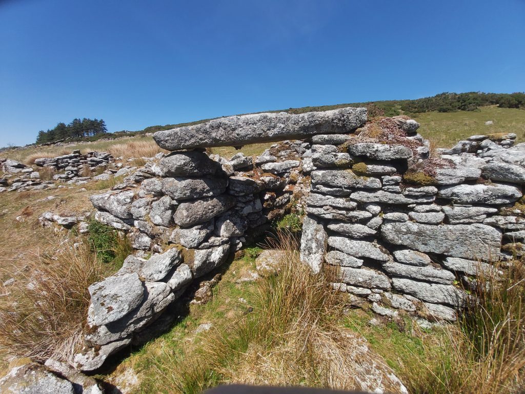
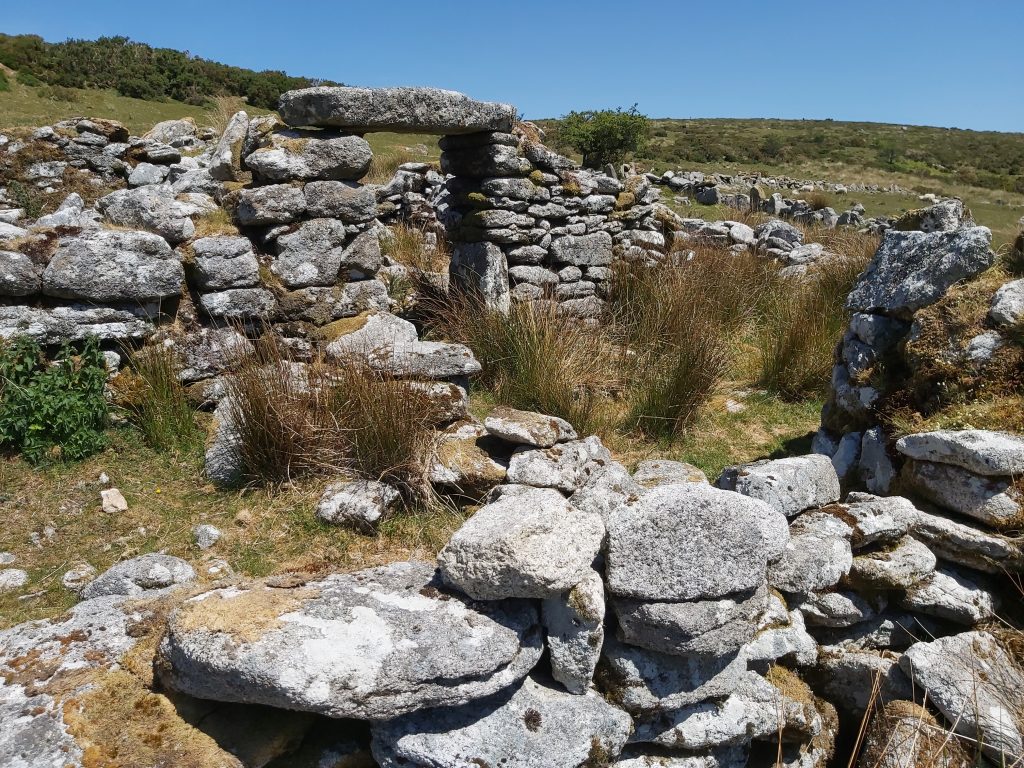
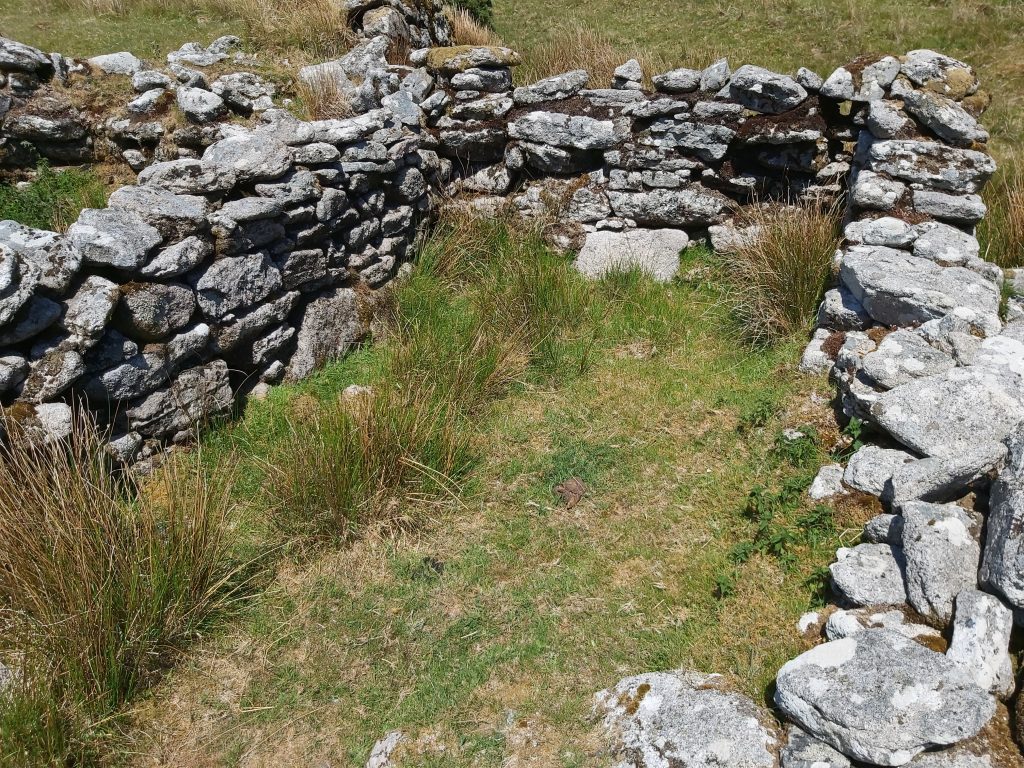
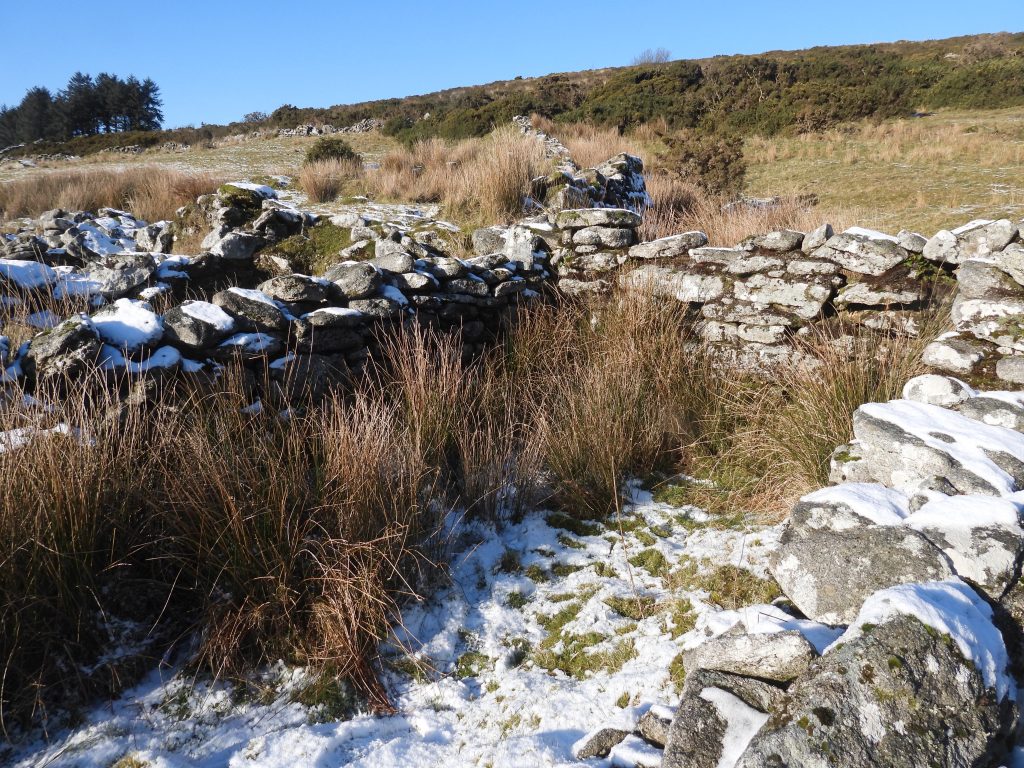
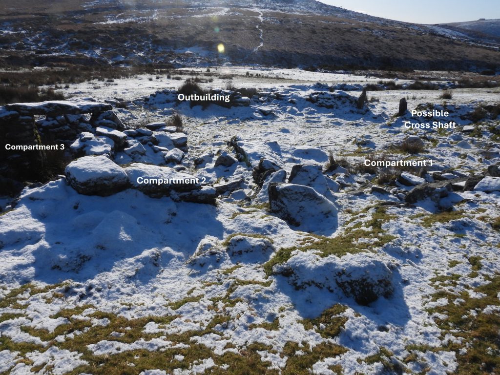
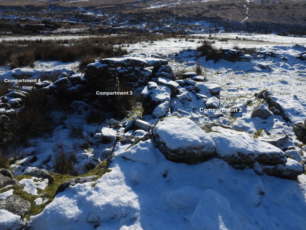
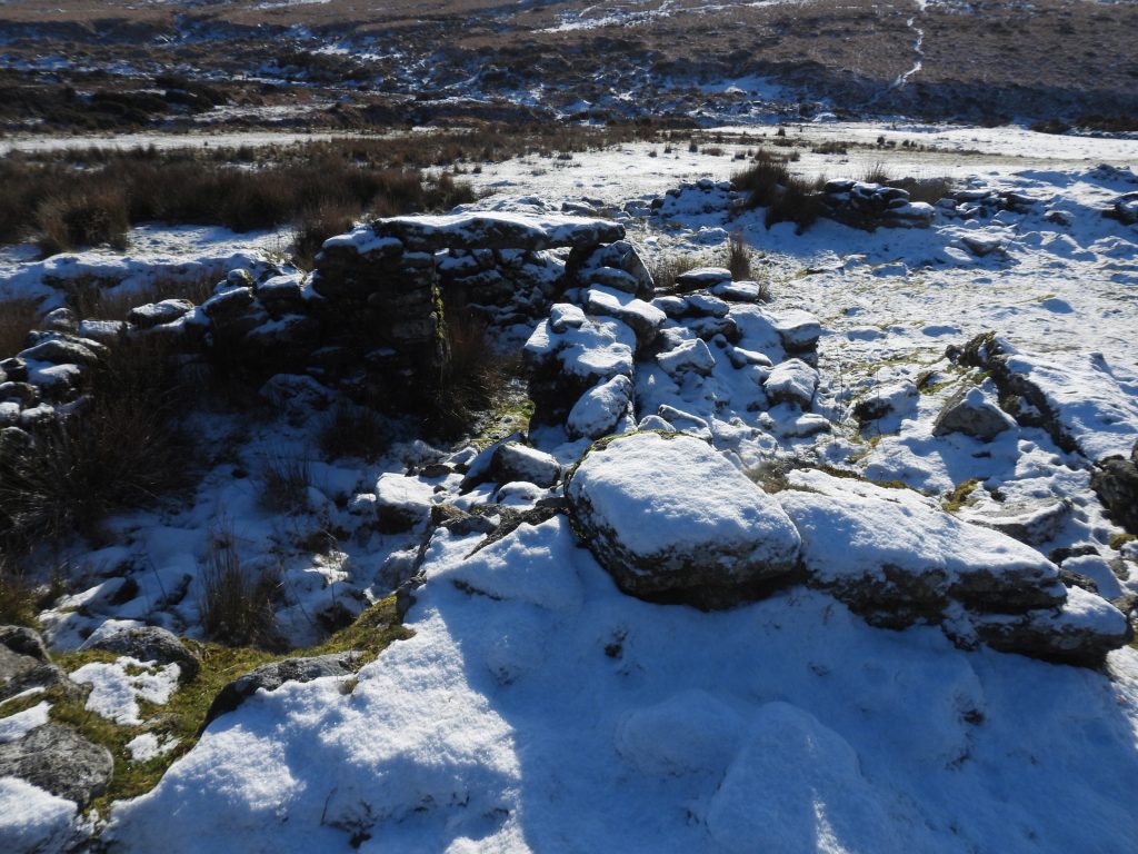
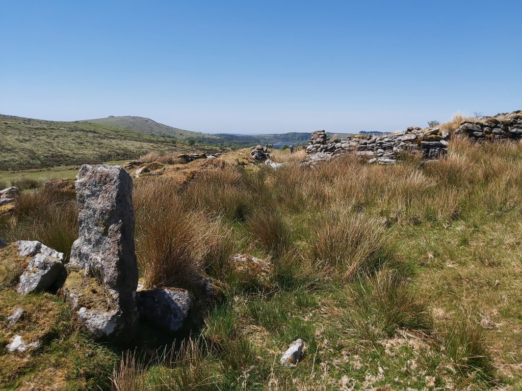
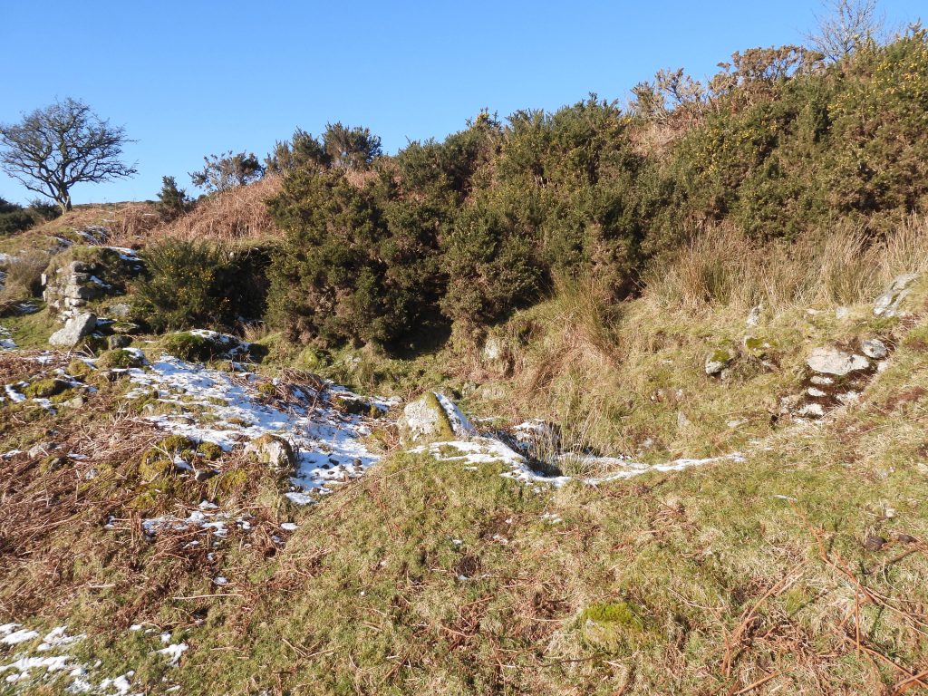
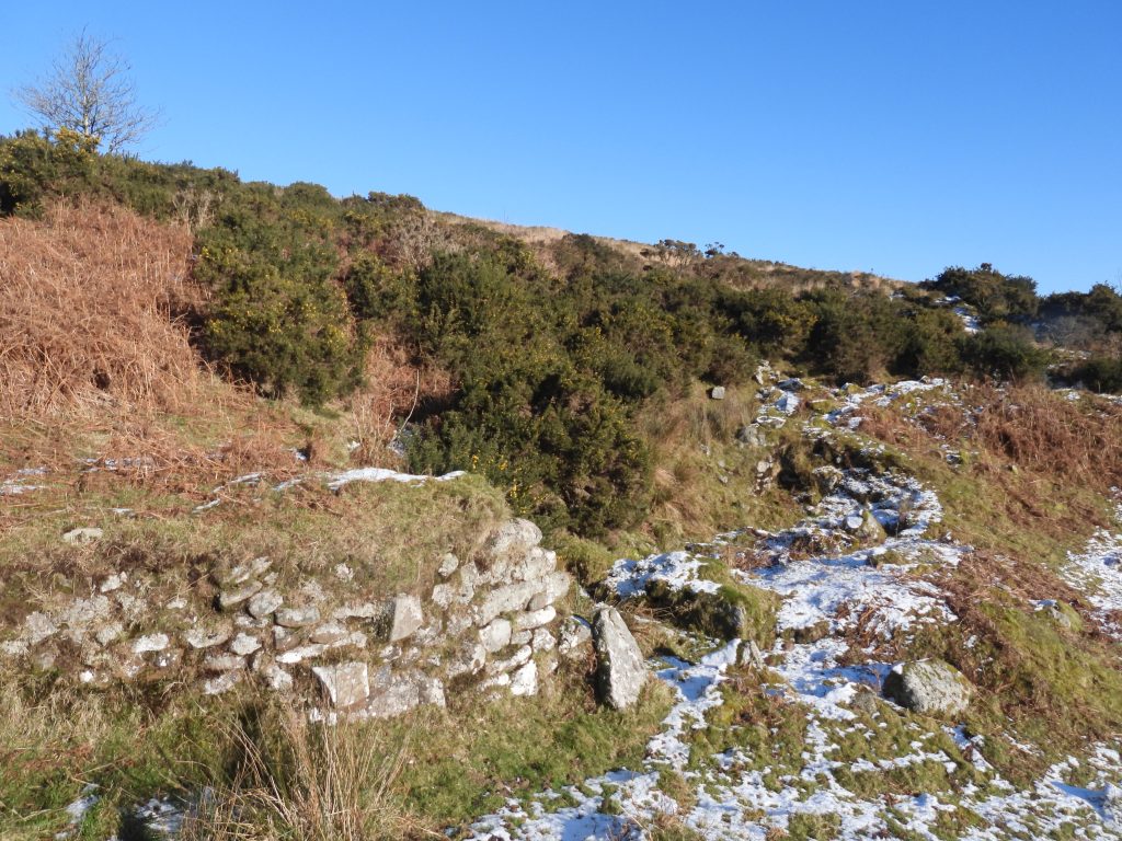
The plot names, cultivation purpose and sizes from the Tithe Apportionment are shown in the table above. The total area was 20 Acres, 3 Roods and 20 Perches. Note the name of the plot 1020 is Collier’s Meadow, where there is quite a large ruin (Longhouse), known today as “Colliers”, which is shown later in this postApproaching Classiwell Farmstead from the south west through the pasture numbered 1016 on the TitheThe west gate of Classiwell. The northern most gatepost (left one in the photograph) is a possible cross shaftThis layout of the farm buildings. The sketch is based on an original in the publication “The Field Archaeology of Dartmoor” with annotations based on the various interpretations by Dartmoor observers, who include: Dr Phil Newman, Sandy Gerrard and Mike Brown. By 1873, the farm was named as Crazy Well. It was around this time that it is believed the farm was abandonedSome of the known tenants from 16th to 19th century based on data from Mike Brown and Paul RendellThis gatepost is considered as possibly once being a cross shaft. It measures 1 m x 0.3 m x 0.25 m and is located at SX58081 70047Within the farmstead is (or at least was in May 2020) a odd shaped piece of granite considered by some to have been a quern
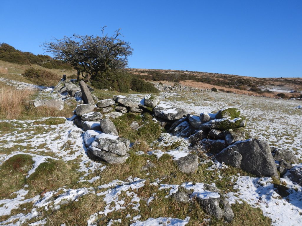
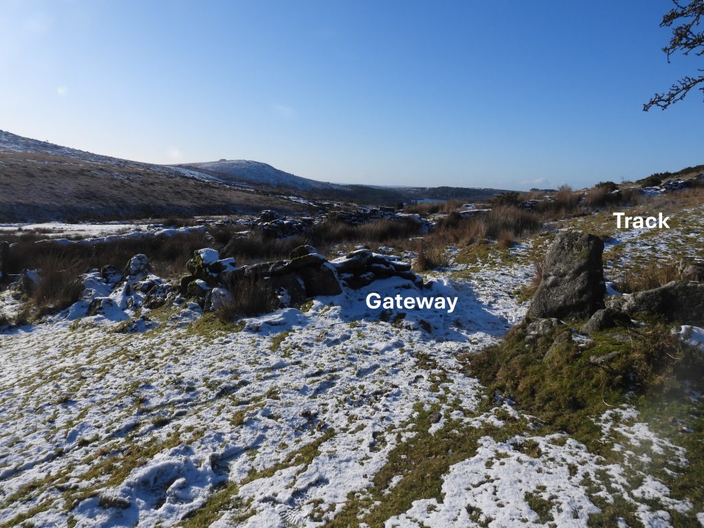
The possible quern is located at SX58091 70041. Eric Hemery mentions this stone in High Dartmoor (page 141). He states: “…..chambered stone thirteen inches square, having in the centre of its upper surface a cavity four inches in diameter and 4 3/4 inches deep: a shallower boring has been started on the upper surface brought the work to an end.”
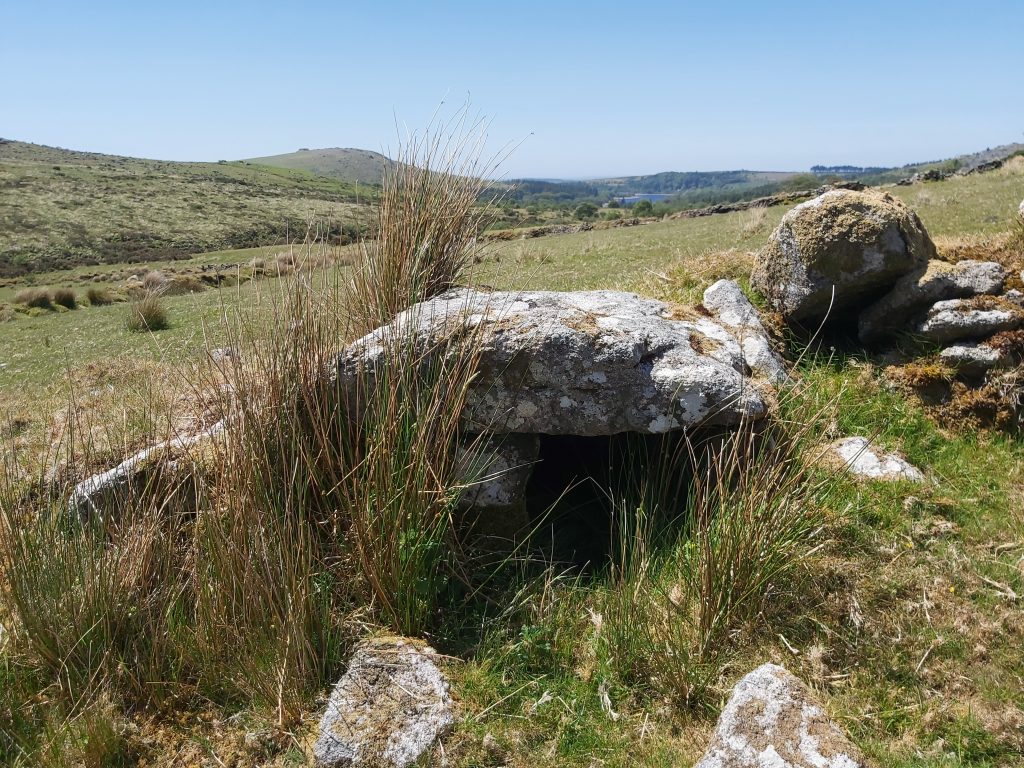
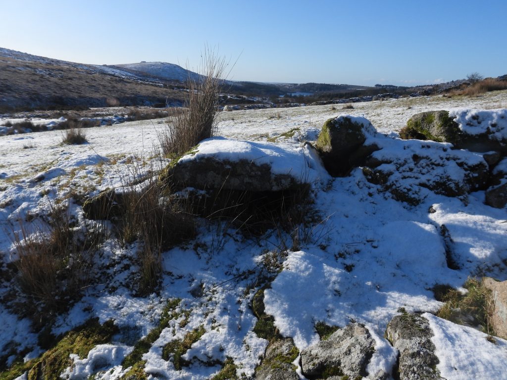
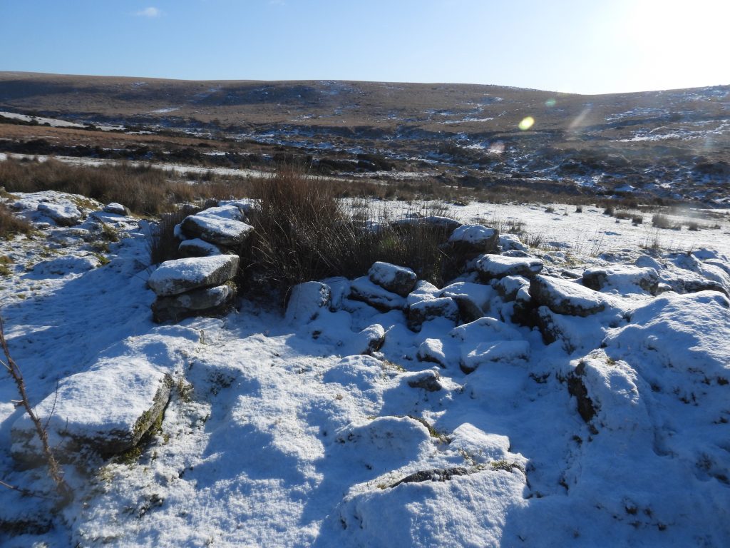
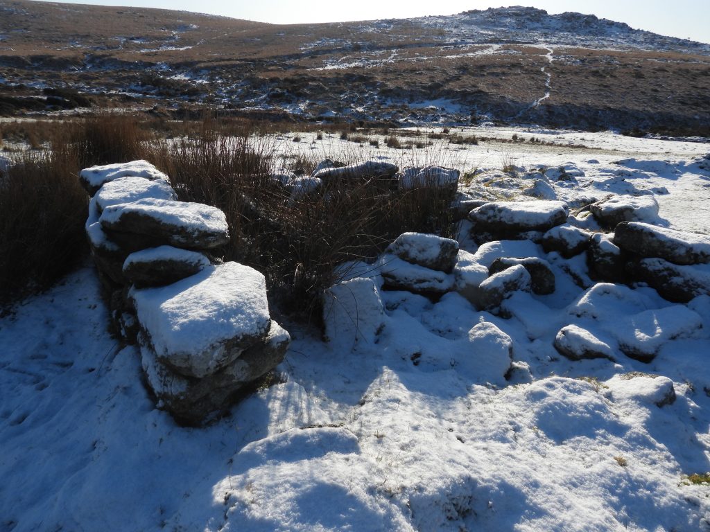
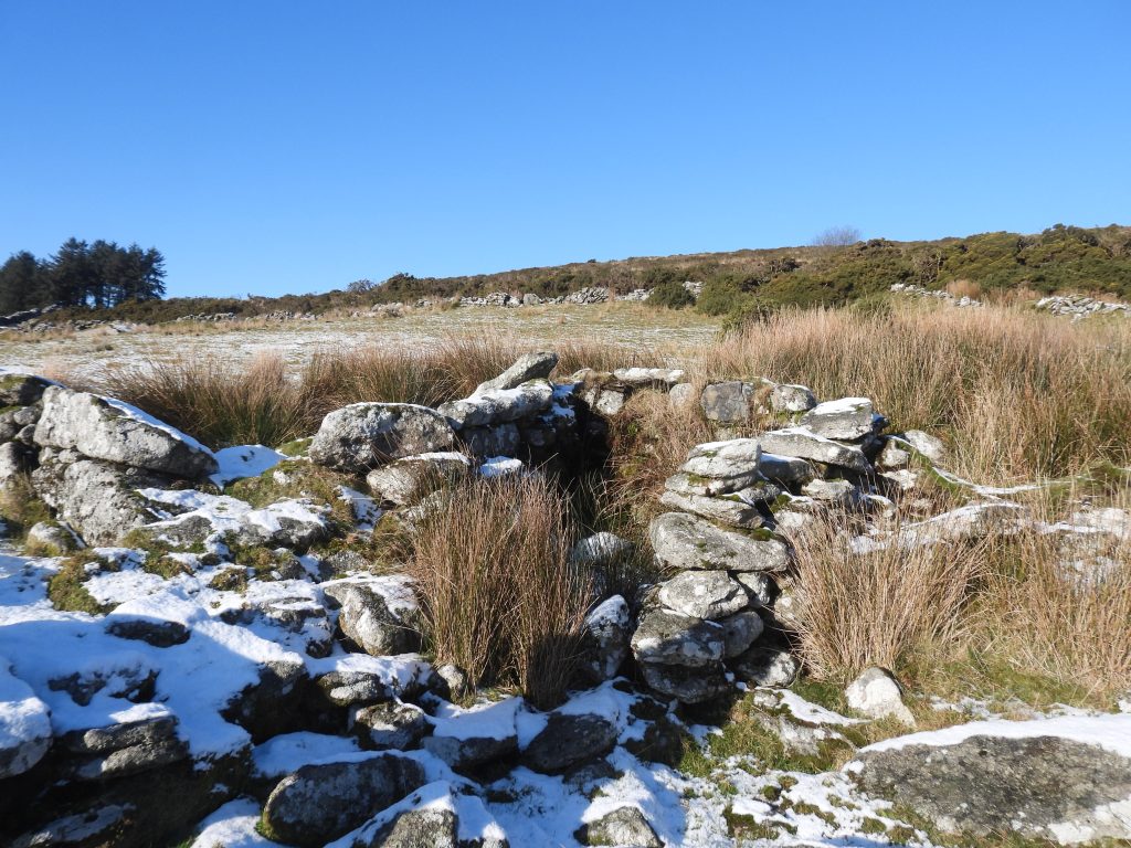
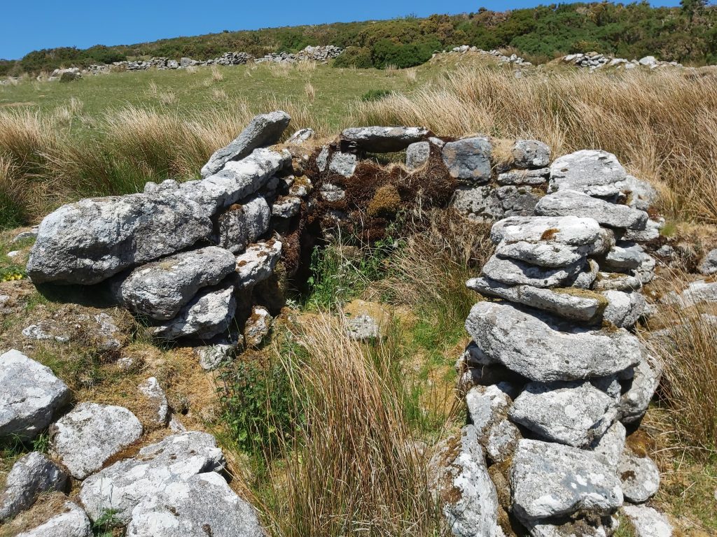
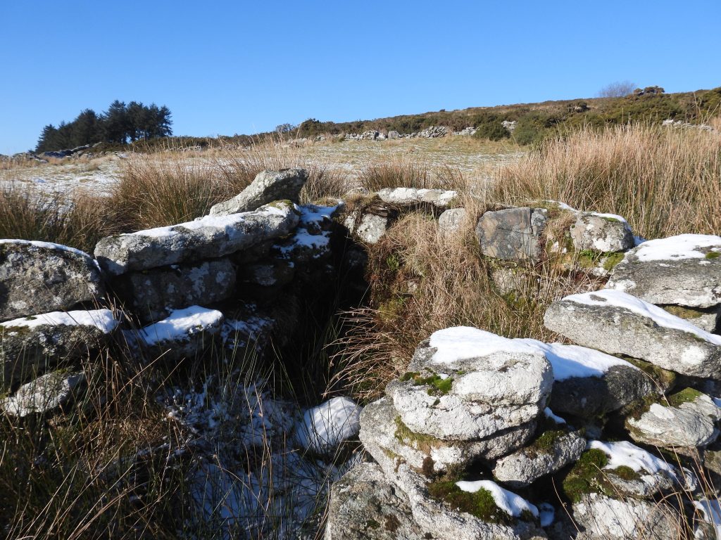
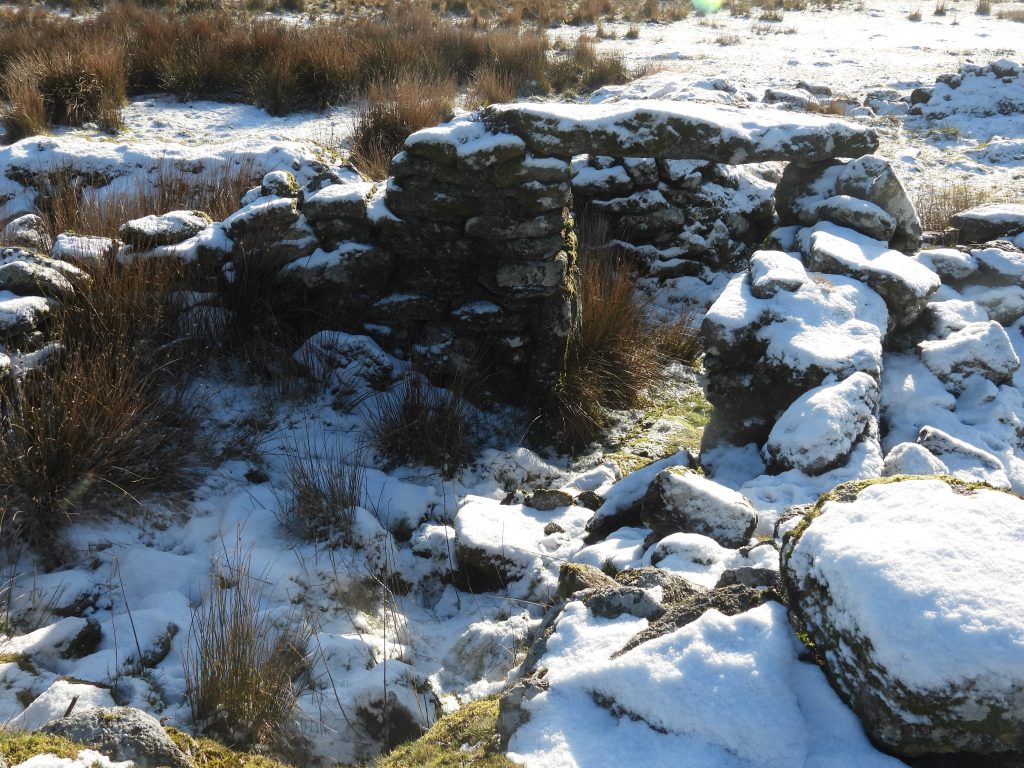
Along the western wall of the farmstead is a possible dog kennel or dog pit. The possible dog kennel or dog pit is located at SX58078 70047The dog pit or kennel with views to Down Tor and Sheepstor. It is recorded thus: “….composed of a stone slab, 0.8 m x 1 m, balanced upon stone supports with a chamber below. The dimension of the entrance is 0.4 m x 0.4 m”. (Newman)Just inside the west gate with view towards the main buildings. This area was probably a courtyardTo the south of the west gate is an open-ended outbuilding or outhouse having been built against the enclosure wall. It is located at SX58086 70041The outbuilding structure is 2.1 m wide by 3.5 m long. Phil Newman observed that an “additional wall has been built in the interior at a later date, which has created a compartment 1.1 m wide”.Near the Dog Pit / Kennel is a structure described as ‘temporary’ by Phil Newman. It is located immediately to the west of the Longhouse at SX58079 70054The ‘Temporary Structure’ measures 1.8 metres long by 1.6 metres wideThere is a small window opening in the ‘Temporary Structure’ which is 0.4 m x 0.4 m. The author assumes this is what can be seen towards the top of the walling in the picture. Newman also records there being “a detached window mullion, 1m long and 0.2 m square which compliments the small opening”. If this construction had a possible window, it might well have been used as extra accommodation perhaps?The west end of the Longhouse, which is the focal building and which occupies the north section of the enclosure wall. The photograph shows the largest of four ‘linear compartments’.The largest ‘compartment’ (annotated as number ‘1’ on the sketch map) measures 10 m long by 3.4 m wide. The centre of the compartment is located at SX58084 70053Compartment ‘2’ is situated to the east of the larger compartment ‘1’. It is 2.5 m wide, with an entrance in the south wall around 1 m wide.Compartment ‘2’ is centred at SX58089 70056Compartment ‘3’ is easily recognised by its lintel. Hemery describes in High Dartmoor: “Of the house little remains: a fine doorway with lintel in situ, a cupboard recess high in the north wall (a position suggesting its use as a cooler)”. No other observer seems to have mentioned the ‘cupboard recess’Compartment ‘3’ is 3m wide x 3.4m with walls 0.6 m thick. Mike Brown describes this a having : “floorspace barely 12.5 ft x 10ft with a door lintel still in situ”. He continues: “..on either side of which are two small outhouses”. Mike Brown record this as a ‘Tiny House”, suggesting this was the only accommodation within the farmstead. Compartment ‘3’ entrance is positioned on its southern wall and is 1 m wide and 1.55 m high. Mike Brown records that : “… when the census enumerator called in 1851, he found no less than six persons living in the little place! – William Dawe, a tin miner, his wife Elizabeth, and their four young children”. One wonders where they all lived, maybe it was compartment ‘3’ but maybe they used some of the other structures for sleeping ?Compartment ‘3’ is centred at SX58092 70057The Lintel is approx. 1.9 m long, 1.5 m wide and 0.2 m thickThe doorway opens onto a short laneThe easternmost compartment (number ‘4’) is 2.5m wide and around 3.4m deep. Of interest in 1977, the OS Archaeology Division only recorded three compartments, viz: “The westerly building (compartment 2) measures internally 3.7 x 2.4m with a drystone wall 0.8m thick; the middle building (compartment 3) measured 3.8 x 2.8m, with wall 1.4m high and 0.6m thick, its door joint and lintel in situ; the easterly building (compartment 4) is 2.3m wide; length not known because the south wall is destroyed, and wall 1.4m high and 0.6m thick”. It is very intriguing how interpretations varied between the 1970s and the 2000s Compartment ‘4’ is centred at SX58096 70055Looking south west over compartment ‘1’ onto the courtyardThis annotated photograph shows some of the various features as viewed north to southCompartments ‘2’, ‘3’ and ‘4’Compartments ‘2’ (right) and ‘3’ (left)Compartments ‘3’ (right) and ‘4’ (left)Farm lane looking west towards Burrator reservoirTo the east of the farmstead. This is one (of two) outbuildings or structures (as annotated on the sketch map in this post) connected to the outside face of the neighbouring enclosure wall. This one is located at SX58107 70052. The structure, whose walling has been emphasised by the snow is 1.5 m by 1.8m wide with walls 0.5 m high. It is usually very overgrown in the summerGatepost on the eastern wallGatepost looking along the narrow lane through the farmstead. It is located between the two structures on the eastern boundary walling.Located to the north of the first eastern boundary structure (or outbuilding) is another structure. It is located at SX58106 70069. The structure is 1.5 m x 1.3 m and looks like it may have been an open endedNext to the structure shown in the previous photograph is a gateway, which leads to a track (this is shown on the sketch map on this post)This Longhouse (known as Colliers) lies to the north east of ClassiwellLike Classiwell, ‘Colliers’ Longhouse was built across the slope. It is divided into two units approx 12ft x 8ft and 12ft x 25ft (ref: Brown)Was ‘Colliers’ ever used for human habitation in the 19th century? It may have just have been a barn or linhay belonging to Classiwell. It is located SX58257 70162At the west end of ‘Colliers’ Longhouse is a revetment with two integral ‘blocks’ which looks like a wall ladder to gain access to an upper platform. Mike Brown offers the following interpretation of ‘Colliers’, viz; “I believe it was built by Joseph Spurr shortly after he became the tenant at Classiwell in 1787*, for his lease included permission to ‘enclose about Eight Acres of the Commons next adjoining the said premises’. This expansion of the site would have necessitated the construction of additional accommodation to house more livestock for which purpose the building tucked in against the rear (northern) slope of the plot is ideally suited, being situated above the largest of the Classiwell fields, which latter also offers the best quality grazing”. This is an interesting thought. *Note: The Joseph Spurr tenancy was recorded as being 1791 (not 1787) in the Paul Rendell publication, ‘Exploring around Burrator’.