A collection of walks, discoveries, insights and pictures of exploring Dartmoor National Park
January 3, 2026
Fox Tor Farm
From the late 18th century and into the 19th century, through land grants provided by the Duchy of Cornwall, certain estate holders began to expand the size of their holdings and to enclose tracts of moorland. This period of Dartmoor history is usually referred to as the ‘improver period’. David Gray (a Dawlish gentleman), noted this and wanted a ‘piece of the action’ (to coin a modern phrase) and was intent of taming a tract of land on Dartmoor. Gray successfully applied to the Duchy to enclose an area of land in the Swincombe valley with the intent of establishing a ‘farmhouse with offices’. In June 1807, Gray was granted a 99 year lease on his chosen plot of 582 acres. On the lease book (1807-1811), Gray was referred to as ‘late of his Majesty’s Secretary of Legation and Charge D’affaires at the Court of Saxony’ and one assumes that he may have just wished to be just a ‘gentleman farmer’ and leave the hard graft to others?
Gray’s enthusiasm for the project had waned within a year and a Thomas Windeatt took over the lease in June 1808. It was Windeatt who in 1812 had Fox Tor farm built and land enclosed. However, the construction was instrumental in the destruction of the nearby Childe’s Tomb by Windeatt’s workmen who were in pursuit of ‘some of the stones for building and door steps’ (ref: Burt in Carrington’s Dartmoor). By 1817, the Eden family had taken occupation of Fox Tor Farm and their ‘dynasty’ through Jeffrey, William and Richard lasted 42 years until 1859. The last known occupier of the farm was a Richard Worth, who left in 1863. That said, the land was still being leased in the 1870s and 1880s.
Much of the detail in this post has been made possible by the superb research work carried out by Elisabeth Stanbrook and recorded in ‘Dartmoor Forest Farms – A Social History from Enclosure to Abandonment’ which was published by Devon Books in 1994. Aside the ruined walls and the remains of the enclosed and worked land, it is always intriguing to unravel some of the related social history, which Elisabeth has successfully achieved. A visit to the ruins of the farm in the 21st century with this knowledge of social history certainly enhances one’s appreciation of how hard life must have been 200 years ago.
Bibliography
Elisabeth Stanbrook (1994) – Dartmoor Forest Farms, a social history from enclosure to abandonment; Fox Tor Farm, pages 42 – 52
Jeremy Butler – (1993) – Dartmoor Atlas of Antiquities: Volume Four – The South-East, 218-220
R.G. Haynes – (1966-1969) – Ruined Sites on Dartmoor (Un-published)
Eric Hemery – (1983) – High Dartmoor, pages 355-360
M.J. Fletcher – (1988, Royal Commission for the Historical Monuments of England (Report – Survey). SDV214888
N.T. Carrington – (1826) – A descriptive poem, page 169
William Crossing – (1902) – The Ancient Stone Crosses of Dartmoor, page 94
William Crossing – (1966) – The Dartmoor Worker, page 29
William Crossing – (1989) – Princetown, its rise and progress, page 37
Tom Greeves – (1986) – The Mines and Miners of Dartmoor, page 2
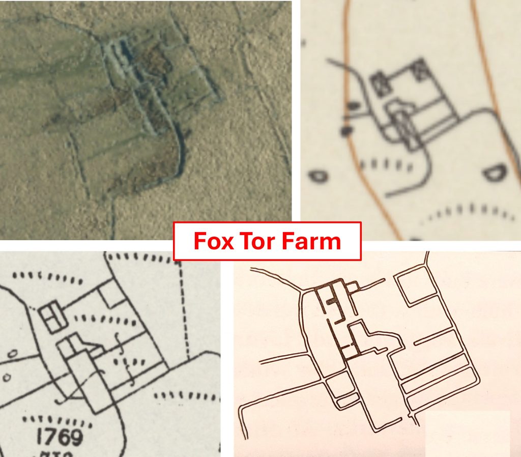
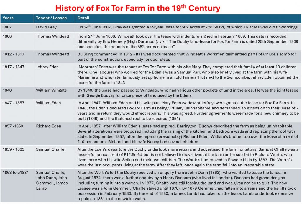
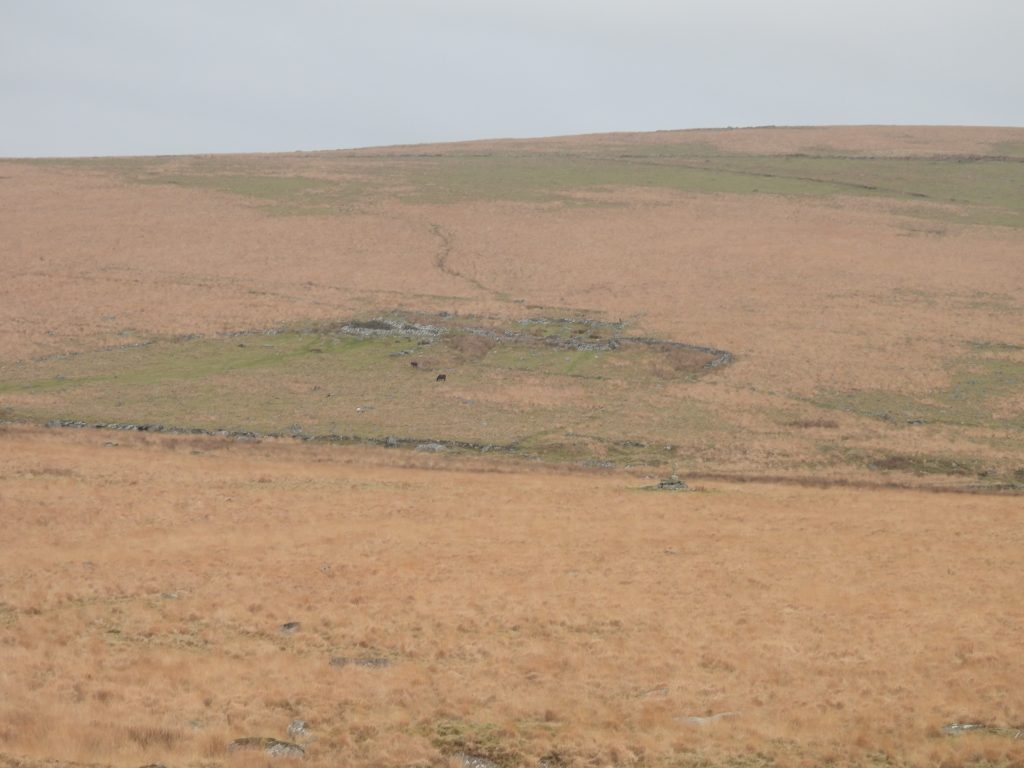
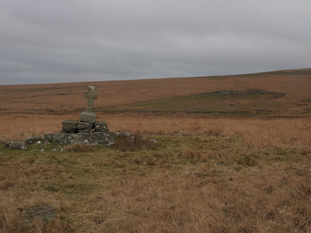
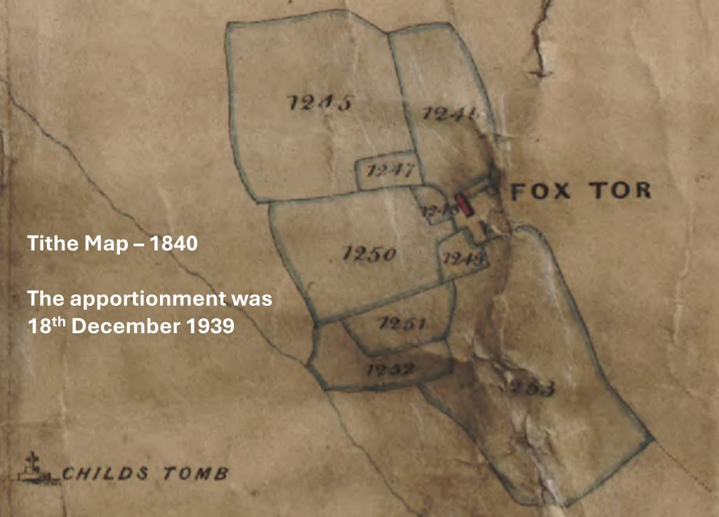
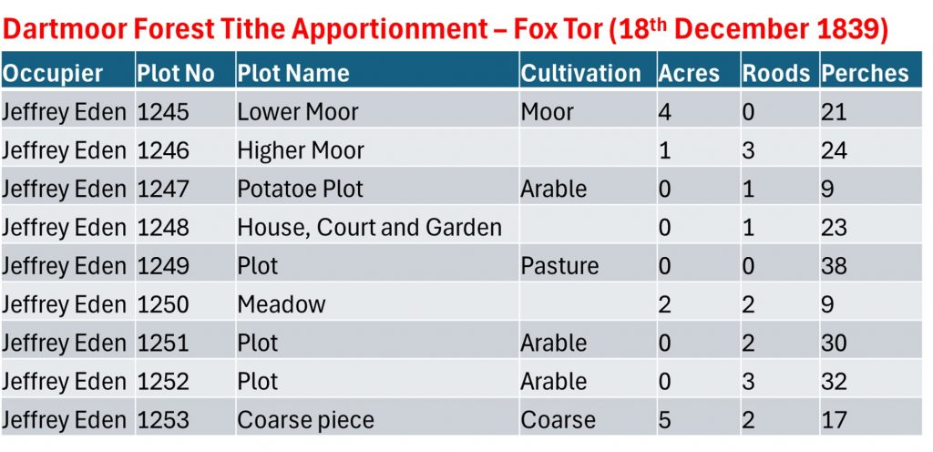
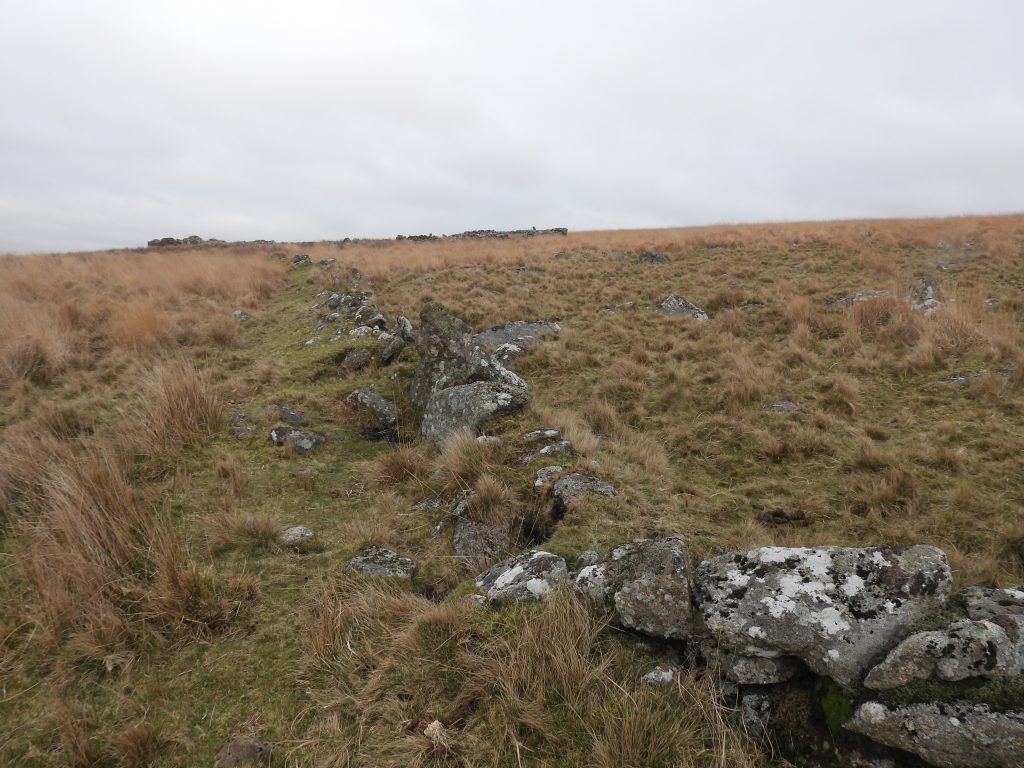
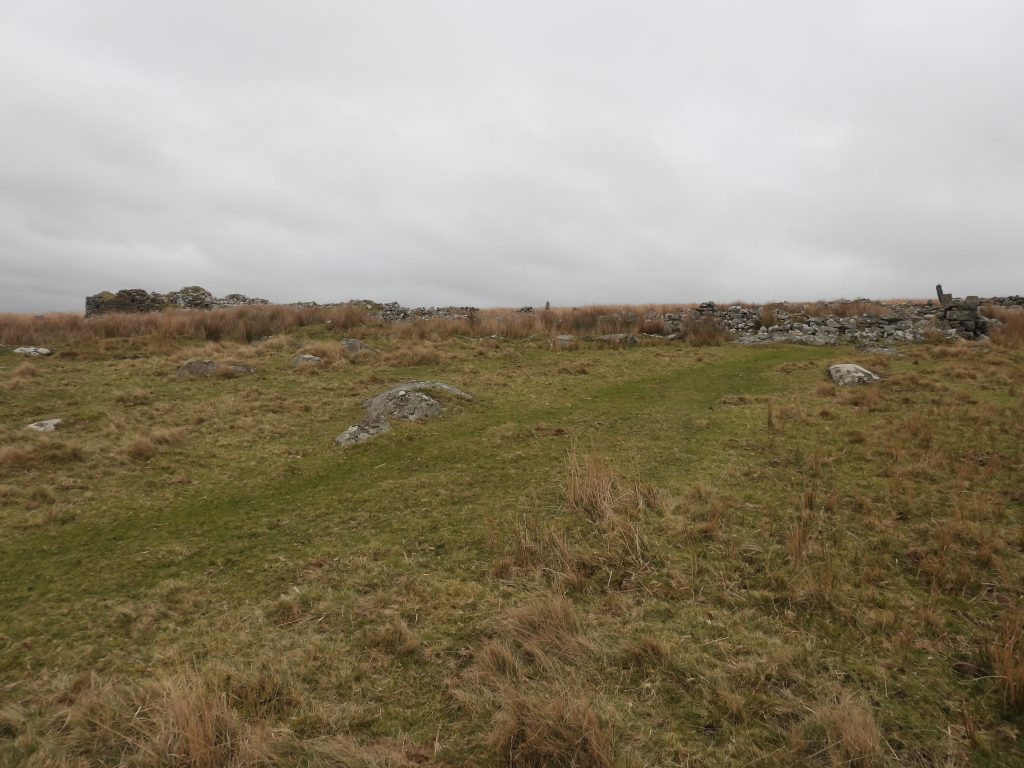
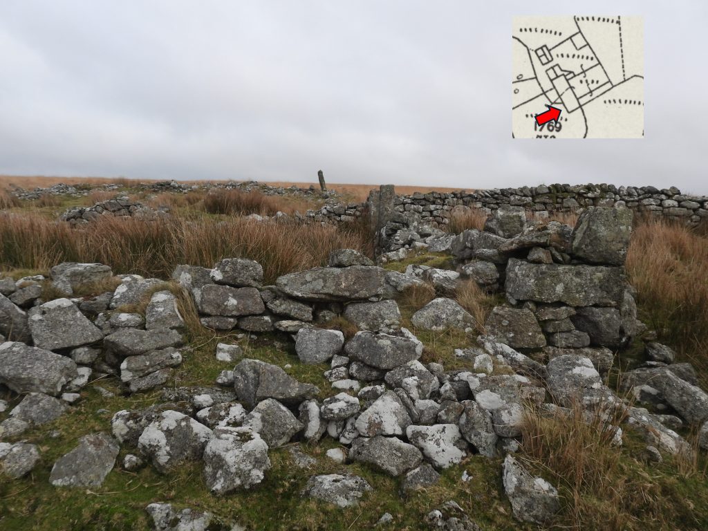
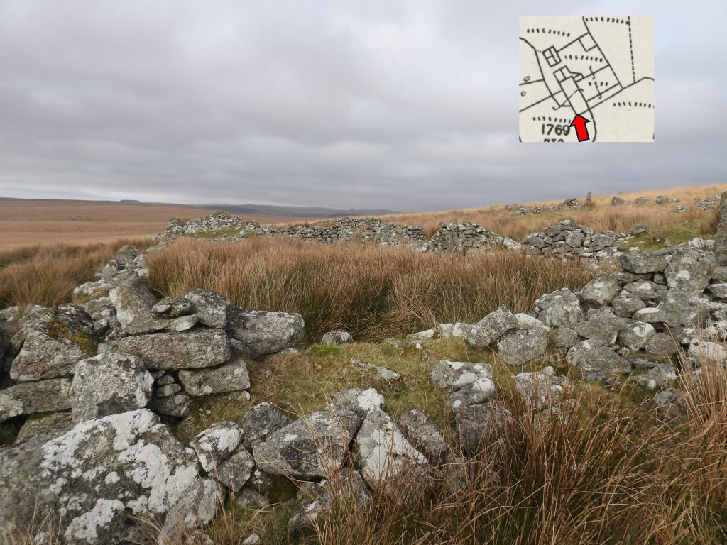
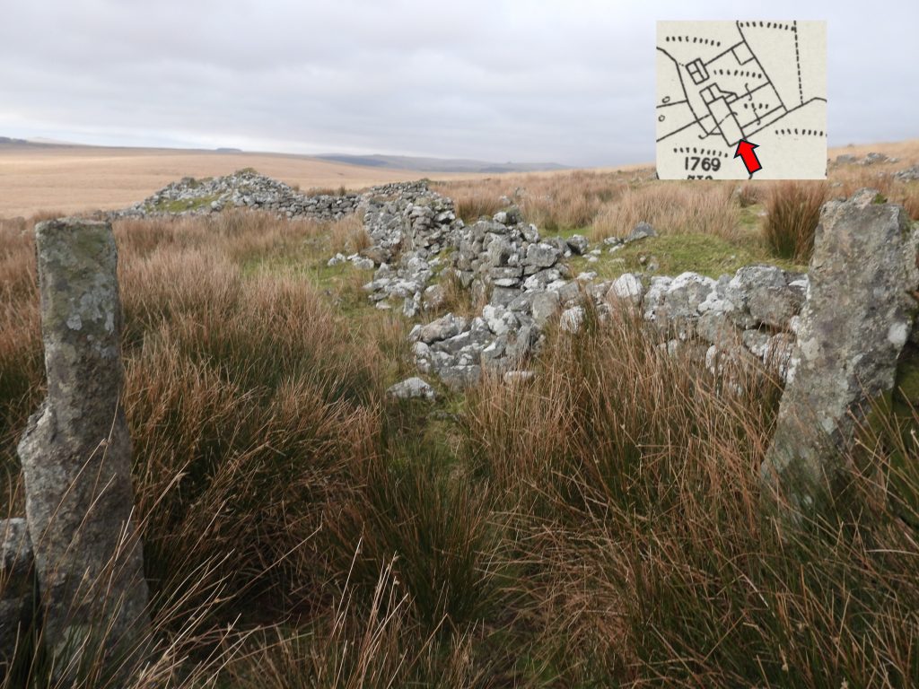
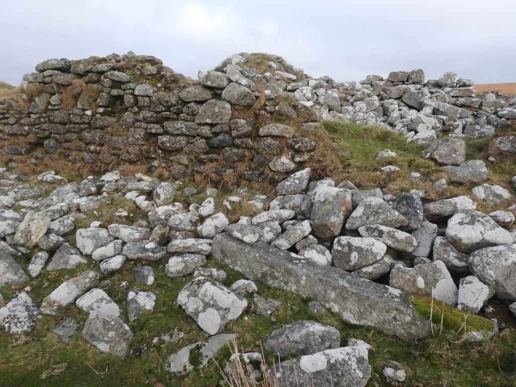
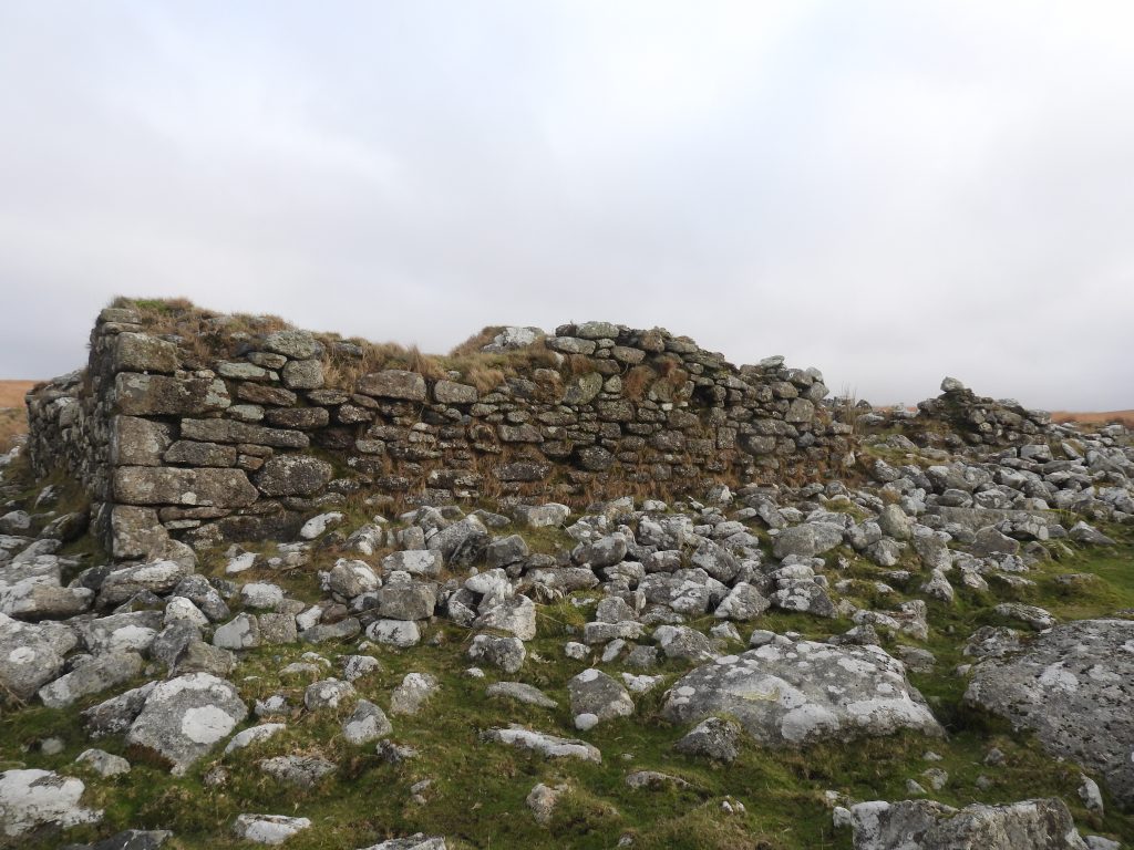
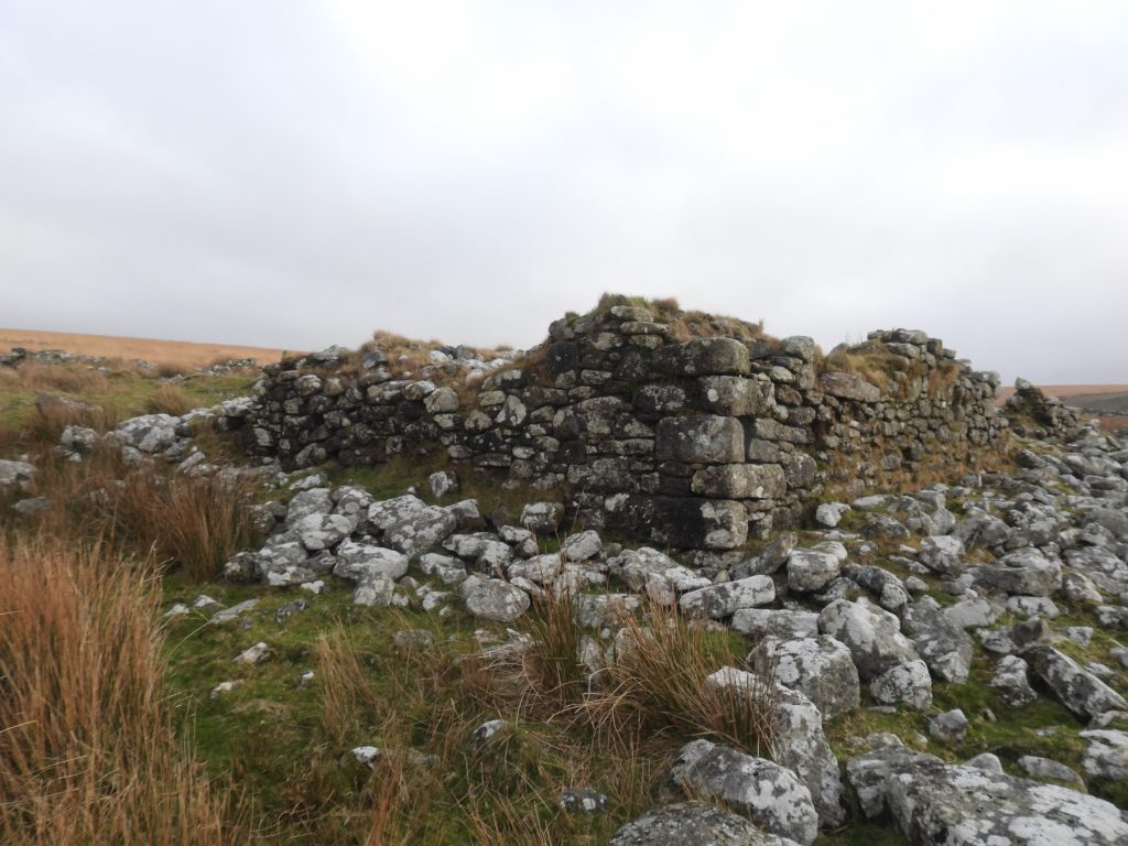
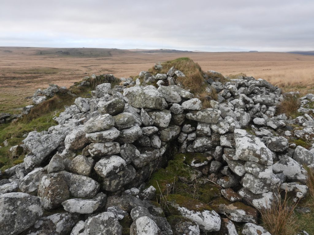
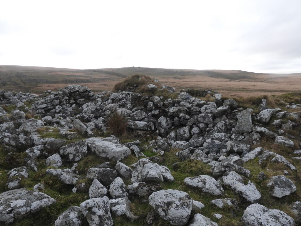
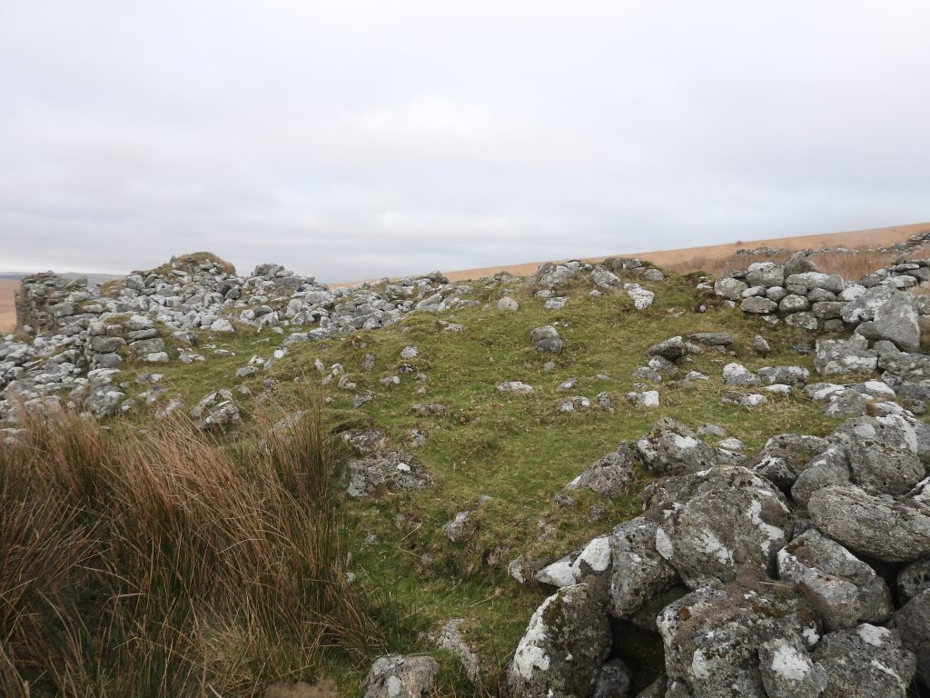
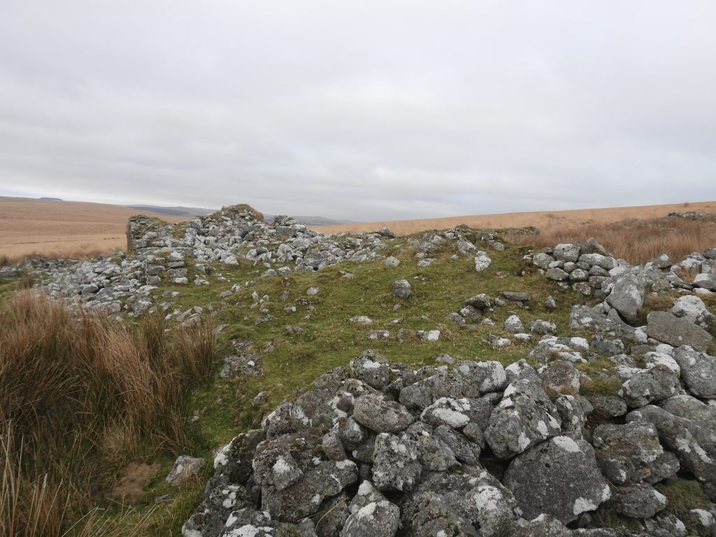
This collage of maps and an aerial view of the ruins at Fox Tor farm indicate the extent of construction which took place in the 19th century, much of which can still be seen today. Of note is the map (top right), from 1949, with three ‘X’ markings, which might indicate they were once roofed. That said, the top left ‘X’ on the map is the farmhouse and the other two appear to have been enclosures.This table of the history of Fox Tor Farm in the 19th century has been created from information taken from the fabulous Elisabeth Stanbrook publication from 1994 – Dartmoor Forest Farms, a social history from enclosure to abandonment; Fox Tor Farm, pages 42 – 52. Its great that the social history has been so meticulously been recorded and gives us an insight into how hard life must have been. Stanbrook records that the original lease (to Gray) stated the bounds as being : “North and North East and East upon Scurhill; South East and East upon County Comb and Fox Tor Hill; South West and West upon the Plymouth Dock Leat and North West upon Steanan Hill and Fox Torr Brook”Approaching Fox Tor farm and Childe’s Tomb from the south west the dome of Ter Hill behind. Access to the farm was via a track that came over Ter Hill and one assumes this may be the dark ‘s’ shape seen snaking up the hill in the photograph, although the author isn’t 100% sure of this. Childe’s tomb (as described by Jeremy Butler remarks) is in reality a Christianised cist and cairn with a kerb retaining circleChilde’s Tomb in December 2025. According to Crossing, in his ‘Ancient Stone Crosses’ (pages 89), “The tomb continued to be perfect until 1812, when it was nearly destroyed by the workmen of Mr Windeatt, who was building the farmhouse near by”. Crossing claimed some of the stones were also used in the construction of a footbridge over a stream between Fox Tor and the farm
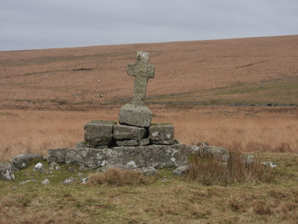
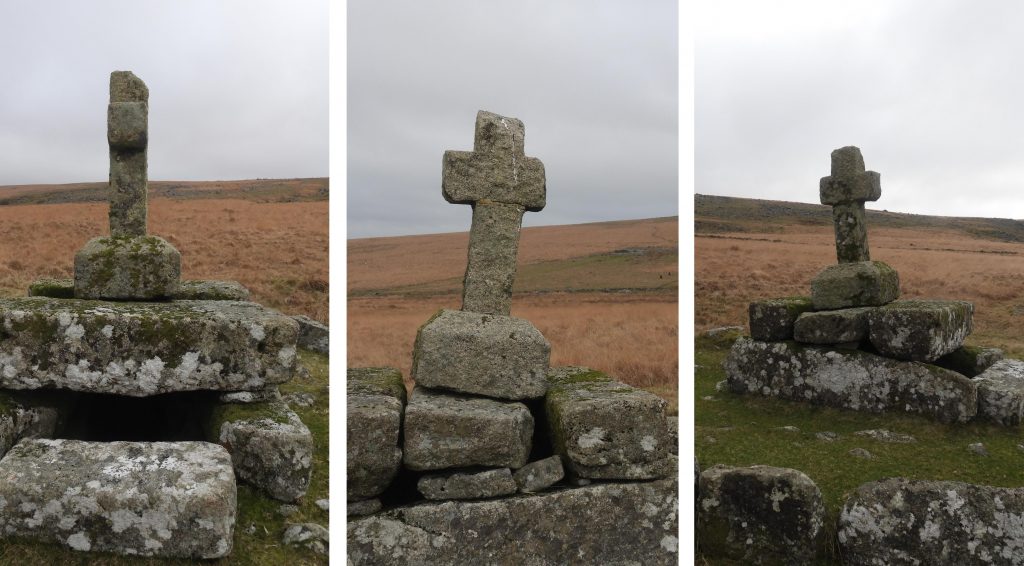
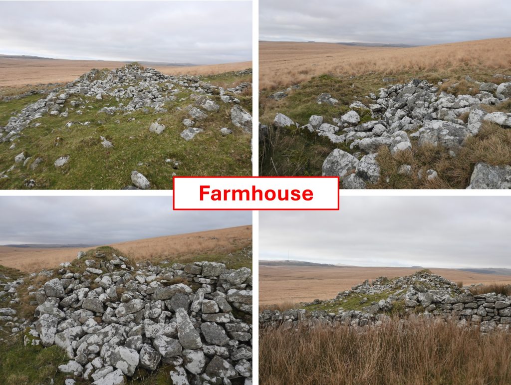
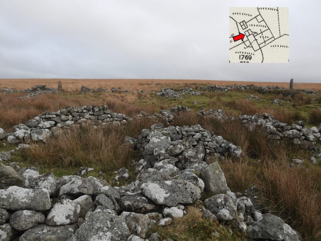
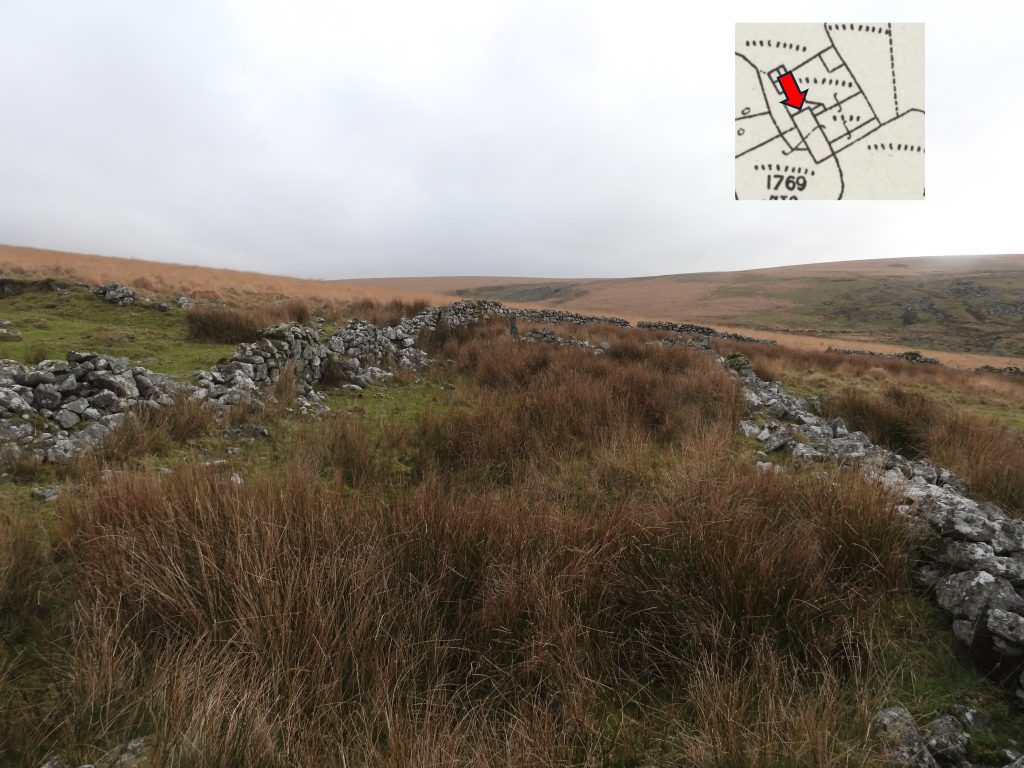
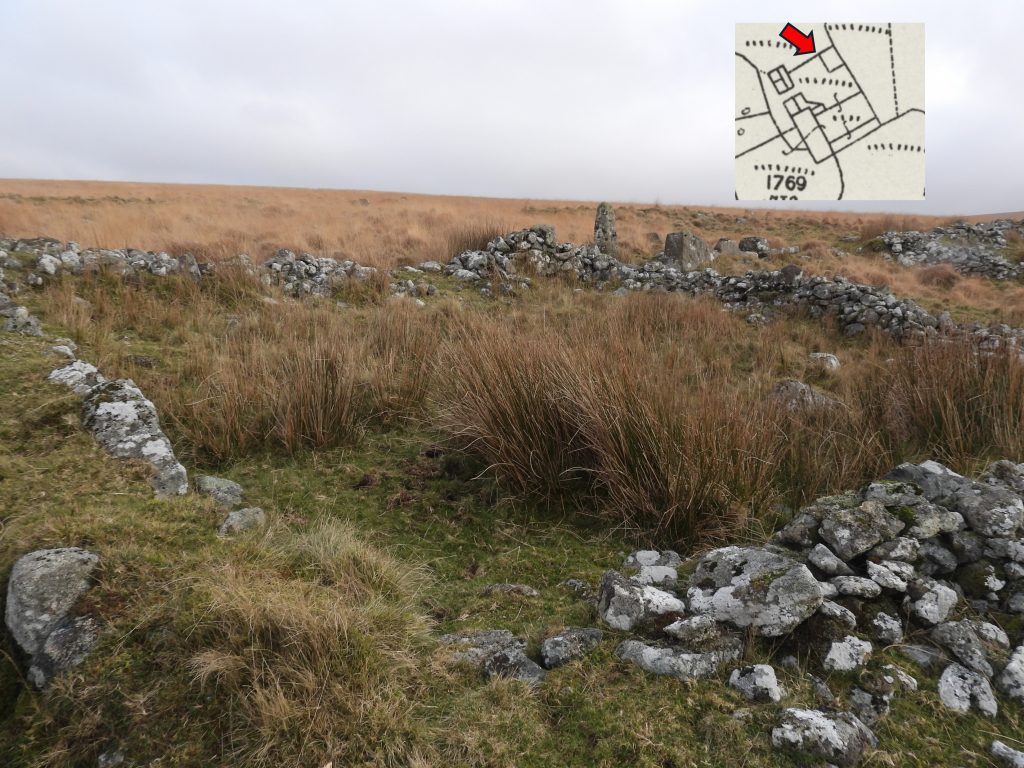
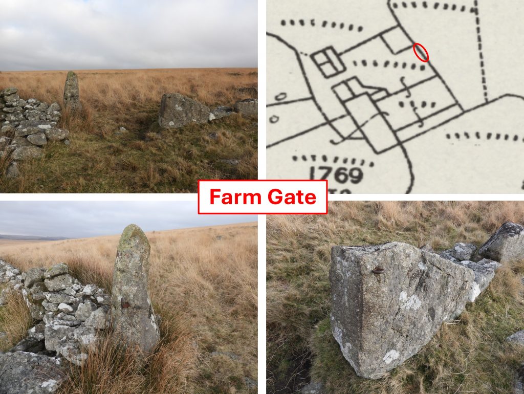
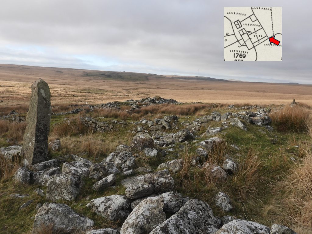
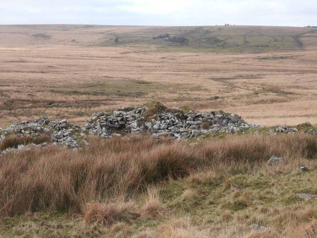
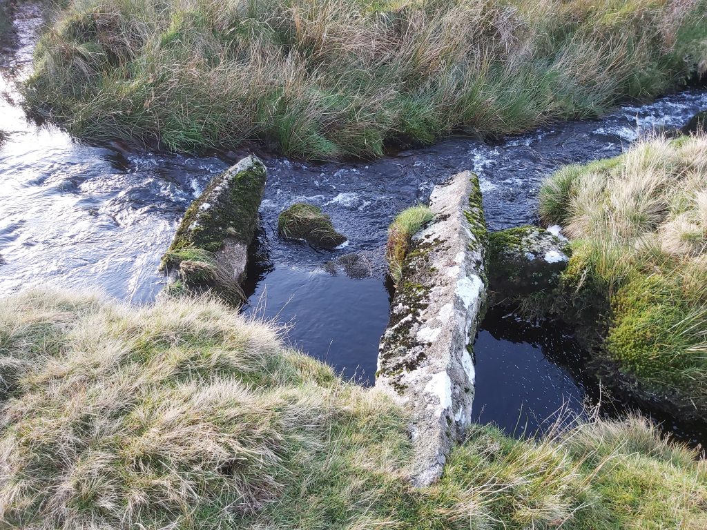
This picture was drawn and etched by P.H. Rogers and was published in Carrington’s Dartmoor, published in 1826. It is assumed this is what it looked like (notwithstanding artistic licence) before it was dismantled by the workmen building Fox Tor farm. Carrington recorded the tomb as consisting of a pedestal formed by three steps (the lower ones comprising four stones, 6ft long and the upper ones comprising at least eight stones or more). He also noted, “a socket and groove for the cross, and the cross itself, with its broken shaft”.
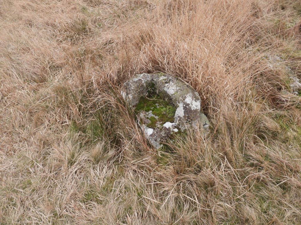
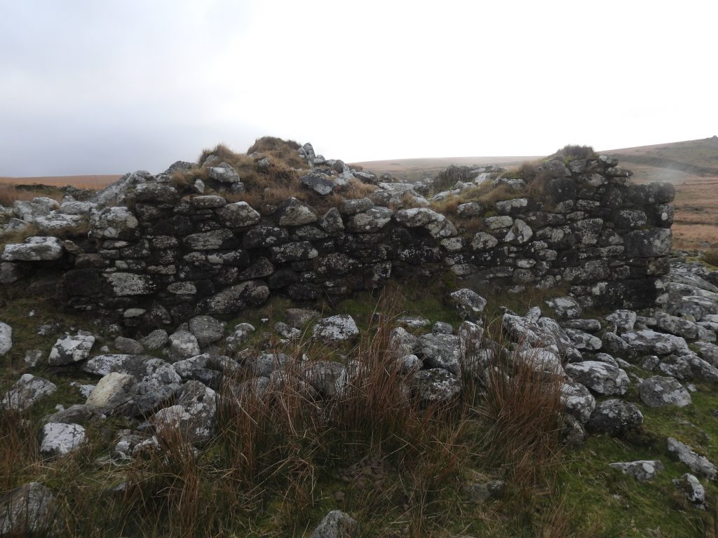
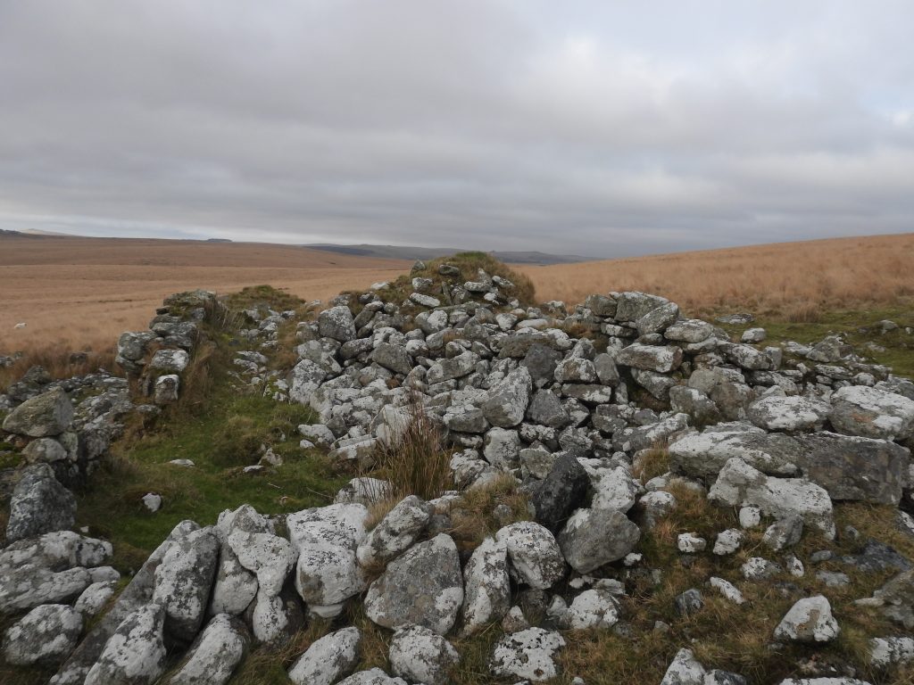
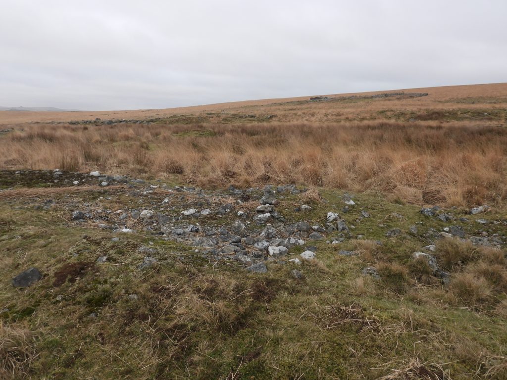
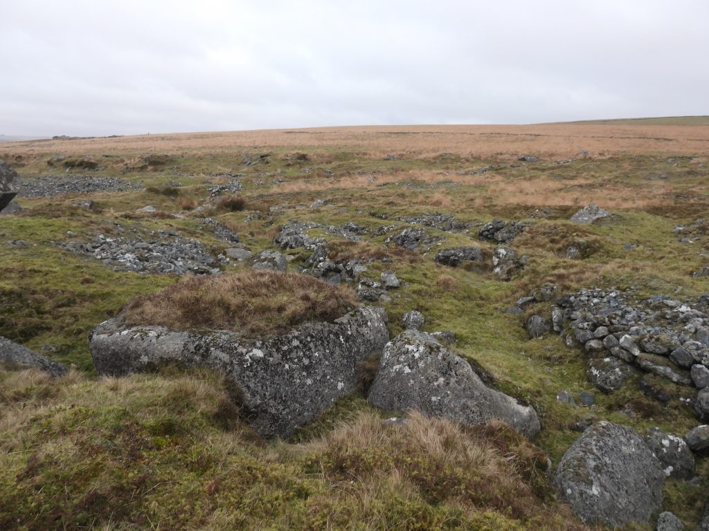
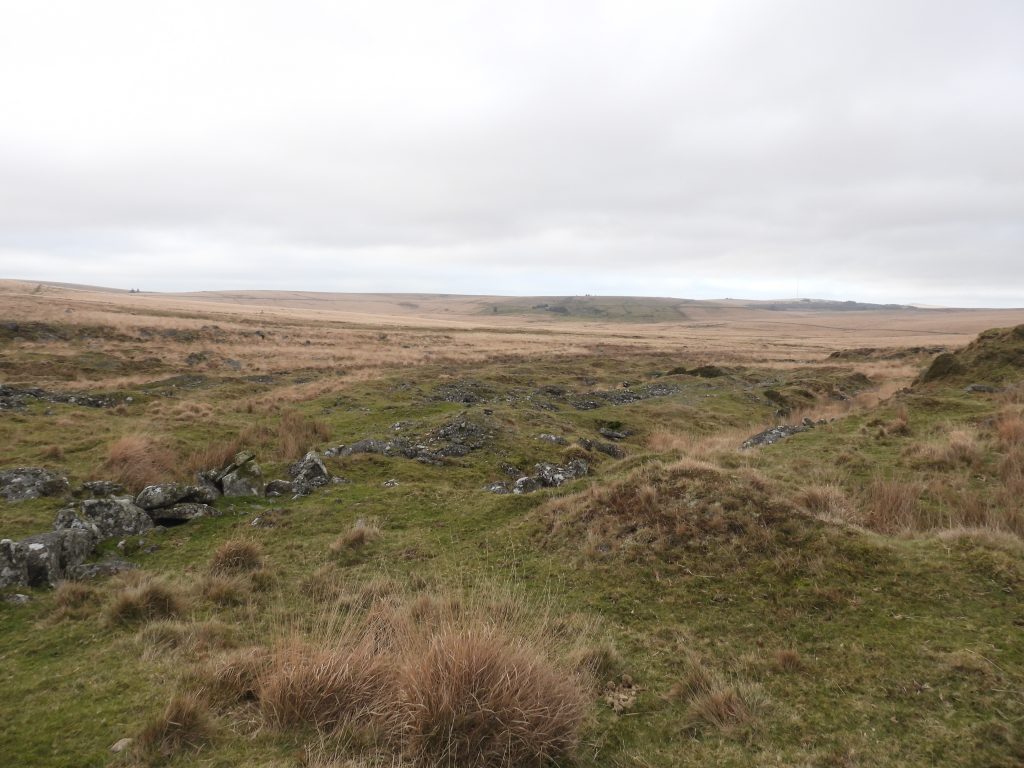
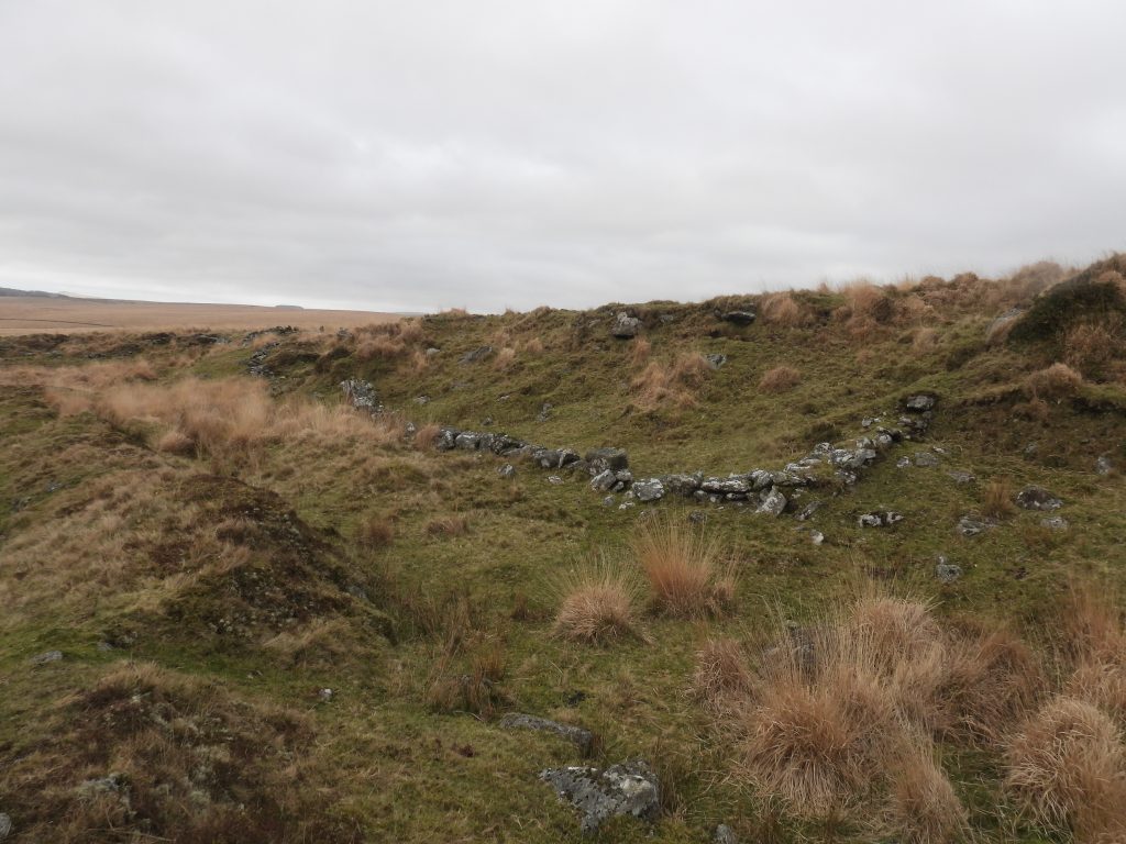
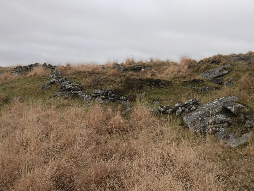
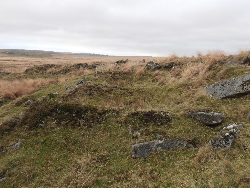
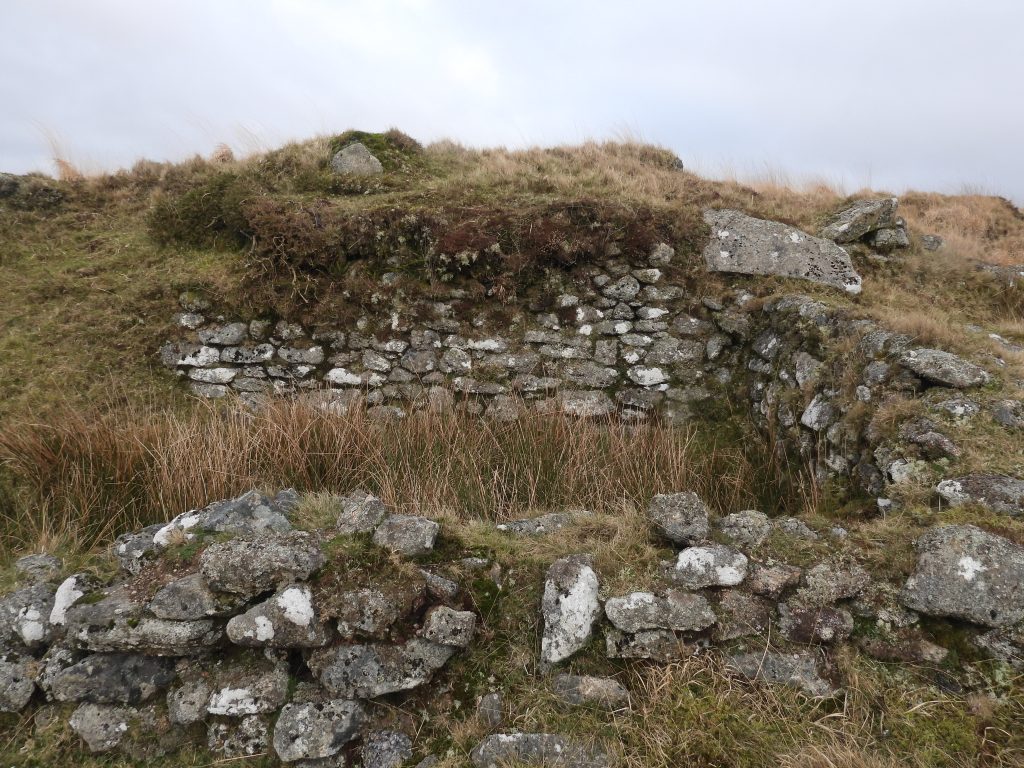
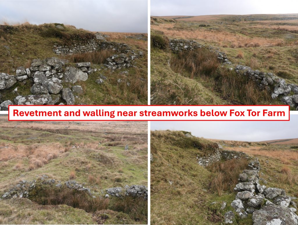
Childe’s Tomb is located in an area moormen call Sand Parks. The Dartmoor legend of Childe the Hunter, who is said to have perished here is well known*, having been recorded by Risdon, whose survey was completed about 1630. Towards the end of the 19th century, William Crossing enlisted the help of a moorman Richard Eden, who had been born at Fox Tor farm in 1823, to locate some of the stones from the original Childe’s Tomb and also from the tomb and cairn itself. Eden told Crossing that he had heard that there were ‘letters’ on the underside of them. Crossing thought the ‘letters’ may have been from the famous Risden couplet relating to the tomb and Childe the Hunter, which read: “They fyrste that fyndes and brings me to my grave, The priorie of Plimstoke they shall have”. Of course Crossing never did find any ‘letter’ inscriptions but claims to have found 9 of the original 12 pillars that formed the pedestal as shown on the P.H. Rogers etch in the Carrington publication. *The cross allegedly commemorates Childe, a local folk lore character who supposedly froze to death on the moors in the reign of Edward III (1327-1377).By 1881, a cross head was found nearby by workmen repairing the newtake walls, which was considered as being an original from the tomb, although this could never be proved. Childe’s Tomb as we see it in the 21st century was restored in 1885 by Mr Fearnley Tanner (Hon. Sec.) and the Dartmoor Preservation Association. A new cross and socket-stone had to be cut and according to Eric Hemery, the stone was cut in Holne. Crossing is said to have exclaimed they set up: “on a few of the stones thrown over the kistvaen, a new base and a new cross!…it would have been better to have been left untouched.” This cross socket lies just a few metres to the east of Childe’s Tomb. This is presumed to have been the original cross socket before it was vandalised in 1812 during the construction of Fox Tor Farm. William Crossing mentions this stone in ‘The Ancient Stone Crosses of Dartmoor’ (pages 91 and 92), where he records: “It was the base in which the cross was once fixed, the socket sunk in it still remaining in part. There was much more design about it than is shown in the vignette* in Carrington’s Dartmoor, which however, in its main features is, probably, a correct representation of the tomb”. Crossing records the dimensions of the stone as being 2ft 3ins across, which is assume to be from corner to corner as he mentions side dimensions later. *vignette =engravingThe tithe map from 1840 shows clearly the 9 plots of Fox Tor farm and their relationship to Childs (sic) Tomb. What is slightly confusing is how Childe’s Tomb is depicted, showing two steps upon which a cross stood – this seems ‘at odds’ with the record in William Crossing’s ‘Ancient Stone Crosses’ publication where he records the cross was seen in 1823 and again in 1825, but was just lying near the cairn. Further to this, Richard Eden (who was born 1823) told Crossing he did not remember seeing the cross in his childhood, so Crossing assumed it had vanished shortly after 1825. So, how did the cross get depicted as being erect in 1840 on the tithe map but according to Crossing had disappeared by 1825?In 1839, Jeffrey Eden and his family were occupiers of Fox Tor farm. The total area recorded on the tithe apportionment was 16 acres, 3 roods and 3 perches. The amount of rent charge apportioned upon the ‘several lands’ and to whom was 4s 11d (£38.45 in 2025). It was payable to RECTORWalling approaching Fox Tor Farm. This is close to two arable plots (251 and 252) shown on the tithe map. At the time of the tithe (December 1839), Jeffrey Eden was the tenant and is known to have employed farm labourers. Crossing mentions in the Dartmoor Worker (page 29) that the father of an acquaintance (Richard Cleave) had ‘spaded’ many acres of land at Fox Tor Farm in the early part of the 19th century. The going rate for ‘spading’ was 4 1/2d a yard. ‘Spading’ was a method of paring and burning the land to make it suitable for cultivation. Approaching the farmhouse and adjacent walls. This view of the main Fox Tor farm ‘complex’ is at the corner of an enclosure, which was marked on an OS map (from 1949) with an ‘X’ marking, which might indicate it was once roofed perhaps.An end on view (south to north) of the enclosure marked with an ‘X’ on the 1949 OS map. It does seems a little large to have every been roofed. This picture was taken at SX62928 70514The gateway into the enclosureThe entrance into the farmhouse of Fox Tor farm. It is interesting to note there is a ‘step’ here which conceivably might have been part of the original (pre-1812) Childe’s Tomb pedestal. It is located at SX62910 70551The farmhouse from the west side. William Crossing in his publication, Princetown – its rise and progress (page 37) we learn about a description of the house by Eden Phillpotts in his novel “The American Prisoner”. Crossing remarks that although fanciful, he thought the description was not that wide of the mark. The description was : “It was built for a gentleman’s residence, and Mrs Mortimore, just mentioned, the stables there which were beautifully paved”. There is no evidence of anything paved North west corner of the farmhouse. Before 1857, the farmhouse only had a kitchen and a bedroom on the ground floor, with space under the thatch.East side of the farmhouse where there looks like there might once have been a ‘lean-to’ (or outshut). Is this the ‘house behind the dwelling’ which the Eden’s asked to be covered?The inside of the farmhouse. The wood used for the construction is said to have come from Brimpts plantation drawn to its site by a team of oxen.Writing in the 1960s, R.G. Haynes recorded of the farmhouse “most of the dressed stone has been removed now, although a stairway is still visible”. There is a section of the ruins which may have been where the stairway once stoodThe farmhouse with Fox Tor on the skyline beyond. There is an interesting story recorded in ‘Tin Mines and Miners of Dartmoor’ by Tom Greeves (page 2), where he recounts oral information he received by William Francis (Frank) Coaker, who was born at Swincombe in 1906. Coaker recalled a story he had heard about a (Whiteworks) miner and his wife who lived at Fox Tor farm. When their first child was expected, it was arranged that she should hang out a white sheet when she was going into labour so her husband could see it from the mine. The day of the labour came but it was a typical foggy Dartmoor day and when she hung out the sheet, no one could see it. When her husband returned in the evening he found his wife had had the baby without any assistance.The farmhouse – imagine the Eden’s with their ten children here plus possibly Sam Parr and his wife as tenants; would this have been possible in such a space? It is known that two of Jeffrey Eden’s daughters (Maria and Elizabeth) also gave birth to illegitimate childrenIn the 1840s, some of the Eden children as well as some of the lodgers left home to ease the space.Collage of the farmhouse ruinsView of the walling looking north-east up to the slopes of Ter Hill. Most of the farm (ref: Tithe) appears to have been for arable purposes. To the north west of the farmhouse there was a small potato plotLooking south east across the enclosed area, shown with an ‘X’ on the 1949 map. It is known that cattle were kept at the farm. This might have been a holding enclosure perhaps?This small square enclosure is also marked with an ‘X’ on the 1949 OS map. It is located at SX62936 70560As the main track to the farm was known to have come across Ter Hill, this may well have been the main gate. Iron hangers and a hook are still in place. Standing stone at south east corner of the main enclosures surrounding farmhouse. Whiteworks cottages can be seen in the distance.Zoomed in view of the farmhouse with Fox Tor mire and Whiteworks beyondBelow the farm, there are two imposts which once formed a clapper across the River Swincombe. William Crossing believed these might have been part of the original Childe’s Tomb step surroundStreamworks along the Swincombe with Fox Tor farm beyondStreamworks to the south of the farm. These are from medieval period and later. As well as streamworks there are openworks which cover an area of approximately 25 hectare which extends along the courses of the Swincombe, Fox Tor Stream, Fox Tor Girt and Swincombe Valley.Looking north west across the streamworks towards Whiteworks and PrincetownOn the edge of a scarp to the east of the Swincombe (between the river and the farm), a few walls have been constructed, which one assumes relate to the farm or possibly pre-date the farmSome of the walling appears to have been built in such a fashion as to create small enclosuresAre these two small enclosures built into the scarp ? The walling here appears to be located at the edge of plot 253 (course piece) shown on the 1840 tithe map, which was just over 5 1/2 acres in size and extended north to the farmBuilt into the scarp is a revetment and walling which resembles a building. It is unlikely to have been related to the tinners’ activitiesThis possible building, might of course be related to the farm. It is located at SX62857 70398