A collection of walks, discoveries, insights and pictures of exploring Dartmoor National Park
December 6, 2025
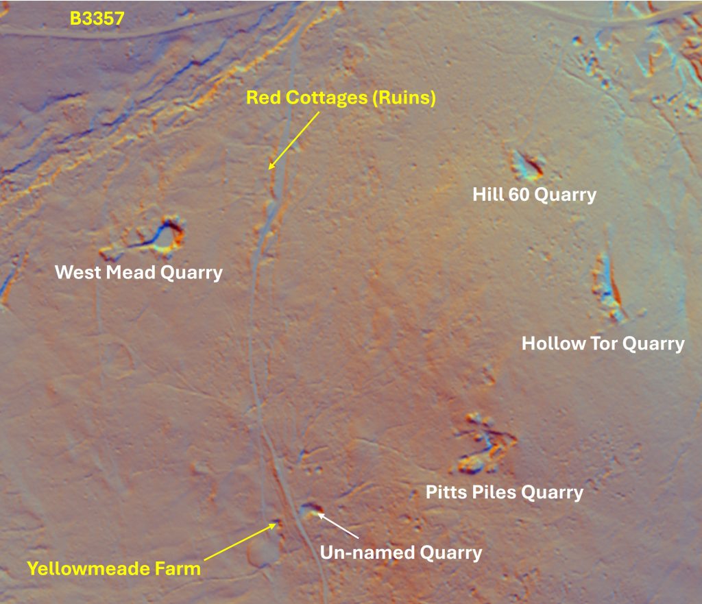
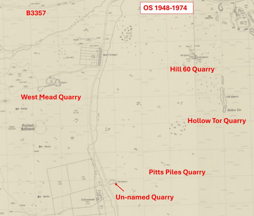
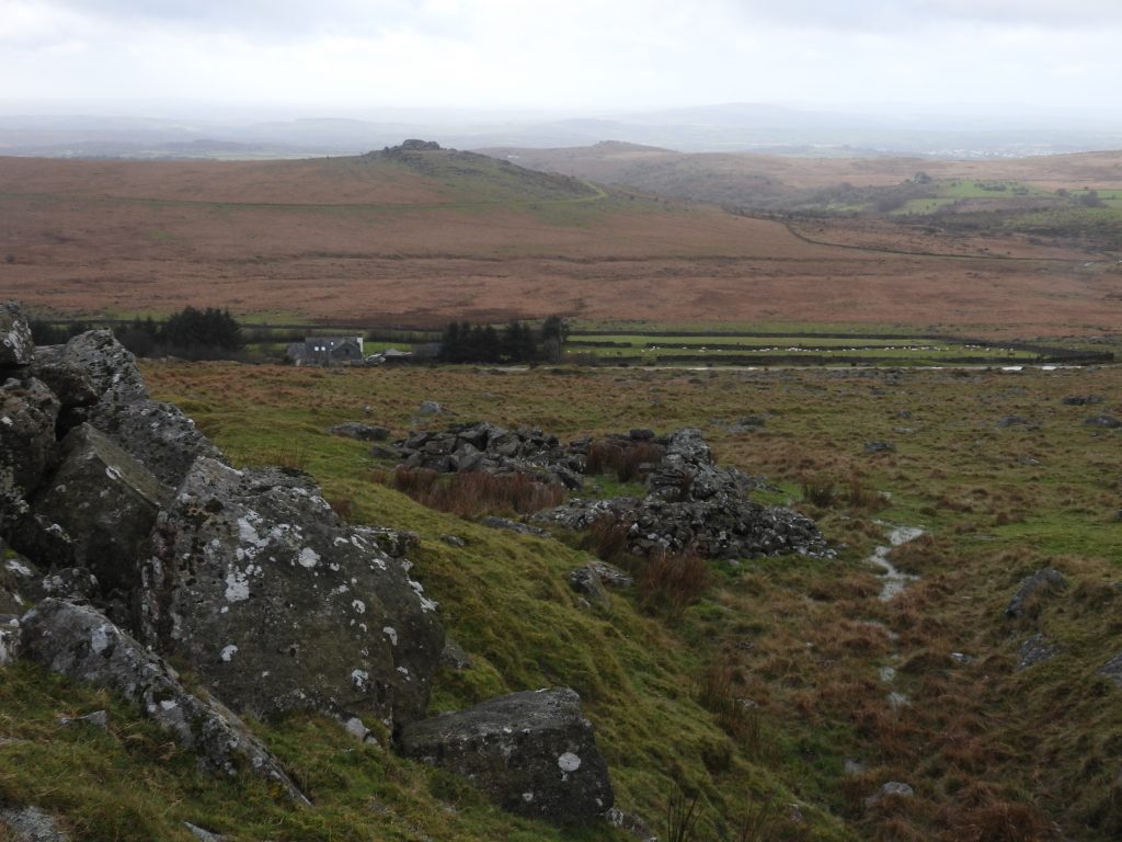
Small quarries near the Red Cottages (ruin) to Yellowmead Farm track
Two very large and well known quarries to the west of Princetown are Foggintor (also once known as Royal Oak Quarry and Hill Quarry) and Swelltor, which are regularly visited by hikers and (in the case of Foggintor) by the military for training. Foggintor was operational between 1820 and 1900 with Swelltor being operational between around 1820 and 1938. Between Foggintor and the old water pumping station on the B3357, either side of the Yellowmeade Farm track are five more smaller quarries, which are probably less well known and as such less well visited. It is these quarries which are the subject of this post
The five smaller quarries are: West Mead, Hill 60, Hollow Tor, Pitts Pile and an un-named one. The oldest of these quarries is likely to be Hollow Tor dating to 19th century. Hill 60 was operational from the 1930s and West Mead from around 1942 to 1966. Pitts Pile and the un-known one near Yellowmeade Farm do not appear on maps until the 20th century.
Bibliography
Kath Brewer – The Railways, Quarries and Cottages of Foggintor
Christopher Gardner-Thorpe – (2003) – The Book of Princetown, Thomas Tyrwhitt’s Dartmoor Town
Eric Hemery – (1983) – High Dartmoor – Pages 1024 and 1027
Simon Dell MBE – Dartmoor Magazine Issue 106, Spring 2012, Page 20
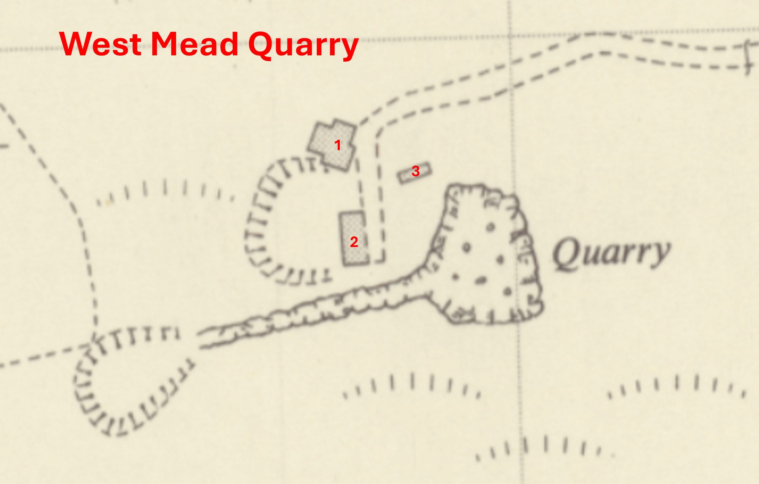
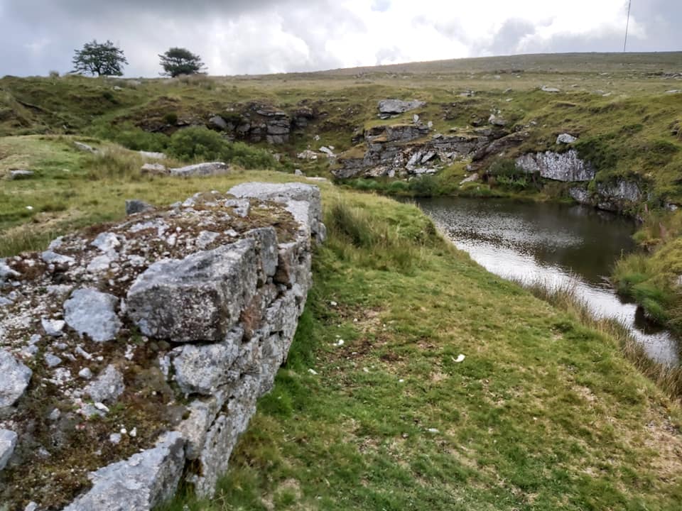
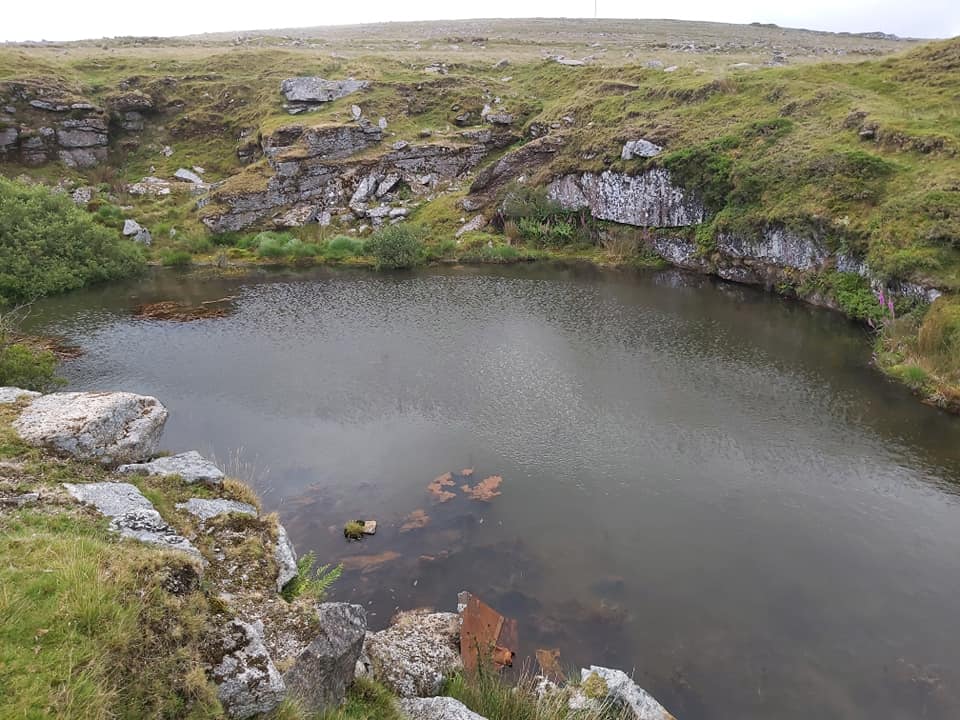
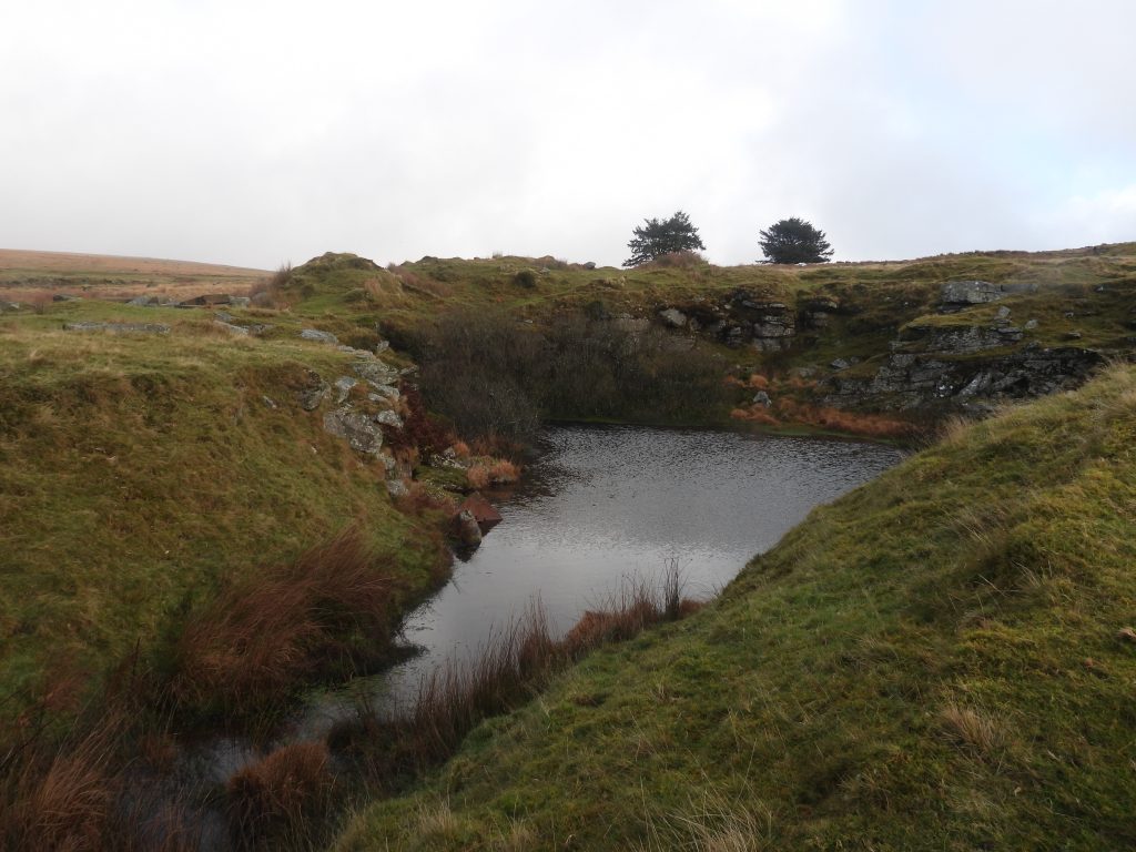
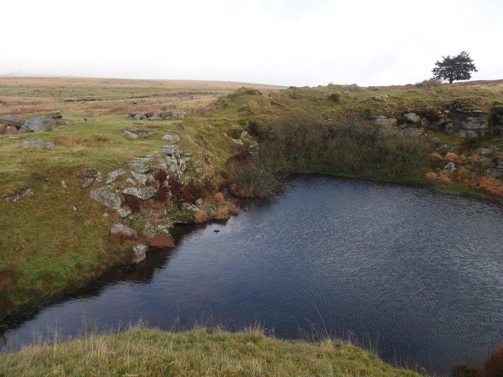
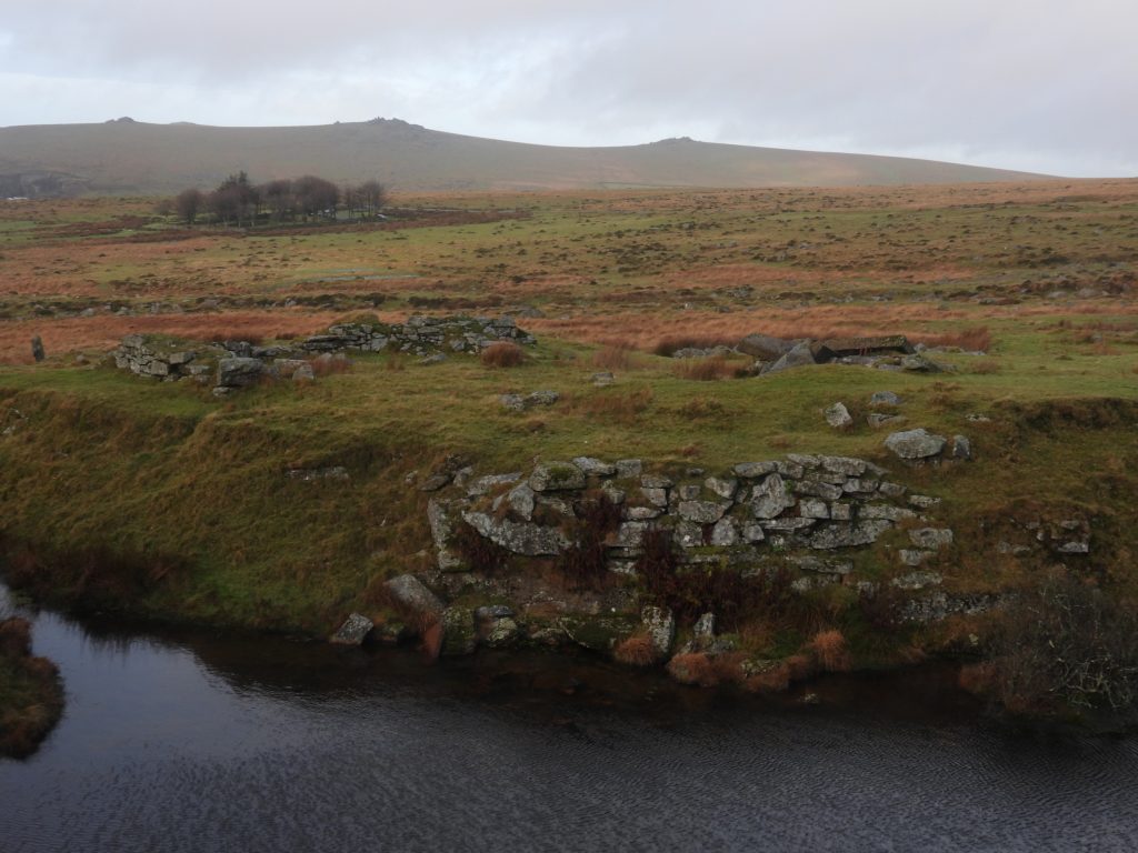
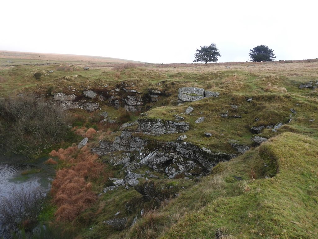
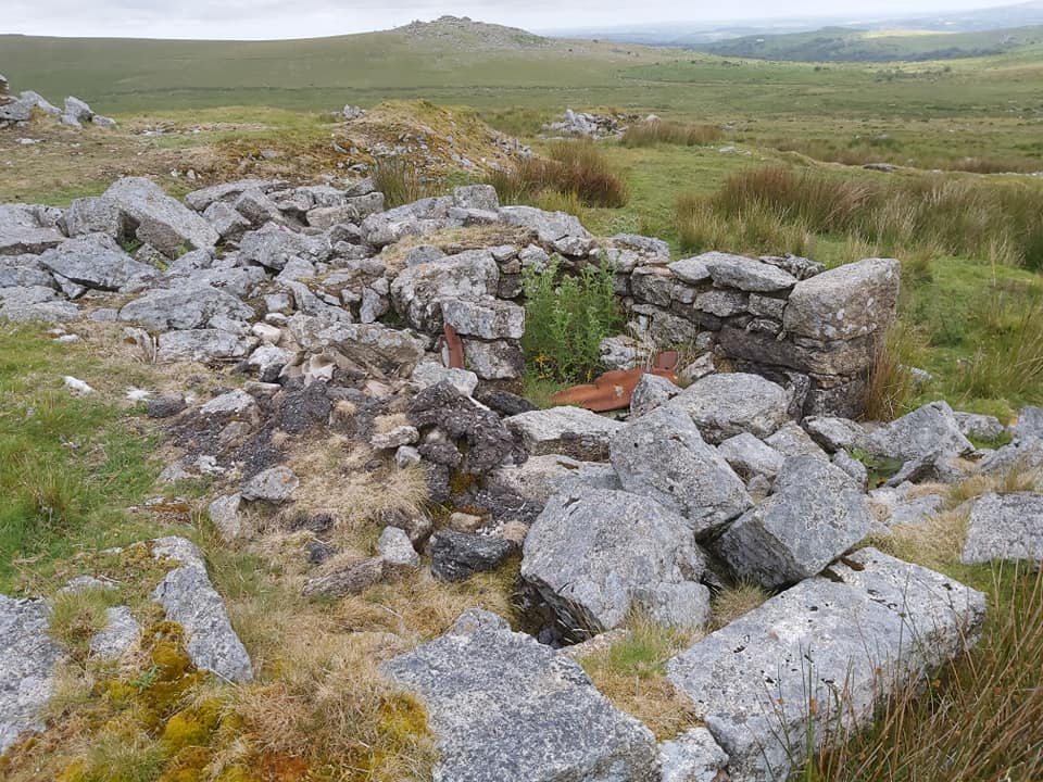
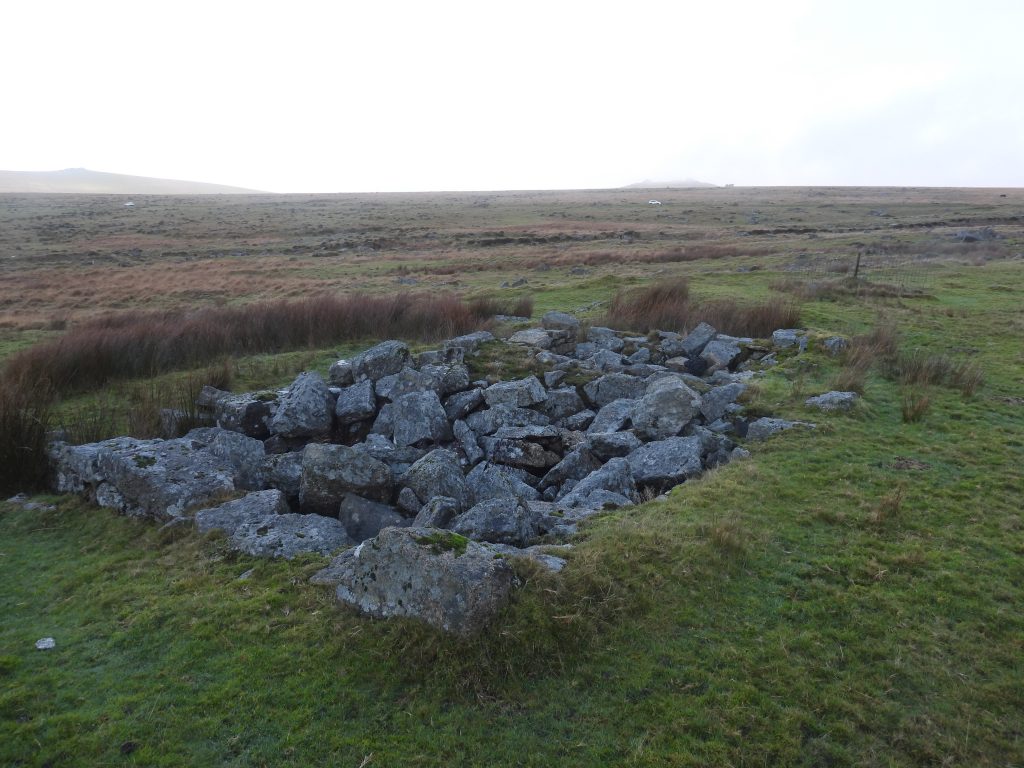
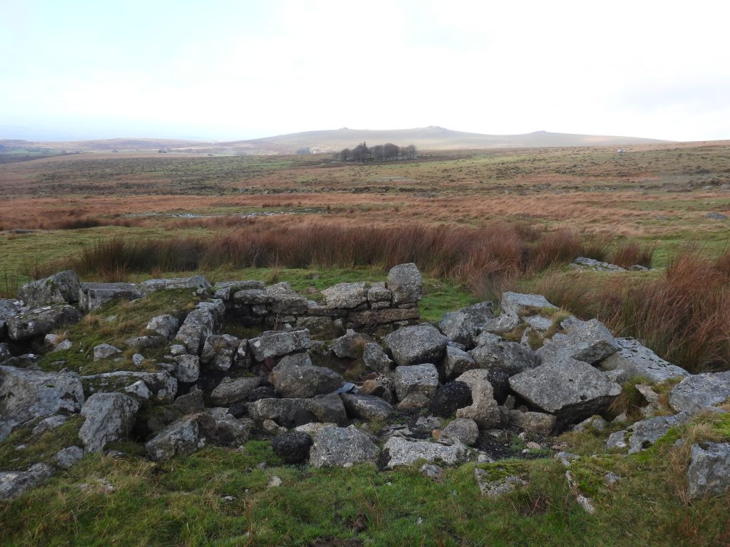
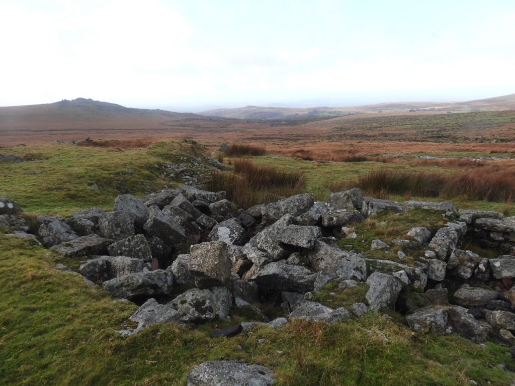
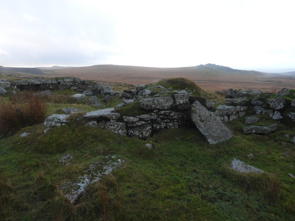
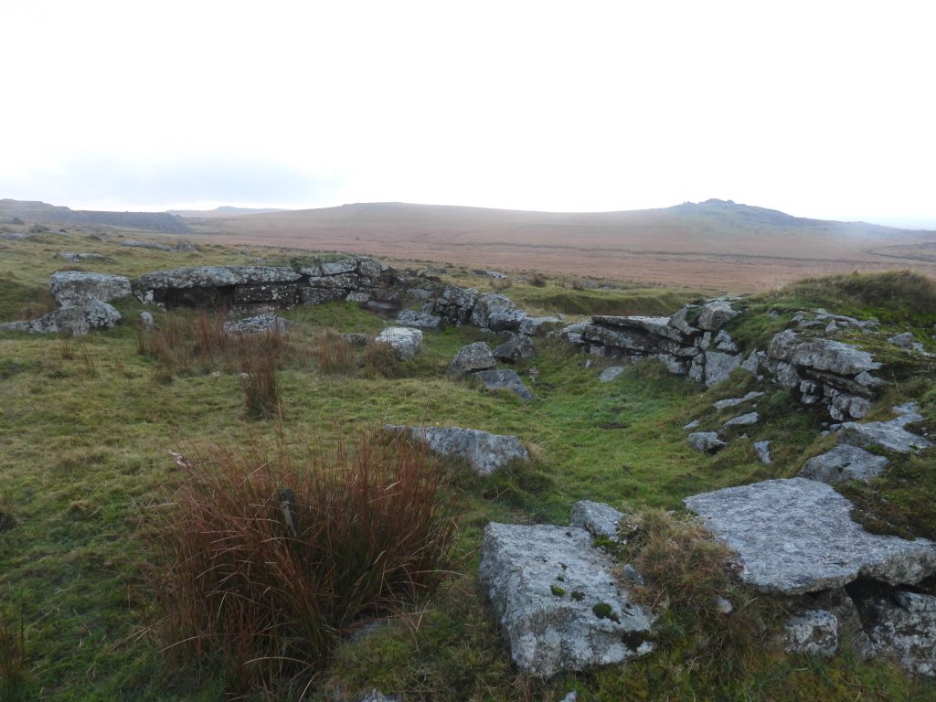
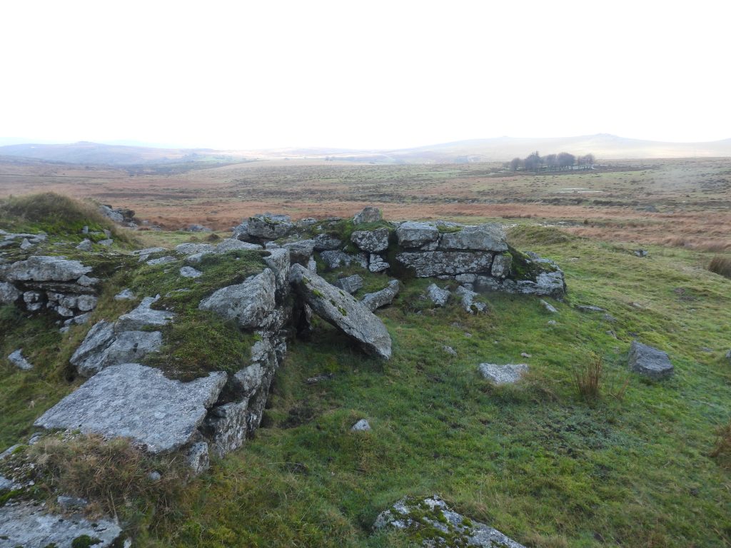
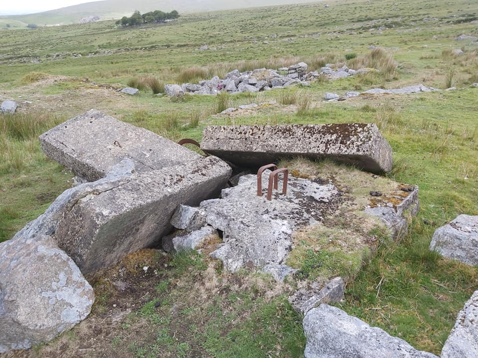
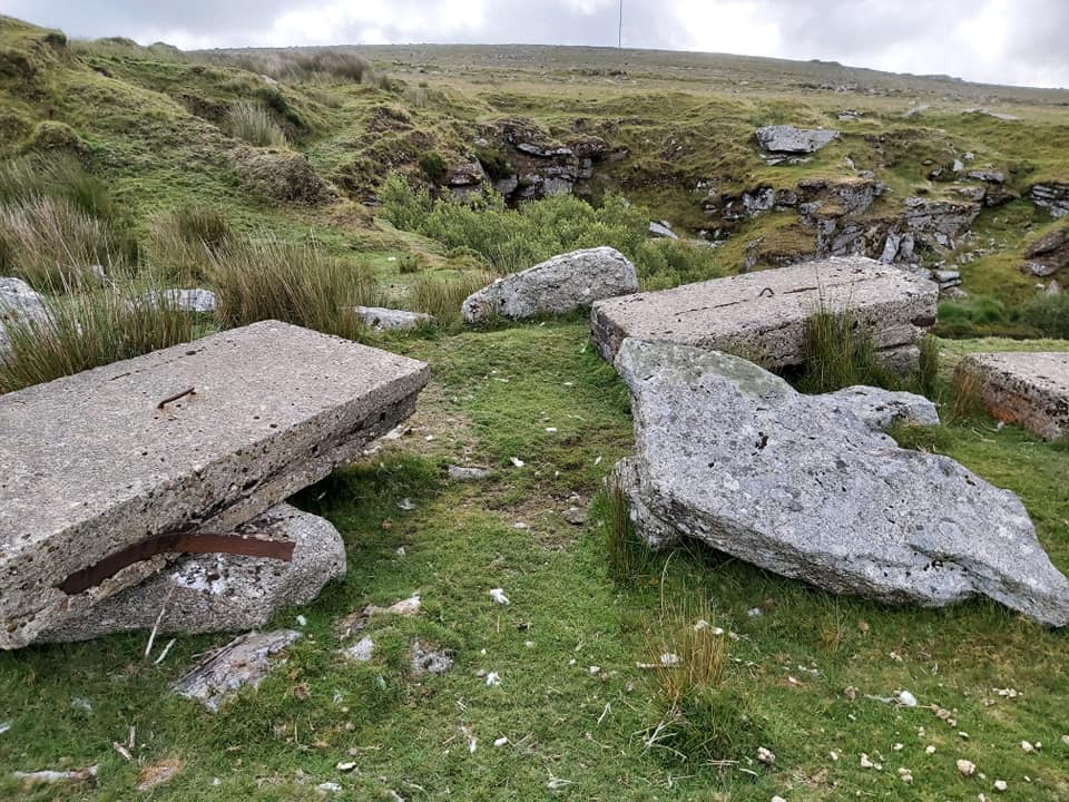
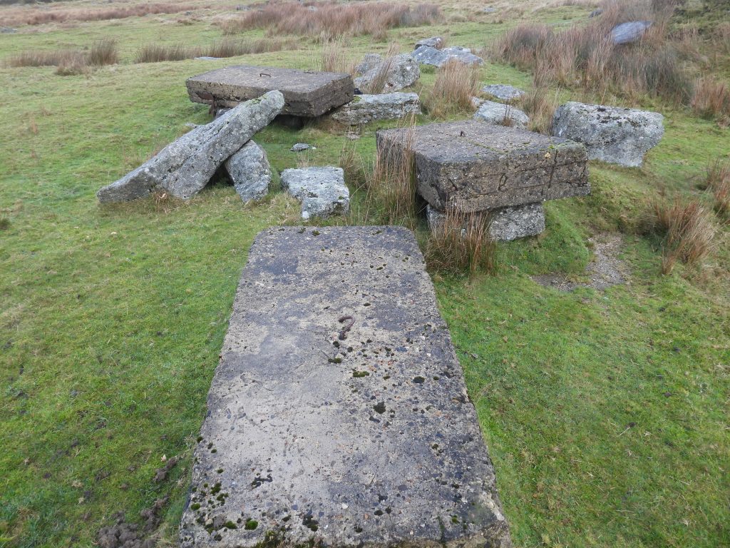
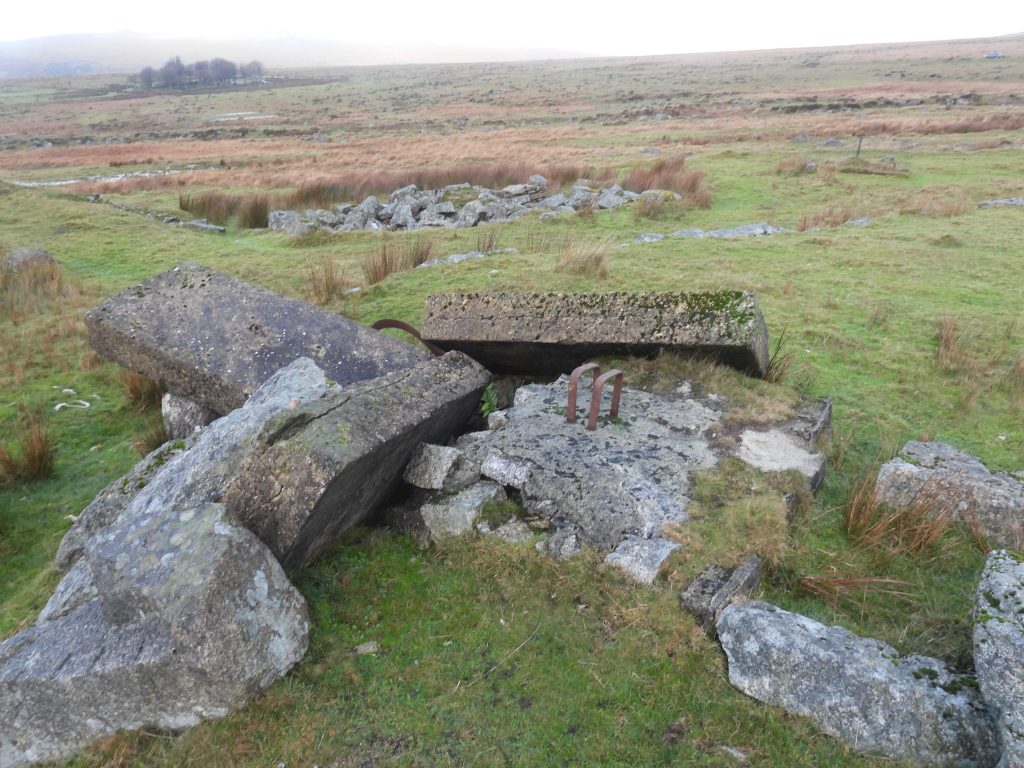
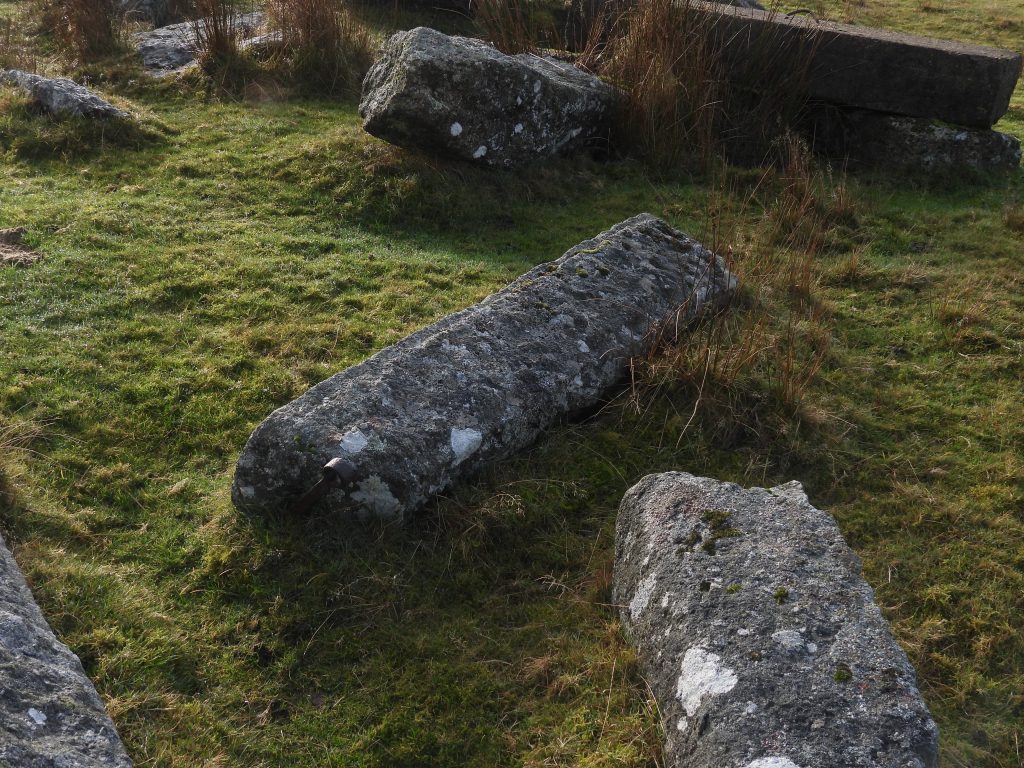
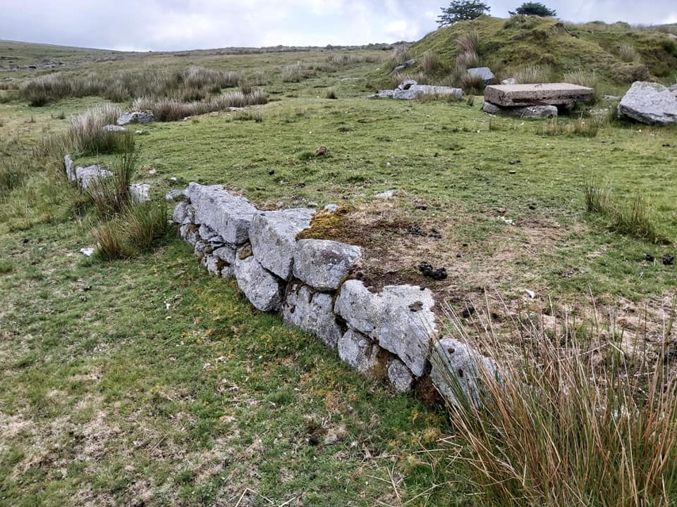
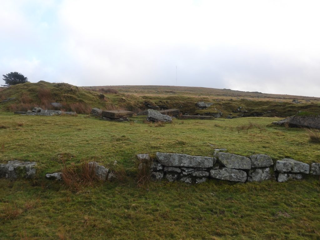
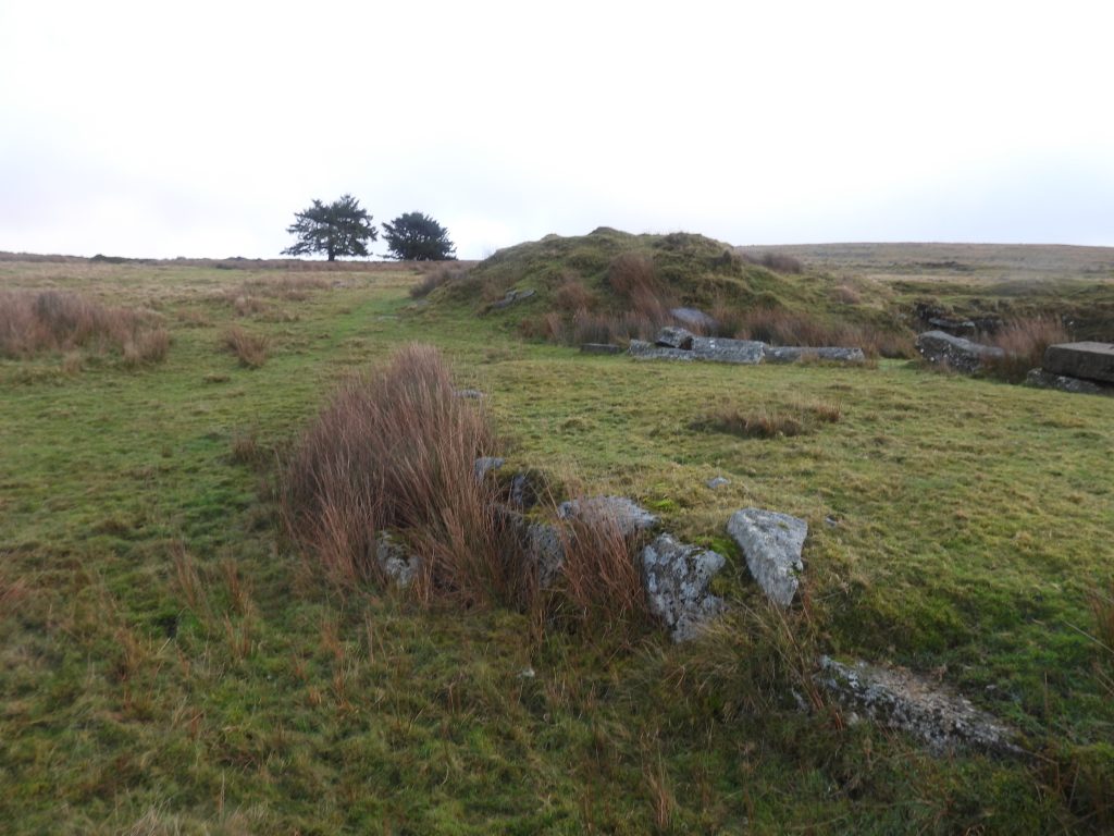
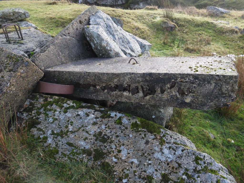
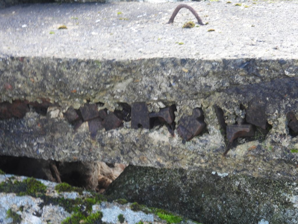
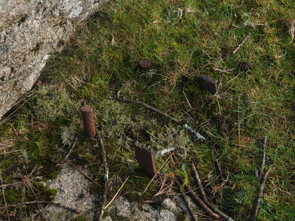
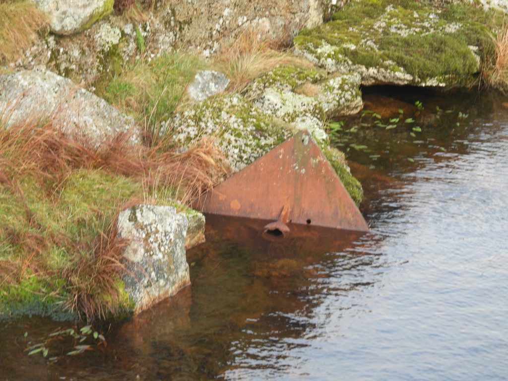
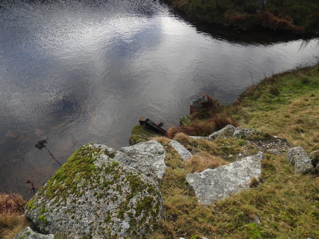
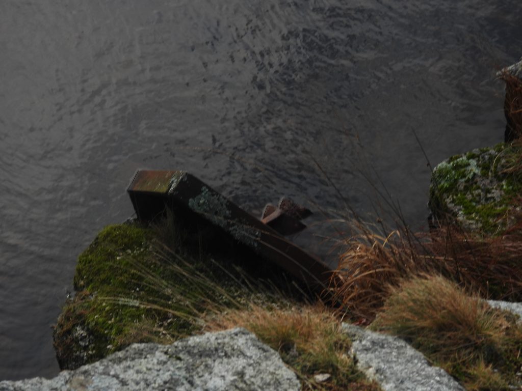
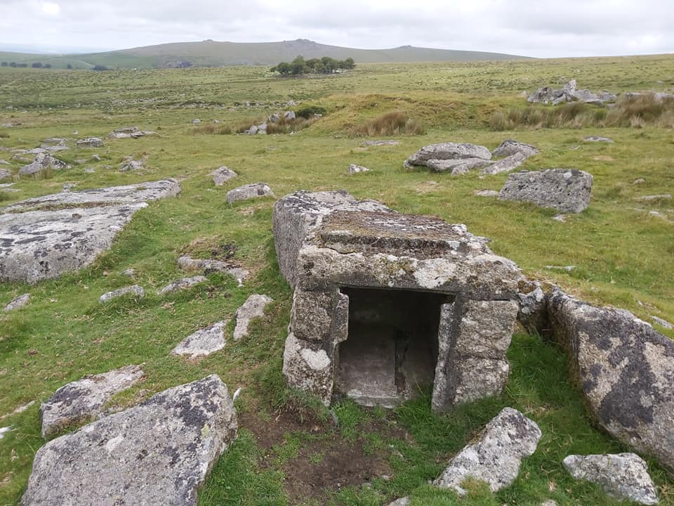
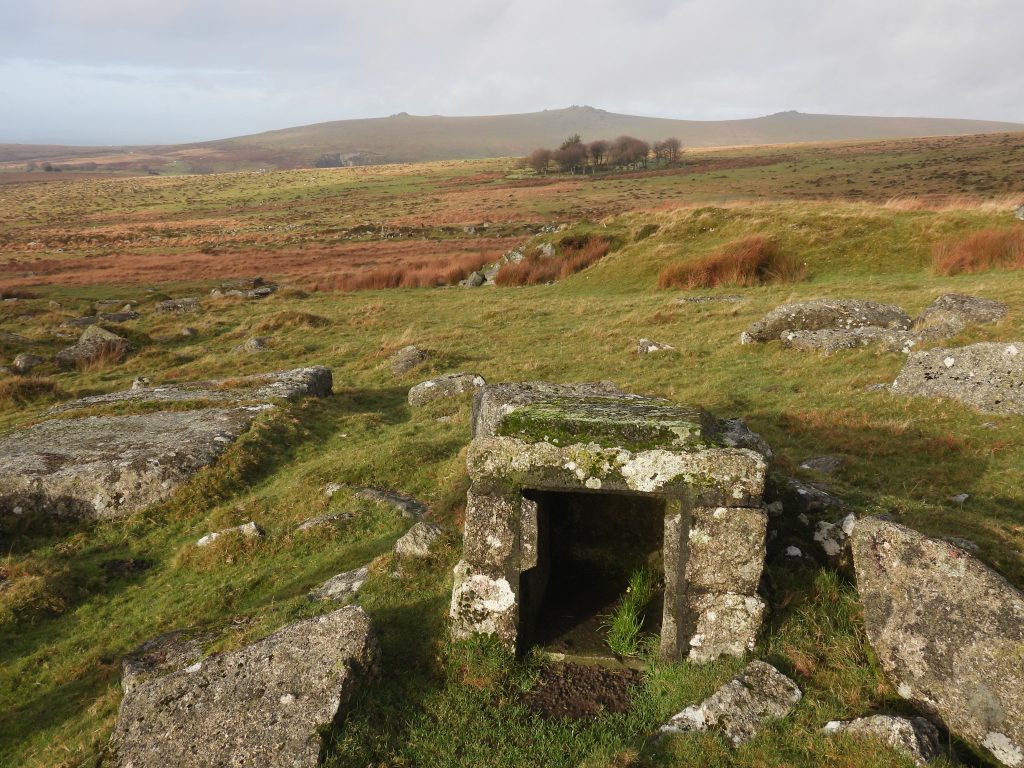
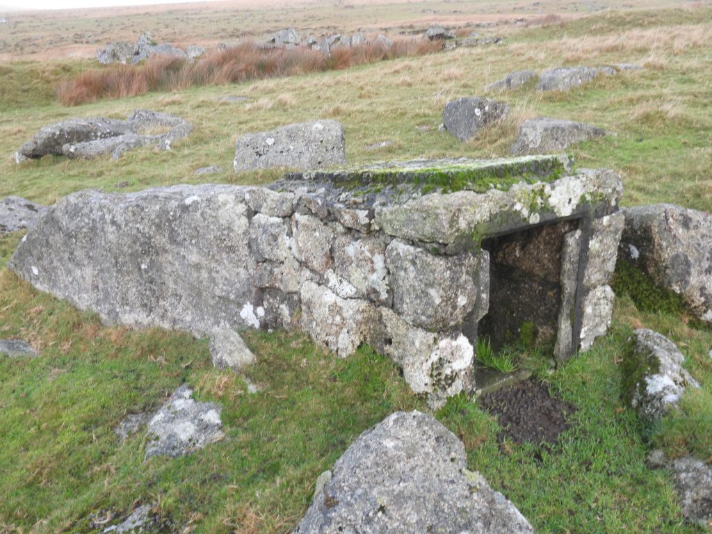
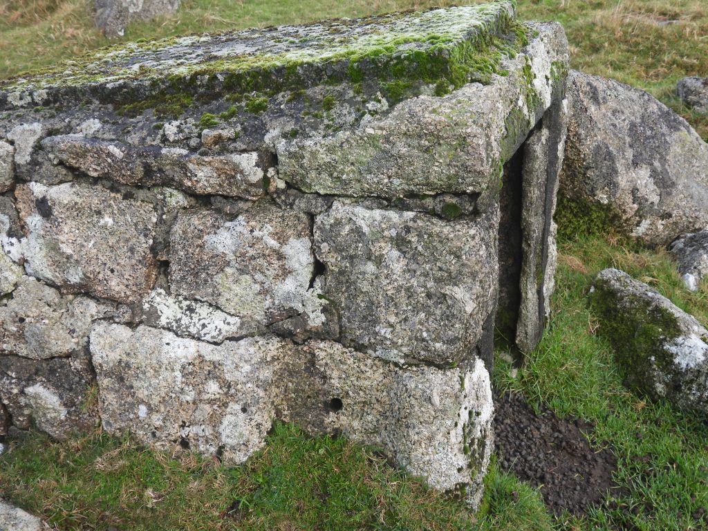
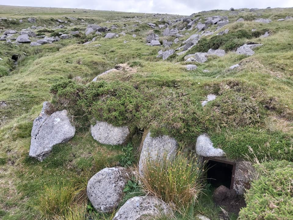
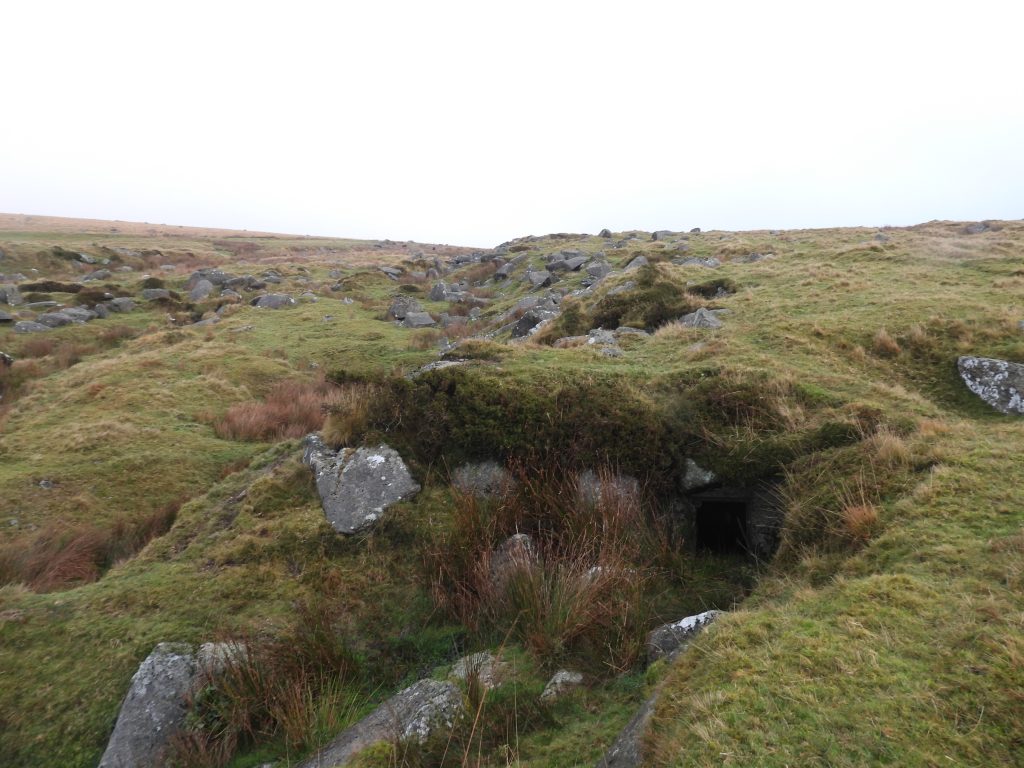
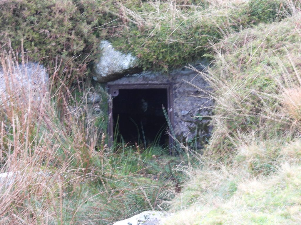
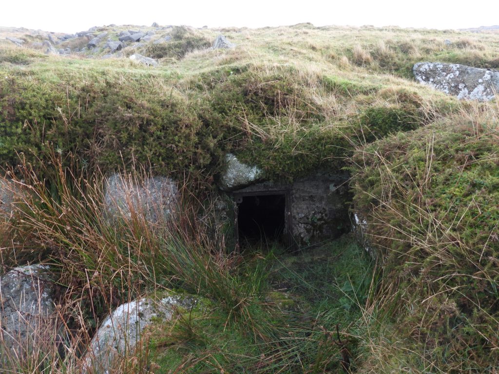
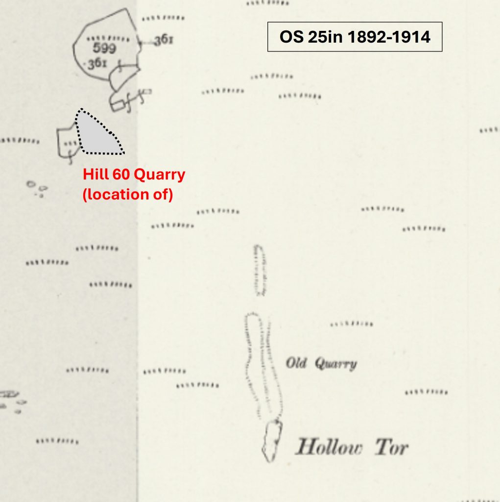
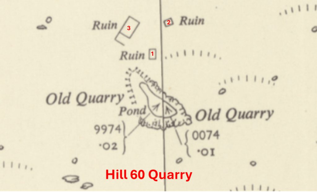
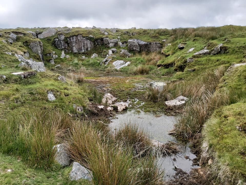
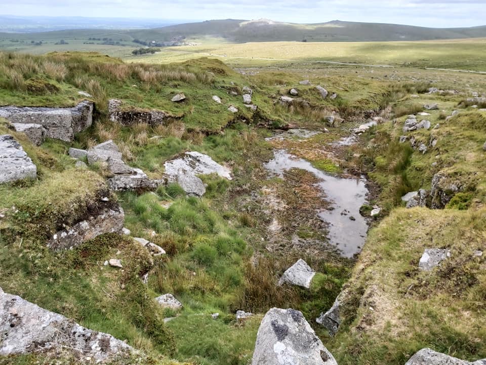
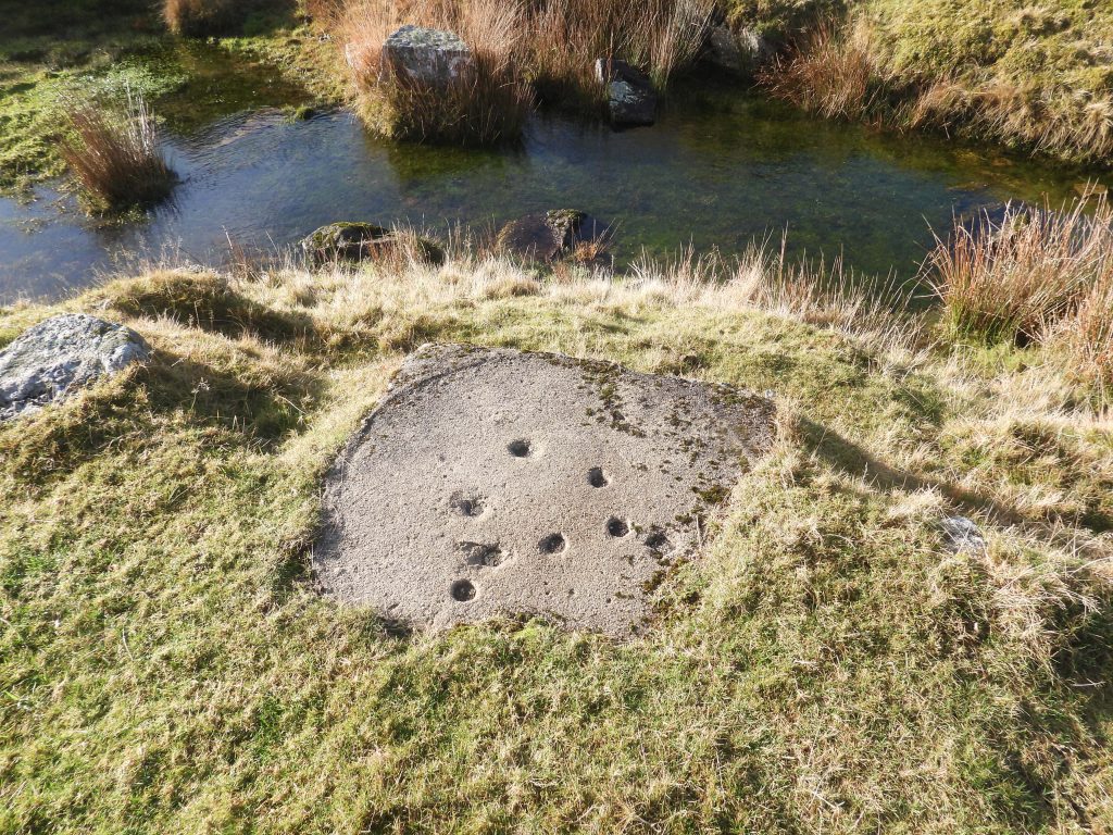
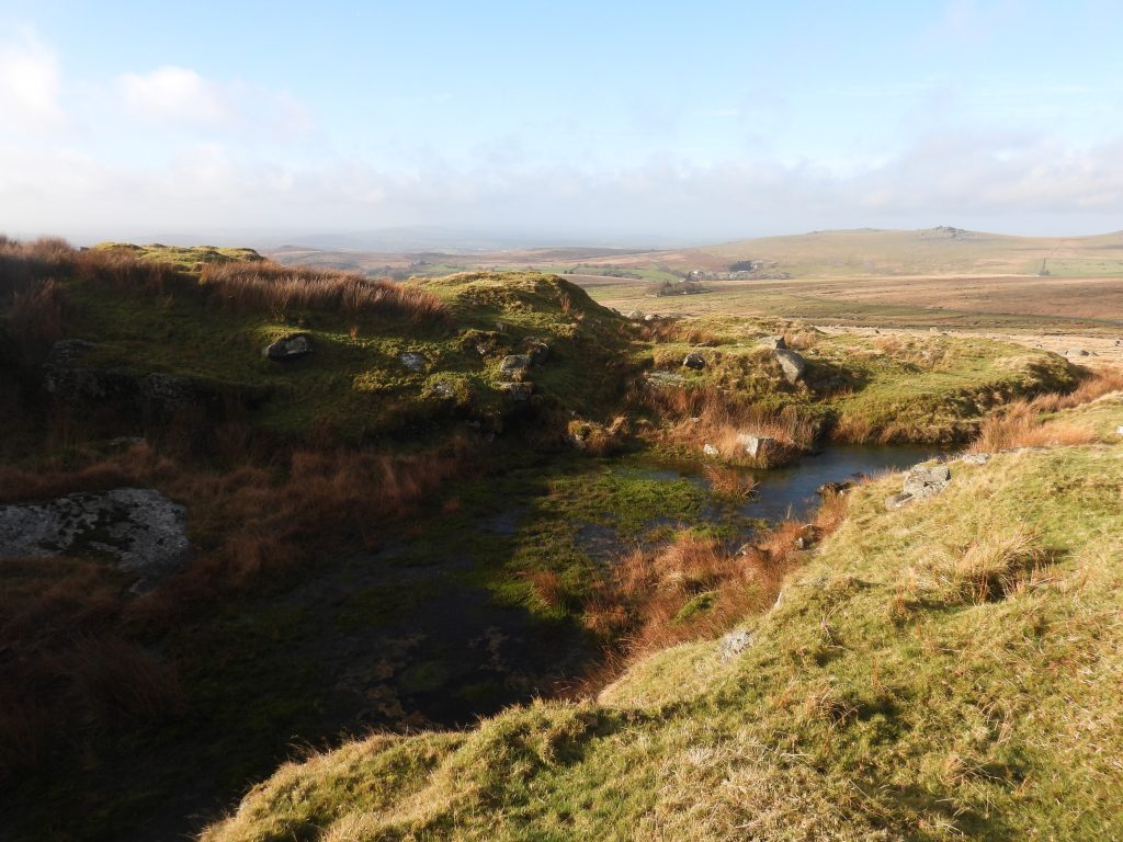
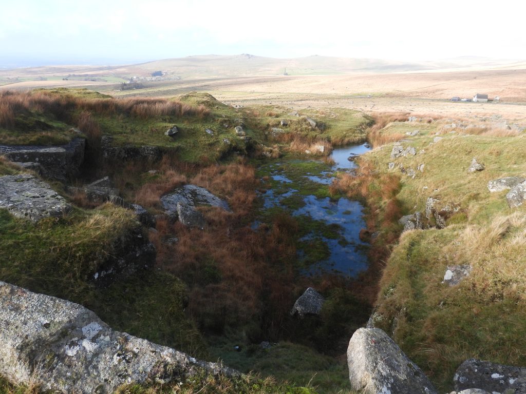
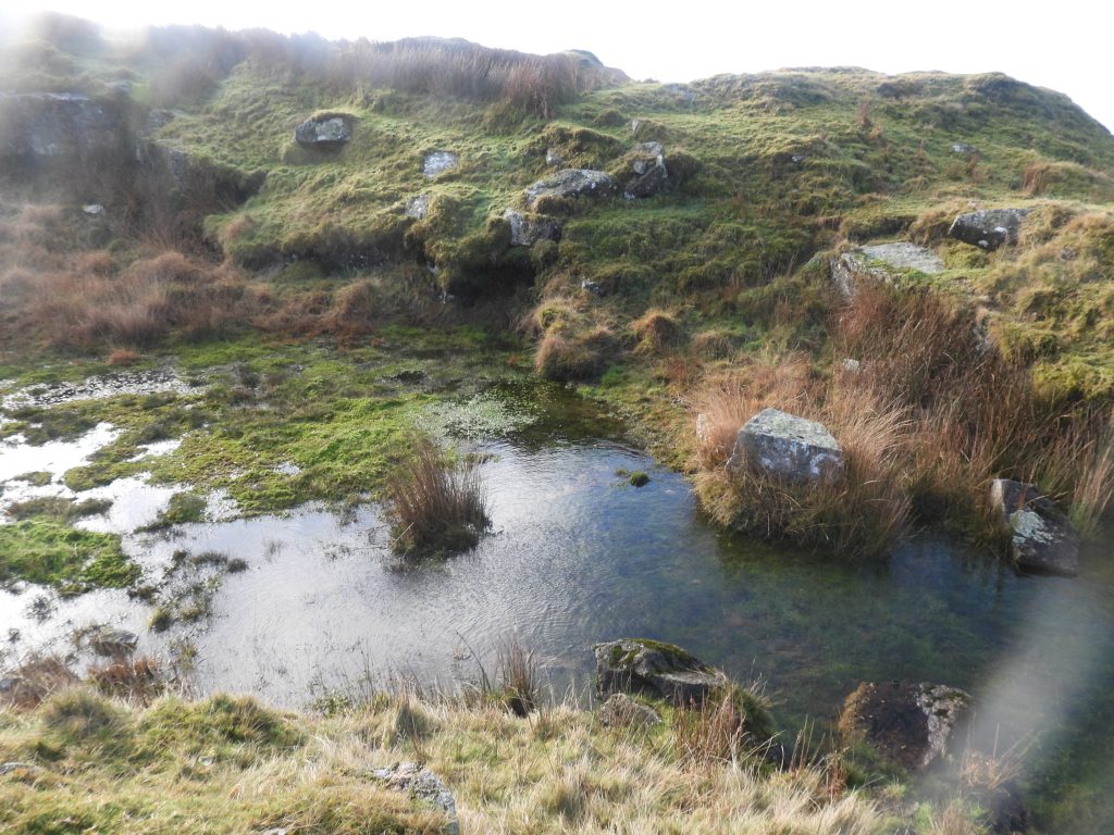
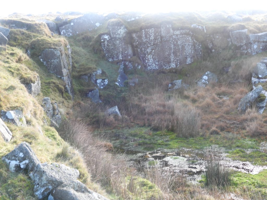
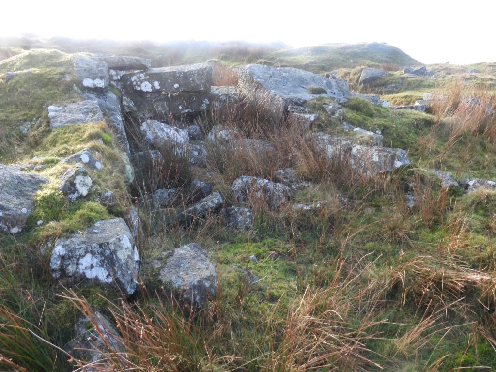
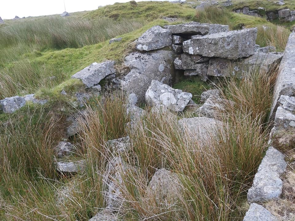
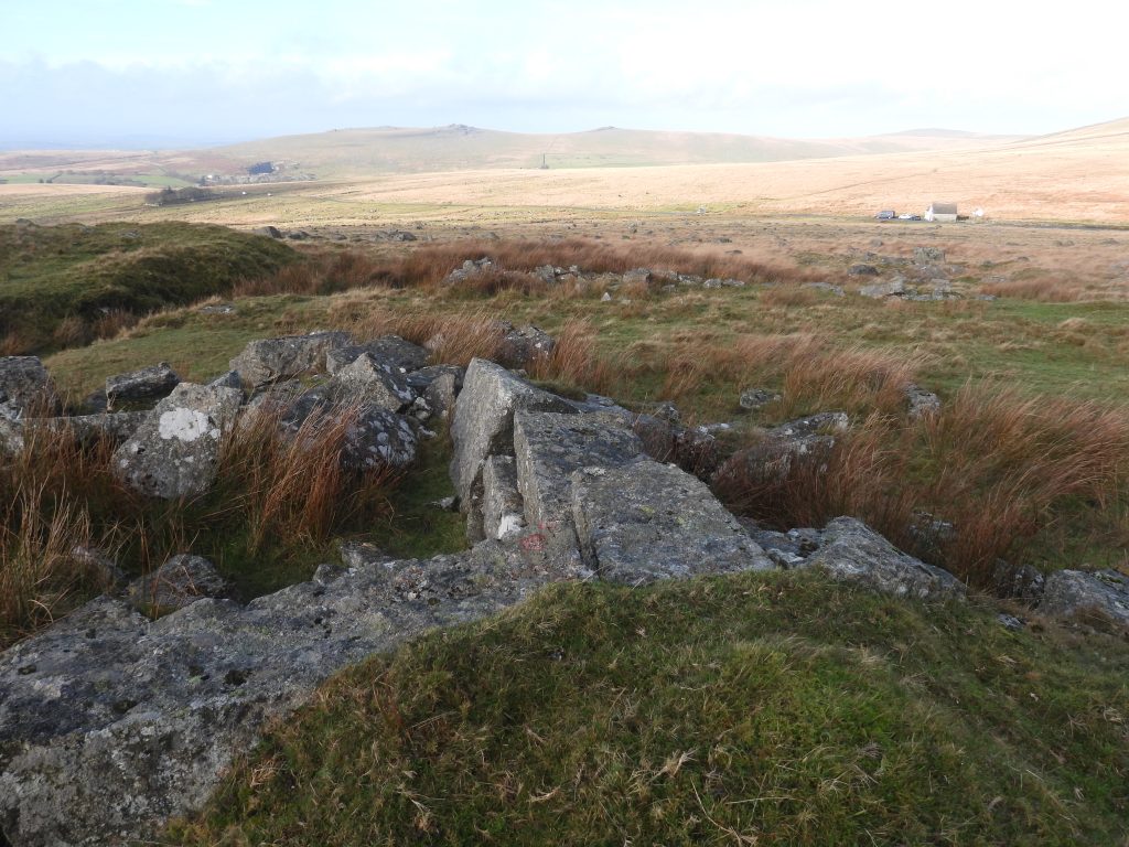
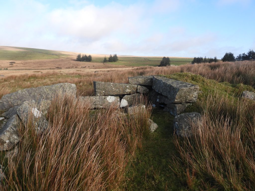
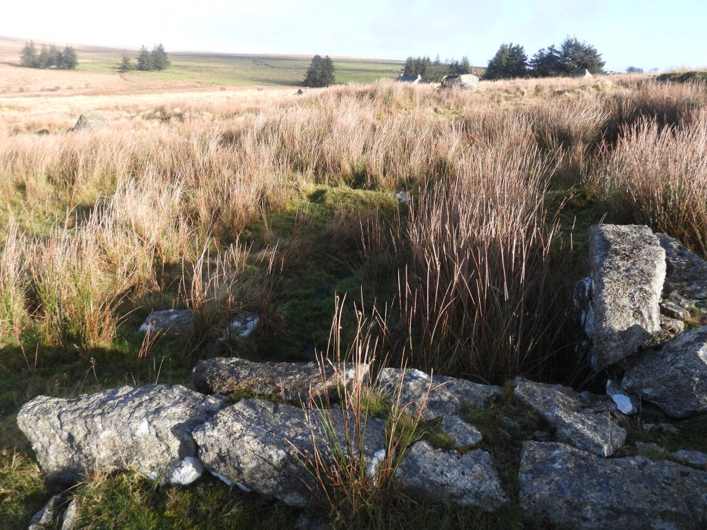
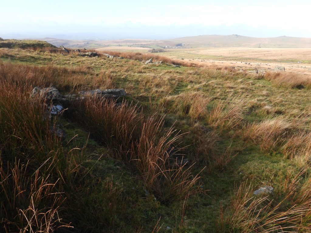
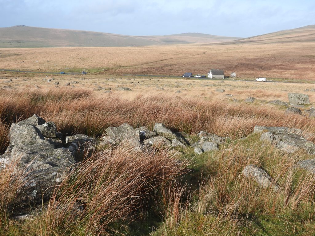
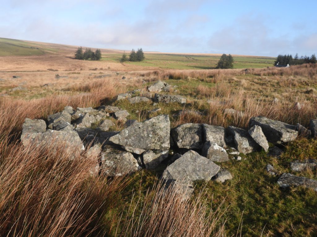
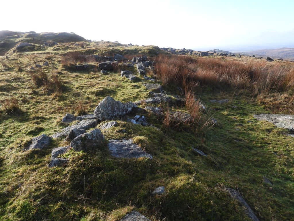
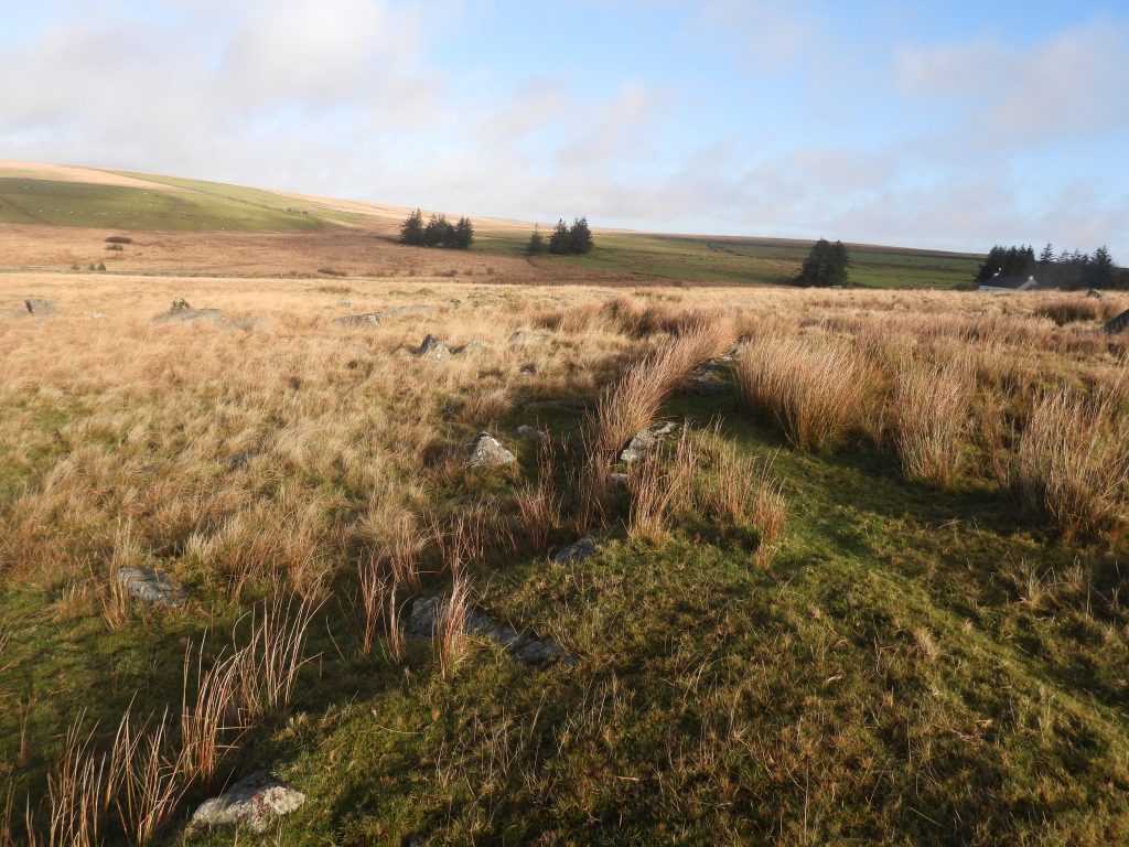
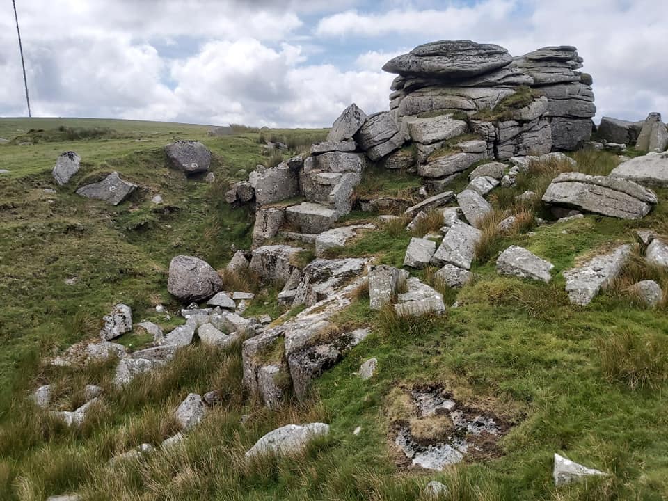
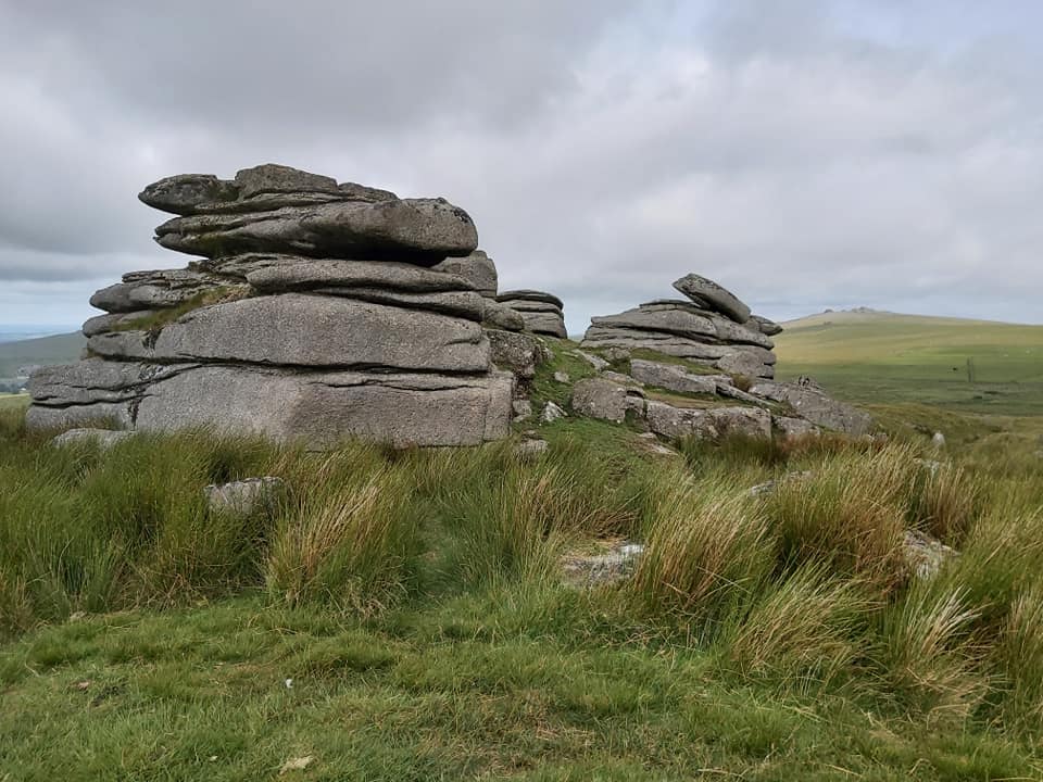
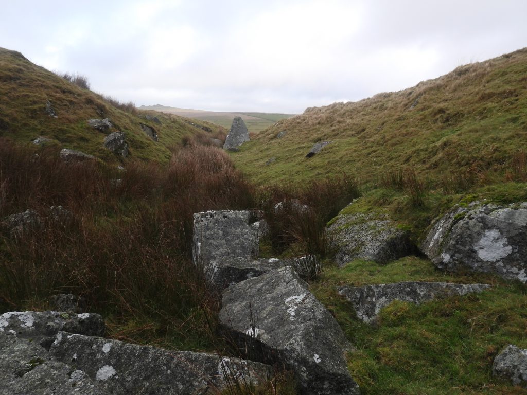
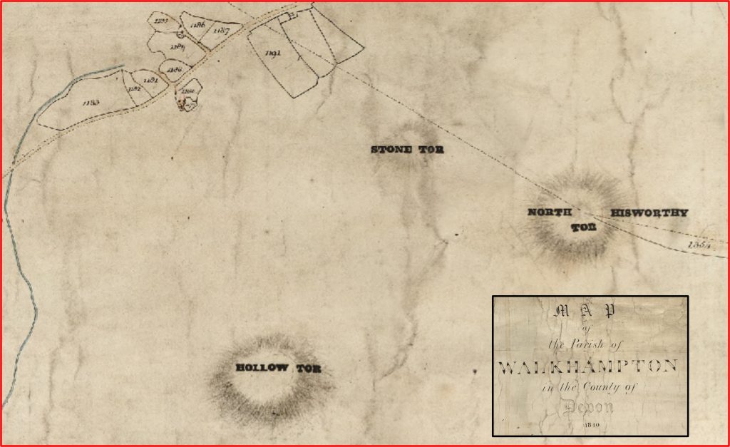
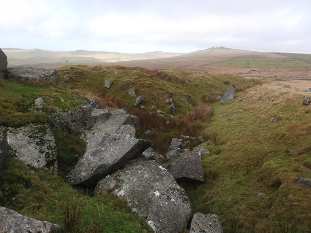
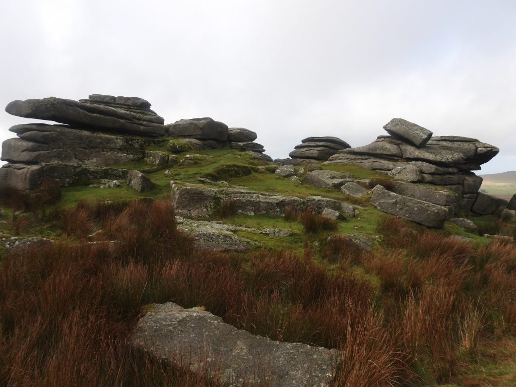
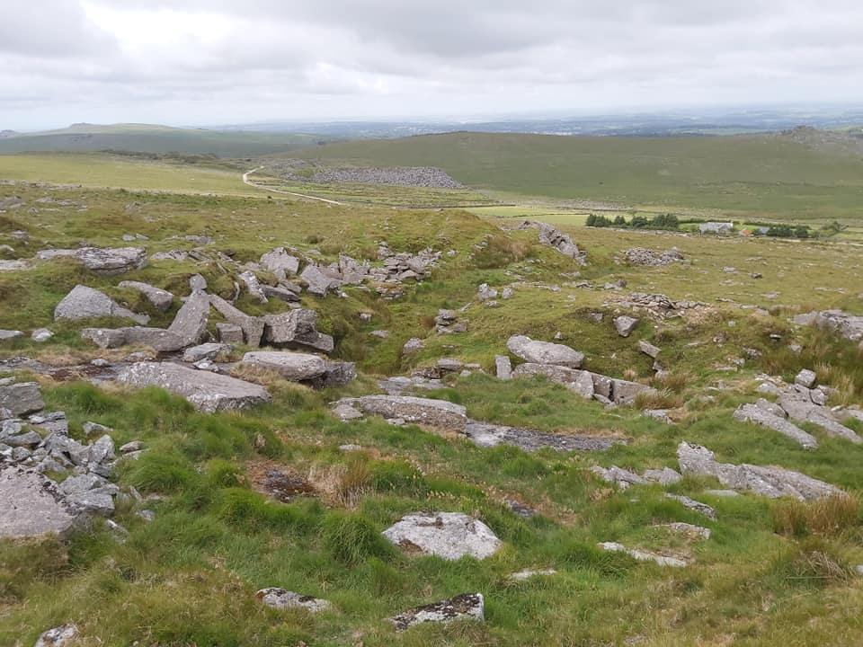
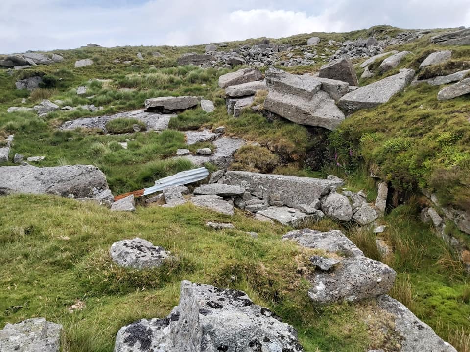
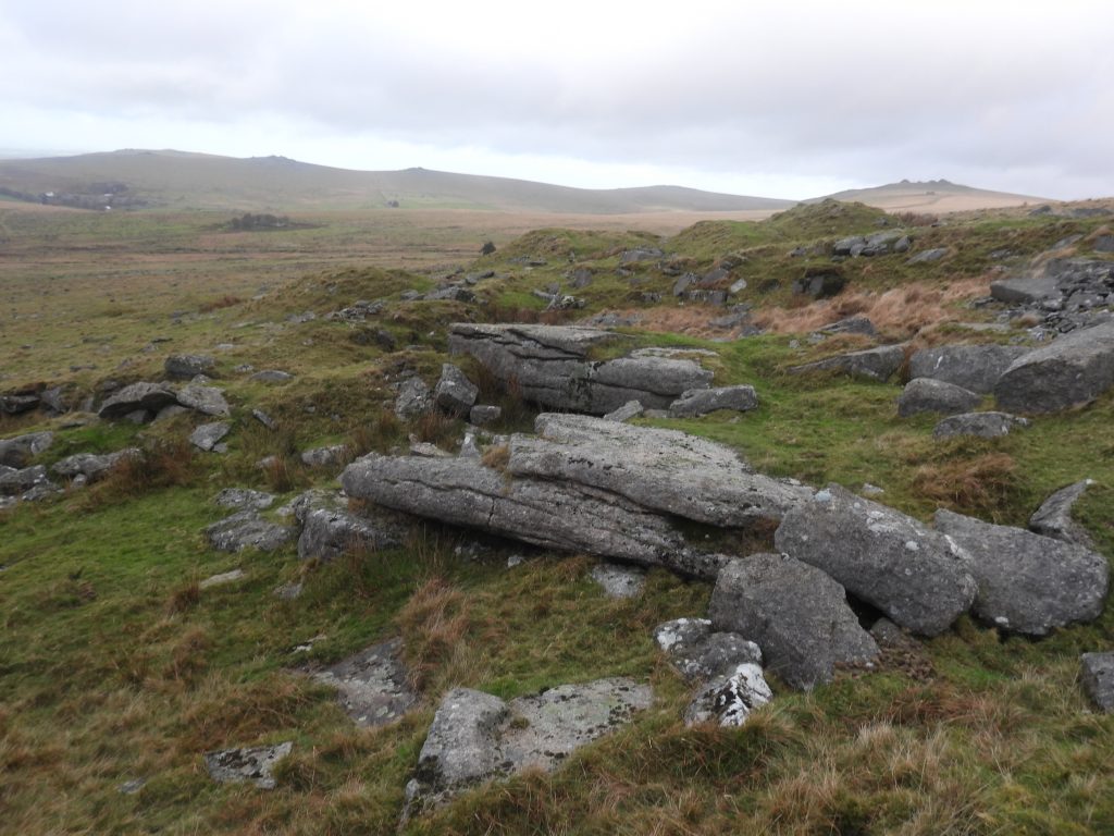
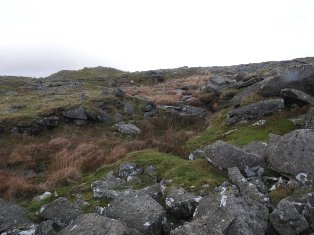
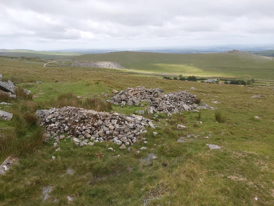
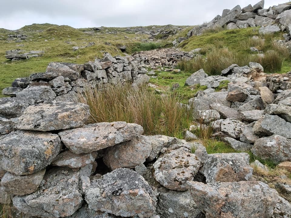
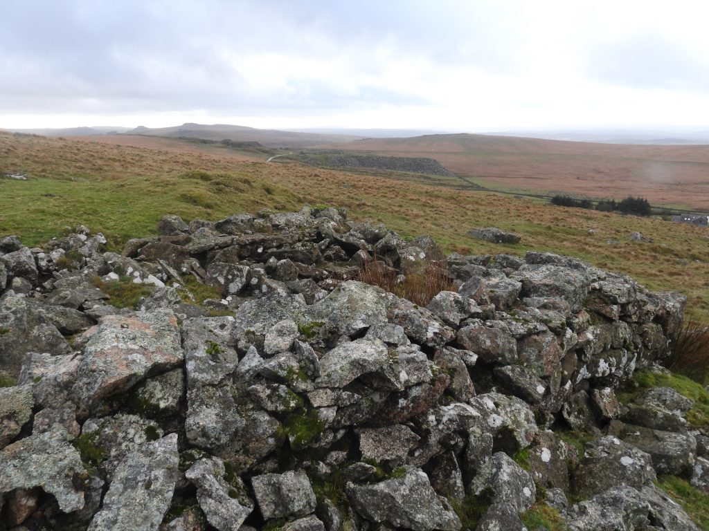
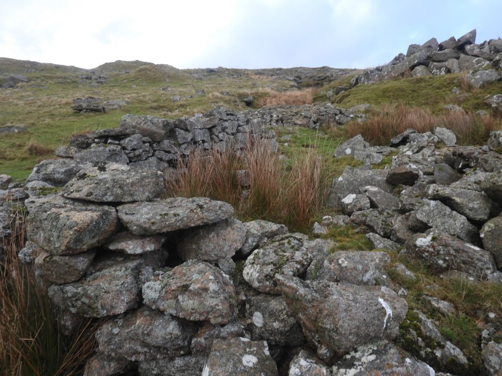
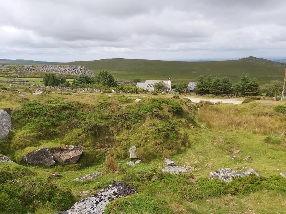
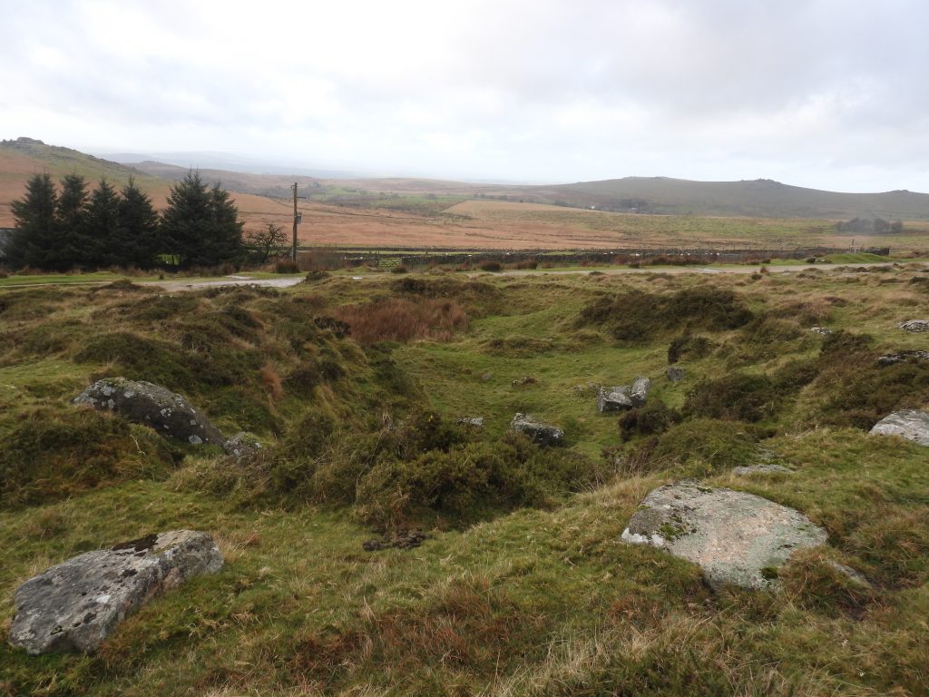
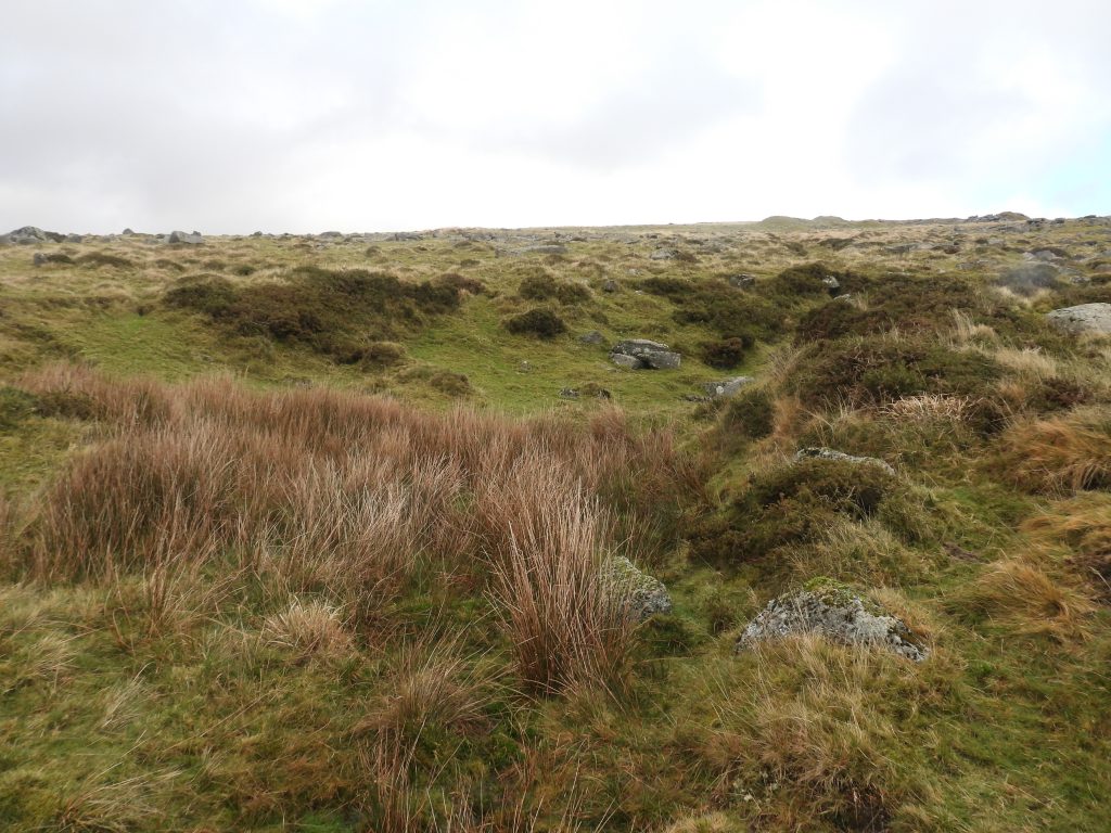
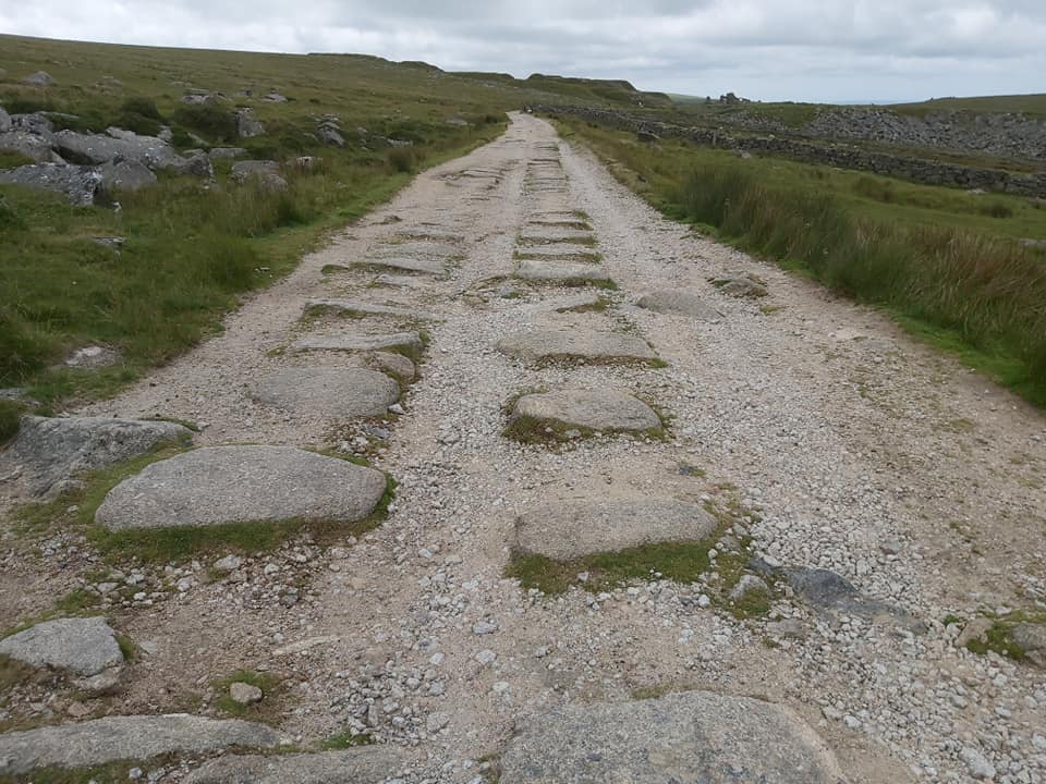
This LiDAR plot shows the locations of the 5 ‘lesser well known’ quarries either side of the Red Cottages (Ruins) to Yellowmeade trackThis mid-20th century map shows the locations of the 5 ‘lesser well known’ quarries either side of the Red Cottages (Ruins) to Yellowmeade trackWest Mead Quarry is located around 300m below the ruins of Red Cottages and the Yellowmeade Farm track. A lease is thought to have been issued around 1941 with the quarry opening a year later in 1942. The map above indicates there was at least three buildings (or similar) there. The track leading away from the quarry, lead eastwards to Red Cottages and the Yellowmeade Farm track.The now flooded West Mead Quarry. The lease was held in 1941 (Brewer) and opened in 1942 (Gardner-Thorpe). The reception hall at Plymouth Gin was built using stone from this quarryWest Mead Quarry: According to Kath Brewer, there was a lease held by David German’s uncles from 1941, when they left Ingra Tor Quarry; According to Christopher Gardner-Thorpe, it was opened in 1942 by Eric Green’s uncles, Joseph James and George Stephens, on land rented by Lord Roborough. Of course, this information could be either contradictory or indeed complementary if David German and Eric Green were cousins. NOTE: Kath Brewer in ‘Railways, Quarries and Cottages of Foggintor’ on page 73, confirms that they were indeed cousins !West Mead Quarry – According to Gardner-Thorpe, Eric Green and his brother Gerald started work here in 1945 as Stonemasons. Eric was 16. They worked eight-hours a day, using a 4 lb lump hammer. Latterly, they brought granite from Merrivale and worked it here, making headstones and kerb stones. Later, in the 1950s they bought a compressor to make the hard work easier.In the Winter of 1947, the quarry workers had 6 weeks off (presumably because of bad weather). By 1956 Joseph Stephens had retired and Eric Green had taken over – he would have been in his late 20s. The quarry continued to be worked until 1966, Looking north-west across the quarry a wall appears to have been built, presumably to stabilise the bank where stone was hauled East end of the quarry. Building 1 (as annotated on the West Mead Quarry map) was the former Blacksmiths ShopRuins of the Blacksmiths Shop. When there was a clean-up when the quarry closed a Park Ranger at the time (Simon Ford) took the bellows from here to Tavistock Museum. The Blacksmiths Shop ruins are located at SX56475 74686South end of the Blacksmiths Shop looking south west across the quarry spoil towards King’s TorThese walls are from Building 2 (as annotated on the West Mead Quarry map). Was this where Eric Green (circa 1956) installed the diesel generator / compressor to assist with rock breaking and dressing ?The reason of this structure in unknown. It is approx 10m (n-s) by 5m (e-w). It is located at SX56473 74665Building 2 with a possible ‘outshut’ at its north endAlthough the concrete detritus seems to be associated with a crane, might it have been the location where Eric Green (circa 1956) installed the diesel generator / compressor to assist with rock breaking and dressing ?Concrete blocks – the author assumes these were balance weights for a crane. The blocks do appear to have been in-filled with pieces of metal. The blocks are located at SX56491 74679Each block appears to have a metal ‘loop’ built inThe main concrete detritus. The ruins of the Blacksmiths Shop can be seen in this photograph as can Four Winds car park. This detritus can be found at SX56482 74676This dressed stone can be found amongst the quarry ruinsEdge of the platform, upon which lies the concrete detritus of the crane base. It is here the outline of ‘Building 3’ (as annotated on the West Mead Quarry map) is located. The location is SX56480 74674Side on view of the platformAnother side on view of the platform. There is a track (to the left of the mound), which lead up to the Yellowmeade track. The two trees on the horizon are where the ruins of Red Cottages are locatedEdge view of some of the ‘metal filled’ concrete blocks. Some of the metal does look like possible old rails – is it possible these might have been rails came from Tyrwhitt’s Plymouth and Dartmoor Railway (from 1823) or from the later Foggintor quarry railway extension? A romantic notion but probably unlikelyClose up of the metal in the concreteMetal detritus found amongst the ruinsOn the edge of the flooded quarry there is an old metal plate with possible post or pole attachmentThe metal plate from aboveClose up of the metal plateTo the south of the quarry is the first of what is assumed to have been an explosives storeExplosives store (1) for West Mead quarry at SX56450 74619. Four Winds car park, Merrivale quarry, the Staple Tors and Roos Tor can be seen in the distanceOn closer inspection the bottom stone on the left side of the doorway of the explosives hut looks like it was once a railway sleeper as it has two holes and has the ‘tell tale’ indentationThe railway sleeper stone. There is a second hole below the current grass level. This does look like it might have been a part of Tyrwhitt’s Plymouth and Dartmoor (circa 1823) or from the Foggintor quarry railway extension – other similar stones can be found on the track to YellowmeadeThere is a second explosives store which has been built into the bank of Pila / Longash Brook. It is quite well hidden. Contextual view of the second explosives storeThe frame for a door is still extantThe second explosives store for West Mead quarry is located at SX56541 74834Track leading away from West Mead quarry towards the ruins of Red Cottages and the Yellowmeade trackEvidence of rock splitting. This abandoned attempt at SX56511 74814This annotated map shows where the next quarry (Hill 60) in this post is located. It is a relatively modern quarry compared with the 19th century quarry at Hollow Tor. It is located next to what looks like some former enclosures. The name ‘Hill 60’ is quite unusual but is thought to relate to a hill from a WW1 battle area known as Hill 60, so called on British military maps because the contoured height of the ground was marked at 60 metres above sea level. Hill 60 quarry was opened in the 1930s (specifically 1936 according to Kath Brewer). It was opened by Claude Rook (or Rooke) and Billy Easterbrook with an Alf Brown as labourer (Brewer / Dell). The annotated map above is from the mid 20th century and shows 3 buildings (or structures) adjacent to the quarry, the ruins of which can still be seen todayHill 60 quarry is only a few hundred metres up the lower slopes of Hollow Tor from the old former water pumping station. Kath Brewer records that in the Maristow Papers under Water and Mine Rents, there was an entry for Oswald Easterbrook, James Claude Rooke and William Stephens dated 19th September 1919, regarding ‘Granite Works, Rundlestone’ with ’20 Years mm (minimum?). Rent £5 in advance. Due’. Is this quarry the same one mentioned ? If so, was the quarry lease 17 years old before work commenced, or did some early work actually take place? Of course, from 1919, the three quarrymen might have only been taking ground lying moorstoneLooking north west into Hill 60 quarry with the Staple Tors ridge and Roos Tor on the horizon. Gardner-Thorpe records: “At the top of the hillside is Hollow Tor and its quarry. Lower down was Hill 60 quarry where Sidney Hext worked”This rock suggests it might have been used for drill testing and can be found near the entrance to the quarry at SX56993 74755The original ‘Hill 60’ was man-made in the 1850s, having been created by the spoil from the cutting for the railway line between Ypres and Comines, which was opened in March 1854. The name ‘Hill 60’ was only named during the war, before which it was known locally as “Côte des Amants”, which translates into English as “Lover’s Knoll”. ‘Hill 60’ was the scene of desperate fighting in April and May 1915 between the British and the Germans. The launch of a British attack on 17th April 1915 began with the explosion of three mines which literally blew the top off the hill. The author has come across two possibilities as to why this quarry was named ‘Hill 60’. Firstly, Hemery in High Dartmoor (page 1024) suggests that during the last war (WWII) there was a look-out shelter which stood on the tor which was thence in consequence known as ‘Hill 60’ (Hemery’s description is a little vague as to the exact location as, in the same paragraph he is referring to Hollow Tor). Simon Dell (Dartmoor Magazine article from 2012) refers to the WWI link and surmises that it might have been possible that Claude Rooke, who was one of those who opened the quarry, would have fought in the Great War and it might have been possible that he was serving with the Devon and Dorset regiment and saw the horrors of ‘Hill 60’ during his service. In Kath Brewer’s ‘The Railways, Quarries and Cottages of Foggintor’, it is recorded that “Dave German tells me that in 1936 Hill 60 (Hollow Tor) Quarry was opened….I do not know how long Hollow Tor remained open after 1936”. The author suspects that there is a little confusion in the interpretation insofar as stating Hill 60 (Hollow Tor) was merely to indicate the area it was in, not that it referred to the (re) opening of Hollow Tor, which would have been exhausted most likely by the end of the 19th century. The author conjectures that Hill 60 quarry was operational from 1936 through to at least early 1940s when West Mead became operational. It is possible that both quarries were operational at the same time. This quarry and that of West Mead, would have been operational after both Foggintor and Swell Tor Quarries were closed, albeit both were briefly used in the 1930sThis structure is annotated as number 1 (ruin) on the Hill 60 quarry map This structure looks like it might have been been built when Hill 60 was opened in the 1930s as it doesn’t appear on OS maps prior to this period. It was probably a shelter or crib hut as it is located close to the entrance of the quarryThe ruin (number 1) is very well built with three of four courses of stone on three sides. It is approx 2m (n-s) x 5m (e-w)This ruin (number 1) is located at SX56997 74765This structure is shown as a ruin on 20th century maps. It is annotated as number 2 on the Hill 60 map in this post. It measures around 4m x 3mRuin (number 2) is located at SX57005 74777. This structure is probably 20th century origins but has been built into a 19th century former enclosure This is the third ruin annotated as number 3 on the Hill 60 map. Note the former old water pumping station by B3357This third ruin does appear to pre-date the quarry as it was part of an enclosure shown on 19th century OS maps. It is quite possible the quarrymen utilised it to construct a building which ultimately was annotated as ‘Ruin’ on late 20th century mapsThe third ruin has a wall leading away from it to the east. The centre of the third ruin lies at SX56981 74771The walling from the third ruin looking east. Wheal Lucky Cottage can just be seen amongst the trees near the top right of this photographOnto the third quarry covered in this post – Hollow TorHollow Tor quarry most likely dates from 19th, possibly late 18th century.The main pile of Hollow TorInside Hollow Tor quarry. Eric Hemery in High Dartmoor (page 1024) states: “This is shown on the 1840 Tithes Map as ‘Stone Tor’ which suggests the quarry-workings to have been of early-nineteenth-century-origin- as they look to be – this local name signifying the tor from which stone was customarily obtained. Horizontal jointings are plain to see, and if an aerial close-up were taken, the vertical partings would resemble a layer cake sliced into four pieces: hence ‘Hollow Tor’, the old name”. The author has no doubt the name ‘Hollow’ might come from Hollowing-out of a tor. However, the reference to ‘Stone Tor’ is incorrect as looking at the Tithe Map, it was Rundlestone Tor which was formerly known by this nameLooking at the Walkhampton Parish Tithe Map from 1840, it perhaps provides evidence that the quarry workings of Hollow Tor would have been of early 19th century or late 18th century origin with a former tor being ‘Hollowed’. The above map confirms that unfortunately Hemery was wrong and ‘Stone Tor’ is Rundlestone and Hollow Tor is named as such on the titheHollow Tor quarry looking north towards Great Mis TorHollow Tor is still considered a contender for so-called ‘Billy’s Tor’ mentioned by Eric Hemery. The name Billy refers to ‘Billy Easterbrook’ a former quarryman mentioned earlier in this post. The exact location of ‘Billy’s Tor’ is often disputed by Dartmoor authors and observers. The fourth quarry covered in this post is called Pitts Pile or Albert Cole’s quarry (ref: Tigwell). Aside reference to these names which appeared in the Autumn 2012 edition of Dartmoor Magazine on pages 22 and 23 (in an article about Billy’s Tor), the author has not heard of these names being mentioned by any other Dartmoor author or observer. There is some metal detritus amongst the quarry. There is quite a lot of disturbed stone in Pitts Pile. It is most likely the quarry dates from 20th century (as it does not appear on 19th century maps). Looking north across Pitts PileLooking north-east into Pitts PileThis ruin is known as Albert Cole’s granite shed. It was erected as, in addition to sheep farming, Albert Cole was a quarry stone cutter. Note how close the ‘shed’ is to Yellowmeade Farm. It was Albert Cole’s grand-father, George Cole who enclosed the fields at the farm and presumably built the farmhouseAlbert Cole’s granite shed is located at SX56882 74343Entrance to Albert Cole’s quarry (or Pitts Pile) overlooking Albert Cole’s granite shed and Yellowmeade farmAlbert Cole’s granite shed looking south towards Foggintor quarryAlbert Cole’s granite shed has around 6-8 courses of stones along three sidesNext to the track by Yellowmeade farm is a small quarry (un-named). According to maps, it might date from 20th century. It is not inconceivable that Albert Cole also worked this quarryThis small quarried area is located at SX56696 74278Looking east into the un-named quarryThese granite railway setts in the track as it passes Yellowmeade Farm are reminiscent of Sir Thomas Tyrwhitt’s horse-drawn Plymouth and Dartmoor Railway (P&DR) from circa 1823. However, this section is a side branch off the Plymouth to Princetown railway since the setts are less regular than those on the former P&DR. The author has read that some sources (Dartmoor CAM) believe that it is likely that this section was built by the Johnson brothers after they took over the P&DR and that this track is an extension of the Foggintor quarry railway.