A collection of walks, discoveries, insights and pictures of exploring Dartmoor National Park
November 18, 2025
Department of Environment Ancient Monument Protection Markers (1972) at Merrivale / Longash Common
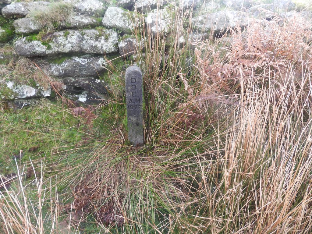
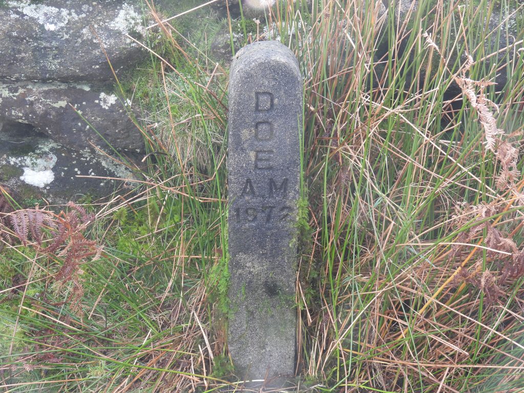
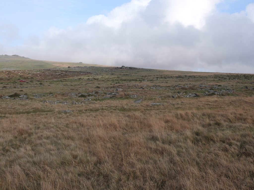
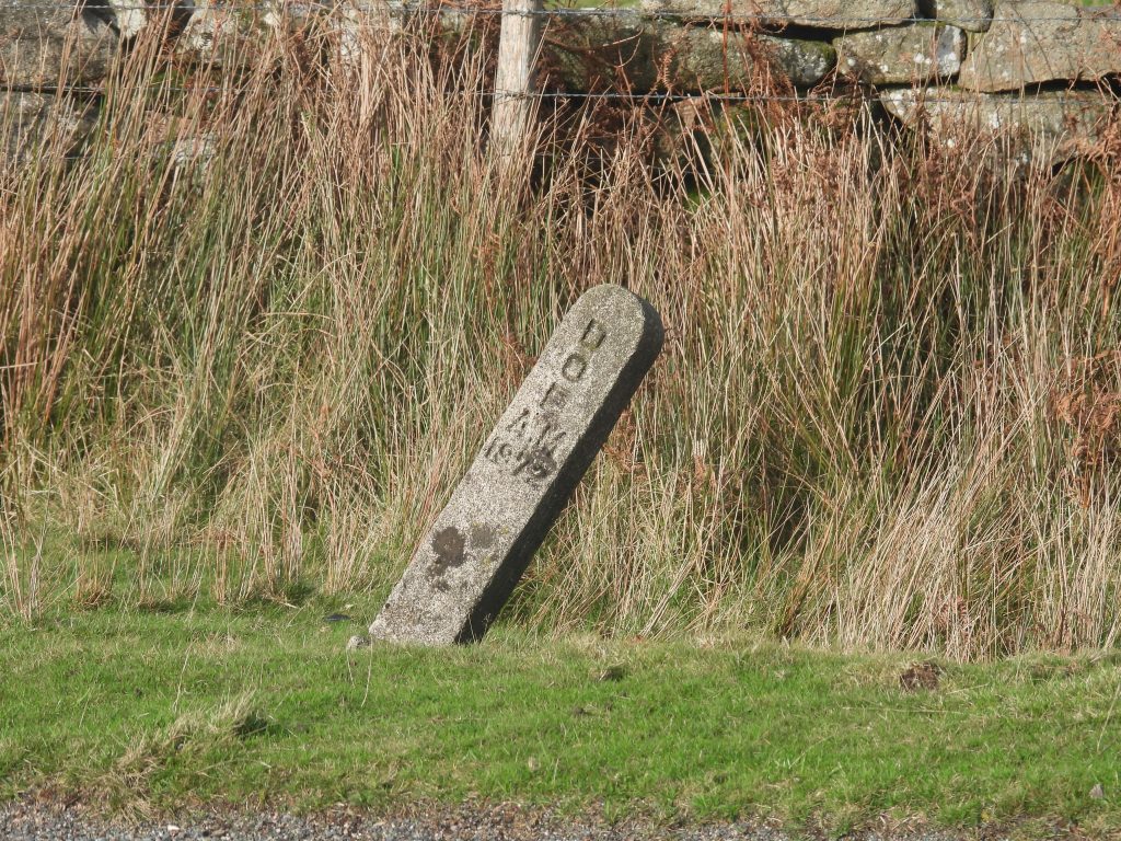
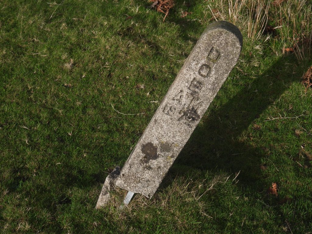
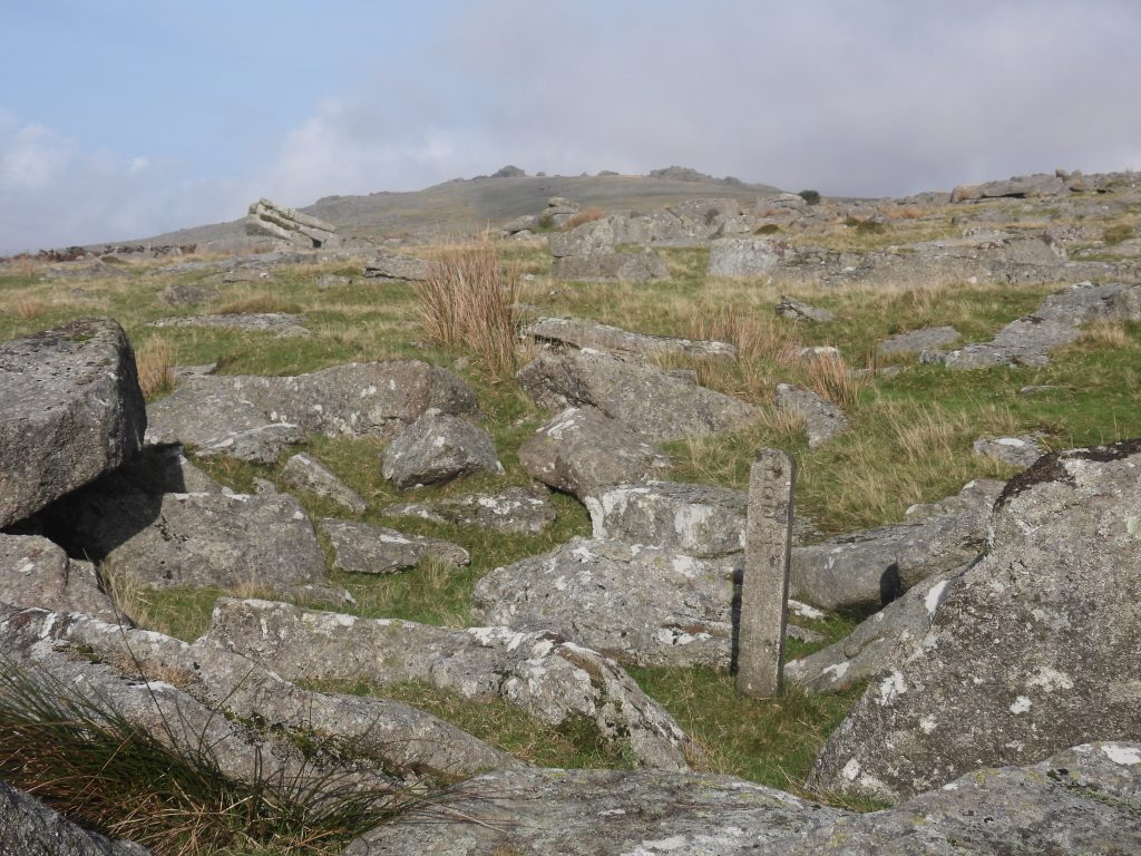
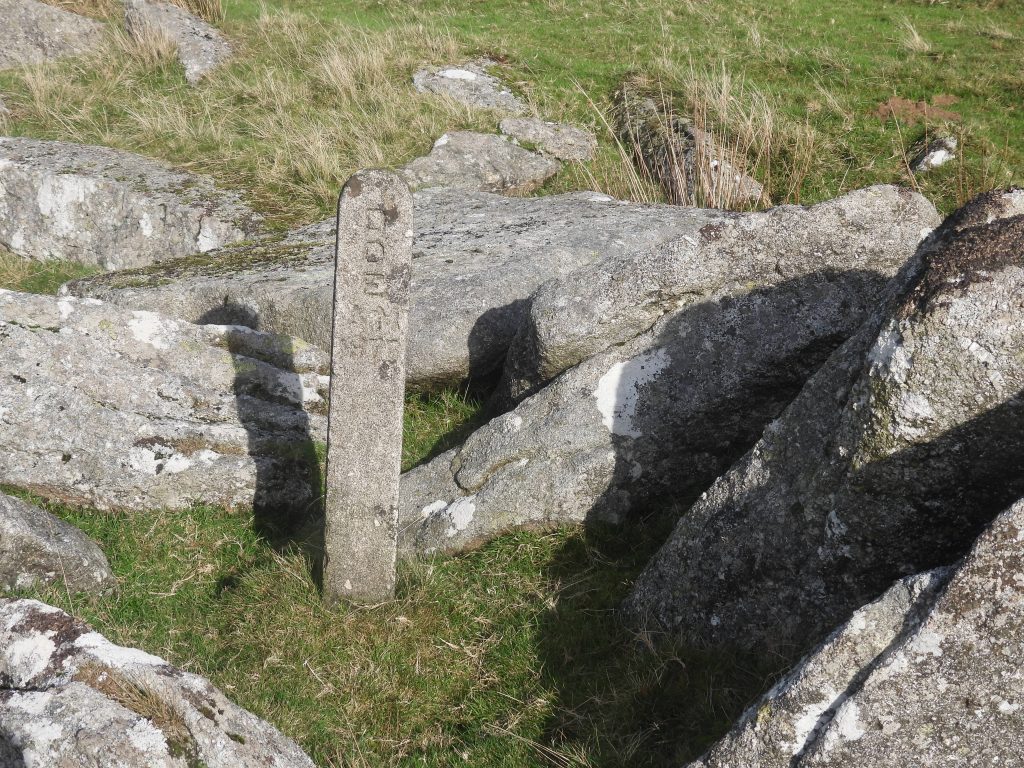
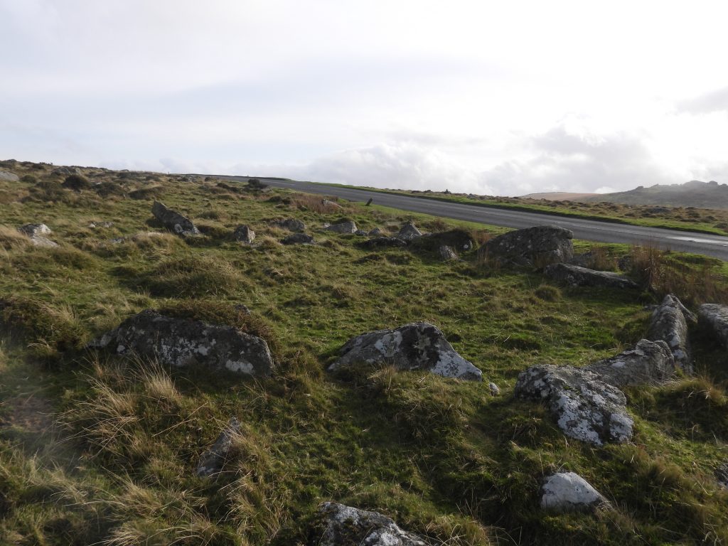
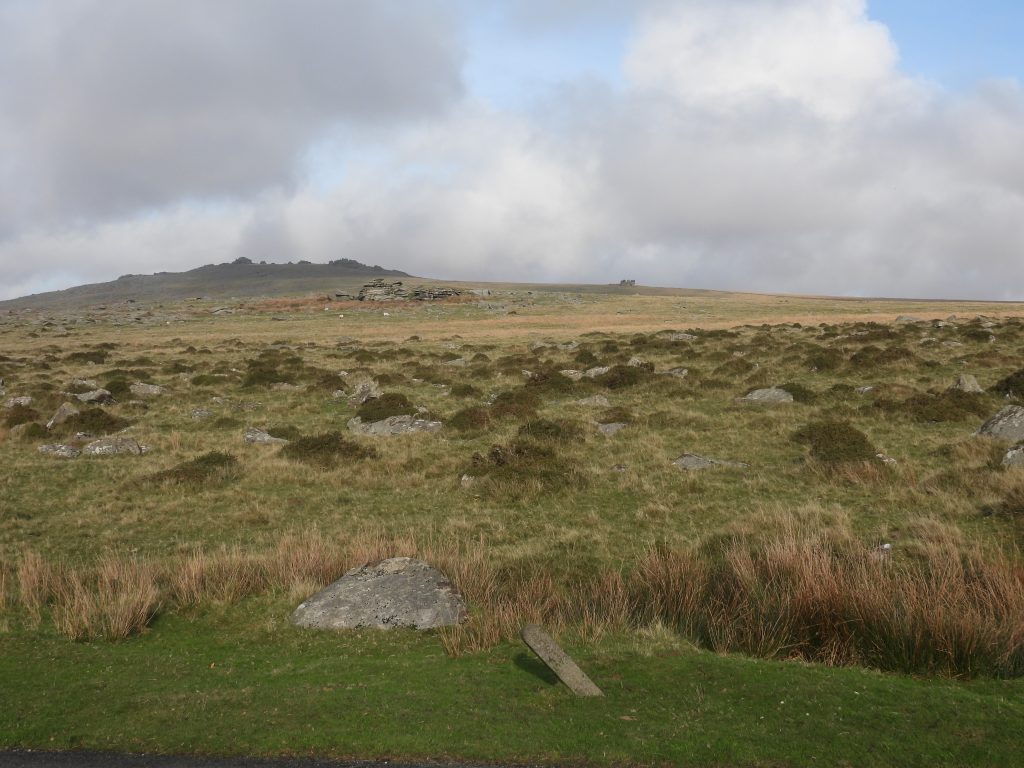
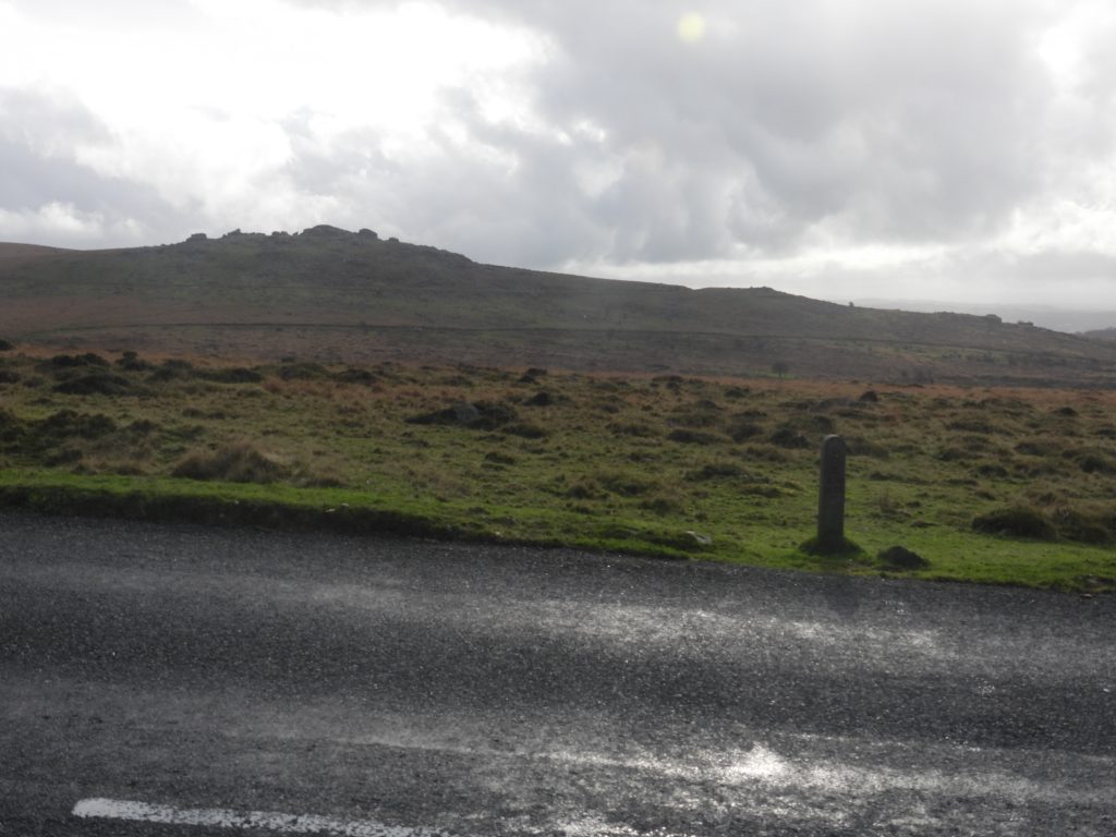
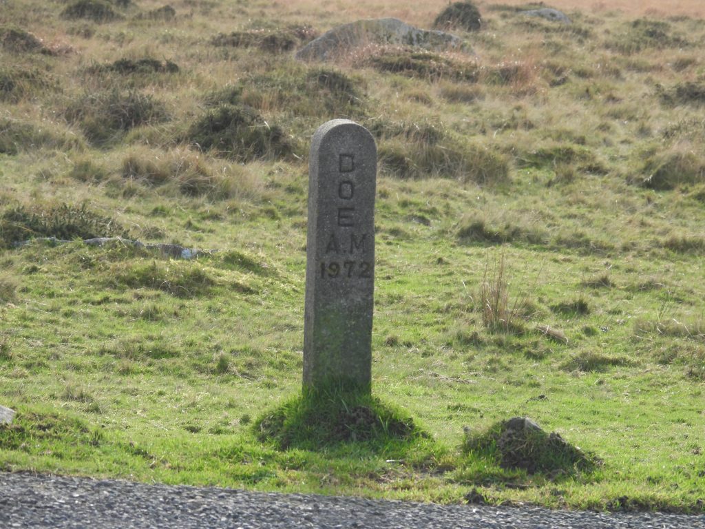
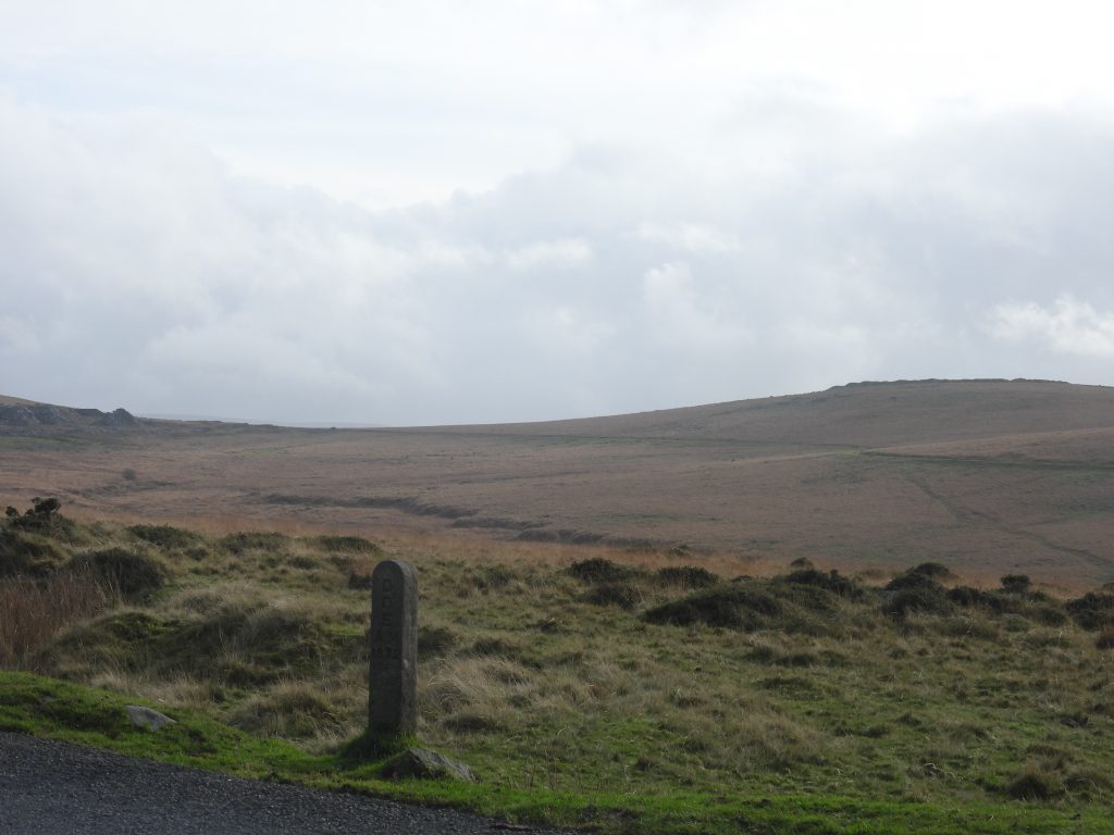
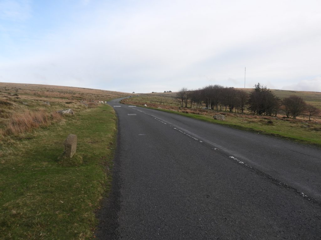
If you drive from Merrivale Bridge in an easterly direction along the B3357 towards Rundlestone Corner, as you near the crest of the hill just before Four Winds Car Park, it is possible, indeed probable you may have seen at least one (possibly two or three) upright Post Office style concrete markers which are embossed with ‘D/O/E/AM/1972’. These letters stand for ‘Department of the Environment, Ancient Monuments’ and as suggested by the numbers were erected around 1972.
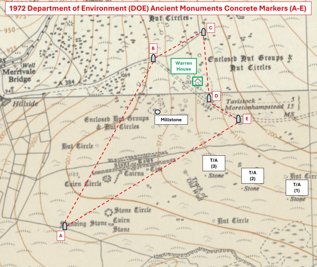
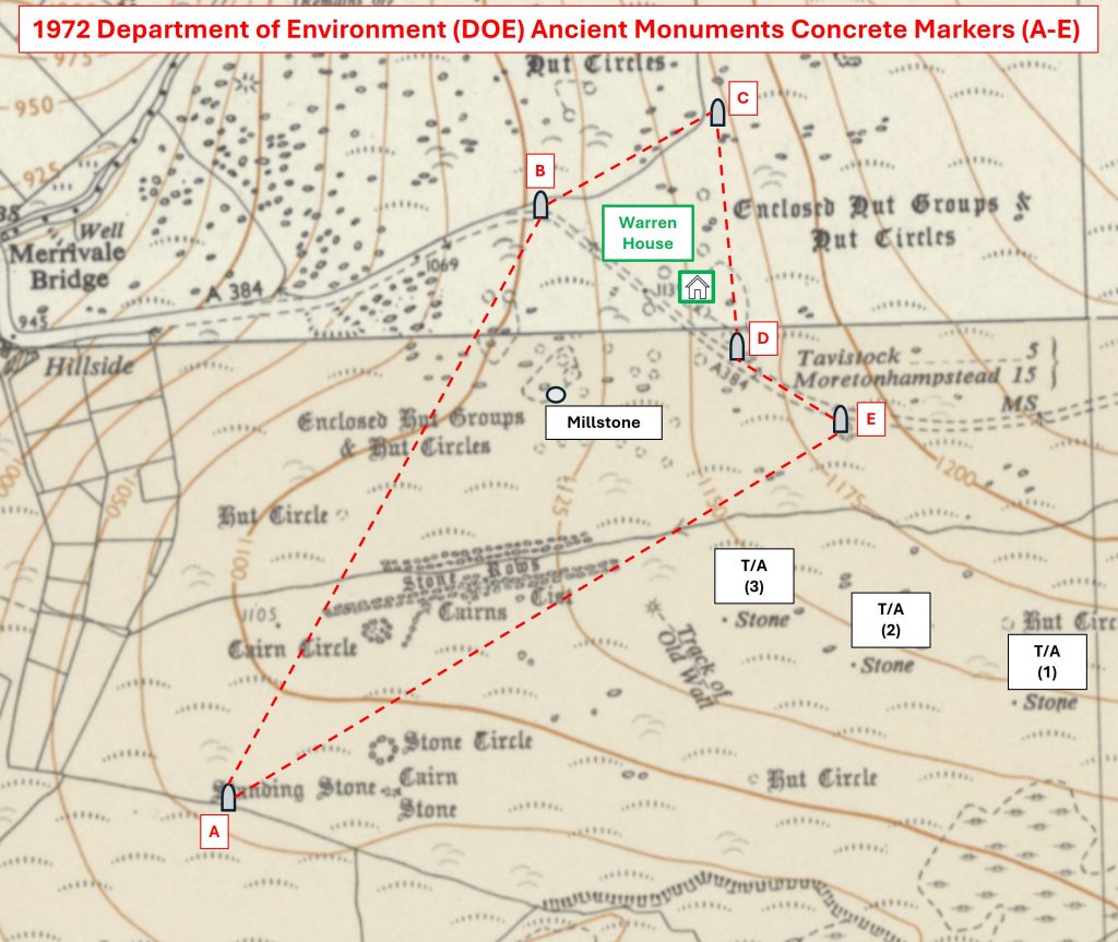
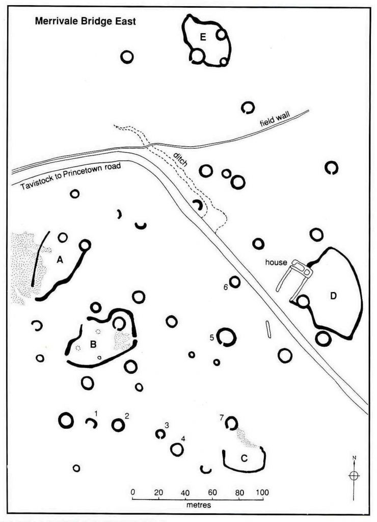
The markers were erected here in order to identify (for protection) certain ancient monuments, in this case the Bronze Age Settlement either side of the road and the well known Stone Rows, Cists and Cairns on Longash Common. The first impression by the author was that the markers appeared to have been erected at rather random locations, especially the three alongside the road in more or less a straight line. However, when the aforementioned three markers and the two others known to be in the area are plotted on a map, their positioning becomes (perhaps) a little more obvious.
The author is aware of at least two other locations on Dartmoor where ancient monument identification for protection has been used – there maybe more. The two other locations are around Penn Beacon, where signs were erected around the 1950s and 1960s and at Shaugh Moor, circa 1970s where ‘star’ shapes atop ‘scaffold sized’ poles were used.
This post explores all the three areas where ancient monument protection signage has been used, focussing primarily on Merrivale. In an attempt to understand the timeline for erection of these signs, the author has researched significant dates when ‘Ancient Monuments Protect Acts’ and other legislations were embodied. There is probably more to the story of all these signs that meets the eye, so if anyone reading this post has anything else to add, the author would be most grateful in hearing from them.
Sabine Baring Gould – (1895) – Second Report of the Dartmoor Exploration Committee,
John L. W. Page (1985) – An Exploration of Dartmoor and its Antiquities
L.V. Grinsell (1978) – Dartmoor Barrows, 173
Jeremy Butler (1991) – Dartmoor Atlas of Antiquities: Volume Two – The North, 72-74
Richard Hansford Worth (1981) – Worth’s Dartmoor, pages 108, 216 and Plate 75B
R.G. Haynes (1966-1969) – Ruined Sites on Dartmoor, 82
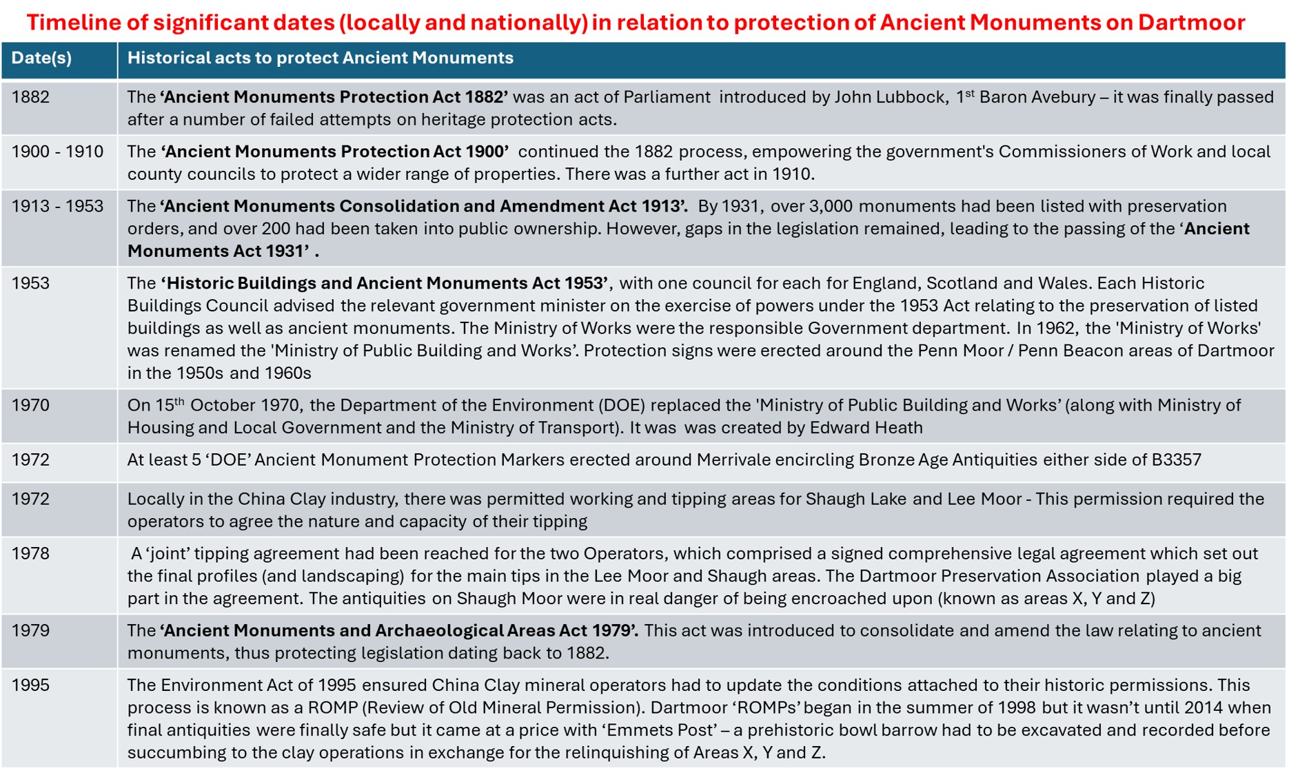
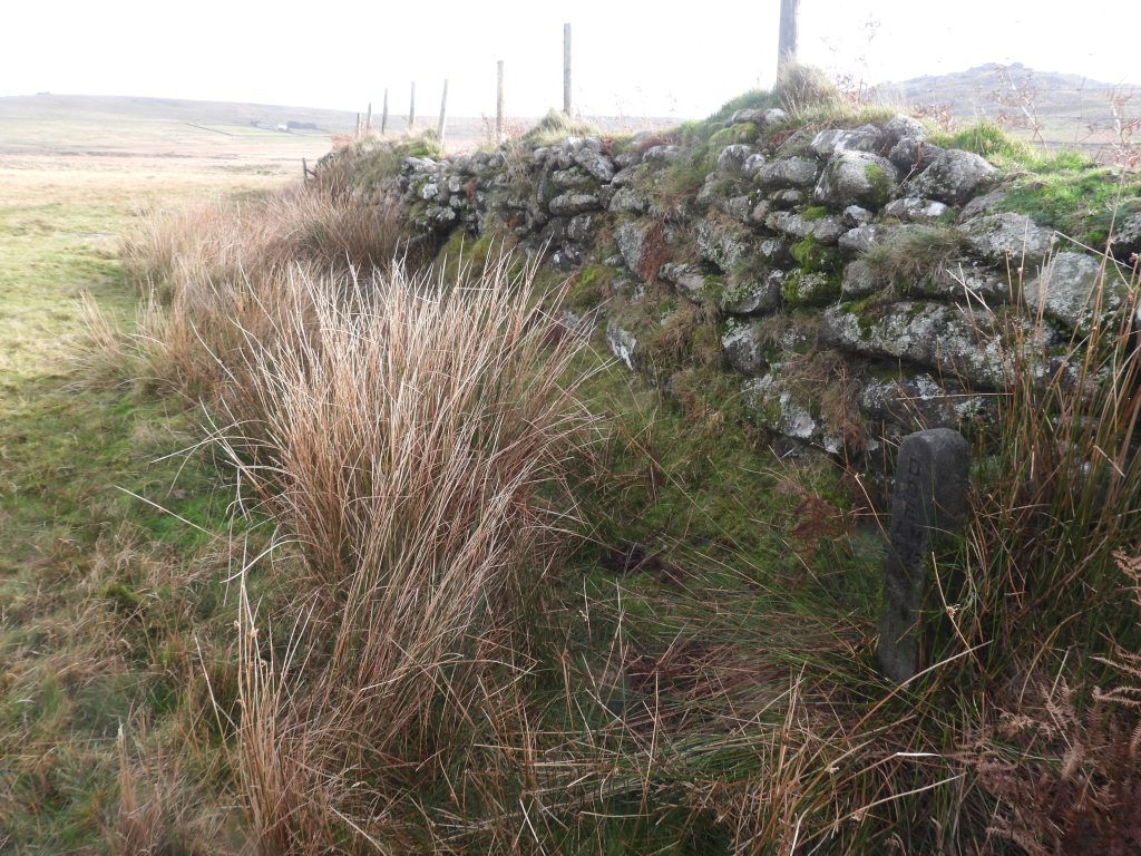
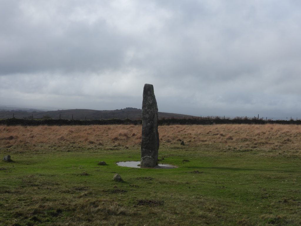
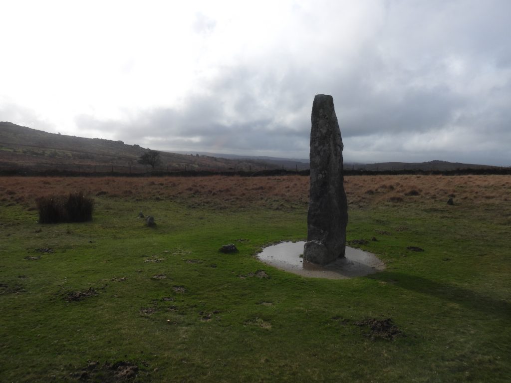
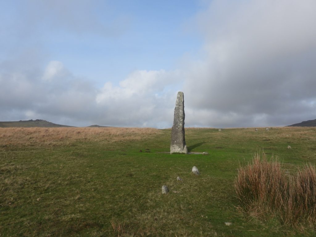
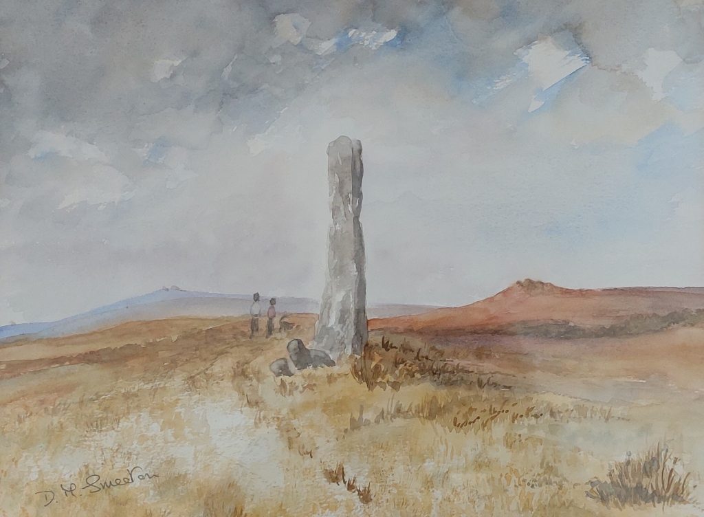
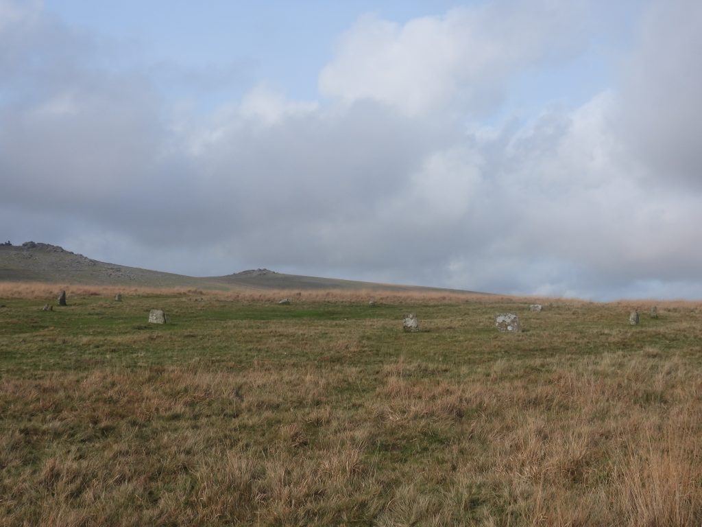
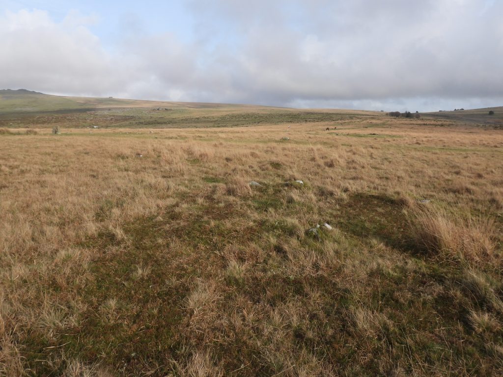
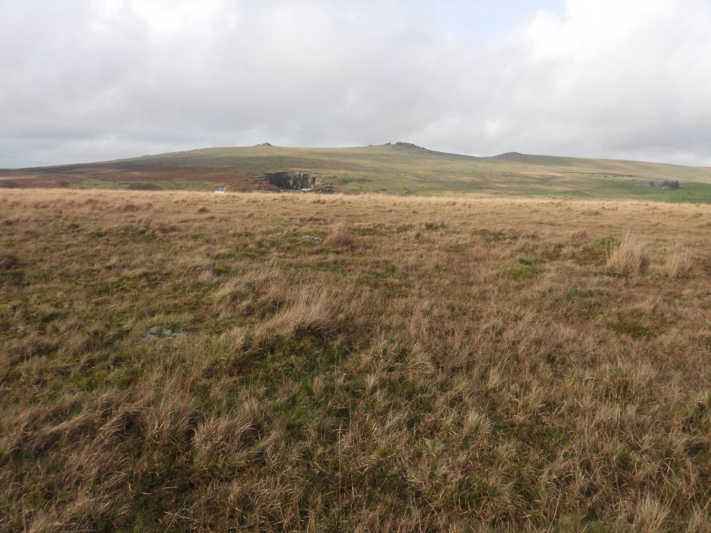
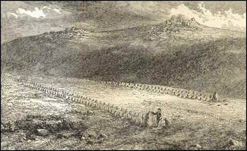
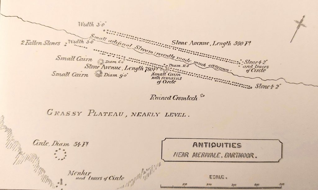
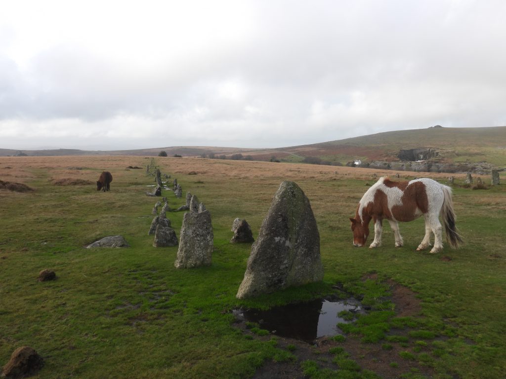
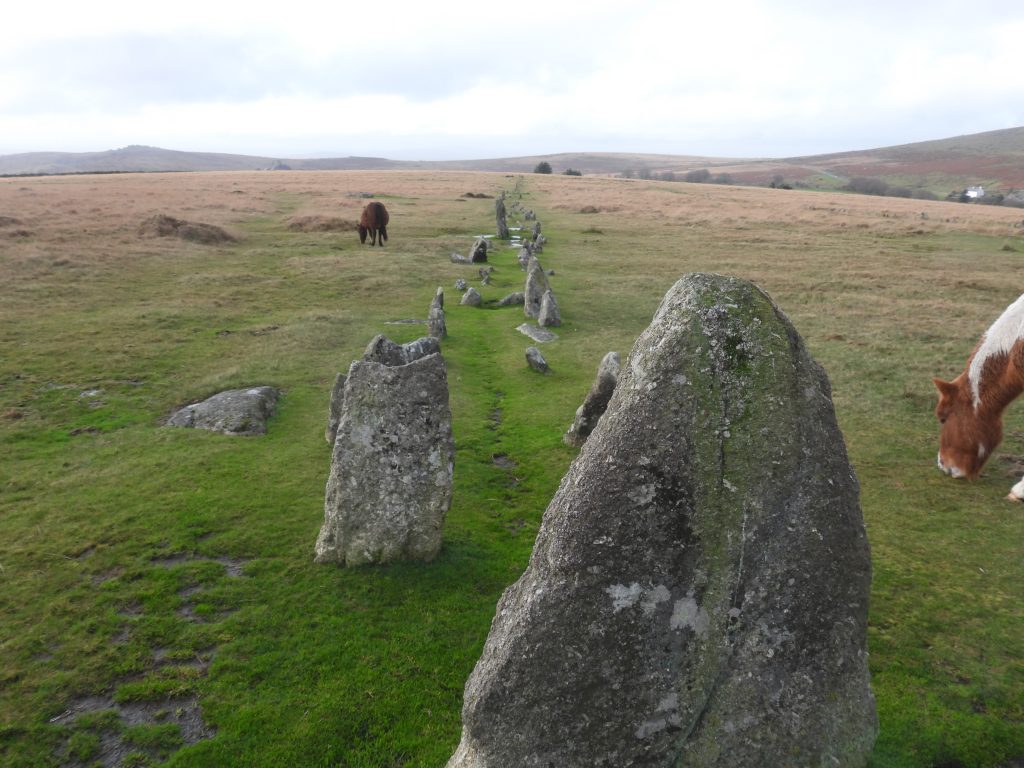
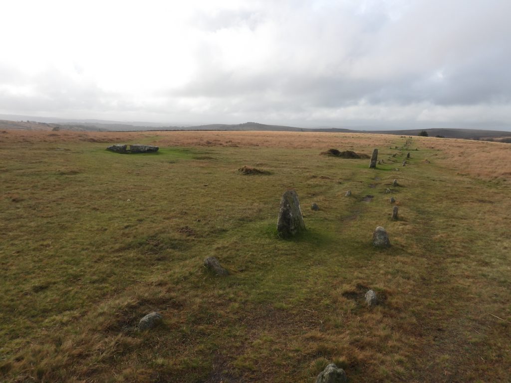
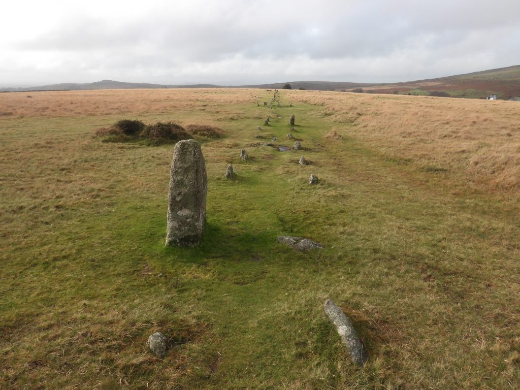
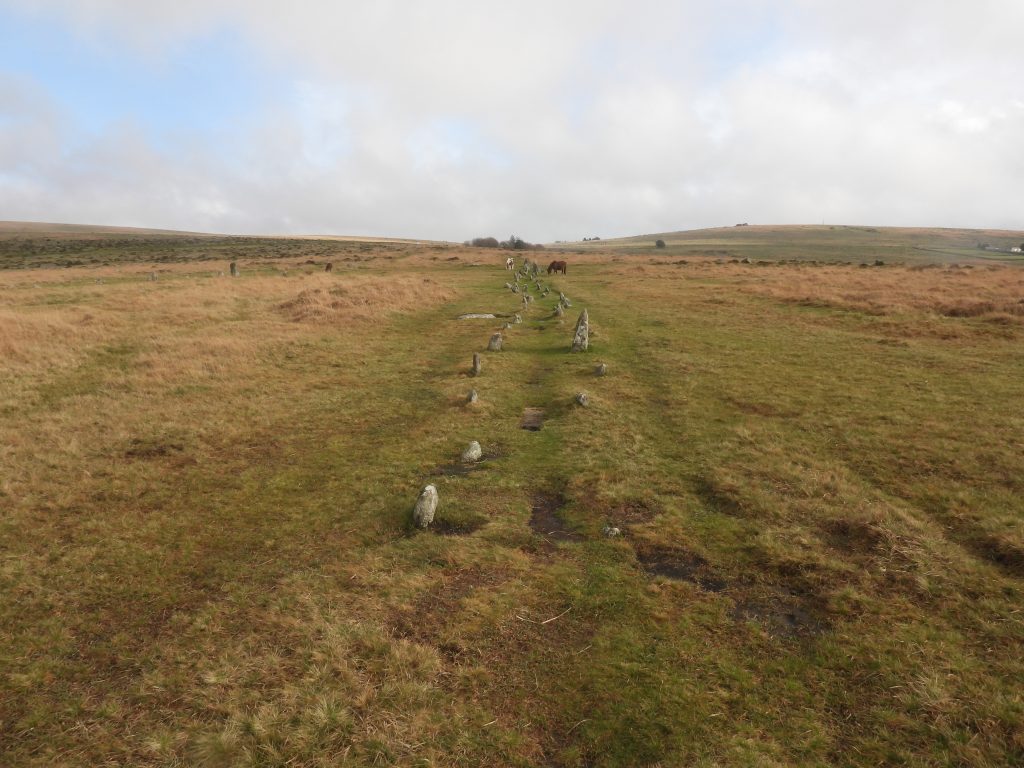
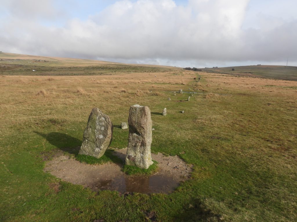
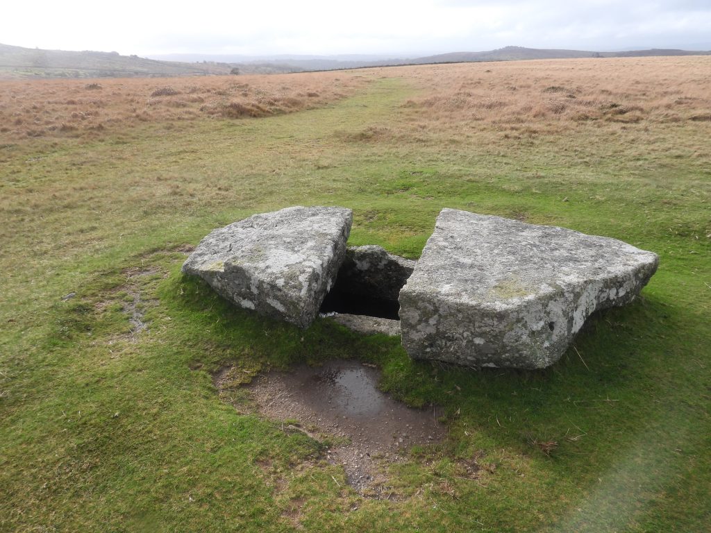
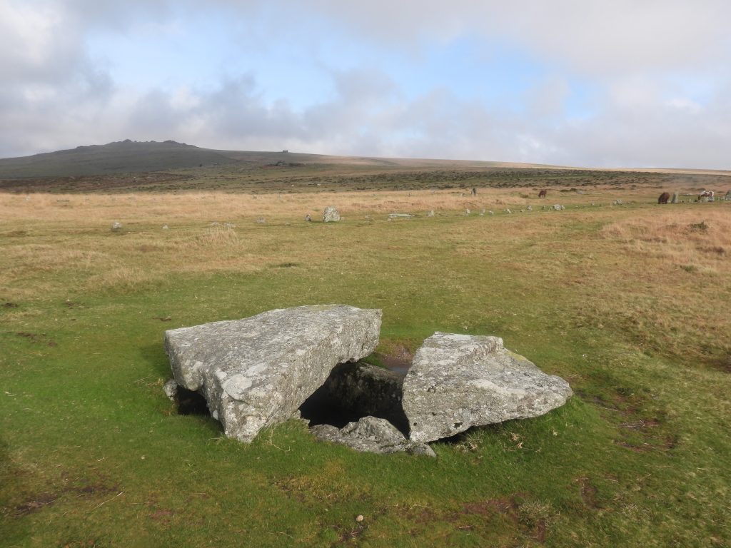
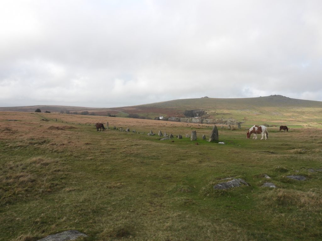
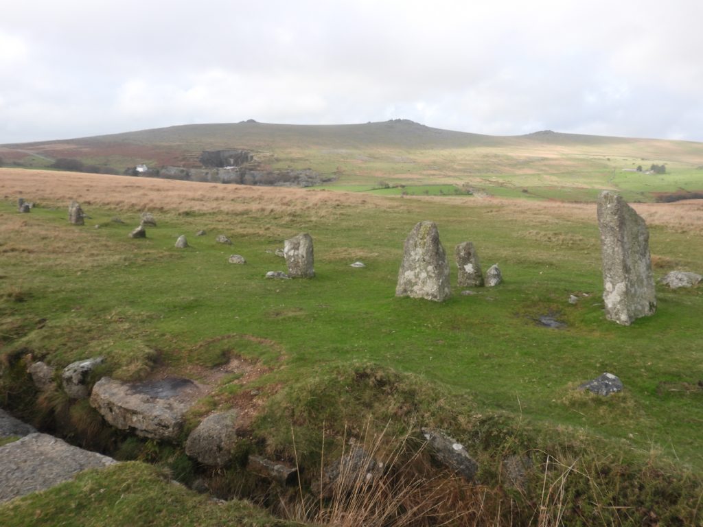
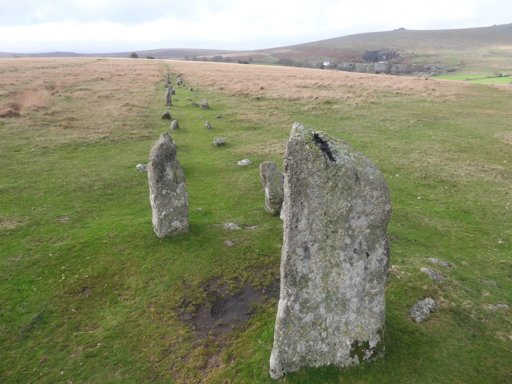
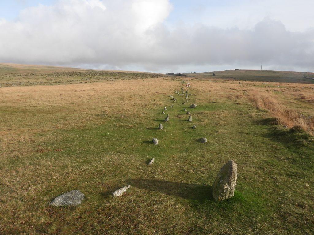
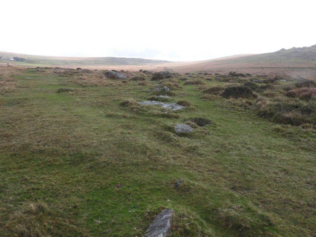
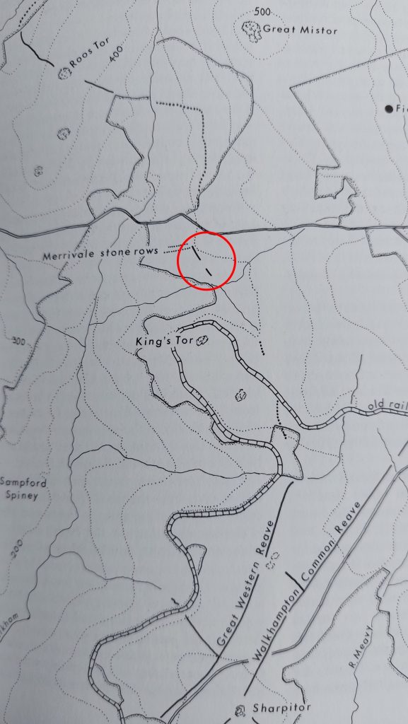
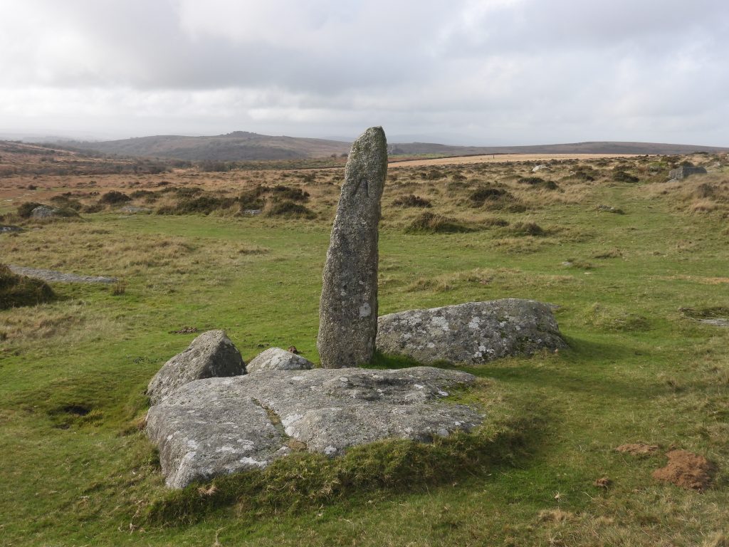
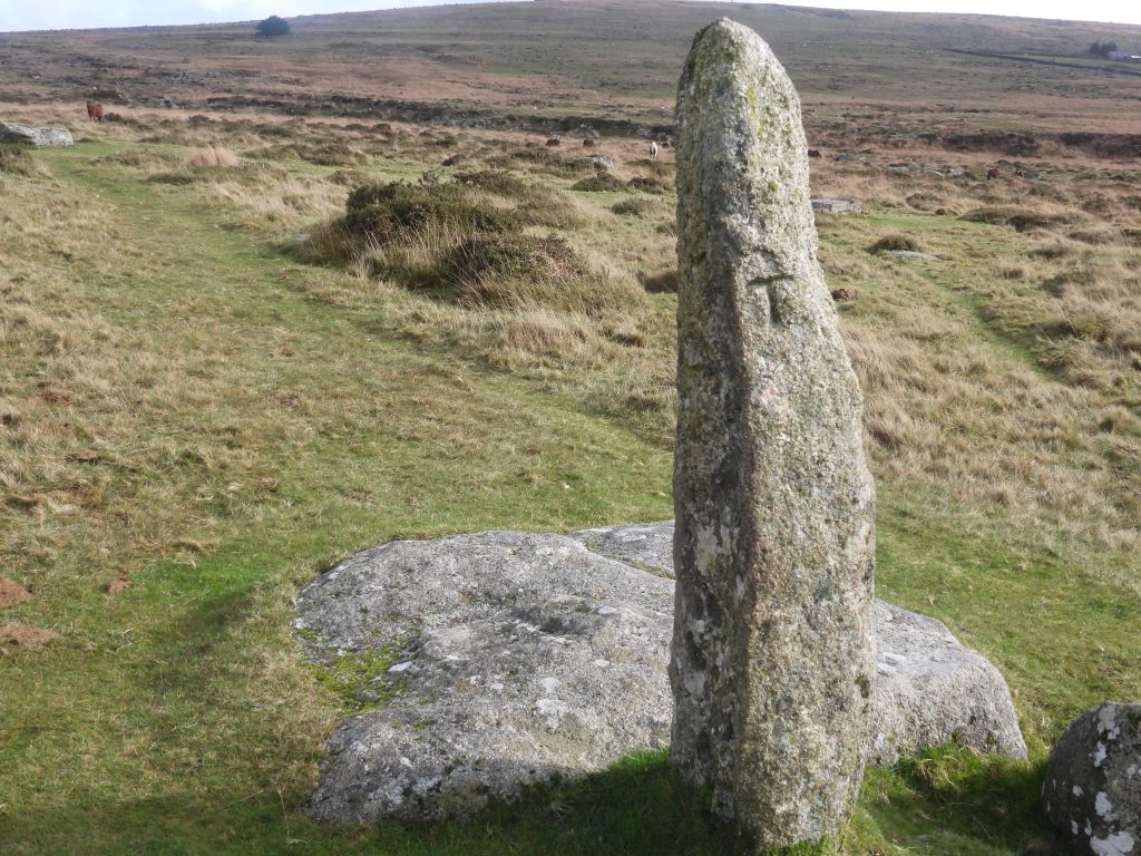
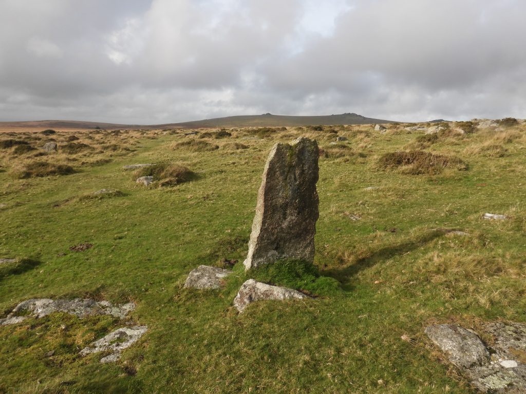
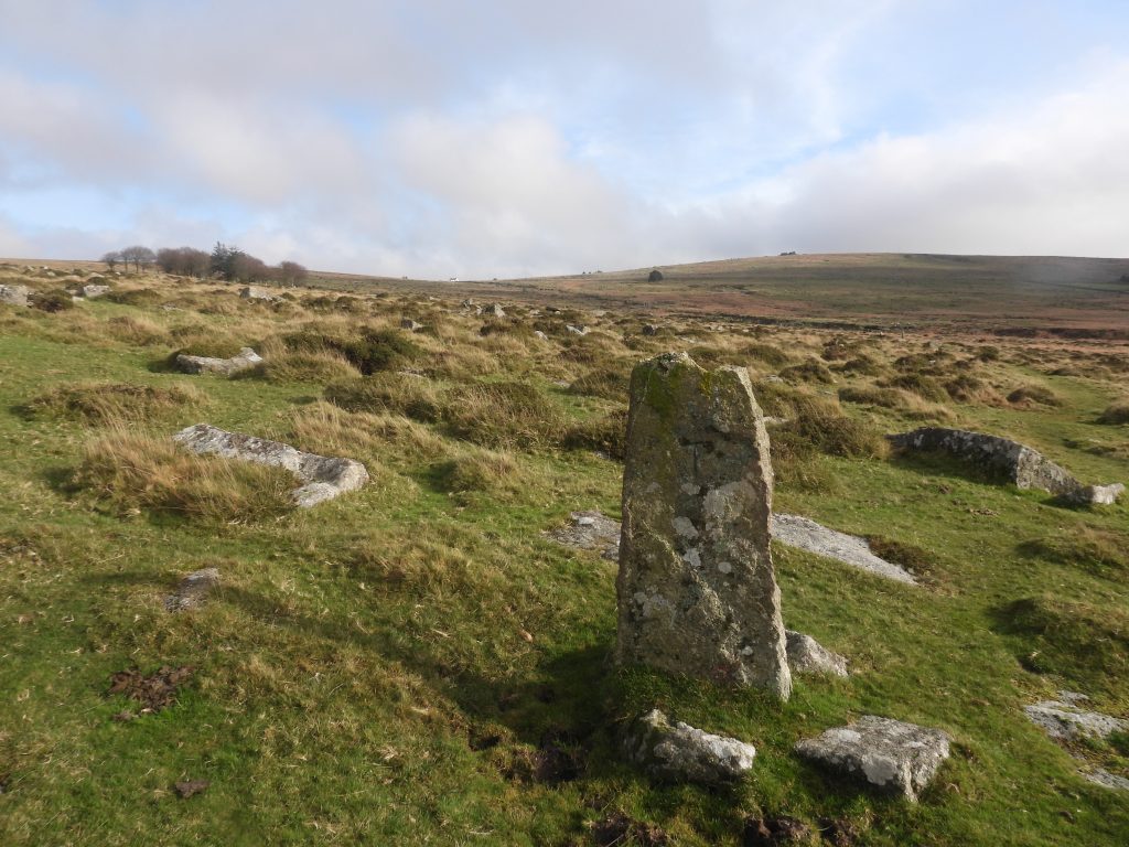
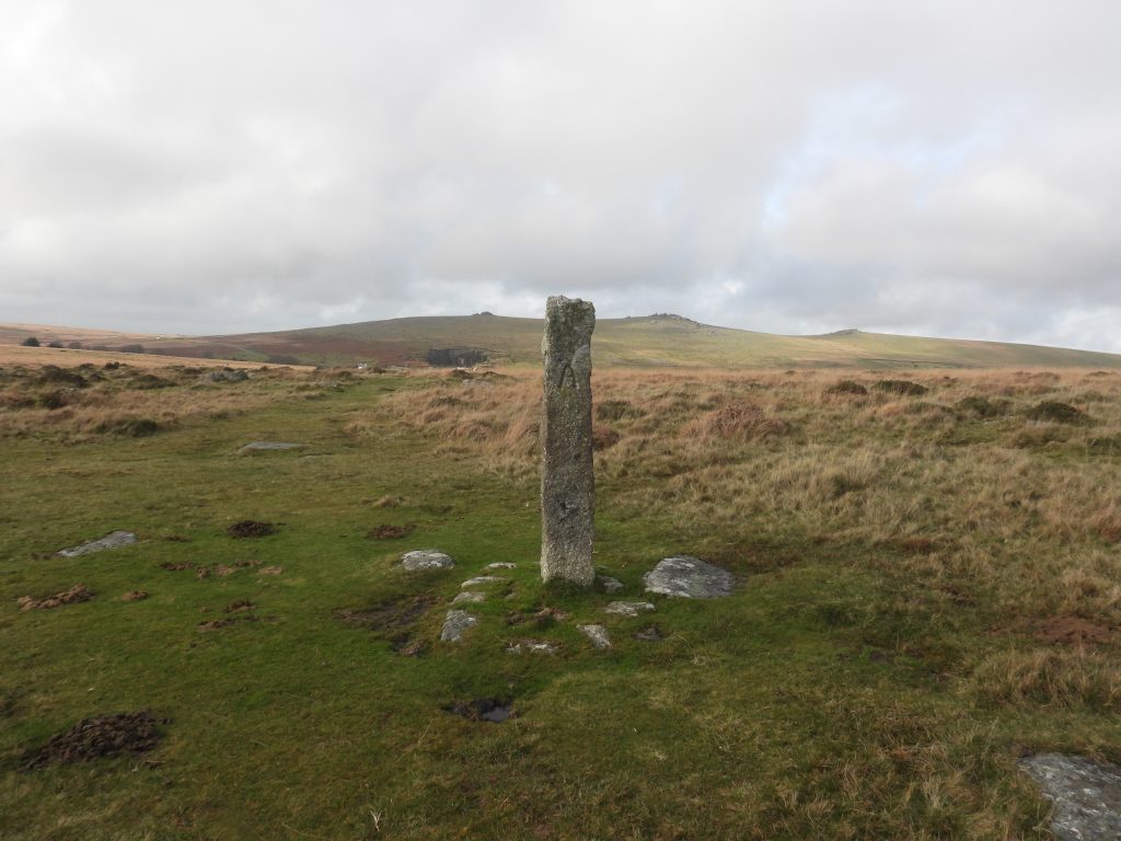
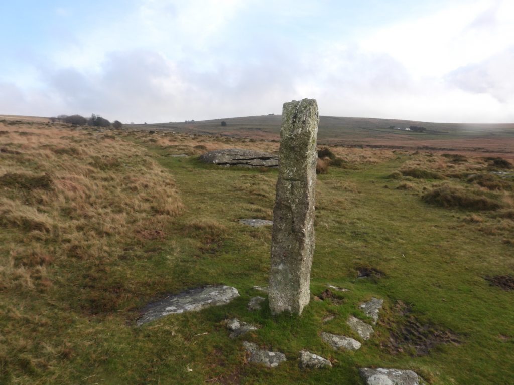
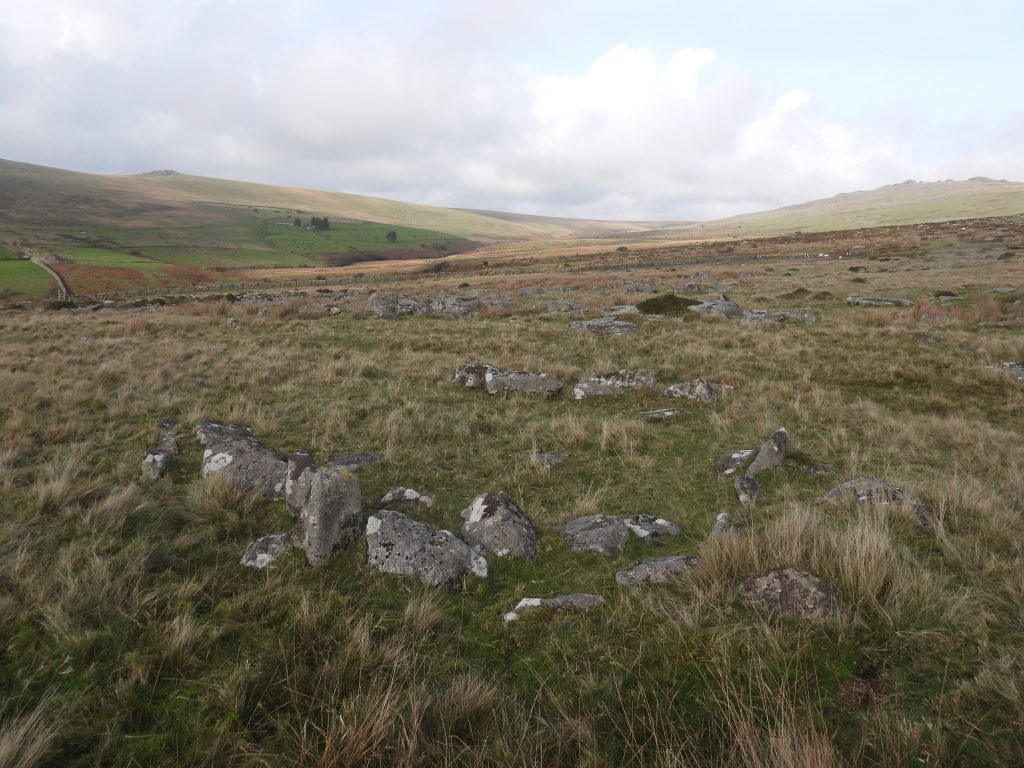
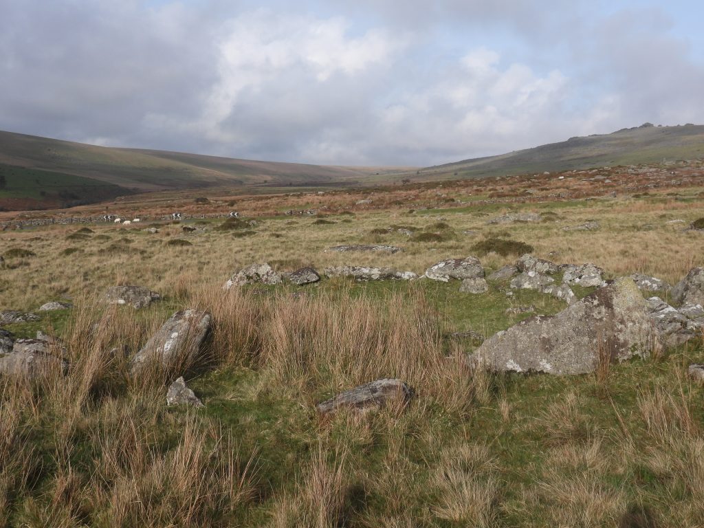
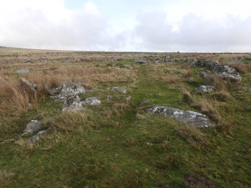
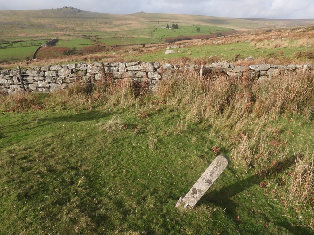
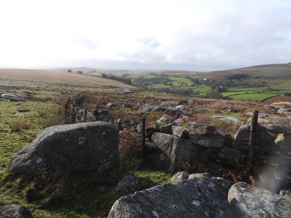
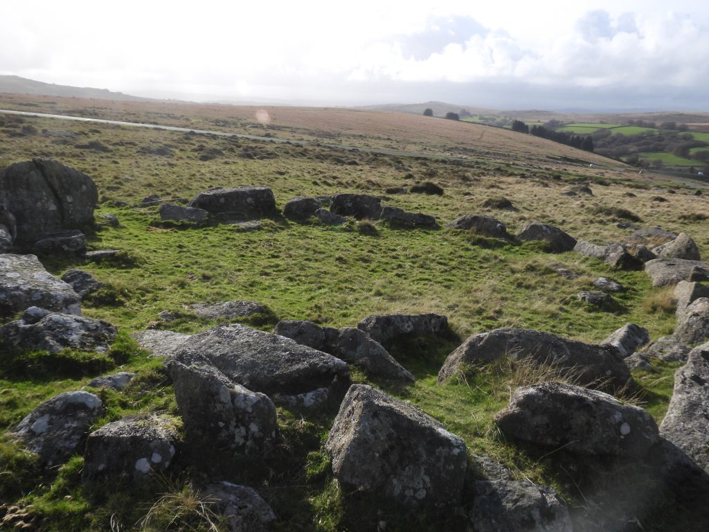
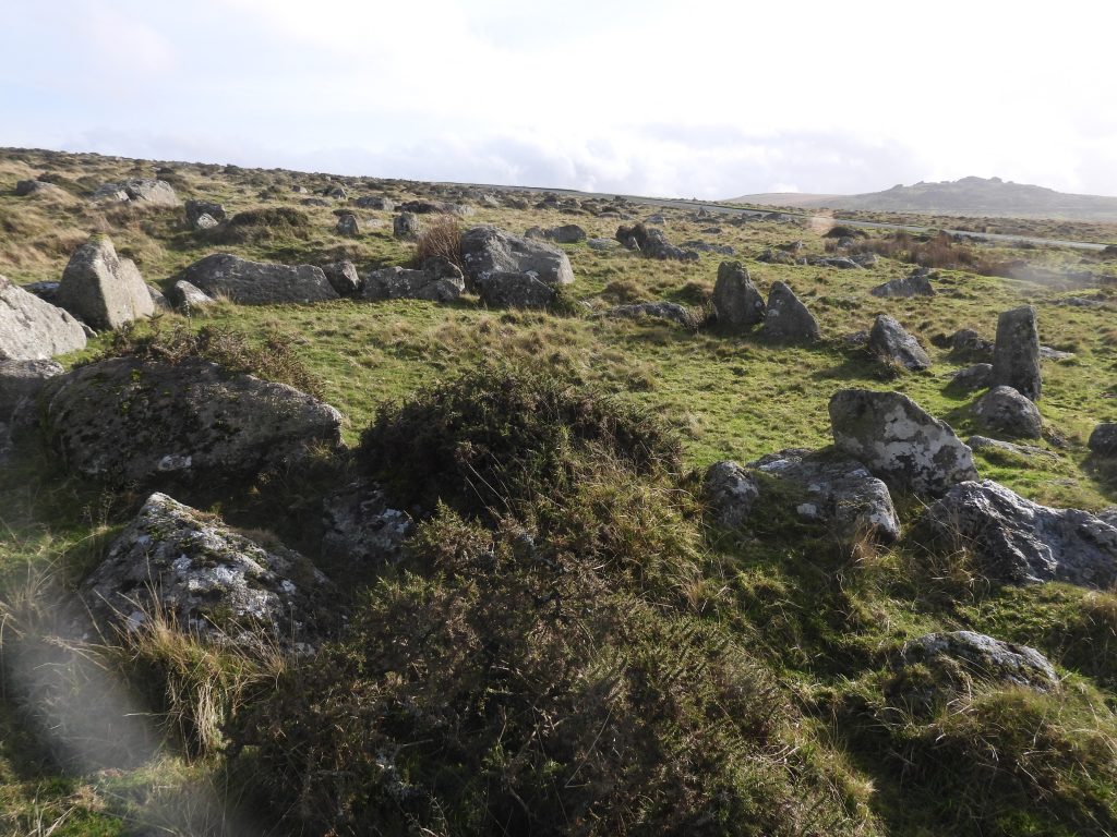
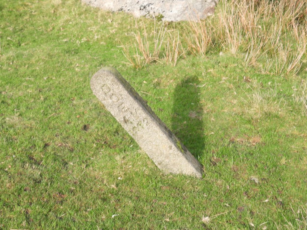
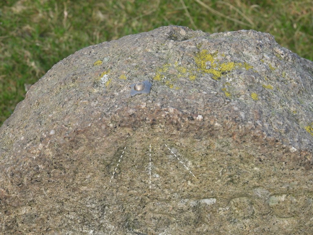
The location of the five DOE markers are plotted accurately on a map (albeit an older OS map), their locations appear to encompass the main antiquities (ancient monuments) of the area. The markers (annotated A-E) appear to totally encompass the Bronze Age Settlement near to the corner of the B3357 (which was once the A384) and the two Stone Rows on Longash Common. Indeed, a straight line between markers A-B and A-E seem to just clip the western and eastern ends respectively of the southern Stone Row – this doesn’t seem to be a co-incidence. That said, the five markers do not appear to encompass the Standing Stone, Cairn and Stone Circle at the southern end of the complex. Perhaps there was sixth marker placed to enable the encompassing of these and is still to be found?This timeline represents key events over a period between 1882 and 2014, which may help to explain the circumstances, if not the exact reason why the markers covered in this post were erected.This ‘DOE AM 1972’ marker (annotated ‘A’ on the map in this post) is located next to the wall, which is part of a newtake encircling the Pila Brook to the southEach ‘DOE’ marker is a standard designContextual picture of ‘DOE AM 1972’ (A). The marker is located at SX55211 74586This Standing Stone, marked on the map in this post is located only a few hundred metres from ‘DOE AM 1972’ (A) marker. That said, this antiquity does lie outside the shape encompassed by the 5 (A-E) markersThis principal Menhir (Standing Stone) at the Longash Common Bronze Age complex stands not far from a Stone Circle, short Stone Alignment and a Cairn. It has been recorded as being 3.2m tallJust to the south of the Standing Stone is a short stone alignmentThis water colour by D.M. Sweeton is believed to be the standing at Longash Common. The tors are (most likely) Over Tor on the right and Great Staple Tor on the left horizonThis Stone Circle lies 33m to the north of the Standing Stone. It is slightly ovoid and consists of eleven stones with gaps that suggest a possible seven may have once existed here. In 1895 some depressions near to the stone circle were excavated by the Dartmoor Exploration Committee who interpreted them as sockets from which standing stones had been removed (Gerrard). This Stone Circle lies just outside the shape encompassed by the 5 (A-E) markersSome ground disturbance just south west of the two Stone Rows which are believed to be the fragmentary remains of a cairnA second set of fragmentary remains of a Cairn, just a few metres from the first. Lovely view towards the Staple Tors and Roos Tor. It is interesting that neither of the fragmentary Cairns are shown on modern OS maps but are recorded in the Devon Environment Record (HER). These two Cairns lie, more or less, on the boundary of the shape encompassed by the 5 (A-E) markersThis illustration was completed in 1895 and comes from ‘An Exploration of Dartmoor and its Antiquities’ written by John Lloyd Warden Page. The title was ‘Stone Avenues above Merivale Bridge’. The illustration was drawn by Alfred Dawson from a sketch by Page. There does appear to be extra stones in both rows compared with the 21st Century. The two tors (Middle and Great Staple) in the background across the Walkham Valley, certainly have been exaggerated !This plan of the two Stone Rows were also produced by J.W.L Page in his publication. It is interesting to note how Page described these antiquities: “…..two avenues, running nearly due east and west, the one 780 feet in length, the other 590. The stones are about 2 feet apart and of most irregular height, though seldom exceeding 3 feet. They vary much too, in shape; evidently no tool has been used upon them, so that some are thin and pointed and others thick and truncated. A circle with a diameter of 11 feet 8 inches, and which appears to have contained a kistvaen, stands about the centre of the larger avenue. Proceeding down this avenue from the east end, we shall, after travelling some 250 feet, find at a distance of less than 100 feet to the south, the remains of a cromlech”.East end of the south row has a terminating (or blocking) stoneThe southern row from the blocking stoneThe southern Stone Row measures 263 metres and comprises 239 visible stones (Ref: Probert and Newman)The southern Stone Row looking westThe southern Stone Row looking eastThe eastern end of the southern Stone Row which has twin blocking stonesSabine Baring-Gould recorded this cist in the Second Report of the Dartmoor Exploration Committee, thus: “7 ft x 2 ft 9 ins, with the remains of a mutilated coverstone. A flint scraper, a flint flake and a polishing stone were found in the cist in 1895”.Grinsell (1978) in his publication on Dartmoor Barrows, records an interesting story relating to the cist: “It was damaged in around 1860 by a man named Harding, who cut two gateposts from the capstone and damaged a wall-slab. The cist was subsequently restored, ‘too generously’ according to Worth”.Both Stones Rows in one compositionThe two Stone Rows are bisected by a leat (foreground), which is still in use running to supply Hillside Farm. The picture shows the eastern end of the northern Stone Row Eastern end of the north Stone Row with its blocking stoneThe north Stone Row is 182 metres long and is thought to have once extended further west, albeit there is no evidence of post holes or stones to confirm this. The picture is from the western endAs recorded by Sandy Gerrard, near the two Stone Rows at Merrivale there is a 380 metre length of the Great Western Reave. It can be found to run here from SX5577 7446 to SX5558 7479. It is composed of loose rubble, measures 2 metres wide and stands up to 0.5 metres high. On old maps it is annotated as ‘Track of Old Wall’ (as per the annotated map in this post)
The Great Western Reave as recorded by Andrew Fleming in his book Dartmoor Reaves from 1988
Close to the Longash Common Bronze Age complex are three standing stones which are inscribed ‘A’ (for Ashburton) on their eastern sides and ‘T’ (for Tavistock) on their western sides. These mark an old packhorse track between Tavistock and Ashburton which was an important trans-moor trading route until it was largely superseded by the turnpike road in 1792. The route is believed to date to at least late 17th / early 18th century and follows in part the more ancient Monastic Way between Buckfast and Tavistock Abbeys (which may date as far back as the 11th century). The T/A stone in the picture is annotated as ‘T/A (1)’ on the map in this post.‘T’ inscription on the T/A (1) standing stone at SX55922 74659The T/A stone in the picture is annotated as ‘T/A (2)’ on the map in this post. The view is facing west with the ‘A’ (Ashburton) inscription ‘T’ inscription on the T/A (2) standing stone at SX55779 74696. The T/A stone in the picture is annotated as ‘T/A (3)’ on the map in this post. The view is facing west with the ‘A’ (Ashburton) inscription. This is the nearest T/A stone to the Longash Common Bronze Age complex‘T’ inscription on the T/A (3) standing stone at SX55667 74741.
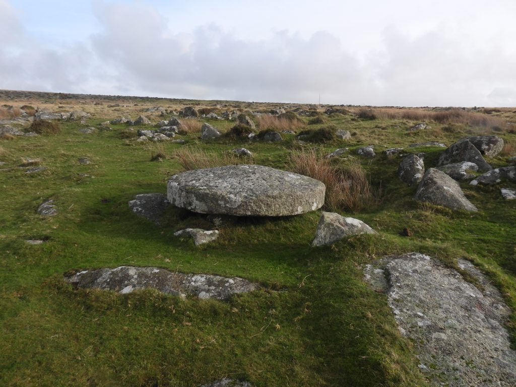
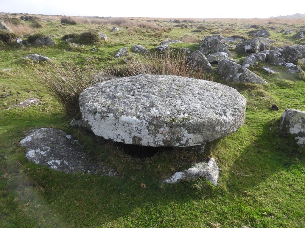
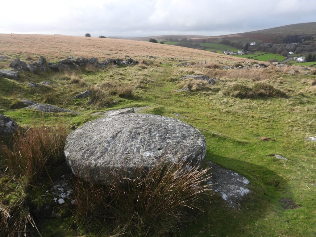
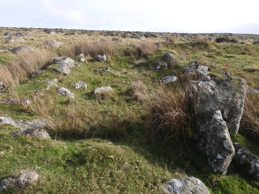
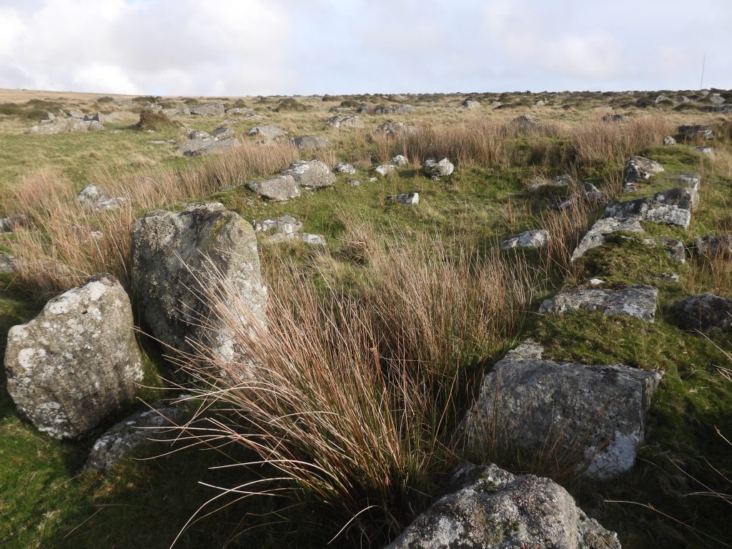
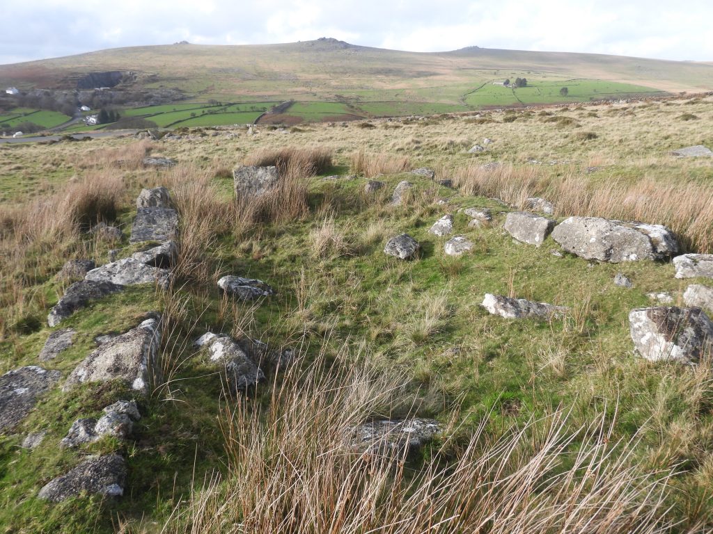
The unenclosed Bronze Age settlement which straddles the B3357, has been meticulously mapped and recorded by Jeremy Butler in Dartmoor Atlas of Antiquities: Volume Two – The North, 72-74. This settlement has been encompassed by the five DOE markers, in the area south of the field (newtake) wall. Within the settlement is the Warren House relating to the early 19th century Merrivale Warren
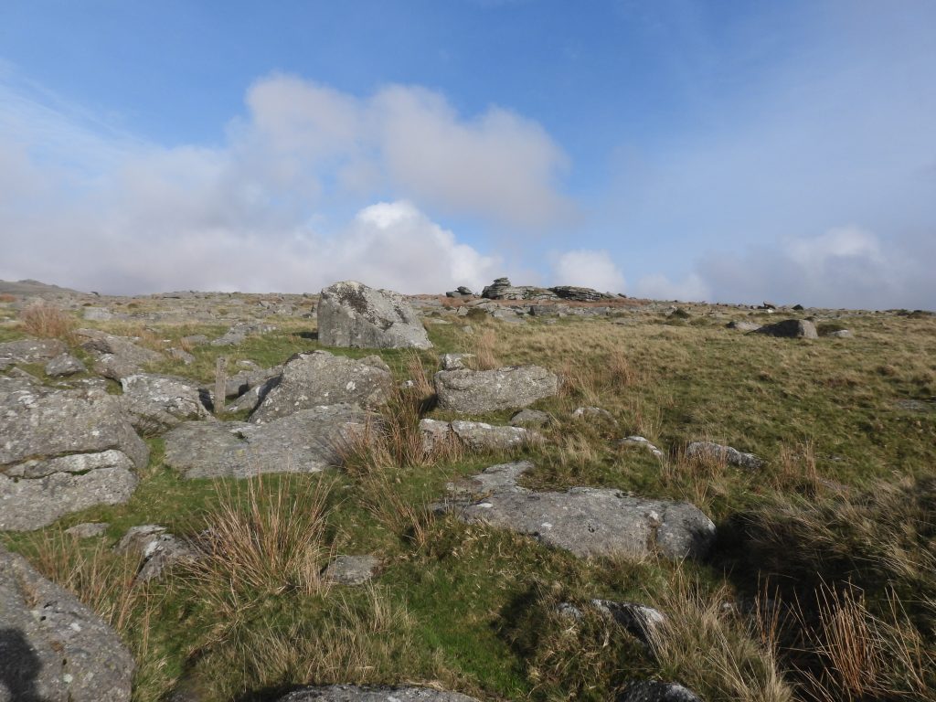
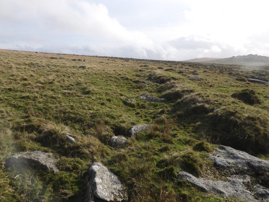
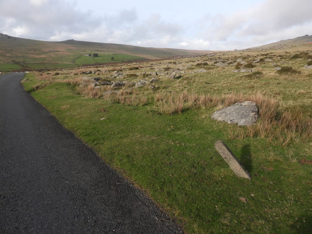
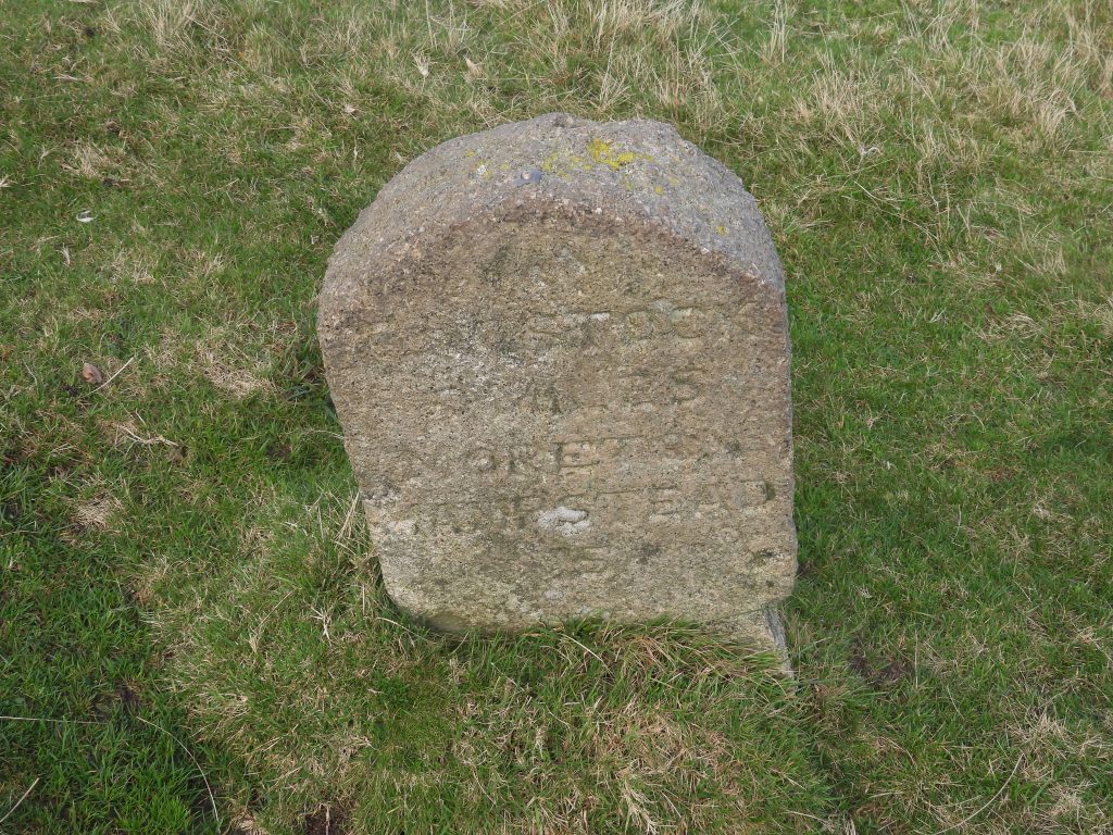
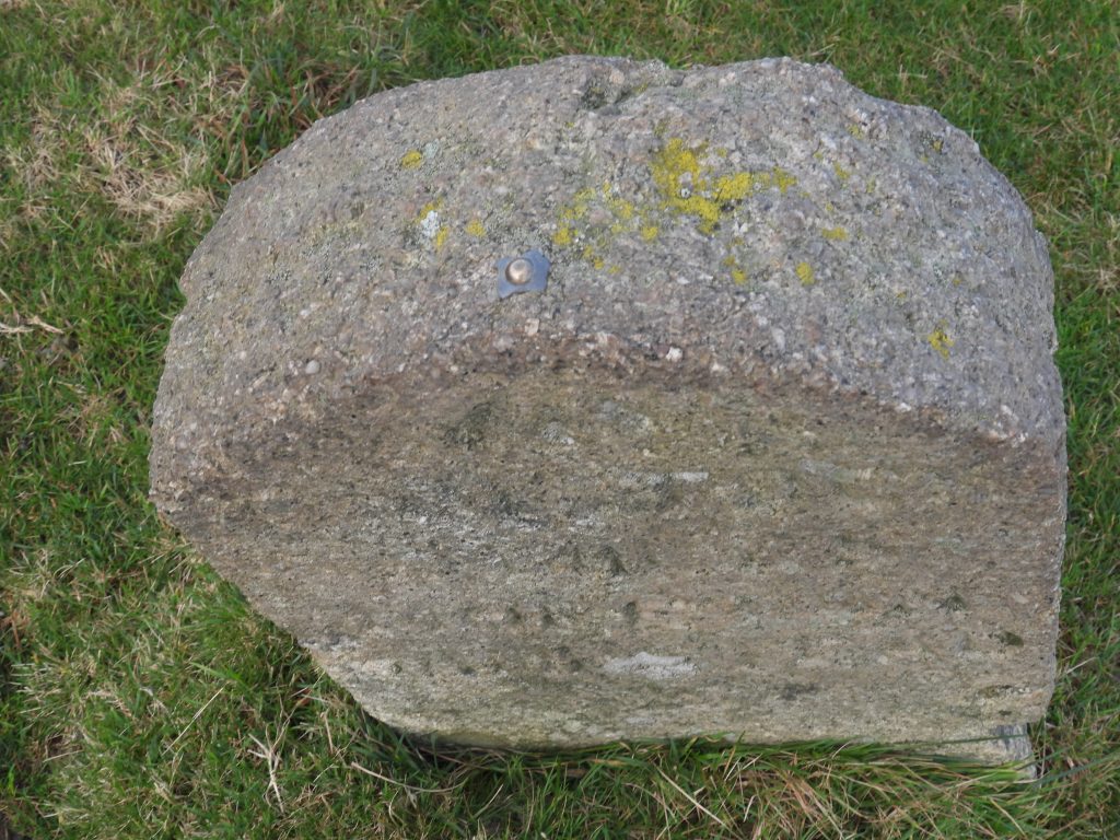
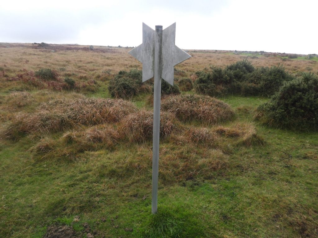
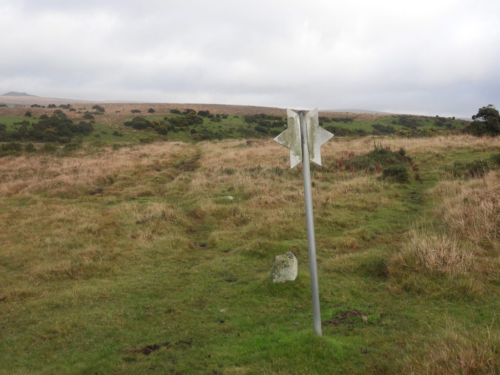
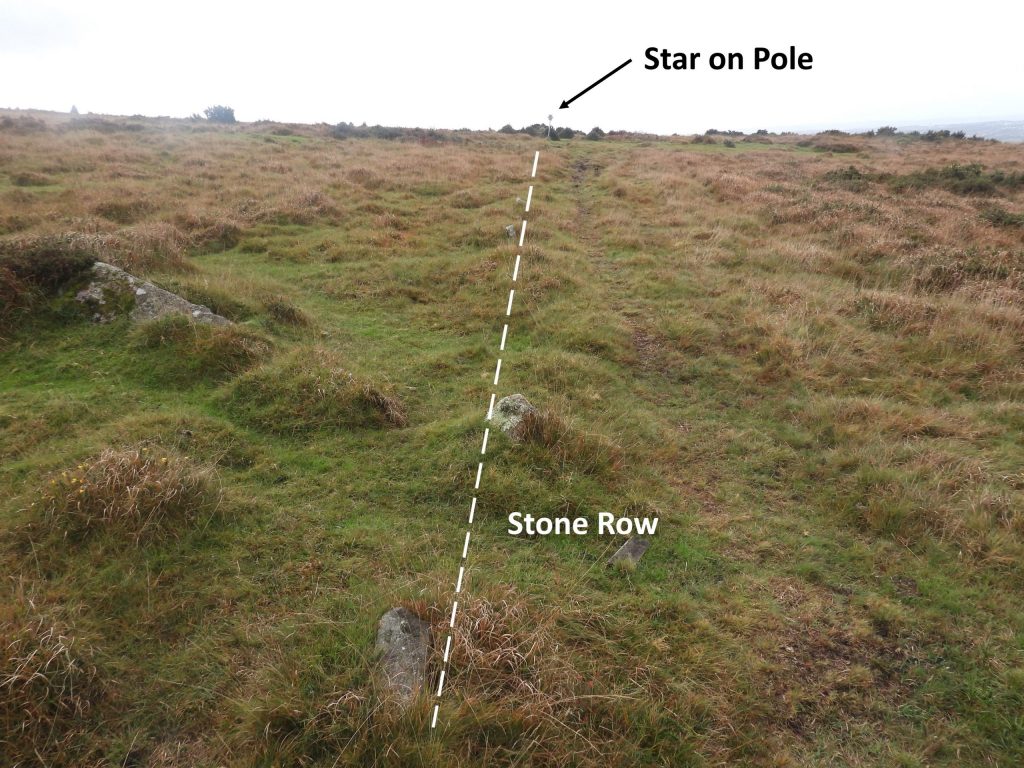
On a moody November day, looking across the Bronze Age hut settlement towards Over Tor, Little Mis Tor and Great Mis TorA typical hut circle with the Walkham Valley beyondAnother hut circle, which is in very good condition – note the chevrons at the bend of the B3357 in the photograph, which indicates the proximity to the roadThis enclosure (annotated as ‘B’ on Butler’s map) is part of the Bronze Age settlement to the south of the B3357. The enclosure is an irregular shape (measured by others as 57 metres by 31 metres). It has a 3 metre wide and 1.5 metre high rubble wall which is double faced in placesWithin the enclosure is a millstone 2 m in diameter and 0.3 m thick. The artefact is propped on top of several smaller stones, presumably in preparation for transport, which Gerrard adds: “This disposition led to at least two antiquarians independently identifying the site as that of a dolmen”The artefact has been recorded by R.H Worth in his ‘Dartmoor’ publication (page 108), where he states “Major Hamilton Smith erroneously identified the millstone as a dolmen in the early part of the 19th century” Worth himself, thought the ‘millstone’ is an edge runner for a cider mill. William Crossing also commented on the artefact in his stating: “Mr C. Spence Bate believed in its funerary origin until his young son located the man responsible for making it”. Crossing like Worth later, thought the stone is an edge runner for a cider mill. No one is sure why it was never removed. The Millstone / Cider Press edge runner is located at SX55515 74942 ‘DOE AM 1972’ marker (annotated ‘B’ on the map in this post) lies on the north side of the B3357It is possible that this marker has been struck by a vehicle in the past leading to its current leaning stateThis marker is located at a bend in the road, which has been named as ‘Halifax Corner’ (ref Dartefacts) or ‘Half-Shaft Corner’ (ref Paul Glanville, retired Dartmoor Ranger)This ‘DOE AM 1972’ marker (annotated ‘B’ on the map in this post) is located at SX55502 75107 ‘DOE AM 1972’ marker (annotated ‘C’ on the map in this post) lies within a group of rocks near the newtake wall corner to the south west of Over Tor. The marker is in this photograph (mid-left)‘DOE AM 1972’ marker (C) close up. The majestic Great Mis Tor is in the backgroundThis ‘DOE AM 1972’ marker (annotated ‘C’ on the map in this post) is located at SX55662 75188. This marker was measured as being 5″ (12.7cm) wide by 4″ (10.2cm) deep by 2′ 6″ (76.2cm) tall. The letters and numbers are approx 2″ (5cm) by 1.5″ (3.8cm)View from the corner of the Newtake Wall close to ‘DOE AM 1972’ (C) marker looking south west across the Walkham Valley. The walling here is part of the boundary of Merrivale Warren, which was operational from circa 1830 (albeit the date is disputed on the Devon Historic Environment Record – MDV14150)Near to ‘DOE AM 1972’ (C) marker, there are a couple of pillow mounds, which were part of the Merrivale Warren. There are 27 pillow mounds recorded with 14 within a 19th century newtake and a further 13 on open moorland to the east.Well preserved Bronze Age hut circle north of B3357Another well preserved hut circleThis hut circle measures 7.5 meters in diameter, with walls standing to a height of 0.4 m. Note the proximity to the road. Butler records that it appears “Stone-robbing has taken place, however, and when six huts were excavated in 1895 by the Dartmoor Exploration Committee they were found to have been previously disturbed, possibly by road menders” citing Baring Gould. The next DOE marker (D), can just be seen by the side of the road in this photographMerrviale Warreners House. It is oriented roughly west to east, with the interior measuring 12.4 m by 4.3 metresEnd on view of Merrivale Warrener’s House – it is surrounded by coursed boulder walls 1 m wide and 0.5 m high. There is also an adjoining enclosureThe records relating to this building and the warren are quite contradictory: Firstly, According to R. Hansford Worth (‘Dartmoor’, page 139) quoting Mrs Bray, the building (or cottage) was erected in 1802 under lease from a Mr Lopez; Secondly, Butler using the same source states the date of construction around 1832 and adds that some huts were damaged at this time and that further destruction was prevented by the Reverend Bray who persuaded the farmer that there would be more profit in acting as a guide for the tourists if the site was left unmolested; Finally, the story appears to have been further complicated by R.G. Haynes (1966-1969, Ruined Sites on Dartmoor), who records that the building was constructed by a man named Watts around 1830, as he had permission to warren this area.Merrivale Warren’s House is located at SX55645 75038‘DOE AM 1972’ (D) marker, on the north side of B3357 just to the east of the Warrener’s House‘DOE AM 1972’ (B) marker, like the one at Halifax / Half-Shaft Corner appears like it might have been struck by a vehicle or possible knocked over due to animals rubbing themselves against it‘DOE AM 1972’ (D) marker is located at SX55679 74970. It is the middle (of three) markers which are adjacent to the road. Over Tor, Little Mis Tor and Great Mis Tor lie beyondThe final known marker (to the author at least) is ‘DOE AM 1972’ (E) which lies on the south side of the B3357This marker (E) when lined up with marker (A) seems to ‘clip’ the eastern edge of the southern Stone Row, perhaps suggesting a very deliberate placement here.‘DOE AM 1972’ (E) marker is located at SX55766 74917Looking east along the B3357. Note the Milestone on the left (north) and Four Winds (south) on the rightThis milestone was set up by the ‘tavistock turnpike trust’ c.1772. It is inscribed ‘TAVISTOCK / 3 MILES / MORETON / HAMPSTEAD 15’ There is a benchmark (and bolt / rivet) on top of the milestoneThe BenchmarkMoving away from Merrviale and Longash Common to Shaugh Moor. There is a ‘star’ on a pole which dates from late 1970s or early 1980s and was one (of three or four) in the area which were intended to indicate where an antiquity was located (in this case the south west end of a stone row). This was another form of ‘marking’ antiquities in order to protect them. In this case it was from the china clay operations centred at Lee MoorThe star on the pole is located at SX55425 63434. More information on antiquity protection in this area can be found here: Securing the protection of Areas X, Y (Shaugh Moor) and Area Z (Lee Moor) from China Clay operations plus unravelling the mystery of the Whitehill Yeo China Clay Works northern boundary – Dartmoor ExplorationsRichard Hansford Worth in 1946 (The Stone Rows of Dartmoor, Part 1, 291) recorded this single stone row as being 180 metres in length. He recorded the spacing of the stones varying between 0.9 metres and 1.5 metres. I wonder what he might have said about the ‘star’ at its southern end ?
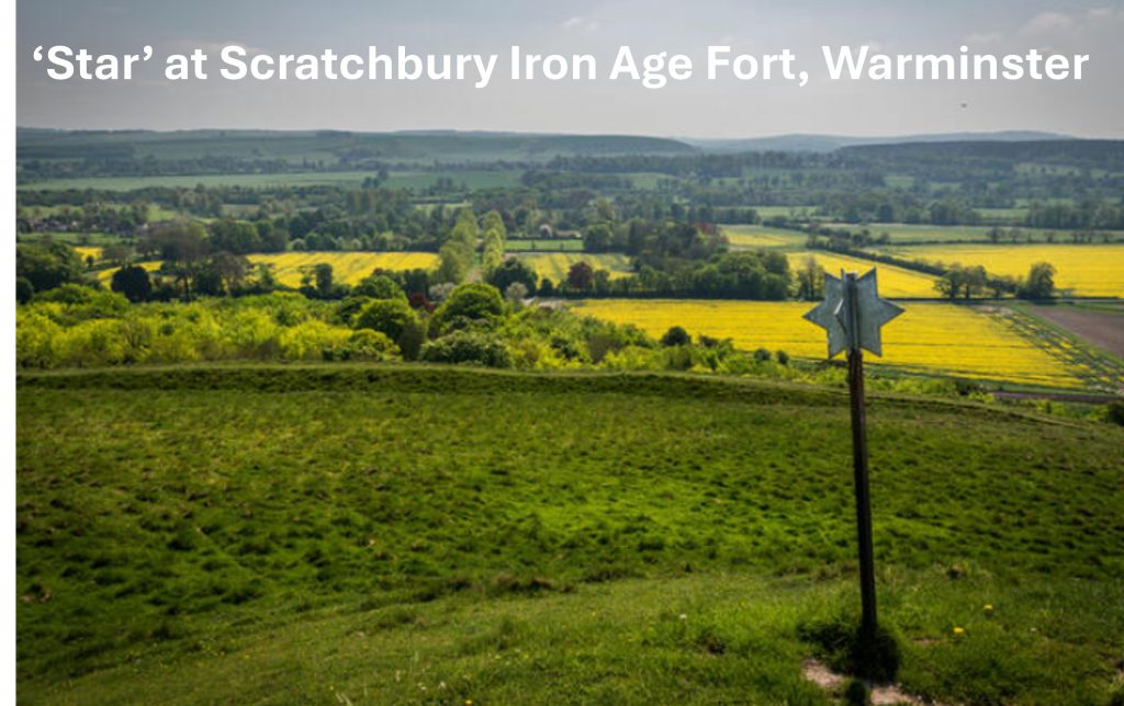
There is a similar ‘Star’ to the ones at Shaugh Moor at Scratchbury Hill Iron Age Fort (Wiltshire) – there are two (similar) reasons considered by internet entries for this star, namely a) This (star) indicates the site of archaeological significance, to let the military know not to drop bombs on this location and b) The star on a stick is a marker indicating that the ground below is a scheduled ancient monument, and should not be dug into by the military. The camp is on the western edge of Salisbury Plain. It seems that this type of design of star was ‘de rigueur’ in the late 1970s / early 1980s
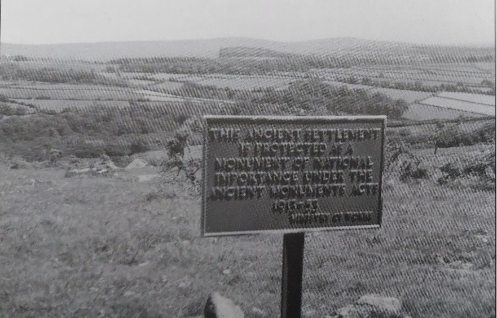
A much older sign relating to ‘Ancient Monument’ protection was once located just north of Ford Waste and probably dates from 1950s. It read: “THIS ANCIENT SETTLEMENT / IS PROTECTED AS A / MONUMENT OF NATIONAL / IMPORTANCE UNDER THE / ANCIENT MONUMENTS ACT / 1913 – 53 / MINISTRY OF WORKS”. This would have been a predecessor to the ‘DOE’ markers at Merrivale and certainly pre-dates the ‘Stars’ at Shaugh Moor. Note that the Ministry of Works was a predecessor to the Department of the Environment (DOE), the latter which didn’t come in until 15th October 1970. Of note is the ‘Settlement’ mentioned here comprises three enclosures and up to ten hut circles to the north of Ford Waste at SX607 619
This iron post set in concrete with a small segment of alloy (which has ‘C B’ embossed on it) is located next to an enclosed settlement on the Penn Moor reave east of Penn Beacon. This too was a former Ancient Monument ‘protection sign’ – it probably dates from the 1960s
In 1962, the ‘Ministry of Works’ was renamed the ‘Ministry of Public Building and Works’, and acquired the extra responsibility of monitoring the building industry as well as taking over the works departments from the War Office, Air Ministry and Admiralty. As there is a ‘C B’ which remains at the bottom of this former sign the author suggests it might have read: “THIS ANCIENT SETTLEMENT / IS PROTECTED AS A / MONUMENT OF NATIONAL / IMPORTANCE UNDER THE / HISTORIC BUILDINGS AND ANCIENT MONUMENTS ACT 1953 / MINISTRY OF PUBLIC BUILDING AND WORKS”. The author believes there are two possibilities for where the ‘C B’ came from on the former sign.