A collection of walks, discoveries, insights and pictures of exploring Dartmoor National Park
November 22, 2025
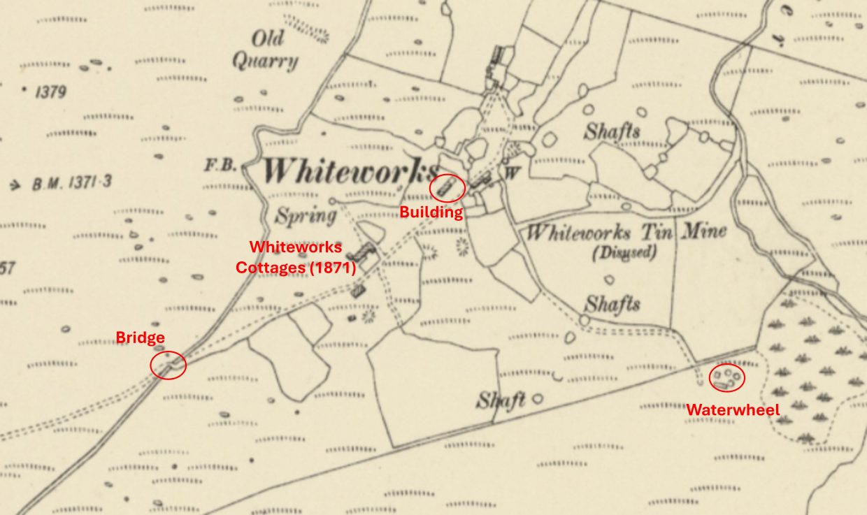
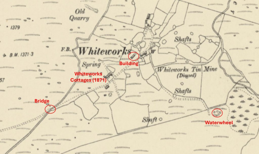
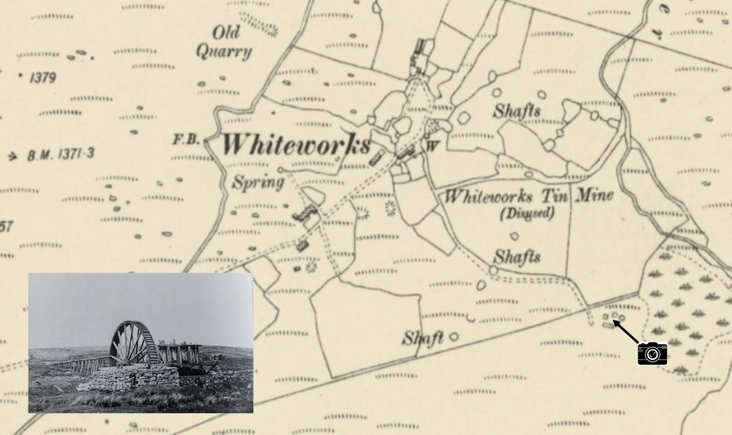
Whiteworks
This ‘Then and Now’ post considers three very different features at the hamlet of Whiteworks, namely; a bridge, a building and an old waterwheel. Evidence of human activity since the medieval period in the area is can still be seen through the numerous remains of enclosure walls, building ruins, the former tin mine, tin openworks, Devonport Leat and the still occupied cottages.
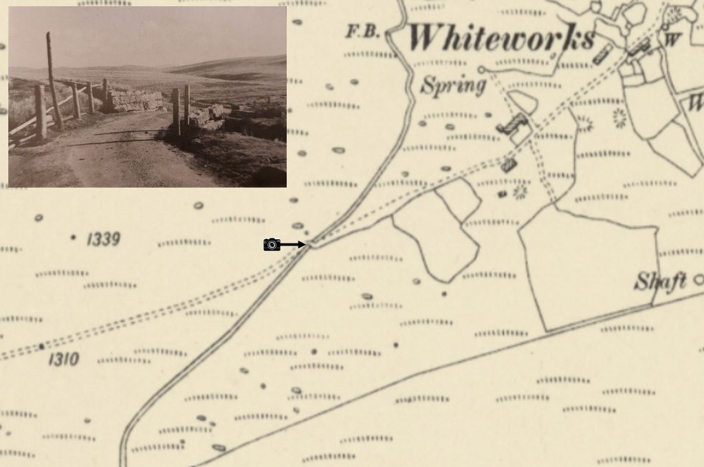
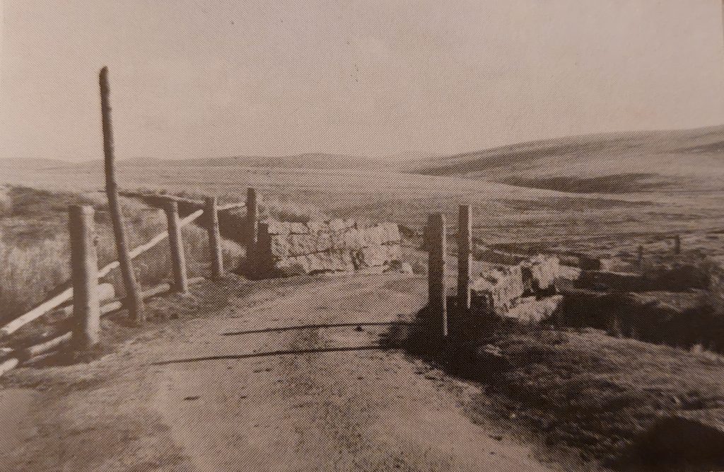
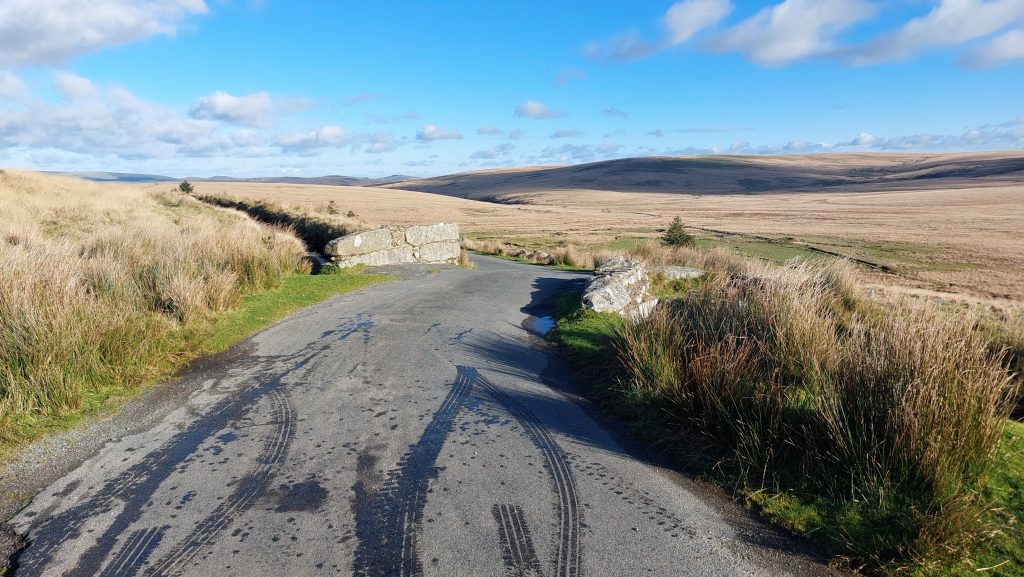
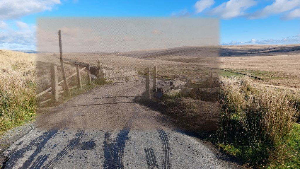
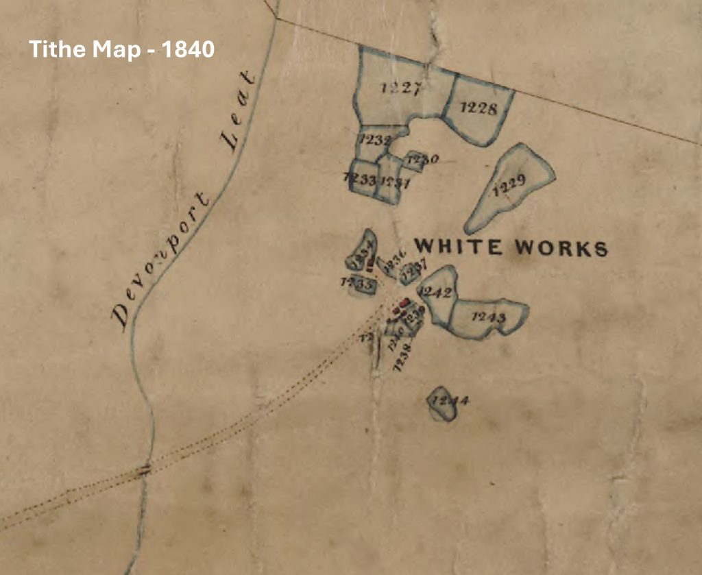
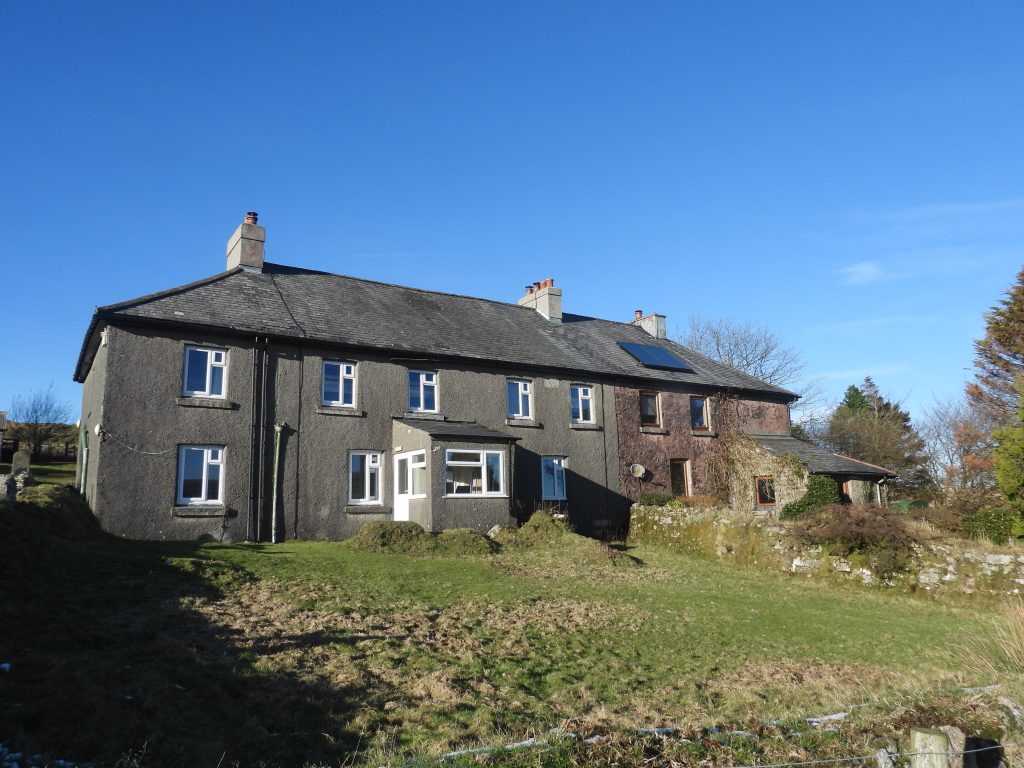
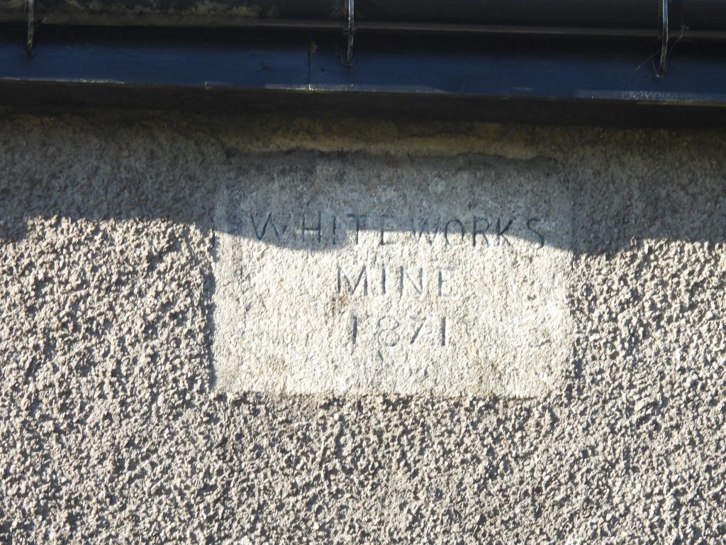
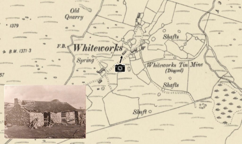
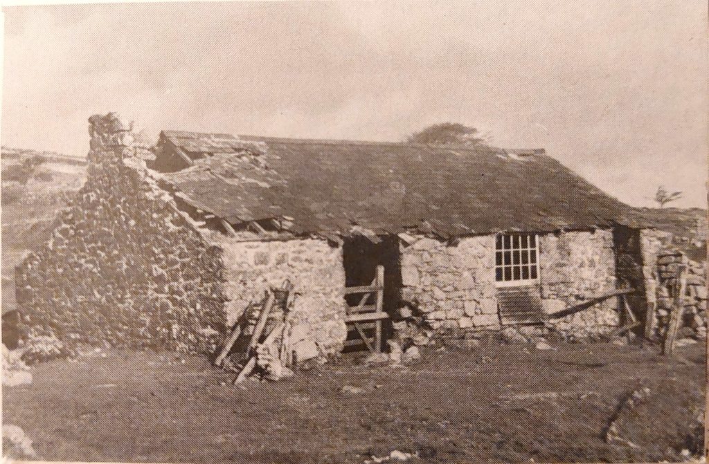
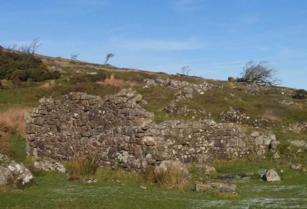
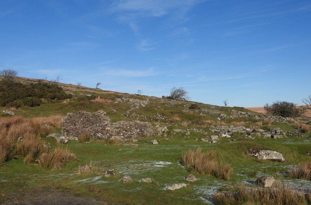
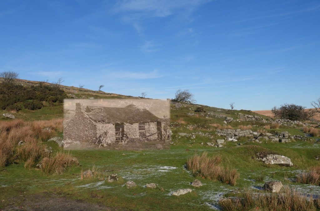
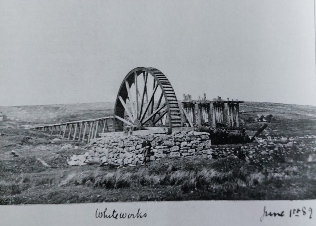
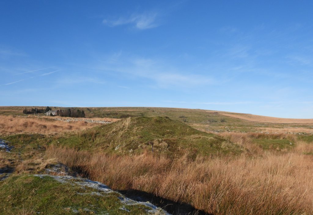
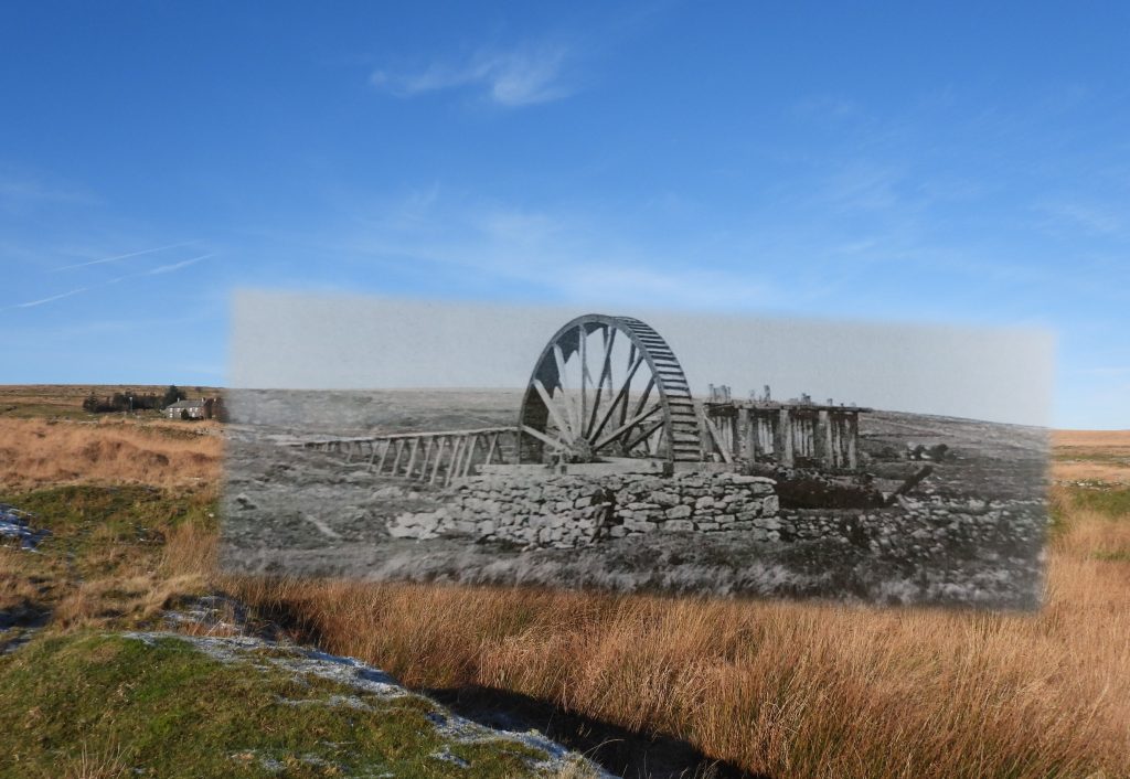
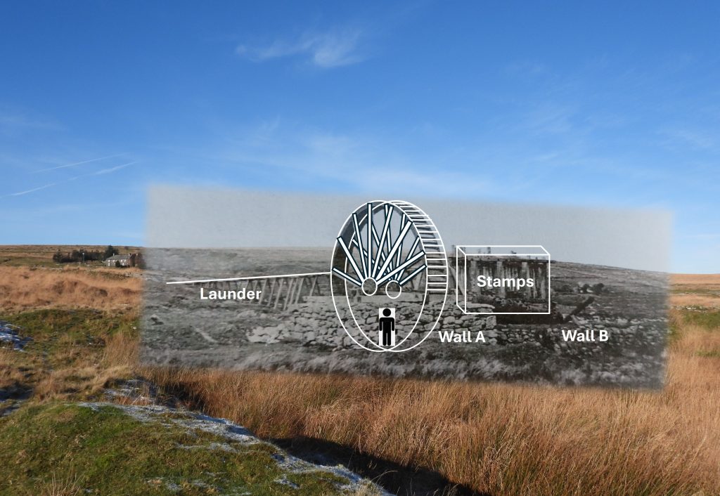
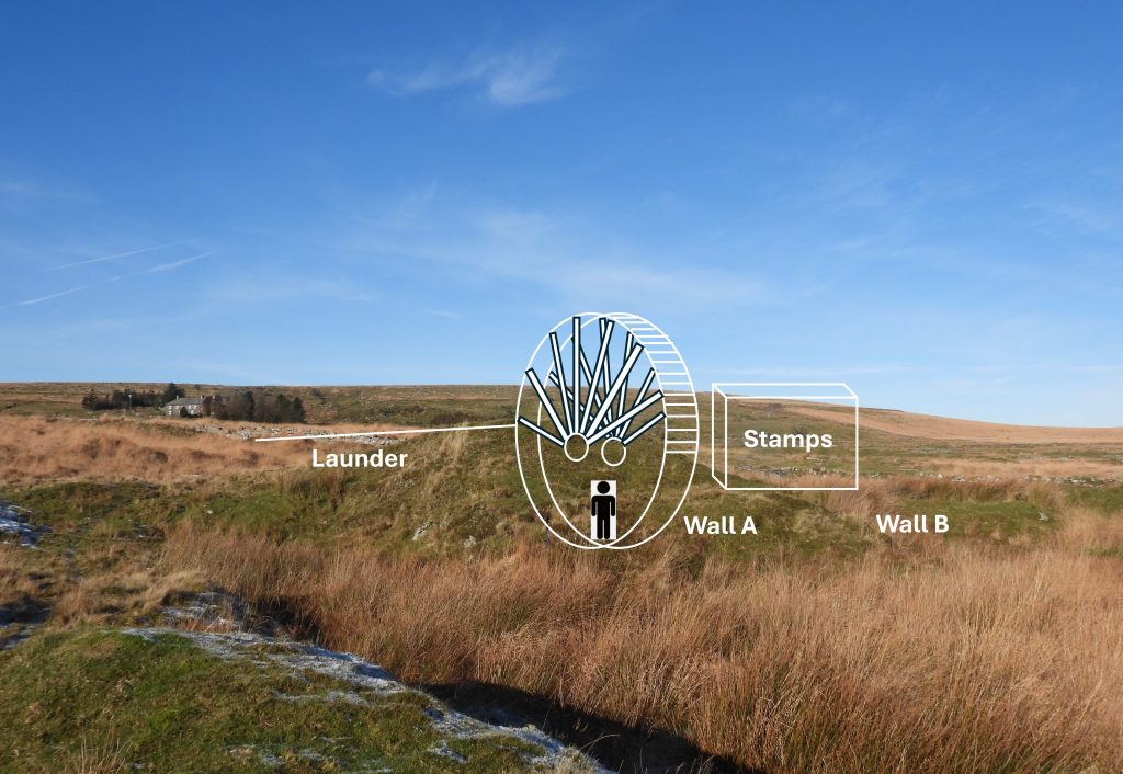
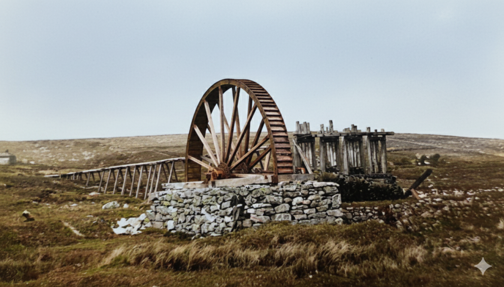
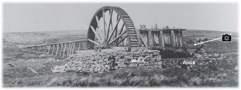
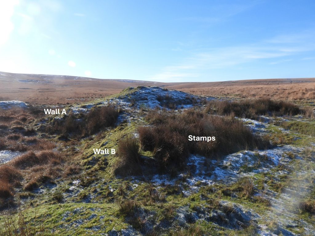
The locations circled in red are the subject to this ‘Then and Now’ post, comprising: the road bridge over Devonport Leat; a ruined building at the end of the tarmac road and the location of the stamps wheel of the former Whiteworks Tin Mine. Also included is a picture of the Whiteworks Cottages and the date plaque on it which gives a nod to its history and its association with the mineWhere the road to Whiteworks takes a ‘dog leg’ over Devonport Leat there is a small car park in a former quarry. The bridge at the ‘dog leg’ is the first location for this ‘Then and Now’ post. Devonport Leat was constructed from 1795-1802 to supply water to Plymouth Dock (known as Devonport after 1824). The leat takes water from the West Dart, the Cowsic and the Blackabrook rivers and once was over 43 kilometres in lengthThis picture appears in an Arthur L. Clamp publication from circa late 1960s / early 1970s. The moorland hereabouts would have changed dramatically had the proposed reservoir which would have flooded Fox Tor Mire had been sanctioned. The dam would have been across the Swincombe at a location called ‘The Boiler’ (which is in shadow in the photograph). In December 1970, the House of Commons heard a bill to consider the proposal to build the dam – against all the odds the bid was rejected.This is the same bridge on a fine day in November 2025Combining the two photographs. Since the original photograph all the wooden posts and fencing has been removed and the top course of the upstream parapet of the bridge has been removedThe Tithe Map from 1840 of Whiteworks shows just a few buildings and enclosures, which would have been associated in the main with farming. This map pre-dates the mine cottages (built 1871) which are now the only buildings still extant in the 21st century. That said, the tin mine was operational during various periods of the 19th century and was extant at the time of the tithe, as it is known to have been operational in 1820, albeit it had closed in 1826. The mine was working again in the 1860s and closed some time after 1876. The three Whiteworks Cottages were built as part of the Tin Mine. The two rendered cottages on the left (west end) are now used for Outdoor Adventure training and the cottage on the left is a private dwelling. The walls of the private dwelling still show signs of where it had once been painted with tar to provide water proofingThe date plaque on Whiteworks showing the date of construction (1871)The second ‘then and now’ picture is of a building which is located at the end of the tarmac road.This picture of the ruined building also appeared in an Arthur L. Clamp publication from late 1960s / early 1970s and was labelled as a former Farm Building. The author suspects that the building was more likely to be associated with Whiteworks Tin Mine as it did not appear on the Tithe Map of 1840 (when there was mainly only farming in the area) but does appear on maps dating from 1873 onwards. . The Devon Historic Environment Record suggests this building was associated with the tin mine. The ruin as taken in November 2025. The giveaway that this is the same building is due to the there being a fireplace at its west gable end and by virtue of the rising ground and trees beyondZoomed out view of the building, which was most likely built in 1870s. The building is located at SX61213 71001Combined pictures taken (most likely) at least 50-60 years apartThe remains of the Whiteworks Tin Mine looking over Fox Tor mire towards Fox Tor and Ter HillThe third and final ‘Then and Now’ in this post is of the former mine stamps wheel and stamps where ore was crushed prior to processing in water filled pits called buddlesThis picture is dated 1st June 1889 and was taken by renowned photographer on that period, Robert Burnard. The waterwheel and stamps were no longer in use when the photograph was takenIn the Dartmoor Tinworking Research Group (DTRG) Newsletter, September 2025, Number 69, there was a very interesting article on pages 26 and 27 by Dr Tom Greeves with regards the location of the Whiteworks Stamps Wheel. The above picture is the correct location despite on first viewing that it doesn’t appear to be correct as where the wheel once stood, the pit has been filled in and created into a mound. Credit is due to the DTRG chairman, Stephen Holley who lead a walk here on 19th April 2025, showing this location as being the correct oneSuperimposed pictures from June 1889 and November 2025. Note the figure standing at the corner of the Wheelpit wall. The edge of the Whiteworks Cottages and the background horizon line up as does grass covered banks where the walling was once locatedKey features of the Waterwheel and Stamps. The location of the two walls (A and B), the stamps location, the background horizon, the edge of Whiteworks Cottages and the small earth bank to the left of the wheel are all indicators that this is the correct location. The picture was taken from SX61523 70769. The features annotated from the 1889 photograph added to the 2025 photograph. Although there is very little walling left (there is some walling here under the vegetation), there are still vertical banks here where the two walls (A and B) once stoodAI coloured version of the 1889 original picture by Robert BurnardTo find more evidence that the identified location for the Waterwheel and Stamps is correct, the author explored the east side of the former structures (where the camera icon has been annotated on the above photograph)The ‘side on’ view (looking east to west) of the location of the stamps wheel, there is still evidence of where the distinct wheelpit wall (wall A) and the revetment (wall B) adjacent to the stamps were once located. Indeed a clear internal right angle between the two can still be discerned. Where the stamps had once been located there is a very distinct square area, thus providing further evidence of this being the exact location which is now the accepted one. The square area of the stamps is located at SX61520 70797