A collection of walks, discoveries, insights and pictures of exploring Dartmoor National Park
December 26, 2025
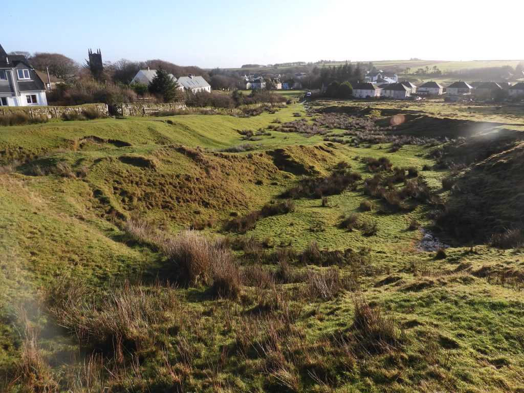
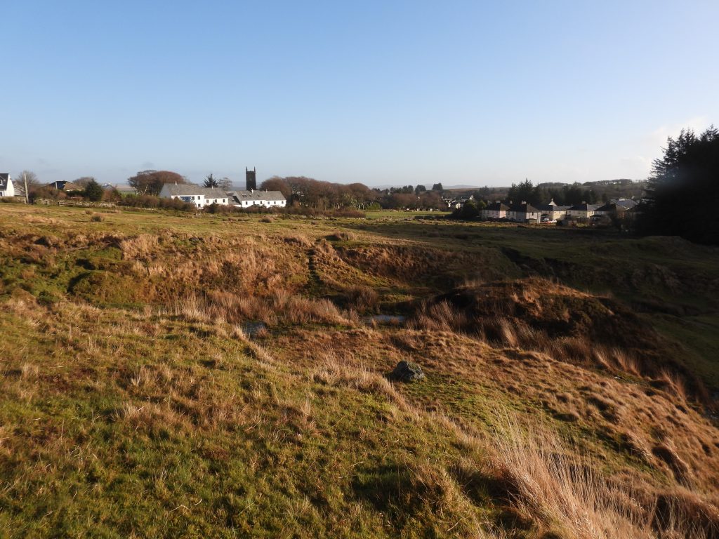
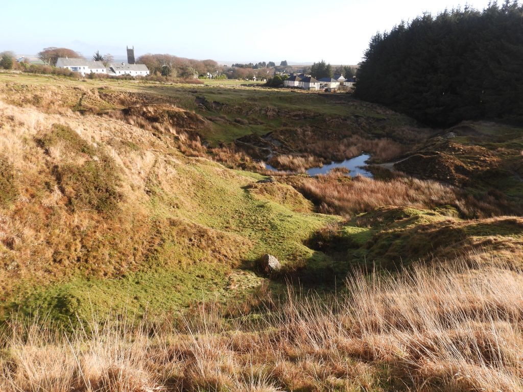
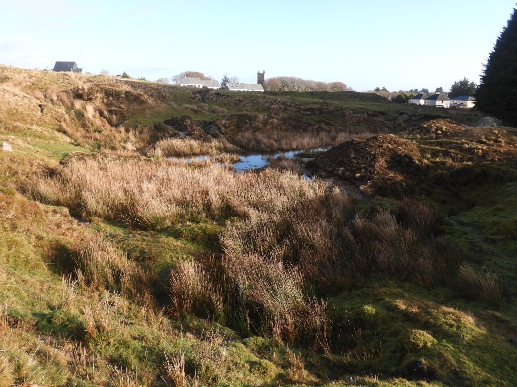
Wheal Duchy
Wheal Duchy lies just to the west of Princetown where there appears to have been some former openworkings before latterday 18th and certainly 19th century shafts were sunk.
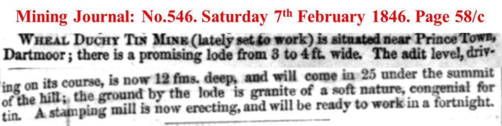
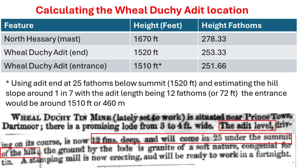
The mine isn’t that well documented but there is a short extract from the Mining Journal (No. 546) dated Saturday 7th February 1846 which gives a tantalising ‘snippit of information’ of operations including a 3 to 4 ft wide lode, an adit which had been driven 12 fathoms and a Stamping Mill having been erected. The adit may well have been dug after the shafts in the area had been sunk and exhausted?
The author is grateful to Dr Tom Greeves who passed on the following: “…to add to the confusion, there was another Wheal Duchy on Whitchurch and Sampford Spiney Commons between 1846 and 1856”. So it seems there were two Wheal Duchy’s
Tom adds: “William Richards seems to have been involved in a Princetown mine – he asked the Duchy for a grant in July 1872 of a mine sett ‘at a place known or called Devil’s Bridge near Princetown’. On 12th January, 1874 mine materials at ‘Devil’s Bridge Mine’ were sold, but in June of that year William Richards, mining agent of Ashburton, with two London partners, acquired a licence from Sir Massey Lopes ‘to search for minerals on Walkhampton Common at Brinda Tin Mine, from Devil’s Bridge as the limit, south of Princetown’ (The Box 874/48/876)”. With the mention here of Walkhampton Common and Devil’s Bridge as a limit, Brinda Tin Mine could easily be the workings to the south of B3312 near Hart Tor (there is an upright near the Meavy, which might have been a sett boundary stone) or the aforementioned previously named Wheal Duchy
This post explores the old workings to the west of Princetown and which extend down to Devil’s Bridge.
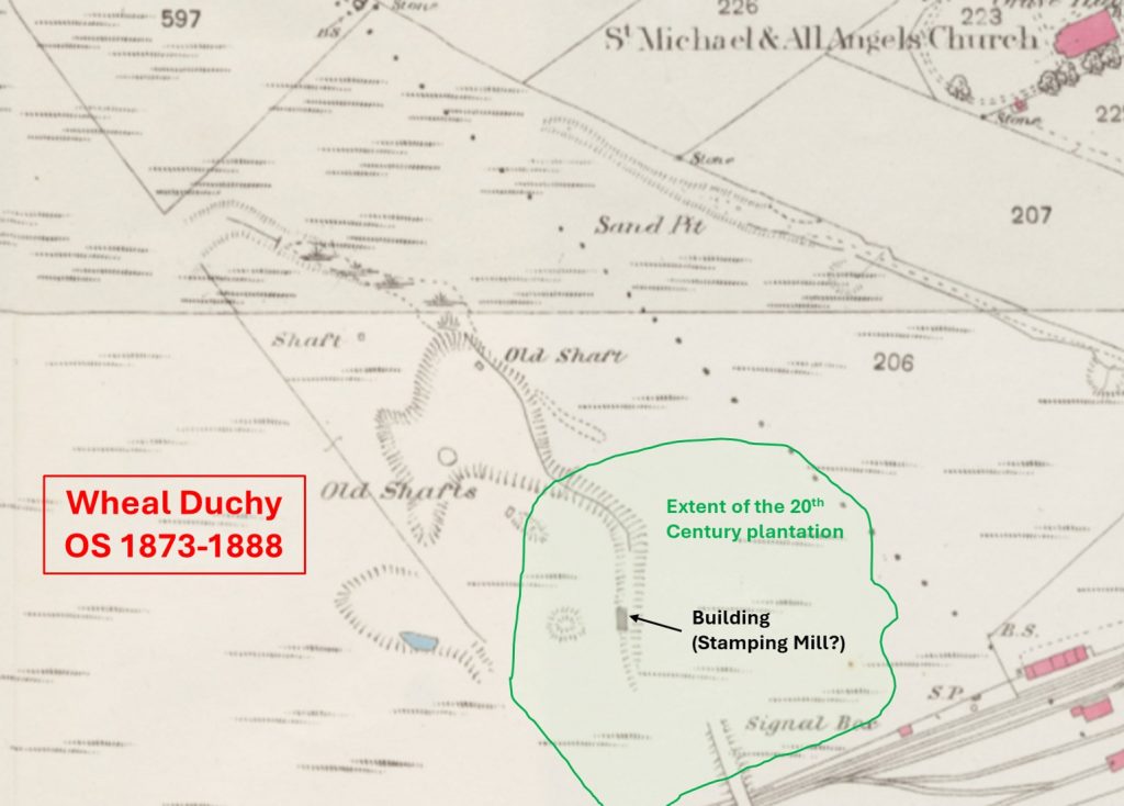
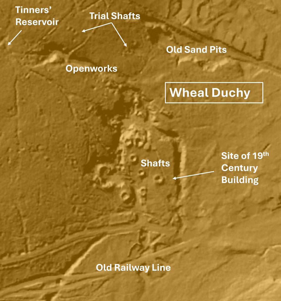
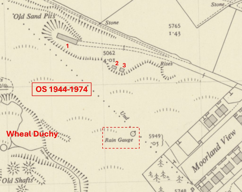
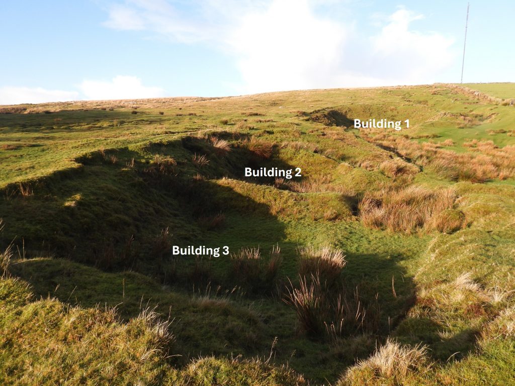
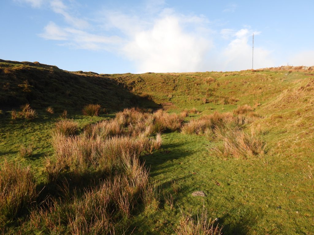
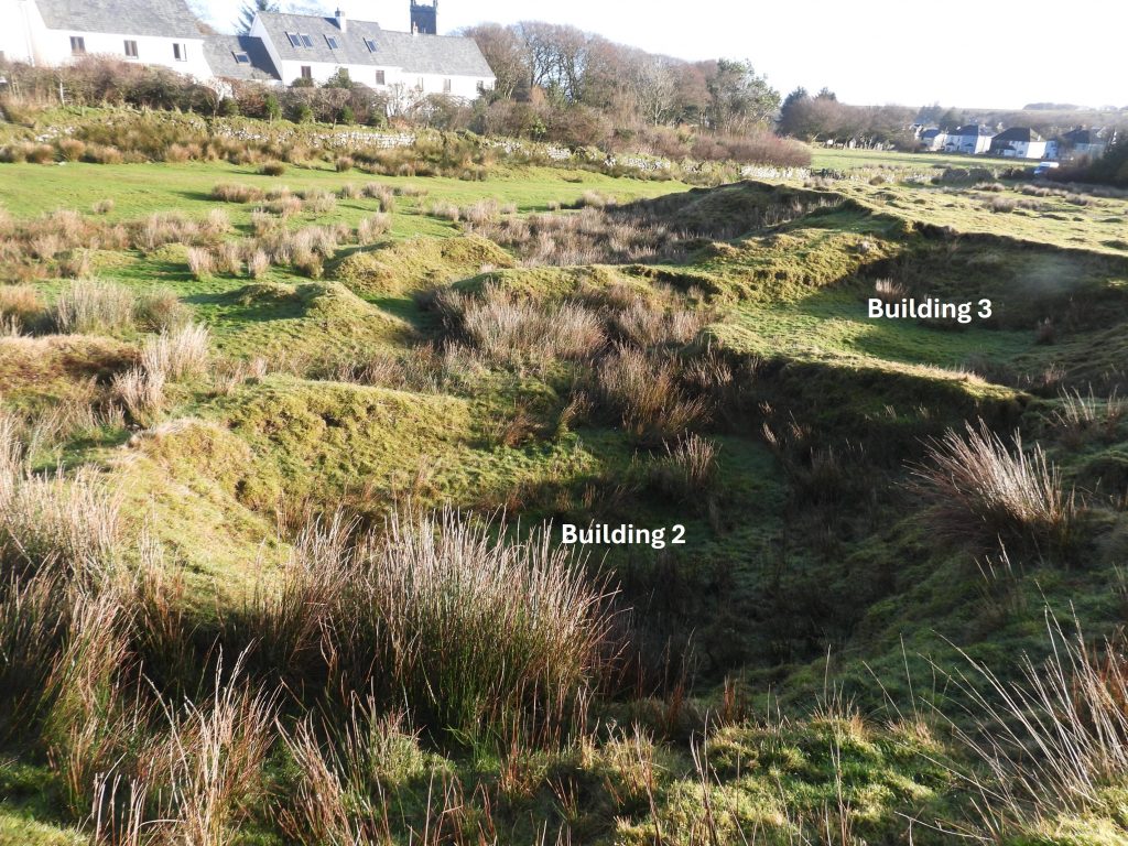
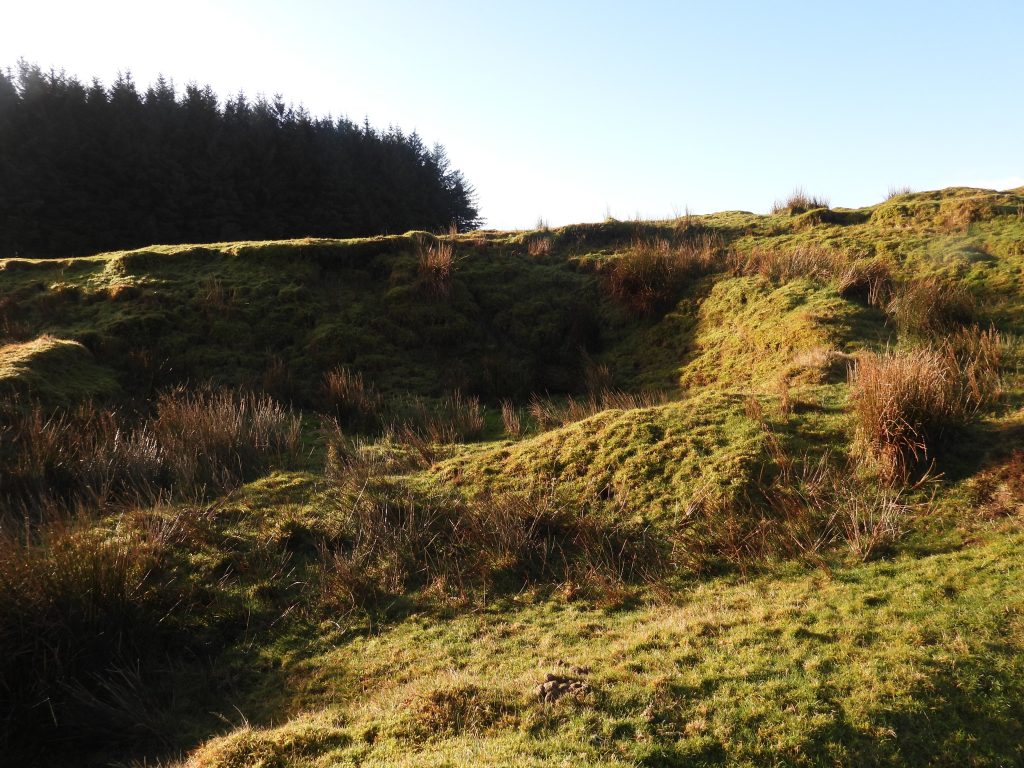
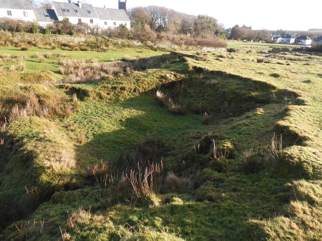
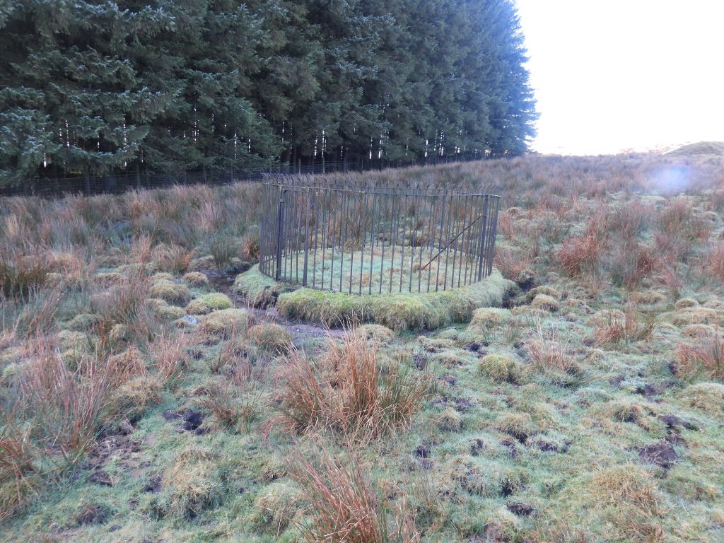
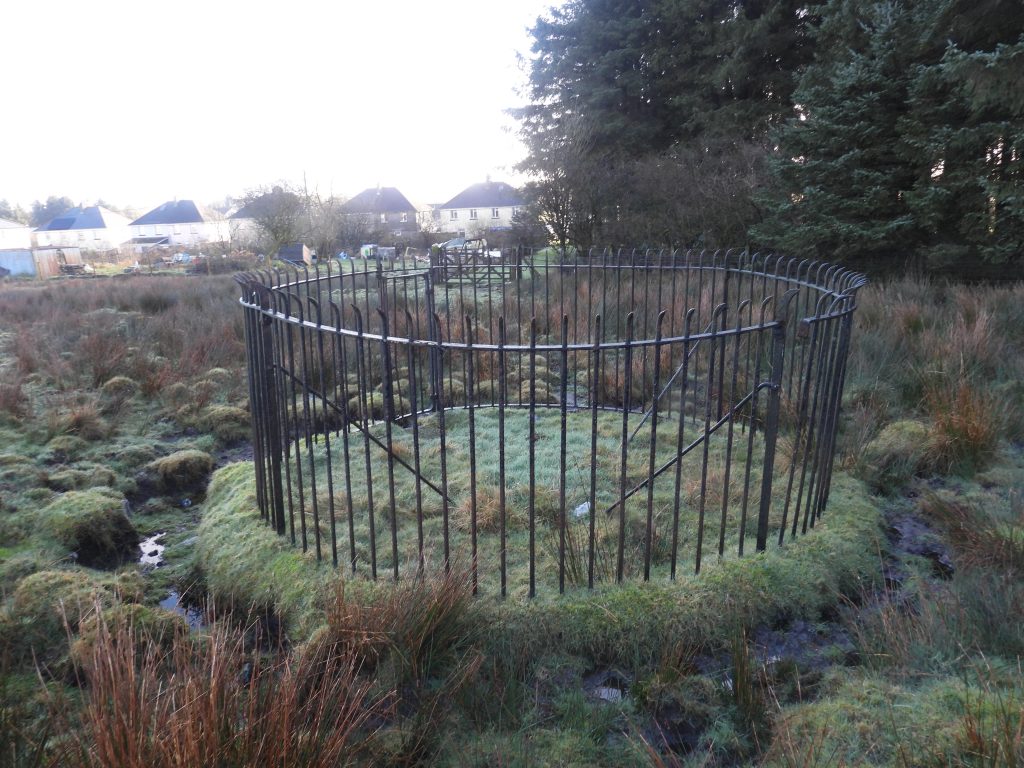
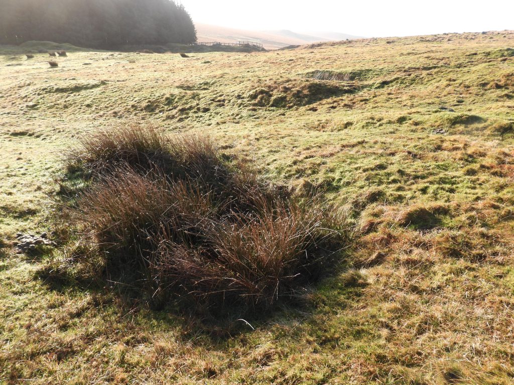
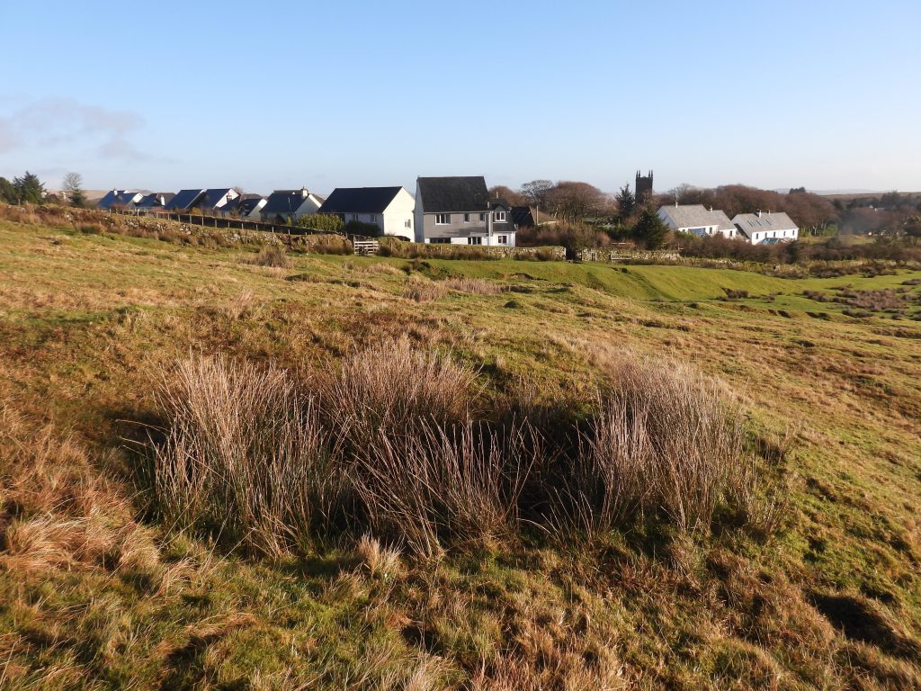
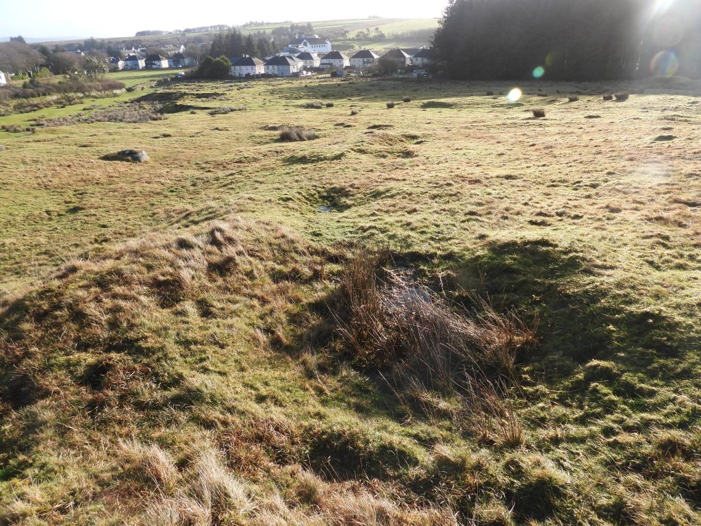
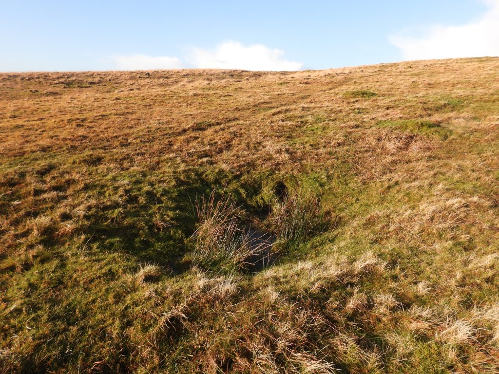
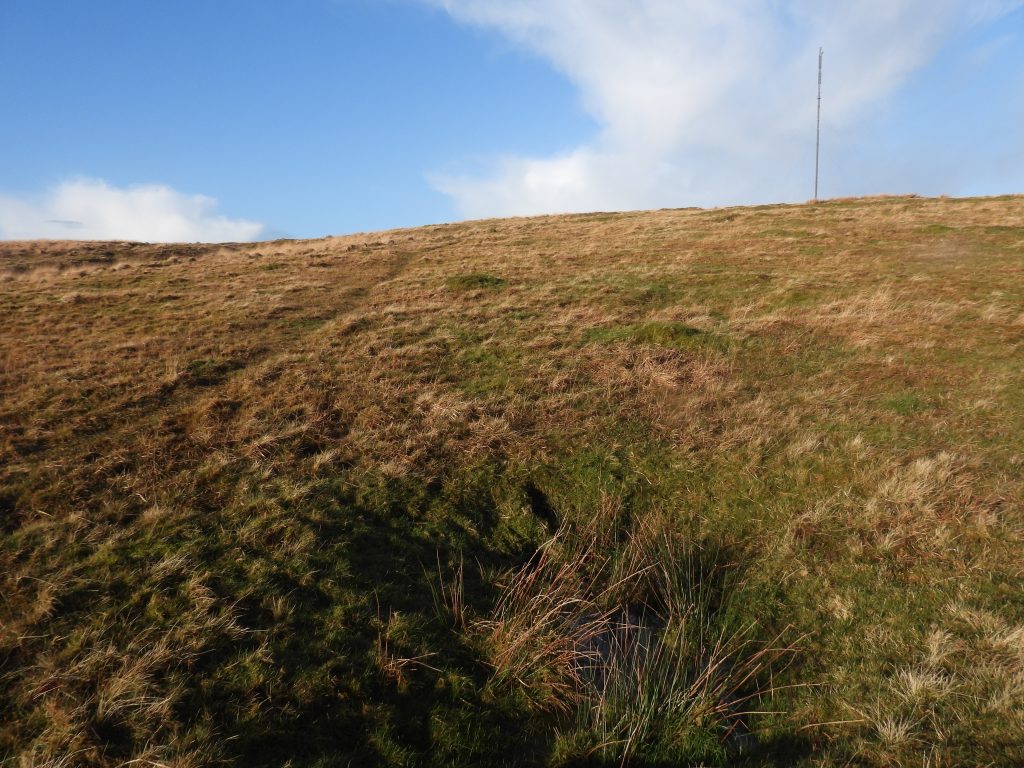
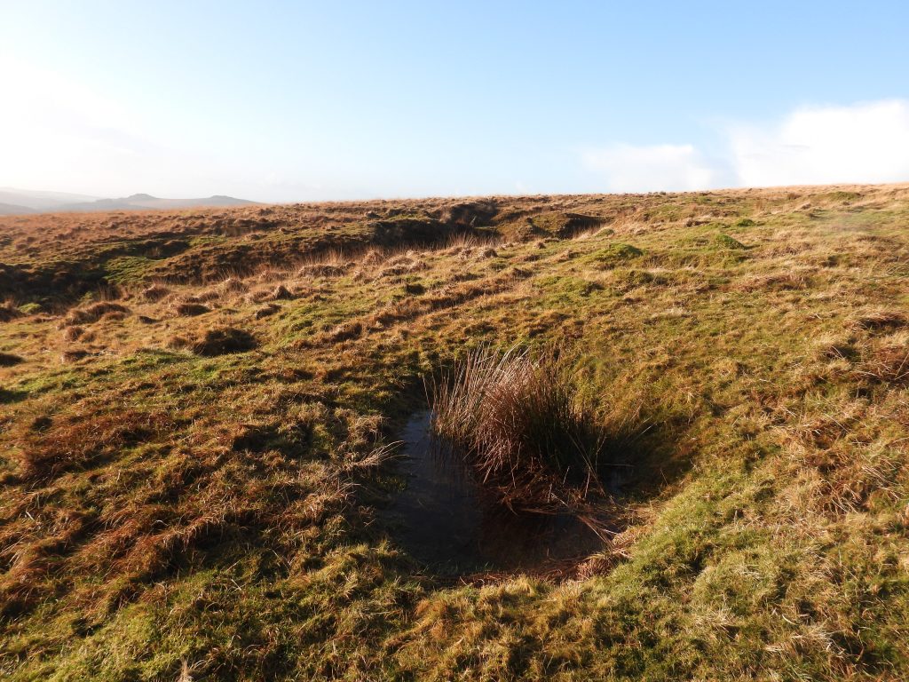
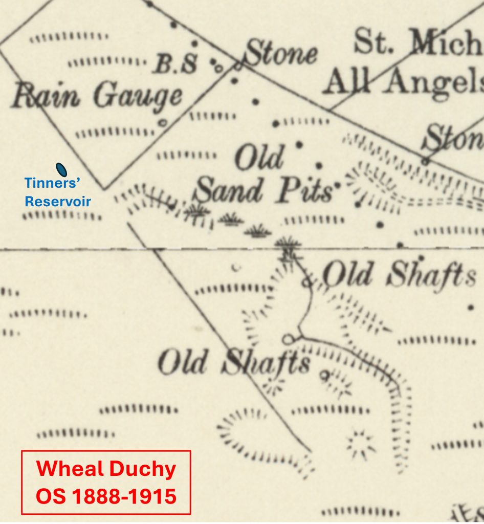
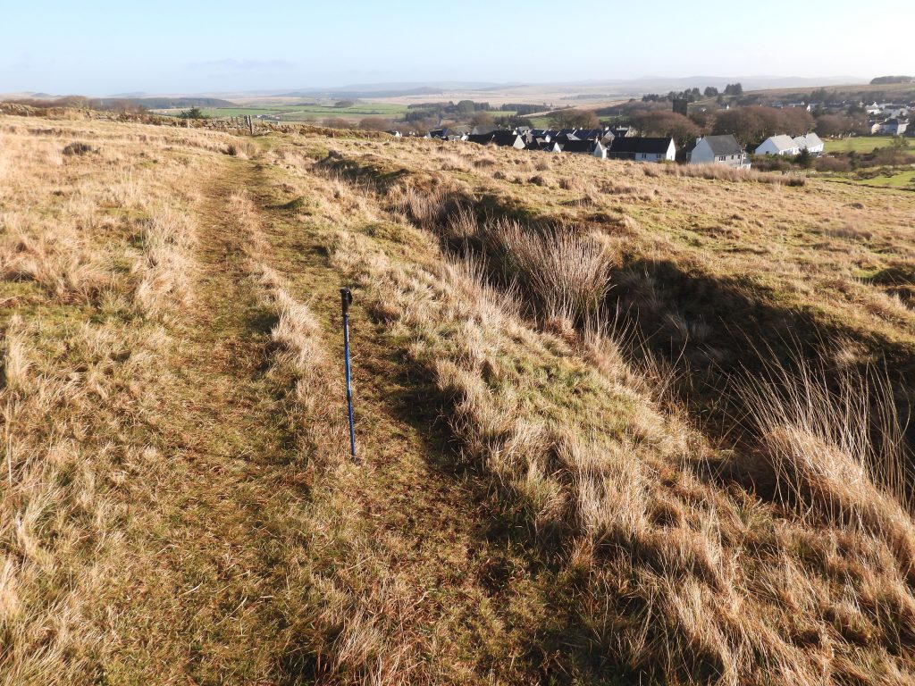
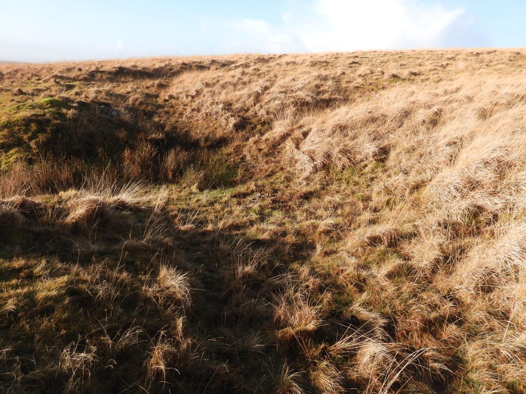
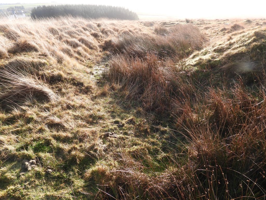
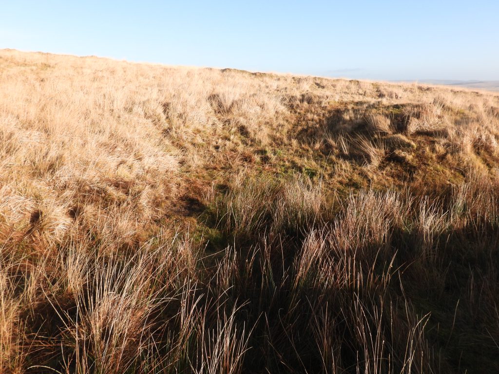
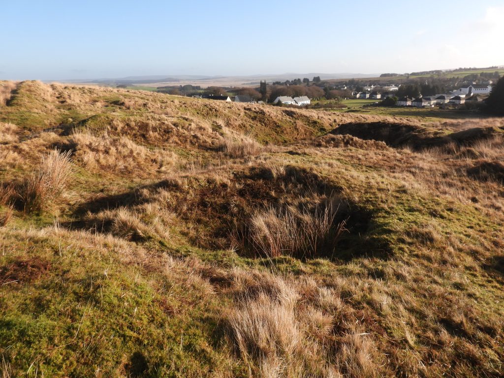
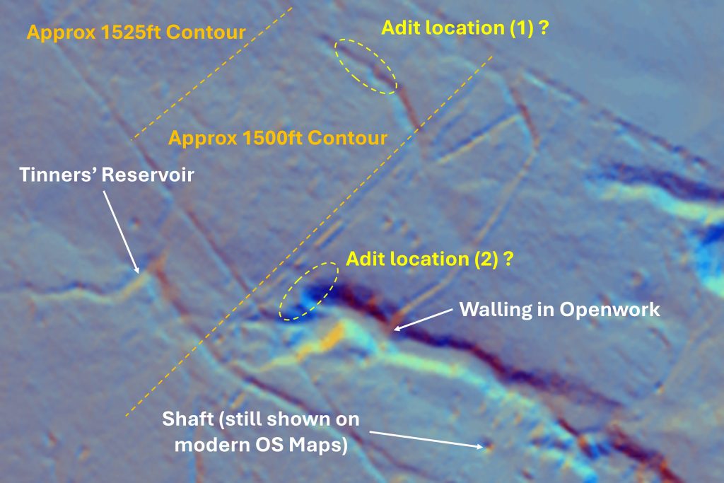
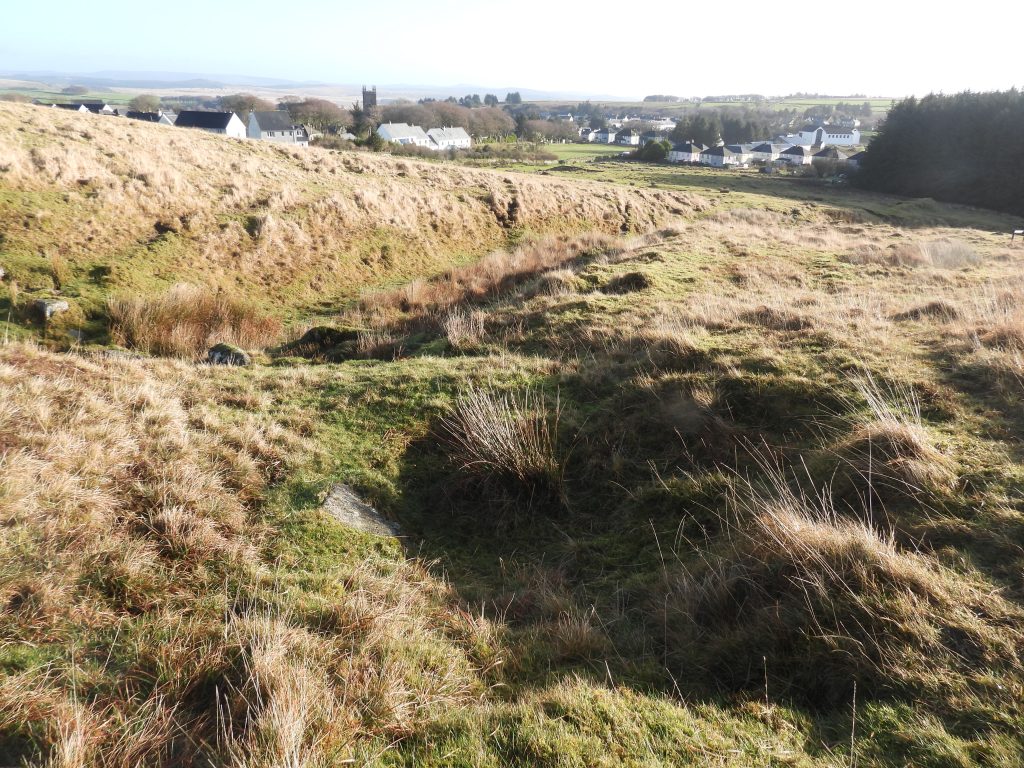
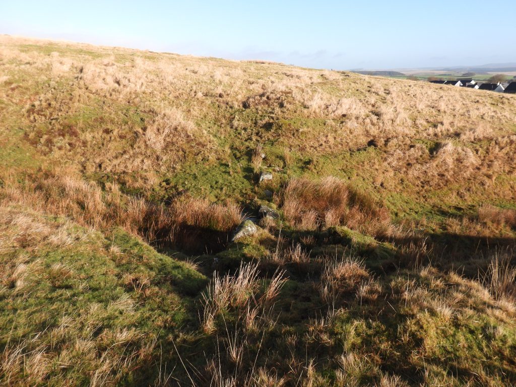
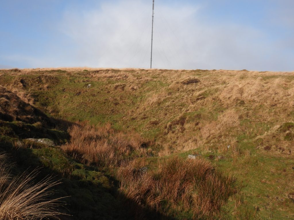
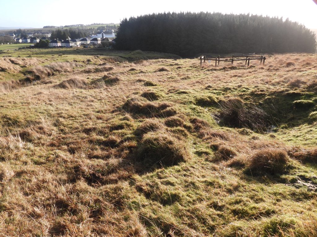
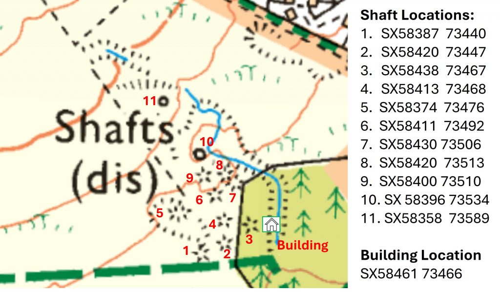
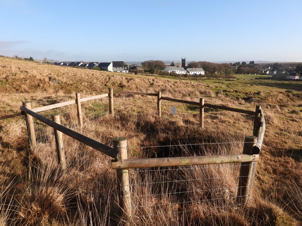
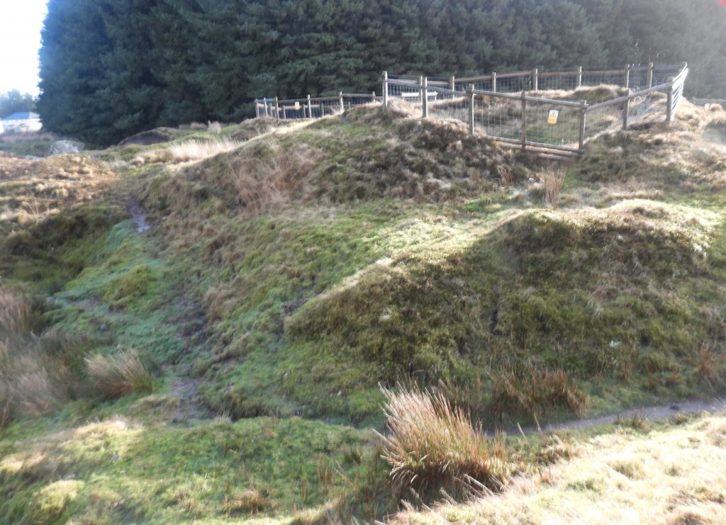
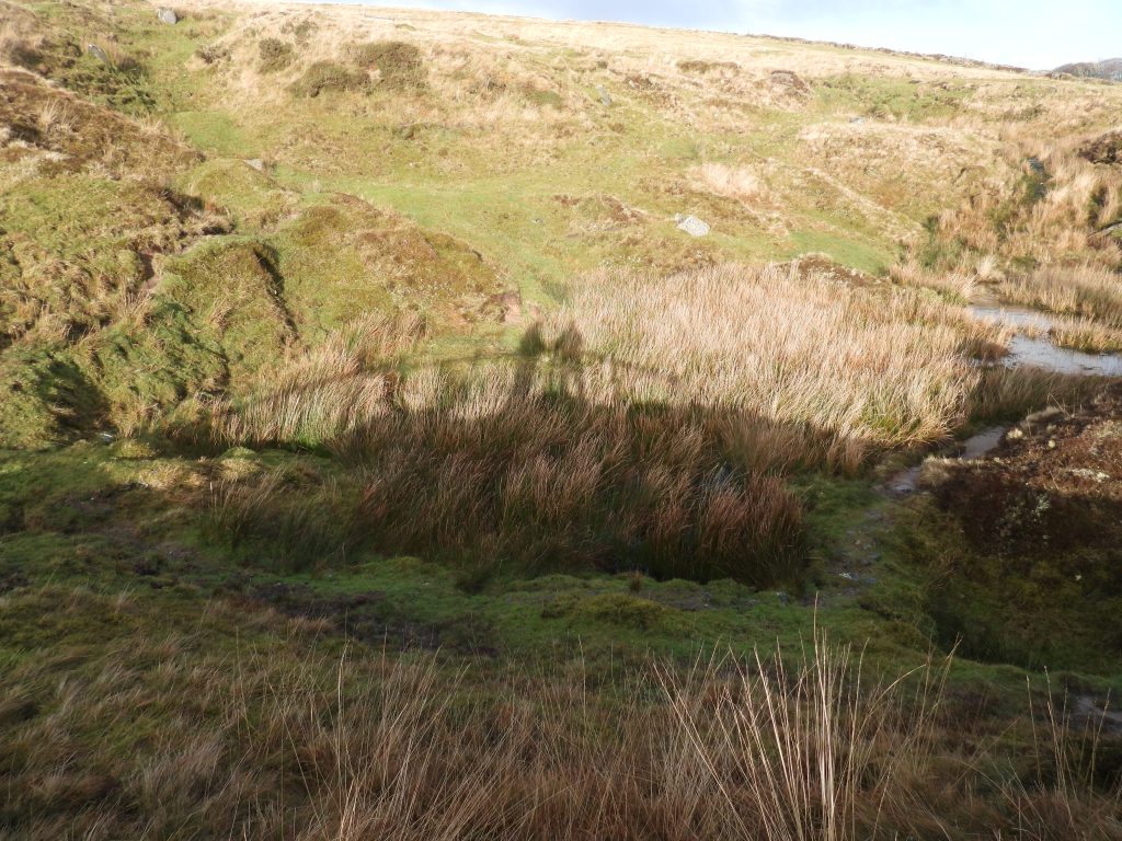
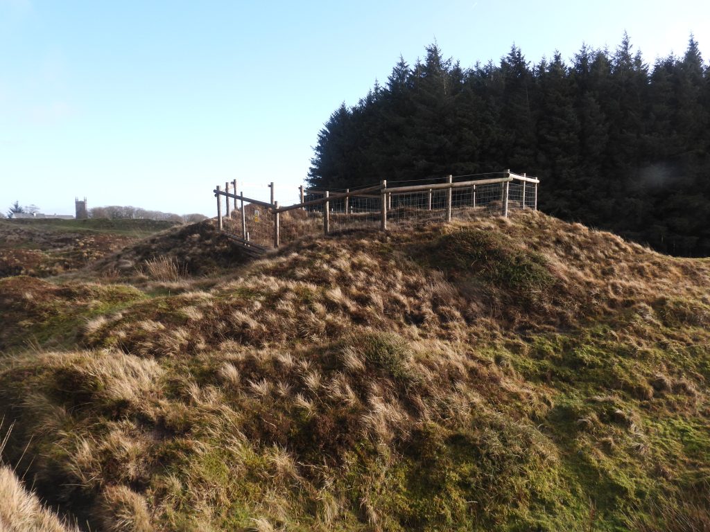
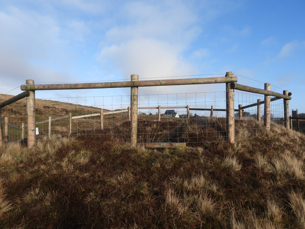
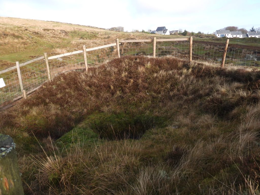
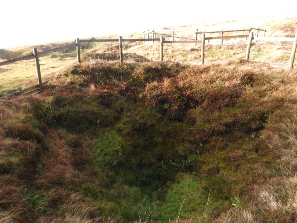
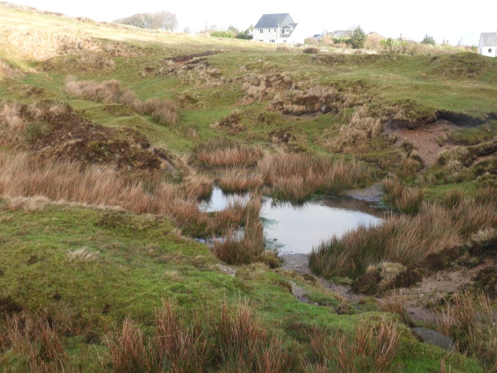
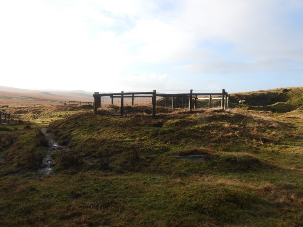
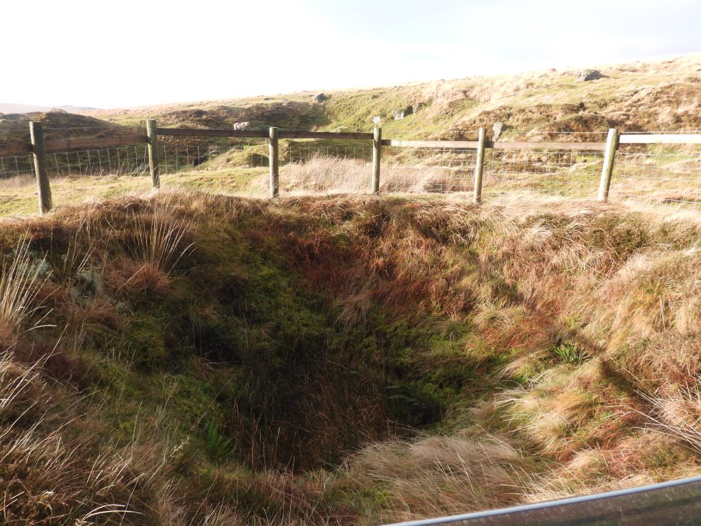
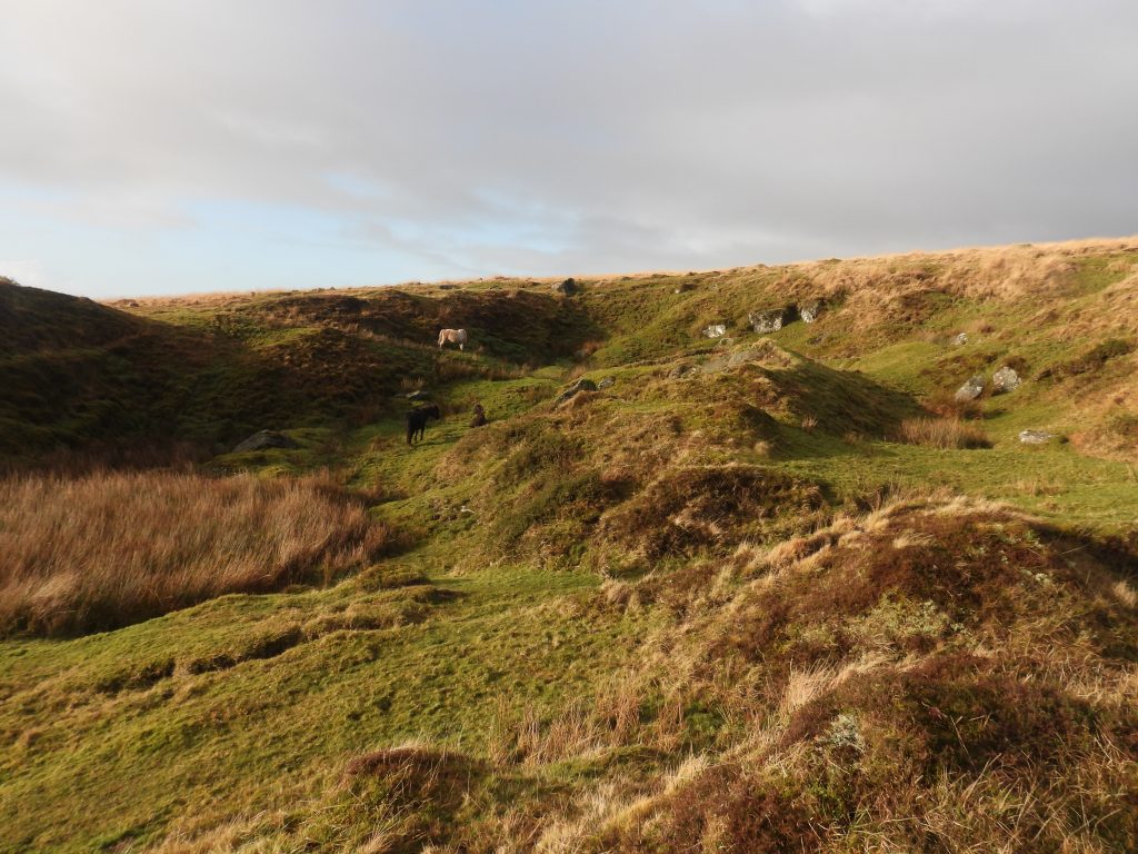
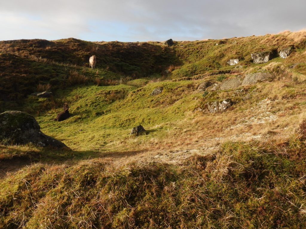
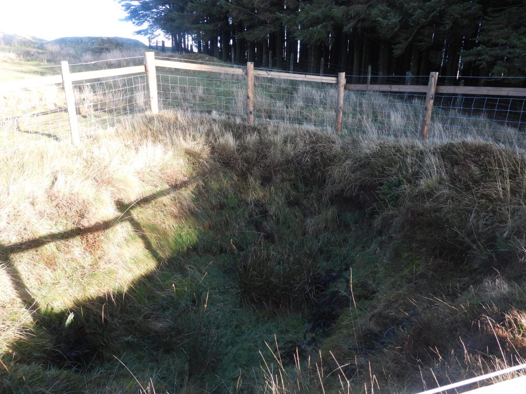
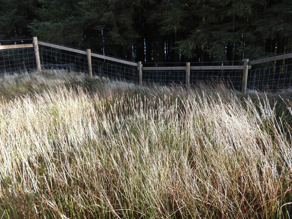
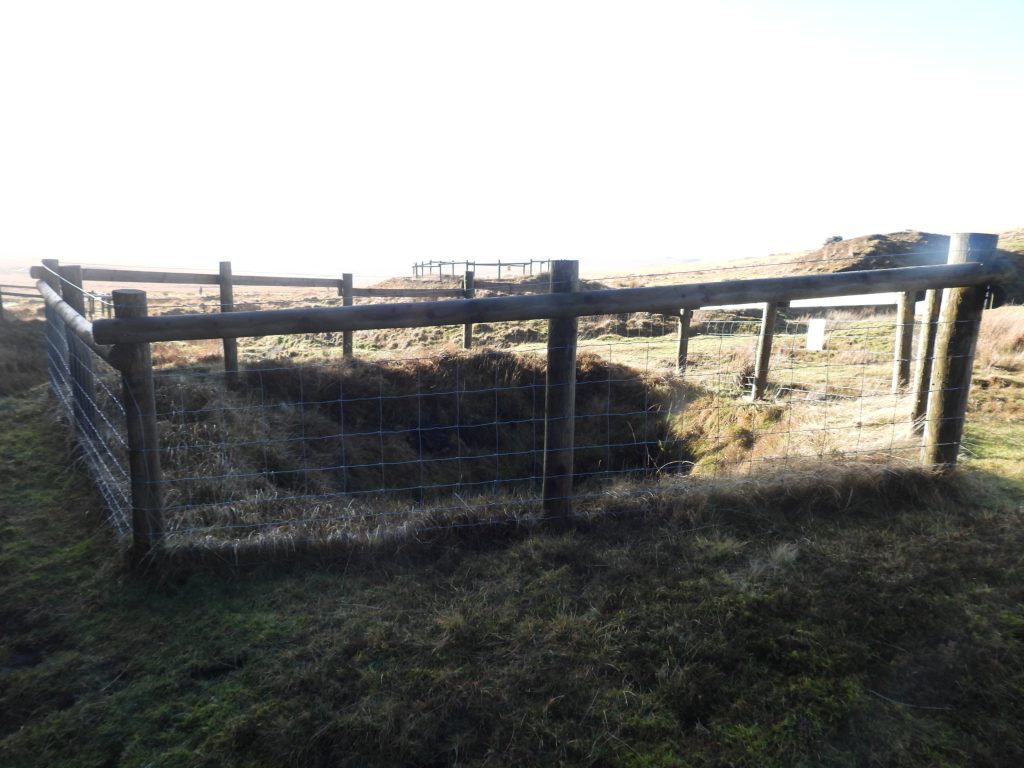
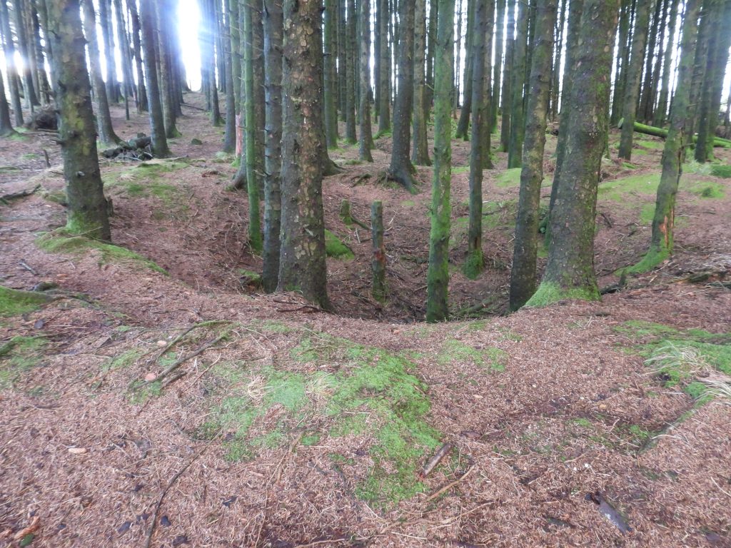
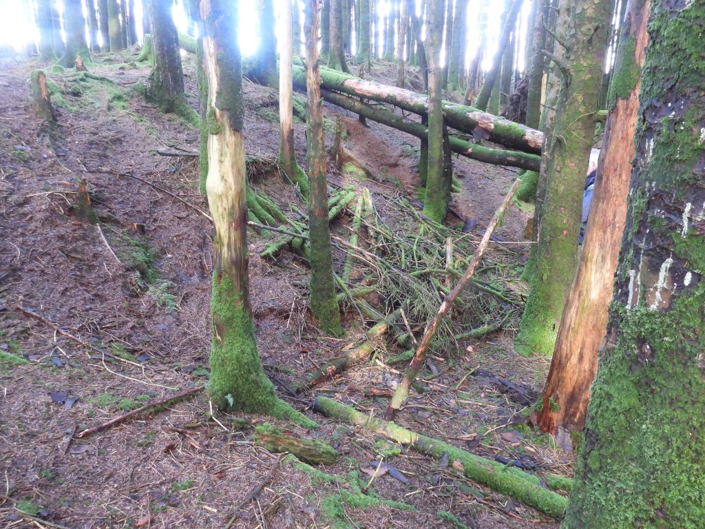
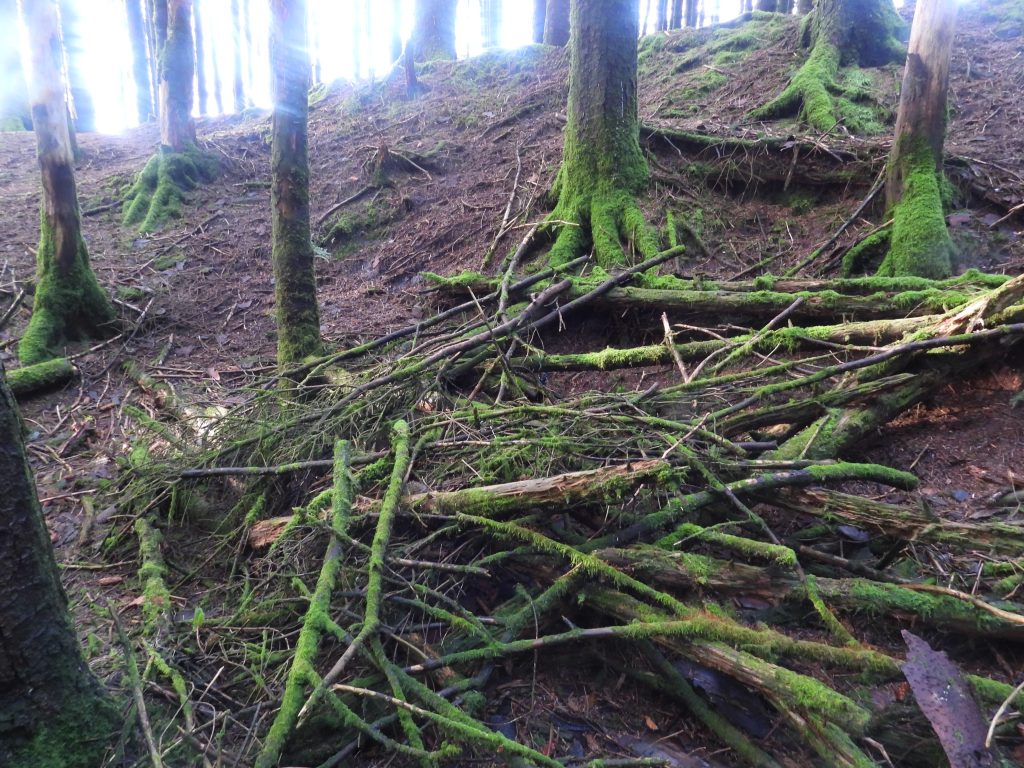
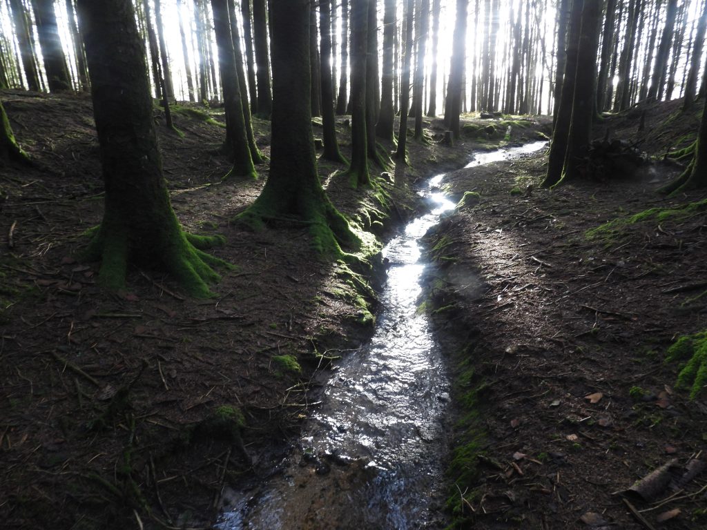
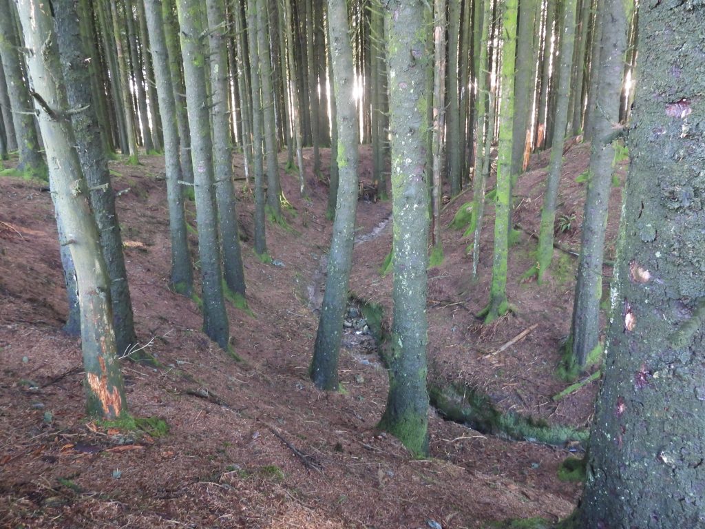
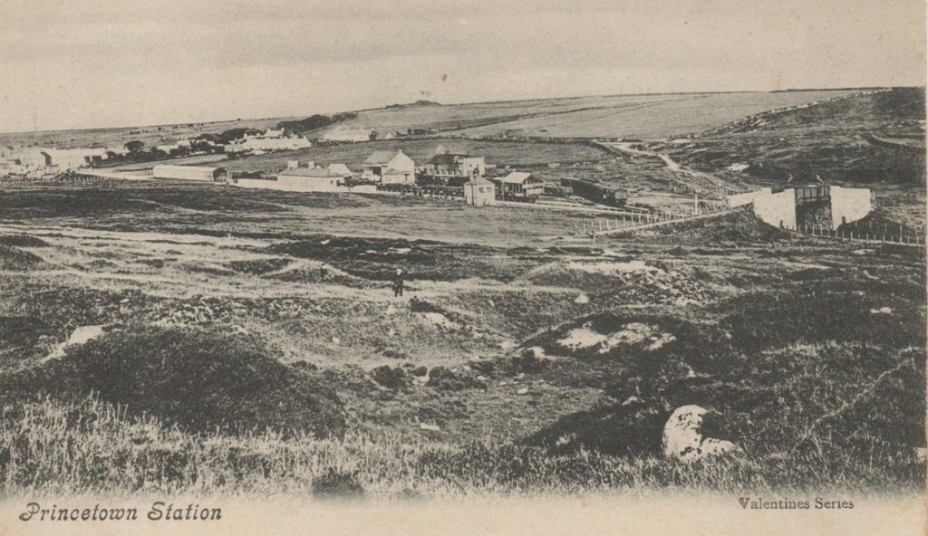
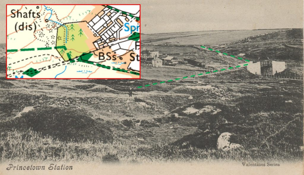
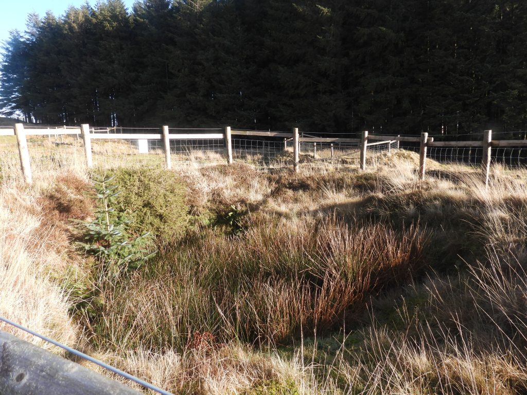
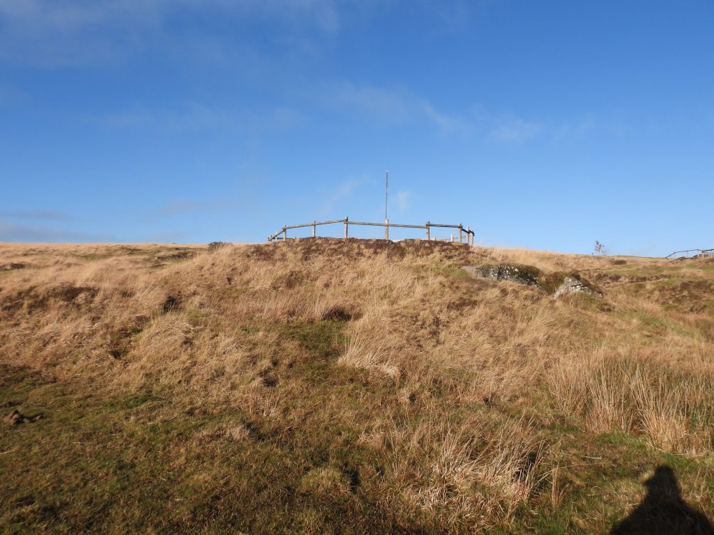
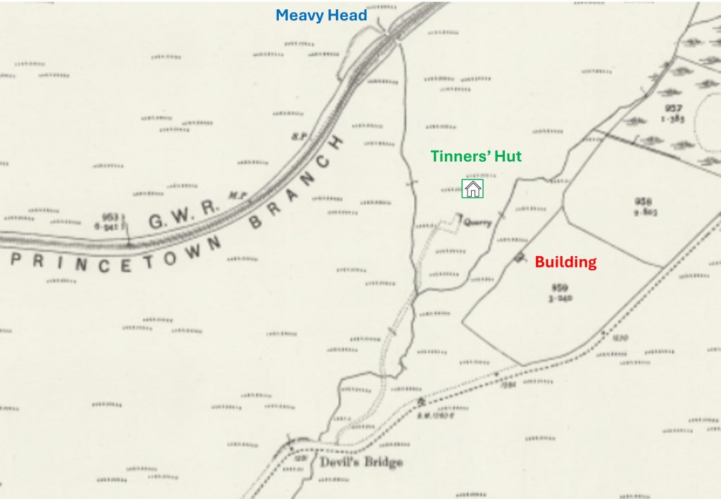
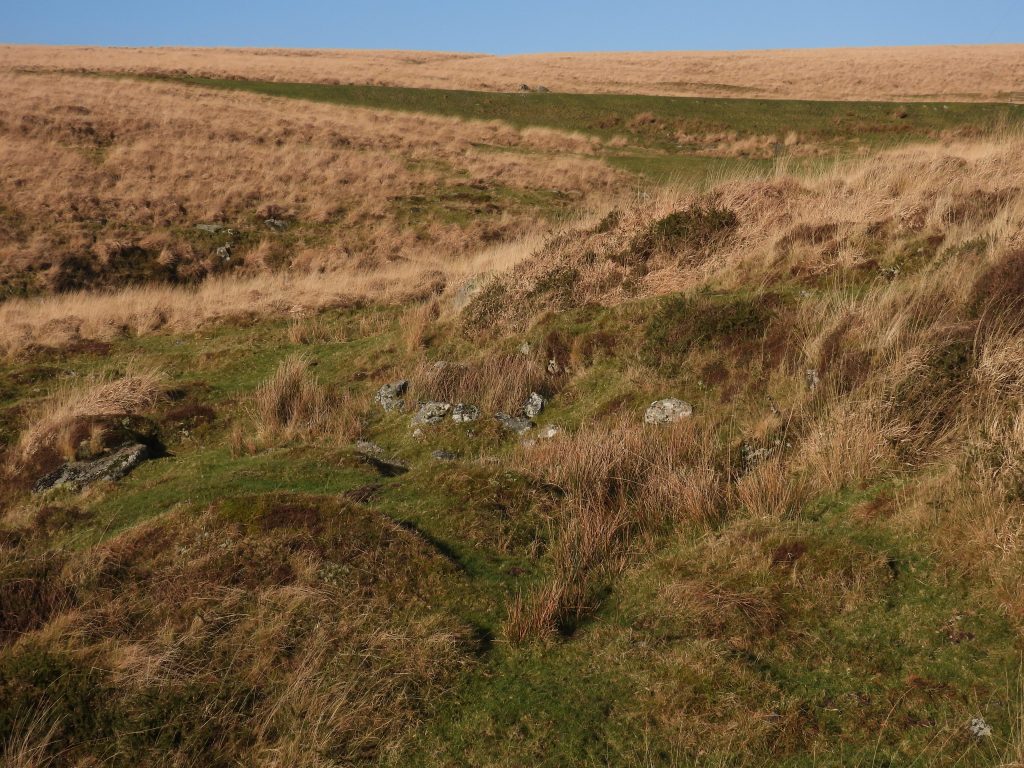
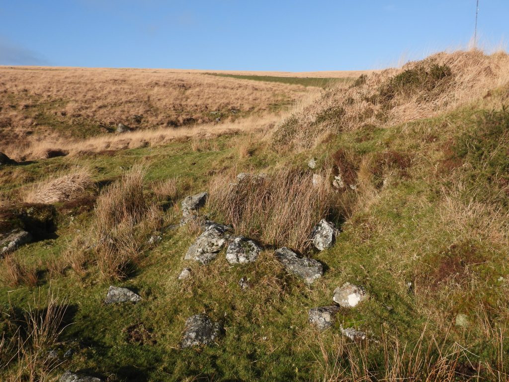
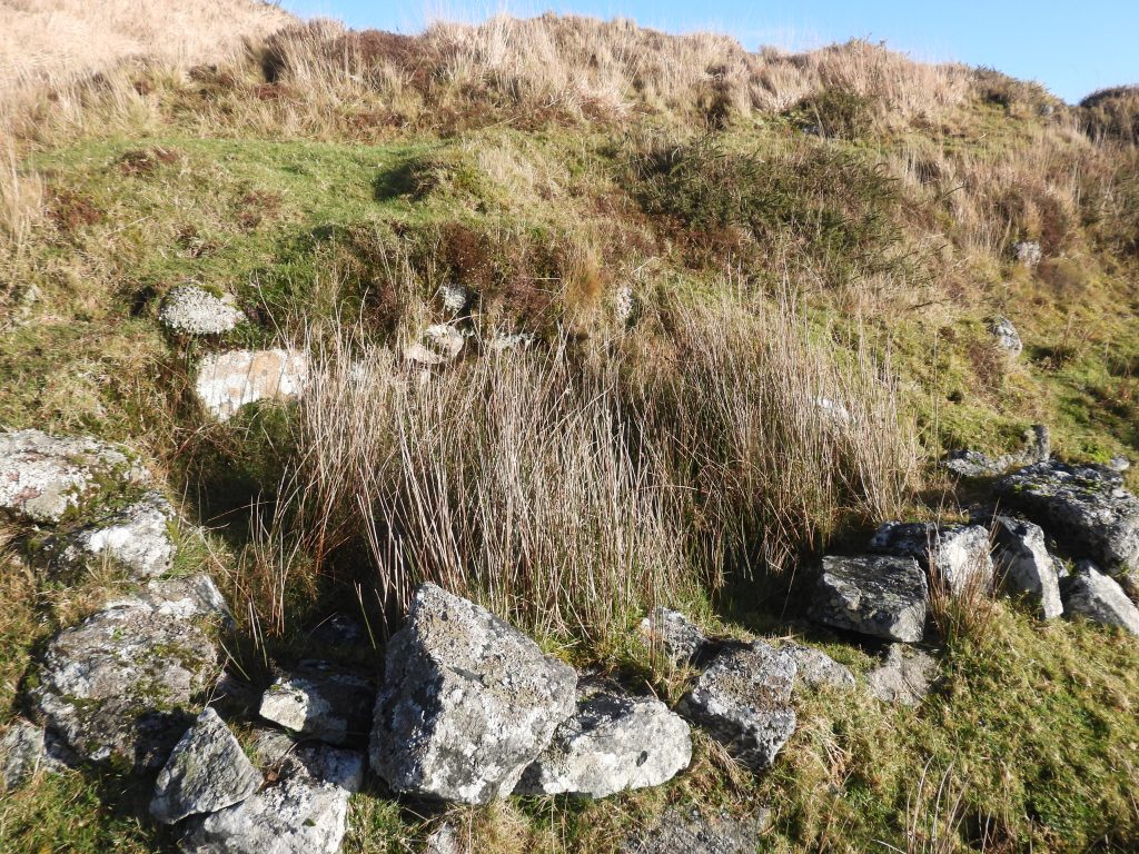
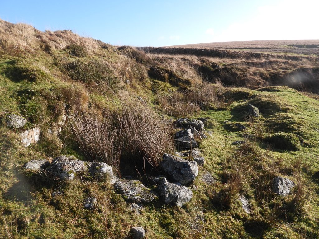
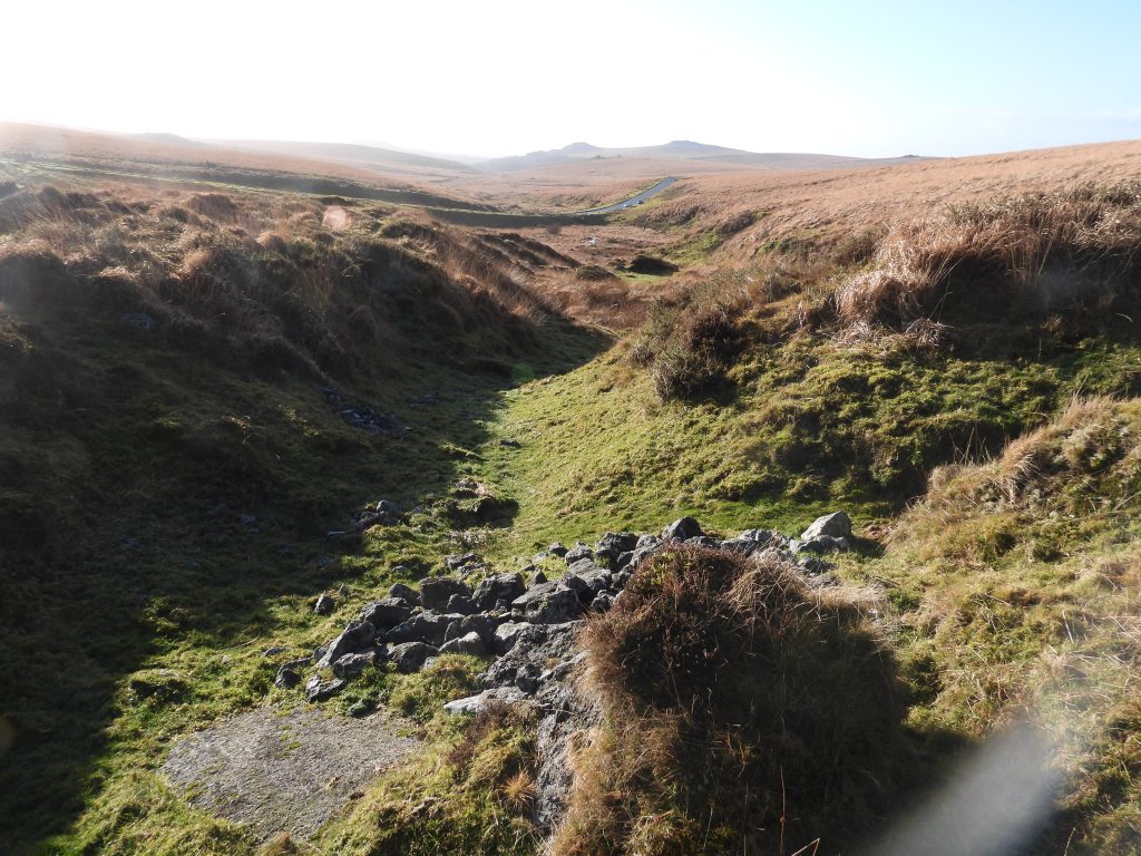
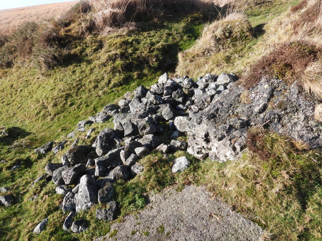
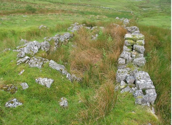
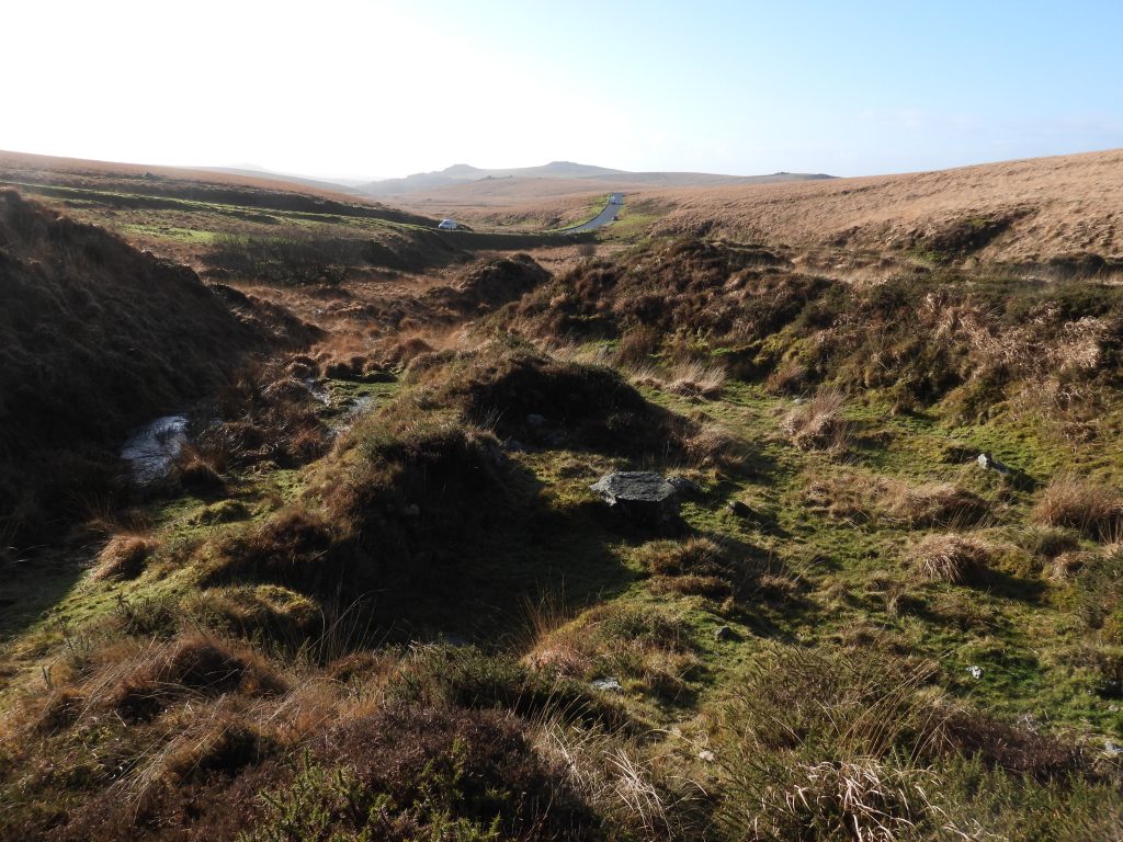
This annotated 19th century map identifies the openworks and old shafts at Wheal Duchy. Note the identification of a building (grey rectangle) which is where there is a plantation from the 20th century. In the bottom right corner are the buildings and tracks of Princetown Railway StationThis LiDAR plot of the area shows the considerable number of shafts in the area of Wheal DuchyThere is very little documented about Wheal Duchy. This extract from the Mining Journal (No. 546) dated Saturday 7th February 1846 gives a small tantalising glimpse into the operations from the mid-19th century. There was a lode 3 to 4 ft wide they were working and an adit had been driven. The writer describes a Stamping Mill having been erected which ‘will be ready to work in a fortnight’. With no information relating to any shafts, it is possible that at this stage the mine had adit only extraction?This annotated 20th century map shows the east side of Wheal Duchy workings, where in ‘old sand pits’ next to the track which leads up to North Hessary Tor there appeared to have once been three buildings, the use of which, the author is unaware. There was also an old Rain Gauge in the areaOverlooking the ‘Old Sandpits’The locations of where the three buildings used to be on the previously annotated map. The author speculates that these were probably used during WWIIThe location of building 1 at SX58455 73652There are two hollows where buildings 2 and 3 were once locatedBuilding 2 hollow at SX58509 73614Building 3 hollow at SX58517 73614This enclosure just outside the plantation once was the location of a rain gaugeThe old rain gauge is located at SX58525 73549To the north west of the ‘old sand pits’ and to the east of the major openworks, there are many trial shafts. The one in picture is located at SX58413 73651Contextual picture of the Trial Shaft at SX58413 73651 with a housing estate at PrincetownAnother trial shaft (or pit) located at SX58407 73637Another trial shaft (or pit) located at SX58398 73634The trial shaft (or pit) located at SX58398 73634 looking towards the mast at North HessaryAnother trial shaft (or pit) located at SX58331 73657Map of the Wheal Duchy shafts from late 19th and early 20th century. Note the annotation for a Tinners’ Reservoir and that there was a Rain Gauge to the north west of the workings. The two markers (BS and stone) relate to the Forest of Dartmoor boundary and the Director of Convicts Prison boundary from 1850. More information can be found here: Director of Convicts Prisons Boundary Stones – Dartmoor ExplorationsThe site of the former Rain Gauge (where the walking pole is located). It lies adjacent to an old boundary at SX58312 73687Earthworks of a tinners’ reservoir (probably pre-1700 in date)The Tinners’ Reservoir is aligned south-west by north-east and is approximately 20m in length by approximately 4m width. Recorded by Dr Tom Greeves in 2020, there is a sluice opening 3m wide in centre of the substantial earth banks.Channels lead into the Tinners’ Reservoir, which is centred at SX58237 73662. The reservoir feeds into a gully then onto workings further down the slope in a southerly directionThe northern end of the workings with another trial shaft / pit at SX58268 73636These calculations relate to the extract from the Mining Journal (February 1846). The author has speculated that the ‘summit of the hill’ is North Hessary and that 25 fathoms below that will be around 1520ft above sea level. Therefore the adit entrance will be at around 1510ft above sea level accounting for the slope of the hill. This would position the adit at or just the top of the workings (which are at 1500ft)This LiDAR plot shows possible locations for the adit (1) at 1510ft above sea level. If the Mining Journal entry was slightly out by a couple of fathoms then the adit (2) location may well be at the top of the openworkingsTop of the old workings where water from the Tinners’ Reservoir would have flowed. Also, this is relatively close to where the author speculates the adit would have been dugLine of granite stone lay across the openworks at its upper end, which are seen on LiDAR plots – an old boundaryThe top of the openworks and around 1500ft above sea level. Might this have been where the adit was driven into the hillside?The northern (top) end of the old shaft areaThis annotated map and table highlights the major shafts (1-11) at Wheal Duchy with their National Grid References. Also shown is where 19th century maps identify there was a buildingShaft 11 at SX58358 73589The ‘middle’ portion of the openworksMiddle portion of the openworks where shaft 10 is / was locatedShafts 9 (foreground) and 8 (background) seemingly protecting animals with the (relatively) new fencingShaft 10 located at SX58396 73534Winter shadows looking down at shaft 10Shaft 9 is located at SX58400 73510The fencing around shaft 9Shaft 9Shaft 8 at SX58420 73513Pool at stream at ‘middle’ openworksShaft 6 at SX58411 73492Shaft 6Ponies near shaft 5Shaft 5 not requiring any fencingShaft 4 at SX58413 73468Shaft 4Shaft 4 with shaft 1 beyondShaft 3 is inside the plantation at SX58438 73467. Access with permissionNext to the stream in the plantation is a rectangular ‘cut out’ into the bank where once there was a building (as shown on 19th century maps). Could this have been the stamping mill alluded to in the 1846 Mining Journal entry? The author is rather doubtful of this being the case. With the lack of remains, it is likely that the structure was woodenThe building would have been located at SX58461 73466Stream within the plantation. If the building was a stamping mill, there would have been a water source, which may well have been launderedStream at the top (north) end of the plantationThe picture in this old postcard of Princetown Station would have been taken from where the 20th century plantation is now situated. Note the workings from the very lower end of Wheal Duchy. Intriguingly, modern OS maps still show a public path (green dotted line) which follows the line across the bridge shown in the postcard and into the plantation – this is clearly a mapmakers mistake as the plantation is on private landShafts 1 (foreground) and 2 (background)Shaft 1 at SX58387 73440This annotated map of the Meavy Head area where there is a tinners’ hut and a probable farming related building or structureTinners’ Hut and small terraceThe small building (tinners’ hut) has stone walls and measures internally approximately 2.0 metres by 1.5 metresClose up of the tinners’ hut is located at SX58224 73138The building has at its south-eastern end, a terrace which extends approximately 7.0 metres which is about 3.0 metres wide. It is thought to date from 1800 or earlierOld workings and possible constructionPossible construction at SX58240 73129Structure at SX58286 73077, which have been constructed using a well constructed field wall as its northern sideQuarry remains just north at Devil’s Bridge. Devil’s Bridge was the sett boundary for Brinda Tin Mine