A collection of walks, discoveries, insights and pictures of exploring Dartmoor National Park
September 6, 2020
NATSWORTHY MANOR BOUNDARY MARKERS
Steve Grigg
Natsworthy was formerly spelt Notsworthy or Noteswrde (Domesday). The Fords of Bagtor owned the manor in the 17th Century, but was disposed of in 1684 as a marriage settlement for one of their daughters (source Dave Brewer Dartmoor Boundary Markers, 2nd Edition). George Templer of Stover bought the manor in 1817, but 12 years later he was in financial difficulties and he sold the manor to the 11th Duke of Somerset. This is where the reason for this post starts. The Duke (Edward Adolphus Seymour) owned both the manors of Ilsington and Natsworthy and in 1853 and 1854, he had the bounds of both these manors. This post covers the boundary markers of the Natworthy Manor
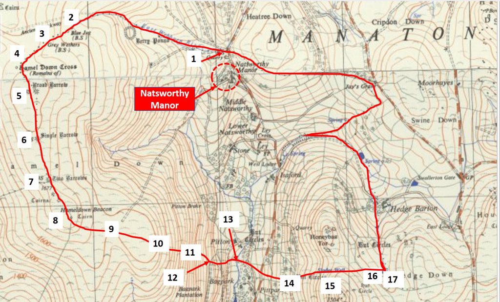
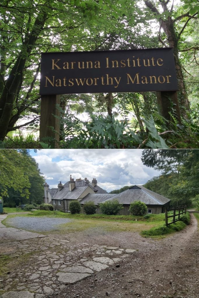
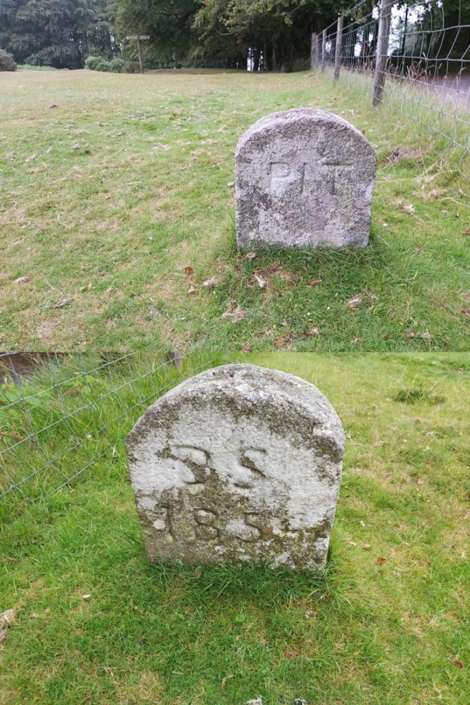
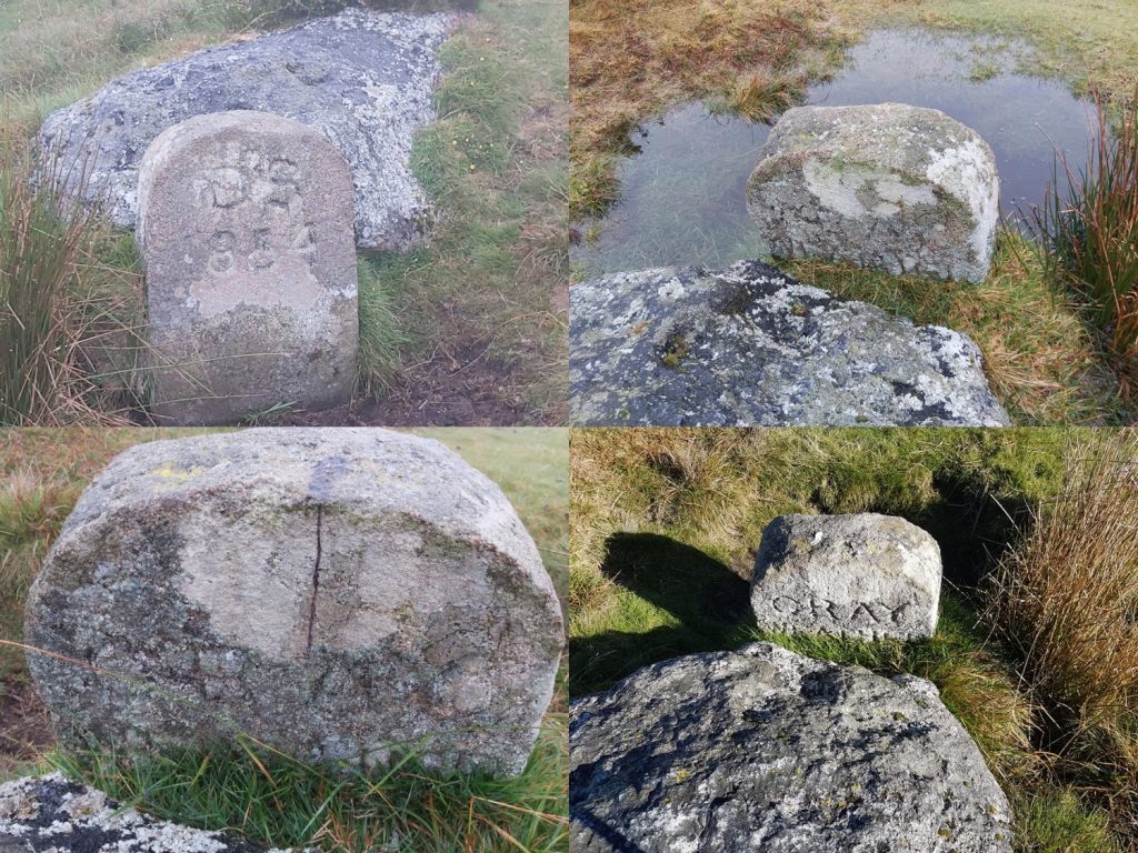
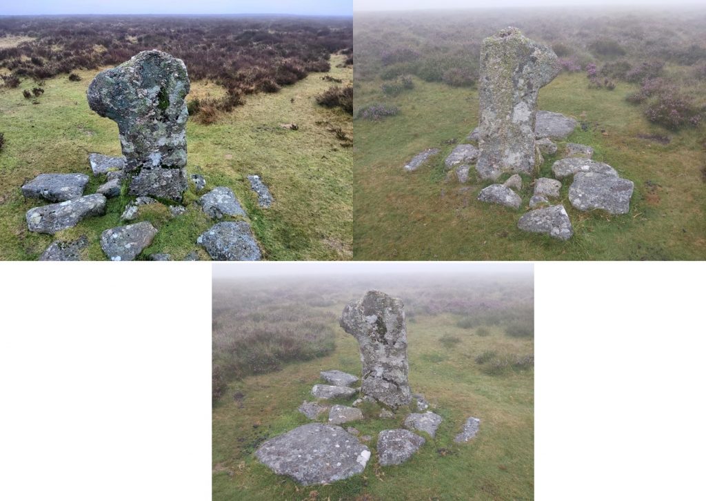
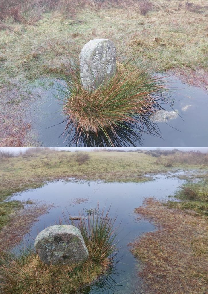
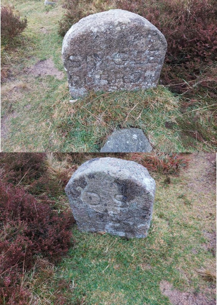
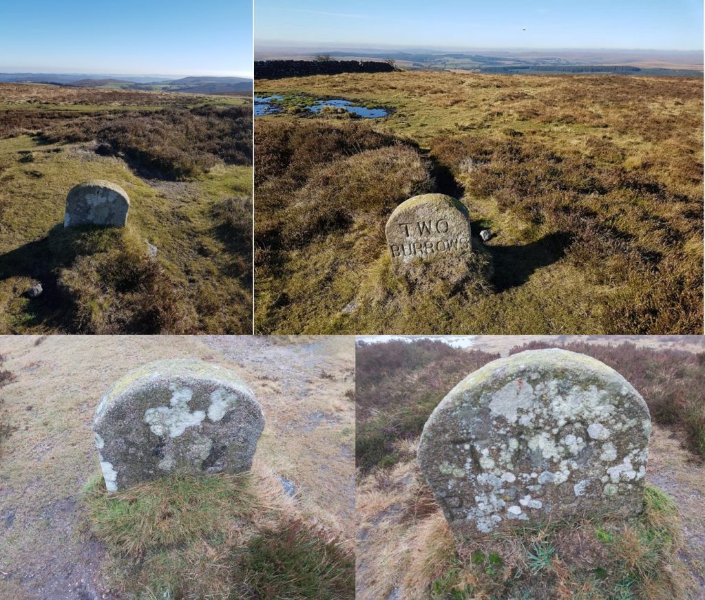
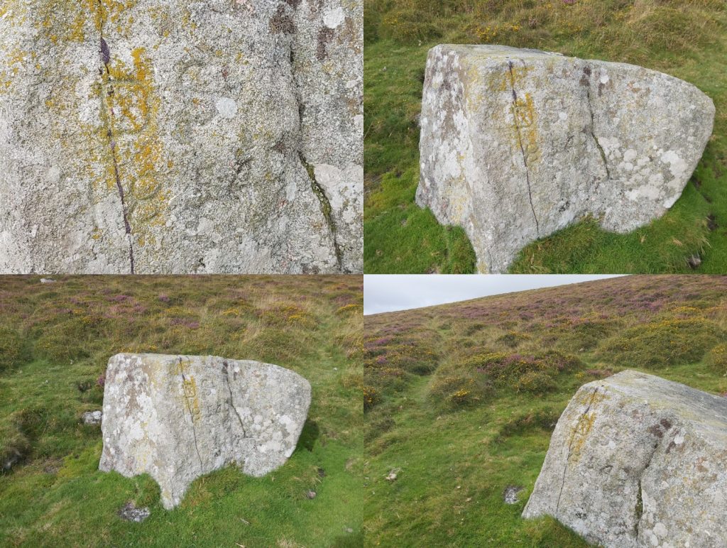
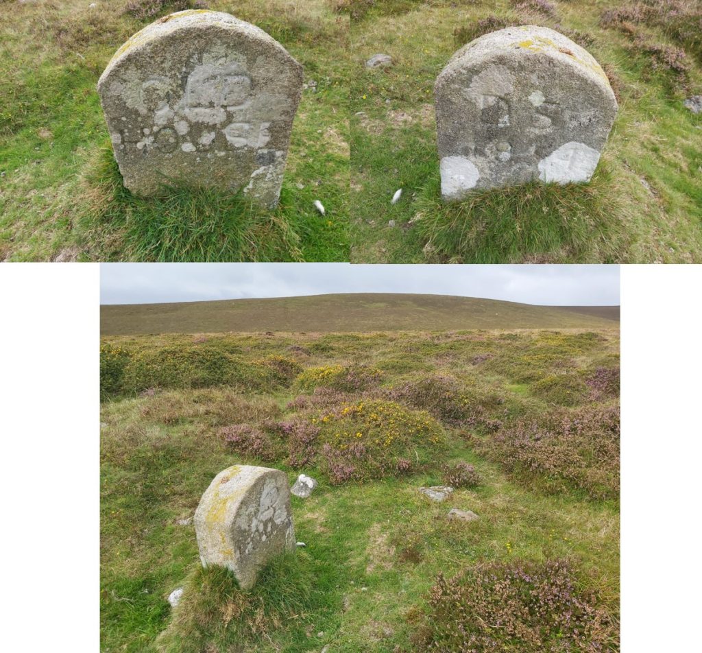
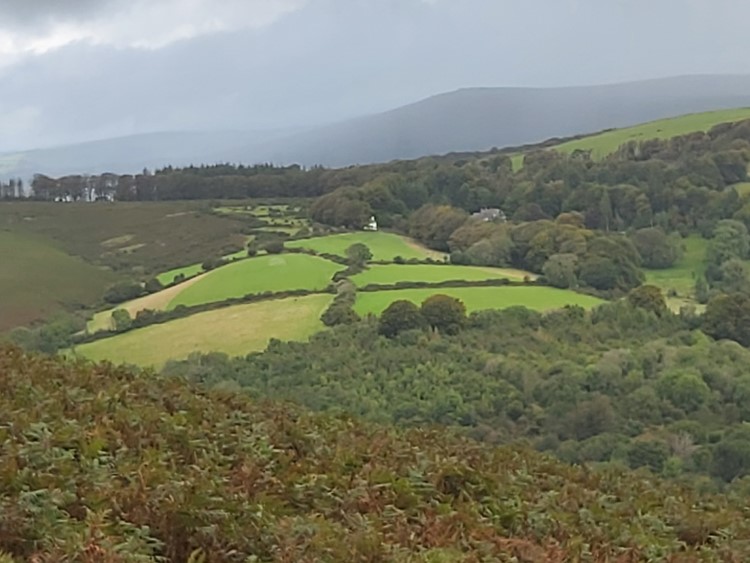
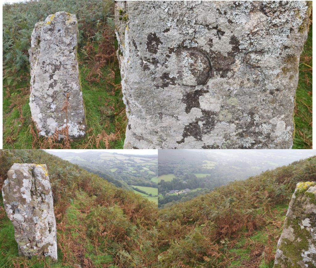
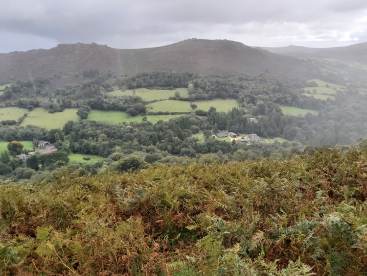
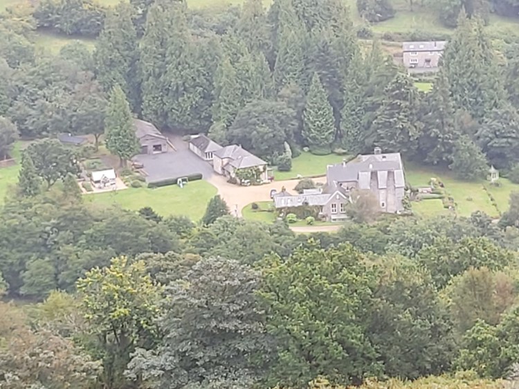
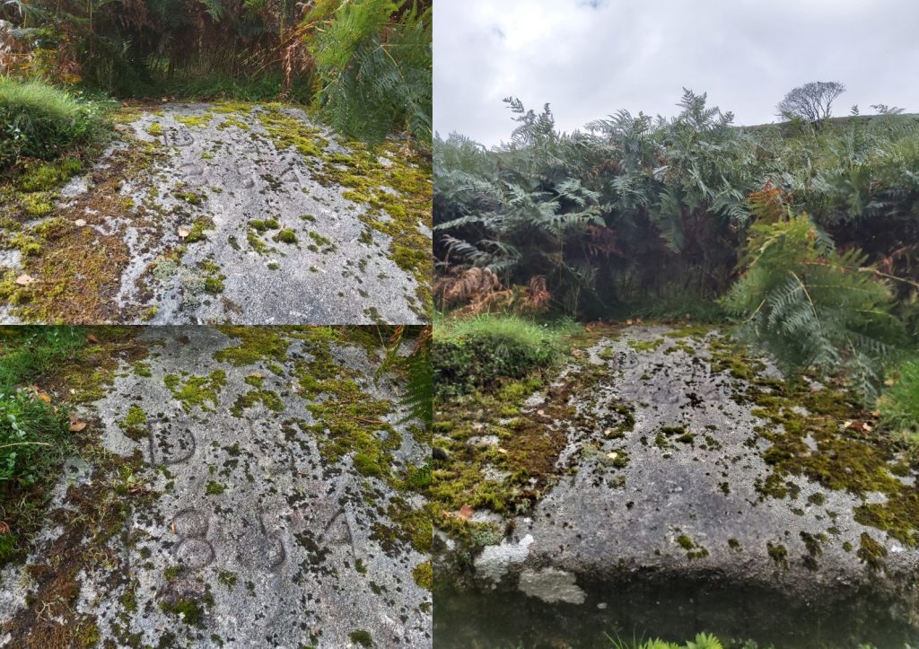
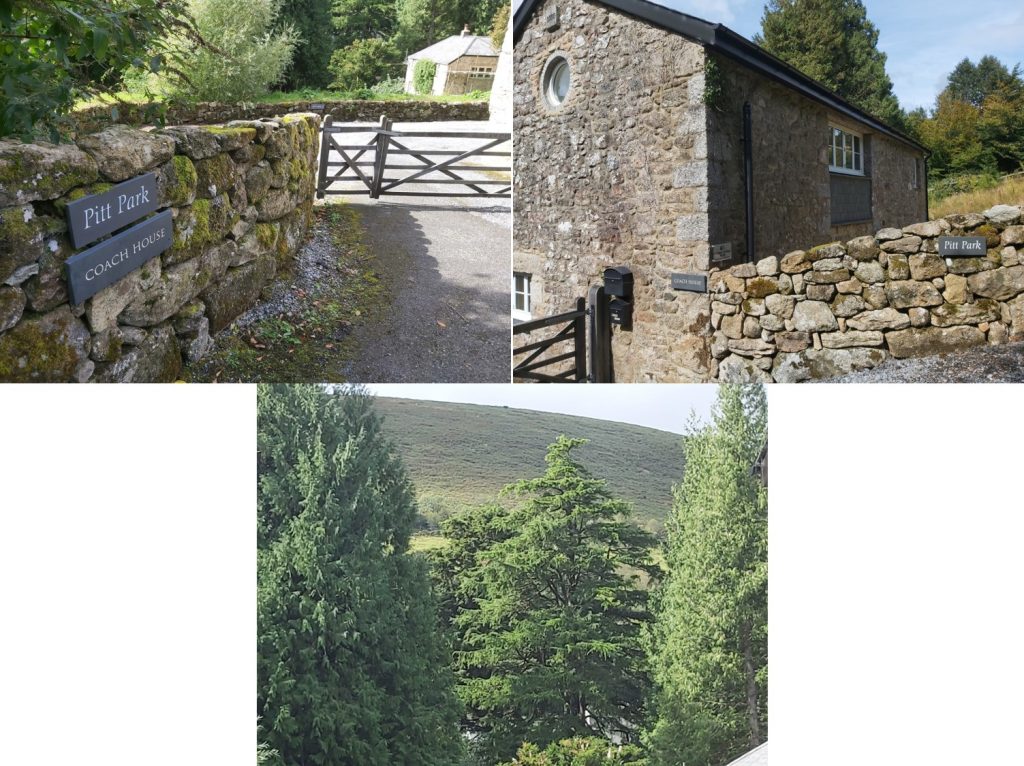
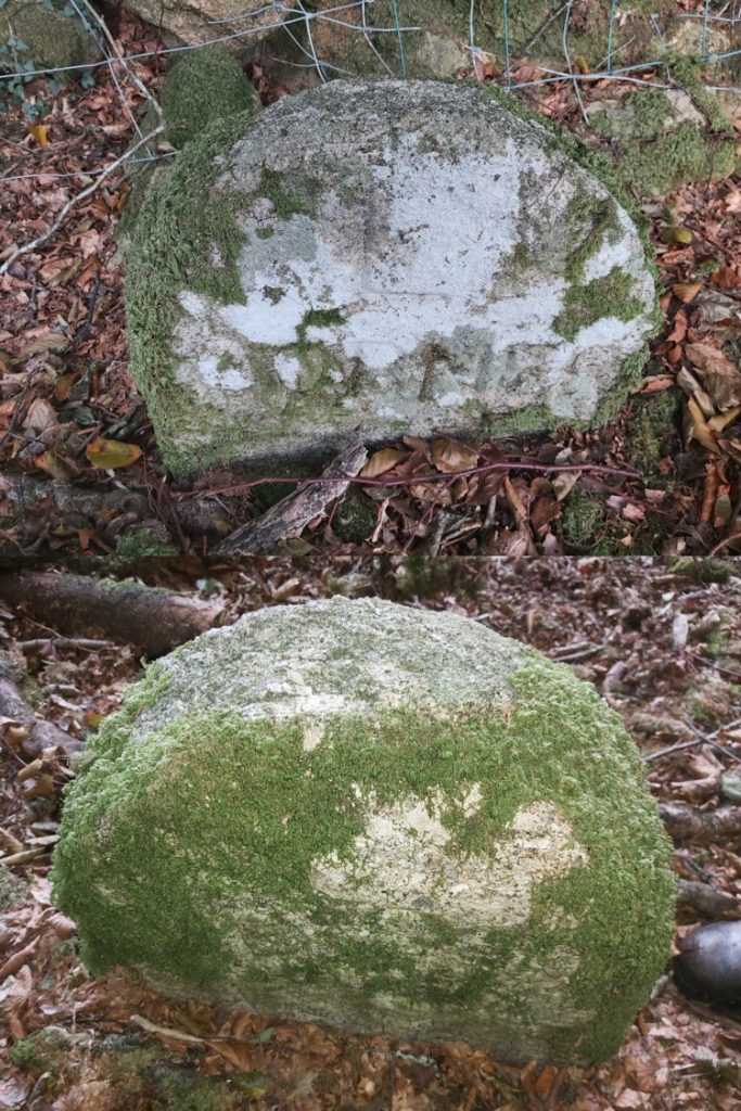
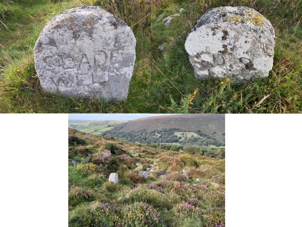
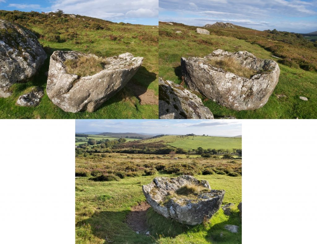
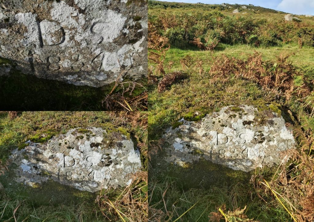
Locations of the Natsworthy Manor Boundary Markers, each of these is covered in this post.Natsworthy Manor in 2020, now used by the Karuna Institute and the manor is now described as “Core Process Psychotherapy and Craniosacral Biodynamics International Training and Retreat Centre”Just north of the manor lies boundary marker (1) – The PIT stone. Typical of the Duke’s dressed boundary markers, this one has DS 1854 marked on one side. SX72096 80187Near the head of the East Webburn is the 2nd stone, called BLUE JUG. SX70840 80370A short way west from BLUE JUG, lies the third boundary marker inscribed GRAY WEATHER. This stone has DS 1854 inscribed on one side. Located at SX70679 80310On top of the broad back of hameldon at its north end is the mutilated remains of Hameldon Cross, our 4th marker. It also has DS 1854 marked on it. Located at SX70423 80106BROAD BURROW, with DS 1854 on reverse. Typical of the Duke’s dressed boundary stones. Located at SX70572 79901SINGLE BURROW with DS 1854 on reverse. Another Duke’s dressed boundary stones. Located at SX70579 79530TWO BURROWS, with DS 1854 on reverse. SX70648 79213Hameldon Beacon, the eighth marker on this perambulation. This stone is inscribed HAMILTON BEACON with a two lines for the HAMIL and TON parts. DS 1854 on the reverse. This dressed stone also lies on the junction of the Widecombe Town Manor bounds (across which markers 9 – 17 lie in an west / east line). This was formerly called “Fire Beacon” in 1566 and “Fire Barrow” in 1659. Found at SX70822 78917.The Grey Wethers Stone, formerly “Greystone” is the 9th marker. “Grey Stone” or “to the grey stone” was used in saxon times to state the importance of a boundary mark. This is a natural boulder inscribed with DS 1854 on it. It lies near Coal Mires at SX71085 78878.OLD HOUSE boundary marker within the ring of a ruined cairn. Referred to in 1566 as “Vome Borough”, then “Vomeburrow” in 1659. Within the mound there is the remains of a shepherd’s shelter. The stone has DS 1854 on the reverse. SX71447 78661Descending the hill from OLD HOUSE, looking North East towards Natsworthy ManorThe 11th marker is located on a very steep part of the hill and is called LONG KNAVE. It is a rough set stone simply inscribed DS on the eastern side. Location is SX71711 78546View across the East Webburn valley towards Chinkwell Tor and Honeyhag Tor. This is just down from LONG KNAVE boundary marker just before the extemely steep decent to the next boundary marker near Bag Park.Bag Park on the valley floor from the hillsideThe next boundary marker is described as “a broad rock in Bag Park”. This marker is a 3m x 2m boulder with DS 1854 inscribed on it and in reality is just outside the Bag Park boundary. It is located at SX 71895 78503 The bridge over the East Webburn at Pitts Park was a manor boundary marker, which is on private land. The pictures show the entrance to Pitts Park and a glimpse of the hillside where the previous two markers are located.Boundary marker point 14 from the map. This is the L Stone or “Ell Stone” marked L CORNER. It is located at the corner of Ell Field at SX72523 78344.SLADE WELL inscribed stone is located at a natural spring and has the obligatory DS 1854 on the reverse. It is located at SX72820 78394The Clove Stone or Saddle Clove Rock is mentioned in 19th century records. It is an unusual shaped rock, having split along a natural fault horizontally, which the upper part has fallen into the inverted position. Located at SX73127 78339The last boulder on the manor bounds lies at SX73177 78362. Is is inscribed DS 1854 and lies a short distance away from the Clove Stone
Isn’t the answer that they are the traditional names of their location? Several location names are obvious like the ‘burrows’ on the cairns, some are clearly the old nicknames of the rocks used like ‘Long Knave’, ‘Grey Wether’ and ‘Clove Stone’, and some are easy to guess like ‘Old House’ at the remains of the shepherd’s shelter in the cairn. So I think there are only a few that are a bit of a mystery – like ‘Blue Jug’.

Sarah Buck September 26, 2021
Great piece of research. Do you know why the stones have their names?
SteveGrigg1961 November 5, 2021 — Post author
Sarah,
My apologies for the lateness in my response. I am afraid that in spite of some research I have been unable to find out.
Regards,
Steve
Nigel Machin November 12, 2021
Isn’t the answer that they are the traditional names of their location? Several location names are obvious like the ‘burrows’ on the cairns, some are clearly the old nicknames of the rocks used like ‘Long Knave’, ‘Grey Wether’ and ‘Clove Stone’, and some are easy to guess like ‘Old House’ at the remains of the shepherd’s shelter in the cairn. So I think there are only a few that are a bit of a mystery – like ‘Blue Jug’.