A collection of walks, discoveries, insights and pictures of exploring Dartmoor National Park
March 3, 2026
Butterdon Racecourse (and environs)
William Crossing in his ‘Guide to Dartmoor’ (1912 edition) records horse racing as having taking place on the northern end of Butterdon Hill (near Hangershell Rock) in the second half of the 19th century – the details of this can be found on page 395 of the guide.
Crossing describes the racecourse in his excursion 32 from Ivybridge. He states that after examining the large cairns at summit Butterdon Hill, he followed a stone row northwards (which he recorded had been adopted as the boundary between the moors of Ugborough and Harford). He then describes a small grass covered cairn, on which a small shelter had been formed. He continued stating: “I remember when some horse races were held here, and the course can be seen near this tumulus*. It is connected with a track that comes up from the in-country southward of the Western Beacon. On the E. side of the ground the course touches the Blackwood Path”
* A footnote on page 395 of Crossing’s ‘guide’ states that “This was about forty years ago, and the meeting was attended by a large number of people from the neighbouring parishes”. If Crossing wrote this around 1912 (the date of the edition of the guide), this would date the racecourse at about the early 1870s. Ordnance Survey maps from the 19th century appear possibly show the location of the course but as a moorland track.
Jeremy Butler, in his Dartmoor Atlas of Antiquities (Volume Four – The South West – Page 24/5), when describing the Stone Row and the nearby antiquities (the Cairn and a nearby Cist) mentions the Butterdon racecourse also. There maybe other Dartmoor authors and observers who have recorded more information about the horse racing on Butterdon Hill but this author is unaware if this is the case
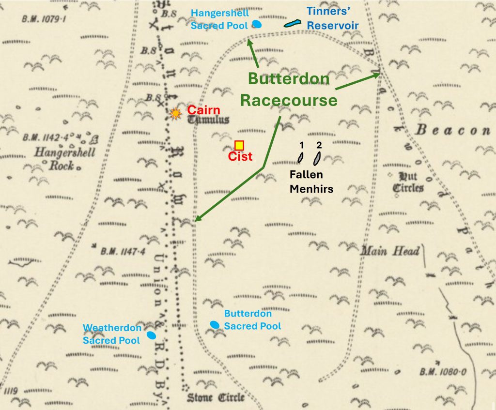
This post covers other key features on the northern flanks of Butterdon Hill, including some of the nondescript moorland tracks which one assumes were part of the racecourse. Included in the post are photographic records of the Crossing’s ‘Tumulus’ (which is Butler’s ‘Cairn’) plus Butler’s Cist, two possible menhirs, a Tinners’ Reservoir, three boundary markers on the Ugborough / Harford Parish boundary and three ‘sacred’ pools. If any reader of this post is able to add any detail of the racecourse (or racing) aside the Crossing record, the author would be most grateful in receiving this information.
Bibliography
William Crossing, – (1912) – Crossing’s Guide to Dartmoor, 395
T.A.P Greeves – (2019), Dartmoor’s Sacred Pools. Design in the Prehistoric Landscape
H.Riley– (2021), UG21 heritage asset database and gazetteer of sites (Report – Survey). SDV364699.
Jeremy Butler – (1993) – Dartmoor Atlas of Antiquities: Volume Four – The South-East, 24-27, 243, Map 53, Figure 53.7
English Heritage – (2011) – National Heritage List for England, 1017611
Based on the description of the racecourse by Crossing, the author suspects the above annotated map is where it was located. The map also shows the locations of other features covered in this post
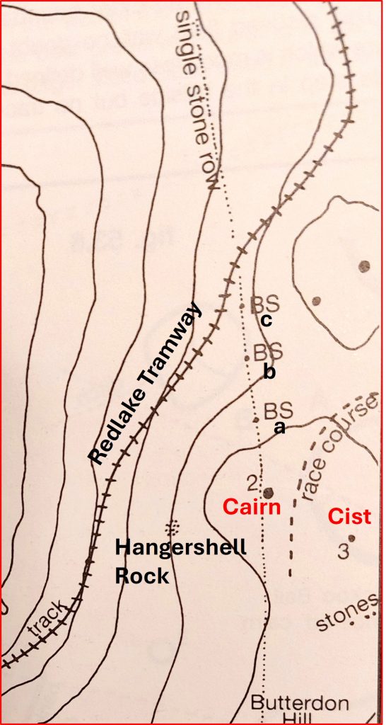
This is an annotated version of Jeremy Butler’s Map, showing the Cairn and Cist in relation to his consideration as to the location of the racecourse
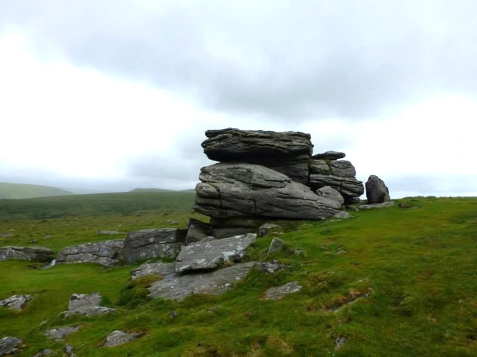
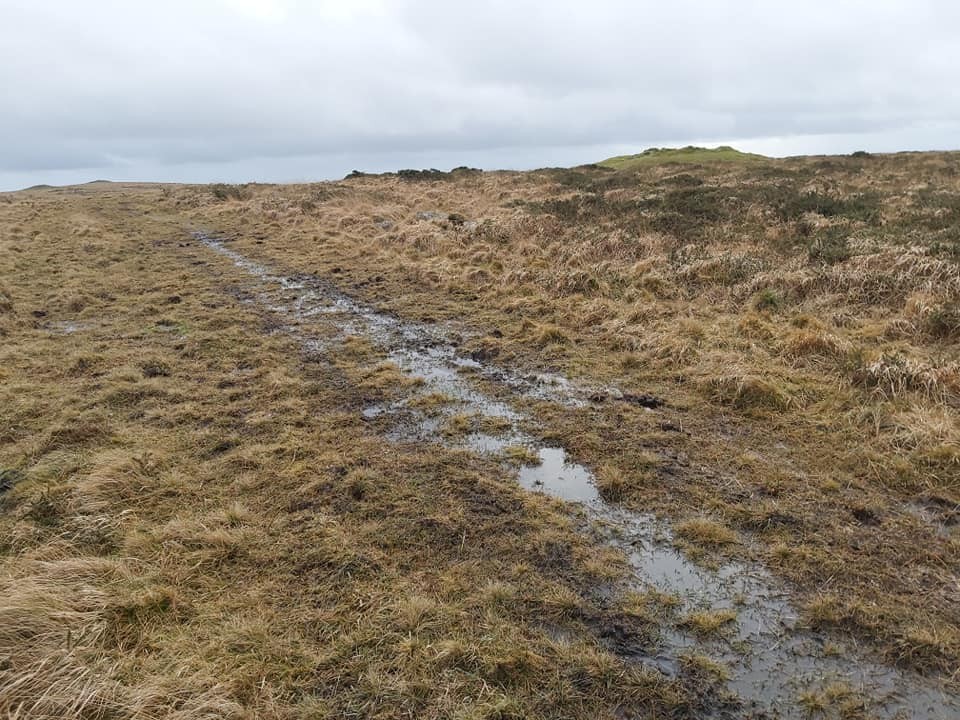
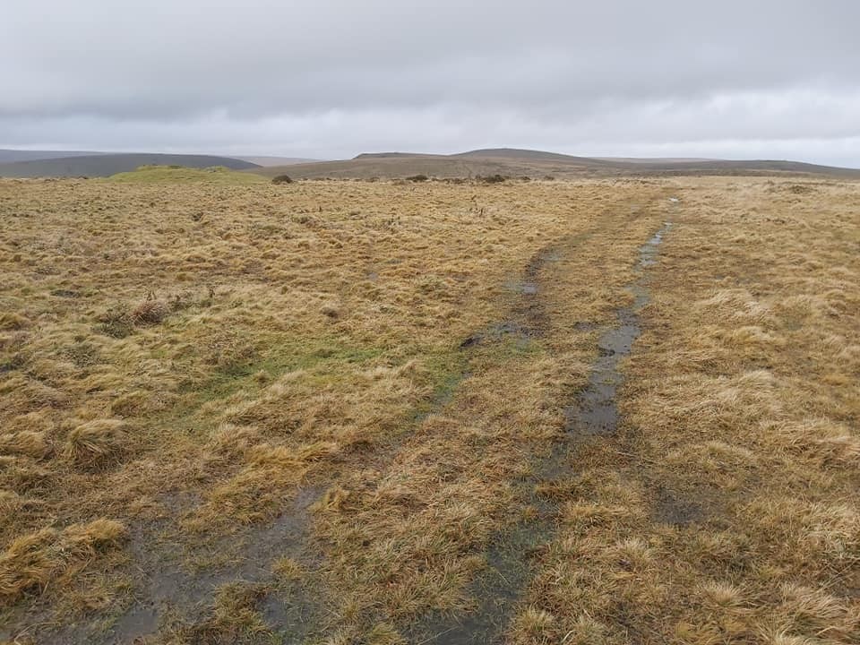
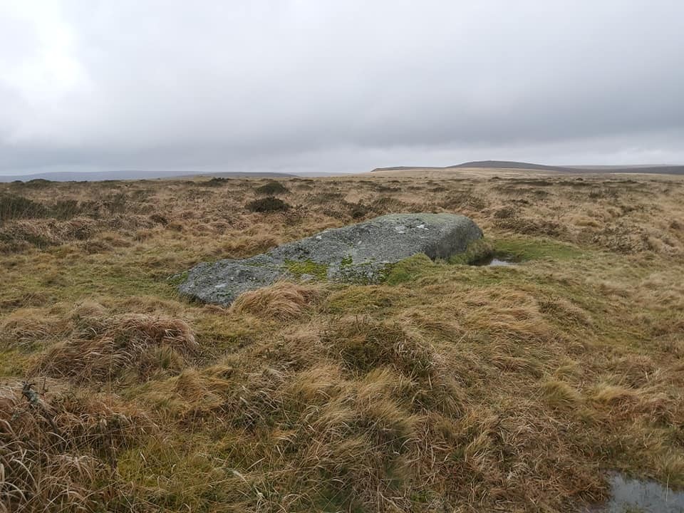
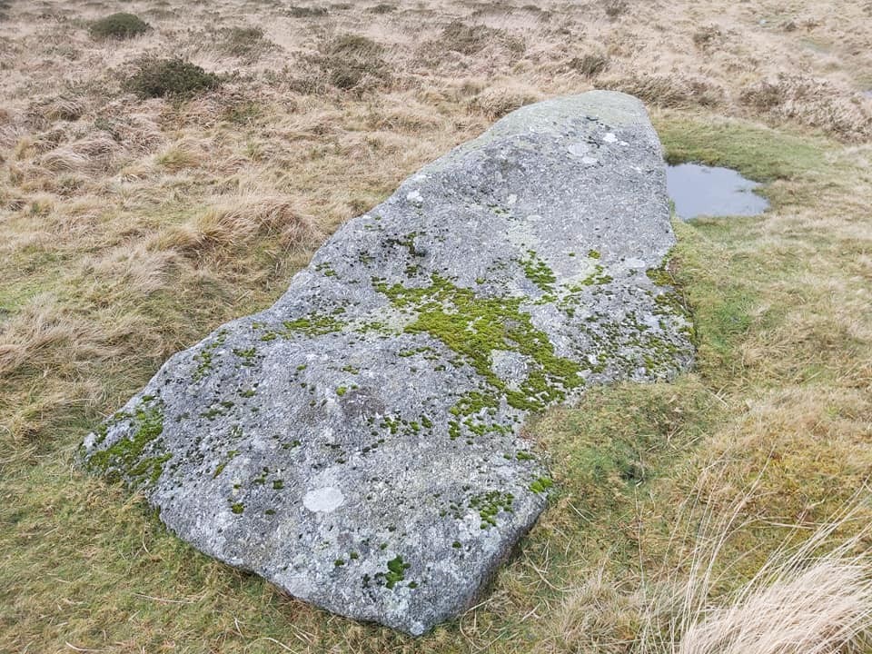
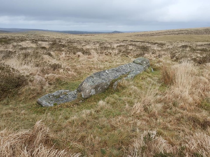
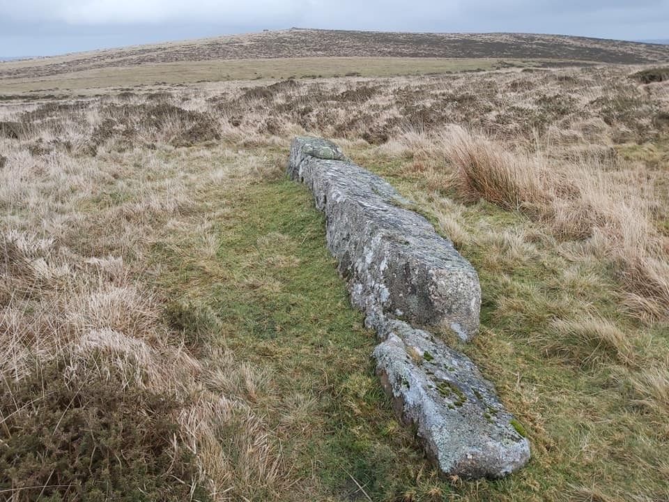
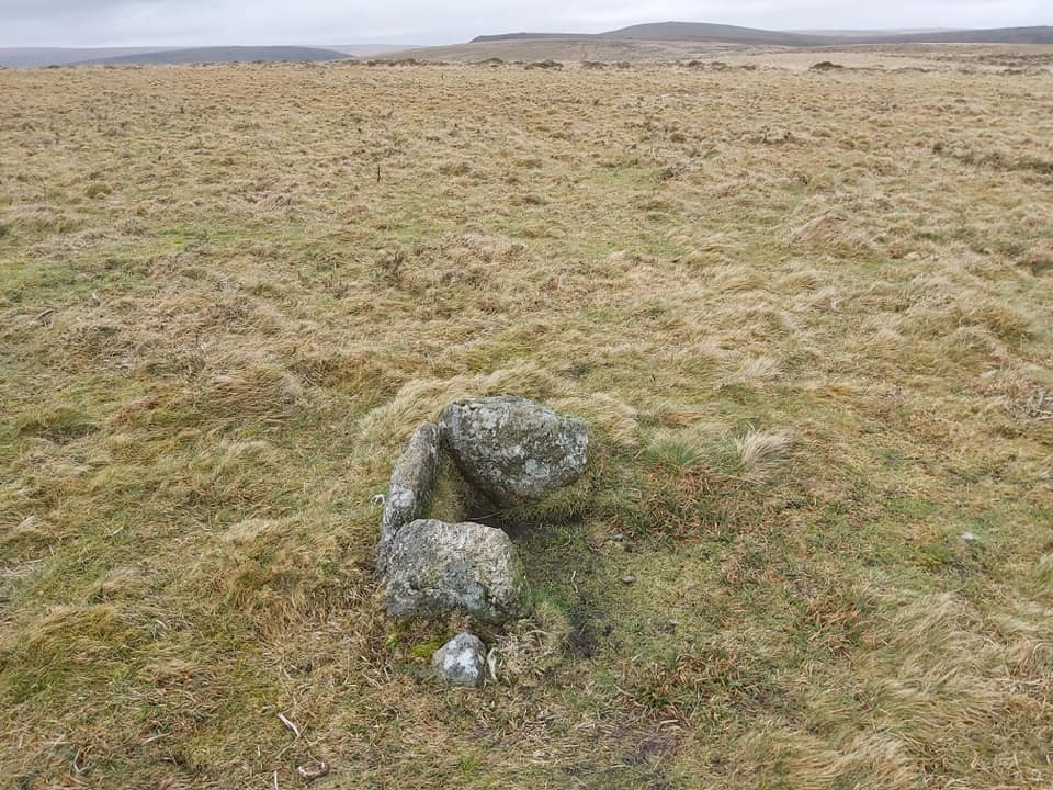
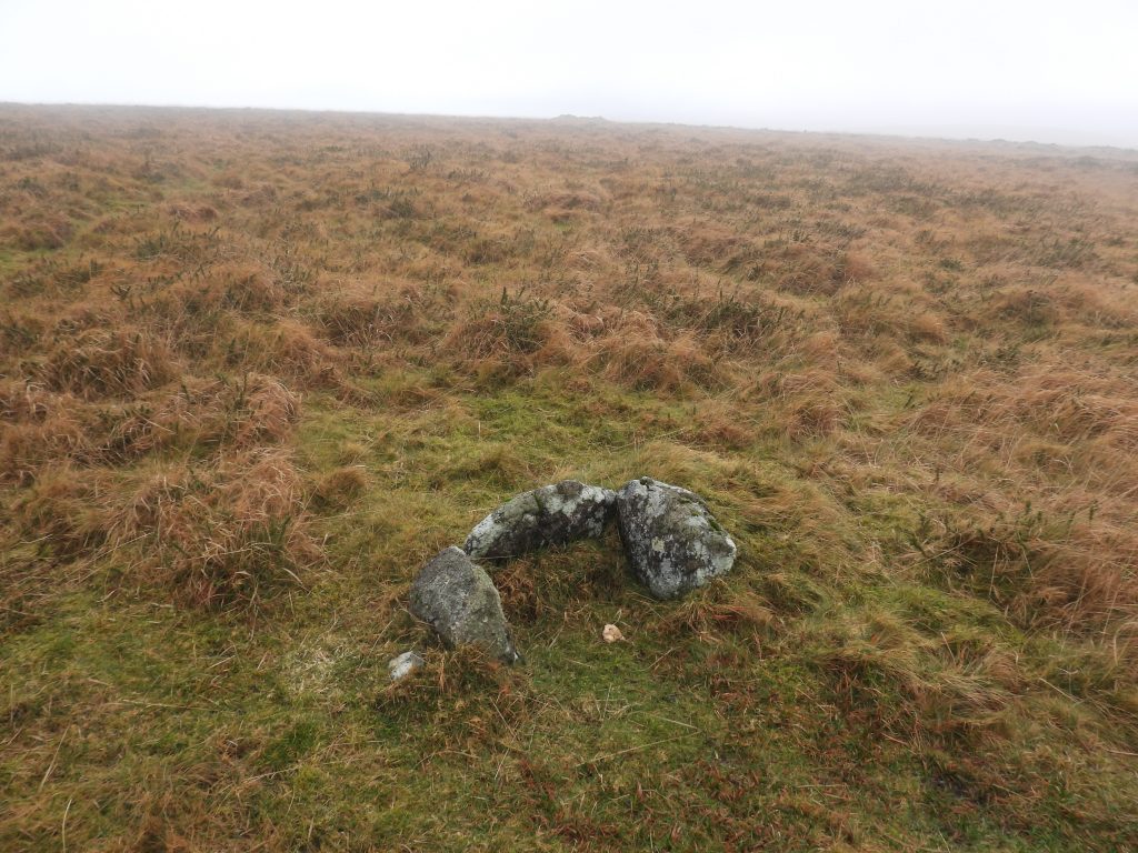
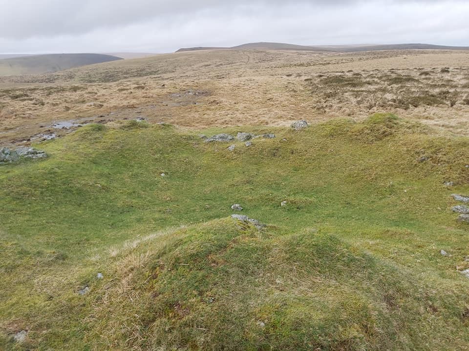
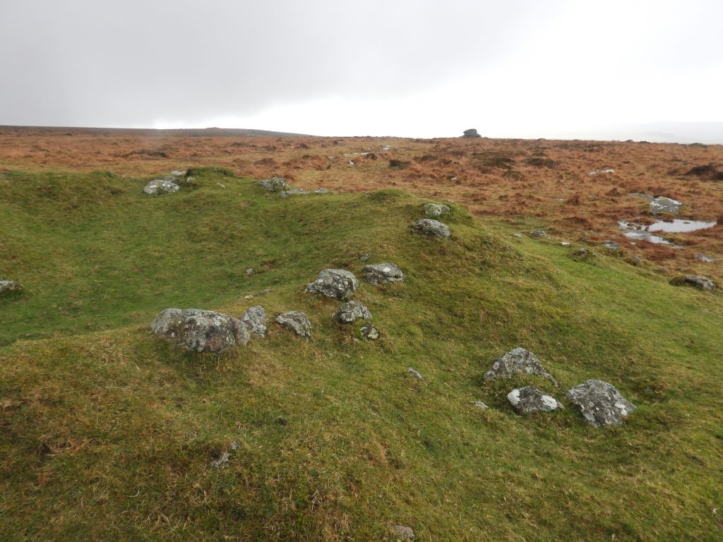
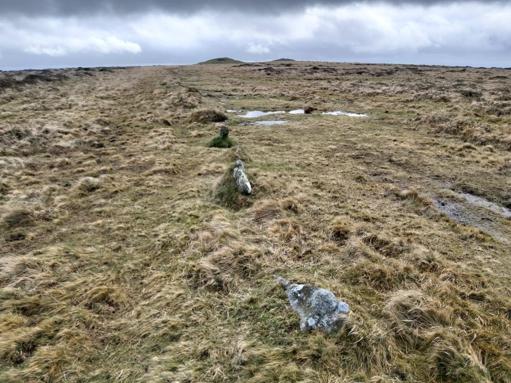
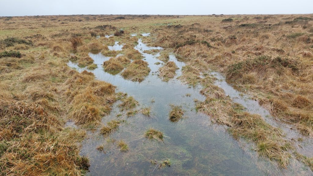
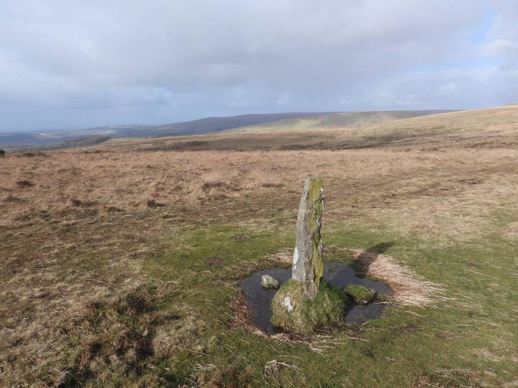
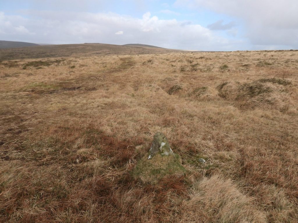
The key granite feature in the area is Hangershell Rock at SX6549 5936. The rock has also been called Hanger’s Shiel, Hangershill Rock and Hangershiel Rock (ref: Tors of Dartmoor website)This rather soggy moorland track at SX65710 59434 was probably part of the racecourse and is near the Cairn (or Tumulus), which can be seen at top right of the photographAnother part of the soggy moorland track at SX65693 59344, also probably part of the racecourse and is near the Cairn (or Tumulus), which can be seen near the top left of the photographWorth (page 267) records two possible menhirs east of Hangershell Rock which are entirely isolated on a grass moor, where there are very few surface stones. The above photograph is the westerly of the two, annotated as number ‘1’ on the map in this post. More information can be found here: Dartmoor Site: Beacon Plain A Standing StoneMenhir 1′ is 6.4m long and has a maximum width of 1.93m and a thickness of 0.76m (English Heritage). It is located at SX65829 59185Menhir ‘2’ is around 50m to the east of Menhir ‘1’ at SX65877 59200Worth records that the two stones (menhirs) “do not have the appearance of surface boulders and might have been brought here from Hangershell”. This (eastern) stone is 5.4m long and has a maximum width of 0.7m and a thickness of 0.5m (English Heritage). Why these two large monoliths are here in an area of grassland largely devoid of stone, remains a mystery. The two stones are orientated east/west towards the Butterdon stone row which is around 250m to the west. More information can be found here: Dartmoor Site: Beacon Plain B Standing StoneButterdon Hill cist is another prehistoric artefact which can be found near the racecourse. The author has fond memories of the challenge of finding this on night walks in the 1990s, taking a bearing from Hangershell Rock (no GPS used)Butterdon Cist is located at SX65778 59334. The cairn (tumulus) can just be seen across the gloom in this photograph. These three upright stones enclose an area 0.7m north to south by 0.5m east to west and 0.4m deep
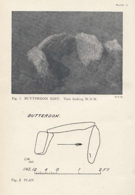
Worth’s record of the cist from 1942 in the 61st Report on Barrows
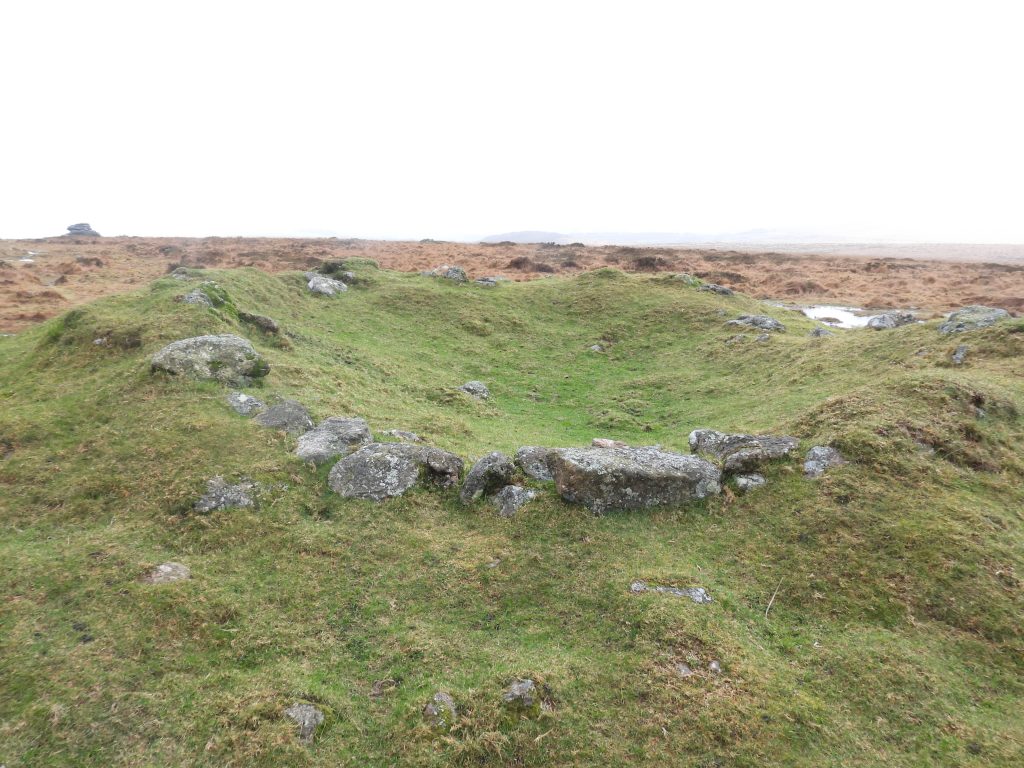
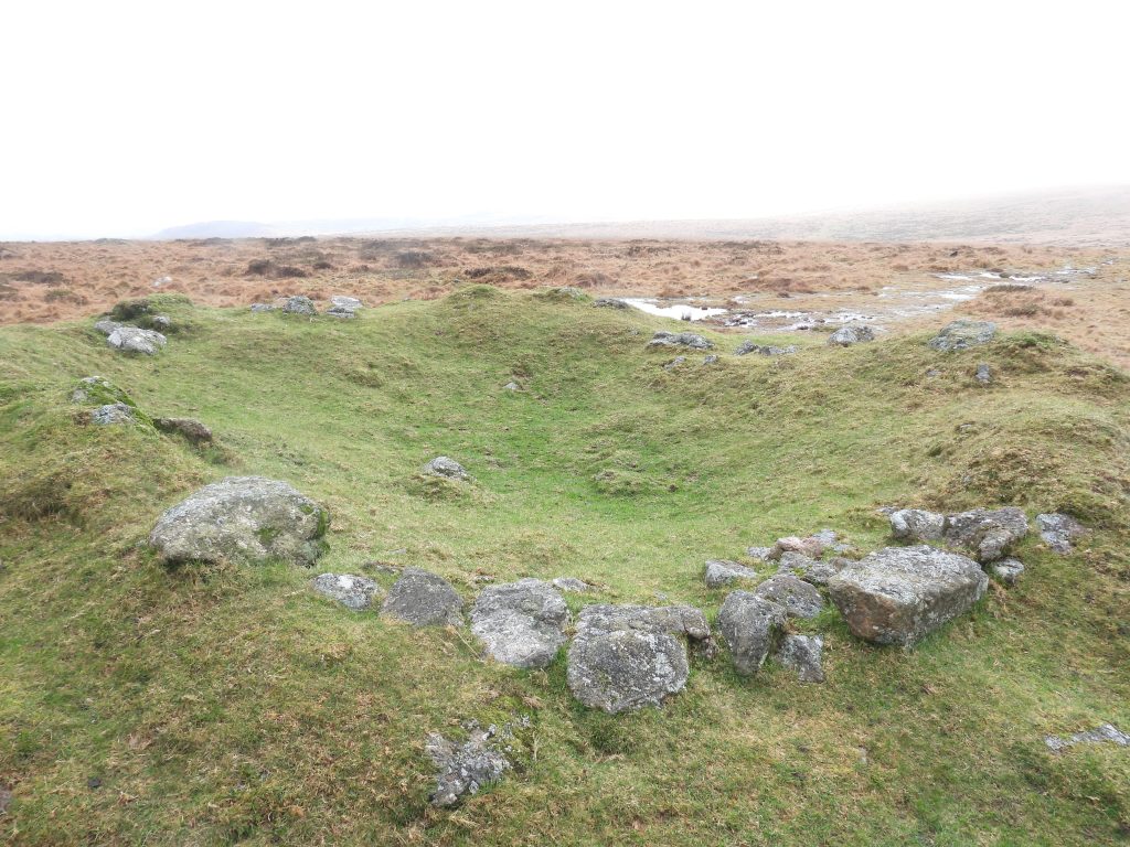
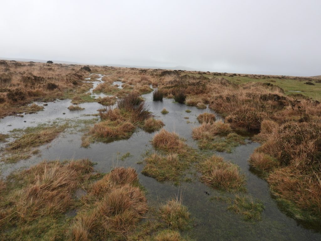
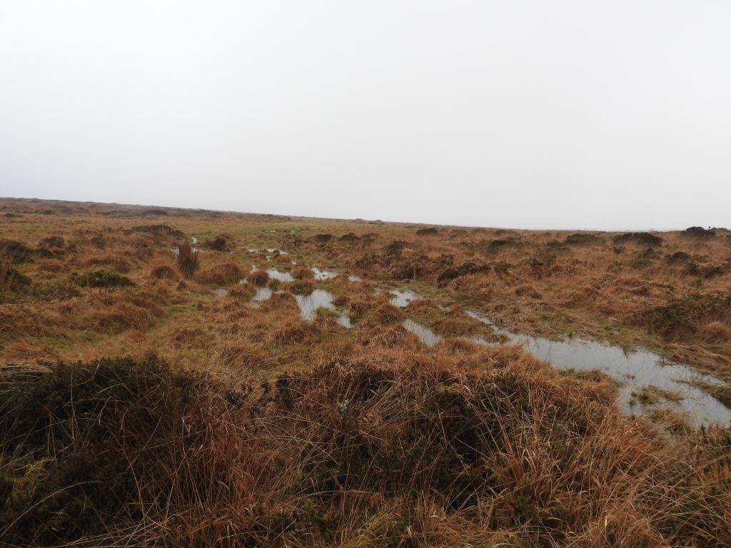
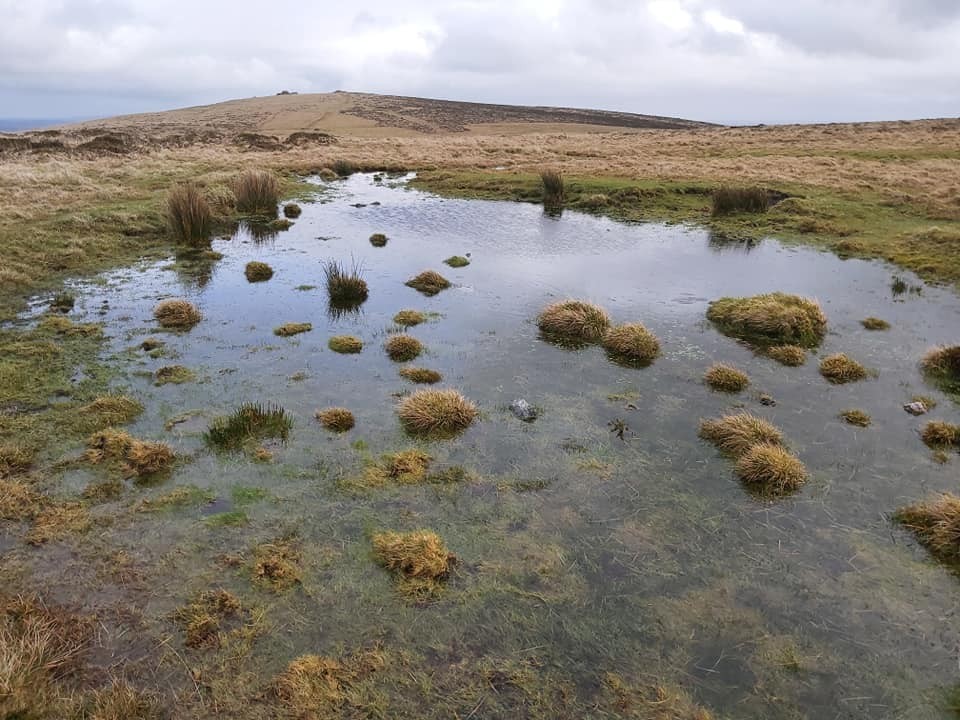
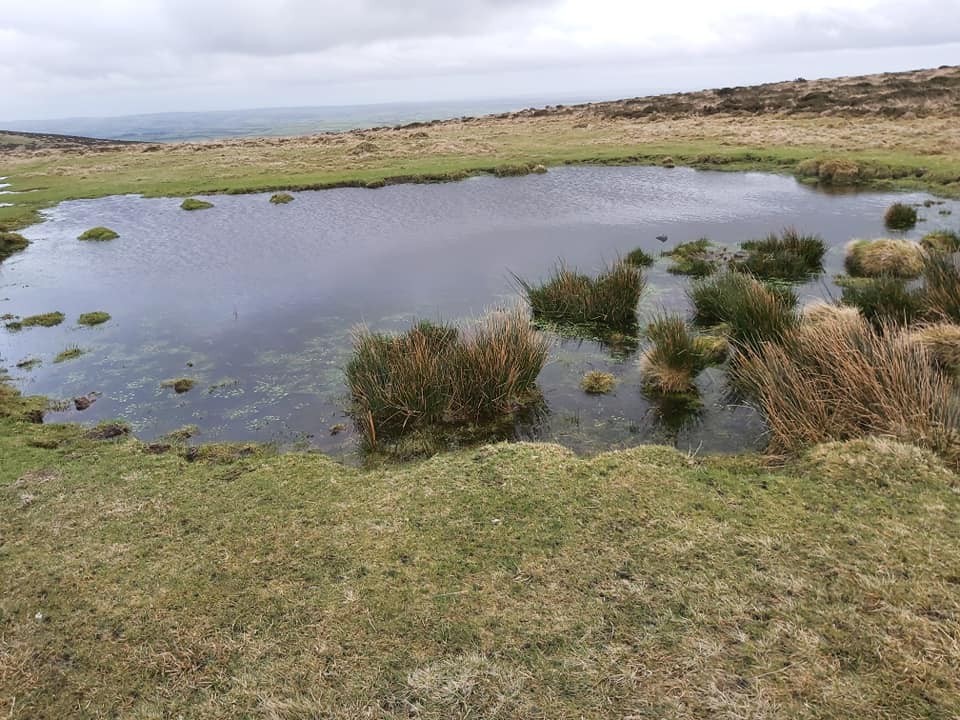
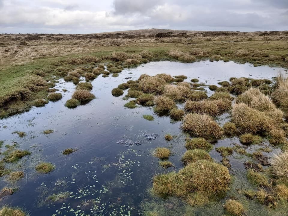
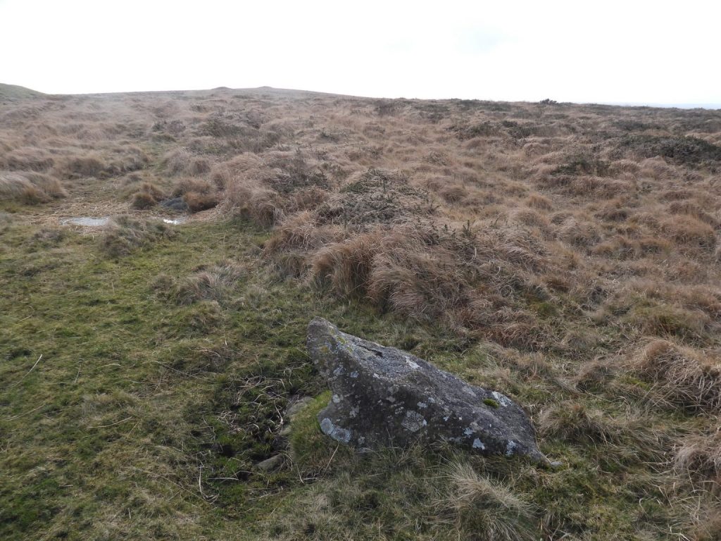
A large cairn (shown as a Tumulus on 19th century maps) is located on the east side of Butterdon Hill Stone Row. It is labelled as number 2 on the Butler map and measures 18m diameter by 1.5m high. In 2021, it was recorded that within the cairn there are the: “Remains of building in the centre of the cairn of 4.5m north to south, 6m east to west, defined by tumbled stone walls, 0.9m wide, 0.8m high, with entrance on east side. Probably associated with seasonal grazing” (Riley). The author can imagine that this cairn may well have been used as a vantage point when the 19th century horse racing was taking placeThe cairn is located at SX6566 5940Cairn with Hangershell Rock on the near horizon (right) and Weatherdon Hill cairns on the far horizon (left)Part of the Butterdon Hill single stone row close to the Race Course. The row is nearly 2km long between Butterdon Hill and Piles Hill. It is the second longest stone alignment on Dartmoor. Stones are recorded as being up to a metre in height and are spaced at intervals of 1 metre to 1.5 metres. A Tinners’ Reservoir which consists of a gorse-covered shallowly crescentic bank about 35 metres in length. Tom Greeves presumes the reservoir served tinworks on the Lud Brook to the south and is likely to be of 16th or 17th century date. The banking on the Tinners’ Reservoir is about 7m wide and 0.5m highThe Tinners’ Reservoir can be found at SX65872 59587Hangershell Sacred Pool measures 13m by 9.3m and is located at SX65824 59588. It is located 50m to the west of the Tinners’ Reservoir (whose earthbanks can be seen in the photograph)Butterdon Sacred Pool isa sub-rectangular shallow pit which measures 15m by 19m and is around 0.4m deep. The edges show the remains of peat cutting. The pool is located at SX65731 58968Weatherdon Hill Sacred Pool measures 13m by 10.5m and can be found at SX65619 58945. Tom Greeves records that there are: “40 ‘sacred’ pools identified on Dartmoor that are thought to have potentially been designed during the prehistoric period, and may have been used to deposit votive items, although these Dartmoor examples may have alternative significance as designed prehistoric elements in the landscape. Many are located on ridge tops and in conjunction with cairns, stone rows and other prehistoric features”. Harford / Ugborough Parish Boundary Stone (annotated a on the Butler sketch map) can be found to the north of Hangershell Rock and the large round cairn to the east of the Butterdon stone row and is located at SX65639 59438.Harford / Ugborough Parish Boundary Stone (annotated b on the Butler sketch map) located at SX65633 59516Harford / Ugborough Parish Boundary Stone (annotated c on the Butler sketch map) is part of the Butterdon stone row at SX65621 59614.