A collection of walks, discoveries, insights and pictures of exploring Dartmoor National Park
February 27, 2026
Butter Brook Tin Mill
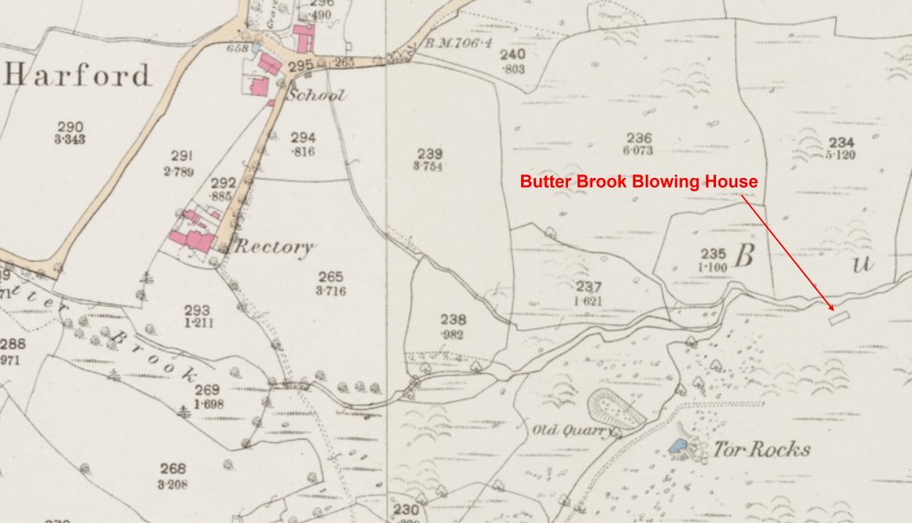
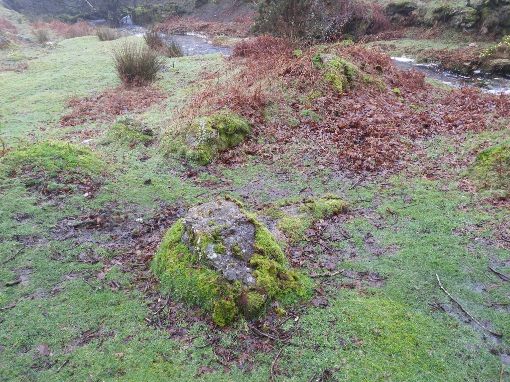
To the south east of the hamlet of Harford, on the left bank of the Butter Brook at approx. SX 6420 5921 is an undocumented Tin Mill which is considered as being pre-1700. The Mill lies at the bottom of a river cliff on the south side of brook.
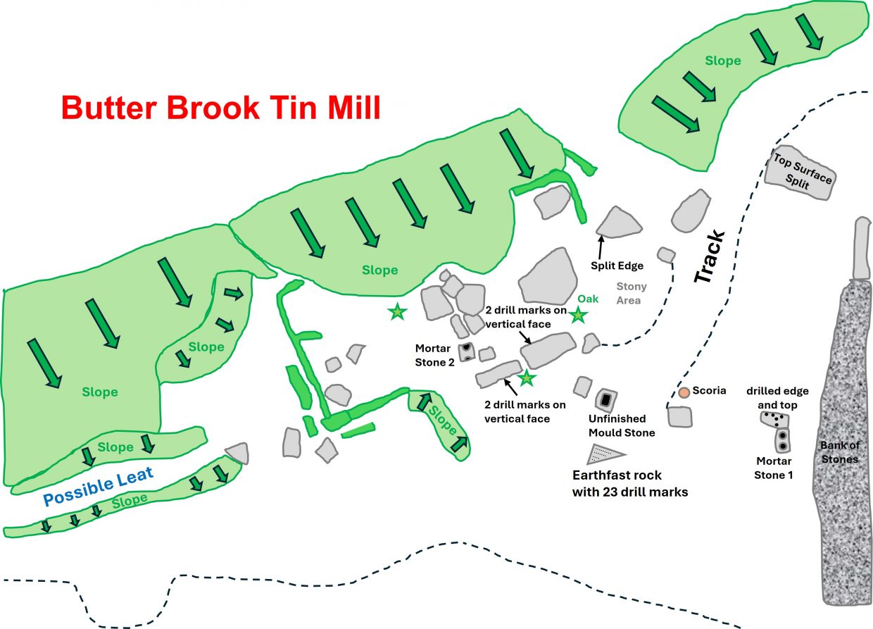
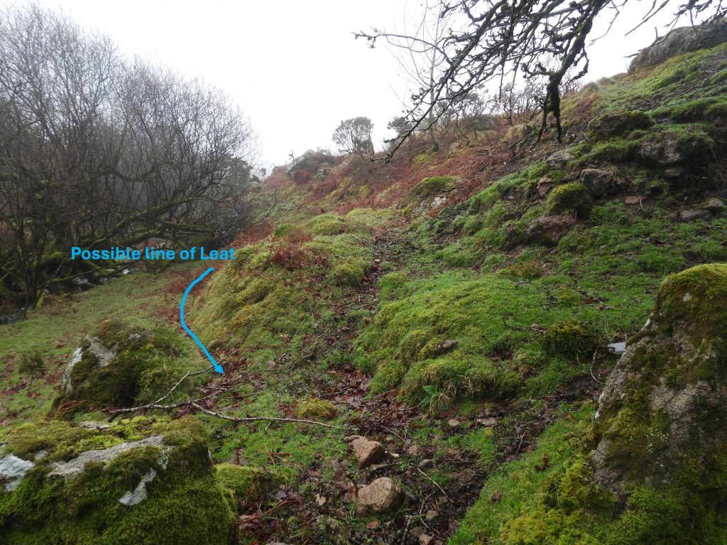
It has been described by researchers as being a Blowing Mill (due to there being an unfinished Mould Stone) and a Stamping Mill (as there have been historically at least two Mortar Stones found). Worth (in 1933) measured the mill as measuring 34 feet by 16 feet (10.4m x 4.9m) internally. There is a faint Leat still visible coming in from the north east, which comes from the heavily worked upper reaches of the brook.
At a later period, the building served as a Smithy, when the nearby Tor Rocks Quarries were in operation. The supporting evidence for this later use as a Smithy there has been Scoria* found (by Worth and Greeves) nearby and also there is a rock with multiple drill holes, which may well have been for checking drill bits or Jumpers.
The question that most researchers / observers ask is ‘how much of the structure is the original Blowing House / Stamping Mill and how much of it has been altered and converted by the 20th century smithy’
*Scoria: Slag or clinker from melting of metals or reduction of ores from a Smithy
Bibliography
R.H.Worth – (1940), Worth’s Dartmoor – The Dartmoor Blowing House (number 19), pages 300, 311
Tom Greeves and Rosemary Robinson, – (31st January 1985) – Butter Brook Blowing Mill (Survey)
The Tinworking Landscape of Dartmoor in a European Context – (2016) – Paper presented by Dr Tom Greeves – Lodges and Mills: The Field Archaeology of Tin Accommodation, Stamping and Smelting on Dartmoor at the conference (6th – 11th May 2016) at Tavistock – Mill number 28
Dr TomGreeves – (1987) – List of donations to the Plymouth Museum (Un-published).
Dr Tom Greeves – (2026) – Pers. Conv.
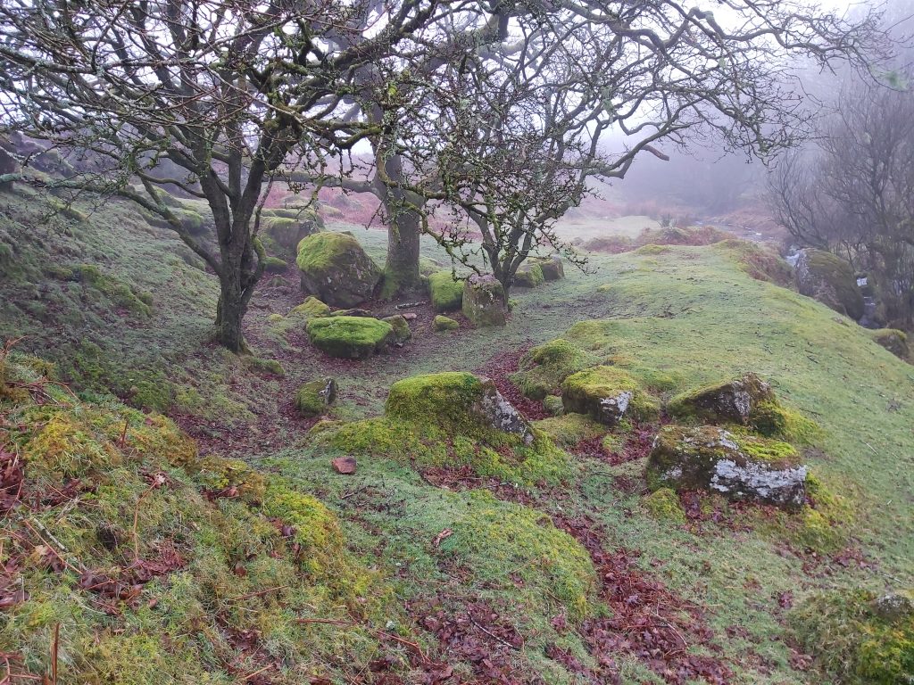
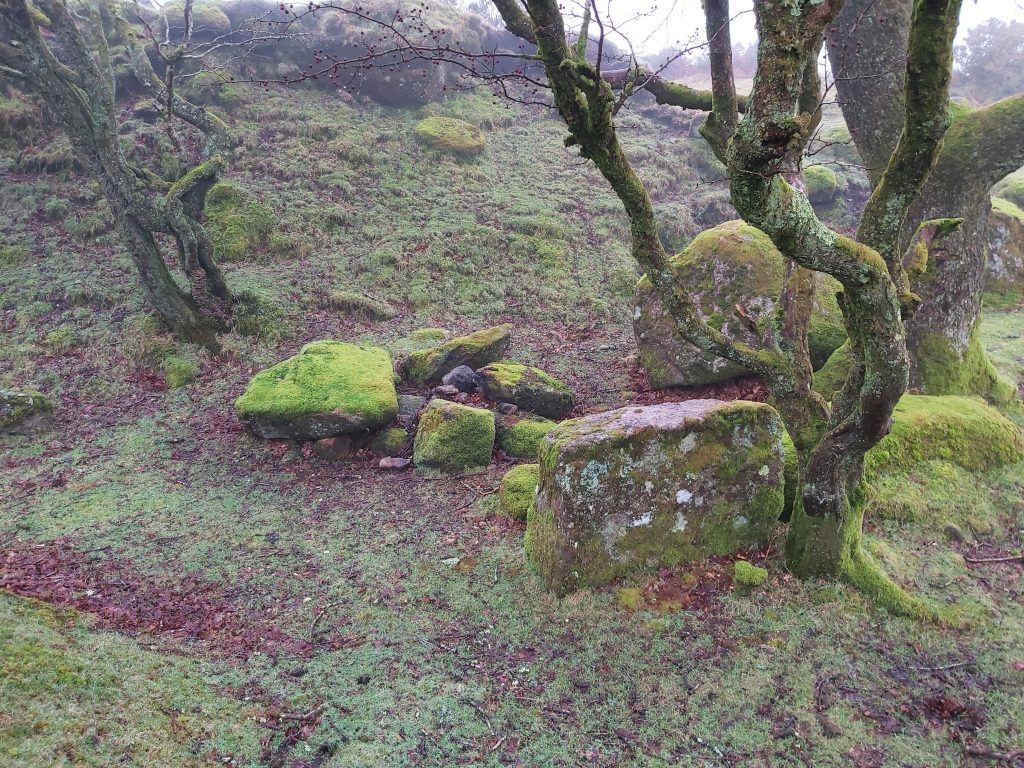
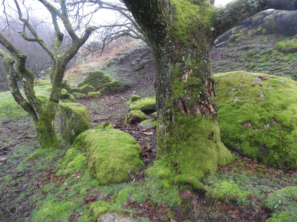
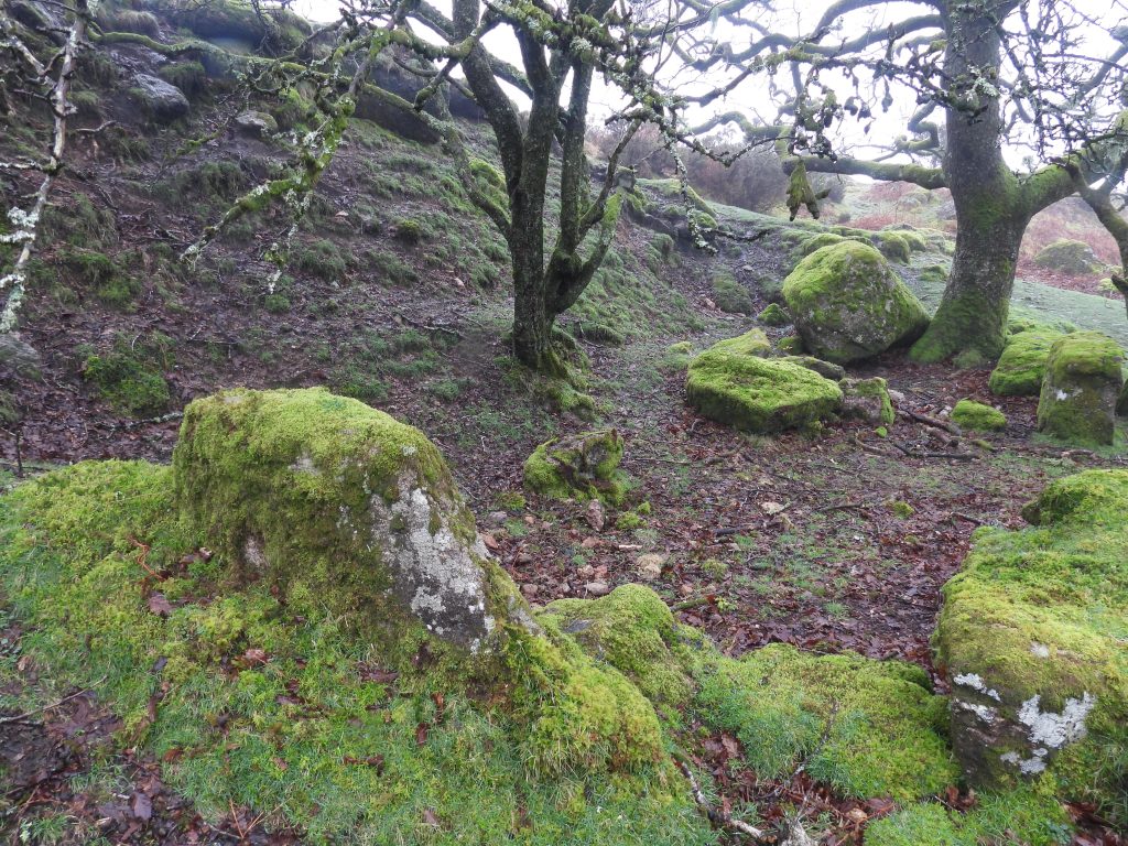
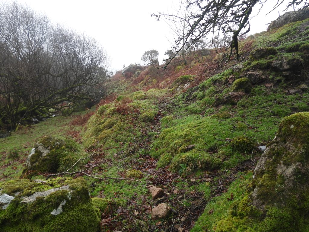
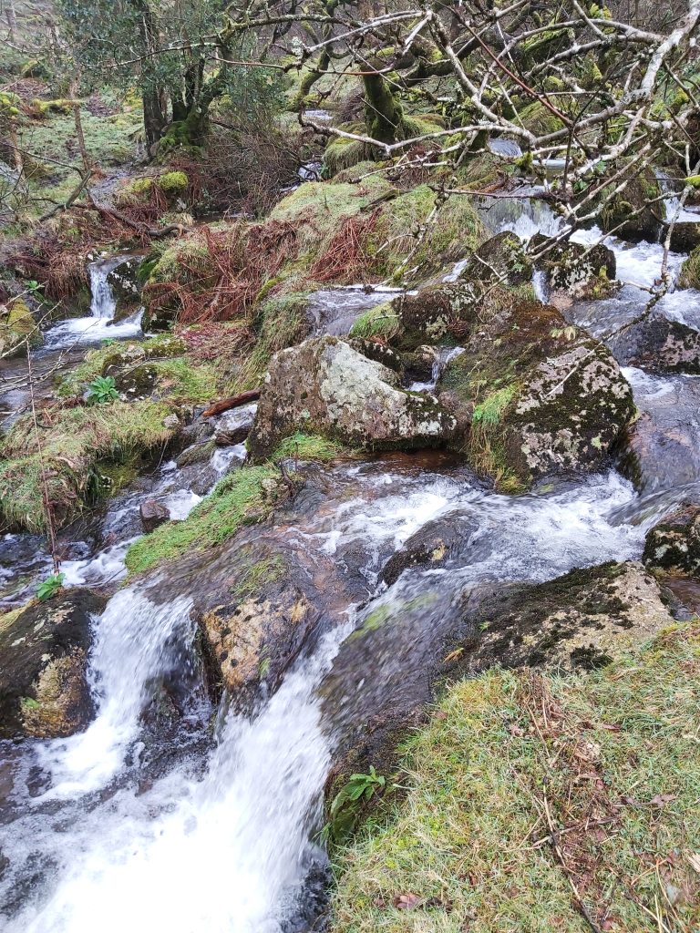
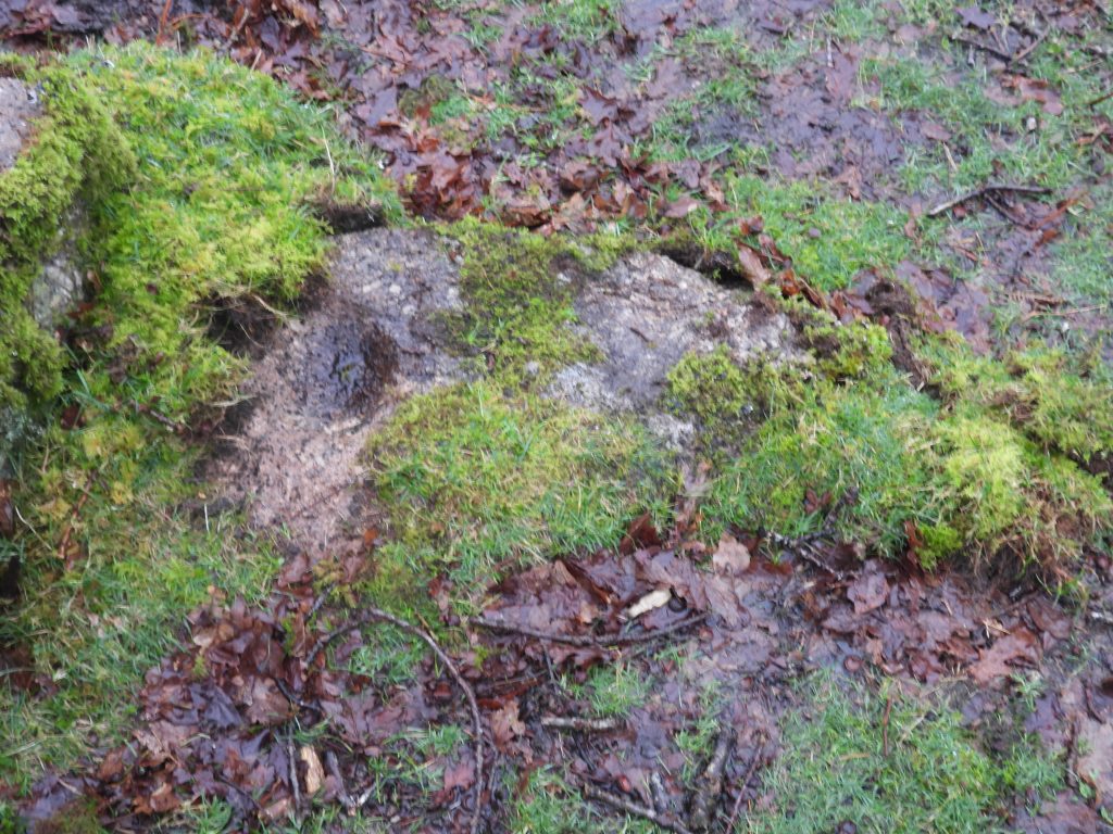
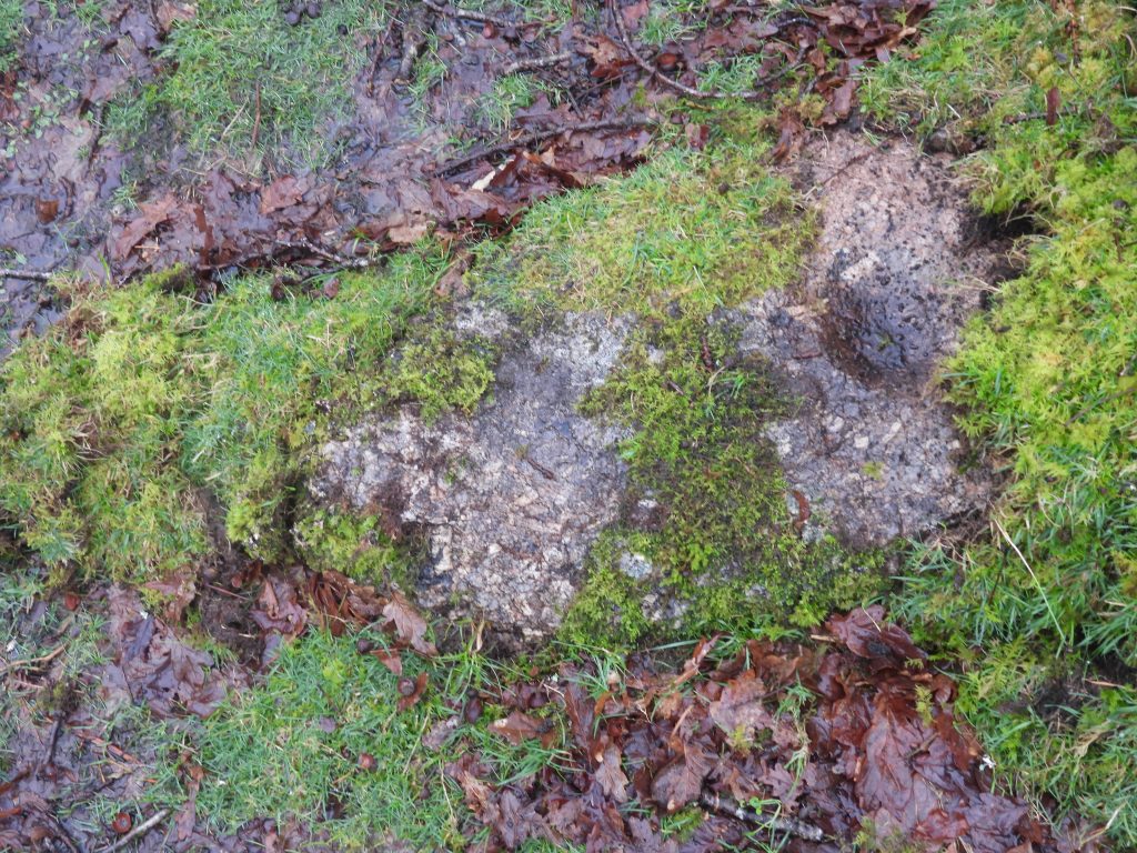
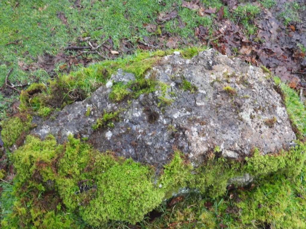
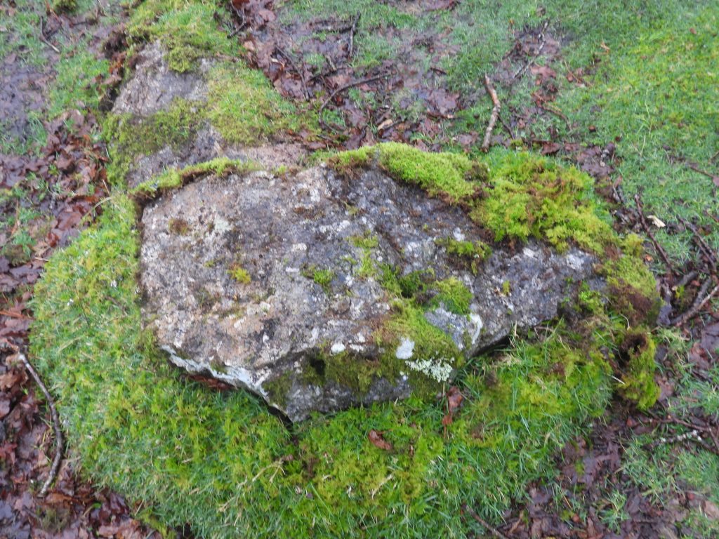
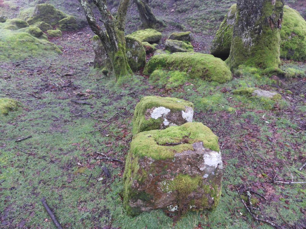
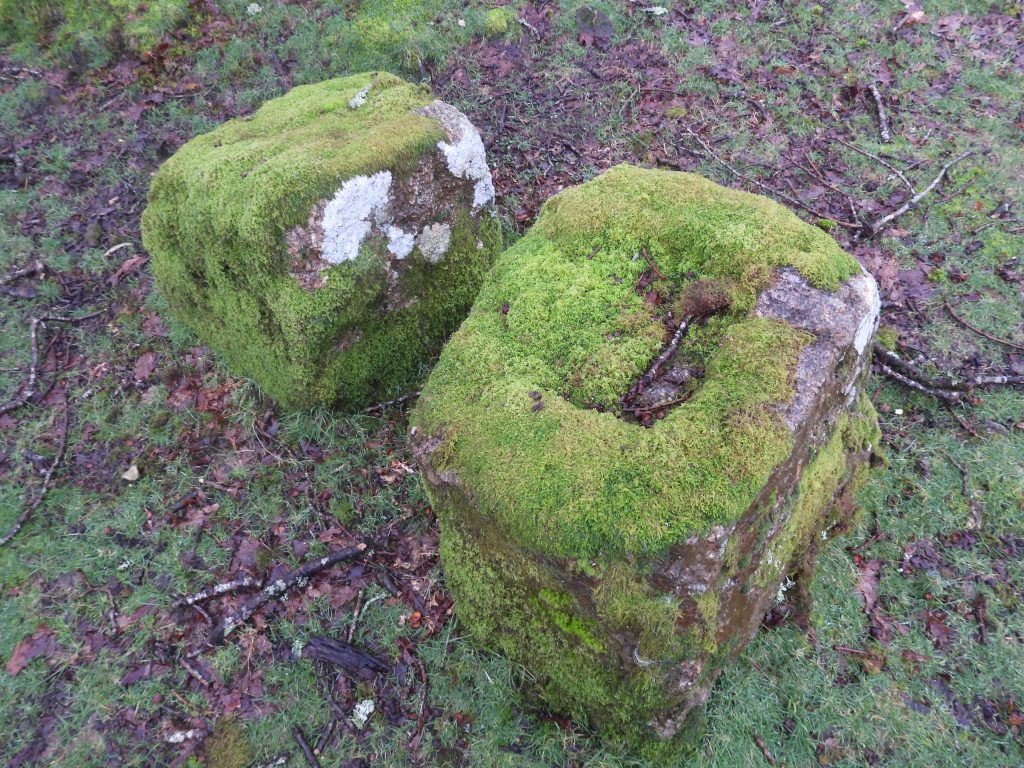
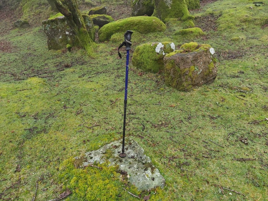
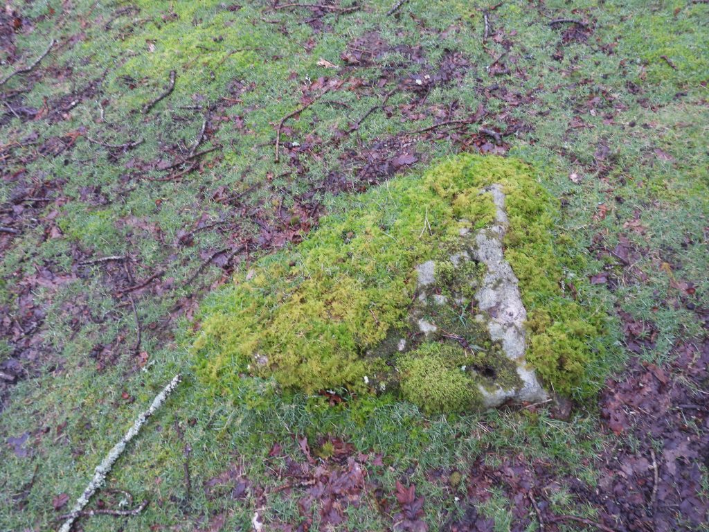
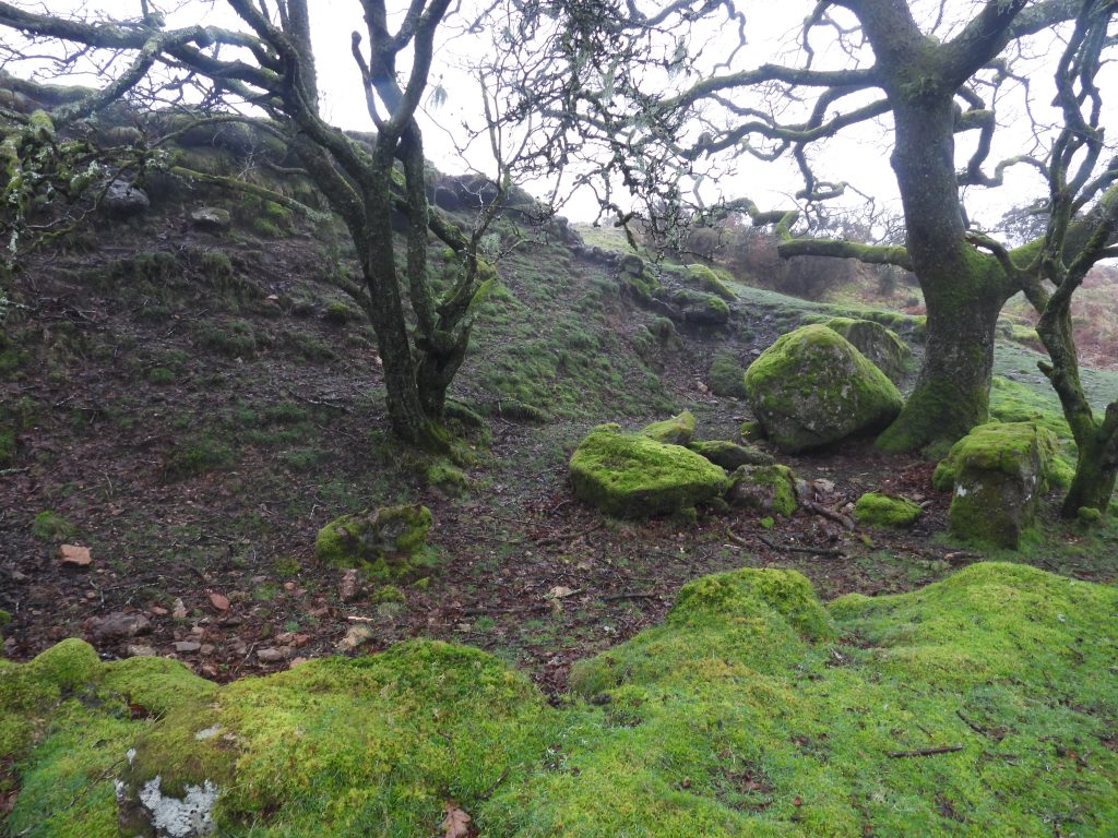
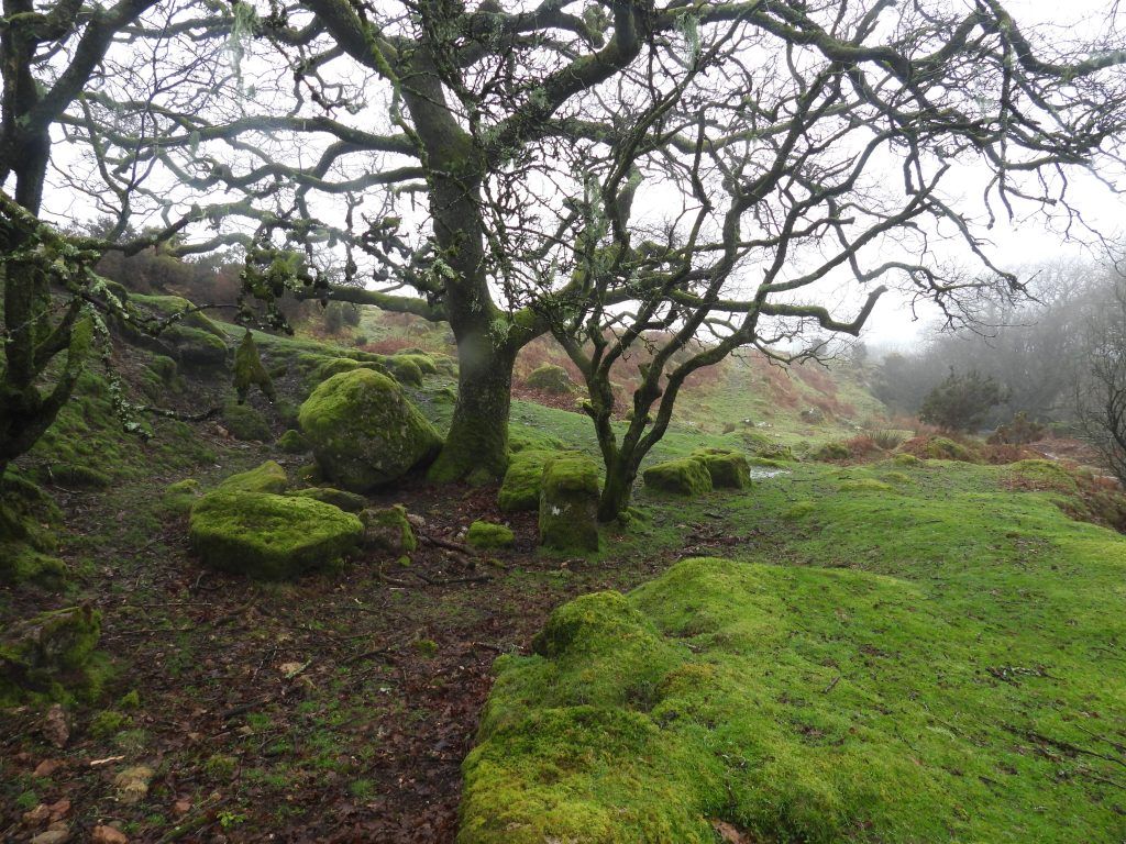
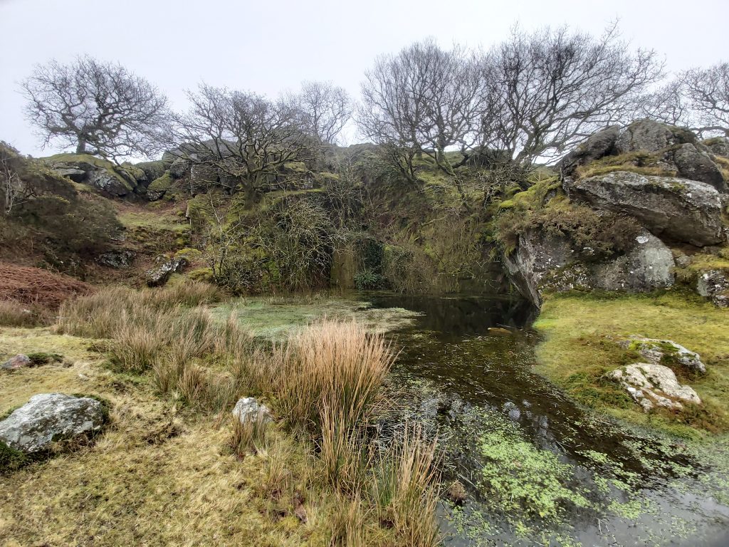
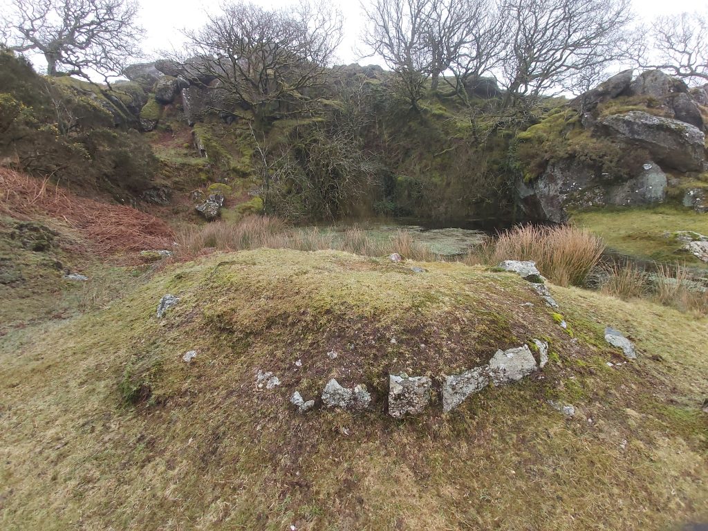
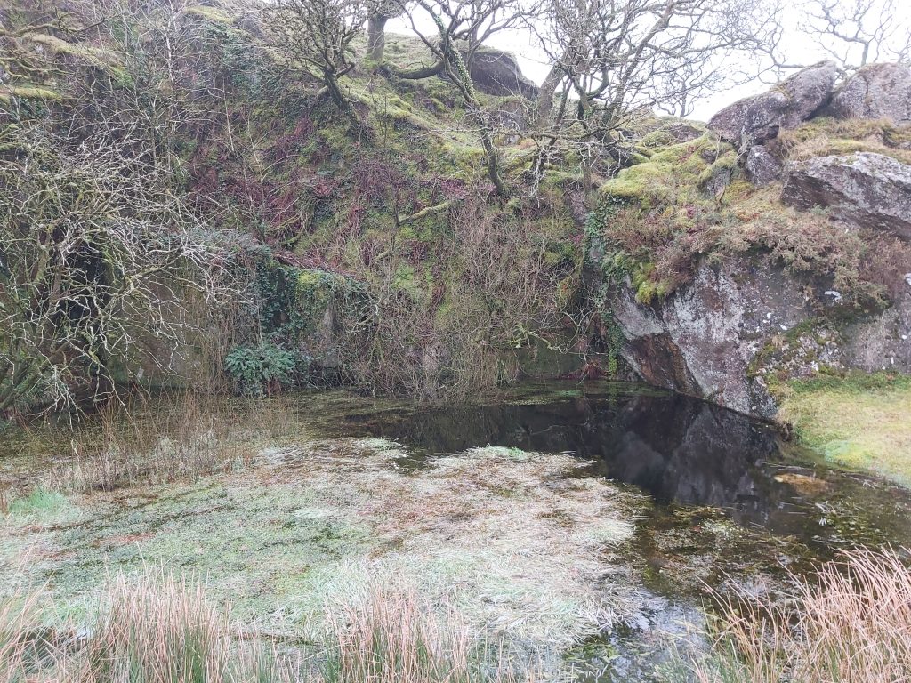
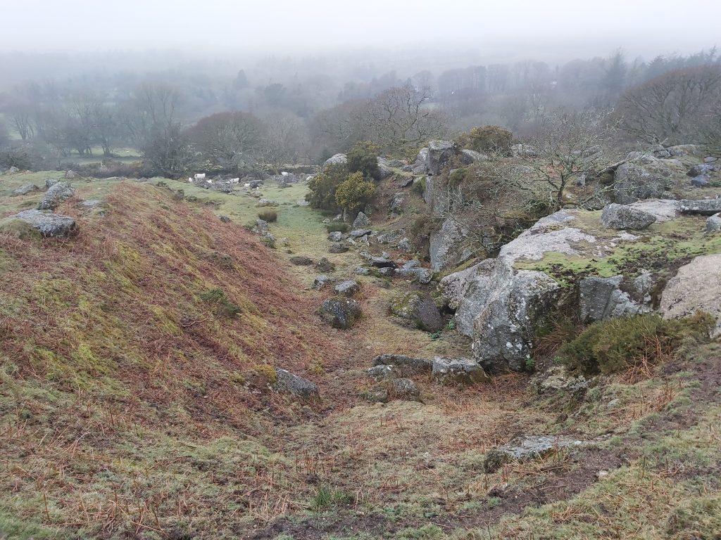
This annotated 19th century map shows the location of the Mill in relation to the hamlet of HarfordThis sketch plan of Butter Brook Mill is based on an original survey conducted by Dr Tom Greeves and Rosemary Robinson from January 1985. At that time, finds included: an iron nail found in eroding south bank of structure; smithing ‘scoria’ found west of ‘unfinished’ Mould Stone and slag found in eroded riverbank. These finds were donated to Plymouth Museum. Visiting the site in the 21st century all the key features shown above can still be located with the exception of Mortar Stone 2, which appears to have disappeared. Interestingly, C.F. Hankin writing in the late 1970s suggested: “The mortar stone lies within the blowing house, but is sometimes moved around by young people who make picnic fires there” (it is unclear what evidence Hankin had to make this statement). Worth found two Mould Stones here and were photographed and illustrated in the Transactions of Devonshire Association (TDA) 65 in 1933.The Mill as viewed north east to south west. The dark brown line of leaves in the foreground is where the Leat may have been located which would have possibly entered the building through the gap in the mill wall (ref: Ordnance Survey Archaeology Division)North west edge of the Mill with a large rectangular rock with several holes drilled into itNorth west edge of the Mill looking toward leat inlet at north east end Richard Hansford Worth in 1933 measured the Mill as being 10.4m x 4.9m (internally) whereas the Ordnance Survey Archaeology Divisionin 1982 recorded this: “The roughly rectangular house measures 13.1 metres by 2 metres overall”. One wonders why there was such a large difference in the width between the two sources. The author hasn’t measured the Mill during his visits. Looking north east from the end of the Mill where the probable Leat inlet came fromHansford Worth records that the Leat is traceable for 70 yards upstream to a small waterfall
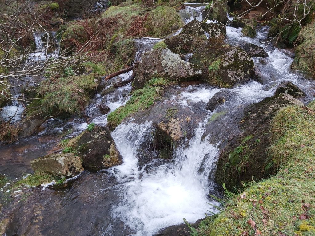
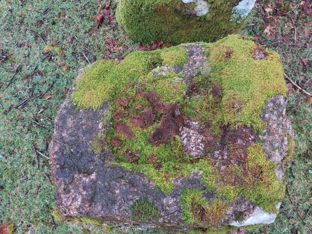
Waterfall on the Butter Brook
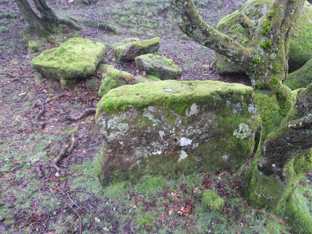
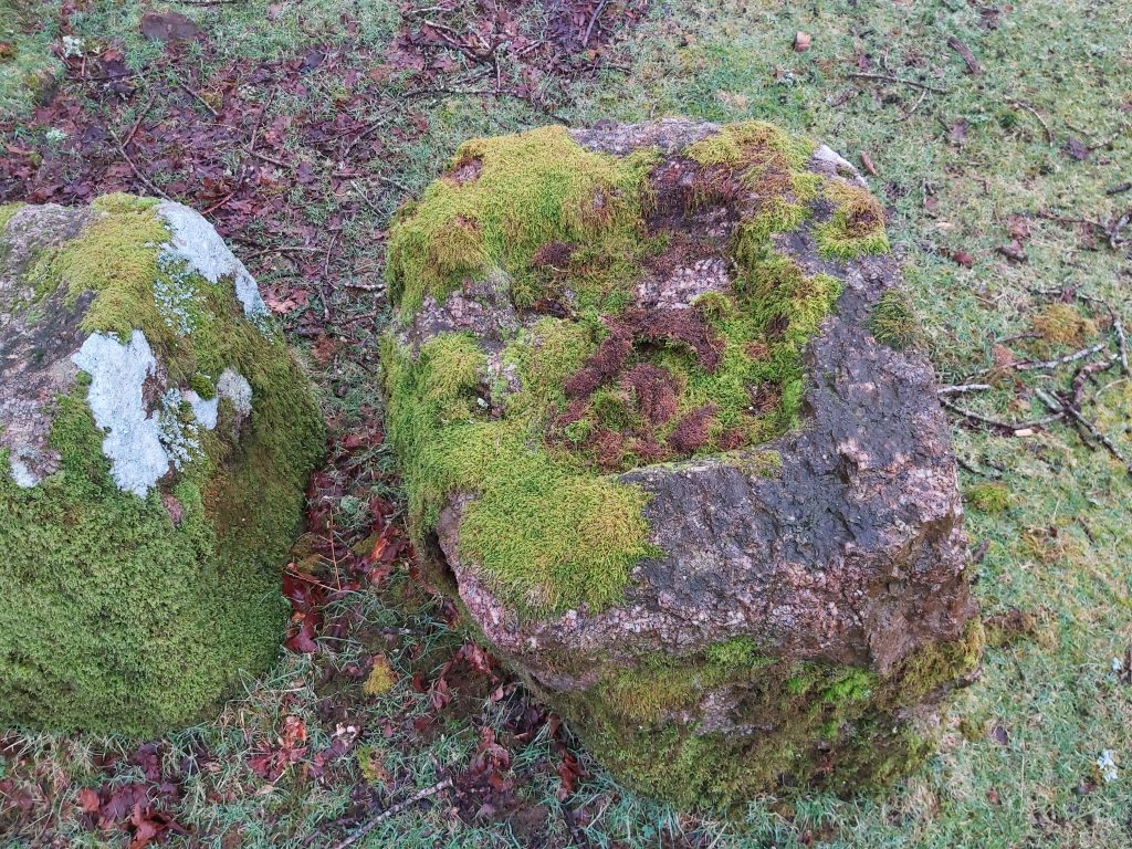
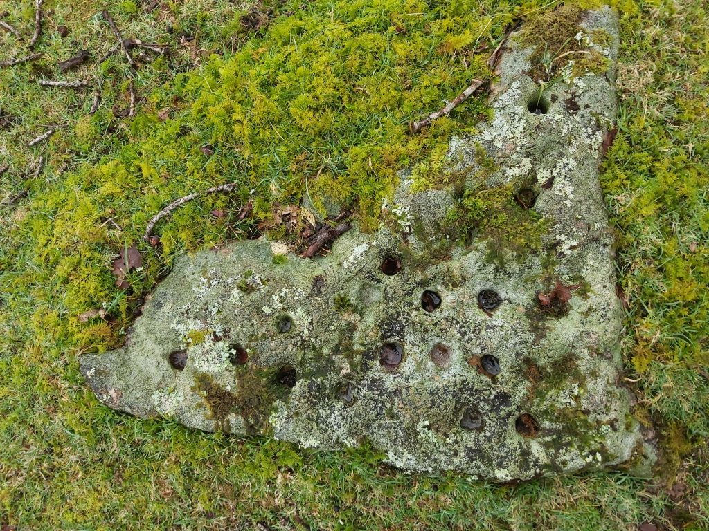
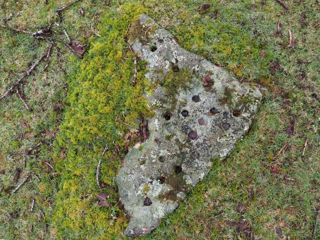
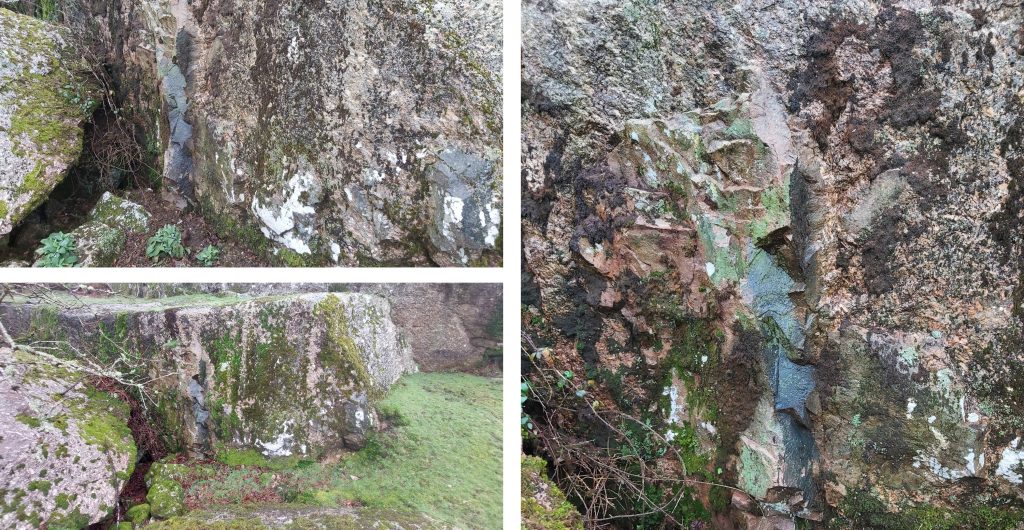
Waterfall on the Butter BrookTwo drill marks on a large block on the outer side of the Mill walling. Worth suggests these round holes were evidently sockets for the axle of some machinery. Worth continues (when discussing this Mill and others) that the axle might have been used as some kind of ‘fulcrum’ of some form of rocking beam or rollers of a flat-rod, and these may have worked the bellowsAnother drilled rock with adjacent Mortar Stone (1)Mortar Stone (1) with two very shallow depressions. This is located outside the millThis Mortar Stone (1) is located at SX64198 59212Rock with drill marks adjacent to the Mortar Stone (1)The stone has drill marks on its top and edgeUnfinished Mould StoneWorth records this partly formed mould as having dimensions of 13 1/2″ x 11 1/2″ and 1 1/2″ deep.Unfinished Mould Stone just a few metres from the north west side of the MillUnfinished Mould Stone was possibly a sample mouldA triangular ‘holed’ stone and unfinished Mould Stone beyondThis triangular stone full of holes is from circa 1916, when the building was used as a Smithy. The theories as to the use of this stone includes; where re-sharpened tools were tested, or where practising of drilling technique took place – the former is considered the most likely by the authorThe stone has 23 holes which are as recorded by the Ordnance Survey Archaeology Division around 2cm in diameter and circa 5cm deep. Worth believes ‘Jumpers’ were used on this stones. The triangular stone with the 23 holes was covered in moss when visited in February 2026Looking over the north east wall of the mill. The Mill is constructed from roughly-dressed dry walling of large stone 0.9 metres thick and up to 0.8 metres high (Ordnance Survey Archaeology Division)Tor Rocks Quarry 1 which is believed was served by the Smithy. The quarry is from 19th century and appears to have been worked in 1850-1860s (Hankin). That said, in a 2012 post (Dartmoor CAM) it is suggested that the quarry “was used only during the building of the (Butter Brook) reservoir”. The author has established that the reservoir was built circa 1915/6, but the quarries here appear on late 19th century maps and marked as ‘old’, so cannot corroberate the statement.Possible crane base at Tor Rocks Quarry 1 Tor Rocks Quarry 1 is located at SX6411 5912Tor Rocks Quarry 2 at SX6405 5904Of interest, in Tors Rocks Quarry 2 is that it was located at an important Devonian / other era geological interface. Darker veins of rock perhaps suggesting this (the author is no geologist!)