A collection of walks, discoveries, insights and pictures of exploring Dartmoor National Park
March 5, 2026
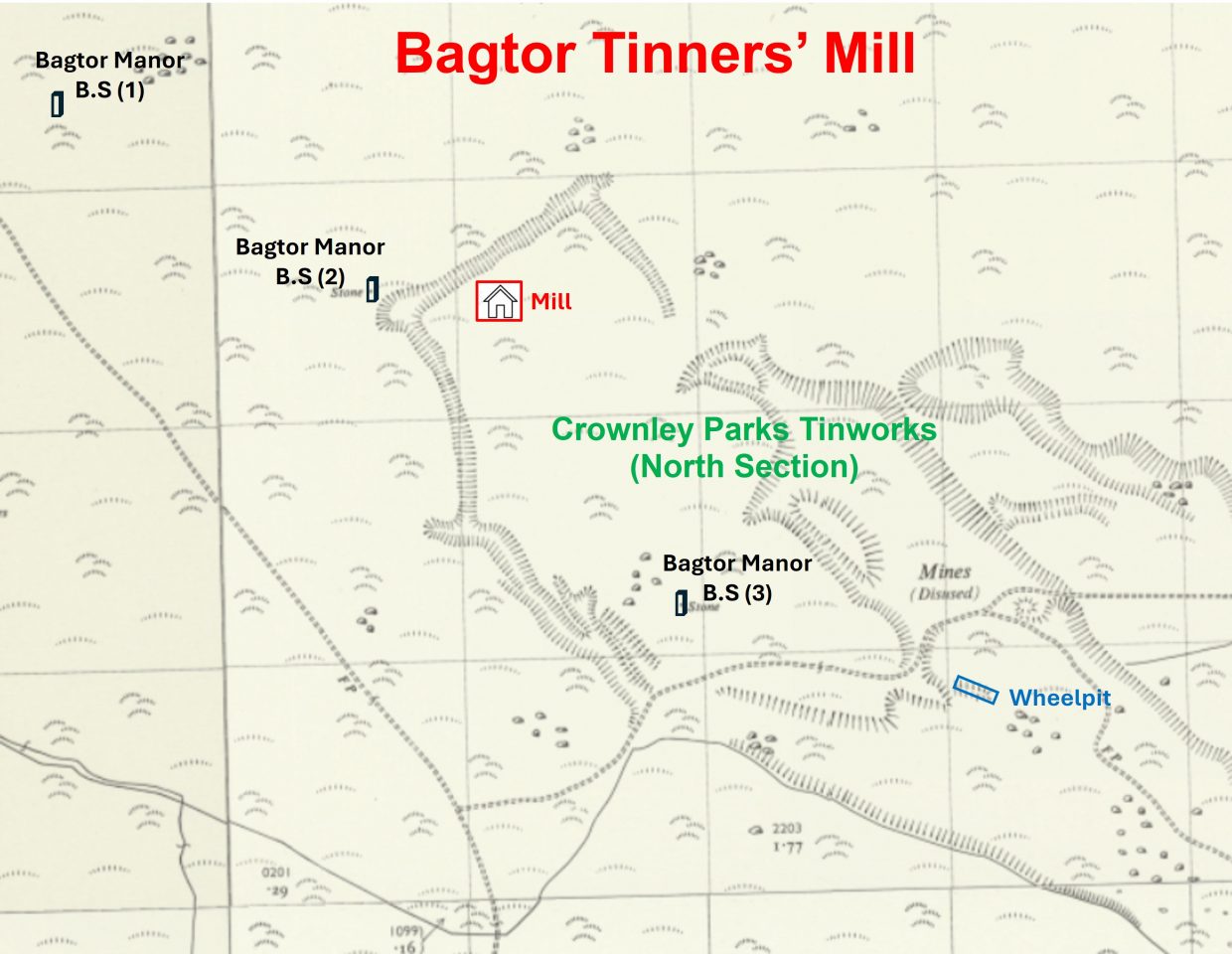
Bagtor Tinners’ Mill
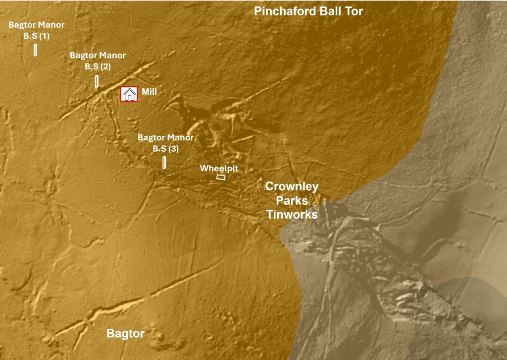
To the south of Pinchaford Ball, centred at around SX7631 7607, there is an approximate 8.5ha of tin streamworks and lode workings known as Crownley Parks. These were documented in 1690 as identified by Tom Greeves (circa 1981). These tinworkings were later reworked as an underground venture in the 19th century as part of Bagtor Mine.
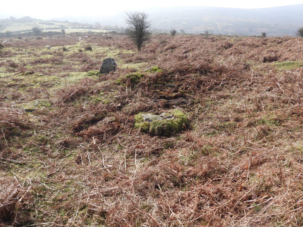
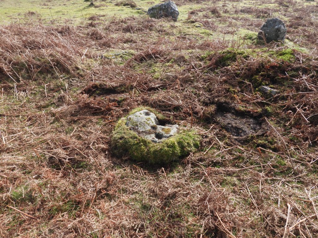
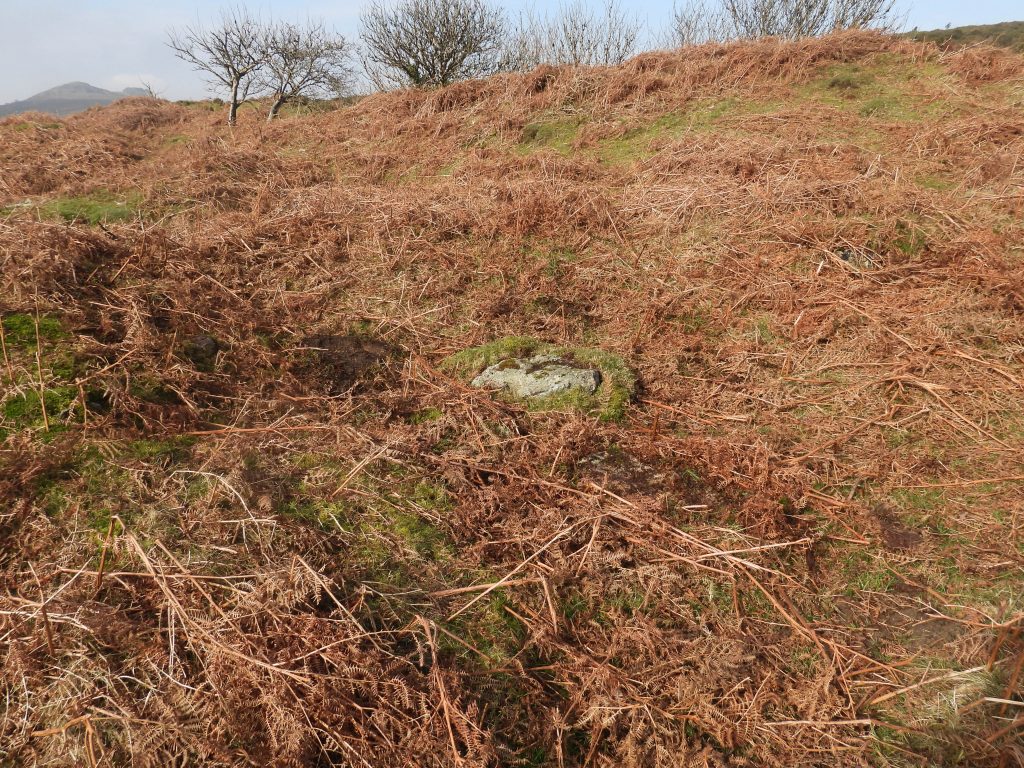
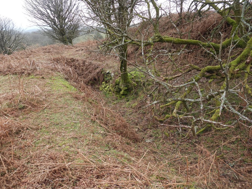
At the north west end of the Crownley Parks sett (just to the south of the narrow north east / south west lode working) is a Tinners’ Building, which has been named as Bagtor Tin Mill. It is number 5 (of 177) of locations identified by Tom Greeves in his ‘Lodges and Mills’ map published in 2016. The noun ‘Lodges’ here is as a generic term ‘for an accommodation building used by the tinners (and others) before about 1750….’. The word ‘Tynlogge’ is evident in historical documents.
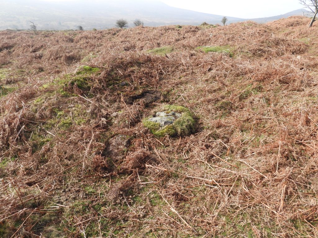
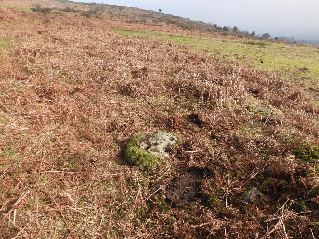
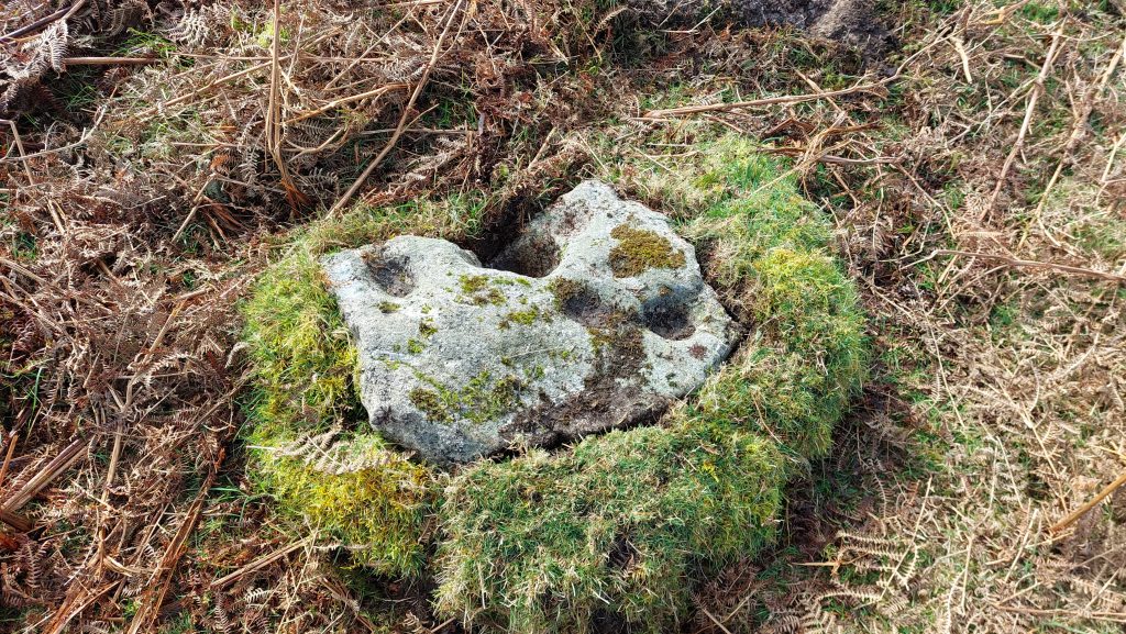
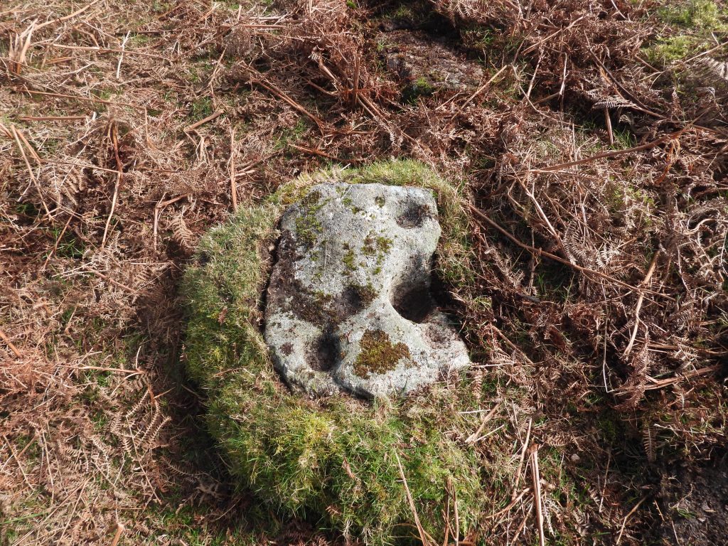
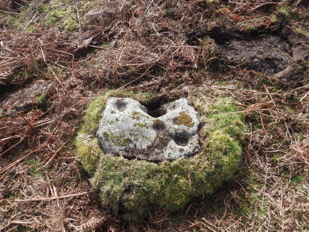
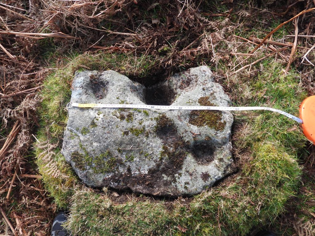
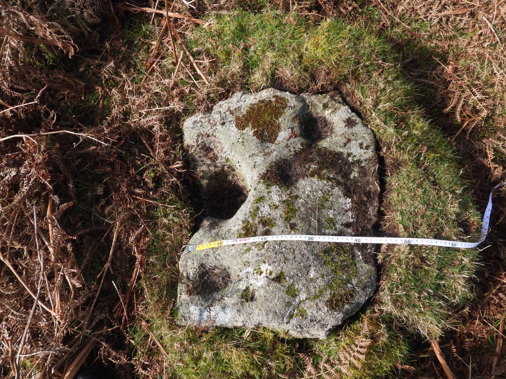
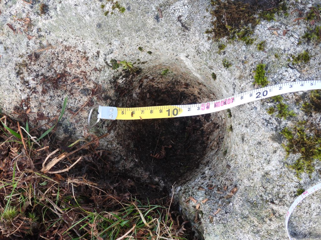
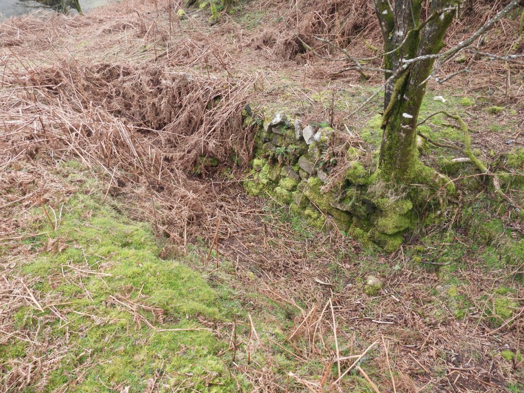
The probable reason for the designation of this building as a ‘Lodge or Mill’ appears to come from the fact that at its centre is a stone which resembles a Mortar Stone, the type found in tin Stamping Mills. That said, the hollows in the Mortar are randomly sized and randomly spaced suggesting that it might not have been associated with water powered stamps.
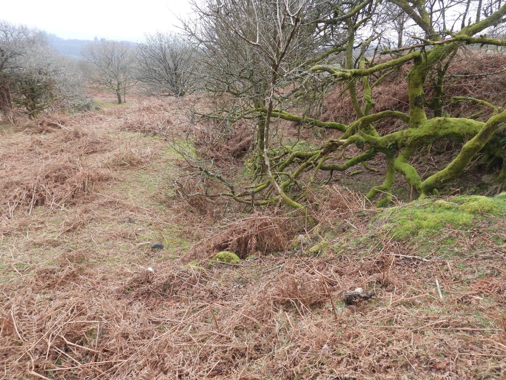
This post is a photographic summary of this ‘possible’ Tin Mill plus other features in the immediate area including three Bagtor Manor/Ilsington Parish Boundary Stones and a Wheelpit amongst the earthworks, spoil tips, workings and shafts in the Crownley Parks sett, which is likely to come from the period of Bagtor Mine in the 19th century.
Bibliography
The Tinworking Landscape of Dartmoor in a European Context – (2016) – Paper presented by Dr Tom Greeves – Lodges and Mills: The Field Archaeology of Tin Accommodation, Stamping and Smelting on Dartmoor at the conference (6th – 11th May 2016) at Tavistock – Mill number 5
T.A.P. Greeves – (1981) – The Devon Tin Industry 1450-1750: An archaeological and historical survey (Post-Graduate Thesis).
Jeremy Butler – (1991) – Dartmoor Atlas of Antiquities: Volume One – The East, 37, Map 4 (Monograph). SDV299725
Dave Brewer – (2002) – Dartmoor Boundary Markers, pages 90-101
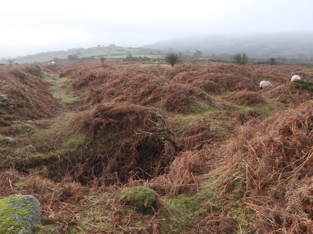
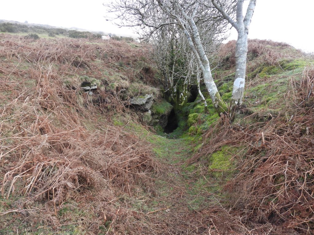
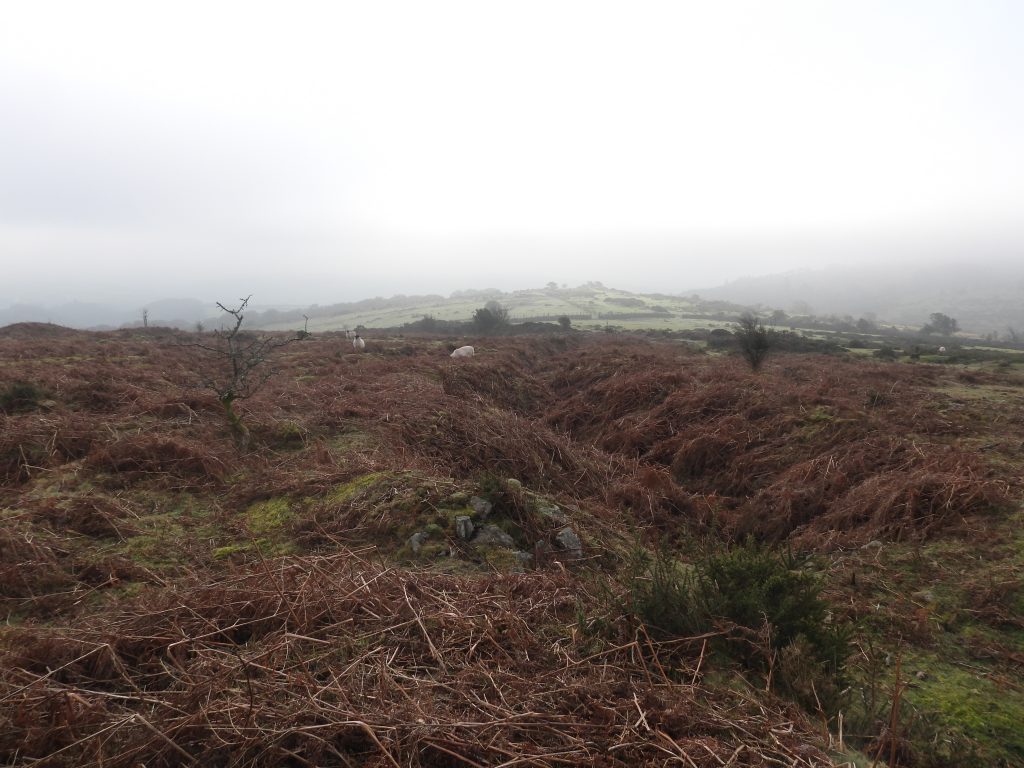
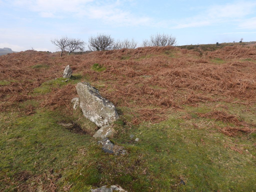
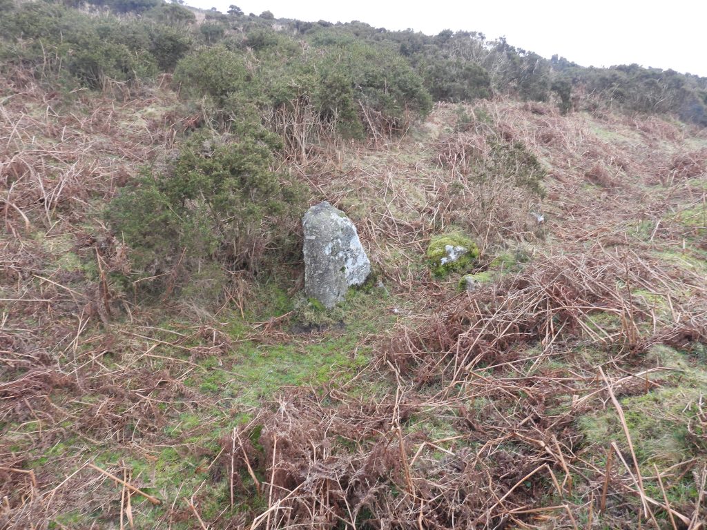
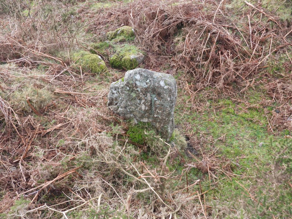
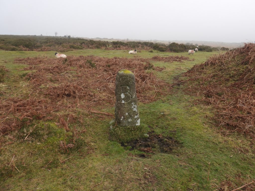
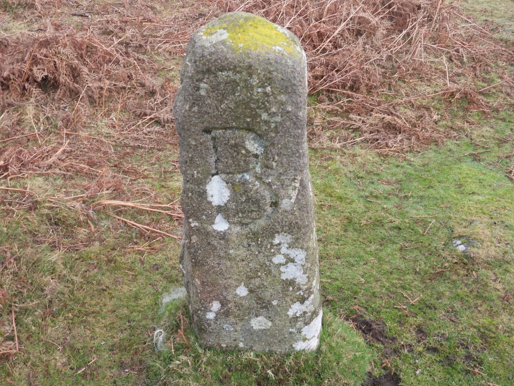
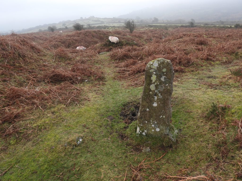
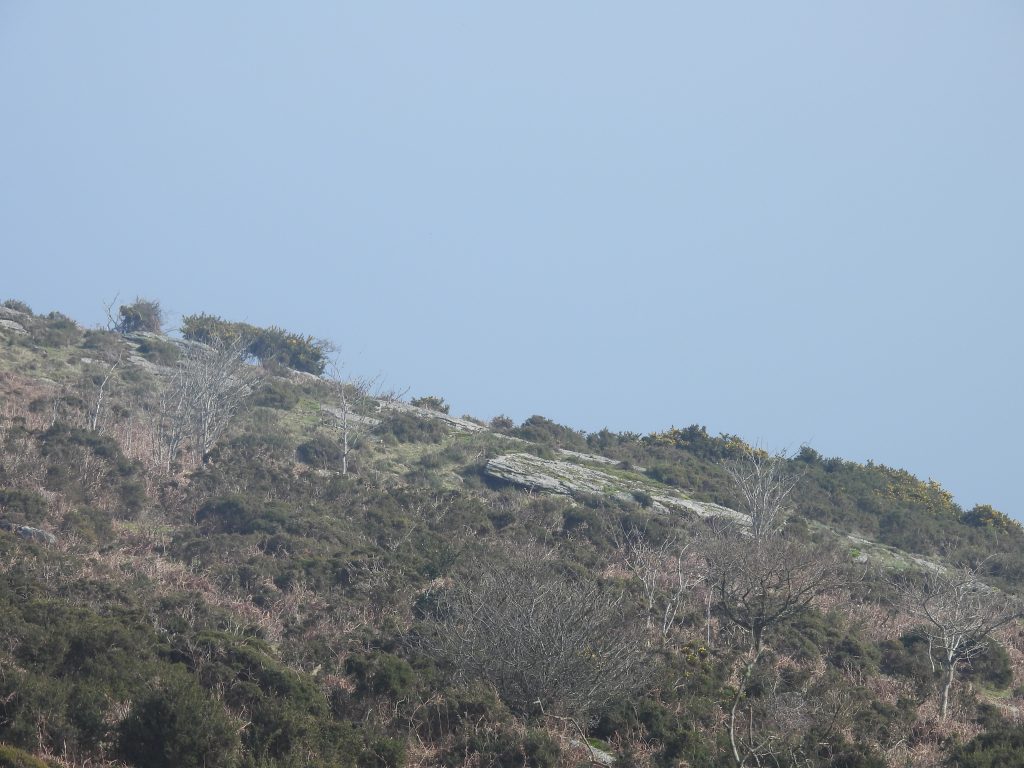
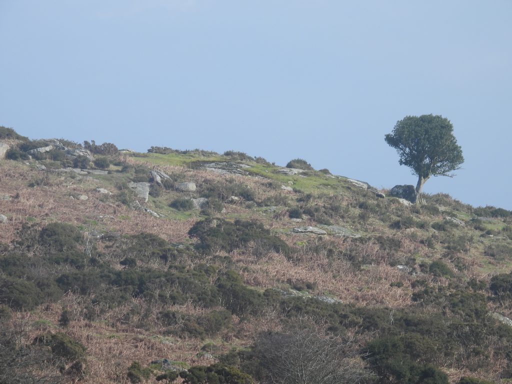
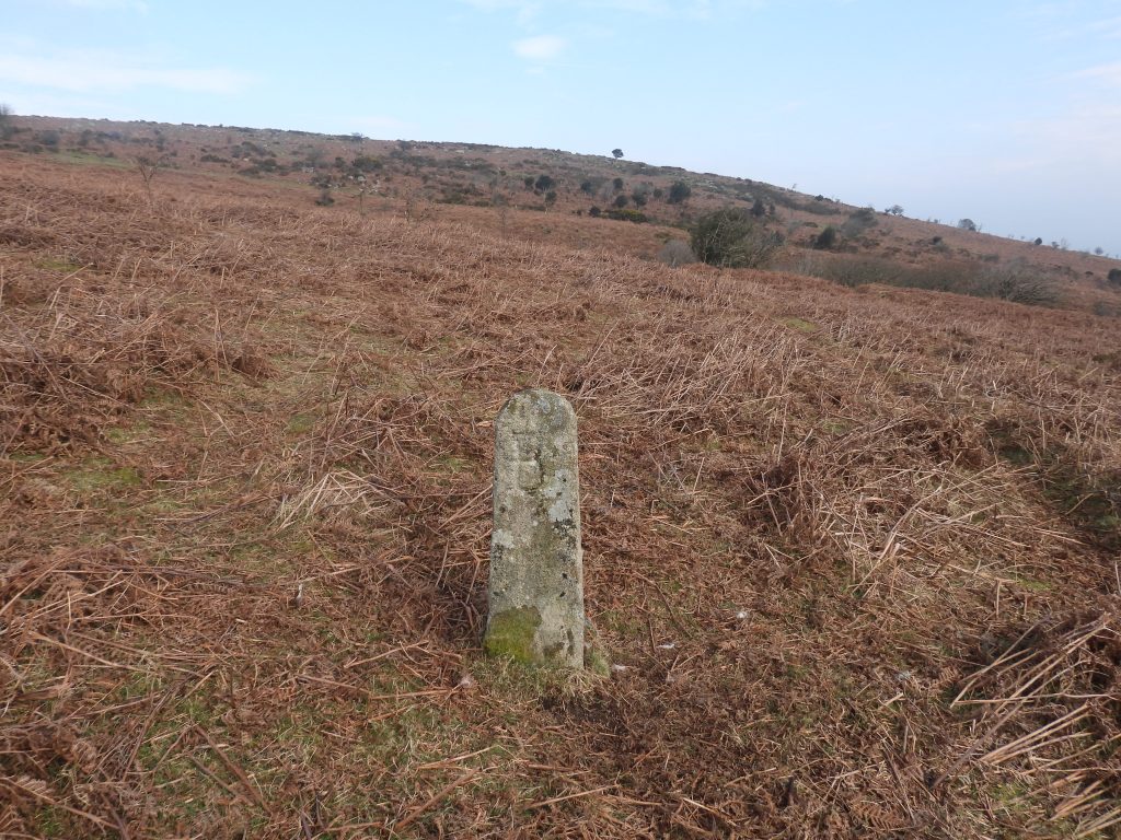
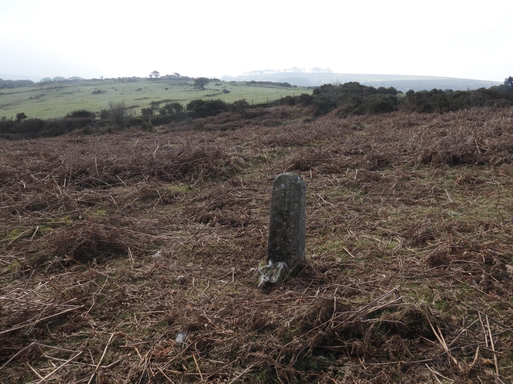
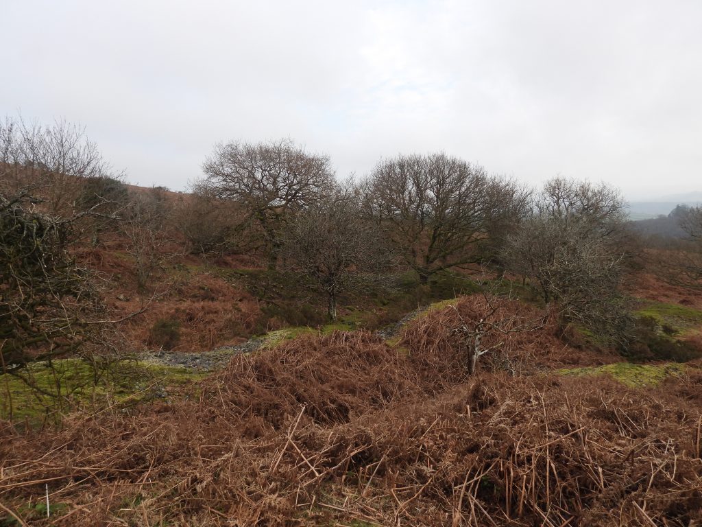
This annotated mid 20th century map shows the relative locations of the (possible) Mill, the three Bagtor Manor Boundary Stones and the 9m long Wheelpit in the Crownley Parks TinworksLiDAR plot showing the approximate 8.5ha of tin streamworks and lode workings known as Crownley Parks Tinworks. Note that the north west section (around Mill) has a striking lode working which traverses the moorland from south west to north east. To the south east, the working contain some very large linear spoil heaps and shaftsNorth west area of Crownley Parks. The area is totally swamped with bracken in the summer monthsThe small lode at the north west section of Crownley Parks which traverses the moorland at around SX7613 7627 in a south west to north east orientation. The lodes is around 100m long, is only a few metres wide in places (and 5m deep) with vertical, rock-cut sides. Jeremy Butler describes this a: “A deep narrow cleft descending at a sharp angle into the hillside. The cramped and dangerous conditions for miners working these lodes can be seen at one point where it is still 5 metres deep yet only a metre wide near the surface”The large quantity of spoil and earthworks at the north western part of Crownley ParksThe Tinners’ Building (or Mill) due to its location was once clearly associated with the tin streamworks and lode works in the immediate locale. Close by there are remnants of two shallow leat, but which do not appear to lead to this structure. There is no evidence of a Wheelpit.The Tinners’ Building / Mill has an irregular rectangle shape. There are three large stones within its centre, one of which is the ‘unlikely’ Mortar Stone. The walls are turf covered and are all less than 0.3m high. Only two corners survive – the north west and the south eastThe Tinners’ Building / Mill measures 3m by 1.8m and has an entrance opening on the south sideThe centre of the mill (at the ‘Mortar Stone’) is located at SX76118 76244. Note the two other ‘exposed’ rocks (dark areas) either side of the Mortar StoneThis view shows the contextual location of the Tinners’ Building / Mill. The trees show where the very narrow lode is located. Saddle Tor can be seen at the top left corner of the photograph. The structure is also adjacent to a shallow channel which was most likely, the edge of an old streamwork.The ‘Mortar Stone’The ‘Mortar Stone’ has seven randomly spaced, circular indentations on the upper surfaceThe deepest hollow is 16cm deep and the shallowest is 2cm. Newman records : “…..the hollows are too unevenly spaced for it to be associated with water powered stamps”. One wonders how these hollows were created. The Mortar Stone is around 60cm longThe Mortar Stone is around 45cm wideThe largest hollow is around 15cm diameter. This hollow does resemble a mortar hollow, of the type found elsewhere on Dartmoor. Perhaps a explanation for the ‘Mortar Stone’ is that is was once a larger size when a more ‘regular’ pattern may have been evidentThe Tinners’ Building / Mill is built over a prehistoric reave. The structure is located to the right (north) of the furthest stone in the reave shown in this photographBagtor Manor / Ilsington Boundary Stone number 1 (as annotated on the map in this post) is located at SX75930 76330. It is located in one of two dry leats, which are now dry and silted. The leats diverted water from the head of the north tributary of the River Sig, to tin streamworks at Crownley Parks Bagtor Manor / Ilsington Boundary Stone number 1 – ‘B’ inscription. The ‘B’ representing ‘Bagtor Manor’Bagtor Manor / Ilsington Boundary Stone number 1 – ‘I’ inscription. The ‘I’ representing Ilsington ParishBagtor Manor / Ilsington Parish Boundary Stone number 2 (as annotated on the map in this post) is located at SX76068 76251. This Boundary Stone is one of a line of inscribed boundary stones and rocks which extend between the Becka Brook and Crownley Parks. They mark the boundary of the Domesday manor of Bagtor (‘Bagathora’). The date when the bounds were first marked is unknown. That said, the three Boundary Stones in this post were amongst eight which were erected in 1835, to strengthen the line of the bounds.Bagtor Manor / Ilsington Boundary Stone number 2 – ‘B’ inscriptionBagtor Manor / Ilsington Boundary Stone number 2 – ‘I’ inscriptionZoomed in view of Pinchaford Ball Tor from near the Mill. The tor is located at SX7638 7642Pinchaford Ball Tor is also known as Punchaford Ball Tor or Bynchen Ball (Source: Tors of Dartmoor website)Bagtor Manor / Ilsington Boundary Stone number 3 (as annotated on the map in this post) is located at SX76200 76117. ‘B’ inscription with Pinchaford Ball Tor beyondBagtor Manor / Ilsington Boundary Stone number 3 – ‘I’ inscription. Bagtor can be seen on the near horizonPart of the southern half of Crownley Parks sett is up to 6m deep workings and contains some very large linear spoil heaps.
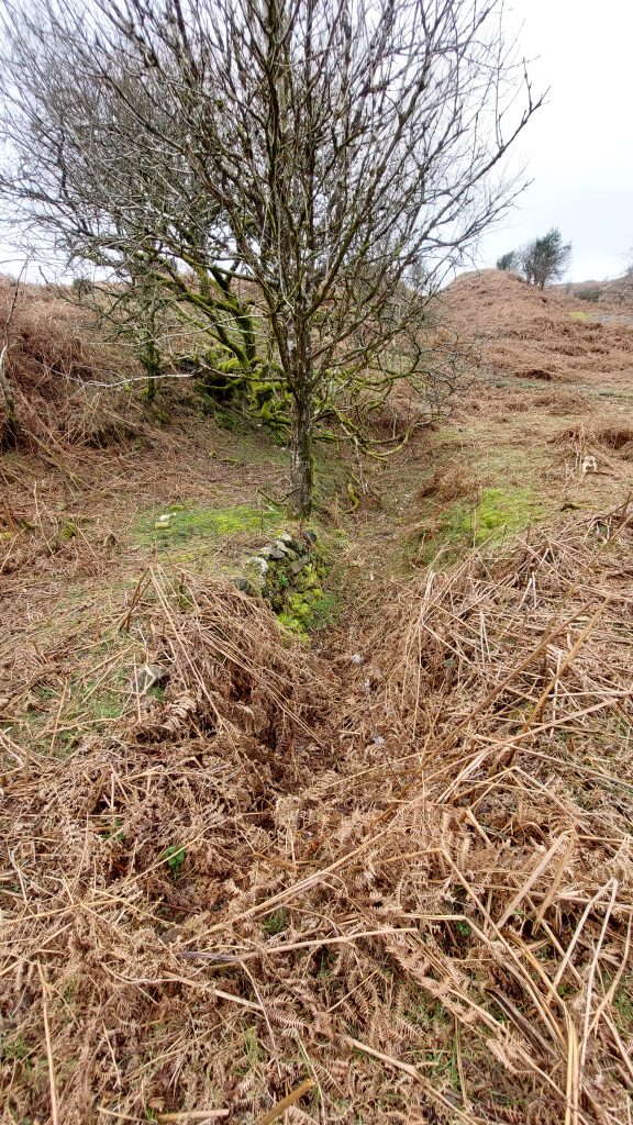
In the southern part of Crownley Park sett there is another industrial archaeology artefact. This Wheelpit is sited on more or less level ground around 40 metres south-west of a shaft in the Crownley Parks sett of Bagtor Mine.
The Wheelpit is around 9m longThe wheel here would have been around 30ft in diameter and have been used for pumping purposesThe Wheelpit at its south east end has remains of some drystone walling. It is located at SX76307 76091