A collection of walks, discoveries, insights and pictures of exploring Dartmoor National Park
June 22, 2026
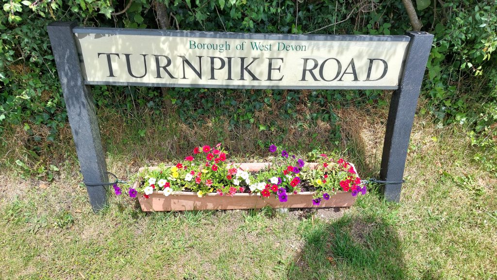
Whiddon Down – Turnpikes and the Royal Post
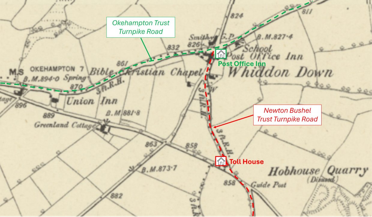
The hamlet of Whiddon Down lies on the old east–west A30 (former Okehampton Trust Turnpike) road, between Exeter and Okehampton in the Parish of Drewsteignton. Coming up from the south to the hamlet is the A382 (Newton Bushel Turnpike) road from Bovey Tracey.
The ‘down’ itself is a ridge of high farmland some 800 feet (around 244m) above sea level with superb views. The hamlet was recorded as Whyddon Doune in 1535 and then as Whiddon Downe in 1661. It is named after its medieval landowners, the Whiddon family from nearby Chagford.
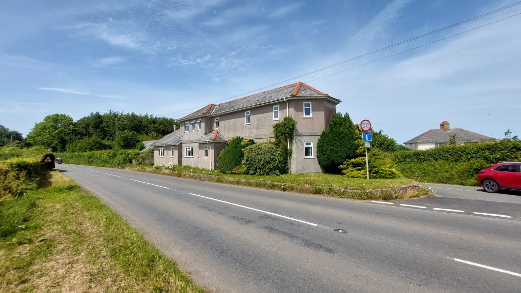
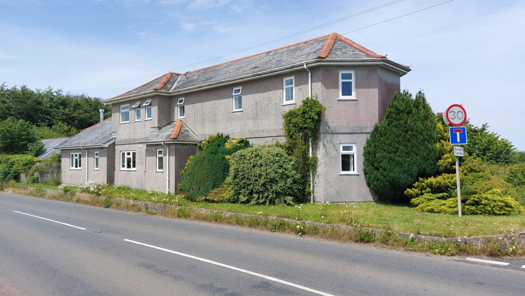
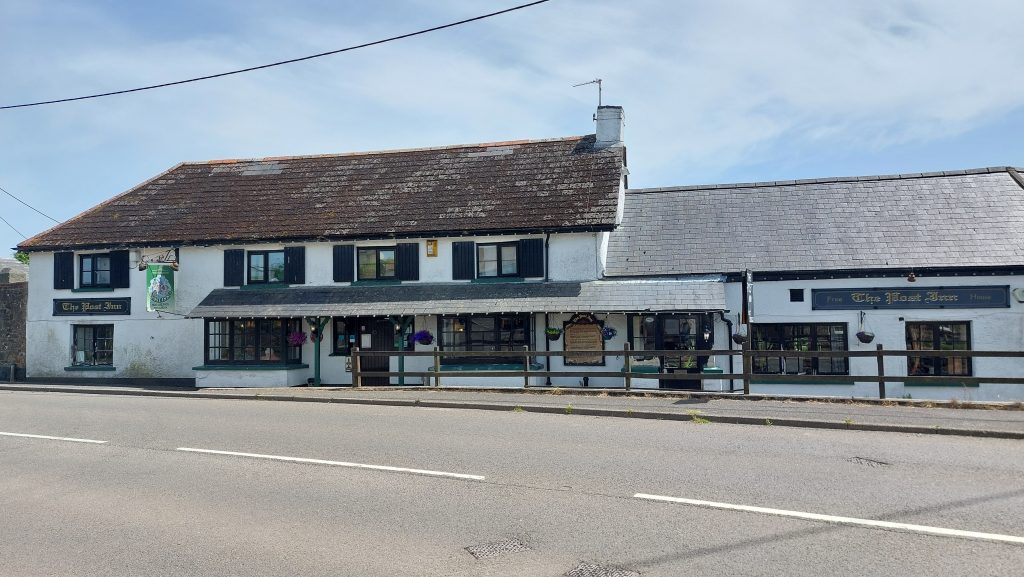
This post covers two features in the hamlet, firstly the Toll House on the former Newton Bushel Turnpike Road which dates to circa late 1820’s and the Post Inn, which dates to 1516 in the centre of the hamlet, which is located on the old A30
Bibliography
Tim Jenkinson – (2005-2025) – Old A30 Launceston to Exeter (Report – Survey). SDV323480
Tim Jenkinson & Patrick Taylor – (2009) – The Toll Houses of South Devon, page 99
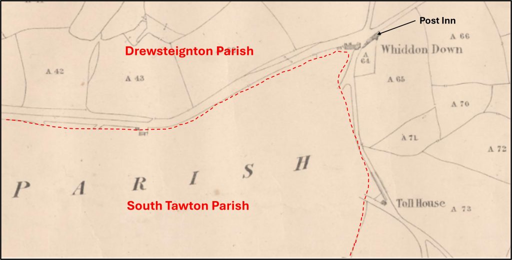
This annotated 19th century map, shows the locations of the two features covered in this post and the respective roads they are located alongsideNote that the ‘Toll House’ is depicted on the Tithe Map (Drewsteignton 1). The surveyor of the Tithe (1840) was William Joll, Plymouth and Geo. Murphy. The Tithe Map also depicts the Post Inn (as a long, narrow building is alongside the road junction), when at a time there was little else at Whiddon Down. The former Whiddon Down Toll House is thought to have been built circa 1826 for the Newton Bushell (Newton Abbot) Turnpike Trust. In 1826 the Turnpike Trust took over the running of the road, along the 12 miles from Bovey Tracey to Whiddon Down. It was a poorly maintained stretch and was prone to flooding. The Exeter Flying Post (ref: Jenkinson / Taylor) stated that the Turnpike Trust failed to make any significant improvements until 1834The former Toll House building takes the form of a lodge house with an angular front, but has been substantially altered over the last 200 years. In ‘The Toll-houses of South Devon, Jenkinson & Taylor record that according to the 1871 census the ‘toll collector’ was 69 year old Agnes Counter (an ironic surname) and was the sole inhabitantThe ‘Turnpike Road’ which is adjacent to the Toll House. It is now a ‘no through road’ leading to the centre of the hamletThe Post Inn lies on the old A30 (Launceston to Exeter) which was set up at various times by the three Turnpike Trusts that managed it (Jenkinson), viz; from the west, the first six miles of the old A30 in Devon, as far as Combebow, came under the remit of the Launceston Trust; the road then passed to the Okehampton Trust who managed a lengthy stretch as far as Crockernwell (to the east of Whiddon Down); finally it became the responsibility of the Exeter Trust. The Inn dates to 1516 and historically was part of Henry VIII’s ‘line of posts’, which was the forerunner to the Royal Post service
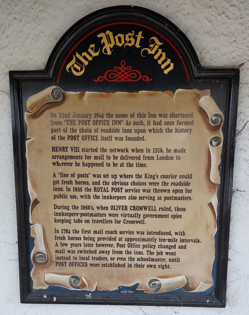
A sign on the side of the Post Inn building provides the summarised history of the Post Inn, which was formerly the Post Office Inn. It once formed part of a chain of roadside inns upon which the history of the Post Office was founded. The Post Inn is thought to date to the 16th century (1516), after Henry VIII started a network for mail to be delivered around the country, when a series of posting houses were set-up so the King’s Couriers could get fresh horses. In 1635 the Royal Post Service was opened up for public use with the innkeepers serving as postmasters. In 1964 the name of this inn changed to the Post Inn. Writing in 1992 (Dartmoor Inns), Tom Quick recorded : “The building has expanded over the years with the acquisition of the adjoining cottages, part of which form the public bar at one end, and dining room at the other. The original building now houses the lounge bar and a section of the dining room”.
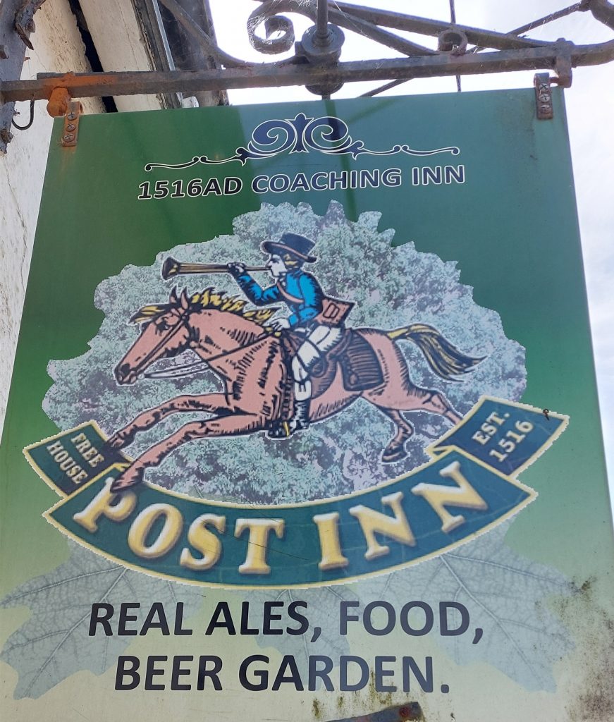
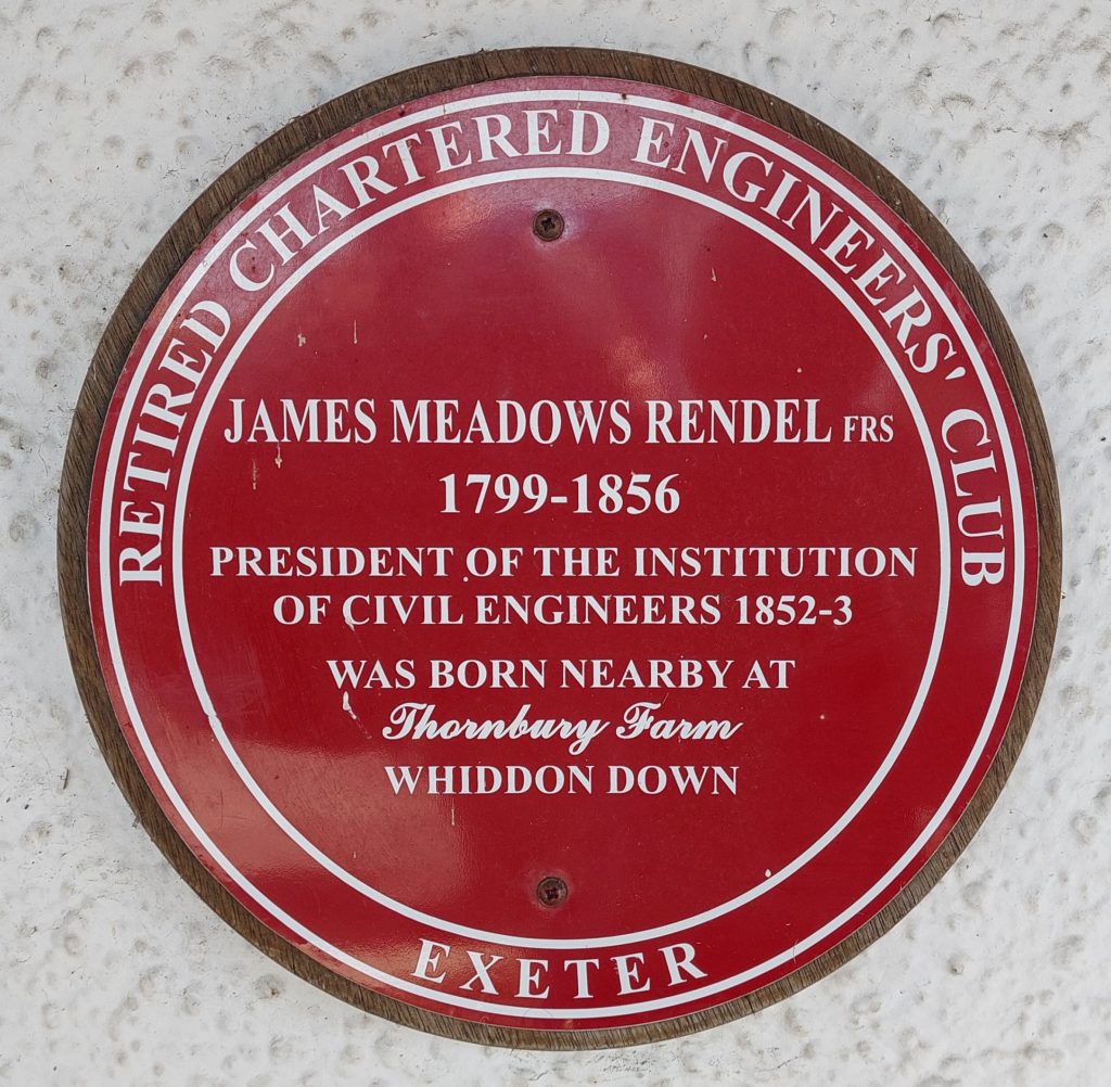
The Post Inn pub sign showing the date 1516Of interest is this sign mounted on the wall at the Post Inn. James Meadows Rendel (December 1799 – November 1856) was an Civil Engineer, whose projects included: in the 1826 bridge over Bowcombe Creek on the Kingsbridge Estuary; in 1824 when he was employed by the Earl of Morley to make a bridge across the Cattewater, an estuary of the Plym; in 1831 when he introduced a new system of crossing rivers by means of chain ferries worked by steam; in 1832 he constructed a floating bridge on this principle, crossing the Dart at Dartmouth; in 1836–37 he designed, as a terminus to the Great Western Railway, the Millbay Docks, Plymouth; and in 1839/40 when he was engaged in preparing schemes for a railway between Exeter and Plymouth, running over central Dartmoor. The author has studied the Rendel plans for the central Dartmoor railway and will be producing a post on this website in the near future.