A collection of walks, discoveries, insights and pictures of exploring Dartmoor National Park
June 21, 2026
Bradford (Bradmere or Beechmere) Pool Streamworks / Wheal St. Ann
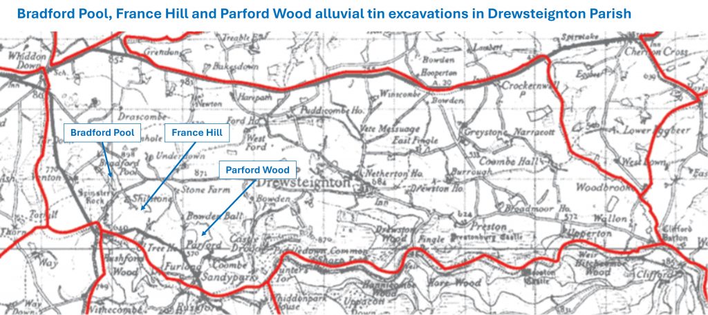
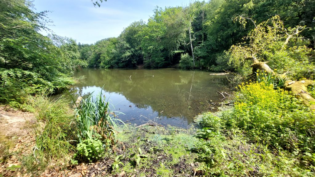
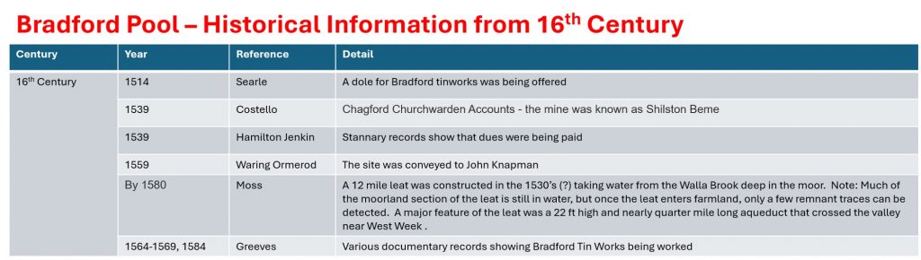
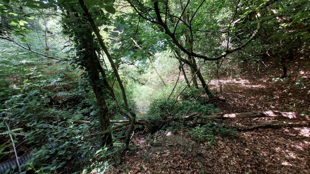
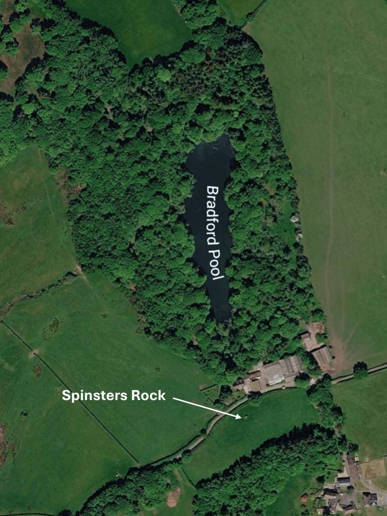
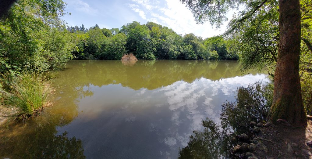
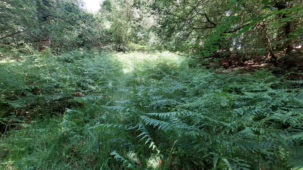
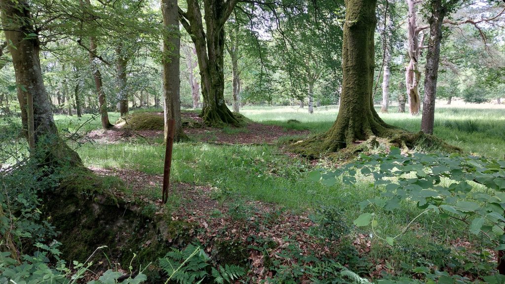
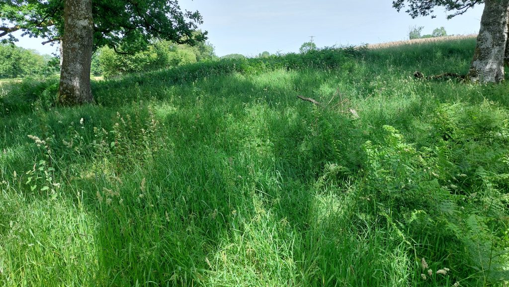
In the parish of Drewsteignton (which generally has limestone deposits rather than mineral), there are three large alluvial tin excavations at Bradford Pool, France Hill and Parford Wood. These deposits sit on the edge of the granite and metamorphic aureole (Hornfelised Culm formation). Of the three, Bradford Pool is the largest covering upwards of over five acres being deepest on the steep eastern side with large areas of stream working on the western side. The flooded opencut measures circa 90 metres by 250 metres and 30 metres deep and was formed by a blocked drainage adit. The main period of (tin) extraction would appear to be the 16th century (1514) to the beginning of the 18th century (1701), with a period of closure between 1641 and 1687, most likely as a result of the English Civil War.
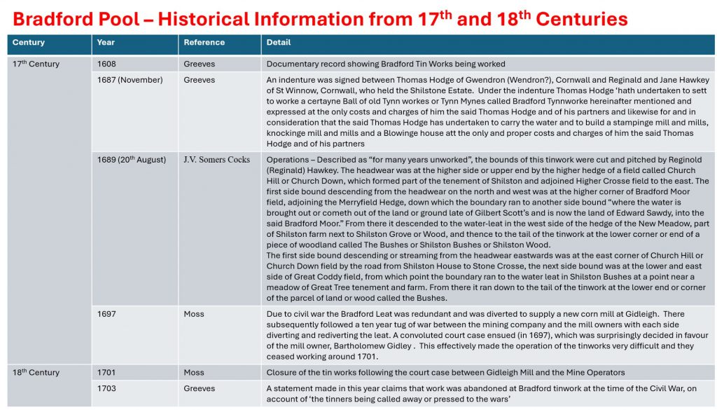
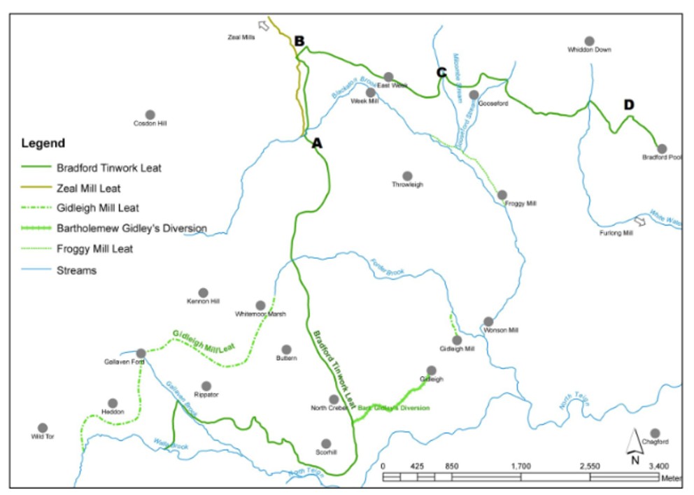
During its’ operational period , the tin working required a constant supply of water and to affect this a 12 mile leat (the longest on Dartmoor) was constructed in the 16th century taking water from the Walla Brook deep in the moor. The water was necessary to power machinery to process the ore and drain the workings and the leat cost was £1,500. Following Civil War and towards the late 16th century the leat became redundant and consequentially was diverted to supply a new corn mill at Gidleigh. There subsequently followed a tug of war between the mining company and the mill owners with each side diverting and rediverting the leat. A convoluted court case ensued in 1697, which was surprisingly decided in favour of the mill owner, Bartholomew Gidley effectively made the operation of the tinworks very difficult and they ceased working around 1701.
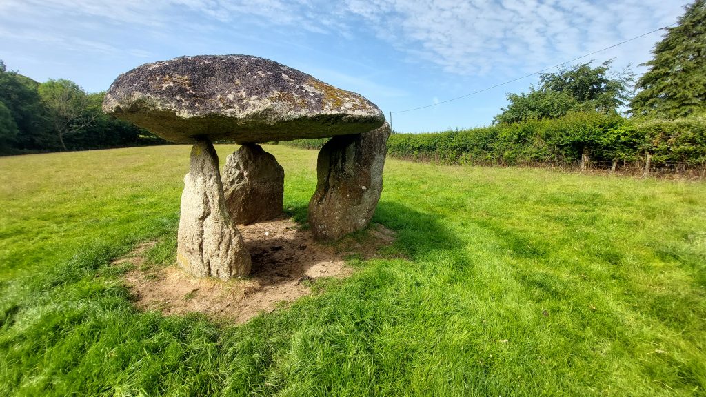
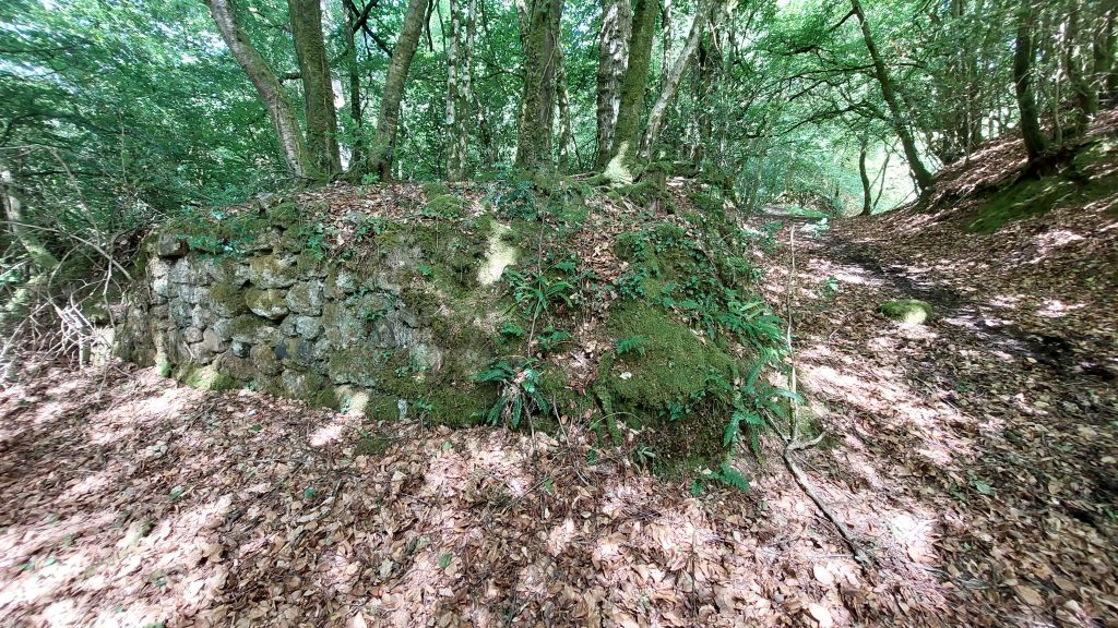
The story continues in the late 18th century when in 1789, the Rev. John Swete (as recorded by Worth) commented that the tinwork had lain idle for a considerable time and was “a vast hollow excavated through a succession of ages by miners’. Swete stated that there had been an accumulation of water due to the collapse of the drainage adit, which had resulted in an accumulation of water. However, the old drainage adit which was driven beneath the hill (‘on the Cromlech’ – Spinster’s Rock side) had been cleared in 1783 (ref: Sherbourne Mercury). Therefore, at the time of Swete’s visit the excavation was likely to have been dry.
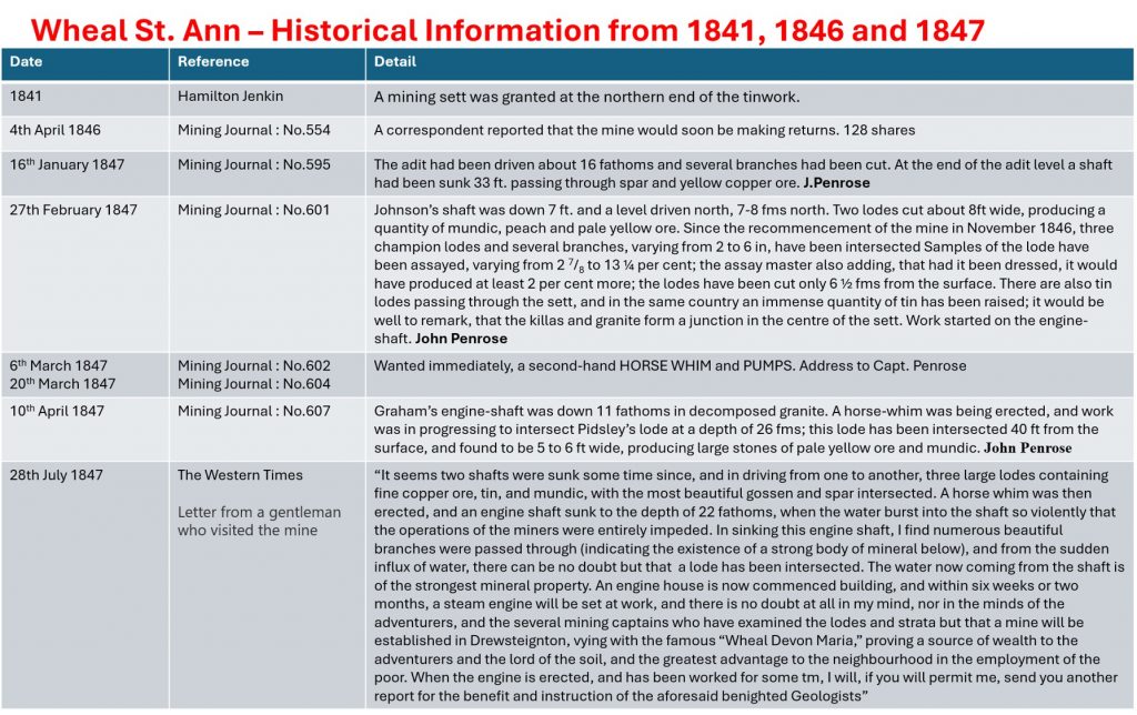
Hamilton Jenkin records that in 1841 a mining sett was granted at the northern end of the tinwork. He adds that two prospecting shafts were sunk to a depth of 40ft and short drives extended on three lodes carrying tin, together with small branches assaying 2.9 to 13.5 % copper. By 1846 the mine working had recommenced by a Bristol company who named the sett Wheal St Ann.
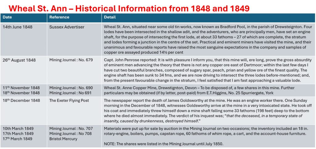
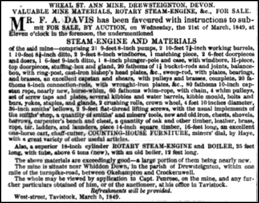
By 1848 the principal shaft at Wheal St. Ann was 34 fms (204 ft) deep and an 18” cylinder rotary steam engine had been erected, with a horse whim for hoisting. The lodes at this depth were said to contain some ‘excellent copper ore as well as tin, with a mixture of silver’. At some time prior to 1848, the adit referred to by Swete had again become choked and Samuel Rowe who visited the mine had once more found a pool. Little development was carried out at the mine and finally on 21st March 1849 the mine materials were auctioned for sale at Tavistock. This ended 350 (elapsed) years of mineral extraction at the site.
Bradford Pool lies on private land. The pictures in this post were taken during a Dartmoor Tinworking Research Group (DTRG) field trip in June 2026, thanks to permission sought from the owner of Higher Shilstone.
Bibliography
A.K. Hamilton Jenkin – (2005) – Mines of Devon, pages 106/107
L.M. Costello – (1981), The Bradford Pool Case; Devonshire Association reports and transactions 113, Page(s) 58-77.
Tom Greeves – (1981) – The Devon Tin Industry 1450 -1750
Tom Greeves – (1992) – Journal Trevithick Society. 19. p6
M.W. Moss,– (2015) – The Bradford Tinwork Leat and Its Route: Through Enclosed Ground, 155-184 (Article in Serial). SDV361921
D.Cranstone and I.Hedley – (1995) – Monuments Protection Programme: The Tin Industry Step 3 Site Assessments, 59, Devon 65 (Report – non-specific). SDV357946.
H.Wreford & M.Williams – (1985) – Mysteries in the Devon Landscape, Bossiney Books, St. Teath.
Mining Journals – 4th April 1846; 16th January 1847; 27th February 1847; 6th March 1847; 20th March 1847; 10th April 1847; 26th August 1848; 11th November 1848; 18th November 1848; 10th March 1849; 17th March 1849
G. Waring Ormerod – (1866) – On the Traces of Tinstreaming in the Vicinity of Chagford; Transactions of Devonshire Association
Western Times, July 28th 1847
Sussex Advertiser, June 14th 1848
The Exeter Flying Post, December 14th, 1848
The Bristol Mercury, March 17th, 1849.
Legendary Dartmoor Website
Samuel Rowe – (1985) – A Perambulation of Dartmoor, Pages 119-121
Searle – Pers. Comment
Tony Hill – (June 2026) – Pers. Conv.
Stephen Holley – (June 2026) – Pers. Conv.
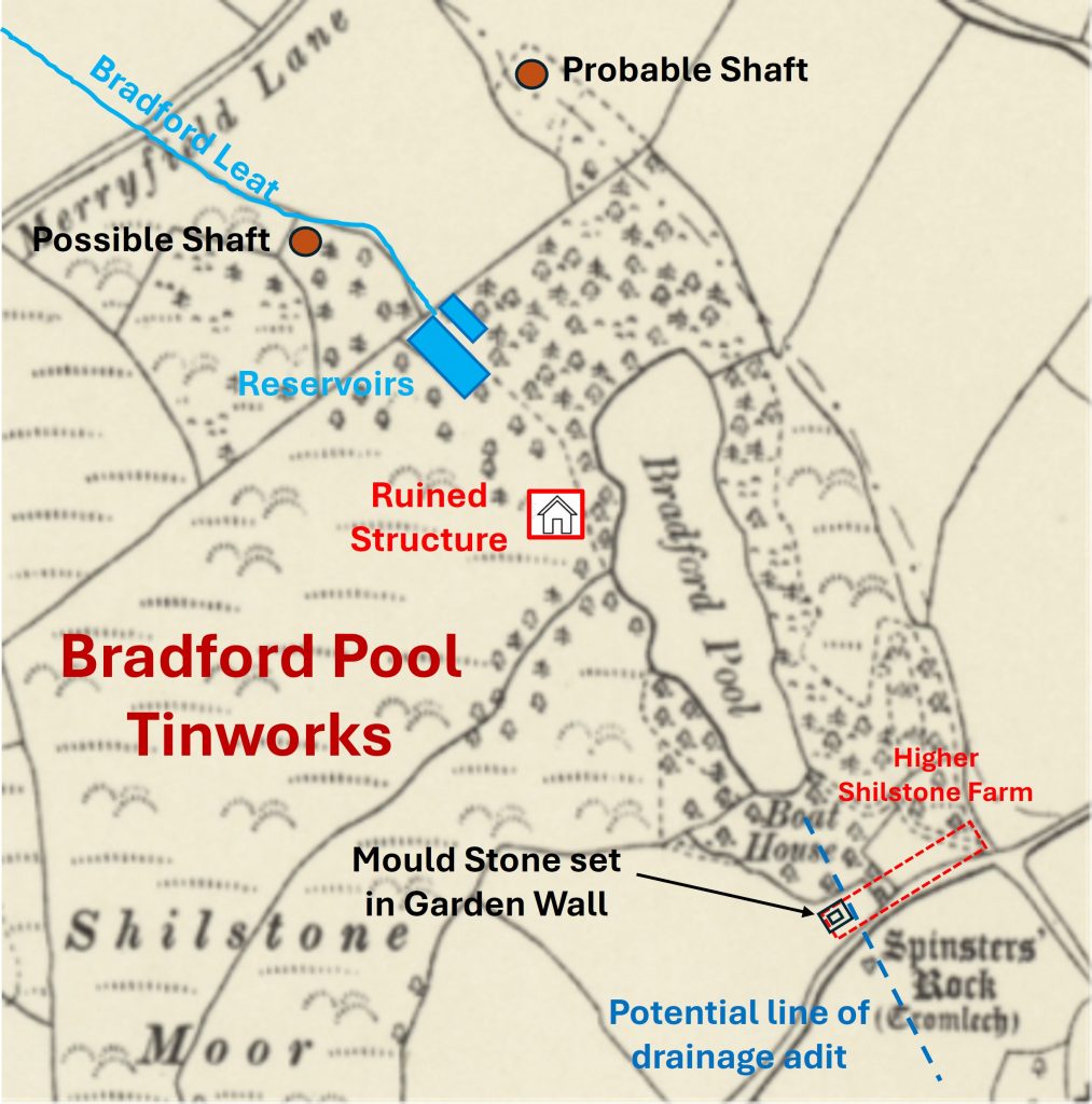
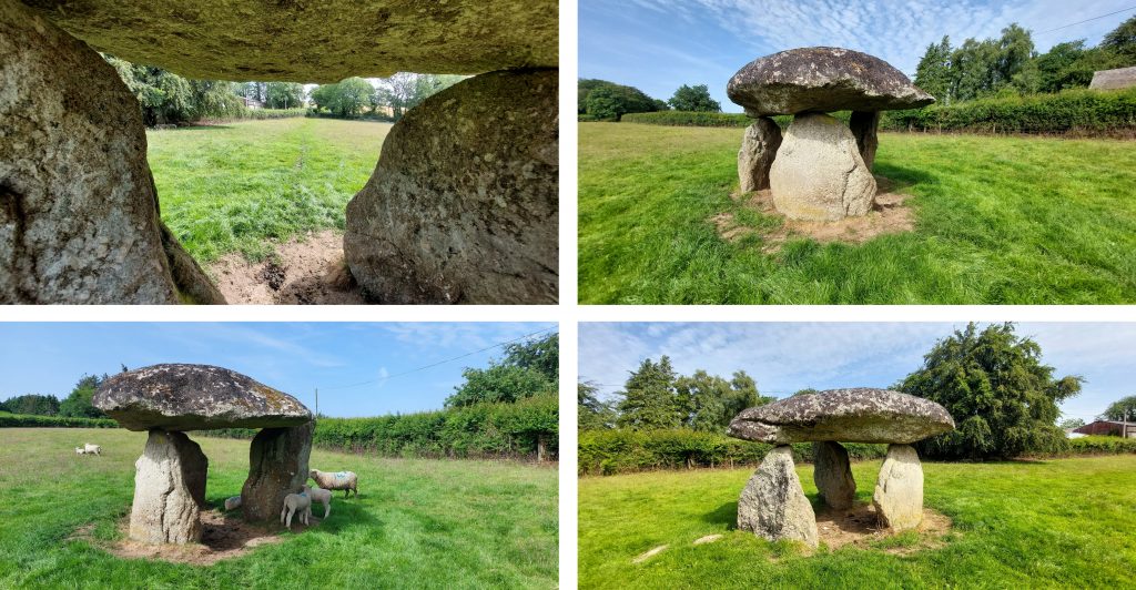
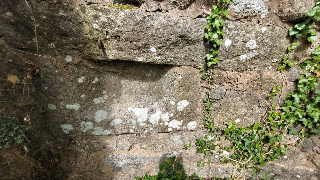
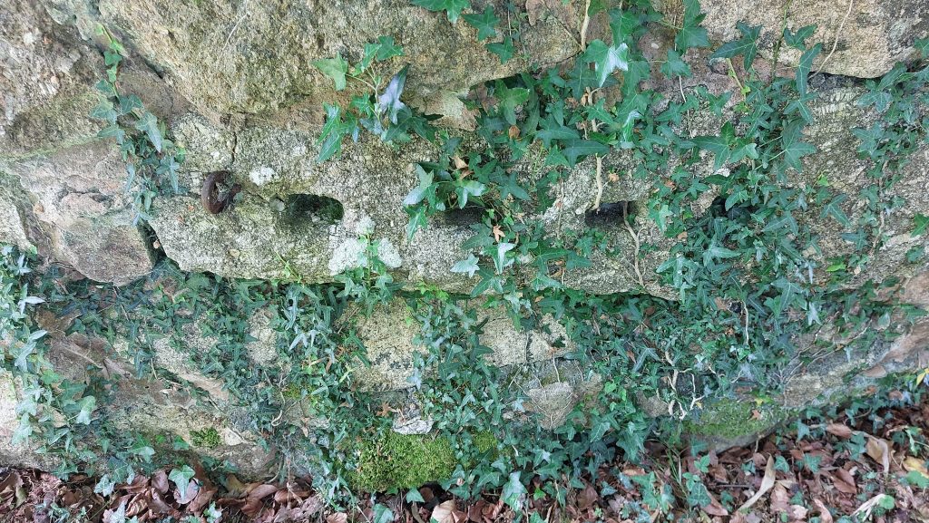
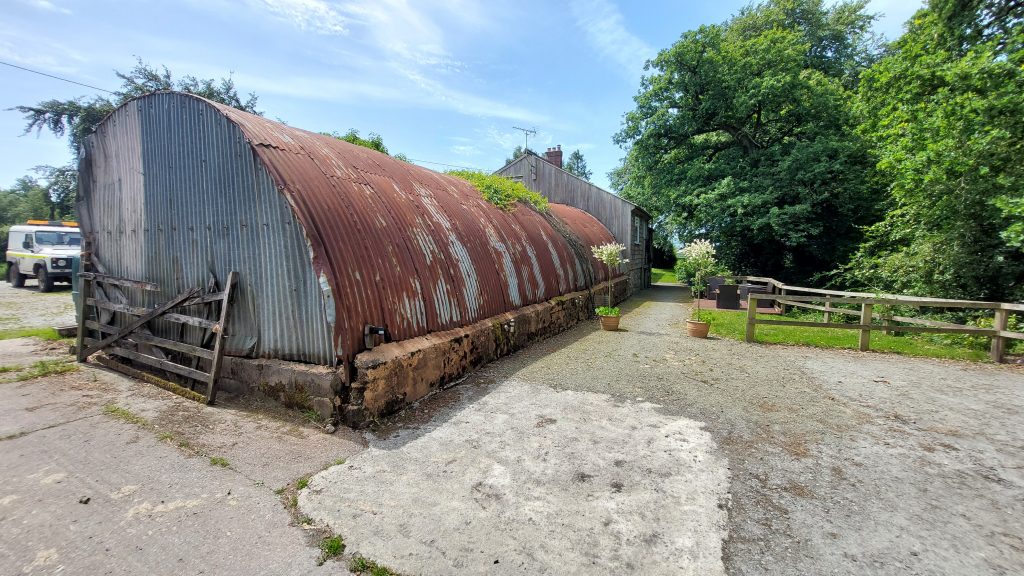
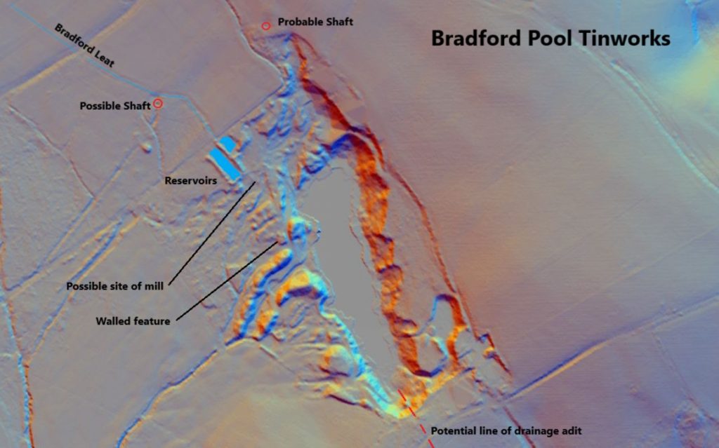
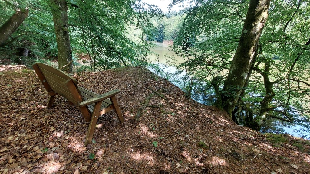
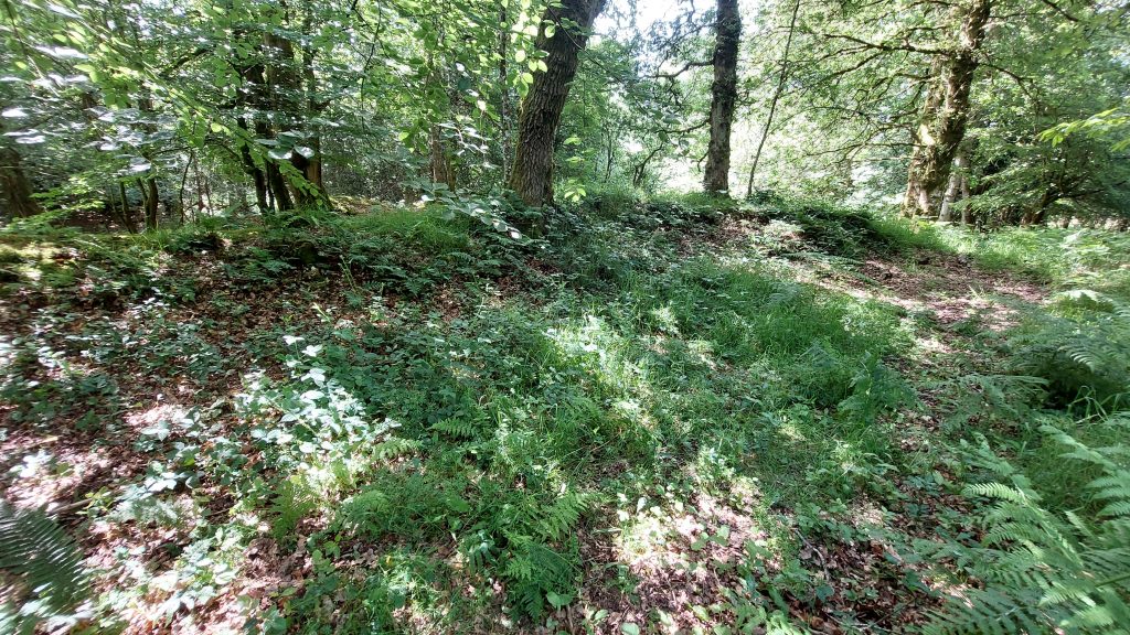
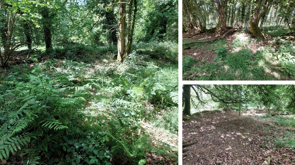
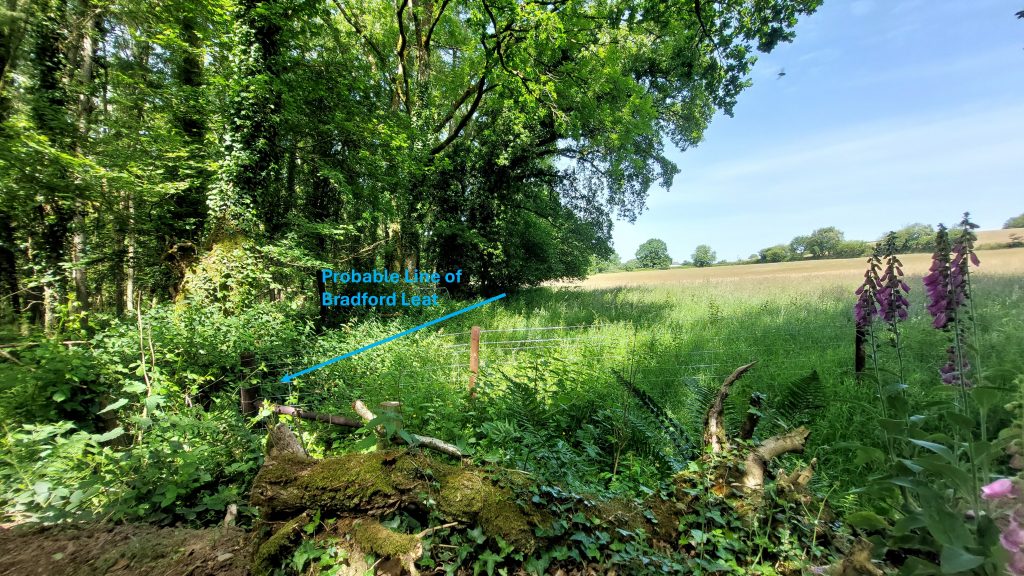
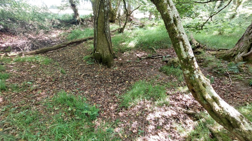
19th century annotated map showing the locations of the key features covered in this post. Higher Shilstone Farm is a 20th century constructionThe locations of the three large alluvial tin excavations at Bradford Pool, France Hill and Parford Wood in Drewsteignton ParishSpinsters Rock lies just to the south of Bradford Pool. It is thought that the old drainage adit which was driven beneath the hill on which this ‘Cromlech’ stands. There are several legends surrounding these stones. The main legend is where the three ladies (wool ‘spinners’ not ‘spinsters’) set out to take their spun wool to the local ‘jobber’ (wool trader). They passed the stones, which had fallen and they decided to spend some time re-erecting three granite slabs. The Spinsters (Spinners) capped them with a huge granite slab leaving us with the name ‘Spinster’s Rock’ Spinster’s Rock is a Neolithic chambered tomb, known as a Cromlech to the Victorians. The stones had collapsed in January 1862 and were re-erected later that year (but not by ‘Spinner’s or ‘Spinster’s). Aside the Bradford Pool tinworks adit running beneath the tomb, another link to Bradford Pool is through Colonel Hamilton Smith, a 19th century antiquarian who was obsessed with Druids and he contested that Bradford Pool was a man-made ritual centre constructed to remember the great deluge when Noah’s Ark ended up on Mount Ararat and Cromlechs were Arkite Cells (as in Noah’s Ark). He surmised another legend about the stones insofar that the erection of the Cromlech was down to three young men and their father, who came down from the heights of Dartmoor (as in Noah and his three sons). More about Hamilton Smith later in this postMould Stone in the garden wall of Higher Shilstone. Hicks (1982) records this as a “Cornish type mould of c.1690 built into wall near Bradford Pool”. Note the Gate Post above the Mould Stone with a piece of iron furniture. The tin ingot would have been around 200 lbs Slotted Gatepost on opposite of wall to the Mould StoneAnderson Shelter at Higher ShilstoneBradford Pool, site of a very large alluvial tin excavation. The excavations have been flooded since late 18th century. The author has variously seen the area of the pool being described at 3 or 4 acres. If one uses the dimensions from Cranstone and Hedley (quoted as circa 90m x 250m), the area is 5.5 acresThis annotated LiDAR image was created by Stephen Holley (DTRG Chairman) and shows the locations of the key features covered in this post. Stephen has indicated a possible site of an Tinners’ Mill which might just be a spoil heapThis table shows a historical timeline of the Bradford Pool tin workings in the 16th century. The construction of a 12 mile leat must have been a huge undertaking at the time and perhaps been an indicator to how much the tinwork was valued to have expended such effortThe tinwork is said to have ceased operation from circa 1642 through to 1687 (Hicks). The court case, from 1697 (for which there is extensive documentation) is important insofar it shows how mining activity competed with other industries for the use of water as a power source. It was a tussle between the power of Common Law Courts over Stannary Law Courts, with the miners finally losing their leat, and therefore their mine / streamworks. The case was transferred to the Court of King’s Bench, Westminster.This bench is in a fabulous location to enjoy the peace of the pool. It is located at SX69985 90942On the west side of Bradford Pool there is a modern day ‘overflow’ at SX69914 90978The channel ‘overflow’ from Bradford Pool. A pipe runs from the pool, under the footpath to this locationWalled structure at SX69928 91027. The structure appears to be earth filled and is too big to have been a Tin Mill. Added to this there is a minimal drop (0-1m) between the two reservoirs to the north. Might it have been part of the 18th century operations when the inventory included an 18 in. rotary-engine, boilers and an account-house (ref: Sales particulars – March 1849)?
Hansford Worth (Worth’s Dartmoor – page 471) and Samuel Rowe (A Perambulation of Dartmoor – pages 119 – 121) both record the observations Colonel Hamilton Smith, an early antiquarian about the pool. As previously mentioned in this post Hamilton Smith was obsessed with Druids and concluded that the pool was an artificial, man-made ritual centre used by the ‘Druids’ to remember the great deluge sent by god to punish mankind for his impiety and of how Noah’s Ark landed up on Mount Ararat. Hamilton Smith alluded to a mound at Bradford Pool which he suggests was intended to represent Mount Ararat. Samuel Rowe, however, in spite also having a ‘weakness’ for the Druids was more pragmatic and wrote: “Bradford or Bradmere Pool, is popularly reported to occupy the site of an ancient tin mine……On the south side, the bank rises steeply from the brink of the pool, and forms apparently the slope of an earthwork, where the vestiges of a ditch or moat can be traced, surrounding a mound of an elliptical form, measuring on the top, one hundred feet, by one hundred and thirty feet. There are too many indications of regularity and design, to admit of the supposition that this mound is nothing more than the upcast of an abandoned mine.”
View of Bradford Pool near its north west corner. As an aside, ‘The Drascombe Lugger’ is a design of dingy, which is described on their website as “a versatile, trusty day boat.” The vessel was designed and first constructed, by John Watkinson in 1965, in a workshop not far from Bradford Pool. The first Drascombe Lugger was first floated on Bradford Pool.It is thought that due to the publication of Denys Watkins-Pitchford (‘BB’) book “Confessions of a Carp Fisher”, Bradford Pool (Bradmere as he calls it) is regarded as the birthplace of carp fishing in England. A 1950 publication of the book found by the author for sale ‘on line’ (June 2026) came with a typed and signed letter from the Watkins-Pitchford (‘BB’) loosely laid in. The letter concerns the identity and fishing rights of Bradmere Pool (said to be occasionally known as Beechmere Pool), or, as ‘BB’ refers to it in the book, “The Old Copper Mine”. The letter is dated 25th March 1958. Also loosely laid in is a handwritten letter from the owner of the pool, Mr J.A. Palmes, which states: “One of BB’s most collectible titles”. Further testaments include “no one is better qualified or better able to write such a book as he; and it must be numbered among the best treatises on carp fishing yet written.” (ref: Angling, July 1950).The ‘large reservoir’ near Bradford Pool. It is centred at SX69868 91117. This reservoir was fed by a smaller one to the east. It is suggested that this larger ‘lower’ reservoir, may well have been a later addition to cope with increasing production at the tinwork at some stageThe small reservoirThe small reservoir is centred at SX69876 91139Sketch map of the Bradford Tinwork Leat by Michael Moss MA FLA as published in the DTRG Newsletter 53 (Autumn 2017). He wrote: “The absence on site of water sufficient to power the necessary mill machinery led to the construction in the reign of Henry VIII of a twelve-mile leat, the longest yet known to have been constructed by Dartmoor tinners, at a cost of £1,500. The source of the leat is the Walla Brook, deep in the moor. While there were other adequate water sources much nearer the tinwork, all were utilised to power pre-existing mills where priority right to the water was enshrined in Stannary Law. The route of the leat, the potential sources of water and the mills they served are as illustrated”. The leat is thought to have fed the smaller of the two reservoirs close by, which in turn overflowed into the larger reservoir.Line of Bradford Leat alongside a field boundary before entering the area of Bradford Pool Tinwork area where the two earthwork reservoirs are located. The field is significantly named “Leat Merrifield”. Merrifield Lane is located to the northThe 1841-1847 timeline of Wheal St. Anne when tin and copper were extracted. The mine captain was John Penrose, who records two shafts (Johnson’s and Graham’s Engine Shaft) having been sunk.Site of the ‘possible shaft’ as shown on the annotated map at the beginning of this postThe 1848 and 1849 timeline of Wheal St. Anne. The Penrose account of status of the mine as recorded in the Mining Journal (No. 679) makes for interesting reading, viz: “It is with pleasure I inform you, that this mine will, ere long, prove the gross absurdity of eminent men advancing the theory that there is not any copper ore east of Dartmoor; within the last few days I have cut two beautiful branches, composed of sugary spar, peach, prian and yellow ore of the finest quality”. His enthusiasm was short lived as the mine closed around 6 months later!An area of ‘upthrust’ to the west of Bradford Pool, perhaps evidence of where one of the shafts was locatedArea of the ‘Probable Shaft’ as located on the Sketch Map. Observation from Stephen Holley (DTRG Chairman). The shaft may well have been north-west of Bradford Pool as Waring Ormerod states ‘20 years ago, a trial shaft was sunk on carboniferous beds to the north-west, but that no ore was found’. The 1969 geological map of the area indicates a shaft to the north-west of the pool.Sale of St. Anne mine effects from March 1849 as advertised in Mining Journal and Bristol Mercury. These facts regarding Bradford Pool from 1882, 1895 and 1933, after the mining operations had ceased come from the Legendary Dartmoor website