A collection of walks, discoveries, insights and pictures of exploring Dartmoor National Park
April 20, 2026
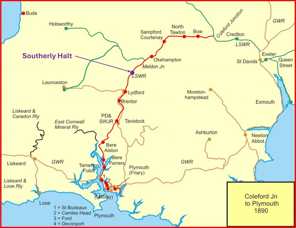
Southerly Halt on London and South Western Railway
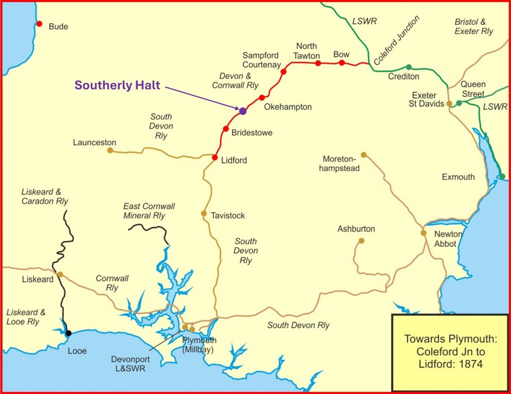
The story of the London and South Western Railway (LSWR) on the western flanks of Dartmoor began on 17th July 1862, when the building of a line from Coleford Junction (north west of Crediton) to Okehampton was authorised in the Okehampton Railway Act 1862. However, before the line was built it had been leased from the Okehampton Railway to LSWR with an extension being authorised to Lidford (it was not known as Lydford until 3rd June 1897) sanctioned under the Okehampton Railway Act 1863. In 1864, it was renamed as the Devon and Cornwall Railway and construction finally started in stages; firstly from Coleford Junction to North Tawton by 1st November 1865; then to Okehampton Road (later renamed Sampford Courtenay) by 8th January 1867; then to Okehampton by 3rd October 1871; and finally to Lidford by 12th October 1874. Before the line was completed to Lidford, in 1872, the Devon and Cornwall Company had been taken over by the LSWR.
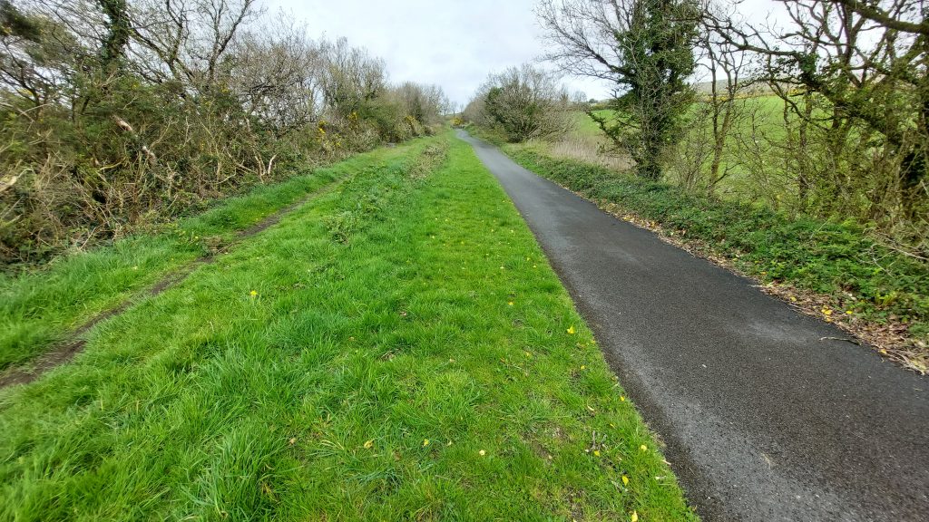
Between Okehampton and Lidford there was just one station, at Bridestowe. However, anyone walking or cycling the 11 miles of the Granite Way (National Cycle Network Route 27) on the old line between Okehampton and Lydford, may well have noted there was once a small halt at Southerly. The author has drawn a blank in trying to find any information on the halt and has noted that it does not appear on any 19th century maps. This post covers some interesting features and artefacts around the halt, which includes a modern parish boundary marker. If anyone reading this post has any information about the halt the author would be grateful in receiving it.
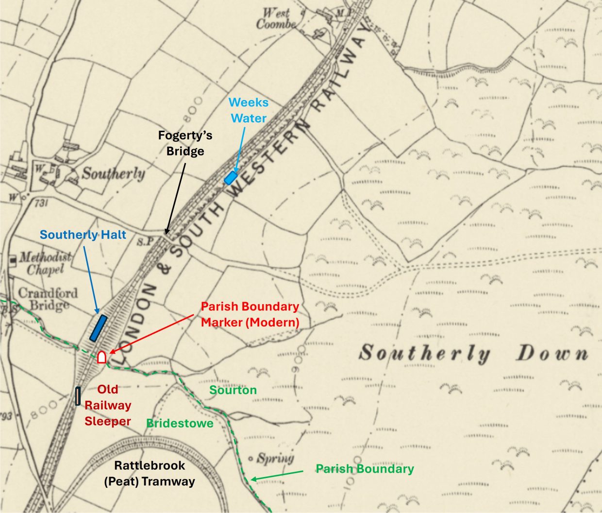
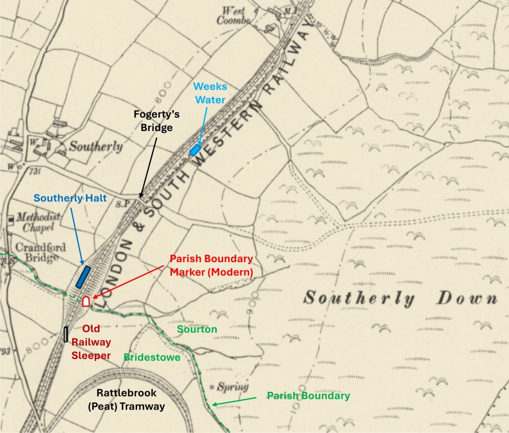
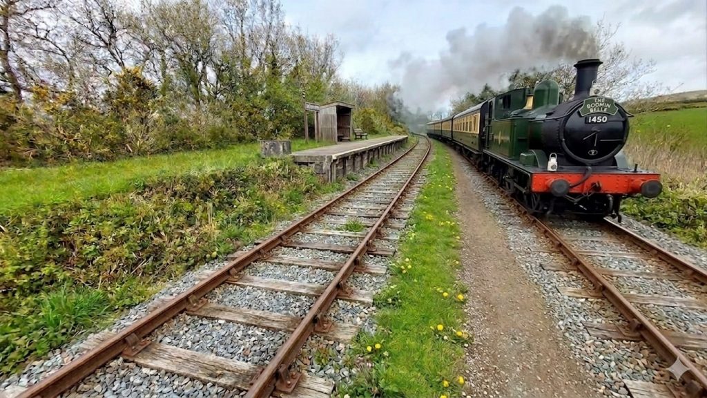
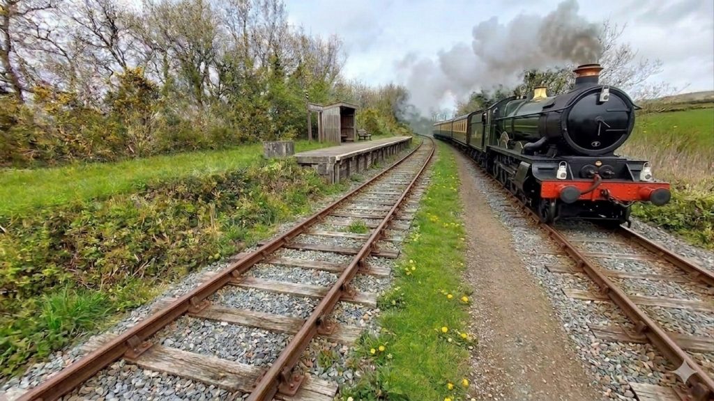
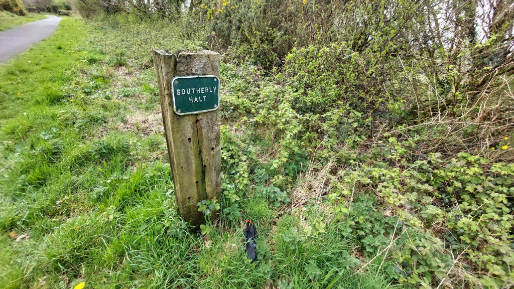
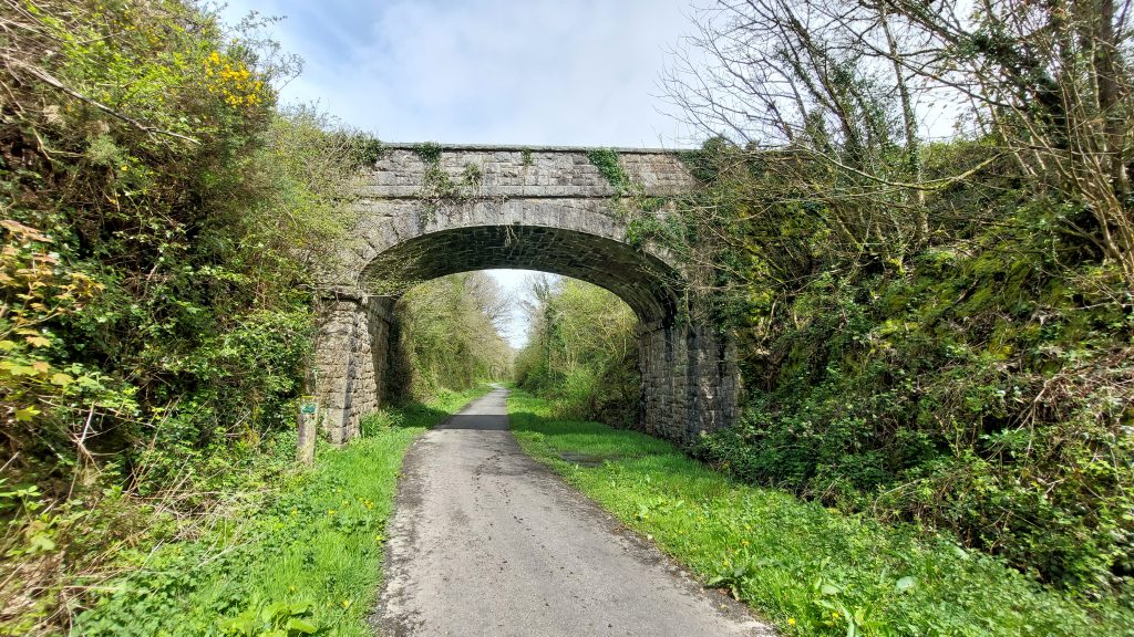
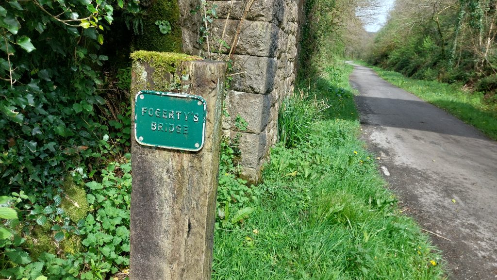
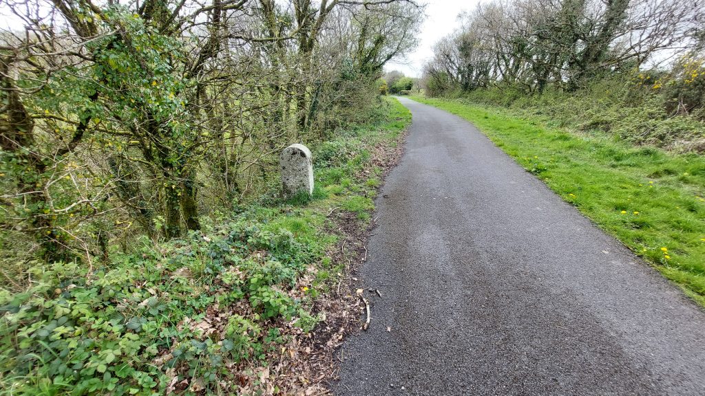
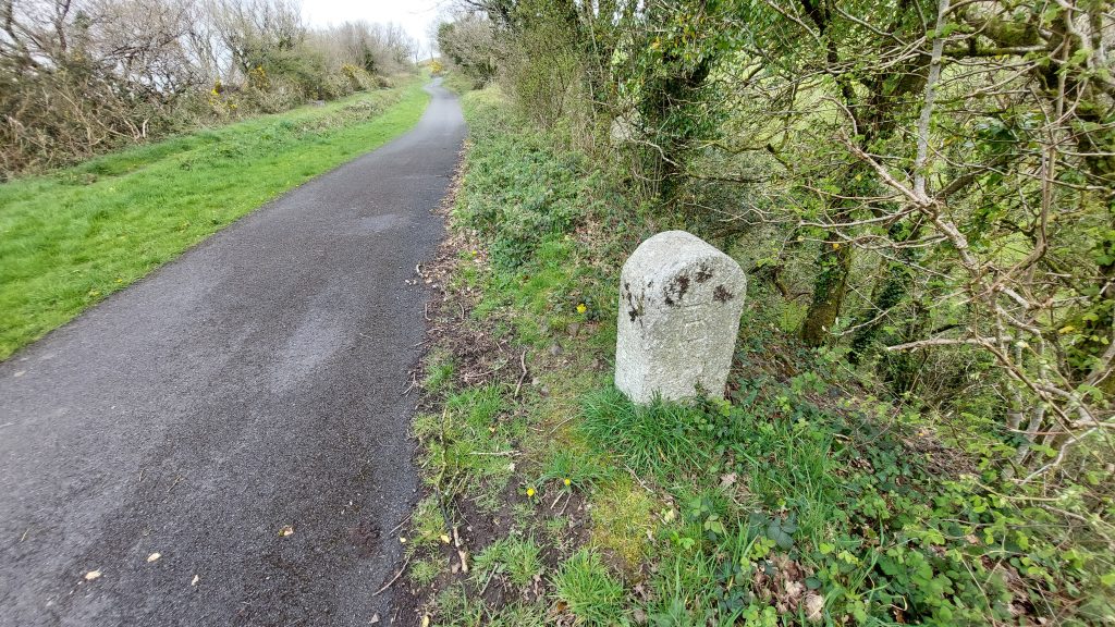
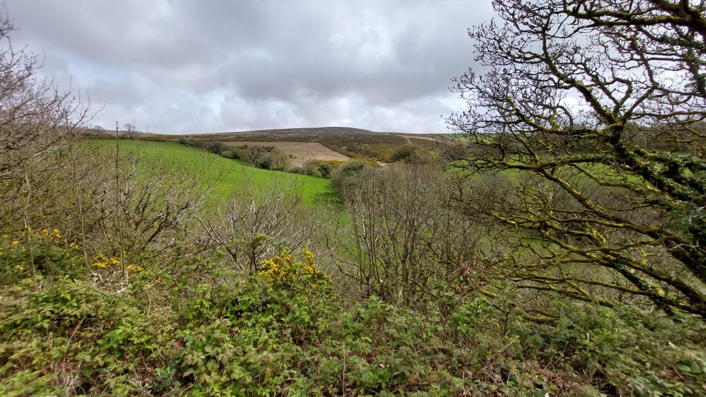
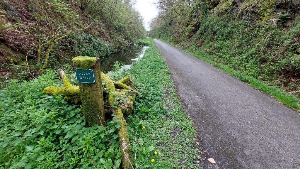
This annotated late 19th century map shows the location of Southerly Halt and other features within the immediate locale. The line was ‘Standard Gauge’ (4ft 8½ inch)This map from 1874 shows the extent of the railways in mid / west Devon (with Southerly Halt annotated). Lidford was chosen as the terminus in 1874 as there was a connection with the South Devon Railway (Tavistock branch line), which would give LSWR trains access to Plymouth via Tavistock. However it was only on 17th May 1876 that the connection was made and trains could run straight through to Plymouth over the existing Launceston line (The Launceston line was a broad gauge line so, a third rail was added to create a mixed gauge route)Southerly Halt on the modern Granite WayUsing AI, the author asked for ‘two railway lines and a small platform’ using the previous photograph. It is doubtful that the lines were this far apart. The line used a standard gauge (4ft 8½ inch) track. One assumes the platform was much longer than shown, but the AI picture provides an idea of what it looked likeSoutherly Halt with ‘The Bodmin Belle’ with Steam Engine ‘1450’ (for artistic purposes only). Engine ‘1450’ was built at Swindon in July 1935 and withdrawn from Exmouth shed in May 1965. It was a Great Western Railway (GWR) Engine so as such would almost certainly not have run on this lineSoutherly Halt with another (unknown) Steam Engine (for artistic purposes only). Southerly Halt is centred at SX52758 87903Southerly Halt sign on the modern ‘Granite Way’Fogerty’s Bridge at SX52881 88101, which connected Southerly Hamlet with Southerly Down. This would have been constructed around or just before 1874Fogerty’s Bridge sign on modern ‘Granite Way’This map from 1890 shows the extent of the railways in mid / west Devon (with Southerly Halt annotated). The early trains on the Launceston Branch (up to Lydford from Plymouth then branching west to Launceston) ran on broad gauge track (7ft 0¼ inch). Although designed by Brunel, the railway was run by the South Devon Railway until financial difficulties in 1876 lead to a takeover by Great Western Railway (GWR). Brunel’s broad gauge network was converted in 1892* to run on the narrower ‘standard’ 4ft 8½ ins gauge (known as ‘Stephenson gauge’ named after George Stephenson). Access to Plymouth was very inconvenient as LSWR trains had to run over the GWR’s lines from Lidford to Plymouth and Devonport. Much of this route was over a single-track and GWR trains were given priority! From 1882 (following the passing of the Plymouth and Dartmoor Railway Act 1882) the construction of independent lines alongside the GWR route from Lydford to a new station in the centre of Plymouth was allowed (as shown on the map). * (Note: For 57 years, GWR ran broad gauge trains, although for 31 years they used an increasing amount of mixed broad (7ft 0¼ inch) and standard gauge (4ft 8½ inch) track. The standard gauge was confusingly referred to by some as “narrow gauge”. Rivalry between the GWR and the standard gauge railway companies became called the ‘gauge wars’).Granite Marker to the south of Southerly Halt marking the Bridestowe / Sourton Parish Boundary. It is inscribed ‘S’ on one side and ‘B’ on the otherThe Parish Boundary Granite Marker with the ‘B’ inscriptionView to Southerly DownWeeks Water is located at SX52994 88209
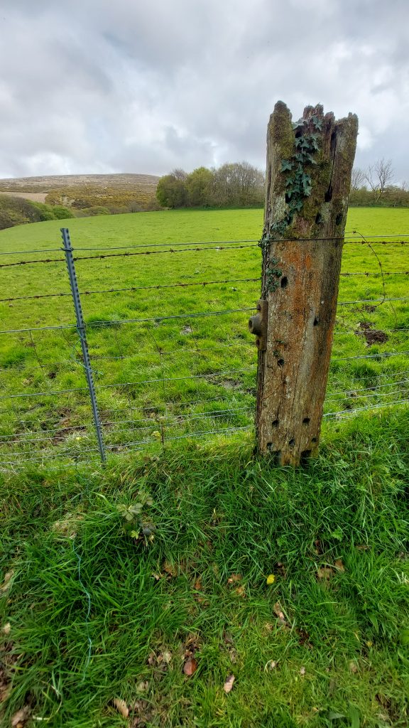
Nest to the line is this railway sleeper now being used as a fence post at SX52715 87798
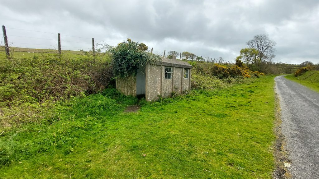
The inspecting and maintenance of the track, including all its component parts such as rails, sleepers, fishplates, bolts, etc. were the responsibility of a Platelayer. A Platelayer would have been assigned to each mile or two of track and would regularly patrol their section of track. They would have been based in a Platelayers’ Hut (or lineside shelter). The nearest Platelayers’ Hut to Southerly Halt is located just to the south of Lake Viaduct with the next hut being located just to the north of Bridestowe Station. Platelayers’ huts (like the one shown in the photograph) were generally a single room, immediately adjacent to the running lines. They would have been equipped with a table, chairs, and a simple stove for heating (note the small chimney)