A collection of walks, discoveries, insights and pictures of exploring Dartmoor National Park
February 21, 2026
Claziwell Tin Mill and environs
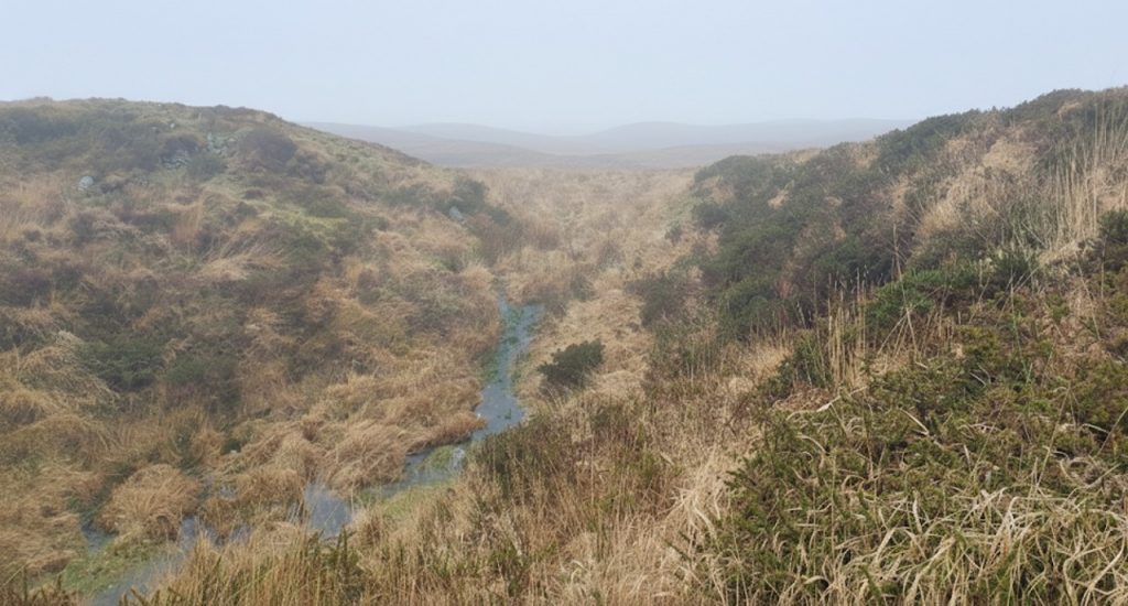
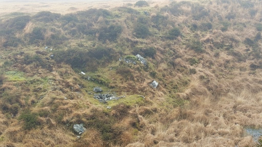
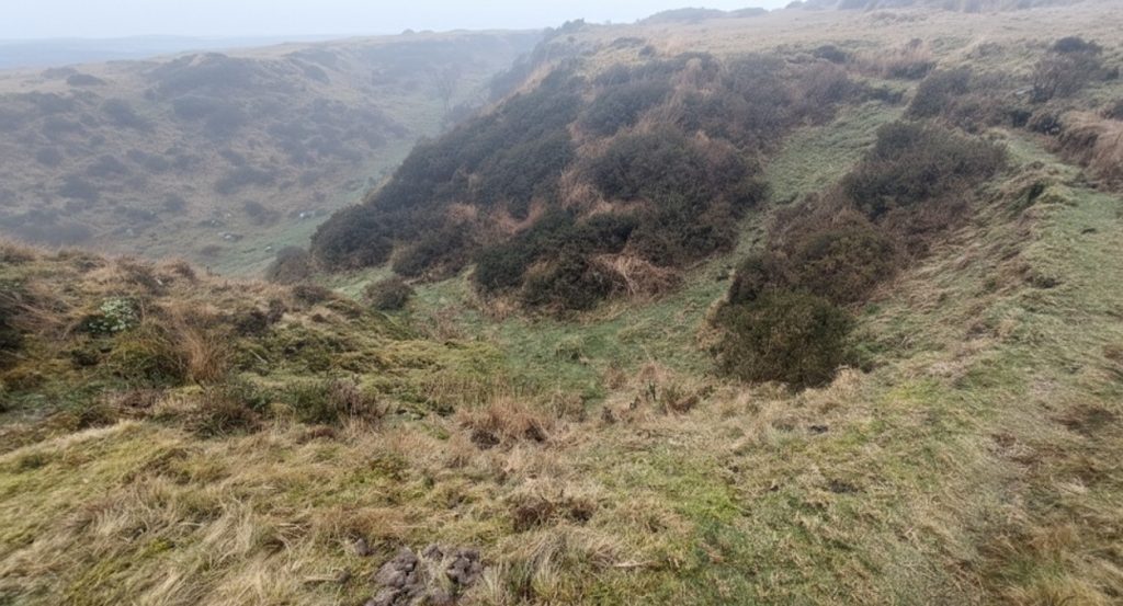
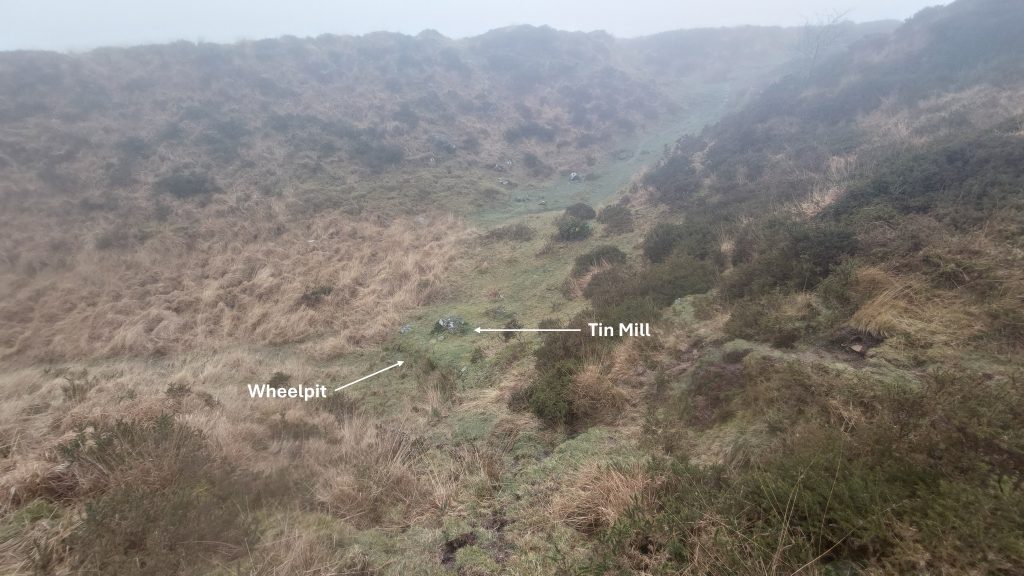
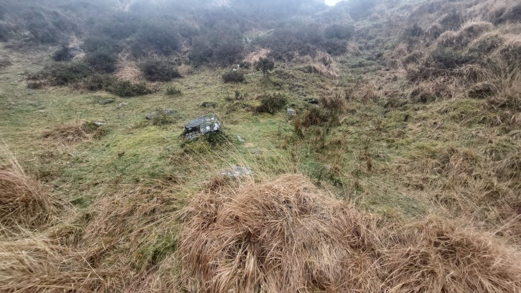
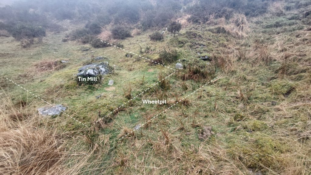
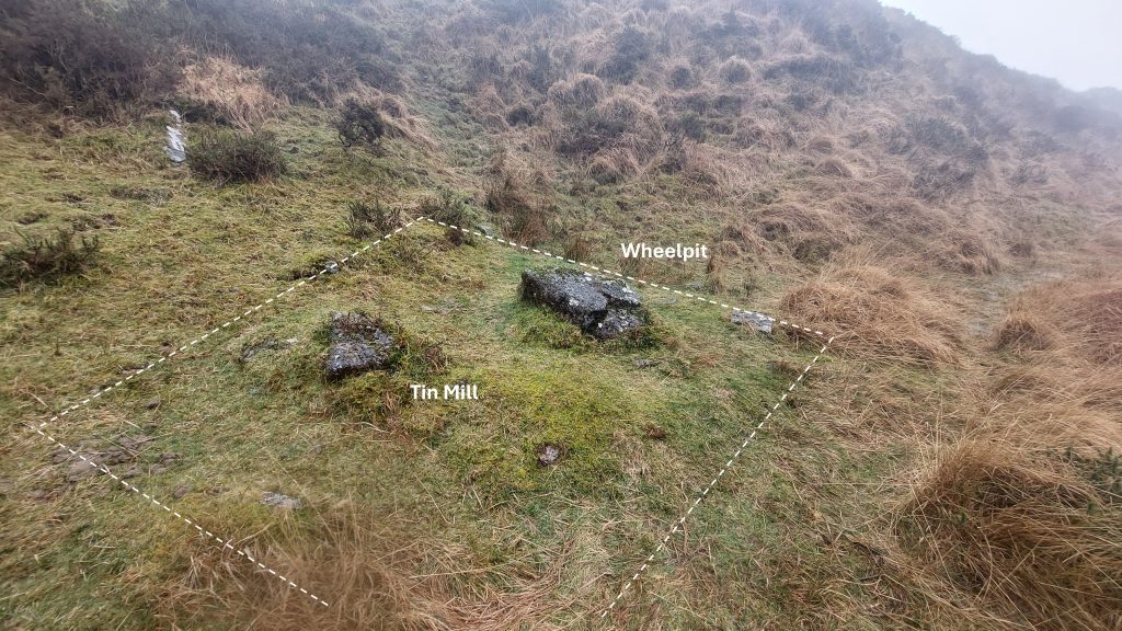
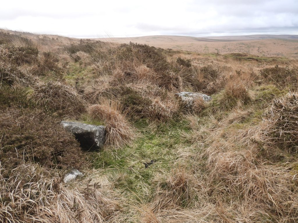
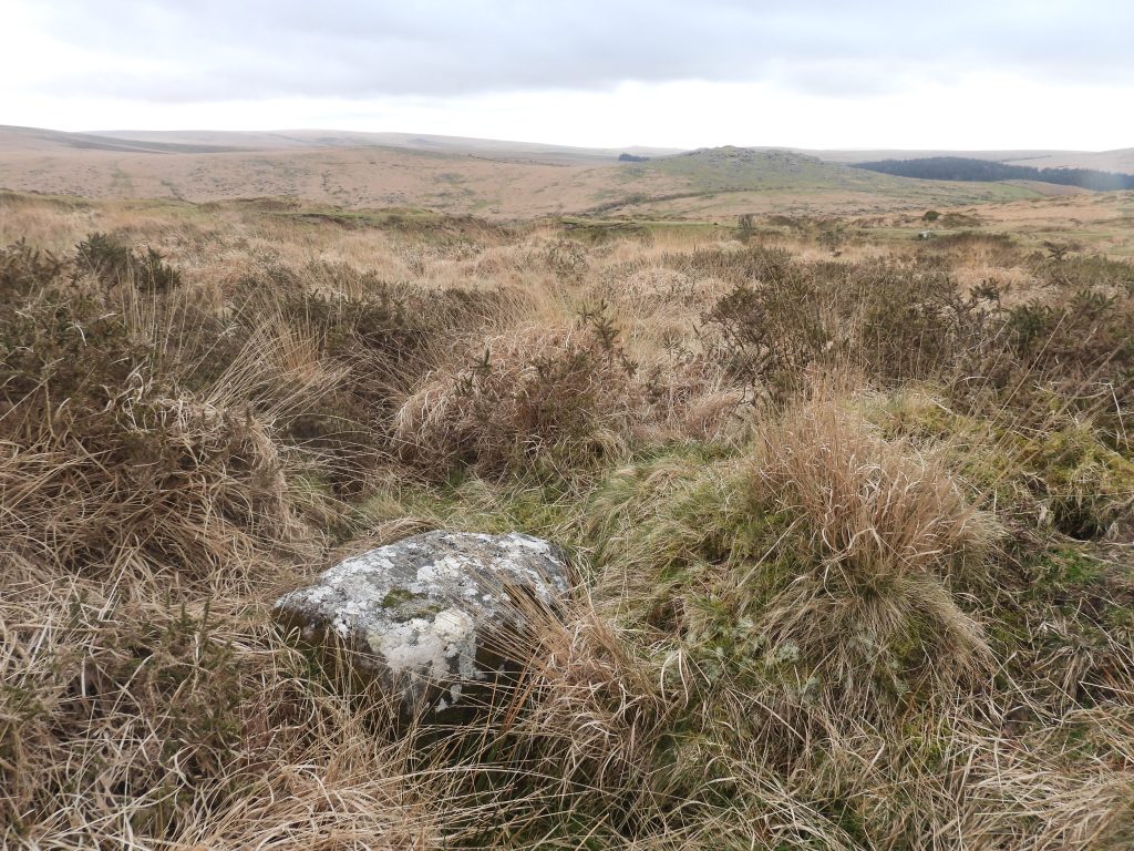
Claziwell Tin Mill, a probable tin stamping mill is most likely to date to the early/mid 17th century was initially surveyed in 1997 by Tom and Elisabeth Greeves. The mill is located on a small terrace at the foot of the steep eastern escarpment of the large tinners’ openwork (beamwork) to the south (below) Crazywell Pool. There are very few obvious remains that survive except as faint traces of walling which define part of one side of the mill and the edge of a possible wheelpit (which itself survives as a shallow hollow).
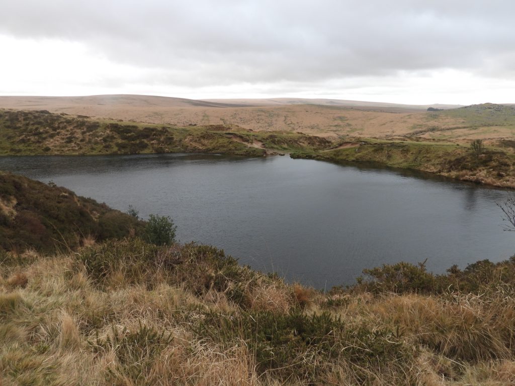
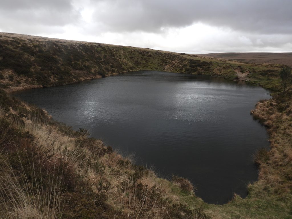
Crazwell* Pool is the main feature in the area and has over the years been been the subject of many wild speculations and local legends, which includes: it is of infinite depth and that the water within rises and falls with the tide! The pool is not natural and has been thought by some Dartmoor writers as being a tinners’ eservoir feeding the openworks to the south, but it simply holds far too much water for that purpose. The reality is that it is probably nothing more than a large gert, which is now flooded. The site was documented in the early 17th century but is thought to have earlier origins. As well as the openworks and the flooded gert (ie the pool) there are many clusters and alignments of trial and prospecting tin pits in the vicinity. There is also evidence of several Tinners’ Reservoirs in the area. Clearly the large openworks would have been excavated before Claziwell tinners’ mill was built but it is probable that the mill and all the tinworks were operational more or less during the same period.
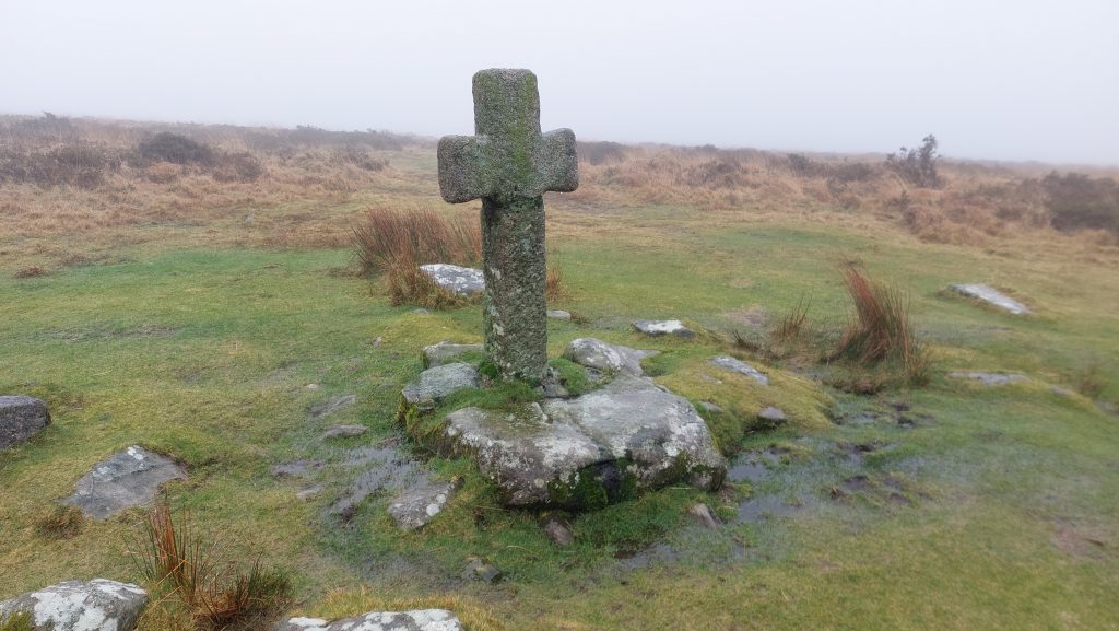
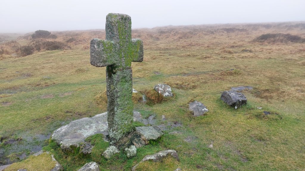
The tinworks were supplied with water by a leat, which came from Hart Tor Brook to the north and would have been constructed at least a century before the more well known Devonport Leat, which flows close by. The water from the leat was stored in several earthwork reservoirs located near the pool before being released into the tinworks. Also of interest in the area is Crazywell Cross (a medieval cross on a modern shaft), the track from Older Bridge to Norsworthy thought to have been used by (yarn) Jobbers and another possible structure on the west side of the main openwork just below the mill.
*Crazywell is the modern name corruption but historically the pool and other features in the area have been known as Clasiwell, Clasawill, Clazywell or Classenwell.
Bibliography
Tom Greeves and Elisabeth Greeves – (1997), A probable tin mill at Claziwell, 4-5 (Article in Serial). SDV242613.
Phil Newman – (2007) – Cramber Tor Training Area Monument Baseline Condition Survey (Report – Survey). SDV348210.
William Crossing – (1912) – Crossing’s Guide to Dartmoor
Mike Brown – (1998) – Dartmoor Field Guides – Volumes 12 and 30
John Lloyd WardenPage – (1889) An Exploration of Dartmoor and its Antiquities, page 150
Eric Hemery – (1983), High Dartmoor, pages 136-7
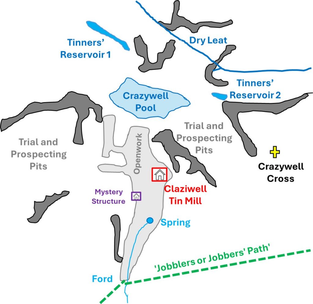
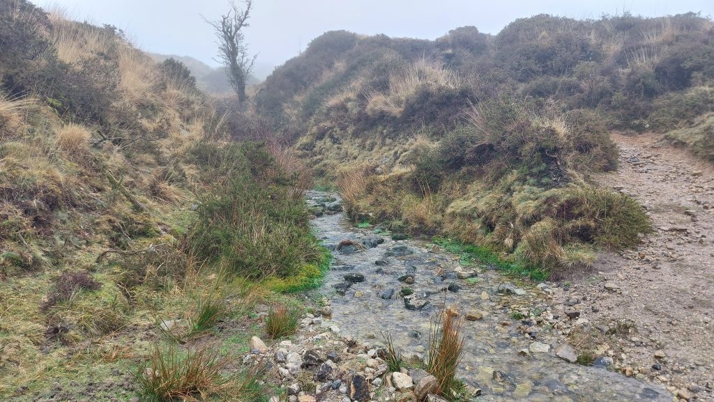
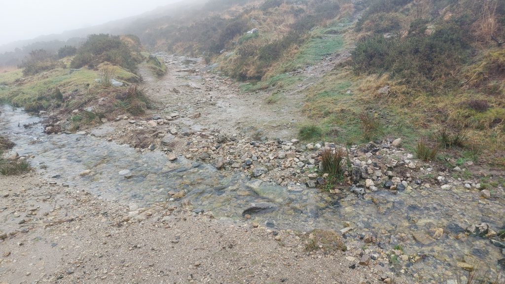
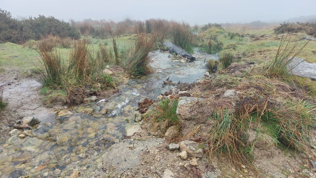
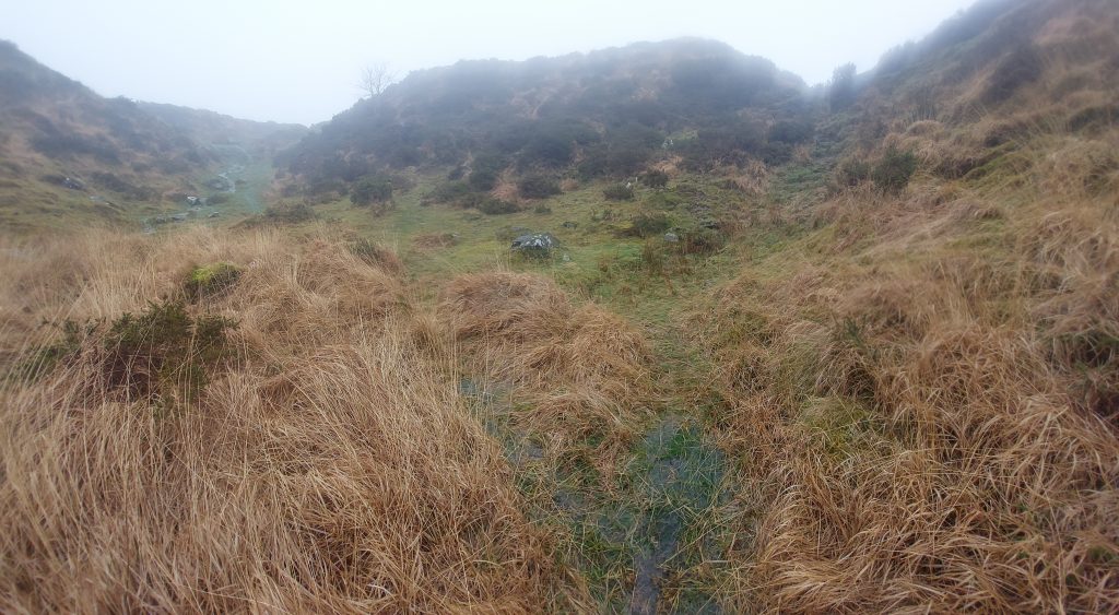
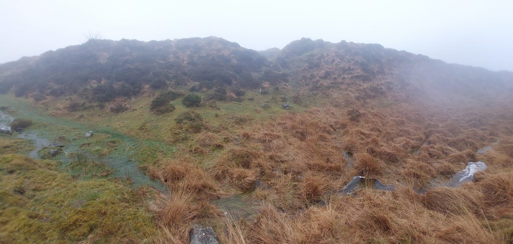
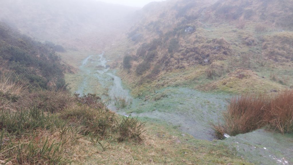
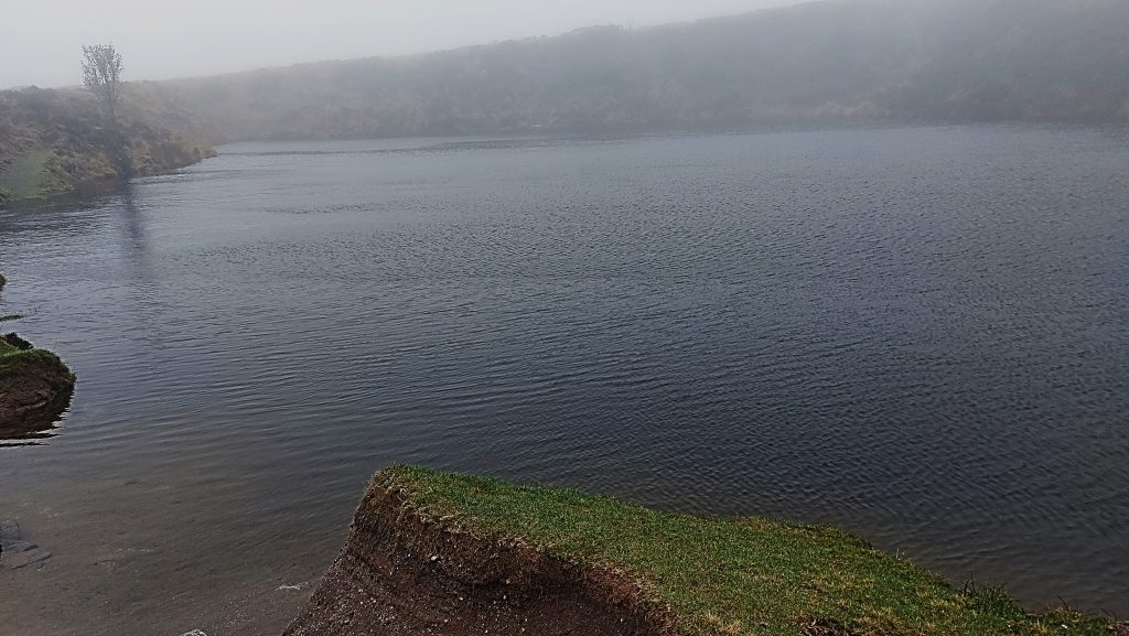
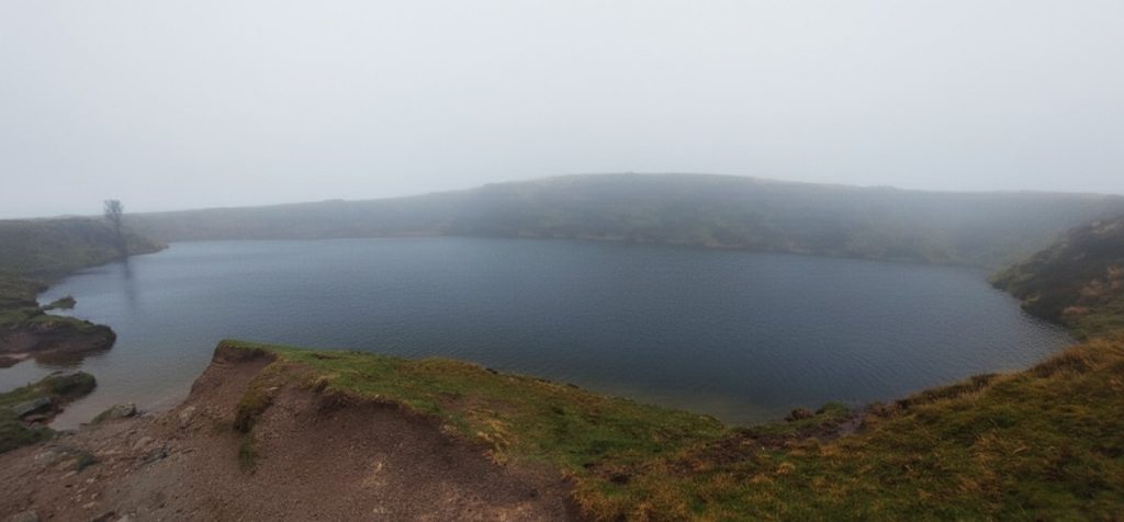
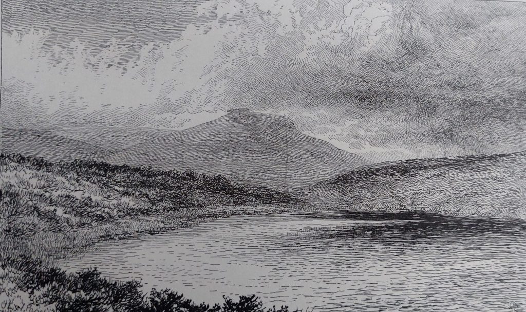
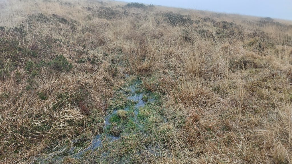
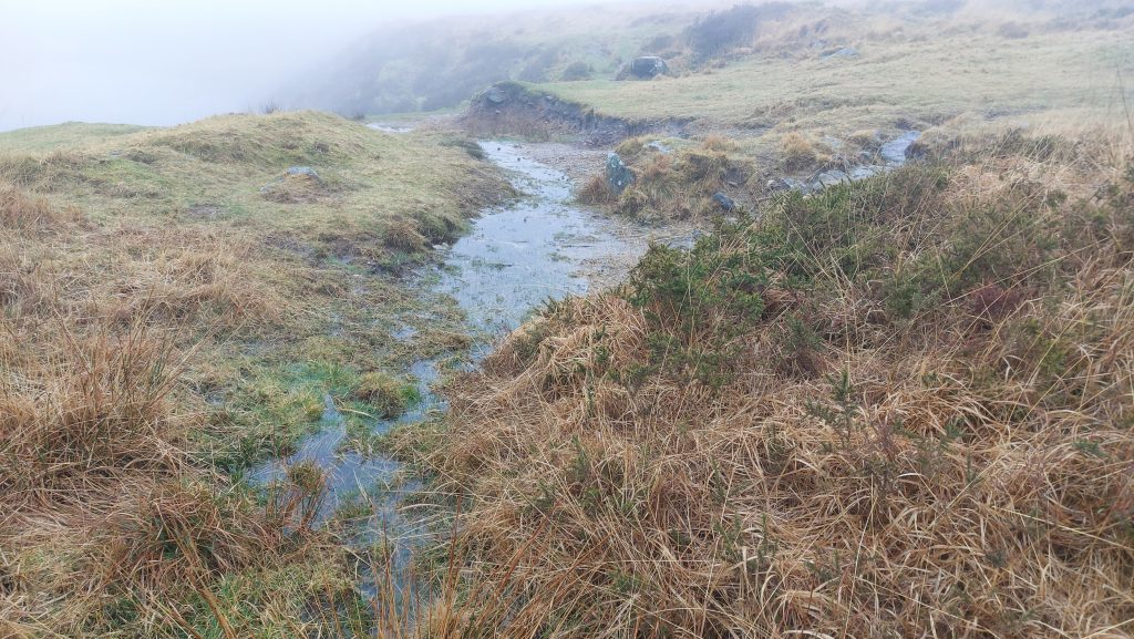
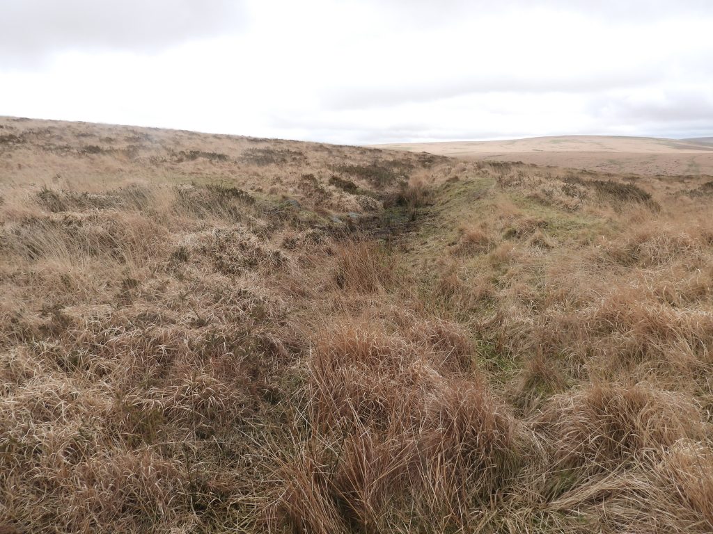
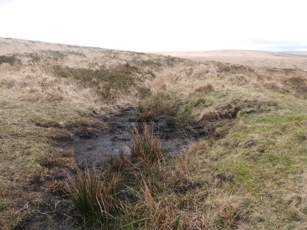
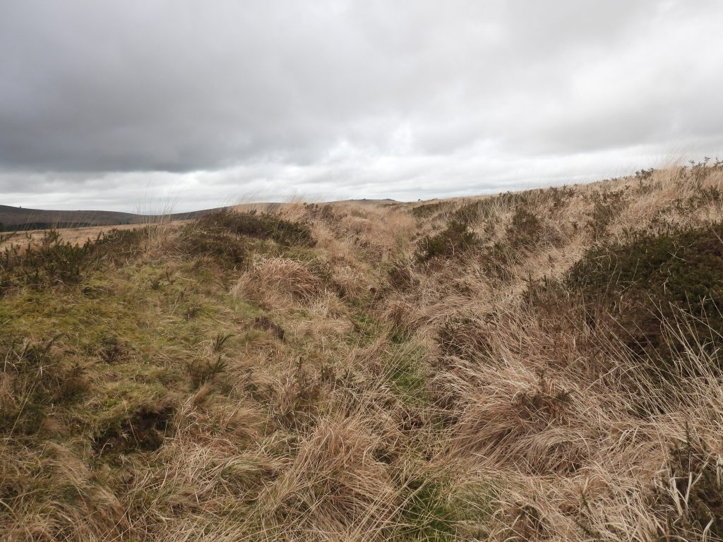
Sketch map of the key features covered in this post. Access to the mill site is safest from the top of the openwork by Crazywell Pool The southern end of the openwork (or beamwork) as it meets the Jobbers path / trackThe stream from the openworks crossing the track. William Crossing describes this route (as described to him by moormen) as a ‘Jobblers’ or Jobbers’ Path’, likely to be from its use by yarn-jobbers in former days. That said, many Dartmoor observers describe this as being part of a ‘Monastic Route’ between the great Abbeys of Buckfast and Tavistock. The stream disappearing into the gloom towards Newleycombe Lake. From Mike Brown’s Field Guide to Dartmoor, Volume 12: “This targe tinwork was cited as one of the causes for the early silting up of the Plym Estuary, large amounts of sand and silt being carried downstream via Newleycombe Lake into the Mewy, which in turn fed the Plym, which latter deposited its water-borne load on the mudflats under Marsh Mills”. He further cites Richard Strode (22nd May 1528 – 5th August 1581), MP for Plympton in 1553 and 1559 as having been thrown into the “depe pitte under the grounde” of Lydford Gaol, for daring to incur the displeasure of the Stannary court of the Devon tinners. Mike Brown further comments that the Stannary Parliament were a ‘law unto themselves’ and ‘the incident of his (Strode’s) imprisonment’ ultimately leading to the convention today called Parliamentary Privilege.The bottom of the openwork, from which the sand and silt were said to have lead to the early silting up of the Plym. Had Richard Strode’s incarceration in Lydford Gaol following his complaint about tin-streaming activity on Dartmoor causing the silting up of the rivers, been directly related to this openwork, then it would date it to the mid-16th century. A mystery structure dug into the western escarpment of the openwork. It is rectangular and might well have been a crude building or possibly part of a shaft. There is no reference to it on the (usually) reliable Devon Historic Environment Record. The author will further investigate when next in the area Top of the eastern escarpment of the openworks above the Tin Mill. This is most likely where water from the leat and reservoirs above would have been lead down to the water wheel belowOverlooking the scant remains of the Tin MillThe faint traces of walling and the shallow hollow (representing a possible wheelpit) are all that survive here. There is slight discernible terrace built into the foot of the eastern escarpment of the openwork, indicating where the mill once stoodTo the right of the the large boulder (which was inside the mill) is a shallow depression, the wheelpit. The mill is located at SX58232 70366The wheelpit is rectangular and around 0.8 metres wide and 4 metres long. The wheelpit has masonry defining the north edge (adjacent to the mill)As cited by Dr Phil Newman. There is: “A low revetment wall at the back of the terrace is 3.2 metres long by 0.4 metre high and the irregular terrace is 3.7 metres long”. These discernible features, although faint, along with the terrace seem to confirm a building once was here. Opposite the site and across the stream, the author noted (but didn’t photograph) a rectangular boulder which may well have come from the mill. Further investigation, when next in the area is required (it was a rather damp day when these pictures were taken)Tom and Elisabeth Greeves surveyed ‘Claziwell tin mill’ in 1996 revealing the whole site as being approximately 13m by 8m. They identified two pits which may have been settling pits or buddles. In the picture is a moss covered boulder (centre), alongside which there may be what might be a couple of pits. The openwork looking north, with the mill at centre (by obvious boulder). The water for the wheel would have been fed through the ‘col’ at top right of the picturePanorama view of the mill site Top of the openwork (near the pool) looking south. Crazywell Pool on a murky and very atmospheric day. It is not of infinite depth and being only about 15ft deep. It is said that the bell ropes of Walkhampton church were once lowered into it without reaching the bottom a depth of 80 – 90 fathoms (540ft)Crazwell Pool panorama picture. John Lloyd Warden Page, wrote in 1889 : “Had it not been for the unusually dry summer of 1844, when the water was pumped into the leat (assumed to be Devonport Leat), the wild stories of its great depth might still have obtained credence. Since then The resulting drop in its actual depth has been ascertained, and in no spot exceeded fifteen feet”. Crazywell Pool from late 19th century titled – ‘Sheepstor, from Classenwell Pool. Drawn by A. Dawson, from a sketch by J.Ll.W. Page’A poor condition tinners’ reservoir (annotated as number 2 on the sketch map)The reservoir is crescentic and measures 18m long. It is fed by a leat which came from Hart Tor Brook. It is centred at SX58310 70463The sluice opening which fed Claziwell openworksTo the north west of Crazywell Pool is a Linear Tinners’ Reservoir (annotated number 1 on the sketch map).The reservoir has a track running through it approx half way down its lengthAt the east end of the linear reservoir is evidence of masonry lining of a sluice opening which has survived remarkably well.The earthwork of the 70m long linear reservoir is about 1m in placesThe sluice end of the linear reservoir which would have provided water into the Craywell workings (now Crazywell Pool). This is located at SX58200 70523Crazywell Pool from its north west cornerCrazywell Pool from its south west cornerA short distance away is Crazywell Cross. It comprises the head of an expanded Latin cross mounted on a modern shaft. It was set up in 1952 with the socket fabricated from moorstones and concrete (ref: Historic England). The cross has height 0.6 metres and width across arms 0.6 metres. With the shaft total height is 1.4mHemery records in High Dartmoor that the original cross base has disappeared together with evidence of its (original) true position. The head and arms are original and were discovered lower down on the hillside (near the track one assumes). It is located at SX58377 70394