A collection of walks, discoveries, insights and pictures of exploring Dartmoor National Park
January 17, 2026
Hound Tor Medieval Settlements and Environs
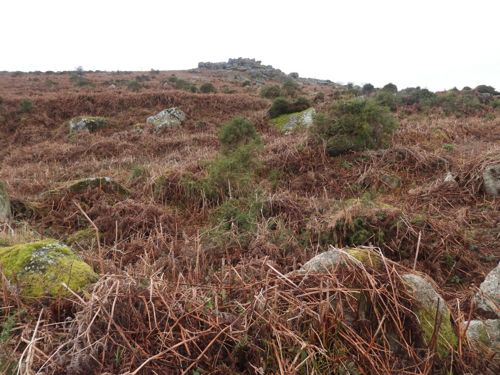
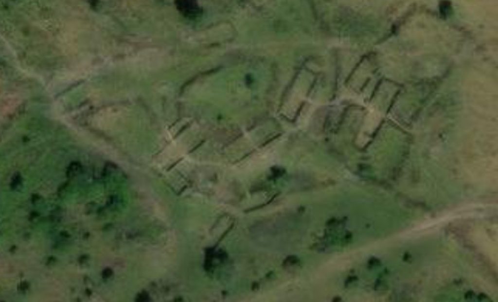
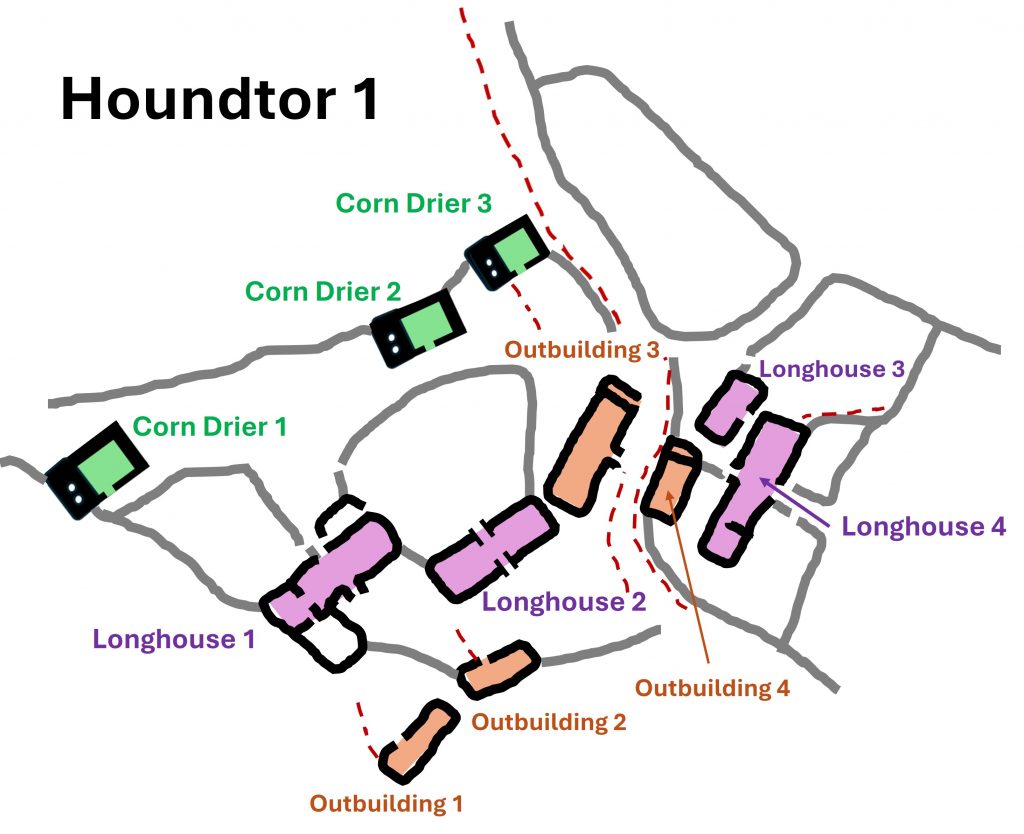
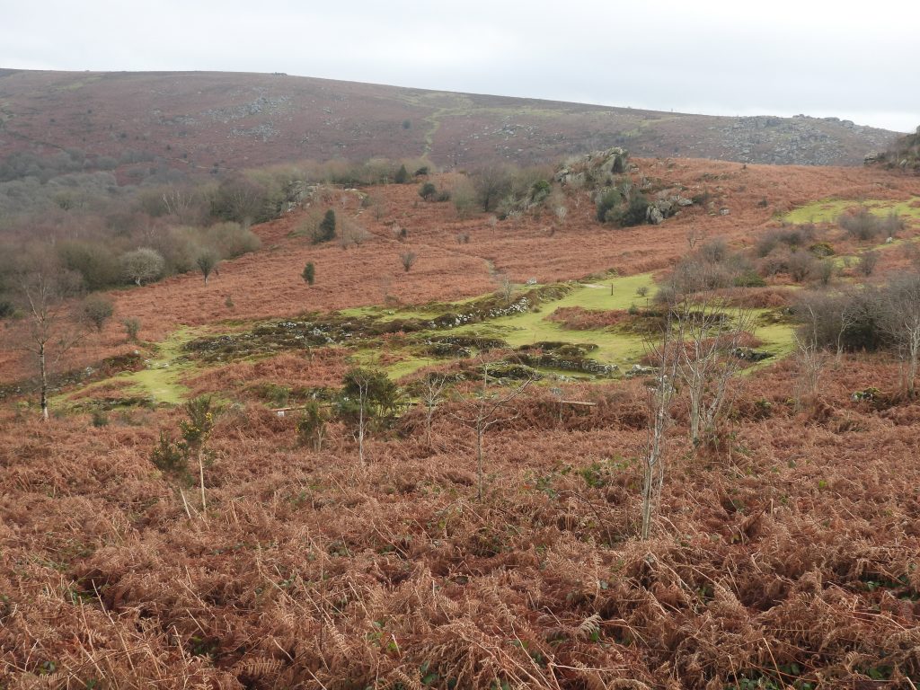
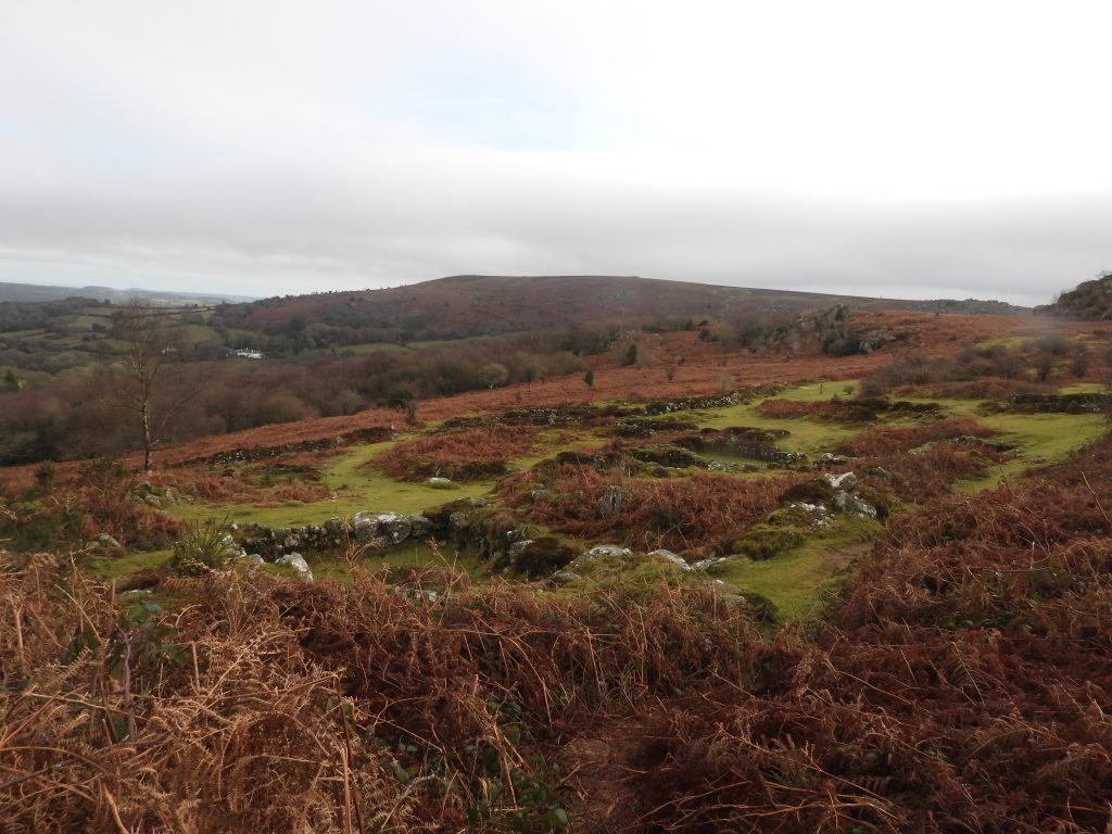
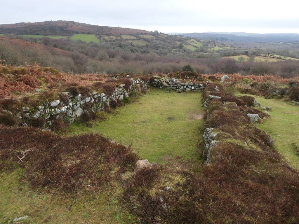
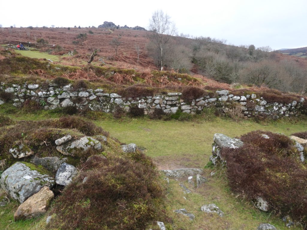
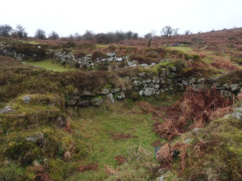
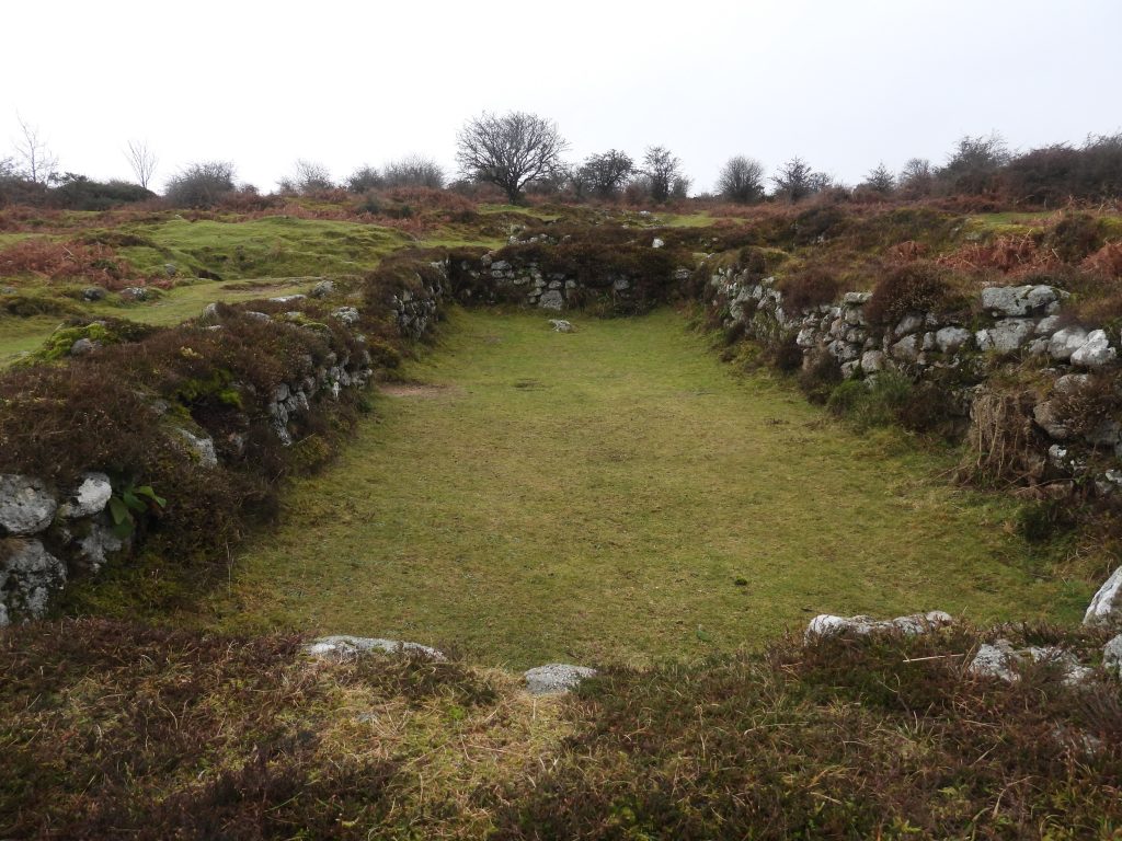
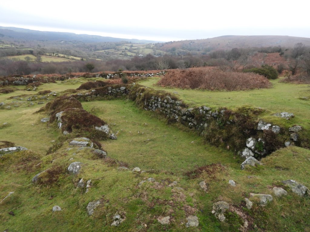
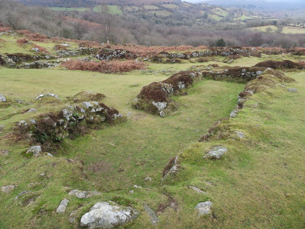
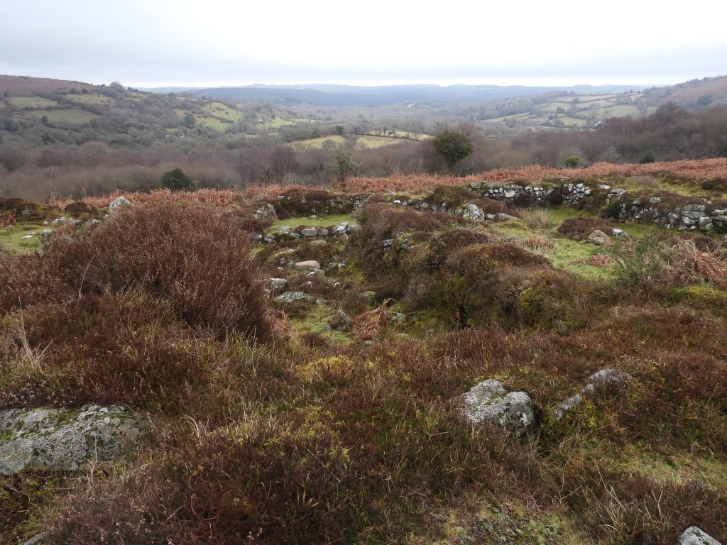
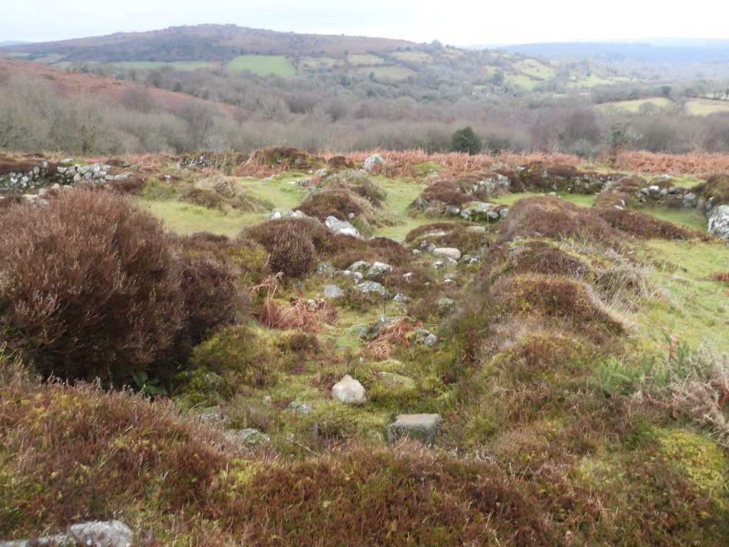
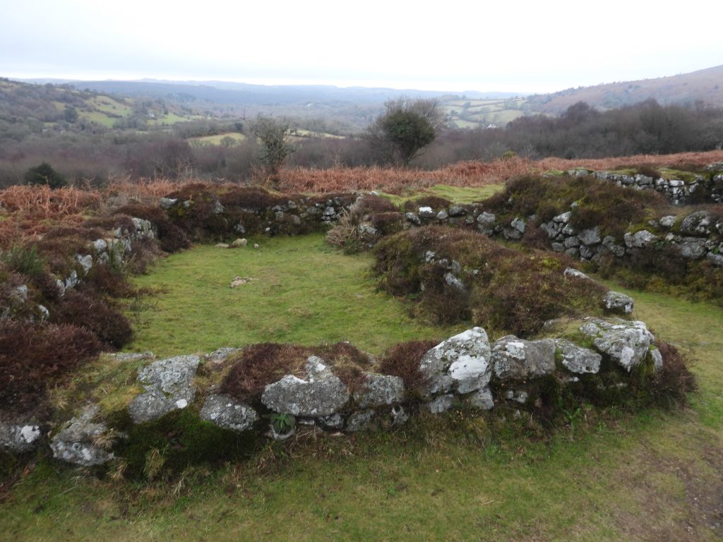
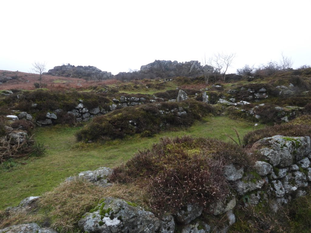
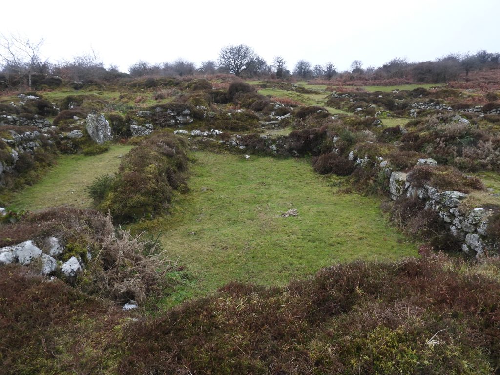
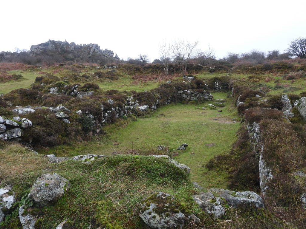
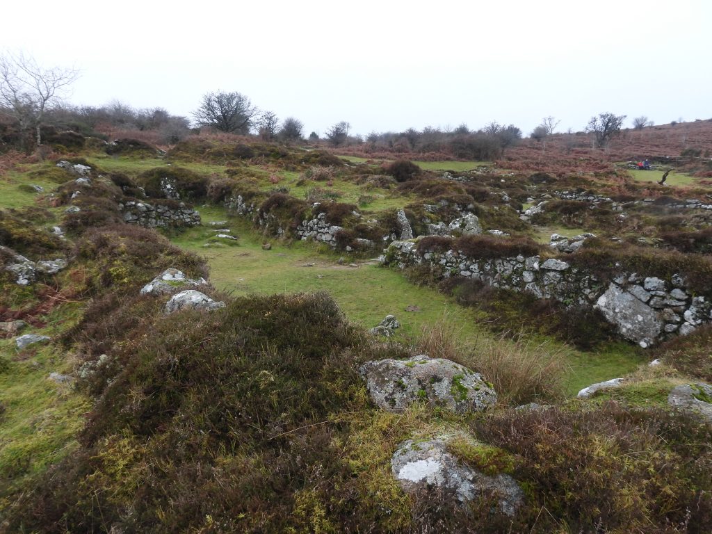
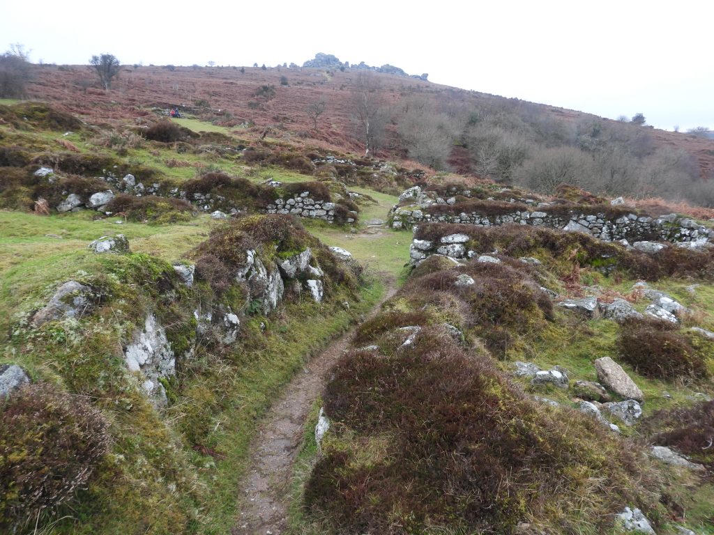
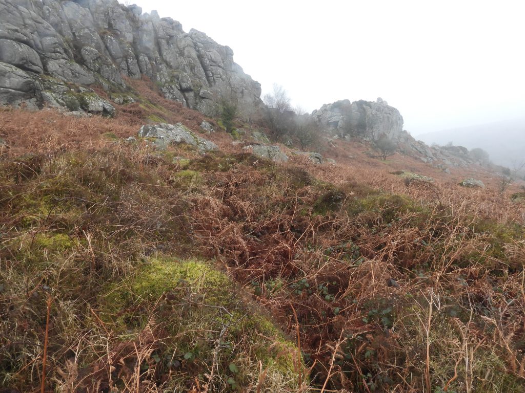
In the shadows of Hound Tor in the parish of Manaton, on its upper slopes are two medieval settlements. To the south east of the tor is ‘Houndtor 1’, which is the most well known of the two, comprising very substantial and well-preserved stone-built structures / buildings. There are eleven buildings in total, comprising four large longhouses, three corn-drying barns and 4 outbuildings. All the buildings were archaeologically excavated in the early 1960s undertaken by E.M.Minter (the results of which were later published by Beresford in 1975). Prior to the 1960s the site would have been almost totally obliterated by a thick overgrowth of bracken and brambles. Today, the settlement is managed by Dartmoor National Park Authority on behalf of English Heritage and has been kept largely free from vegetation and is a delight to visit. The settlement is thought to have been dated to the 13th century and was occupied for around 150 to 200 years (open to debate), after which it was abandoned. The abandonment may have been due to a combination of climatic changes and the onset of the Black Death which ravaged the country during this period.
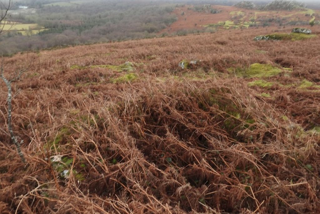
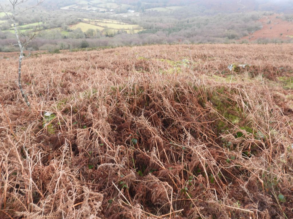
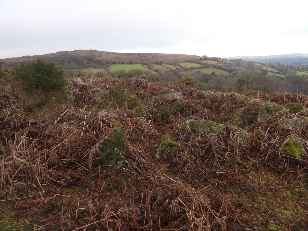
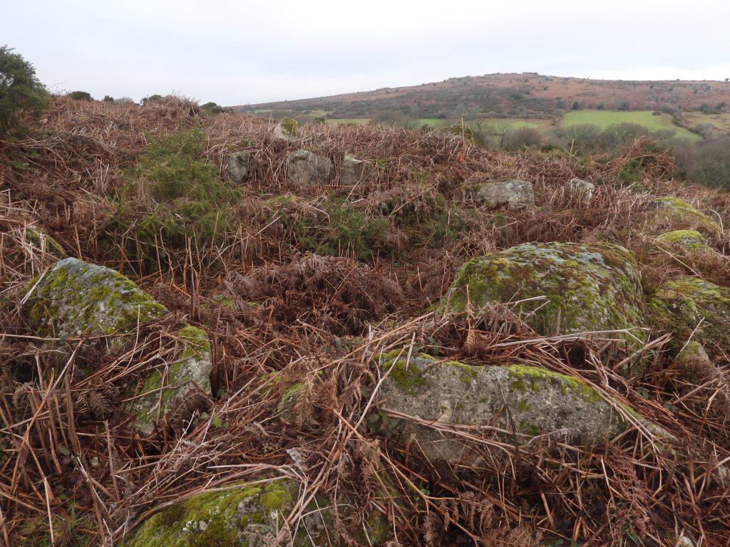
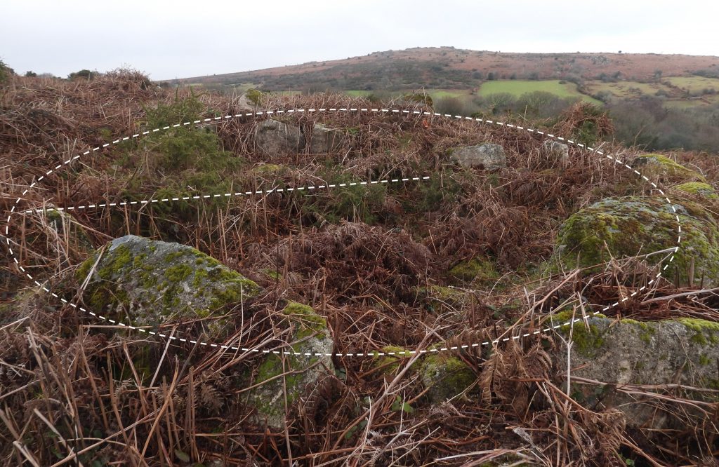
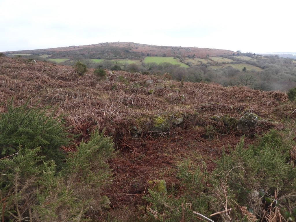
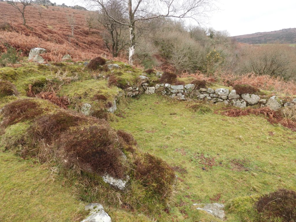
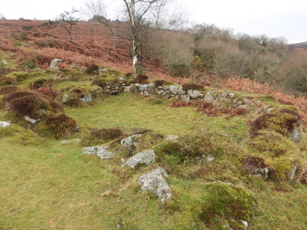
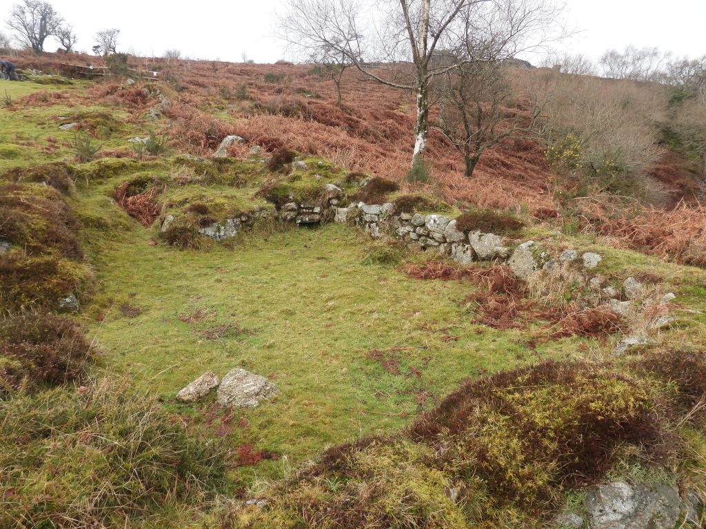
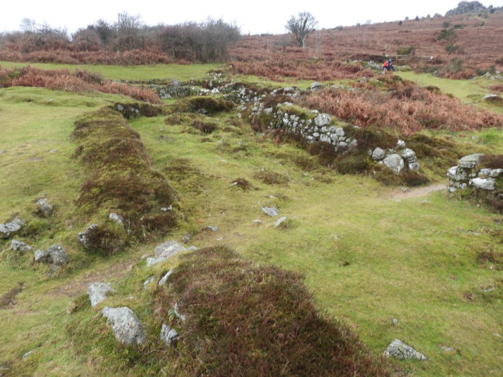
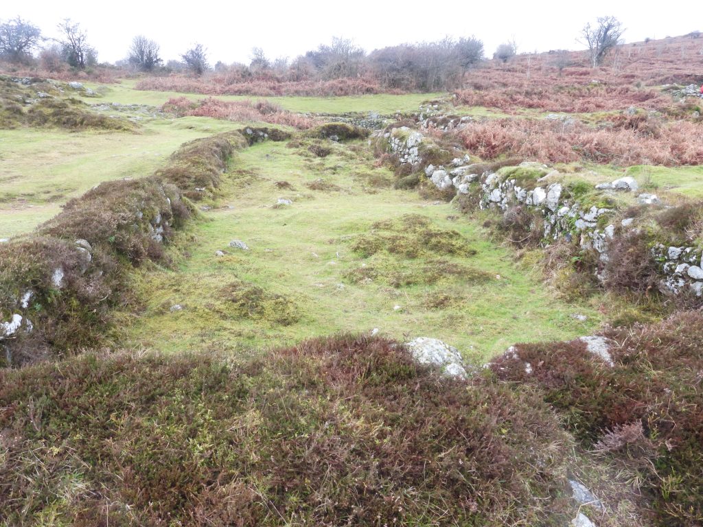
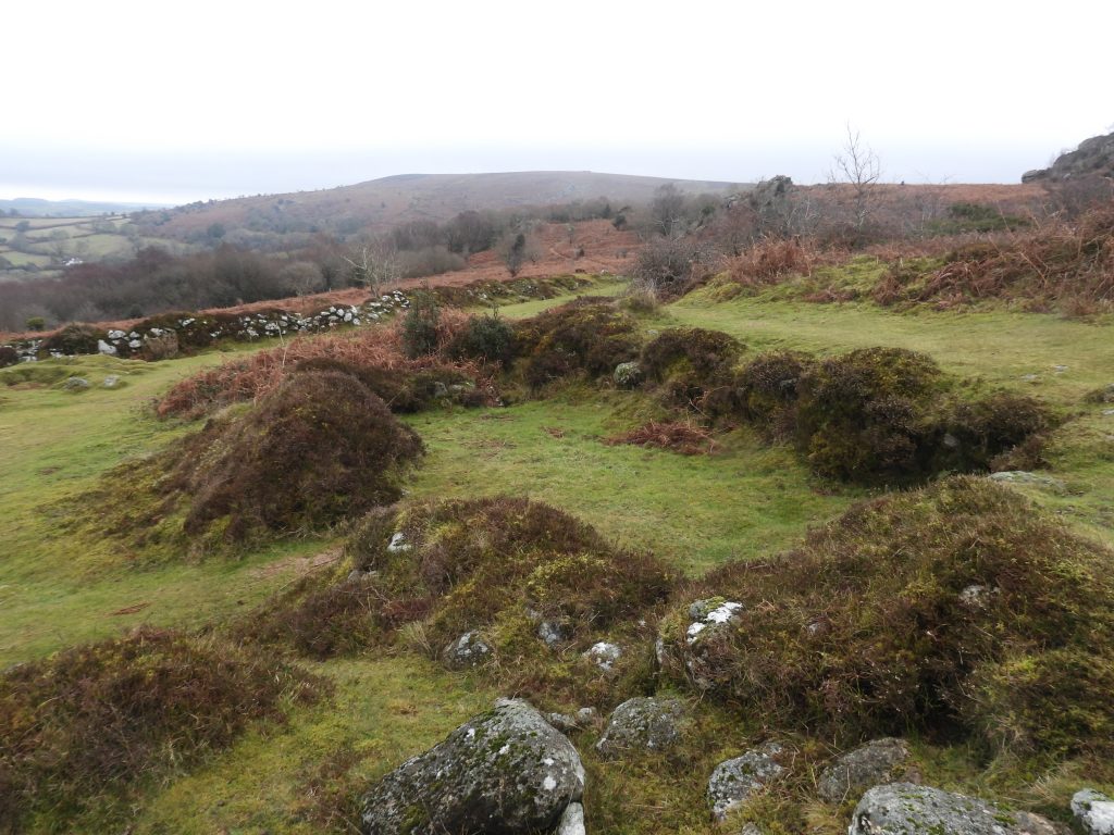
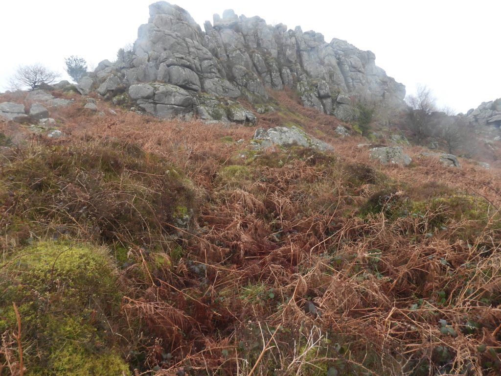
To the north east of Hound Tor is ‘Houndtor 2’, which has been described as a medieval farmstead. It is located some 350 metres north of the more well known site of ‘Houndtor 1’ and its remains comprise three rectangular medieval buildings within a possible prehistoric enclosure and a fourth circular building which was a bronze age hut circle but was reused as a store or pen during the medieval period. Unlike its ‘big brother’, this medieval farmstead is usually totally inundated with gorse and bracken to chest height in summer, so any visit should be considered only in winter or early spring. The farmstead is thought to have still been occupied after the ‘Houndtor 1 ‘ was abandoned and indeed, may have continued to be occupied into the early 15th century. This farmstead is not shown on modern OS maps.
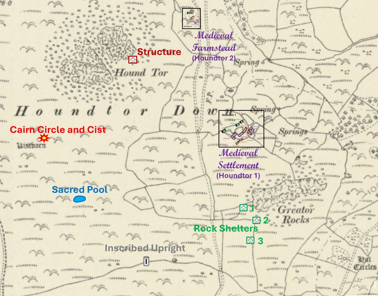
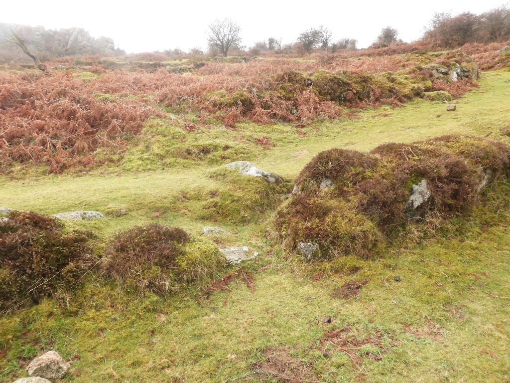
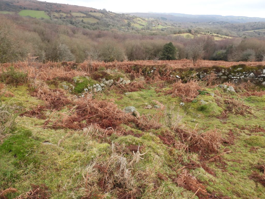
Other features of interest in this area, include post medieval cairnfields (field clearance), ridge and furrow, misc. shelters, a sacred pool, bronze age antiquities and an inscribed granite pillar, which bears evidence that it may once have marked the boundary of Ilsington Manor. There have been numerous papers, reports, surveys and books written about this area, many of which are referenced in the bibliography here. This post is intended to provide the reader with a pictorial flavour of many of the key features to be found but is by no means exhaustive record of the area or indeed artefacts covered here
Bibliography
Mike Brown – Dartmoor Field Guides, Volume 43 – Hound Tor Down, Heytor Down and Heytor Rocks
E.Marie Minter – (1972 – 1973) – Eleven Years of Archaeological Work on Dartmoor, 114-116 (Article in Serial). SDV307263
G. Beresford – (1975) – ‘Three Deserted Medieval Settlements on Dartmoor: A Report on the late E Marie Minter’s Excavations’ Medieval Archaeol 23, 98-158
Sandy Gerrard – (1997) – Book of Dartmoor, landscapes through time
Phil Newman, Simon Probert and H. Riley – (1994/1995) – Houndtor Down, Manaton, Devon – A New Survey by the Royal Commission on the Historical Monuments of England. (Report – Survey). SDV344628.
Jeremy Butler – (1991) – Dartmoor Atlas of Antiquities: Volume One – The East, 51-3, Map 8.2
Phil Newman – (2017), An Archaeological Survey of an area affected by burning on Hound Tor Down, Manaton, Devon
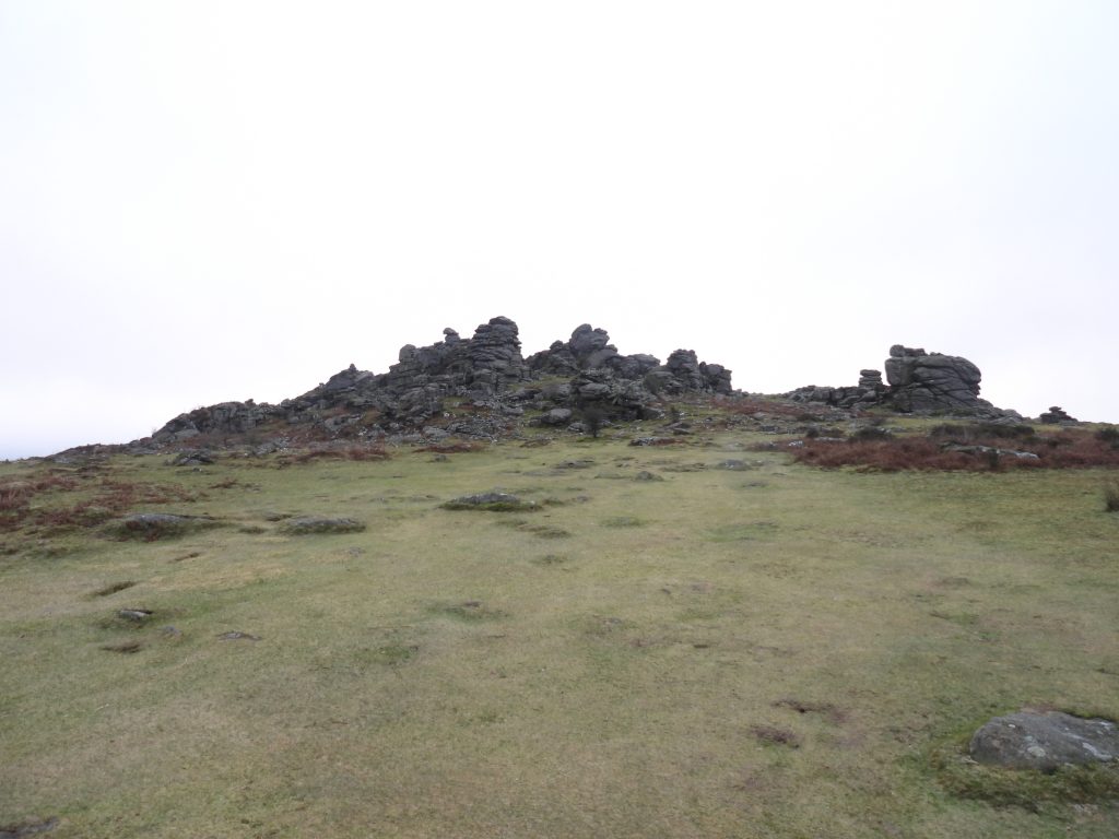
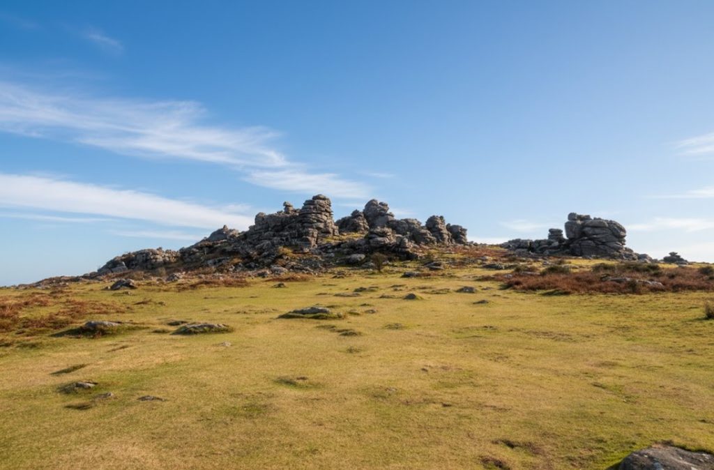
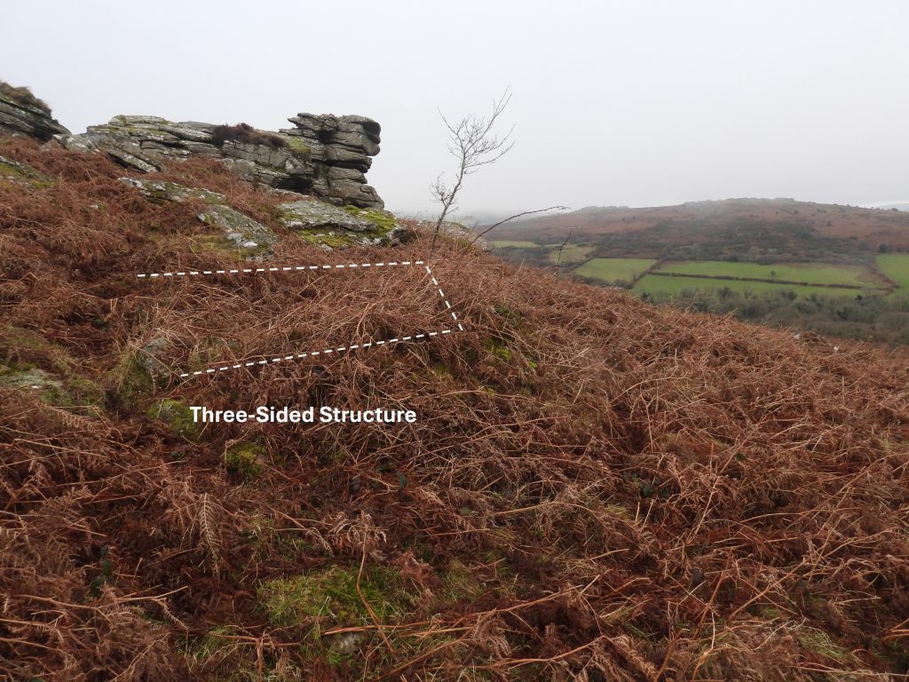
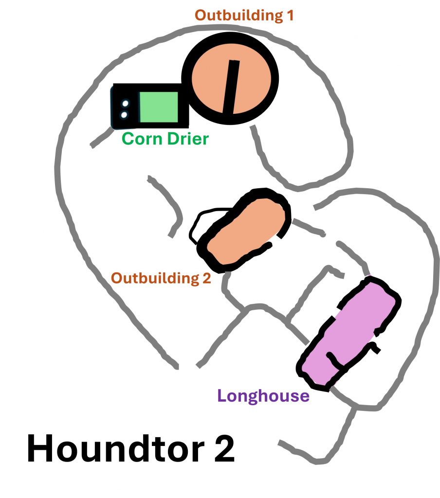
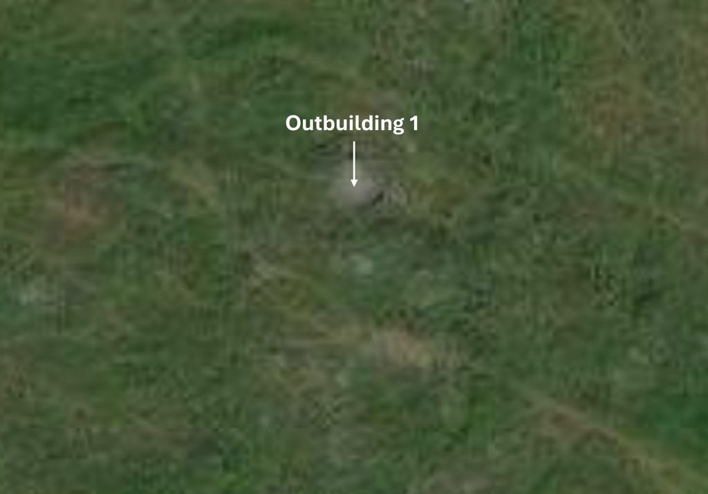
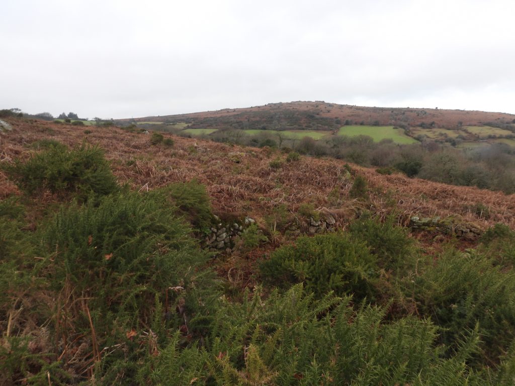
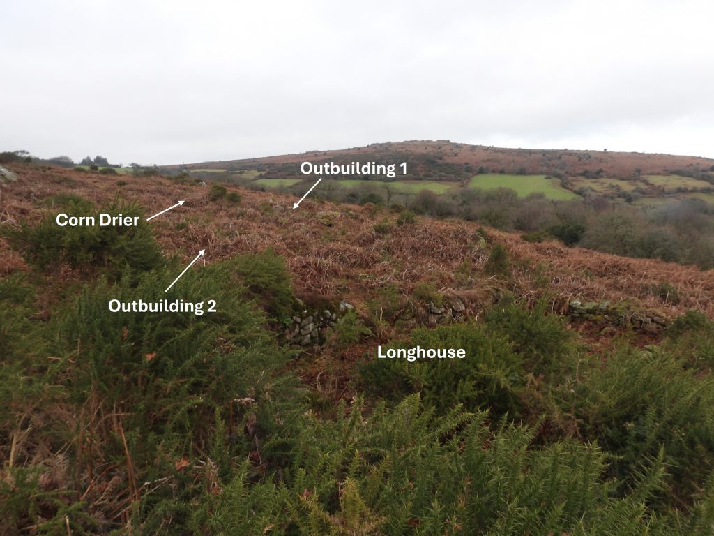
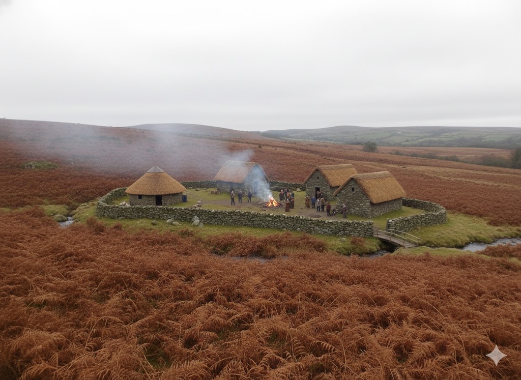
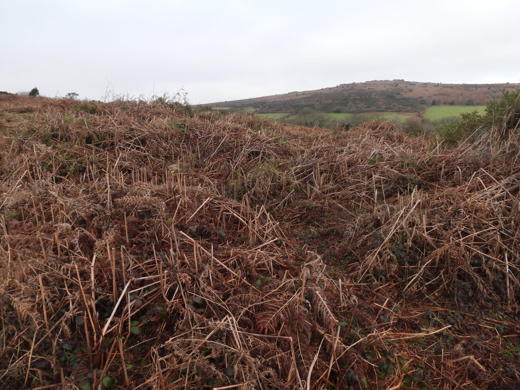
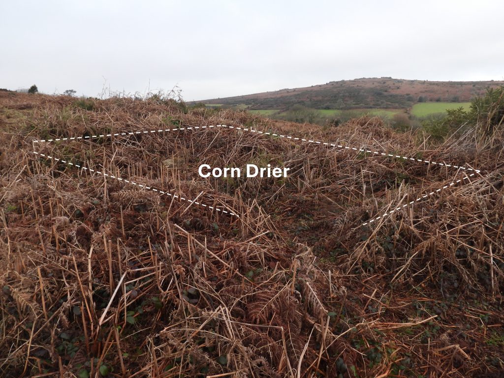
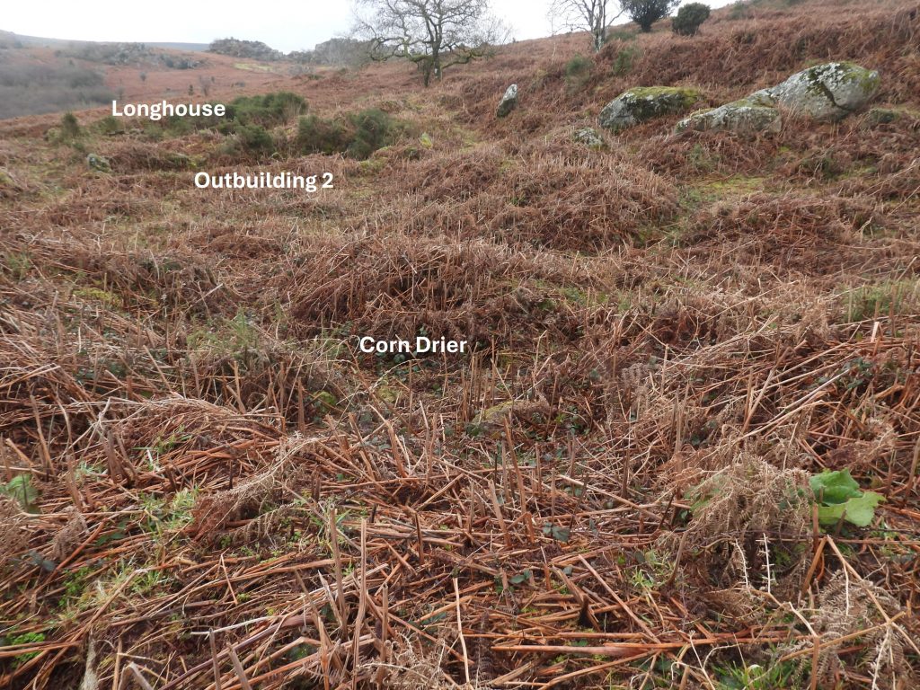
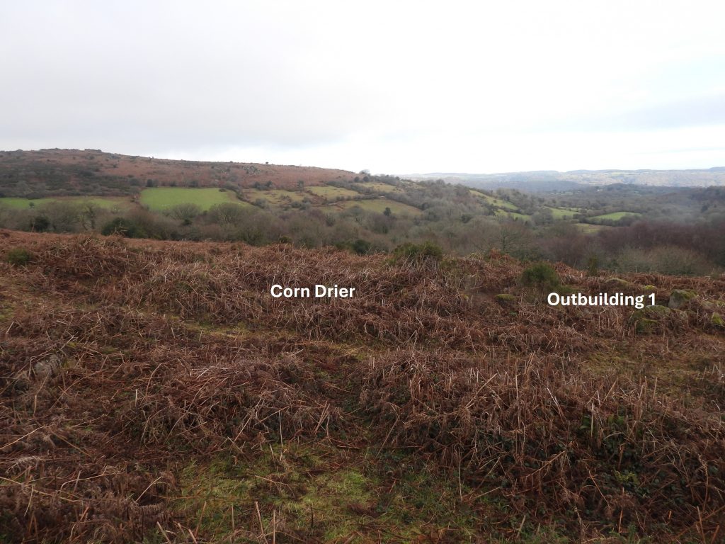
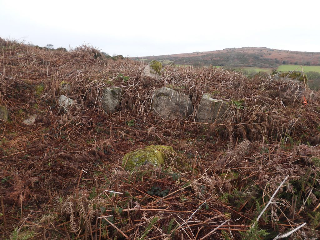
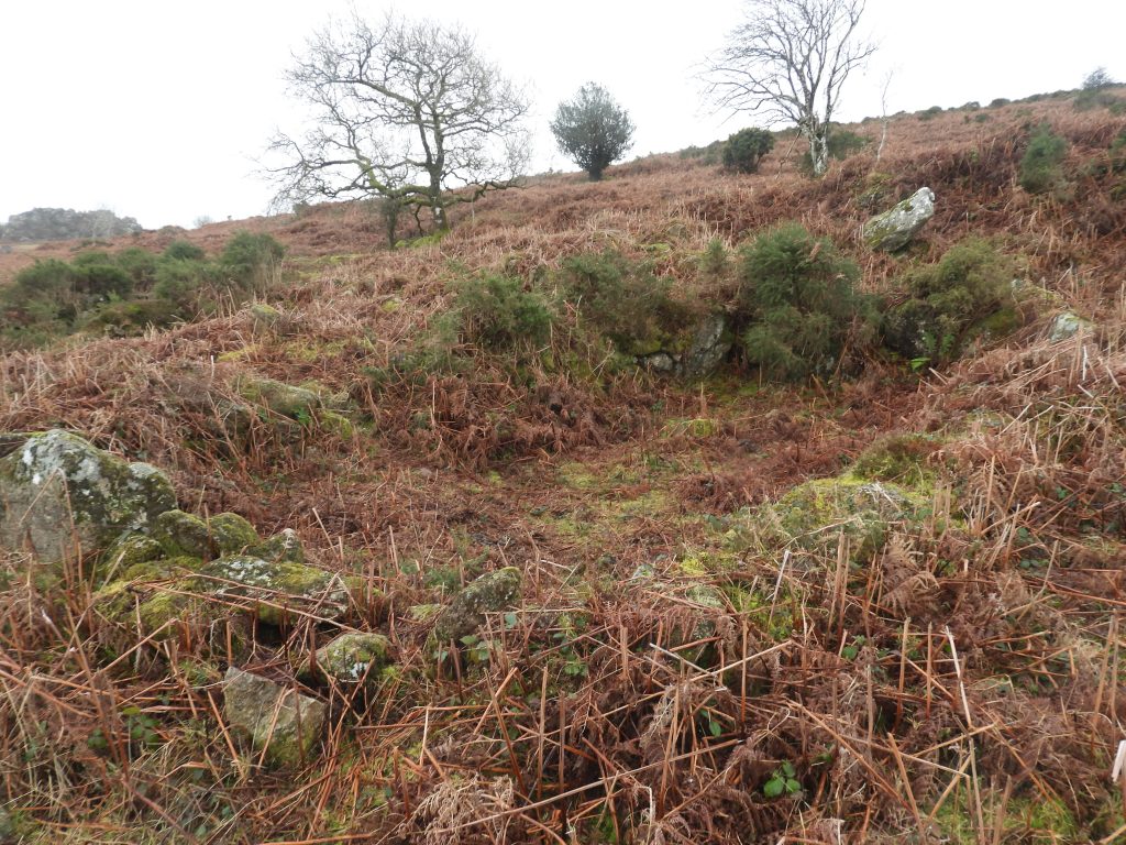
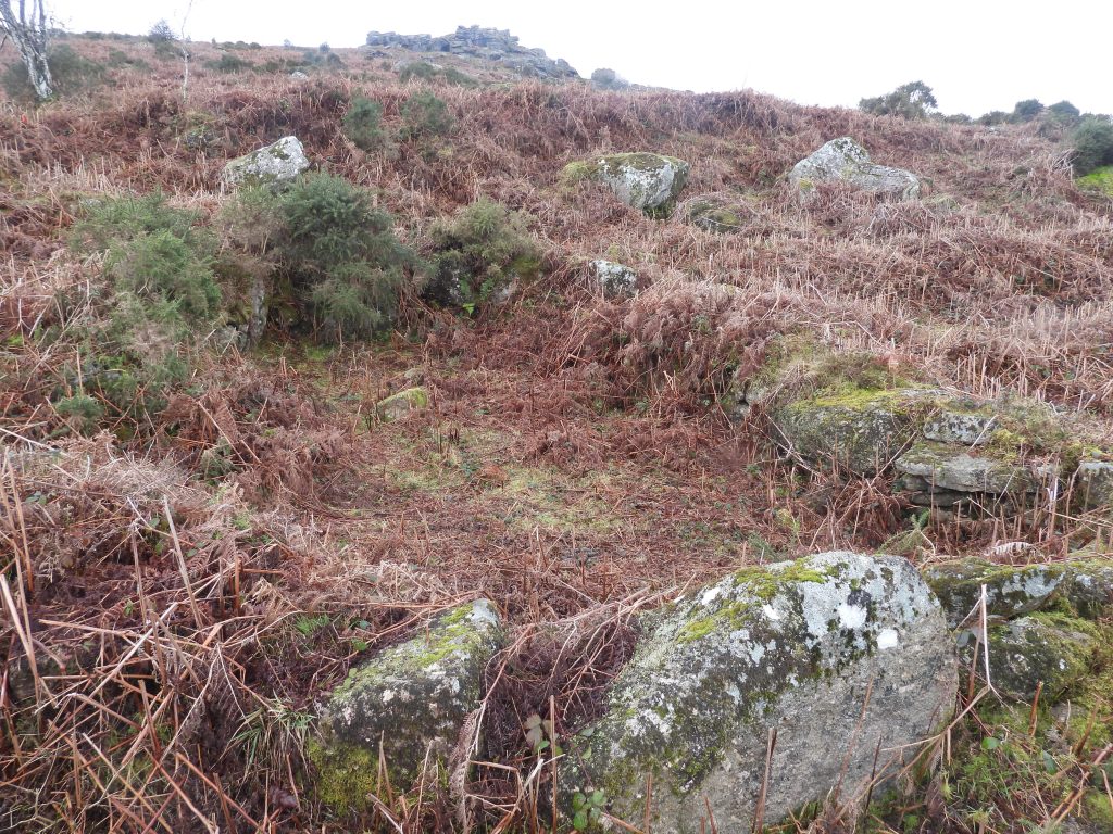
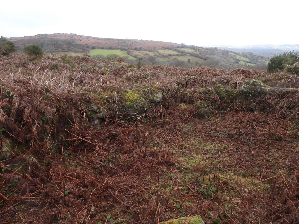
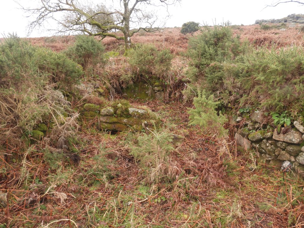
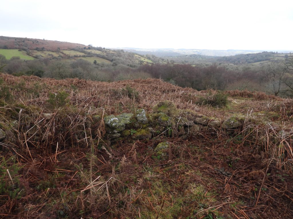
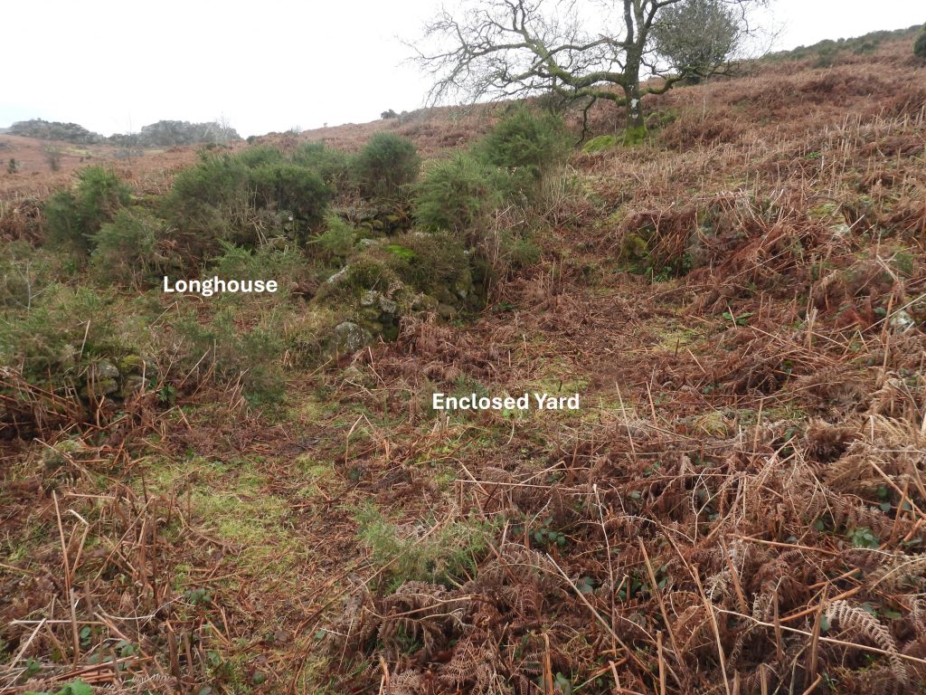
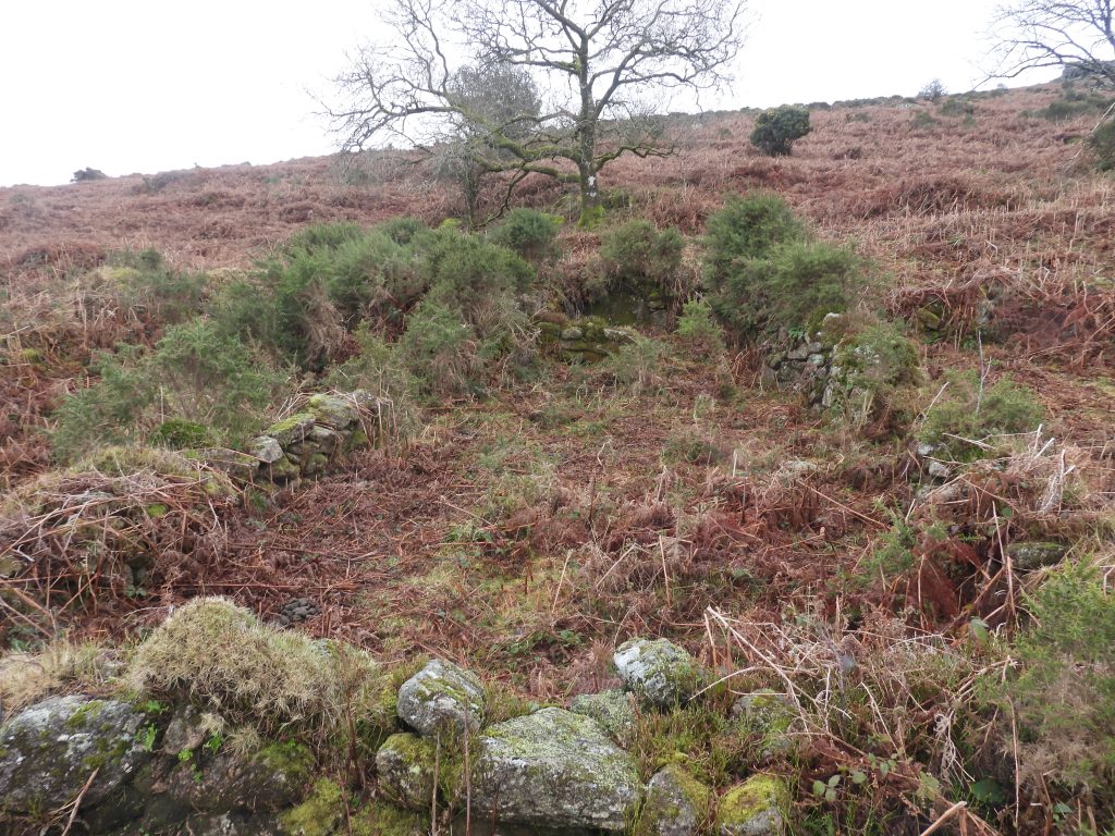
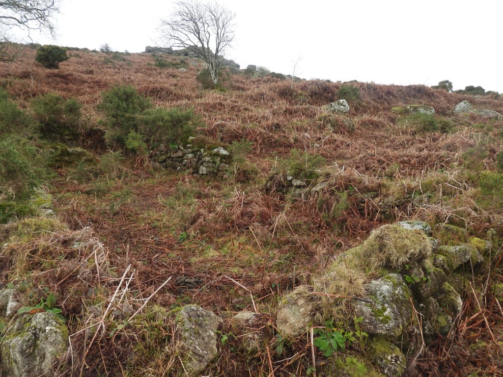
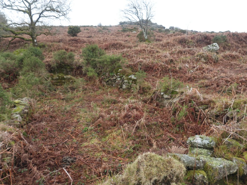
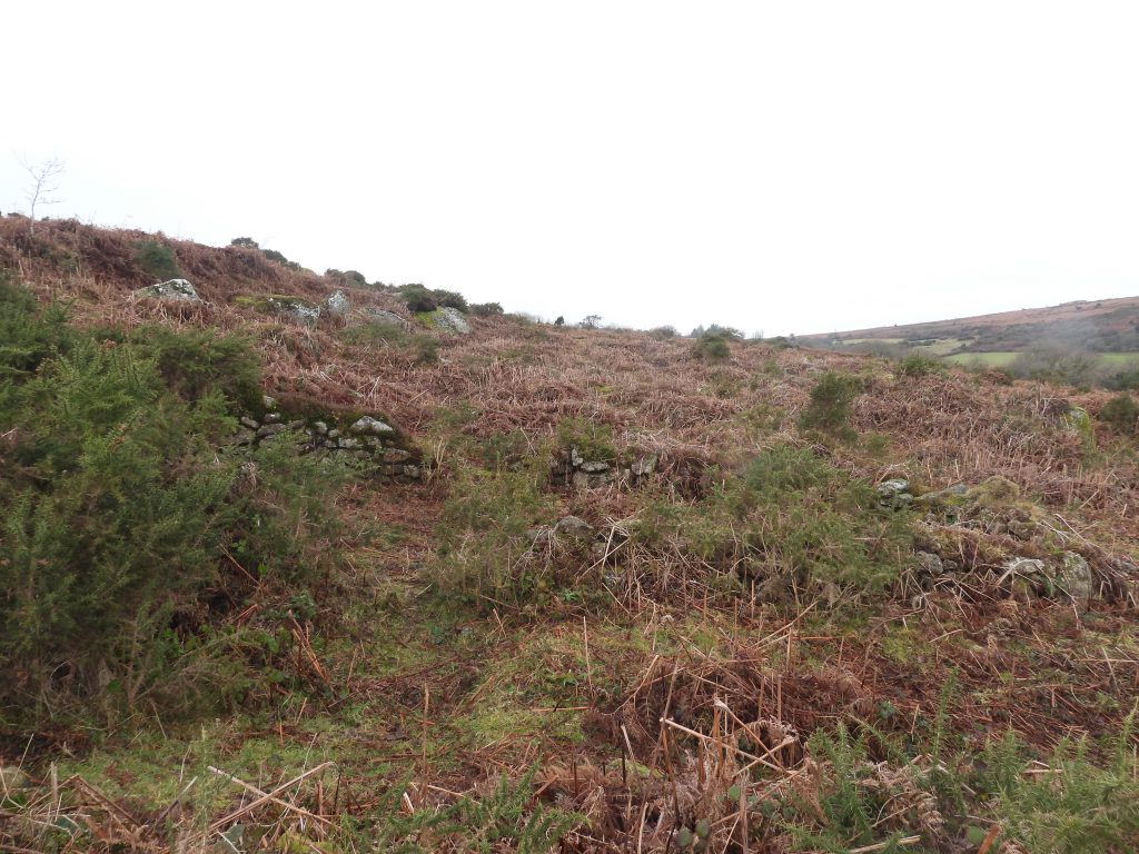
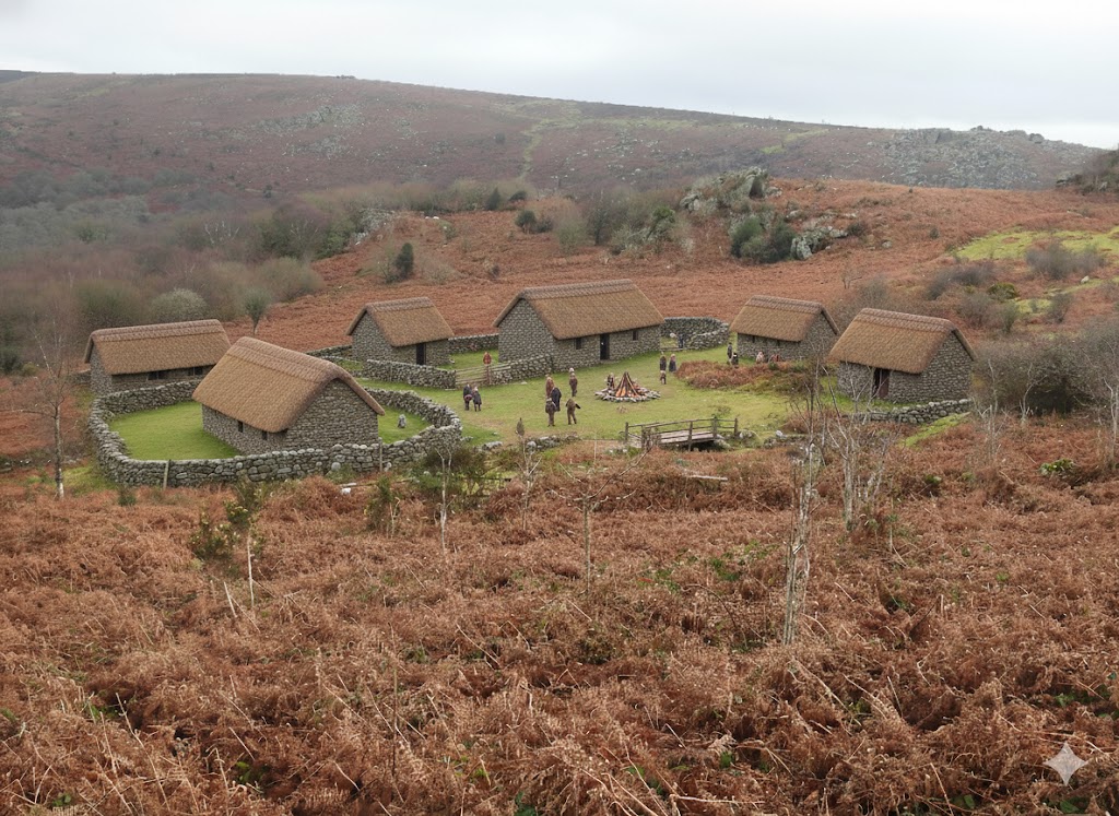
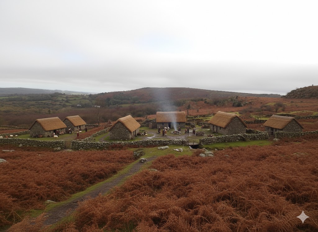
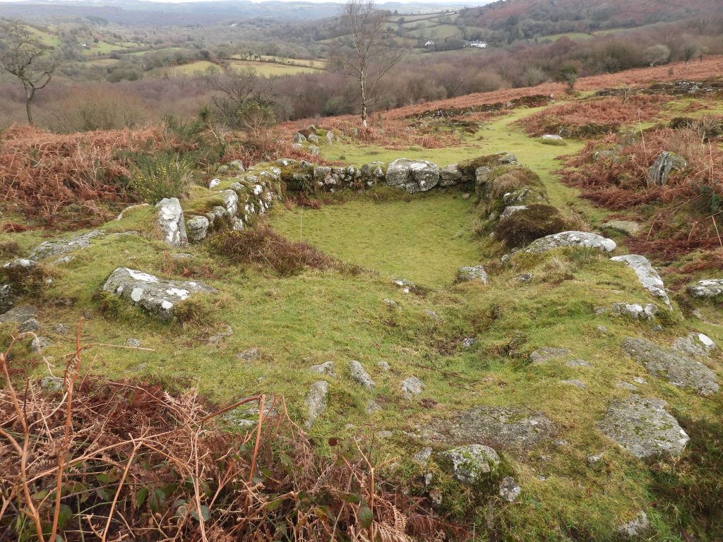
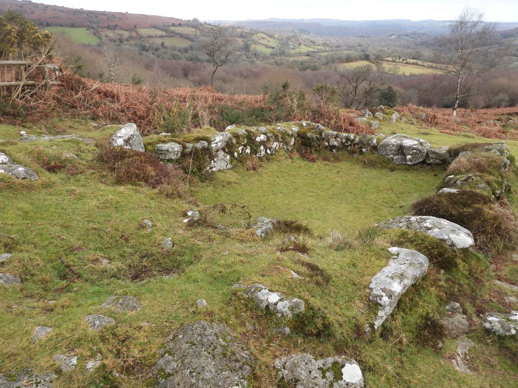
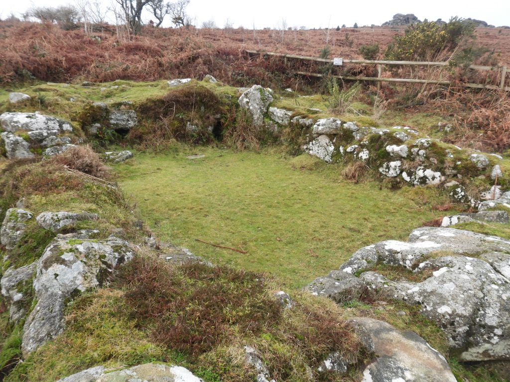
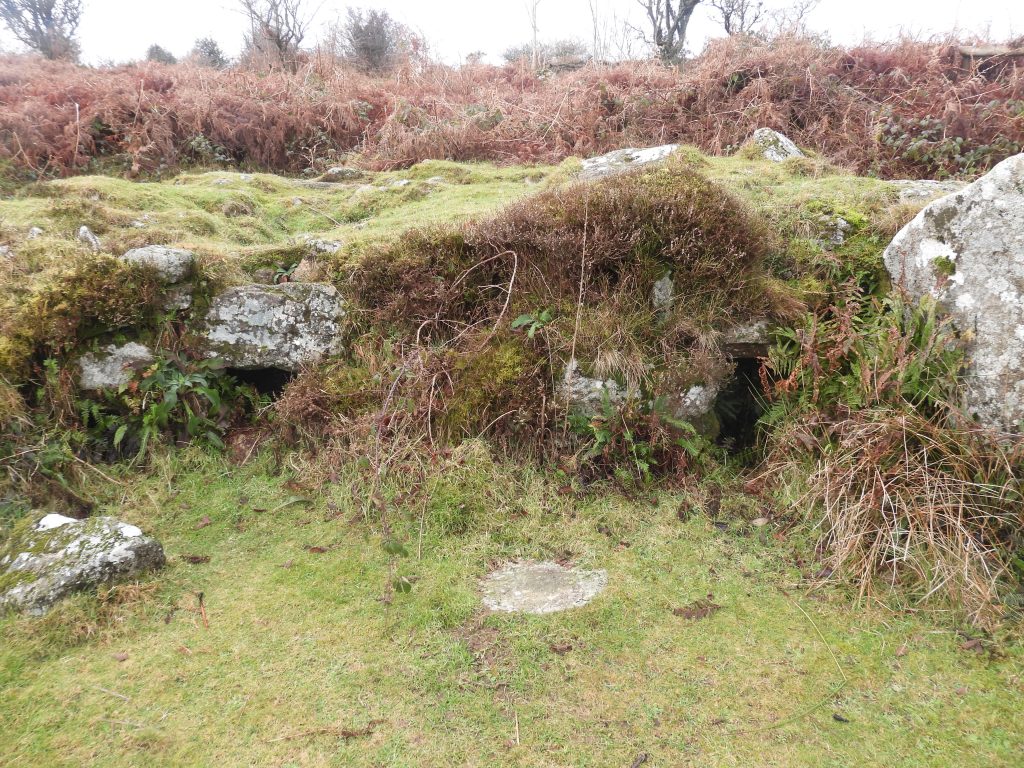
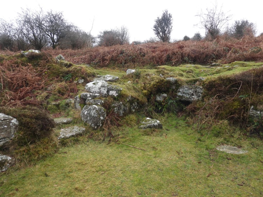
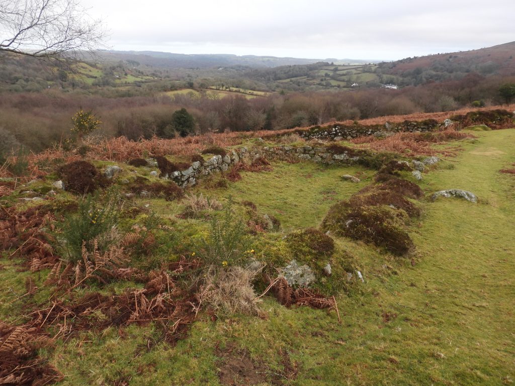
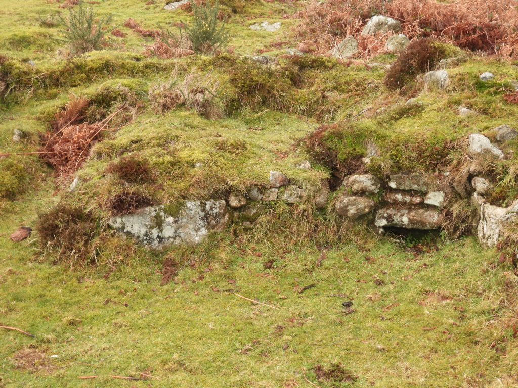
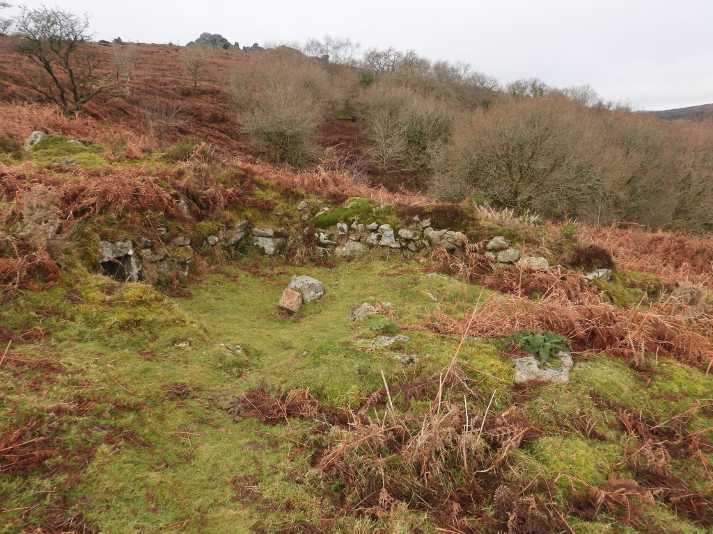
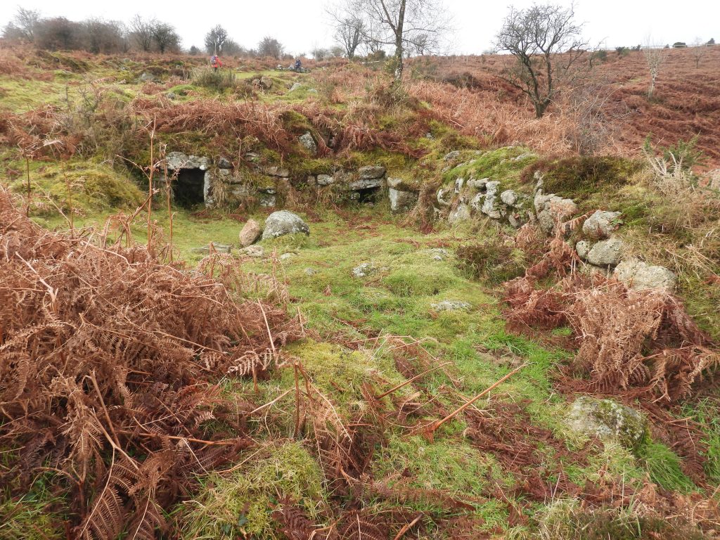
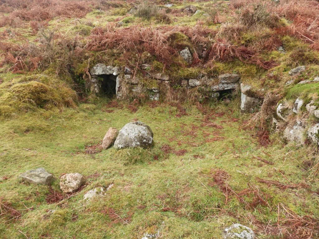
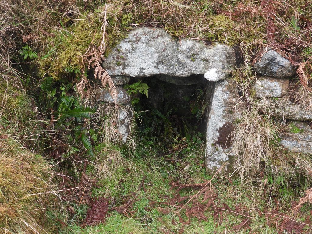
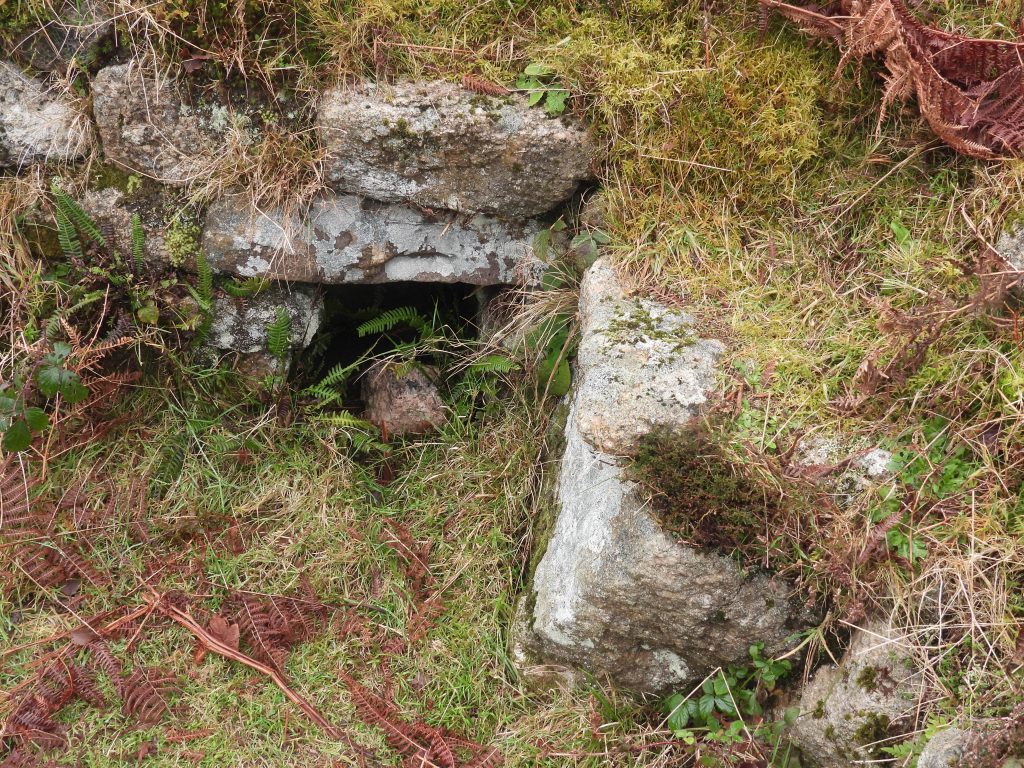
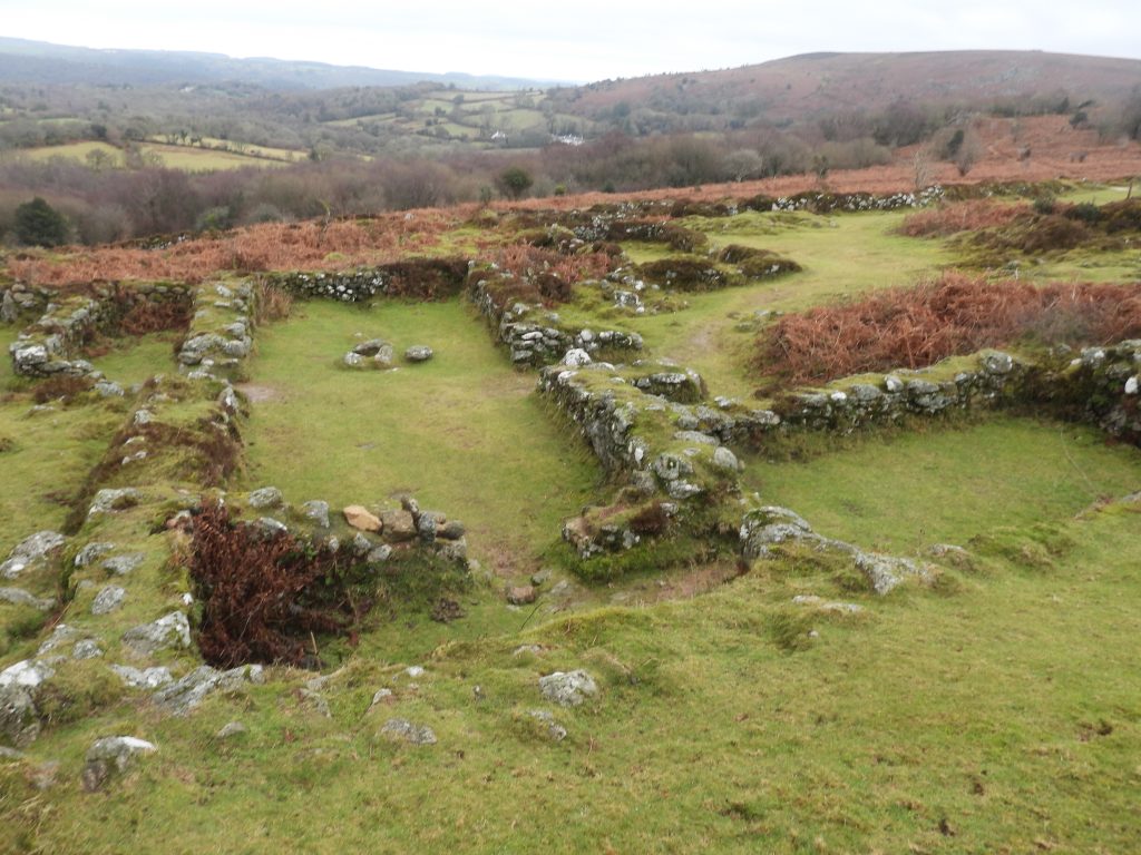
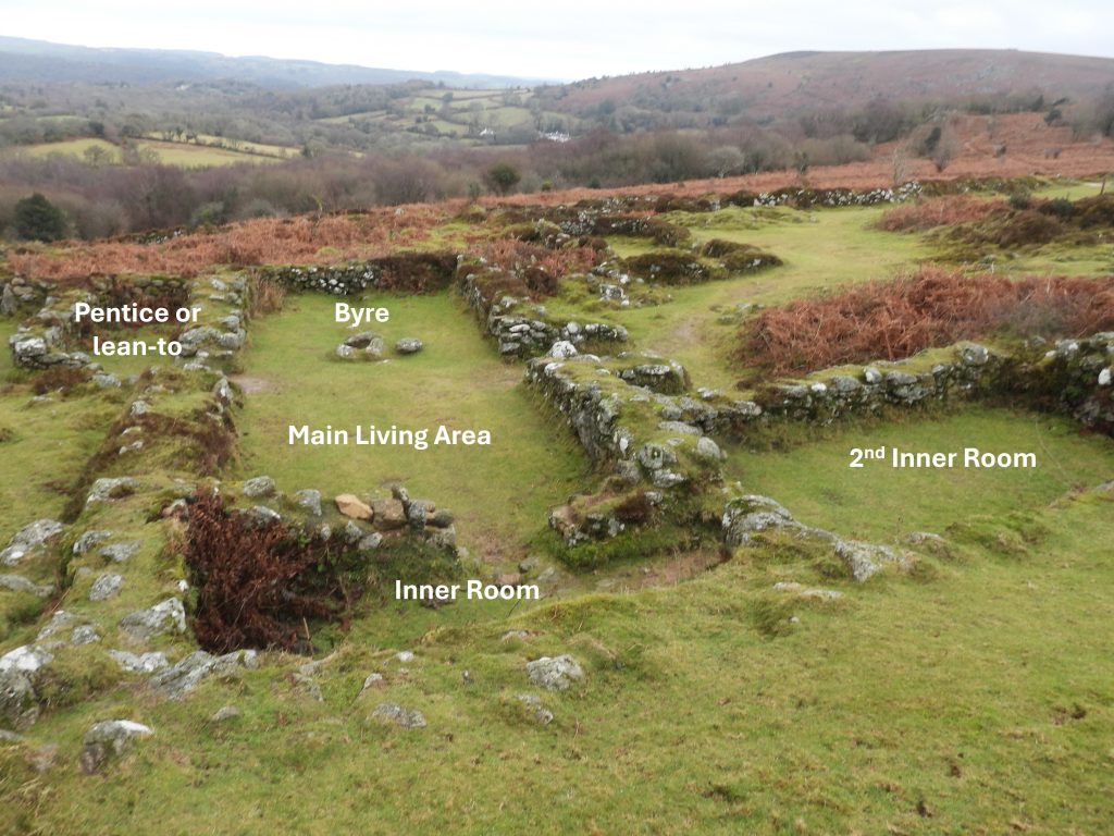
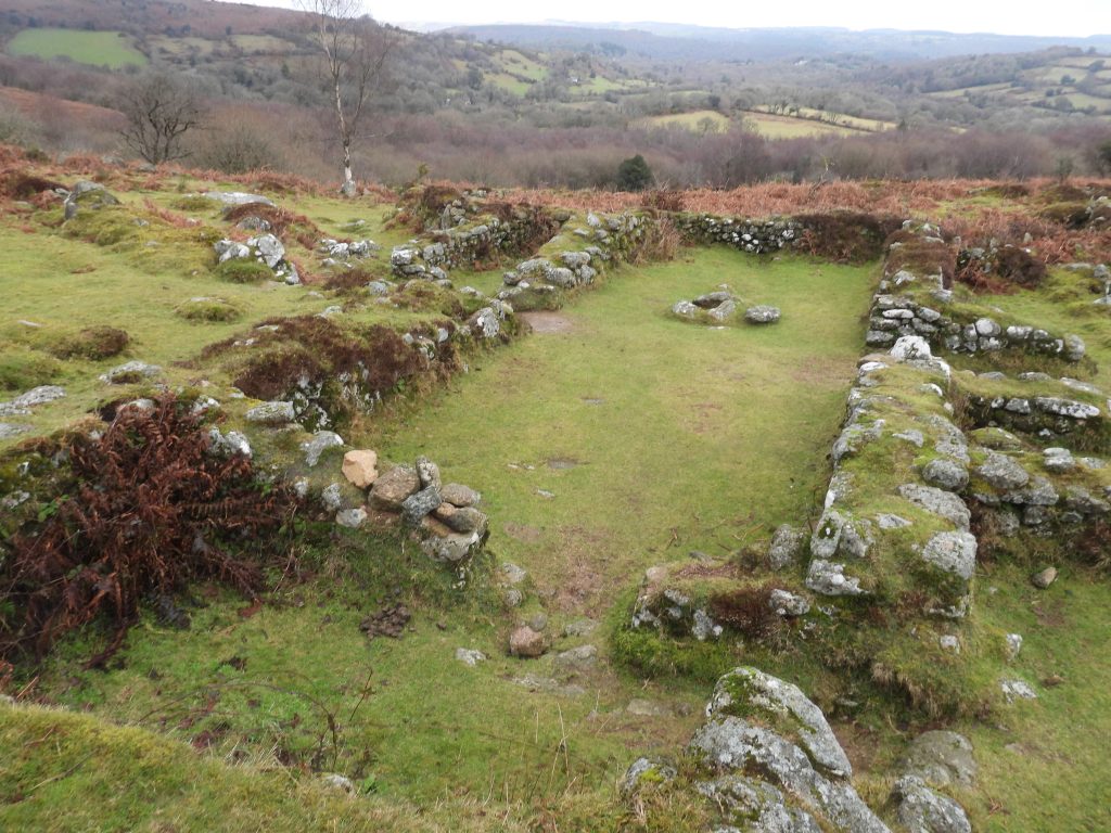
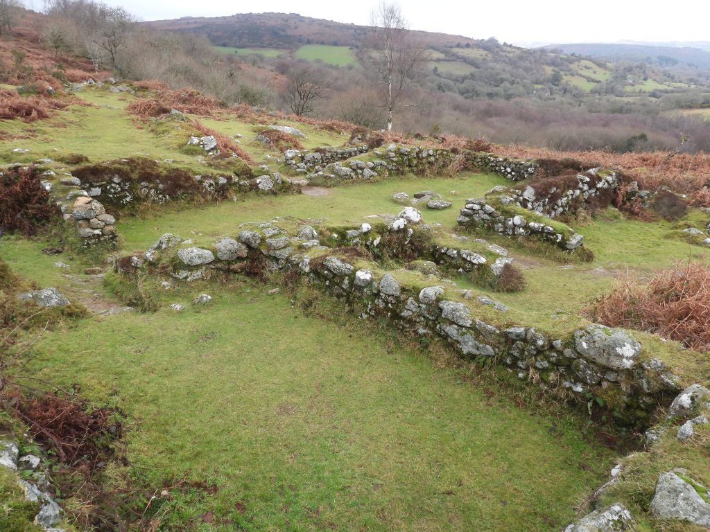
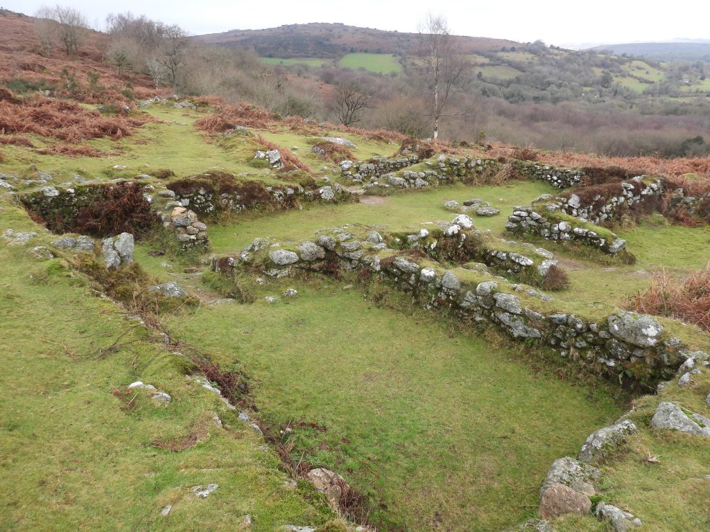
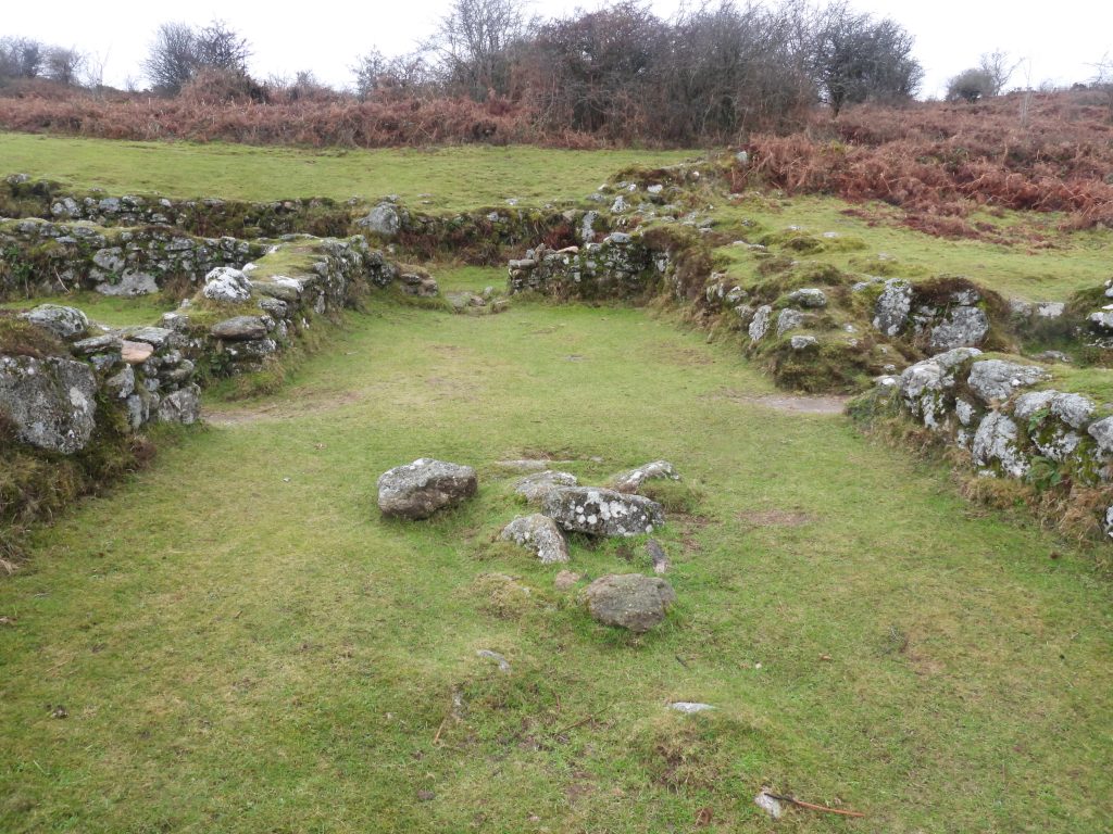
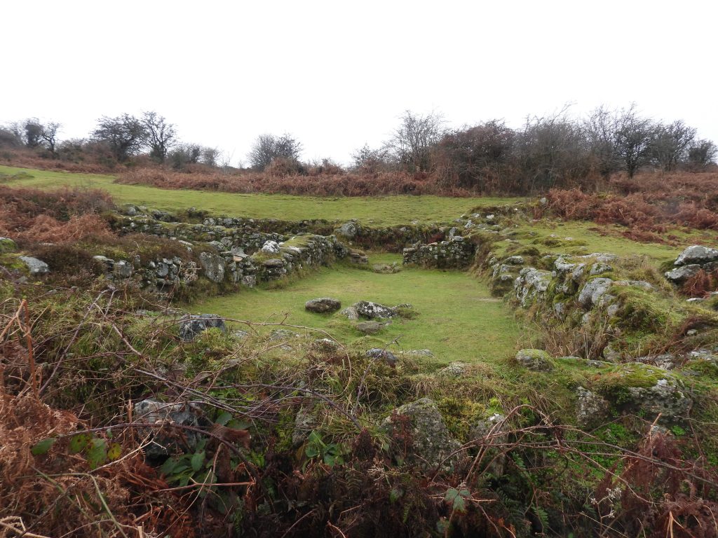
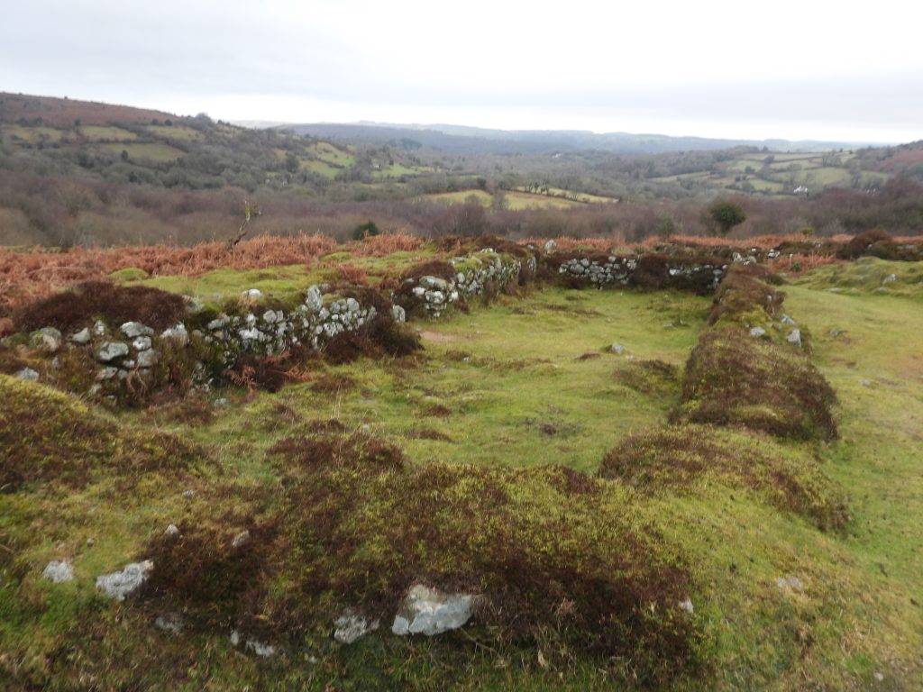
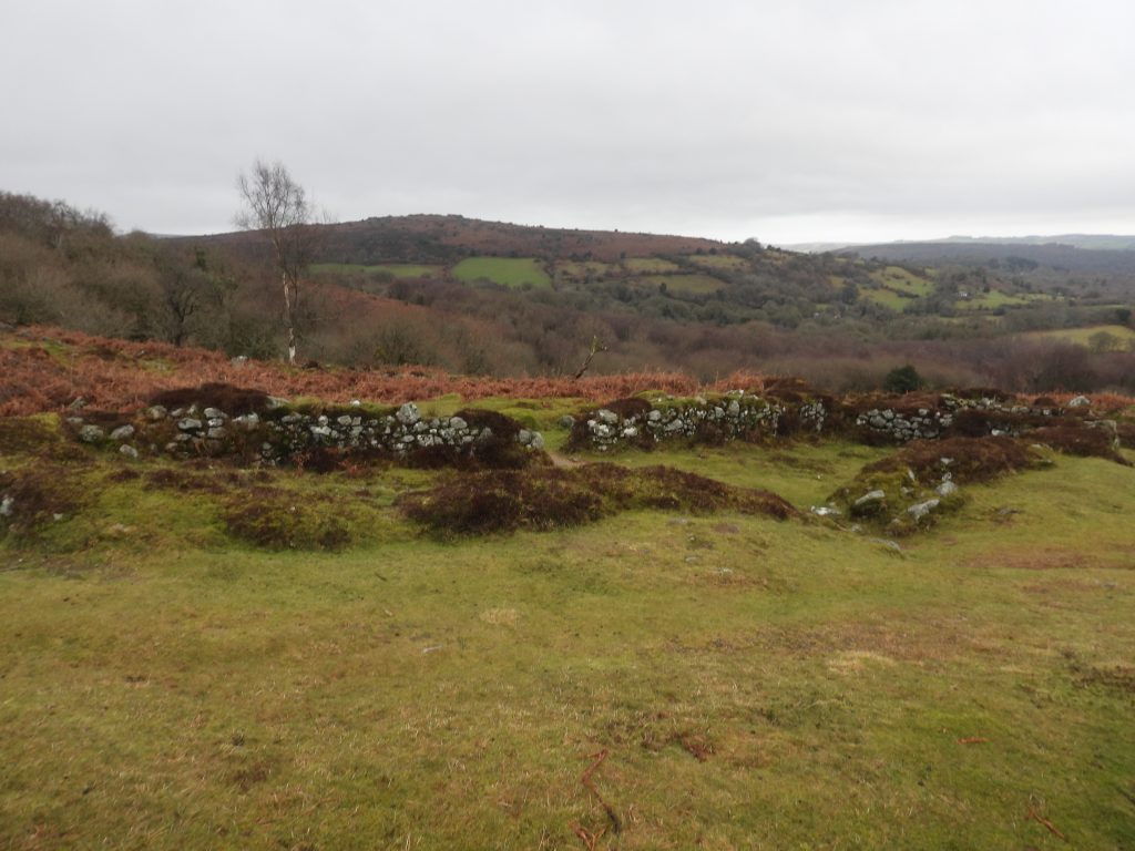
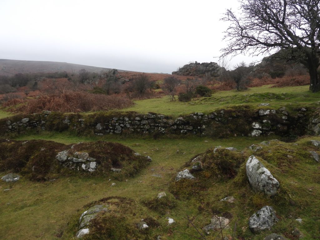
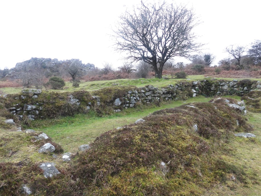
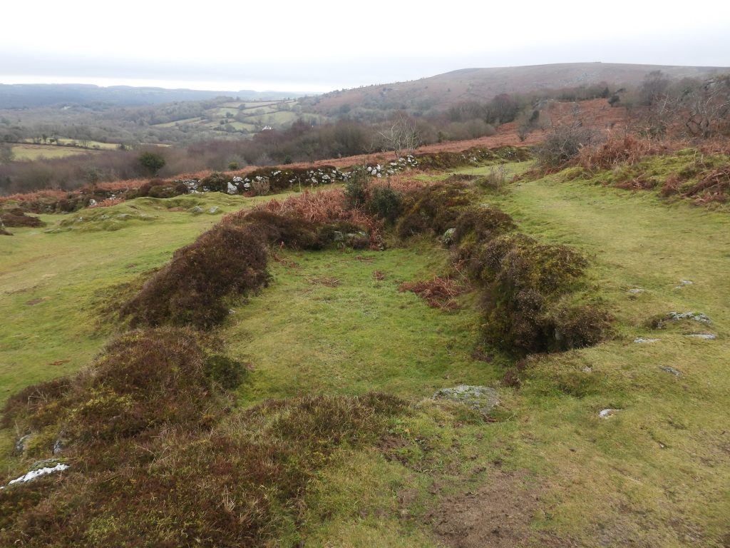
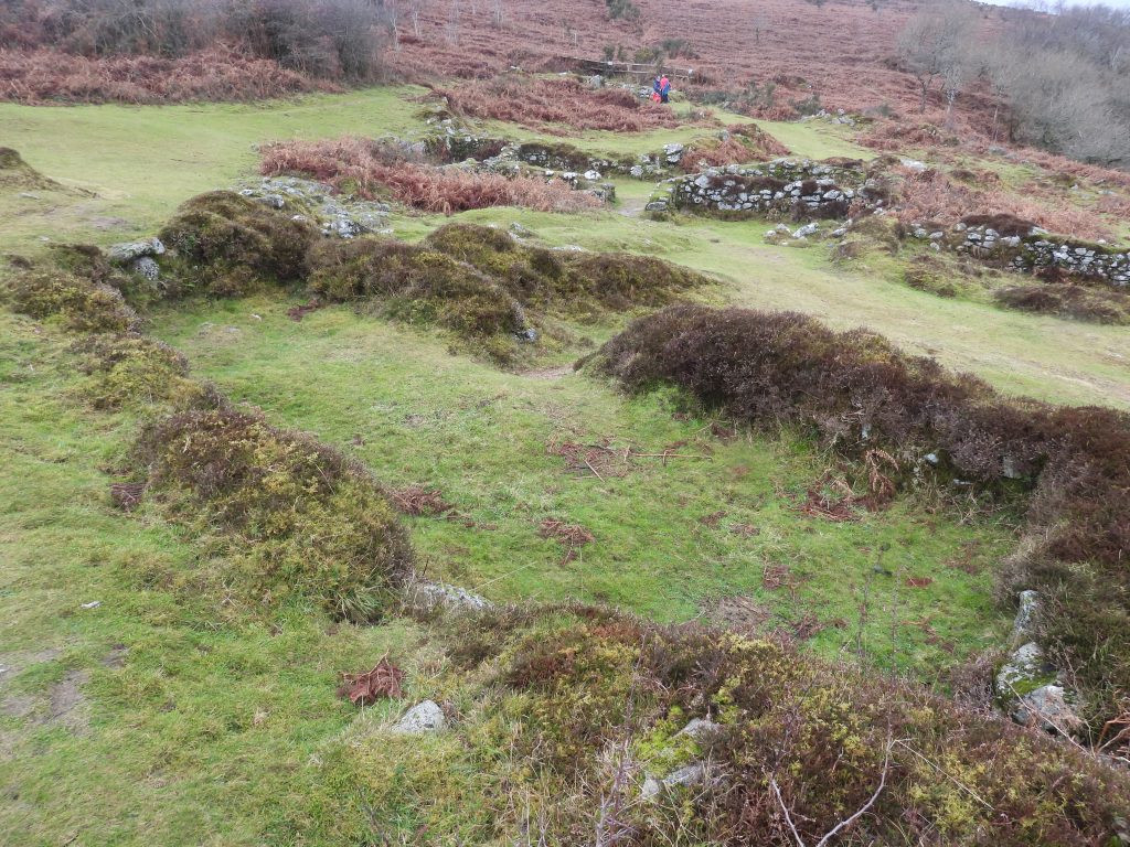
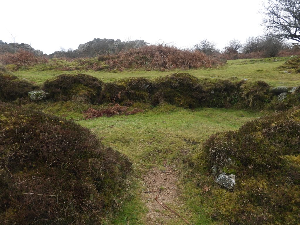
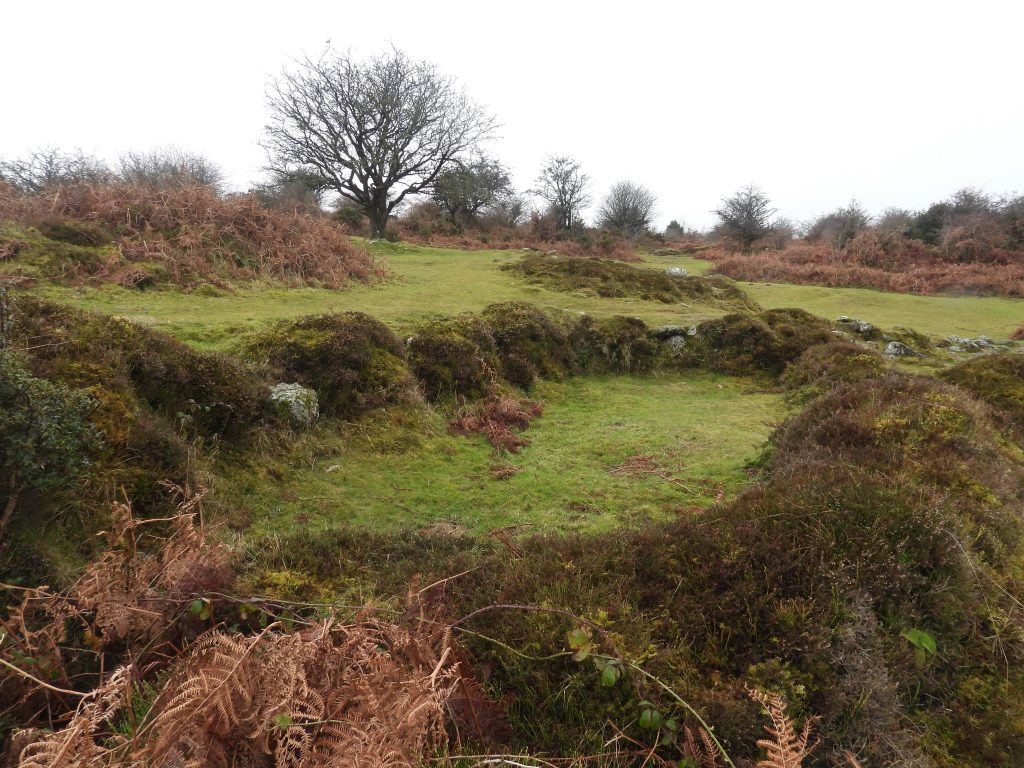
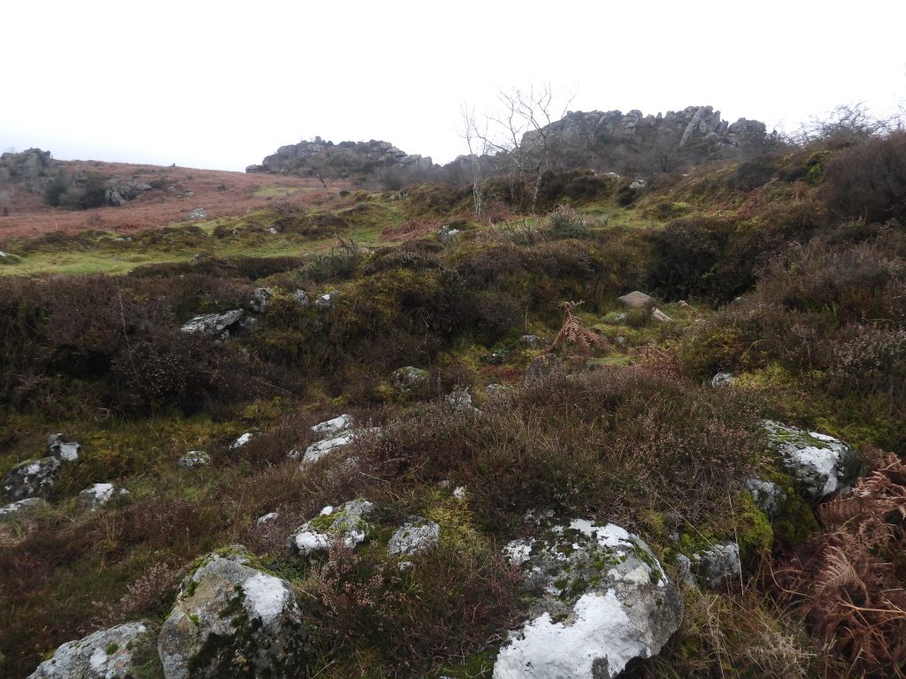
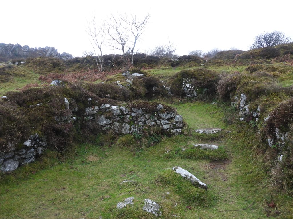
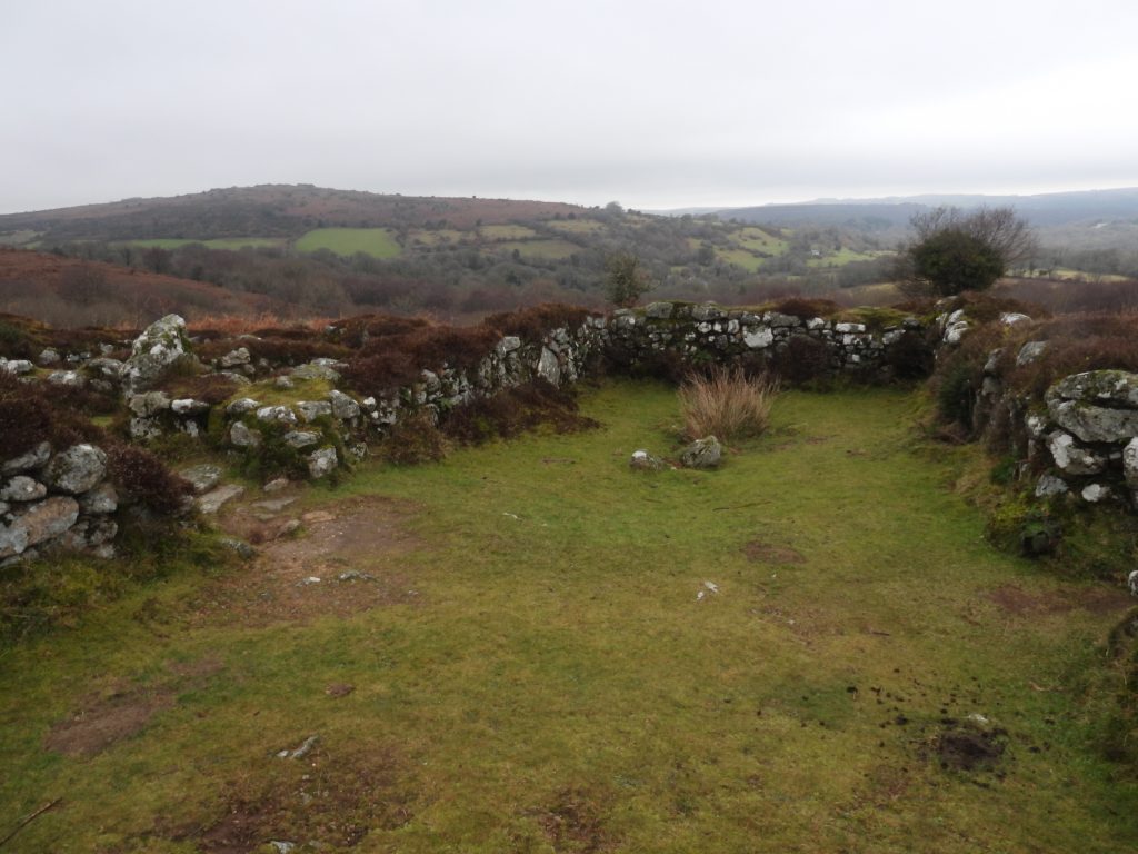
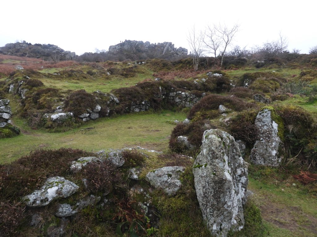
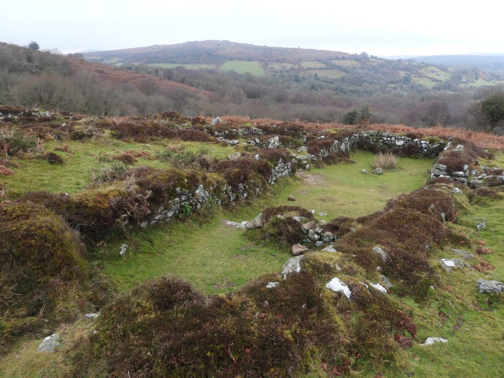
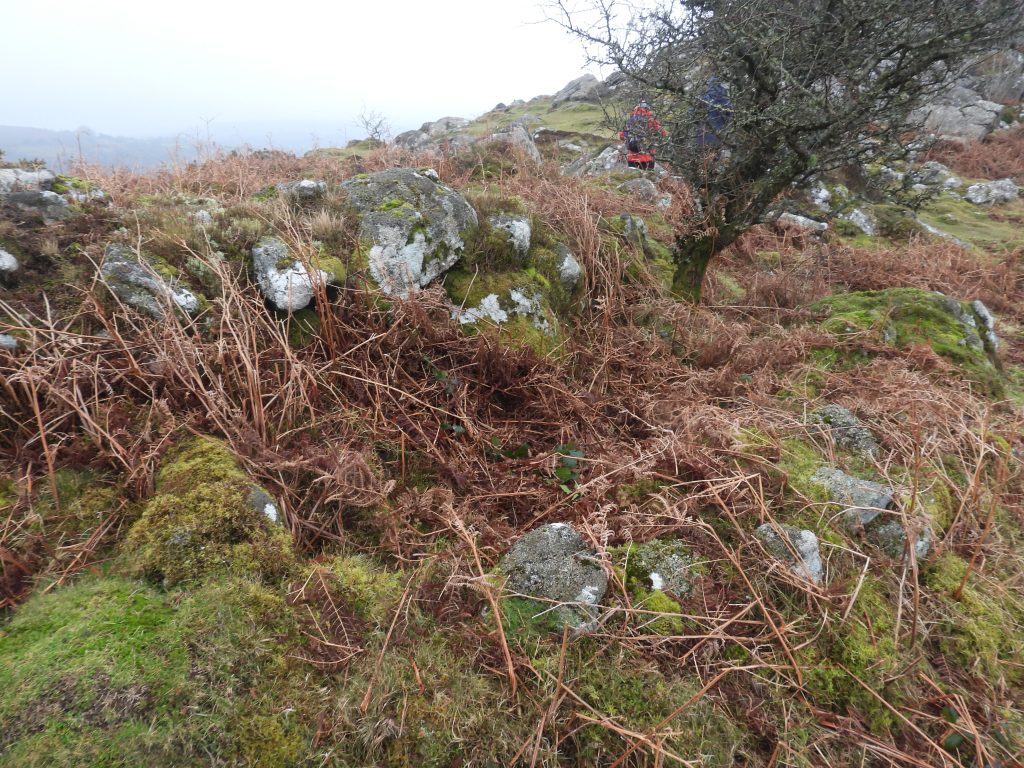
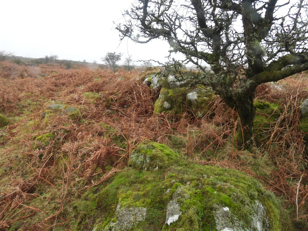
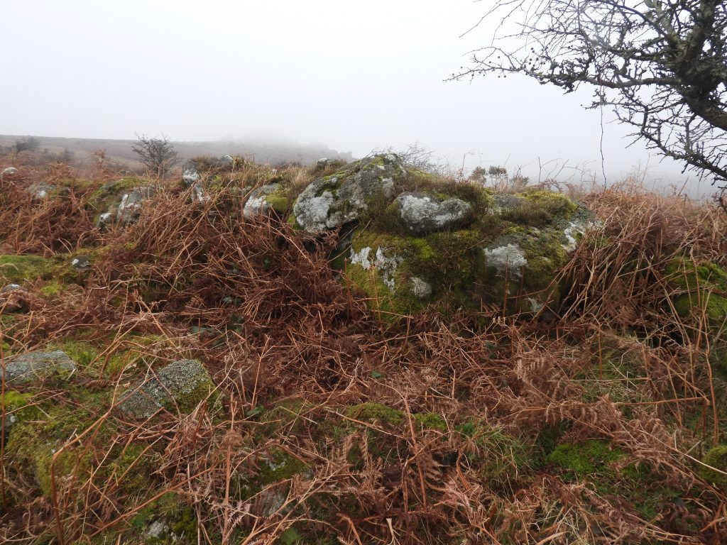
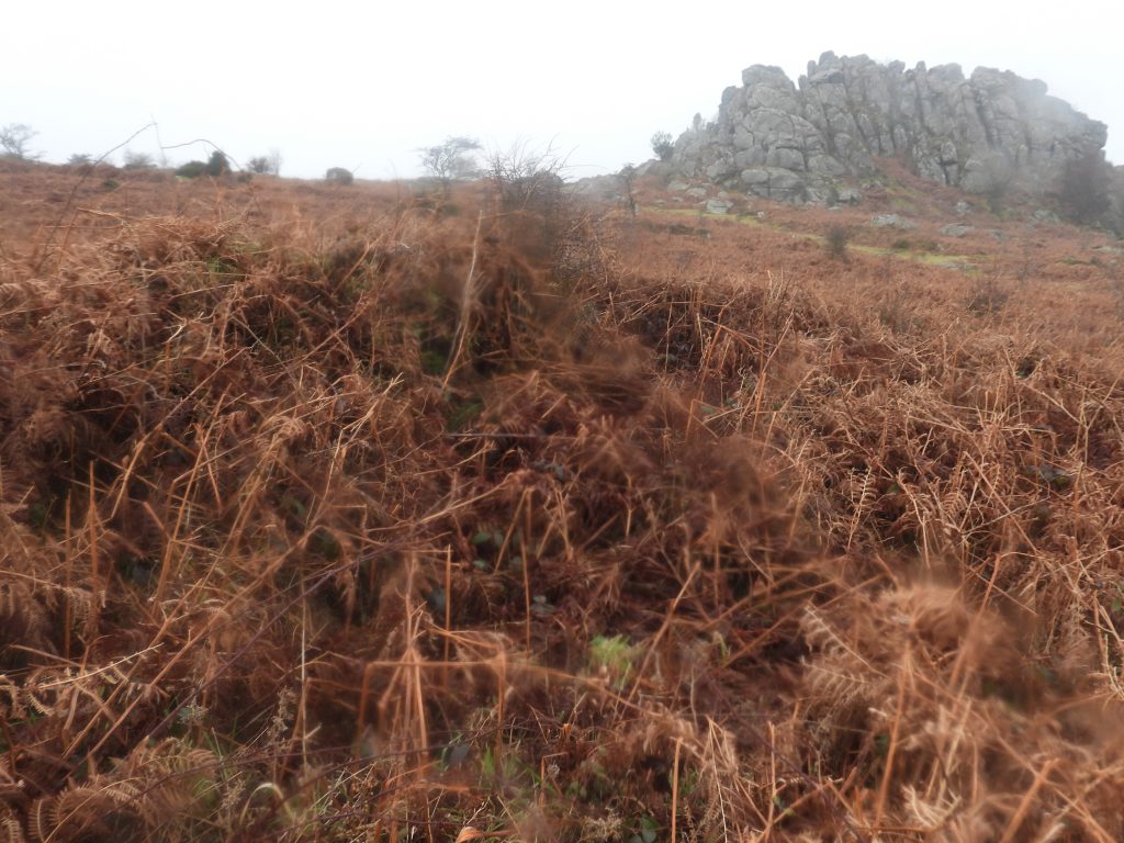
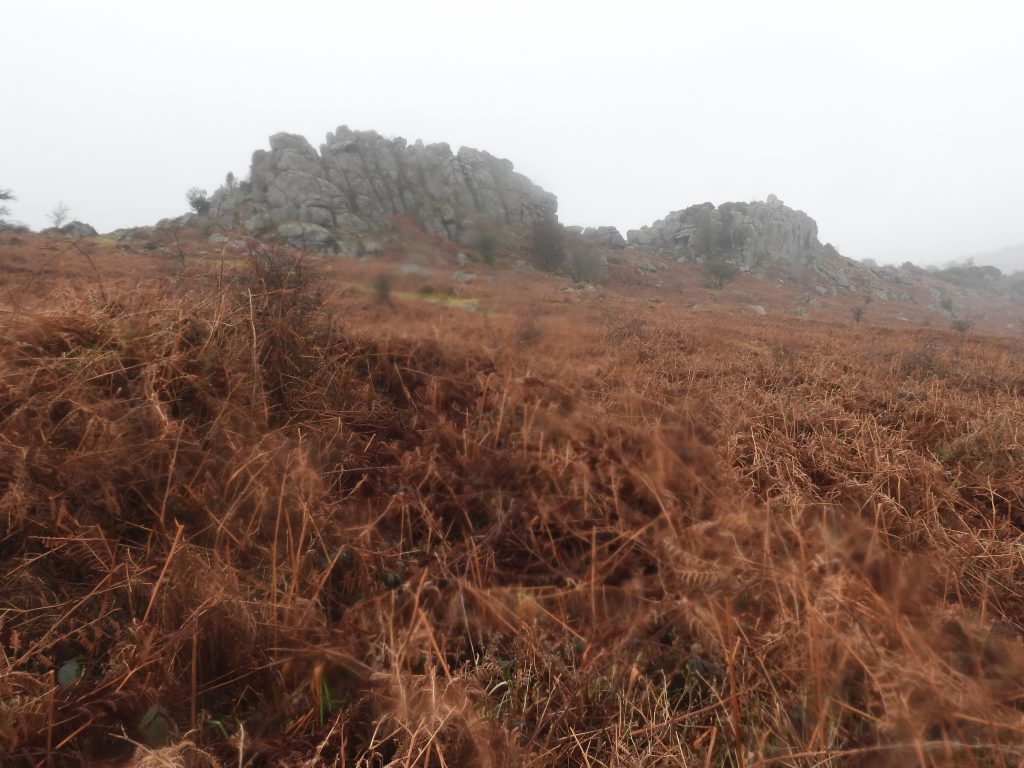
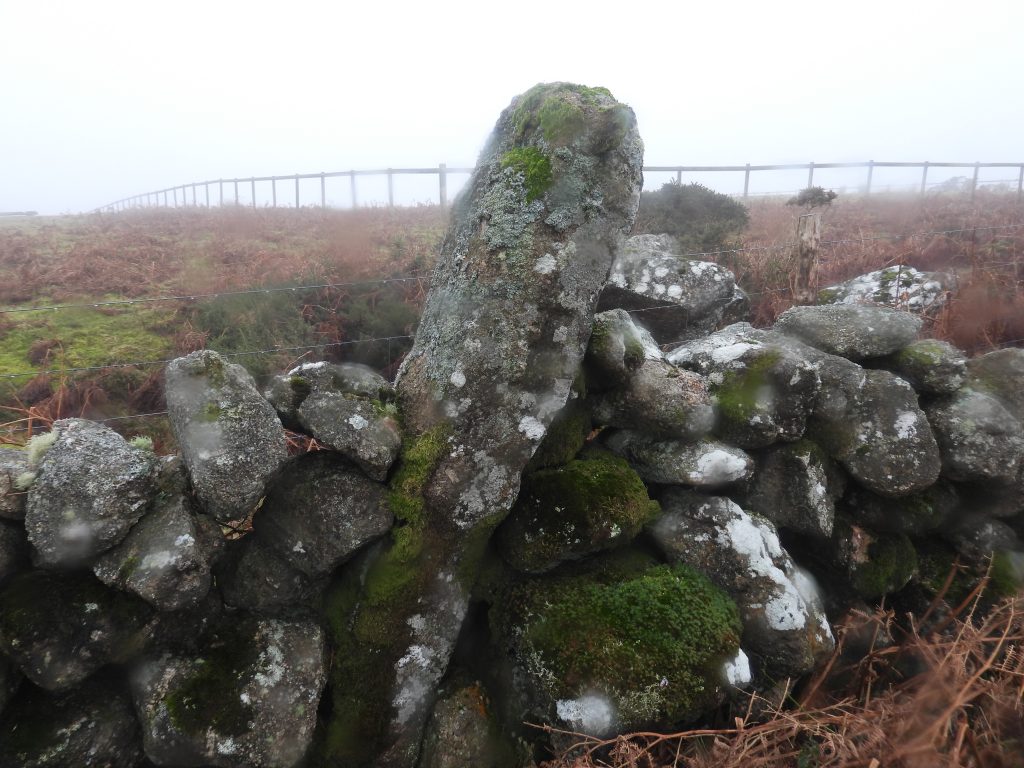
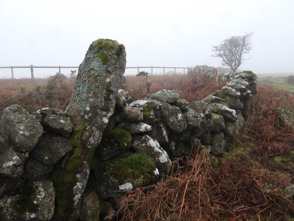
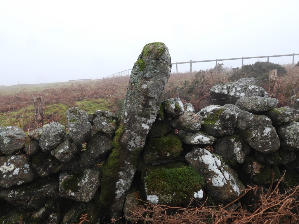
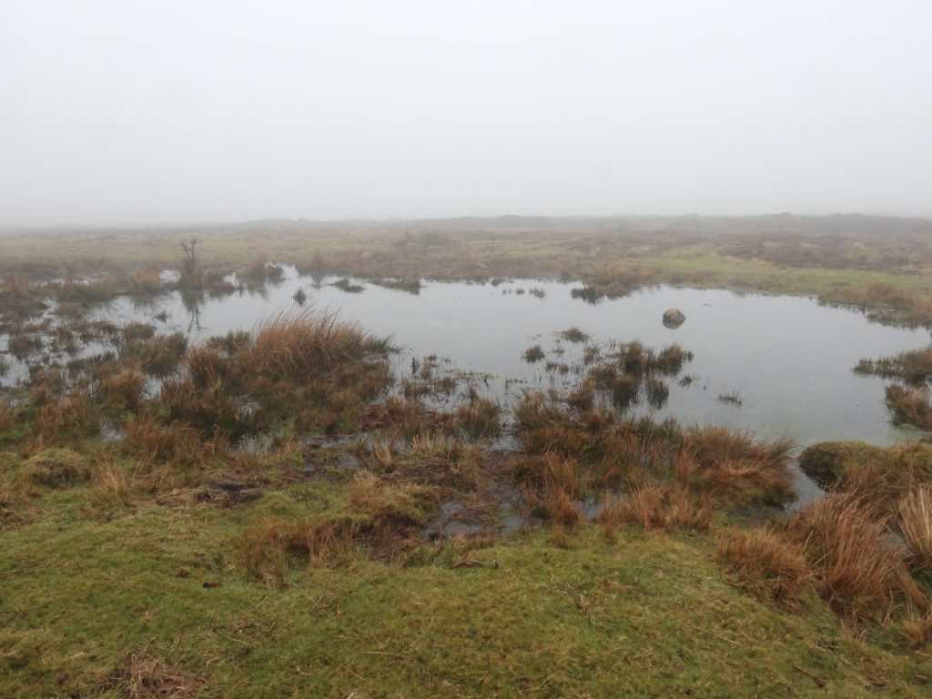
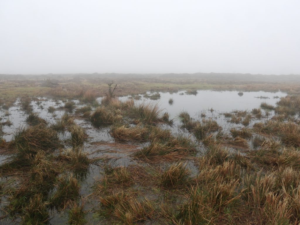
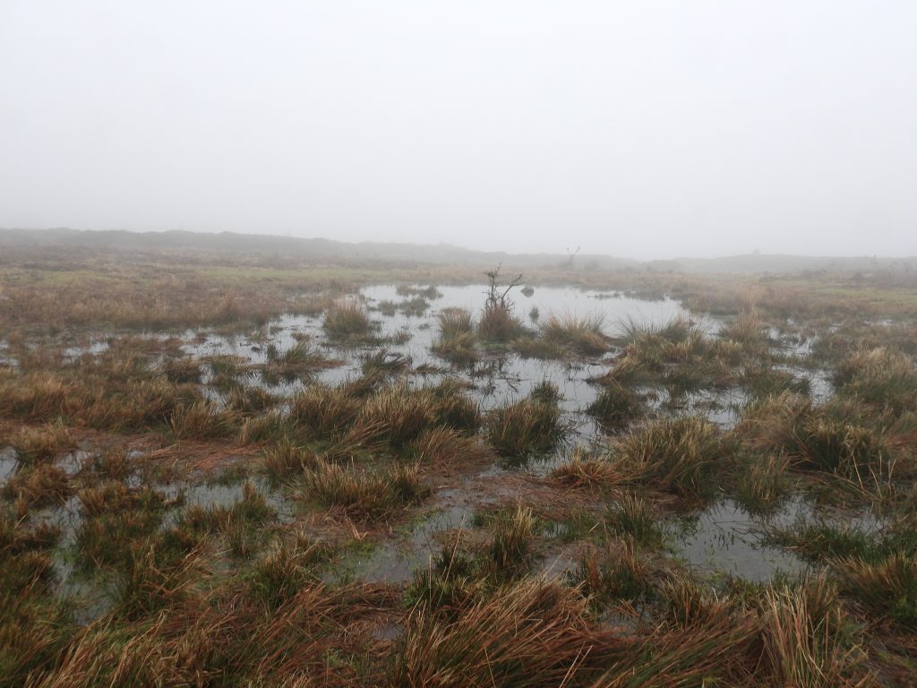
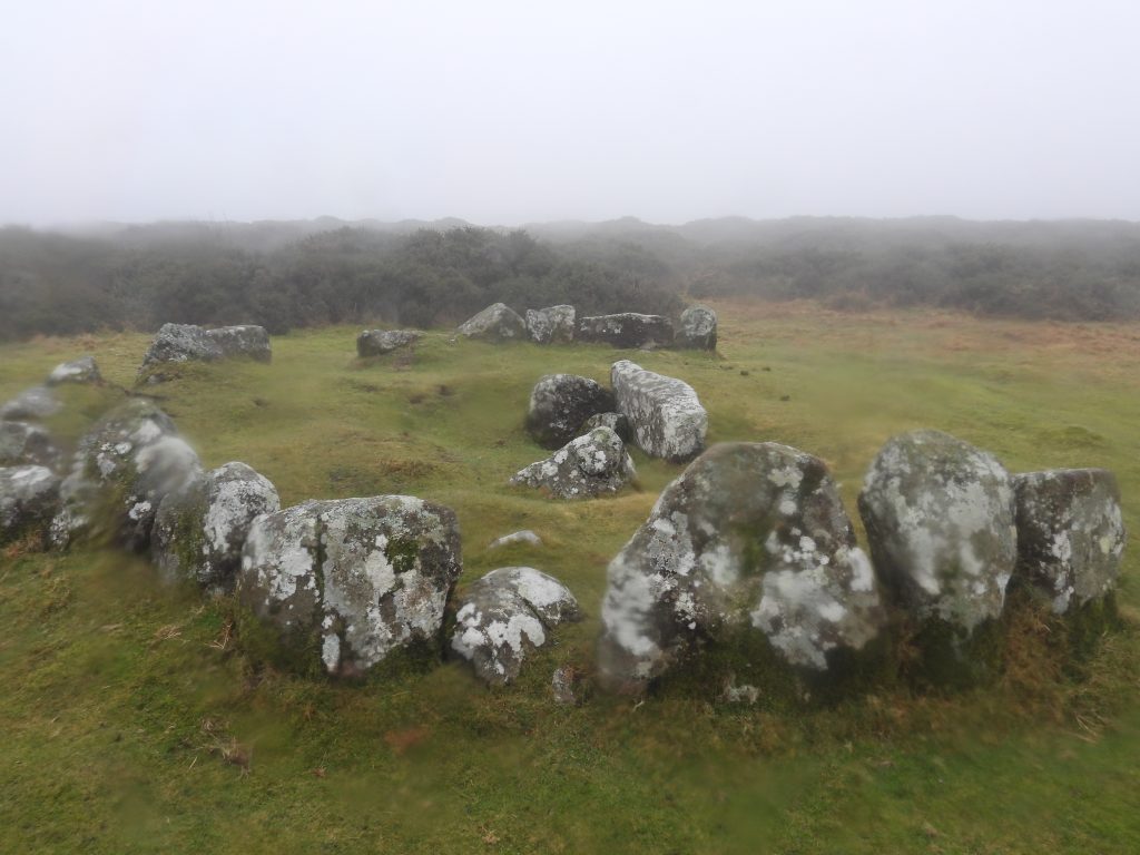
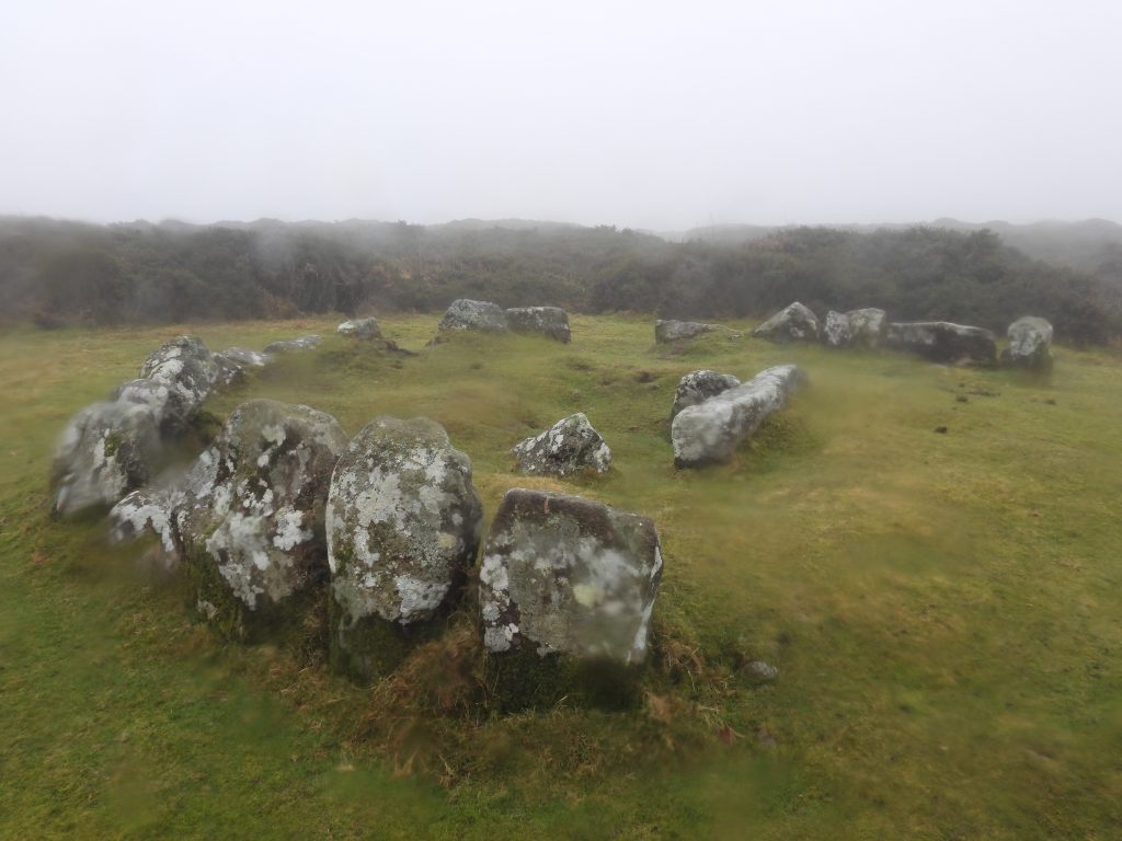
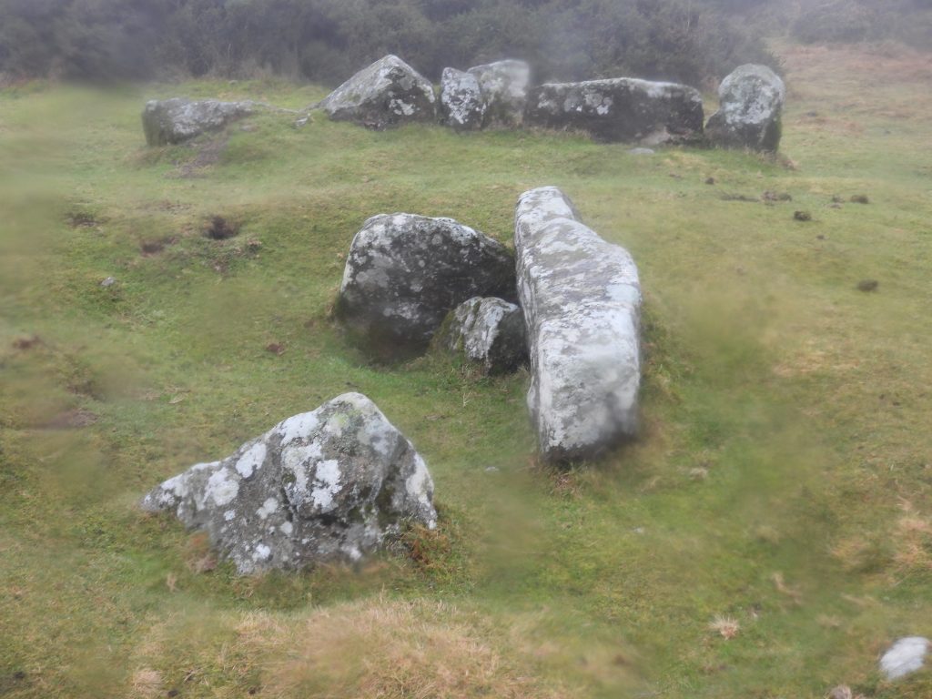
This annotated 19th century map shows the locations of the features covered in this post. Evidence from the Domesday Book from the 11th century (1080s) shows that there was a settlement called Hundetorra, named after the rocky outcrop of Hound Tor. Hundetorra was probably just a dispersed settlement of isolated farms on the slopes between the rocks of Hound Tor at that time (ref: English Heritage)Hound Tor from the west on a gloomy day in January. The ‘Tors of Dartmoor’ website / database records other names that the tor is known as include: Great Hound Tor, Hundatora, Houndtor Rocks, Houndter Rocks, Hounter Tor, Hound Tor Rocks, Houndtordown Rock, Clitter RocksA cleaned up ‘AI’ version of the previous photographThis feature just 20 metres to the east of Hound Tor is a mystery three sided structure. As can be seen from picture, in spite of the winter die back of bracken, the structure is still rather swamped. The three sided structure is square (approx. 2 m x 2m) . It has coursed boulder walls around 0.8 m wide and 1.2 m high. Its open side faces the tor to the west. Its function is unclear, but it is thought to be post-medieval. The author conjectures that it might have been a small look-out facing down the slopes of the tor towards the Becka Brook valleyThe three sided structure as viewed from the south side. It is located at SX74342 78981This simple coloured sketch of Houndtor 2, medieval farmstead is based on sketches by Sandy Gerrard and Jeremy Butler. It is located within a prehistoric enclosure. Of note, is that outbuilding 1 was a ‘re-used’ bronze age hut. There are also two other bronze age huts nearby. Between the longhouse and outbuilding 2 is a small yard. The farmstead is centred around SX745 791, on a level shelf approx 250m from Hound Tor. An aerial view of the medieval settlement, is a startling indication of how much vegetation there is in the area, with only outbuilding 1 being reasonably discernible. A walk down the slope from Hound Tor to the farmstead, even in winter, needs care as there are few paths.Overlooking the medieval farmstead from the south. Not the large amount of gorse and bracken. The walls in the foreground are the longhouse.Annotations on the previous photograph indicating the relative locations of the four principal structures of the medieval farmsteadUsing the previous photograph, the author used an ‘AI’ filter to remove the gorse and add in a medieval settlement. Intriguingly, a small stream has been added, which of course doesn’t exist on the site. The Corn Drier. This building was recorded by Butler as measuring 6.8 by 3.4 metres. This building was not excavated in the 1960s (by Minter) and is located adjacent to the ‘re-used’ hut circle. It was Beresford (in 1975) who assumed this to be a corn drying barn. That said, other observers (Newman), have noted there is as yet no substantive evidence for the kiln and hearth found (as in the other examples at Houndtor 1)Lines added to provide the reader with an insight as to where the walls are under the bracken. The corn drier is located at SX74491 79111The corn drier is best viewed from the north, where the walls can be better discerned. To the south is outbuilding 2 and the longhouse. Greator rocks are in the distanceThe corn drier and outbuilding 1 (re-used bronze age hut circle) as viewed from the south westFormer Bronze Age hut re-used in medieval period – annotated outbuilding 1The former hut circle measures 5m x 6.9 m in an not quite circular shape and has a straight cross wall dividing the interior. It is thought that outbuilding 1 was probably reused as a pen or storehouse. However, it was not excavated in the 1960sThe interior of outbuilding 1. The grid reference for its location is SX74501 79114The partition wall inside the building is 0.4 metres high.Recorded by Beresford in 1979 (from the E.M Minter excavations in the 1960s) as : “A rectangular barn …built parallel to the longhouse……linked to it by an enclosed yard. The barn had been built into the remnants of one or two prehistoric hut circles”. This is outbuilding 2 as annotated on the sketch planOutbuilding 2. Jeremy Butler recorded in his Atlas of Antiquities (Volume One – the east) that there is a curved section remaining outside of this building which has been left (from a former bronze age hut) to buttress the exterior. This ‘curve’ is shown on the sketch plan in this post. The south west end is built into the scarp and the entrance can be seen on the middle left (east) in the photographDuring the excavation of this building it was shown that the original floor had been destroyed and no prehistoric finds were recovered. The adapted medieval building was constructed using drystone walls of up to 1.4 metres thick. It is oriented approximately north-east to south-west and located at SX74501 79097The internal dimensions (Newman) of outbuilding 2 were recorded as 7.8 metres by 3.8 metres with walls up to 0.8 metres high.The 13th century longhouse at Houndtor 2 medieval farmstead. It was subdivided into three sections with one obvious internal wall still surviving which created an inner room on the southern end, which measures 2 metres by 3 metres. There is a step up into the inner roomNorth east end of the longhouse. Construction, like its neighbouring building was constructed using drystone techniquesOutbuilding 1 was thought to have been a barn and was linked to the longhouse enclosed yard.View of the Longhouse, looking south. The building dimensions are around 11m x 4m (but varies between different researchers)The longhouse has two opposing entrances in its north west and south east walls.In the longhouse excavators found a wattle and daub chimney hood collapsed on top of a granite hearth-stone (Butler)View of the longhouse from the south east, clearly showing the two opposing entrancesOnto ‘Houndtor 1’ medieval village, the more well known of the two medieval settlements on the northern and eastern slopes of Hound Tor. An aerial view of the medieval village, is in stark contrast to ‘Houndtor 2’ medieval farmstead and shows very little intrusive vegetation.This simple coloured sketch of Houndtor 1, medieval village is based on sketches by Sandy Gerrard and Jeremy Butler. It is centred SX746 788, located on a southeast-facing slope between Hound Tor and Greator Rocks. Access is very straight forward from the north east‘Houndtor 1’ medieval settlement (or village) comprises eleven ruined buildings, all oriented southwest to northeast. Fragmentary archaeological evidence from the site suggests that in the 11th and 12th centuries (before the village as we see it today was constructed) there were huts used by shepherds and cattle farmers in the summer months (transhumance)The author experimented with AI on the previous photograph asking for medieval building and people to be added. Clearly the number of buildings, their orientation and walling isn’t exact but the picture does give an imagined view of a village at this location The medieval village includes four longhouses, four other buildings (which were possibly lower status dwellings or outbuildings) and three barns with corn driers.This is another experimented AI composition which used the previous photograph. The same criteria were added to the model ‘add medieval buildings and people’. As with the previous composition the number of buildings, their orientation and walling isn’t exact but the picture does give an imagined view of a village at this location Starting in the west side of the village, one of the first buildings encountered is a corn drying barn. It is annotated as ‘corn drier 1’ on the sketch planCorn drier 1 is the first (of three) corn drying barns at the settlement. Butler records that the three corn drying barns were likely to have been the last buildings constructed in the settlement, most likely when the climate was deteriorating. It is probable that crops could no longer be dried in the fields after the harvest and therefore artificial heating was required to preserve the corn seedCorn drier 1 is constructed using coursed stone rubble (as are all other buildings here) and measures approx. 10m by 5m. It is the best preserved of the three and is located at SX74590 78782Corn drier 1 – Masonry-lined openings into the kiln and over at the base of the platform are still visible at its west endThere is a stepped entrance into Corn drier 1 as can be shown in the photographCorn drier 2 is located down the slope at corn drier 1 at SX74628 78797Entrance into corn drier 2Corn drier 2 measures 8m by 4m internallyCorn drier 2. The excavations of the 1960s didn’t yield any evidence to indicate what the floors of these drying barns were like, or what kind of roofs they possessed.The drying kilns of corn drier 2Entrance into corn drier 2Corn drier 3, the furthest down the slope of the three. It is located at SX74639 78806Corn drier 3 measures approx. 8.4m by 3.6m internally. It is not as well preserved at corn driers 1 and 2 possible due to previous vegetation growth over the structureCorn drier 3 looking west into the structure.Description by Beresford in 1979. “The driers were substantial structures housed within a raised platform faced with stone and packed with rubble and growan…..originally there were two kilns per platform, but at a later date all the kilns on the right hand side of the driers were filled in and replaced with high level ovens”. Beresford continued: ” the kilns were heated by way of a straight-sided flue, 2 foot long by 1 foot, 6 inches, the entrance of which and the surrounding ground were burnt by firing”.Eastern most opening at the base of the platform for the oven and kiln at corn drier 3Western most opening at the base of the platform for the oven and kiln at corn drier 3Now for the dwellings….this is longhouse 1 as annotated on the sketch plan. Beresford (1979) stated that this was the most complex of the settlement, comprising byre, living area, inner-room, second inner-room and a pentice, or lean-to.This annotated photograph shows the main constituent parts to longhouse 1. The pentice was possibly for storing straw and hayLonghouse 1 (main part) measures 15m by 4.3m internally. The narrow pentice, or lean-to measures 1.8m by 4.6m and is constructed against the north-western section of the longhouse – it is thought that it may have been added at the later date. The main chamber has an internal partition (immediately below the camera position) at the south-western end. The partition has created an inner room, which measures 2.2m by 4.3 m internally. (Measurements made by Phil Newman)Overlooking longhouse 1 with the large unheated 2nd inner room which extends at right angles to the higher (south west) end of the longhouse. Note the south entrance with its substantial porchBeresford recorded: “No evidence was recovered to indicate the function of the first (smaller) inner-room, although it may have been used as a storage or sleeping area. The position of the second (larger), un-heated inner room may indicate its function was to accommodate a dependent relative”. Longhouse 1 has opposing entrances, centrally placed in the long walls. The stones are thought to represent where the cooking pit and hearth were located. During excavations the ‘remains of a wattle and daub chimney hood covering the hearth were discovered and a small cooking pit was found lying to one side of the granite hearth’ (Beresford)Overlooking longhouse 1 from the north east. The building is located at SX74617 78771Longhouse 2 is a far more simpler affair comprising a building which measures 14.2m by 4.3m internally. As with others, this building is likely to have been a single storey thatched structure. Walls were constructed to shield the passage from the byre (lower end) and the living area (upper end)Longhouse 2 has two opposing entrances, which like others in the settlement are placed in the centre of the long walls. Porches were added to both entrances at a later date and the thresholds were pavedLonghouse 2 with its opposing entrances very evident. This cross passage separating the living area from the byre. The south entrance (left) has a few paving slabs. Adjoining the longhouse is a large garden to the north (see bracken beyond the walls to the right)Longhouse 2 is located at SX74634 78768Outbuilding 3 is thought to have been a traditional longhouse (with upper living area and lower byre) but was converted to a barn at a later date. It now has only one entrance on its eastern side. It measures 12.3m by 4m internallyEntrance to outbuilding 3 on the eastern side albeit there would have been originally an opposing entrance on the western wall. The entrance is pavedOutbuilding 3 has a small lean-to or pentice at the northern end, which was possibly used for storing hay or straw. Like the main structure it would have been a single storey structure under a thatched roof.Outbuilding 3 is located at SX74644 78780. It is conjectured that as the settlement was gradually deserted, abandoned houses were converted for alternate usage like we see hereOutbuilding 1 is located at the south of the settlement. Internally it measures 9.7m by 2.6m (Newman). It has an entrance in the north-western wallOutbuilding 1 is thought to have been just a small house. Two hearths at the upper end of the single chamber were uncovered.As with other buildings, outbuilding 1 would have started life with two opposing doors, the one to the south-east appears to have been blocked at some point. Note Greator rocks in the backgroundOutbuilding 1 is located at SX74632 78754. There does not appear to be any evidence that the lower end of the building was ever used to house animals, therefore this was unlikely to have ever been a traditional longhouse. Newman/Probert/Riley (1994) recorded that it “appears to be built into an earlier lynchet, or terrace cut into a slope in order to better cultivate the land”.Outbuilding 2 is very small measuring just 7.3m by 3m internally. Beresford recorded this as an example of a small medieval longhouse, albeit there is only one entrance.Outbuilding 2 is located at SX74632 78754. If outbuilding 2 was a longhouse it is considerably smaller than the other longhouses in the settlement. Sandy Gerrard recorded this as an outbuilding in his ‘Dartmoor’ publication and although others have called this a longhouse, it does not appear to have been ‘counted’ in the total number of longhouses (four) within the settlement. Outbuilding 2 entrance.Outbuilding 2 from the northern end. In 1994, Newman/Probert/Riley cited that there was “no excavated evidence exists for this being a dwelling”. Perhaps this is why it is labelled as just and outbuilding by certain researchers. Outbuilding 4 is located at SX74656 78776. Beresford makes an interesting observation about this structure as follows: “It had three main phases of use. The evidence for hearth and opposing doorways (later blocked) indicate that it was originally constructed as a dwelling, although there is no evidence to suggest that the lower end was ever used as a byre. A pentice, or lean-to was added in the second phase to the north-east of the building and finally in the third phase when the building was converted into a barn, the lower end of the building was demolished and rebuilt, the doorways were blocked and a further door with a external step was built into the new end wall”.Outbuilding 4 shares a common yard with longhouses 3 and 4. However, as the building is considerably smaller, this possibly indicated a lesser status or importanceOutbuilding 4 is irregular in plan and measures around 7m by 2.5m internally. It would appear that part of the north wall has collapsed and the internal chamber. Longhouse 3 is one of the two smaller structures associated with the main ‘manor’ longhouse (annotated 4 on the sketch). Longhouse 3 measures just 7.5m by 4m internally. It is accessed through an entranceway located in its south-eastern wall.Longhouse 3 is thought to have been originally constructed to serve as a barn (possibly for corn drying), but was later converted to a dwellingA central hearth and cooking pit was introduced in a later phase and a shallow central drain dug into the lower end of the house. This converted it for use as a very small longhouse. It is located at SX74662 78788The final building of the settlement covered in this post is Longhouse 4. One could say, leaving the best until last in this post. The longhouse is considered to have been the ‘manor house’. This designation has been given since it has two associated smaller buildings being enclosed by a boundary wall and being slightly separate from the rest of the settlement. This may suggest it had a greater importance.The longhouse measures 17.3m by 4m internally, which includes a small room at the southern end, which can be seen in the photographLonghouse 3 has a substantial walled passage leading into the building from the eastern side. This is conjectured to assist with the movement of cattleThe floor level of the inner room is around 0.5m higher than that of the main chamber and is accessed by two stone steps. The inner room measures 3.5m by 4m and is formed by a cross-wall extending at right angles from the eastern side wall. E.M.Minter in the 1970s recorded a thick slab of granite set into the centre of the upper end wall, forming a fireback, which is assumed to be the large slab seen in the inner room as shown in the photograph. She further stated, “…a granite hearth was located in front of it (the large slab) with a wattle and daub canopy set over it to carry the smoke from the fire up through the turf roof”.Looking north inside longhouse 3 towards the byre endLonghouse 3 has two opposing centrally placed entrances in the long walls. The western entrance has a substantial porch with two large uprights either side. The eastern entrance leads out to the fields through a long narrow sunken passagewayLonghouse 3 comprises a byre, living room and inner-room (which can be seen closest to the camera position). The living area included a large central hearth and cooking pitLeaving the medieval settlements and heading towards Greator Rocks, three small rectangular shelters adjoining former field boundaries can be found. The first ‘shelter’ is located at SX74649 78577. It is annotated as number 1 on the map in this post.Rock shelter ‘1’ is around 4m by 1.4m internally with walls 1.2m wide and 0.4m high (Newman). It is thought that the three Rock Shelters were probably used as tool sheds or shelters for those working in the now abandoned fieldsRock Shelter ‘2’ is better defined than number ‘1’. It is located at SX74682 78543Rock Shelter ‘2’ is located under the shadow of Greator RocksRock Shelter ‘2’ measures 3.7 by 2.2m internally. Rock Shelter ‘3’ is engulfed in brackenRock Shelter ‘3’ is located at SX74662 78486 and measures 3.6m by 1.7m internallyRock Shelter ‘3’ is a three sided structure is open to the southAt SX74377 78419 is an inscribed stone in the enclosure wall of Holwell LawnThe pillar is inscribed on its northern face with an ‘I’ with a central cross-bar The pillar is 1.6m high, 0.3m wide and 0.25m thick. The ‘I’ style is similar to another inscribed stone which can be found near French Hanger corner which dates from 17th century and is believed to mark the boundary of the former Ilsington Manor prior to later changes. This pillar may well be a part of the former manor bounds from that period, but of course may not be in its original location. That said, why would a lower (height) field wall boundary have been constructed incorporating such a large pillar, had it not been originally extant in this location?Houndtor Down pool is one of over 40 such ‘sacred’ pools identified on Dartmoor by Dr Tom Greeves. The pool is thought to have (potentially) been designed during the prehistoric period, and may have been used to deposit votive items (offerings)Houndtor Down pool is located at SX74193 78598 and measures around 50m by 17mThe final artefact of interest covered in this post is a cist within cairn circle, aligned roughly north-southThis cist within cairn circle is shown on modern OS mapsThere are 19 stones of the circle still standing. However, the western side of the circle has been entirely robbed. It is located at SX74106 78772. More information can be found here: Dartmoor Site: Houndtor Down Ring Setting Cairn and Cist