A collection of walks, discoveries, insights and pictures of exploring Dartmoor National Park
November 11, 2025
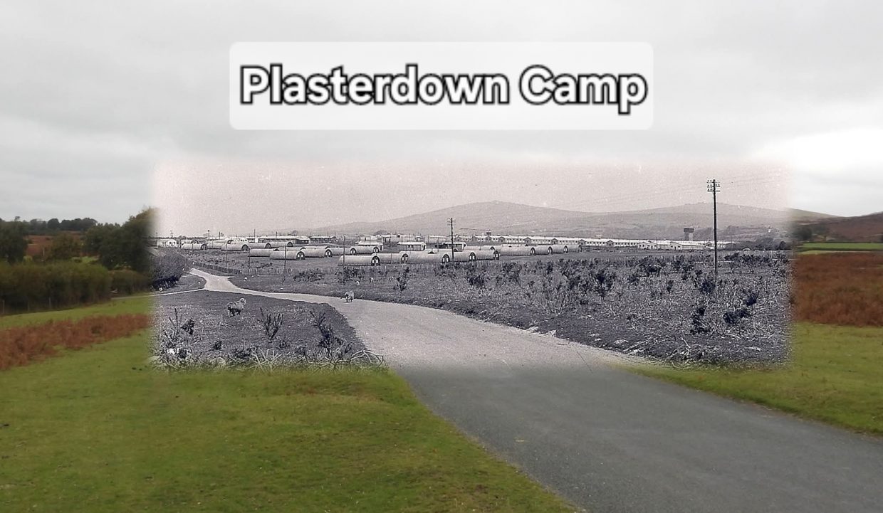
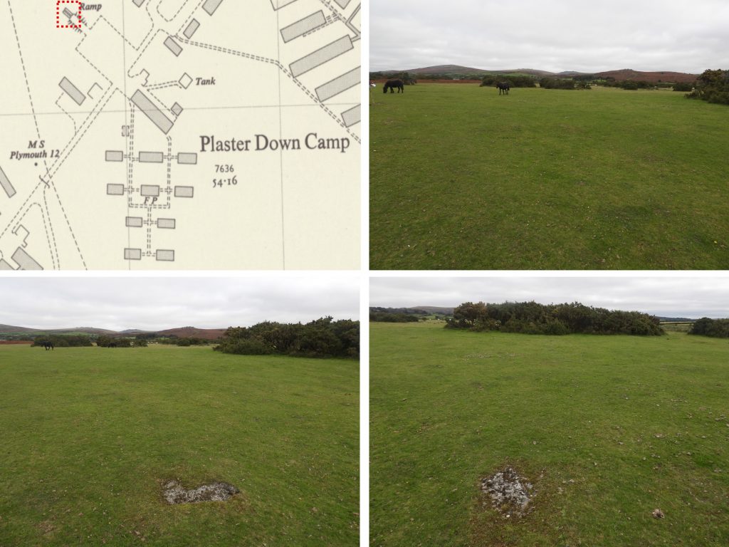
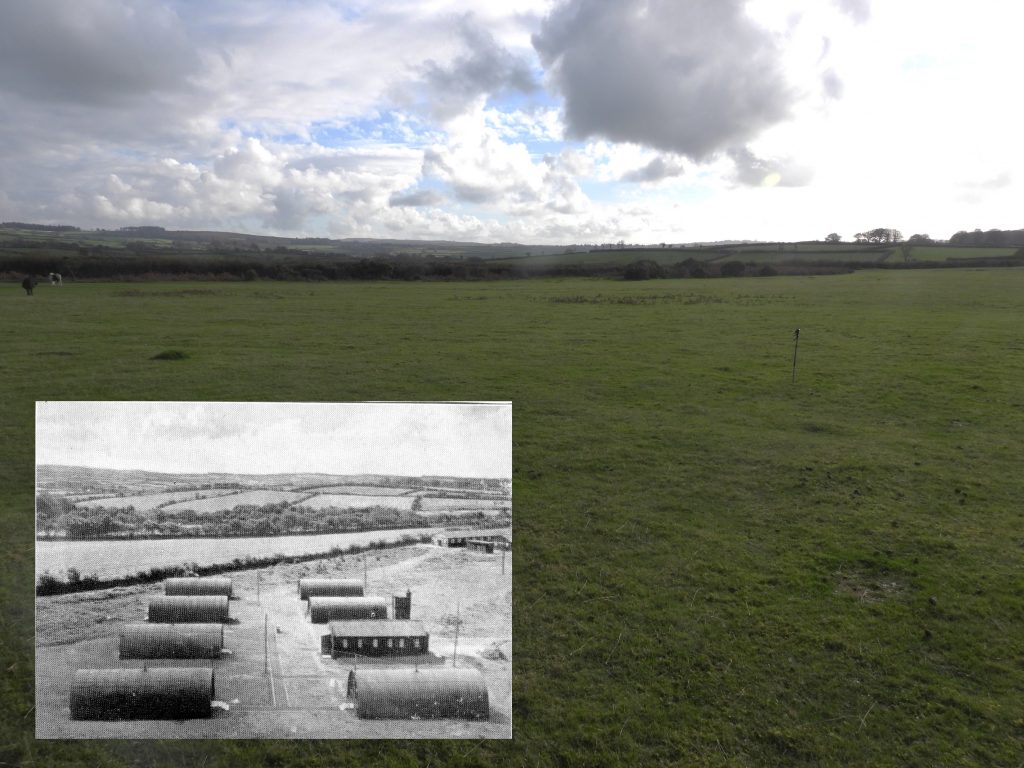
Plasterdown Camp
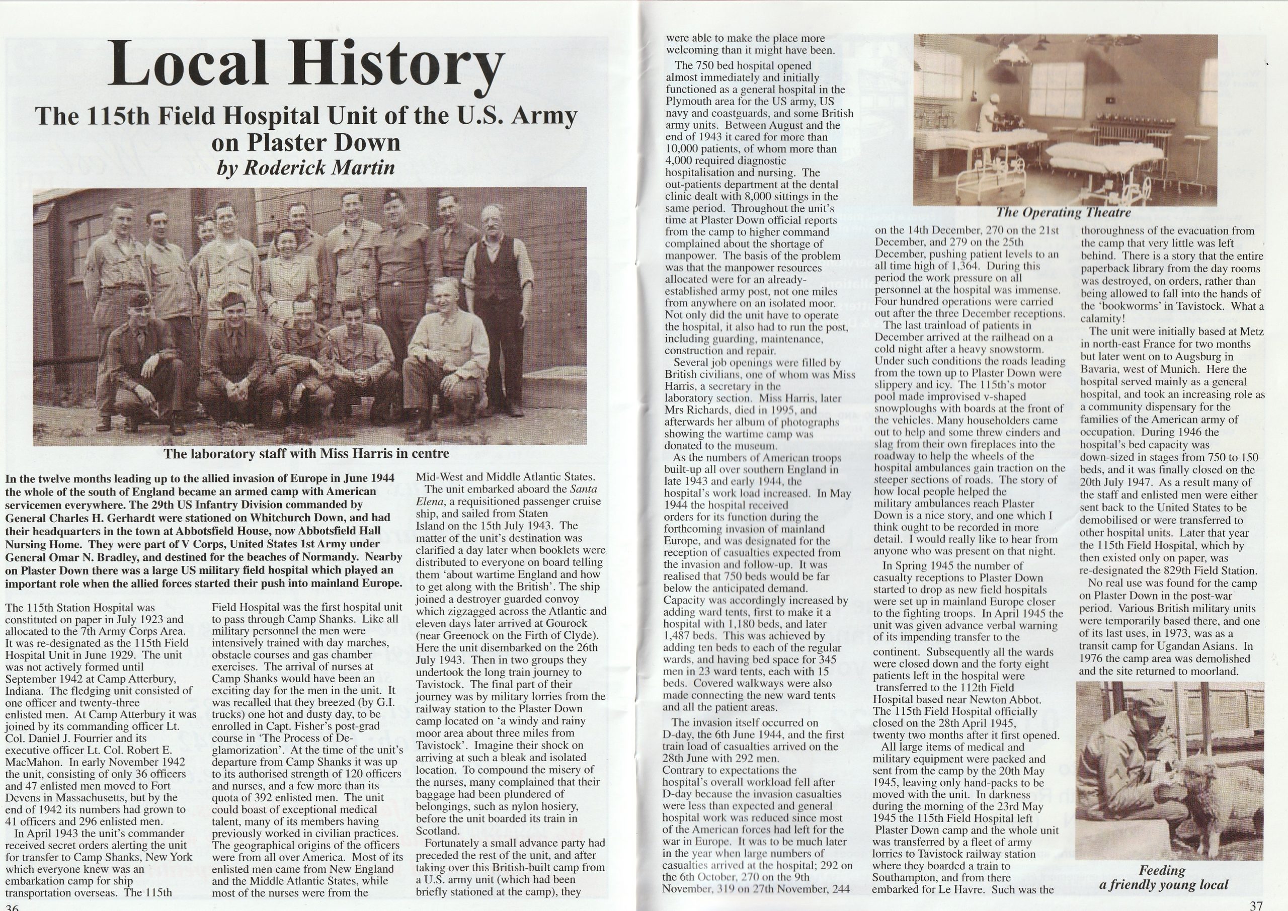
The history of the U.S Army Camp operated by the 115th Field Hospital Unit at Plasterdown (or Plaister Down) between Horrabridge (via Jordan Lane) and Whitchurch Common (Warren’s Cross) in WWII has been very well documented by local historians Roderick Martin and Gerry Martin. This post has utilised much of the research conducted by them and through a booklet (Birth and Life of 0P115-P) written by Lt Col Robert McMahon who was the commanding officer during the war period at the camp. Interestingly Lt. Col Robert McMahon, wrote the booklet in December 1944 (there is a date of 11th that month) and there is a footnote to the title which states ‘England 1943 – 45?’, the question mark obviously is used because he did not know when the camp would be closed or de-commissioned. Additionally, this post uses information recorded by others and given to the author (including pictures and verbal testimony) from the post war years through to its final closure in the 1970s, provides a rich history of the camp, and is used here with grateful thanks.
The camp was built by the British in 1942 for the U.S. Army as a Field Hospital which was operated by them between 1943 and 1945, then after the war the camp was used by various military units and finally was used to house Ugandan refugees in 1972/3 before being demolished in by 1976. Today, there are very few remains of the camp, which once had over 150 buildings. The author has extensively explored the open moorland of where the camp once stood to try and understand its layout and to try and find any remnants – there are very few ! As it is nearly 50 years since the camp closed it is probable that very few people who wander across the moorland know the history behind the camp, such was the extensive clearance that has taken place.
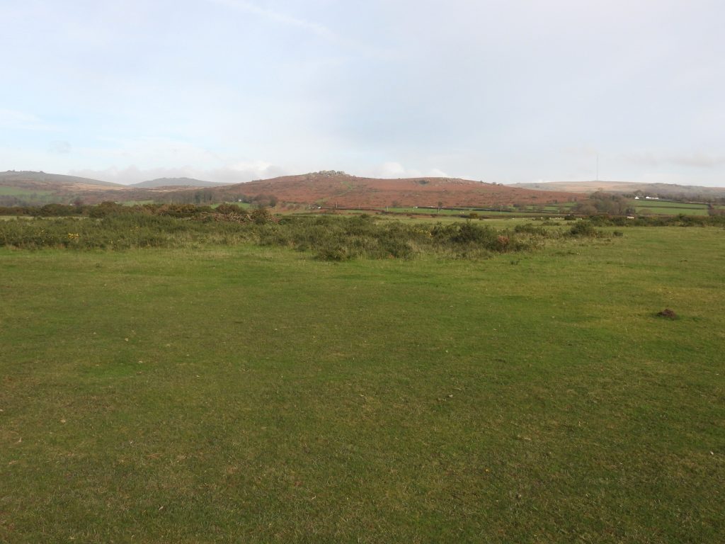
The original 115th Station Hospital was formed (in name only) in July 1923, being designated to the 7th Army Corp. It was then designated the 115th Station Hospital Unit in June 1929 but wasn’t made fully operational until September 1942 with and most of the men coming from New England and the mid-Atlantic states and the nurses were from mid-Atlantic and mid-West states. The unit arrived in the UK (Greenock, Firth of Clyde) on 26th July 1943 before taking the long train journey to Tavistock and onward to the camp by lorry.
The camp was opened as a 750 bed General Hospital virtually straight away, having briefly being occupied by another U.S Unit, who effectively ensured the camp was more welcoming than it might have been. It was used mainly by the US Army, US Navy and Coastguard along with some British Army Units who were stationed mainly in Plymouth. Amazingly, in just five months between August 1943 and the end of the year around 10,000 patients passed through the hospital, of which 4000 needed diagnostic hospitalisation and nursing. There were also 8000 outpatient sittings. The camp was always under staffed, which was compounded by the fact that as well as looking after the patients, the unit also had to run the camp, maintain and repair the buildings. Some of these tasks were undertaken by local people.
There was a build up of troops in 1943 and into 1944 as the invasion of mainland Europe approached. It was expected that many more casualties would be to brought to Plaster Down, therefore the initial 750 beds would be insufficient. Ward tents with additional walkways were erected bring the bed numbers up to 1180, then by D-Day (6th June 1944) the bed numbers were 1487. On 28th June 1944, the first D-Day casualties arrived (292 men). The surge of casualties didn’t occur until the Autumn of 1944, with 292 arriving on 6th October, 270 on 9th November, 319 on 27th November, 244 on 14th December, 270 on 21st December and a further 279 on Christmas Day. The total at the end of 1944 was 1364. 400 operations were carried out for the December admissions alone, which brought immense pressure on the staff. The snowy weather (nearly two feet of snow on Whitchurch Down) at Christmas 1944 compounded the difficulties at the camp
By Spring 1945, the numbers of patients reduced at the camp as field hospitals had been built in mainland Europe closer to the fighting. By April 1945, the hospital unit was given warning of being sent to Europe. By 28th April 1945, the remaining 28 patients had been sent to the 112th field hospital near Newton Abbot and on 23rd May 1945, the whole 115th Field Hospital Unit left for Metz (France), then Augsberg (Bavaria, Germany).
Post war, (1946) the buildings was used as a general hospital for local people and families of the US Army being downsized in stages from 750 beds to just 150 beds. The hospital was finally closed on 20th July 1947. Between 1947 to 1973, the camp had no real dedicated identity. It was used briefly by Polish refugees and German Prisoners of War. By 1951 the site was owned by the Ministry of Defence with various British military units being stationed there, albeit temporarily. During Summers in the 1950s, the camp was used by Territorial Army (TA) Units and in the 1960s it was used by the Woman’s Royal Air Corp. Permanent occupation by troops was considered in the late 1960s, with the camp being given a facelift before receiving soldiers returning from Aden. In June 1971, the 24th Infantry Brigade moved out and afterwards it was briefly used by the Army and the Royal Marines for training
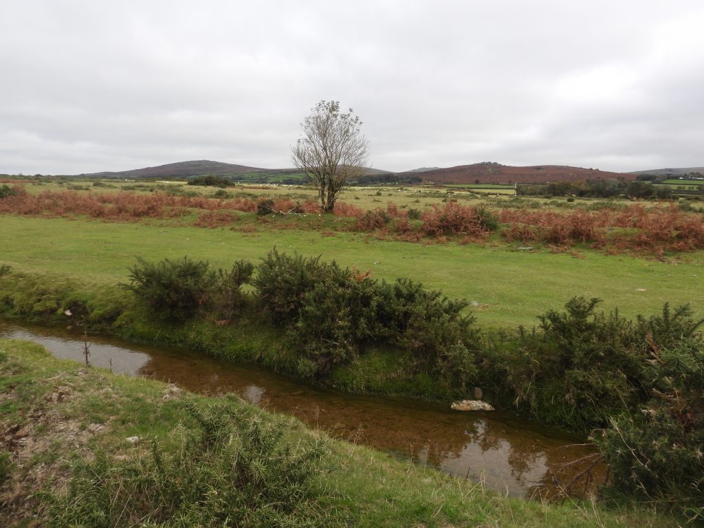
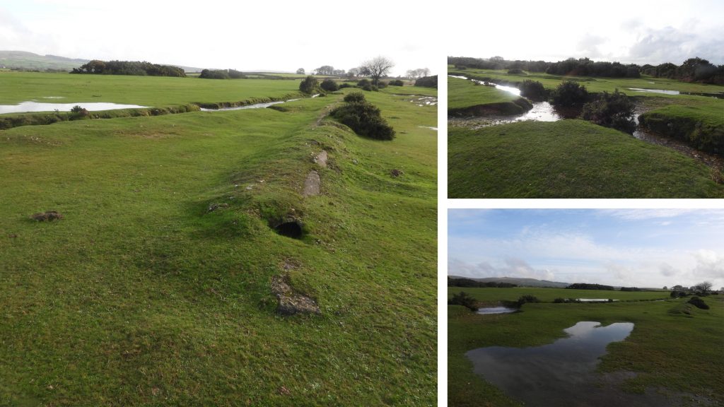
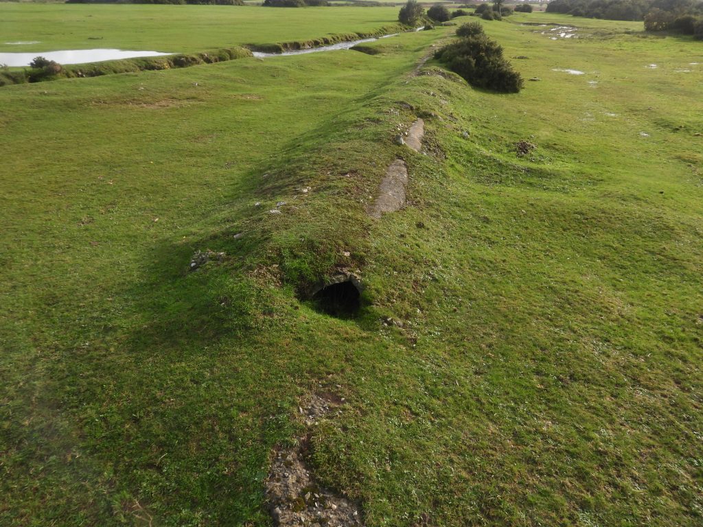
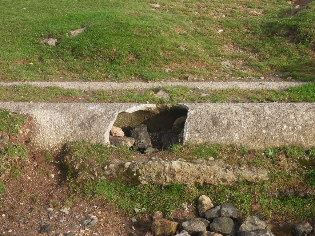
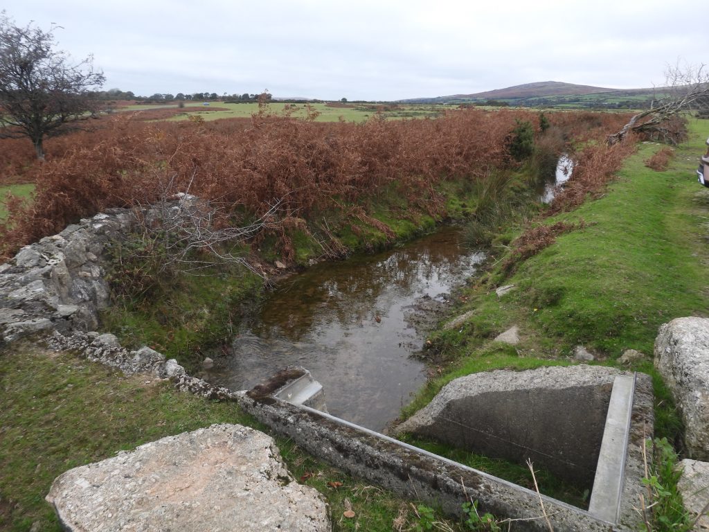
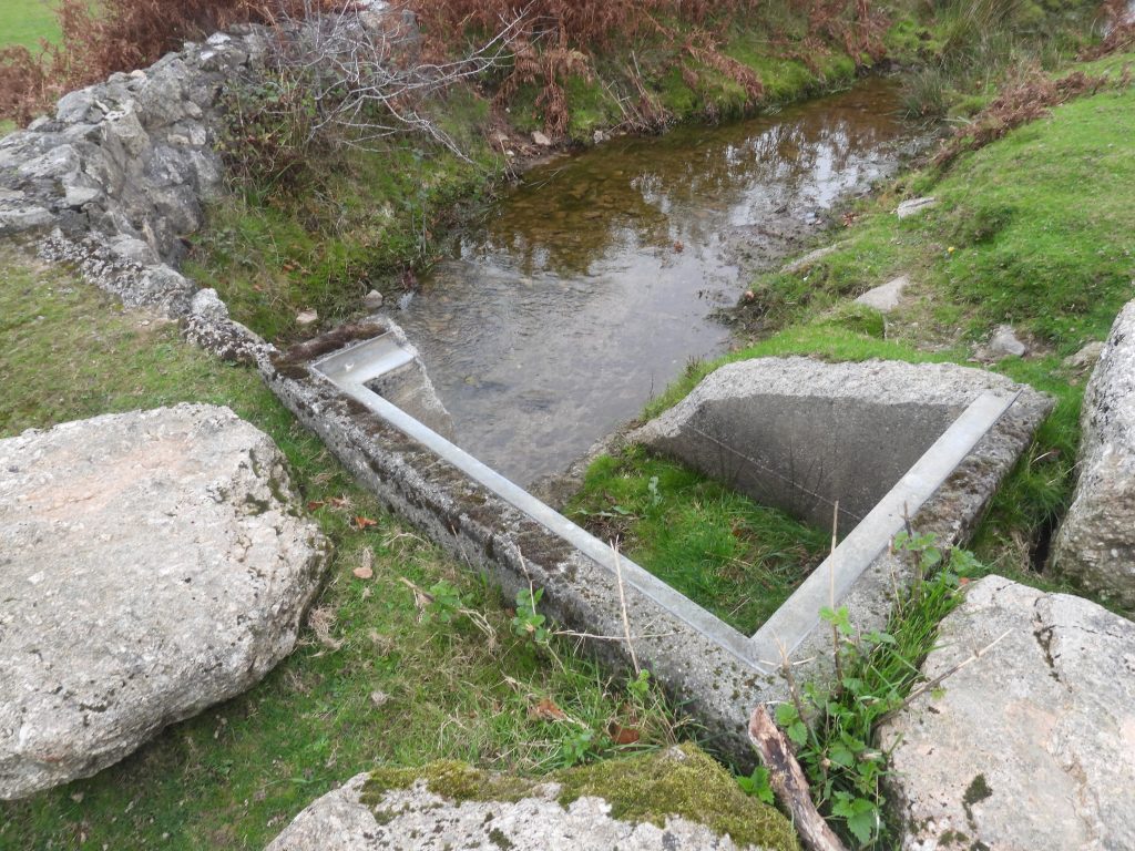
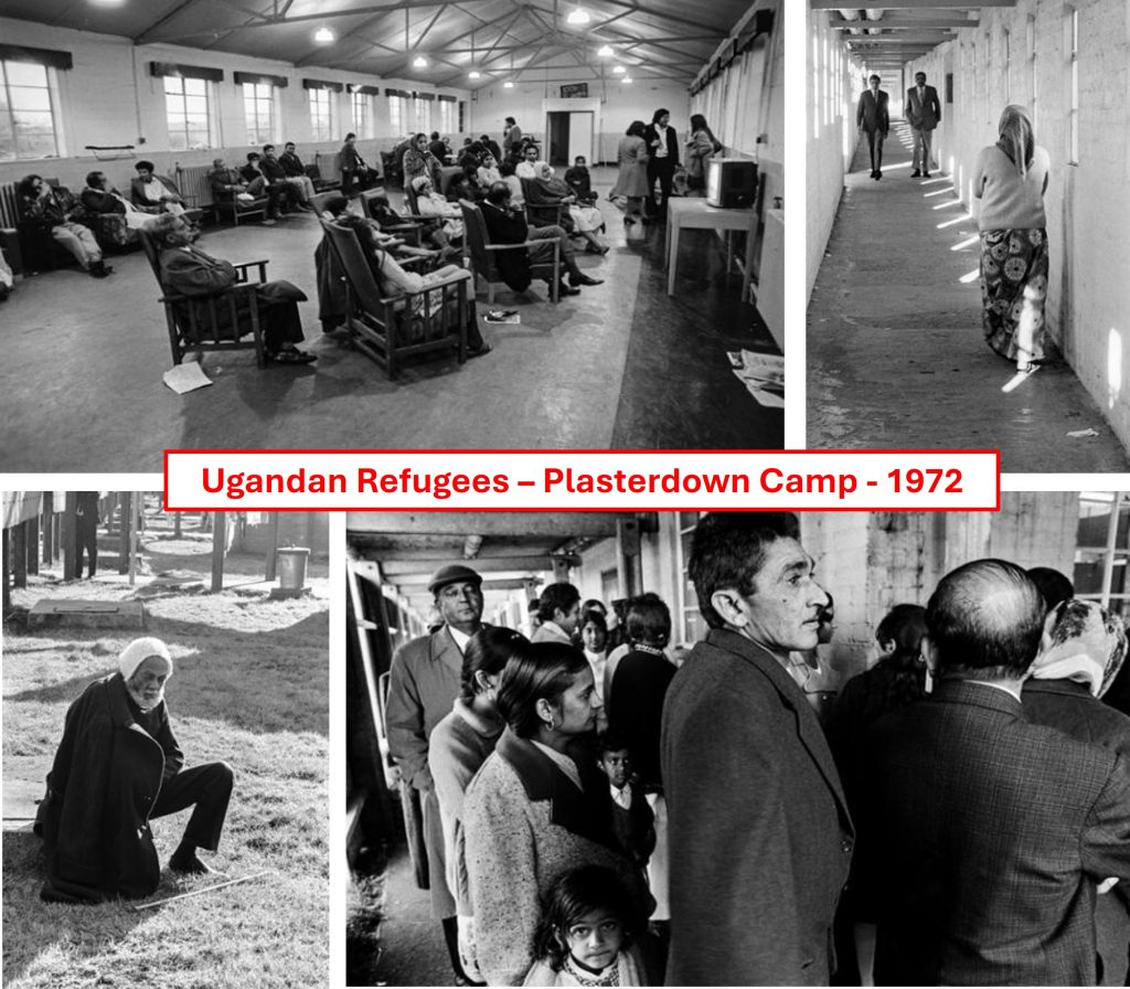
In August 1972, the President of Uganda and brutal dictator Idi Amin gave Ugandan Asians 90 days to leave the country. Amin supported ethnic Ugandans and felt threatened by an educated Asian elite many of whom were bankers, civil servants, factory and land owners. From October 1972, Plasterdown was used as a refugee camp for some of the Ugandan Asians with initially 367 being housed followed shortly afterwards by another 150. The authorities wished to keep the refugee numbers to below 900. By 1973 the site was empty and attempts were made to find a new function for the 230 acre site which included as a temporary school and to temporary housing for the homeless. Following a mass sell off of equipment, the death knell came with, in 1976 the buildings being demolished and such was the effectiveness of the demolition, just about every sign of the hospital and camp was removed. Of note, is that Grimstone and Sortridge Leat ran through the site, but to avoid pollution it was diverted through a concrete pipe, which is the most obvious relic which can be seen today.
Bibliography
Roderick Martin (2011) – Tavistock Diary – The 115th Field Hospital Unit of the US Army on Plaster Down
Gerry Woodcock (2004) – The Book of Whitchurch by Gerry Woodcock
Lt Col Robert McMahon (December 1944) 115th Station Hospital – Birth and Life of 0P115-P
Brigadier-General C.G. Higgins – The Oxfordshire and Buckinghamshire Light Infantry Chronicle (1956) – page 55
The Abingdonian – (October 1963) – page 545
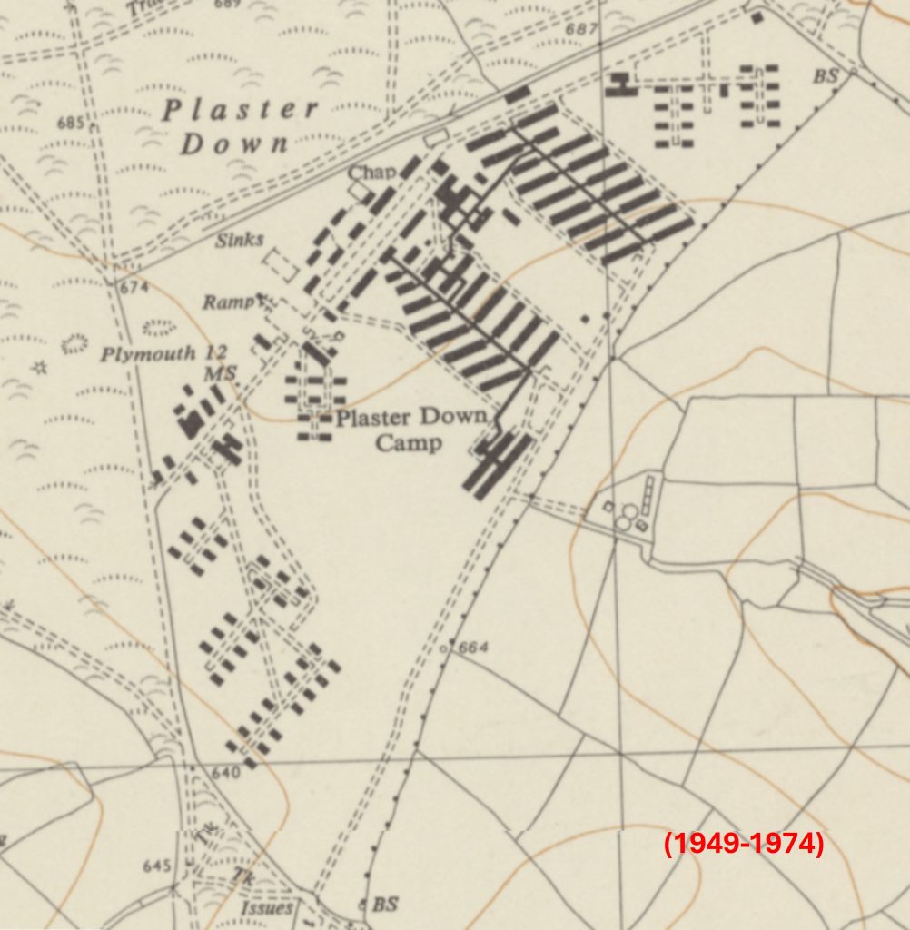
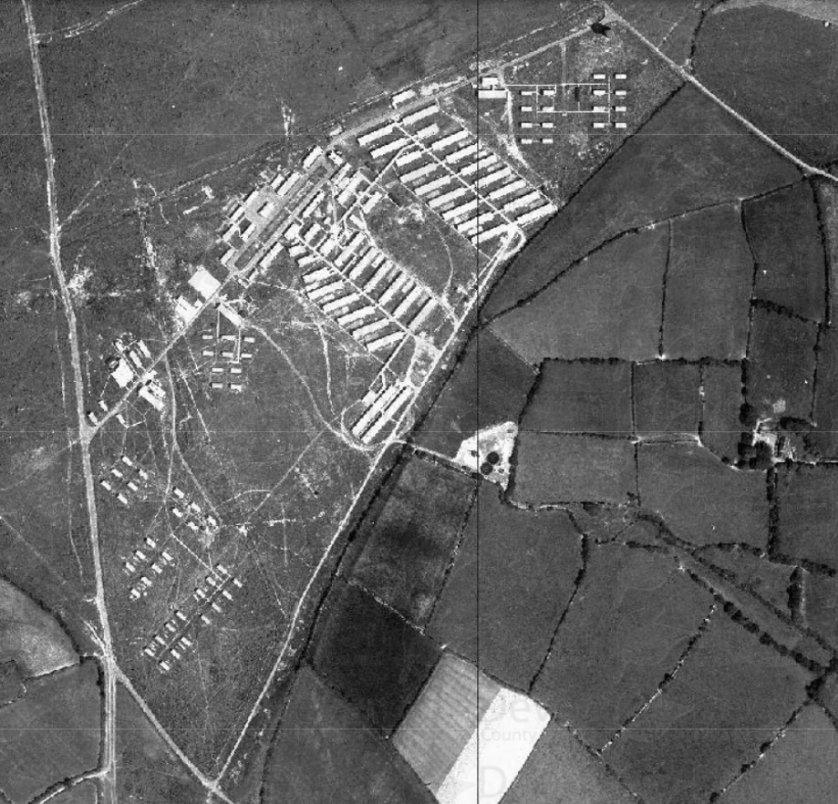
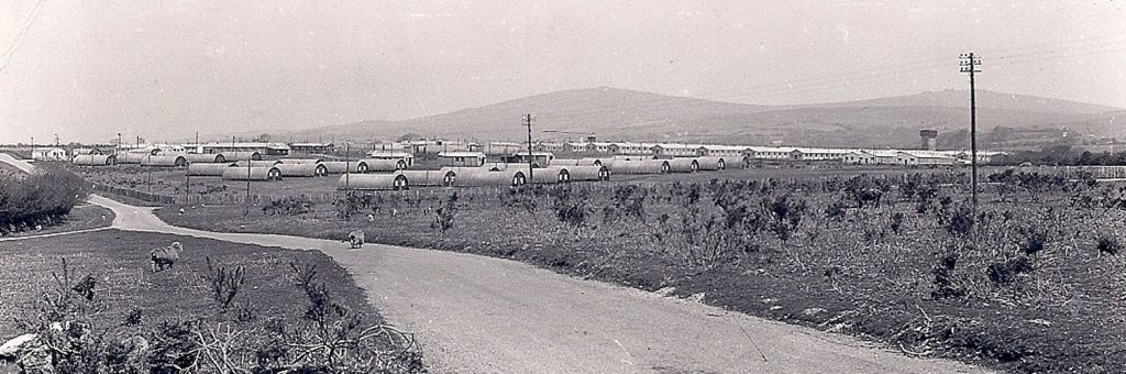
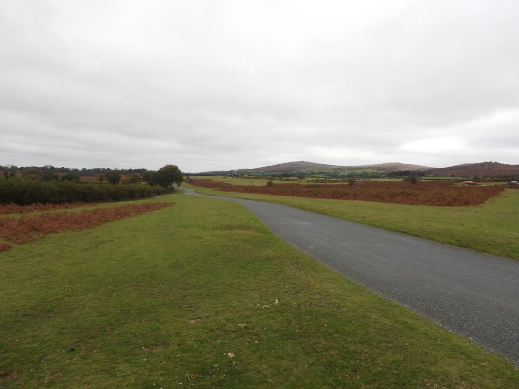
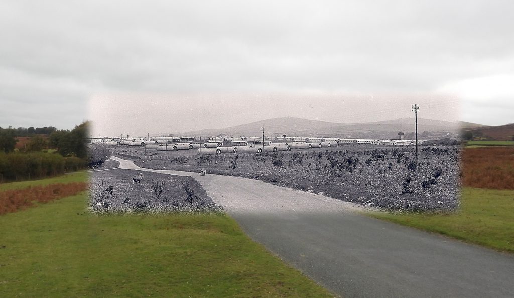
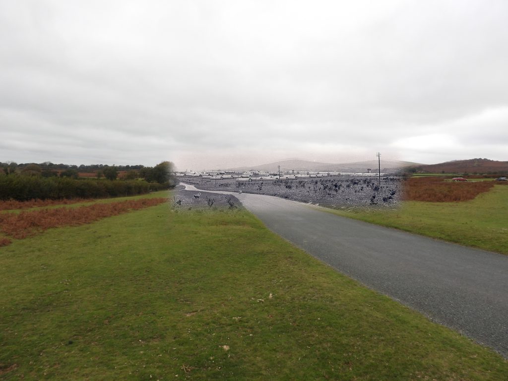
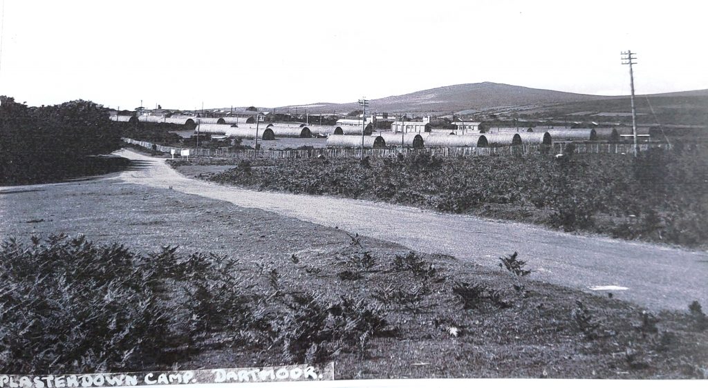
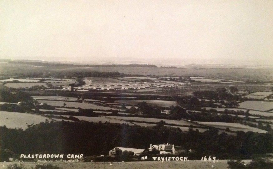
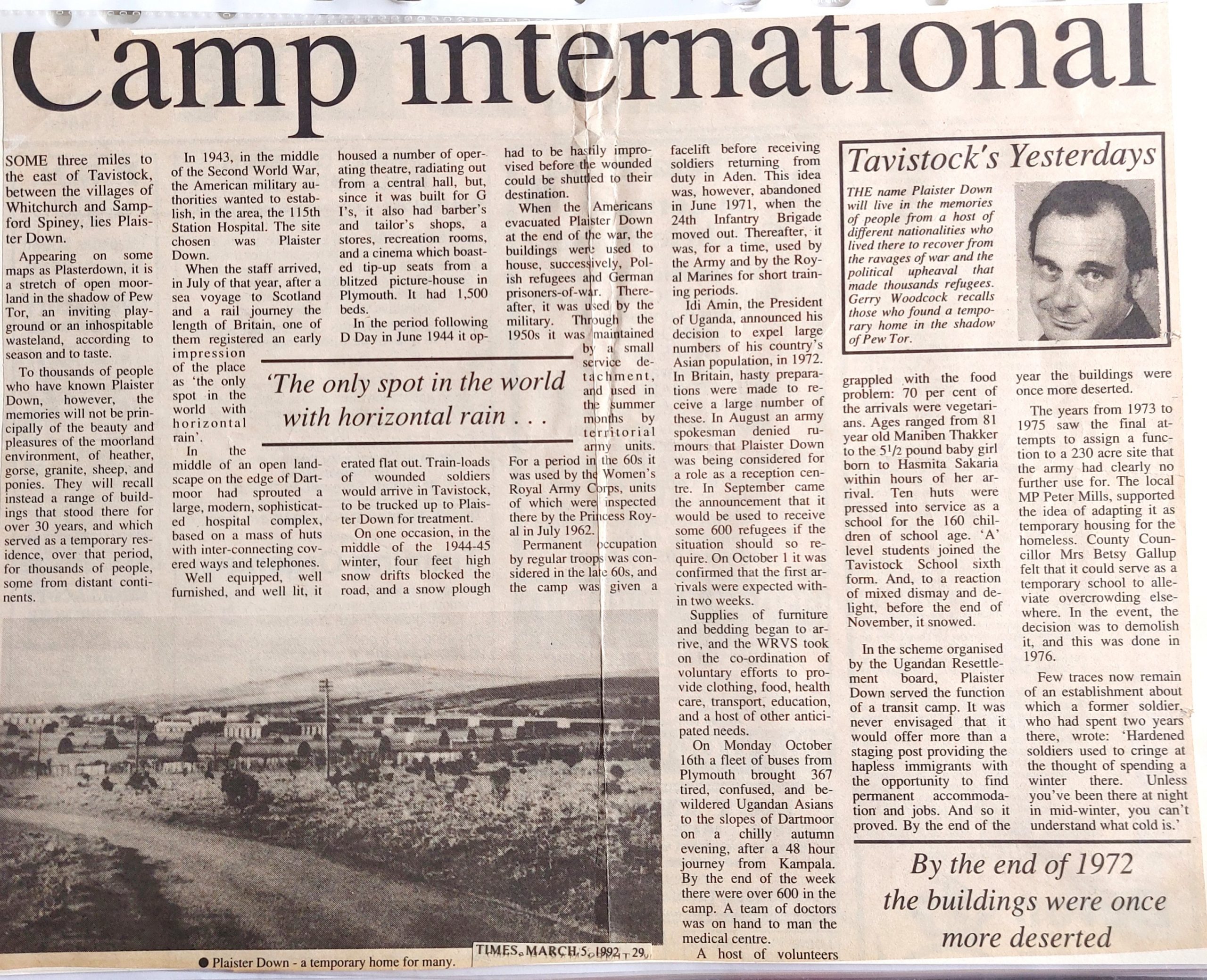
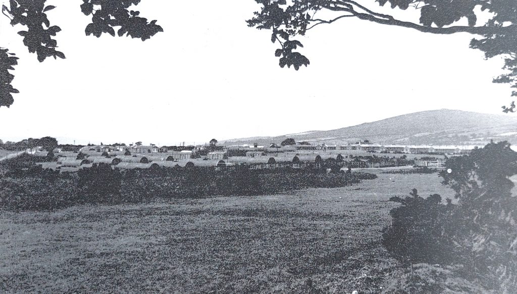
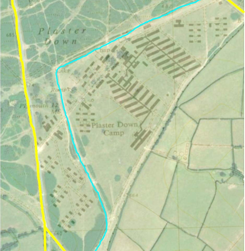
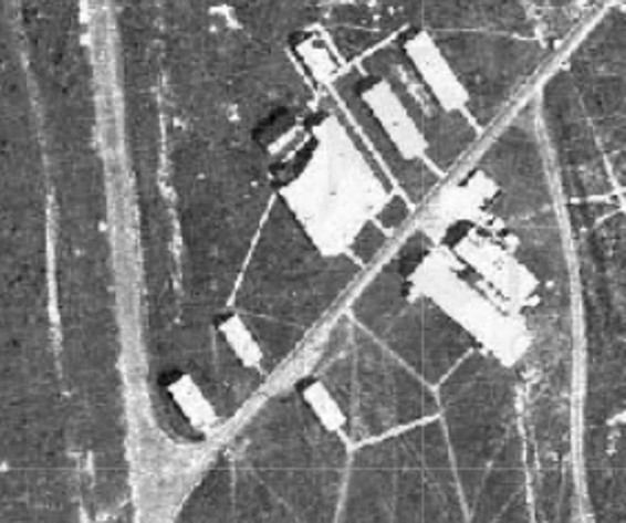
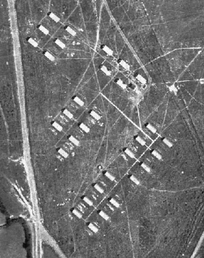
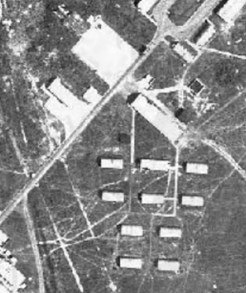
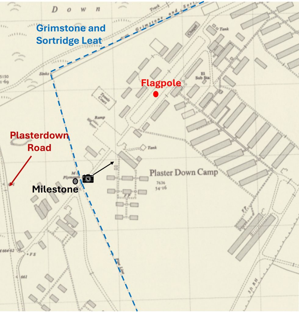
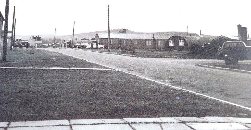
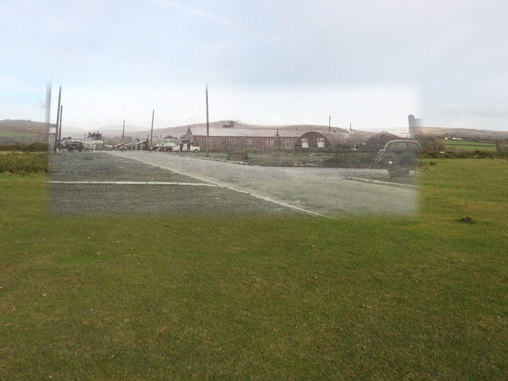
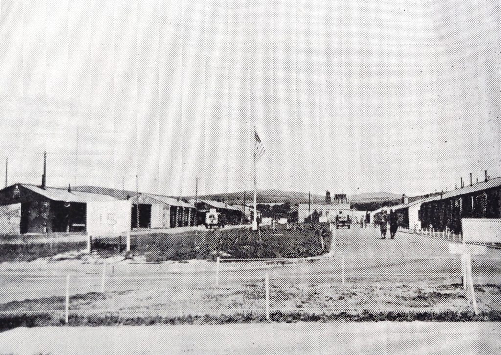
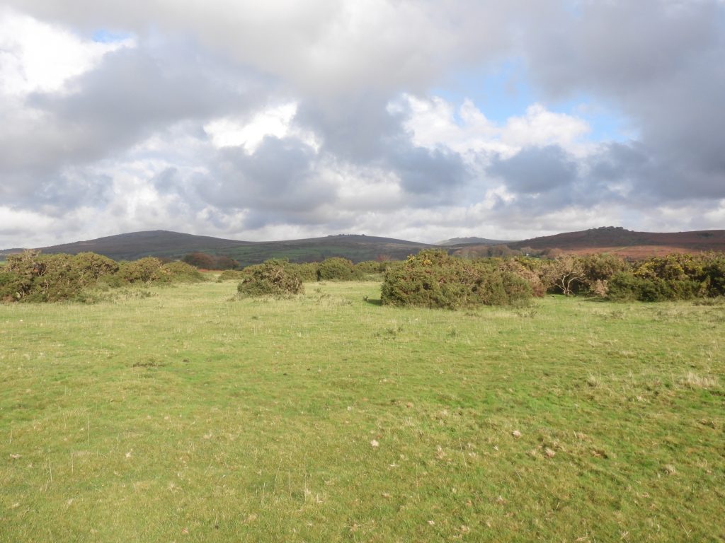
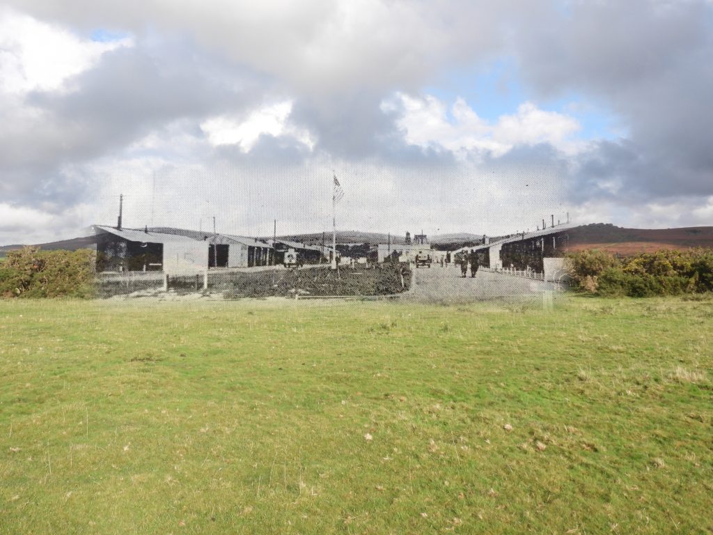
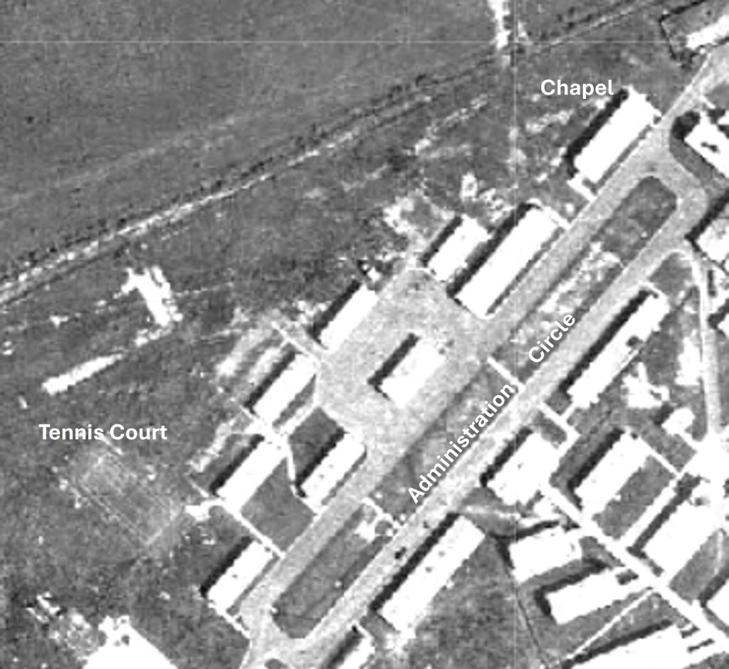
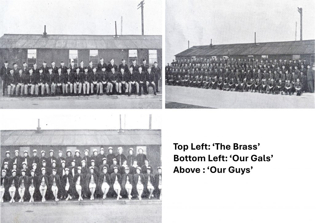
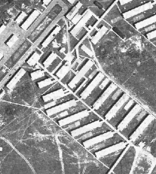
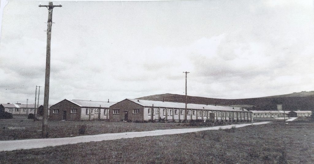
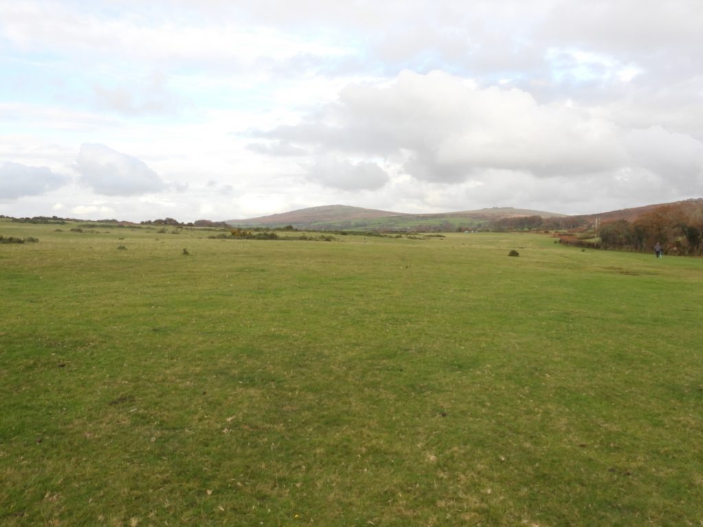
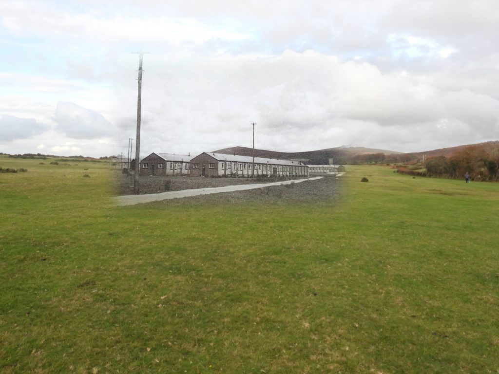
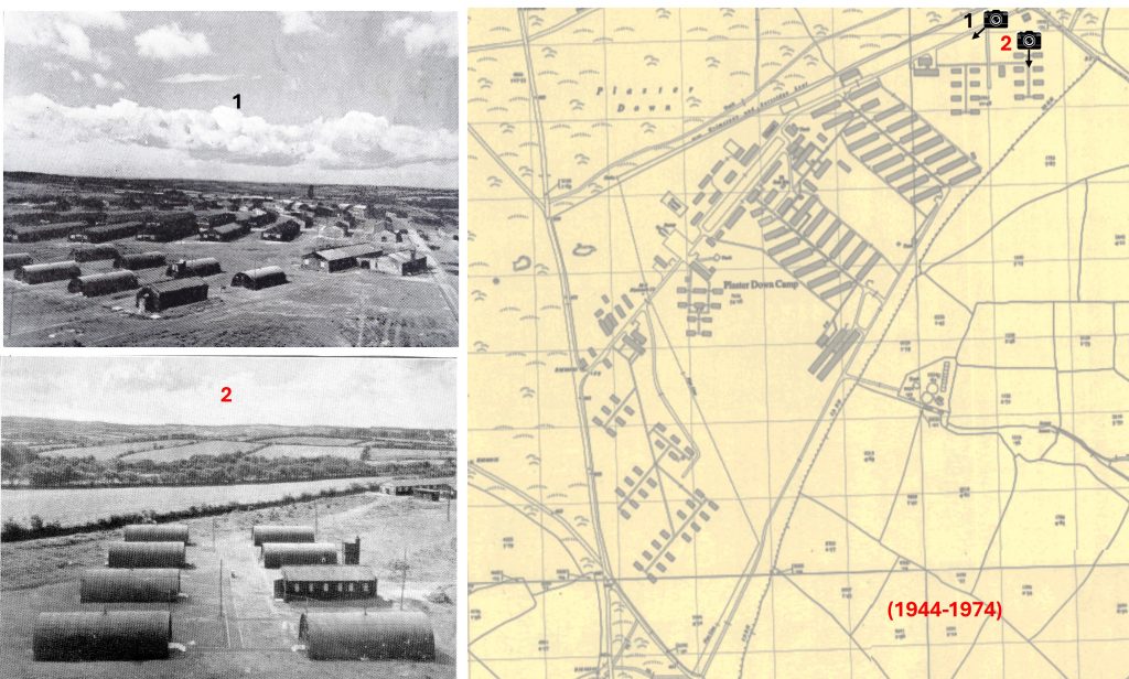
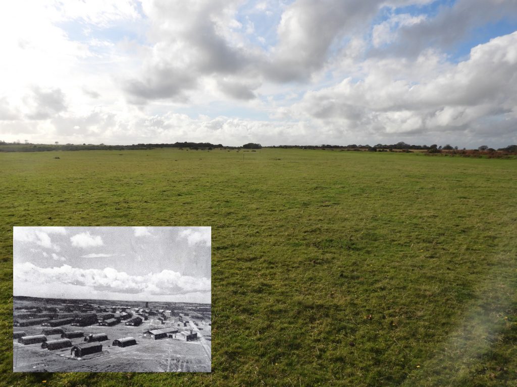
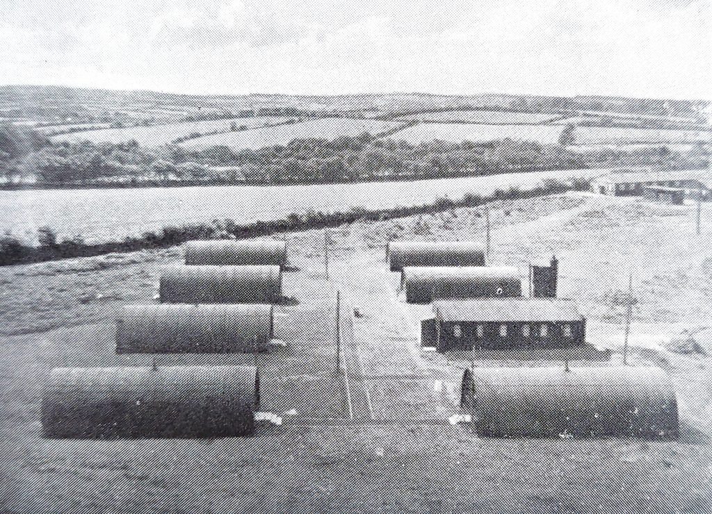
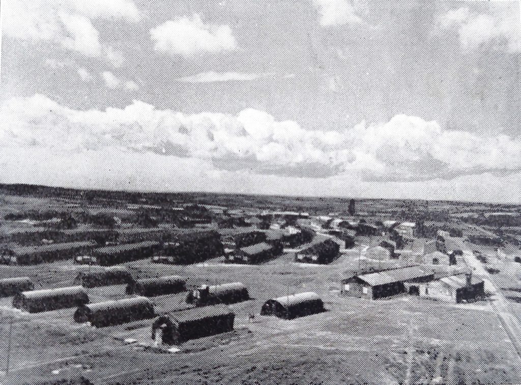
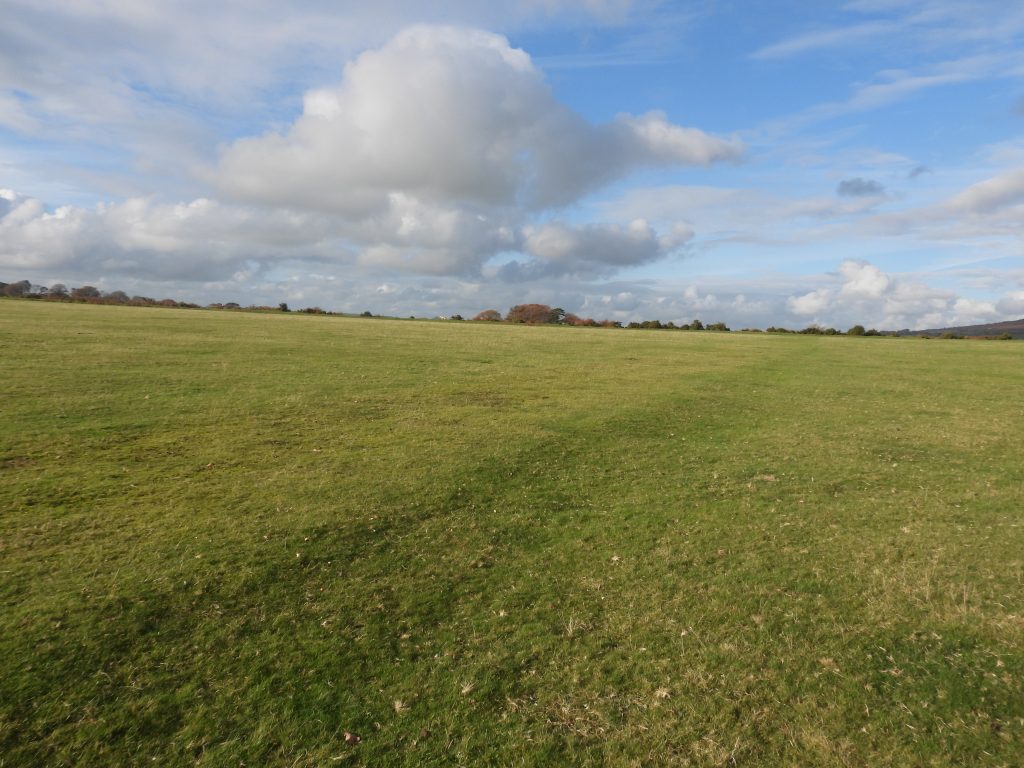
This map shows all the buildings of Plasterdown Camp from the 1940s to 1970s, which extended from the Horrabridge / Warren Cross road in the west to the Whimington / Warren Cross road in the east. The Grimstone and Sortridge ran through the camp, roughly north to south from where the map is annotated ‘sinks’, past the ‘Plymouth 12 MS’ then across the open piece of land. The leat is not shown on the map as it was channelled through a concrete pipe to prevent the water getting pollutedThis aerial photograph of Plasterdown Camp is from 1946, just one year after the 115th Hospital Field Unit left the siteThis fabulous article on Plasterdown Camp was written by local author Roderick Martin and is reproduced here with permission, with grateful thanksPlasterdown Camp from the south west (Jordan Lane) where the road crosses Grimstone and Sortridge Leat – date unknownThis is the same view of the previous black and white photograph taken in October 2025. Superimposed photographs, which are between 50 and 80 years apart. The tors and roads are lined up. The road coming in from the left leads to Fullamoor FarmSame composition zoomed outOld postcard of Plasterdown Camp also from the Horrabridge / Warren Cross roadAerial ViewThis fabulous article on Plasterdown Camp was written by another local author Gerry Woodcock, who was a prolific writer on Tavistock and the local area. The newspaper article was shown to the author my Jill Fitzsimmons who also provided the author with lots of information regarding the camp, with grateful thanksThis view of the camp is believed to have been taken near the Whimington road
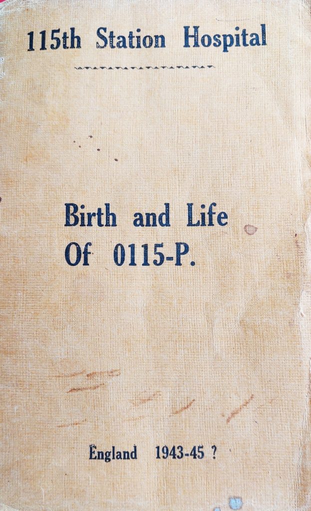
This picture is the front cover of the booklet written by Lt Col Robert McMahon who was the commanding officer during the war period at the camp. Most of the war photographs in this post were taken from this booklet, which is the personal copy loaned to the author by Jill Fitzsimmons. Interestingly Lt. Col Robert McMahon, wrote the booklet in December 1944 (there is a date of 11th that month). Note the footnote to the title which states ‘England 1943 – 45?’, the question mark obviously is used because he did not know when the camp would be closed or de-commissioned. Inside McMahon started by titling the text with ‘The Birth & Life of the 0115-P’ or TWO YEARS OF SNAFU* AT HOME and ABROAD. *SNAFU is an acronym that is widely used to stand for the sarcastic expression “Situation normal: all (fouled) up” and is an example of military slang. The term has been censored here
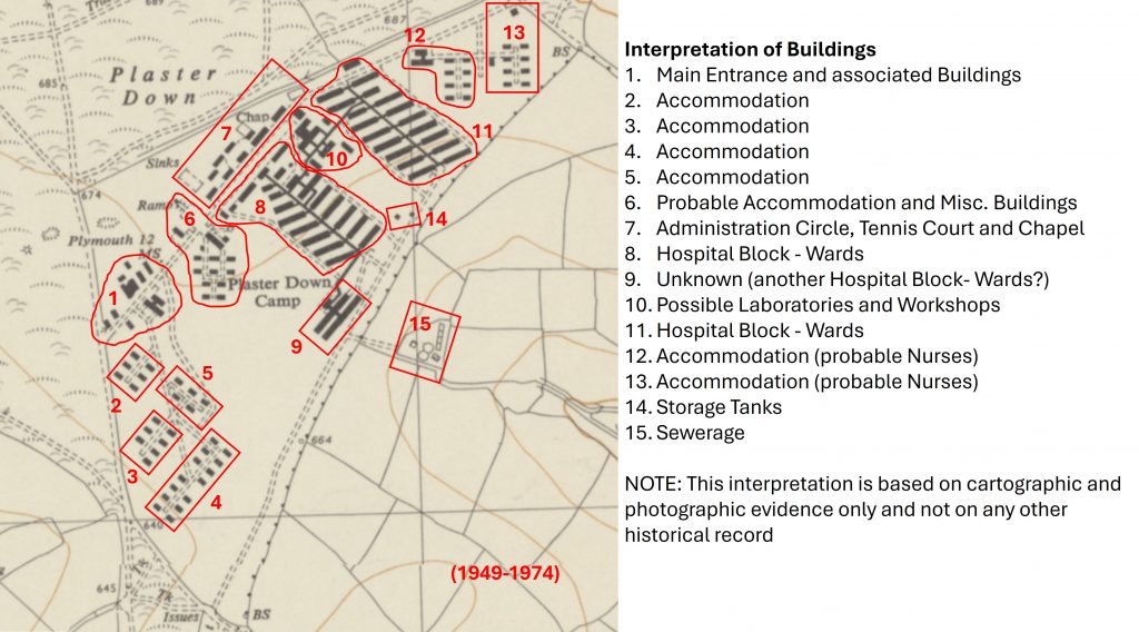
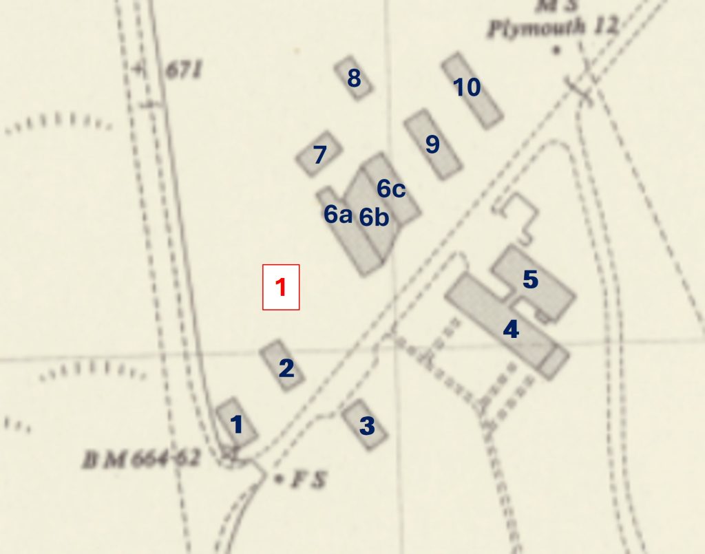
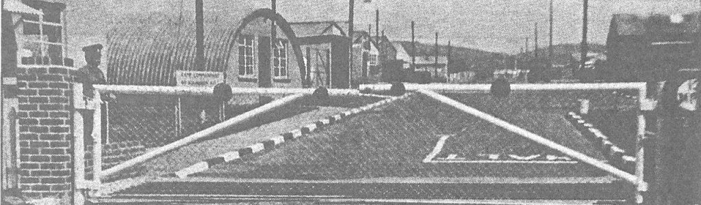
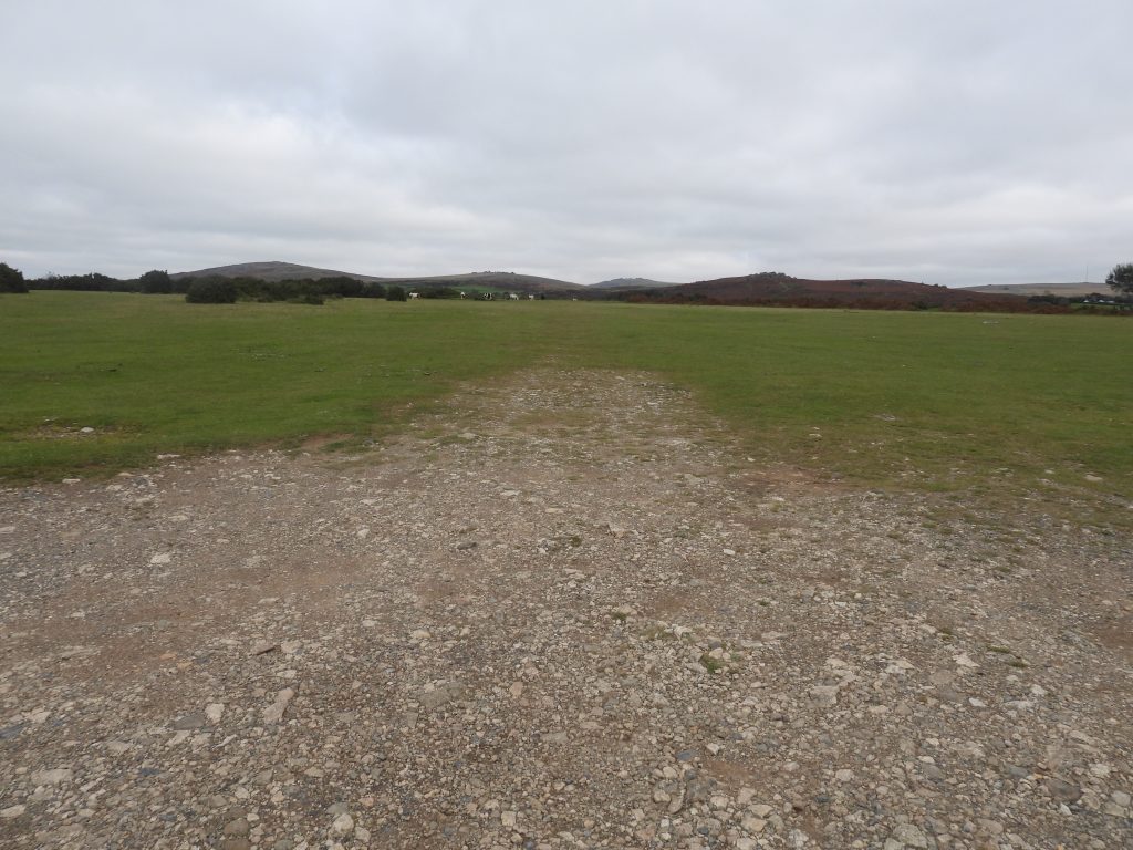
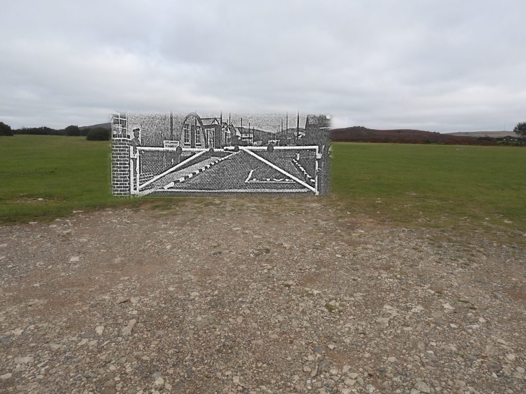
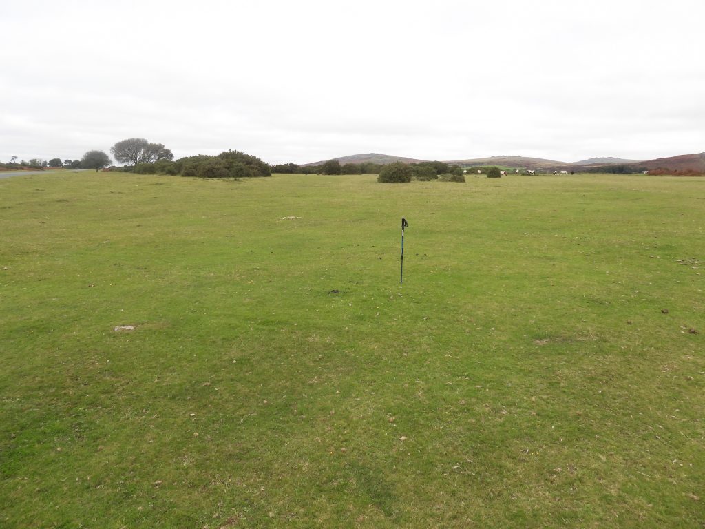
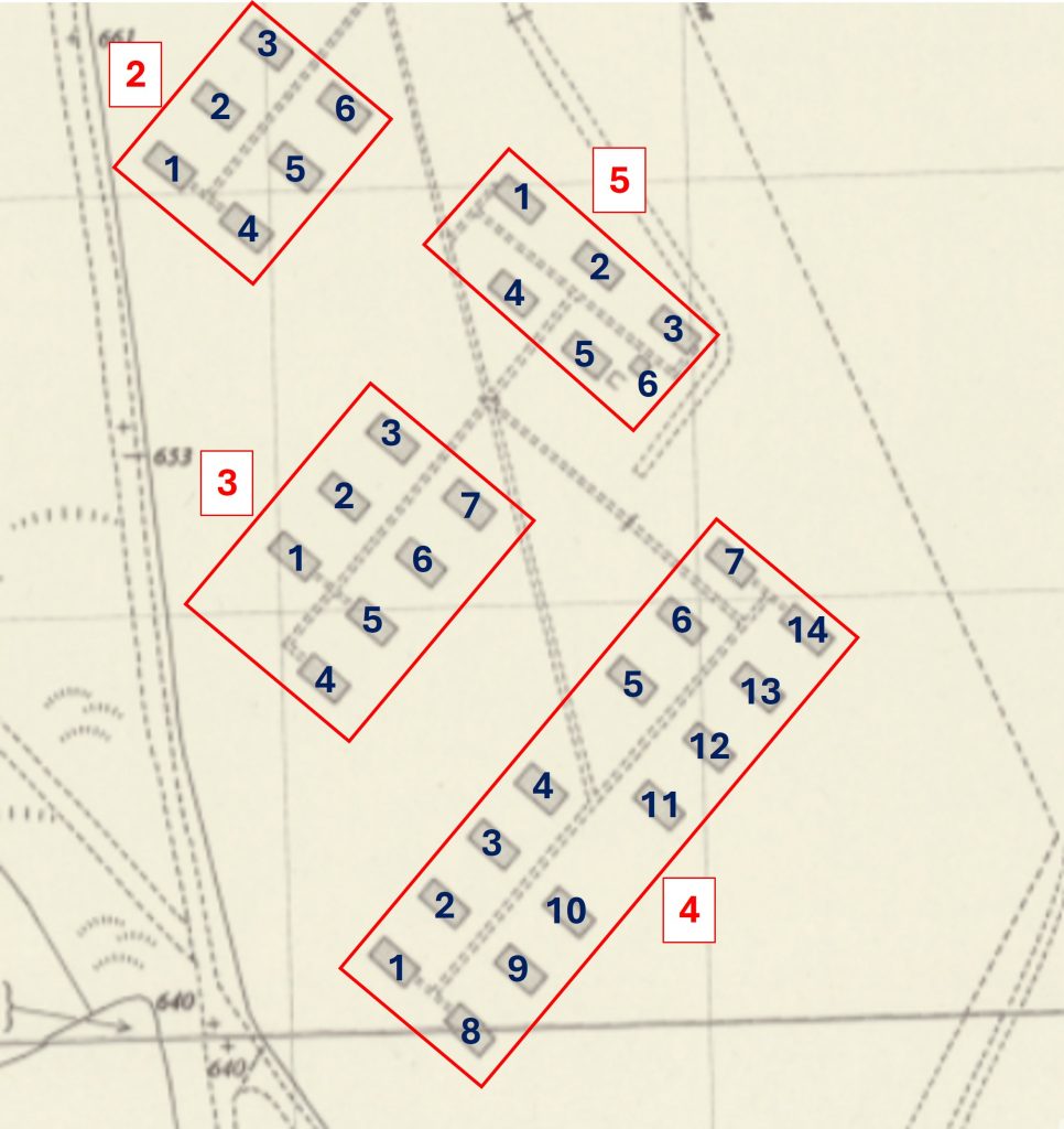
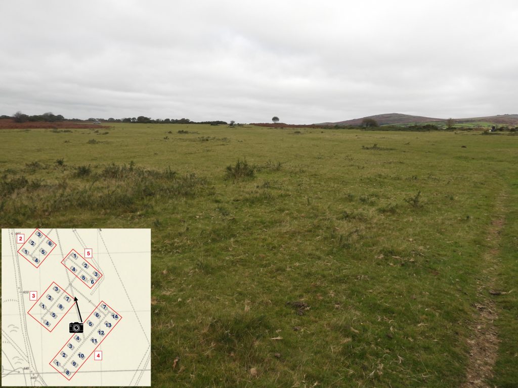
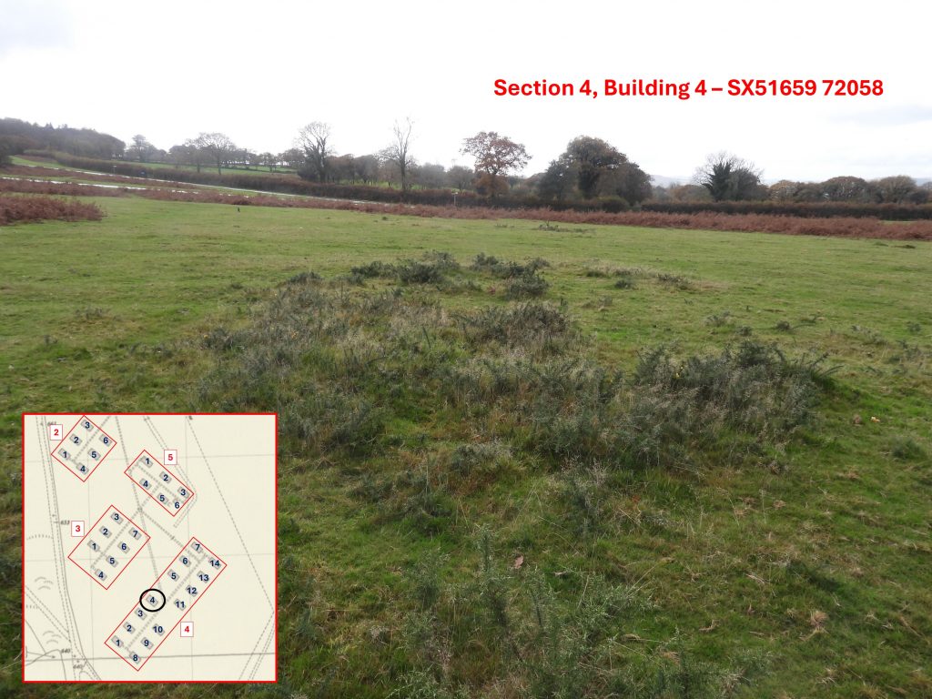
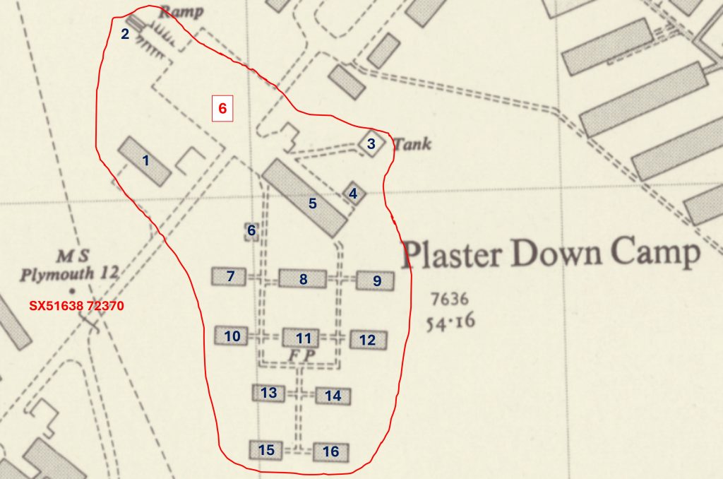
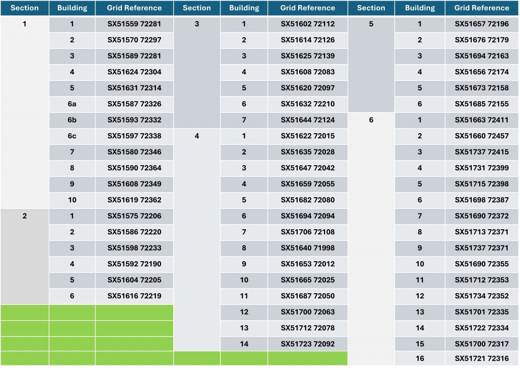
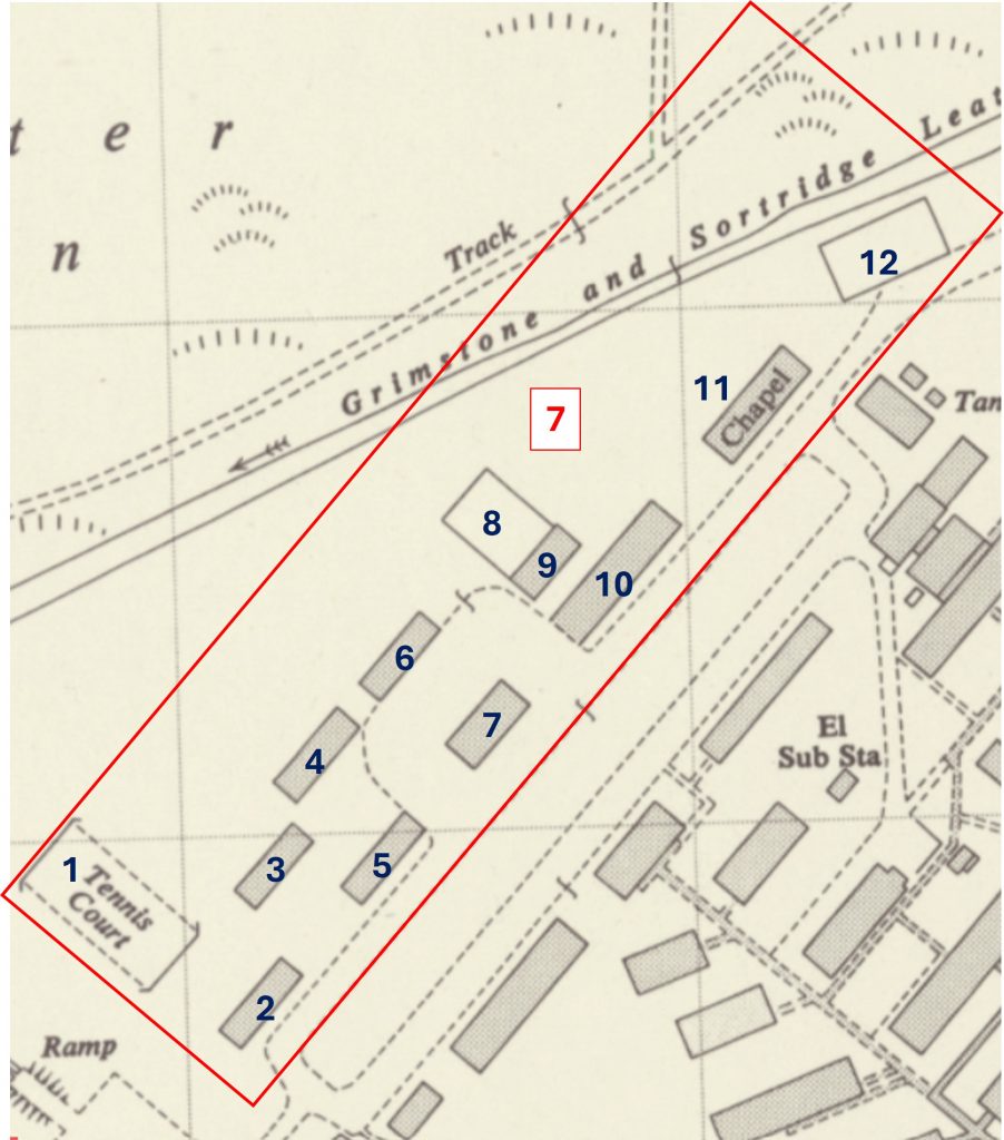
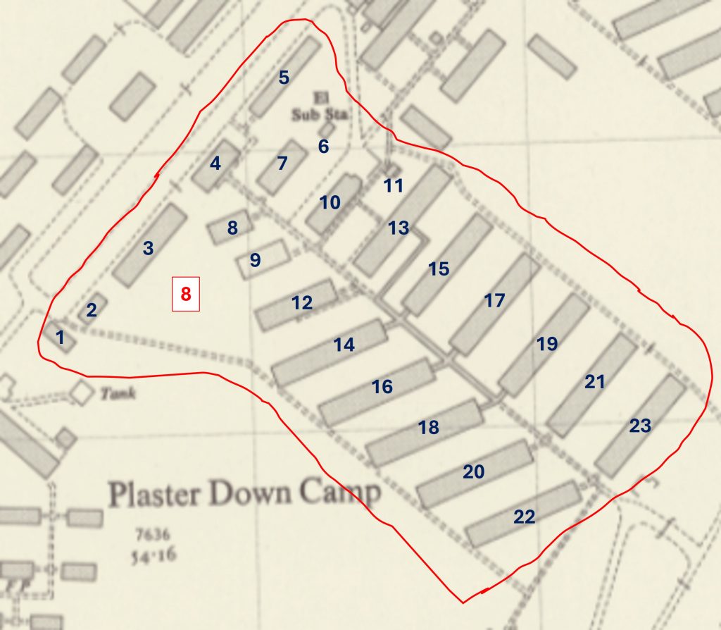
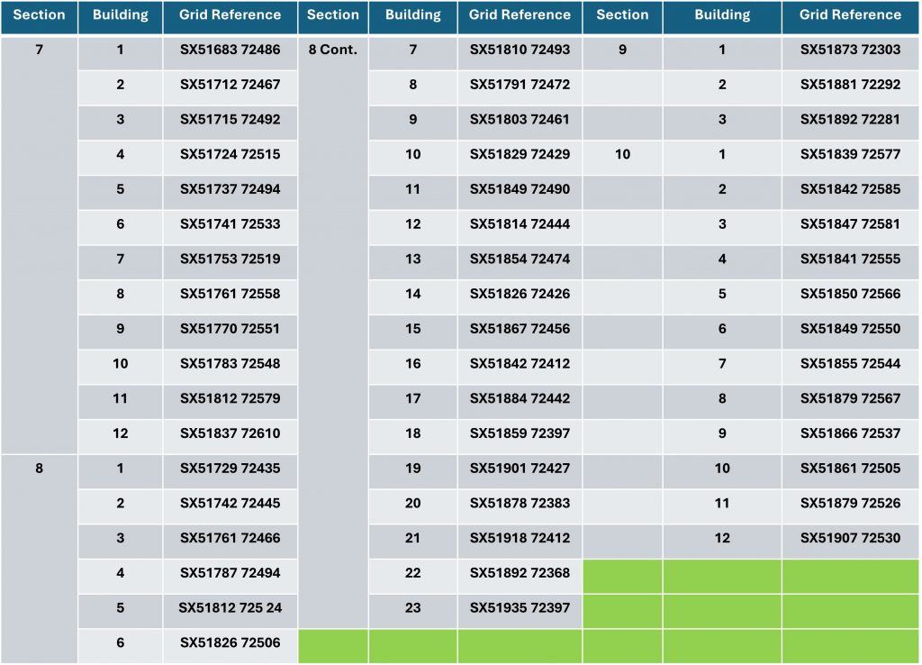
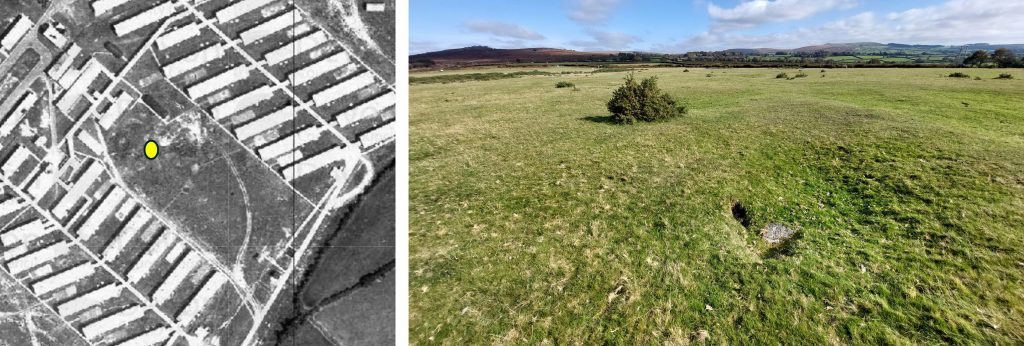
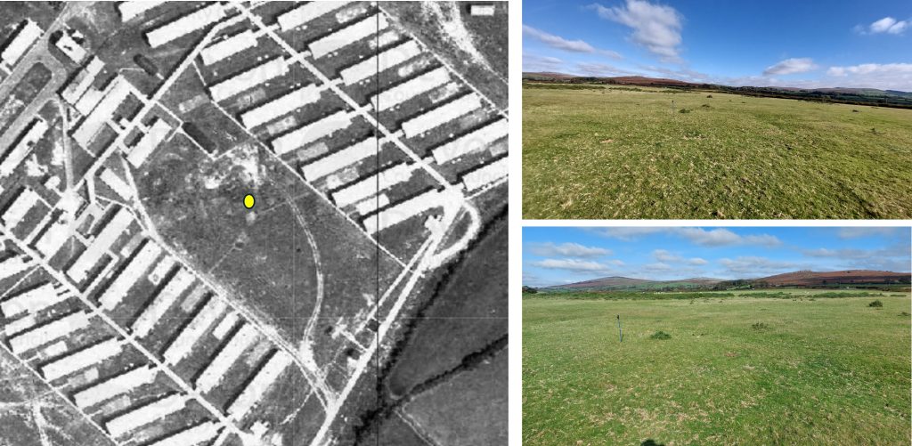
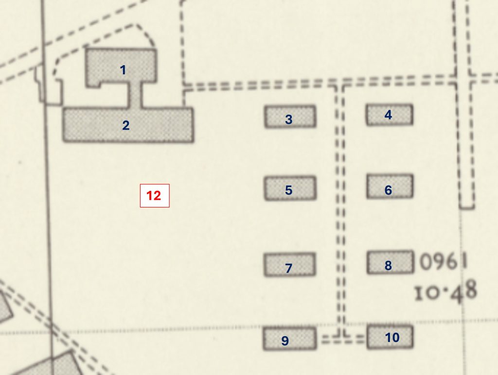
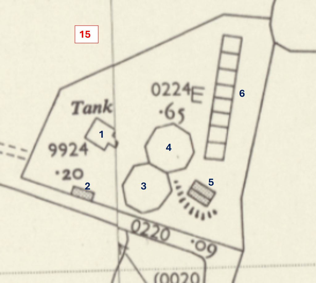
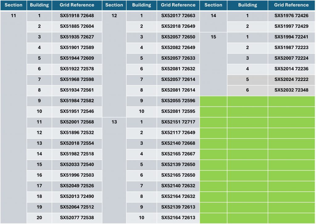
For the purpose of this post, using cartographic and photographic evidence, the author has subdivided the camp into 15 sections and provided a best guess interpretation (in the absence of a camp plan). The author has recorded the grid reference for centre of each building / feature. These grid references are recorded later in this postThis picture is a 21st century aerial photograph superimposed onto a 20th century mapSection 1 – the buildings by the main gate next to the Horrabridge / Warren Cross road. The road through these buildings (south west to north east) leads through to the 12 Miles to Plymo milestone and the Grimstone and Sortridge LeatMain gate, likely taken in 1960s or 1970sThere is still evidence of the road leading through the former main gate – taken in October 2025Front gate black and white image superimposed onto a picture from October 2025. The pictures were lined up through knowledge of where the guard house was and by the tors in the backgroundWhere the walking pole is positioned is where the guard house was located. It is Section 1, Building 1 as per the authors annotation and is at SX51566 72282. There is evidence 50 years on, of some minor ground disturbance, which ordinarily would go un-noticed to the casual observer
This is a 1946 aerial view of the main entrance with buildings. The building at the bottom left is the guard house
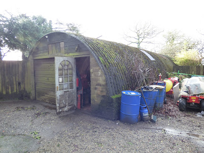
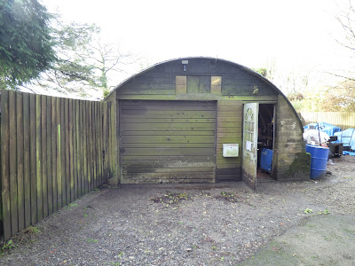
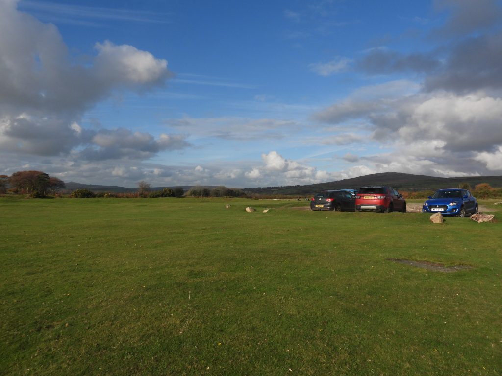
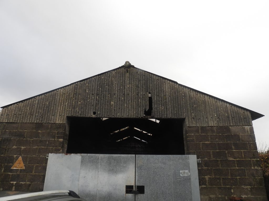
A view of the main entrance from the road, now used as a car parkSections 2-5; the buildings which are located next to the Horrabridge / Warren Cross road were most likely accommodation for staffThis picture is courtesy of John Stickland, with thanks. John explains that this is a surviving building from the camp, which is on private land, namely the grounds of the former Woodhouse Garden Machinery at Bleak House. Mark Woodhouse, the former proprietor of the business, told John that his father bought it at the clearance auction in 1976ish and they moved it back to Bleak House in sections and re-erected it. It is likely to be one of the accommodation units from the Hospital, possibly from sections 2-5 as per the authors map annotationsA front on view of the former accommodation block
Sections 2-5 – the buildings which are located next to the Horrabridge / Warren Cross road from an 1946 aerial photograph
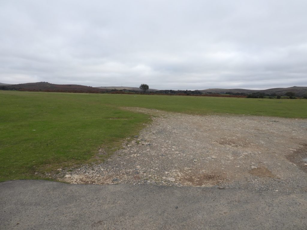
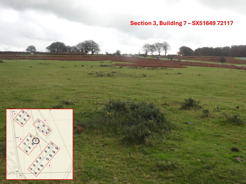
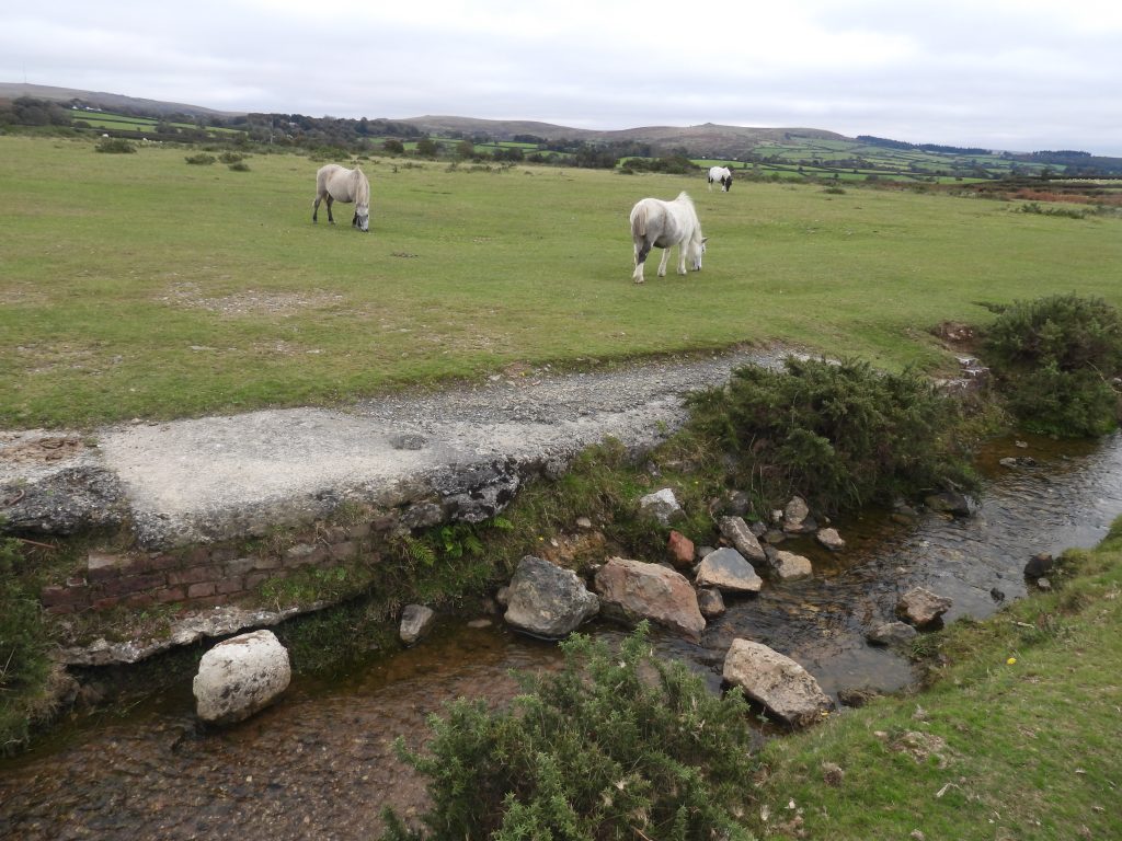
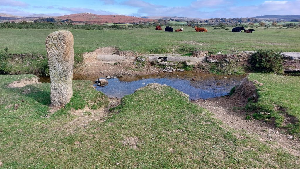
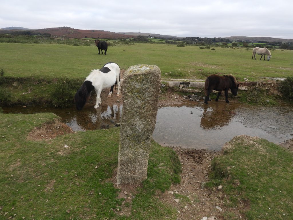
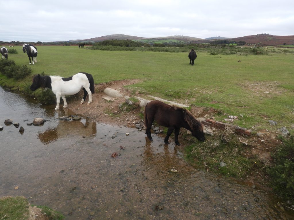
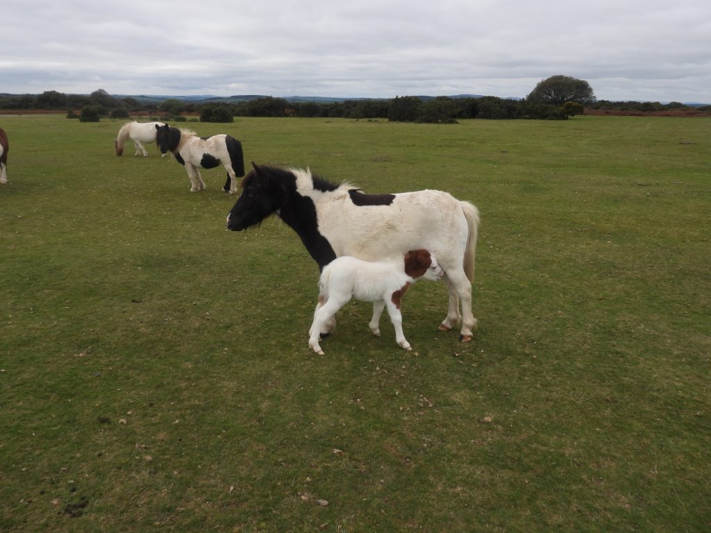
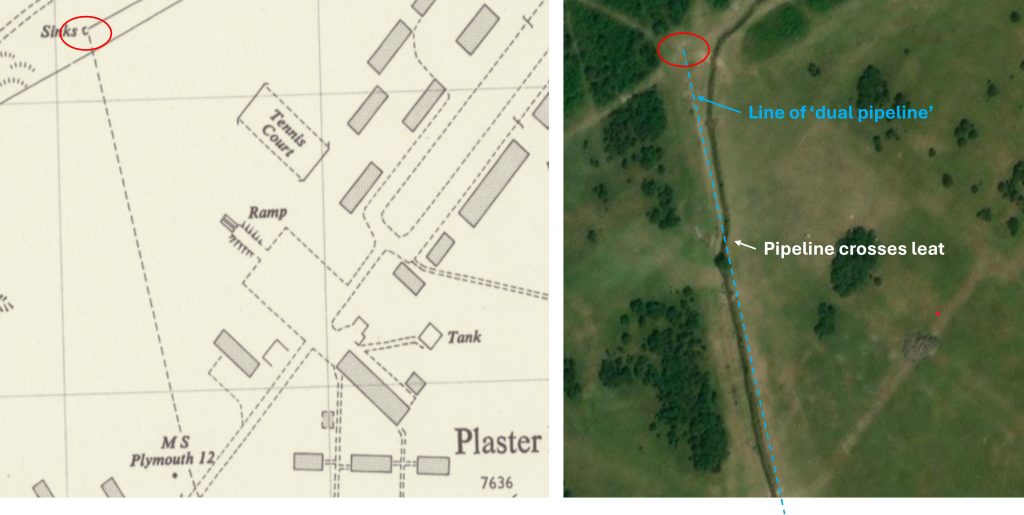
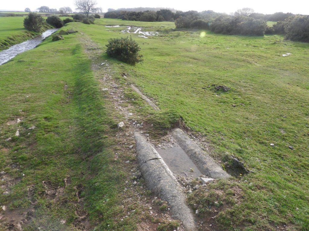
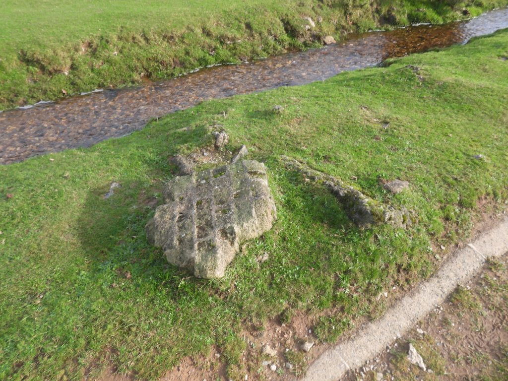
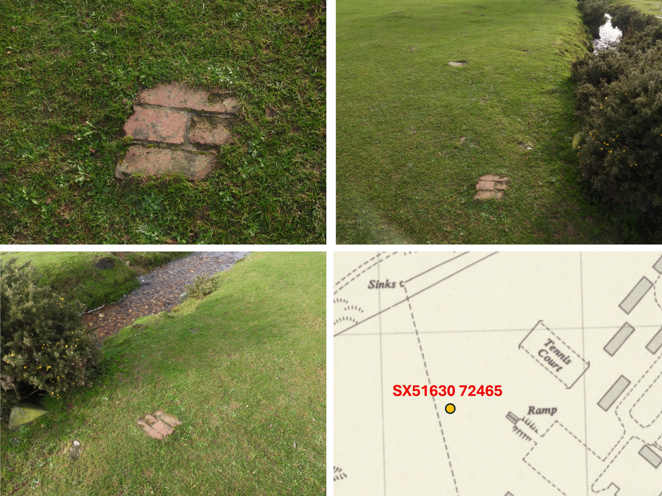
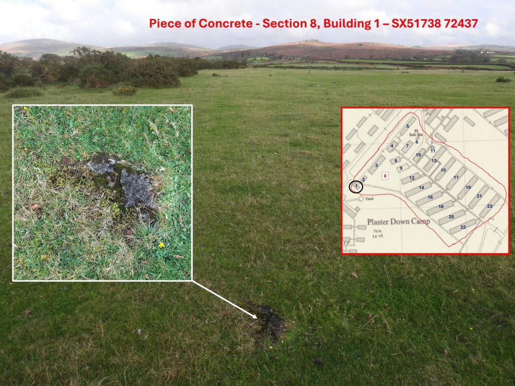
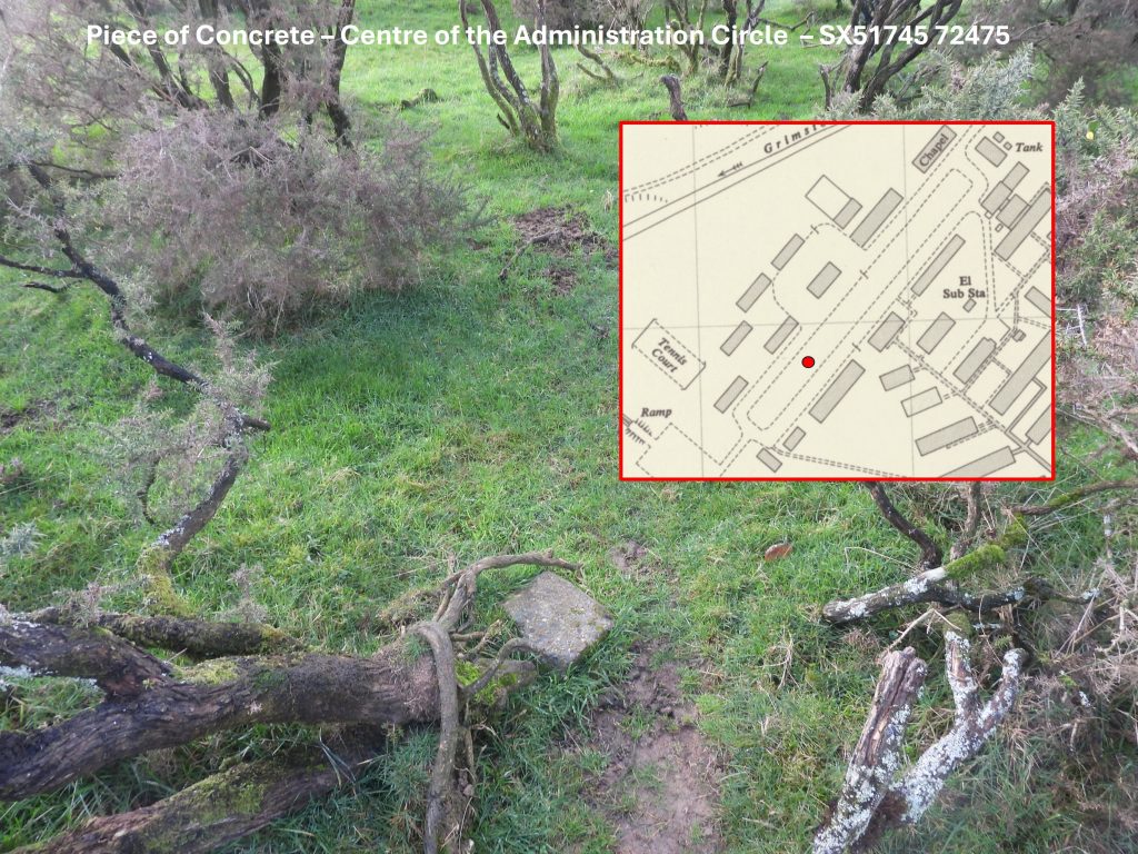
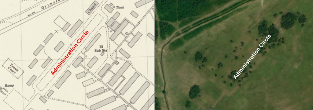
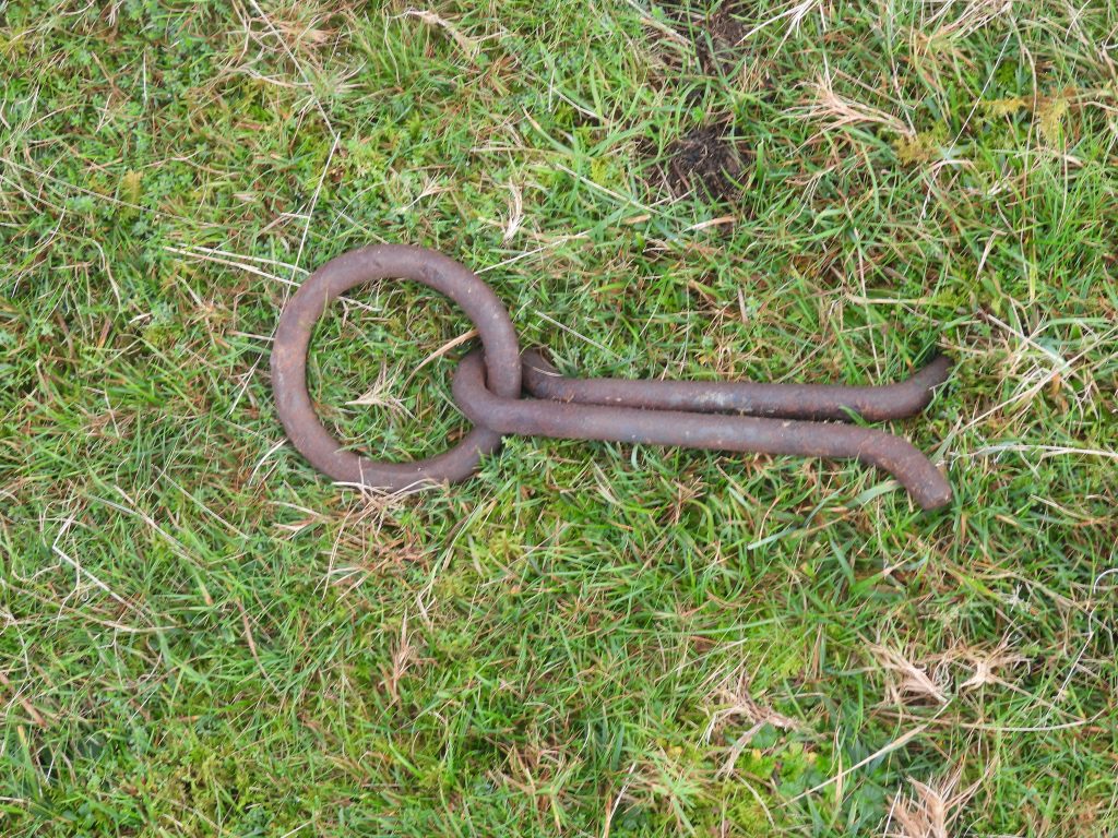
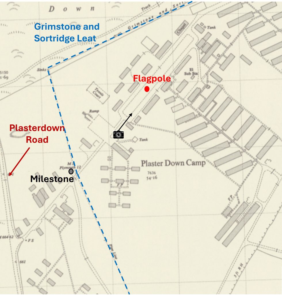
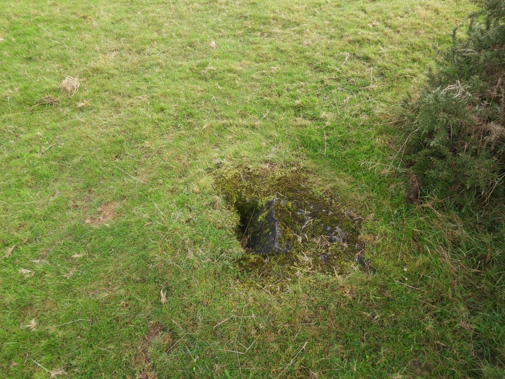
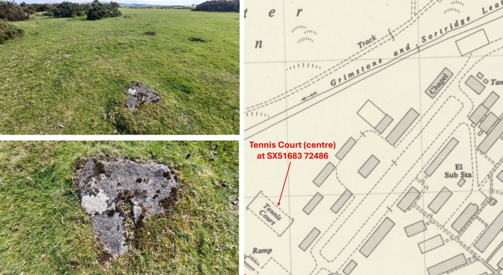
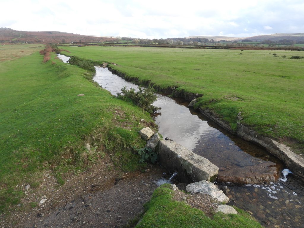
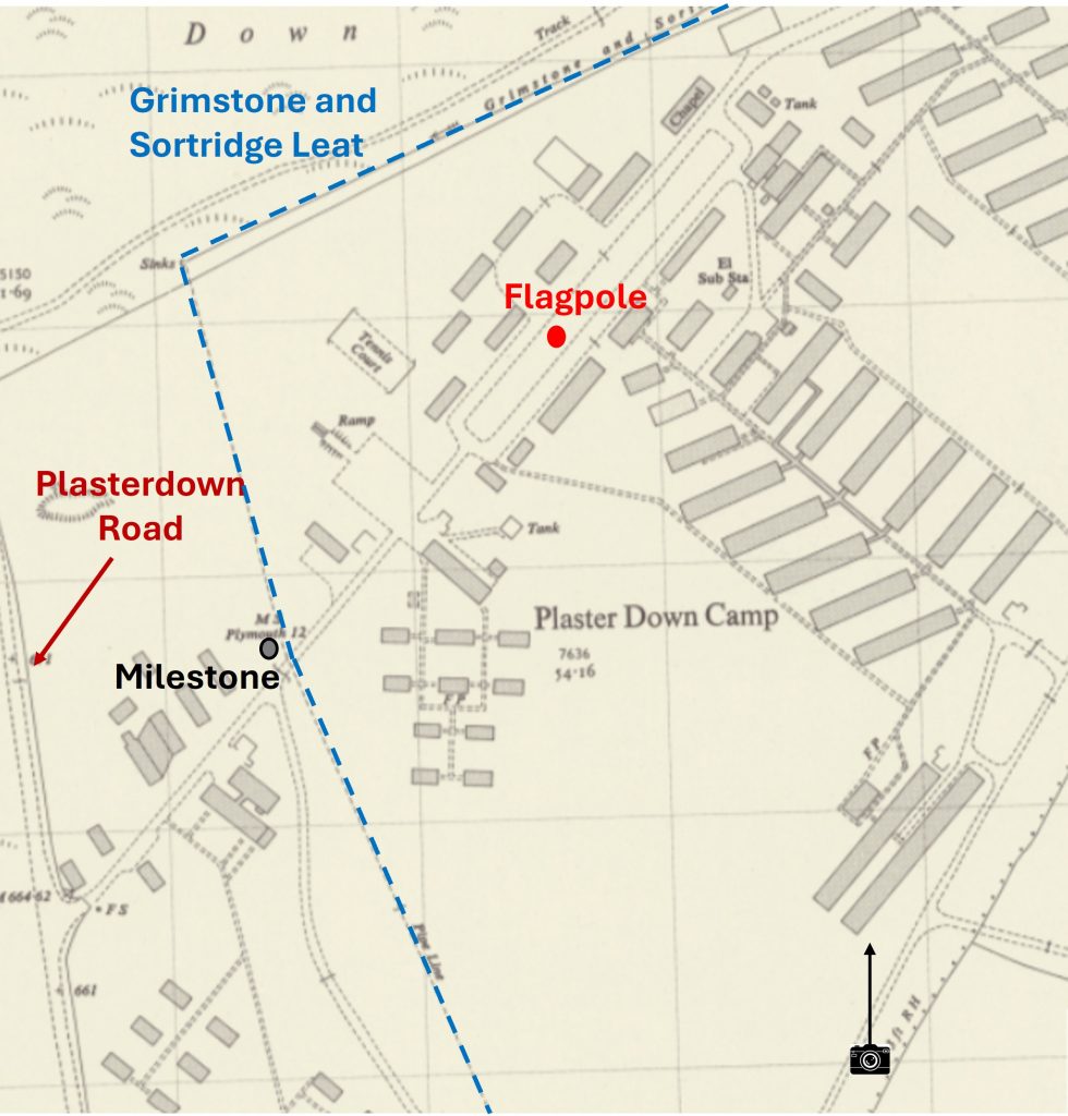
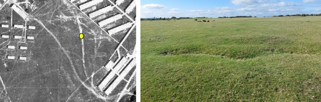
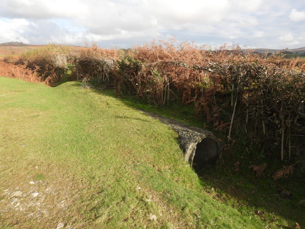
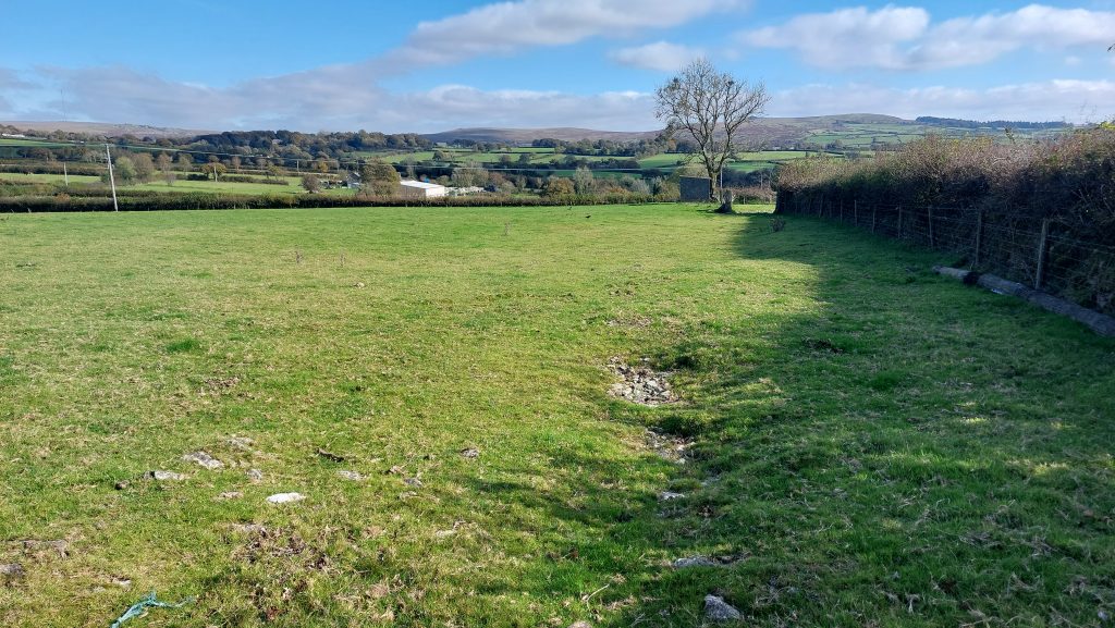
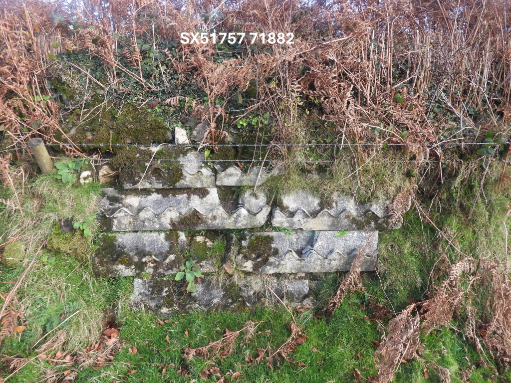
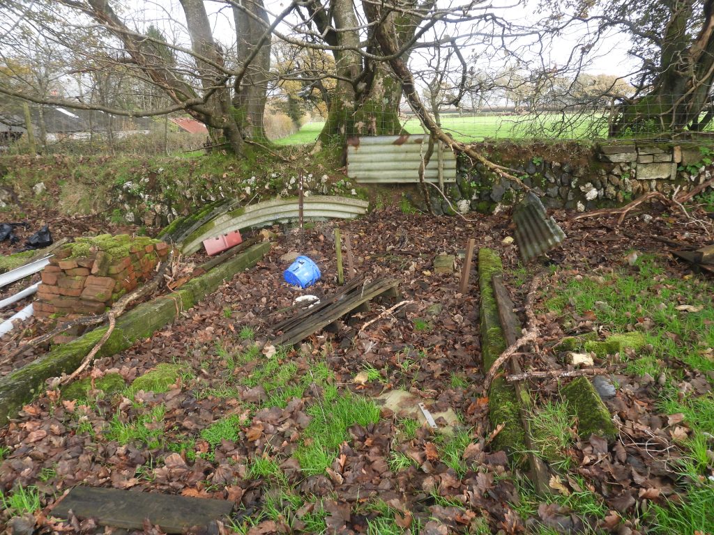
This is a general view of sections 2-5 accommodation blocks as seen in October 2025. There is some ground disturbance which can be detected even in 2025. The picture is a view from SX51663 72052 next to Section 4, Building 4This faint track leads north(ish) from Section 4 through Section 3 and 5. This must have been the pathway used by staff to and from work on a daily basisThis is section 4, building 4 recorded at SX51659 72058. The raised gorse being where the building once stoodMoving north up the central track between the groups of buildings to Section 3, Building 7 at SX51649 72117Section 6. The author surmises that they were more accommodation blocks (possibly the officers) and other buildings sandwiched between the Grimstone and Sortridge Leat (by the milestone) and start of Administration Circle. 1946 aerial photograph of the section the author has annotated as section 6Using the National Library of Scotland Maps, the author has recorded the National Grid Reference (NGR) for the centre of every building / feature shown on the previously annotated maps for sections 1 through 6This concreted section with bricks and debris is where there must have been a bridge which crossed the ‘dry leat’ (as it was sent down a concrete pipe through here)This milestone is inscribed ’12/MILES/TO/PLYMo’ and is unusually around 150m from the road, so most likely would have been moved. It is believed to have been (originally) erected in 1832. Note the concrete pipe on the north east bank of the leat, which where the water would have once flowed The milestone and some locals. The milestone is 118cm tallSection of the concrete pipeDebris in the Grimstone and Sortridge LeatPonies by a section of the exposed concrete pipeYoung FoalThis annotated map shows the approx. location where the next picture was takenThe author believes this photograph may have been taken in the 1940s or 1950s. Its location appears to be just north west of the leat and milestone (by virtue of the orientation of the buildings, it proximity to the administration circle (flagpole) and the back drop of Pew Tor) as per the annotated map previously shownLocation in November 2025 of the previous black and white photograph, just north west of the leat and milestoneSuperimposed black and white picture on the November 2025 photograph with Pew Tor appropriately line up in the centreThis ramp feature with a piece of concrete at SX51651 72466Another view of the leat which separated the camp – it is likely is was just a dry ditch when the camp was operationalA dual concrete pipeline was put in place for the Grimstone and Sortridge Leat to flow through presumably to prevent pollution. Note that the course of the pipeline crosses the course of the leat we see todayThe pipeline where the Grimstone and Sortridge Leat makes a 90 deg bendThe pipeline ‘inlet’ (marked as ‘sinks’ on old map) is located at SX51614 72514The ‘dual pipe’Section of walling near the concrete pipe at SX51625 72482Broken pipe near the Milestone on east side of leatMisc piece of debris from the camp, which is located away from any of the original structures or featuresThis small piece of concrete is from section 8, building 1 at SX51738 72437. This would have been at the south west end of the administration circleThis small piece of concrete was found amongst the gorse in what would have been the centre of the administration circle at SX51745 72475The outline of the administration circle is still shown on some recent (21st century) aerial photographsThis ring and connecting bar was not on site but shown to the author by someone who lives local to the former camp. This artefact was believed to have been a restraint of some kind. The author has been unable to confirm this.Section 7 building annotation which was the north west side of the administration circle. Of interest is the old tennis court and chapel identified on the old map. The Grimstone and Sortridge Leat here was not piped This annotated map shows the approx. location where the next picture was takenThe administration circle where the flagpole was located. One assumes this is where the main headquarters was located. Note the speed limit was 15 mphThe administration circle in November 2025This composition superimposes the old black and white photograph onto the November 2025 picture. Created by lining up the background tors and knowing where the flagpole was located (amongst the gorse) Administration circle from an aerial photograph from 1946. The tennis court lines very evident from the photographThese pictures are from the Lt. Col Robert McMahon and were of staff either from between July 1943 and April 1945HeadquartersAmongst the gorse is this piece of concrete with a hole next to it, which is at SX51753 72478. The location suggests to the author this was the flagpolebase
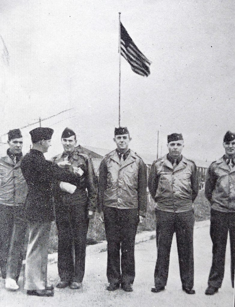
Another McMahon booklet picture titled ‘Our First Purple Heart Presentation’ with flagpole behind
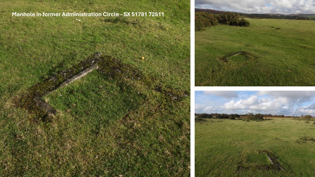
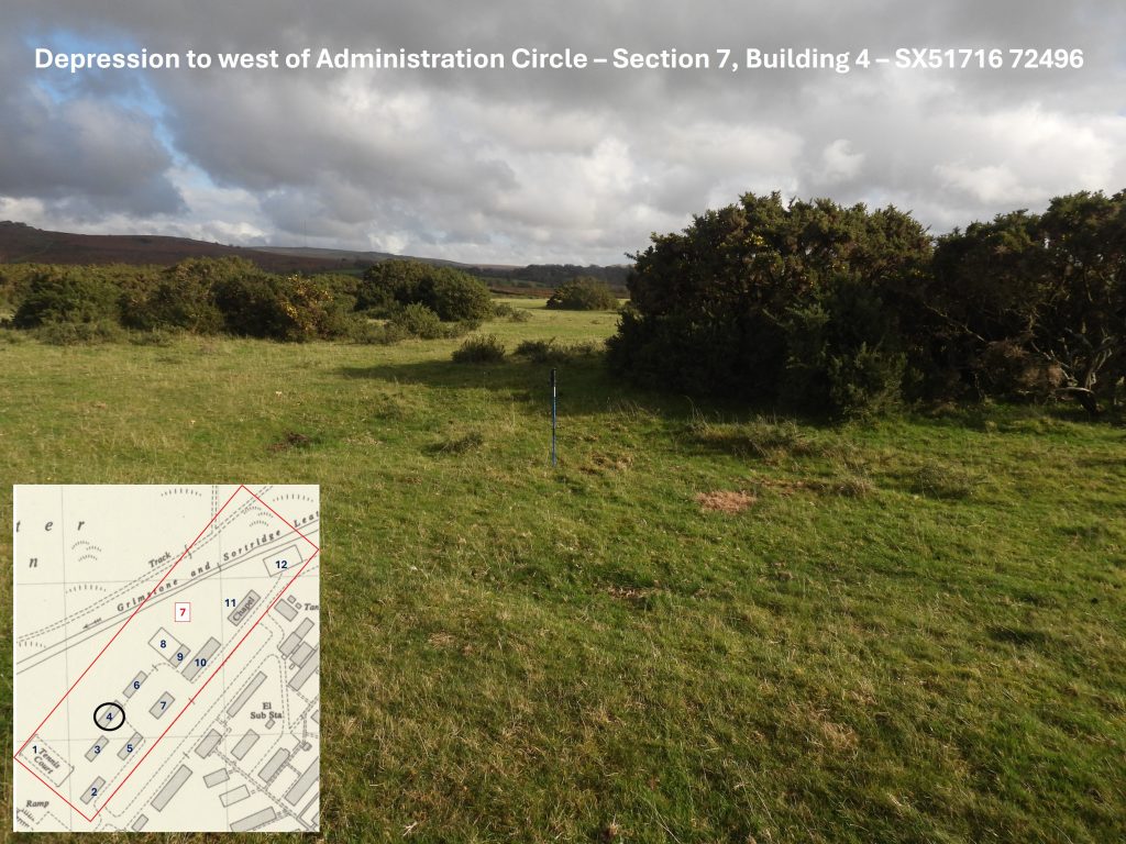
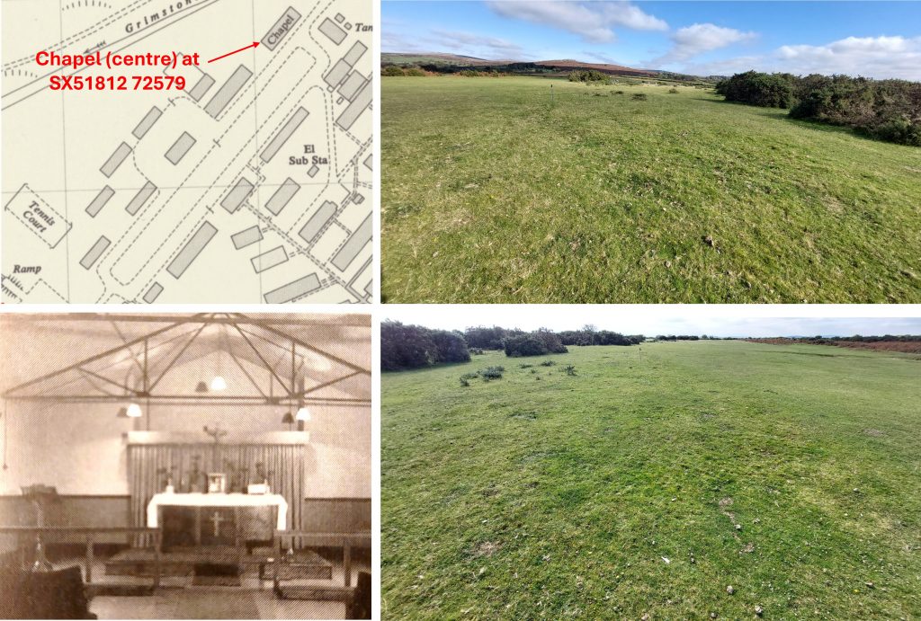
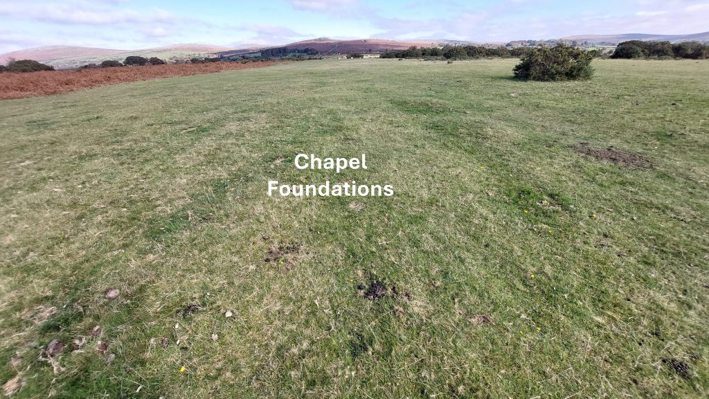
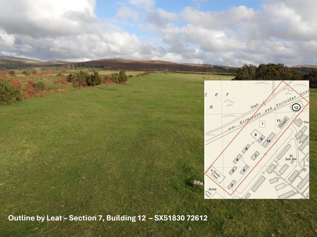
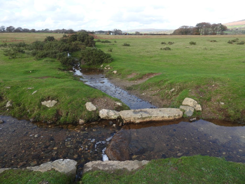
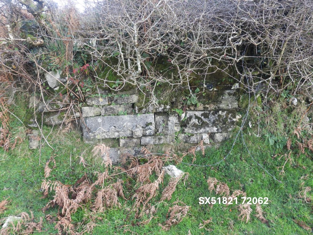
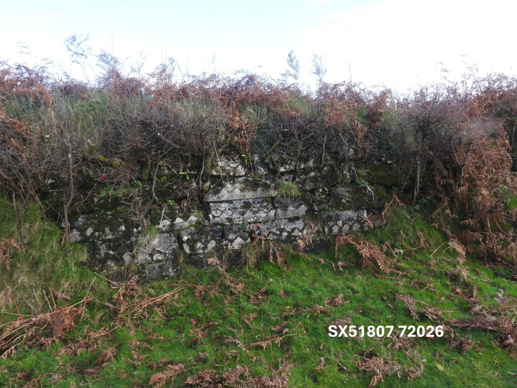
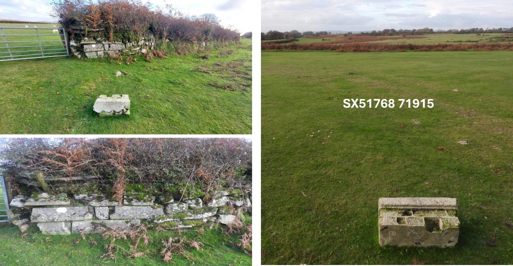
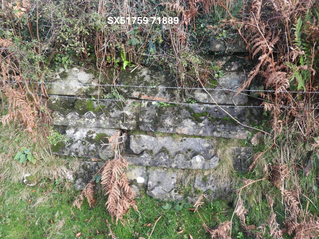
Manhole in the former administration circleThe former tennis court has a few concrete remains next to itThis depression to west of the administration circle is section 7, building 4 at SX51716 72496The chapel for Plasterdown CampThe chapel foundations are centred at SX51812 72579These foundation outlines by the leat are from section 7, building 12 located at SX51830 72612The Grimstone and Sortridge Leat with bullseye stone taking water off west to Reddicliffe FarmThe bullseye is located at SX51907 72651Section 8 building annotation which was the south east side of the administration circle. It is very probable that these were the hospital wards
Section 8 buildings (wards etc.) from 1946 aerial photograph
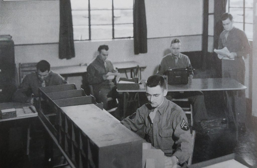
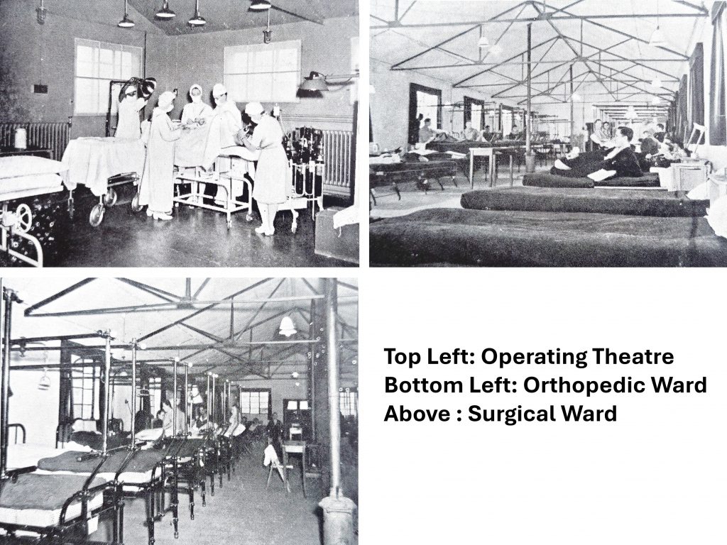
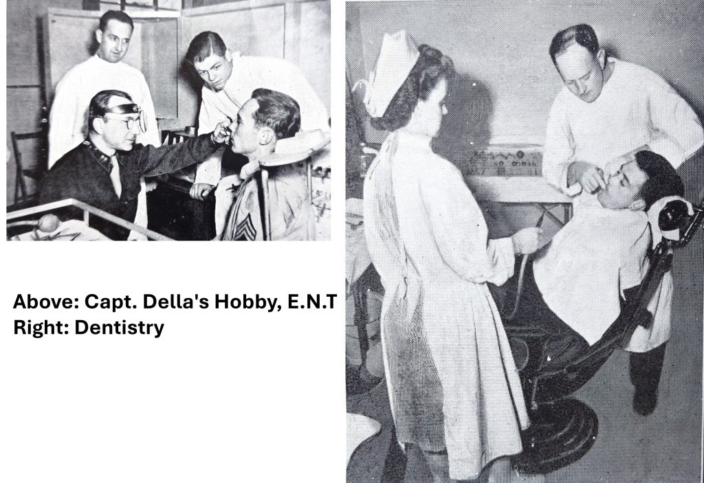
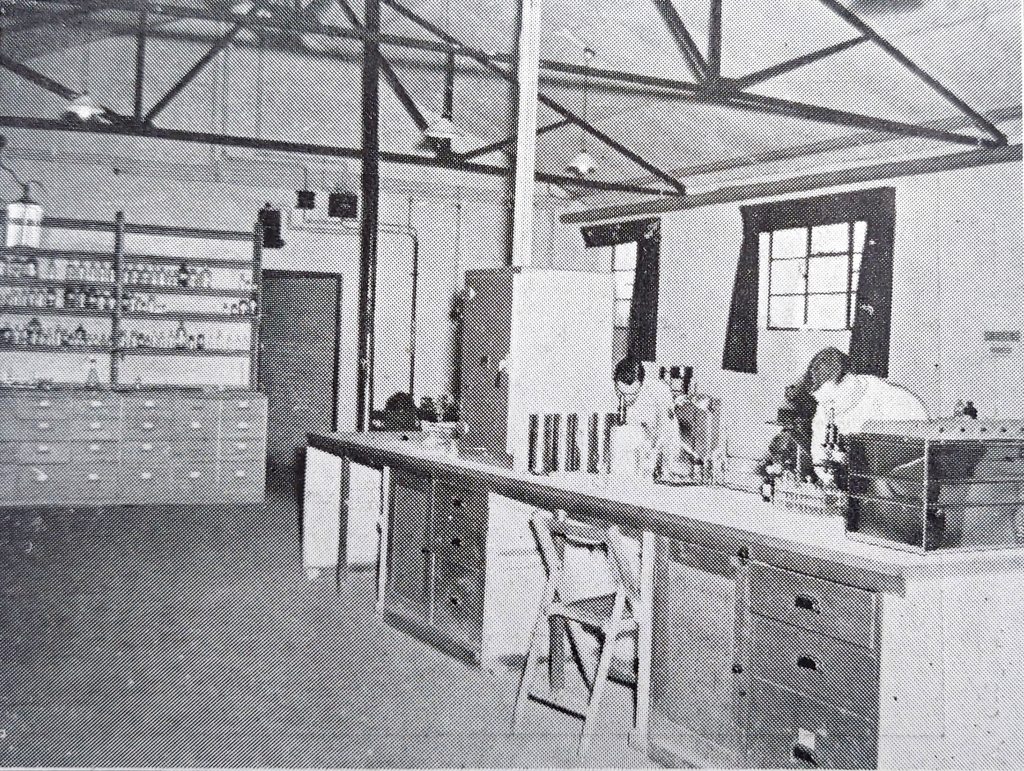
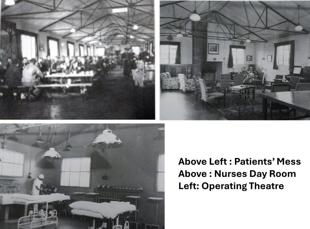
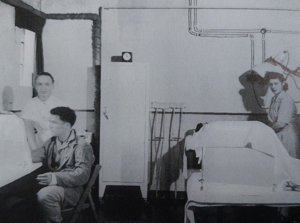
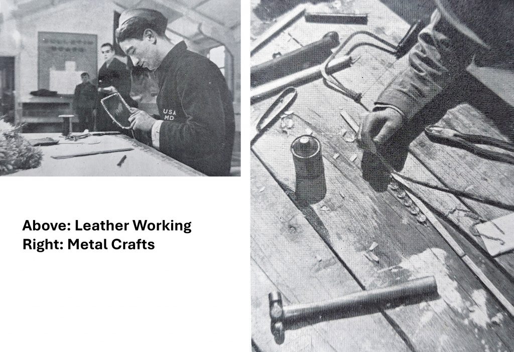
More pictures from the Lt. Col Robert McMahon booklet of the wards and an operating theatre. They were taken from between July 1943 and April 1945. In all likelihood, as the wards do not appear full, it is likely that the pictures were taken pre D-Day (6th June 1944)More pictures from the Lt. Col Robert McMahon booklet – dentistryThe LaboratoryMore pictures from the Lt. Col Robert McMahon booklet Physiotherapy
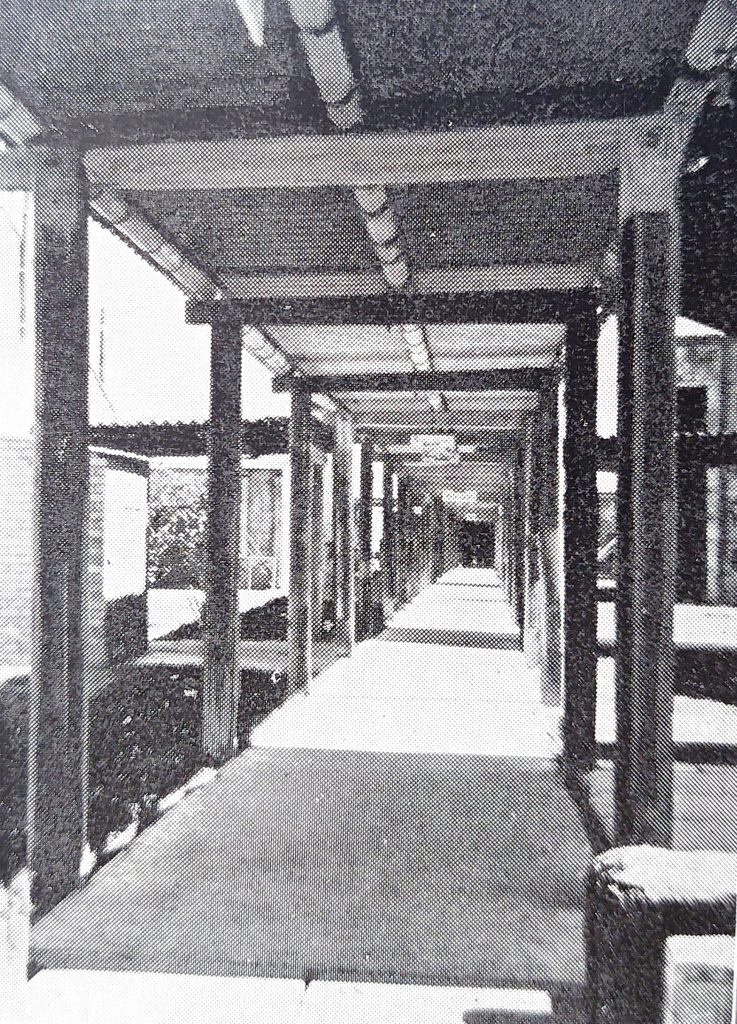
Covered walkways between the buildings
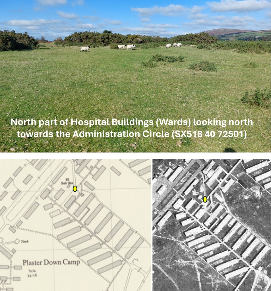
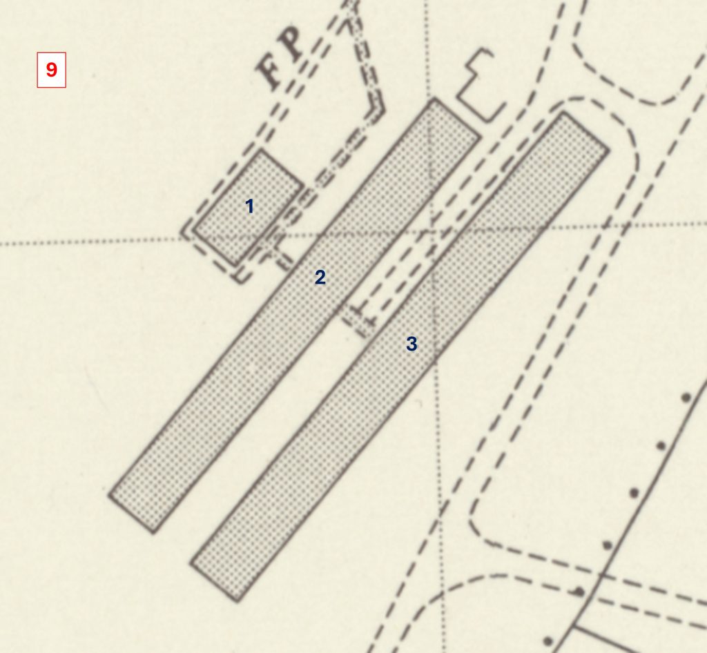
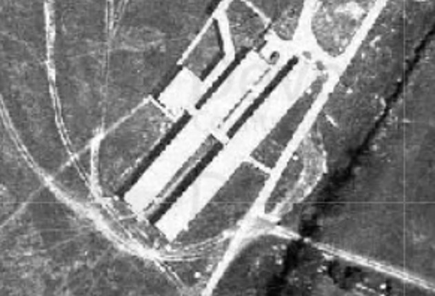
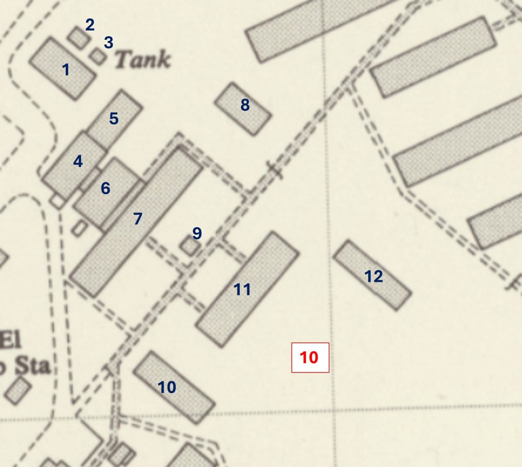
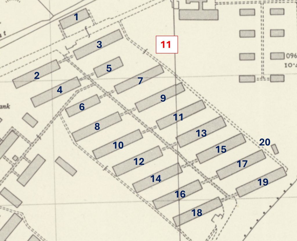
North part of hospital wards in section 8 buildingsTo the south east of the hospital wards is section 9 of the authors annotations. This area comprised of what the author describes as ‘The Long Buildings’. They were located alongside the south access road by the camp boundary
1946 aerial photograph of the ‘Long Buildings’. To the west of this area, there were no buildings and is where used for helicopters
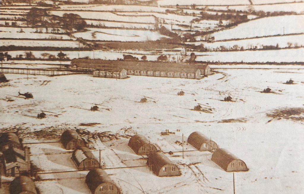
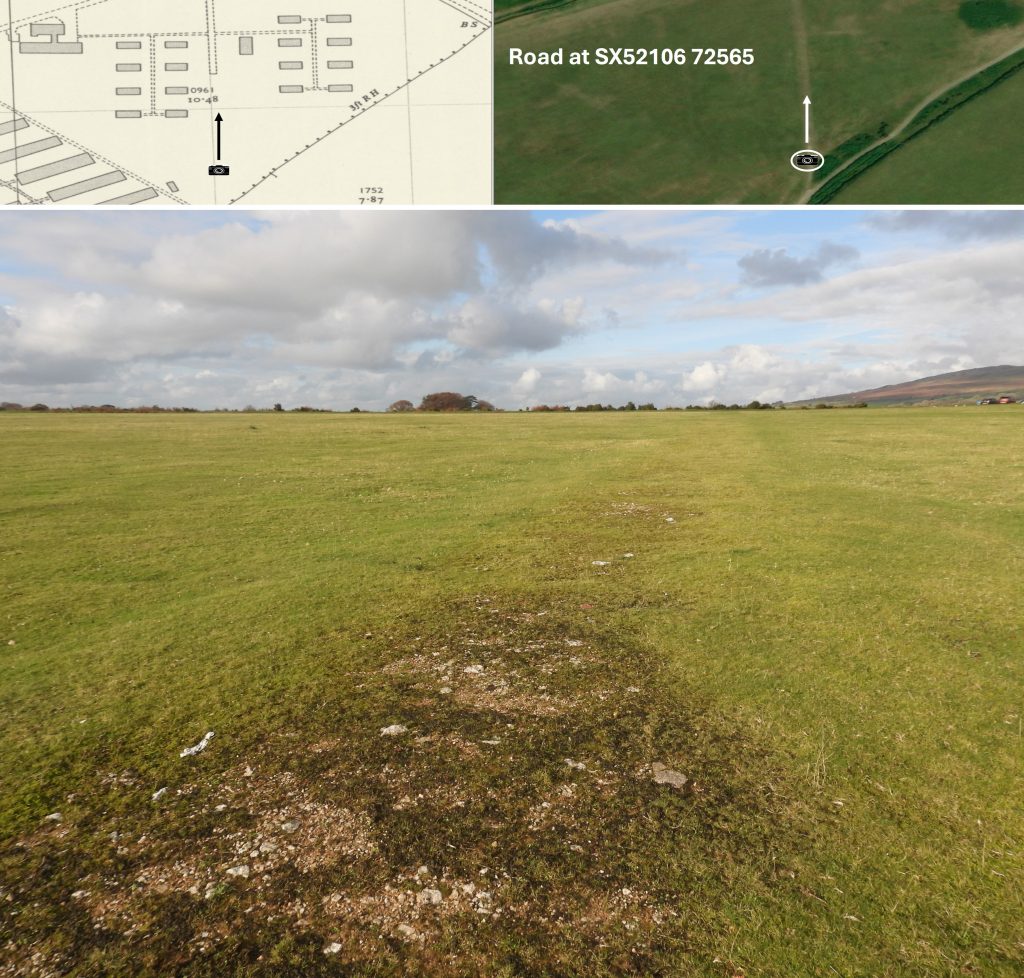
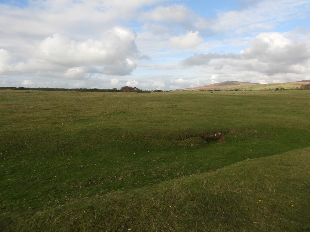
The camera icon shows the location of where the next few photographs would have been taken when the camp was still operational and from November 2025The ‘Long Buildings’ – date unknown. The number of windows of these buildings compares with those from an aerial wintery view shown later in this post thus confirming where this picture was takenWhere the ‘Long Buildings’ were located – November 2025Superimposed picture of the ‘Long Buildings’ onto the November 2025 photograph. The location was identified using NGR’s and by lining up the background torsThis wintery view shown the ‘Long Buildings’ and the Helicopter area. The number of windows on the buildings compares favourably with those on a previous black and white photographSection 10 as annotated by the authorThese workshops may well have been located in section 10 buildingsUsing the National Library of Scotland Maps, the author has recorded the National Grid Reference (NGR) for the centre of every building / feature shown on the previously annotated maps for sections 7 through 10Section 11 was likely to have been more wardsPossible drainage feature between sections 8 and 11 as shown by the yellow dotAn unknown feature between sections 8 and 11. This might have been the location for the temporary ‘tented’ wards which were erected in the Autumn of 1944 post D-Day to increase bed numbersAnother feature between sections 8 and 11Section 12 is believed to be where the nurses were accommodatedThese pictures annotated ‘Our Home’ (1) and ‘Section of Nurses Area’ (2) located near the north east entrance to the camp. The pictures come from the Lt. Col Robert McMahon booklet Approx view of the black and white photograph as taken in November 2025
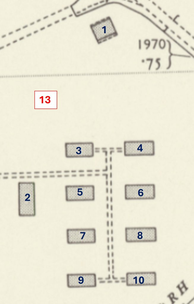
Section 13 – part of the nurses area
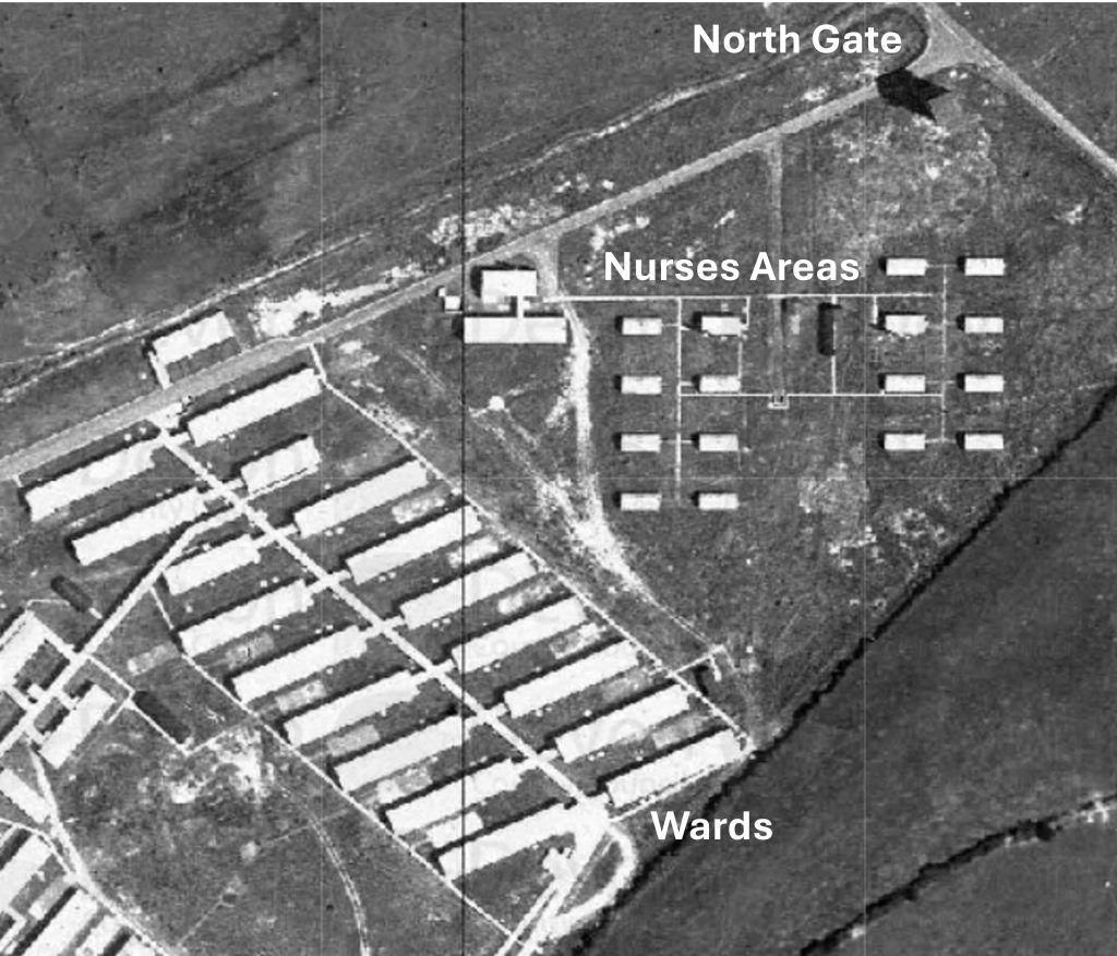
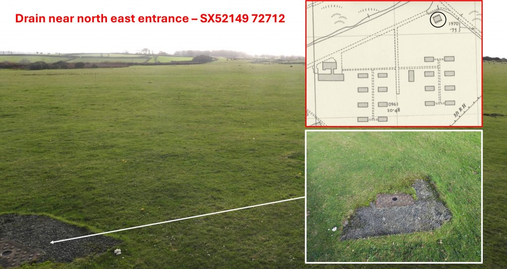
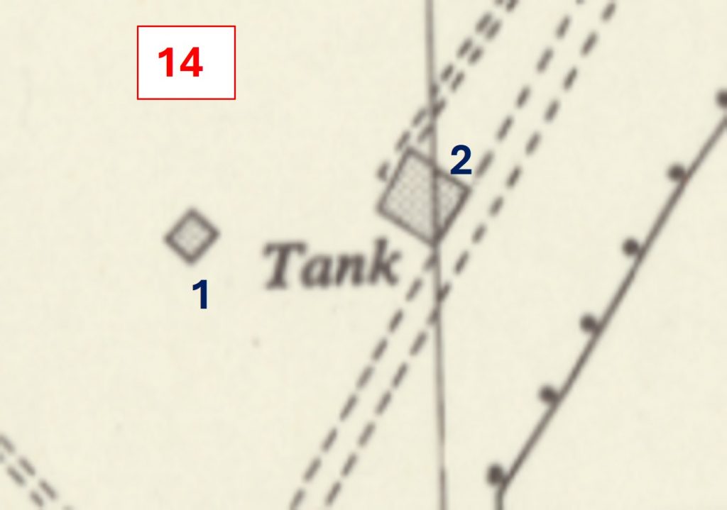
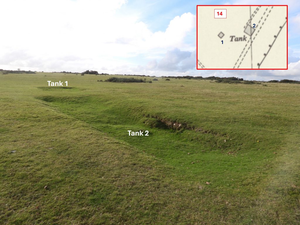
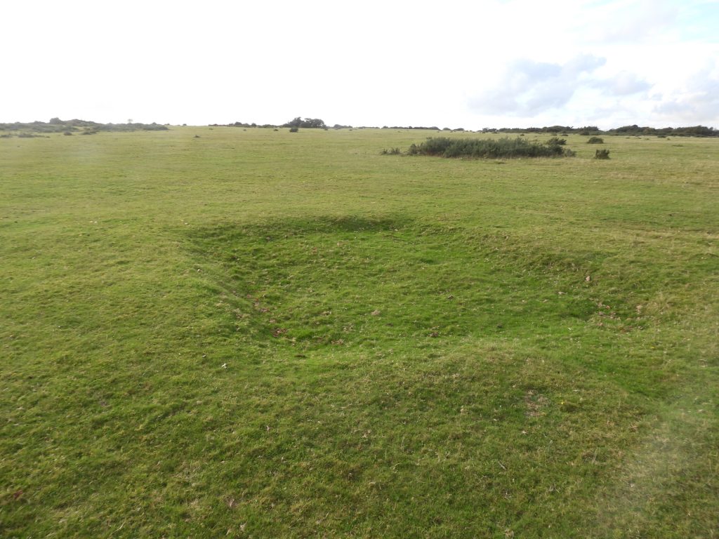
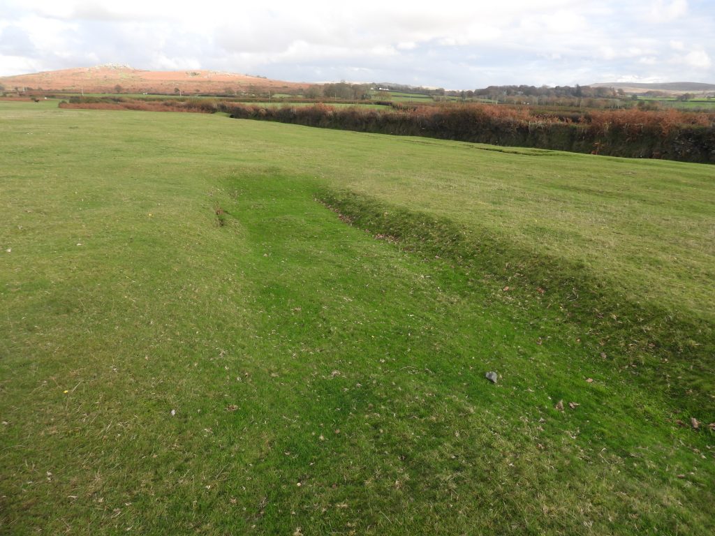
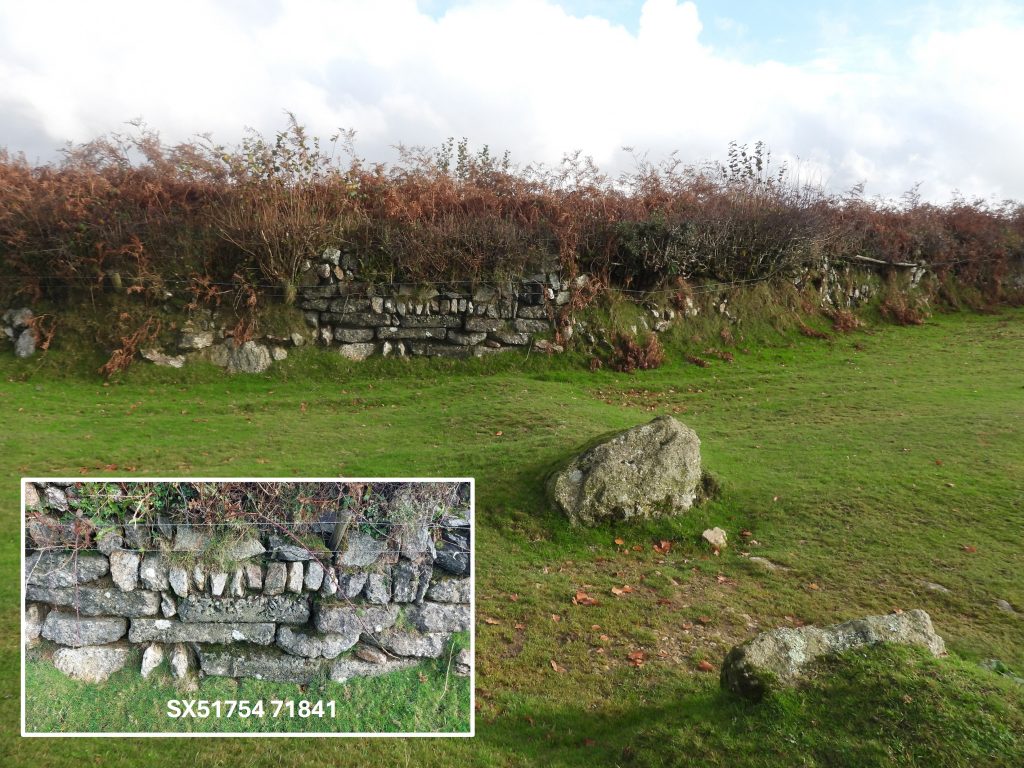
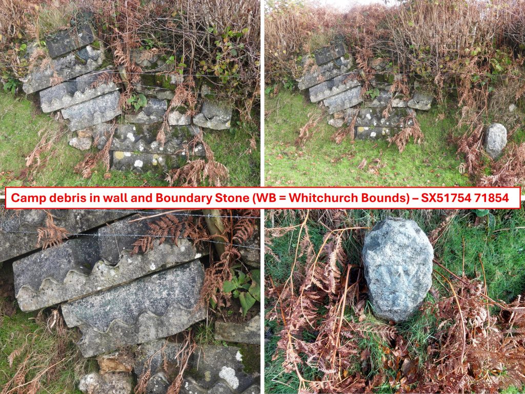
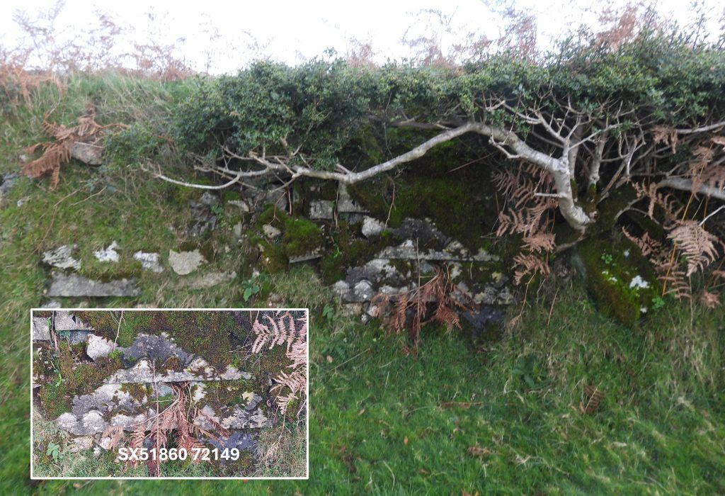
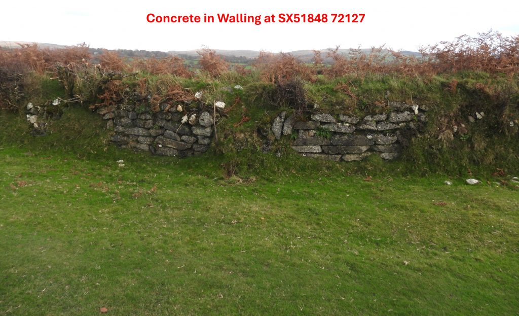
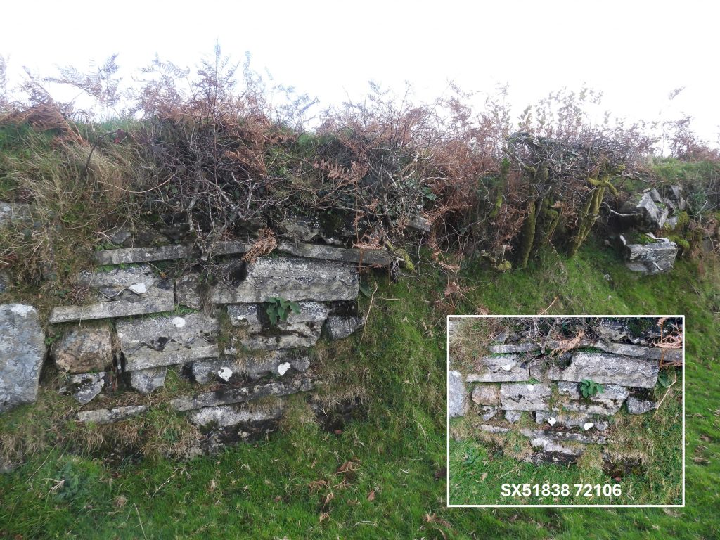
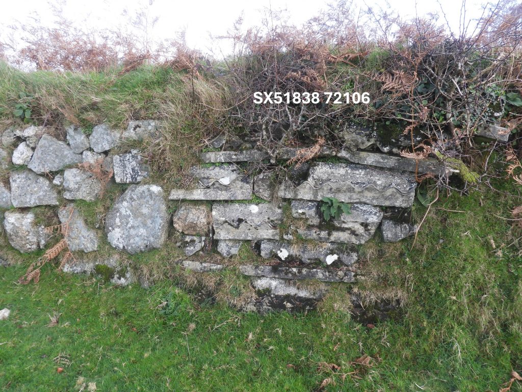
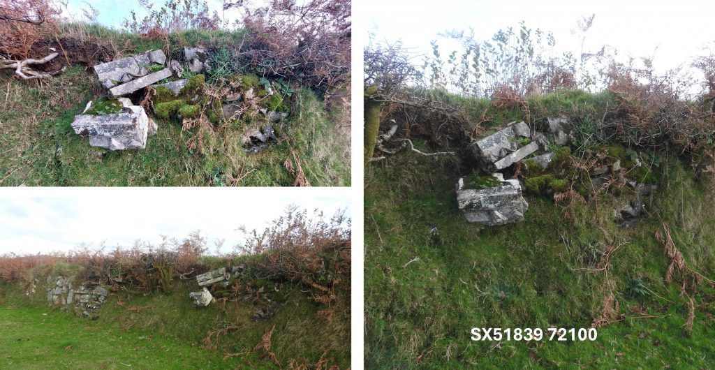
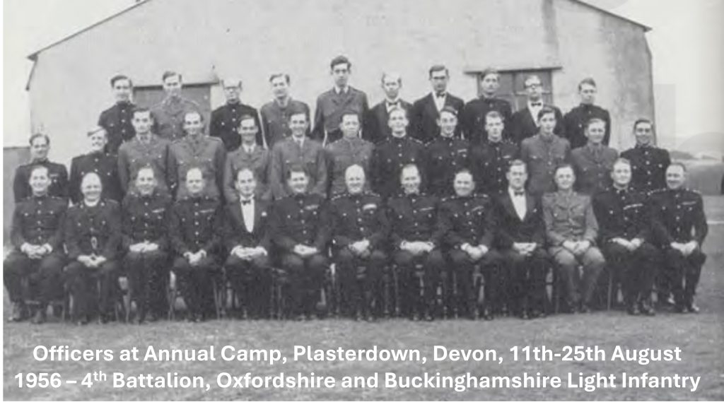
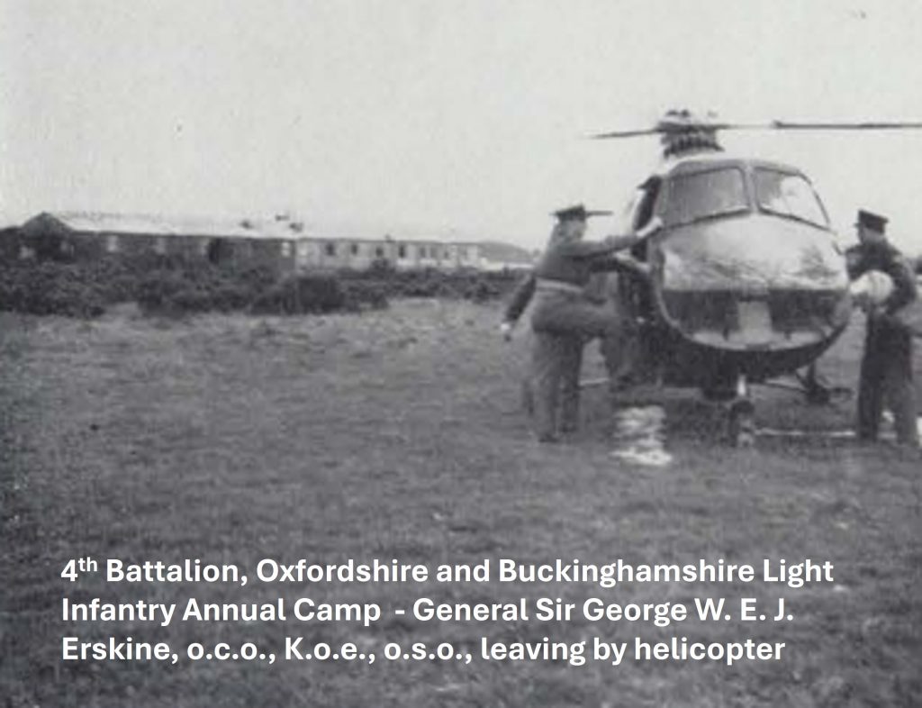
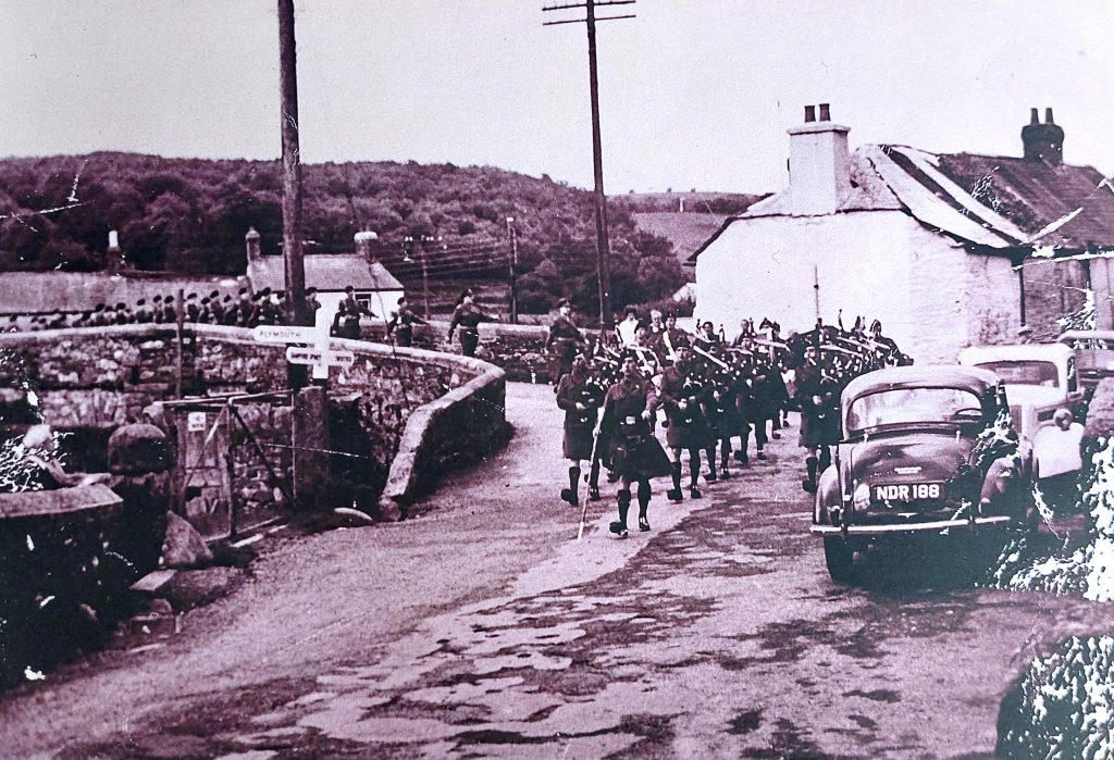
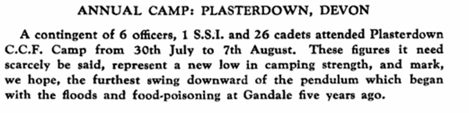
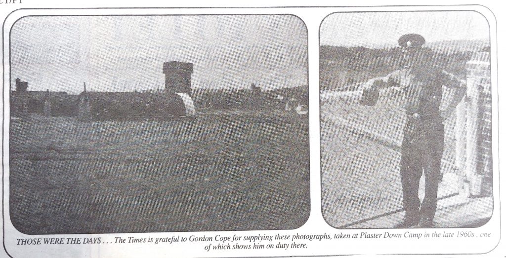
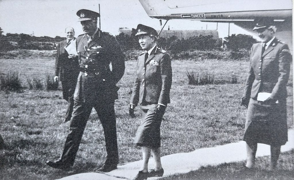
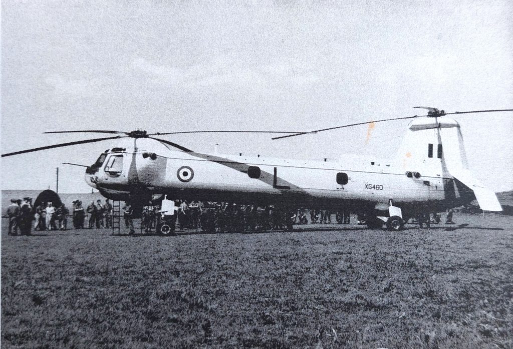
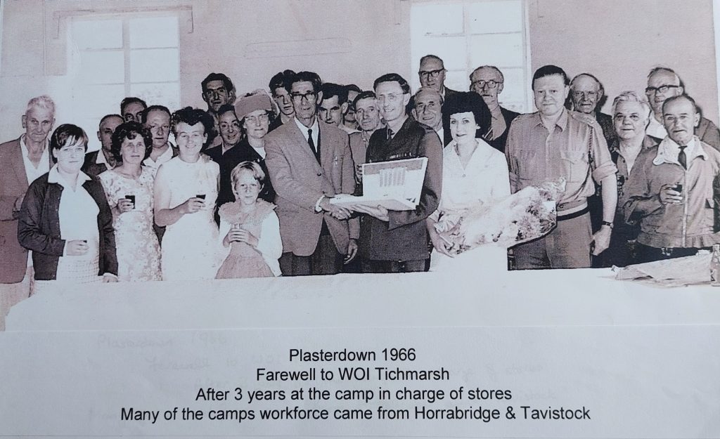
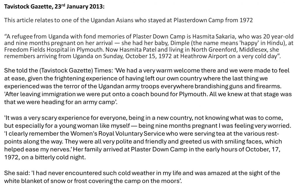
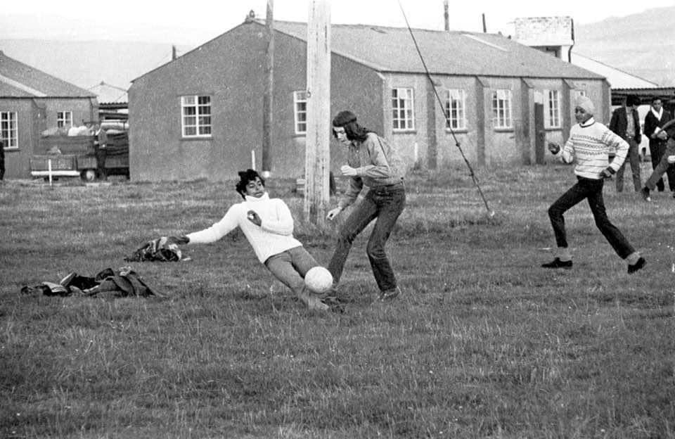
Aerial photograph from 1946 of sections 11, 12 and 13Approx view of the black and white photograph as taken in November 2025Zoomed in aerial view of the ‘Nurses Area’Zoomed in aerial view from the north east corner of the campThis faint line was either a walkway in the nurses area or where the sewerage was runBy the north east gate is a drainThe north east gate in November 2025 is now a small car parkRoad which ran across the nurses areaNext to the camp boundary there is a concrete pipe at SX52091 72510. Could this have been a sewerage pipe as the sewerage buildings are not that far awaySection 14 comprises two tanksThe two depressions of the tanks are still evident. Were these fuel tanks?The depression of tank 1 at SX52013 72465The depression of tank 2 at SX52026 72472Tank 2 looking northThe sewerage area – section 15The sewerage area in October 2025Faint remains of the boundary road at the south east side of the campUsing the National Library of Scotland Maps, the author has recorded the National Grid Reference (NGR) for the centre of every building / feature shown on the previously annotated maps for sections 11 through 15. In total there were in excess of 150 buildings / features across the campAlong the south east wall of the camp there are at least a dozen locations where debris from the camp has been used to repair and maintain the wallCamp debris next to the Whitchurch Bounds, boundary stoneMore debris used in the wallWall repairsWall repairsWall repairsWall repairsWall repairsWall repairsWall repairs by gate with a brick ‘lump’ which might be used to wedge the gate openWall repairsWall repairsThis roofing at Fullamoor Farm may well have come from Plasterdown CampThis debris and foundations of a former building at Fullamoor Farm may well have come from Plasterdown CampPipe outlet near a modern car park, where the water would have (re) entered the original course of the Grimstone and Sortridge LeatClose up of the outletThe Annual Camp of the 4th Battalion Oxfordshire and Buckinghamshire Light Infantry (TA), which took place at Plasterdown in 1956. There were 50 officers, 135 volunteers and 220 National Servicemen.General Sir George W. E. J. Erskine of Southern Command paid a flying visit by helicopter to the camp in 1956. The article from which this photograph was taken suggests there was a ‘sheep pat’ on to which the General had to step on on alighting from the helicopter which was ‘thanks, to the last minute arrangements of the native population of Plasterdown’A Scottish Territorial Unit from late 1950s marching to Plasterdown Camp – picture courtesy of Jill FitzsimmonsFrom a report in ‘The Abingdonian’ (a school publication by Abingdon School) the details of their Combined Cadet Force (C.C.F) camp in 1963 can be summarised as follows: On the first day they went shooting; on the second day, they embarked on a 72-hour Arduous Training exercise (initially in sunshine so hot that two Cadets suffered from heat exhaustion, and one of them had to drop out of the exercise). The exercise had to be abandoned due to mist on the following day, when one patrol got lost! The camp didn’t appear to get any better as they had planned to hold the open air drumhead service which was cancelled due to the mist then on the final day an exercise in fighting patrols was curtailed due to a army regular officer failing to show up. The person who wrote the article about the camp signed off on a positive by saying “All in all, though, a smooth-running, pleasant camp, which served very well as a “digestif” at the end of a crowded term”. Picture courtesy of John Stickland – taken in 1966Princess Royal (the then Princess Anne) visiting the camp in 1962Princess Royal then Princess Anne visiting the camp in 1962. She was visiting the Women Royal Army CorpHelicopter was from 66 Squadron, RAF Seletar. The helicopter is a Bristol type 192 Belvedere. This helicopter built in 1961 and was scrapped in 1969Picture from the camp from 1966. The author believes ‘WOI’ abbreviation is for Warrant Officer (First Class), the highest non-commissioned rank in the British Army and Navy. In October 1972, initially 450 then another 150 Ugandan Asians were housed as part of resettling them, as they escaped persecution in their own country. They were given only 90 days by the dictator Idi Amin to leave their own country. This article is the story of one of the Ugandan refugees talking about the legacy: The ‘Trauma’ Legacy of Amin, Very Few Ugandan Asians Talk AboutYoung Ugandan refugeesAn interesting account from a Ugandan refugee recorded by Tavistock Gazette Times in 2013
‘Jumpers for Goalposts’ – The Ugandan Asians playing football circa late 1972 or 1973. From fear in their homeland to having fun, 4000 miles from home
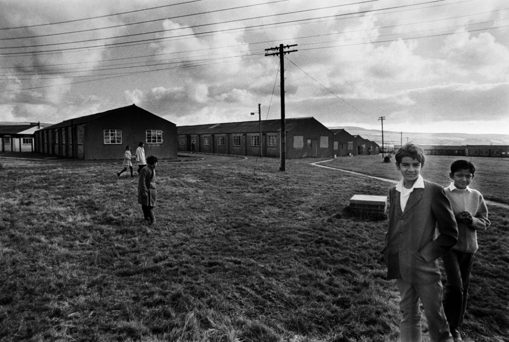
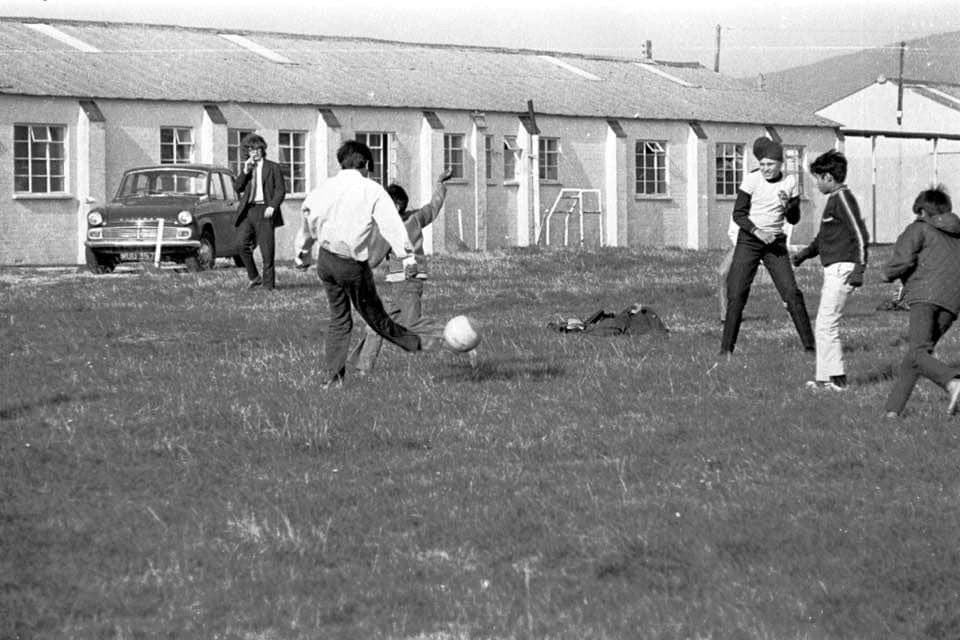
Picture of the camp from 1972, courtesy of Mary Hawkins
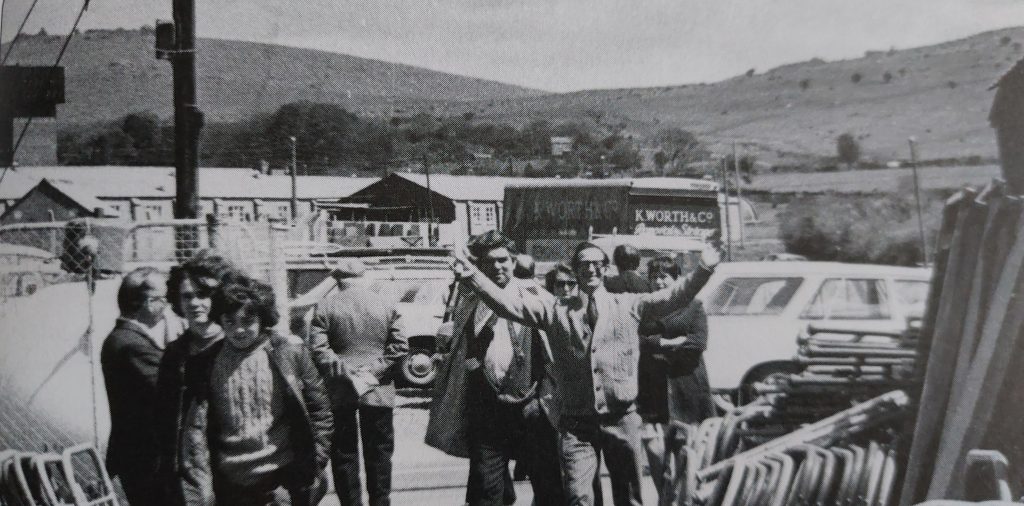
The selling off of items at the camp, circa 1974
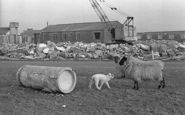
Demolition from circa 1975. The site was fully cleared by 1976
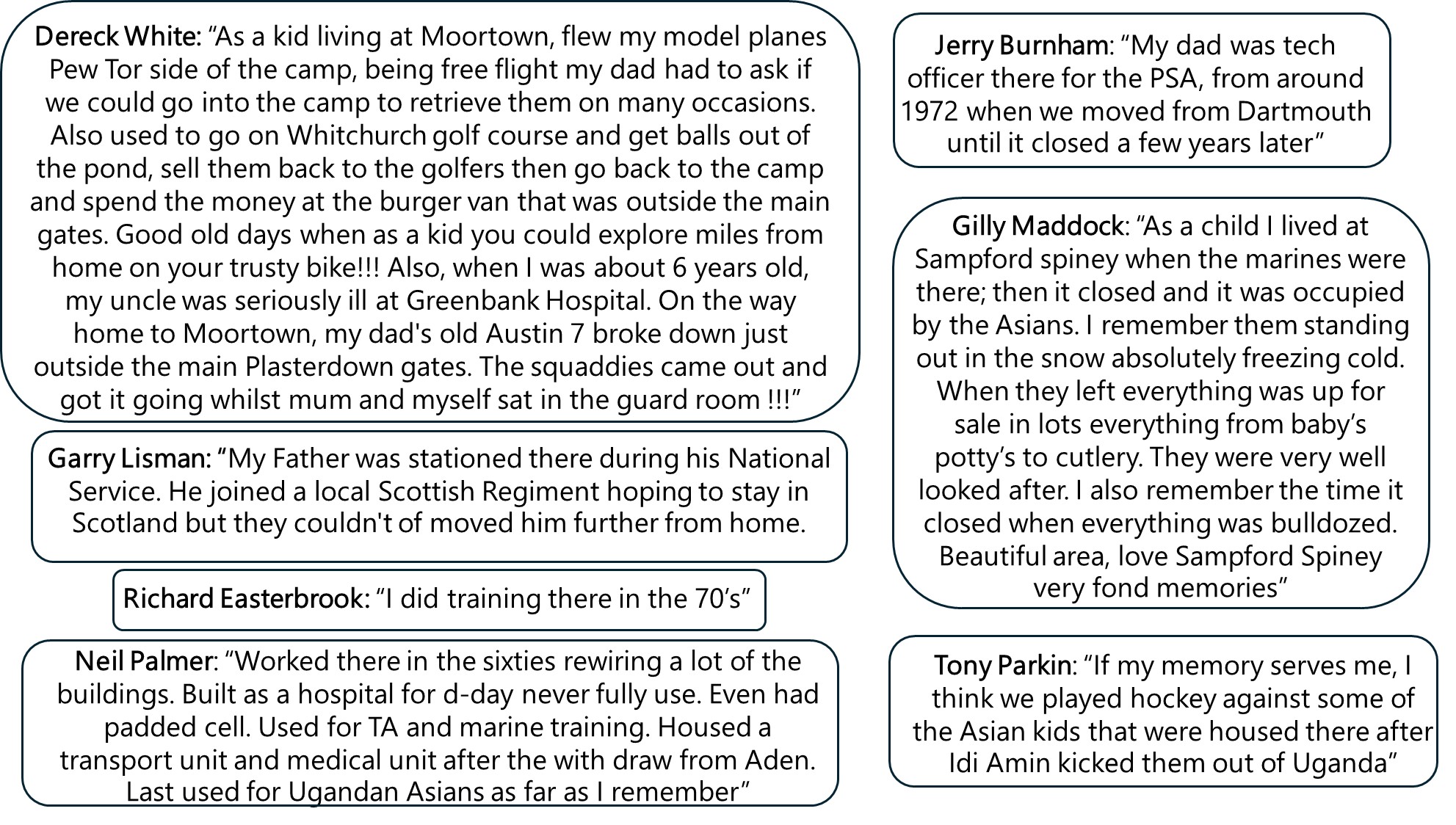
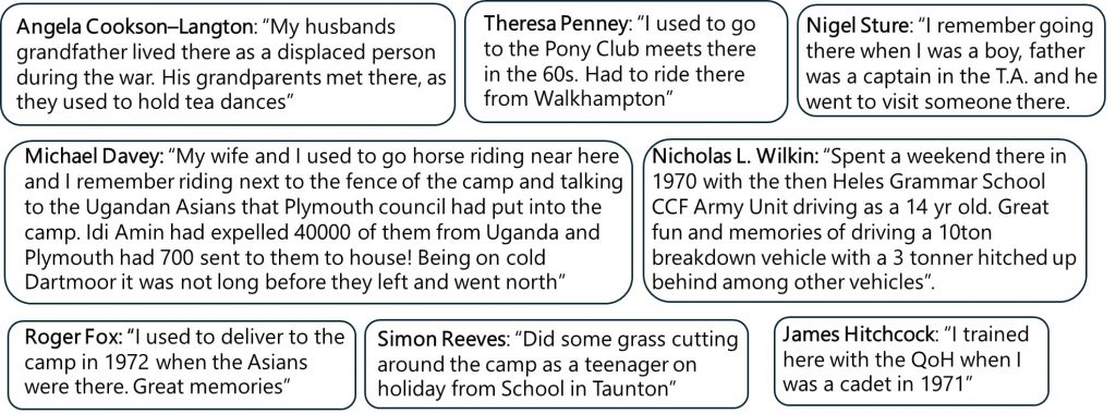
These quotes have been provided by those who either directly had experiences of the camp or had relatives who were there
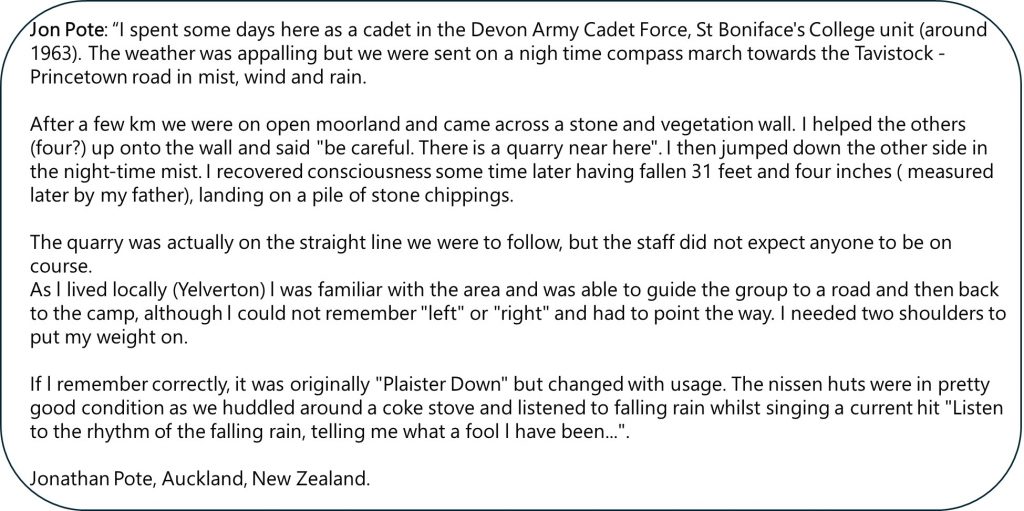
More memoriesA memory of Jonathan PoteMore memories
If anyone reading this post has their own memories and / or pictures which they wouldn’t mind sharing, the author would be most grateful in hearing from them

David Deal June 5, 2026
My Dad was a US Army surgical technician at the 115th Station Hospital in 1943 to 1946. His name was Lynwood Deal.
SteveGriggDartmoor June 8, 2026 — Post author
Hi David,
Many thanks for sharing this infomation
Kind Regards,
Steve