A collection of walks, discoveries, insights and pictures of exploring Dartmoor National Park
October 15, 2025
The ‘Gold Box’
There are many cists, cairns and antiquities on Dartmoor which have been given names, some relating to treasures; These include: the ‘Crock of Gold’ on northern slopes of Royal Hill, the ‘Money Box’ at Lower Piles (near Harford), the ‘Money Pit’ on the slopes of Yar Tor and the ‘Monument’ on Dartmeet Hill.
There are two cists with names located around Foxtor Mires; the first ‘Grandpa’s Grave’ or ‘Grandpa’s Chest’ which is located a few metres below (east of) Devonport Leat, near Sunny Corner; the second is the ‘Gold Box‘ which is located around 200m north east of Goldsmiths Cross adjacent to Fox Tor Mire, which is the subject of this post.
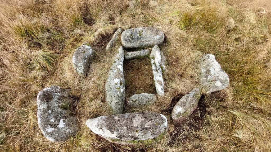
The name ‘Gold Box‘ appears to have been mentioned in only two locations. Firstly, the name appears in High Dartmoor (page 337) where Eric Hemery casually mentions two cists with one “formerly known as the Gold Box”. He then states: “some set stones nearby could be remnant members of a row which lost their fellows to Ned’s Wall*“. The second reference to the ‘Gold Box‘ is by Mike Brown in volume 18 of his Field Guides where he states: “A well preserved cist within a tiny retaining circle of seven large stones must be the one which Hemery says used to be called the Gold Box for the other cist he mentions is a sorry remnant, far too insignificant”. The author would agree with Mike Brown.
The Gold Box is in actual fact a ‘ring setting cairn with cist’ (not just a cist) and has variously been recorded by many including Lethbridge, Grinsell, Turner, Probert, Ordnance Survey Archaeology Division and Butler, none whom have given it a name. No doubt the name for this cairn & cist is an old moorman name, which one assumes was passed onto Hemery during his research for High Dartmoor and is either named as such due to it being a rather spectacular antiquity or has taken the name due to its proximity to the nearby Goldsmith’s Cross. The cairn and cist is still shown on modern OS maps
*Ned’s wall refers to a nearby Newtake wall (probably Great Fox Tor Newtake) worked on by Edward Worth in the early 20th century
Bibliography
Eric Hemery (1983) – High Dartmoor (page 337)
Mike Brown – Dartmoor Field Guides Volume 18 : Swincombe Valley; Whiteworks; West Dart Valley East of Princetown
Jeremy Butler (1991) – Dartmoor Atlas of Antiquities (Volume Four, The South West), Map 64 – Fig. 64.3 (page 220-1)
Kate Butterworth (Whiteworks) – Pers. Conv.
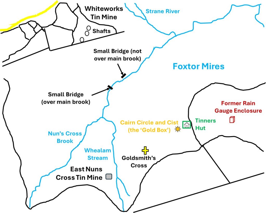
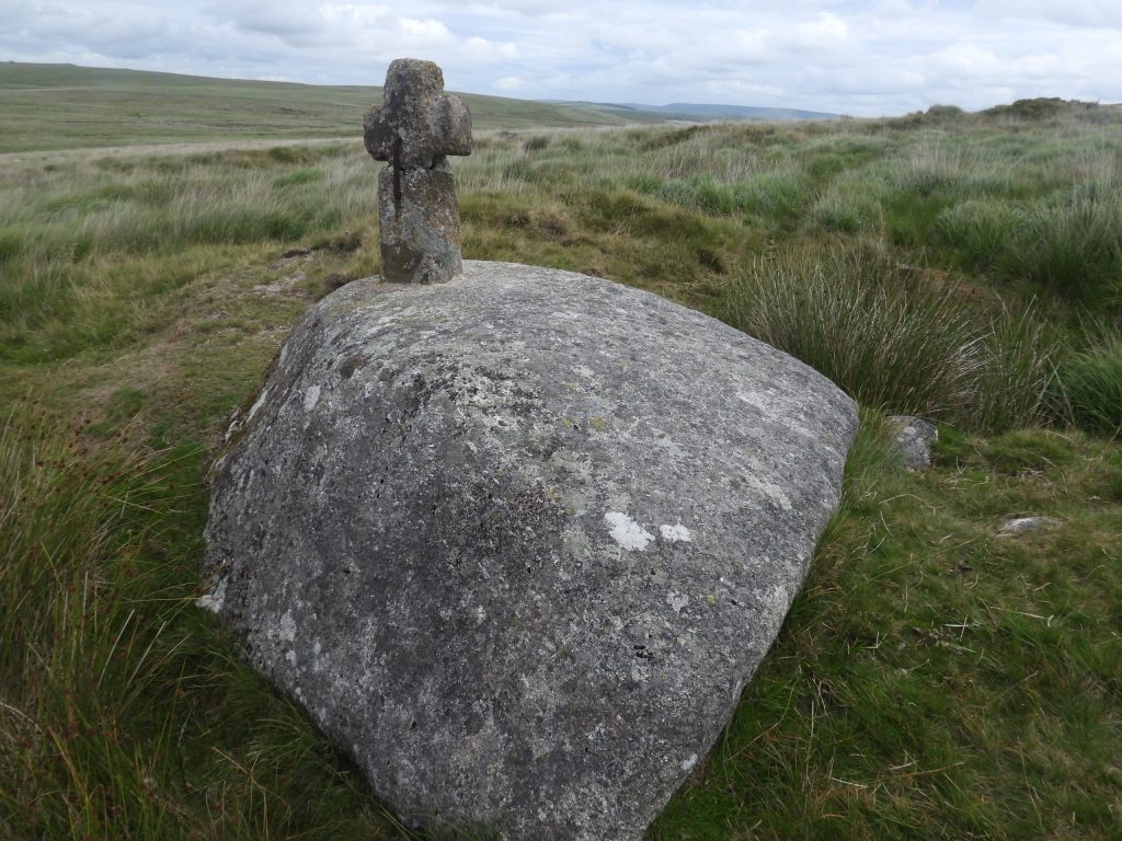
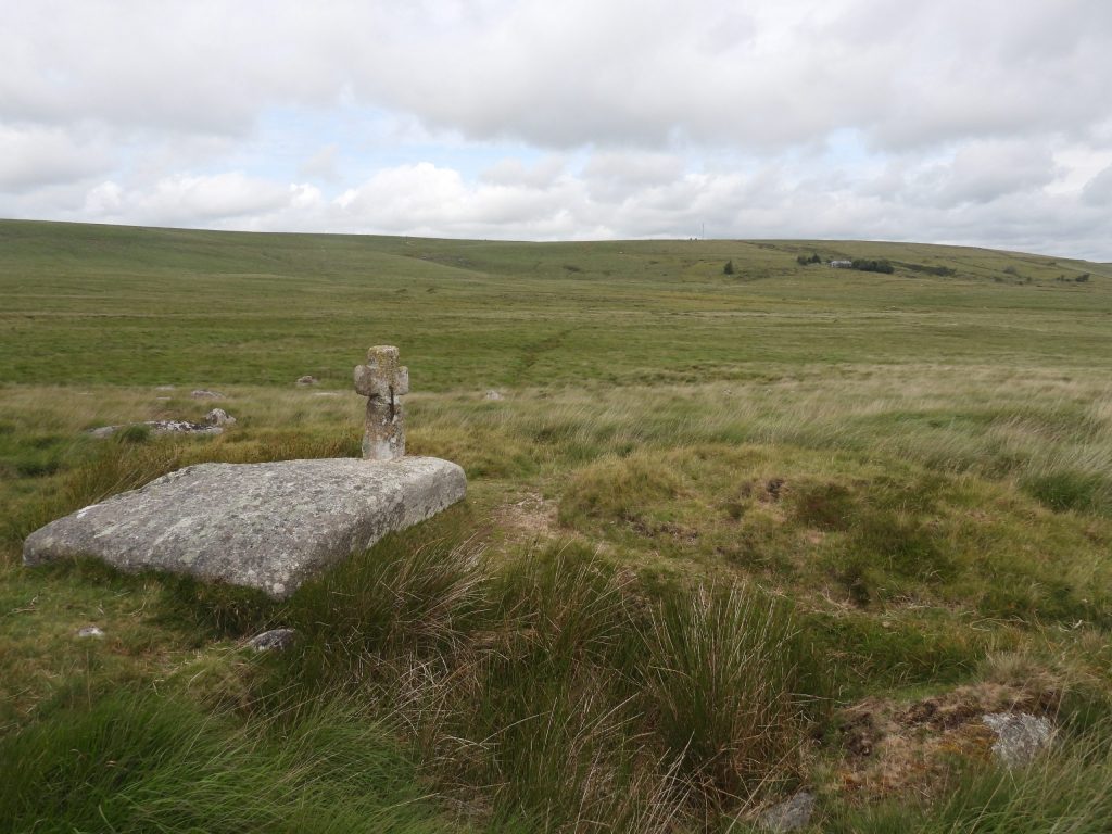
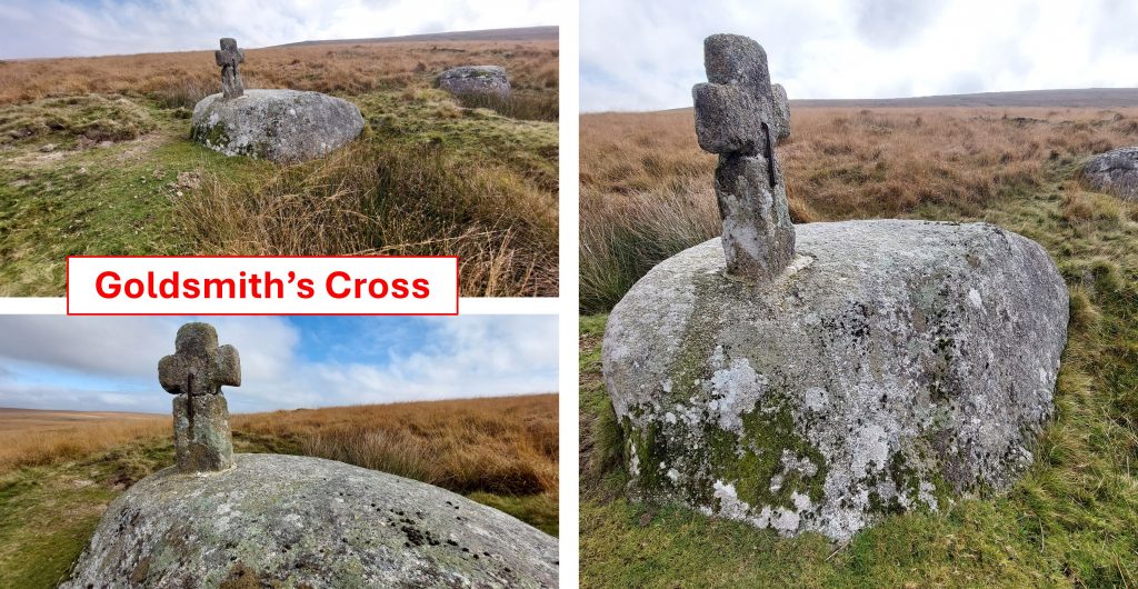
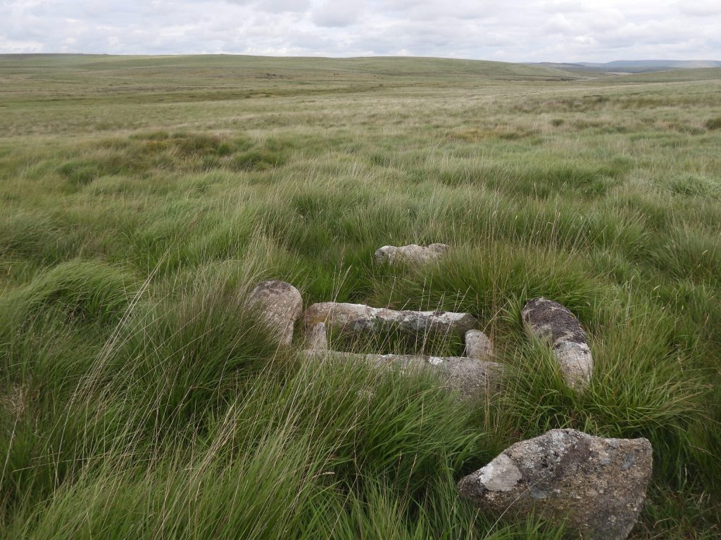
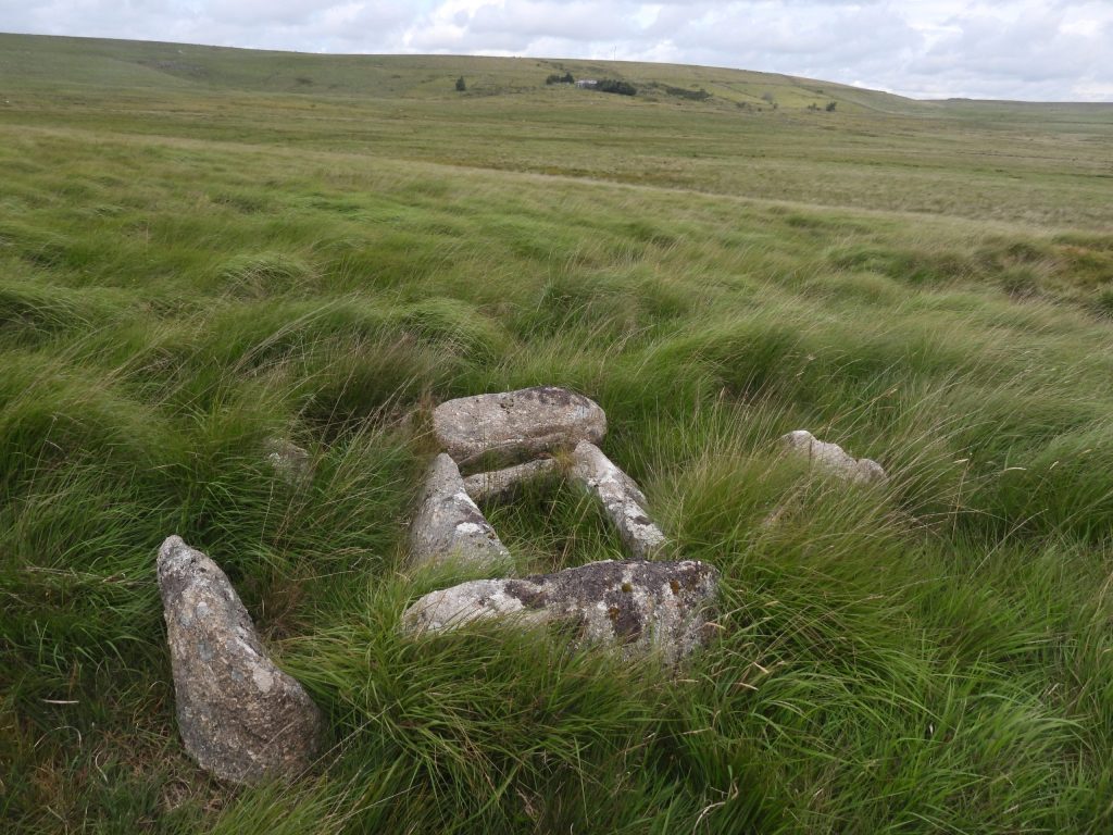
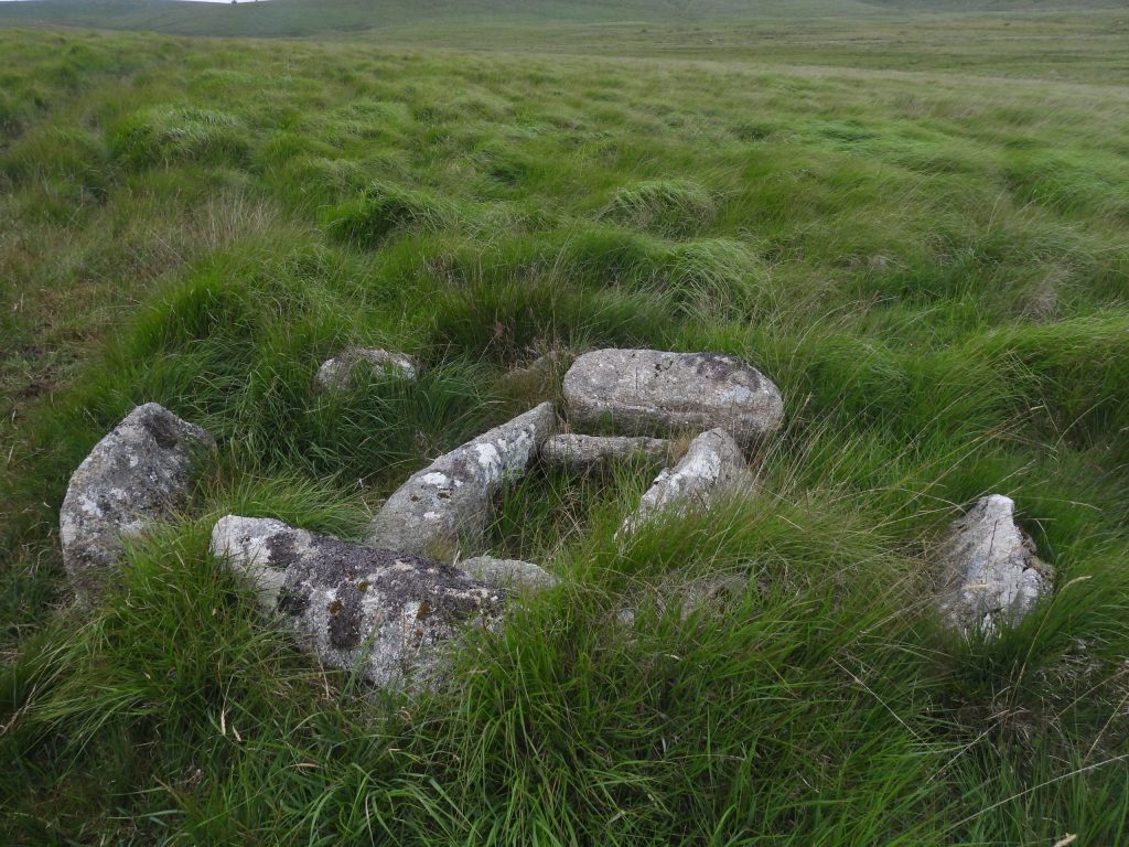
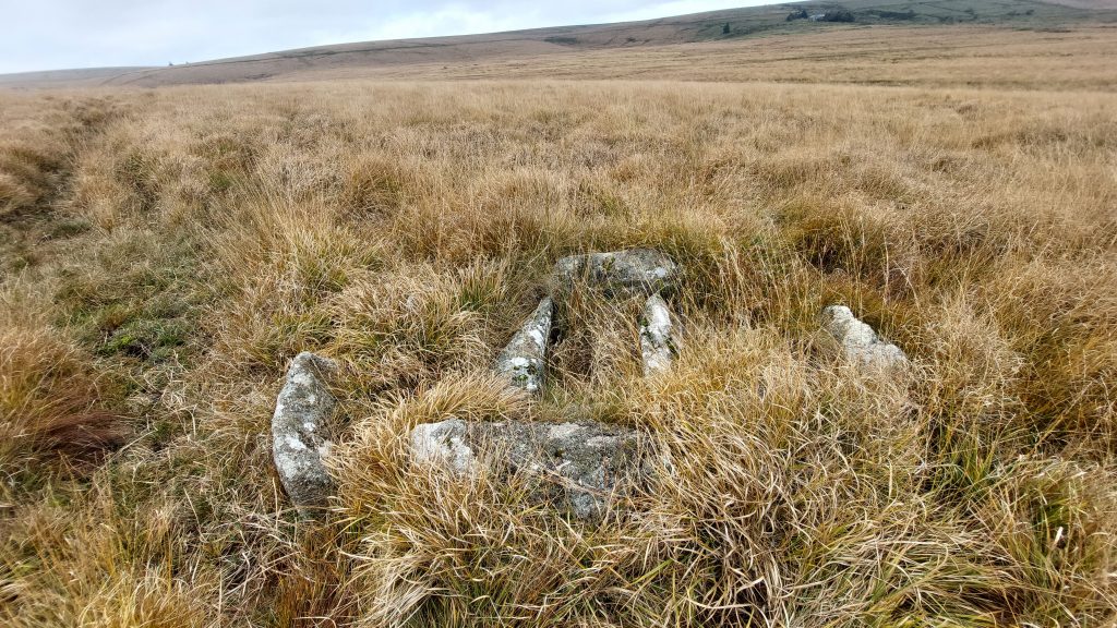
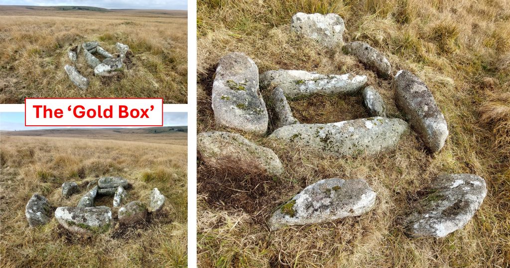
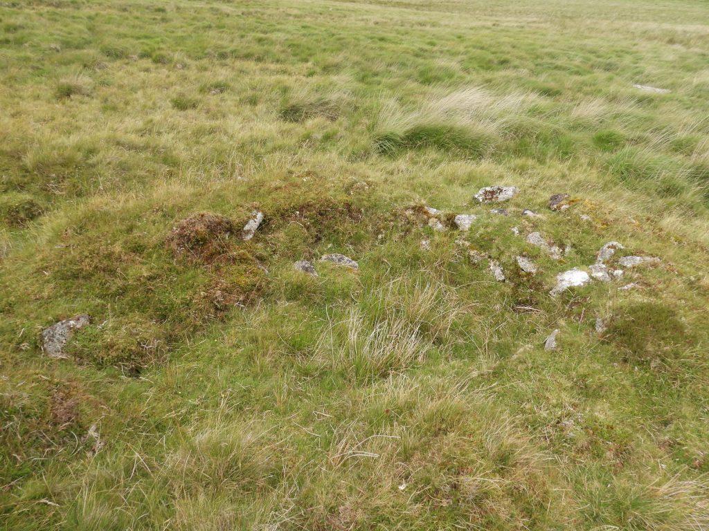
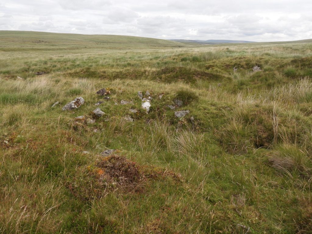
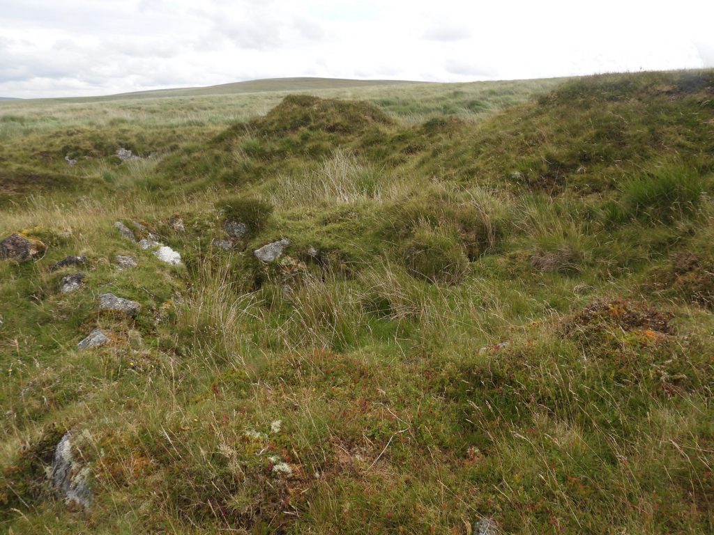
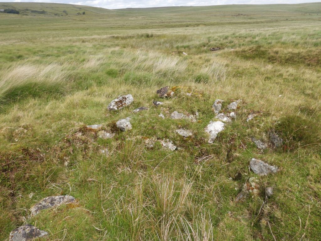
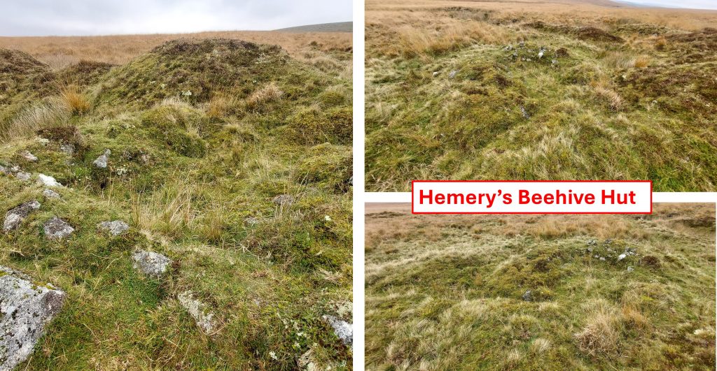
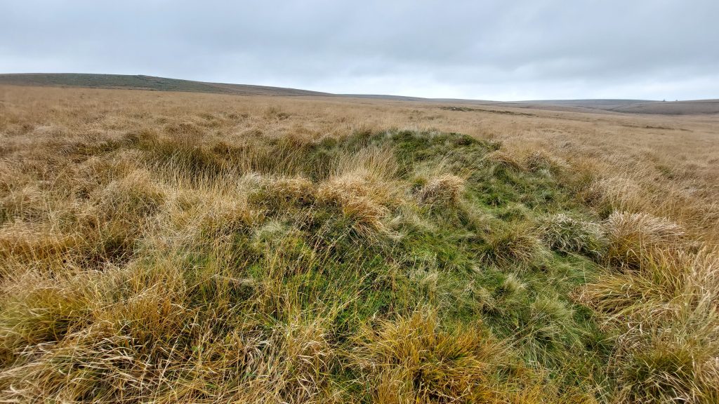
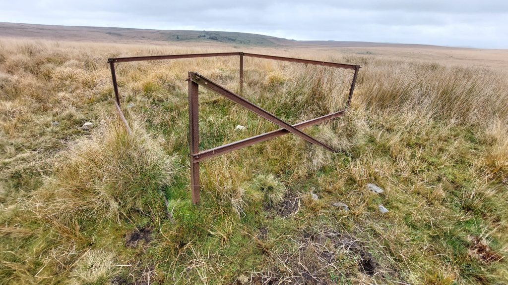
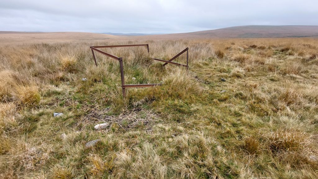
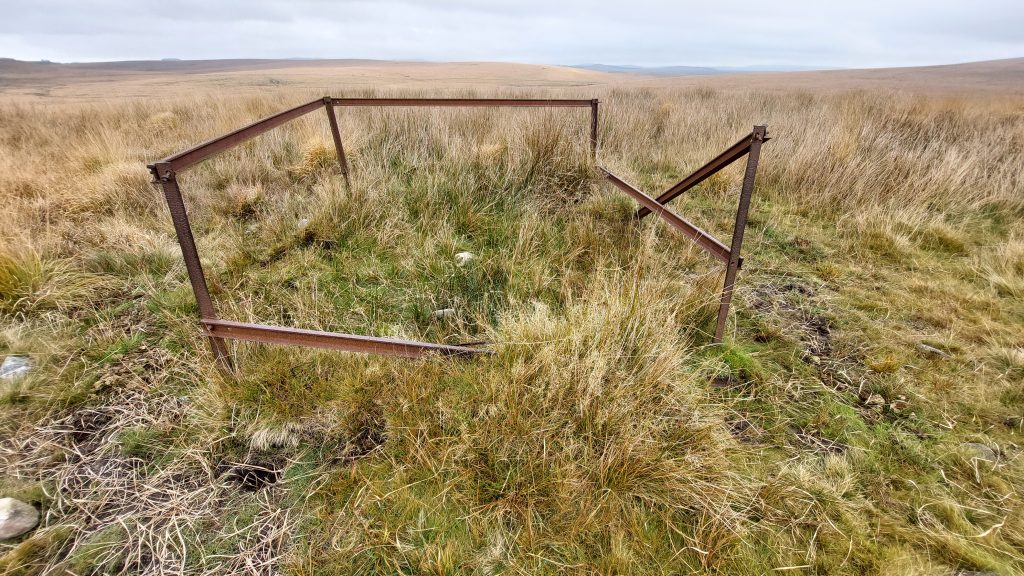
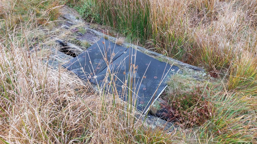
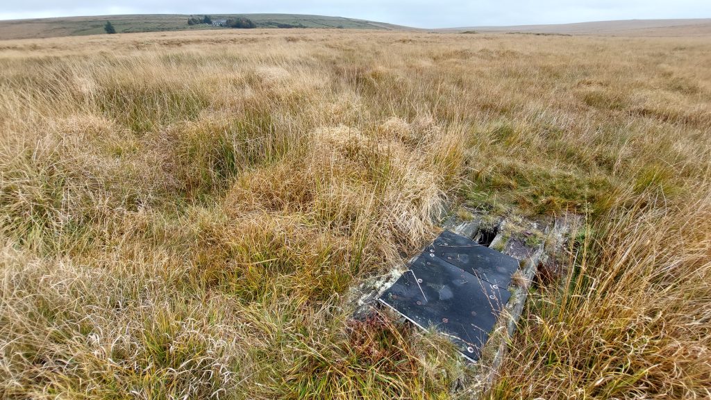
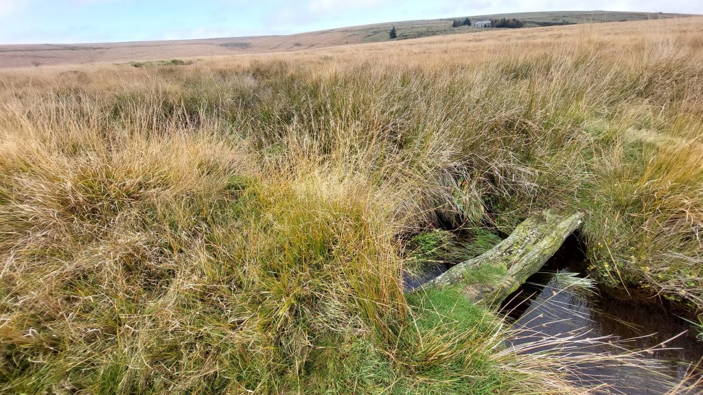
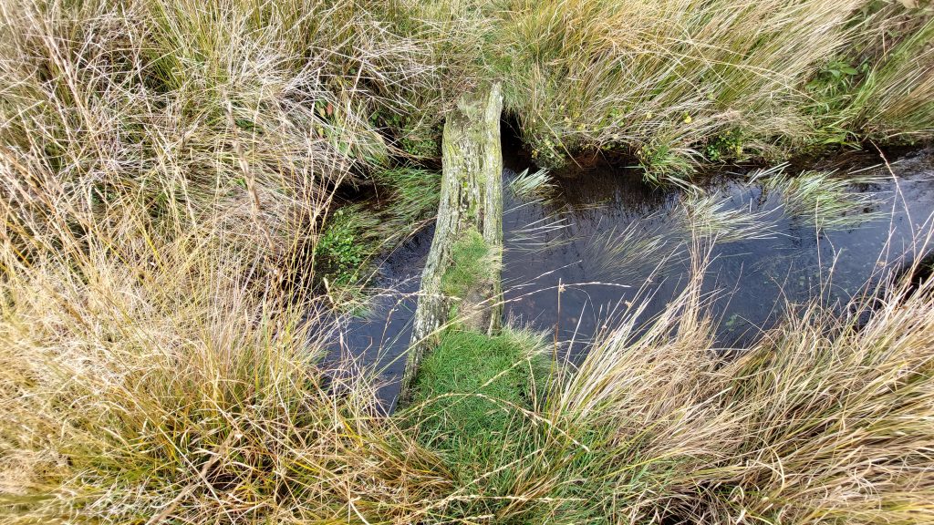
Sketch map of the location the ‘Gold Box’ with nearby artefacts and features covered in this postGoldsmith’s Cross is shown on modern OS Maps. It was discovered, prostrate by a Lieutenant Goldsmith, R.N in 1903. The cross has been recorded as being re-erected by Jack Worth of Whiteworks (ref: Hemery) and interestingly, Elisabeth Stanbrook, (ref: 2003, Ancient and Modern, Anniversaries for Two Dartmoor Crosses) records that ‘Goldsmith’s Cross’ was re-erected by four sailors recruited by Goldsmith to cement the cross back in the socket. Either way, this event post-dates the year that William Crossing published his book on crosses (1902). Crossing did include it in the 1910 edition of his ‘Guide to Dartmoor’.Goldsmith’s Cross is a Greek (Latin) Cross and is sometimes known ‘Foxtor Mires Cross’. The cross was possibly a waymarker to indicate a safe route across the mire from Whiteworks. Historic England record that the shaft has been repaired just below the arms and is cemented and joined with iron clamps. Goldsmith’s Cross is located at SX61652 70152The ‘Gold Box’ in a rather overgrown state (picture taken June 2023)The ‘Gold Box’ lies near the edge of the edge of Foxtor mires to the northwest of some tinners’ workings and a shallow gully and northeast of Goldsmith’s Cross. The cist well preserved cist and has a retaining circle of seven large stones. This undoubtedly is Hemery’s ‘Gold Box’ from High Dartmoor. Jeremy Butler in his Dartmoor Atlas of Antiquities, South West (page 220/1) describes the ‘Gold Box’ as “an oval retaining circle closely surrounding the cist is exceptionally small, only 2.5 metres across and in contact with one end of the cist”.The ‘Gold Box’ in October 2025A cleared overhead view of the ‘Gold Box’. One wonders if Hemery’s statement “some set stones nearby could be remnant members of a row which lost their fellows to Ned’s Wall” refer to the set stones surrounding the cist or others nearby, albeit none are obvious in the long grassThe ‘Gold Box’ can be found at SX61798 70313. It certainly is quite a well preserved antiquity and well worth a visit if in the area.A short distance (50m) from the ‘Gold Box’ is a Tinner’s Hut which is 2.8 m by 2.1 m and is aligned north to south and built into Tinners spoil. The walls of the Tinners Hut are made up from small stones and are 0.5 m high. The walls are very thick at 1.7mThis Tinner’s Hut is located at SX61859 70315The Tinners Hut looking across Foxtor MiresHemery, in High Dartmoor (page 337) describes this Tinners Hut as a Beehive HutTo the east of the Tinners Hut and workings there are a few trial pitsThis trial pit is located at SX61936 70414This old framework / enclosure is thought to be where there was a former rain gauge from probably 1940’s or 1950’s. It is made from old rails which most probably came from Whiteworks Mine.In a conversation with Kate Butterworth (Whiteworks) she stated that she was told that the Princetown History Club former Chairman (David German) had an uncle (Frank?) who once took a daily walk across the Foxtor Mire to record rain fall for Paignton (UDC ?). This is thought to be where he took those recordings at a rain gauge. The enclosure, would have been used to protect it from grazing cattle. Of course, there was once a plan to build a reservoir here (from 1930s) but was finally thwarted by DPA in 1970s when they bought land around ‘The Boiler’ on the Swincombe – the story and timeline seems to fit neatly.This possible rain gauge enclosure is located at SX62067 70323This rather dilapidated crude bridge lies in Foxtor Mire and seems to lie across a small gully adjacent to the brookThe contextual position of the bridge at SX61547 70599This bridge across the main brook in the mire is located on the footpath between Goldsmith’s Cross and WhiteworksThe bridge which certainly has seen better days and is located at SX61473 70538