A collection of walks, discoveries, insights and pictures of exploring Dartmoor National Park
October 8, 2025
Wheal Unity
Wheal Unity was located either side of the road between Zoar Cottages and Will Farm in the parish of Peter Tavy, next to a former farmstead called Budler (which was still extant at the time of the tithe in 1840). The first evidence of a mine in this vicinity was recorded by Swedish traveller Henric Kalmeter in his journal of 1724, where he recorded: “a mile from here to the east lies an old tin mine called Buddleybeer, in which one Squire Scoble and Mr James Cooper were interested, but which is now said to be completely finished, except that two or three men prospect or work there when time permits.”
By the time of Benjamin Donn’s Map of Devonshire, dated 1765 the mine was called Budlake Tin Mine. There are no further records regarding the mine until 1790, when a sett was recorded as being called Budhill Mine. Two years later in 1792, the mine sett was extended to include Towill or Great & Little Will & rest of Budhill aka Badlake. It is intriguing to note the various names of Buddleybeer, Budhill, Badlake and Budlake were all one of the same.
Wheal Unity seems to have been first mentioned 1794 as observations by William George Maton where it was stated ‘about a mile eastward from the copper mine are two tin mines Huel-Jewel and Huel-Unity. The depth of neither of these is so great as that of the Cornish tin mines in general. The ore is in black irregular crystals, the direction of the lode being the same as that of Huel-Friendship, viz from east to west. There are furnaces for roasting the ore very near to the mine’. The word ‘Huel’ is an old Cornish word for “Mine” and is an alternative spelling of “Wheal”.
According to John Taylor, Wheal Unity was abandoned in 1795, however it may have reopened as the last reference to the mine is dated 1799, when it was to be sold by private contract. This post would not have been possible without the author having permission (by John Coussons of Will) to enter land where the mine was once extant and for information passed by Stephen Holley during a DTRG walk around the area.
Bibliography
Stephen Holley – Dartmoor Tinworking Research Group (DTRG) Chairman – Pers. Conv.
P.H.G. Richardson – (1992) – Mines of Dartmoor and the Tamar Valley After 1913
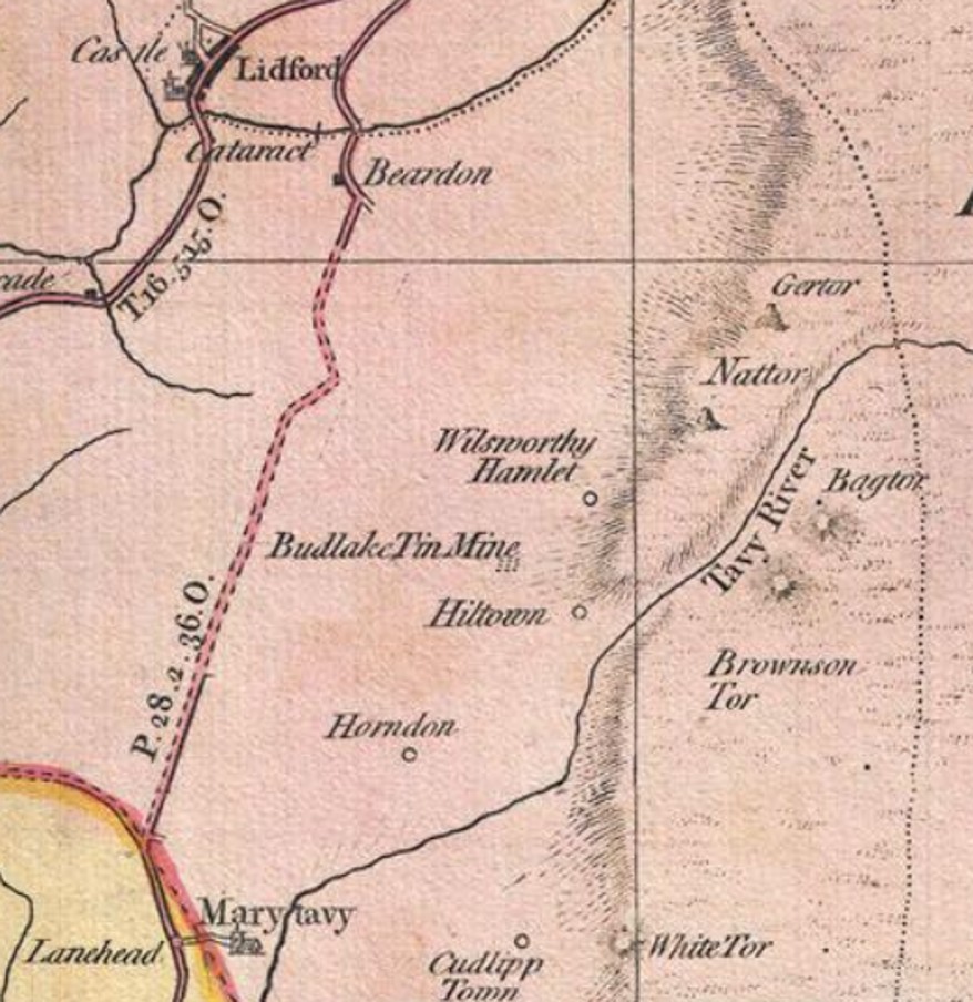
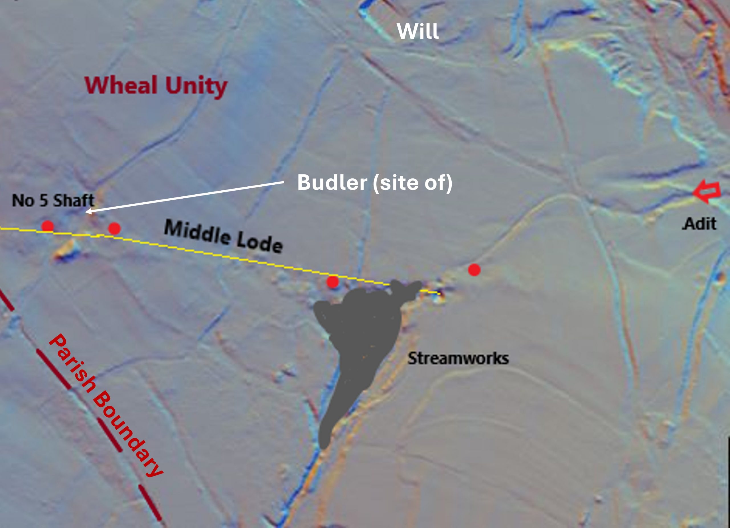
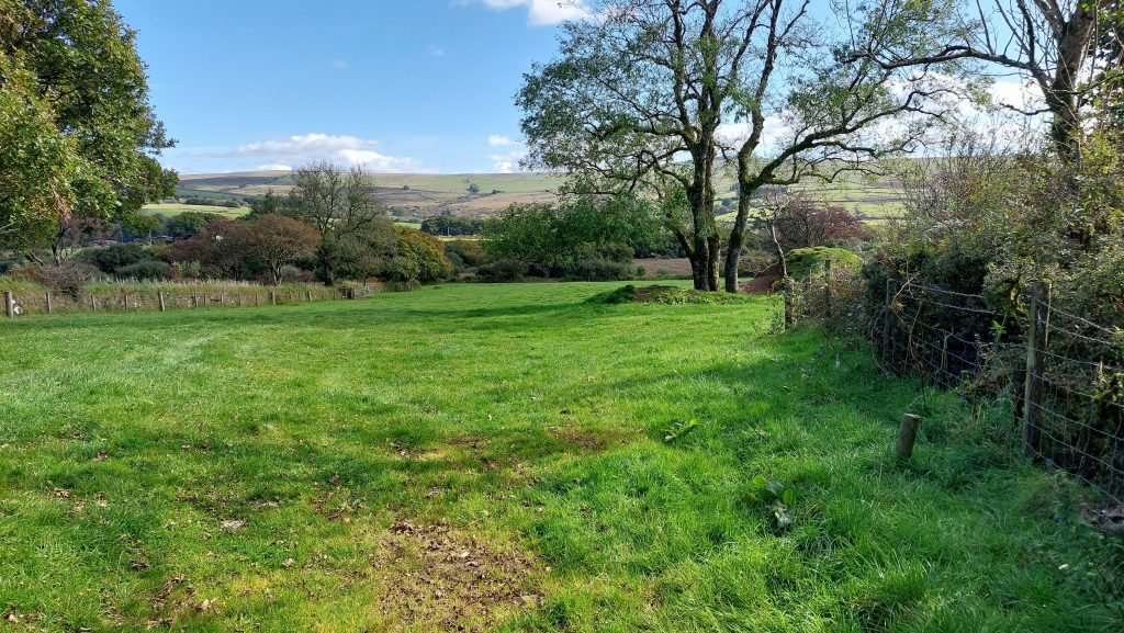
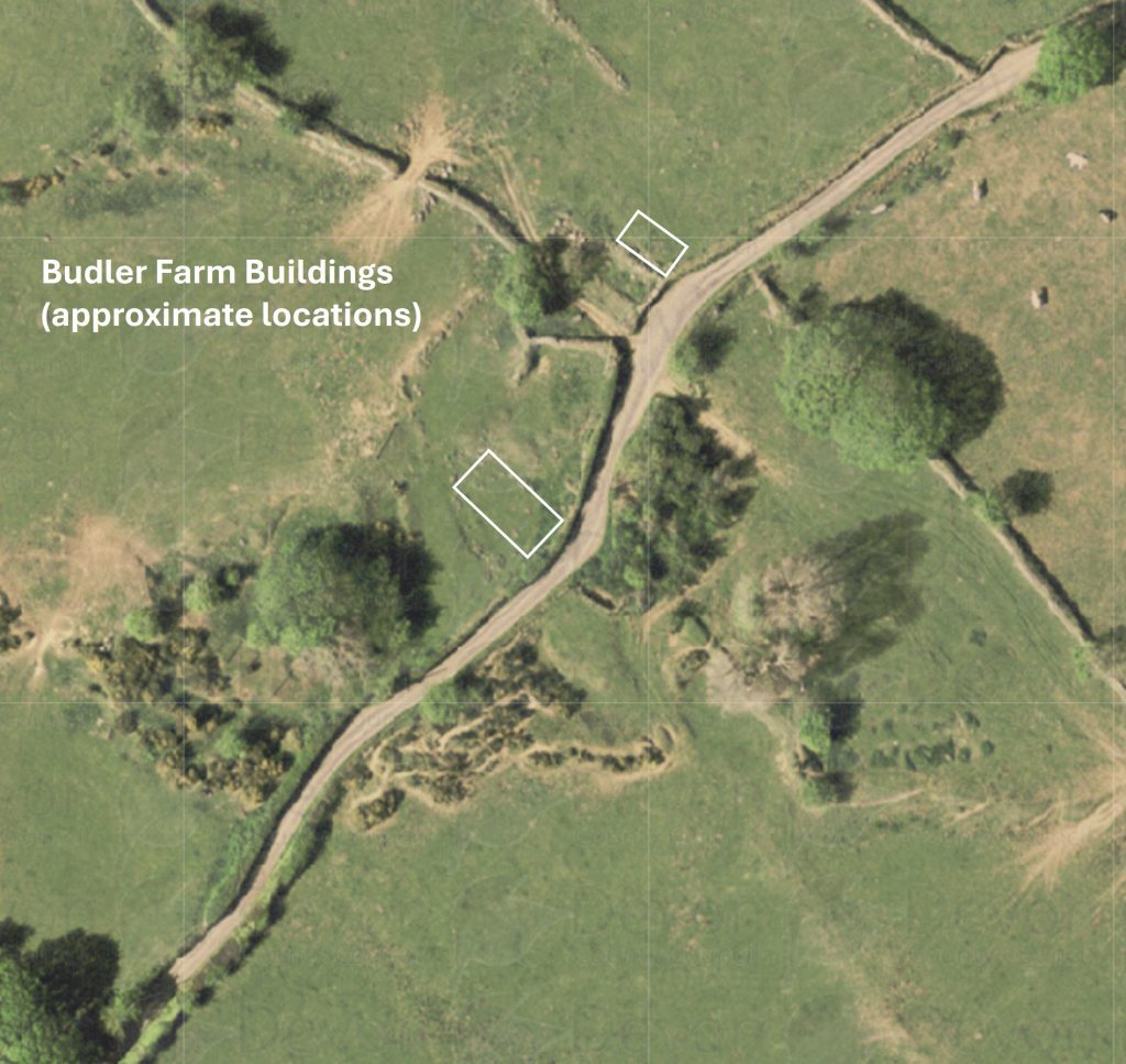
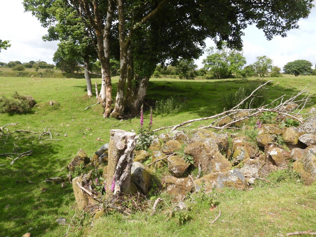
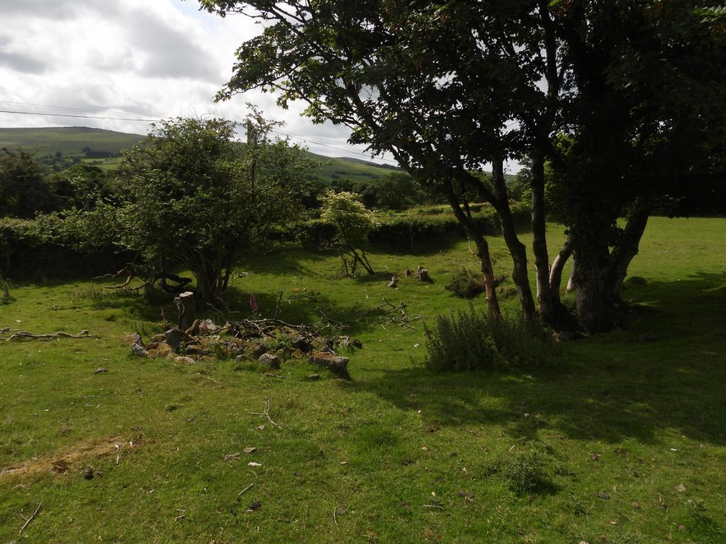
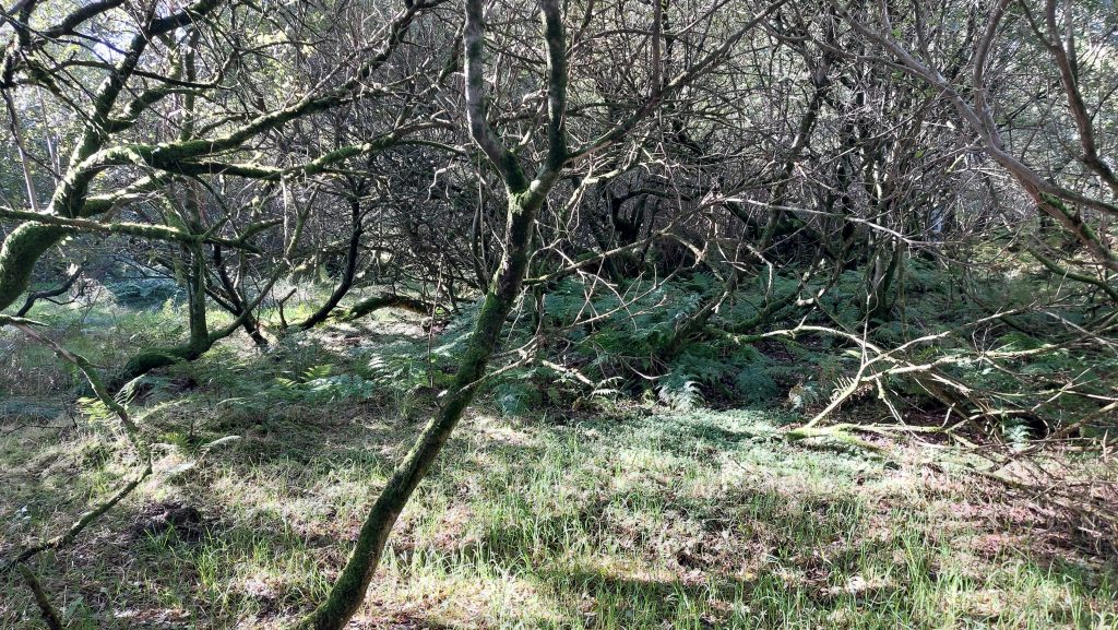
The first existence of this mine was confirmed on Benjamin Donn’s Map of 1765 which places a mine called Budlake Tin Mine on the recorded Budhill / Badlake sett as can be seen from the snippet of the map above. Donn’s complete map is a highly important 1765 depiction of Devonshire which was drawn in twelve panels, covering the entirety of the county from the English Channel to Barnstaple (Bideford) Bay and from Cornwall to Somerset at a scale of 1 inch to 1 mile. The map also incorporated large insets of Exeter, Plymouth, Plymouth Dock, Stoke Town, and the Isle of Lundy. This annotated 19th century map shows the locations of 4 shafts and extensive streamworks which are thought to have been a part of Wheal Unity (and its previous derivatives). The location of Budler (from the 1840 Tithe Map) has been superimposed onto the imageThis annotated LiDAR plot shows the locations of 4 shafts, the streamworks and an adit connected with the mine. It was located along the ‘Middle Lode’ of the later Wheal Jewell mine. Note that No 5 shaft was once recorded as part of the later Wheal Jewell operationsThis annotated aerial map of the mine shows a softened landscape in the 21st century. A few hundred years ago the shafts and extensive streamworks from the former mine would have been very discernible . In 1790 when the mine was called Budhill Mine there was a deed between Revd. Walter Radcliffe of Warlegh, Devon & Thomas Olivie Prout of St Agnes, Cornwall , Gent & Partners regarding the sett (of the mine) & 1st & 2nd Hilltown in Peter Tavy – dues 1/8th.This shaft is labelled as No 5 shaft in P.H.G. Richardson’s book Mines of Dartmoor and the Tamar Valley After 1913 (page 48) and is thought to have been part of Wheal Unity. It lies to the west of the Zoar / Will road, near Budler and on the border of Mary Tavy and Peter Tavy parish boundary at approx. SX52850 81289In a field to the east of the former Budler farm, there is evidence of upthrust next to a former shaftAerial photograph of the former Budler Farmstead. Two shafts from Wheal Unity plus some ‘disturbed ground’ can still be seen within the area. Further information on Budler Farm can be found here: Budler Farm – Dartmoor ExplorationsBudler Farmhouse location was centred at SX52915 81300. There is some disturbed ground (around the tree) immediately to the south west of the former Budler Farm. The rocks may well have been part of the mine or alternatively were part of a field clearanceThe disturbed ground to the south west of Budler Farm. The area is located in what was the Garden Plot (field 835). The Plot was 10 perches (around 250 sq. m)The extensive streamworks, which was probably the historic medieval workings associated with the mine are now covered by a small woodland. The streamworks are centred at SX53188 81162