A collection of walks, discoveries, insights and pictures of exploring Dartmoor National Park
September 29, 2025
Wheal Harmony
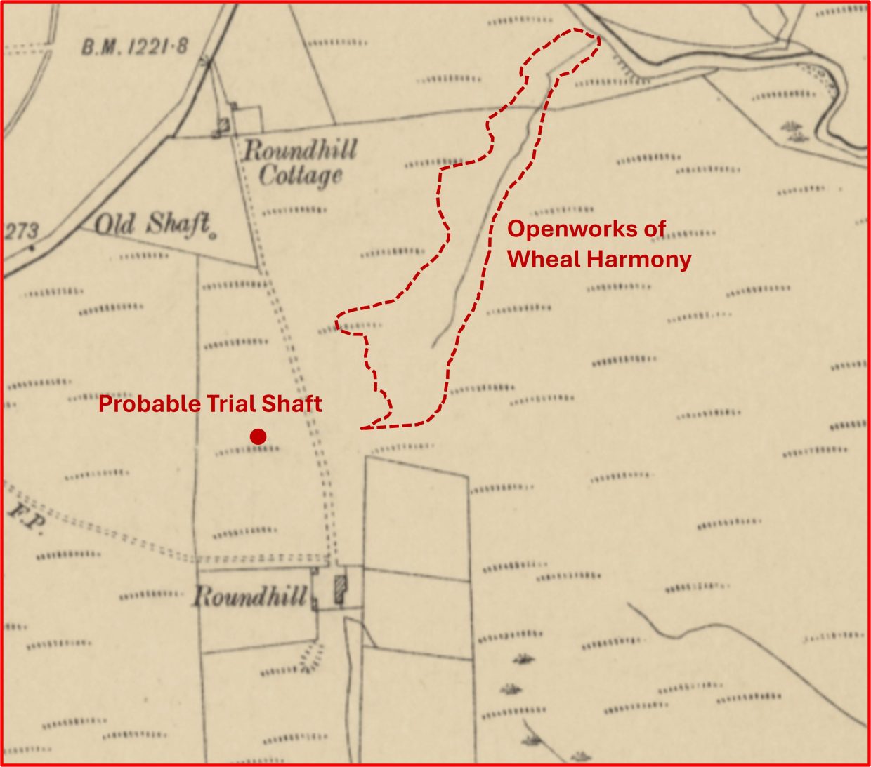
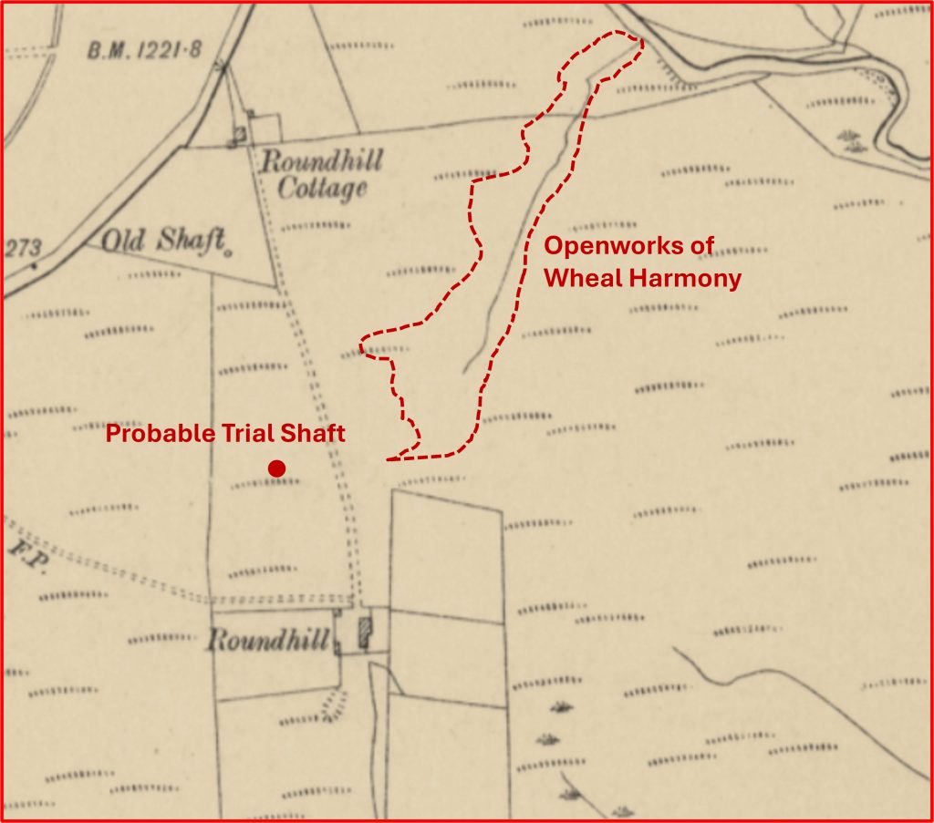
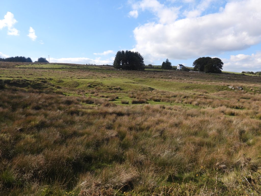
Wheal Harmony is believed to have probably opened in 1834 and seems to have mainly comprised the re-working of some extensive medieval openworks (tinworkings) near Roudhill Cottage / Roundhill Farm and to the south of Two Bridges. It is known that this mine had by 1871 been out of use for some. No production figures have been found
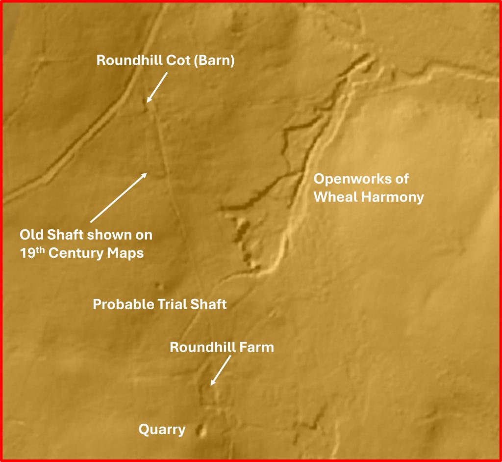
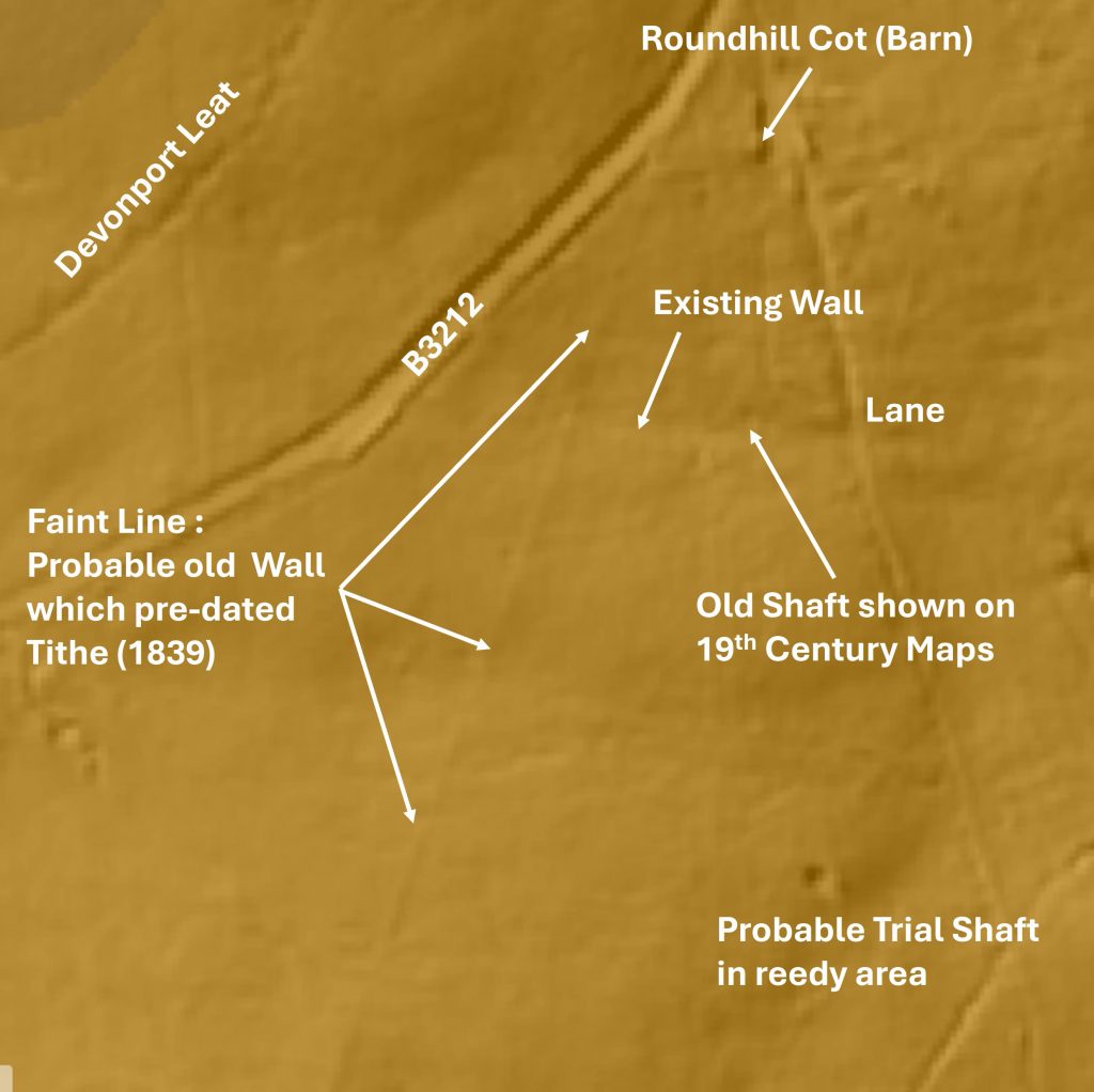
There is one known shaft in a field near Roundhill Cottage as it is shown on 19th century maps. The appears to have possibly been a other shafts between Roundhill Cottage and Roundhill Farm.
This post has been possible through the kind access provided by Russell Chapman of Roundhill House as much of the area is on private land
Bibliography
Royal Commission for the Historical Monuments of England (RCHME) – (1987-1993) – Duchy Farms Project Survey Visit, N. V. Quinnell
Dartmoor Tinworking Research Group (DTRG) Newletter – (July 1977, Issue 13)
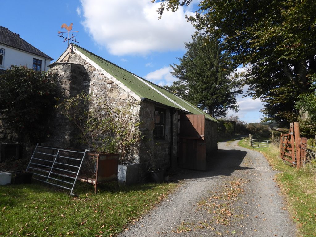
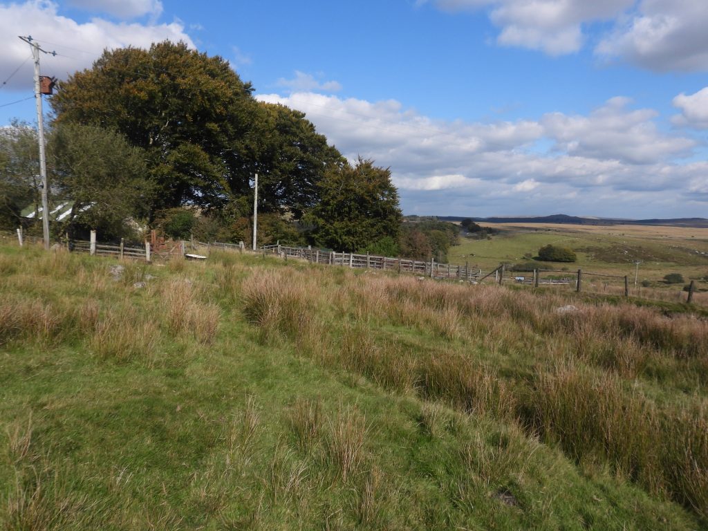
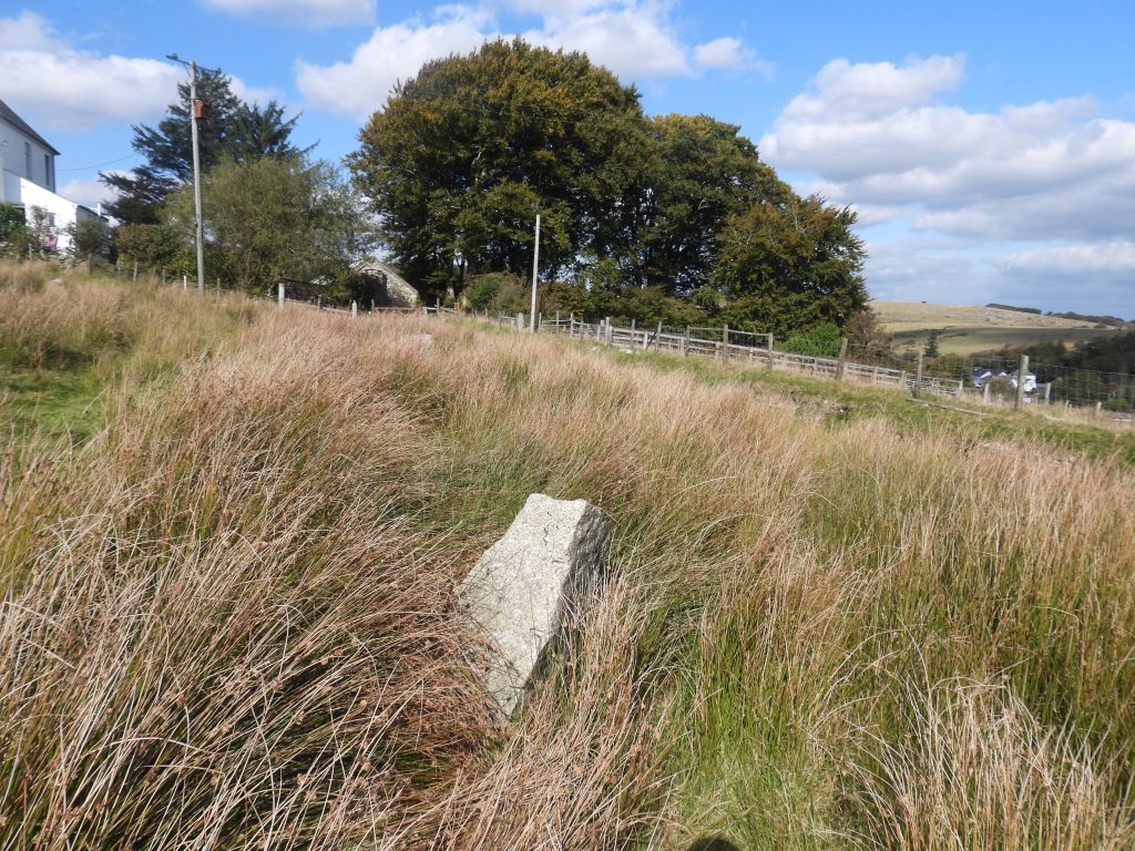
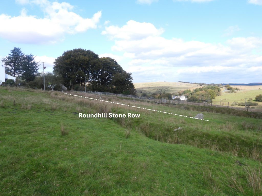
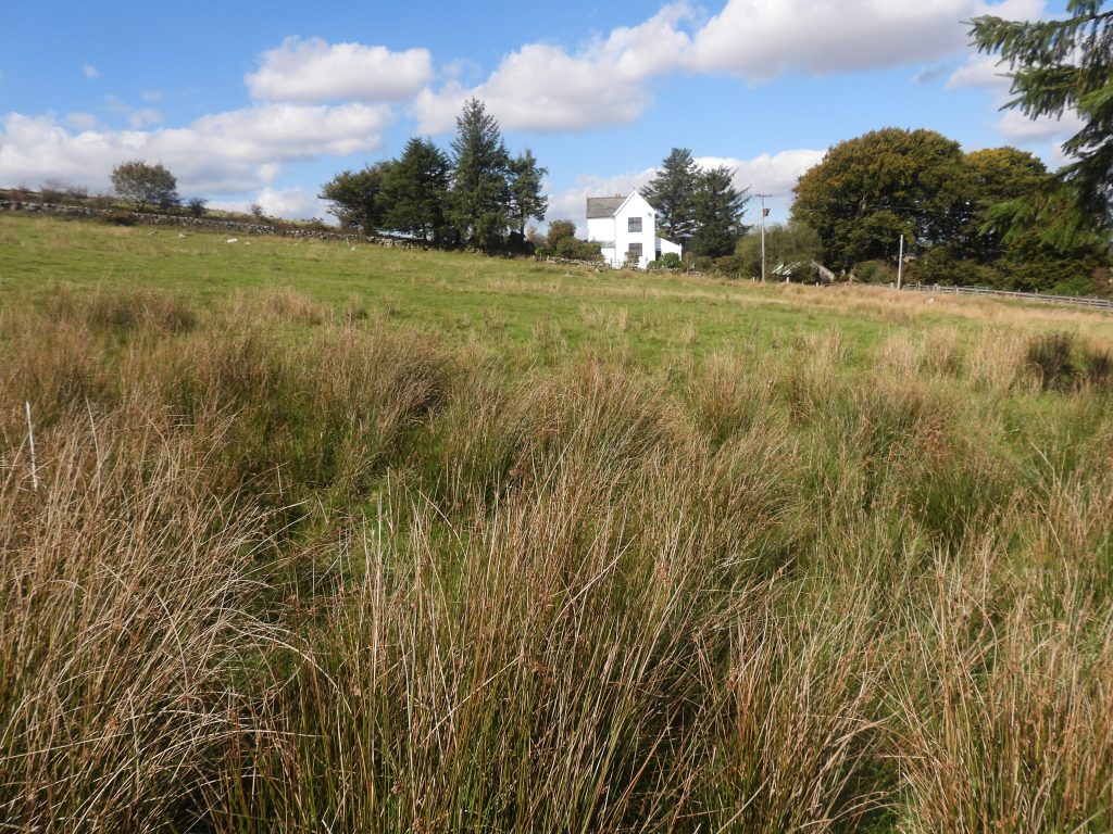
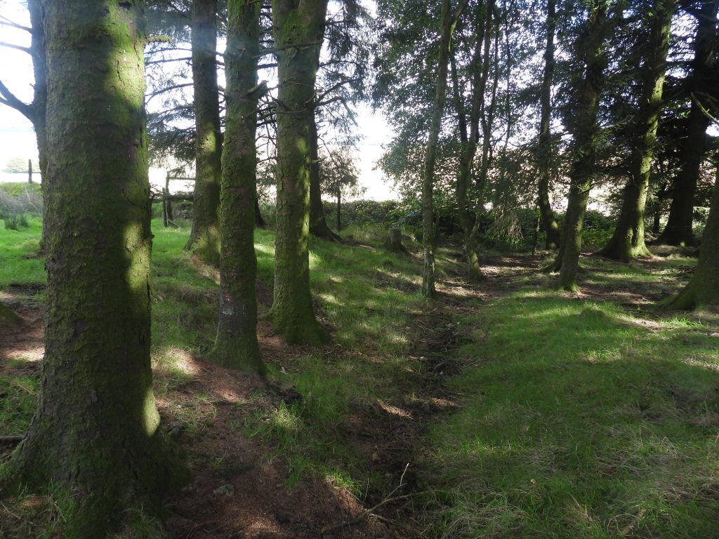
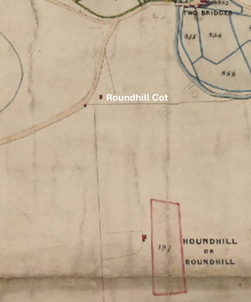
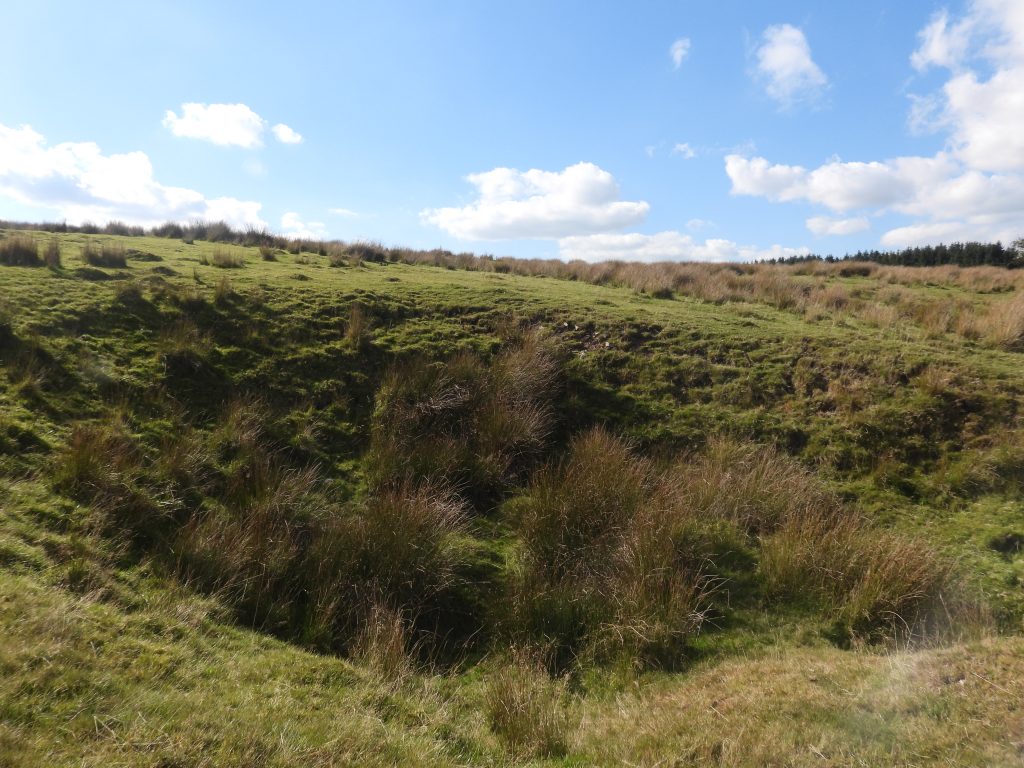
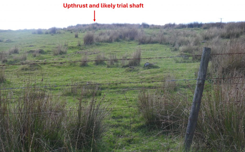
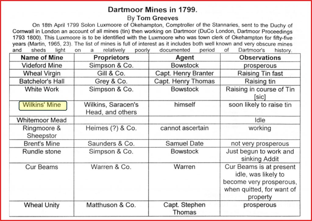
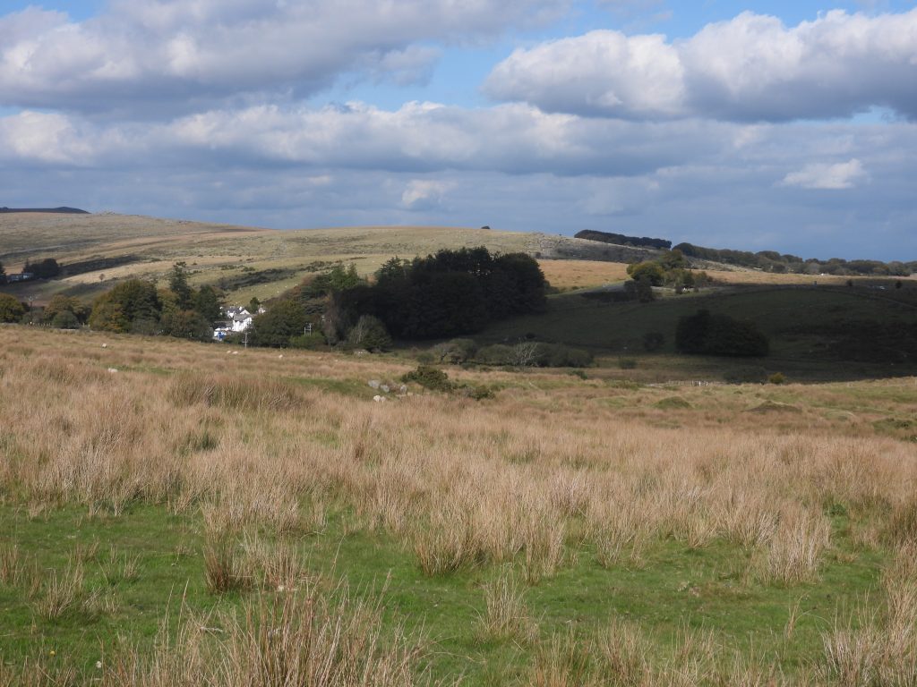
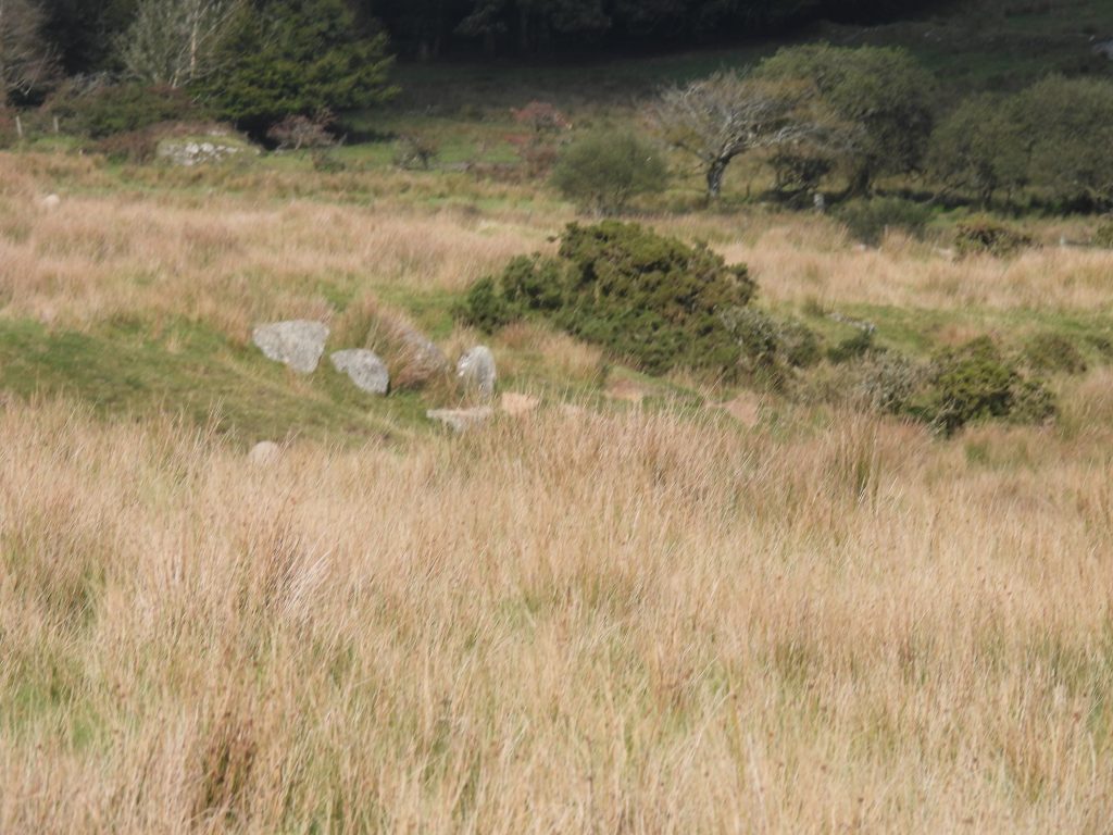
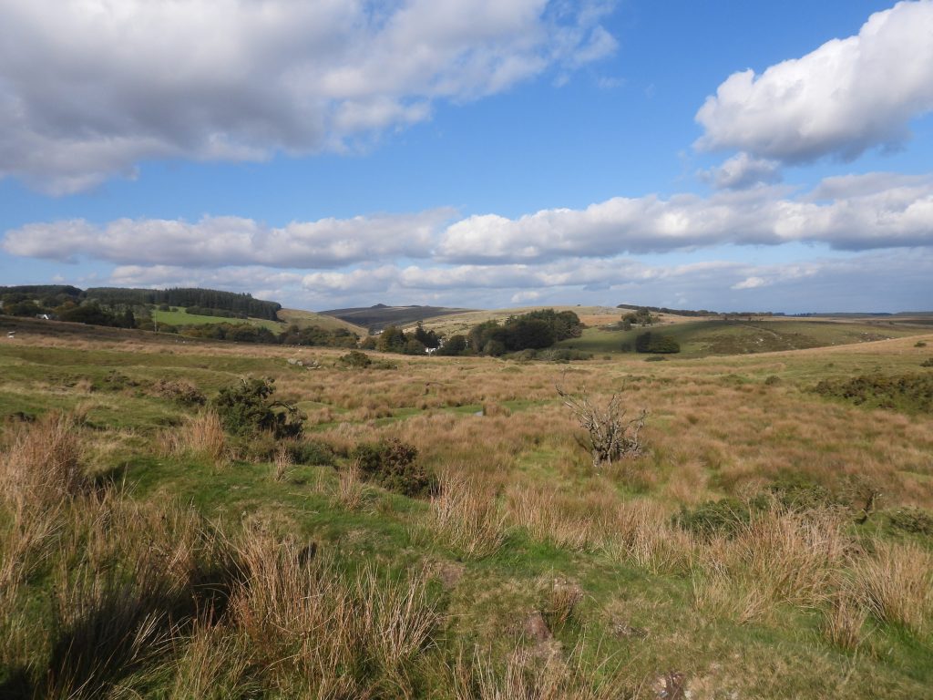
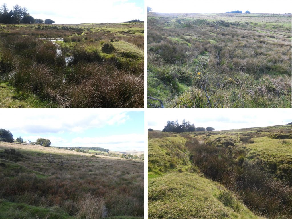
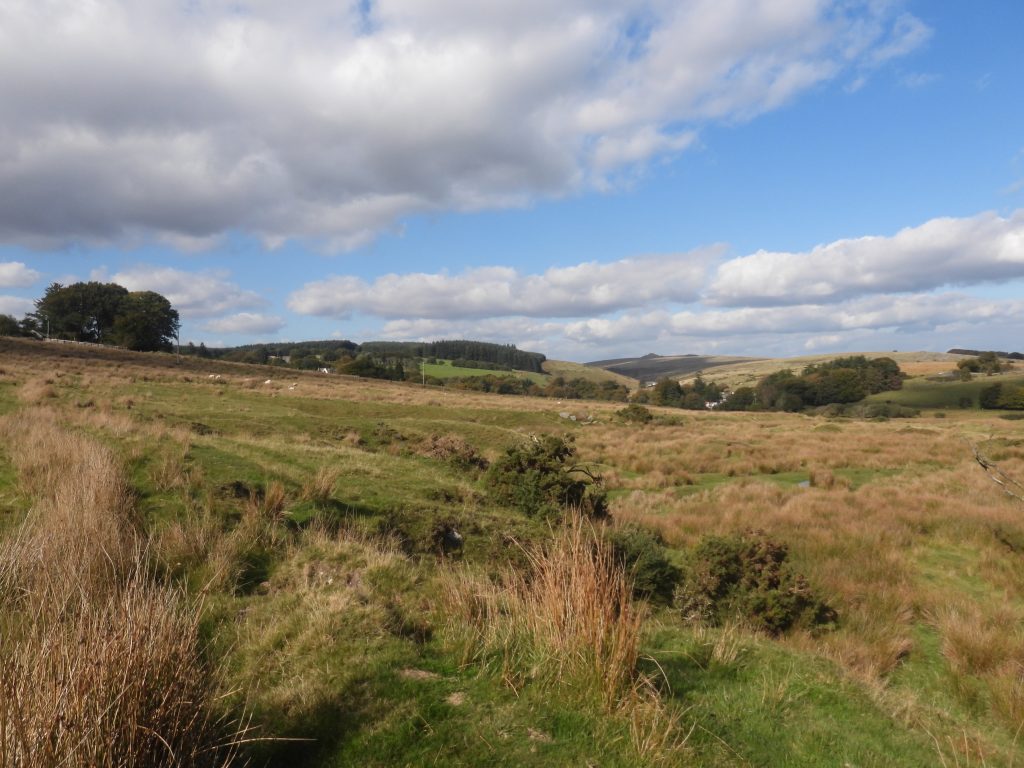
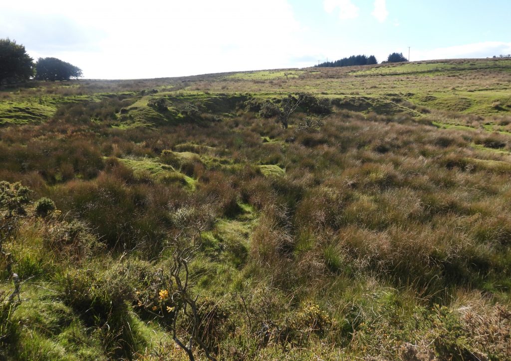
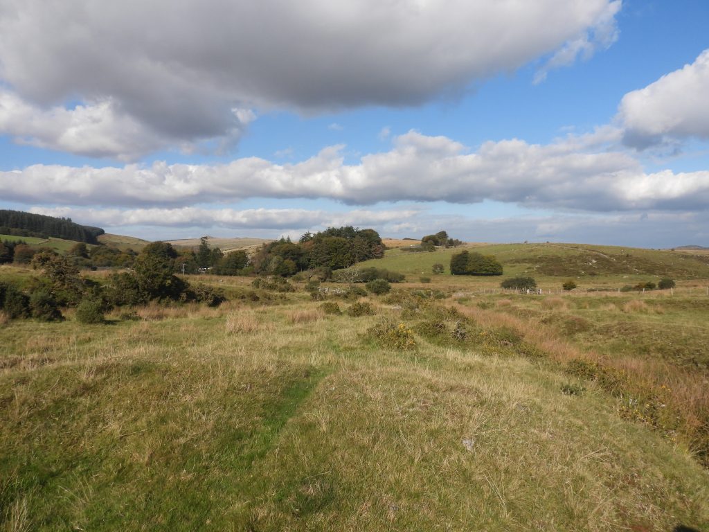
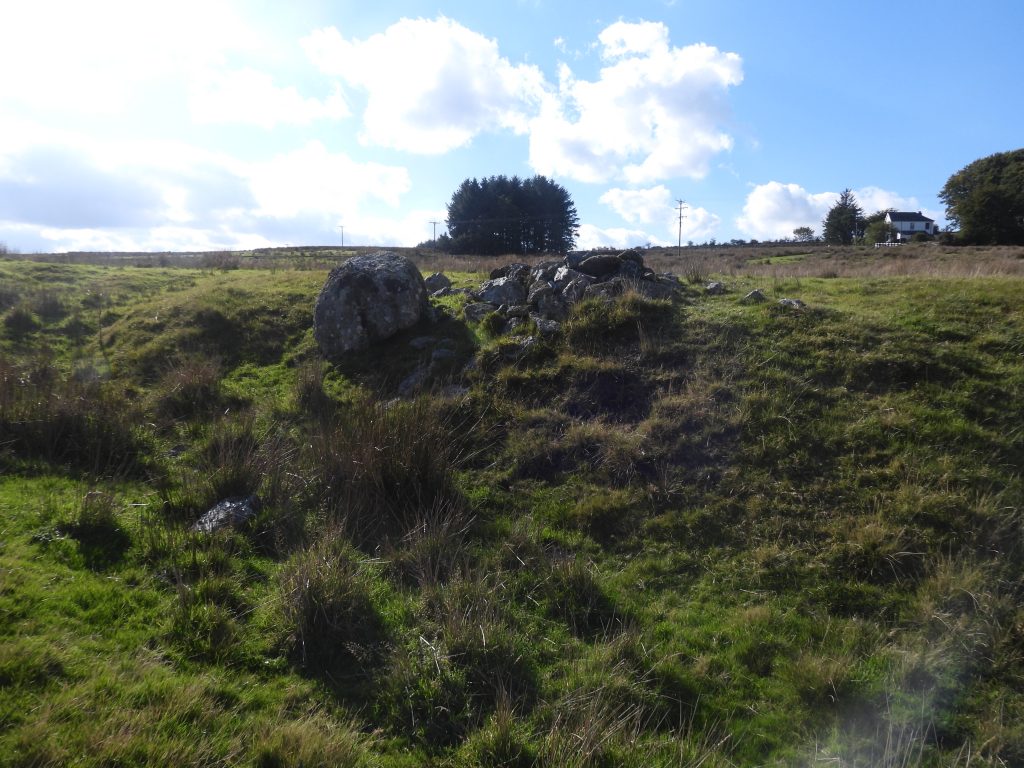
Annotated 19th century map of Wheal Harmony shafts and openworksLiDAR (Light Detection And Ranging) plot of the Wheal Harmony area covered in this post.Roundhill Cot is on private land and is now a storage barn but was once lived in, most probably up to late 19th / early 20th century. The most well known occupant was the Dartmoor poet, Jonas Coaker.Ditch leading away from Roundhill House might be confused with being a leat. It is in fact the runoff from the septic tankPart of the Rounhill Stone RowThe Roundhill Stone Row. This is a playful creation by the owner of Roundhill House with the stone coming from the digging of a new outlet from the house septic tankLiDAR of the area where there is one known and one probable trial shaft. Of interest is a very faint line, which appears to run from the bend of the B3212.It is likely that this is a very old field boundary. Under certain conditions (e.g frost), the owner of Roundhill House states he can see this line in his field as it disappears to the south westLocation of the shaft shown on 19th century maps at SX60526 74561. There is no upcast here and it is obvious that the shaft has been very well filled inShallow runoff from the area of the old shaft in a nearby small plantationThe 1839 Tithe map shows ‘Houndhill or Roundhill’ depicted (plot 187); it is a large rectangular plot (5 Acres, 3 Roods and 5 Perches), with single dwelling (occupier was John Stancombe) shown to the west. Building is roughly rectangular, aligned north-south, with an outshot on the eastern side. Roundhill Cottage is also shown but not labelled. Interestingly, there are two faint ‘circular’ features and a linear feature to the east of Roundhill Cottage, which may well have been part of the mine.This depression can be seen on LiDAR just south of Roundhill Farm. It appears to have been an old quarry rather than anything associated with the mine. The stone quarried here, no doubt being used for local buildings. The quarry is up to 24m across and 2.5m deepFrom the track between Roundhill Cottage and Roundhill Farm looking west. Upthrust from a likely trial or exploratory shaft, which is evident when viewed on LiDAR. This is one of three pits which have have recorded by RCHME thus: “An alignment of three tin pits, 28m apart, occurs on an ESE slope in a rushy field W of Roundhill Farm. Centred at SX 6057 7539 they range from 6.8m to 3.8m in diameter and from 1.2m to 0.4m deep”. This is no doubt part of Wheal HarmonyThe above table was published in the Dartmoor Tinworking Research Group Newletter from July 1977 (Issue 13). The table shows recorded Dartmoor Mines from 1799. The entry for Wilkins Mine is interesting and is likely to have been near Two Bridges as the Saracen’s Head was the original name for the Two Bridges Hotel. lt is possible that Wilkins Mine may be the same site that in the 1830s was known as Wheal Harmony or Round Hill MineThe tinworkings at Wheal Harmony looking north towards Two Bridges and Crockern TorZoomed in view of some rocks on the edge of the tinworkingsNoted by Dr Tom Greeves: “The area is enclosed by a boundary bank which intrudes upon the workings on the southeast side and on the southwest side is broken by an erosion gully. The bank is about 1.6m wide and 0.5m high, but along the northwest side it becomes more a ditch with upcast”Collage of various parts of the tinworkings. The earthworks are post medieval with pits and streamworks enclosed by a shallow ditch and bankThe depth of working here is between 2m and 5m, accompanied by a small central stream.Tin workings, centred at SX6073 7455, on a slight northeast facing slope and occupy an area 240m long, 100m wide at the upper end (south) and 40m wide at the lower end (north). Lines of the streamworks can be seen on the east side of the tinworkingsLooking across the tinworkings to Roundhill Cottage and the ‘modern’ Roundhill House (circa 1913)On top of one of the earthworks, looking north up the West Dart valleyLower end of the workings with some boulder clearance