A collection of walks, discoveries, insights and pictures of exploring Dartmoor National Park
January 26, 2026
Westdown Mine (aka West Downs Consolidated Mining Company / East Wheal Bedford / Sortridge and Bedford)
West Down mine is located to the north west of the River Walkham a short distance downstream from Grenofen bridge. The mine was an attempt to exploit lodes between Lower Grenofen and the River Tavy. It was in operation for around 10 years from 1847 through to 1858, but this wasn’t continuous. On West Down, above the mid-19th century mine are (un-recorded), trial pits or early costean* pits (Newman) which although are shown on late 19th century maps, are likely to pre-date the mine.
In 1847, an anonymous report, suggested that the Poldice lode (east of the Walkham) was 2 to 3 ft. wide and had been worked from surface, but was poor……There were one or two other lodes in the sett on which little or nothing was done, and “…the lodes generally are poor and not very encouraging for extended operations” (Brooke Index). In spite of all this, on 19th June 1947, the West DownsConsolidated Mining Company was formed, to work this small sett which was 2 miles by 1 mile. The mine worked by this cost-book company and lasted 4 years until 2nd August 1851 with Captain James Carpenter being in charge of operations (1849-1851) and James Diamond as the purser (1851). The mine was positioned on the eastward continuations of the Virtuous Lady and Wheal Bedford lode and the westerly extension of the Wheal Poldice lode, on which a shaft was sunk.
Mining Journal entries from 1847 suggested that there was more than enough tin which had been broken to pay cost. However, in 1849, financial issues came to the fore when a notice was published over the names of Harrison, Weatherhead, Dow, Brightman and Thomas (Committee members) warning merchants not to give any credit as they were not accountable for any debts which had been or might be contracted in respect of the mine. In spite of apparent financial issues, a shaft had been sunk below the openwork (where tin had been worked) but because of water issues (being in Killas and very wet) a new shaft was needed. Therefore, in August 1850 a new shaft was sunk (intended depth 20 fms) with a small steam-engine needed to be installed to drain it (Mining Journal). Also, in 1850 it was recorded that a considerable amount of capital had been spent, which might have caused further financial issues. The mine suffered a further set back when, also in 1850 a considerable amount of the company’s property had been forcibly removed to East Crowndale Mine at Rix Hill, under the direction of Captain R. Williams of that company, whose orders had resulted in serious damage to the burning-house and had broken a covenant. In spite of the issues in 1850, around January 1851, the aforementioned steam engine (a Nicholls horizontal condensing engine) had been installed. Financial difficulties continued that year and into 1852, albeit shares were still being listed in the Mining Journal in February 1852. Some tin sales, were recorded in May 1852 (Mining Journal). That said, there were no ‘operational’ reports in the Mining Journal from August 1851 and throughout 1852, perhaps suggesting the company had been wound up – an entry in the Brooke Index closes the operation of the first iteration of this mine (West Downs Consolidated Mining Company) as being August 1851. The mine closure looks to have lasted around 18 months.
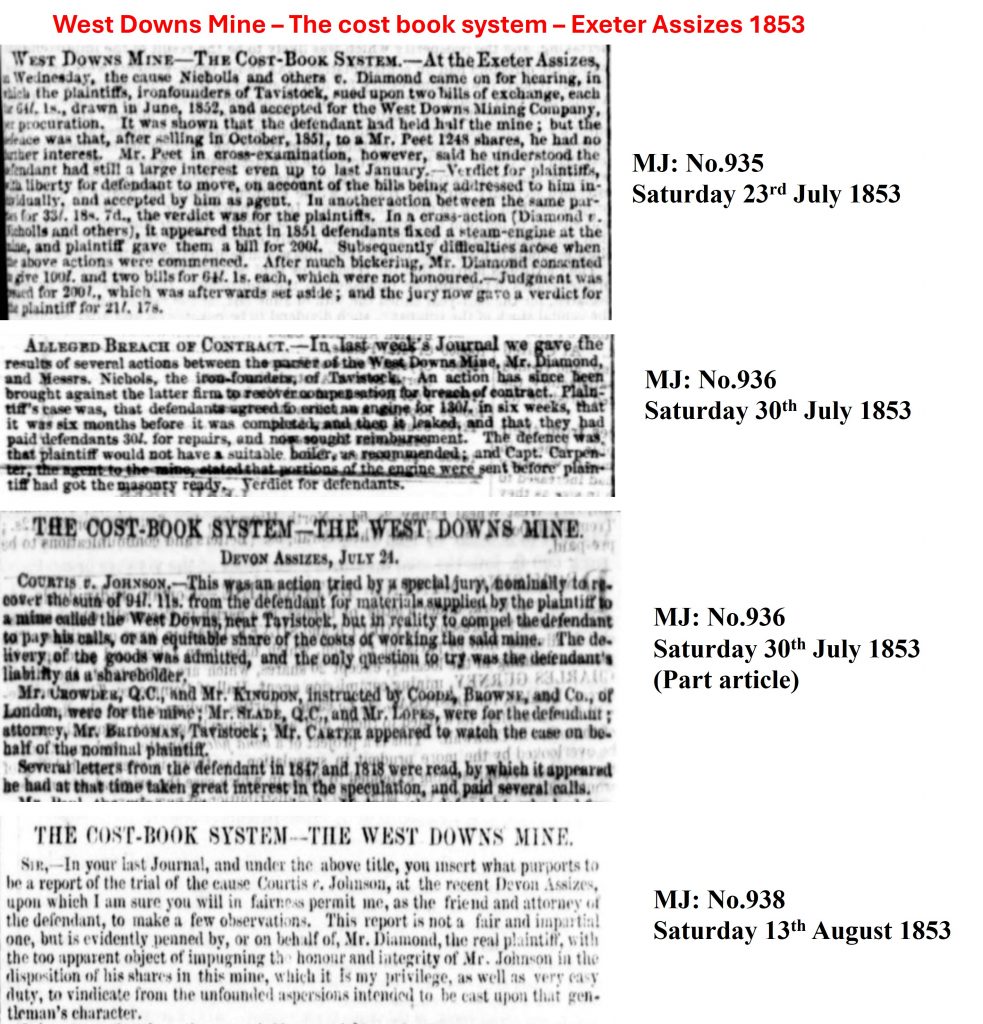
In the summer of 1853 Nicholls (iron-founders) and others sued James Diamond (Purser) for the non-payment for a steam-engine erected in 1851. Before the Nicholls / Diamond court case, on 26th February 1853, the company was reorganised and renamed as East Wheal Bedford Mining Company, in 2,048 shares (at £1 16s per share) – it was another cost-book company. In March 1853, the manager reported: “all possible progress was being made in driving the 20 fm cross cut towards the lode, despite a labour shortage”. A new shaft was commenced (on West Down), which was to be pumped using a 30ft waterwheel and flat-rods. it was about this time (July 1853), the steam engine which had been erected in 1851 was put up for auction. In February 1854, work was suspended (except for occasional inspections) and on 29th October that year another company was formed, Sortridge and Bedford Mine – a third iteration of the mine, which replaced East Wheal Bedford Mining Company. The new company continued, where the previous one had left off concentrating its efforts on the shaft on West Down, which reached a depth of 50 fms.
By July 1857 the mine had cost £7000 with very little output. There was a decision to close the mine in 1857, which was overturned in September of that year had been overturned. The mine finally went up for sale in May 1858, but nothing came of this. Sortridge and Bedford Mine ceased on 26th May 1858.
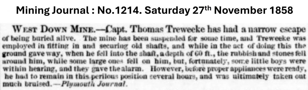
The last known documentary record of the mine was in December 1858, when in spite the mine having been reported as having been suspended for some time, shafts were being made safe. A Mining Journal entry at that time record an accident when a Captain Thomas Treweeke was buried alive whilst making the shafts safe – fortunately he survived.
The mine features are thought to have included: Several shafts and adits, a steam engine building with associated chimney, a stamping mill, a dressing floor, an account house, a smithy and burning house (calciner) with associated flue / chimney.
Costeaning is the process by which miners seek to discover metallic lodes. It consists in sinking small pits through the superficial deposits to the solid rock, and then driving from one pit to another across the direction of the vein, in such manner as to cross all the veins between the two pits.
Bibliography
Brooke Index – Whitchurch Parish
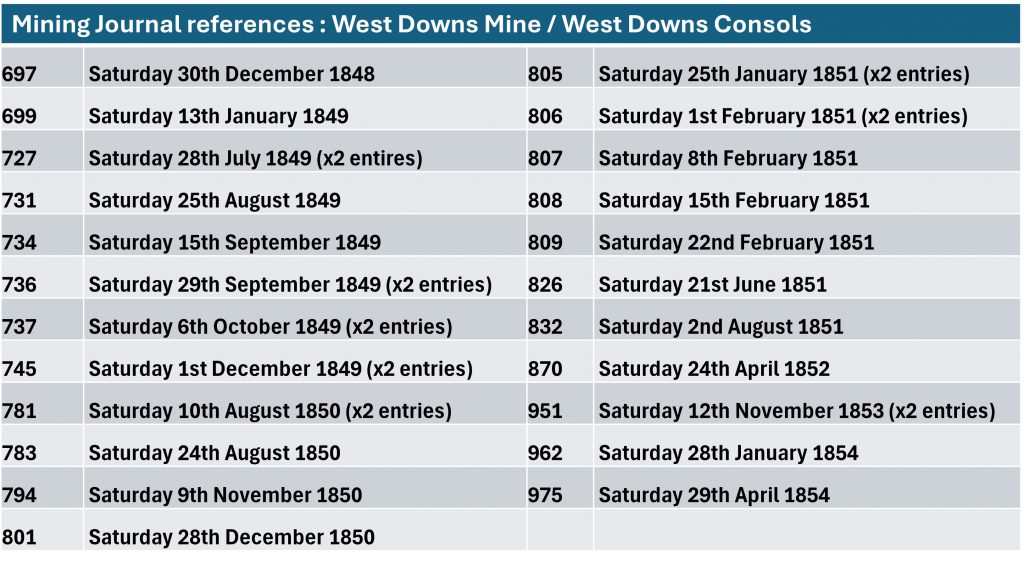
Mining Journal : entries from 1847-1854 and 1858
Phil Newman – (2011) – Mining in the Tavy Valley, West Devon: An Assessment of Archaeological Potential
Devon and Dartmoor HER – (MDV79966) – Shaft and Spoil Heap on West Down, Whitchurch
Devon and Dartmoor HER – (MDV79963) – Shaft and Spoil Heap on West Down, Whitchurch
H.G. Dines – (1956) – The Metalliferous Mining Region of South-West England, page 694
Dartmoor Tinworking Research Group (DTRG) – Newsletter 17 – July 1999
Stephen Holley – (2026) – Pers. Conv.
Dartmoor Chris – (2026) – Pers. Conv.
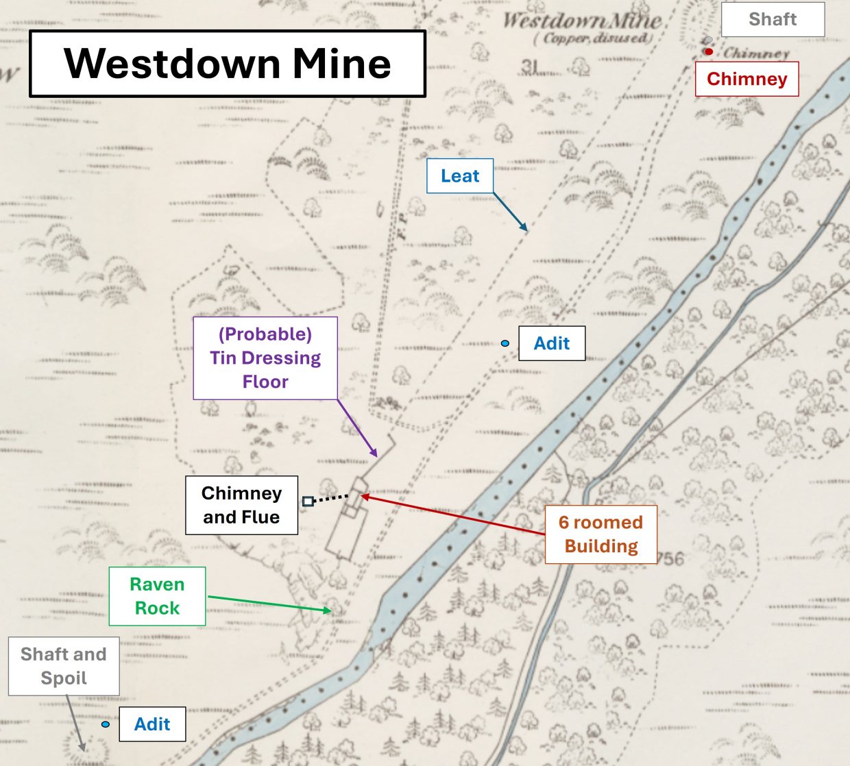
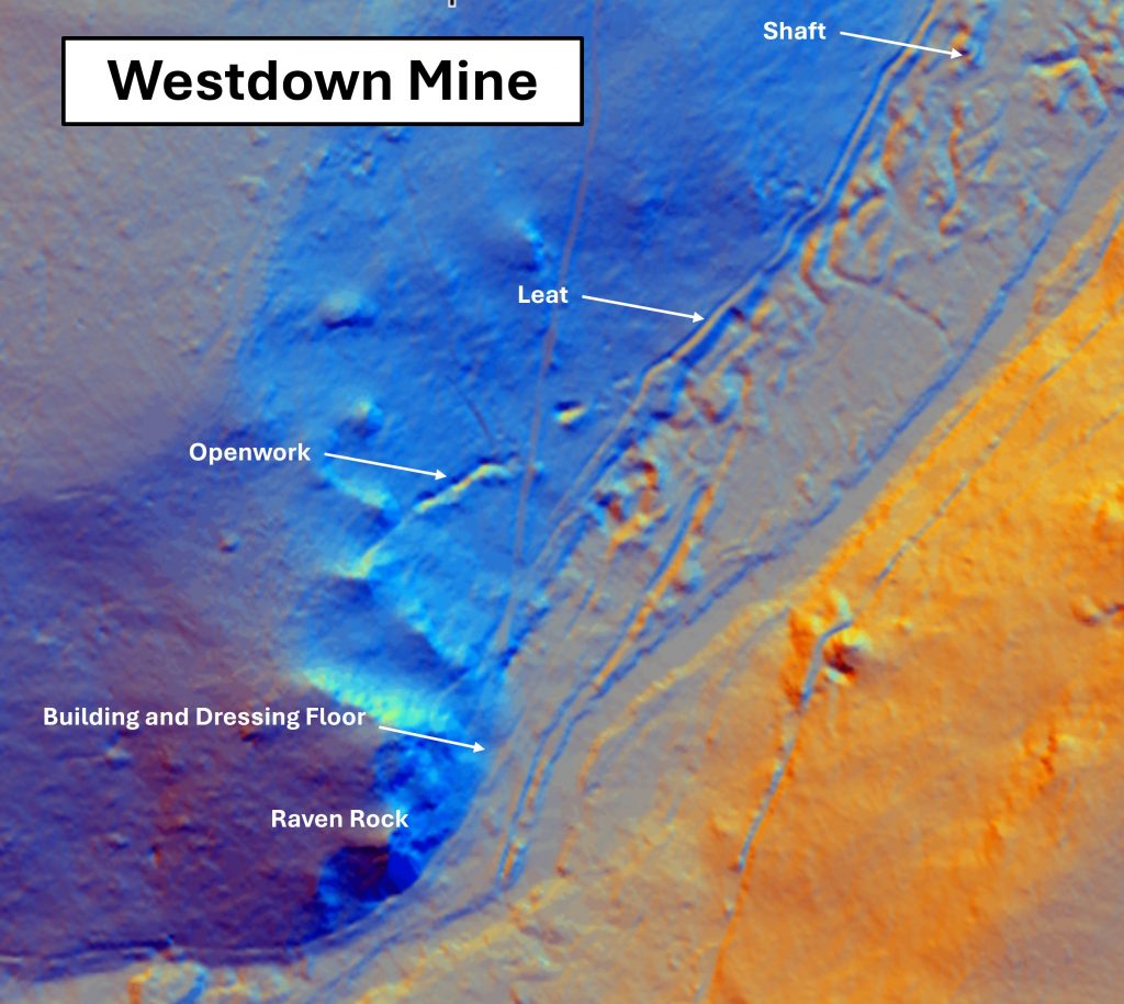
This snippet of an OS map (1873 – 1888), shows the key features of the mine in relation to the River Walkham. The map suggests the mine was for copper but all the evidence* suggests it was a tin mine. Not shown is a shaft on West Down to the west. * “The masonry remains where the 6 roomed building had once been assumed to be connected with 19th century copper mining. However a spread of dark red tin slimes suggests that this was the site of a tin dressing floor” (Greeves)This LiDAR plot shows the mine between a shaft near the eastern chimney and the building / dressing floor near Raven Rock. Note the openworks on the plot. It was surveyed in 1999 by the Dartmoor Tinworking Research Group (DTRG). Their findings were recorded in their newsletter thus: “One discrete openwork has been surveyed, running approximately east-west on the side of West Down. lt measures 53m in length, is 6m wide, and, interestingly, has spoil heaps visible on its southern side. Three of the heaps partially overlie those below them, suggesting a progression of work uphill. At the head of the openwork is an adit, the walls of which are steeply angled, almost certainly reflecting the dip of the lode”.West DownsConsolidated Mining Company was formed as by this cost-book company in 1847. This financial model continued when East Wheal Bedford Mining Company was set up in 1853
The DTRG plan created in 1999
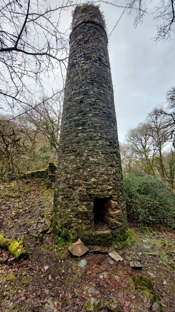
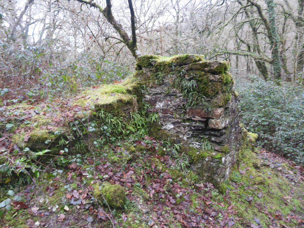
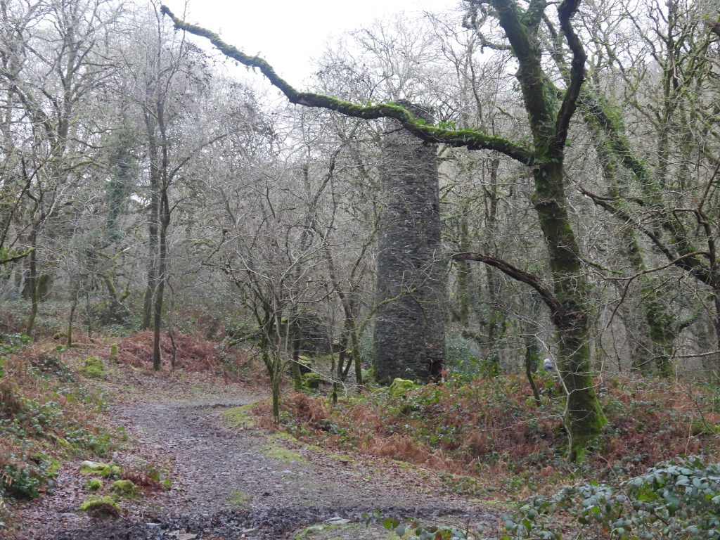
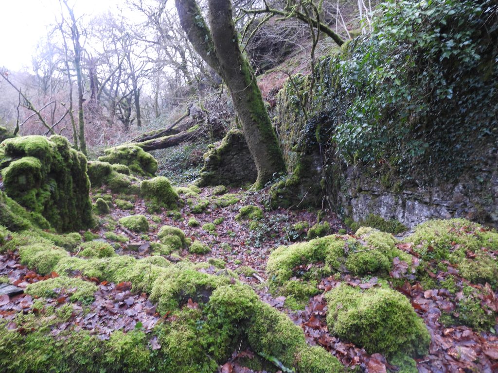
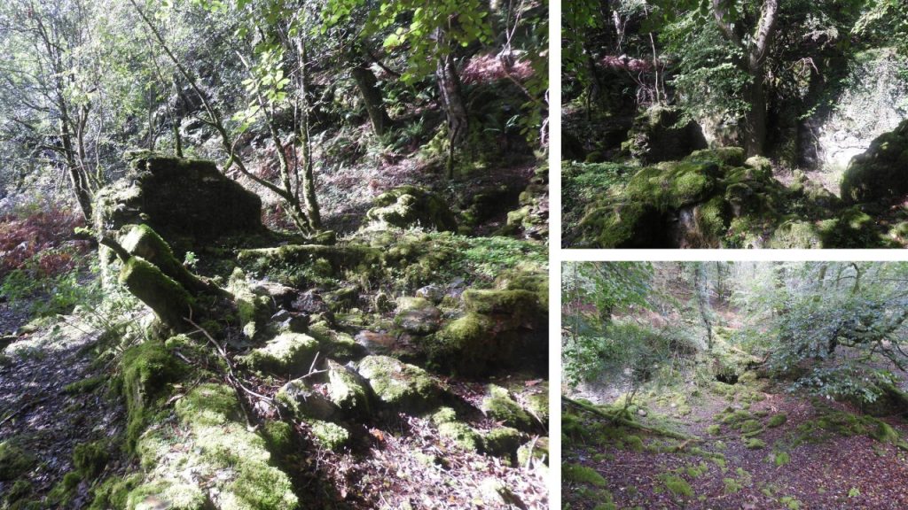
The most conspicuous remains from Westdown Mine. This chimney stack was constructed around January 1851 and was used with the steam engine erected here for use in draining a ‘new shaft’ which had been sunk in August 1850
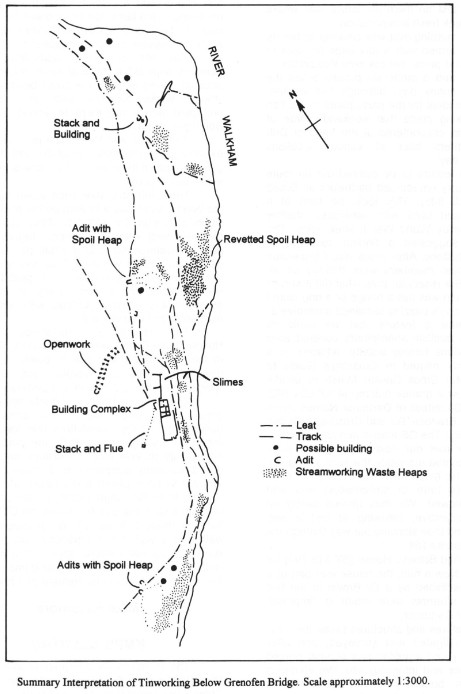
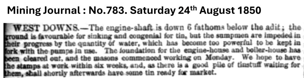
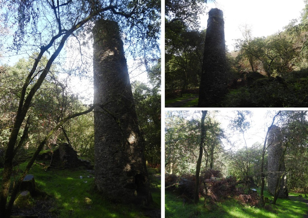
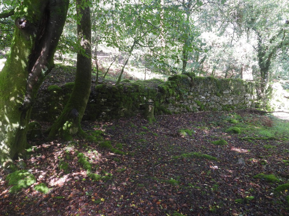
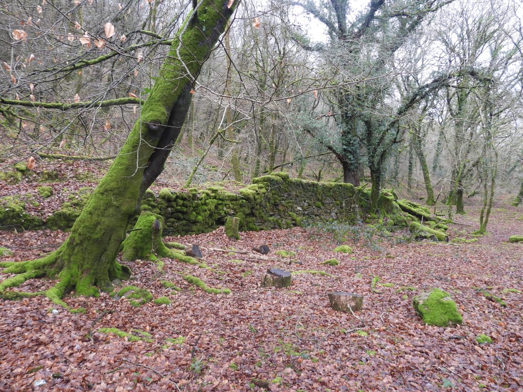
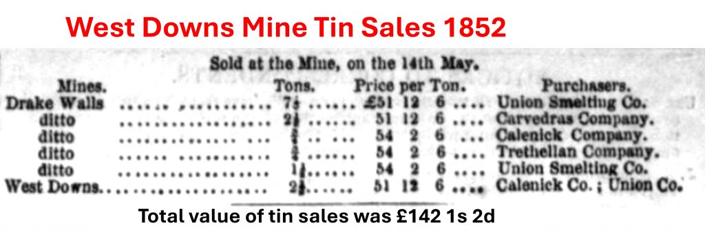
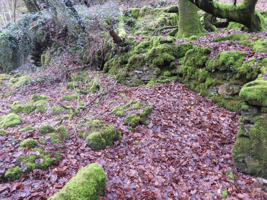
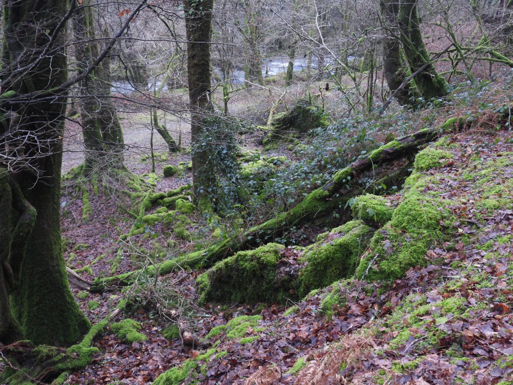
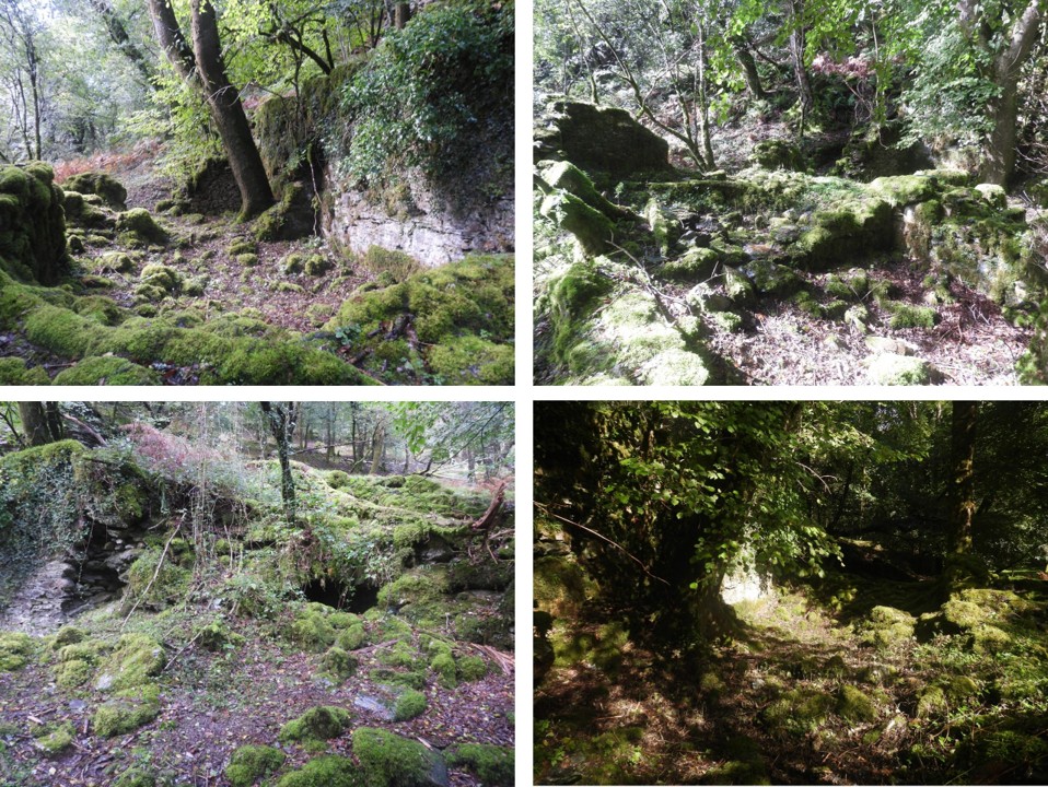
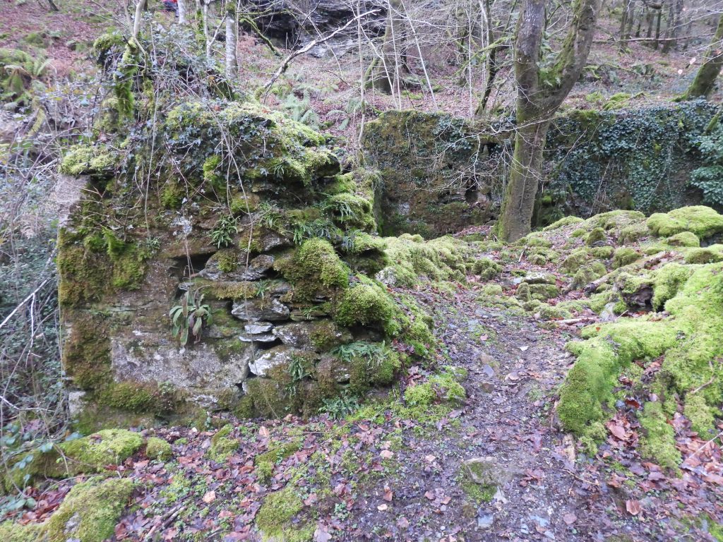
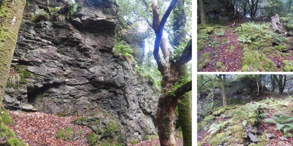
The chimney stack is located at SX48784 70538. Note the remains of a building behind, which presumably housed the steam engine or the boilerThis Mining Journal entry indicates the digging of the foundations for a steam engine house commenced in August 1850. This was to serve the ‘new’ shaft. The suggestion from the Mining Journal entry is that there was to be an engine-house and a boiler-house. It is not known exactly where the stamps mentioned here (to be ‘at work’ within six weeks), were located. They could have been further down the valley where there is evidence of a dressing floor or in the locale of the chimney stack and ruined building – that said, there is no obvious wheelpit, stamps (or even buddles) to been found within the mine complex.These building remains of possibly the (steam) engine-house and the boiler-house. Behind (to the north west) of this ruin amongst all the vegetation is where the ‘new shaft’ would have been locatedThe chimney stack and building ruins taken in September 2023The chimney stack and building ruins taken in January 2026In the DTRG newsletter from July 1997, the following was recorded: “The east end of the complex consists of a long retaining wall with a levelled tenace on its south side. On this terrace and immediately to the south dark red discoloration of the soil is suggestive of tin slimes (i.e. the waste product of tin dressing)” Dr Tom Greeves in 1997, also noted that as there are no buddles on the floor here suggesting they may date to pre 1850.The above is the only tin sales relating to the mine that the author could find. No other sales information could be found from the usual records (e.g Hills, Burt et. al). This entry was from Mining Journal No.873, Saturday 15th May 1852. Where the tin was dressed remains an unresolved mysteryIn July and August 1853 in the Mining Journal, there were four reports which describe the court case between Nicholls (of Tavistock) and West Down Consolidated Mining Company (represented by Diamond, the Purser). The mining company had found problems with the steam engine (erected in 1851), which had to be upgraded. In 1853, the adventurers tried to recover costs from the manufacturers. The adventurers lost the court case in Exeter as the manufacturers, Nicholls had stated that they had recommended a 10″ cylinder steam engine costing £140 (which was suitable to pumping and stamping). The company had decided to purchase a steam engine costing £130, a cost saving but possibly it wasn’t fit for purpose.The building complex at SX4869 7030, comprises an enclosure with a six-roomed building at its eastern end. This is identifiable from the 19th century OS map. There was an account house, a smithy and burning house (calciner) at the mine, so the building remains may represent these functionsTop of the walling of the ruined buildings, looking south across the enclose and track to the riverCollage of the six roomed building taken in September 2023. Note the two openings in the bottom left picture, one is thought to be the oven / kiln as it is an open-fronted chamber with an arched roofAnother collage from September 2023Wall remains from the six roomed complex at its southern endMining Journal (MJ) entries relating to the mine from 1848 to 1854. This list excludes other MJ entries found elsewhere in this postOpen-fronted chamber with an arched roof
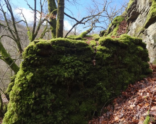
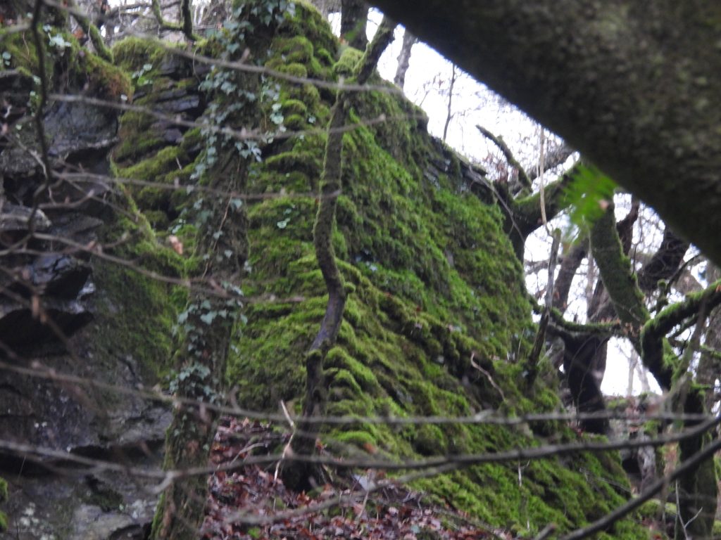
From the rear of the six roomed building on the west (higher) side a flue can be traced up the hillside to the square base of a presumed chimney stack, which is located next to Raven Rock
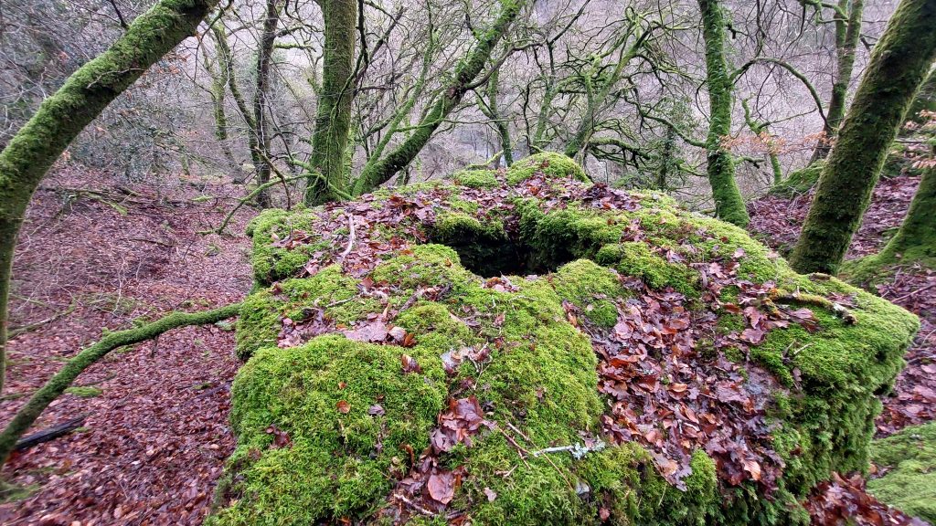
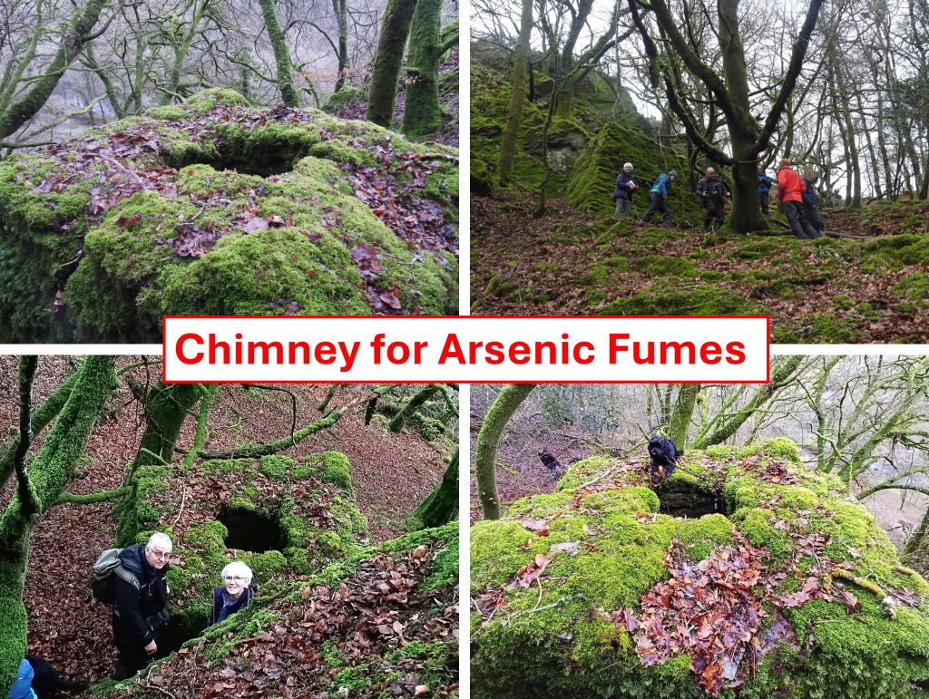
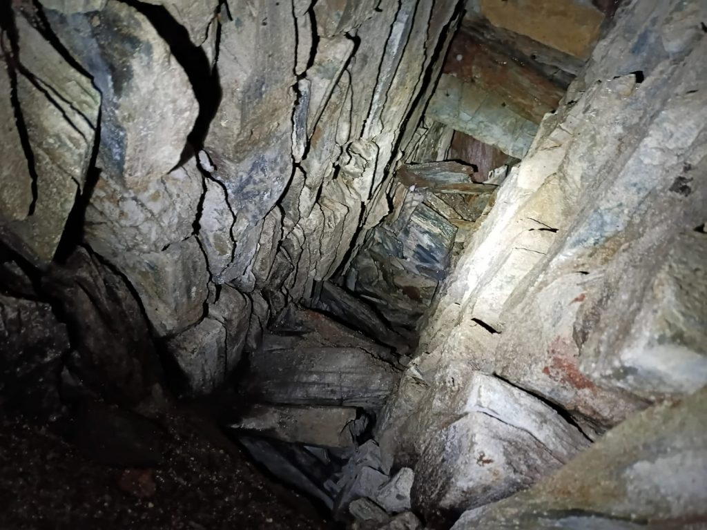
Top of the chimney stack. Looking into the chimney, it only drops around 1m, but that is because it was ‘capped’ – there is a void underneathDTRG members (plus Bess the dog) exploring the chimney stack which all assume was for taking arsenic fumes away from the Burning House (calciner) belowZoomed in view of chimney from the track belowInside the chimney stack, quite a large void is left. Picture courtesy of Matthew JohnsonTo the south of the building is a huge rock outcrop, known as Raven Rock. Mrs. Bray, when describing the River Walkham below Grenofen, was left spellbound by the fine scenery on offer, and wrote a compelling description of the crags further down the valley: “The noblest of these piles is called the Raven Rock; no doubt from the many birds of that tribe which harbour in it. This, when seen at twilight, with the river rolling and foaming but a few yards from its base, has an effect that acts powerfully on the imagination. In the days of superstition I can well believe it might have been deemed the haunt of pixies and spirits, that make their rings in the greensward at dusk, and lead poor travellers astray, laughing at their harms.” (ref: Tors of Dartmoor at https://www.torsofdartmoor.co.uk/tor-page.php?tor=raven-rock-walkham)
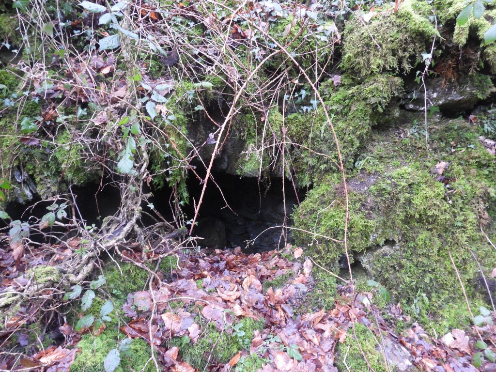
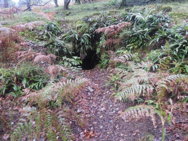
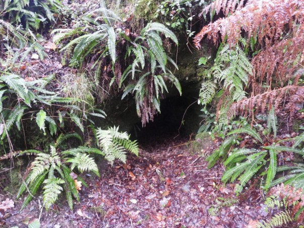
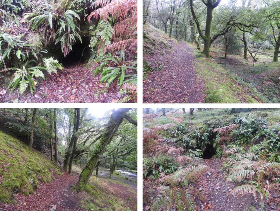
Adit to the south of Raven Rock
This is one of two adits that overlie earlier streamworks with associated spoil heaps
Location of the adit at SX48446 70184The last known documented information relating to the mine appeared in the Mining Journal of Saturday 27th November 1858, when Captain Thomas Treweeke (who was employed previously by East Wheal Bedford Mining Company in 1854and Sortridge & Bedford Mines from 1854 to 1857) was involved in an accident, which left him buried. The article suggests he fell 60ft (10 fms) with rubbish and stones falling around him from which he was taken out ‘much bruised’