A collection of walks, discoveries, insights and pictures of exploring Dartmoor National Park
April 4, 2026
West Cleave Tin Mill
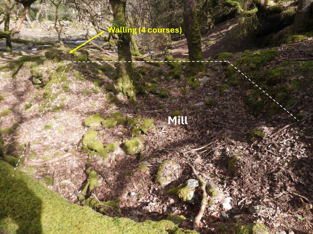
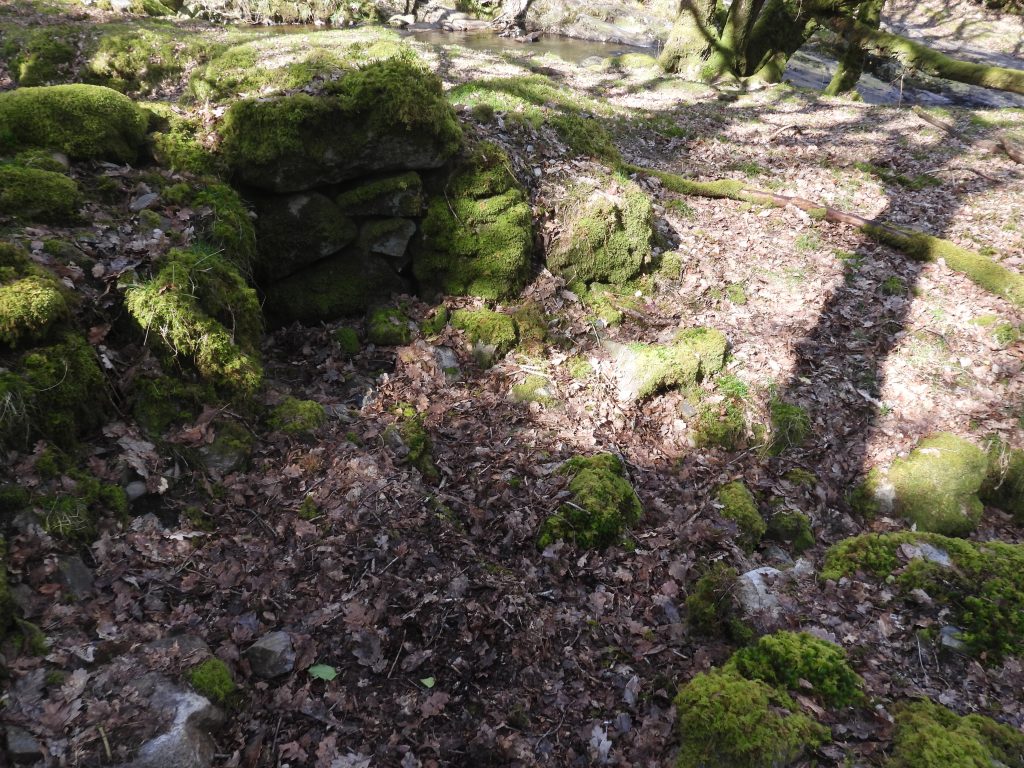
This Medieval (or later) Tinners’ Stamping Mill is situated on the right bank of the East Okement River at SX60768 93965 downhill from West Cleave Tor. Tom Greeves records that it is : “Very likely to be a tin mill, but status not proven”
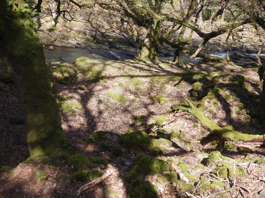
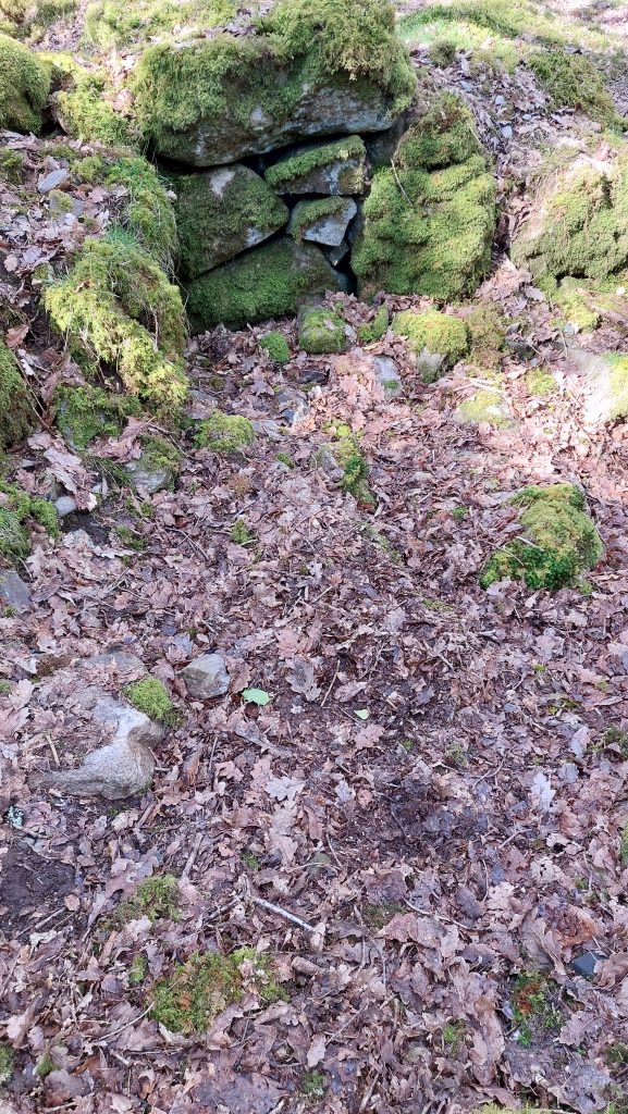
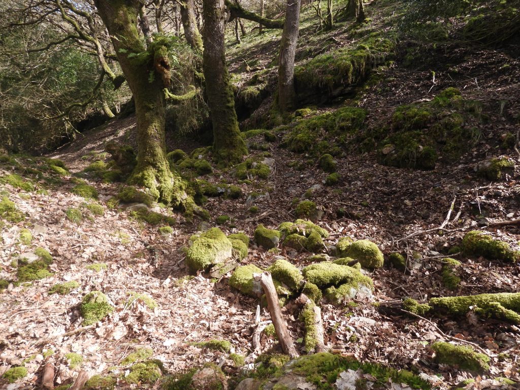
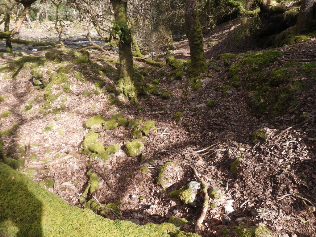
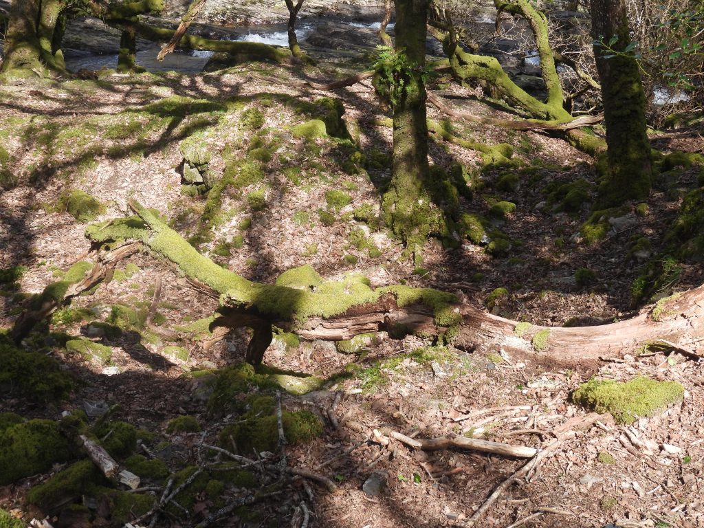
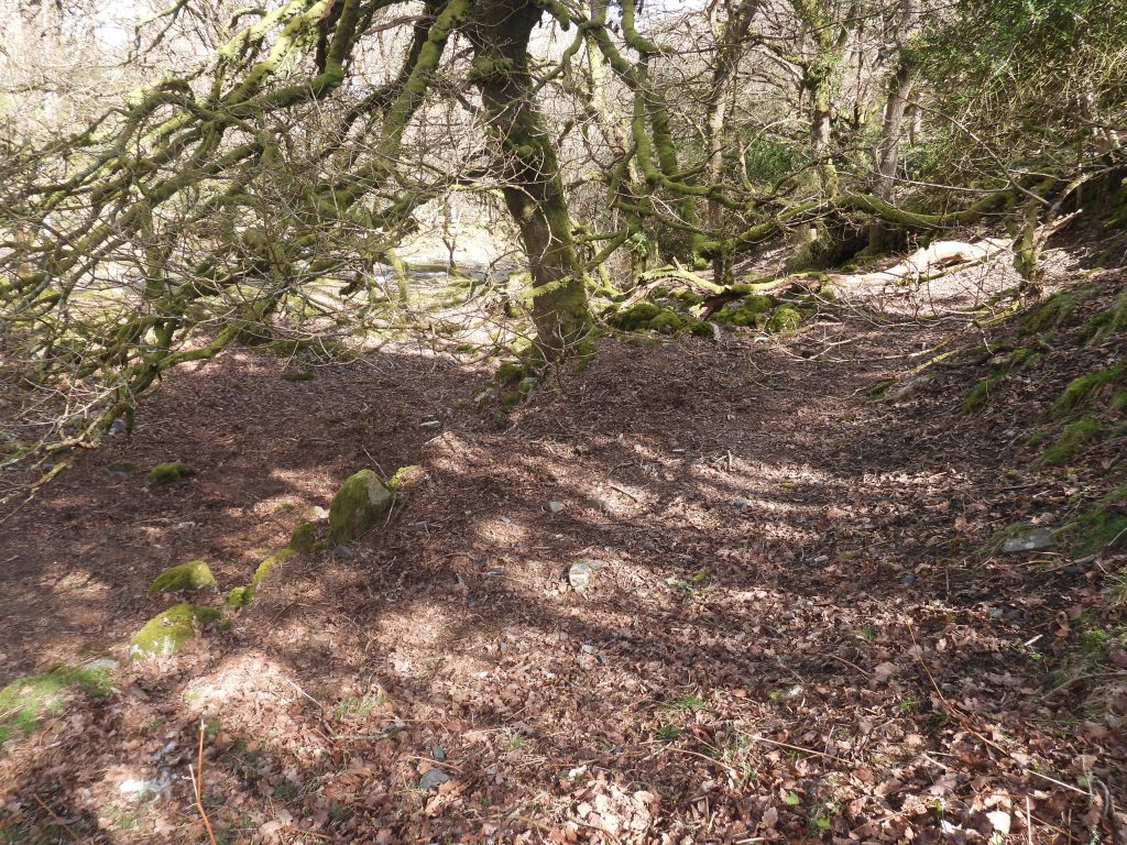
Any visit to the site can be a little tricky but is worth the effort for its wonderful location in the valley of Halstock Wood (known as West Cleave gorge) alongside the East Okement River. For those interested in industrial archaeology the structure remains are relatively well preserved and include a Wheelpit and Tailrace to the north and a levelled area which was possibly an embanked Dressing Floor to the west. To the east there is a possible Loading or Storage Terrace and a Leat. There are no known Mortar Stones from the Mill ever found
Bibliography
The Tinworking Landscape of Dartmoor in a European Context – (2016) – Paper presented by Dr Tom Greeves – Lodges and Mills: The Field Archaeology of Tin Accommodation, Stamping and Smelting on Dartmoor at the conference (6th – 11th May 2016) at Tavistock – Mill number 163
T.Greeves & R.Robinson (1983) – Site survey at 1:100
D.Cranstone, & I.Hedley -(1995) – Monuments Protection Programme: The Tin Industry Step 3 Site Assessments, Devon 27 (Report – non-specific). SDV357946.
Eric Hemery – (1983) – High Dartmoor, pages 867 and 876
William Crossing – (1986 Facsimile) – Gems in a Granite Setting; Beauties of the Lone Land of Dartmoor, page 50
Ward Lock and Co Ltd – (1939) – A Pictorial and Descriptive Guide to Dartmoor 9th edition (revised), page 91
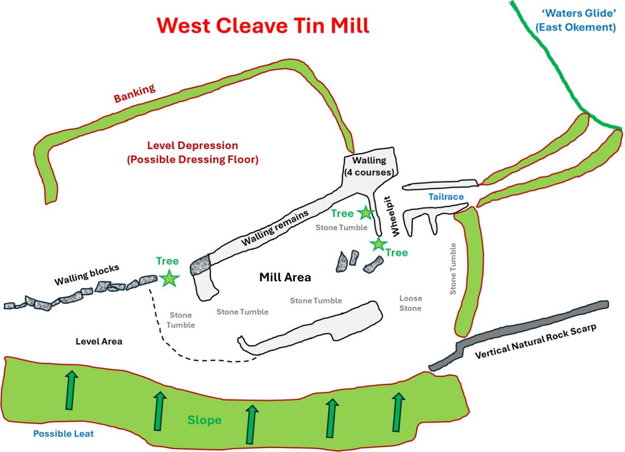
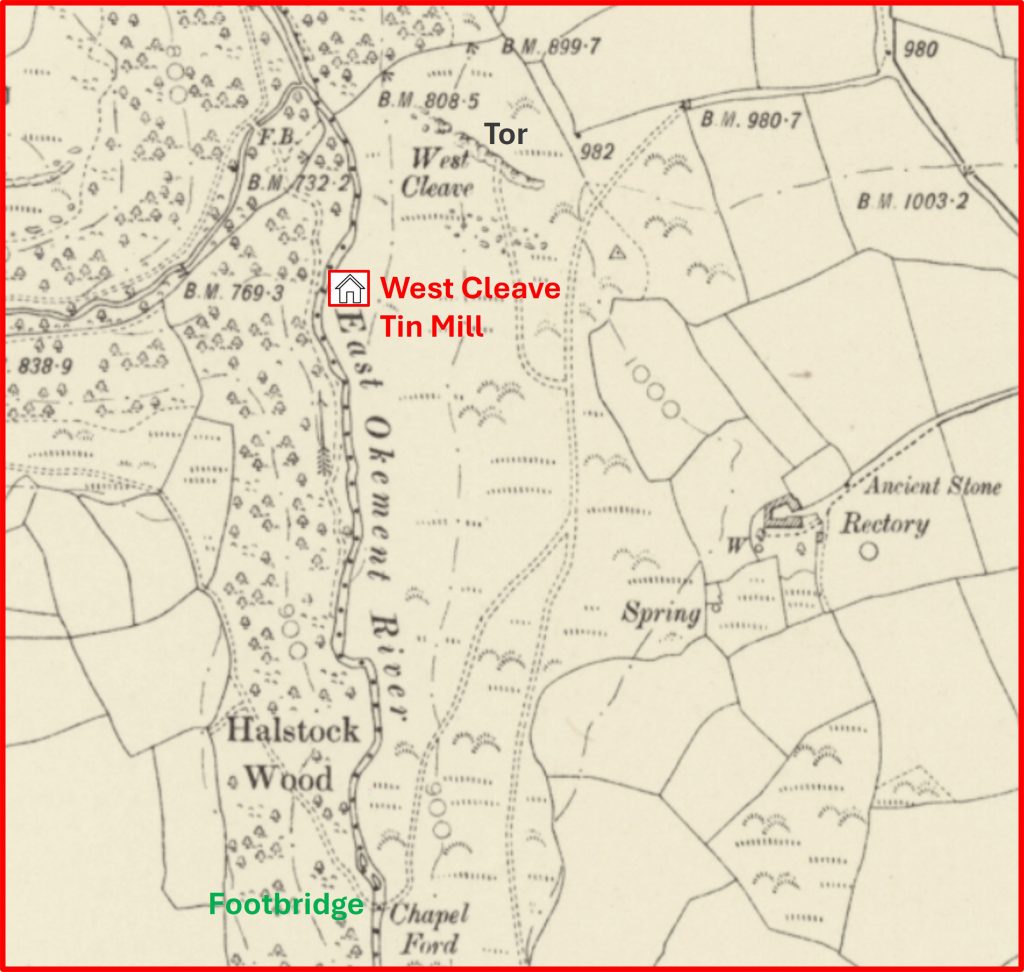
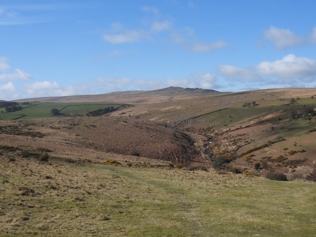
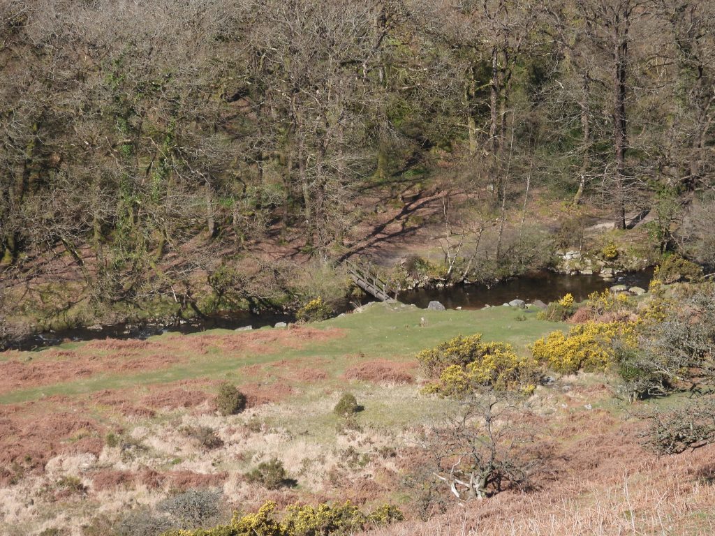
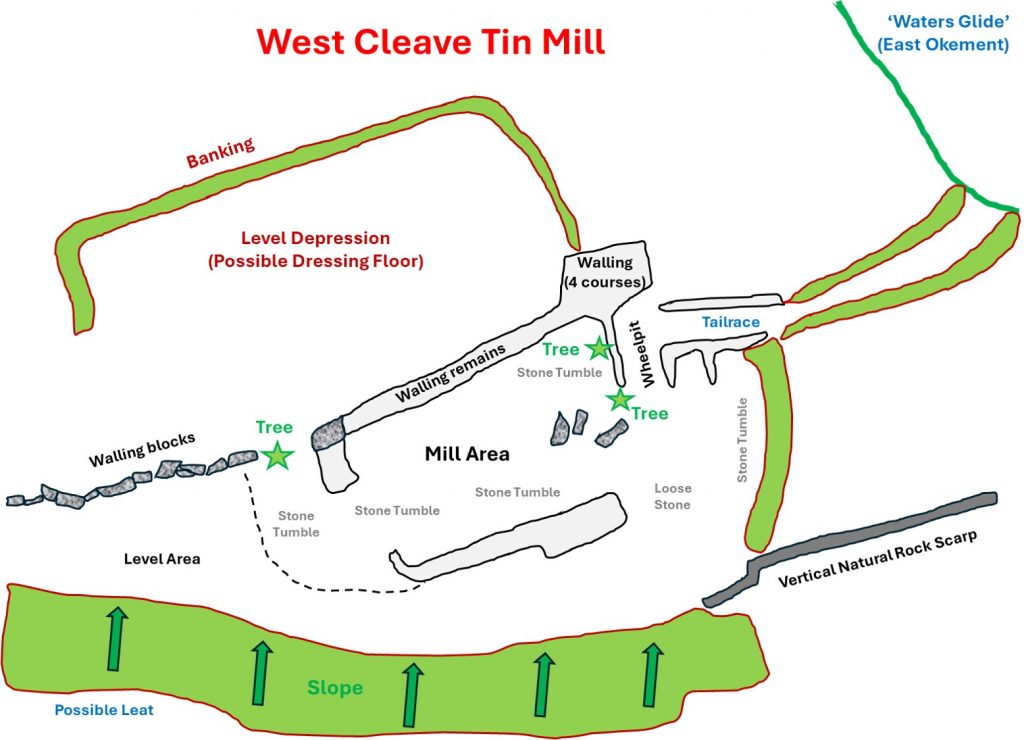
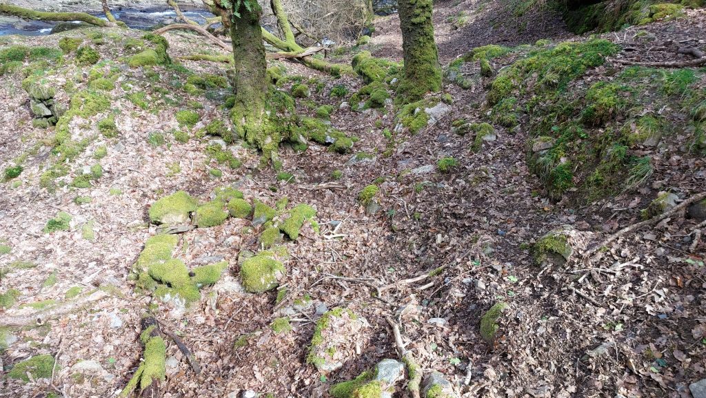
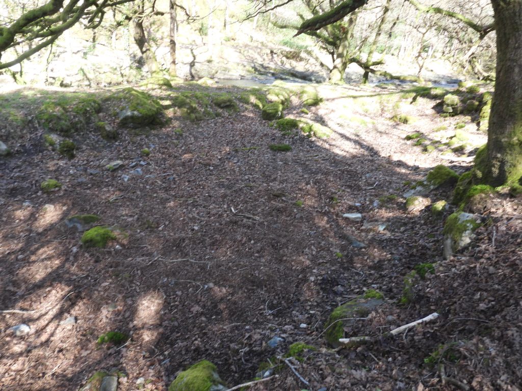
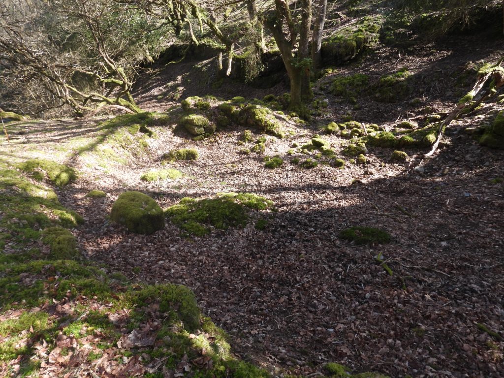
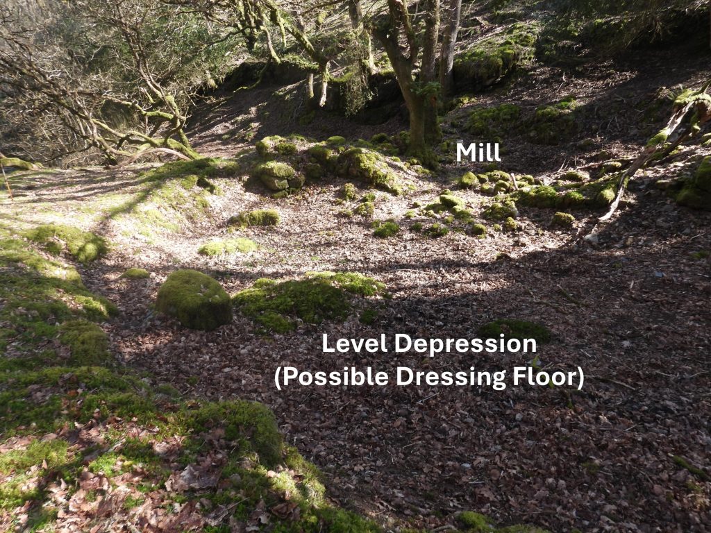
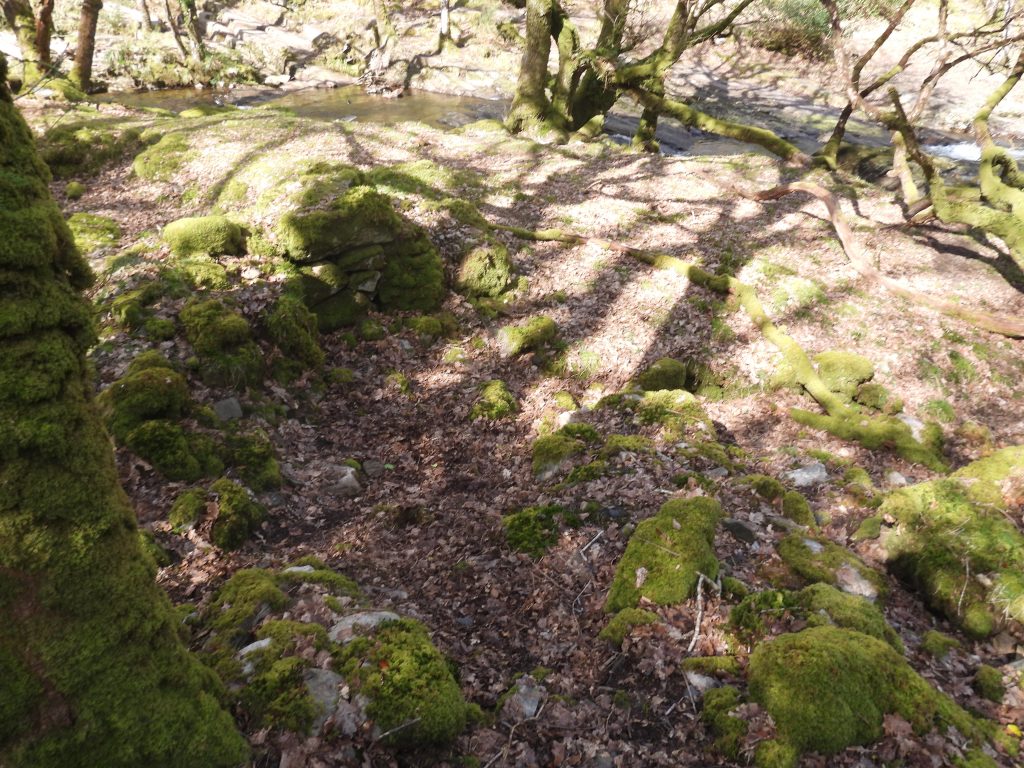
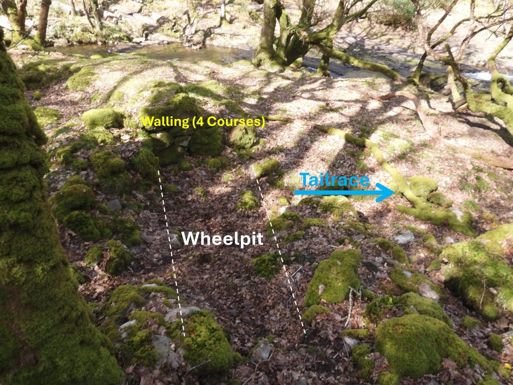
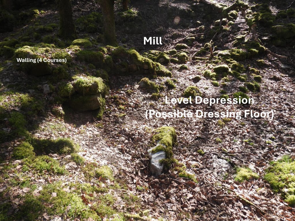
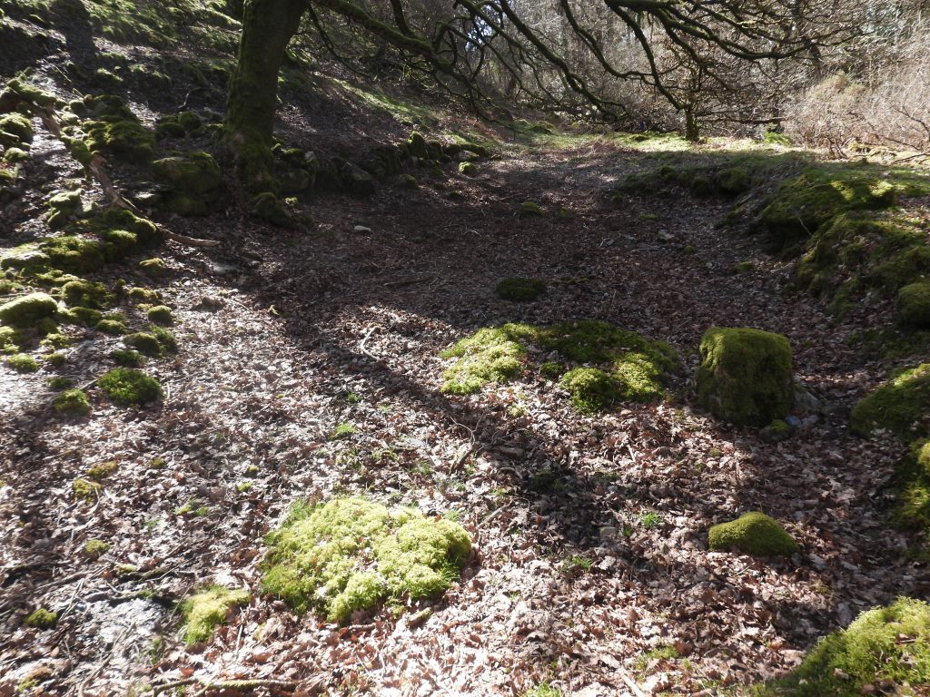
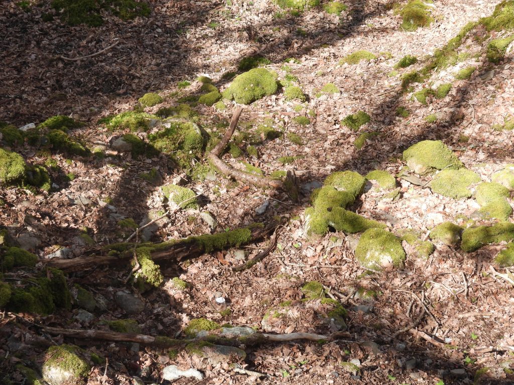
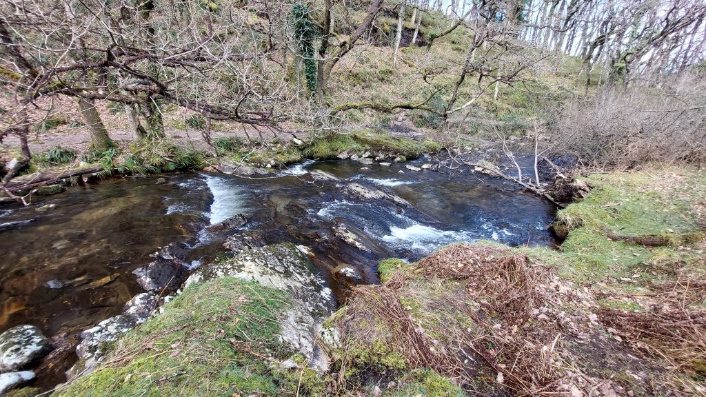
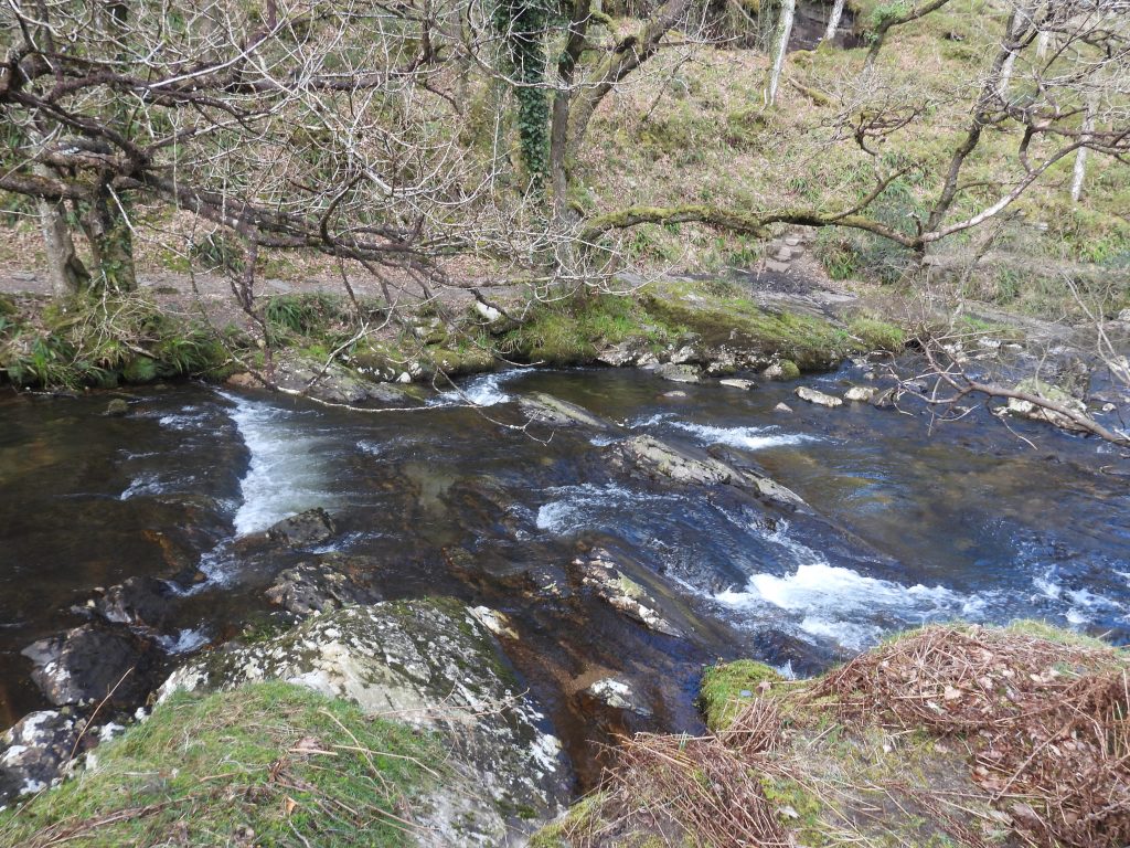
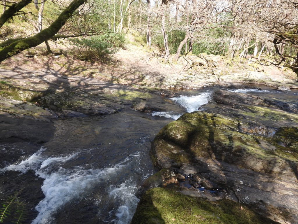
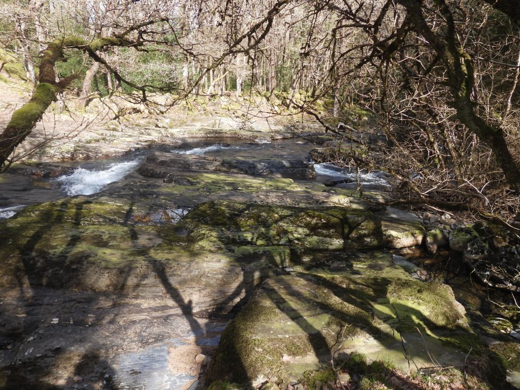
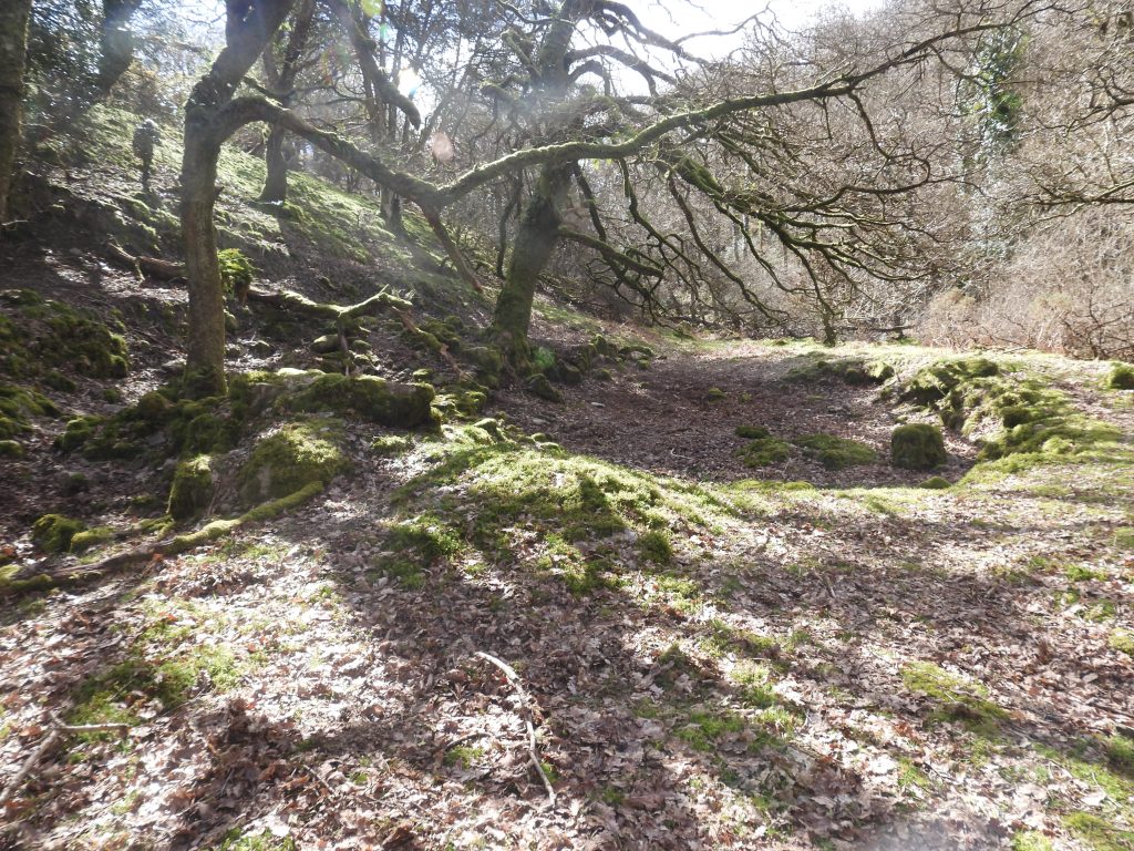
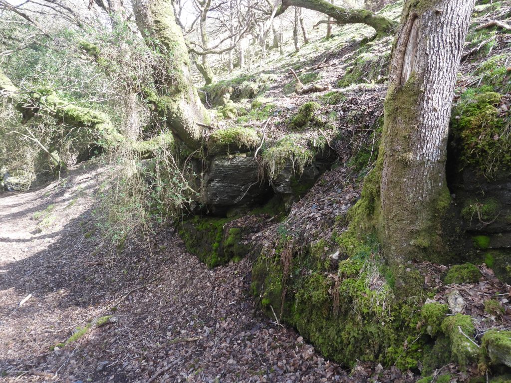
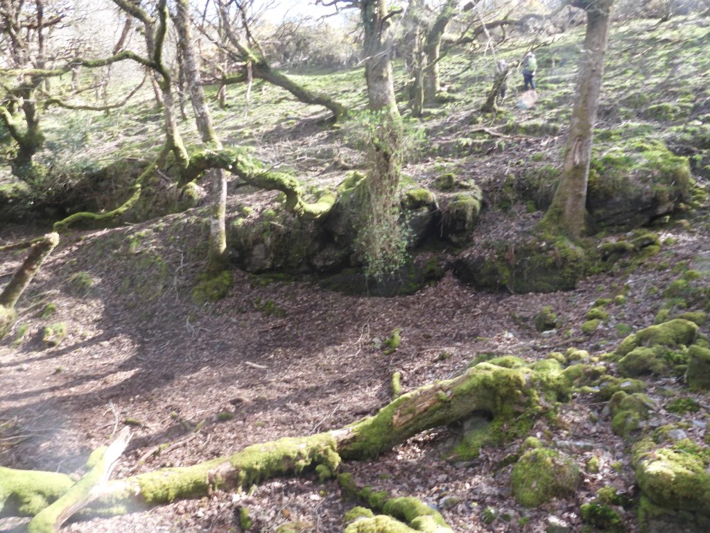
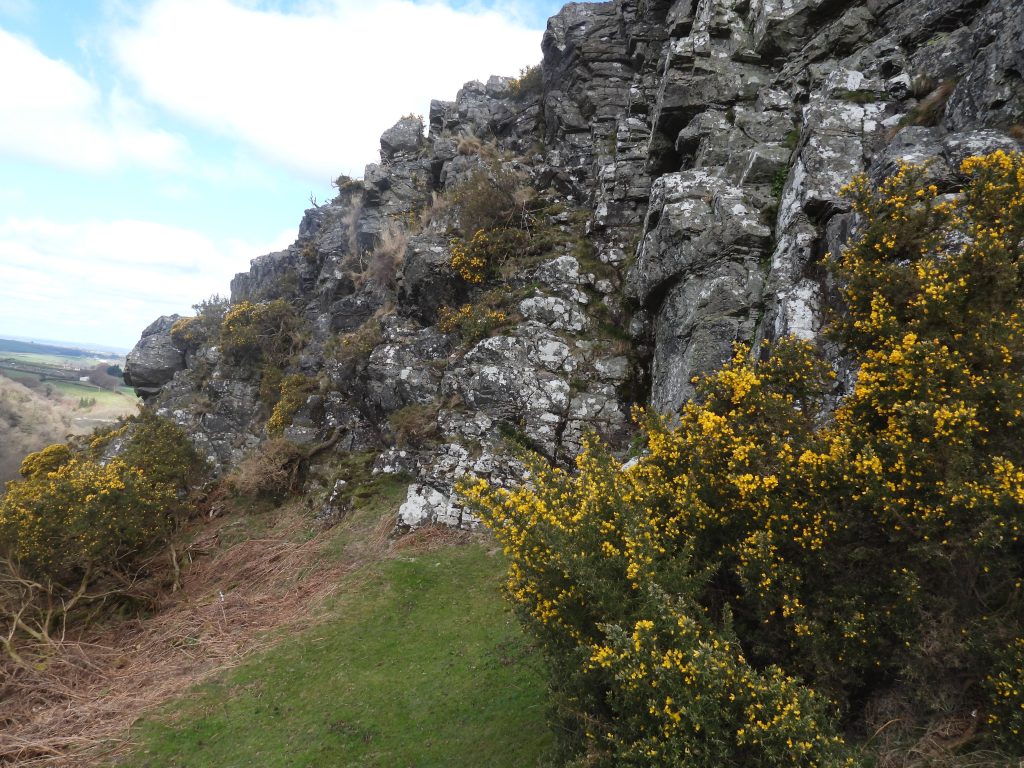
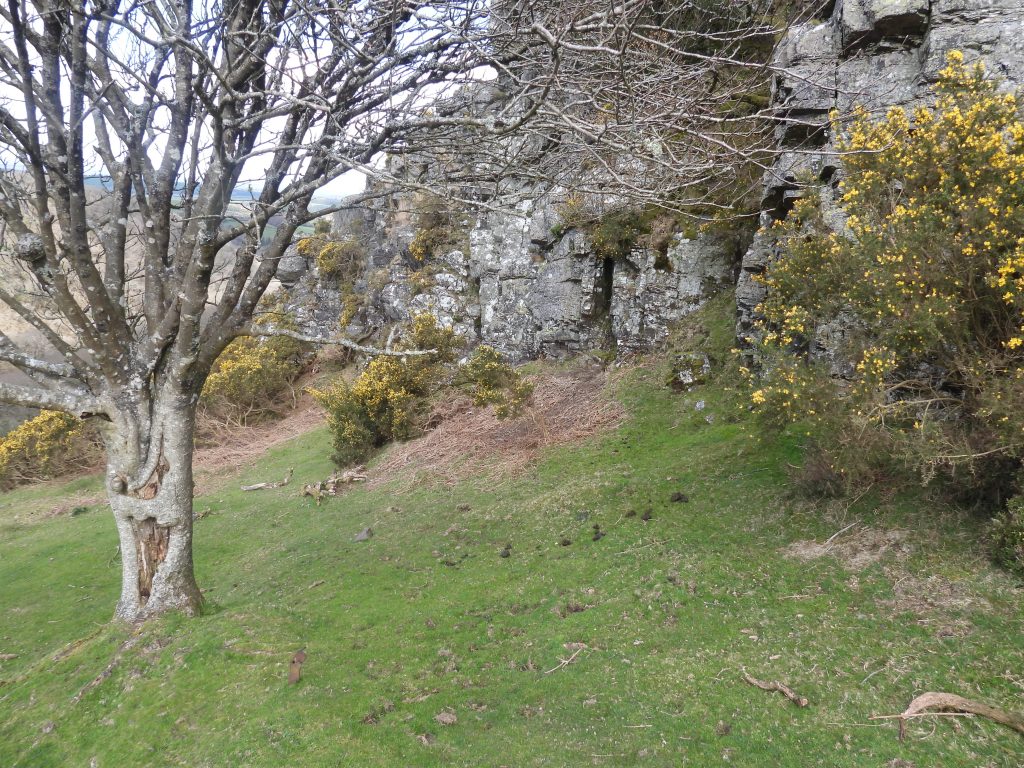
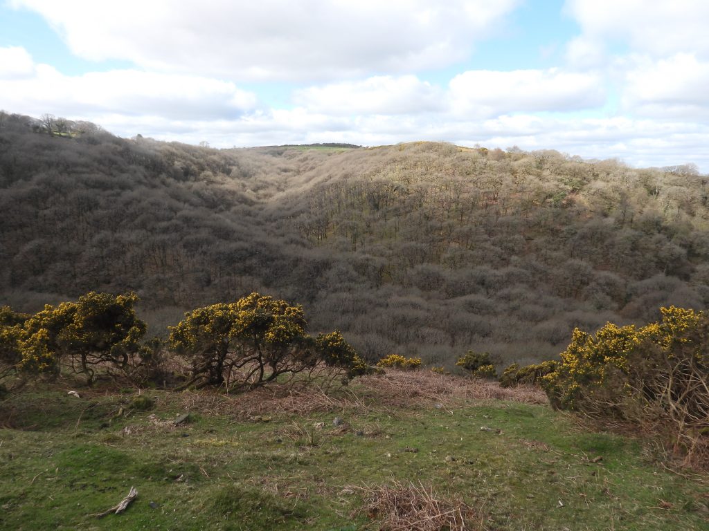
This annotated 19th century map shows the location of the Mill in relation to Halstock Wood alongside East Okement River. Access can be achieved by following the right (east) bank of the river downstream from Chapel Ford Footbridge or downhill south west from West Cleave TorEast Okement Valley as it curves around Scarey Tor just before it enters Halstock Wood and West Cleave gorgeEast Okement River at Chapel Ford where there is a well used FootbridgeThe path which descends through Halstock Wood / West Cleave Gorge follows the left (west) bank of the East Okement River down the Fatherford Viaduct from this bridge. It is possible (with care) to follow the right (east) bank of the river downstream to West Cleave Tin Mill, a distance of around 600mSketch map of West Cleave Tin Mill based on the original survey created by T.Greeves and R.Robinson in 1983. The mill is next to the East Okement River where the water passes over some large slabs annotated on the original survey as ‘Waters Glide’Arriving at the Mill and adjacent Level Depression (possible Dressing Floor) from the east. Note the location next to the East Okement riverThe Tin Mill Annotated photograph of the Tin Mill. If comparing this photograph and the sketch in this post it is best to look for the label ‘Walling (4 courses)’ as this is a prominent feature on the siteThe area sandwiched between the Mill and the river was labelled by Tom Greeves in his survey as ‘Level Depression’ (1983). In 1995, Cranstone and Hedley record an ’embanked dressing floor to the west’ (of the mill). In all likelihood, this was a Dressing Floor but there is no evidence to 100% corroborate this (e.g Buddles). The author has labelled it on his sketch as Level Depression (possible Dressing Floor)Looking from the west across the Level Depression (possible Dressing Floor) towards the Mill. The prominent walling of 4 courses marks the north west corner of the Mill and the west end of the WheelpitAn annotation of the previous photograph
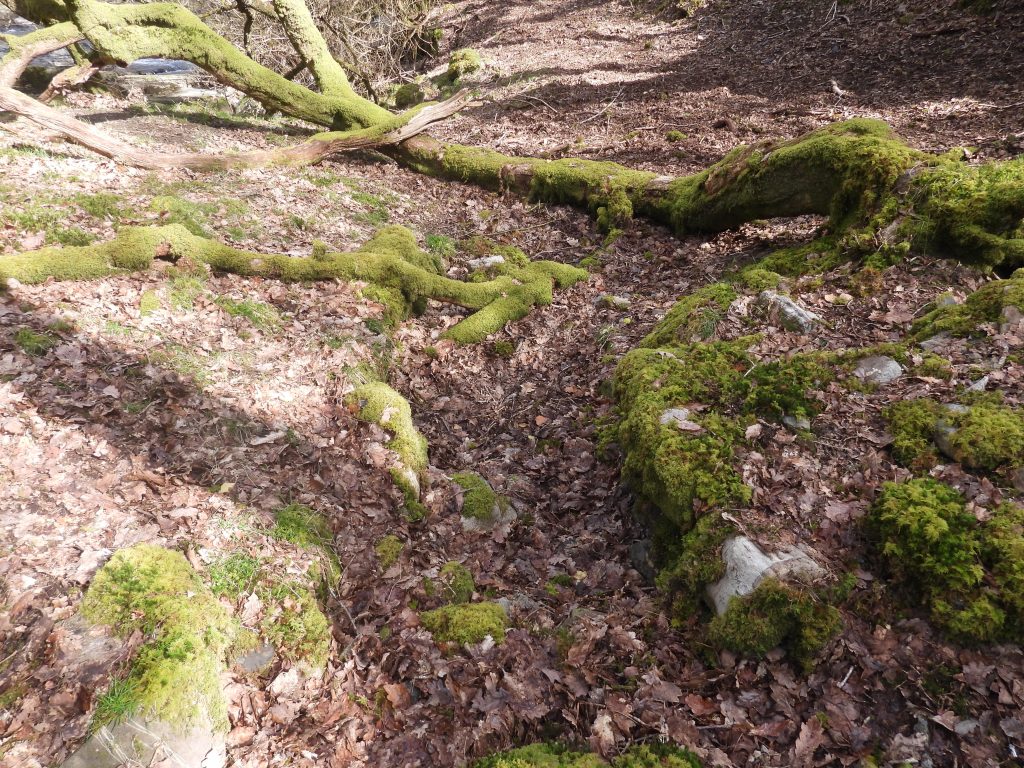
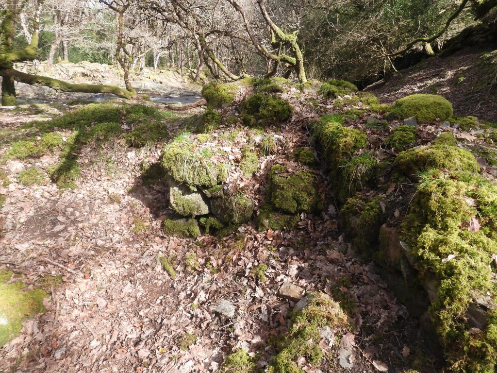
The Wheelpit is orientated approx east / west with the Walling (4 courses) at its west end
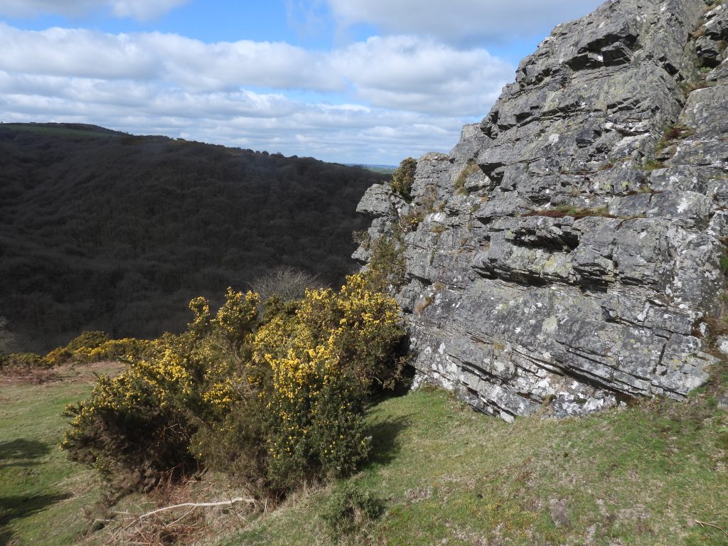
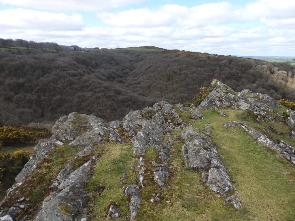
The Tailrace is stone linedAn unannotated photograph of the Wheelpit and TailraceThe annotated photograph shows the wheelpit being 90 degrees to the tailrace. The axle of the wheel would have been connected through the north end of the Mill building. Close up of the Wheelpit and TailraceAnother annotated photograph showing the Mill, Level Depression (possible Dressing Floor) and the Walling (4 courses)The level depression (possible dressing floor) with walling blocks (in shadow by the large tree) which are shown on the sketch Three or four courses of walling on a built up corner at junction of the mill / wheelpit and the level area (dressing floor) is a prominent feature on the siteMill internal stone tumbleMill walling on west side. The Wheelpit is behind the two large treesMill internal stone tumbleDappled sunshine over the Mill from the southDappled sunshine over the Mill from the south eastLevel area above the Mill, which might have been a Loading or Storage Terrace (ref: Cranstone & Hedley) East Okement to the south west of the Mill. Note the footpath on the left bank, which descends from Chapel Ford (Footbridge) to Fatherford viaductEast Okement to the south west of the Mill with footpath opposite. If the river could be crossed here, this would be the easiest way to access the MillThe East Okement at Watersglide (Greeves) or Waterslide (Hemery). The Tom Greeves name is taken from his survey plan of the Tin Mill. The Eric Hemery name is taken from ‘High Dartmoor’ (page 876) where he records: “The glen opens below West Cleave Rocks onto a sylvan glade, where a brighter light is admitted to sparkle on a lengthy waterslide…..” Hemery also mentions a ‘waterslide’ in the context of following the footpath down the left bank from the clam (footbridge at Chapel Ford)The Waterslide or Watersglide is adjacent to West Cleave Tin Mill near where the tailrace exits back into the riverView of the Mill with the possible Dressing Floor. Note, just below the figure ascending the hill (top left) is the line of a Leat which would in all probability have been laundered onto the WaterwheelNatural rock scarp is shown on the sketch map of the MillA natural rock scarp to the north east of the MillWest Cleave Tor is a steep climb out of the gorge from the Tin Mill (or indeed an alternative was of accessing the Mill through a steep descent). The name ‘West Cleave’ is annotated on the OS map in this post which was published in 1956.William Crossing states in his publication ‘Gems in a Granite Setting – Beauties of the Lone Land of Dartmoor’ (page 50) ; “From the village a lane leads past the entrance to the old vicarage to the commons on the west side of the parish, and following this we shall, on entering upon them, find ourselves near a tor placed on the brow of the hill. This is Cleave Tor, or to give it the name by which it is generally referred to in the neighbourhood, Cleave Rocks, and is unlike any other tor on Dartmoor. Instead of rising from the turf, as most tors do, or jutting abruptly from the hillside, Cleave Tor runs straight out from the surface of the ground, and only attains height in consequence of the hill sinking very rapidly from that point. But Cleave Tor is not of granite; hence this dissimilarity to the other tors on the Moor.”In the publication from Ward Lock and Co Ltd (1939): A Pictorial and Descriptive Guide to Dartmoor 9th edition (revised), the tor is called ‘The Coronet’ or ‘Cleave Tor’ on page 91.The tor is non-granite and was called ‘West Cleave Rocks’ by Eric Hemery in his publication High Dartmoor (pages 867 and 876)Looking west across the East Okement Valley or as Crossing defines it ‘Belstone West Cleave’. This photograph gives an indication of the steepness of the hillside(s) here. West Cleave Tin Mill located approx 75m (250ft) below this point.