A collection of walks, discoveries, insights and pictures of exploring Dartmoor National Park
September 24, 2025
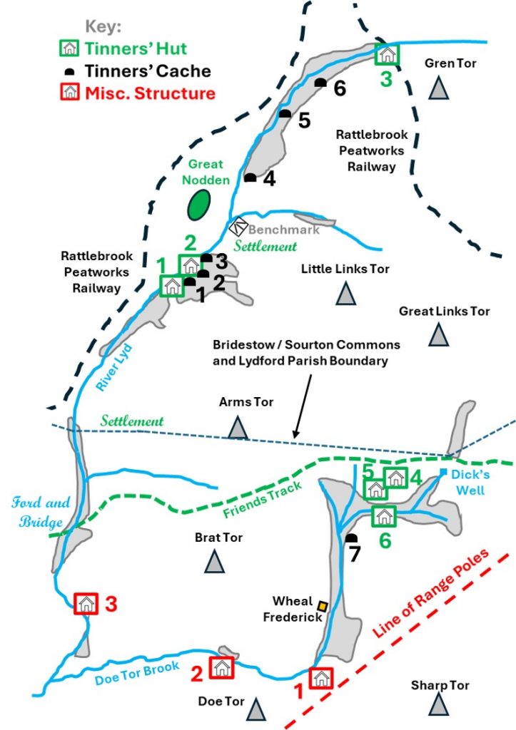
River Lyd / Doe Tor Brook Tinners Workings, Huts, Misc. Structures, Caches and a 19th Century Mine
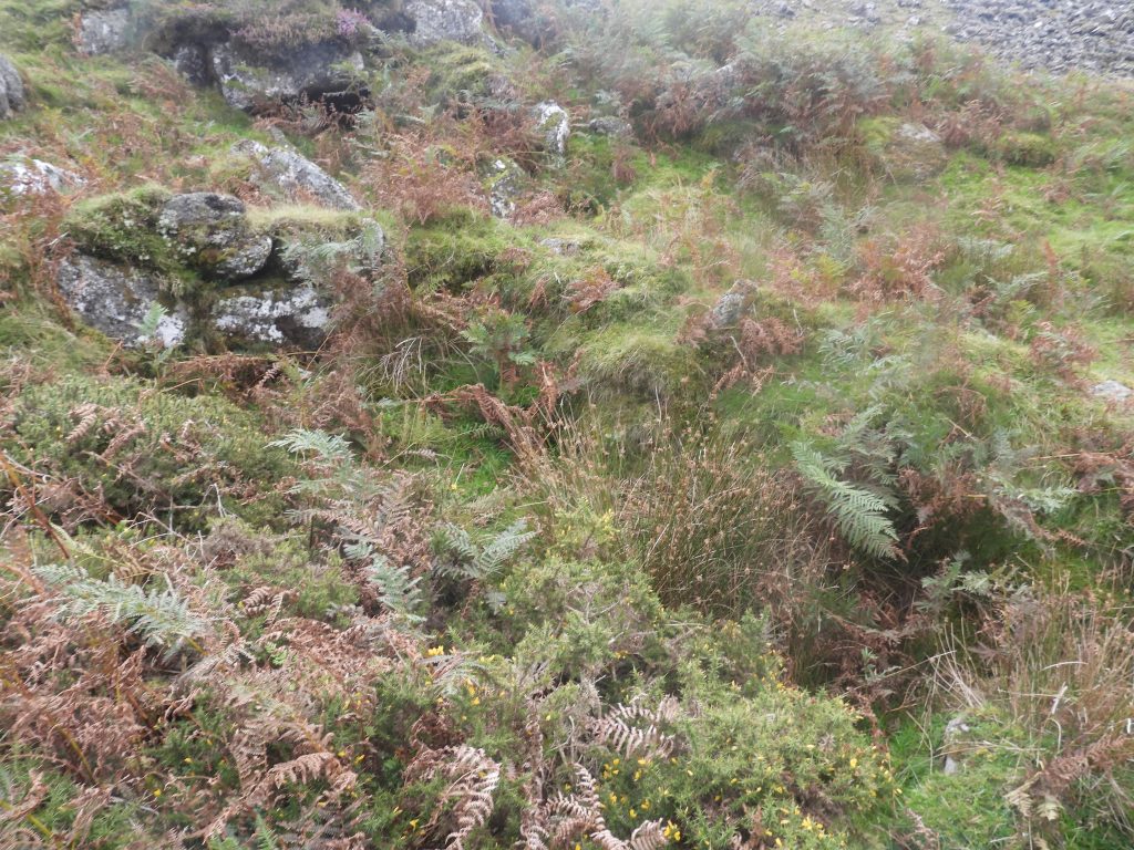
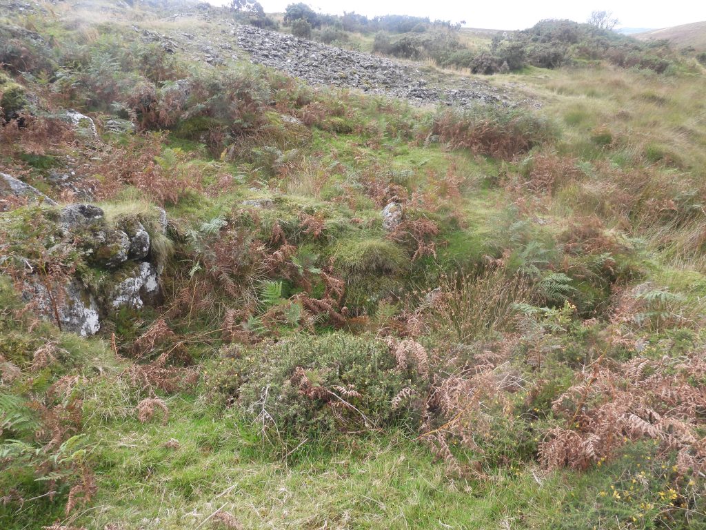
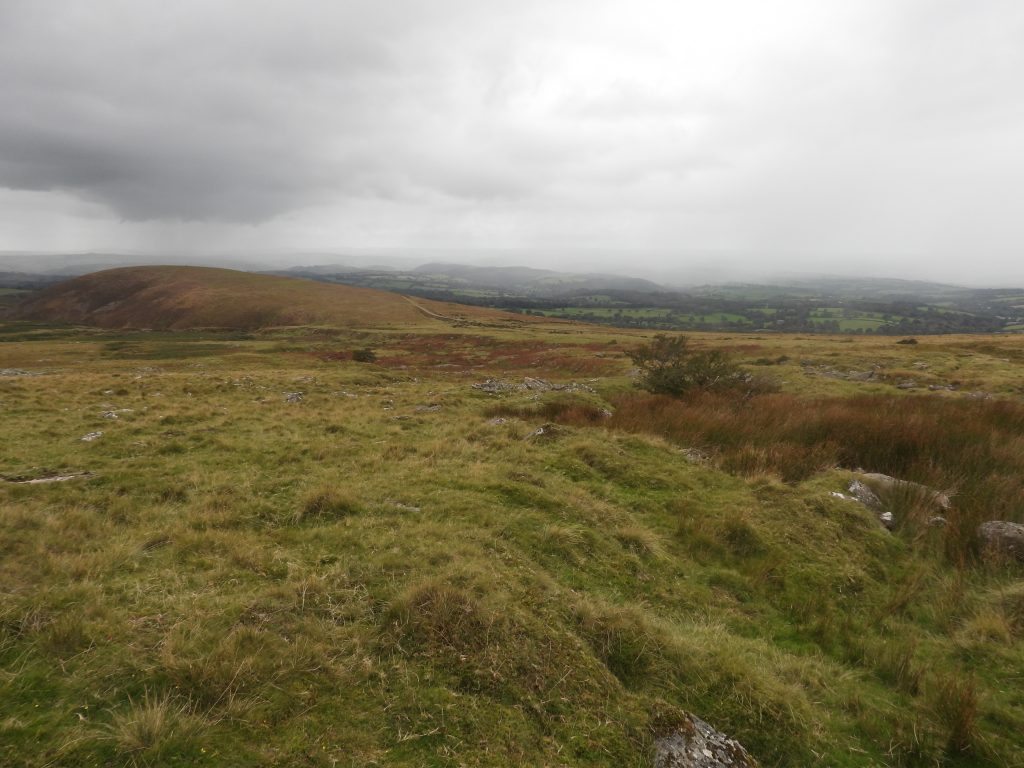
Virtually every river, stream, brook and lake on Dartmoor has at some stage been worked by the Tinners from pre-Roman times through to the 20th century. The area around the upper Lyd, north west of the bridge and stepping stones at High Down and Doe Tor Brook to the south of Great Links Tor are two good examples where Tin mining became increasingly important during medieval times where a technique called Tin Streamworking (or streaming) was used and which left huge scars in the landscape that we can still see today.
By the late medieval period, Tin Streaming was outdated as alluvial deposits were being depleted. The Tinners resorted to work on ‘tin lodes’ in situ and dug trenches, gullies, openworks with many trial pits in order to find their precious ore. There were three Stannary towns established from 1305 around the moor in Tavistock, Chagford and Ashburton with a fourth Plympton added in 1328 to oversee the industry.
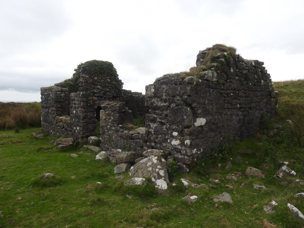
This post covers an exploration of these two water courses which have at least 6 Tinners Huts, 7 Tinners Caches , 2 Misc. structures (building-like) and a short-lived mid-19th century mine, which was once thought to have been called Foxholes Mine but is usually known as Wheal Frederick. The mine has a well preserved building and dressing floor (including leat, embankment and wheelpit) containing round buddles which are likely to be the earliest on the moor.
Bibliography
Dartmoor Tinworking Research Group website – dtrg.org.uk (Tinners Huts and Caches)
Jeremy Butler (1991), Dartmoor Atlas of Antiquities: Volume Two – The North, 223, Map 43
R.N. Worth (1895), The Stone Rows of Dartmoor: Part 4, 438
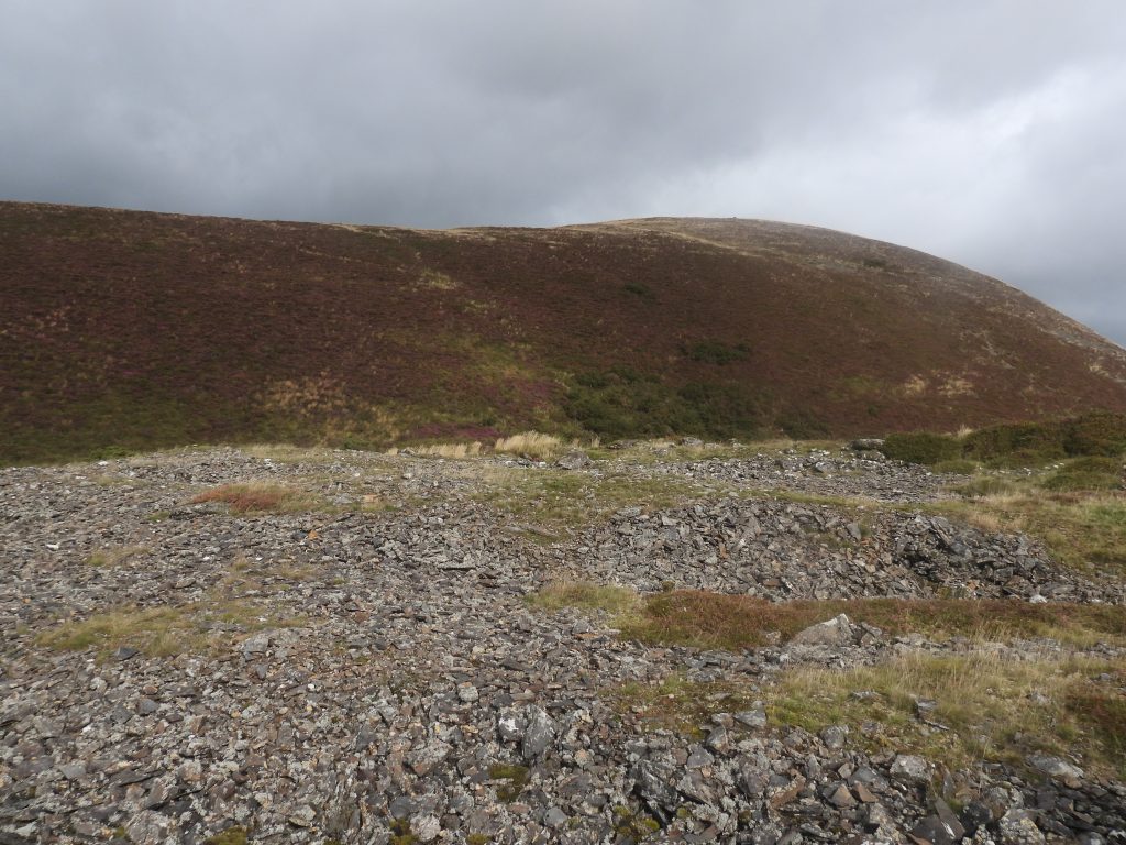
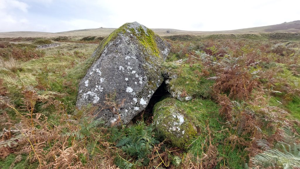
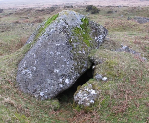
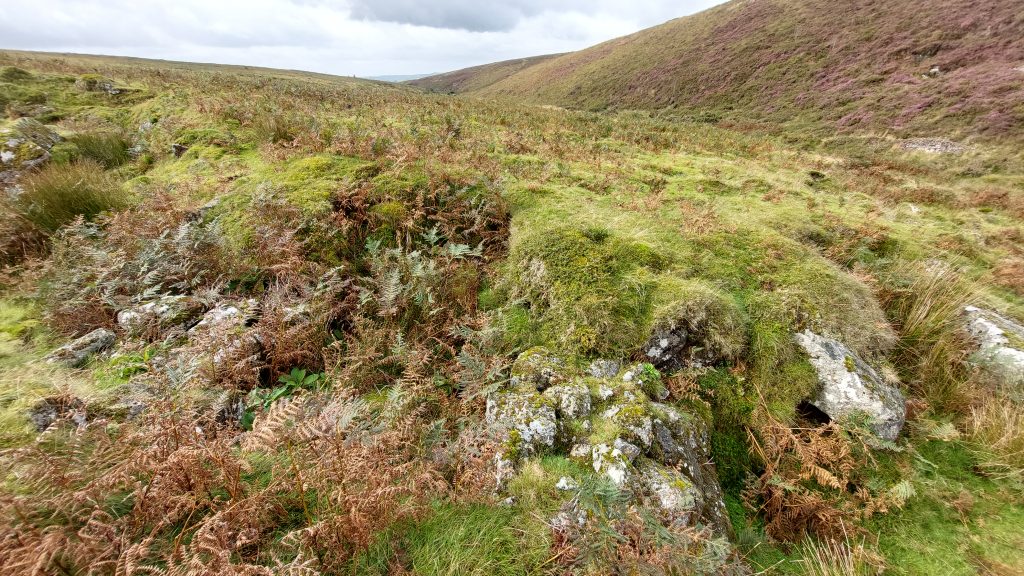
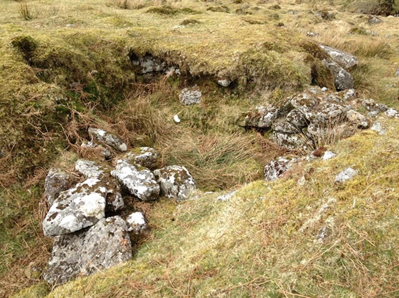
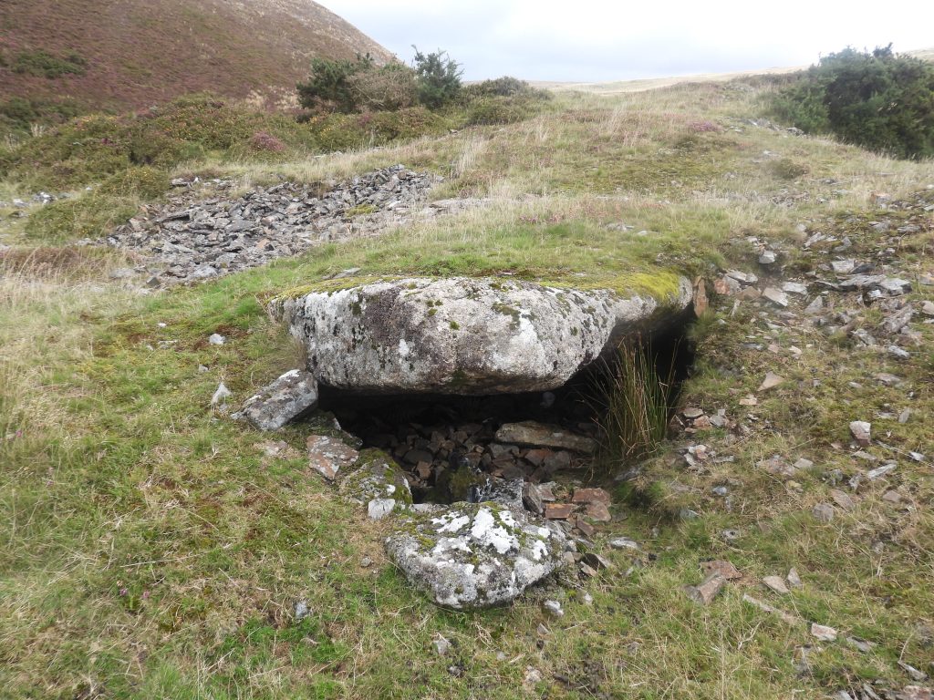
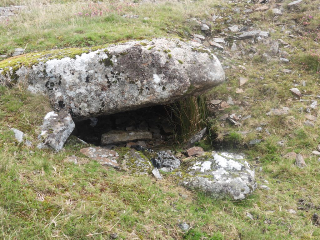
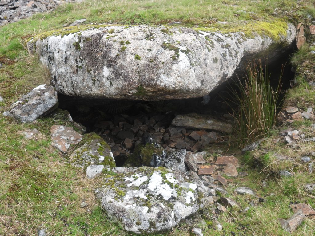
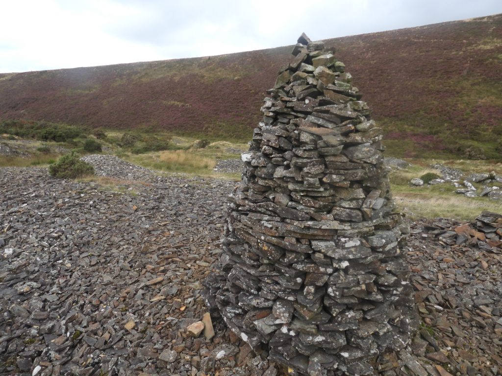
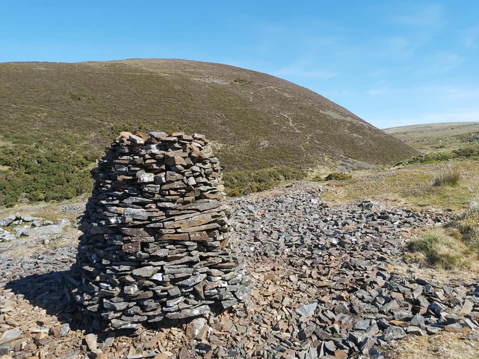
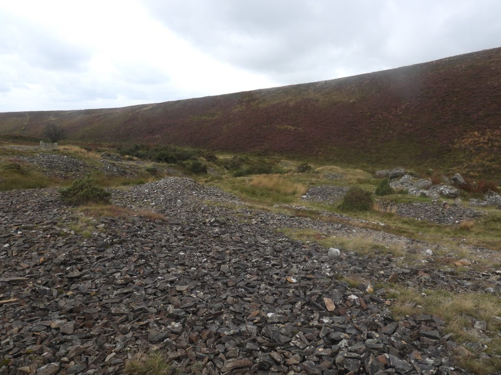
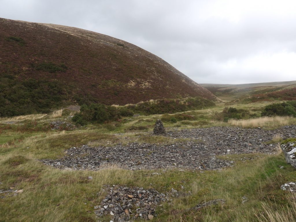
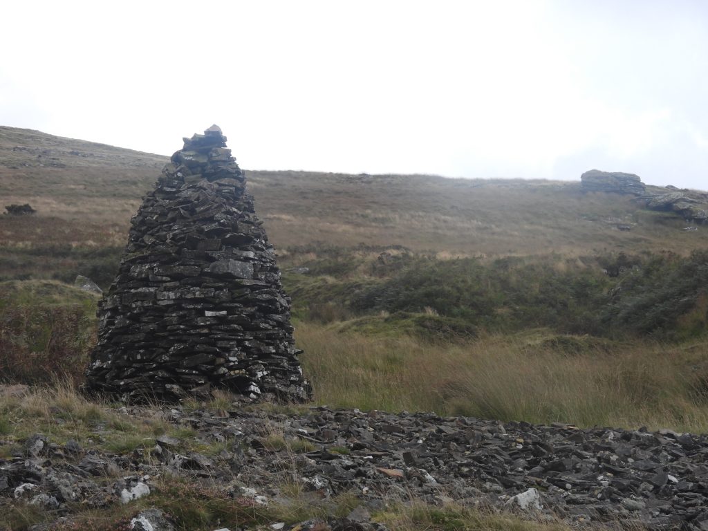
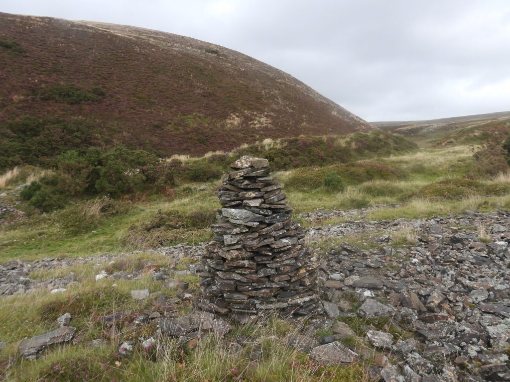
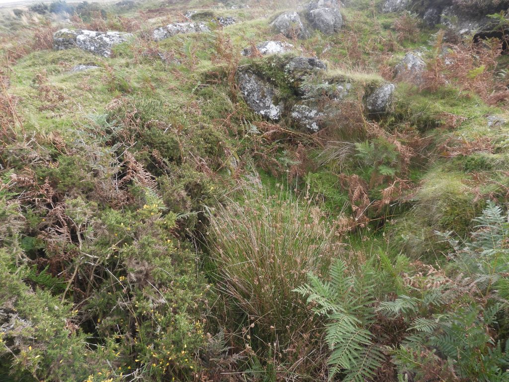
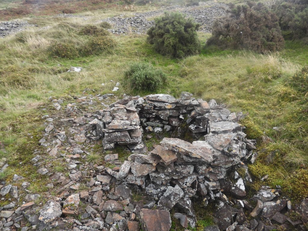
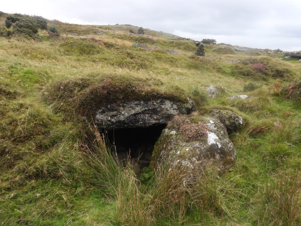
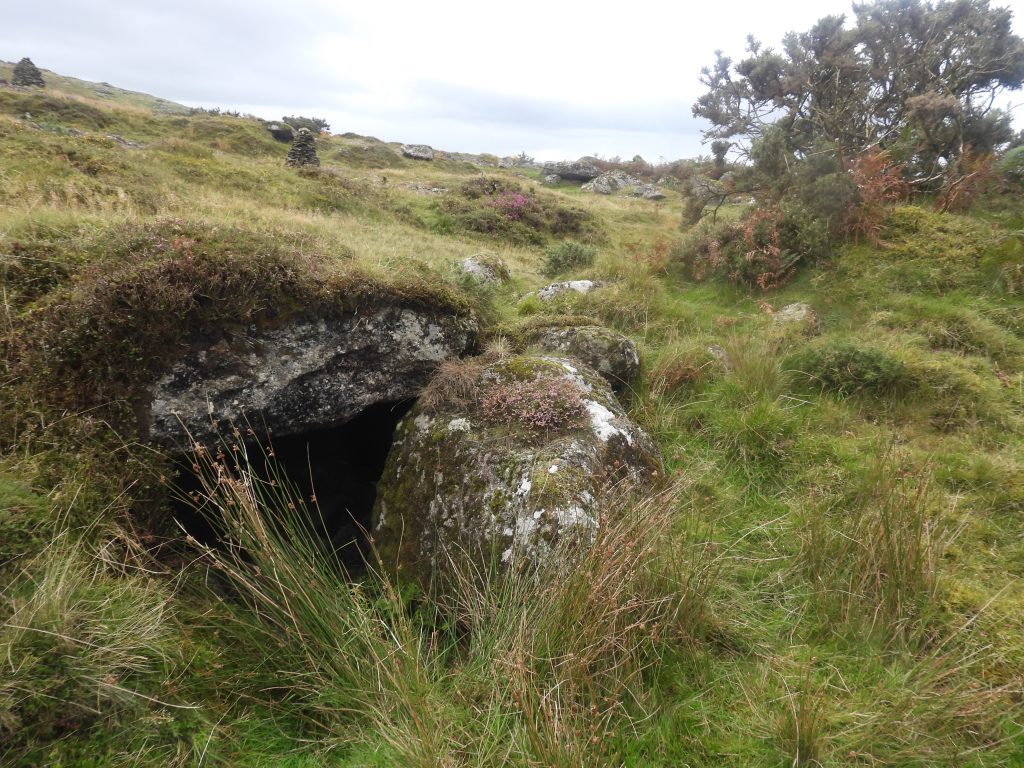
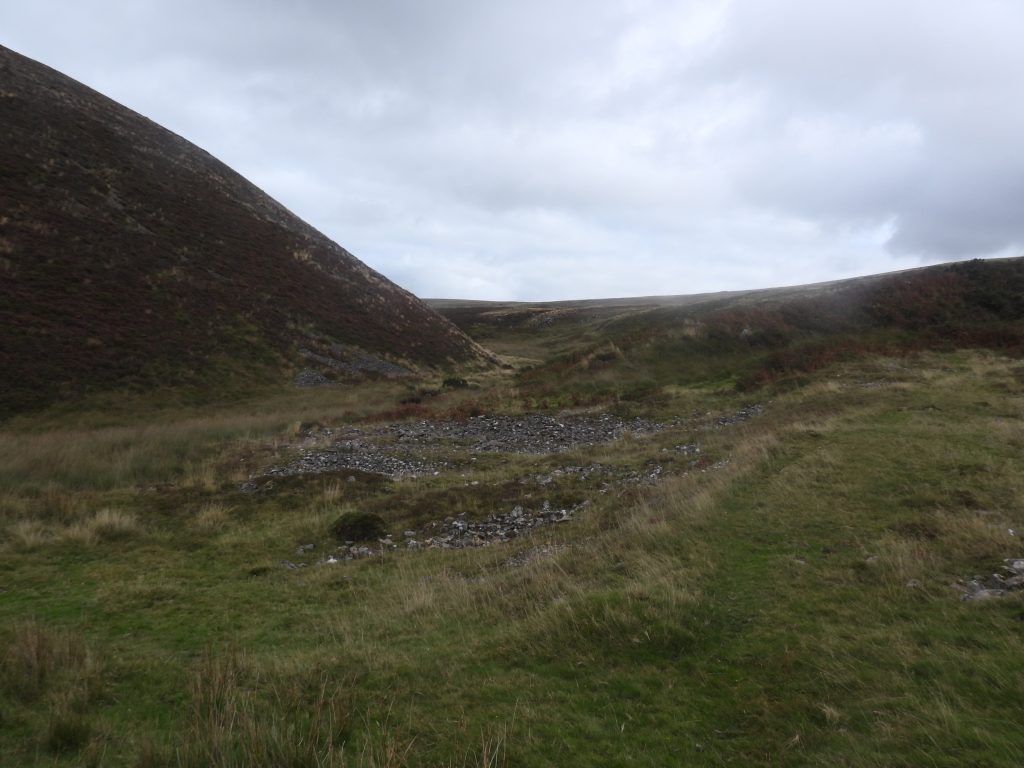
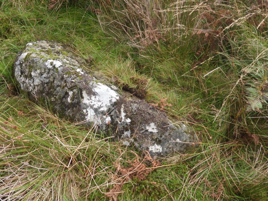
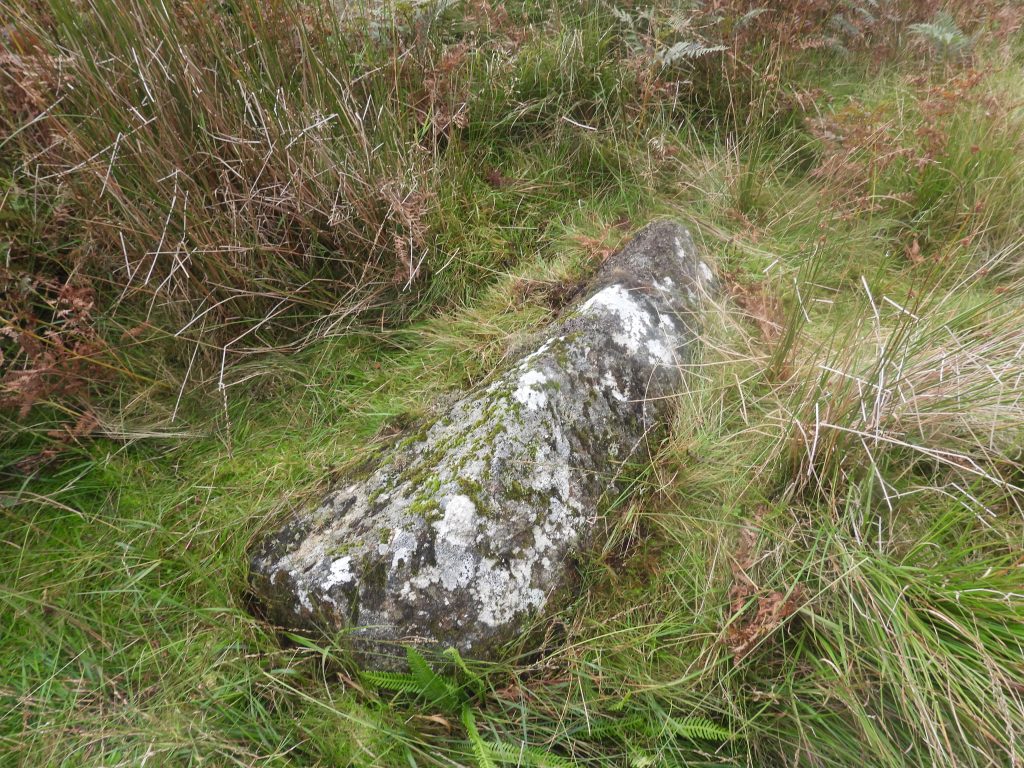
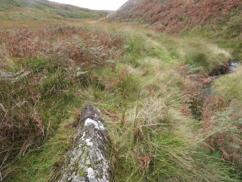
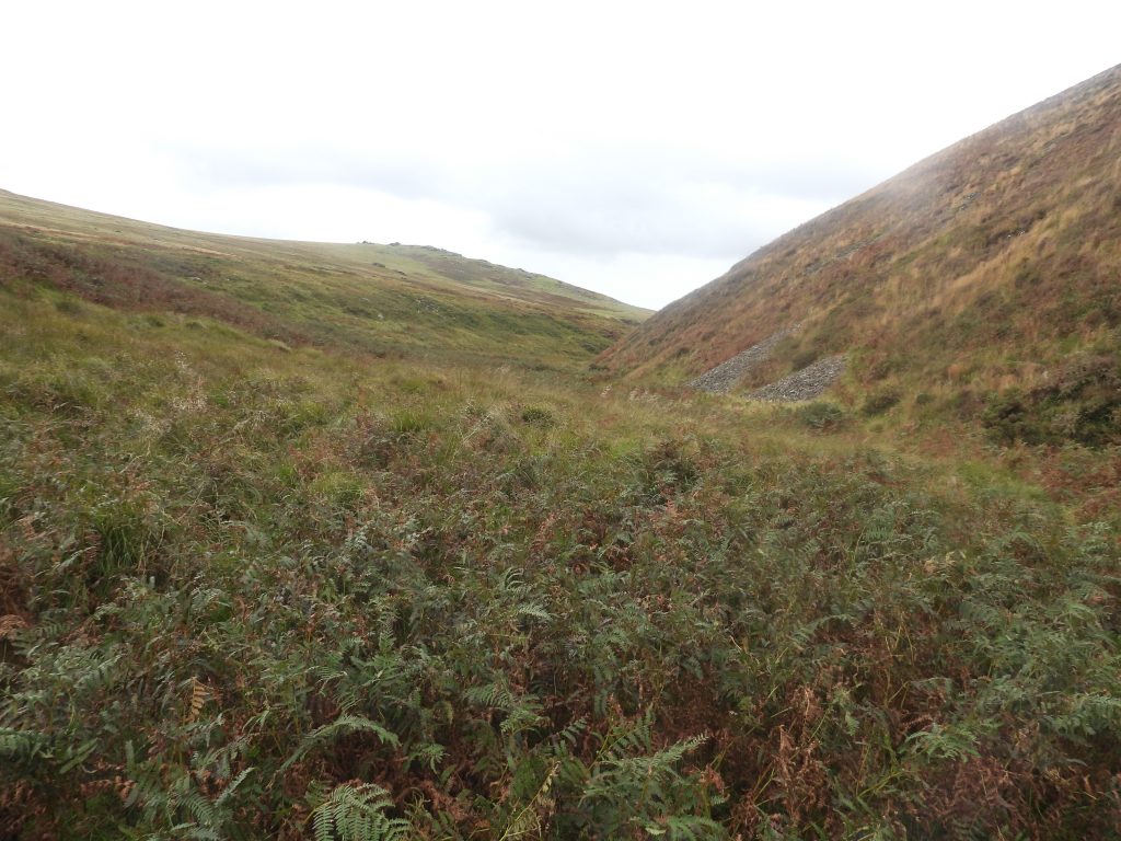
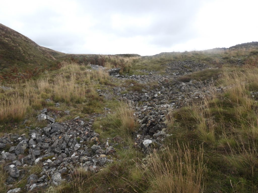
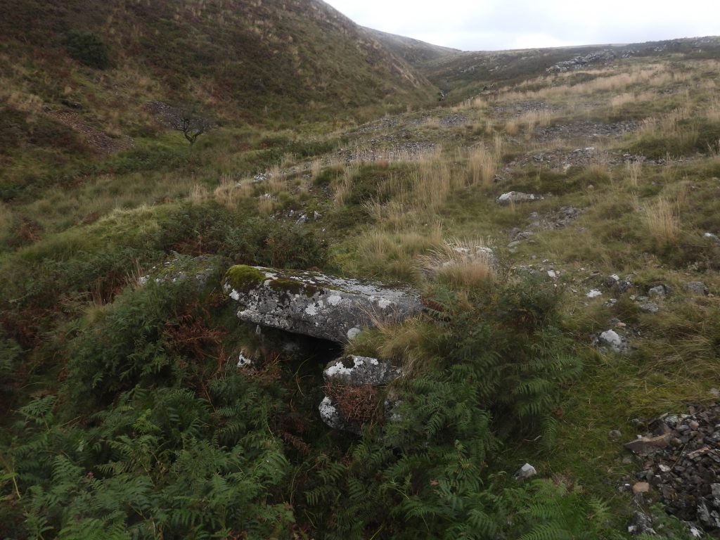
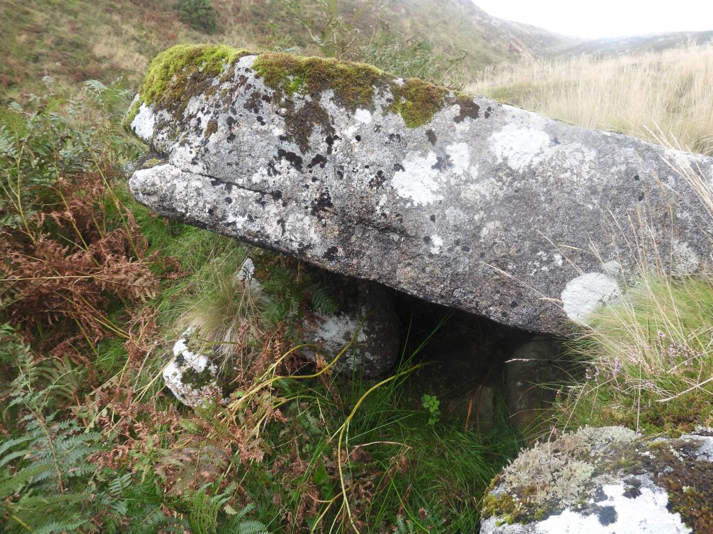
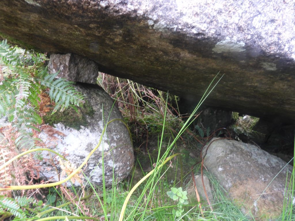
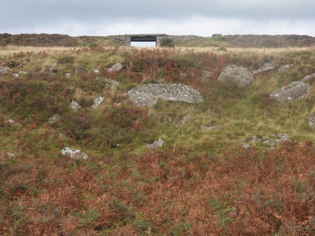
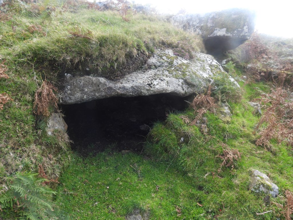
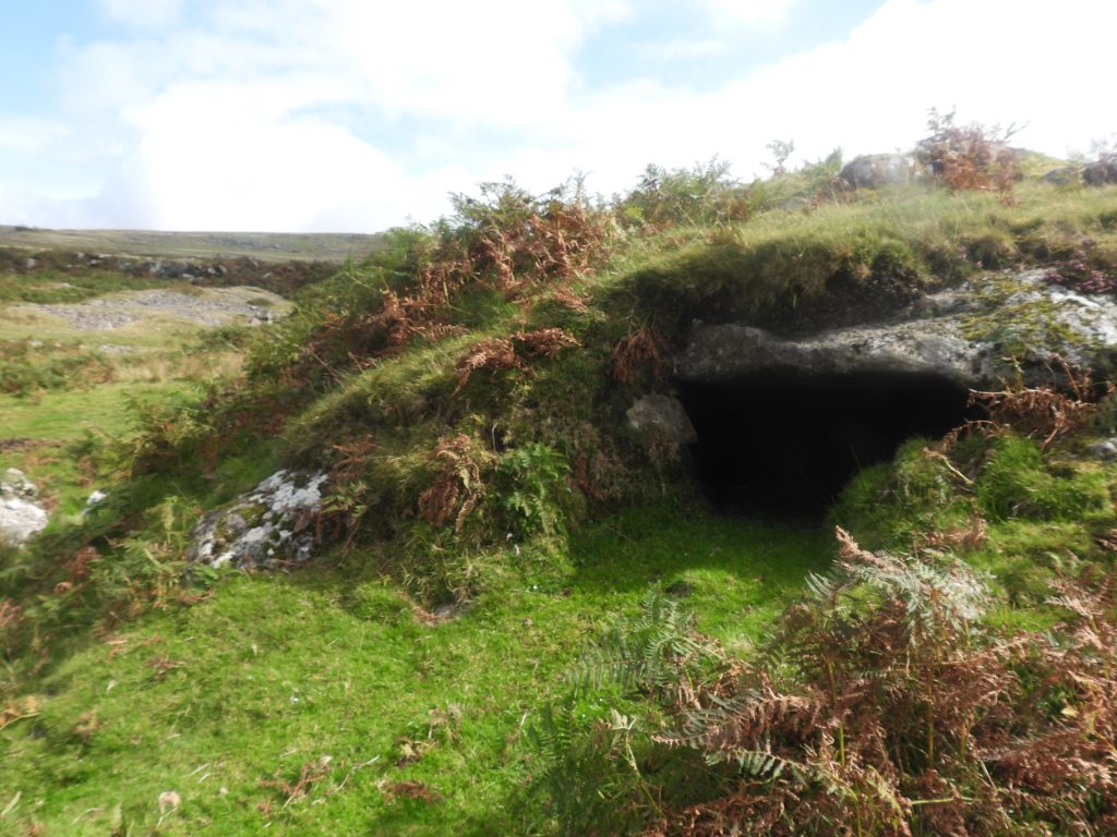
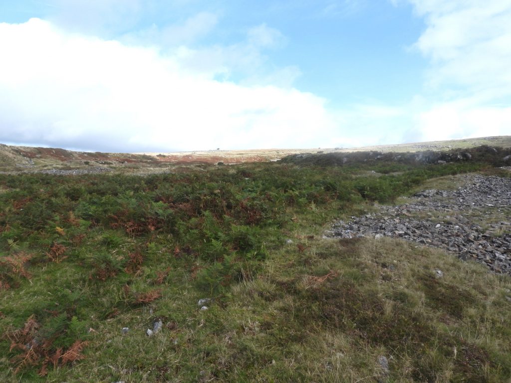
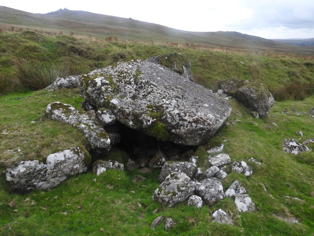
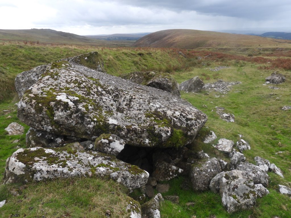
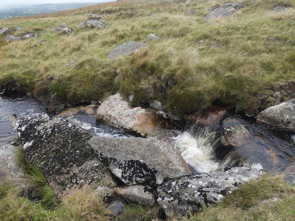
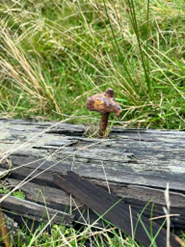
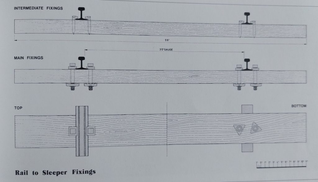
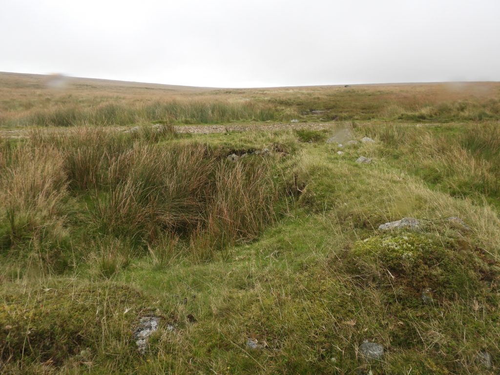
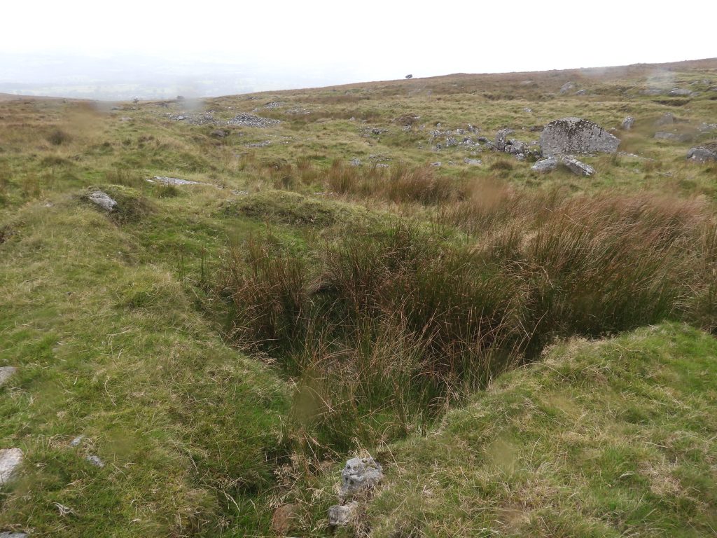
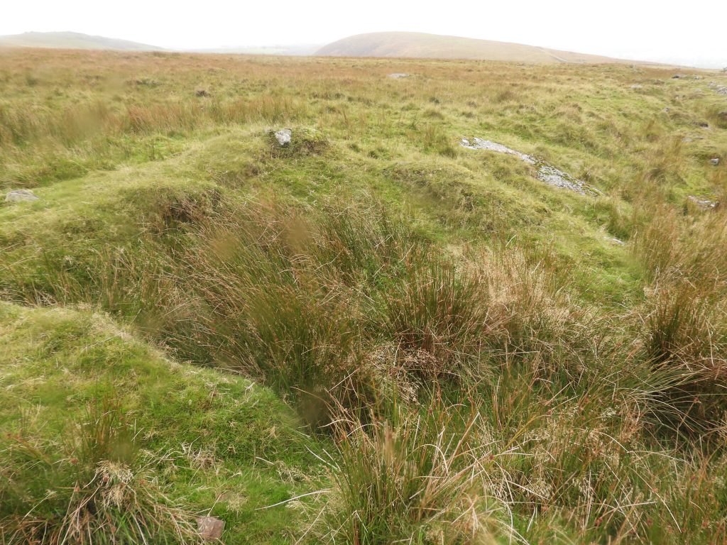
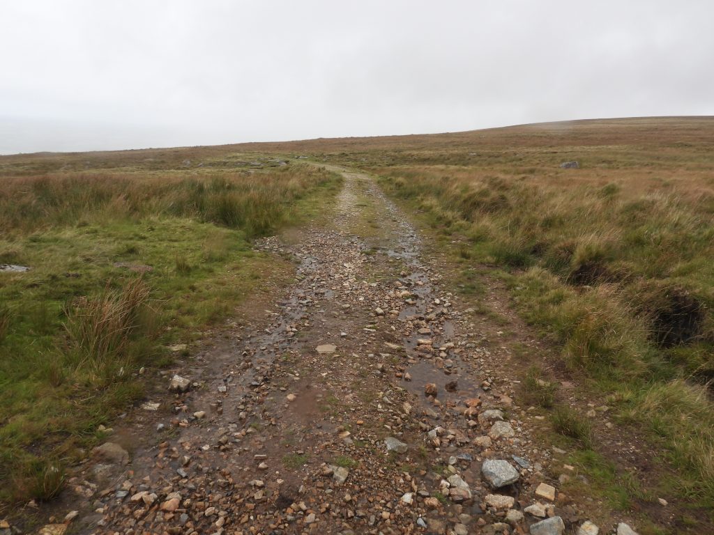
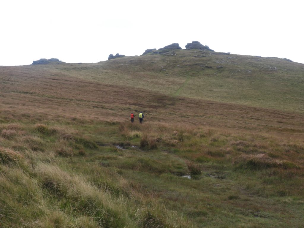
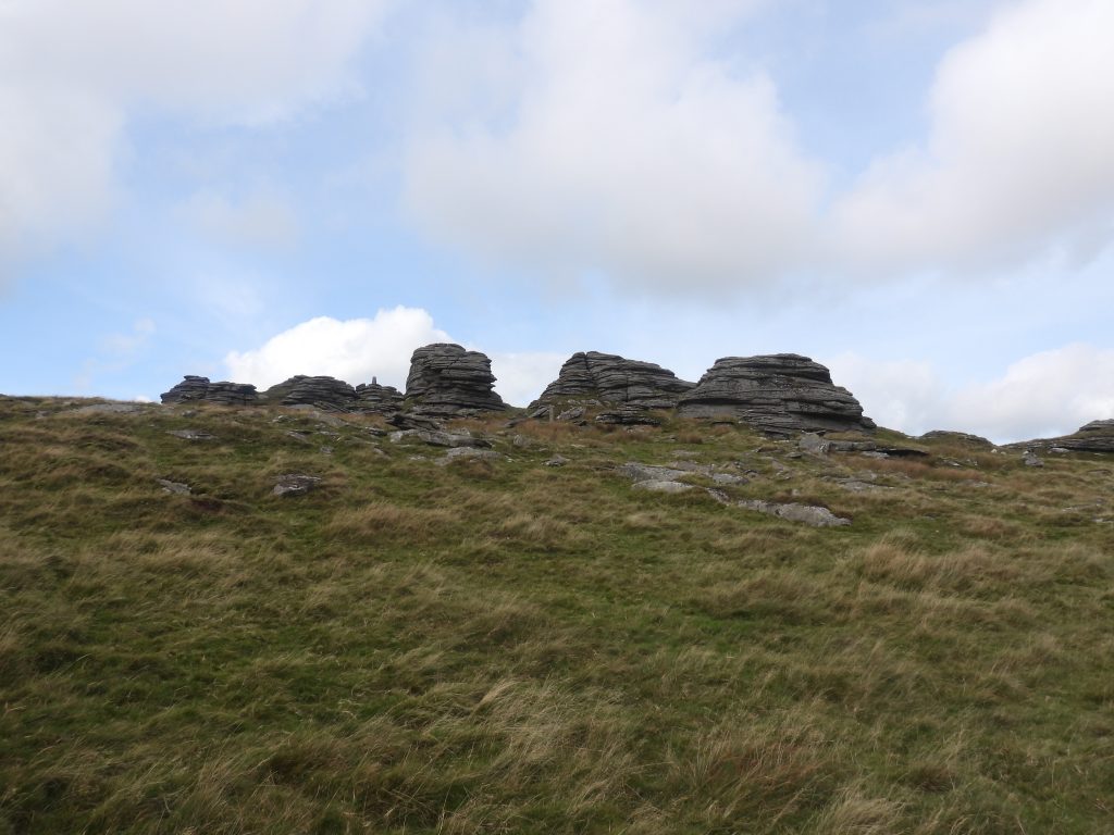
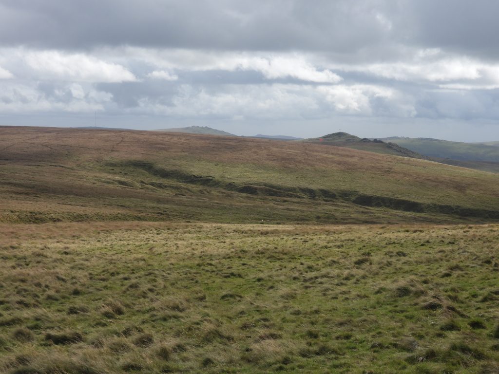
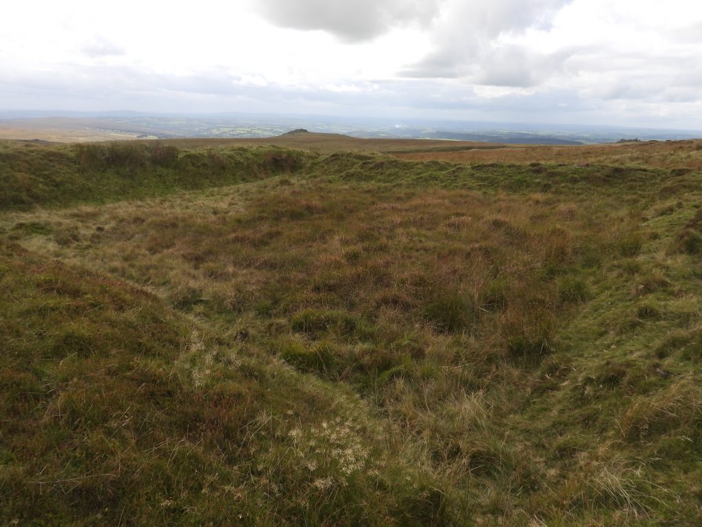
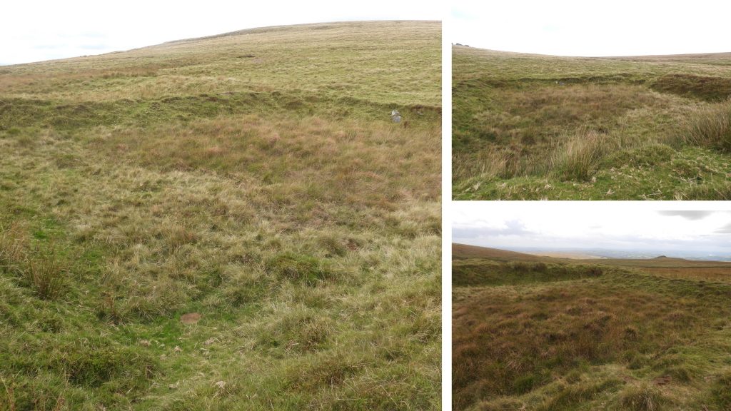
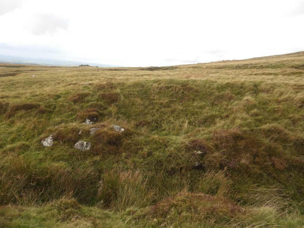
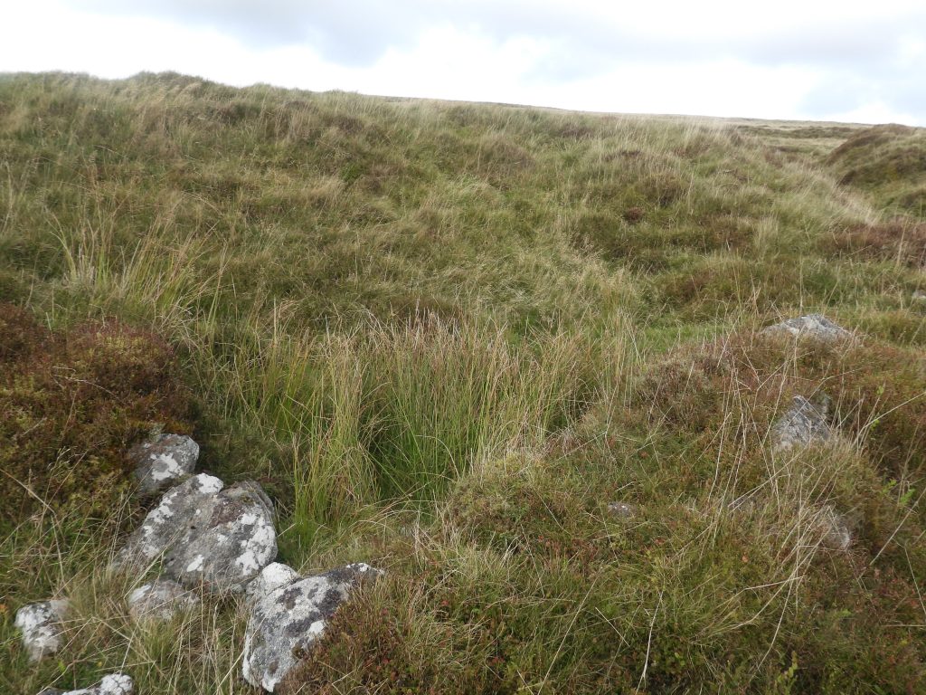
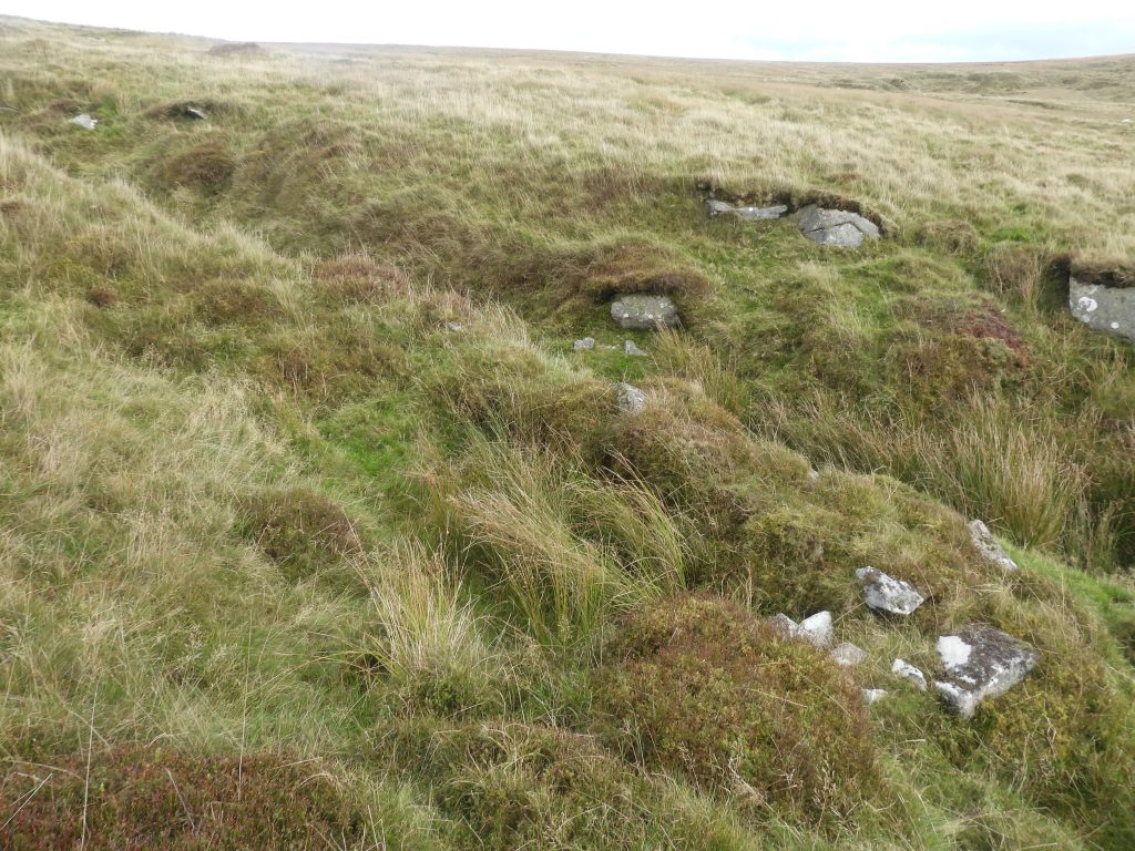
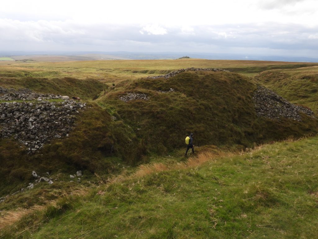
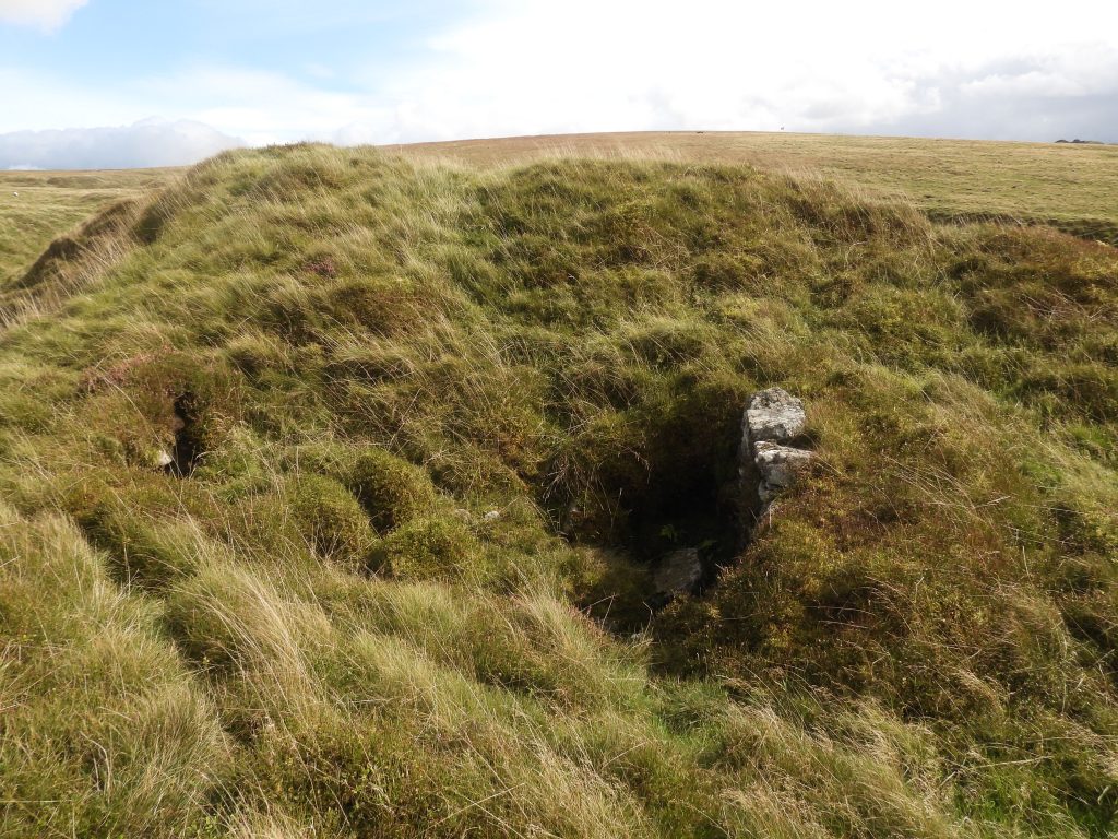
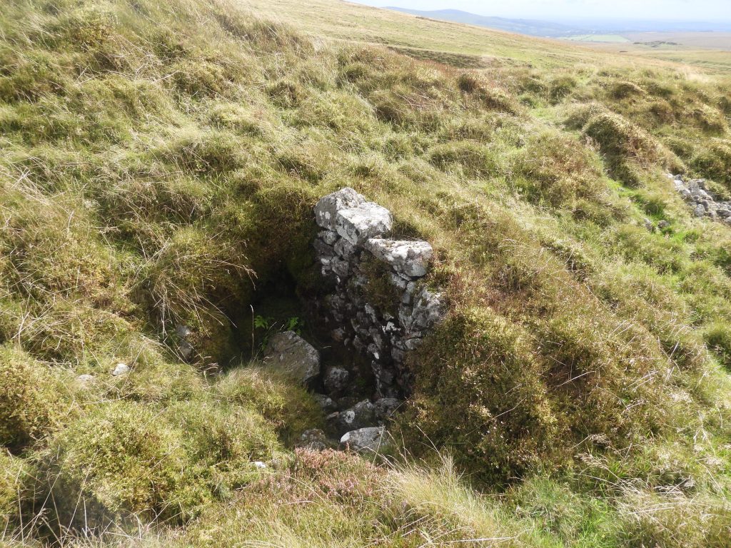
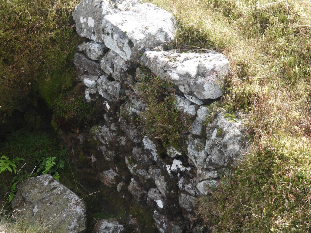
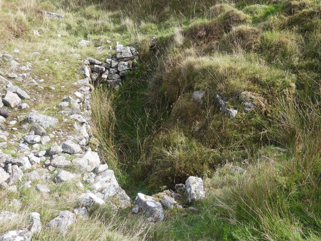
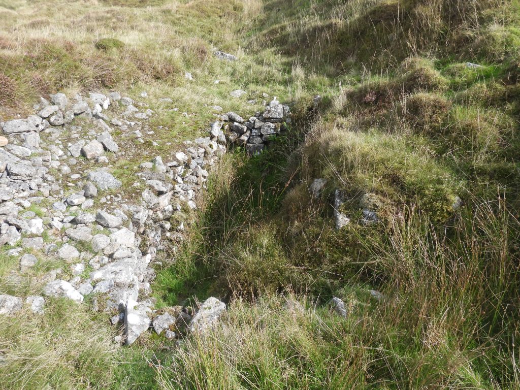
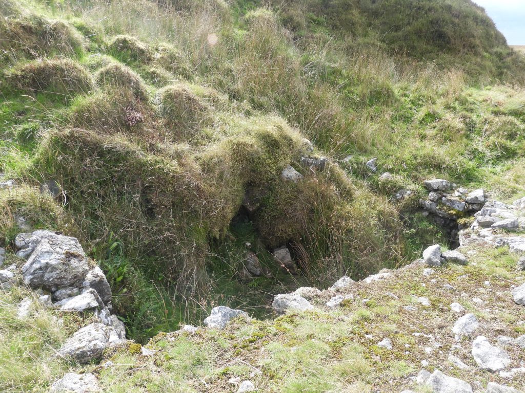
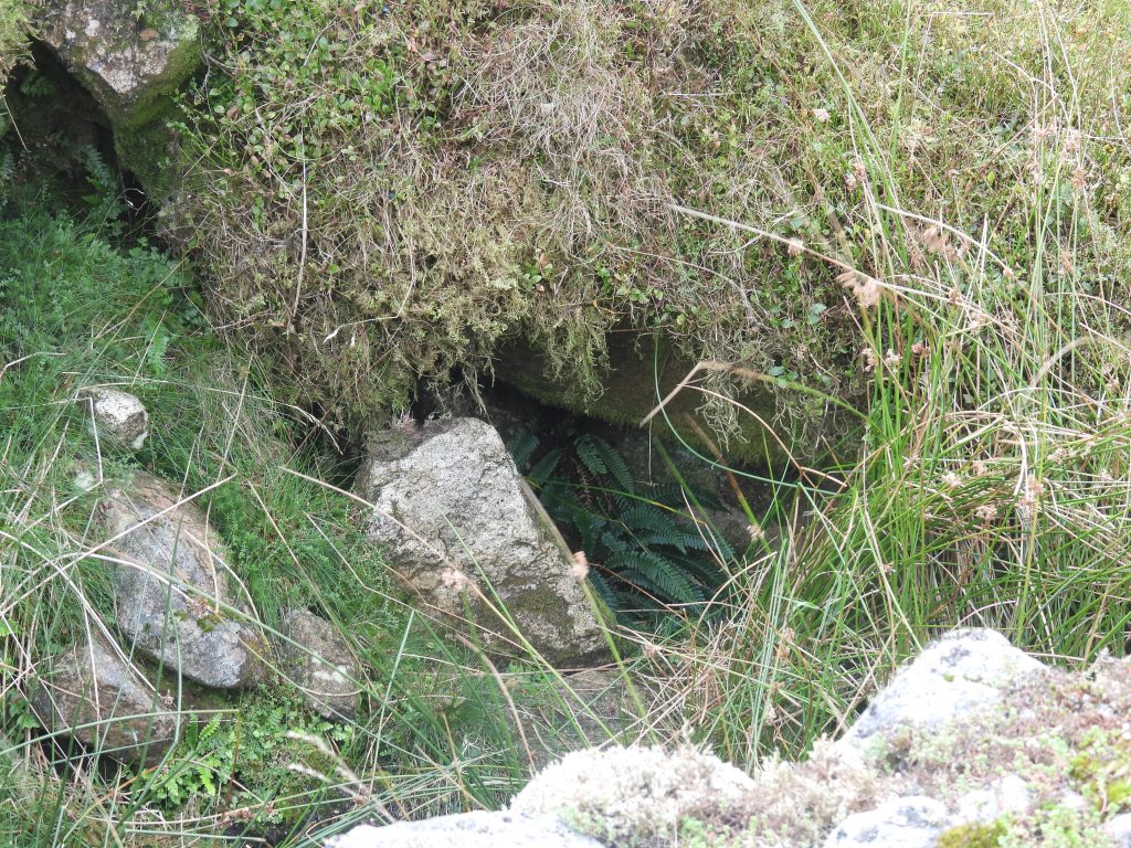
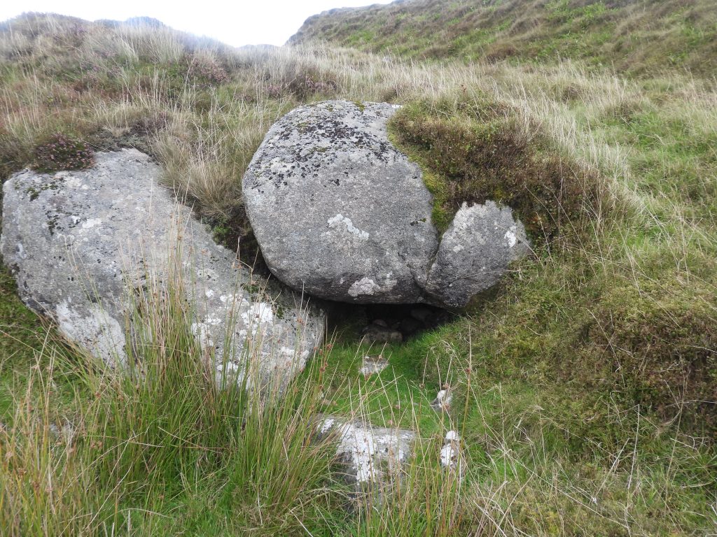
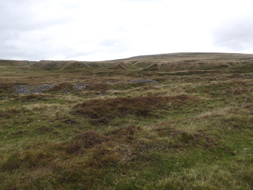
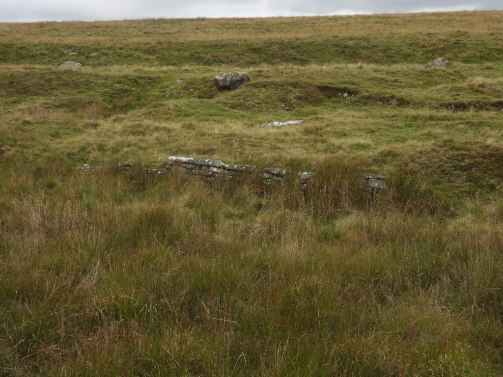
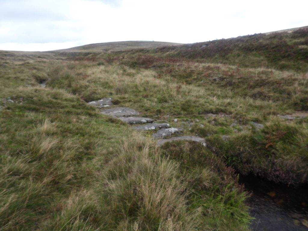
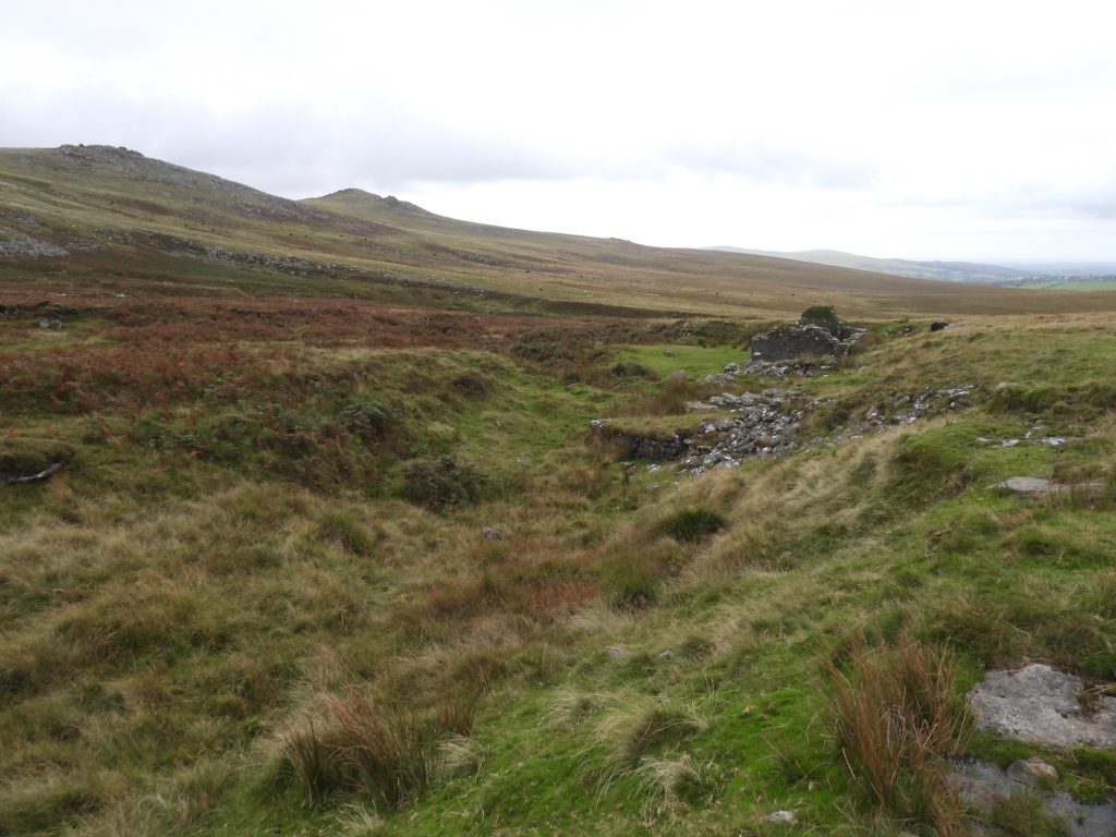
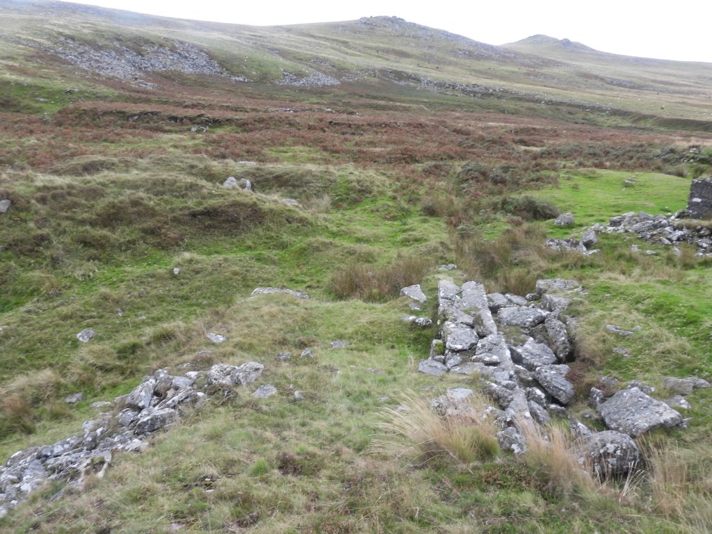
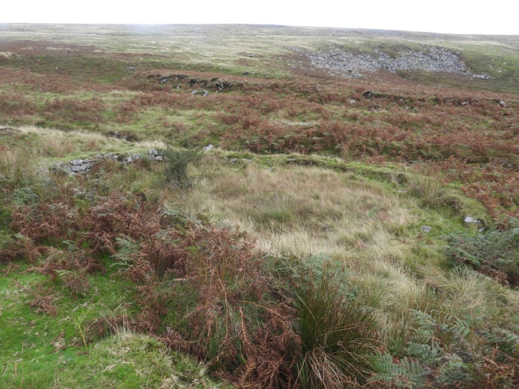
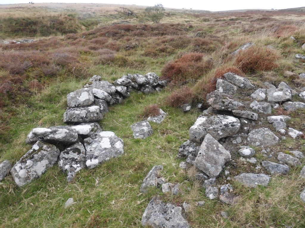
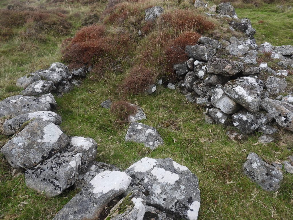
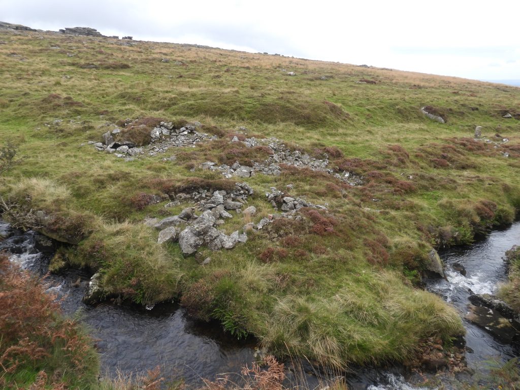
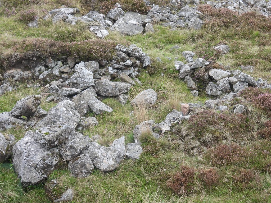
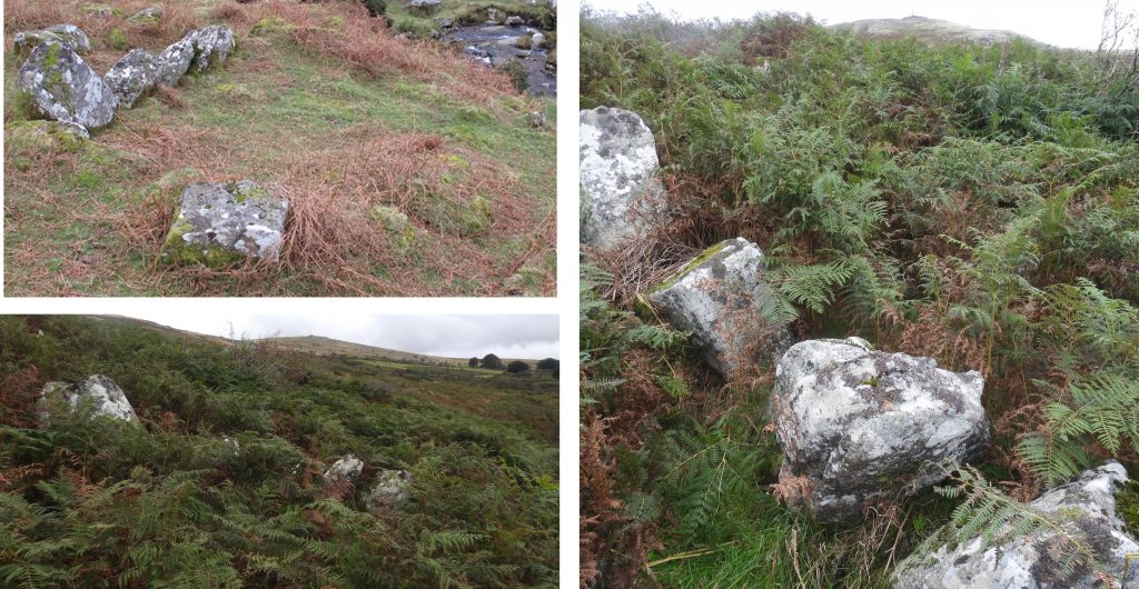
Sketch map showing the area and features covered in this post. The grey areas around the water courses are tinners workingsTinners workings along the Lyd with Great Nodden behindThis Cache (annotated 1) has a narrow entrance with a large space behindCache 1 is located at SX53840 86980This Tinners Hut (annotated 1 on the sketch map) has been constructed lengthways between streamwork mounds. It is orientated north to south, has thick walls but no defined entranceTinners Hut 1 is located at SX53757 86994. The hut unusually has a channel running under the south wall, presumably for drainageThis Cache (annotated 2) has internal walls which have been constructed with hundreds of small slate stones.Cache 2 is possibly the one described by R.N. Worth in 1895, viz: “A rock-shelter exists on the left bank of the river Lyd opposite Great Nodden, in an angle of the valley worked by tin streamers. A very large flat granite slab about 18 inches thick and partly buried, forms part of the crest of a small stony hillock. Dry stone walling has been built up underneath its southern and eastern corners, forming a right-angled cavity, with an entrance at the south end of the east face. It is about 3 1/2 feet in height, the longer side being 14 feet and the south side 11 feet long. Worth was sure that it pre-dated the tin streaming work”.Cache 2 is located at SX53903 87025Goldsworthy stacks in September 2025. A bit tongue in cheek reference to the contemporary artist Andy Goldsworthy it looks similar to his work. The stack has ‘grown’ over the last few years.The same ‘Goldsworthy’ stack taken in May 2020Tin workings along the Lyd, on the opposite banks to Great NoddenThe smaller of the ‘Goldsworthy’ stacks with a Lyd curving around Great Nodden behindThe larger of the ‘Goldsworthy’ stacks is located at SX53925 87056The smaller of the ‘Goldsworthy’ stacks is located at SX53919 87083The east wall of this Tinners Hut (annotated number 2 on the sketch map) utilises a waste mound The Tinners Hut has wide sturdy walls. There is no obvious entranceTinners Hut 2 is located at SX53890 87093This little structure, barely 1m by 1m is a modern construction and can be found at SX53939 87094This Cache is annotated as number 3 on the sketch map. It is a large cache with luminous moss growing insideCache 3 is located at SX53922 87104Tinners working under Great NoddenBenchmark B.M 1203.5 which is located where an un-named stream flows into the LydThe Benchmark can be found at SX54079 87301Contextual view of the rock with the Benchmark inscribed on itLooking south west down the Lyd from near the benchmark. The slopes of Great Nodden on the right and Arms Tor on the horizon (middle)More tin streaming up the Lyd to the west of the benchmarkThis possible Cache is annotated as number 4 on the sketch mapCache 4 is located at SX54167 87566Inside Cache 4. There appears to have been a small square stone deliberately placed perhaps to prevent the large block collapsing any furtherThe bridge of the Rattlebrook Peat Railway runs parallel to part of the tinners workings of the upper LydThis Cache is annotated 5 on the sketch map. Cache 5 is located at SX54344 87840Tinners workings of the upper LydThis possible Cache is annotated as number 6 on the sketch mapCache 6 is located at SX54557 88018Upper Lyd looking west to Great NoddenSmall waterfall on the upper LydTwo abandoned railway sleepers from the Rattlebrook Peat Tramway can be found at SX54863 88150. The Rattlebrook Head Peat Works is believed to run from around 1867, when the first sett licnece was granted through to 1931. The buildings at the works were constructed around 1873, which may have more or less been the time the railway was built. These sleepers are most likely around 150 years oldThe oak sleeper has a threaded ‘triangular’ plate attached to it. This is probably the same as found at Redlake Tramway on the south moorThis sketch is from a book by Wade on the Redlake Tramway. In circa 1911, the railway sleepers at Redlake had bolts and clips which were unusual insofar as the bolt passed through a clip (topside of sleeper), through the oak sleeper into a threaded ‘triangular’ plate with toothed corners which dug into the sleeper. This is shown on the bottom sleeper in the drawing above. This looks identical to the method used at Rattlebrook RailwayTinners Hut 3 is located adjacent to the Rattlebrook Peat Railway. It has earth bank walls covered in vegetationTinners Hut 3 is suggested by the Dartmoor Tinworking Research Group (DTRG) as having been mentioned by Eric Hemery in High DartmoorTinners Hut 3 is located at SX54899 88139Rattlebrook Peat Railway near Lydda Bridge, Tinners Hut 3 and Tigers MarshNext stop Great Links TorEast side of Great Links Tor. The trig point and the upright boundstone discernibleLooking east to the upper Doe Brook Tinners workings. Sharp Tor and Hare Tor in the middle distance and on the right and Great Mis Tor in the far distance in the middle of the photographThis square reservoir is 18 metres across by 2 metres deep was constructed to the west of Dick’s Well to supplement the supply of water for the tinners. Butler states there is a leat leading from one corner of he reservoirThe reservoir is located at SX55051 86031This Tinners Hut is annotated at number 4 on the sketch mapTinners Hut 4 is located on the edge and aligned to a linear openwork. The structure measures 3.1m by 2.1m and is 1.2m tall. There is an intact wall made of coursed block like stones. One side of the structure uses the scarpTinners Hut 4 is located at SX54888 86016The deep Tinners workings of upper Doe Brook with a 1.9m tall man for scaleThis Tinners Hut is annotated as number 5 on the sketch map. It is built into the spoil of a huge openwork. The structure measures 3.7m by 2.4mTinners Hut 5 is located at SX54846 85970Close up of the walling in tinners hut 5. There is at least 12 courses of stones here, which are 1.5m high Tinners Hut 6. This is in reality a narrow rectangular pit amongst waste mounds, which measures 3.1m by 1.5m. The walls are at least 1.3m tallTinners Hut 6 has three main walls of this structure with the fourth being possibly subject to partial collapseTinners Hut 6 is located at SX54862 85856A partial collapse within tinners hut 6 which looks like a cache but this is considered doubtful by the authorCache 7 is located at SX54813 85861Upper Doe Tor Tinners workings looking west towards the lower slopes of Great Links TorA small revetment adjacent to Doe Tor Brook Clapper across Doe Tor Brook a short distance above the dressing floor of Wheal Frederick. This is approaching from the north. The clapper is located at SX54623 85469. It is roughly at this point where a tramway starts. Wheal Frederick dressing floor and two-roomed building from the north. The tors in the mid-distance are from left to right are Sharp Tor, Hare Tor and Little Hare TorWheal Frederick wheelpit (right) and stamps area (left). The wheel pit is below a very pronounced leat embankment at SX54576 85394. The wheel was approx 8m x 1.5m and is known to have still been in position in late 1879. The stamps area lies just below the terminating point of the tramwayWheal Frederick appears to have operated on one year licences between 1850 and 1854. In 1853, the mine was part of the grandly named “Duke of Wellington consols”. Was this name part of sentimental patriotism with the Duke’s death on 14th September 1852. The two roomed mine building is believed to have been a mine office and / or count house. The sett was first recorded in 1845 in the Duchy of Cornwall mineral grants. The mine was active until 1872 and was associated with similar remains on the Rattlebrook to the east. The most northerly of two quite well preserved buddles at Wheal Frederick. This buddle does contain a melior (holed stone) at its centreMisc. Structure 1 is located down stream from Wheal Frederick. It comprises a semi-circular structure of loose stones. Its purpose or use is unknownMisc. Structure 1 is located at SX54573 85147Taking down the range flag at Doe TorMisc. Structure 2 across Doe Tor BrookMisc. Structure 2 is located at SX54136 85108Misc. Structure 3 is described on the Dartmoor Tinworking Research Group (DTRG) as a Tinners Hut. The author rather doubts this description as it only comprises of 6 large granite boulders, which do not appear to have ever been part of a building. That said, on modern OS maps it is shown as a black rectangle, which rather contradicts that statement. It is located at SX53291 85404