A collection of walks, discoveries, insights and pictures of exploring Dartmoor National Park
February 17, 2026
Nun’s Cross Mine
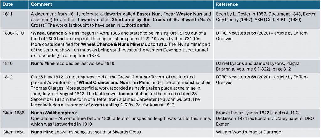
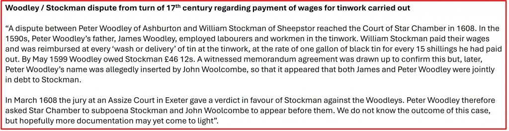
Tin works around the Nun’s Cross area appear to have been first documented in the late 16th and early 17th centuries being known as ‘Westernun’ and ‘Easternun’, adjacent to another tinworks called Shurburne by the Cross of St. Siward (Nun’s Cross) as referenced in a document 1343, found in Exeter City Library in 1957. It is likely that these tinworks (the document dates from 1611) relate to the alluvial and/or open works seen today, especially those to the west/north west of the cross. Additionally to this, at ‘Westernun’, a DTRG article written by Dr Tom Greeves in 2020, records a dispute between Peter Woodley of Ashburton and William Stockman of Sheepstor over non-payment of wages for ‘wash or delivery’ of tin at the tinwork, which reached the Court of Star Chamber in 1608.
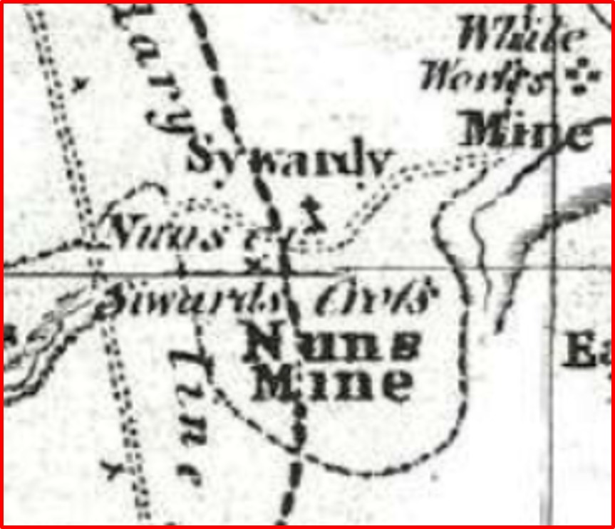
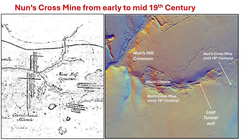
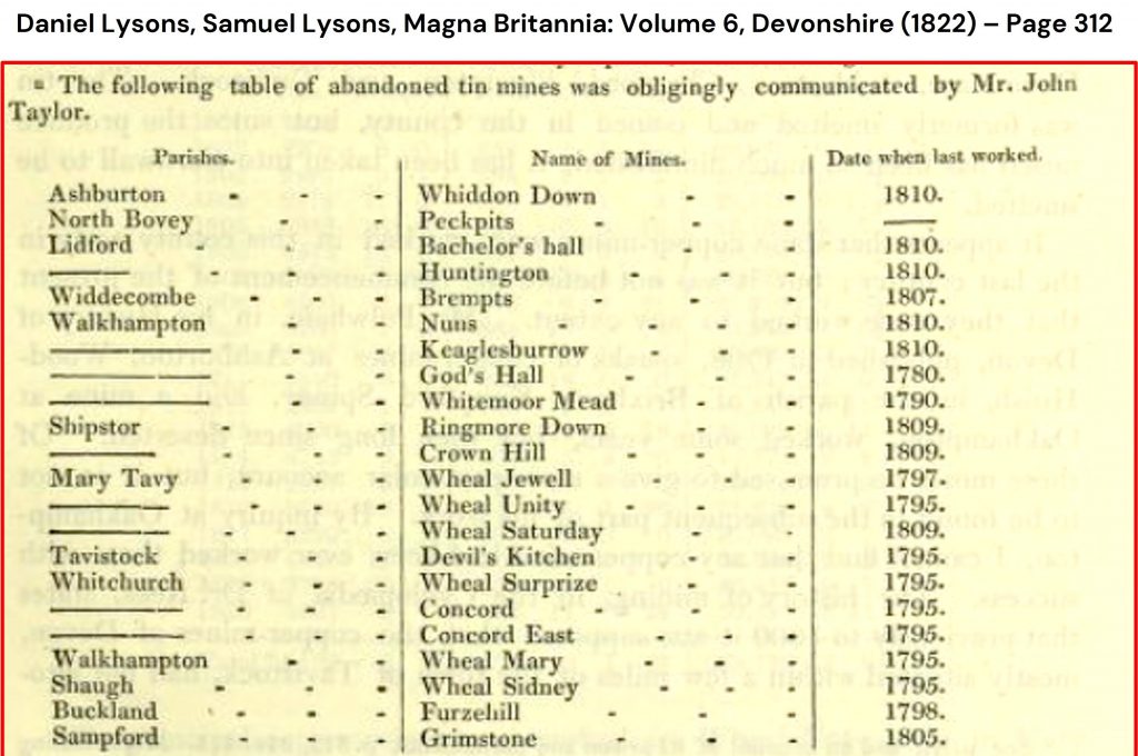
Fast forward to early 19th century, the ‘Wheal Chance & Nuns’ mine is documented as beginning in April 1806 and stated to be ‘raising ore’. Further documents for the mine are dated up to 1812. The ‘Nun’s Mine’ part of the venture shown on maps as being south-west of the western Devonport Leat tunnel exit according to a map from 1873. This mine is likely to have been around where ‘Westernun’ was referred to 200 years prior.
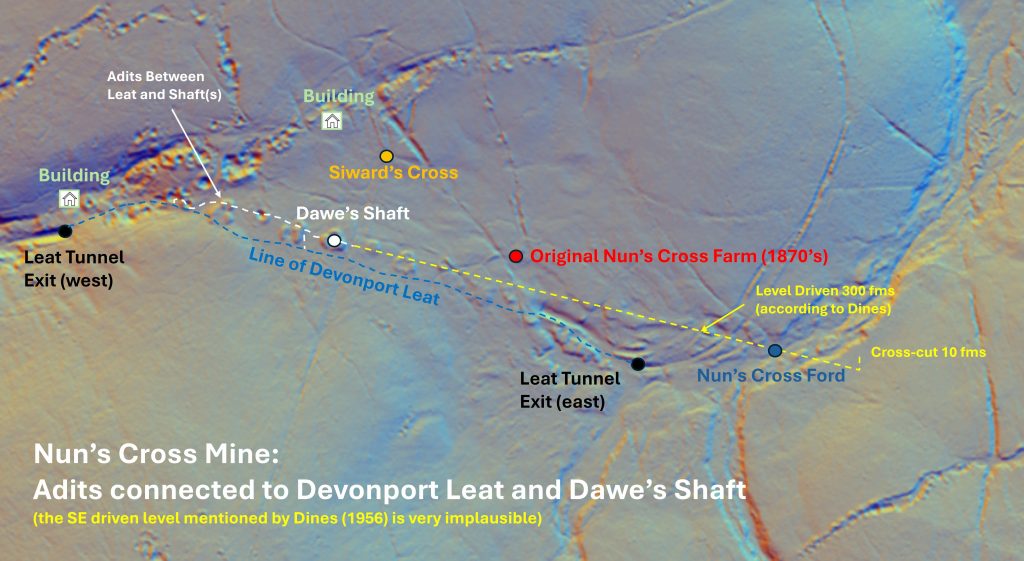
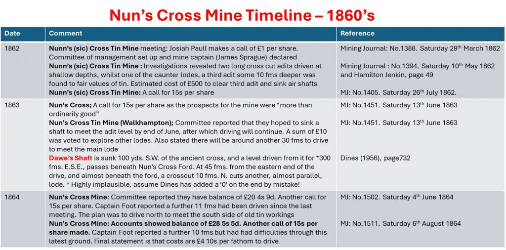
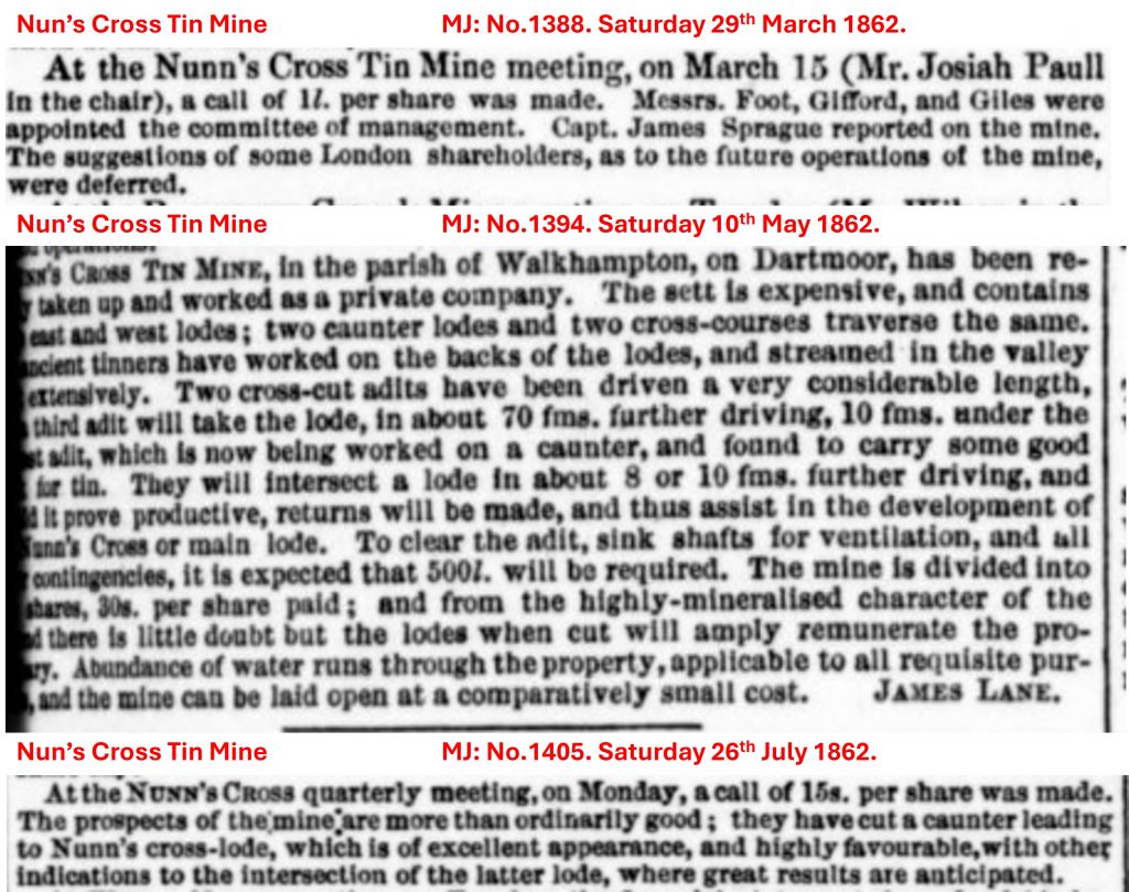
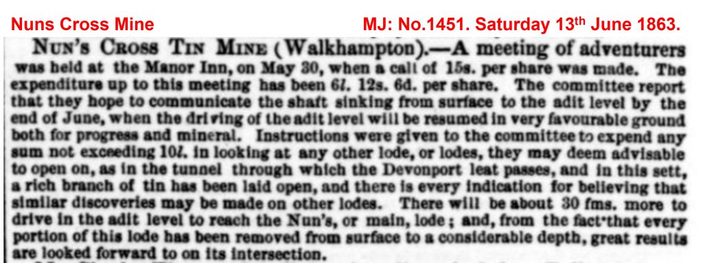
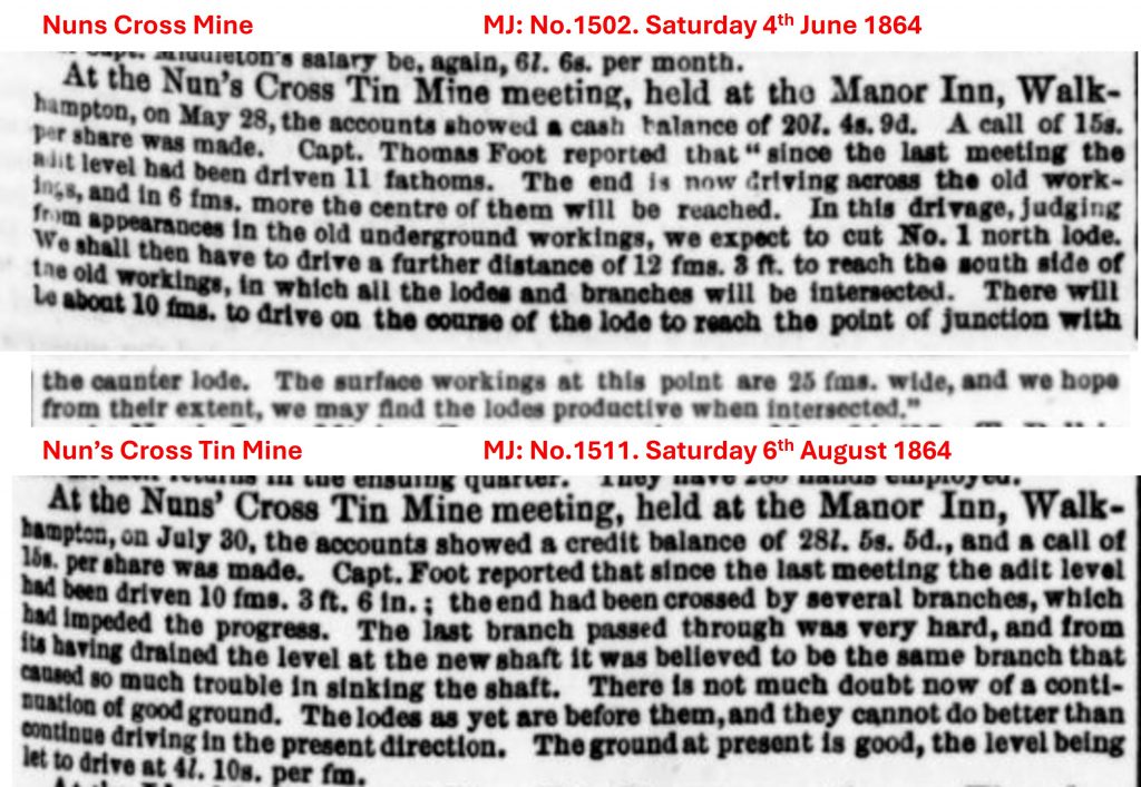
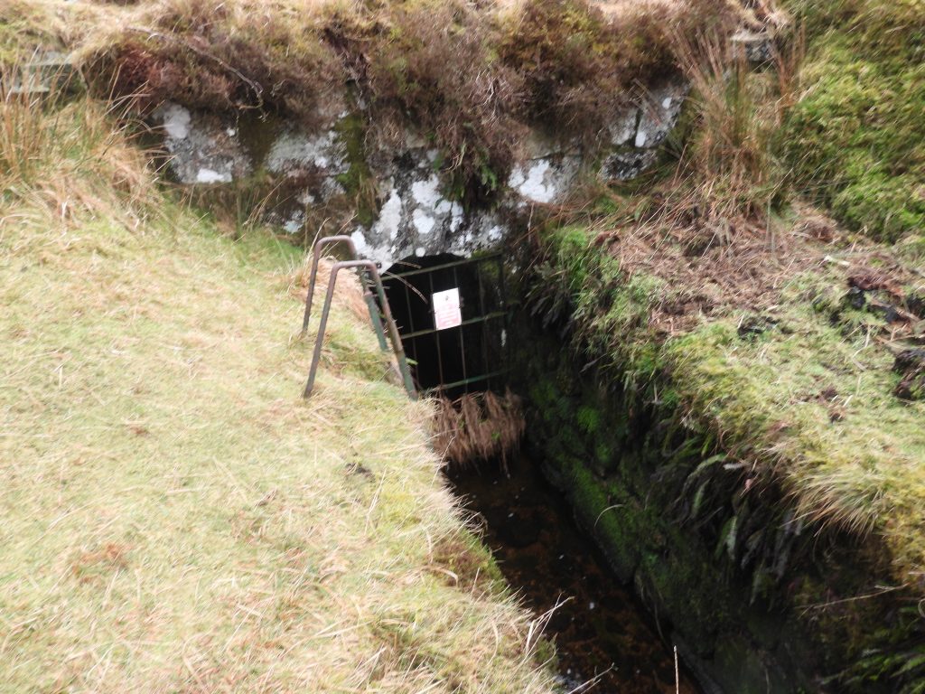
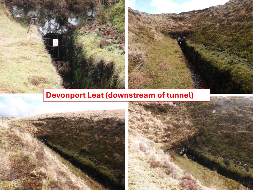
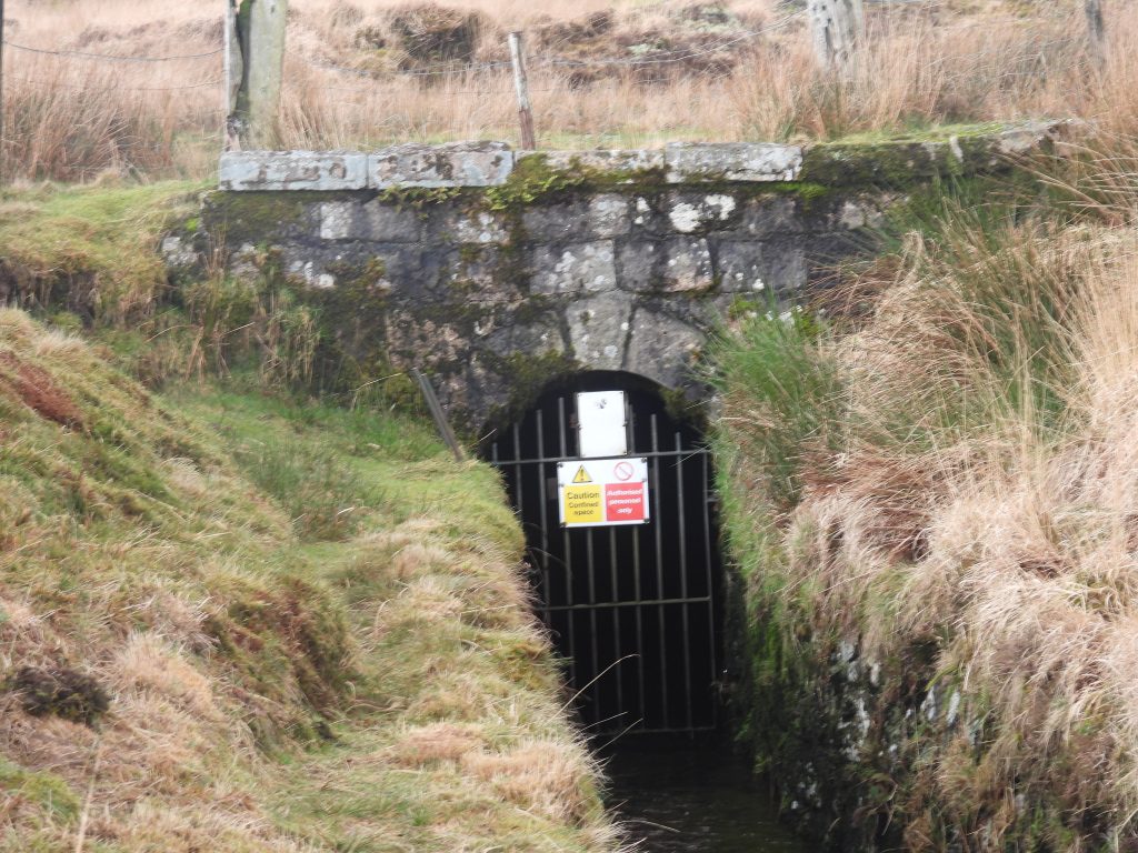
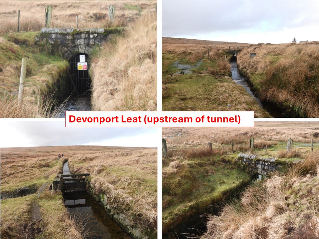
By the second half of the 19th century, the ‘Nun’s Cross Mine’ operation appears to have shifted to the east, closer to the cross. A mining sett licence was granted in January 1862 and the operation said to contain three east-west tin lodes and two caunter lodes, ‘all of which showed signs of having been extensively developed on the backs of the old men’. Between 1862 and 1864, exploratory work was carried out on these lodes by a small cost-book company called Nun’s Cross Tin Mine. Two long cross-cut adits were driven at shallow depths, whilst on one of the caunter lodes* a third adit was dug – all seemingly carrying ‘fair values of tin’. During this time ventilation shafts were sunk to the adits and a main shaft (Dawe’s) was sunk in June 1863. Access to the adits and the shafts was also secured by using the Devonport Leat tunnel. Operations seemed to have ceased before the end of 1864 without recorded production. A further mining sett licence was granted in July 1872 (which was almost a carbon copy of the 1862 licence) but nothing seems to have come from it. This post contains maps and photographs, which relate to the 19th century operations.
*Caunter being a term that refers to a lode that runs at an offset angle to the main lode
Bibliography
Nun’s Cross Mining Sett Licence – (1862) – The Box (ref: 874/48/47)
Nun’s Cross Mining Sett Licence – (1872) – The Box (ref: 874/48/63)
Dartmoor Tinworking Research Group – (2020) – Newsletter, number 59
A.K. Hamilton Jenkin – (2005) – Mines of Devon, page 49
H.G. Dines – (1956) – The Metalliferous Mining Region of South-West England, page 731
Daniel Lysons and Samuel Lysons – (1822) – Magna Britannia: Volume 6, Devonshire – Page 312
Mining Journals – No.1388. Saturday 29th March 1862; No.1394. Saturday 10th May 1862; No.1405. Saturday 26th July 1862; No.1451. Saturday 13th June 1863; No.1502. Saturday 4th June 1864; No.1511. Saturday 6th August 1864
Exeter City Library – (1957) – Document 1343
DRO Exeter – Lysons 1822 p. cclxxxi. M.G. Dickinson 1974 (ex Bastard v. Carey papers)
Mike Brown – (1999) – Field Guide to Dartmoor; Volume 15 – The Middle Plym & Tributaries Eylesbarrow Nuns Cross, page 14
Eric Hemery – (1983) – High Dartmoor, page 138
Debbie Lister – (2026) – DW Research Services, Pers. Conv.
Dr Tom Greeves – (2026) – Pers. Conv.
Dartmoor Chris – (2026) – Pers. Conv.
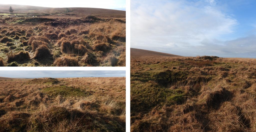
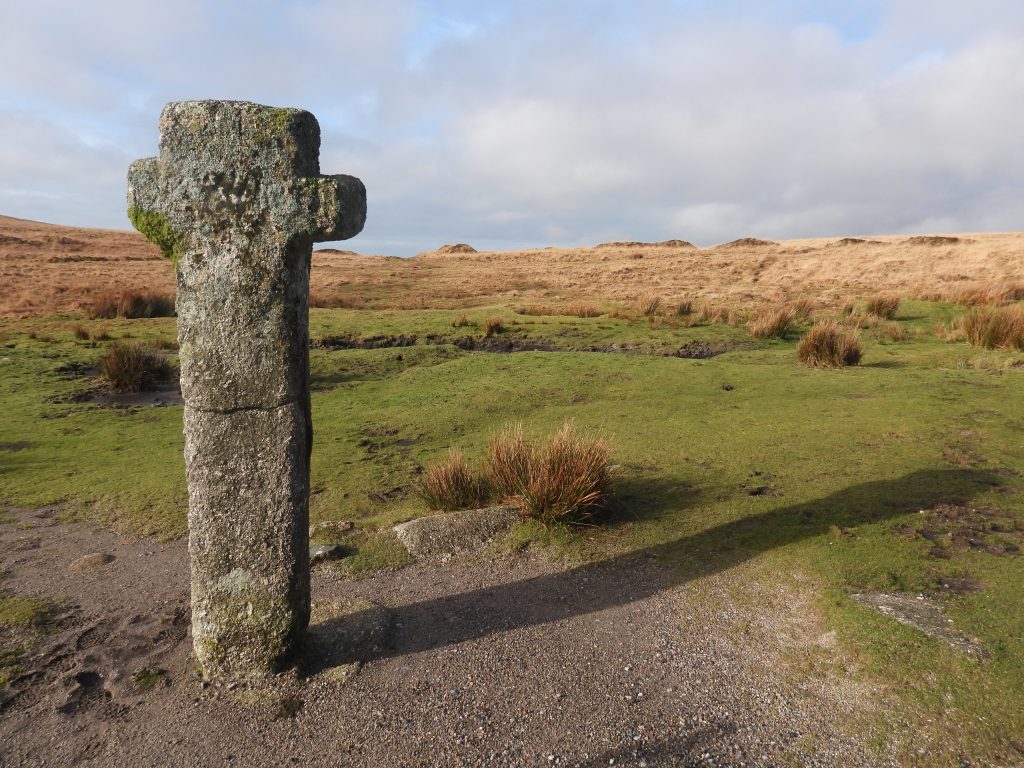
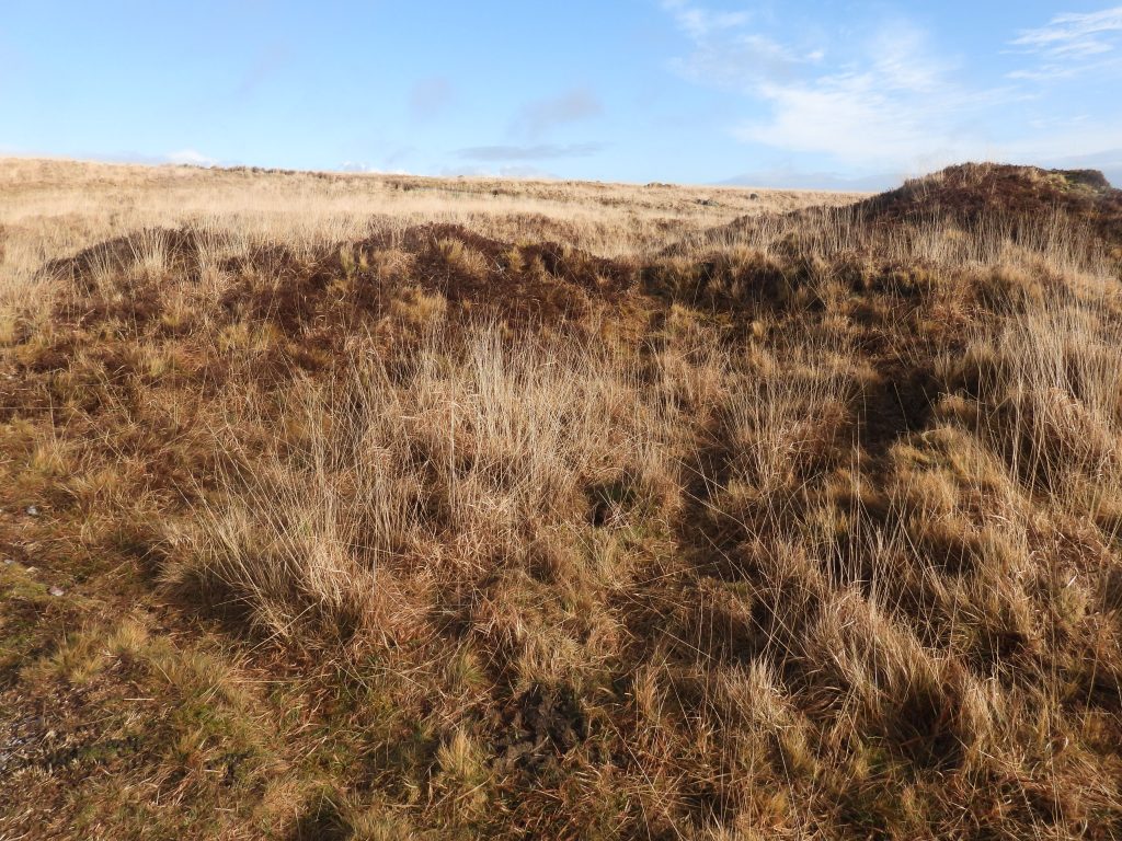
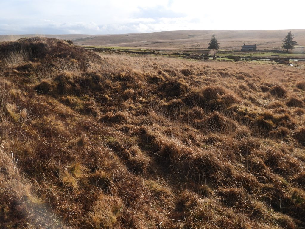
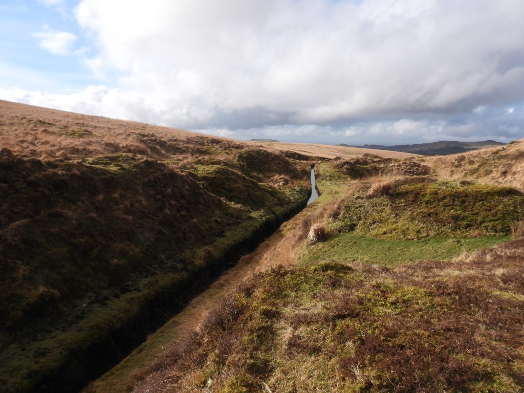
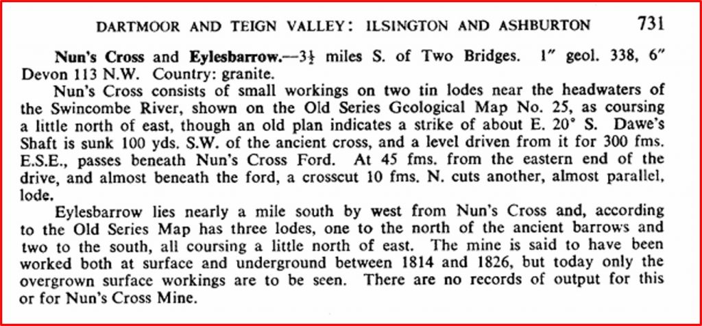
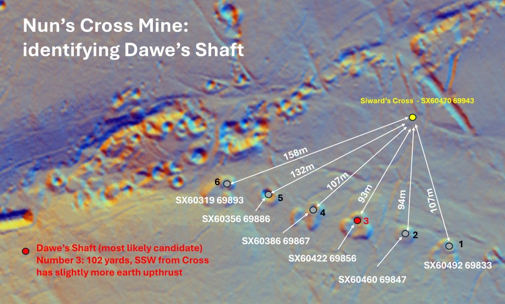
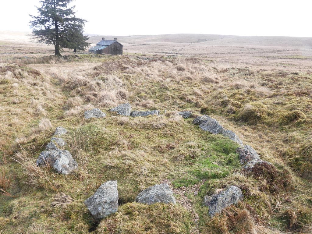
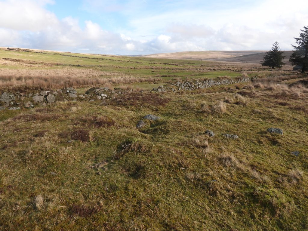
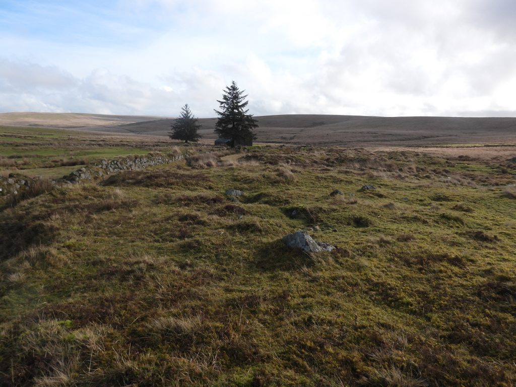
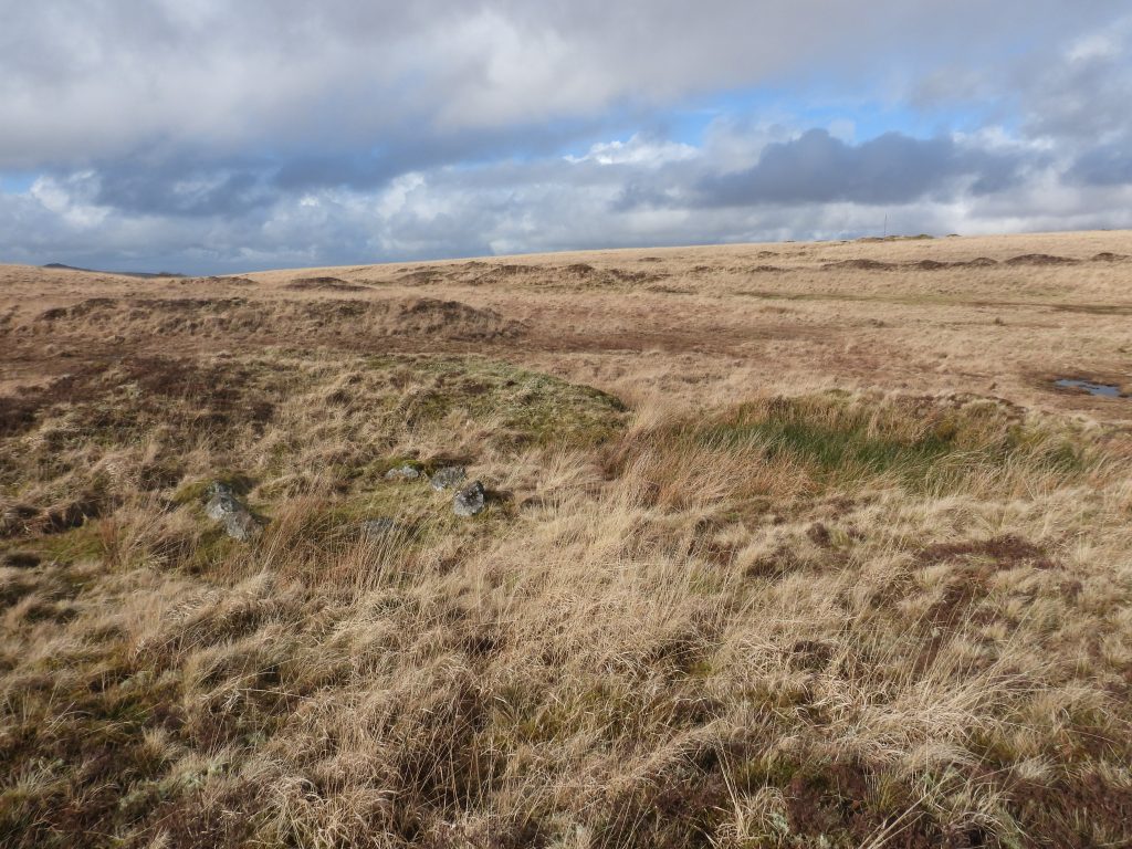
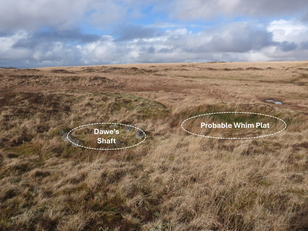
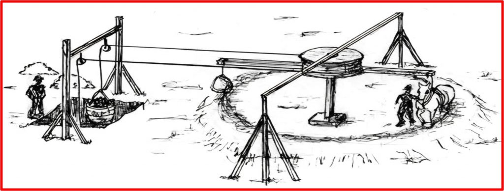
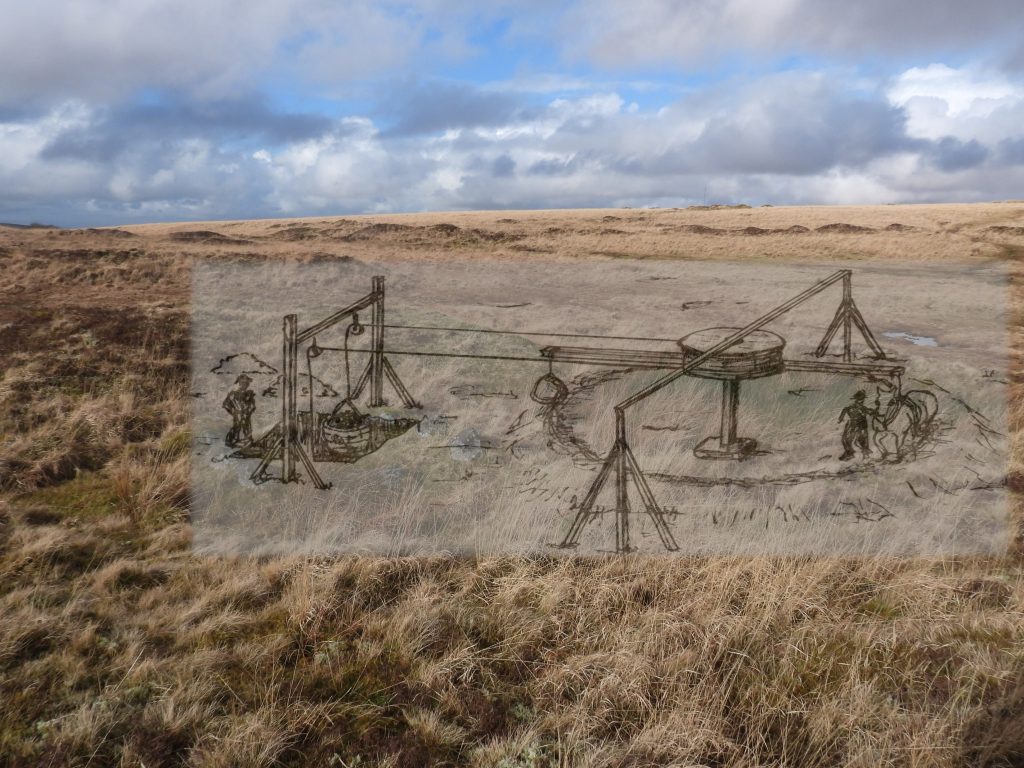
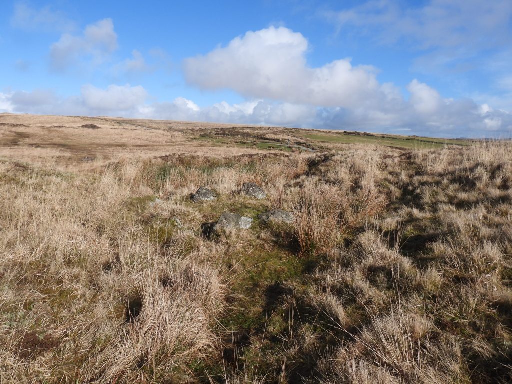
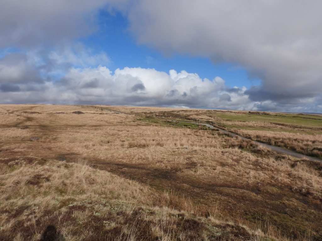
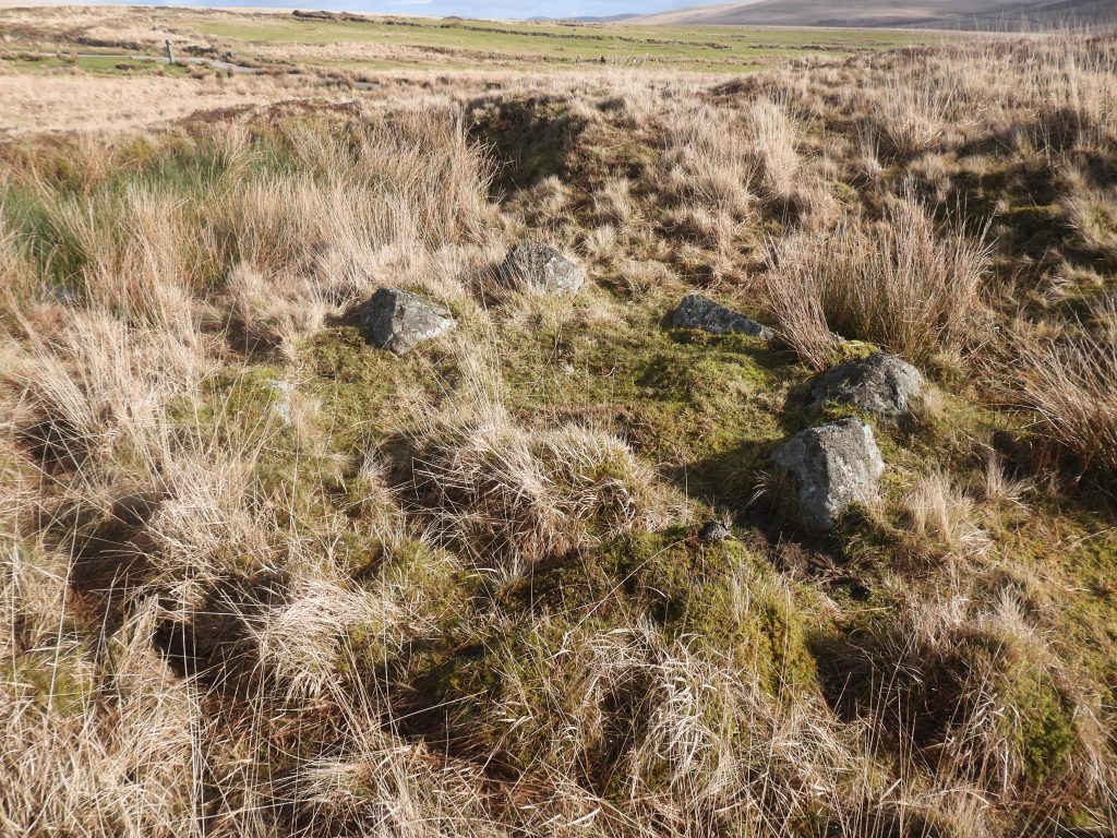
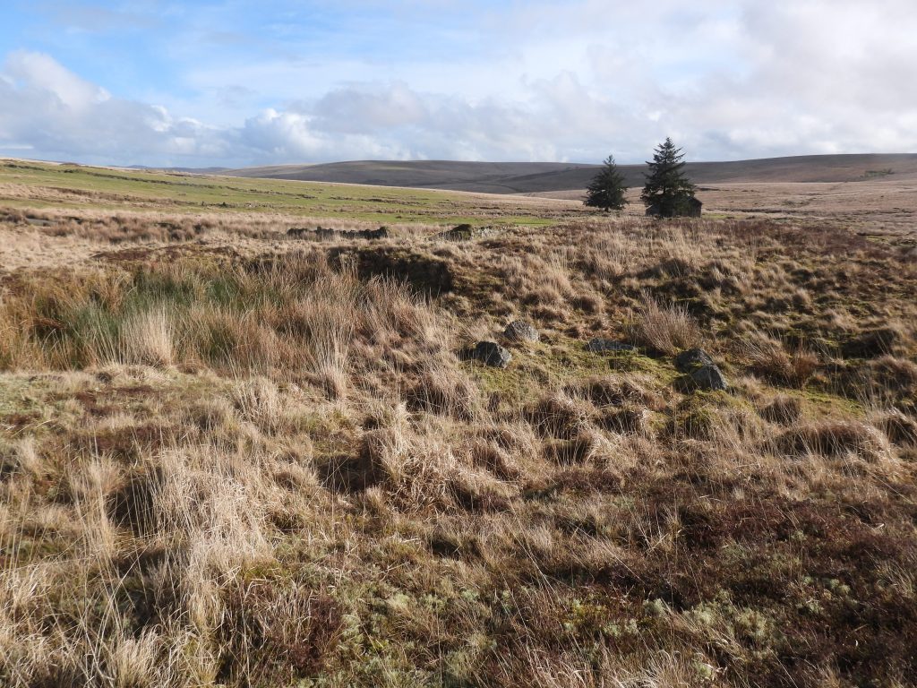
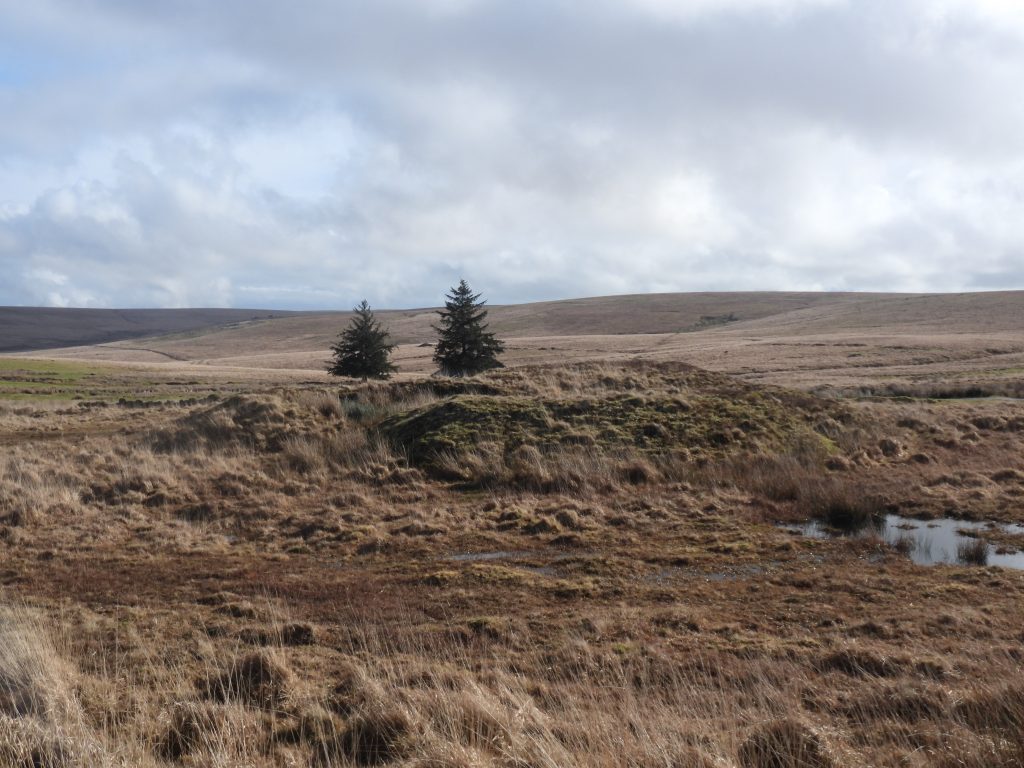
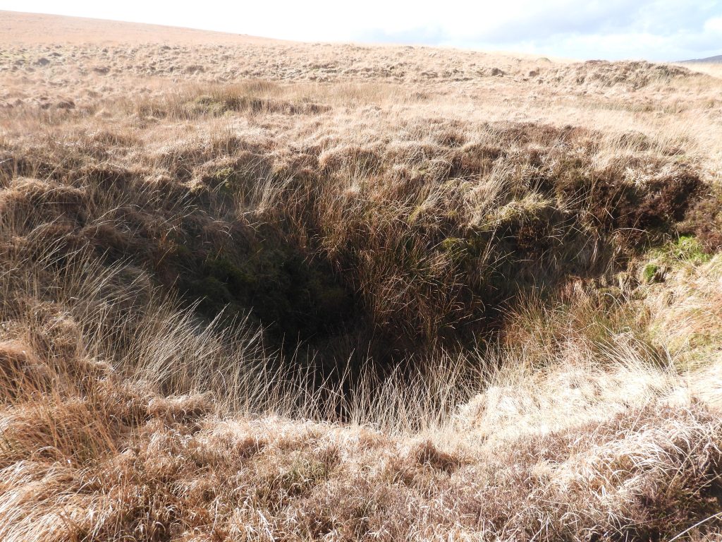
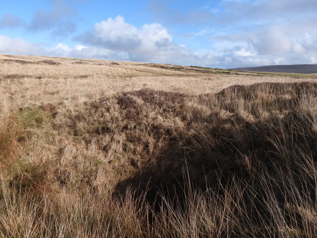
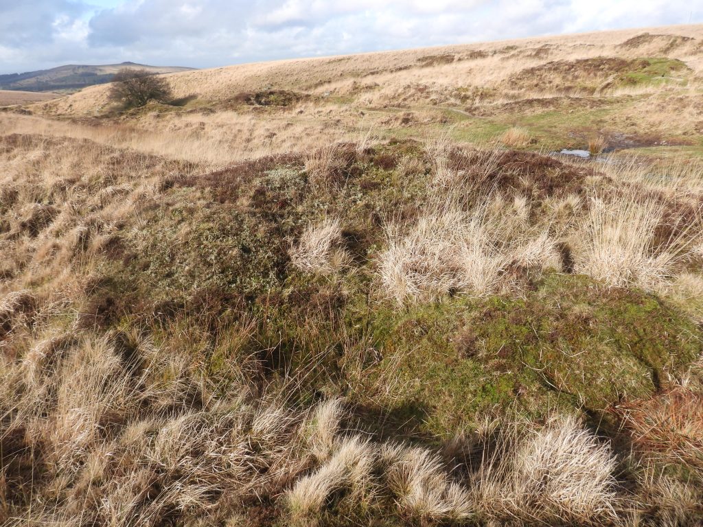
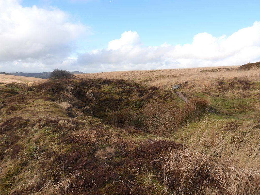
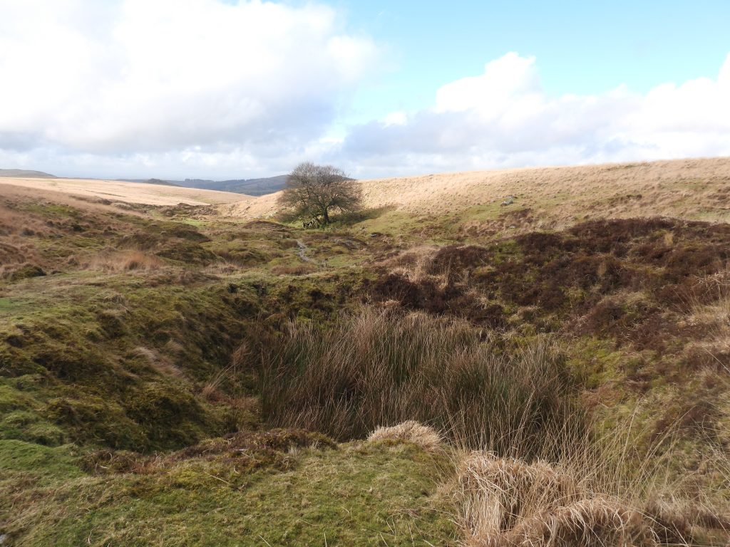
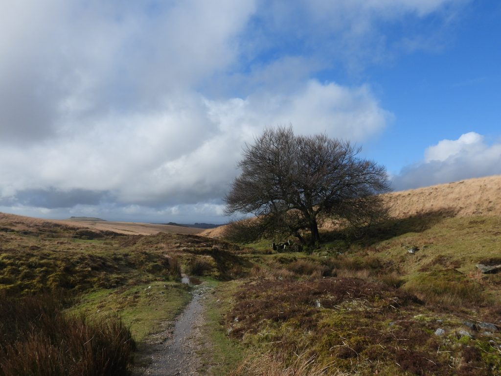
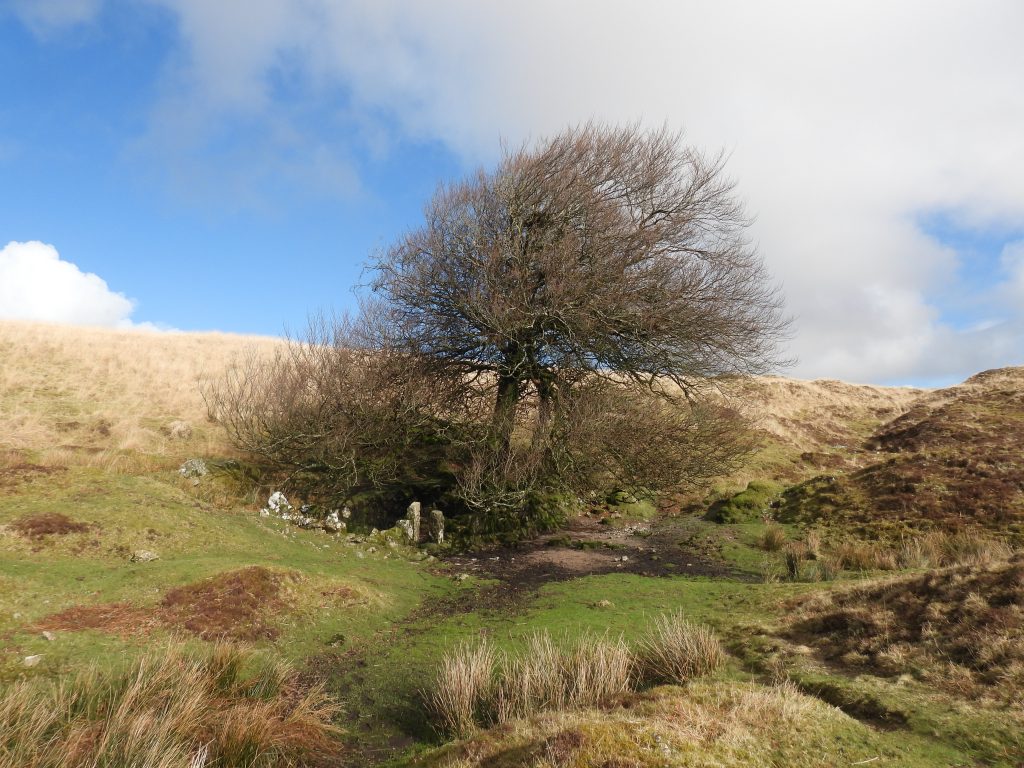
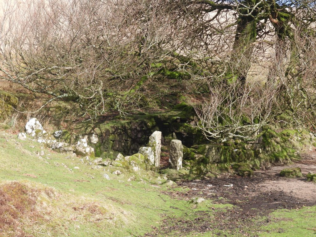
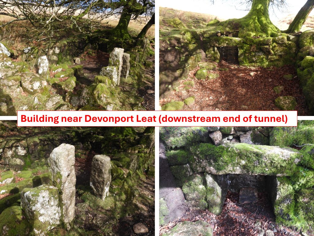
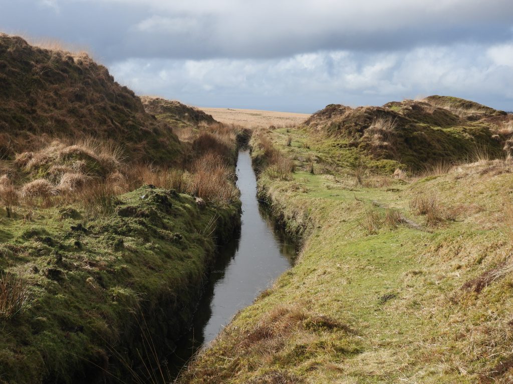
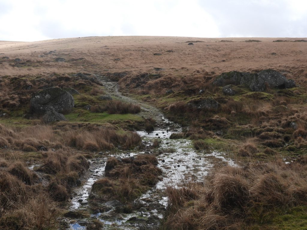
Snippet of William Woods Map of 1850s showing the location of Nun’s Mine just south of Siwards / Syward’s Cross. This provides an interesting timeline as there was quite significant activity at the mine in the 1860s, clearly the map indicates there was activity here before that.There are several tin openworks and pitworks on the slopes of Chants Hill or Chance Hill, north west of Nuns Cross. These pits are mostly oriented west-south-west to east-north-east following the predominant direction of the lodes. They are likely to be post-medieval in date though some may well be earlier. The directions of these pits are more or less repeated at the main shafts from the 1860s part of Nun’s Cross Mine.Nun’s Cross (aka Siward’s or Syward’s Cross) from which the mine took its name. The ancient name of Siward’s Cross (Latin: Crucem Sywardii) was quoted in the 1240 perambulation of the Forest of Dartmoor documents. Note the ‘mounds’ behind the cross, which are the earth upthrust from shafts from the 1860s part of the mineThis annotated LiDAR map shows the extent of the mine as described by entries in Dines (1956) and the Mining Journal from 1862-1864. That said, the Dines entry (which is repeated in Eric Hemery’s ‘High Dartmoor’ on page 138) of a SE level being driven 300 fathoms to under Nun’s Cross Ford and beyond is highly implausible due to the terrain, its length and timeline – plus one would have expected this to have been recorded elsewhere (e.g Mining Journal). Note: The author, whilst researching some Maristow Papers confirmed that the supposed driven level (300 fms) would have taken the operation outside the agreed leases of 1862 and 1872, thus confirming the Dines information to be incorrect.This rectangular ‘cut-out’ is the stone foundations of a small structure adjacent to the south side of some deep tin pits. This is located at SX60416 69978The rectangular footprint measures 3.6m by 7.5m and the walls are 0.4m wide and stand to just above the ground. The structure almost certainly to have been associated with the tinworking activity, and possibly was used in conjunction with Nun’s Cross Mine nearby. The pits may have been from an earlier period than the structureNun’s Cross Mine timeline from early 17th to mid-19th centuries with documentary evidence obtained by the author (thusfar). The last operational records (Mining Journal) for Nun’s Cross Mine were from between 1862-1864, which are recorded later in this postThis extract from the Dartmoor Tinworking Research Group (DTRG) newsletter (59) from 2020, details the dispute between Peter Woodley and William Stockman which reached the Star Chamber in 1608. It relates to the ‘Westernun’ workings. The author is grateful to Dr Tom Greeves for pointing him in the direction of this information1873 Map and comparable LiDAR plot showing Wheal Chance and Nun’s Cross Mine. The authors interpretation is that in the early years of the 19th century (circa 1806-1812), the valley to the west of Devonport leat tunnel exit comprised Wheal Chance to the north and Nun’s Cross Mine to the south. By mid 19th century Nun’s Cross Mine was further east, near Siward’s CrossDevonport Leat just after the westerly tunnel exit. This valley (and below towards Newleycombe Lake) would be where the early 19th century Wheal Chance and Nun’s Cross Mine were locatedExtract from Lysons Magna Brittania, indicating that Nuns Mine had closed by 1810, albeit there is other documentation which refer to the mine circa 1812Nun’s Cross Mine timeline from 1860’s with information from the Mining Journal and Dines. No production figures were ever recorded and one assumes the 1860’s venture had been closed down by the end of 1864. There was a further sett licence issued in 1872 but nothing appears to have come from thatThe above is an extract from H.G. Dines (1956); ‘The Metalliferous Mining Region of South-West England’, page 731. It indicates that there was a Shaft (Dawe’s) which was sunk 100 yds S.W of the ancient (Siward’s) cross. There is a record in Hamilton-Jenkin’s ‘Mine’s of Devon’, suggesting a shaft was sunk in June 1863. One suspects, Hamilton-Jenkin obtained his information from the Mining Journal; No.1451. Saturday 13th June 1863, which records the same. As there are are 6 shafts at a distance of approx. 100yds+ from south to south west from the cross, the record seems to be robust. That said, the (Dine’s) record adds that a level was driven from it for 300 fathoms and passes beneath Nun’s Cross Ford – the author has confirmed that this was not only very implausible but would have breached the mine sett licence agreementThe boundary of the mine sett as defined in the January 1862 and July 1872 leases. The south east corner was defined as being 200fms from Siward’s or Nun’s Cross (which would have been at SX60342 69601). The south west point was defined as being at plot 1046 (tithe reference), which was part of Newleycombe Farm (which would have been at SX58956 69931)This is a mock up of the front cover of the Nun’s Cross Mining Sett Licence from 1862 – The Box (ref: 874/48/47). The licence also mentioned Thomas Horswell (Mine Agent from Hewton Beer Ferris) and Sam Terrell (of King Square, Bristol). James Sprague was described as a Mine Captain from Beer FerrisSome of the restrictions and allowances detailed in the Nun’s Cross Mining Sett Licence from 1862The 6 shafts to the south and south west of Siward’s Cross. The author speculates that Shaft ‘3’ was Dawe’s Shaft and the others are merely trial shafts or air shafts reaching the adit level below. The author has been shown an underground plan of Devonport Leat Tunnel and the Adit level from Nun’s Cross Mine (not for publication), which clearly indicates that access to the lode was obtained either from the surface (via these shafts) or through the leat tunnel. Any ore would have come to the surface via Dawe’s Shaft in all probabilityShaft 1 at SX60492 69833 with Nun’s Cross Farm behind. The original farm circa 1871 and the more modern farmhouse (in picture) from 1901 were not there when the 1860’s shafts were sunk. The circle of stones mark the shaft and most likely represent where the shaft was capped.Shaft 2 at SX60460 69847. The wall may not have been here when the shaft was sunk and most likely was built by John Hooper, who enclosed the land at Nun’s Cross Farm in 1871. Shaft 2 was most likely an air shaft. Note the fir trees from Nun’s Cross Farm.Shaft 3 (as shown on annotated LiDAR plot) was most likely Dawe’s Shaft, based on distance / direction from Siward’s cross as described in Dines plus it is the shaft here with the most earth upthrust. The shaft appears to be marked by a circle of stones with a (probable) whim plat a short distance to the north (reedy area to the right of the photograph)The authors interpretation of the location of Dawe’s Shaft and the probable Whim PlatSketch map of what a simple shaft headgear and horse drawn whim may have looked like in the 19th centuryThe headgear / horse drawn whim sketch overlaid onto a modern (February 2026) photographDawe’s Shaft is located at SX60422 69856Top of Dawe’s Shaft ‘earth upthrust’ looking north east (ish) towards Siward’s crossClose up of the capped Dawe’s ShaftThe (probable) Whim Plat in the reedy area, middle left of the photographThe ‘earth upthrust’ of Dawe’s Shaft as viewed from the west. It is over 2m high
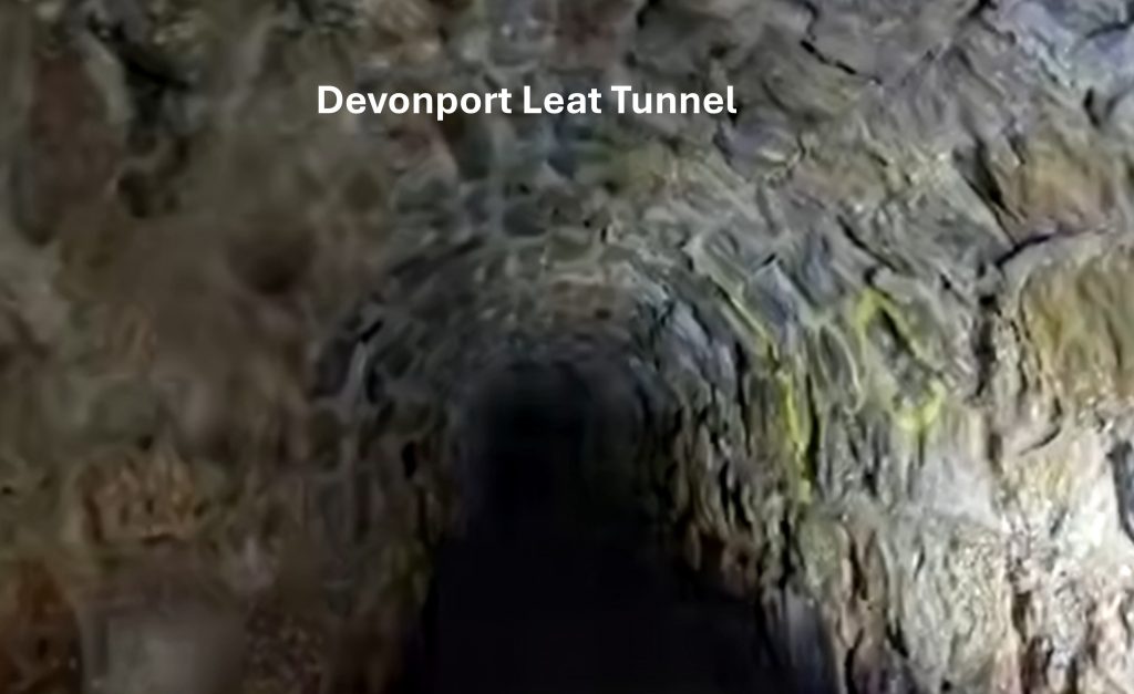
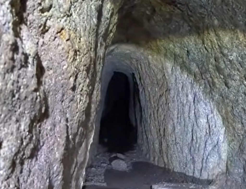
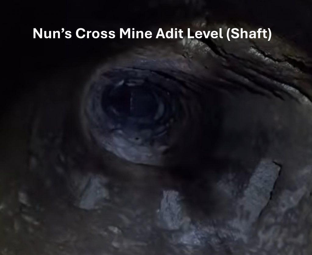
This Youtube video, shows two explorers recording the Devonport Leat tunnel and the interconnecting adit levels of Nun’s Cross mine dating to 1862-64. Devonport Leat was constructed from 1795-1802 to supply water to Plymouth Dock (known as Devonport after 1824). Being (slightly) pedantic, the Youtube title is slightly misleading including as it does the word ‘Medieval’. Nevertheless, it is quite a good video showing the underground workings: Exploring a Secret Tunnel Beneath Dartmoor – Medieval Mine Found!
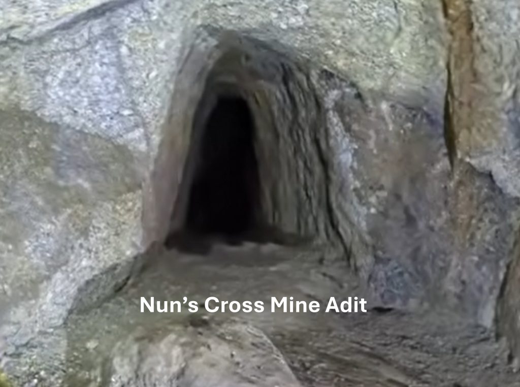
Inside Devonport Leat Tunnel – access to Nun’s Cross Mine Adits – screen shot from Youtube videoAdit from Nun’s Cross Mine accessed from Devonport Leat Tunnel – screenshot from Youtube videoAnother Adit from Nun’s Cross Mine accessed from Devonport Leat Tunnel – screenshot from Youtube videoLooking up a blocked shaft of Nun’s Cross Mine accessed from Devonport Leat Tunnel – screenshot from Youtube video. This might be Dawe’s Shaft but cannot be verified. The author has been told that by Dawe’s Shaft where the adit tunnels are located there is a plat (platform) cut into rock for loading kibbles with ore ready to go to the surface. This fact confirming there must have been a small headgear at surfaceShaft 4 at SX60386 69867 looking north towards earlier tinners’ workings and north east towards Siward’s CrossShaft 4 was most likely an air shaftShaft 5 at SX60356 69886Shaft 5 looking north eastShaft 6 at SX60319 69893. The tree is located near a ruin sometimes referred to as ‘Old Farm’ (ref: Mike Brown’s Field Guide, volume 15, page 14)Mining Journal records from 1862 relating to Nun’s Cross Mine. Note the mine was a ‘private’ cost-book company. Part of the entry for 10th May is repeated by Hamilton Jenkin (page 49), namely; “To clear the adit, sink shafts for ventilation, and all contingencies, it is expected that £500 will be required”. These shafts and the adit are those covered and suopported by photographs in this postAnother shaft (not annotated on LiDAR map in this post). This is located near the exit of the Devonport Leat tunnel. The trees at ‘Old Farm’ are just visibleShaft looking westAn 1863 entry from Mining Journal. Note the section which includes Devonport Leat, namely; “Instructions were given to the committee to expend any sum not exceeding £10 in looking at any other lode, or lodes, they may deem advisable to open on, as in the tunnel through which the Devonport Leat passes, and in this sett, a rich branch of tin has been laid open, and there is every indication for believing that similar discoveries may be made on other lodes”. This extract seems to confirm the miners made access to the lodes through the tunnel as previously seen by pictures in this postLarge beech trees at ‘Old Farm’The last Mining Journal Nun’s Cross Mine references from 1864. Note the term ‘Drivage’ in the record of 4th June – to the west is Drivage Bottom…the word Drivage referring to tunnelling. The record from 4th June is still using relatively positive language but the record for 6th August less so, describing trouble in sinking a shaft. These are the last known documentary records for the mine (to the authors knowledge)In volume 15 (page 14) of Mike Brown’s Field Guide to Dartmoor he describes this building thus: “Above the right bank of the tunnel exit stands a small tinners’ hut now shaded by large (beech) trees. Known as Old Farm, it last saw use as a shepherd’s shelter by the tenants of nearby Nun’s Cross Farm, although before this time, in the early 1880s, the Devonport Leat Company was paying a shilling (5p) a year on a property described as a ‘Blacksmith’s Shop near Nun’s Cross’, and this must be the building referred to”. Hemery also calls the building ‘Old Farm’ but casts doubt on whether it was ever connected with the tinners.Hemery recalls (High Dartmoor, page 138) that Mrs Phillips of Nun’s Cross Farm always referred to this building as ‘Old Farm’. He states that around the late 1970s, there was still a crock (stewpot) in the kitchen, where there is a fireplace. The Phillips family were the last occupiers (farmers) of Nun’s Cross farm in the late 1930s / early 1940sHemery suggests the dwelling was built in 1793 as a smithy for the making and maintenance of the tools used by the men employed in driving the nearby Devonport Leat tunnel. The Brown and Hemery records relating to it once being a smithy match.Devonport Leat tunnel at west endThe tunnel is 648 yard long (ref: Brown) and is a fine achievement considering the primitive methods of surveying then in use. The tunnel is not straight and its the cutting on such a shallow gradient would have required considerable expertise by the engineers and workmen driving it through the hillside.Devonport Leat snaking its way west just after the tunnel. Around 1840, there was an ambitious plan to construct a railway from Exeter to Plymouth right across Dartmoor. The plans would have abandoned the leat here and re-routed it through another tunnel (which was to be shared with the railway) under Nun’s Cross Hill not far to the west of Whiteworks, near Sunny CornerThe upstream Devonport Leat tunnel entrance. There would have been easy access to the Nun’s Cross Mine lodes via their adits here.Devonport Leat curves around the hill just uphill from Nun’s Cross Ford. It is underground here that the records in Dines (1956) and Hemery (1983) suggest a level was driven 300 fathoms E.S.E from Dawe’s ShaftNun’s Cross Ford under which Dines and Hemery record a level was driven. The 300 fathoms of the drive would have been down hill under Devonport Leat and under this stream. Without drainage this would have been very difficult. The author has evidence to prove this information to be incorrectThis is a mock up of the front cover of the Nun’s Cross Mining Sett Licence from 1872 – The Box (ref: 874/48/63). The licence also mentioned Mine Agent Thomas Buvick and Civil Engineer George Rowe. This seems to be the last document associated with the mine1872 Nun’s Cross Mining Sett Licence. The boundary of the sett (and accompanying map) being a carbon copy of a licence dated 1862. One wonders how and when the adventurers from 1862 (James Sprague et. al.) relinquished their licence which was for 21 years also. Note: The mention of the ‘White Works’ road and ‘Pit Cot’ road are not the ones we might identify with today but are the rough tracks within the Walkhampton Parish boundary to the west and east of Older Bridge