A collection of walks, discoveries, insights and pictures of exploring Dartmoor National Park
March 31, 2026
Golden Dagger (Redwater Valley) Stamping Mills
The Ordnance Survey first edition map of 1809, depicts several ‘Stamping Mills’ (three black square blocks) on the west side of Redwater Valley (West Webburn River), one being adjacent to and two within the (20th century) Soussons Plantation and all three being to the south and west of the (late 19th century) Golden Dagger Tin Mine complex. These ‘Stamping Mill’ sites are not shown on later maps, perhaps suggesting abandonment in the first half of the 19th century.
The triangulation for South Devon was undertaken in two phases; firstly in 1795/96 Captain William Mudge and Isaac Dalby extended the primary triangulation of England and Wales into South Devon fixing the positions of trigonometrical stations on the heights of Dartmoor; secondly in the early 1800s under the direction of *Lieutenant-Colonel William Mudge and Captain Thomas Colby, the interior triangulation, extended the original framework of the first survey to record precisely located points and landmarks, which numbered over 600 for the survey of Dartmoor and South Devon as a whole.
The resulting first edition Ordnance Survey map from these surveys was first published 11th October 1809. Dartmoor was covered by Sheet 25 (reprinted in the 20th century by David and Charles as sheet 90), which was one of eight sheets (OS numbers 20-27), each measuring 36in (91.44cm) by 24in (60.96 cm) – including all borders. With this history of the triangulation process, it is probably safe to assume that the ‘Stamping Mills’ shown on this first OS map, date from at least late 18th / early 19th centuries.
The National Library of Scotland (aka Side by Side maps) electronic version of the first OS map, enables researchers to precisely locate features on old maps by placing their computer cursor over the feature and reading a 10 figure grid reference. Thus (theoretically) features can be located to within a metre or two accuracy. Armed with the grid references for the aforementioned ‘Stamping Mills’ the author conducted a site visit and this post is a summary of that. Note that the terrain is either very wet to get to or entails traversing through a very inhospitable eastern edge of Soussons Plantation.
* Assume that William Mudge was promoted sometime between 1796 and the turn of the 19th century from Captain to Lieutenant-Colonel
Bibliography
Ordnance Survey Map – (1809) – Sheet 25 (named Tavistock in original series) or Sheet 90 (David and Charles reprint edition)
William Mudge and Isaac Dalby – (1799-1811) – An account of the Trigonometrical Survey of England and Wales, 3 volumes
National Library of Scotland – (1809) – electronic map
Phil Newman – (2002) – Headland Warren and the Birch Tor and Vitifer Mines (Report – Survey). SDV363213.
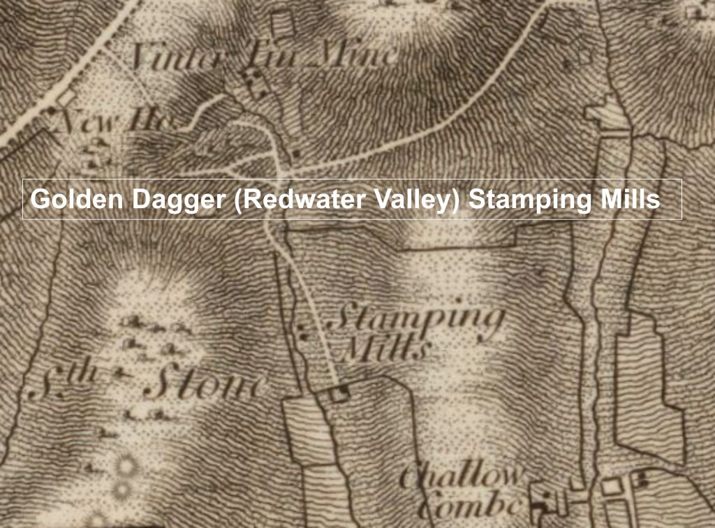
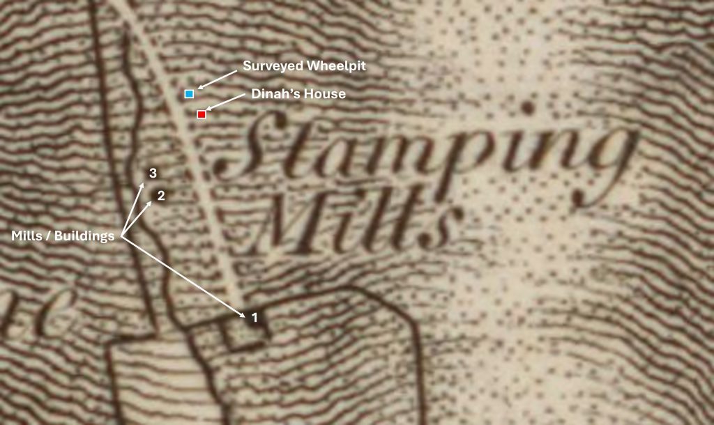
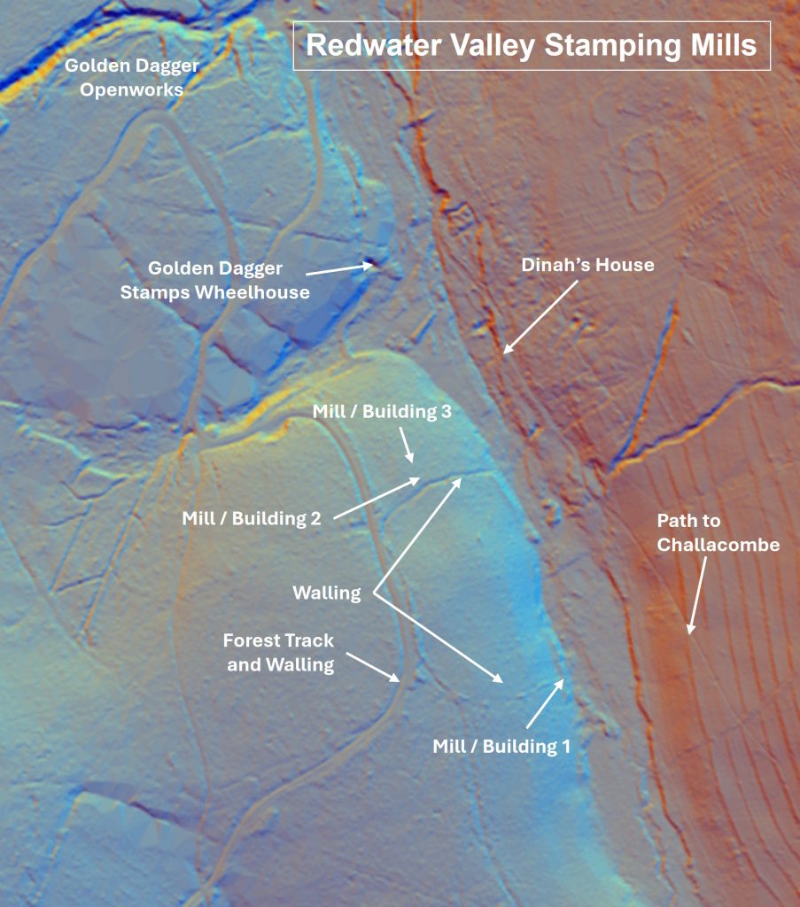
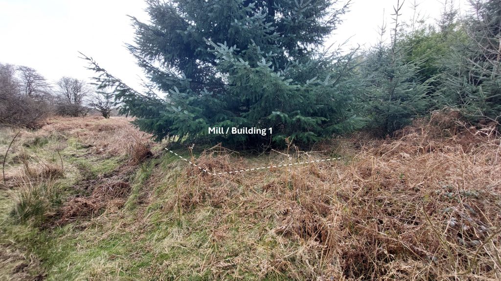
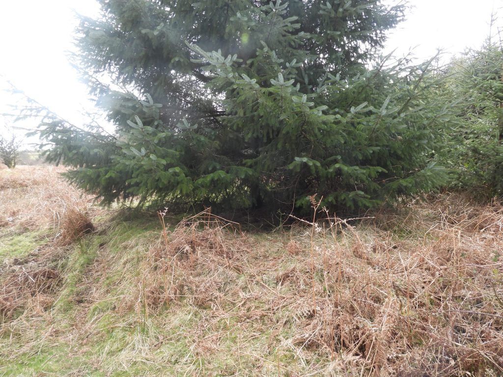
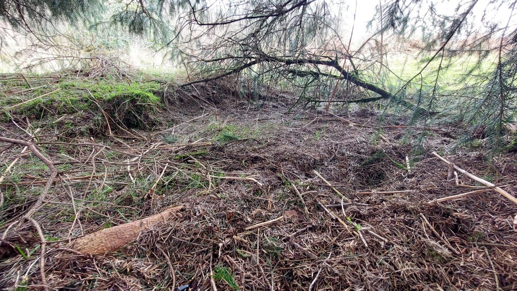
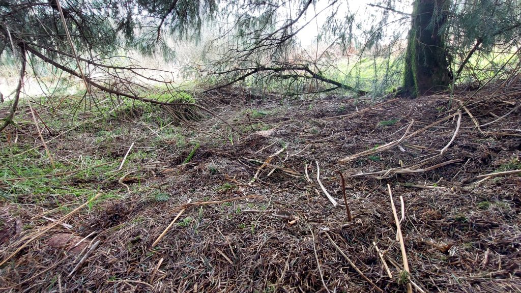
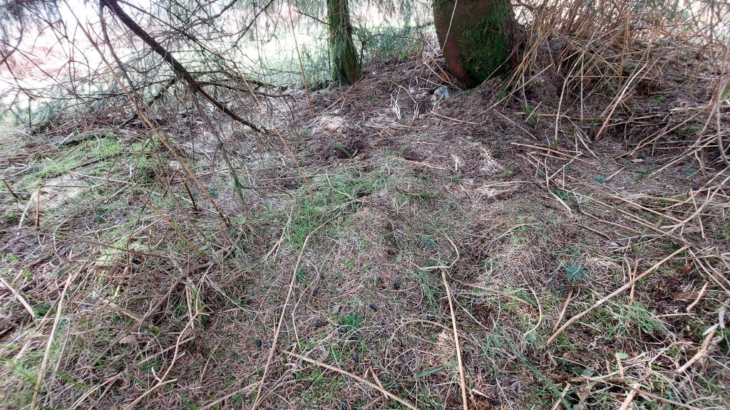
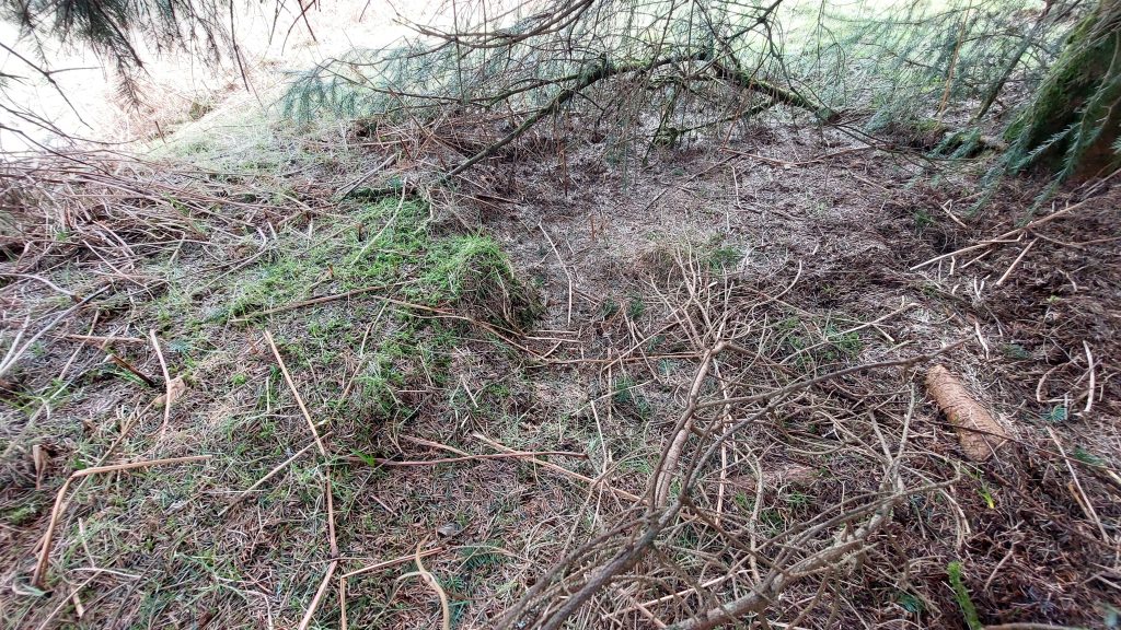
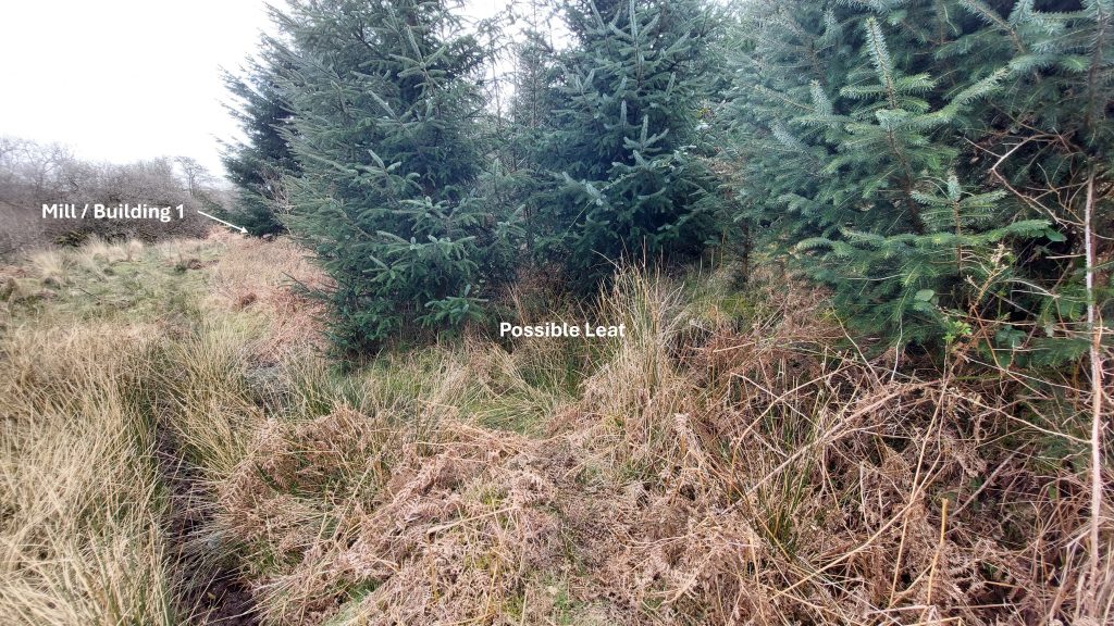
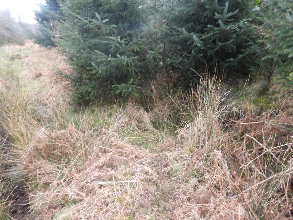
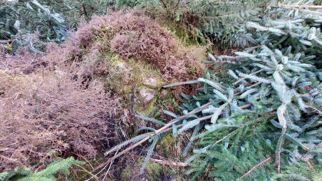
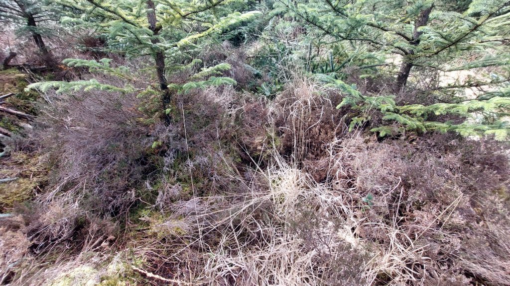
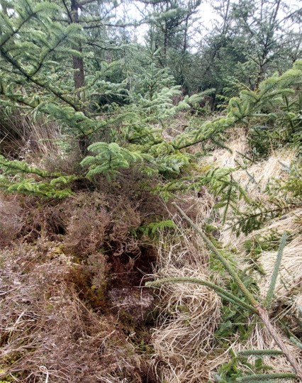
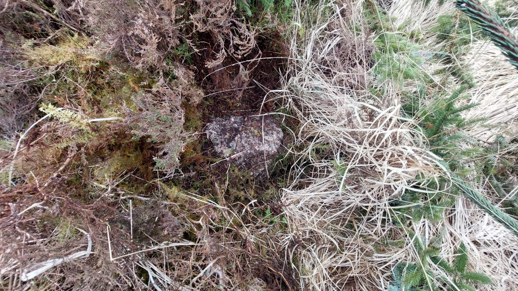
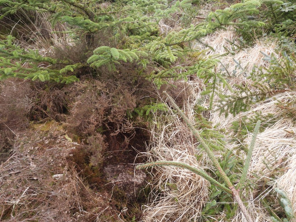
This ‘snippet’ of the 1809 OS map shows the annotation of ‘Stamping Mills’ with associated three black square, located to the north west of Challow Combe (now Challacombe), south of Vinter Tin Mine (Vitifer) and south west of New House (near Warren House Inn)Zoomed in look of the three Mills / Buildings, which using National Library of Scotland electronic mapping located these at SX68529 79708 (1), SX68388 79905 (2) and SX68378 79935 (3). Note the annotated addition of Dinah’s House which was part of the Golden Dagger mining complex in the late 19th century, which hopefully provides the reader a ‘context’ for the location. Also, of note, is a surveyed wheelpit (SX68439 80060) by Phil Newman (2002), which records the following: “……very ruinous wheelpit sited west of the track at the foot of a slope, just north of Dinah’s House. The masonry is incomplete but both ends survive. A faint level earthwork terrace on the north side of the wheel marks the position of a probable dressing floor”. This wheelpit perhaps suggesting this was an additional ‘mill’ to the three squares shown. This wheelpit was has yet to be visited by the author.This LiDAR plot shows the locations of key features in this post. Of note, is the disturbed ground to the south east of Mill / Building 1, which would have been exploits of early tinners’. This plot is quite revealing as the Mill / Building 1 is located close to the West Webburn river thus the more likely of the three to be a Sramping Mill. Mill / Buildings (2/3) seem to be simply too high up the slope to have been mills as they wouldn’t have had a water source, which is borne out by the plotThe location of Mill / Building 1 requires traversing the boggy valley floor and crossing the West Webburn River. Once on ‘hard ground’ the location of this feature can be found, albeit it is located under a very large conifer tree, which makes it difficult to photograph and survey. Note the disturbed ground beyond the site (to the south), perhaps indicating tinners’ activities.The site of Mill / Building 1 is located on a small platform which is around 0.5m high which can be seen here on the left side of the conifer treeBy scrambling through the branches of the conifer tree, the internal of the structure was recorded. Aside the root damage, there does appear to be a slight depression in the structureThe slight depression inside the structure might indicate the possible location of a wheelpit but this is difficult to fully ascertain. The structure was measured by the author as being at SX68535 79706 compared with SX68529 79708, which was measured using National Library of Scotland (NLS) electronic mapping. The difference between the two grid references are only around 6 metres apart, thus this is pretty accurate given the relative accuracies of a gps device and that of the NLS systemClose up of the shallow depressionTo the north (upstream) of Mill / Building 1 there is a channel which might have been part of a leat. It leads directly to the ‘mill’The ‘leat’ channel is shown here on the bottom right side of the photograph. The leat appears to extend well over 100 metres to the north. The authors interpretation is that Mill / Building 1 was a Stamping Mill for the following reasons; a) There appears to be tinners’ workings close by making it an ideal location, b) There appears to be a leat leading to it, c) There was a well defined track leading to it (1809 OS Map), d) There is evidence of a possible wheelpit. All this from an enthusiastic amateur not an archaeology expertLeaving the first building, the route through the edge of the eastern side of Soussons Plantation is rather torturous. At SX68417 79918, the author stumbled across this stone structure. Using NLS electronic mapping, it confirms this is a piece of walling running roughly east / west. For those keen on finding benchmarks, this piece of walling is around 20m from B.M 1109.6. That said, finding it certainly would be the proverbial ‘needle in a haystack’This part of the plantation is where mill / building 3 was thought to be located (using NLS electronic mapping SX68378 79935). It was quite an effort to get to this location
A stone block was found at SX68376 79933 barely 2m from the NLS estimated location.
Was this a building block from the 3rd building ? It is quite possible. The location of the 2nd building is shown on the 1809 OS map as being only 20 metres away, but getting to it was virtually impossibleAs there is no evidence of a leat plus this building (3) is so high up the slope at least 15m above the valley floor where West Webburn river flows, it is unlikely to have been a ‘mill’. There is a very small tributary of the West Webburn from which water could have been diverted to this location along the 348m contour but the author believes this is extremely doubtful.