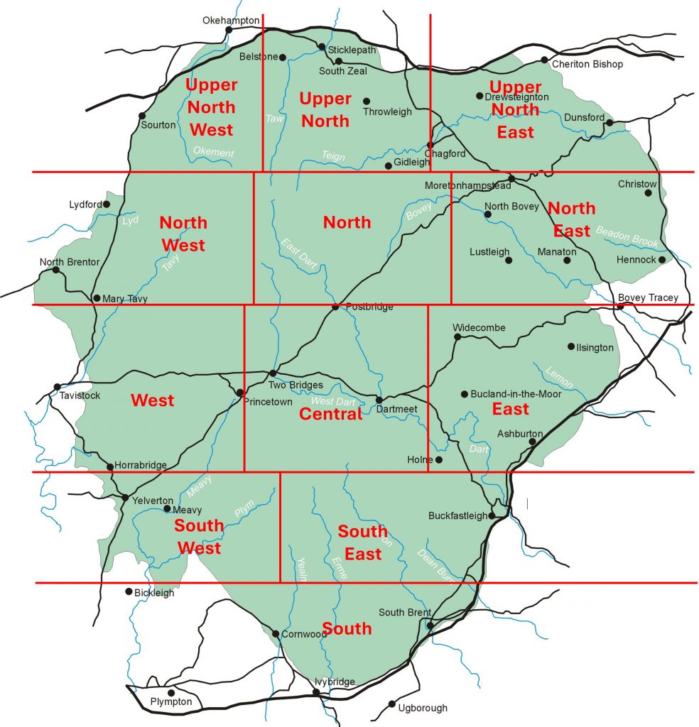
The dartmoor.gov.uk website under the heading ‘basic facts’ records that: “Dartmoor National park is 368 square miles or 954 square kilometres …..about 20 miles from North to South and 20 miles from East to West”.
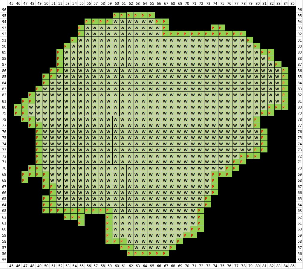
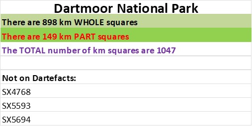
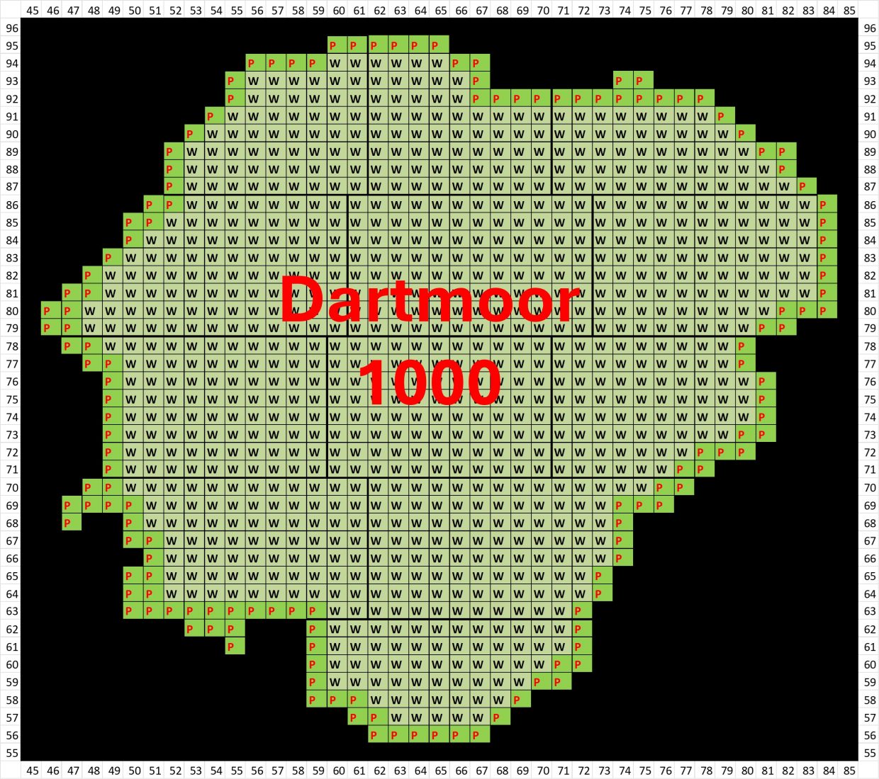
The author has been fortunate to have visited a large proportion of the National Park over the last five decades and has worked out that he has visited every km square. If every km square has been visited, does this mean 954 squares as per the aforementioned record? The answer is in fact no, as there are 898 ‘whole’ km squares and 149 ‘part’ km squares making 1047 km squares in total according to the authors research.
Having collected a large library of pictures over the years, the author has for some time wanted to record each km square of Dartmoor. The name Dartmoor 1000 being chosen for this project is to give it a more catchy title, albeit 1047 km squares of information are being recorded.
The Dartmoor 1000 Project posted here is intended to record one artefact* per ‘whole’ or ‘part’ km square within the National Park. Although every km square has previously been visited by the author, the collating of photographs and revisiting squares where no photograph was taken during a previous visit (plus working on other projects / posts) means the Dartmoor 1000 project is not expected to be fully finished until Easter 2027. That said, with revisiting and exploring squares to choose an relevant artefact, the author is fully expecting to find something new!
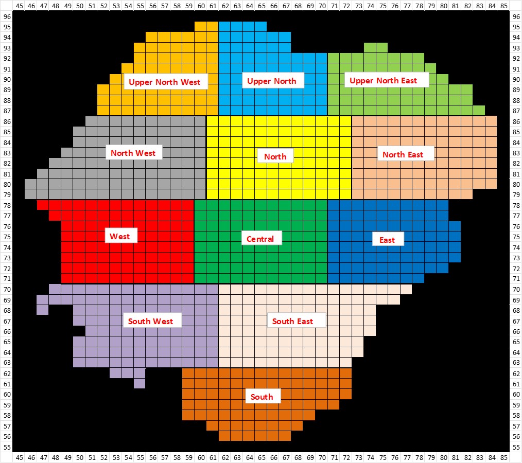
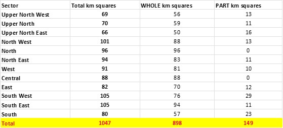
As will be seen in this introduction post on the project, to simplify things, the author has split the National Park into 12 areas (or sectors). When each area is over 90% complete, it will be published – this approach is a bit piece meal but hopefully will act as a spur to the author to finish it.
*The artefact chosen for each square includes items such as boundary stones, buildings, bronze age antiquities, mining features, clapper bridges, crosses, cists / cairns, longhouses etc.