A collection of walks, discoveries, insights and pictures of exploring Dartmoor National Park
March 29, 2026
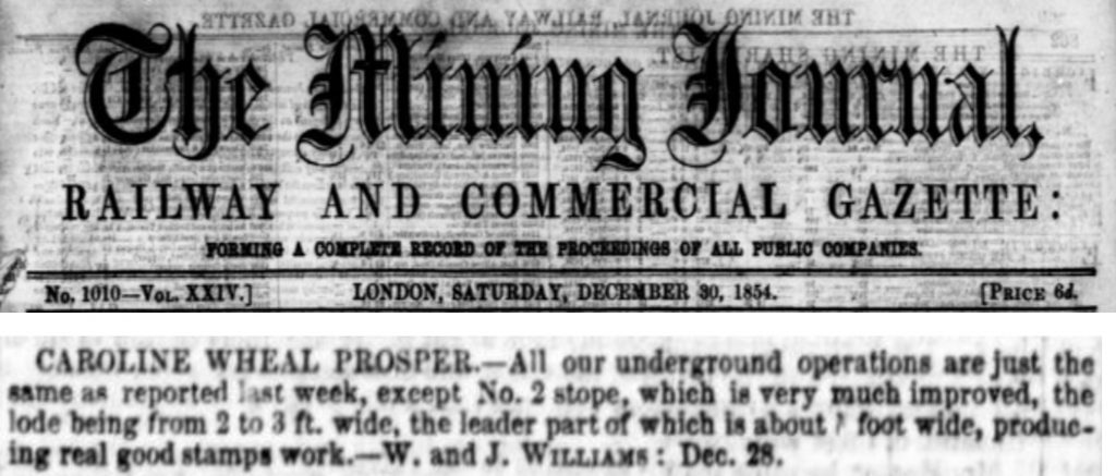
Caroline Wheal Prosper
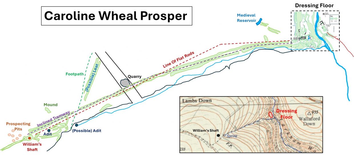
Caroline Wheal Prosper is located partly on open access land (Lambs Down) where there is a shaft (Williams) an openwork plus an adit and partly on private land (Larkham Woods), where there is an openwork, an adit, dressing floors and associated infrastructure set amongst mixed woodland. The distance between the two locations is around 700m with an elevation gain of around 130m. Like many mines of the middle 19th century period, Caroline Wheal Prosper was totally unsuccessful, with no major productive output being recorded except for an small entry in the Mining Journal in June 1855 that a sample of tin had been sold in Truro and hearsay of another 10 cwt during its operational period. The mine only operated for around three years from 1854 to 1857 according to records from the Mining Journal. Williams Shaft is located at SX6949 6564 and the dressing floor by the Dean Burn at SX7015 6586.
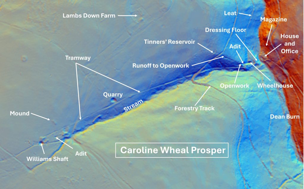
For such an unsuccessful mine, which seemed to have very little promise, it is remarkable that a plethora of surface infrastructure was constructed around very limited underground working with there being only one known shaft and a couple of adits. This infrastructure includes remains of a wheelhouse, dressing floors, several ancillary buildings and a 680m long inclined tramway running from the dressing floors to the shaft, with flat rods running alongside.
Records indicate that upwards of £8k was spent (and lost) on the mine quoted at the time as being with ‘remarkable recklessness’. The mine captain (William Vosper Williams) seemed to have been the common denominator with failure here, at Arundell Mine (1853) and at Devon Great Elizabeth later. Williams was also one of the main associates at East Brookwood Mine in Holne during the 1860s. This mine was similarly unproductive and short-lived enterprise. It closed by 1868. Was Williams just unlucky, incompetent or just a spendthrift?
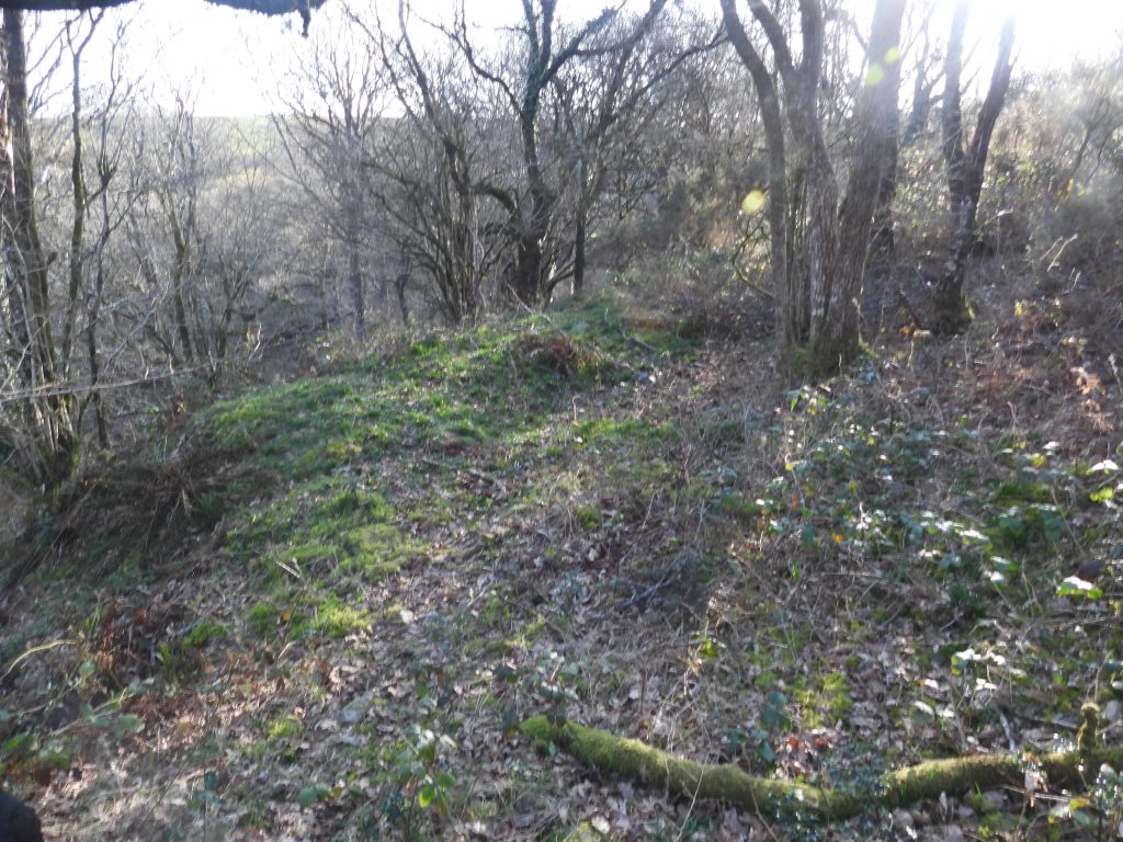
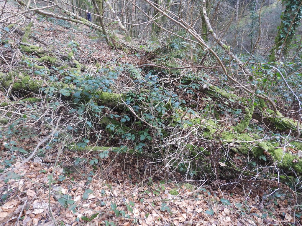
The earliest field evidence for tin working at the mine is in Larkham Woods lies just above the ruined wheelhouse, where there is a small openwork. This would have pre-dated the 1850s activities and appears to have been fed by a crescent shaped reservoir sited around 100m further up the hill.
The mine was superbly documented by Dr Phil Newman for English Heritage in 2004 who surveyed the site with the assistance of Simon Probert and much of the information from that survey has been used here. The photographs for this post were obtained following two visits to the mine, one with the Dartmoor Tinworking Research Group (DTRG), who obtained permission to access the area where the dressing floors are within Larkham Woods.
Bibliography
Dr Phil Newman for English Heritage – (2004) – Caroline Wheal Prosper ; a Tin Mine at Buckfastleigh in Devon. Archaeological Investigation Report Series (ref: ISSN 1478 – 7008; AI/29/2004)
Mining Journals – (1854 to 1859) – 24th June 1854; 30th December 1854; 14th April 1855; 23rd June 1855; 22nd October 1859
A.K. Hamilton Jenkin – (2005) – Mines of Devon; Pages 111 and 156
H.G. Dines – (1956) – The Metalliferous Mining Region of South-West England, pages 739/740
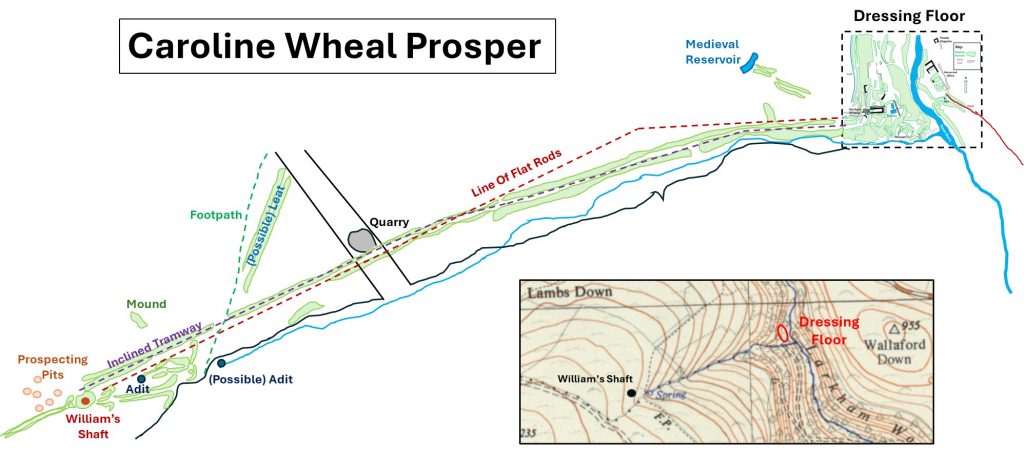
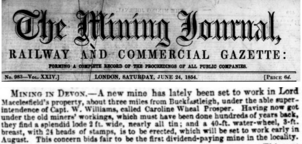
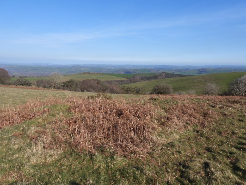
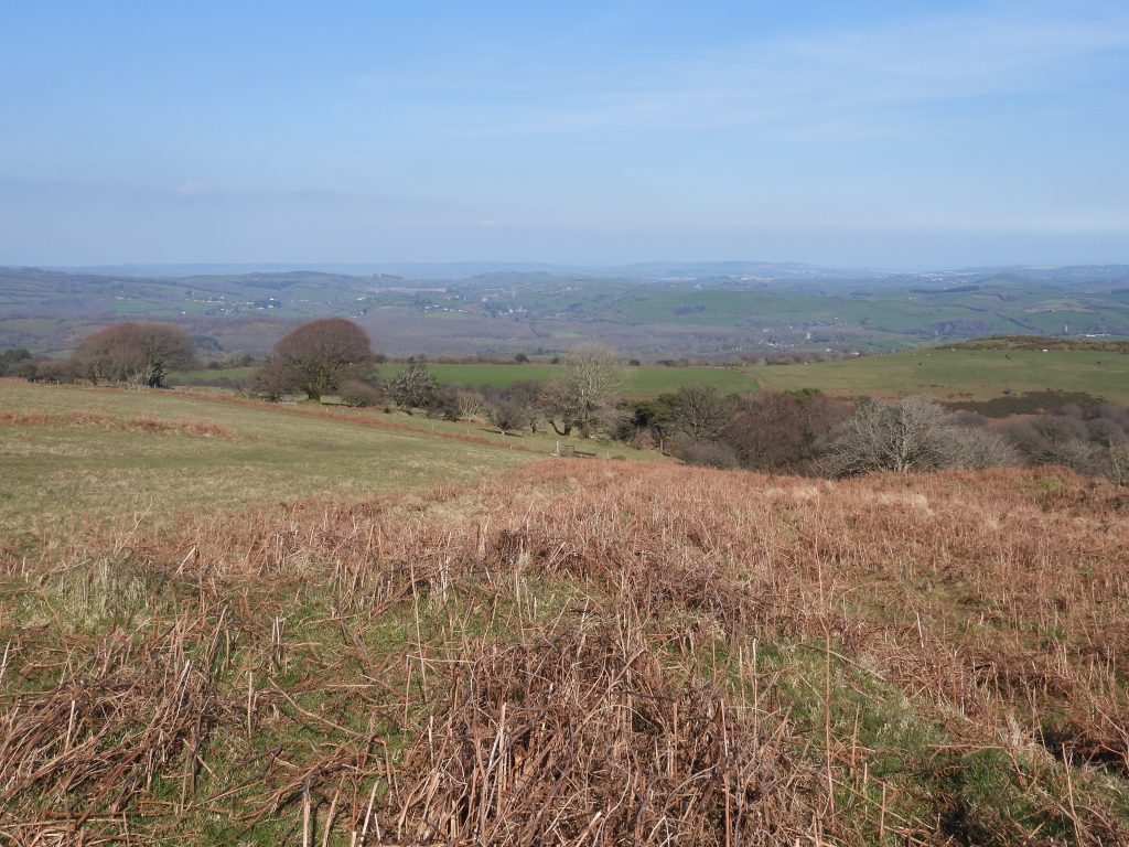
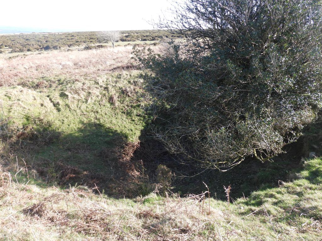
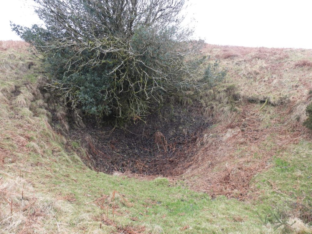
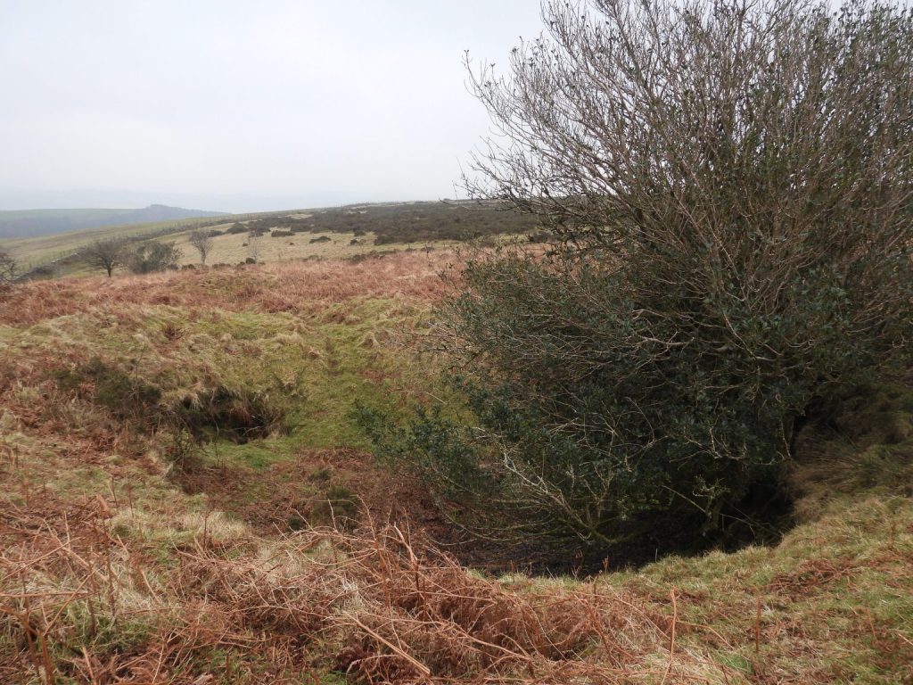
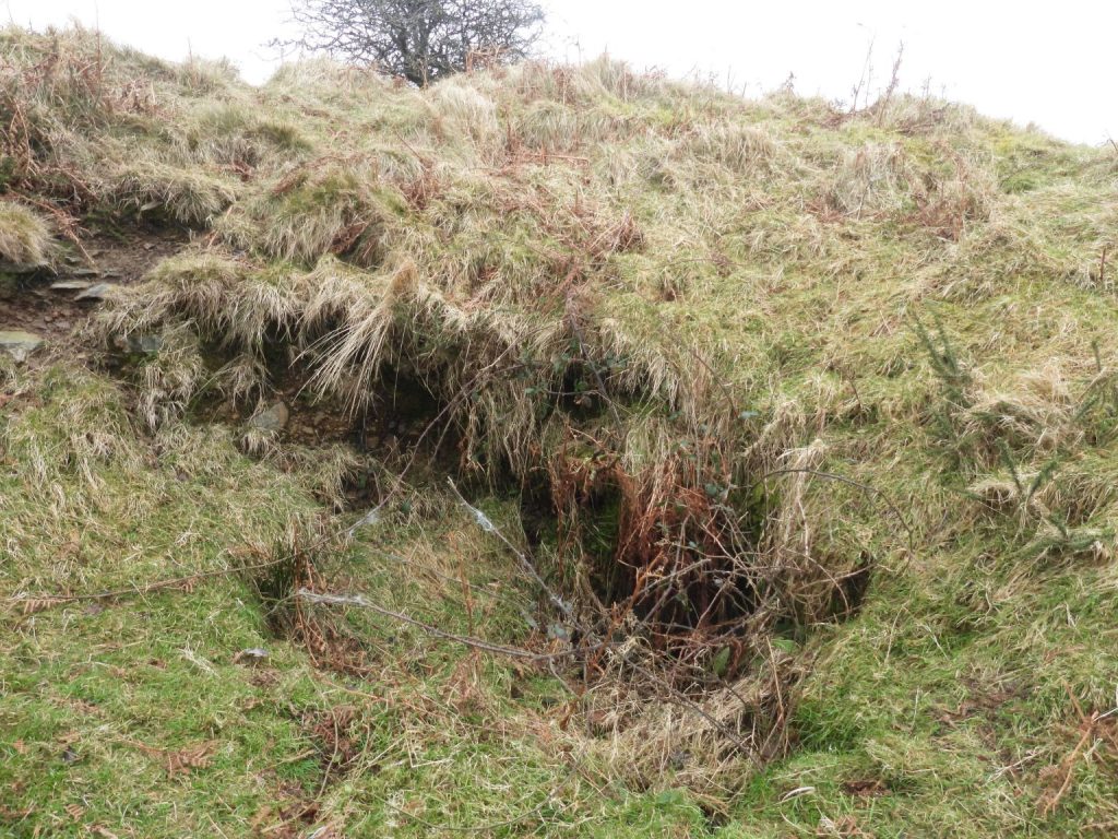
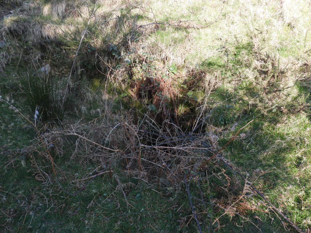
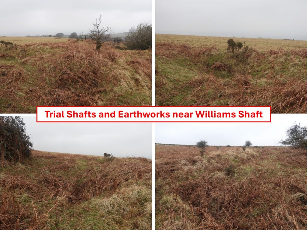
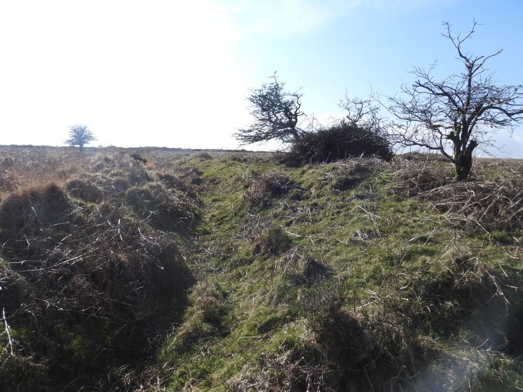
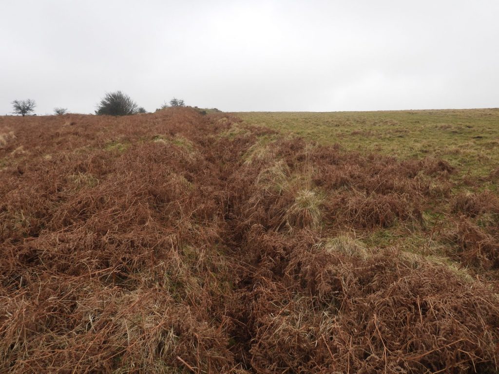
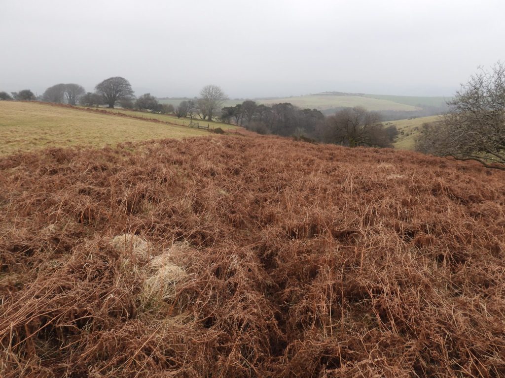
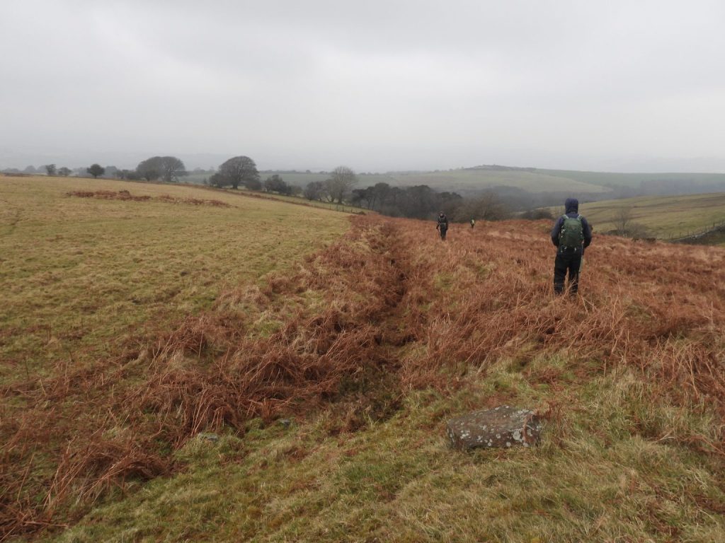
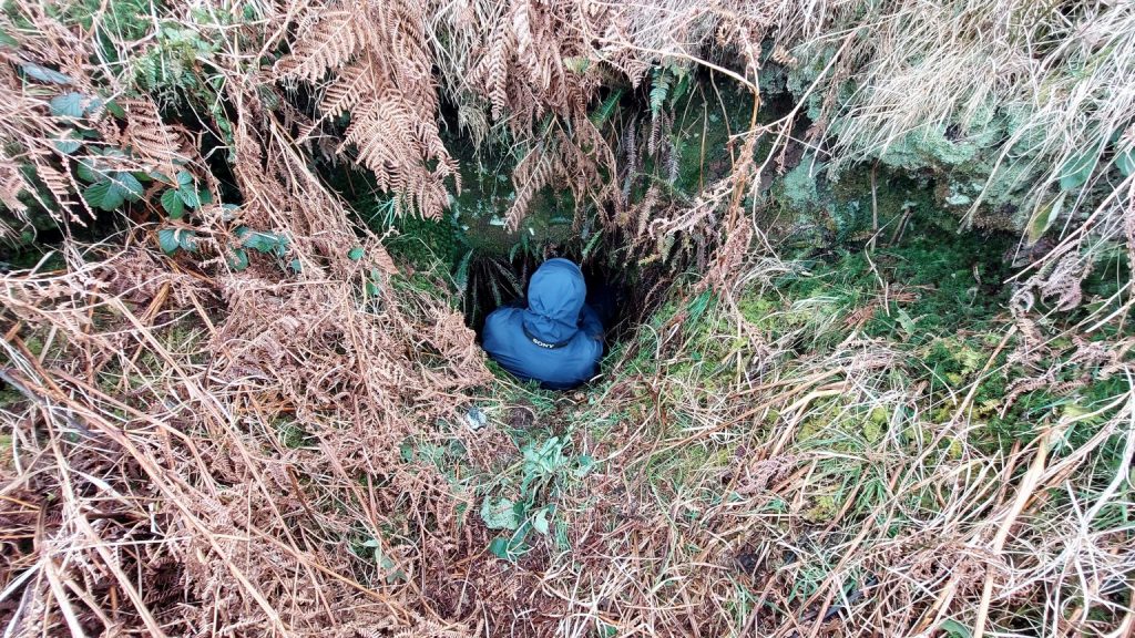
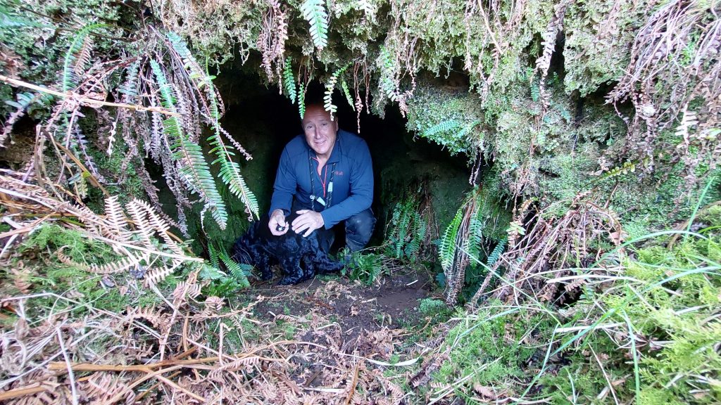
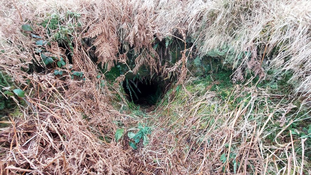
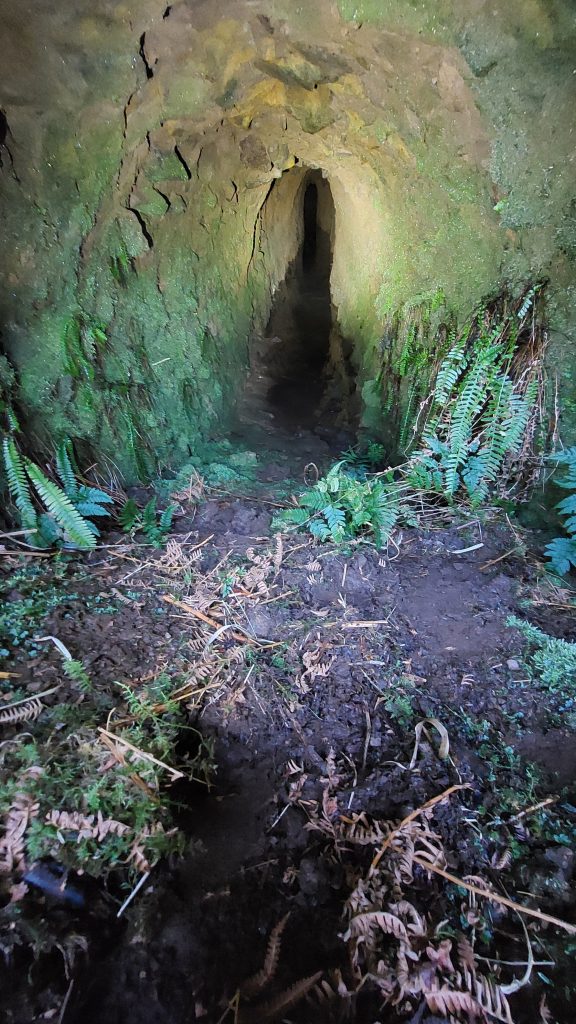
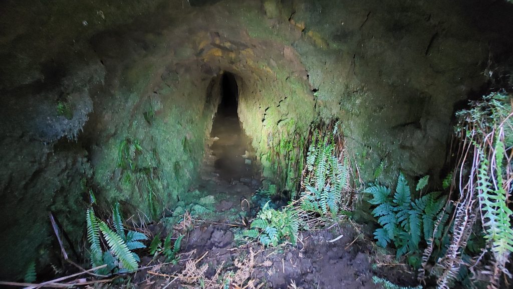
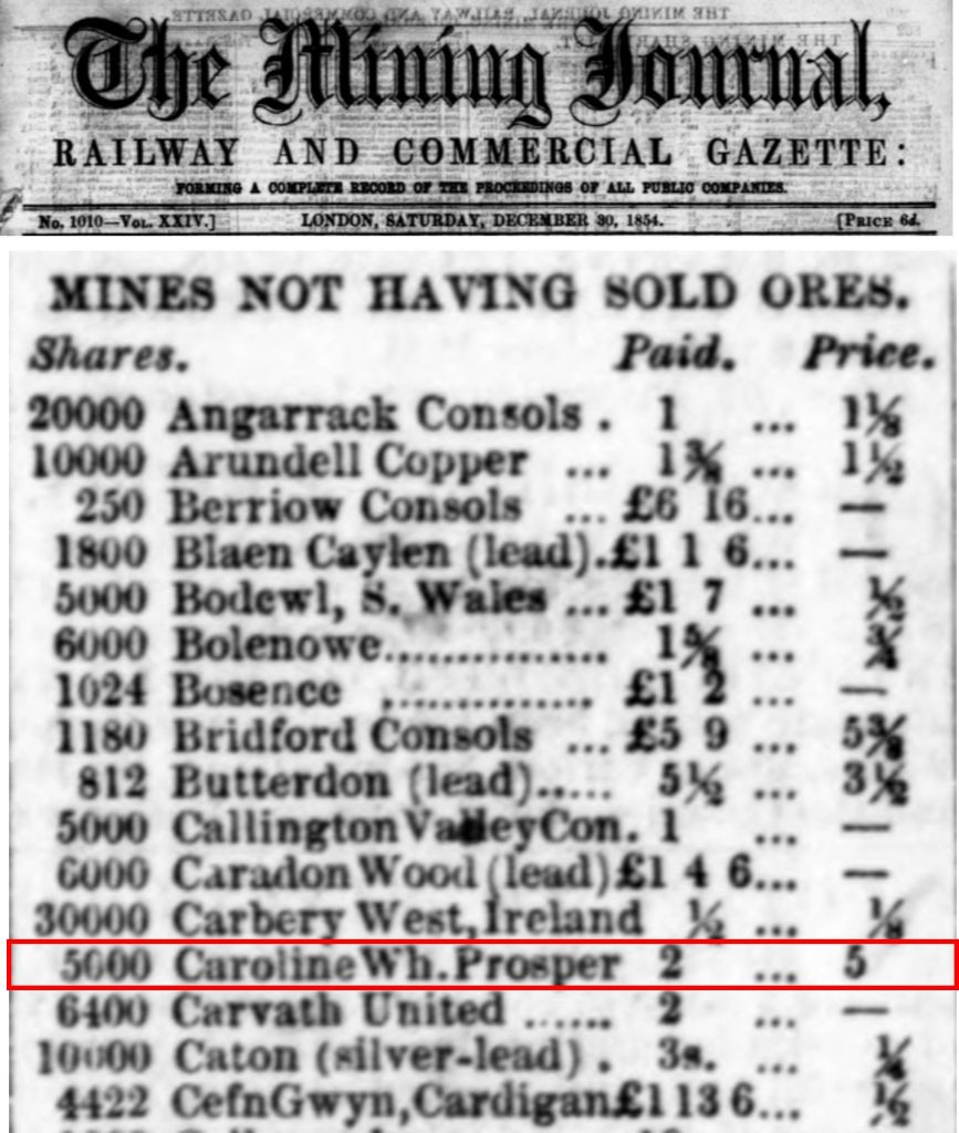
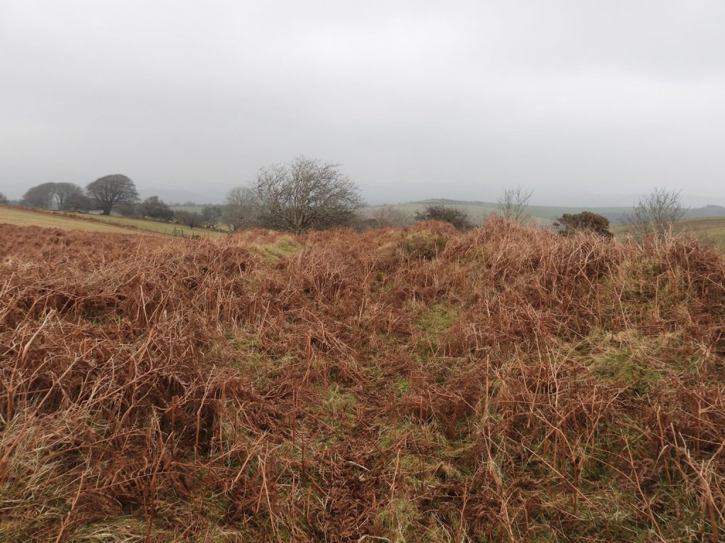
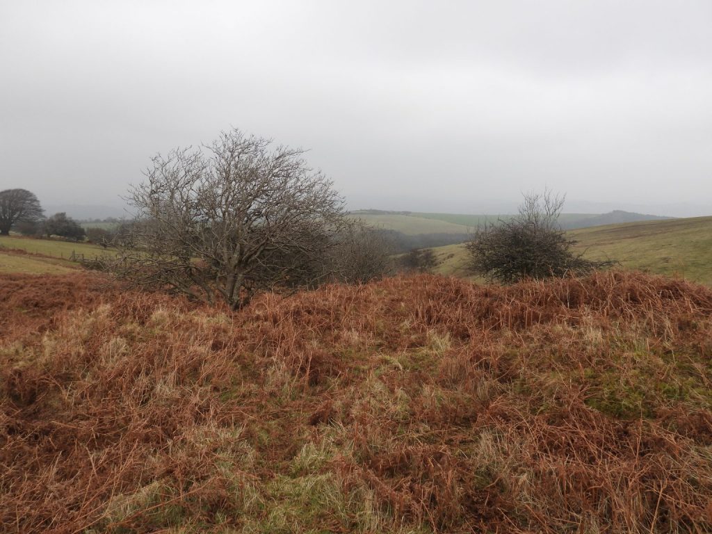
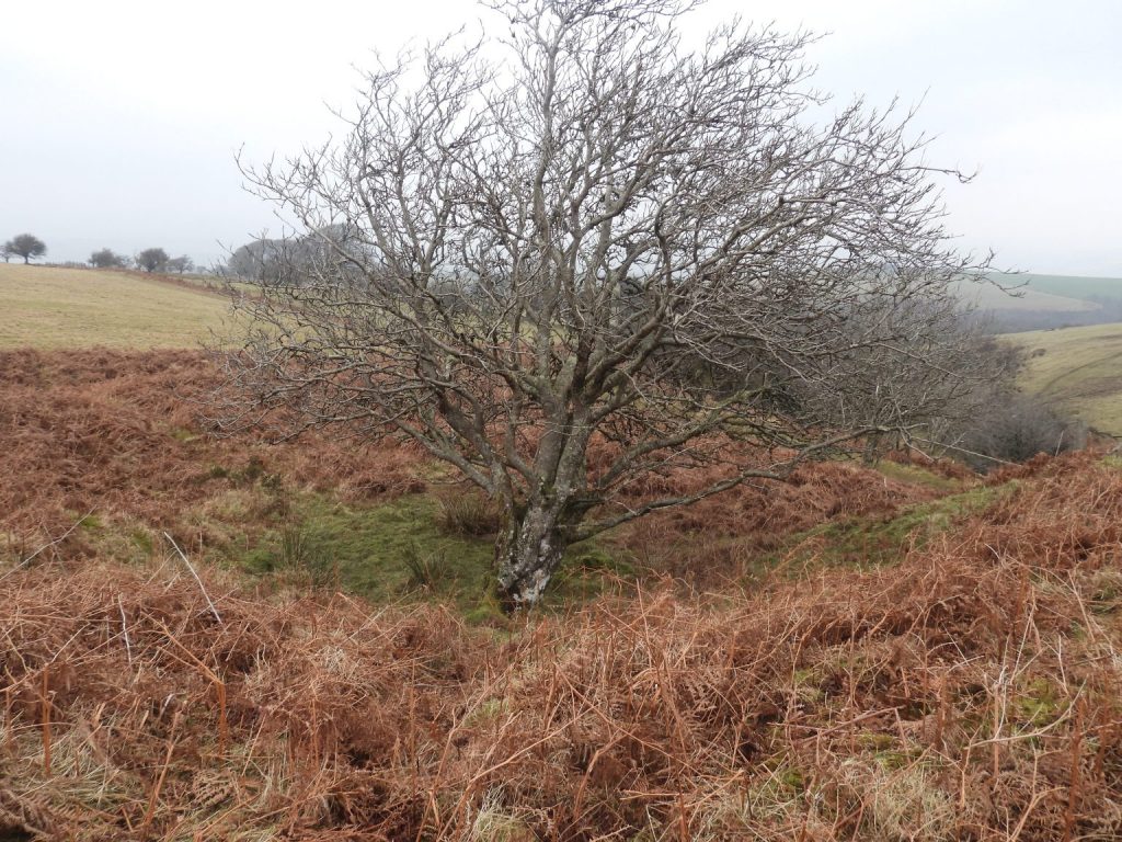
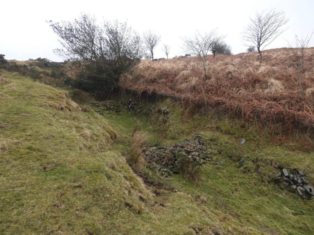
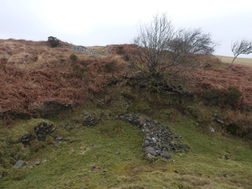
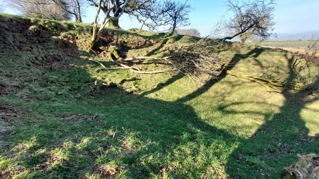
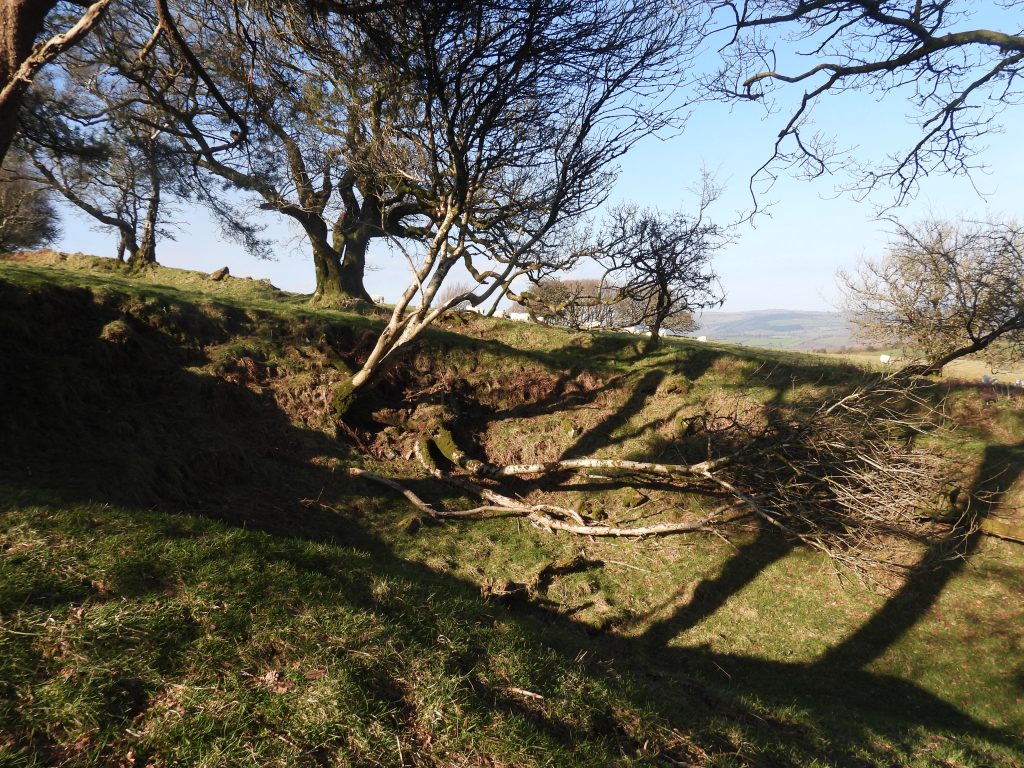
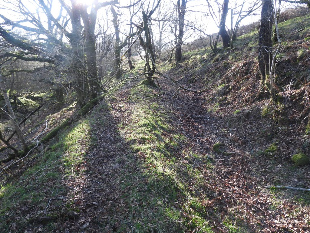
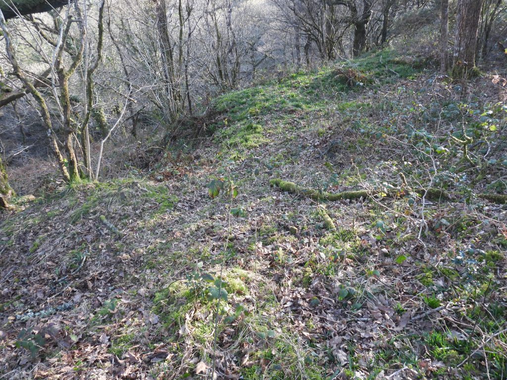
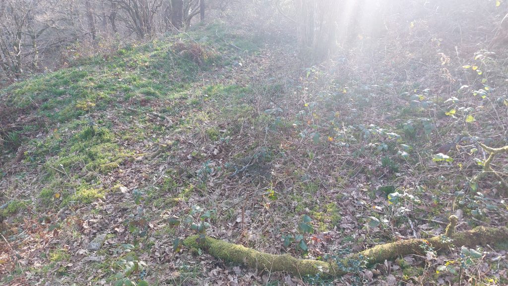
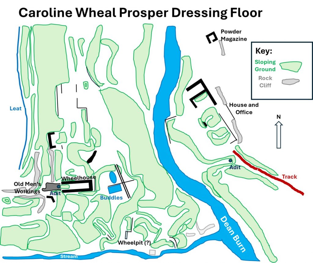
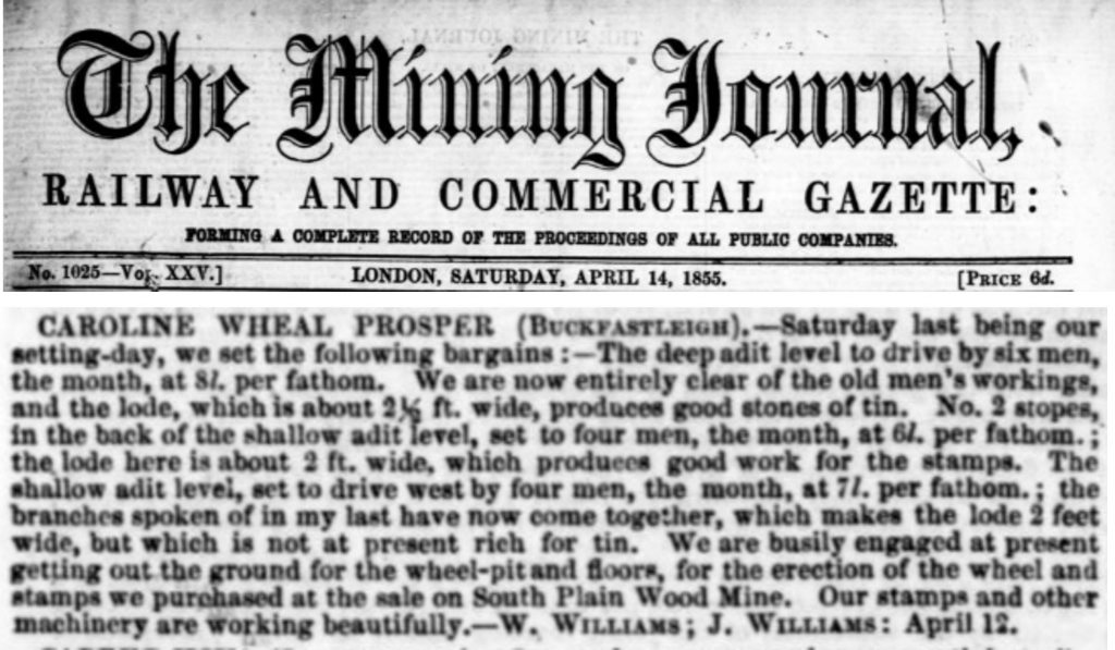
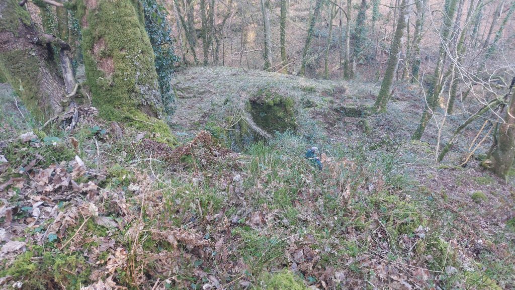
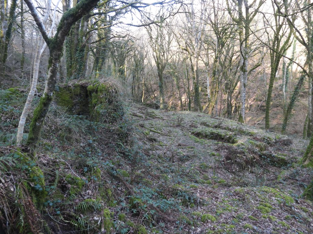
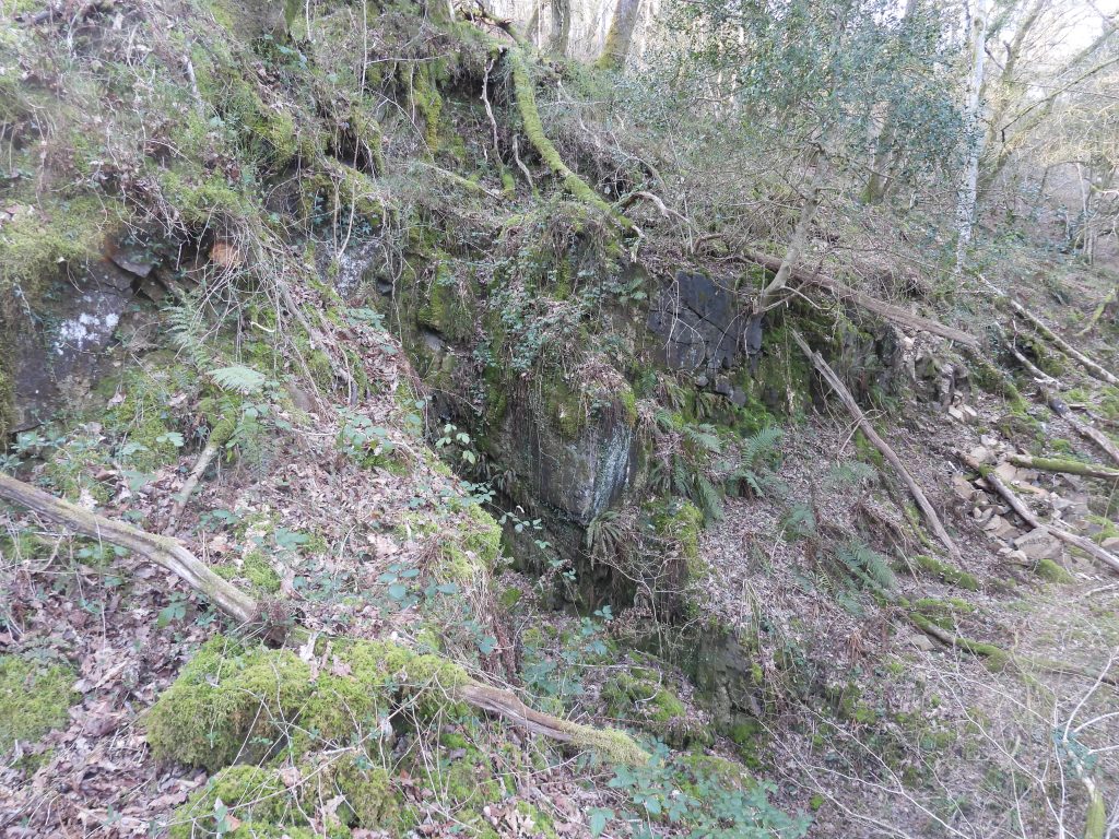
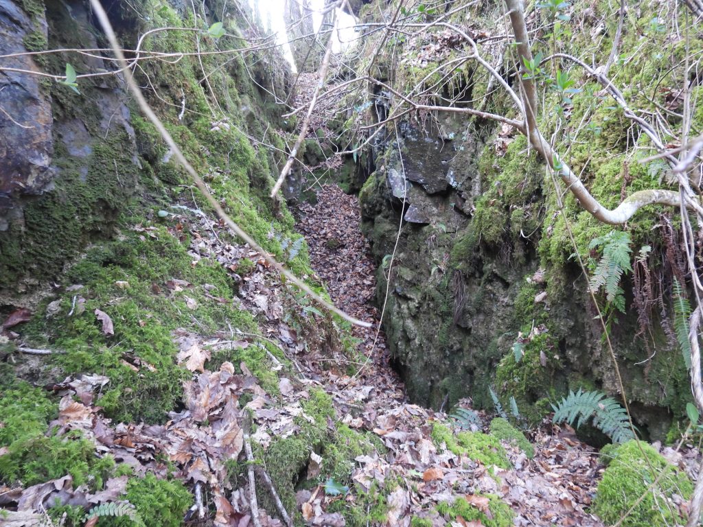
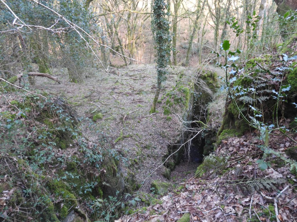
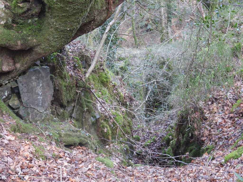
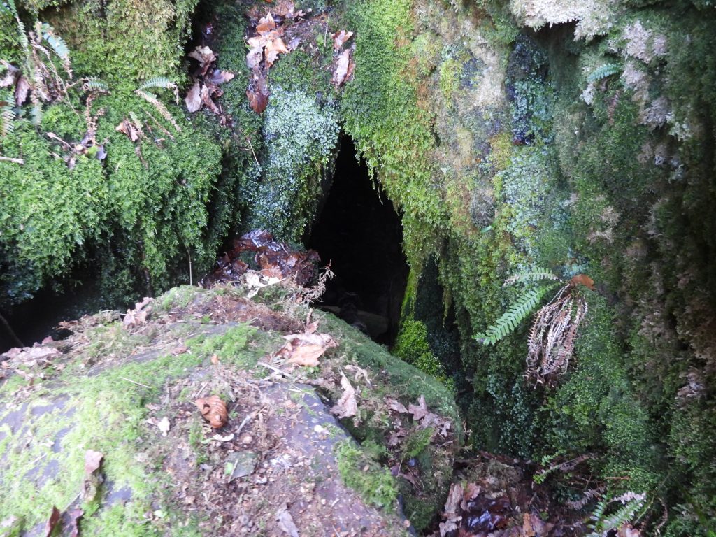
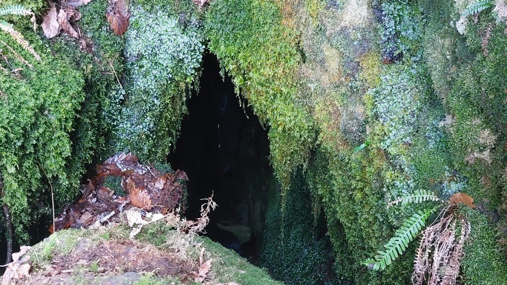
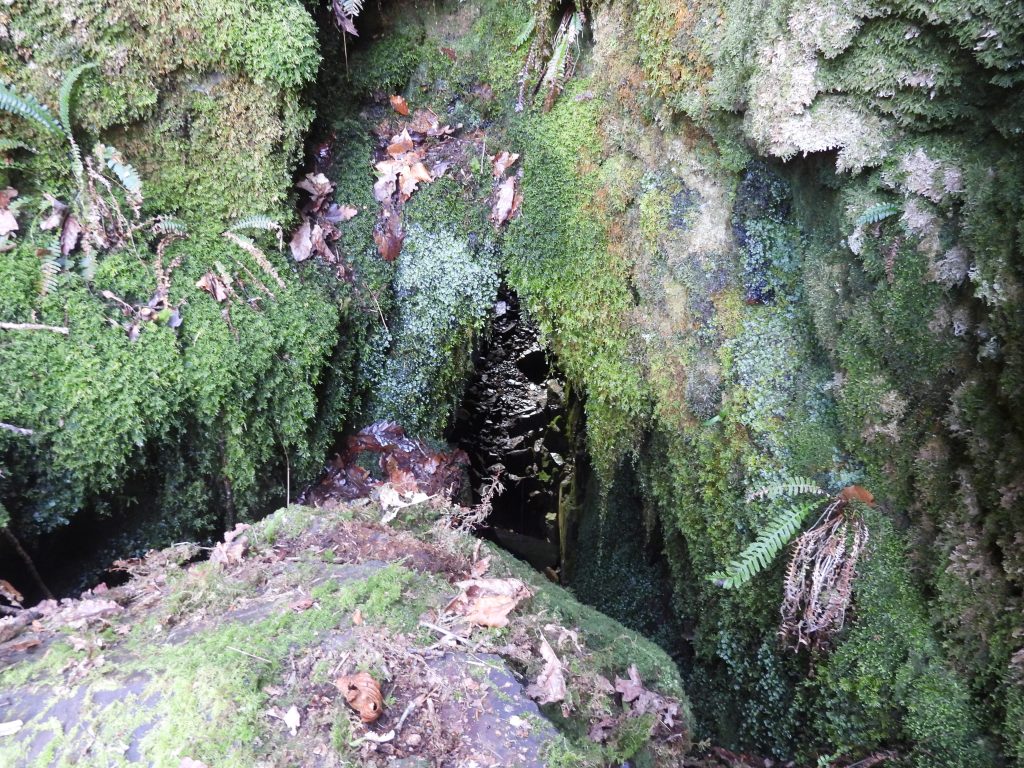
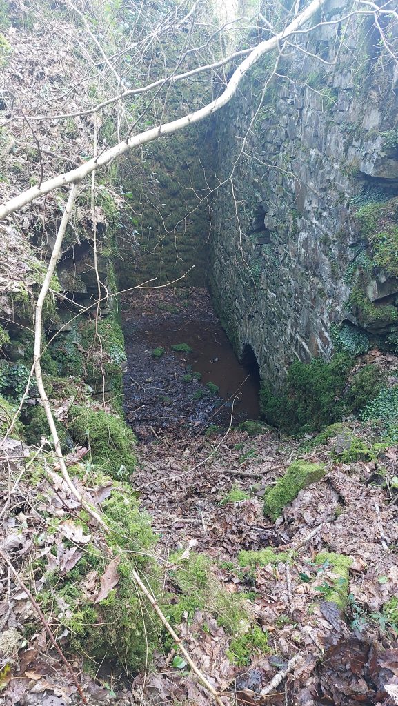
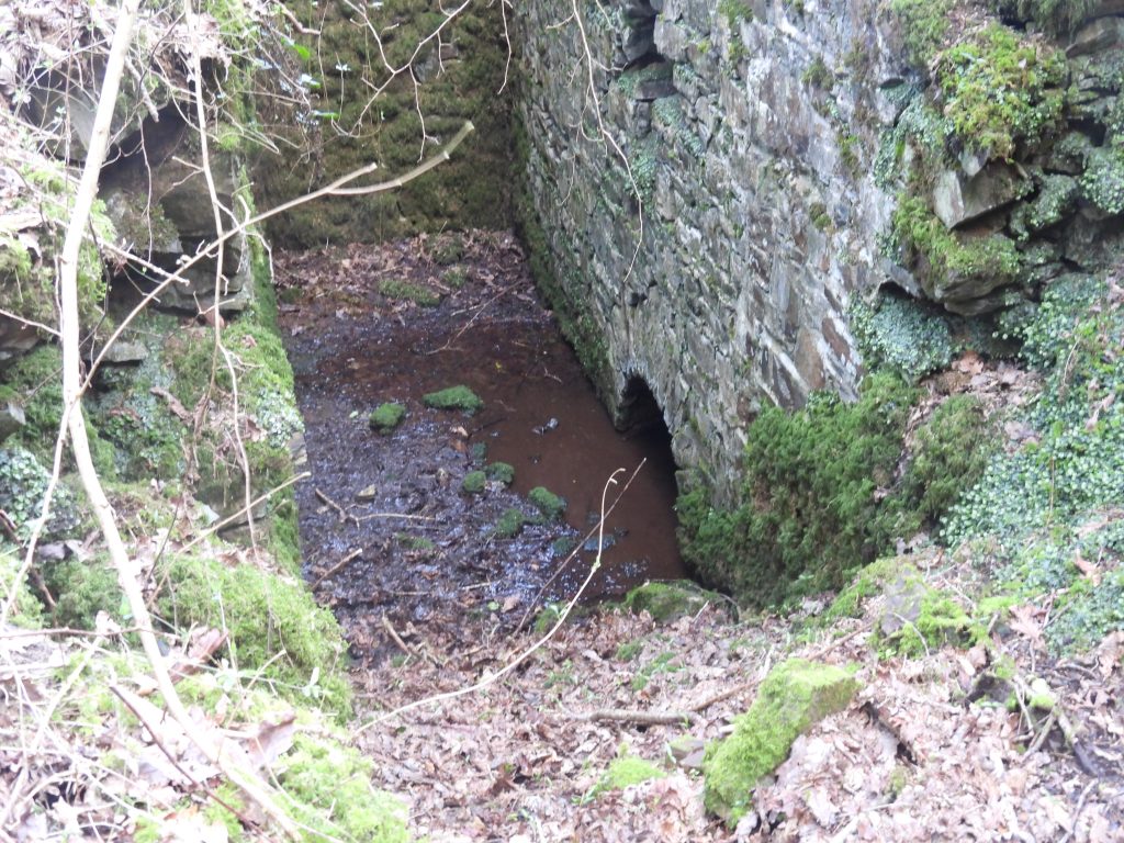
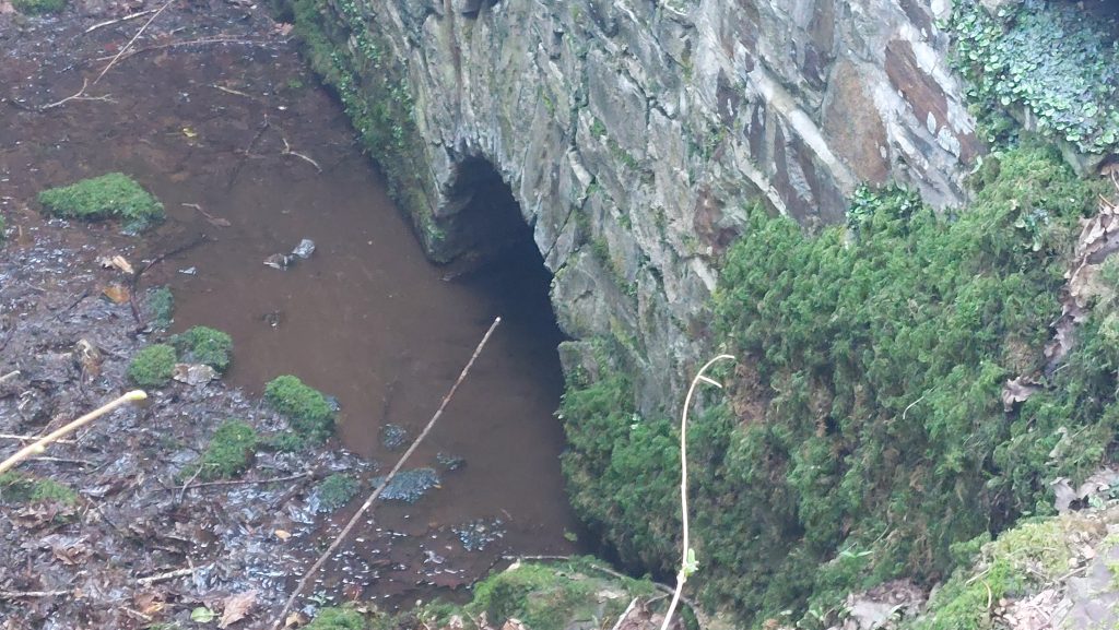
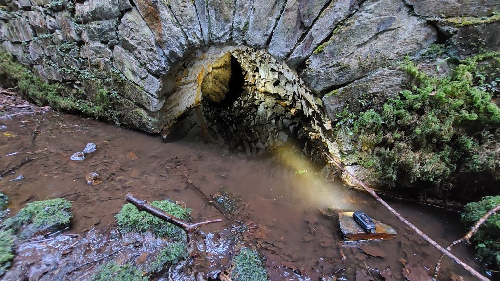
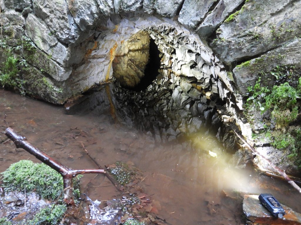
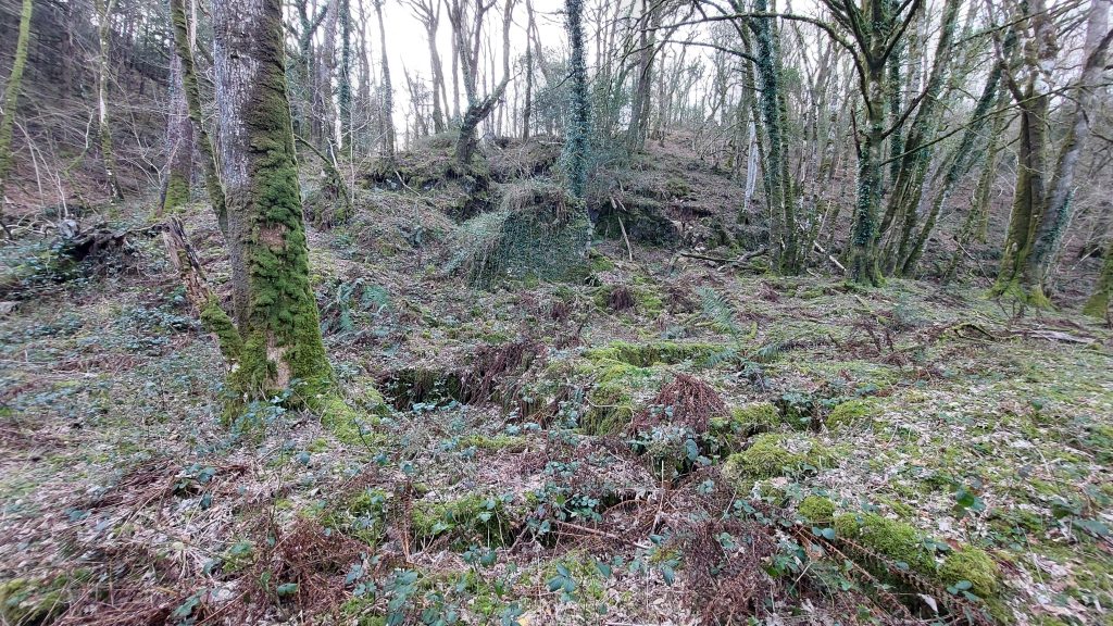
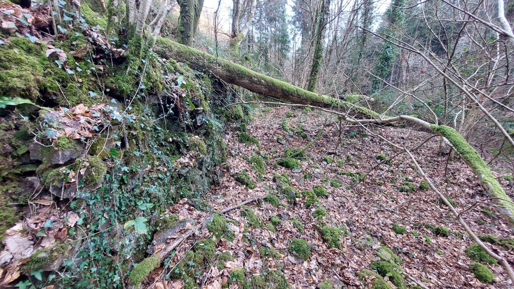
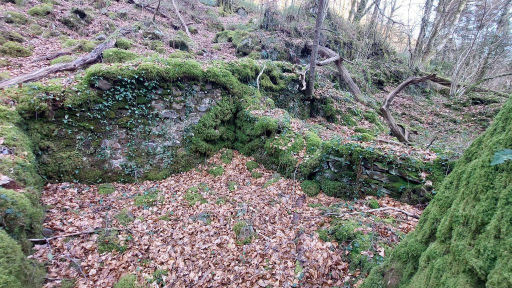
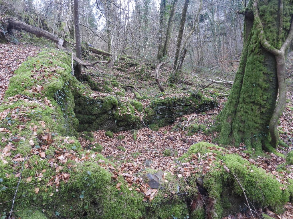
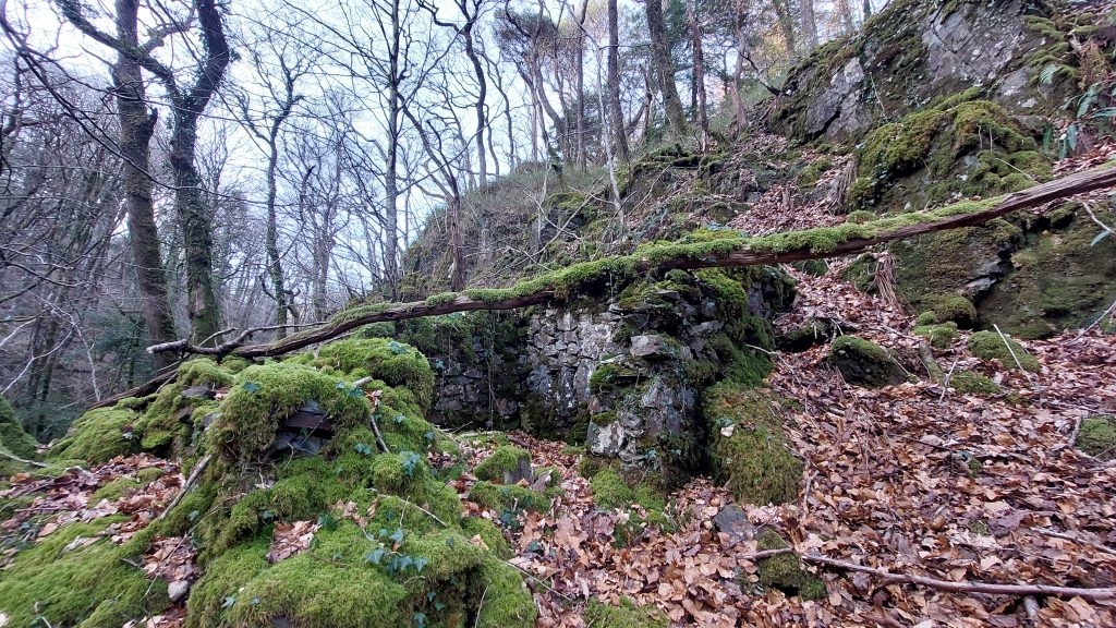
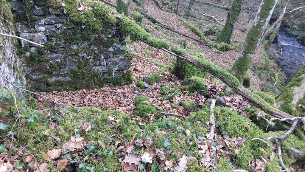
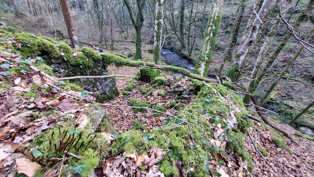
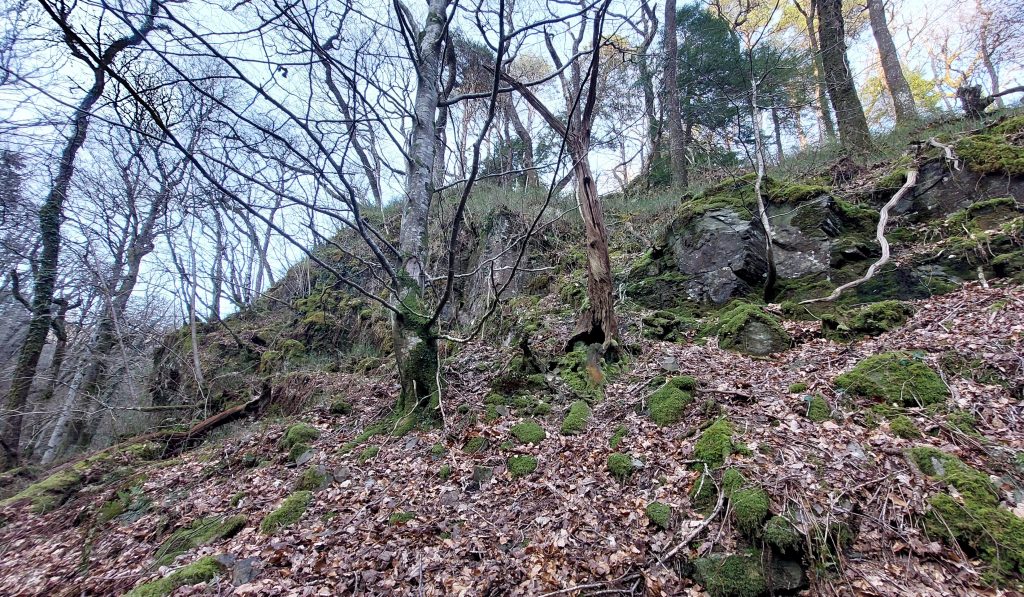
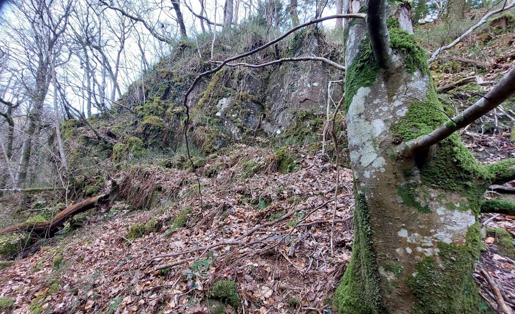
This sketch map is based on the survey produced by Newman / Probert in 2004 which was based on a mine plan. The footpath shown is the approx. boundary of open access to private land. The OS map (from 1956) provides a contextual location for the mine. The small quarry is in an area of land called ‘Pieces’ as identified on the 1843 Tithe Map. This annotated LiDAR plot shows the features of the mine covered in this postThe announcement that Caroline Wheal Prosper had opened appeared in the Devonport Journal in April 1854 and in the Mining Journal (MJ) in June 1854 (as shown above). It confirms that the venture was where the ‘old miners’ workings’ had taken place ‘hundreds of years back’. A 2ft wide lode, nearly all tin is recorded. The MJ entry does suggest that there was a 40ft x 3ft waterwheel being set to work with 24 head of stamps planned to be completed by August 1854. A second wheel was erected a year later (covered later in this post)The photographic record in this post starts on Lambs Down. A short distance to the north of the main shaft (Williams) and tin pits is this shallow raised mound (or platform). But what was its origin?The mound is located at SX69537 65699. It might well be connected with the mine operations (perhaps a structure was here – maybe wooden). Therefore, the mound may be just building foundations. It does look like a pillow mound albeit there is no drainage trench around it as one might normally see.Williams Shaft (named after the Mine Captain) was sunk to a depth of 100ft, albeit there is evidence from the abandoned mining plan (DRO AMP R79F) that it had been intended to sink the shaft to at least 500ft. The mining plan depicts five tin lodes which are aligned east-west from the Dean Burn. Only one lode was ever developed, which is where this shaft is locatedWilliam’s Shaft measures 16 metres by 14 metres by 3 metres deep. The shaft is located at SX69495 65641There is a small finger-shaped spoil heap on the east side which is likely to be where material was removed during the sinking of the shaftExtract from ‘The Metalliferous Mining Region of South-West England’, pages 739/740 by H.G.Dines. The record here shows William’s Shaft was 15 fms (90 ft) deep, with adit level only 6 fms (36 ft). Dines mentions at least five lodes with the one worked by William’s Shaft as being 8 ft wideOn the north east side of the shaft is an opening, which is may lead to shallow aditThe opening at the edge of the shaft is located at SX69499 65642There are some shallow trial shafts / pits near William’s Shaft may be from an a pre-1850 period of prospecting.From a point adjacent to the north of William’s Shaft there are the remains of the inclined tramway, which can be traced nearly 700m downhill to the east directly to the dressing floor near the Dean Burn. The tramway is built onto a small embankment on the open moorland section as shown in the photographThe earthwork remains of the inclined tramway to the east of William’s ShaftThe line of the inclined tramway looking east towards Larkham WoodsExploring the inclined tramway. The channel appears to be where earth was piled up to make an embankment. Note the shallow mound (previously shown in this post) in the open grassy area to the upper left part of the photographAnother view of the inclined tramway. Note the line of walling which delineates the open access moorland from private farmland leading down to Larkham Woods belowWide reaching views to the South Hams from the inclined tramway38 metres east of William’s Shaft is this open adit. The shaft is where the tree is on the horizon. This open adit corresponds to the ‘shallow adit’ depicted on the abandoned mine plan. There is a narrow gully leading from the adit portal where perhaps hand barrows of waste material were taken to be dumped on the spoil heaps below – there is a long linear ‘finger’ dump around 100m down the hillExploring shallow adit (2025)DTRG member exploring shallow adit in March 2026Shallow adit entrance can be found at SX69535 65660The entrance of the shallow adit
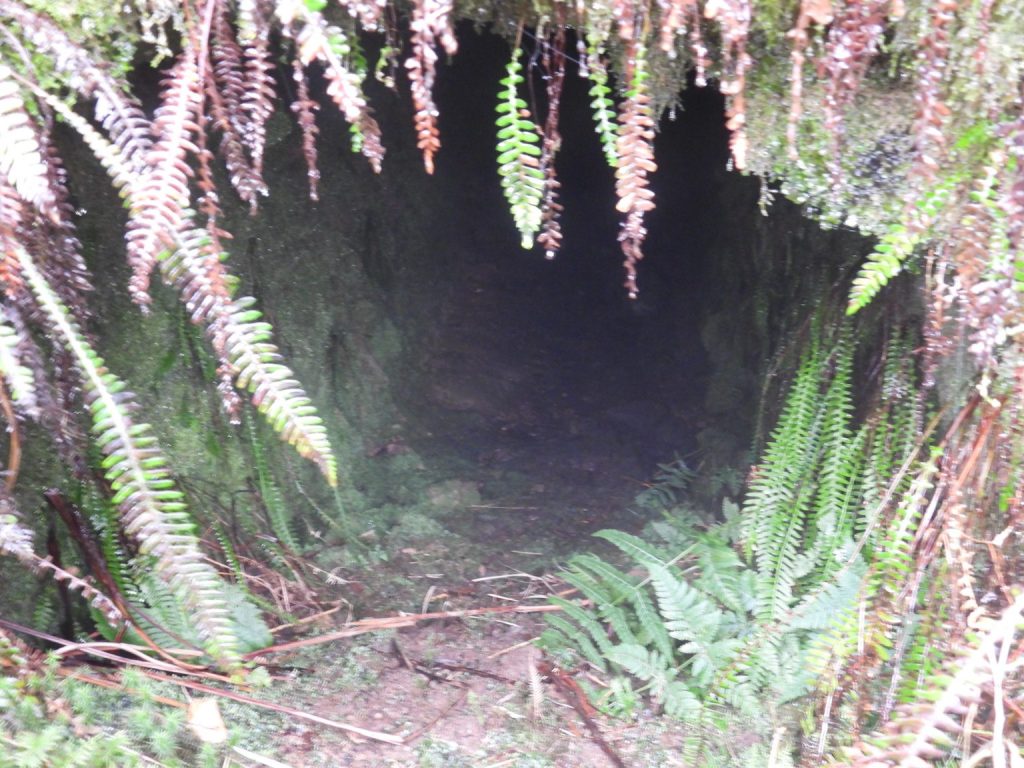
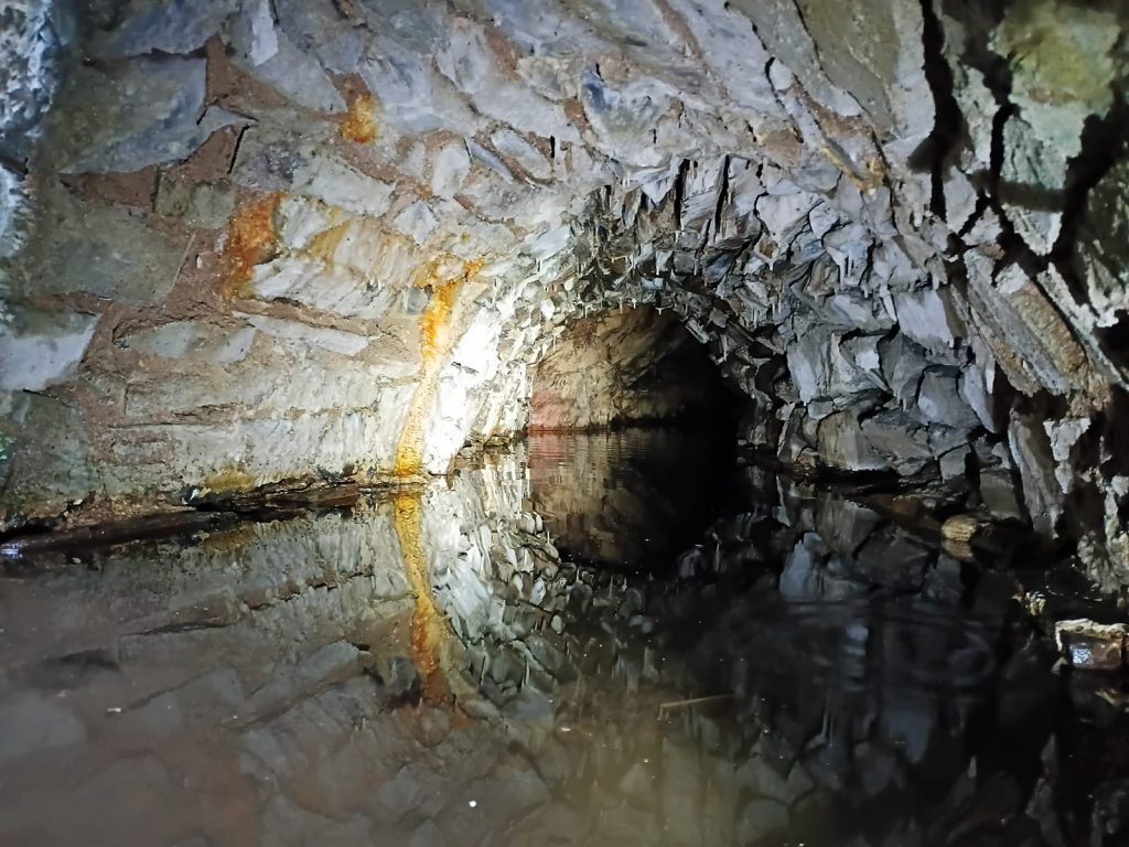
Inside shallow adit. The adit is only 6m below the level of William’s Shaft. It may still be entered, though not recommended to go further than the entrance on health and safety grounds, which is where this photograph was taken
It is thought that the adit is open back to the shaft, where it is blocked by backfill.
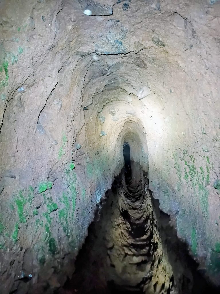
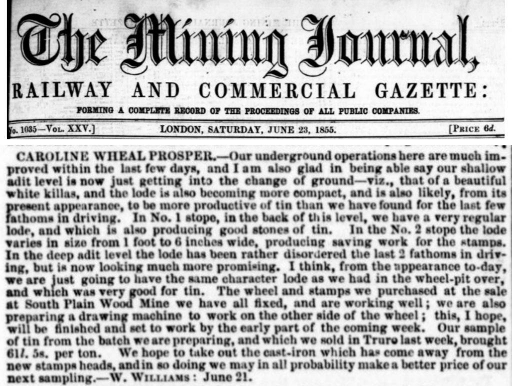
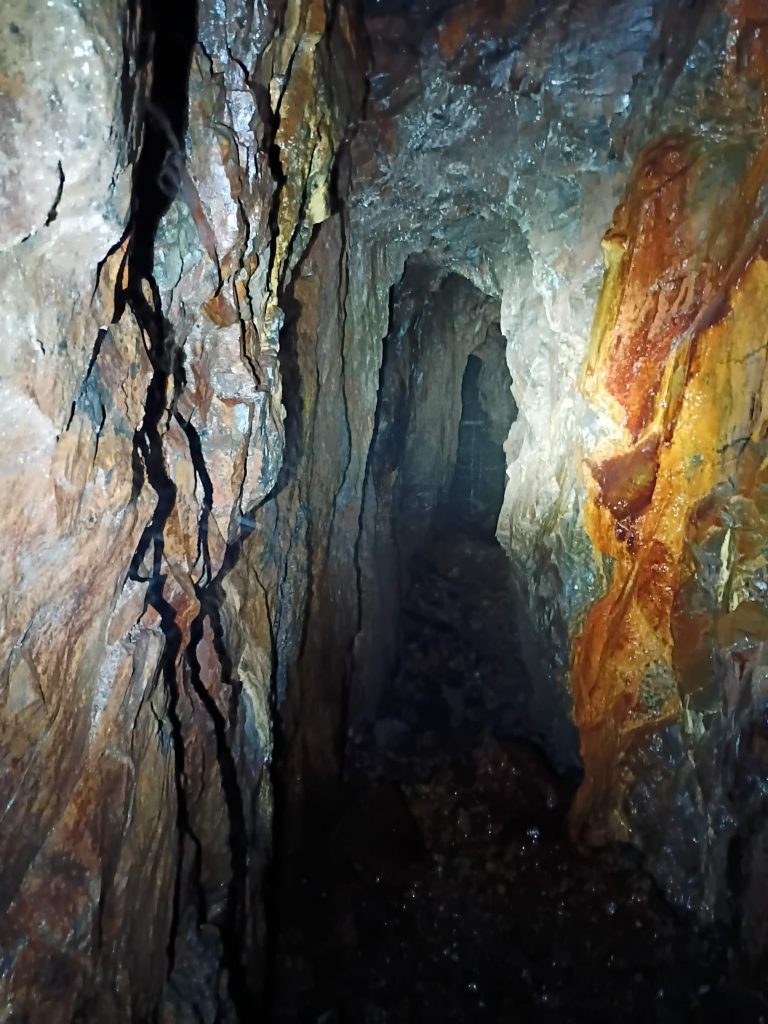
Reflections from water inside the shallow adit. In the Mining Journal (14th April 1855), Mine captain Williams recorded that four men were driving this adit west (ie towards the shaft) at a cost of £7 per fathom. Picture courtesy of Matthew Johnson
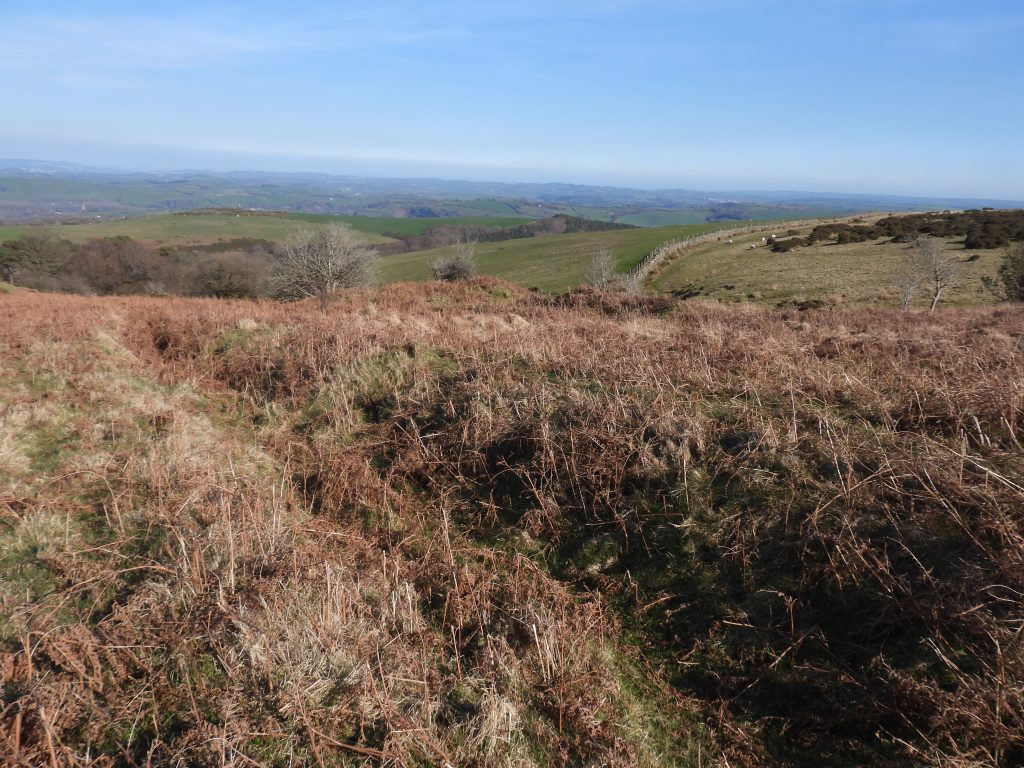
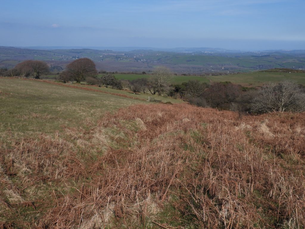
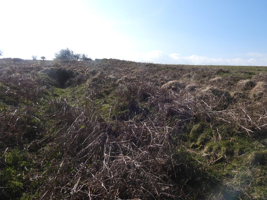
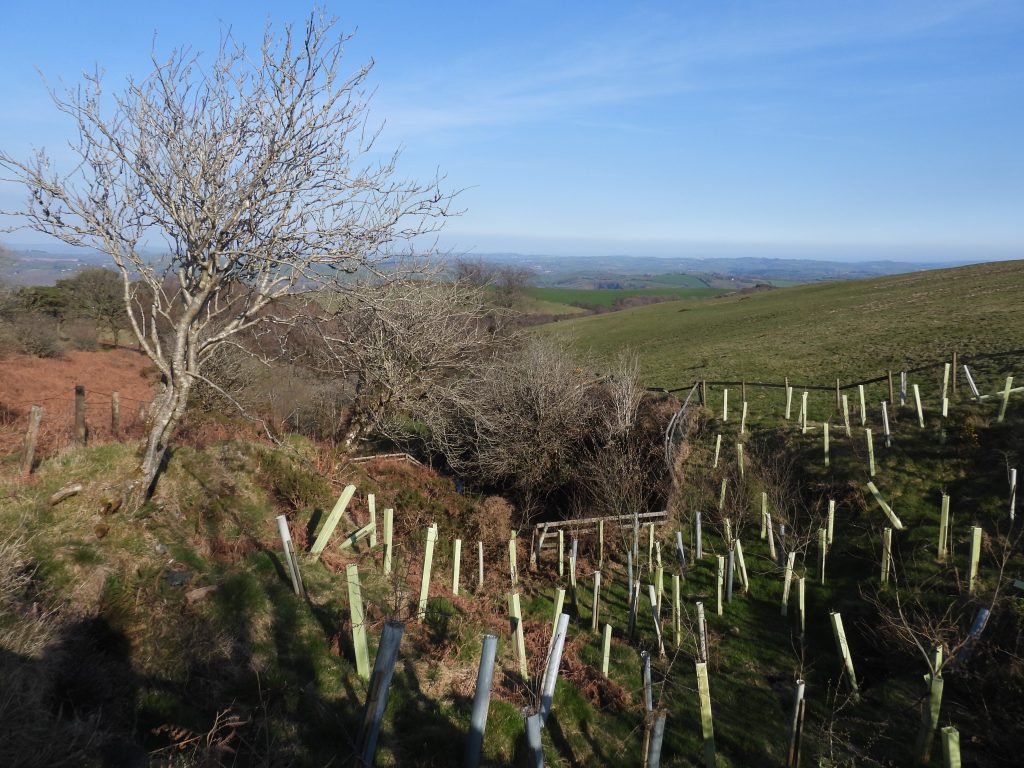
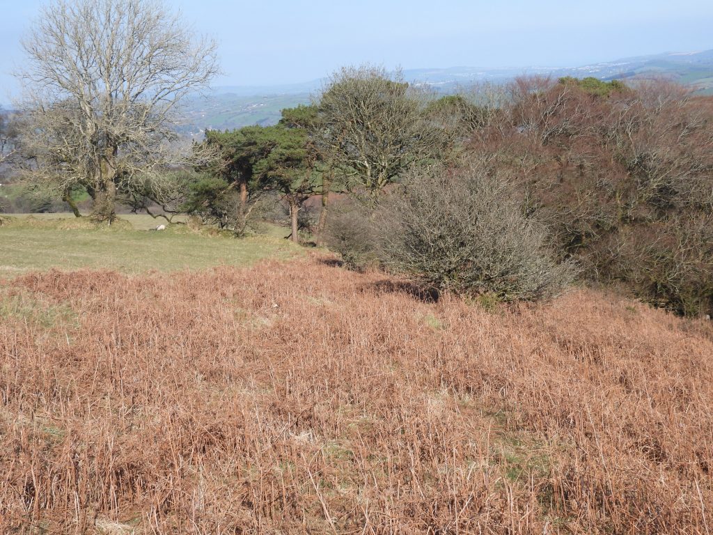
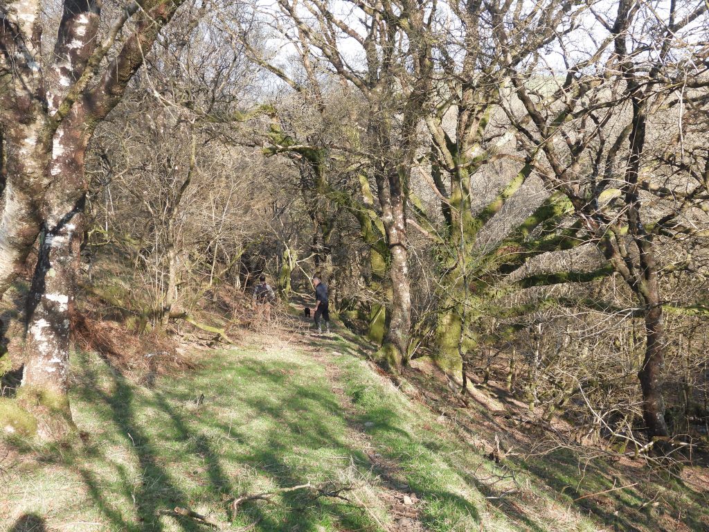
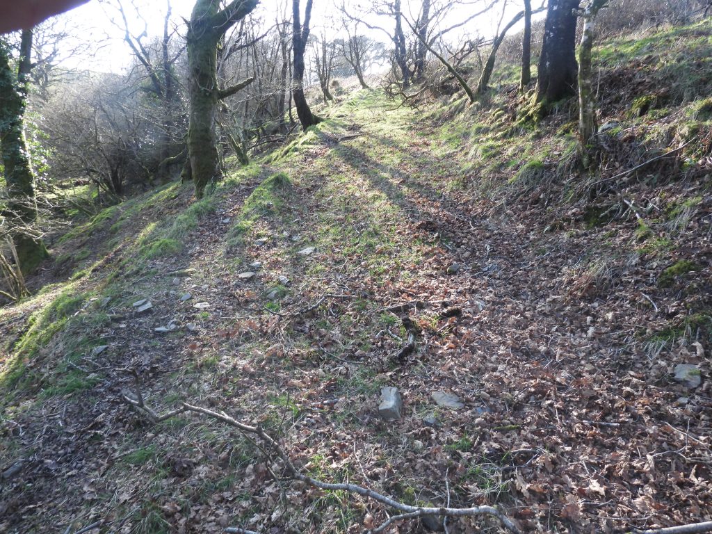
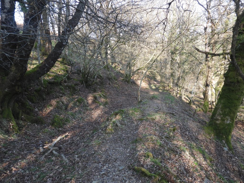
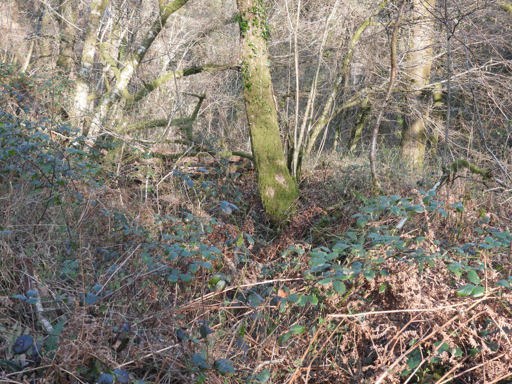
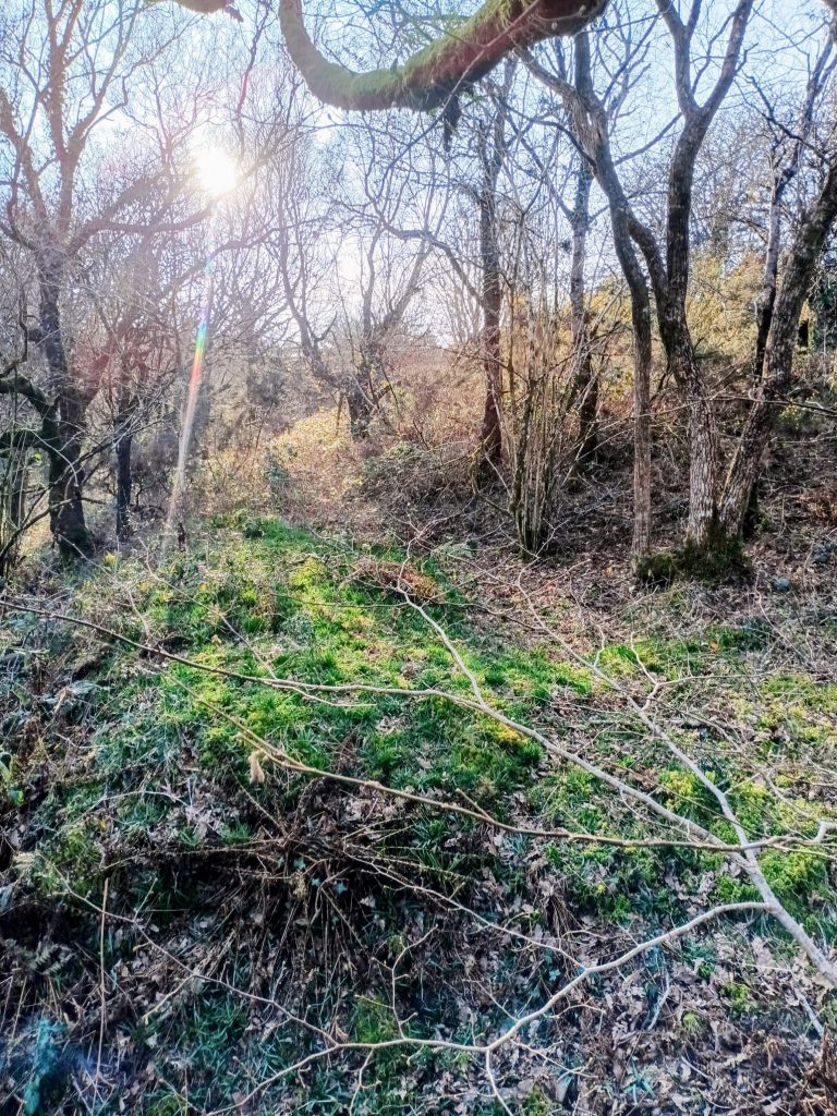
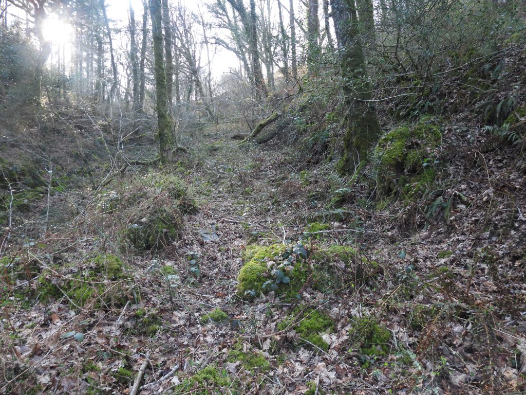
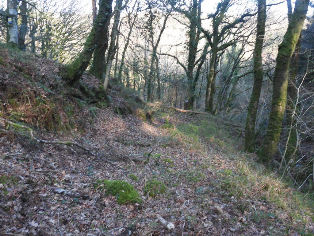
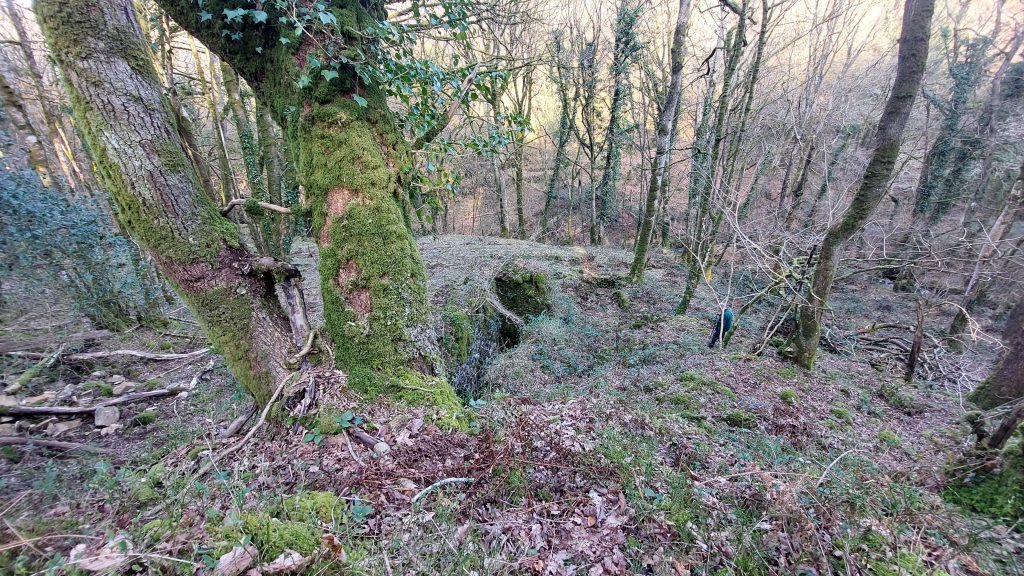
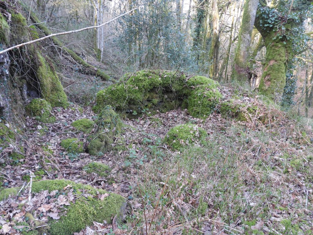
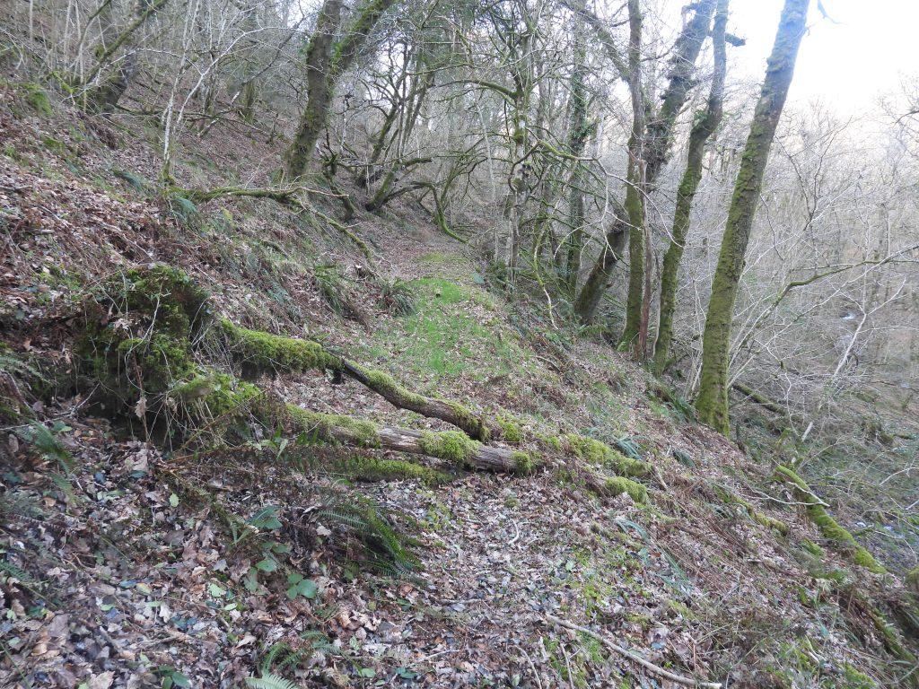
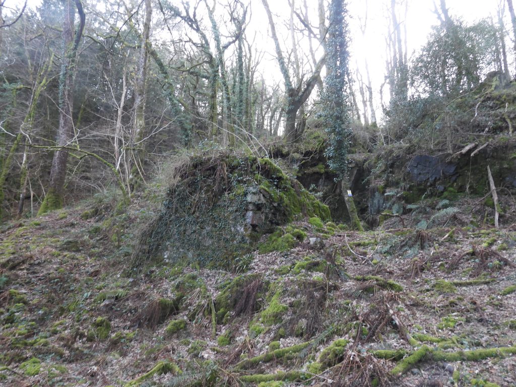
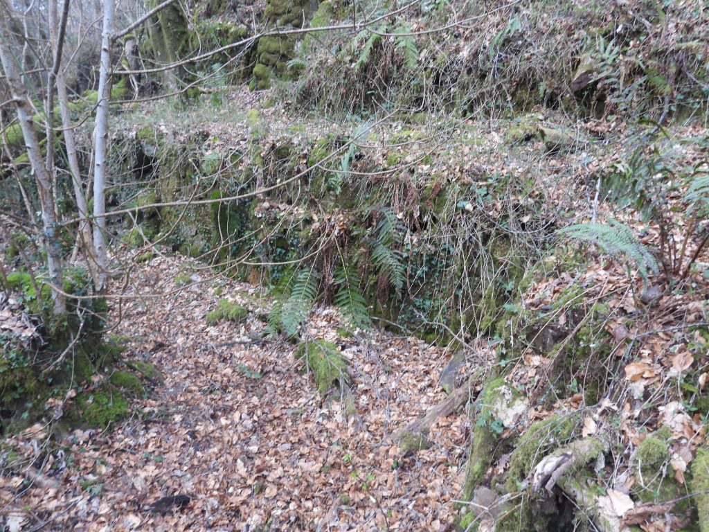
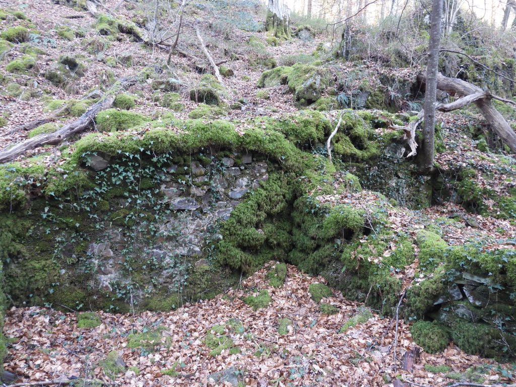
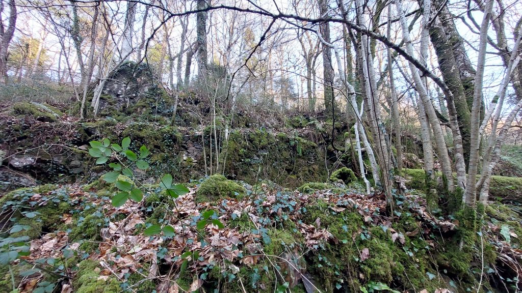
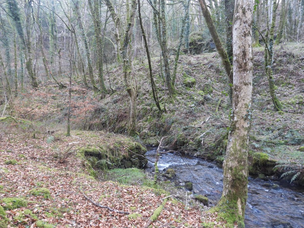
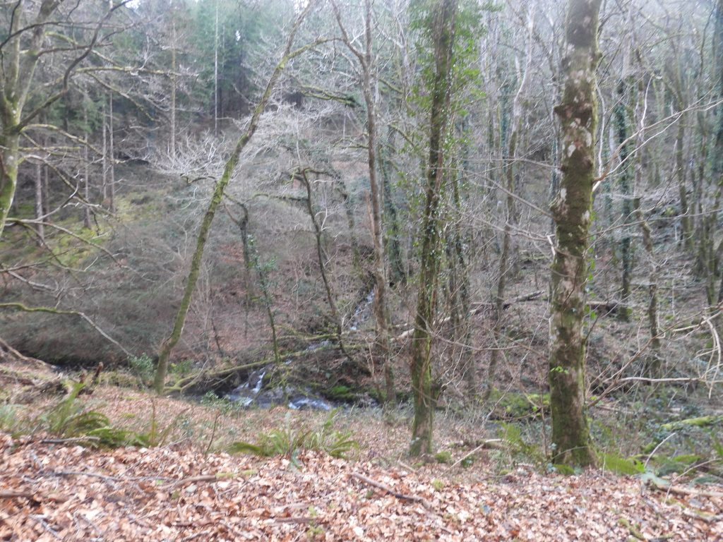
Entry from Mining Journal from December 1854. Hamilton Jenkin records that the Williams Shaft had been sunk to a depth of 15 fathoms a year later than this. One assumes this entry refers to the shaft and not the deep adit at the dressing floor Share information regarding 5000 shares for Caroline Wheal Prosper from the Mining Journal on 30th December 1854. Interesting that the title is ‘Mines not having sold ores’. Just over 100m further down the hillside (east) from the shallow adit there is a 36m-long linear spoil heapThe end of the linear spoil heap is where the (left) tree can be seen in the photographThe tree at the end of the spoil is located within a shallow depression. On first impressions the depression doesn’t look natural – that said, this might have been the level of the ground before the waste material was dumped on the spoil heap above. There was a lower adit depicted on the abandoned mine plan but there is no field evidence at this particular location (if it was ever driven at all?)To the south of William’s Shaft there is a gully which looks like an openwork (see LiDAR in this post). The ‘openwork’ is bordered by a wall to the north and has small stony ‘dams’ across it, which one assumes is part of the peat restoration project (picture from 2025)Stony dam within the openwork with the earthworks near Williams Shaft beyondIn the English Heritage (Newman) report records that if there was a lower adit as suggested on the mine plan it may “have been sited in the canyon of the tributary” (see photograph). Onto private land below the footpath, following the inclined tramway east towards Larkham Woods. Whearas the upper portion of the inclined tramway was on a raised embankment, the construction changes to a terraced cutting running along the side and down the slope of the valley further down. The size of embankment and cuttings suggesting it was single track onlyOn a plot of land called ‘Pieces’ on the Tithe of 1843 a dug out area can be found which is thought to have been a quarry. It may well have been used in the construction of the nearby Lambs Down Farm (which was occupied until the 1840s, appearing on the 1841 census but not the 1851 census). More information about the farm can be found here: Lambsdown Farmstead – Dartmoor ExplorationsThe ‘quarry’ is located at SX69720 65758. The author has a theory that stone for Lambs Down Farm was quarried here, then after the farm was abandoned the stone was ‘recycled’ and used for the mine wheelhouse and buildings in Larkham Woods – there is no documentary evidence to support this theory but the timeline fits perfectlyInto Larkham Woods following the inclined tramway. Looking back up the slope of the inclined tramway. From William’s Shaft down to the dressing floor the tramway falls by around 125m. The venturers must have expected an enormous quantity of ore from William’s Shaft for such an enormous investment of effort and cash, in building the tramway. According to the mine plan there were flatrods running more or less parallel to the inclined tramway from the wheelhouse up to William’s Shaft. Newman records that the “course of the rods is depicted on the abandoned mines plan leading up the slopes of Lambs Down to the west. It is shown with only one angle and two completely straight sections and appears to pass beneath the tramway about half way along. The only indication of its course surviving on the ground is a terraced cutting in the hill slope 120m west of the wheelpit”. These features were not photographed by the author during his visit.The inclined tramway being cut into the natural slope of the hillsideWhere the inclined tramway has been cut by a modern forest track its course continues through very thick and brush and brambles. An alternative route to the dressing floor needs to be found from here.Just above a forest track around 50 metres to the south of the inclined tramway is a crescent shaped reservoir, which appears to have once provided water for the openwork above the wheelhouse. The reservoir has an obvious central sluice opening which can be seen in the photograph (the bank having been disturbed at some time since its abandonment)
The reservoir is approximately 22m long and with banks around 0.4m high (picture courtesy of Matthew Johnson – DTRG member)
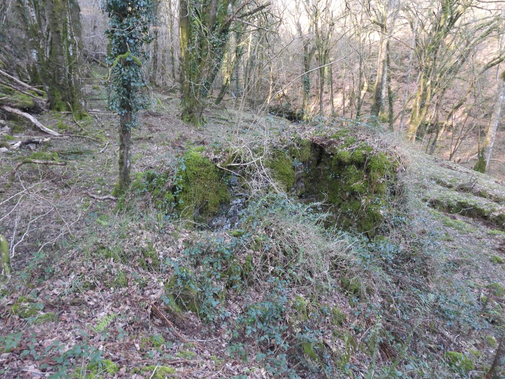
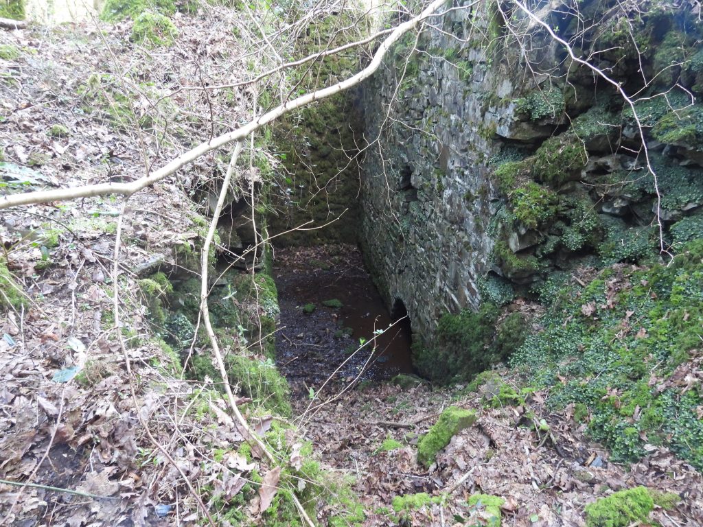
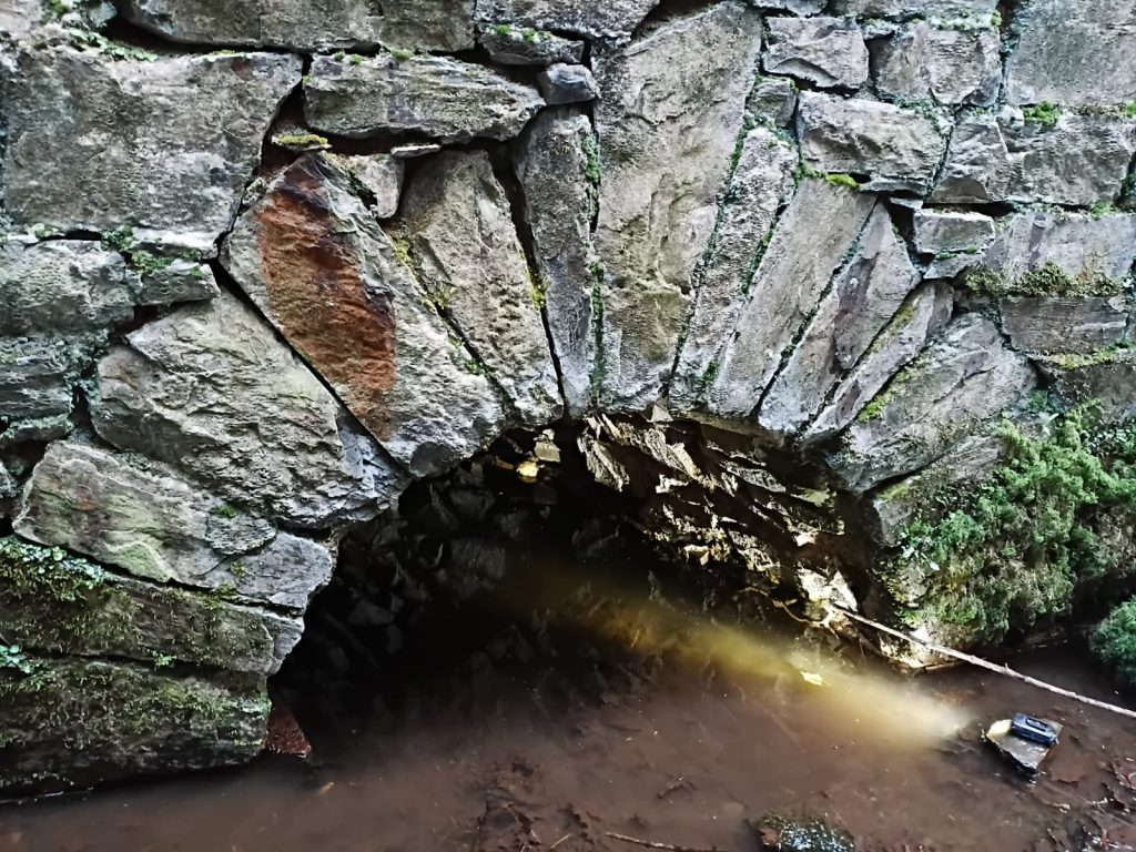
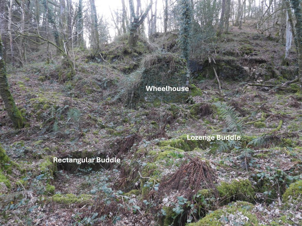
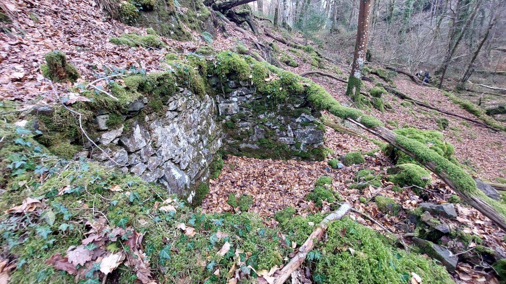
The reservoir pre-dates 1850 possibly by hundreds of years. It seems that it might have been fed via a diverted channel of the small tributary of Dean Burn which runs parallel to the inclined tramway (east-west direction). Also, it is possible it was supplemented using rainwater run-off collected from the slopes of Lambs Down, although the expert wisdom suggests this is less likely.Nearing the bottom of the inclined tramway (below the reservoir). Almost at the terminal point of the inclined tramwayThe authors sketch map above is based on the fabulous survey plan produced by Phil Newman and Simon Probert for English Heritage circa 2004. The inclined tramway terminates at the (unlabelled) curved wall just below the label ‘adit’ which is adjacent to the wheelhouse. The terrain here is very steep as is indicated by the light green shapes. The ‘Old Men’s Workings’ is where water from the reservoir would have been diverted.Close to the bottom of the inclined tramway. The ‘curved wall’ is just out of sight and the rock cut openwork and deep adit is behind the large tree in the photograph. The wheelhouse is the obvious dark area. Note the figure in the photograph for scale.Mining Journal extract from 14th April 1855. The entry mentions ‘deep adit’ which is immediately to the west of the wheelhouse and under the ‘Old Men’s Workings’. The ‘shallow adit’ is the one recorded in this post by William’s Shaft. They were engaged in preparing the ground for the dressing floor and wheelhouse at this time. The wheel was being purchased from South Plain Wood Mine, near Holne. This was the second wheel recorded in the Mining Journal in little under a year – 1854 / 1855. W (William) William’s, the Mine Captain appears to be the author of the report alongside a J. Williams, who one assumes was a relation (possibly a son, brother or nephew). This authors eye was drawn to what appears to have almost been a ‘throw away’ comment which states a lode “…is not at present rich for tin” – perhaps foretelling the future of this venture?This curved section of wall lies above the wheelhouse and adit as depicted on the sketch mapThis curved section of wall has been recorded as might having been: a) associated with either a balance bob for the waterwheel or b) part of a mechanism to enable the flat rods to negotiate the steep changes in the profile of the slope. There is mention of the use of a ‘drawing machine’ having been considered hereabouts (MJ – 23rd June 1855) and the author wonders if this was part of it?This curved section of wall is located at SX70116 65859Mining Journal entry for 23rd June 1855. An upbeat entry by Williams and Williams suggesting tin will be found soon at shallow adit. They also state that the ‘deep level adit’ was looking more promising. The wheel puchased from South Plain Wood Mine, near Holne had been ‘fixed’ and was working well. They were also preparing a drawing machine to ‘work on the other side of the wheel’ (was this where the curved wall is located, assuming the stamps lay on the flattish area on the north side of the wheelhouse?). There is a record here of some tin being sold in Truro.Overlooking the wheelhouse and dressing floor with the Dean Burn far belowSide view of the wheelhouse (left) with the dressing floor to the right (east), where there are two buddles Stone-cut channel is just above the ‘deep adit’ portal. Note the small ‘cliff’ adjacent to itThis stone-cut channel is just above the ‘deep adit’ portal. It is thought that it may have been an adapted section of an early working for the course of the flat rodsPhotograph taken from above the deep adit looking east into the remains of the wheelhouse. Cited by Tom Greeves (1981), a gold coin of Henry VI (1422-61,1470-71) was discovered in 1855 by men building the wheelpit / wheelhouse just in front of the deep adit. One assumes they were finishing off the structure in 1855 as it has been recorded that a 40ft wheel and 24 stamps were in place by November the year before (1854)Another view from above deep adit looking down onto the wheelhousePart of the 450m-long leat which took water off the Dean Burn. The leat width is up to 3m by 0.6m deep in places. The water fed the obvious wheel which was housed in the wheelhouse whose remains are recorded here. That said, surviving documentation hints there once may have been two waterwheels.Entrance to the deep adit, located between the wheelhouse and the stone-cut channel where the old men’s workings were (located above)The entrance to the deep adit is located at SX70129 65870This adit was mentioned by Mine Captain William Williams’ report in the Mining Journal (24th June 1854) by virtue of stating they had “got under” the “old miners’ workings”. The light coming from the adit is from two members of the DTRG
Inside deep adit. In the Mining Journal (14th April 1855), Mine captain Williams recorded that six men were driving this adit at a cost of £8 per fathom. Picture courtesy of Matthew Johnson
Inside deep adit. Picture courtesy of Matthew Johnson
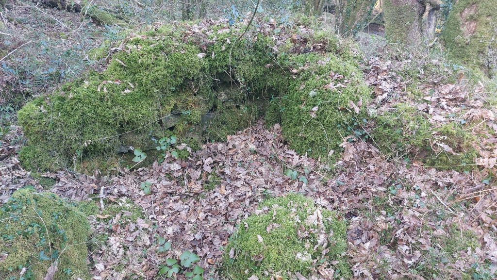
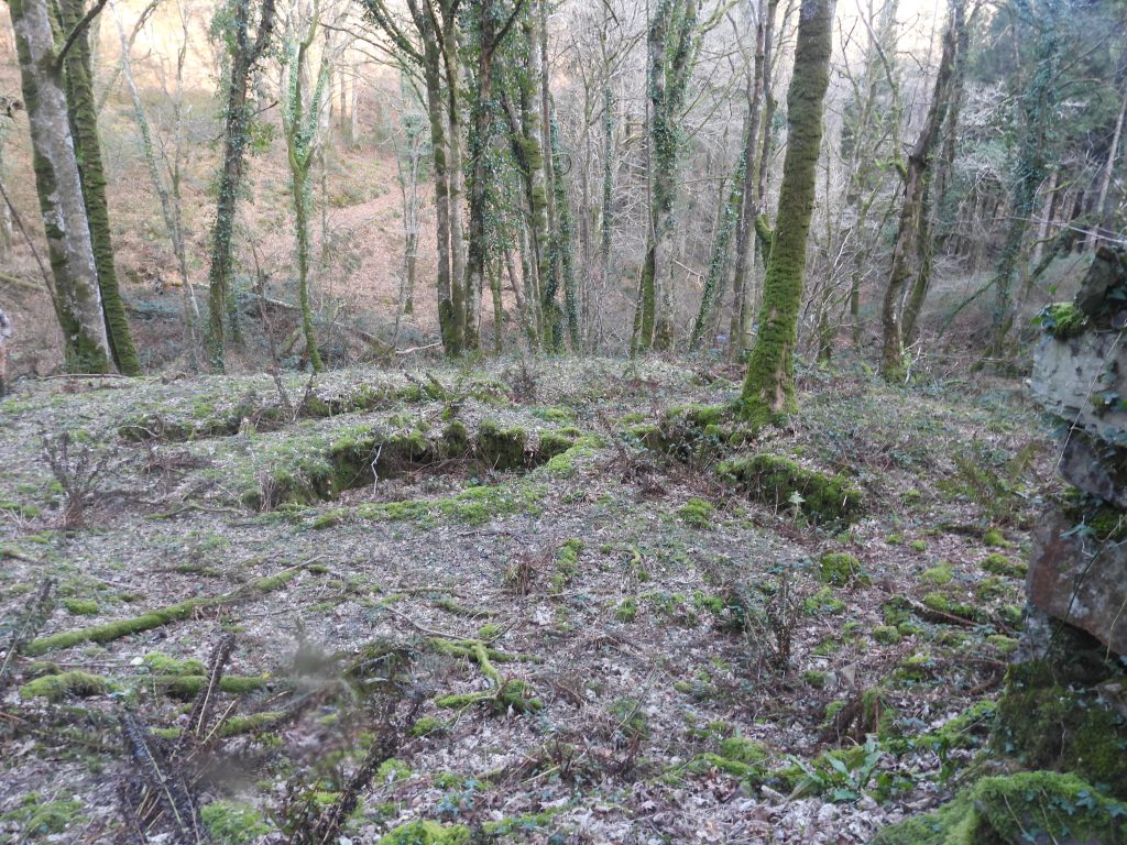
Looking down into the wheelhouse. It is located to the west of a level shelf (where the buddles are located) and against the steep rockface, just in front of the adit. The length of the wheelhouse is around 9m
The wheelhouse internal depth is up to 5.5m with a width around 2m
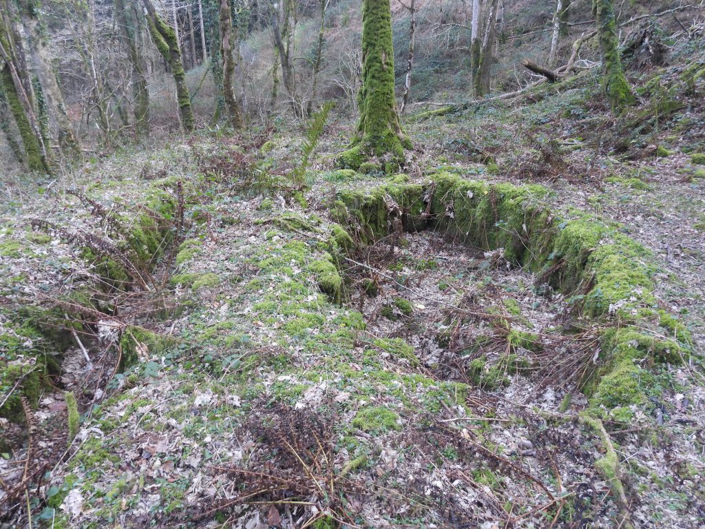
By November 1854, it was reported that all the machinery had been installed at Caroline Wheal Prosper by Messrs Gray and Oatey of the Wadebridge Foundry which consisted of a waterwheel and 24 heads of stamps (ref: Hamilton Jenkin (2005) – page 111). The wheel was 40ft and was the first (of two) to use the wheelhouse. The original wheel was started at a ceremony with the adventurers assembled. The purser’s wife, Mrs Hamilton, pronounced success to the mine, ratifying the same by the sacrifice of a bottle of champagne on the wheel, which ‘immediately commenced its majestic gyrations’. There was also a celebration of the new venture twhen shareholders dined at the Churchwarden’s Hotel and the miners and labourers were treated to dinner at the Waterman’s Arms in Buckfastleigh (Devonport Journal – 30.11.1854)The wheelhouse contains a rather splendid 1.1 m-diameter arched opening (exit portal)The exit portal archway. In spite being over 170 years old, the archway is remarkably preserved and the construction must be admiredLooking inside the rock-cut exit portal / tunnel. The exit portal leads into a curved tunnelThe tunnel is around 12 metres long. Picture courtesy of Matthew JohnsonThe exit portal is on the south east side of the wheelhouseThe end of the rock-cut tunnel (tail race) from the wheelhouse. Light can be seen in the photograph from the arched exit portal at the wheelhouse. Picture courtesy of Matthew JohnsonLooking at the wheelhouse from below. The wheelhouse was built in 1854 (ref: Mining Journal – 24th June 1854). It housed a 40ft wheel which was installed by November that year and drove 24 heads of stamps. Another wheel was installed in April 1855 and was purchased from South Plain Wood Mine near Holne Bridge (Mining Journal – 23rd June 1855). The stamps were (most likely) located on the north side of the wheelhouse (to the right of the structure), albeit there is no remains to definitively support this.Looking across the dressing floor towards the wheelhouse. Mine records imply that another stamping mill (the first ?) was still operational while the second (with the wheelhouse) was being installed. The mine plan (DRO AMP R79F) indicates a second waterwheel, which was located just below the tail race (left side of the photograph) which had ’16 stamps’. There are no remains of a second wheelpit today.There are two buddles to the east of the wheelhouse. The northern buddle is an unusual lozenge shape and immediately below and to the south is a second buddle of rectangular outlineView of the lozenge shaped buddle (long axis is 4.5m and a width is 2.1m). Wheelhouse and dressing floor from the east. The rectangular buddle measures 4.3m by 2.3mNot far from the east bank of the Dean Burn is the probable location of another adit, which is probably one which Williams mentions in a report of 14th July 1854 (‘work commenced on driving a deep adit east’). There is a narrow gully here with some spoil, leading to a blocked portal. The location is SX7018065865On the east side of the Dean Burn is the ruin of a stone buildingOn the abandoned mine plan the building is annotated as a house and officeThe building was probably single storyThis photograph of the building was taken at SX70173 65879The building has three internal dividing walls creating four compartmentsThe overall length of the building is 23.5m and is 5.5m wide (Newman)A powder house / magazine building is located around 15m north of the house and office. It is built on and against a rocky outcrop / torThe structure is square at around 2m x 2mThe walls are quite thick at around 0.5m and survive to around 1.5m high. The photograph shows a contextual view in relation to the Dean BurnThe powder house / magazine is located at SX70161 65918The final known entry in the Mining Journal relating to Caroline Wheal Prosper is dated 22nd October 1859. The article indicates the operations had been suspended for more than two years, suggesting circa 1857 for the closure of operations. The article is very scathing of Capt. William V. Williams stating : ‘The career of the mine has been remarkable for its recklessness in the Ashburton district……The quantity of tin supposed to be discovered was so great that thirty heads of stamps were erected, and a long railway was laid down from the shaft to the floors’. So £8000 spent (equivalent to £1.3M in 2026) for a hearsay 10cwts of tin! Of note in the record is stating there were 30 heads of stamps…the 1854 wheel drove 24 head of stamps, so perhaps its replacement purchased from South Plain Wood Mine near Holne Bridge in 1855 drove an extra 6 heads ?Behind the powder house (magazine) there is an un-named cliff outcrop. As there is no provenance, the author has named it Larkham Woods TorLarkham Woods Tor at SX7017 6591The photograph shows where the track on the east bank of the Dean Burn, where a bridge once stood. The bridge would have been constructed from timber. Newman records this crossing thus: “…….for all that remains of it today is a two-sided stone revetted abutment of 9m by 4m by 1.2m high on the east side of the river and a length of revetment some 15m long on the opposite side”Climbing the hill to the east out of the Dean Burn valley, described in Mines of Devon (Hamilton Jenkin) as a ‘gorge’. Where the tributary meets the Dean Burn can be seen clearly