A collection of walks, discoveries, insights and pictures of exploring Dartmoor National Park
February 26, 2026
Blacktor (Middleworth) Tin Mill
On the Devon Historic Environment Record at grid reference SX5755 6911, a wheelpit, which can be found adjacent to a large openwork is recorded and referenced by Butler (1994) and Fletcher (2007-8). Further research reveals that the wheelpit was part of a 17th century Tin Mill called Blacktor.
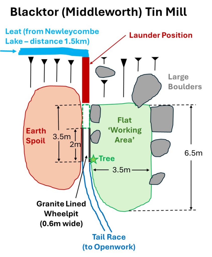
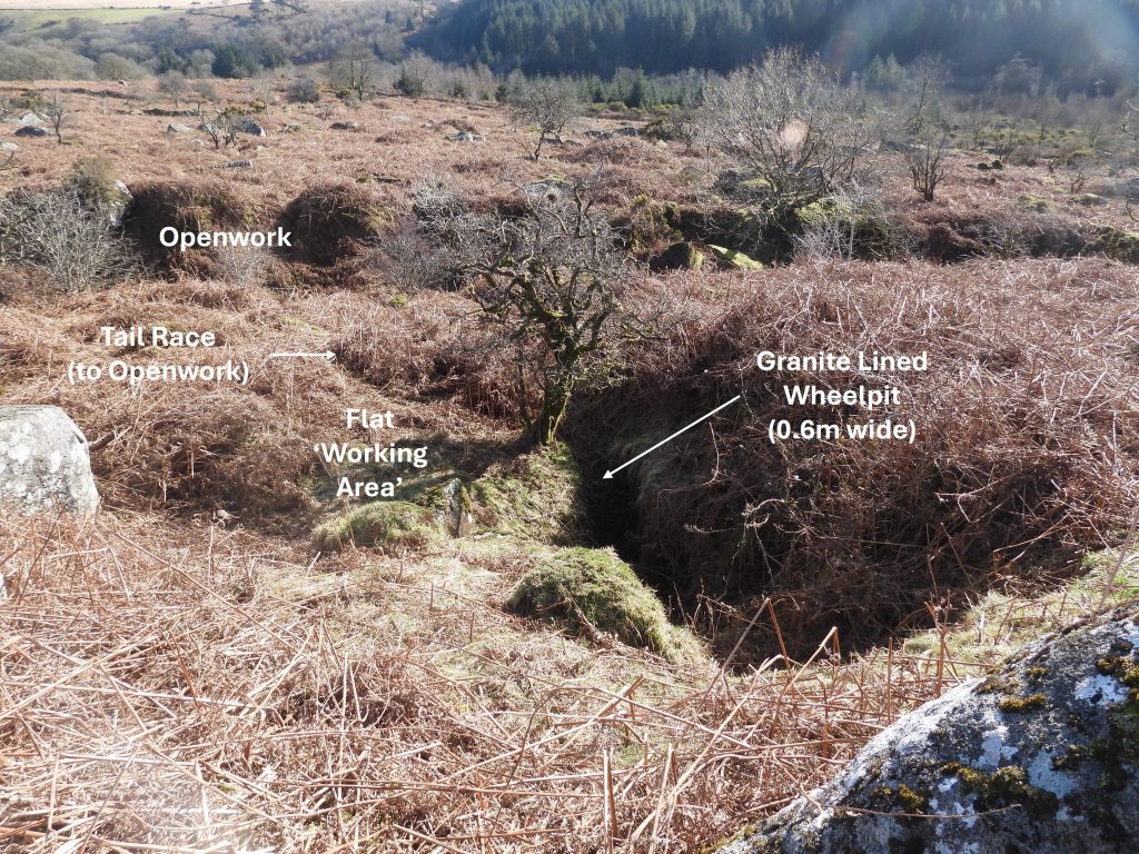
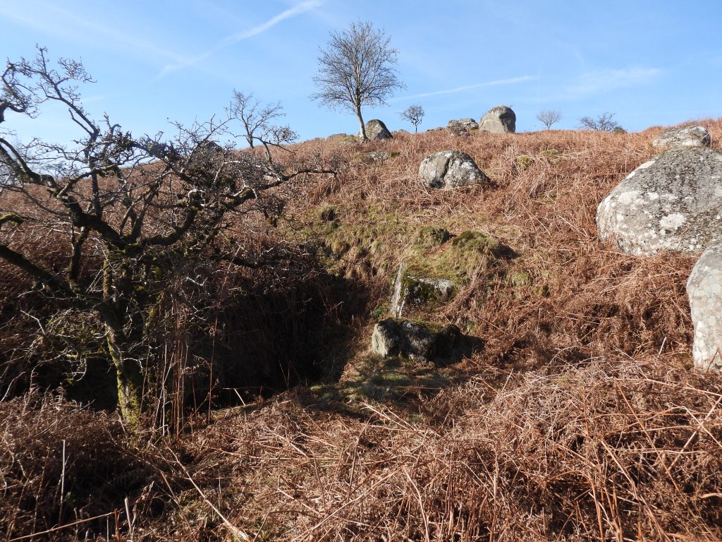
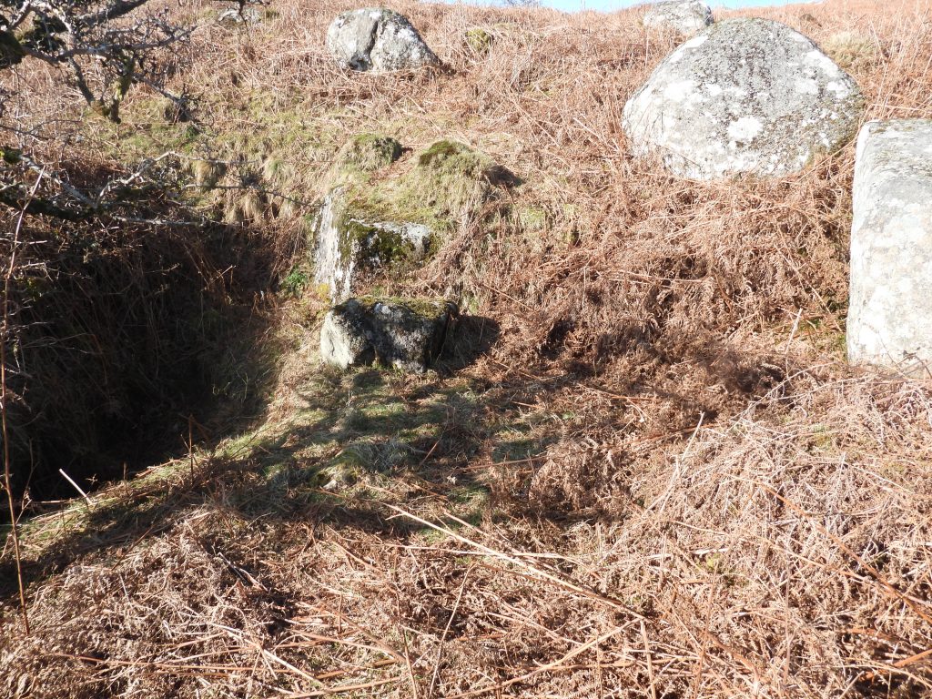
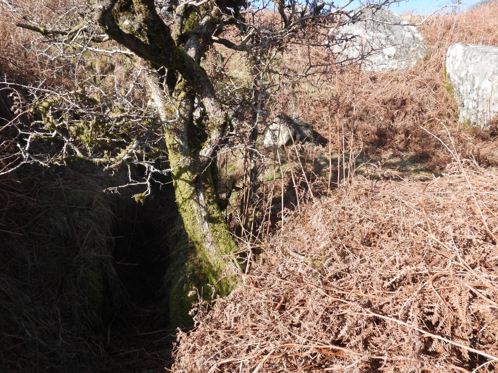
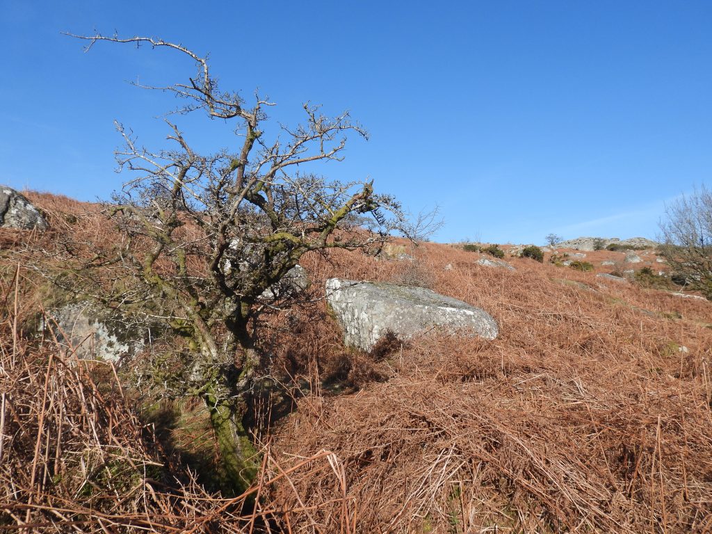
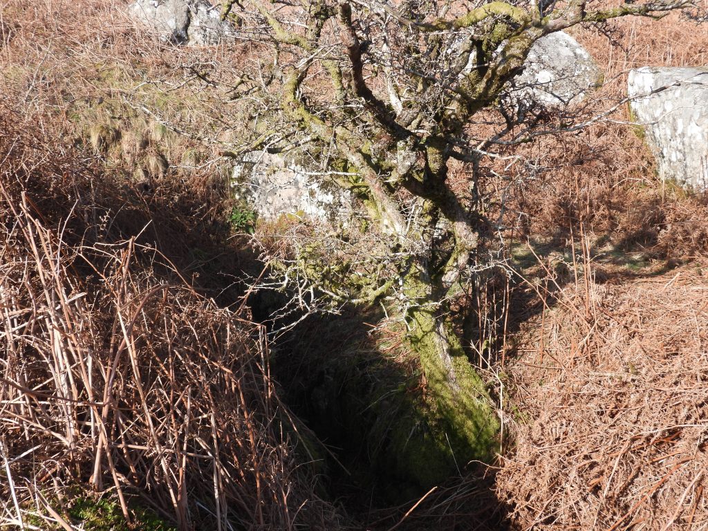
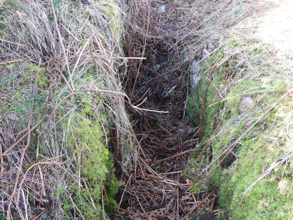
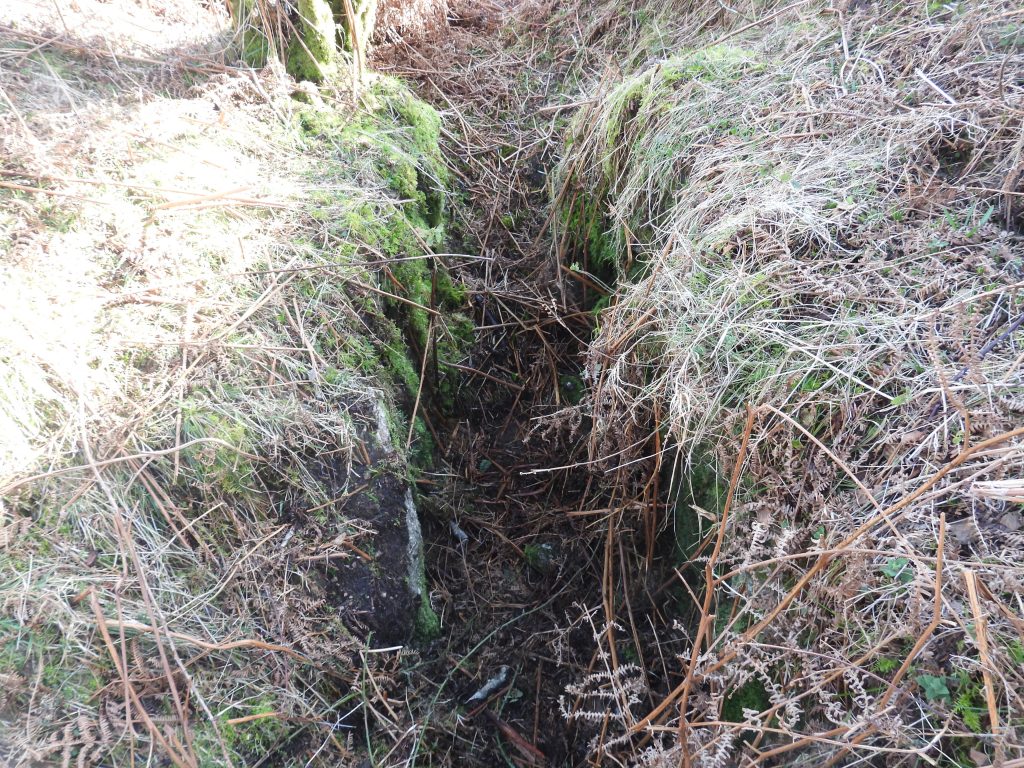
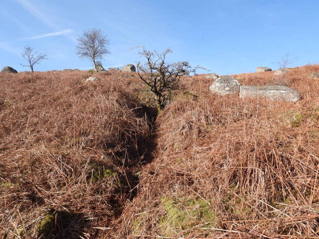
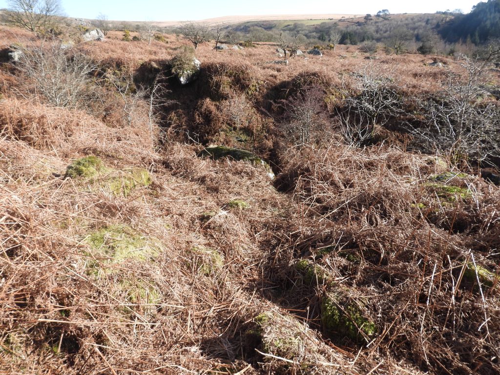
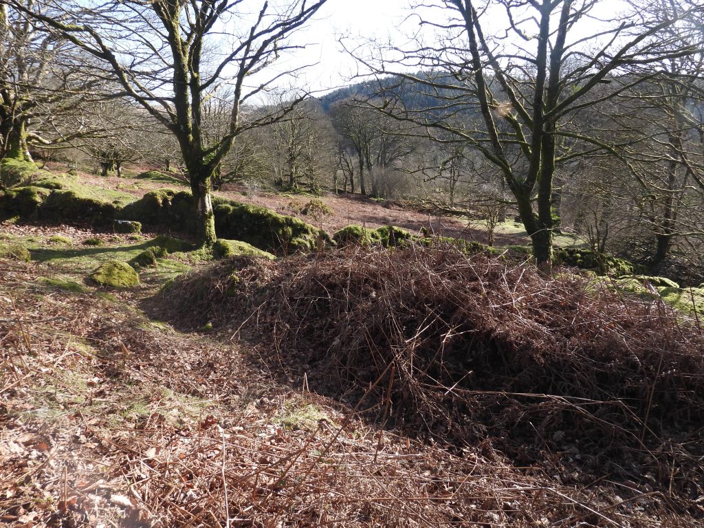
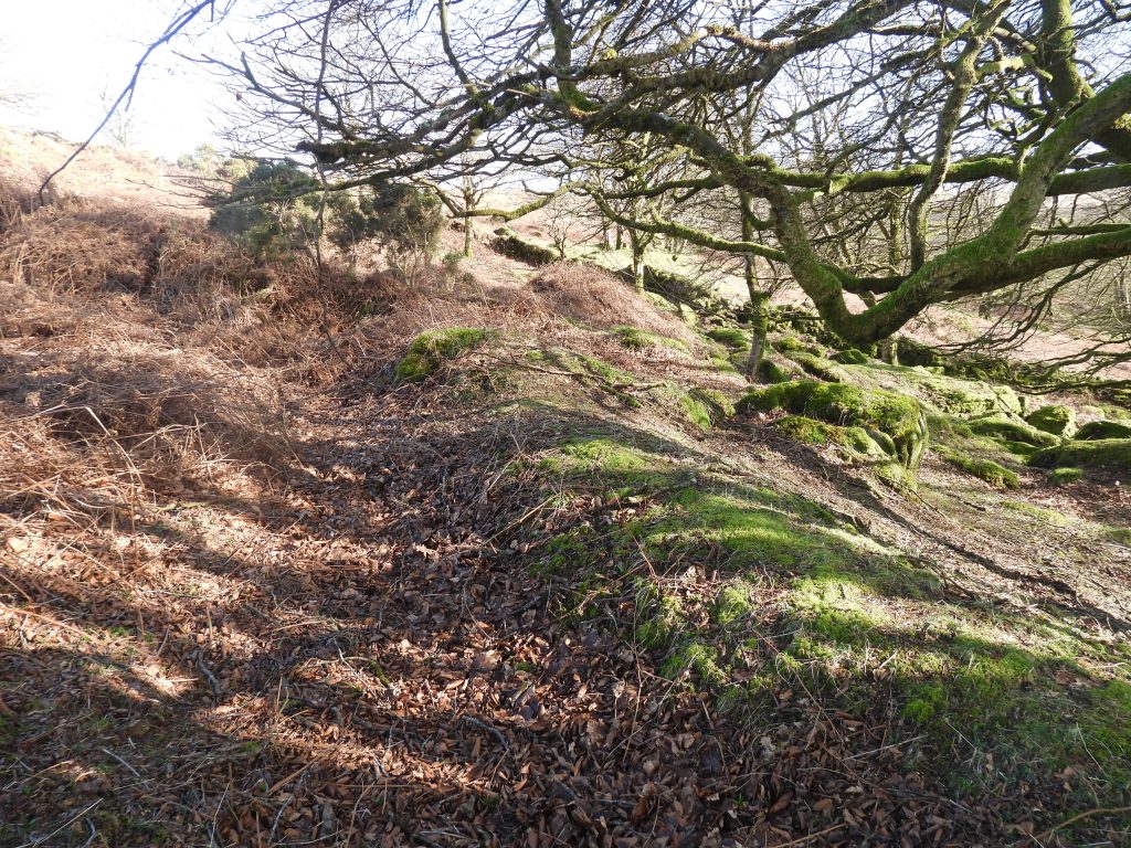
The mill is located just above (to the west) of the large openwork approx. 350m east of Middleworth Farm and not far from the Middleworth Farm to Deancombe Farm track in Narrator Brook valley. The mill comprises a small flat ‘working area’ adjacent to the wheelpit and is cut into a steep slope. The wheelpit is narrow at only 0.6m wide and is located in a 2m long ‘slot’, which is faced on each side by a drystone wall of poor quality. The mill waterwheel would have been fed by water flowing along a 1.5km long leat which still can be traced back to Newleycombe Lake (virtually opposite Classiwell Farm). The point where water would have been laundered to the top of the wheel from the leat above is very obvious and the tail race from the wheelpit empties into the deep openwork between two ruinous hut circles.
What is curious about this small mill is that it is served by such a long leat. Why would such a long leat have been constructed for such a small wheel in the mill? Perhaps the answer to this question may be found on the 1886 OS Map where the leat is shown leading only to the Middleworth Farm area. It is likely that the leat, which seems to have previously been extended to the mill at some point (the junction of the leat split to the mill and the farm being just below Snappers Tor), had been constructed to serve the Middleworth homestead / community, which historically had associations with the tin industry.
Research conducted by Dr Phil Newman records: “Richard de Middleworthi is recorded coining tin in 1303. In 1567 ‘Mydleworthie’ was held by Joan, wife of Elizeus Bailie, who had in 1550 coined tin at Tavistock. In 1611 the windiates of Middleworth granted shares in tinworks at ‘Keyglesburrowe’, ‘Reddapit’, ‘Cramberplena’, ‘Deancombe Lake’, ‘Deancombe Land’.” It is probable that the leat therefore was constructed for Middleworth and its associated mill, possibly as early as the 16th or 17th centuries.
Perhaps the final piece of the jigsaw to the story comes from research conducted by Dr Tom Greeves who recorded : “Blacktor mill; in a document of 1693 mentioned as lying at the head of sowtons meads tinwork. The mill was situated near Middleworth farm”.
This post provides a photographic record of the Tin Mill and its associated Leat and the author considers (as an enthusiastic amateur) additional evidence which dates the Leat and links it to the Middleworth land(s).
Bibliography
Jeremy Butler – (1994) – Dartmoor Atlas of Antiquities: Volume Three – The South-West, 65, Map 47
M.J. Fletcher– (2007-2008) – Walkhampton Premier Archaeological Landscape; Field Investigation Project
The Tinworking Landscape of Dartmoor in a European Context – (2016) – Paper presented by Dr Tom Greeves – Lodges and Mills: The Field Archaeology of Tin Accommodation, Stamping and Smelting on Dartmoor at the conference (6th – 11th May 2016) at Tavistock – Mill number 19
Phil Newman – (1994) – Tinners and Tenants on South-West Dartmoor: a case study in landscape history, 224, 231 (Article in Serial). SDV340414.
Sue Rogers – (2026) – Pers. Conv.
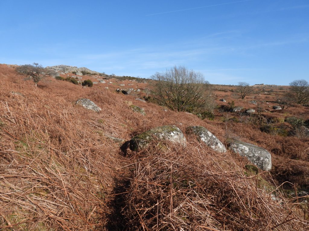
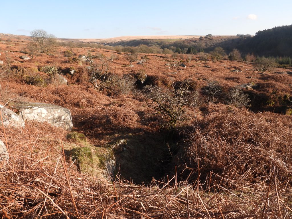
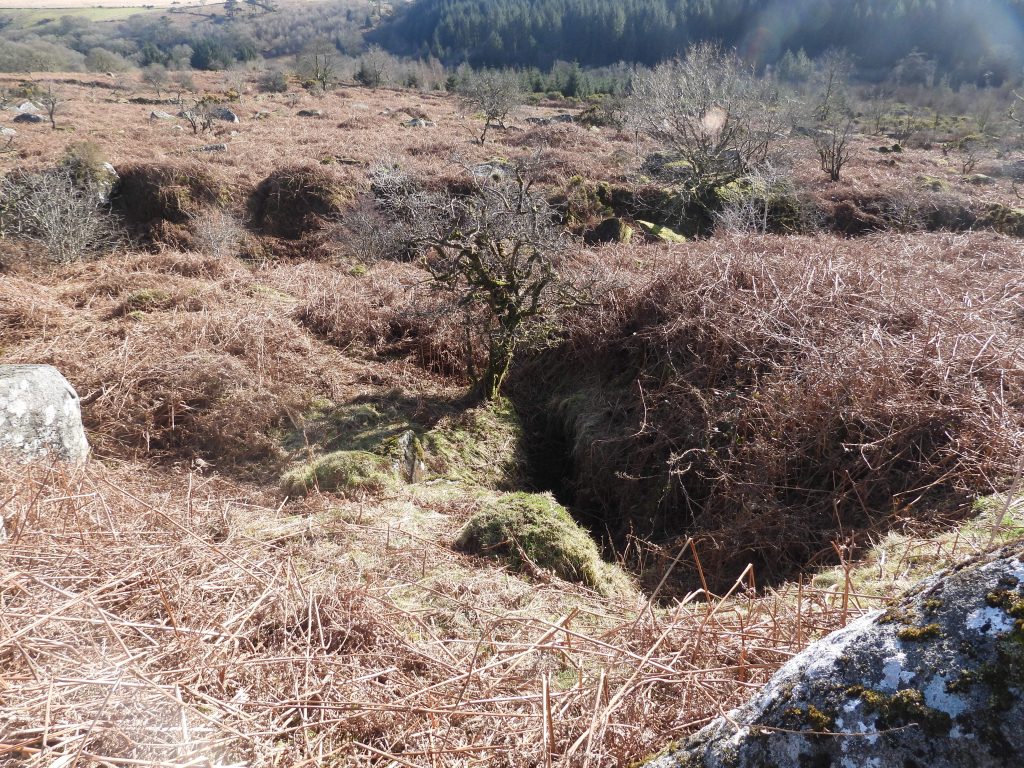
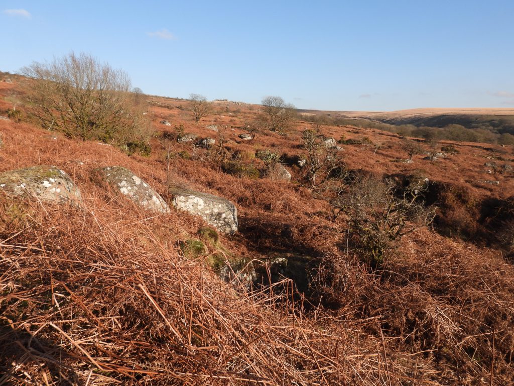
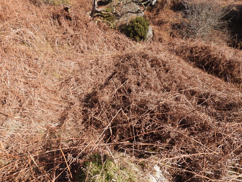
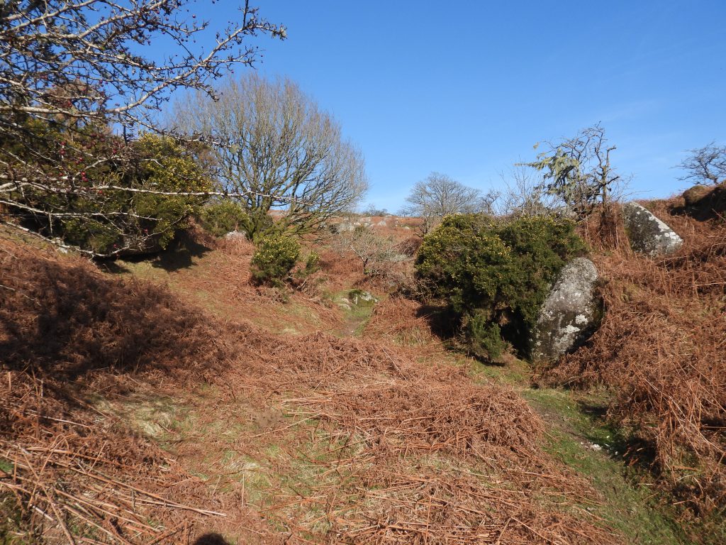
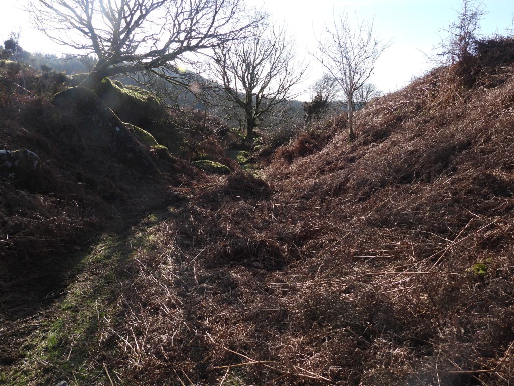
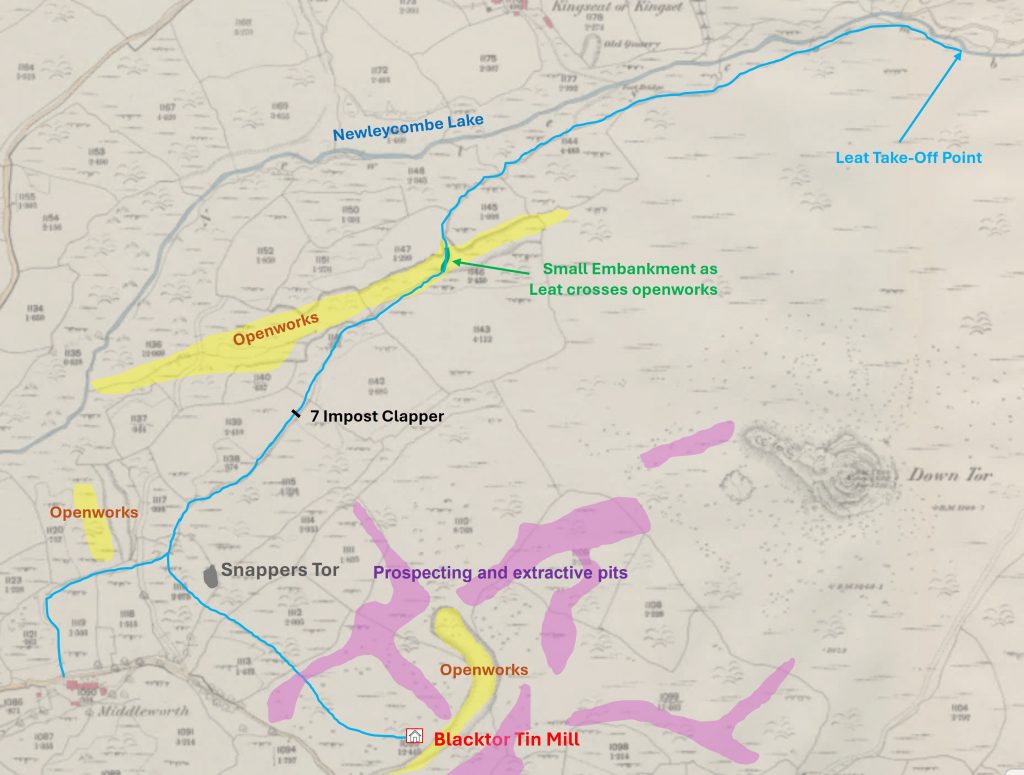
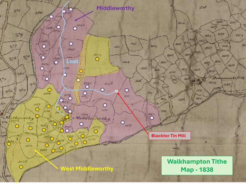
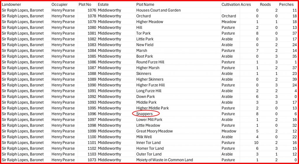
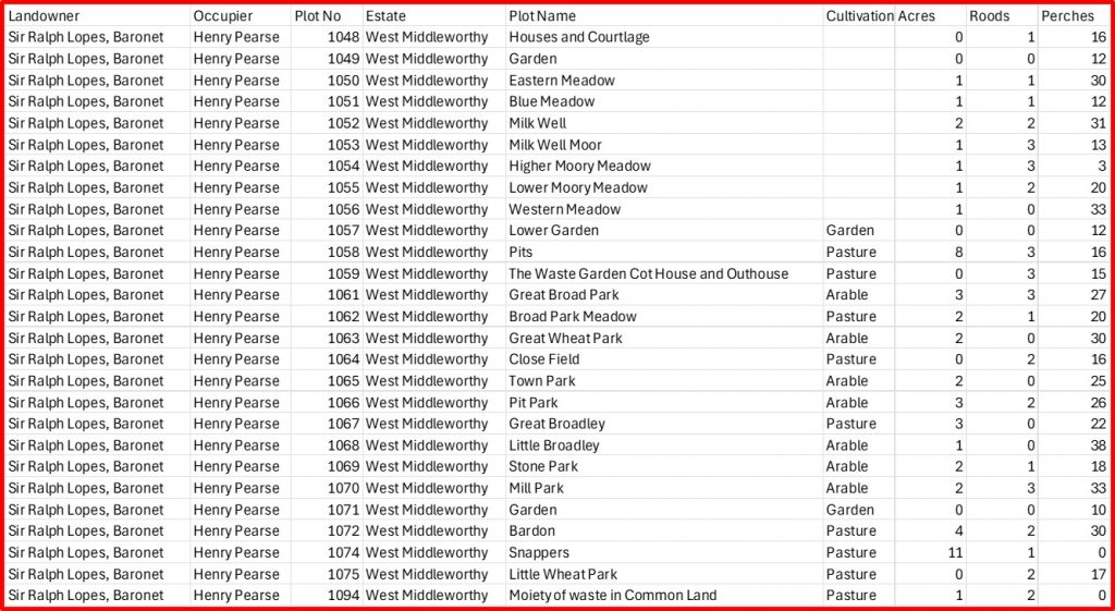
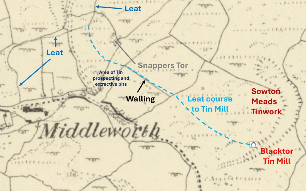
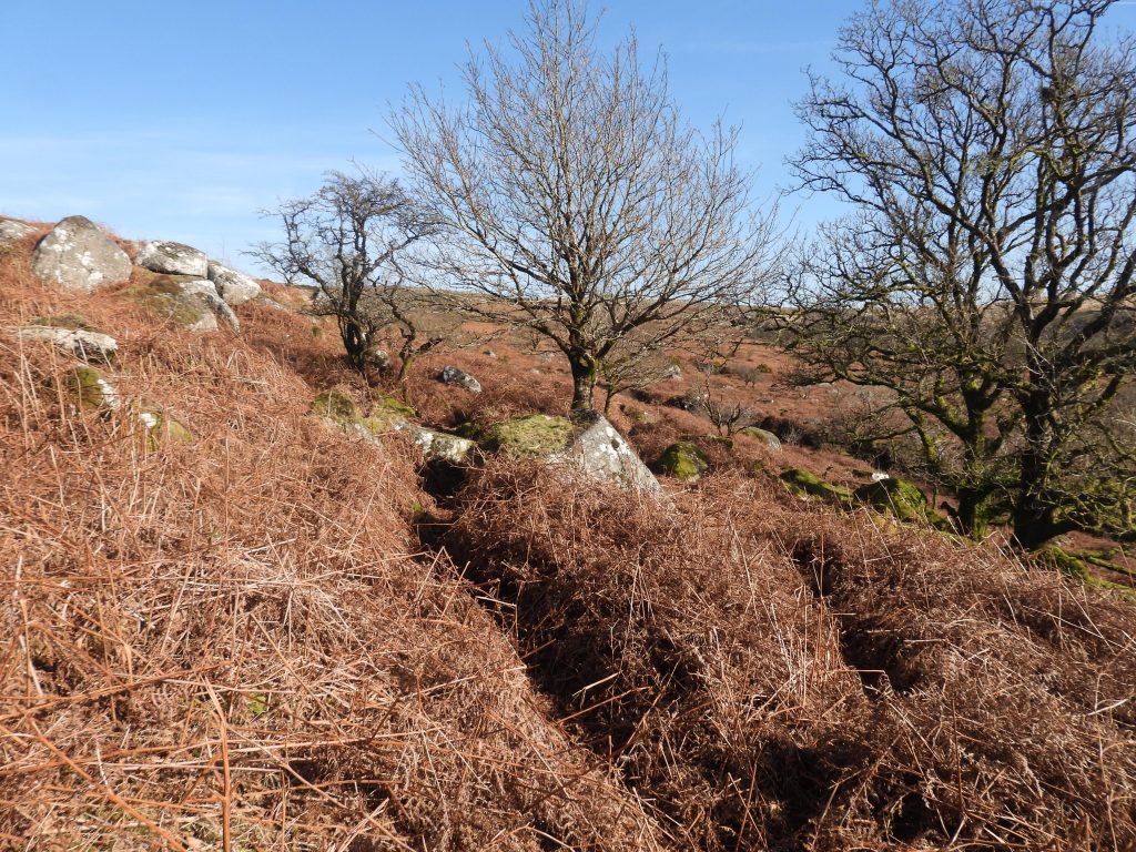
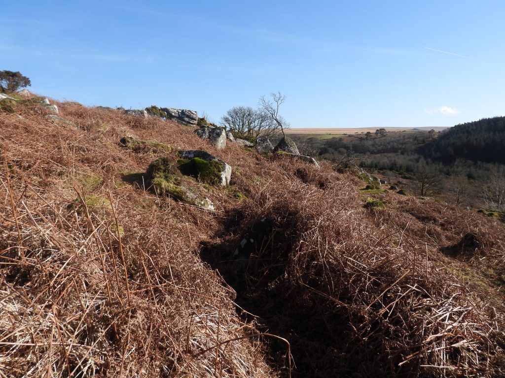
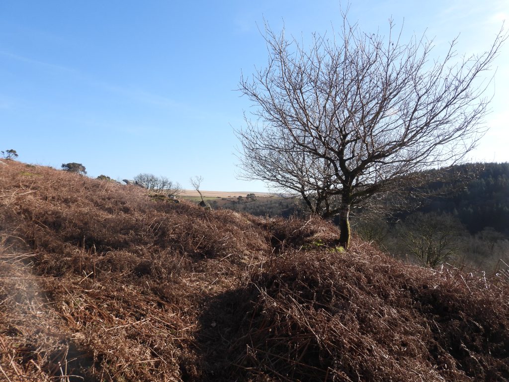
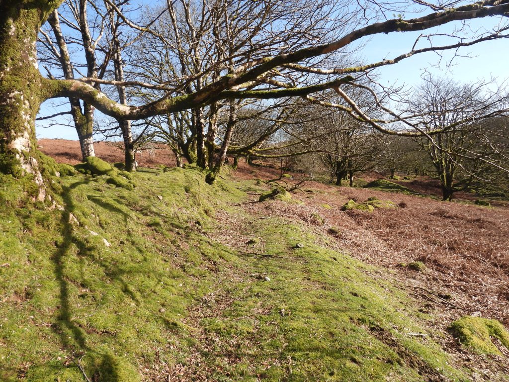
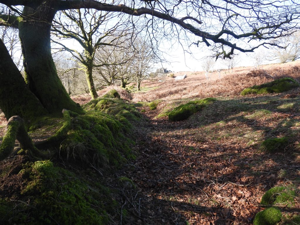
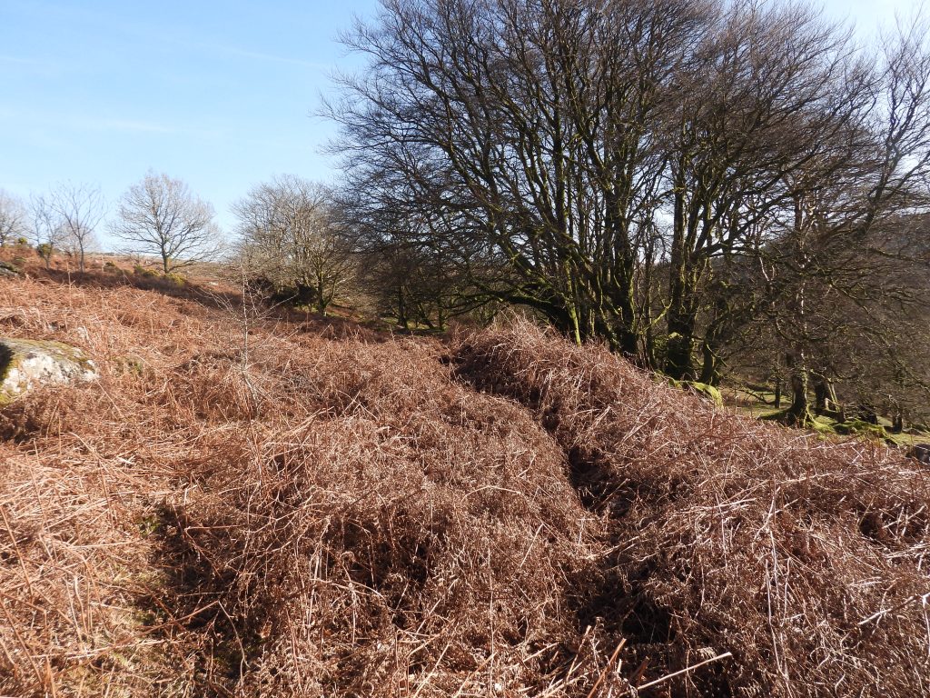
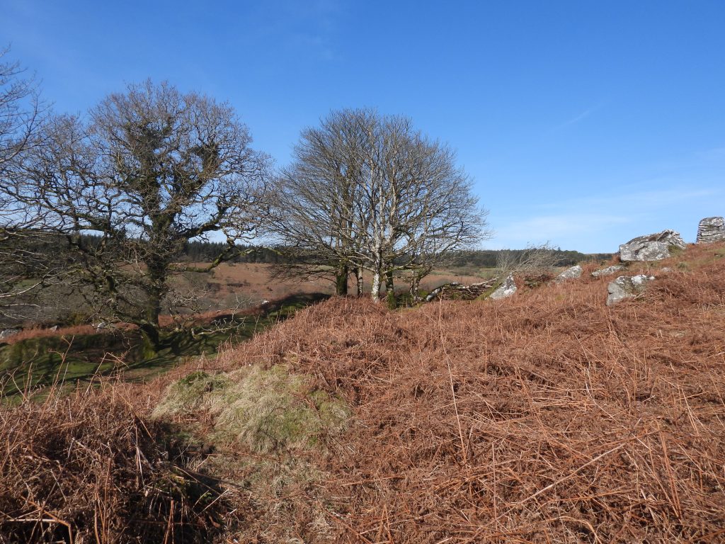
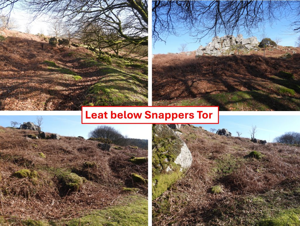
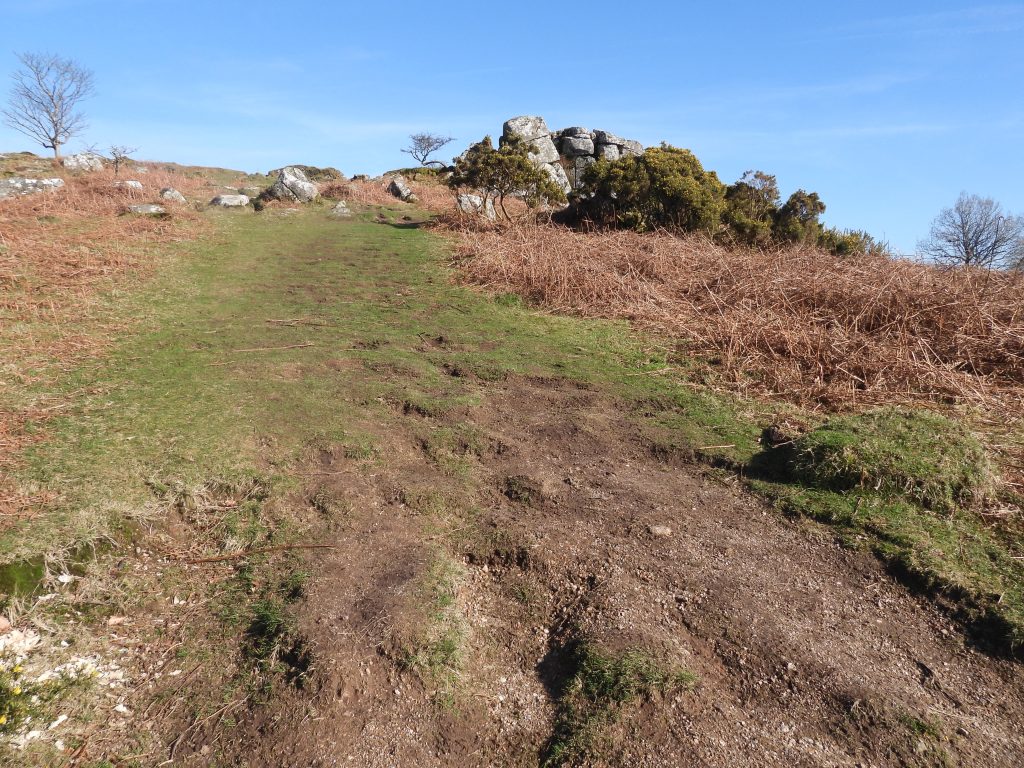
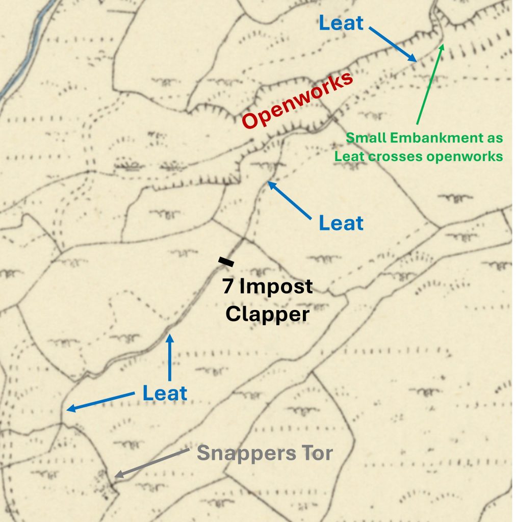
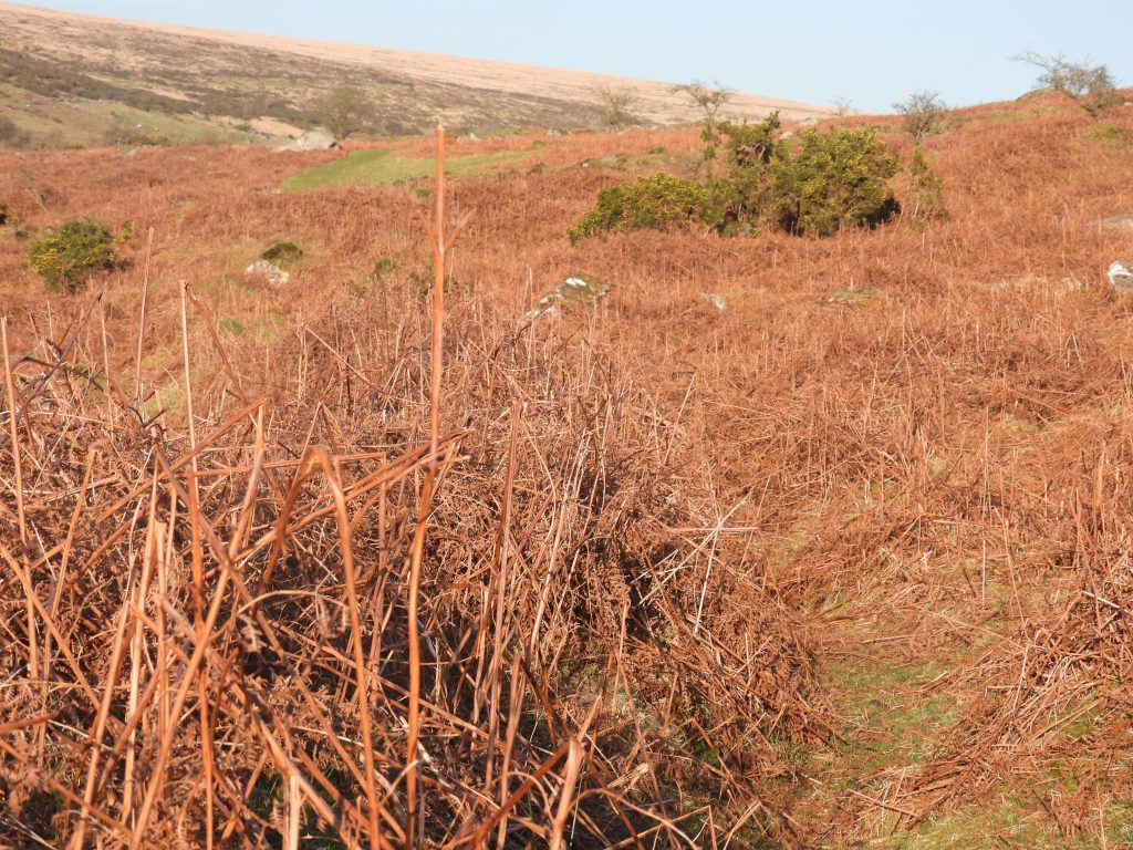
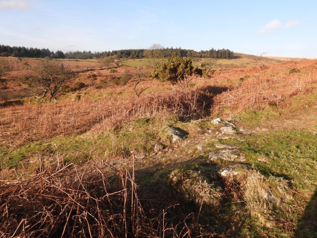
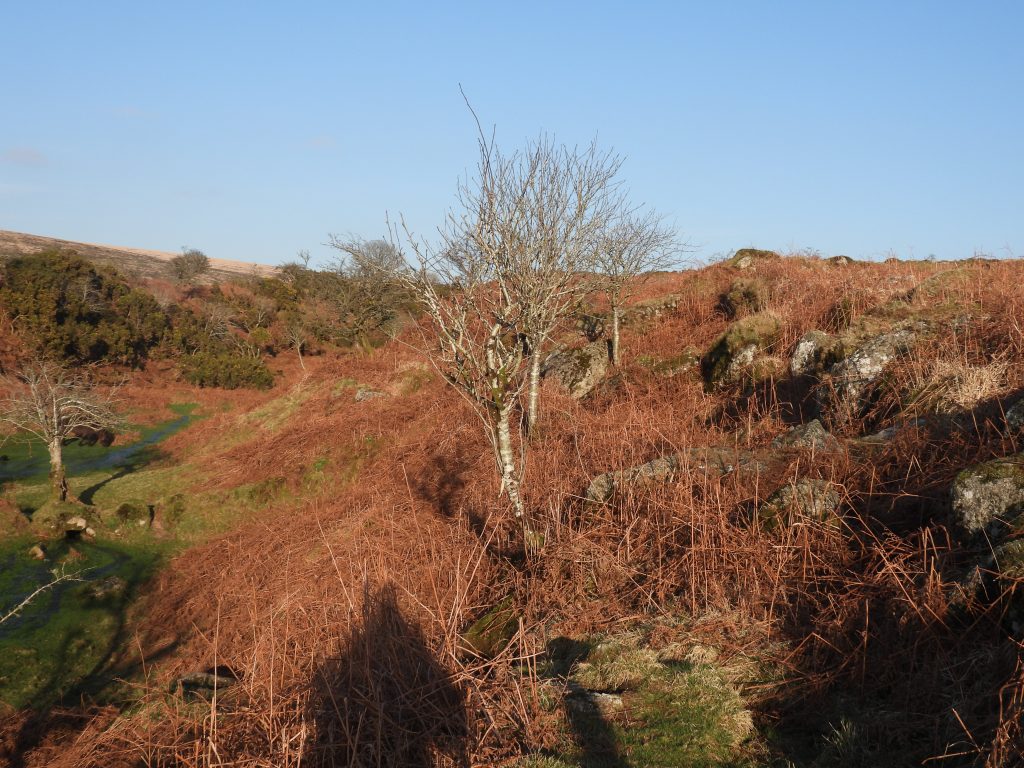
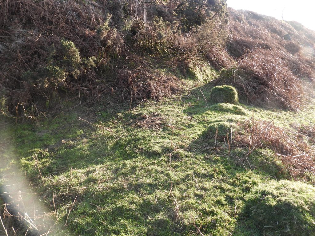
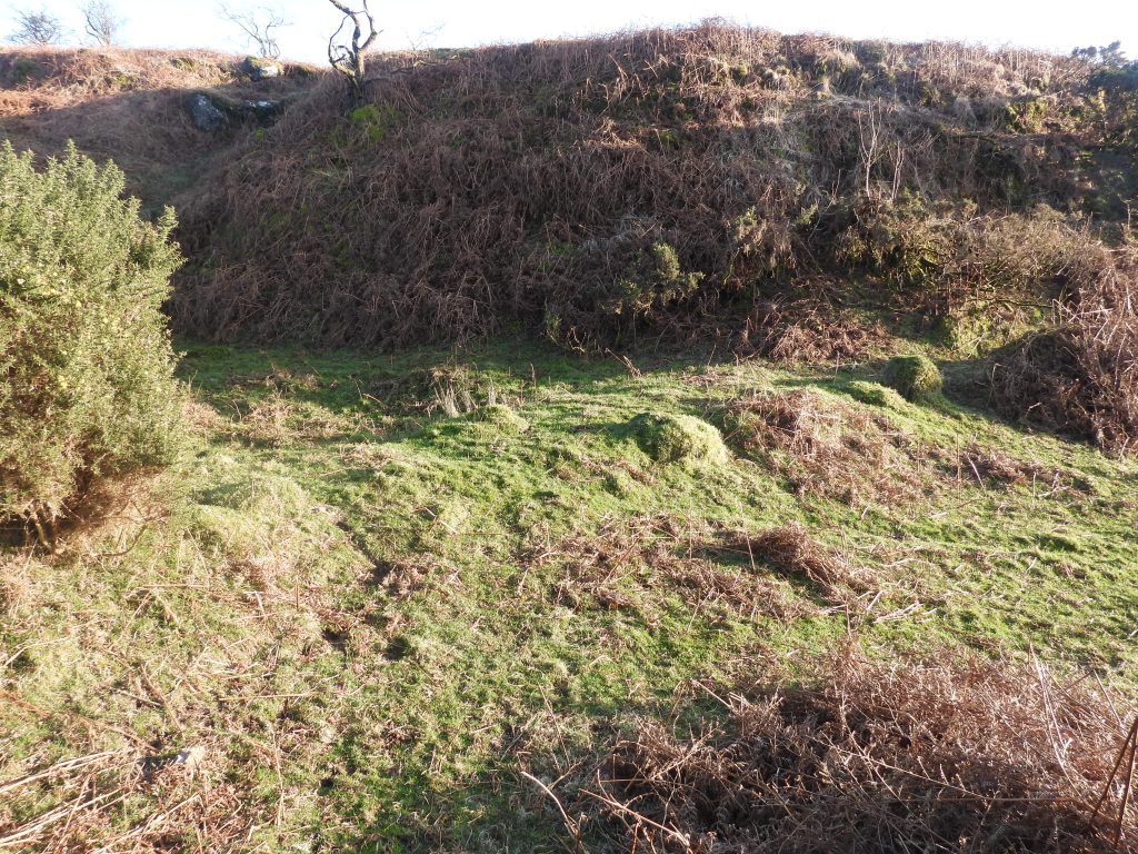
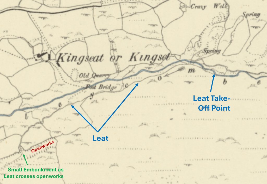
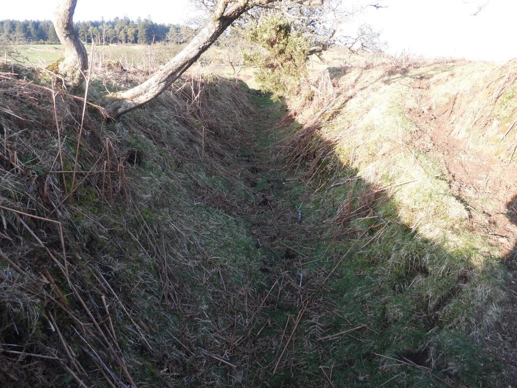
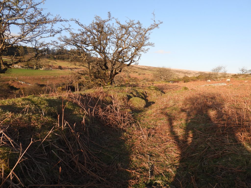
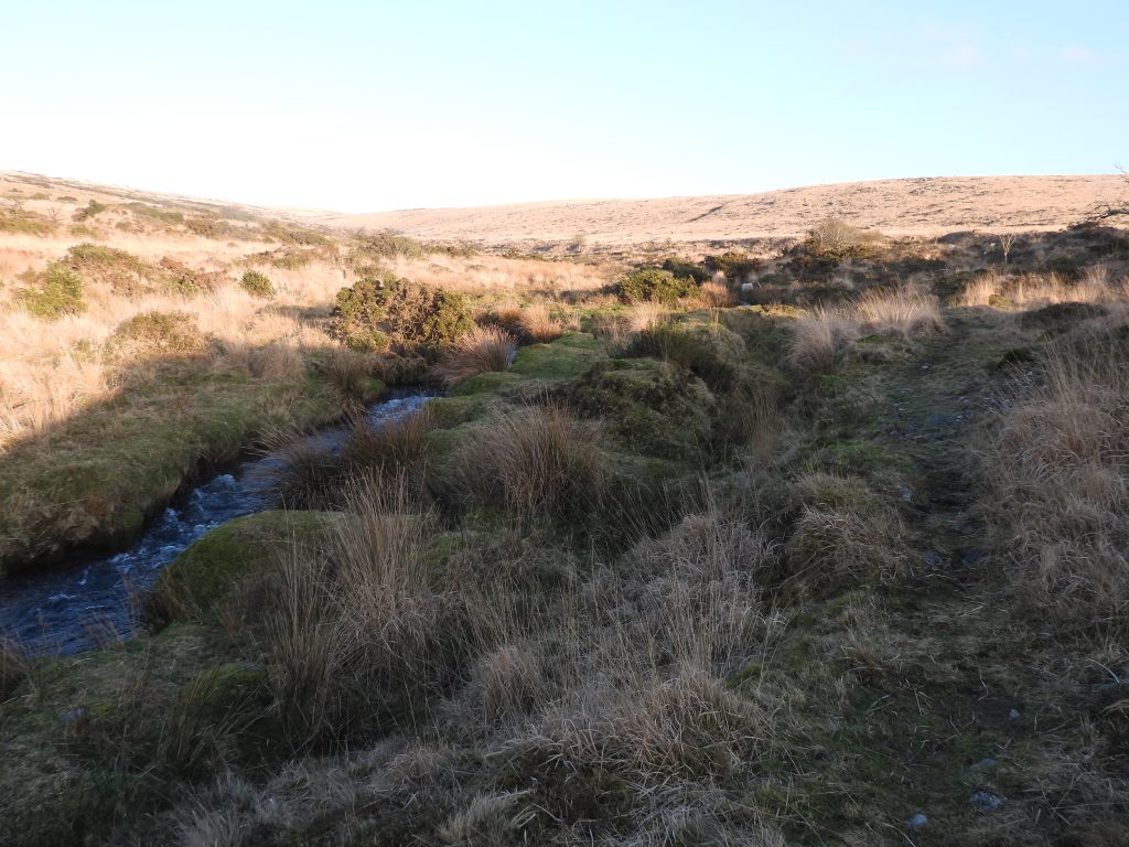
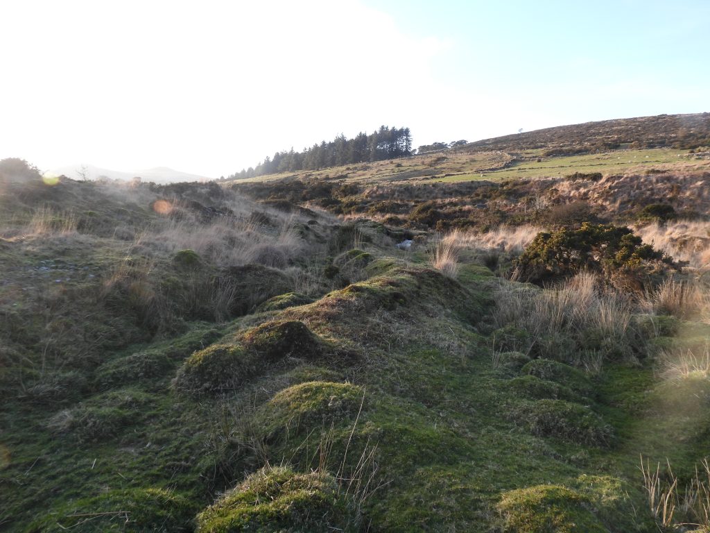
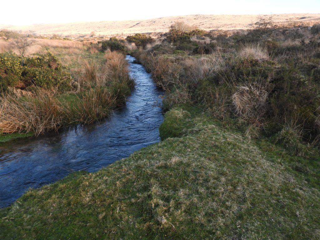
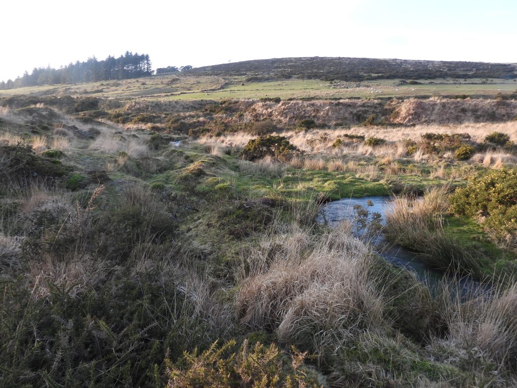
Simple (amateur) sketch plan of the Tin Mill. The sketch is not to scale although the measurements are authentic. The author is grateful to Sue Rogers in helping with this and for providing very helpful interpretations of the mill and the course / features of its associated leatThe above picture is at the leat (shadow at centre / foreground) above the mill. The reason for using this as the first photograph in the post is two-fold; firstly it provides a contextual view above the openworks and with Combestone Tor in the distance and secondly provides a winters view (late February) with the dead bracken – a visit in summer would be less revealing of features when the bracken is at its height of growth. Overlooking Blacktor Mill (from the large square boulder to the area in the shadow). This is where the launder would have beenAbove the mill – with a clearer view of the wheelpit and the mill working area (to the left of the tree)Annotated picture showing the key featuresThe ‘working area’ and top end of wheelpit as seen from within the mill. The wheelpit ‘slot’ is heavily silted at its north end and may extend into the hillside for another 1.5m after the obvious exposed drystone wall.The ‘working area’ of the mill is approx. 6.5m x 3.5m being surrounded by a number of large boulders, some of which are earthfast. The ‘working area’ is located at SX57556 69119. One assumes it was a stamping mill. No mortarstones have ever been found here.There is a tree growing next to the wheelpit at its south east end.Contextual view of the mill with Down Tor on the horizonThe mill and openworks with Combestone Tor beyondThe wheelpit ‘slot’ next to the treeThe wheelpit is narrow at only 0.6m wide and is located in a 2m long ‘slot’, which is faced on each side by a drystone wall of poor quality.The wheelpit is 1.1m deep. Location SX57553 69118The tail raceOne of two Hut circles – heavily overgrown and very difficult to discern, even in winter. Historic England have recorded that this “hut circle has an internal diameter of 8.9 metres, surrounded by a 1.3 metre wide wall standing up to 0.8 metres high”. Location SX57561 69114The second of two Hut circles – heavily overgrown and very difficult to discern, even in winter. Historic England have recorded that this “hut circle has been destroyed by a later tin openwork, but the remaining wall measures 1.5 metre wide and up to 1.2 metres high, defining an internal area of 8 metres in diameter”. Location SX57558 69106Openworks below the mill. The document from 1693 for Blacktor mill describe it (the mill) being at the head of Sowtons Meads tinworks. It is possible that this was these tinworks and possibly in the late 17th century the mill was at the ‘head’ of the works, which were extended northwards after that date (assuming the word ‘head’ refers to the top of the tinwork / openwork)Lower end of the openworks near the Middleworth / Deancombe trackThis annotated OS map from 1886, shows the location of Blacktor Mill in relation to the extensive tin openworks, prospecting and extractive pits. The leat which provided water to the mill has a take off point from Newleycombe Lake, 1.5km away. The ‘junction’ where the leat appear to have split to the mill and the Middleworth farmstead / community is 1.2km from Newleycombe Lake and is to the west (below) Snappers Tor. The leat is exceptionally well built and would have been seen as a a good investment for those living and working in the area.It is interesting to look at the Walkhampton Tithe map from the area. The tithe records there being a ‘Middleworthy’ and a ‘West Middleworthy’ which were more of less in the centre of the tinworking activities. This fact seems very complementary to the Phil Newman information, viz: Richard de Middleworthi is recorded coining tin in 1303. In 1567 ‘Mydleworthie’ was held by Joan, wife of Elizeus Bailie, who had in 1550 coined tin at Tavistock. In 1611 the windiates of Middleworth granted shares in tinworks at ‘Keyglesburrowe’, ‘Reddapit’, ‘Cramberplena’, ‘Deancombe Lake’, ‘Deancombe Land’. The leat would, one assumes, have been an integral part of life at that time The ‘Middleworthy’ Tithe detail. Blacktor Mill is located in an 8 acre pasture called ‘Snappers’. The landowner was Sir Ralph Lopes and the occupier Henry Pearse.The ‘West Middleworthy’ Tithe detail, which was located towards Norsworthy Bridge. The landowner was Sir Ralph Lopes and the occupier (the same as ‘Middleworthy) Henry Pearse.The next part of this post (and exploration) follows the leat from the Tin Mill to slightly north west of Snappers Tor as indicated by this annotated 1886 map. This first part of the leat is around 300m longLeaving the mill area and following the leat in a westerly direction, the route is not direct and avoids many earthfast bouldersThe banks of the leat are around 0.5m in placesAn ‘s’ bend in the leatAt around SX5742 6920, a earth bank wall is encountered. To the south is this flat area, which might have been an old track – to the north in all probability is where the leat would have flowedThe north side of the earth bank (wall), which is still shown on OS maps. It is the north side the leat, most probably flowed. A possible interpretation is that the line of the leat (and earth banking) was used for the later construction of this wallingThe leat crosses drystone walling and some prospecting pits. One assumes these walls were constructed late 18th / early 19th century at the time of the ‘Improver Period’ and thus indicates the leat was much older than that, assisting perhaps in timelining the mill (1693)The leat embankment near tine prospecting pitsBeyond the tin prospecting pits, the leat is choked with bracken. This is to the south of Snappers TorLooking north west along the line of the leat below Snappers TorCollage of pictures of the leat below (west) of Snappers Tor, more or less where the leat ‘split’ to Middleworth and the Tin Mill. The bottom left picture was taken at SX57291 69329Point on the track below Snappers Tor where the leat crosses (look out for the earth banks on the down hill side). This picture was taken at SX57279 69303The next part of this post (and exploration) follows the leat from near Snappers Tor to an openworks to the north east as indicated by this annotated 1886 mapAlthough not obvious from the photograph, the leat here is very easy to follow with well defined earth banksEnroute to Newleycombe Lake and the Leat take off point the leat is crossed by a track and there is a 7 impost clapper. This is no doubt testament to how important the leat was. The clapper is located at SX57429 69474The leat enters an openwork – it is just to the right of the shadow of the author and passes next to the trees in the centre of the photographThe leat crosses the openwork via a small raised earth bank. It is possible the leat had been laundered here as wellThe small raised earth bank where the leat crossed the openwork. It is located at SX57605 69638The final part of this post (and exploration) follows the leat from the openworks with the small raised earth bank to the leat take off point on Newleycombe Lake as indicated by this annotated 1886 mapThe leat flowed through steep sided banksThe leat on a westerly course entering the Newleycombe Valley. Kingsett Farm ruins can be seen on the upper left part of the photographApproaching the leat take off point. The leat is now virtually parallel with Newleycombe LakeThe final few metres before Leat Take off point – note the earth bank for the leat is still very evident. Newleycombe Lake is just visible in the photograph as is Classeywell Farm and Cockles Gate (by the edge of the conifer trees)The Leat Take off point at SX58169 69853The Leat Take off point where at a very distinct bend in Newleycombe Lake. The take off point is just above the light coloured molinia grass in the centre of the photograph and the start of the leat is very obvious where the ‘s’ shaped low earth banks are