A collection of walks, discoveries, insights and pictures of exploring Dartmoor National Park
February 1, 2026
Kit Tin Mine
Kit Tin Mine was described as being ‘miniscule’ by Peter Richardson in a book he published in 1992, concluding it was one which merits attention because it comprises all the essential elements for a mine but in a small area. The mine is located just 1/4 mile east-south-east of Sheepstor and is just metres from the Sheepstor – Collyton road. The mine is on private land and permission should be sought if you wish to visit. Mine remains include; Shafts, an Adit, three Buddles, a Wheelhouse, a Blacksmith’s Shop / Forge, a Powder House and the remains of an old farm – most of these features relate to latter day 20th century operations.
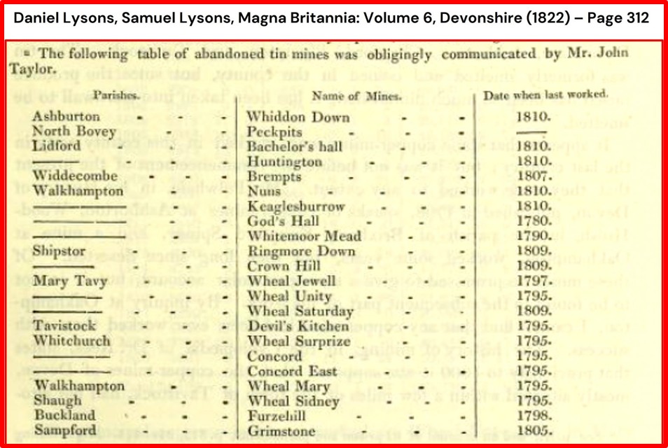
The earliest reference to a mine in this area dates to 1799 (Luxmoore) and relates to ‘Ringmoore and Sheepstor Mine. It is thought that Kit Mine was part of this aforementioned mine. Writing in 1822, Lysons and Lysons listed ‘Ringmore Down Mine’ as having been last worked in 1809, suggesting it had been operational for at least 10 years (1799-1809), probably more. This documented evidence suggest there was mining taking place at Kit Tin Mine around 100 years of more before some of the ‘modern’ infrastructure from the early 20th century, which is still evident today, was constructed.
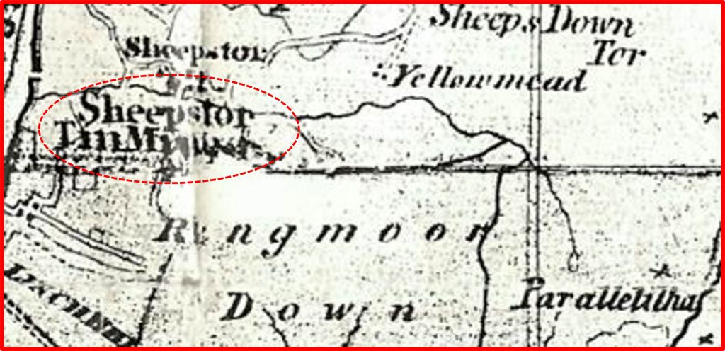
On the 1850’s William Wood’s map of Industrial Dartmoor, ‘Sheepstor Tin Mine’ was shown in roughly the same location. That said, it is thought (DTRG) that this mine annotation may relate to the 1830s and it is unknown whether the mine was operational then.
In the Mining Journal in November 1848, it was recorded that the sett of Holditch Mine had been obtained from the trustees of the poor of Okehampton, and that it was intended to work it. As this Mining Journal entry occurs under ‘Sheepstor Parish’ in the Brooke’s index, one might assume that this mine is a re-incarnation of the previously mentioned mines. The evidence to support this is that the mine is located at Holditch Brake, which at the time of the Tithe (1842) was part of Holditch Farm. That said, the 1848 Mining Journal entry appears to have been erroneously been linked to this mine but actually refers to Holditch Farm near Mary Tavy (DTRG). The clue is the mention of Okehampton by the Mining Journal.
The (Sheepstor) Holditch sett was acquired by the Sheepstor and Lyd River United Mining Co. on 6th November 1865 (Brookes Index and Greeves). This company reported that ‘the ground there had been worked previously to a depth of 6 fathoms (36 feet) with an adit having been driven around 100 of the required 160 fathoms, to cut the lode 30 fathoms below surface, before it had been abandoned on the death of the principal adventurer’. One assumes, they were referring to the Sheepstor Tin Mine from circa 1830s. The Sheepstor and Lyd River United Mining Co. appear to have ceased just a year later on 4th September 1866 (Brooke Index) having issued prospectuses which were advertised in March 1866, with attempts being made to place shares through brokers – these efforts were unsuccessful. This was the last 19th century (known) reference relating to the mine.
Into the 20th century. Kit Tin Mines Limited (Sheepstor & Latchley), was registered on 5th November 1900 and worked Kit Tin Mine at Sheepstor and Wheal Benny (near Latchley). It would seem that most of the investment and capital went on Wheal Benny with Kit Tin Mine playing ‘second fiddle’ to its Cornish counterpart (just north of Gunnislake). The Kit Tine Mines Limited operation at Sheepstor lasted between 1901-1904 when the dressing floors which are still extant today were constructed. Also, during this period, the original shaft was deepened to around 100ft (Barclay), some trial pits were dug and the adit was driven another 80 fathoms (480 ft). Ultimately, this phase of the mine appears to have failed for several reasons. Firstly, the cost of the driving of the adit (which missed the shaft, continuing on to intersect the lode); secondly the poor yield of tin and finally due the fact that the adit and shafts were quite a distance from the dressing floor leading to a very inefficient transportation between them using a manually operated windlass and wheelbarrows. The mine was offered for sale for £5,000 and an offer for £3,000 was rejected. It was never sold. Kit Tin Mines Limited ceased around 1904 and the company wound up voluntarily in 1911 (Greeves). Some further works at the mine were carried out in 1915-16 (Dines / Barclay) and around 1918-19 by the P.F.T Corporation of London (Richardson). There was no official recorded tin production records, but there was an oral record given to Dr. Tom Greeves states that 30 cwt of tin were taken to Gunnislake by horse and cart by Richard Legassick (whose descendants still live at Collyton).
Most of the details contained in this post have been obtained through the Dartmoor Tinworking Research Group (DTRG) newsletters and through the excellent book by P.H.G.Richardson – (1992) – Mines of Dartmoor & the Tamar Valley (after 1913).
Bibliography
P.H.G.Richardson – (1992) – Mines of Dartmoor & the Tamar Valley (after 1913), Chapter 10 (pages 89-93)
Solon Luxmoore – (1799) – Duchy list by the controller of Stannaries
Charles F. Barclay – (1925) – Kit Tin Mine, Devon Mineral Club Journal 1 (4), 2000, 3-4
Daniel Lysons and Samuel Lysons – (1822) – Magna Britannia: Volume 6, Devonshire, page 312
William Wood – (1850) – Map of Industrial Dartmoor
Brooke Index – Sheepstor Parish
Dr Tom Greeves – (2001) – Notes for excursion 14, Ringmoor Down Tin Mine
H.G. Dines – (1956) – The Metalliferous Mining Region of South-West England, page 704
Dartmoor Tinworking Research Group (DTRG) – Newsletter 69 – September 2025
T.Welch and B.Welch – (2019) – Survey of Kit Tin Mine Burrator (DTRG Newsletter 57)
Mining Journal – 25th November 1848.
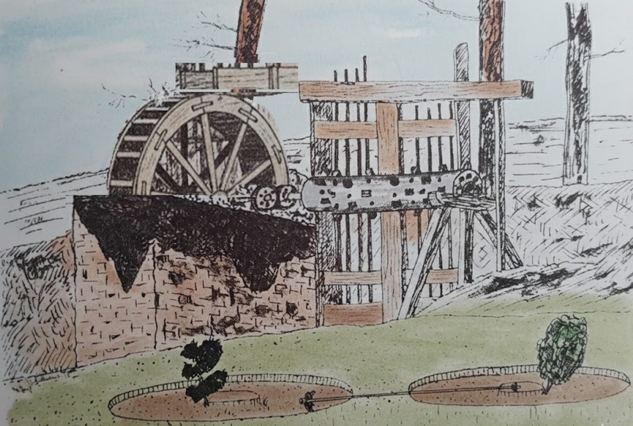
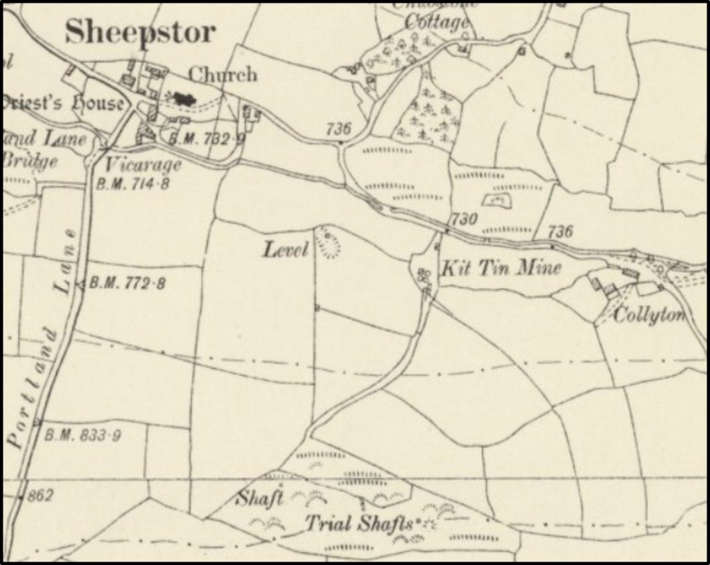
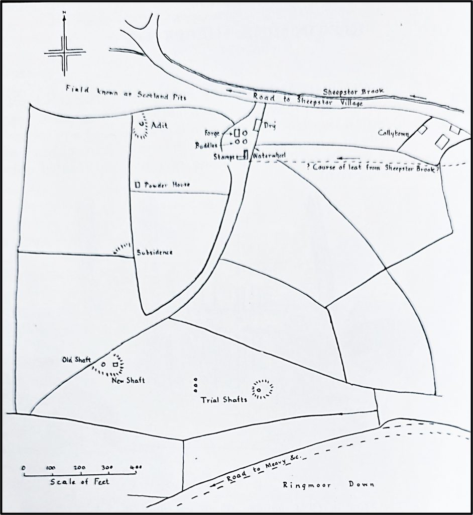
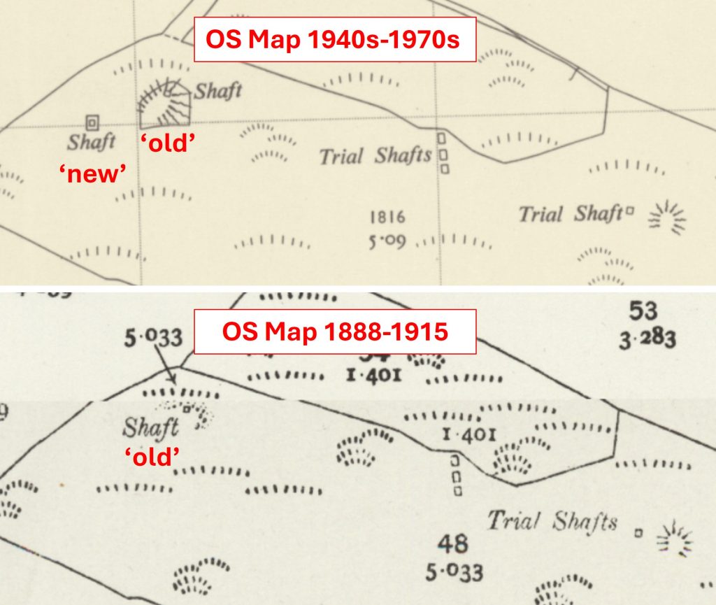
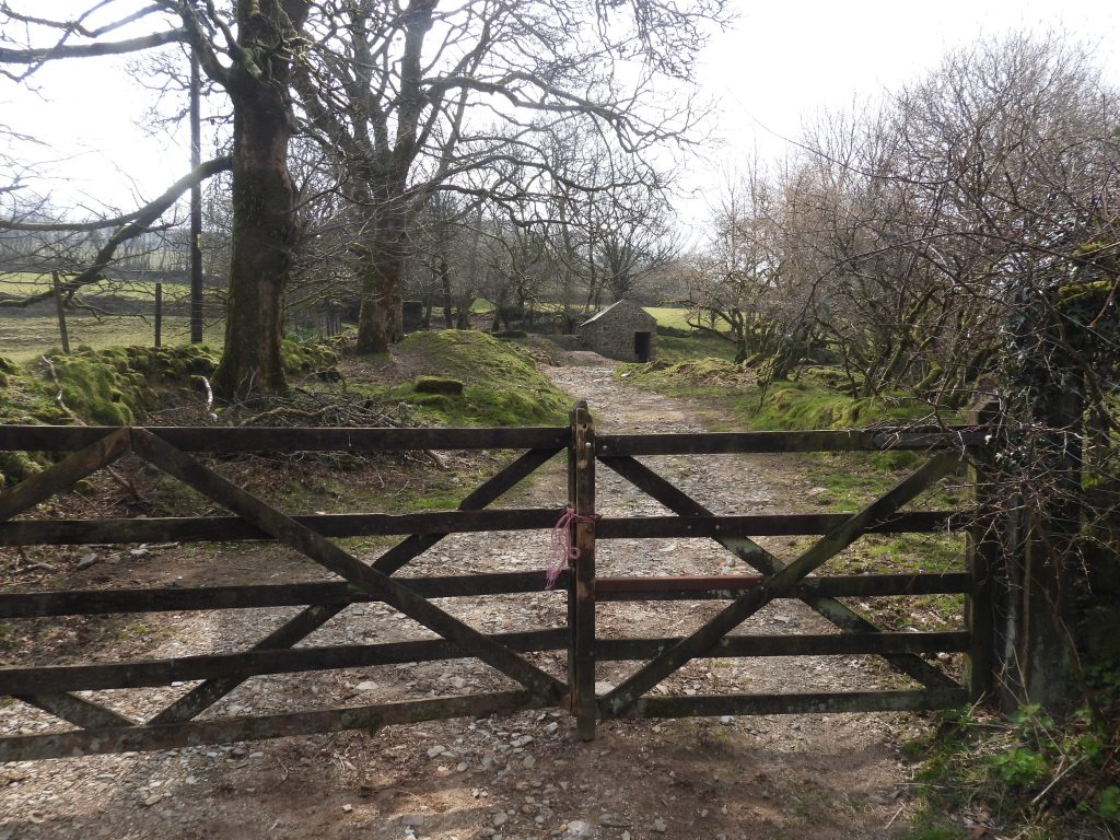
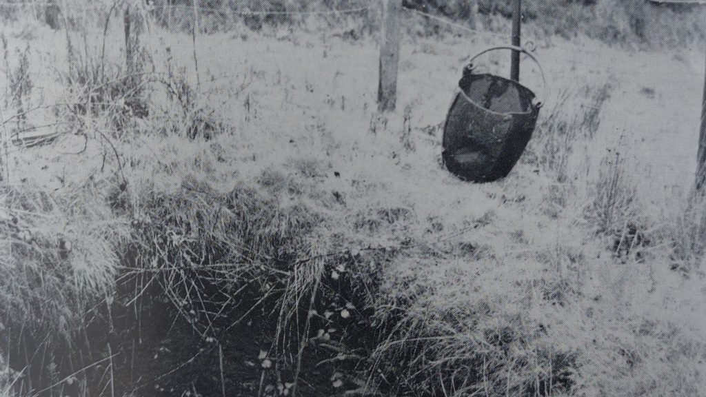
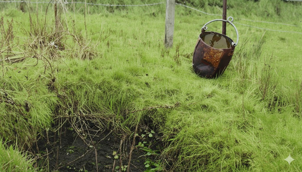
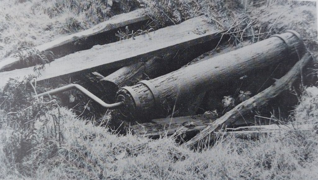
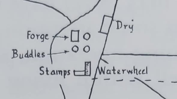
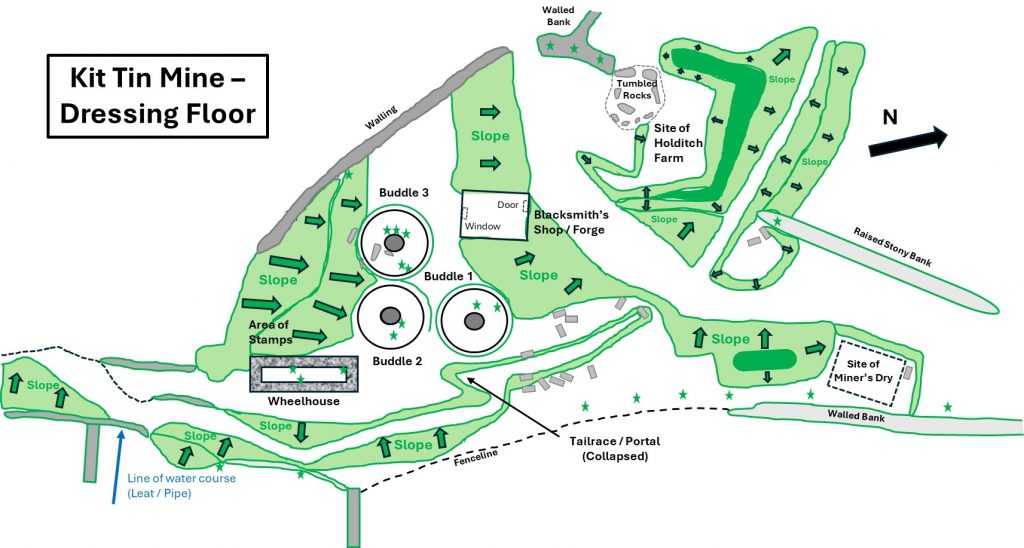
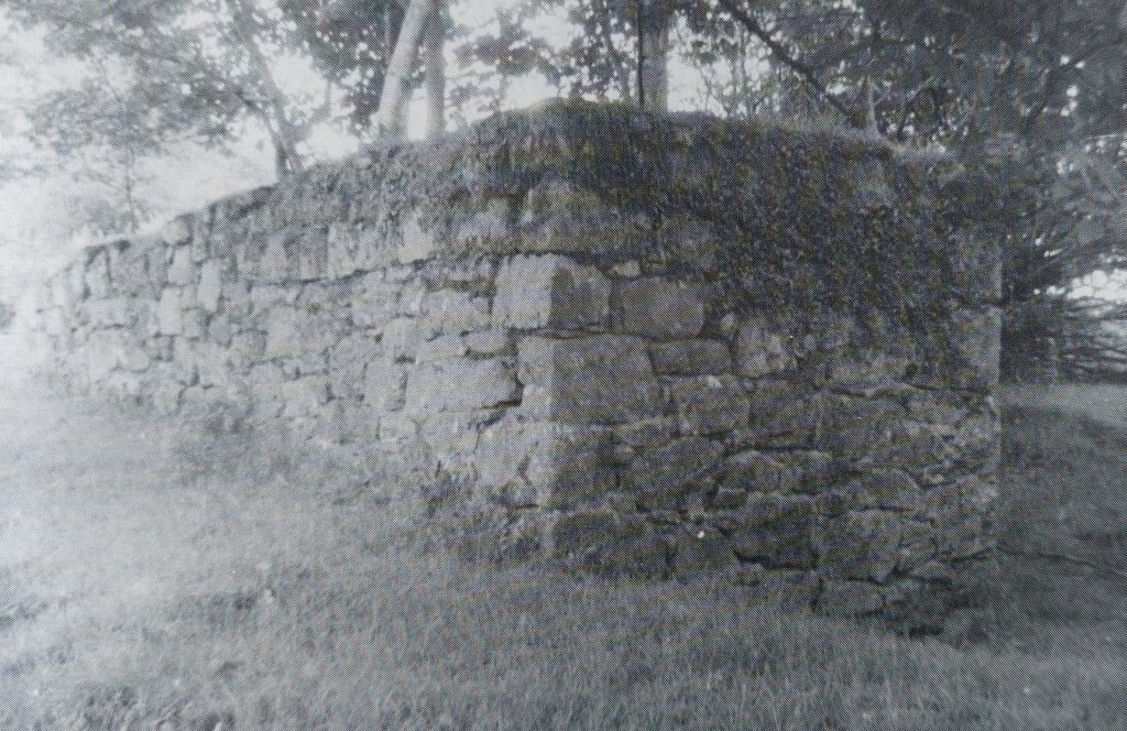
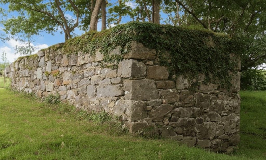
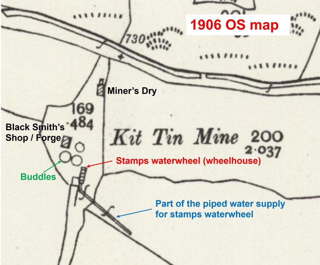
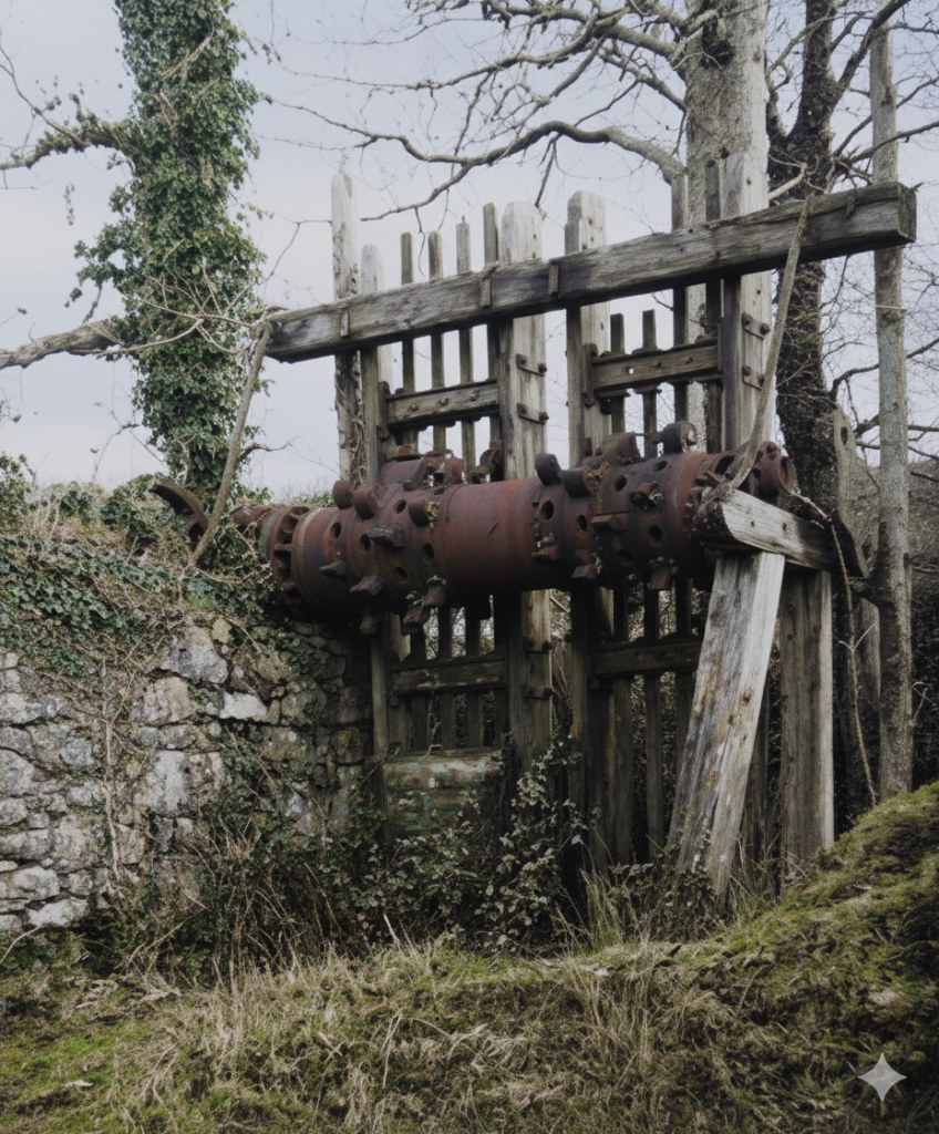
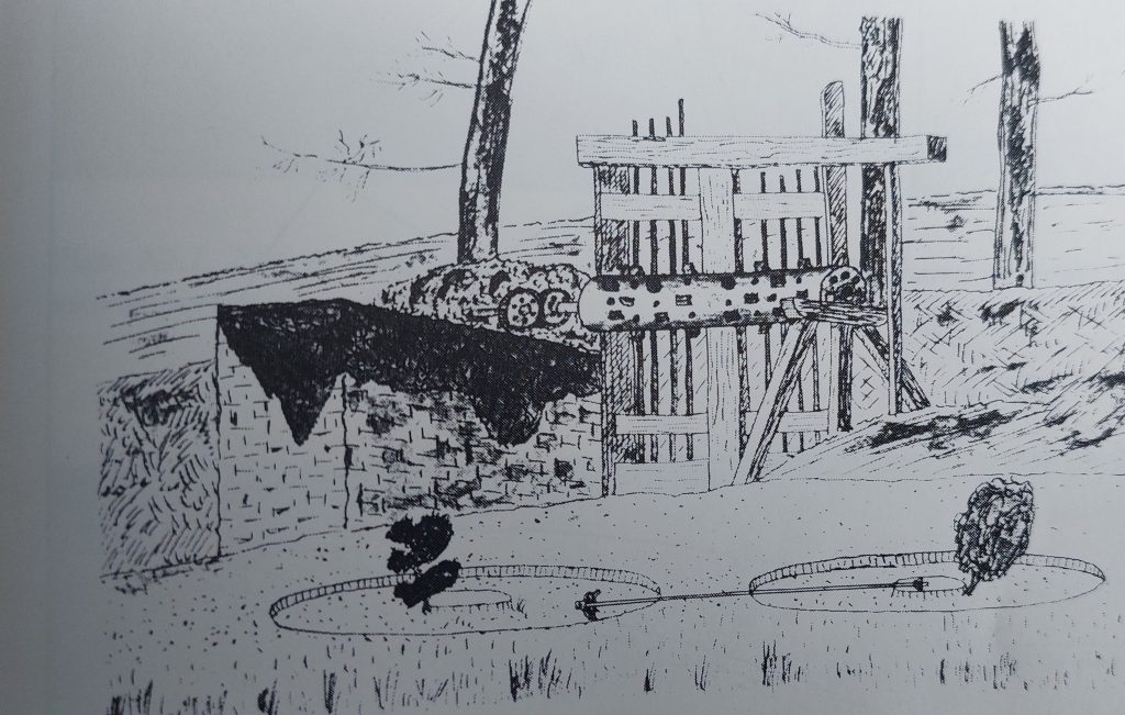
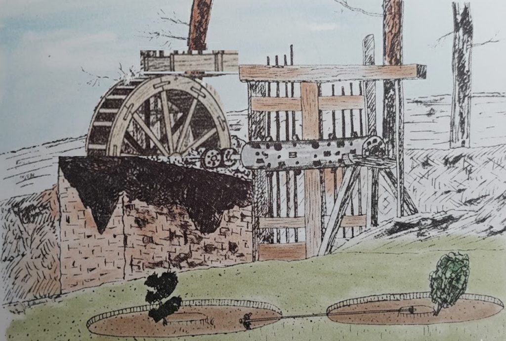
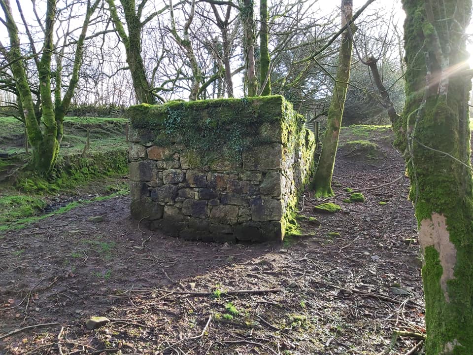
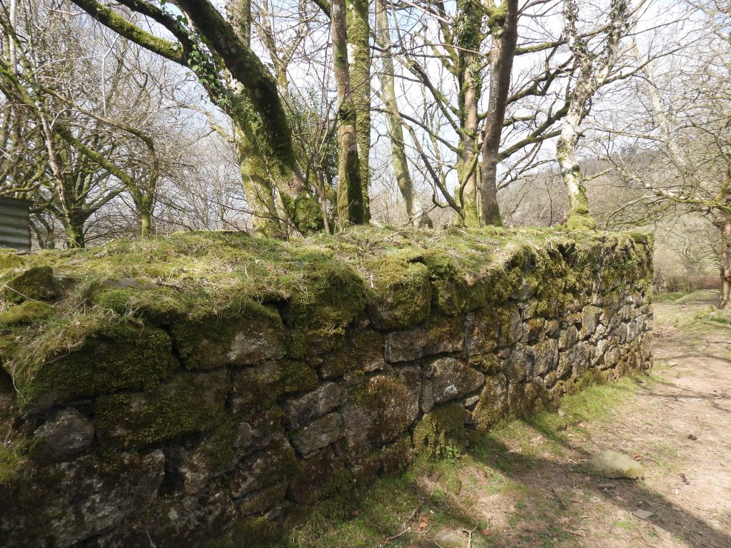
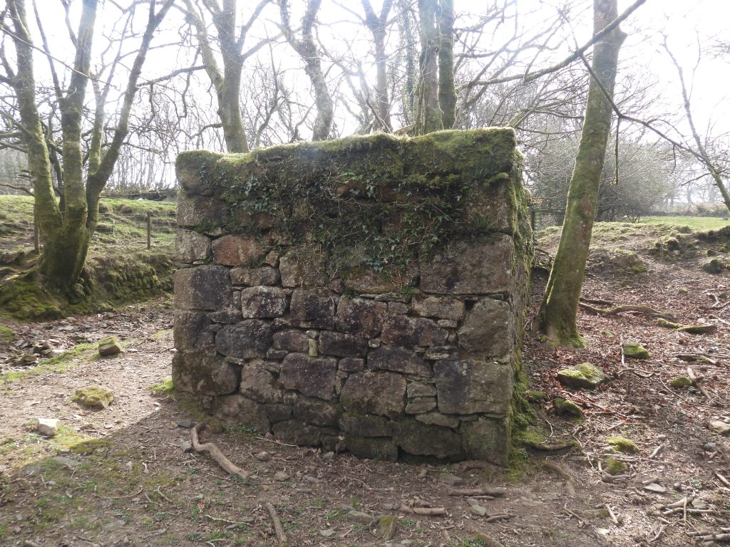
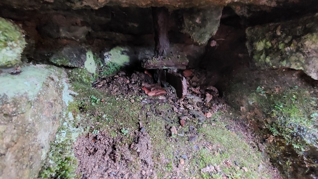
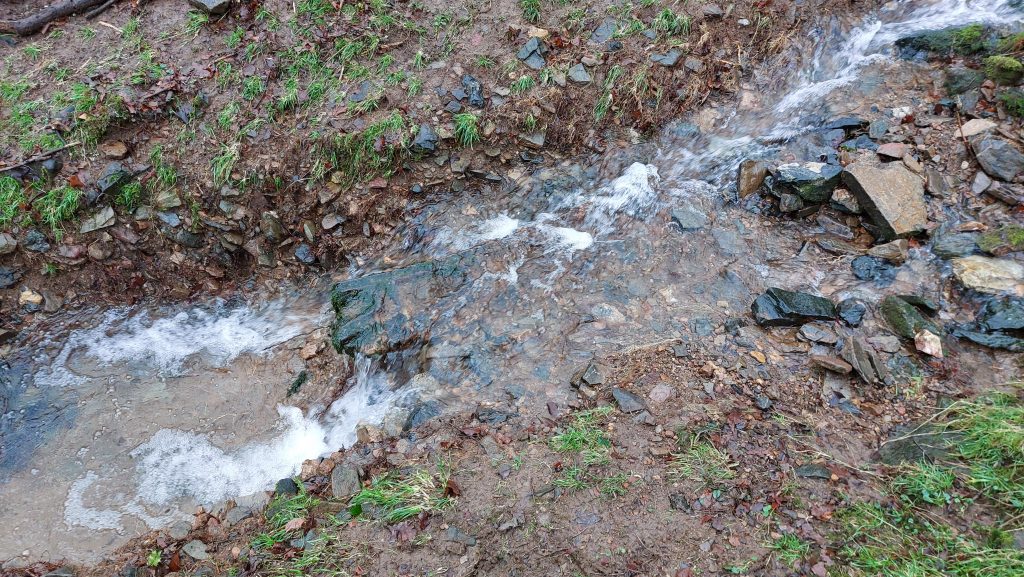
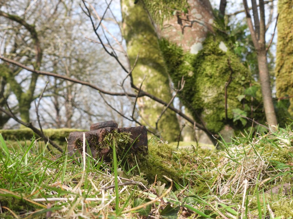
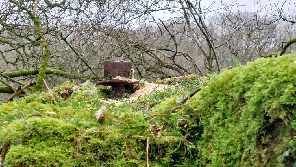
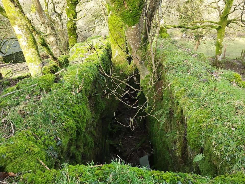
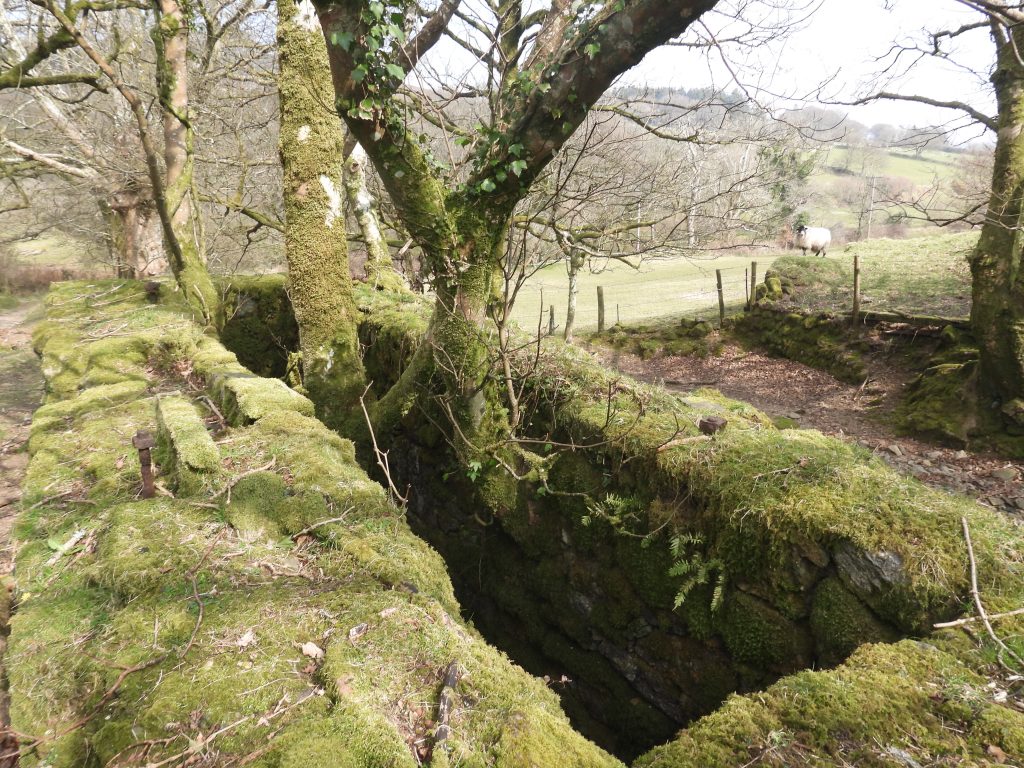
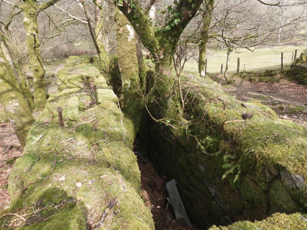
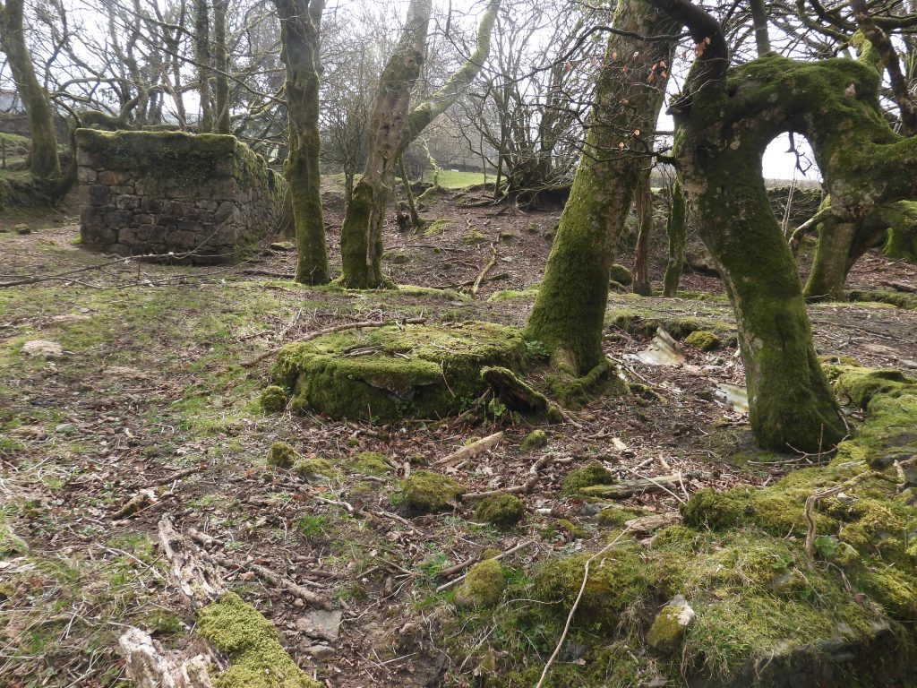
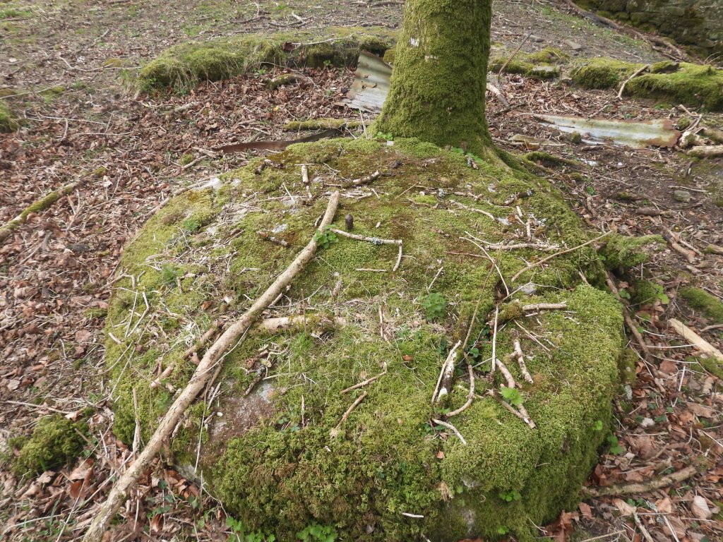
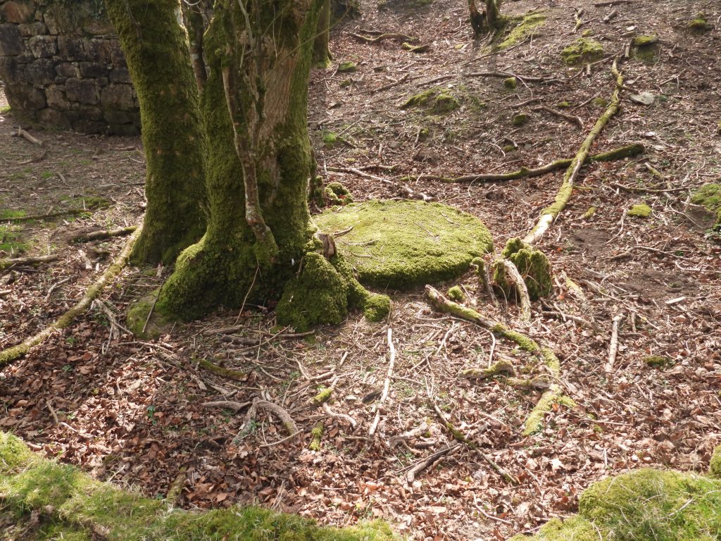
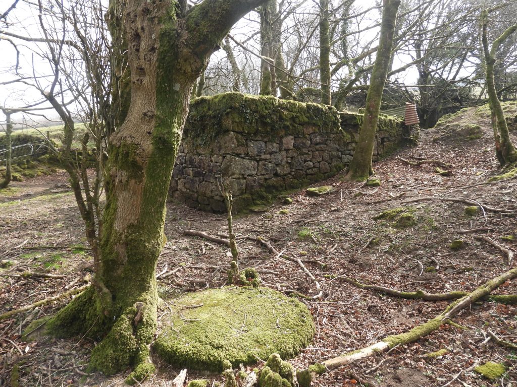
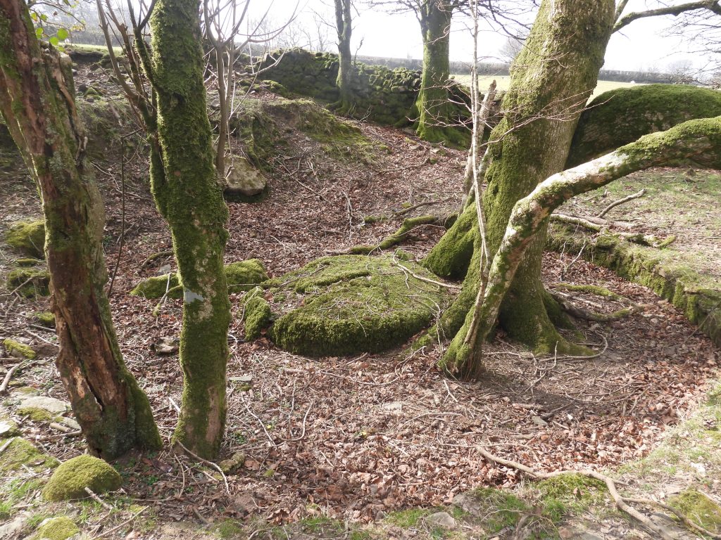
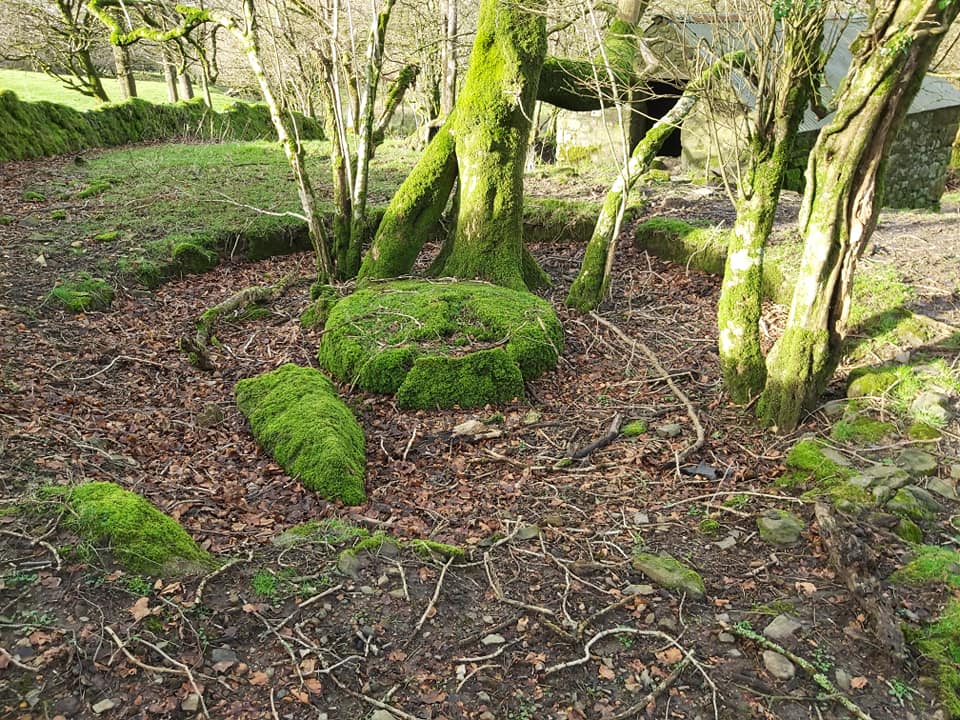
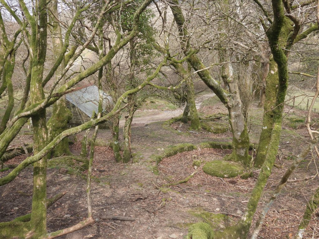
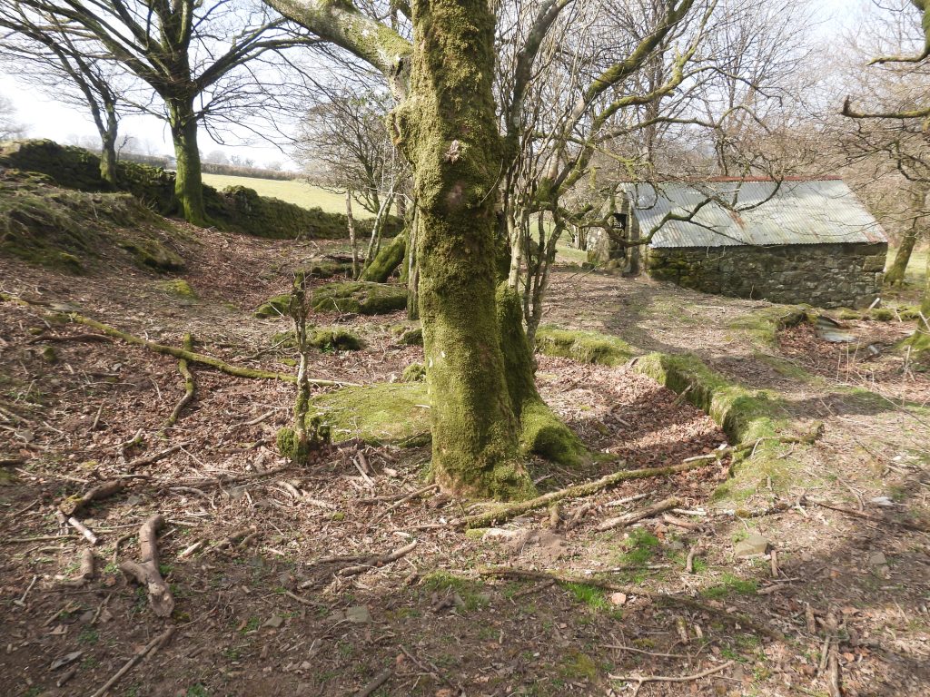
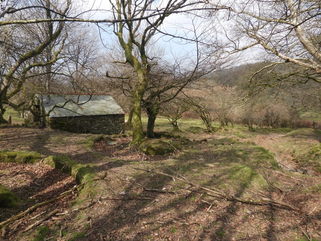
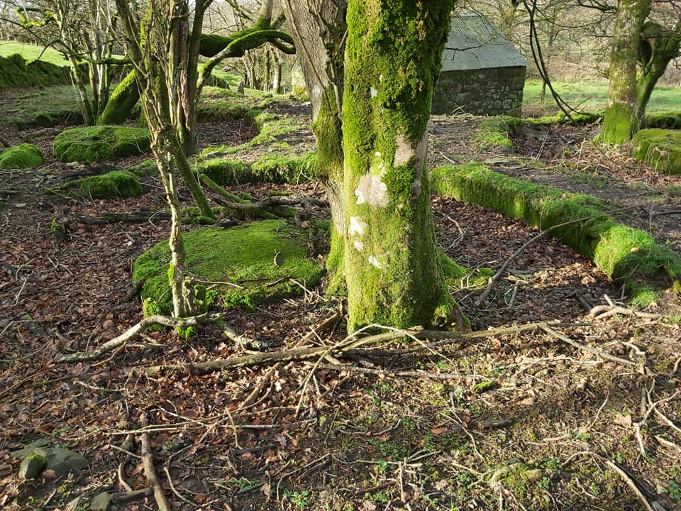
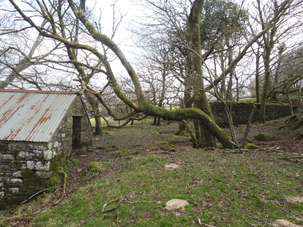
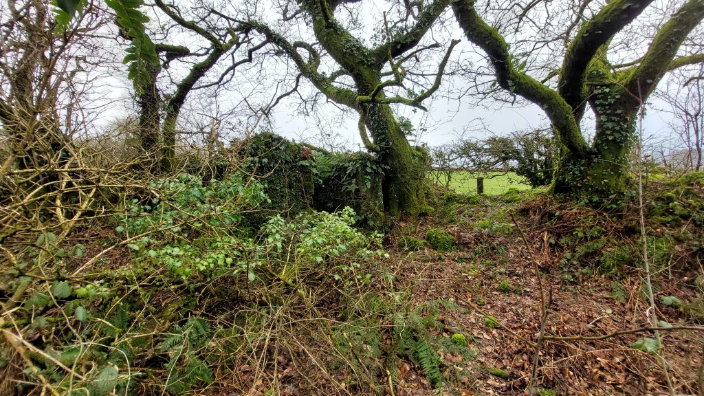
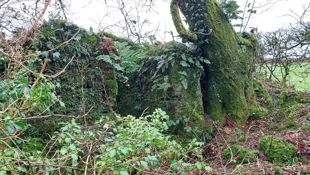
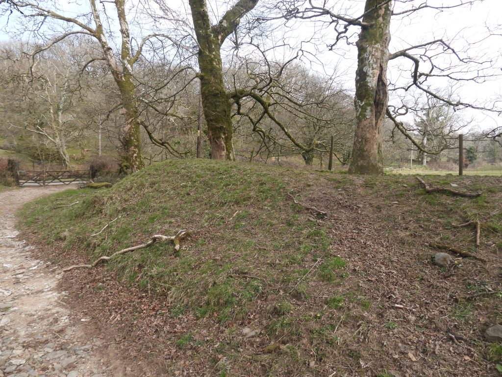
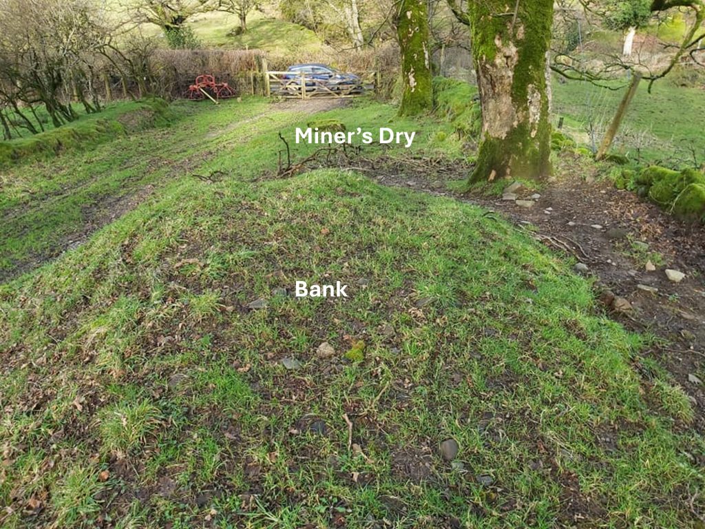
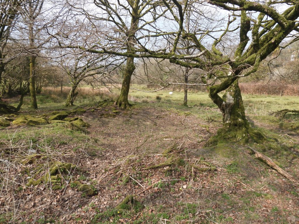
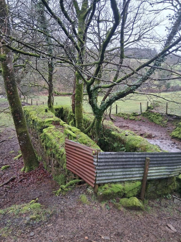
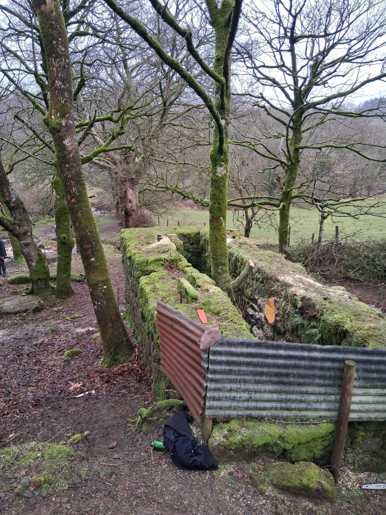
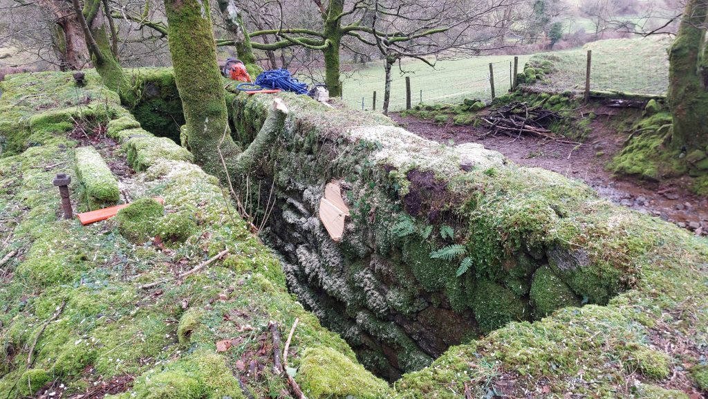
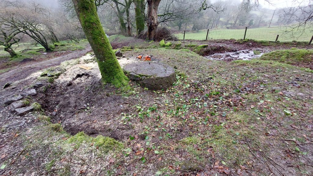
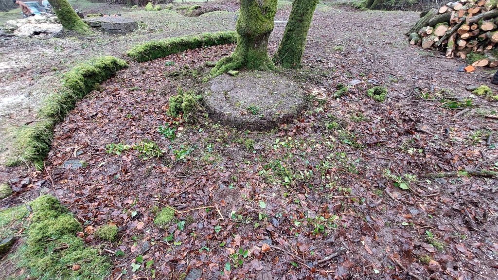
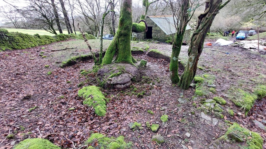
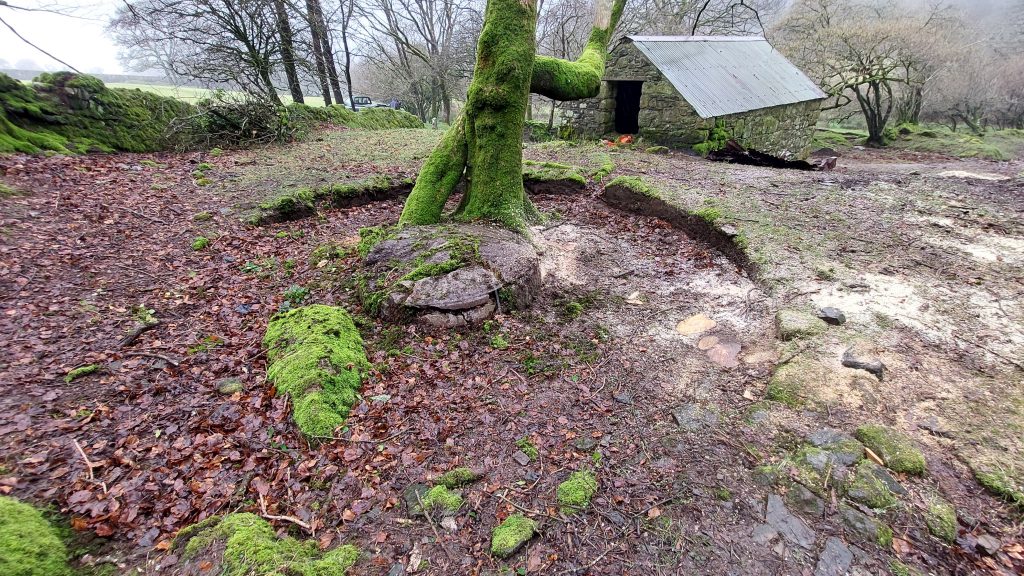
This early 19th century map shown the location of Kit Tin Mine between Sheepstor and Collyton. The annotation ‘Kit Tin Mine’ is where the dressing floors are located with the annotation ‘Level’ was where the adit was located. The shafts are to the south west.This map is an extract from the PHG Richardson book, showing the key features of the mine. Richardson first visited the mine in 1934, which was 15 years after it was last worked. By analysing old OS maps from the National Library of Scotland, it is probable that Richardson, unfortunately mis-labelled the ‘Old Shaft’ and the ‘New Shaft’ and these should be reversed. In 1902, there were 9 miners here (all underground); In 1903, there were 15 miners here (8 underground and 7 at surface) and in 1904, there were 10 miners here (all underground). In 1925, Charles F. Barclay described the adit as being 2-3 ft wide and about 5 ft in height…by this time a collapse had blocked the adit, just 15 fathoms (90 ft) from the entrance.By analysing these two old OS maps from the National Library of Scotland, they provide evidence that Richardson, unfortunately mis-labelled the ‘Old Shaft’ and the ‘New Shaft’ and these should be reversed on his sketch. This evidence is ‘backed up’ by a reports from a report by F.C.Ferguson in 1919, when he recorded ‘a north and south line of trial pits covering a distance of 25 yards are situated about 100 yards east of the old shaft’. This places the ‘old shaft’ to the east of the ‘new shaft’. Charles F. Barclay visited the mine in 1925 and recorded the ‘old shaft’ was around 60-100 ft deep. He further stated the ‘new shaft’ as being 4-5 ft in section and 25 ft deepThis is a gate entrance from the Sheepstor – Collyton road. Permission must be sought (which the author obtained) to venture beyond and see the early 19th century dressing floor of the mine. From this vantage point, the location of the miner’s dry is immediately to the left by the big tree, the Blacksmith’s Shop / Forge is the building with the apex and open doorway and the square shape of the wheelhouse can juts be seen in amongst the treesRichardson first visited the mine in 1934. In 1938, he recorded the ‘older’ shaft with a iron kibble nearby. By the mid-1970s virtually all traces of shafts, dums and trials in the field known as Holditch Little Brake had been obliterated and the area grassed over.The Richardson 1938 picture colourised using AI, bringing it to lifeIn 1938, Richardson recorded the ‘newer’ shaft as having a barrel of a former windlass covering part of the shaft. Richardson, in his book refers to the unusual form of tin found here as ‘Diamond Tin’, a term used by local miners. The term Diamond Tin is where tin ore occurs in unusually large crystals which were light yellow in colour. By the mid-1950s the new shaft had become filled in to surface although the adit was still partially open. The Richardson 1938 picture colourised using AI, bringing it to lifeThe Lysons’ record from 1822, indicating ‘Ringmore Down’, in Shipstor Parish was last worked in 1809.Details of Kit Tin Mine Limited 1900 from Brook IndexThis is the magnified sketch that Richardson made of the 20th century mine dressing floor. Today, the Forge building, the three round Buddles and the Wheelhouse still survive. There would have been a smaller waterwheel to drive the Buddles (Ferguson report mentioned by Richardson)This plan of the Dressing Floor is based on the magnificent and detailed plan drawn by Tanya and Barry Welch on behalf of the DTRG in August 2019. The original plan is extremely detailed and testament to Tanya and Barry’s skill and patience. This picture by Richardson was recorded in 1989. It is the Wheelhouse which formerly enclosed the waterwheel. The Richardson 1989 picture colourised using AI, bringing it to lifeThis picture is of the lane which leads down from the shafts. The raised area was thought to have been a loading platform for the stampsSnippit of William Wood’s map of Dartmoor from 1851, showing a ‘Tin Mine’ in the areaThis snippet of a 1906 map shows a pipe which was part of the water supply to drive the waterwheels at the dressing floor. There is still evidence of the 12-inch underground piped water supply. It now terminates in a hole some 35 m east of the hedge just above the Wheelhouse. Recorded by Tanya and Barry in 2019 is that just inside the entrance gate in the hedge there is a similar short length of pipe which looks like it could have been used for this purposePicture of the west side of the Wheelhouse and the Stamps from 1930s. Colourised by AIThis sketch was made by Richardson in 1934 and shows the granite Wheelhouse, the 8-head battery of Cornish Stamps and two of the three circular convex buddles. Richardson records that when he first saw the mine the stamps and the gearing from the waterwheel were more or less intact, which is clearing shown in the sketch. The Stamps were removed and sold for scrap in 1936.Using some AI and a little bit of artistic licence the author has colourised and enhanced the Richardson sketch which now includes a waterwheel and a (part) launder leading to it. The author has assumed an overshot wheel without having any evidence to the contrary. The waterwheel may have sat lower in the wheelhouse with a crank connecting it to the stamps driveThe Wheelhouse in 2025. The stonework is in remarkable condition. The structure is, however, at some risk with trees growing both inside and around the baseA view of the Wheelhouse on the east sideThe Wheelhouse comprises around 8 courses of block workBolt within the Wheelhouse which most probably was used to secure the stamps frame Part of the waterwheel was located in the stream immediately to the east of the WheelhousePart of the wheel recovered from the stream and now stored safely. Note the slots for the wooden slats for the waterwheel. The wheel was 20ft diameter and 2ft breastA rusted nut and bolt on the top / east side of the WheelhouseAnother rusty nut on top of the WheelhouseThreaded bolt on north west side of WheelhouseAnother nut and bolt on the WheelhouseInside the Wheelhouse. When Richardson visited in 1934 the wheel had collapsed with the WheelhouseThe internal dimensions of the Wheelhouse are 7.2 m × 1.2 m, and would the wheel is recorded as having been 20 ft x 2 ft (report by F.C Ferguson from 1919)There are three mature trees growing inside the Wheelhouse plus there is some metal detritus in thereThe author has arbitarily labelled the three circular convex Buddles and number 1,2 and 3 (this annotation wasn’t on the original Welch / Welch plan). The photograph shows Buddle 1 (Buddle 2 by Wheelhouse is just out of sight)Buddle 1 with a central boss and spigot still in remarkable condition.Buddle 2 being swamped by two mature treesBuddle 2 with the Wheelhouse beyondBuddle 3 has around 5 mature trees but like the other Buddles still retains its central bossBuddle 3 also has two large rocks within its original working circle. All Buddles are circa 5.5m in diameter
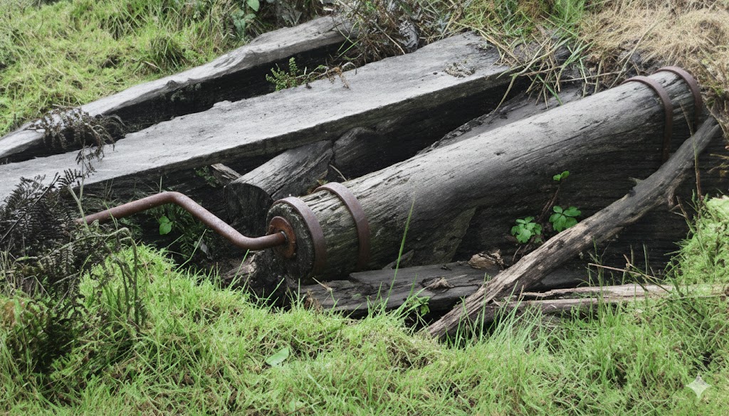
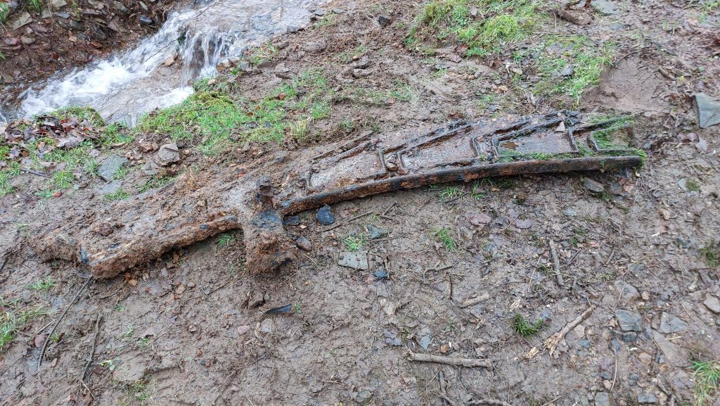
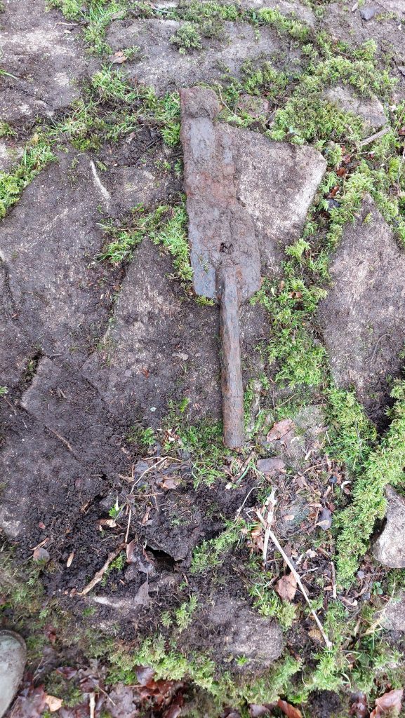
A metal ‘paddle’ shaped artefact found near Buddle 3
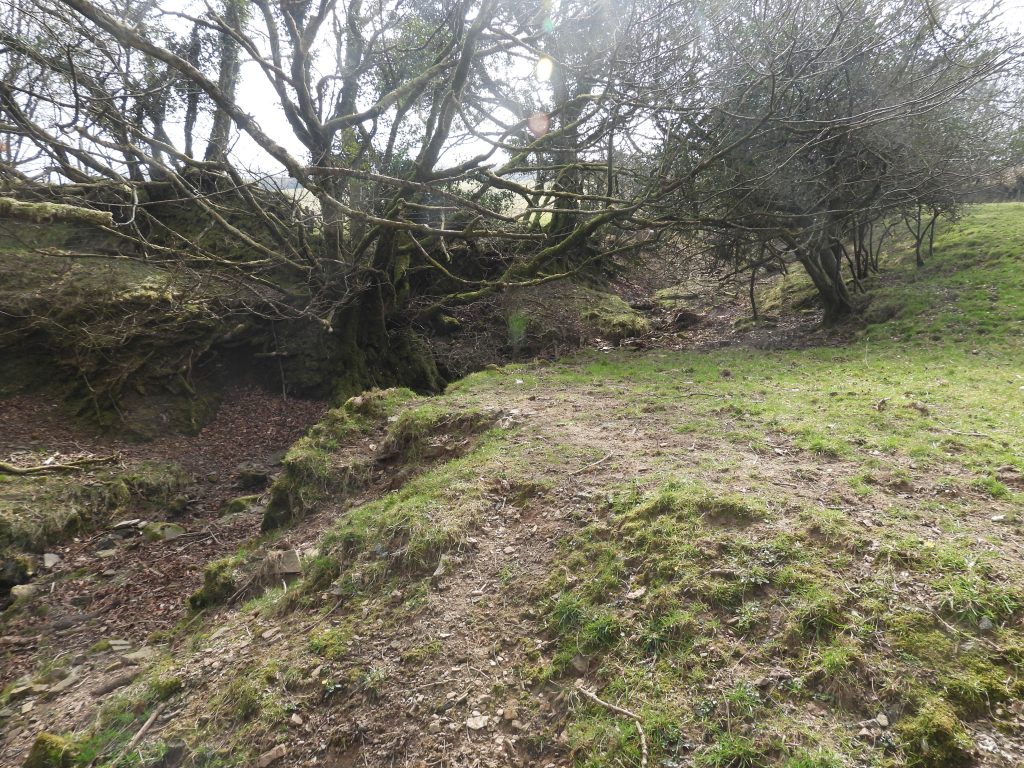
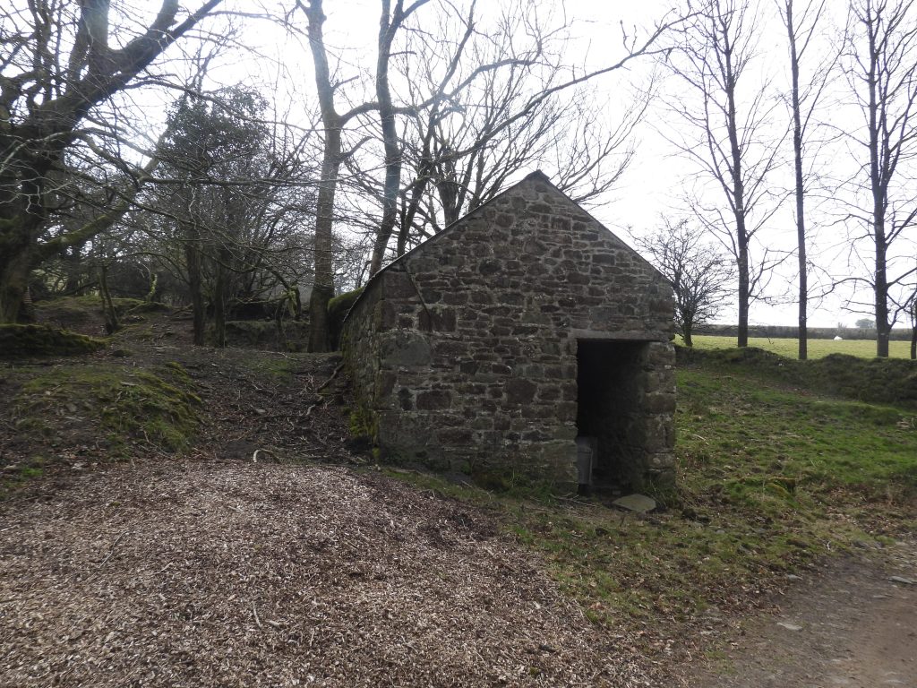
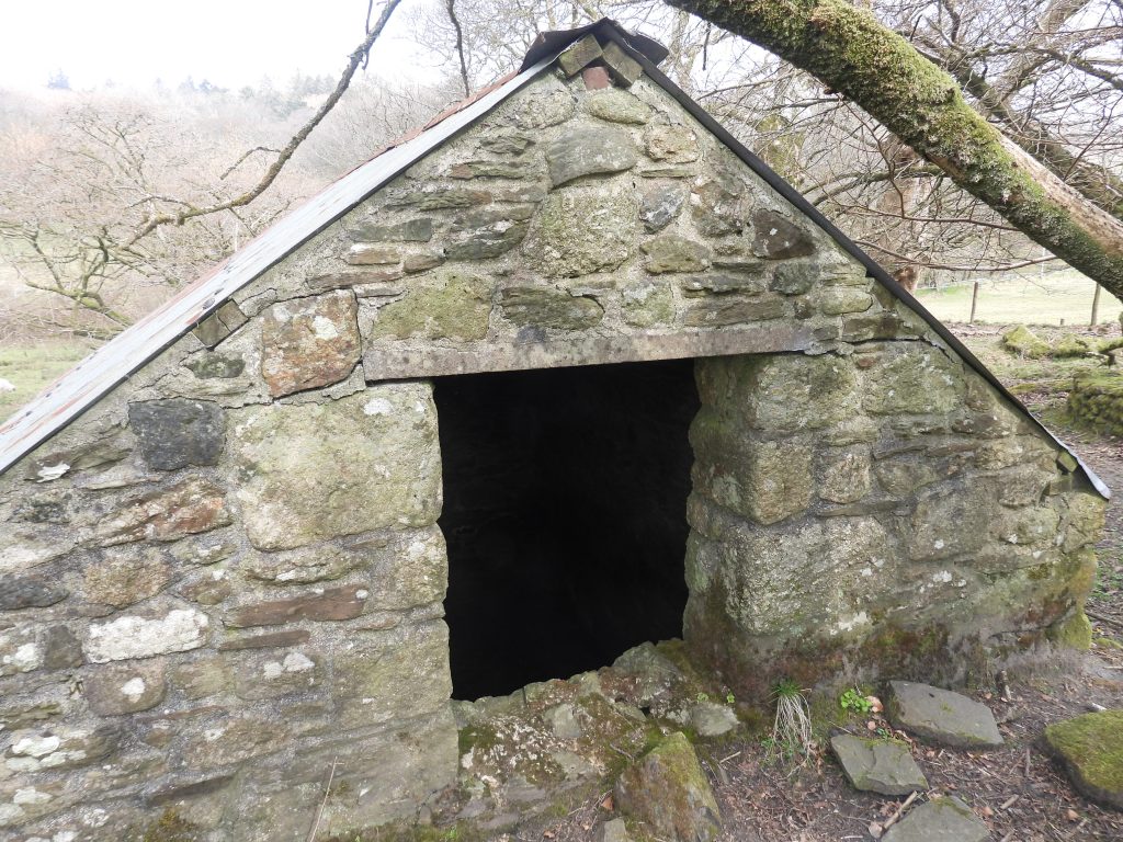
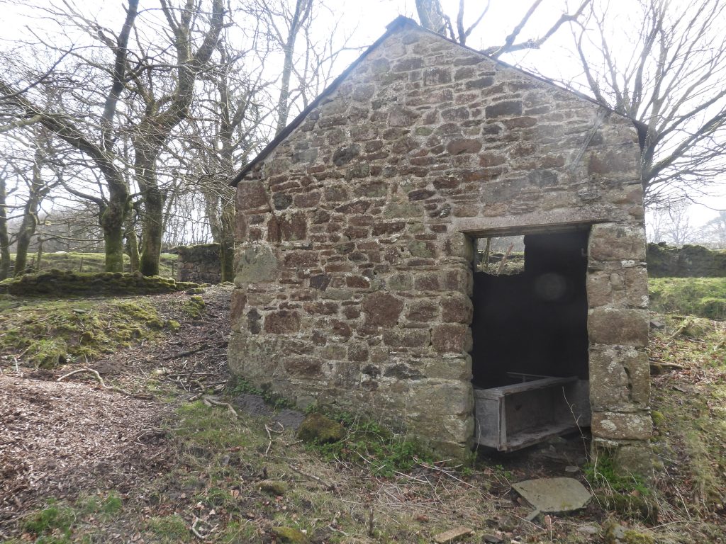
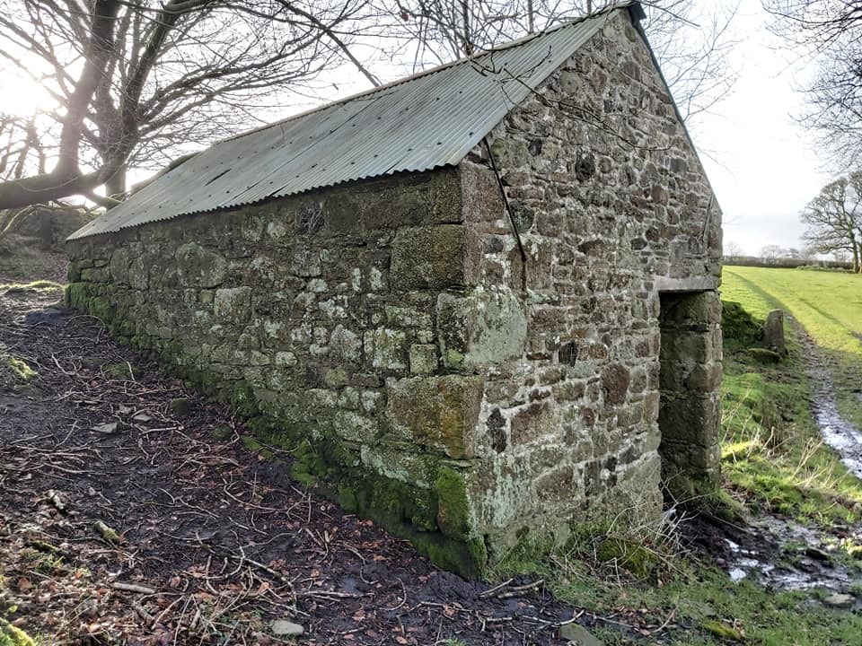
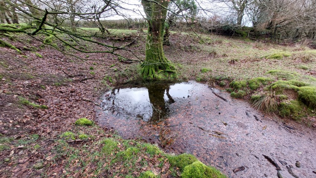
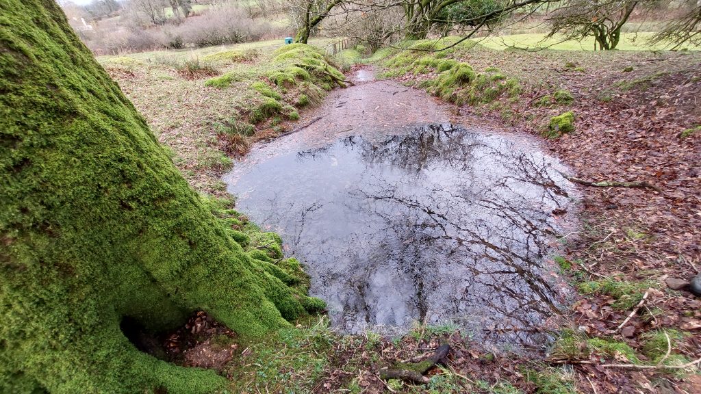
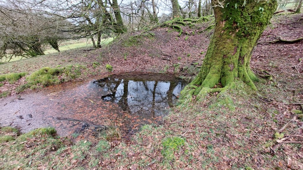
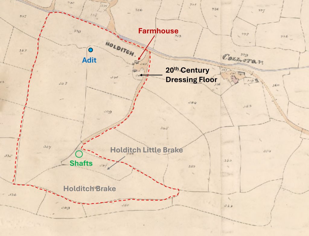
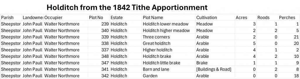
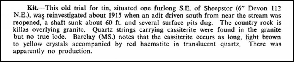
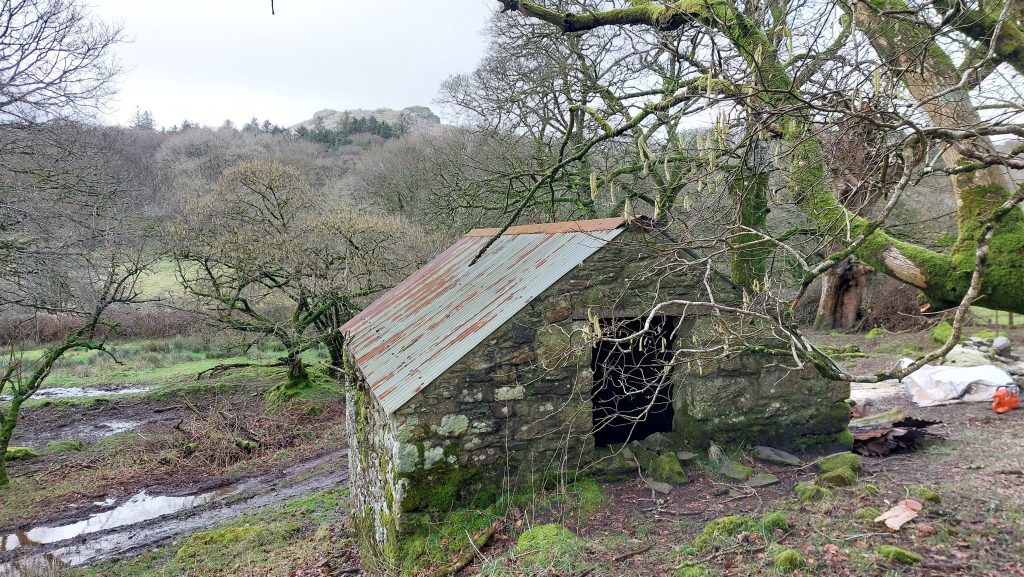
View from the Wheelhouse across the three Buddles towards the Blacksmith’s Shop / ForgeAnother view across the three Buddles towards the track and Blacksmith’s Shop / ForgeLooking west across the BuddlesIn 2019 Tanya and Barry Welch found traces of tin slime on the slopes between the Buddles and the Blacksmith Shop / Forge.At the time of writing this post, the author is aware of plans by the DTRG to remove these mature trees with permission by the landownerThe Blacksmith’s Shop / ForgeThe rear window / access portal of the Blacksmith’s Shop / ForgeSide on view of the south end of the Blacksmith’s Shop / ForgeThe Blacksmith’s Shop / Forge measures 5.75 m × 4 m and in the recent past has been used as a cattle shed.The roof of the Blacksmith’s Shop / Forge has clearly been replaced since Richardson’s visits in the 1930s and there is now no evidence of a chimney.Adit – the water ‘bubbles’ hereAdit looking north with run-off leading to Sheepstor BrookThe adit is located at SX56170 67489Small Powder House in corner of a field to the west of the dressing floorThe Powder House is located at SX56161 67419This large bank near the entrance to the road is possibly man-made or the track has been excavated. In front of the bank is the site of the former Miner’s Dry (or crib hut)The site of the former Miner’s Dry (or crib hut) to the north of the bankThis is a site of the former Holditch Farmhouse. There were three buildings in this area at the time of the 1842 Tithe.This annotated map of the Tithe (1842), shows the outline of ‘Holditch’ estate, with the locations of the shafts, adit and dressing floor which were to be added within 60 years. The (Sheepstor) Holditch sett was acquired by the Sheepstor and Lyd River United Mining Co. on 6th November 1865. One assumes the sett comprised the whole of the ‘Holditch’ estate as shown on the map.Details of the Holditch Tithe apportionment. The total estate was 23 acres, 3 roods and 18 perches. The 20th century would be located in plot 342 and parts of plot 341.This entry in Dines (1956) – The Metalliferous Mining Region of South-West England, page 704 recorded that the mine was reinvestigated in 1915 with the re-opening of an old adit. Nothing appears to have come of the 1915 activity or the employing of three men in 1918-19 by the P.F.T Corporation of London to clear the adit. This appears to be the final ‘full stop’ on the story on the unsuccessful operations of this ‘miniscule’ mine
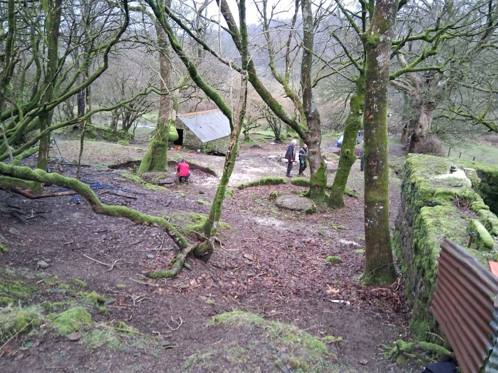
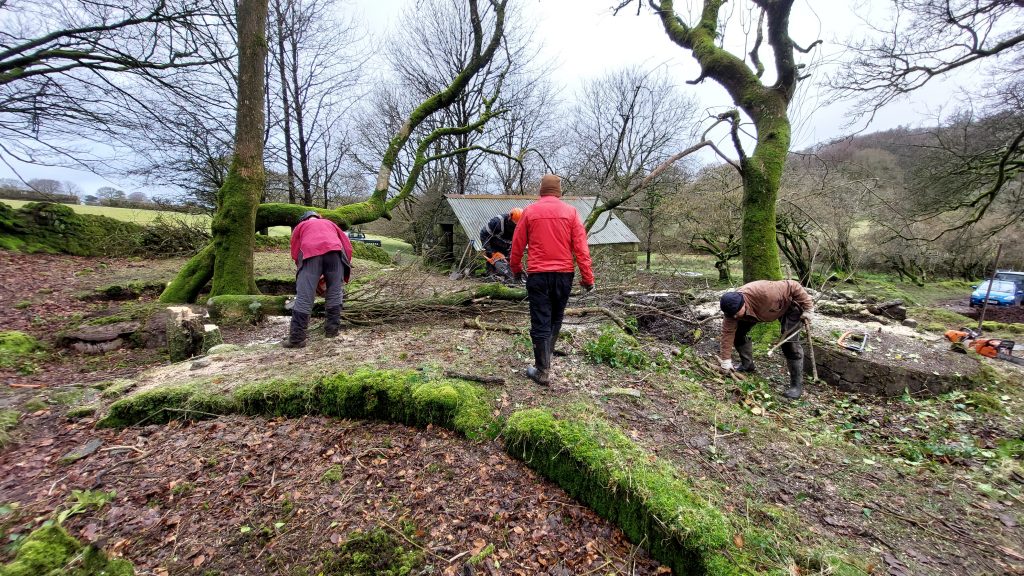
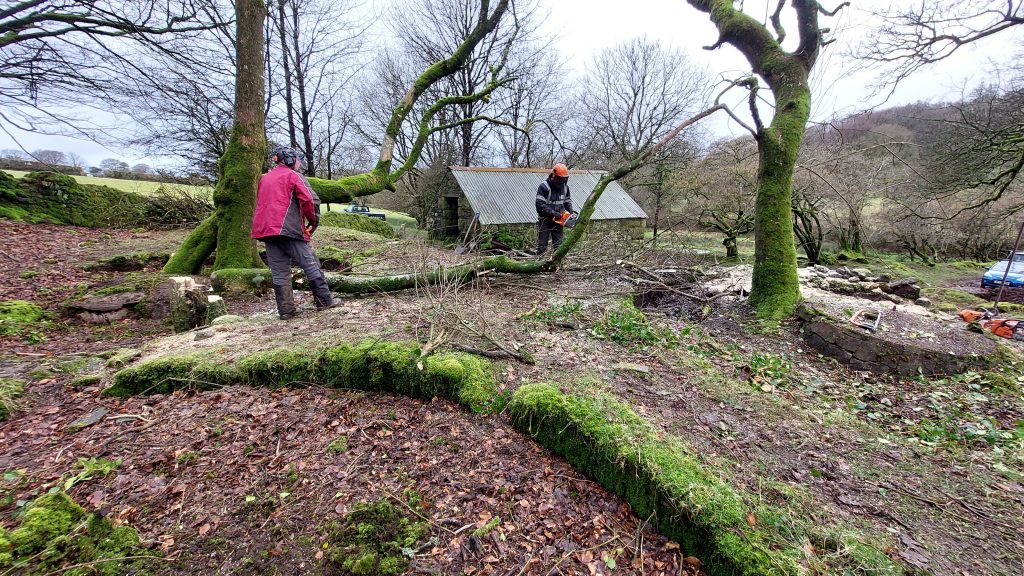
In February 2026, the Dartmoor Tinworking Research Group (DTRG) had a clearance day at the mine, with the aim to cut down as many trees as they could which were a damage risk to the Wheelhouse and the three Buddles. The following pictures were taken during this DTRG clearance day
The Wheelhouse at the start of the DTRG clearance day. Picture courtesy of Clive Barnes
The Wheelhouse at the end of the DTRG clearance day. Just one very large tree left. Picture courtesy of Clive Barnes
The Buddles at the start of the DTRG clearance day. Picture courtesy of Clive Barnes
The Buddles at the end of the DTRG clearance day. Picture courtesy of Clive Barnes
Wheelhouse – one more tree (north west corner) to goWheelhouse at the end of the DTRG clearance dayBlacksmiths Shop / Forge with Sheepstor on the horizonDTRG clearance teamChainsaws-R-usTIMBER !!Buddle 1 after clearanceBuddle 2 after clearanceBuddle during clearance. There was large ‘chunk’ which had been dislodged from the central boss (the lighter piece shown nearest the camera) which has now been put back in its former locationBuddle 3 with several trees removed. Just a couple of awkward trees left, one of which has a large branch which extends over the Blacksmith’s Shop / Forge. If the tree falls, the building is in danger of significant damage