A collection of walks, discoveries, insights and pictures of exploring Dartmoor National Park
January 23, 2026
Walkham and Poldice (aka Walkham United)
The 19th century mine called Walkham and Poldice, which later in the century became part of Walkham United, is located to the south of Grenofen bridge where the River Walkham takes a 180 degree change in direction from initially a northerly direction to a southerly direction about a mile before it flows into the River Tavy and Double Waters.
There is some confusion regarding the origins of the mine. There was an earlier tinwork called Poldice, recorded in 1717 (Rendell). Into the 19th century (sometime after 1856), the operating company of the Walkham and Poldice sett, was also working Devon Poldice (Newman). In 1859 this ‘combined sett’ was depicted on a map as Huel (Wheal) Walkham , totalling an area of 62ha (Newman).
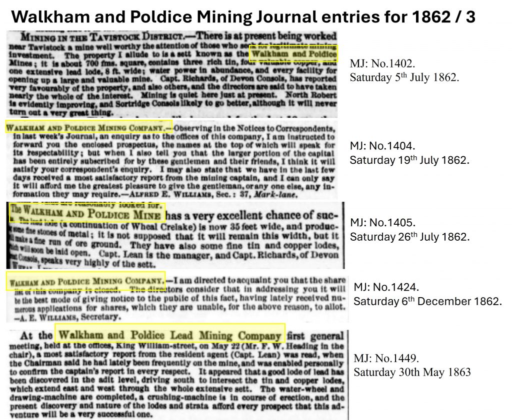
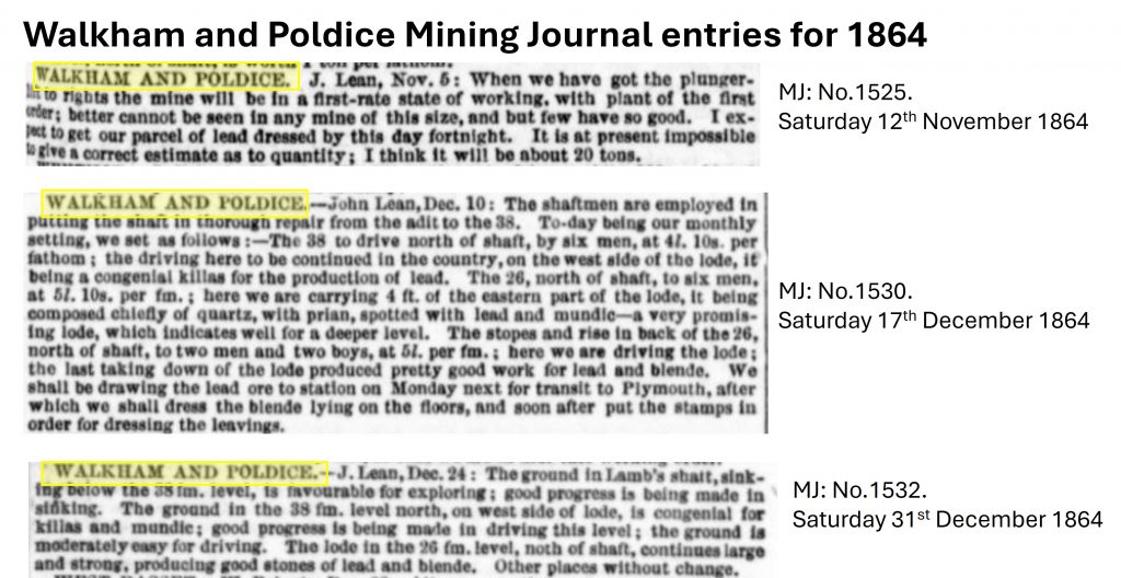
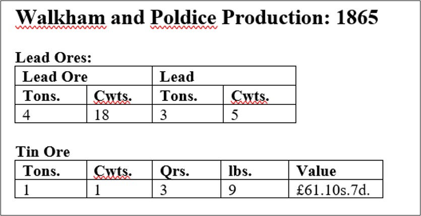
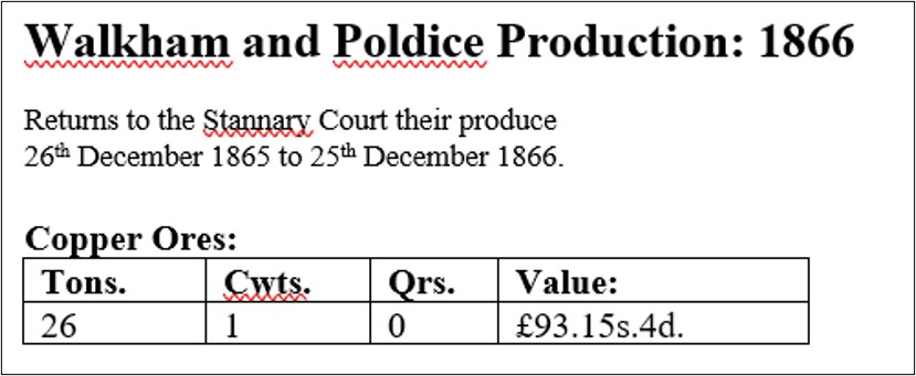
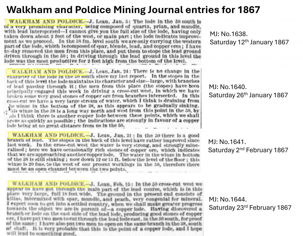
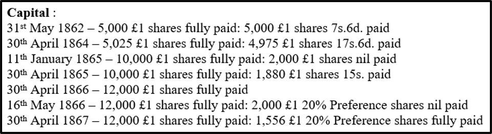
The mine known as Walkham and Poldice was officially launched on 31st May 1862, under the management of Captain John Lean and seems to have developed the northern part of the aforementioned sett. In July 1862, a correspondent reported that the mine had three tin lodes, four valuable copper lodes, and a lead lode 8 ft. wide. Captain John Lean appears to have worked for the mining company until 1867 before it was wound up two years later on 9th March 1869 by which time it had reached a depth of around 50 fms. It seems that Captain John Lean stayed at the mine through its lifetime as the company went into voluntary liquidation in October 1867, two years before being fully wound up. An auction was held in November 1867 of the lease and equipment. The ‘Halcyon’ days of the mine appears to have been during 1865 and 1866 when 4.9 tons of lead, just over 26 tons of copper ore (at a value of £93.15s.4d or around £15,000 in 2026) and just over a ton of black tin (at a value of £61.10s.7d – or just over £10,000 in 2026) were officially recorded. In 1862 at the launch of the company there were 10,000 shares and by 1866 there were 12,000 shares with calls for extra capital seemingly asked for by June 1866. The total capital raised was around £12,000
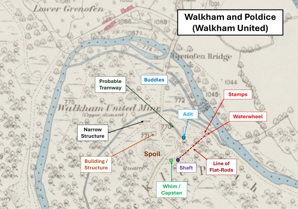
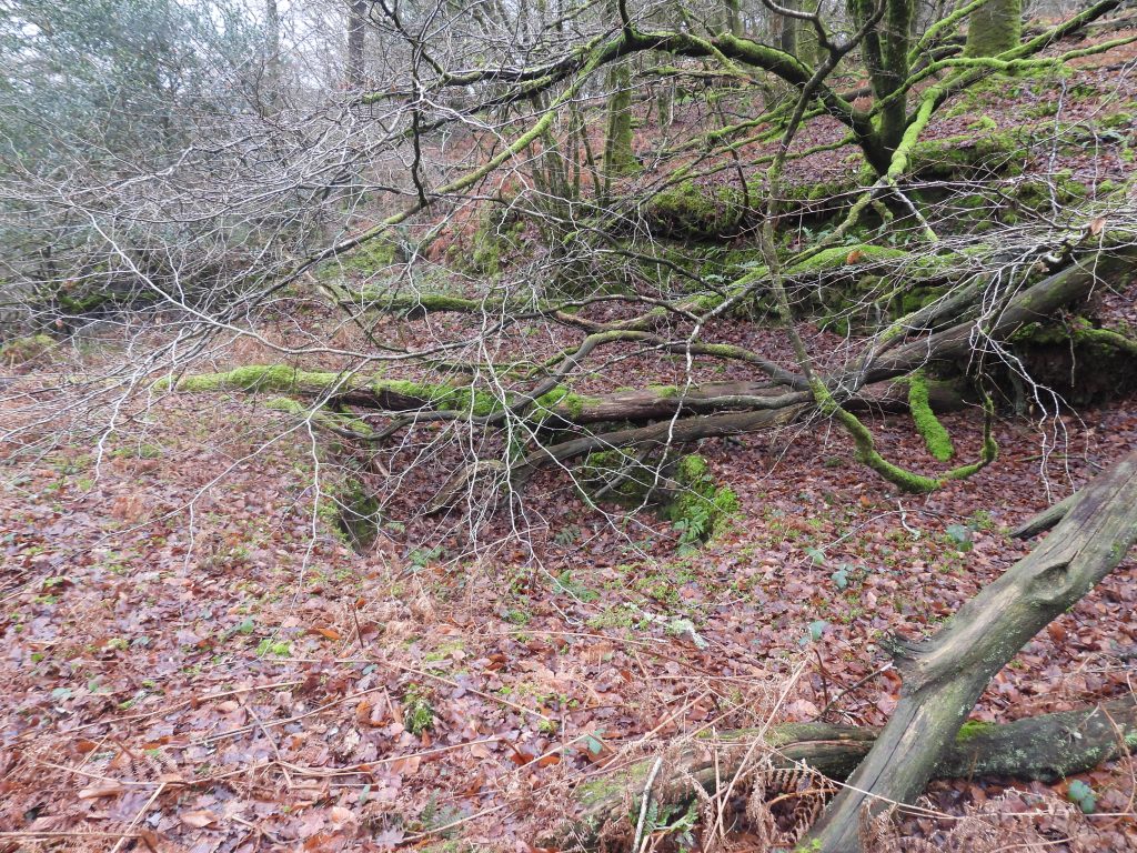
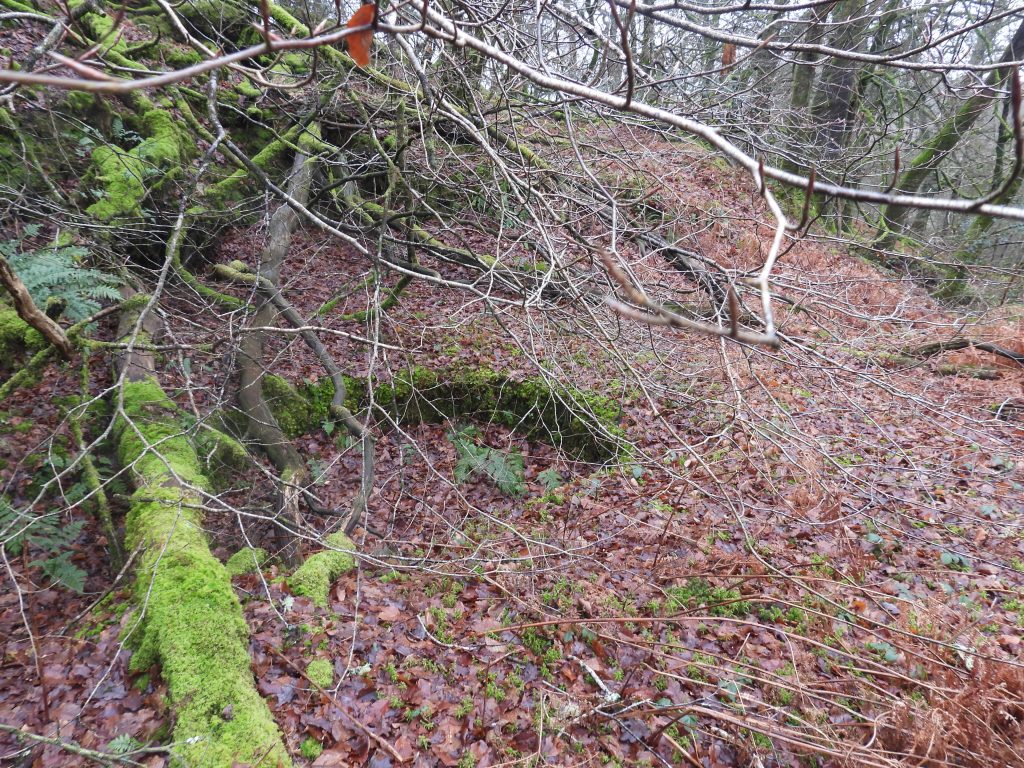
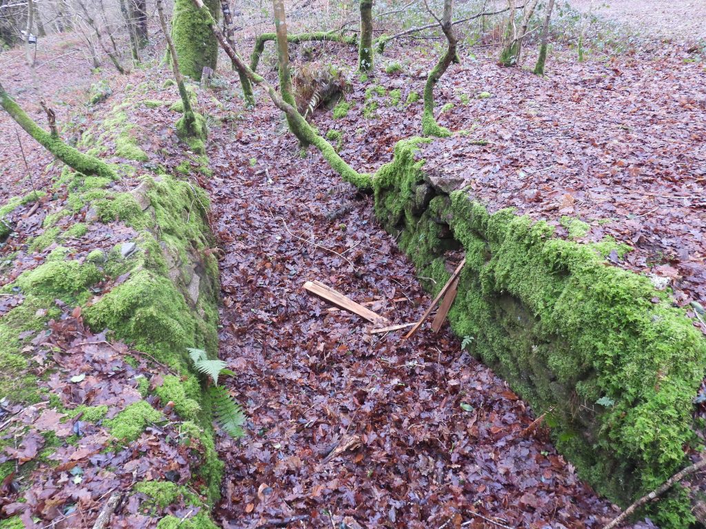
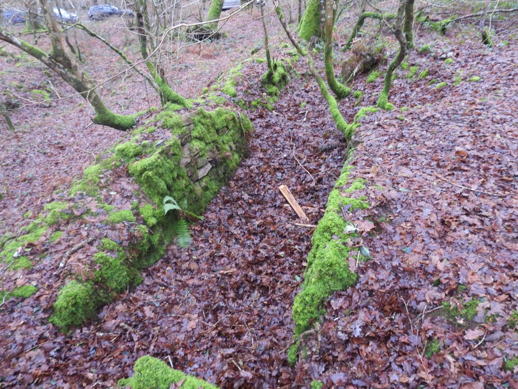
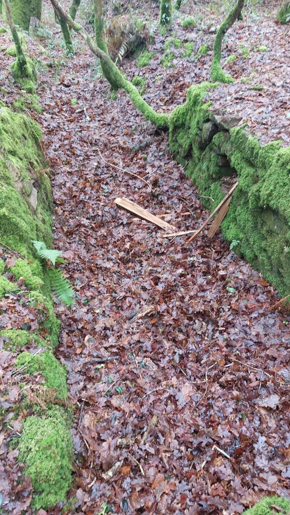
Mine remains can still be found and will probably date from 1862. They comprise: an engine shaft, a capstan platform, an adit (partially blocked), a flatrod channel, a probable tramway, a ruined wheelpit, a large spoil tip, several buildings / structures and a dressing floor. Most of these features have been recorded in this post as is additional information on the mine (recorded by Hunt, Dines, Brooke Index and in Mining Journals).
Bibliography
Brooke Index – Buckland Monachorum Parish
Hunt’s Mining Stats – (1865-66)
Roger Burt, Ray Burnley and Peter Waite – (1984) – The Devon and Somerset Mines: (Mineral Statistics Of The United Kingdom, 1845-1913)
Phil Newman – (2011) – Mining in the Tavy Valley, West Devon: An Assessment of Archaeological Potential
H.G. Dines – (1956) – The Metalliferous Mining Region of South-West England, page 694
Stephen Holley – (2026) – Pers. Conv.
Dartmoor Chris – (2026) – Pers. Conv.
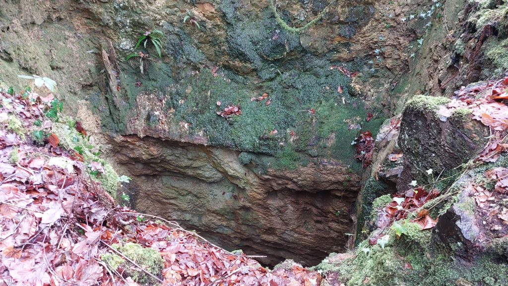
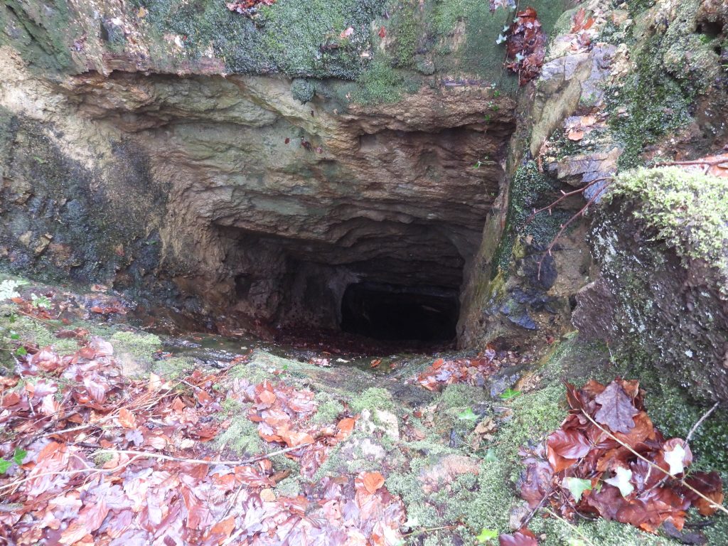
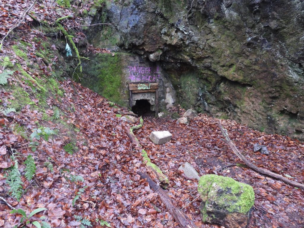
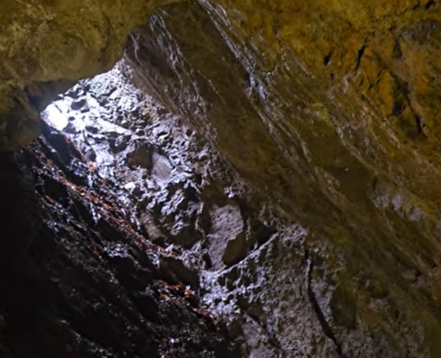
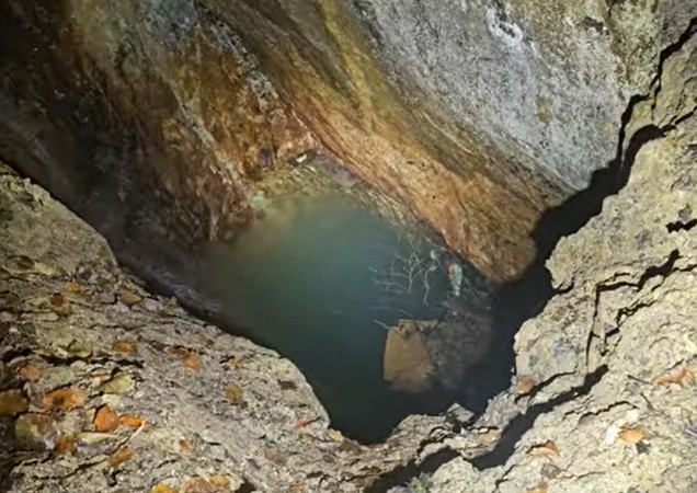
This annotated snippet of an OS map (1873 – 1888), indicates where most of the key features on the mine are located.Early Mining Journal entries for Walkham and Poldice Mine from 1862 and 1863. Of note is the mention of the size of the mine in 1862 as 700 fathoms square and having “three rich tin, four valuable copper and one extensive lead lode, 8ft wide” (whereas Dines in 1956 only mentions two lodes). At the first general meeting, held in May 1863, it was reported that good lead ore had been found in the adit level and that a drive was being made southwards to cut the tin and copper lodes. The water-wheel was completed, and a dressing-machine was being erected. At the date of the first return (April 1863), there were 84 shareholders. Two of the largest shareholders were Alfred Lamb (1,750 shares) and Francis William Reading (2,272 shares) – ref: Brooke Index. Top of the Engine-Shaft (22fms deep), which connected to 4 other levels (14fm, 26fm, 38fm and 50fm).Engine-Shaft. The adit level can just be seen on the side of the shaft (squarish portal). The shaft is fencing is poor allowing for (careful) photography. The shaft is located at SX49016 70794The Engine-Shaft lead to stopes at the 26fm, 38fm and 50fm levelsLooking down Engine-Shaft. The adit level passes this shaft 3fms (18ft) below surface. which can be seem looking (very carefully) down the shaft. The Engine-shaft was once known as Lamb’s Shaft which is assumed to be after one of the largest (and original) share holders from 1862To the north of the Shaft, passing an area where there was once a rock cut Bobpit, is a Flat-rod channel which leads down the hill to the former wheelpit and stampsTo the west of the Shaft a Whim / Capstan can be found. which would have allowed the raising and lowering of materials to either the surface and / or adit level from the 22fm level.The Whim / Capstan is located at SX49004 70796The distance between the Whim / Capstan is around 12m. It is thought that this may have been man poweredMining Journal entries from 1864 by Mine Captain John Lean. Note that the report of 24th December (MJ: 31st December) recorded the shaft as being called ‘Lamb’s Shaft’. On 30th April 1864, the return recorded: 5,025 £1 shares fully paid: 4,975 £1 shares 17s.6d paid.The adit entrance appears to have once been blocked up. The evidence suggests that ore might have either been taken out from the mine via the adit or via the shaft.
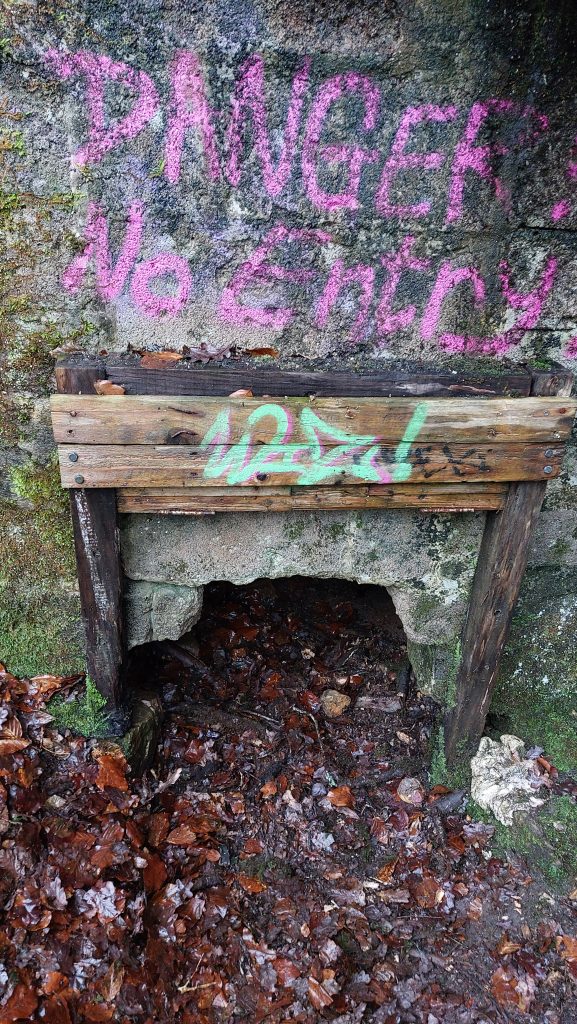
The entrance to the adit is at SX49026 70833. The distance between the adit and the shaft is 40m (or 22fms)
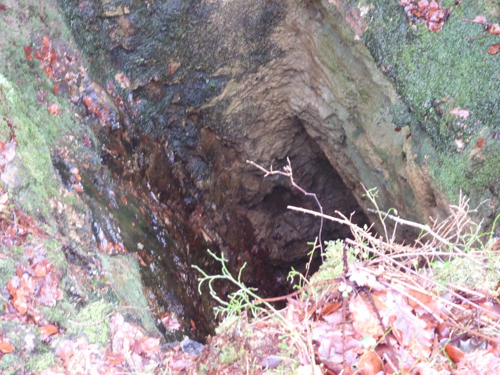
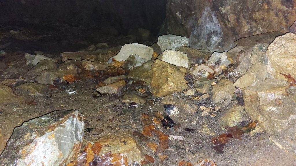
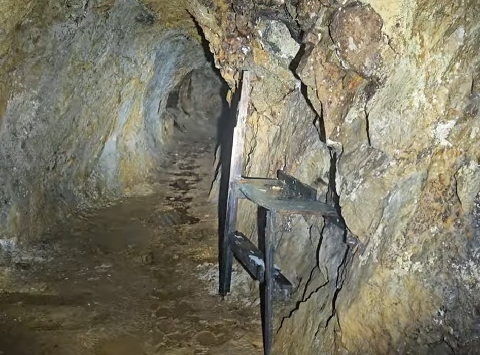
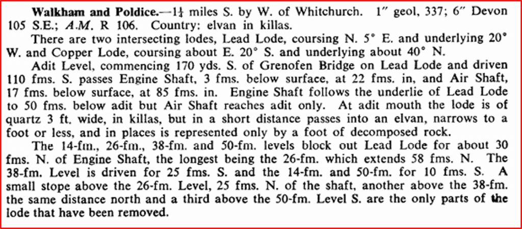
Just inside the adit from the entrance. Dines records that it was driven on the Lead lode for 110fms The internal pictures of the adit have been created using ‘screen shots’ from a Youtube video called Mine Hunt (West Devon). One of the features in the adit, just before it intersects with the Engine-Shaft is this apparent work bench
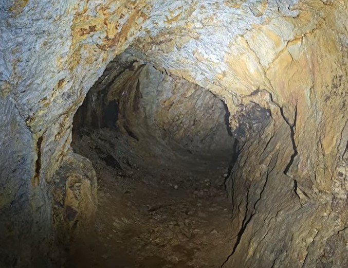
The adit is quite large, probably being consistent with the conjecture that ore was removed through here
The above is an extract from Dines (1956) – page 694, which provides some interesting facts and figures. about the lodes and levels. He states there were two intersecting lodes (Lead and Copper)
From the adit, looking up Engine (Lamb’s) Shaft
Looking down from the adit level. The Shaft would have been sunk down from here for another 19fms (114ft)
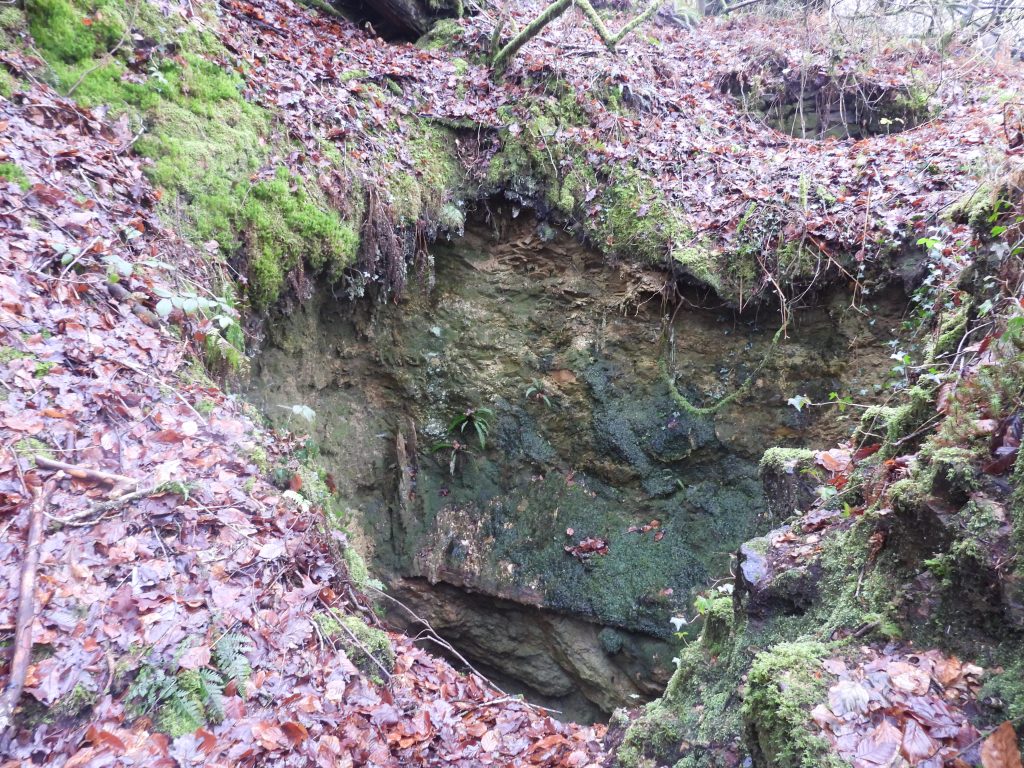
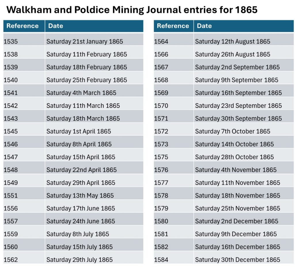
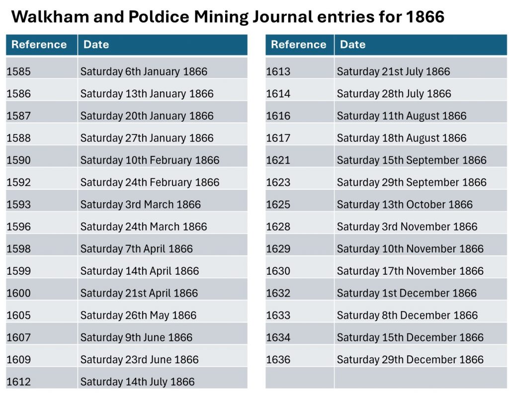
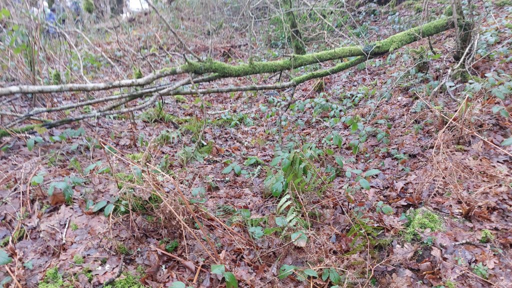
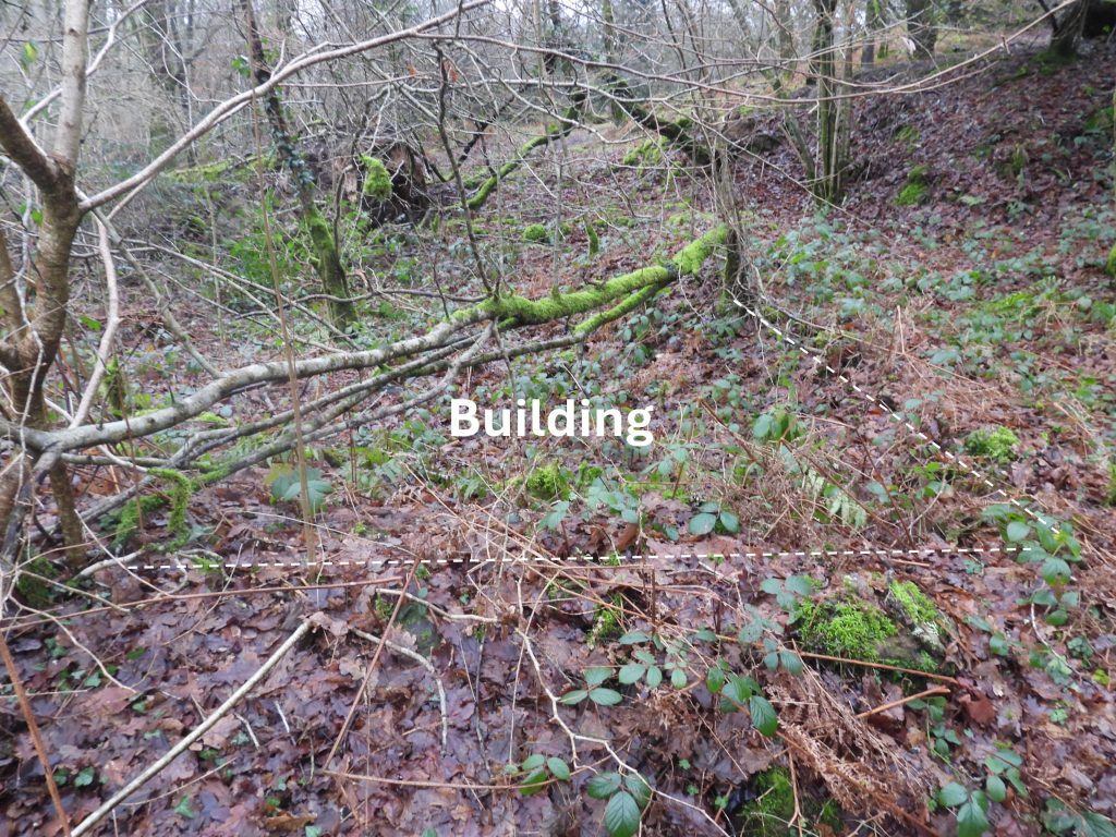
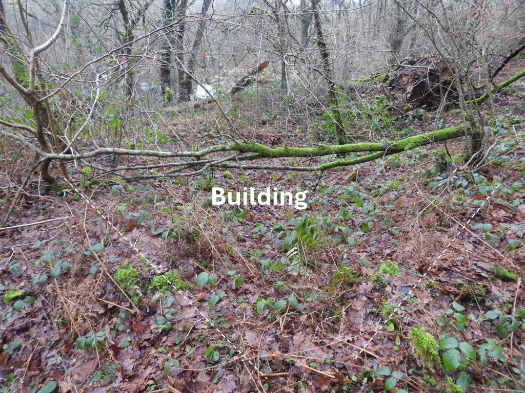
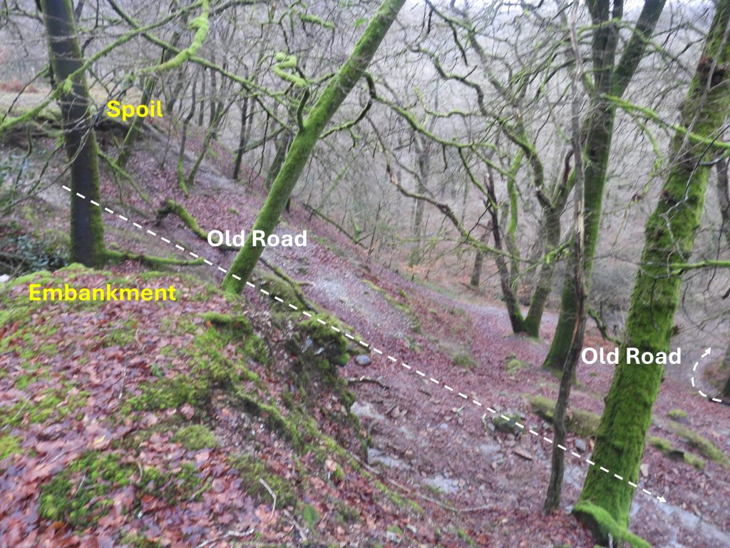
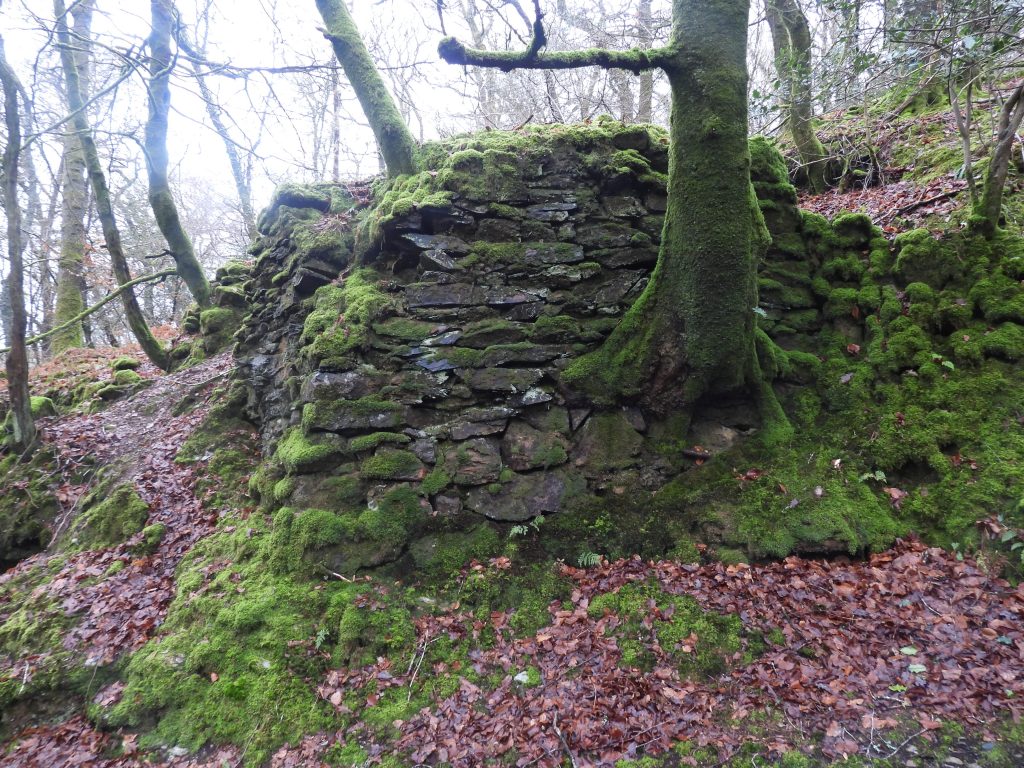
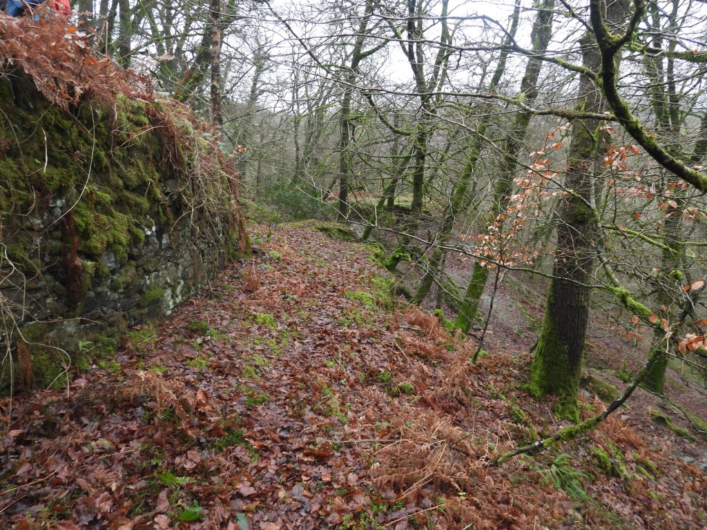
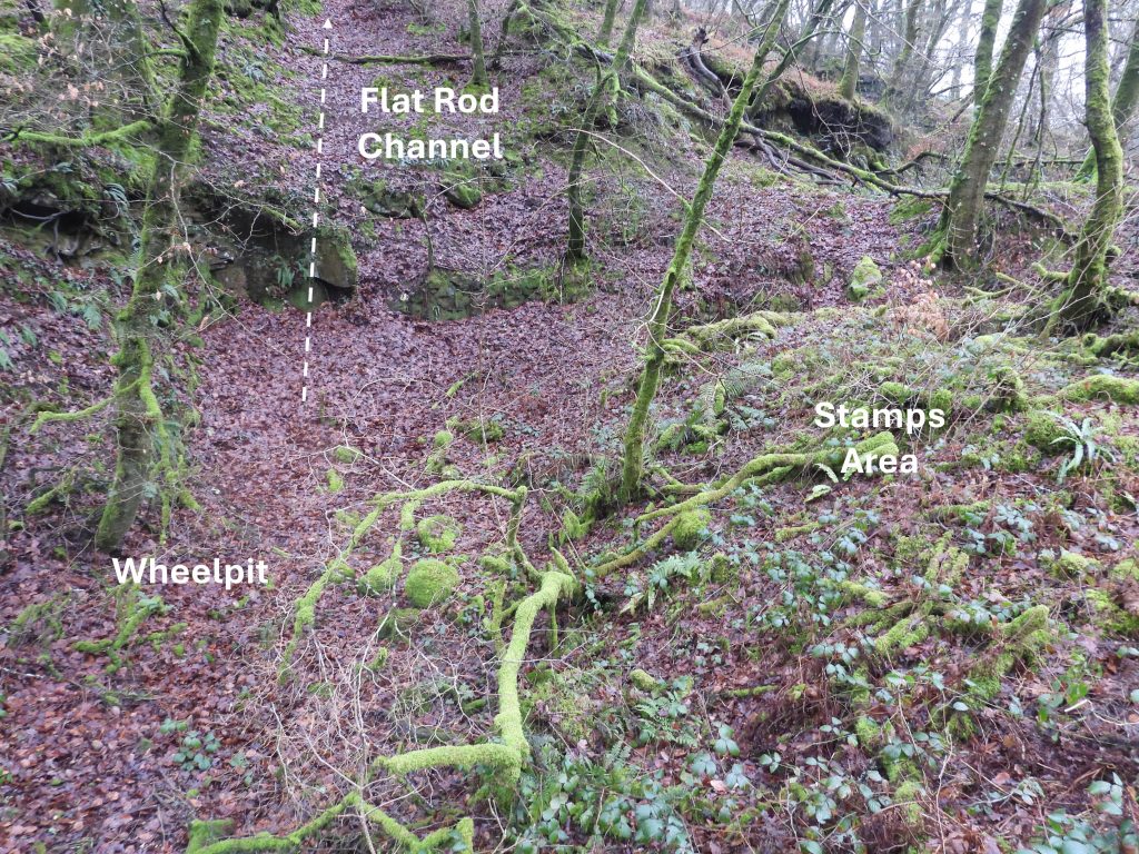
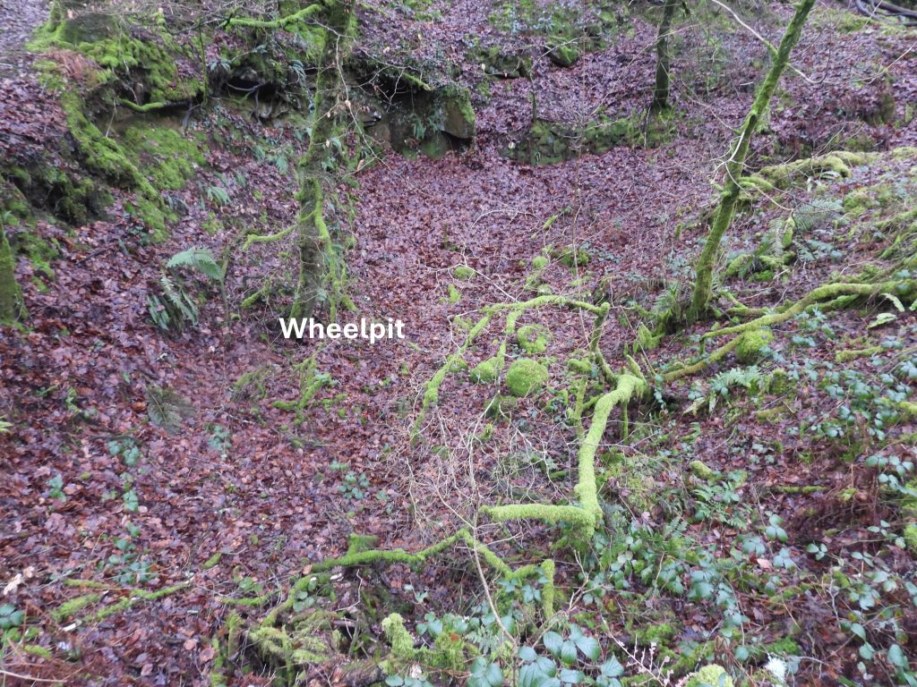
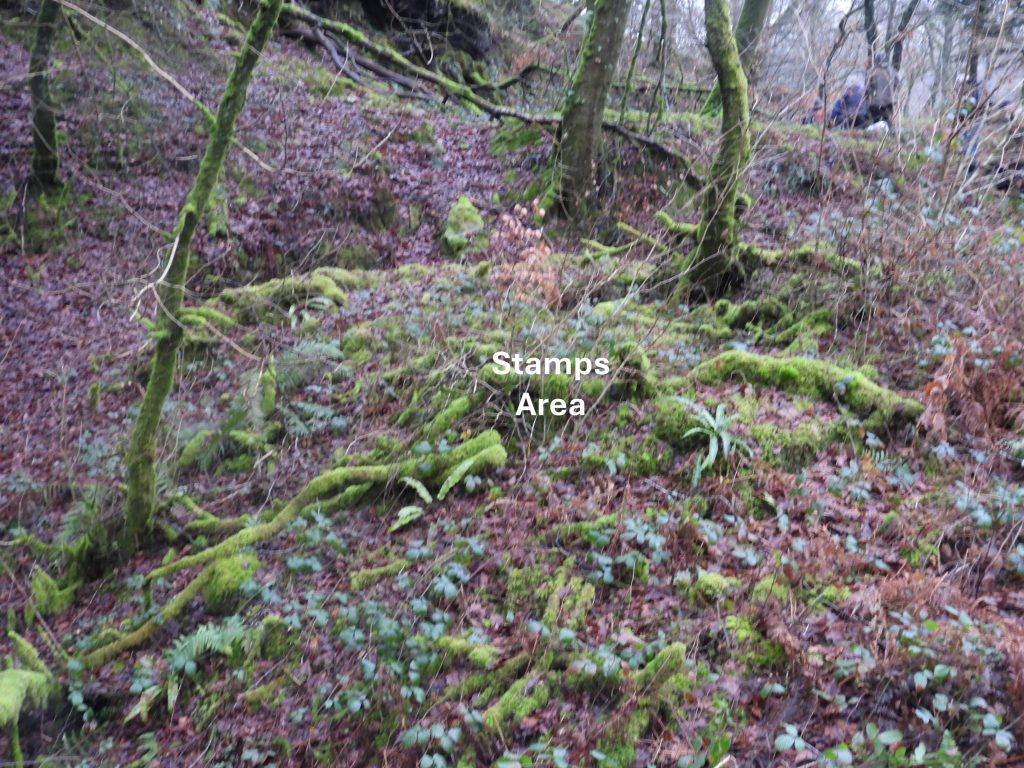
There were an incredible 36 references to Walkham and Poldice Mine in the Mining Journals from 1865 as shown in the tables above – Captain John Lean was busy writing his reports. The Brooke Index records that “The engine-shaft* was being sunk below the 38-fathom level in April 1865. In the 38-fathom level the North lode was unsettled, and was composed of spar, spotted with lead and rich stones of copper ore. Two men were driving the 26-fathom level. In December 1865 the 50-fathom level was being driven northwards in favourable ground, and the 50-fathom level south was producing stones of copper and lead. The 38-fathom level was being driven eastwards on a lode thought to be Wheel-pit lode”. *As previously mentioned the engine-shaft had previously been recorded as ‘Lamb’s Shaft’. 1865 recorded production figuresFrom the Brooke Index: “In 1866, the 50-fathom level south on the lead lode was being driven by 6 men. Its leader was about 4 ft. wide, with lead ore disseminated throughout, producing some saving work. The 50 and 38-fathom levels west were set to drive by 4 men each, the lode in the latter having a leader 18 in. wide containing capel, mundic, and copper ore”.1866 recorded production figuresTo the north of the adit entrance is a ‘right angle’ corner of walling. A (probable) tramway would have lead off to the left (north west) down the slope – the OS map does suggest a tramway construction (two parallel line). The waterwheel and stamps from here is to the right (north east), down what looks like a modern footpathThese are probably some of the last of Captain John Lean’s reports recorded in the Mining Journal and as was common, the language is very positive and upbeat. In spite of this, just a few months later, in April 1867 arrears of (share) calls amounted only to £99 5s were recorded, which was less than 1% of Capital invested. The writing was on the wall at this point and in October 1867, the company went into voluntary liquidation. Charles Bedell and Henry Ritchie were appointed liquidators. An auction was held in November 1867 of the lease, a 28 x 4 ft. water-wheel, a Cornish crusher with 20 in. rolls, a drawing-machine, 6 heads of stamps, 50 fathoms of pitwork, air-pipes, dressing-equipment, tools and other items. After the winding-up was completed, a final meeting return was registered in March 1869. Five months later, in August 1869 the materials were again put up for auction. (Ref: Brooke Index)Amongst this vegetation was a former buildingThe building foundations are difficult to photograph. The author speculates that beyond the stone foundations, the building was a wooden structure. The building is located at SX48969 70842Close to the Whim / Capstan is an embankment which appears to have once been joined, presumably by a bridge across an old track / road to a spoil tip. The ‘old road’ is on old 19th century maps and appears to have connected Buckland Monachorum and GrenofenThe stone embankment from below (on the old track / road)The side of the embankment with the old track / road belowSite of the Wheelpit and Stamps near the river and Flat-rod channel leading up to the Shaft beyondThis annotated photograph shows the featuresAt the auction in November 1867, the water-wheel was said to be 28 x 4 ft. water-wheel (a later source said 18 x 4 ft.)
The Wheelpit is located at SX49057 70841
The Waterwheel is said to have driven 6 heads of StampsA long narrow structure is located at SX48965 70862The long narrow structure does look like a Wheelpit but it is slightly uphill from the leat shown on OS Maps. Also, of note is that the leat shown was for the Virtuous Lady and Lady Bertha Mines, several miles to the west. The leat headweir is located to the south of Grenofen bridge not far from the Waterwheel and Stamps for this mine. Of course, the leat used for this mine may have been routed to this structure
The mine also had a Cornish crusher with 20 in. rolls and a drawing-machine. Might this rectangular structure been either of these ?
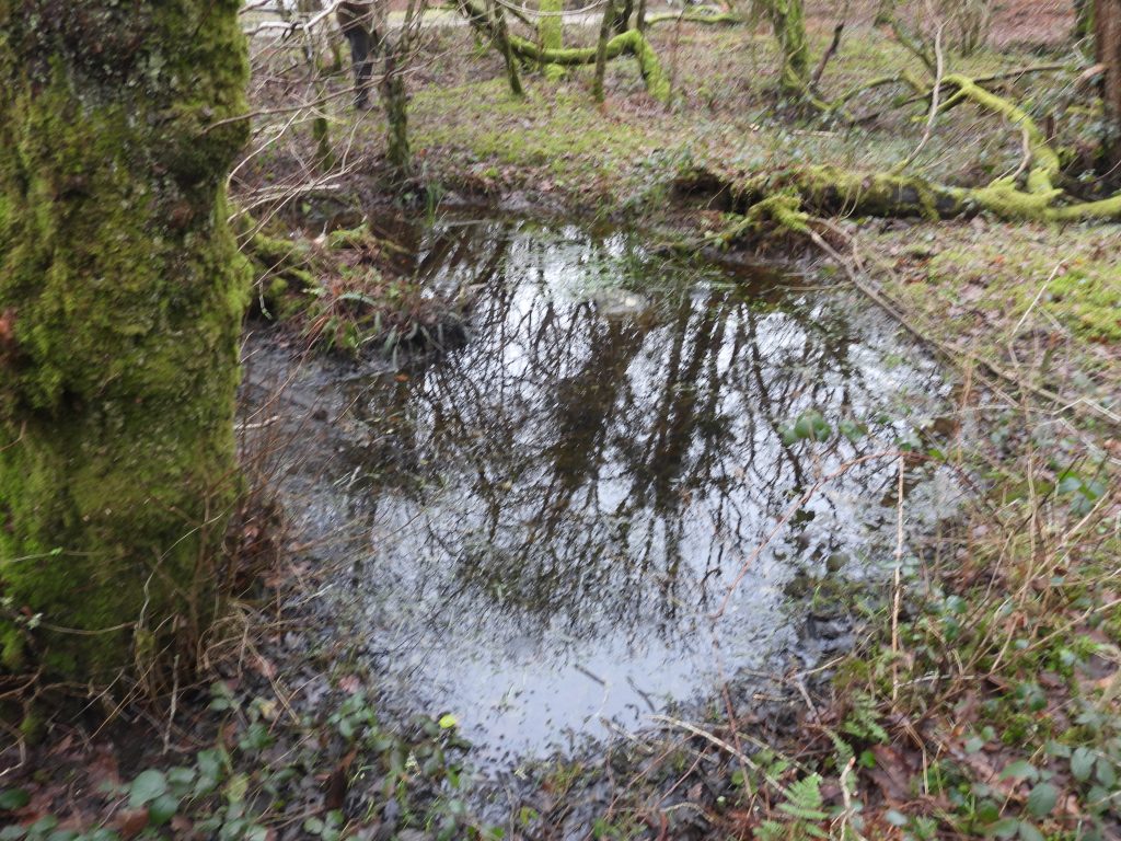
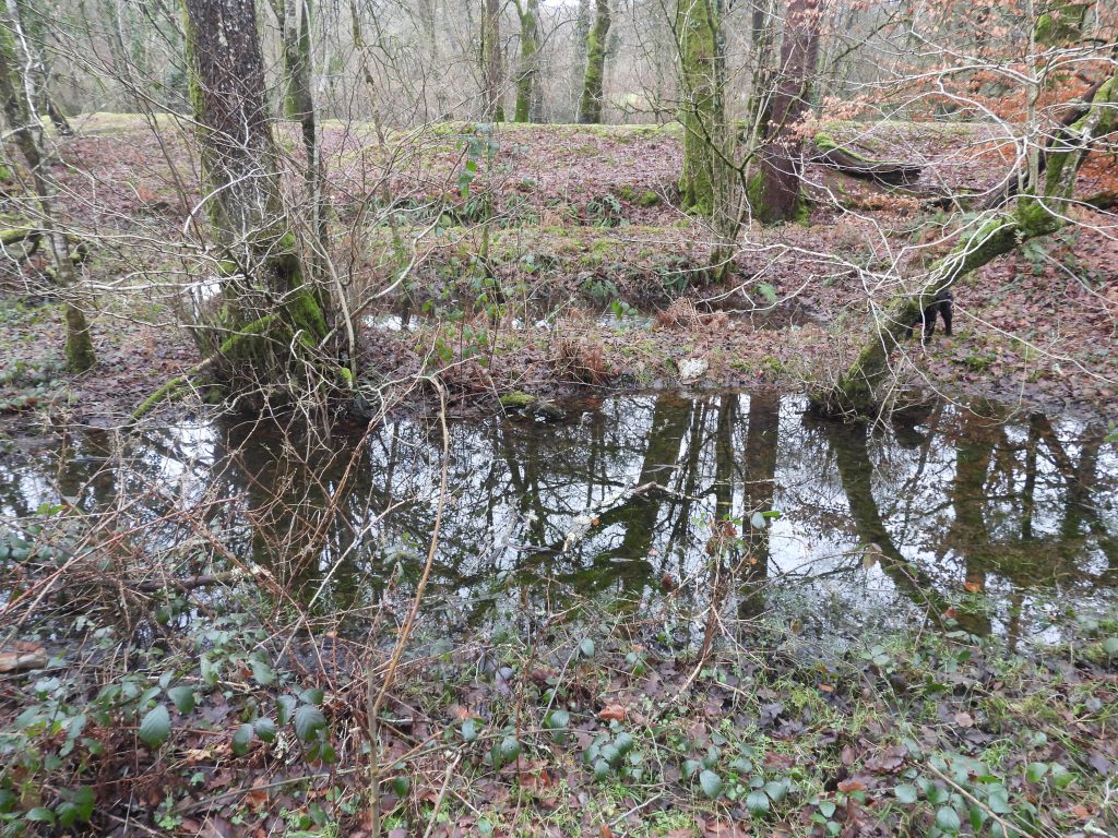
Buddles near the riverBuddles near the riverBuddles near the riverAre these settling pits?This information was recorded in the Brooke Index. If the author has read the information correctly, the Capital invested was circa £12,000 (in £1 shares) – originally 10, 000 shares in 1862, rising to 12,000 shares by 1866. With the recorded (known) sales only valuing around £155, this mine, like many others was a money pit, destined to fail.