A collection of walks, discoveries, insights and pictures of exploring Dartmoor National Park
January 20, 2026
Gem Mine (aka West Sortridge Consols)
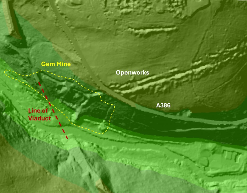
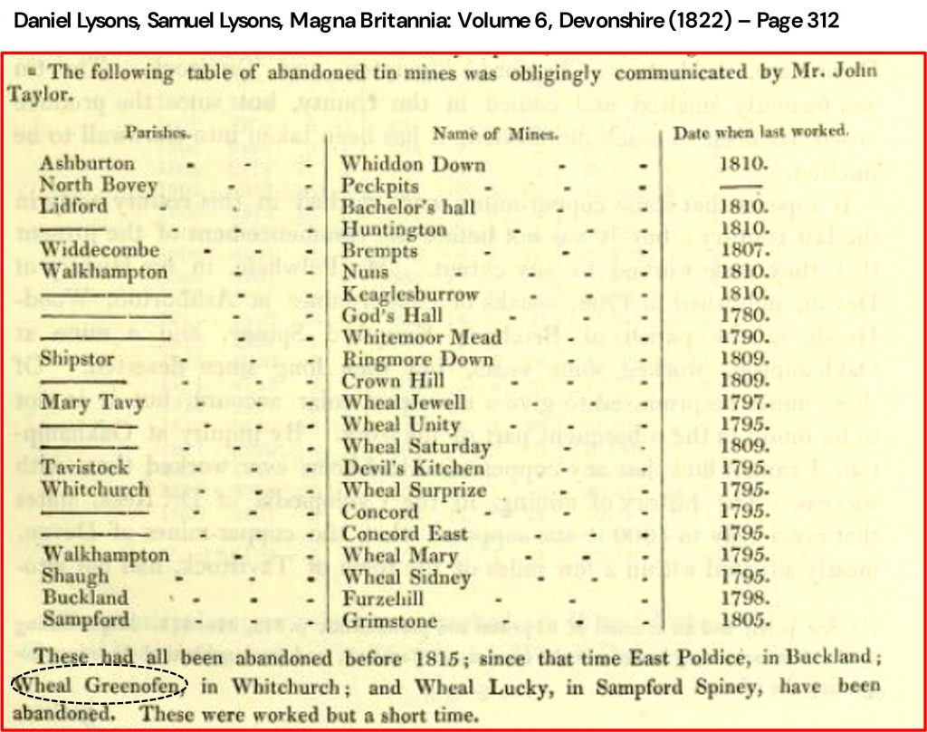
Gem Mine lies to the north east of the River Walkham, at the western end of two large parallel (late medieval) east-west openworks, which begin in what is now Birchcleave Wood. The history of ‘modern’ mine is thought to have potentially started in the early 19th century, when it possibly was known as Wheal Grenofen as recorded by Lysons (Magna Britannia: Volume 6, Devonshire (1822). Lysons recorded the mine (Wheal Grenofen) as being in the Whitchurch parish and their record indicates it must have had been abandoned between 1815 and 1822. The mine was almost certainly the initial ‘modern’ attempt to exploit the tin lodes exposed by the medieval openworks.
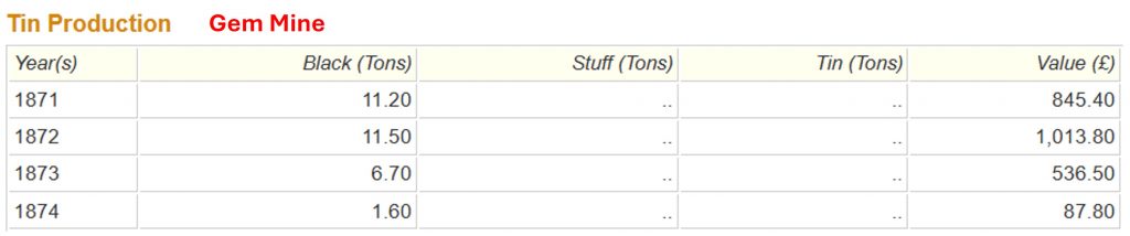
Forward to the mid-19th century (1855), the mine was operating as West Sortridge Consols. Under this name it is recorded that 6 tons of tin were produced, valued at £632 (equivalent to over £88,000 in 2026) – this was the only recorded output. It was still named West Sortridge Consols in 1859 (Newman). The mine appears to have closed in the late 1850s and into the 1860s as it was re-opened in 1871 as Gem Mine and two years later was known as Gem Tin Mining Company (Newman). Burt, Burnley and Waite (1984) recorded that the mine produced 31 tons of tin up to 1874, valued at £2383 (or equivalent to over £364,000 in 2026). However, from 1874 there were proceedings to liquidate the company and the mine became abandoned once more.
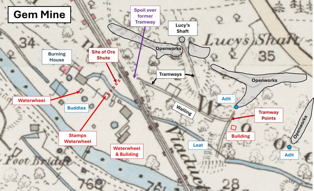
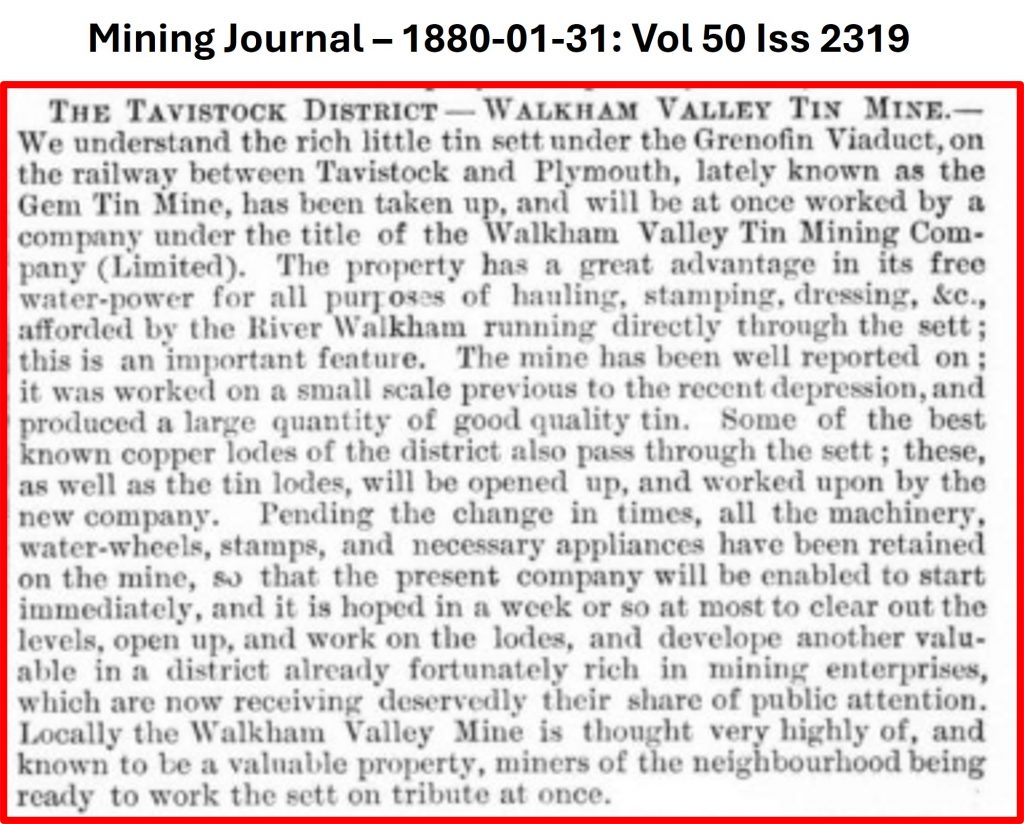
On 31st January 1880, the Mining Journal published that the sett was acquired by the Walkham Valley Tin Mining Company. Within a year (1881), the mine had been absorbed into Walkham United, which only survived until 1883 when it was struck from the register. An OS map (1873 – 1888) from the National Library of Scotland and a photograph published in ‘Industrial Archaeology’ by Helen Harris provide a superb ‘visual’ indication of what the mine would have looked like in its latter years of operation.
The author would like to especially thank Stephen Holley (Dartmoor Tinworking Research Group) for a detailed guided walk to the mine, where the photographs and many of the details found in this post were collected. Also, to Dartmoor Chris for adding newspaper historical information.
Bibliography
Roger Burt, Ray Burnley and Peter Waite – (1984) – The Devon and Somerset Mines: (Mineral Statistics Of The United Kingdom, 1845-1913)
Phil Newman – (2011) – Mining in the Tavy Valley, West Devon: An Assessment of Archaeological Potential
Daniel Lysons and Samuel Lysons – (1822) – Magna Britannia: Volume 6, Devonshire – Page 312
Mining Journal – 31st January 1880 – Vol 50 Iss 2319 (page 117)
Helen Harris – (1968) – Industrial Archaeology of Dartmoor (pages 215 and 226)
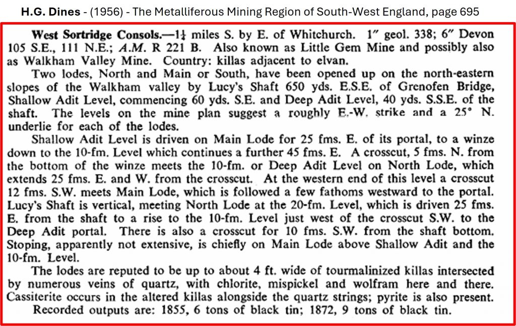
H.G. Dines – (1956) – The Metalliferous Mining Region of South-West England, page 695
Stephen Holley – (2026) – Pers. Conv.
Dartmoor Chris – (2026) – Pers. Conv.
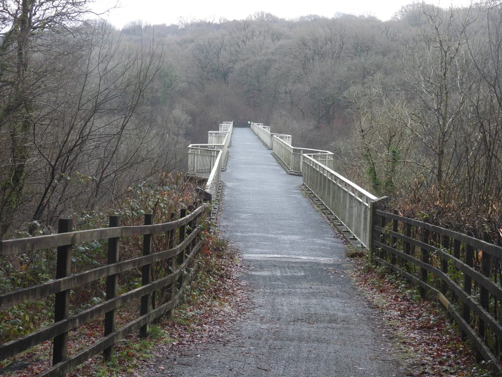
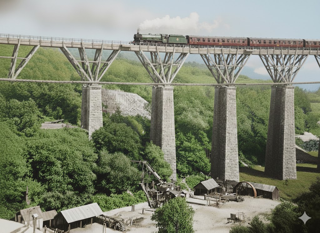
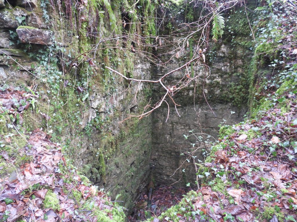
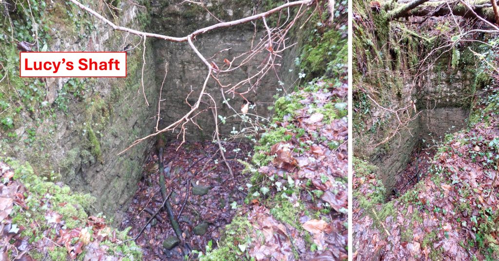
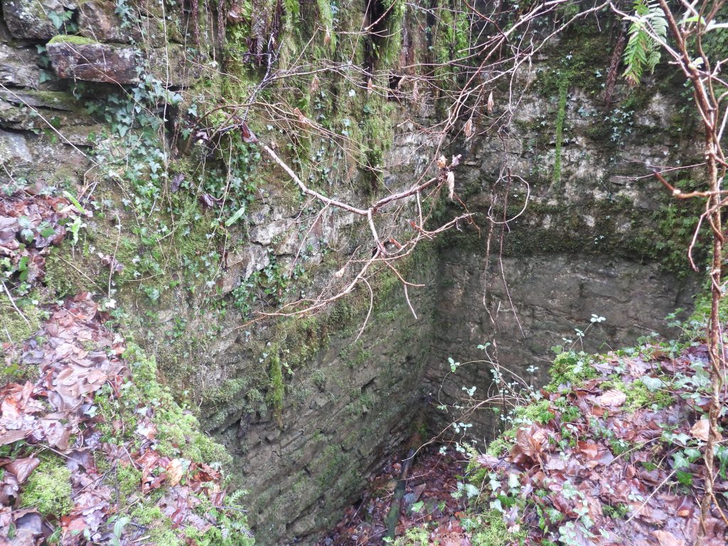
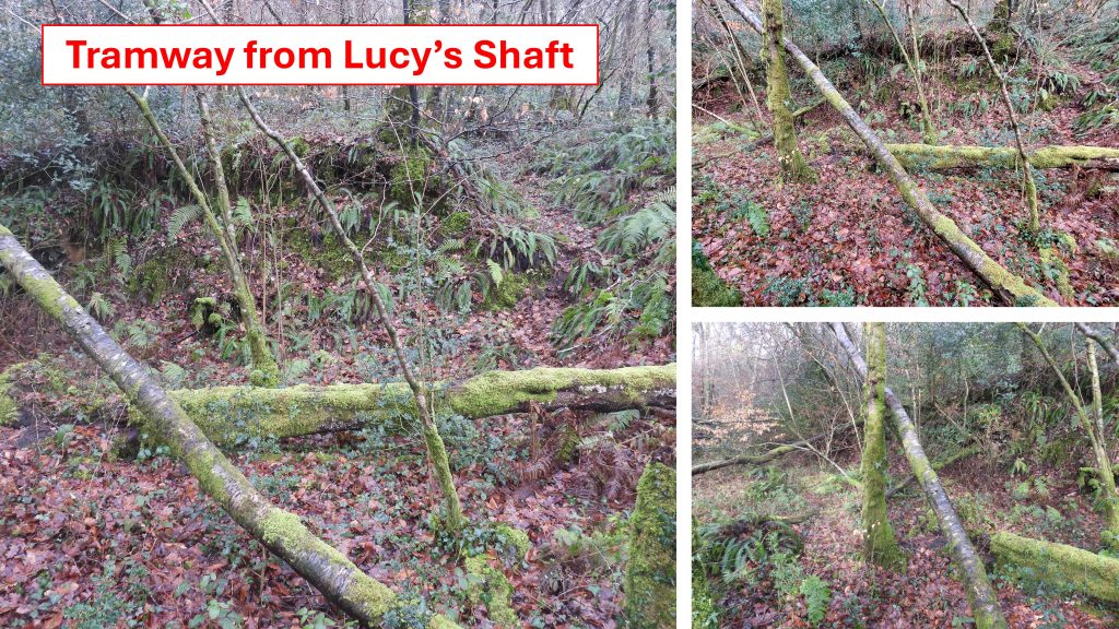
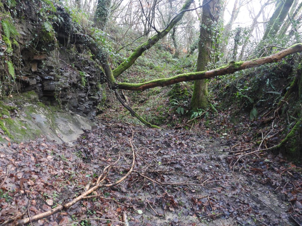
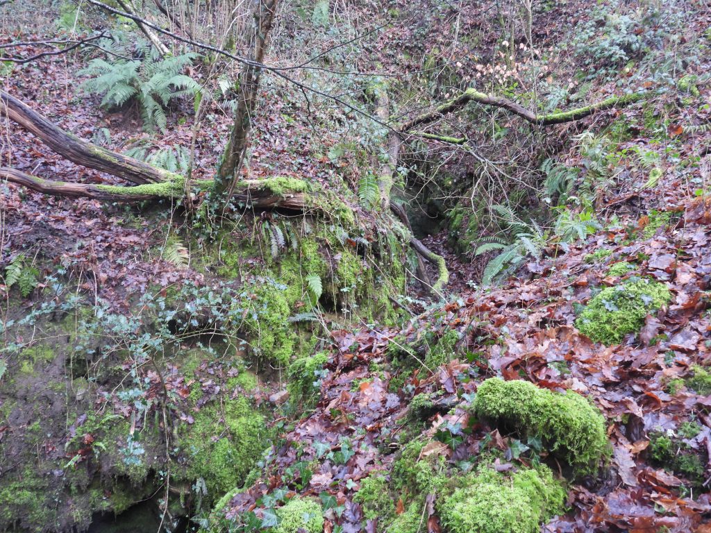
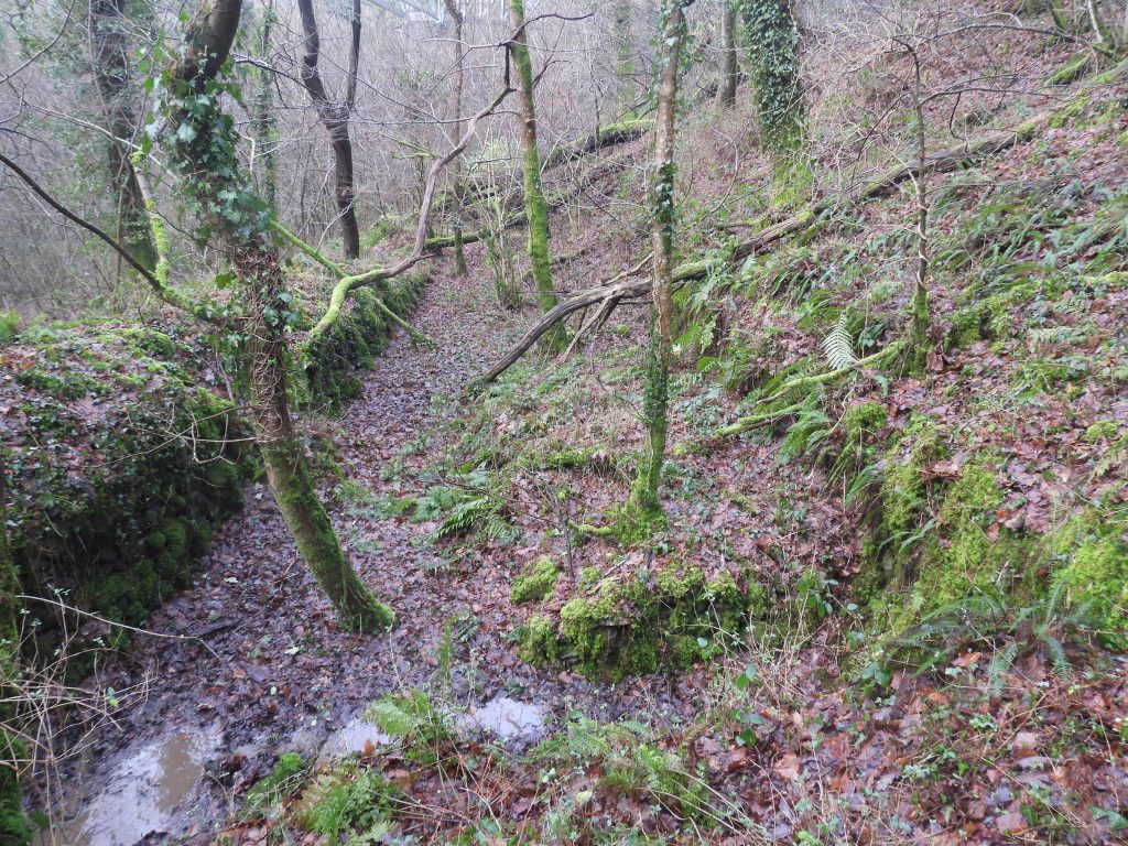
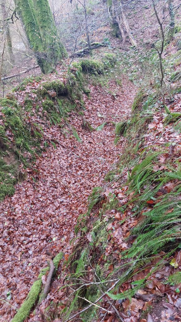
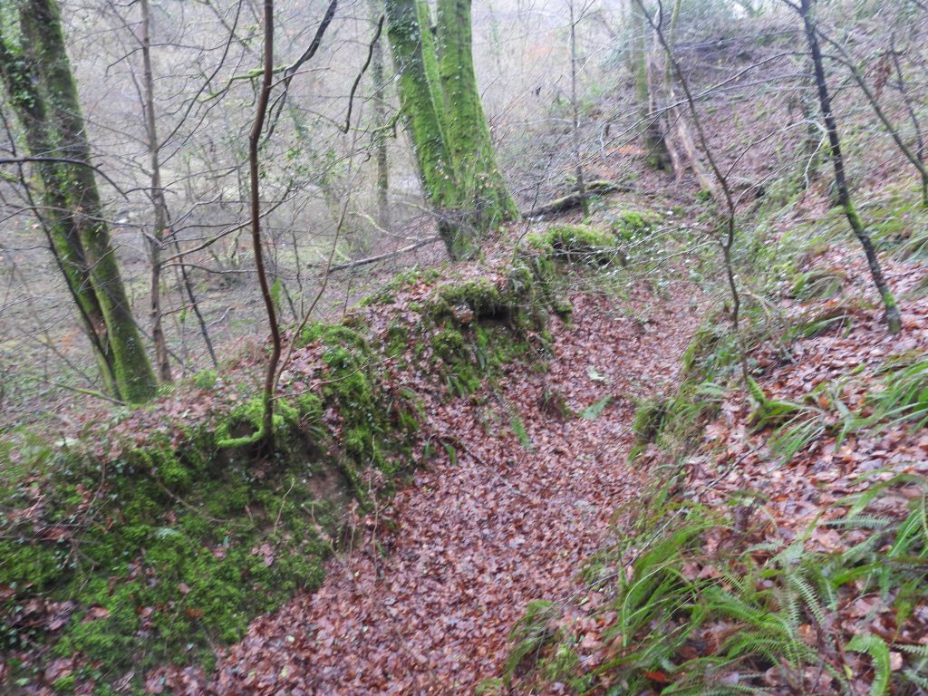
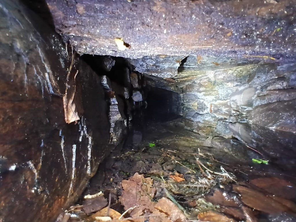
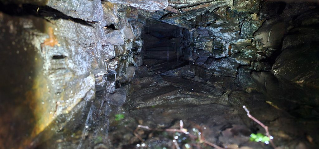
This snippet of an OS map (1873 – 1888), shows the key features of the mine. Essentially, the ore extraction was to the north east of Walkham (or Gem) viaduct with the dressing floors to the south west of the structureThe modern Gem viaduct, used by cyclists and walkers. It was constructed from January 2011 through to May 2012 and cost over £2 Million. This AI enhanced photograph (from 1887, after the mine had closed) shows the original viaduct which was designed and built under the supervision of Isambard Kingdom Brunel between 1856 and 1859 (ie between the periods when the mine was first known as West Sortridge Consols then Gem Mine). It was demolished in 1965 after the closure of the railway (1962). Note the dressing floor had at least three waterwheels, the middle of the three was the stamps wheel. Apologies for any railway purists if the AI filter has chosen a steam train which historically is incorrect (only added for artistic purposes)This LiDAR plot shows that Gem Mine lies at the western end of two parallel large late medieval west east openworks, which begin in Birchcleave Wood. The wood lies on Furzeland Down and presumably wasn’t there in the late medieval period. The openworks cross the modern A386, close to the bend in the road just south of Gem Cottage, the former Count House.The Lysons’ record from 1822, indicating Wheal Grenofen had been abandoned after 1815 (and before 1822) when Magna Britannia: Volume 6, Devonshire was publishedExtract from the Mining Journal from 31st January 1880, showing ownership of the mine just a few years before its final closureThe main shaft of the operation was Lucy’s Shaft. The shaft was vertical and met the northern tin lode at 20 fathoms. It was driven 25 fathoms east to rise to the 10 fathom level (Dines)Lucy’s Shaft is located at SX49508 70610Dines records Lucy’s Shaft as being 650 yards ESE of Grenofen Bridge, when the mine was West Sortridge Consols, which of course, was before the railway viaduct was built. This is probably why the reference point was such a distance away. Helen Harris records in ‘Industrial Archaeology of Dartmoor’ that when the Brunel bridge / viaduct was demolished in 1965, the stone was used to fill the mineshaftRunning SSE from Lucy’s Shaft (as shown on the OS Map) was a tramway (or incline plane). This lead to a lower tramway which ran parallel to the mine leat and the river to the dressing floor downstream. The tramway appears to have been built through an openwork. These pictures were taken at SX49521 70602This extract from Dines (1956) provides some interesting details about the mine when it was West Sortridge Consols. Dines suggests the mine was also known as Little Gem and possibly Walkham Valley Mine. He records Lucy’s Shaft, two lodes (north and south) and two adits (Shallow and Deep) not far from the shaft. Tin production 1871-1874; 31 tons, valued at £2483.50This photograph was taken just below the A386 in the late medieval openworks. There is evidence here that the bank has been concreted to prevent bank slippage, albeit this does look rather an old construction. This location is SX49574 70584This adit portal (blocked) is located SE from Lucy’s Shaft. There was a small tramway operating from here, which is shown on the annotated OS map shown in this post.
Rails from the tramway can be still be found below the adit.
The rails appear to be part of a ‘points’ system (as shown on OS map)The tramway points are located at SX49537 70552The rails appear to have run south west and north west from this pointThis building / construction is just a few metres from the tramway points. Its purpose in unknownThe building / construction is located at SX49550 70551Part of the tramway, running north west towards the viaduct – it appears to terminate by a large spoil heap, but would have originally lead to just above the dressing floor. There is walling here on the downslope side of the tramway just above the mine leatConstruction at SX49526 70557. This is thought to be the location where the tramway (or incline plane) meets the railed tramway
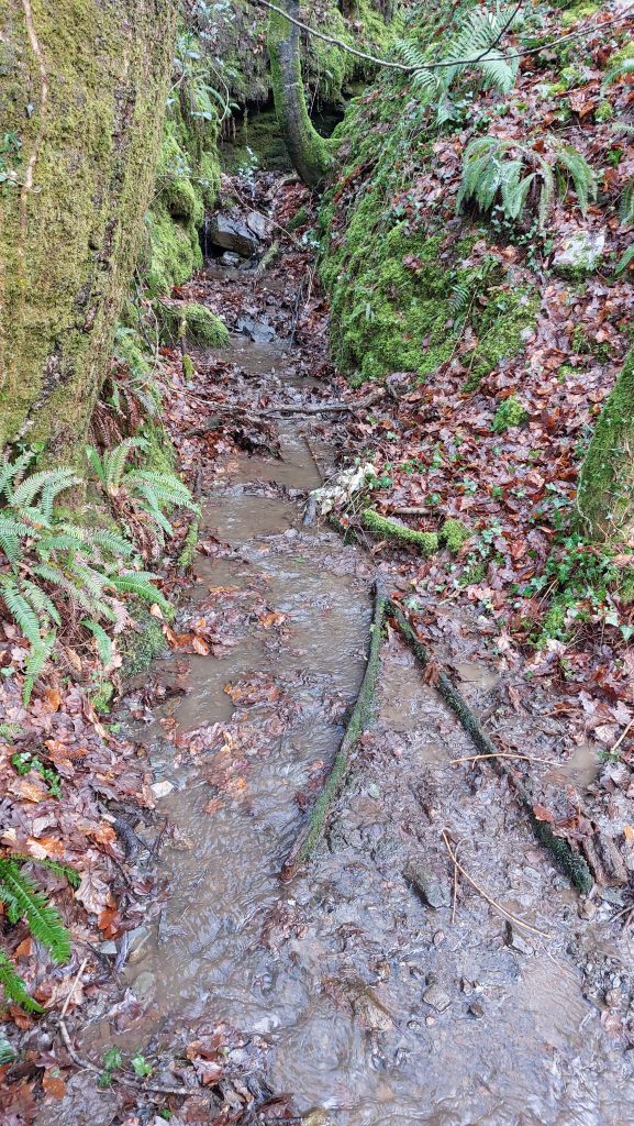
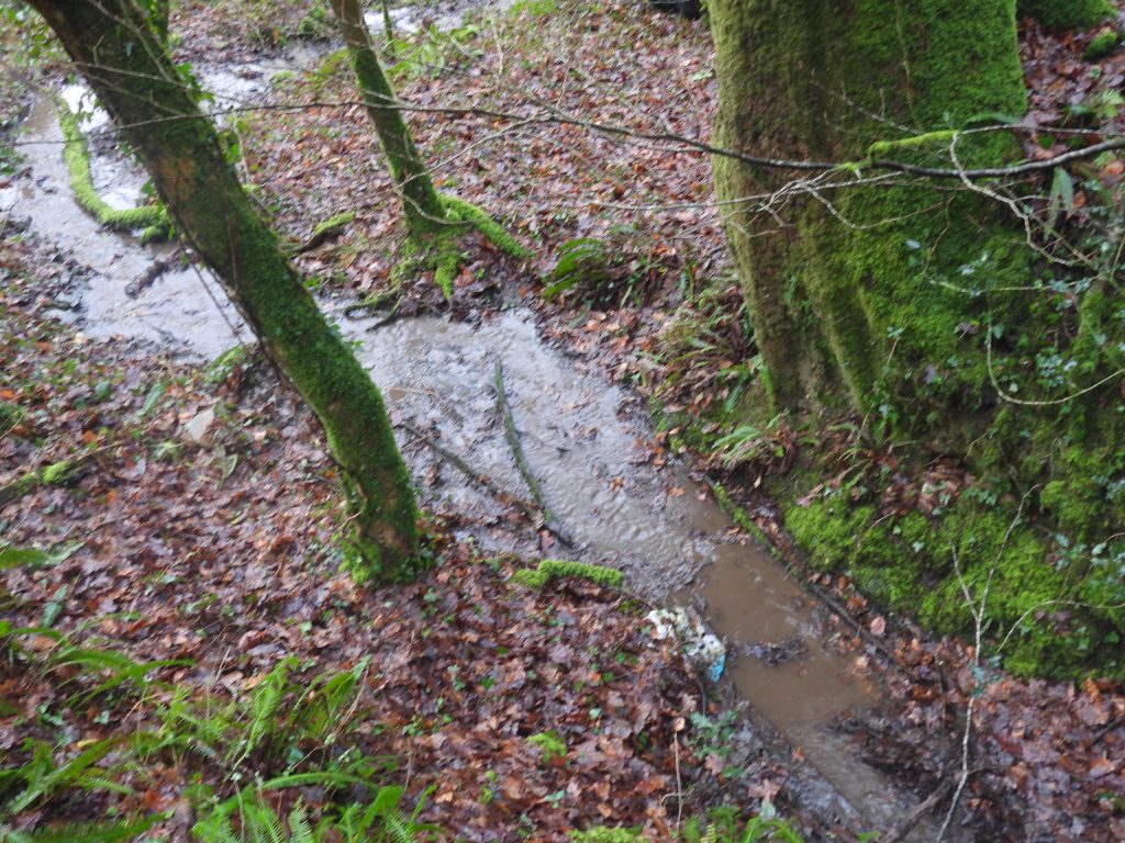
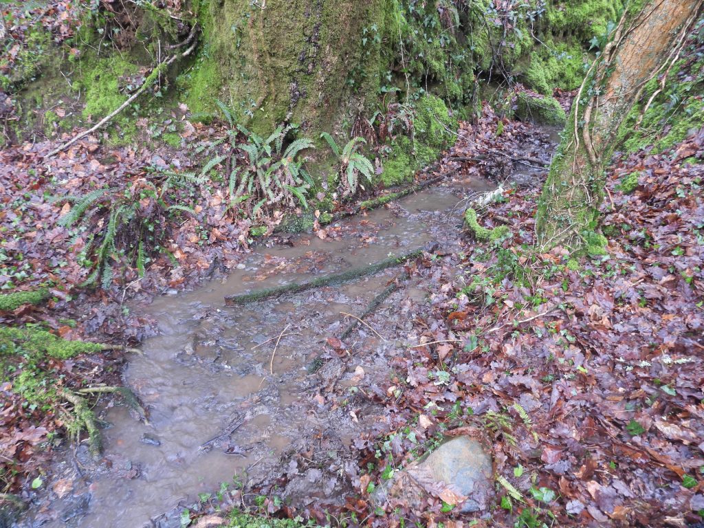
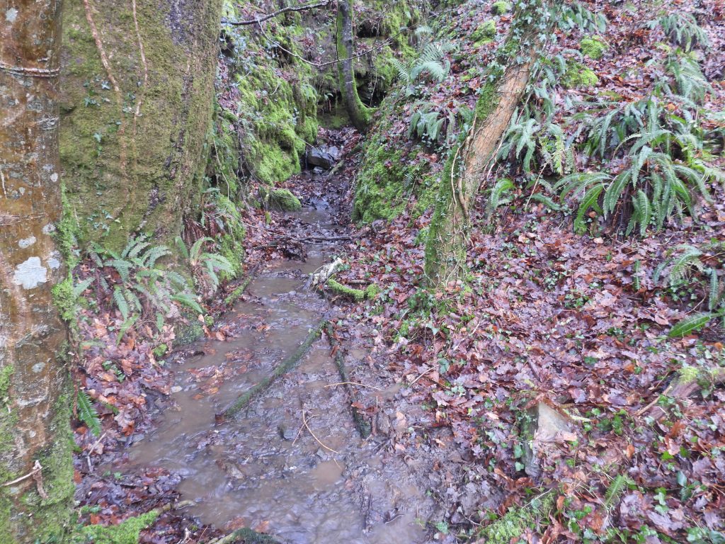
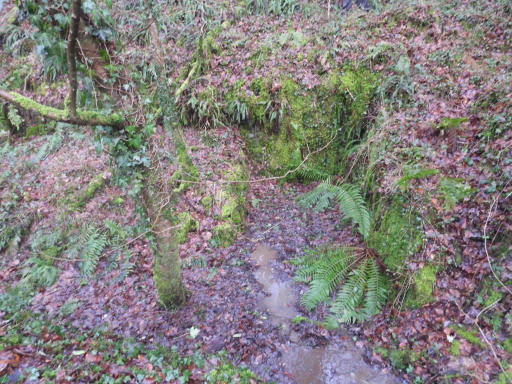
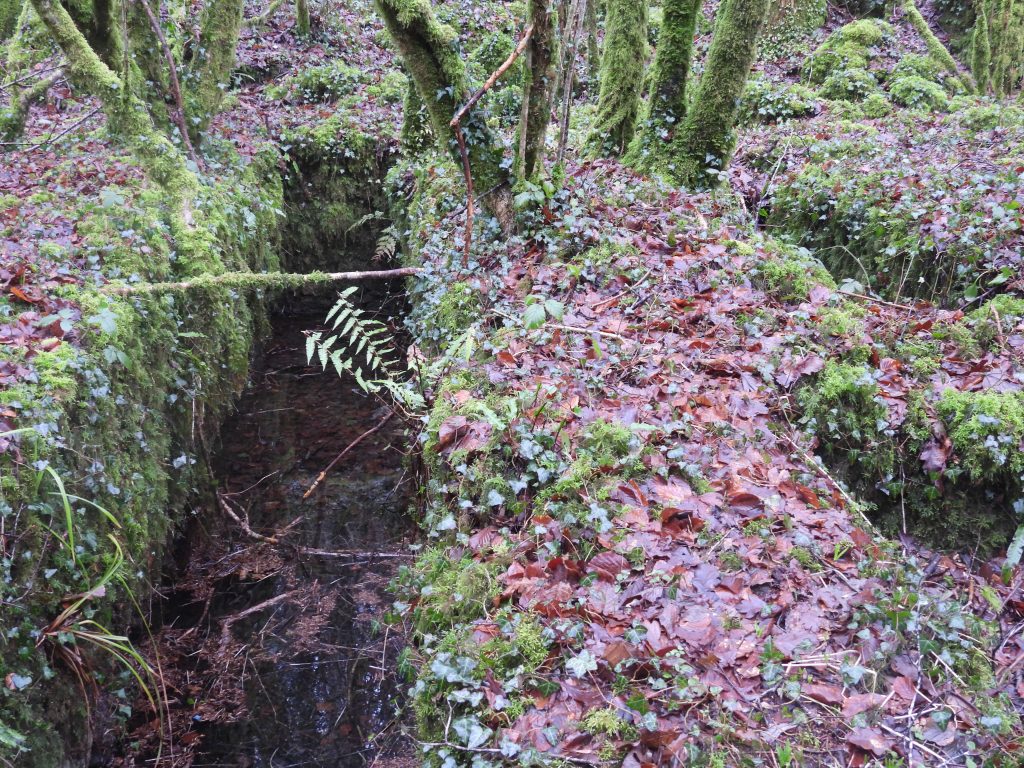
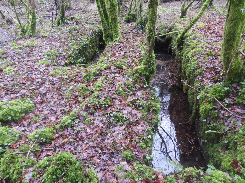
Below the tramway in the direction of the river is a well constructed leat which provided water to the dressing floor
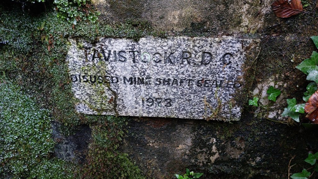
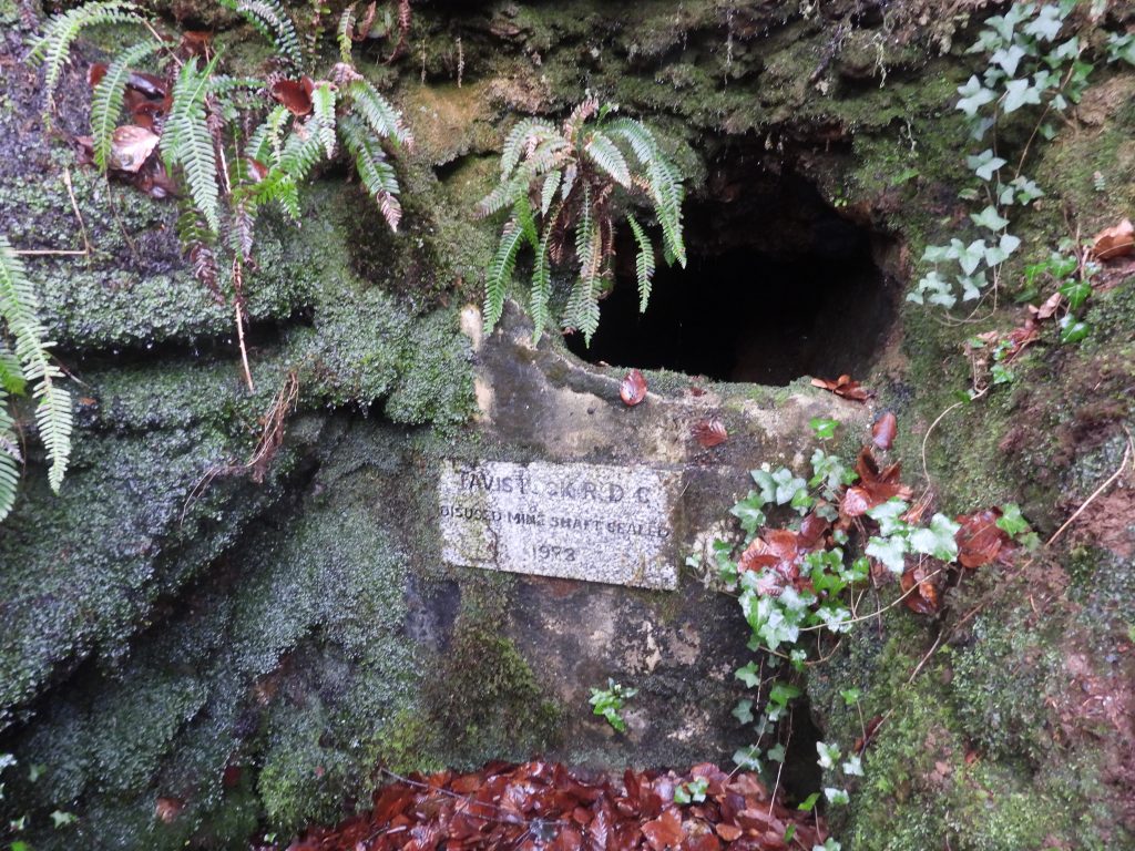
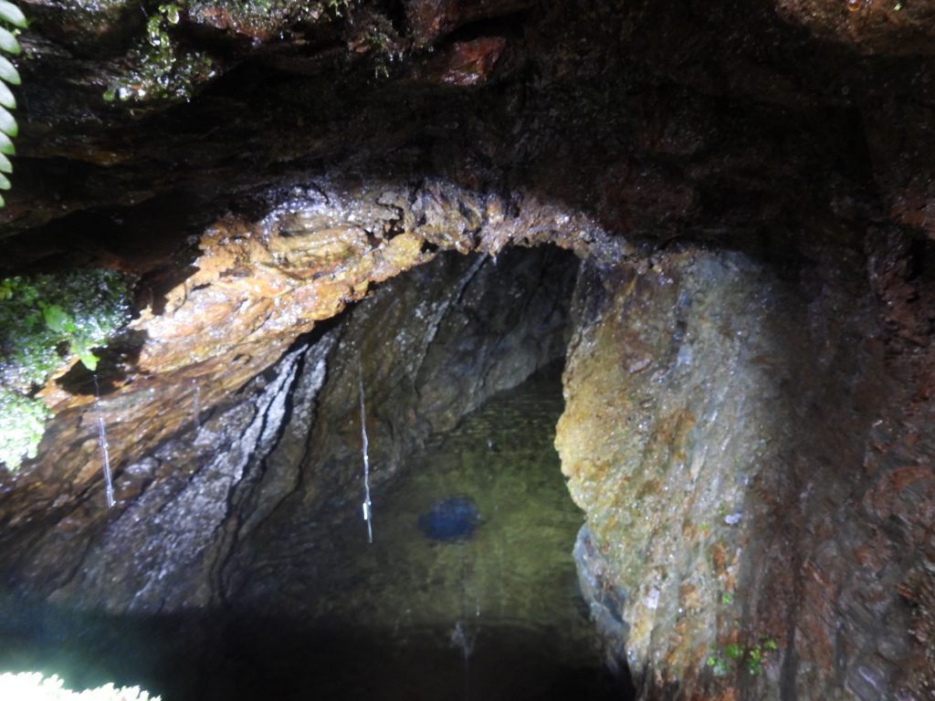
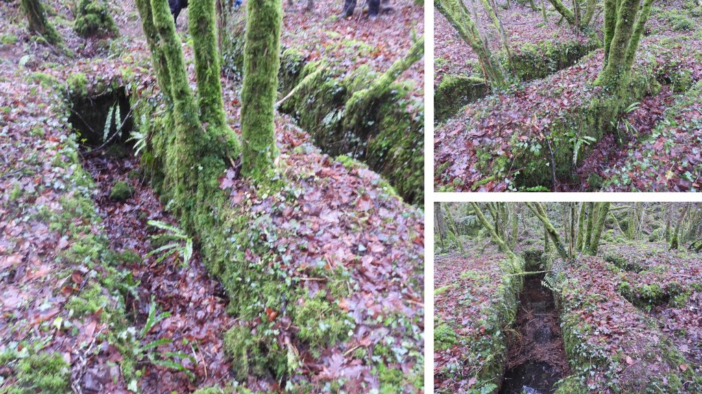
The leat was unusually wide. The photograph was taken at SX49557 70520Sign at entrance to another adit. It reads : ‘TAVISTOCK R.D.C / DISUSED MINE SHAFT SEALED / 1973’. The adit entrance is no longer fully sealed. The location is SX49588 70536A glimpse inside the adit entranceContinuing along the leat to Gem Mine dressing floor. Its take off point from the Walkham is on a bend in the river just south of the former Magpie Mill and where a water treatment works is now locatedEntering the mine dressing floor area just to the west of Gem ViaductA ruinous building can be found next to the most south easterly wheelpit – this building is the one closest to the viaduct on the (AI) photograph shown earlier in this postThe ruin is located at SX49471 70564This wheelpit was the most south easterly of the three at the mine. There is adjacent slots which might have house a ‘gearing’ wheelThe wheelpit width is consistent with the wheel shown on the (AI) photographThe wheelpit and adjacent ‘slot’ are located at SX49464 70549
Another wheelpit is located at SX49449 70569
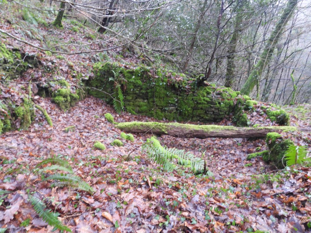
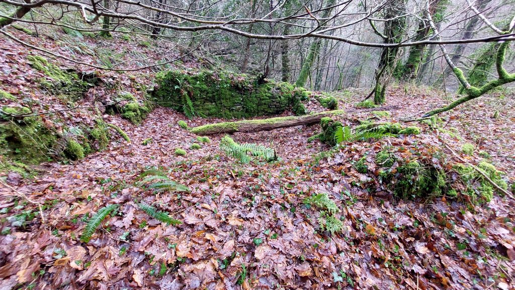
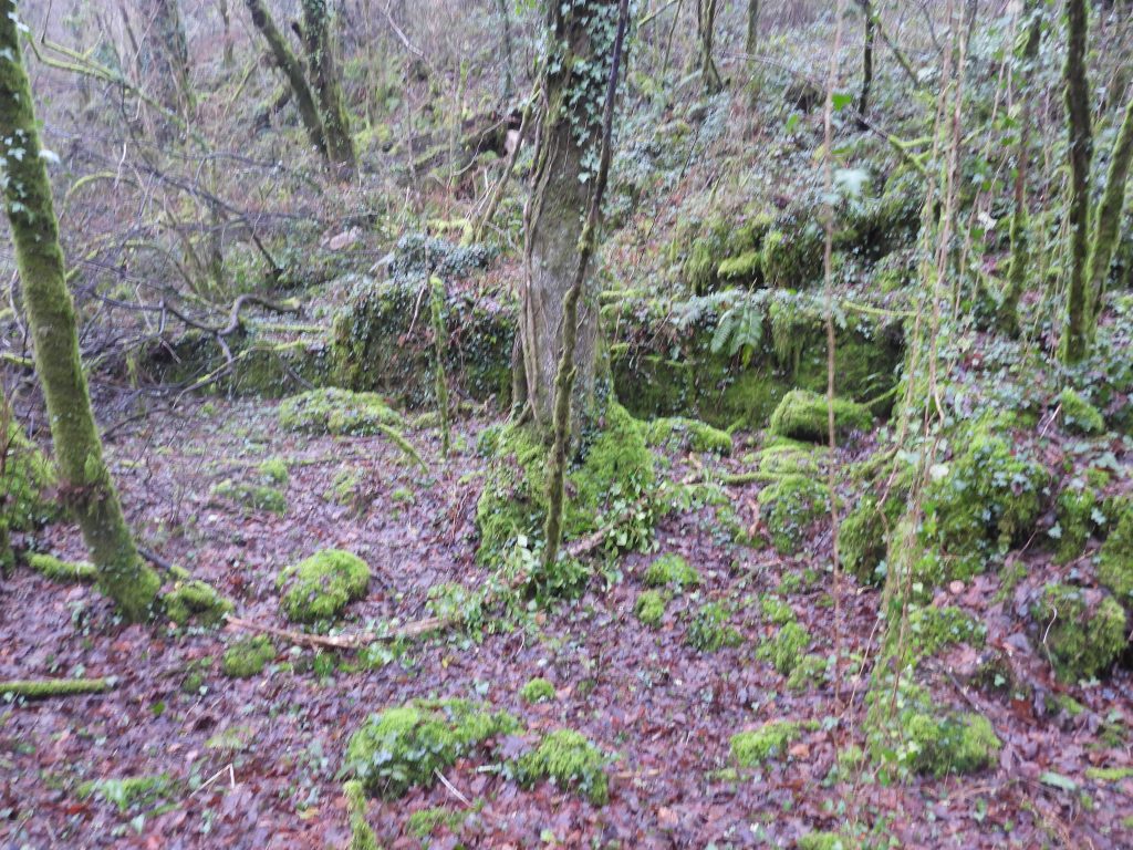
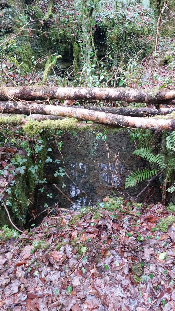
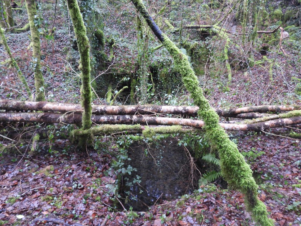
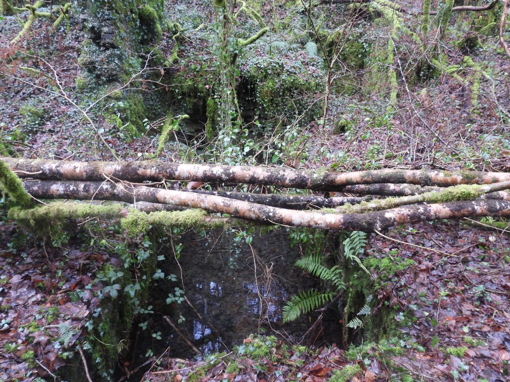
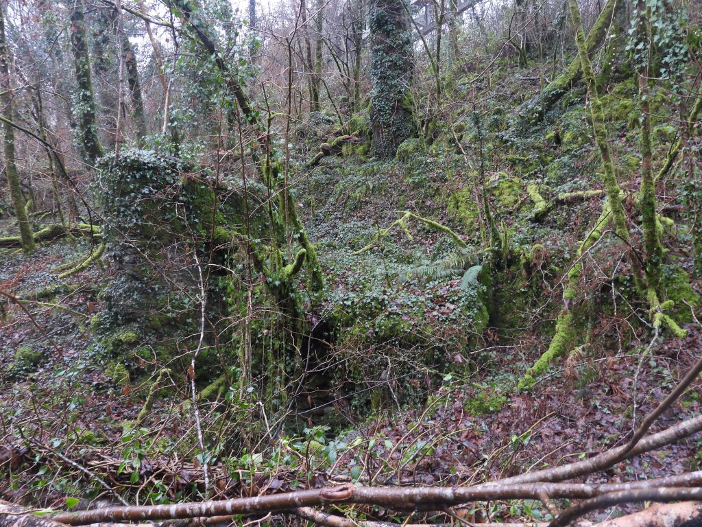
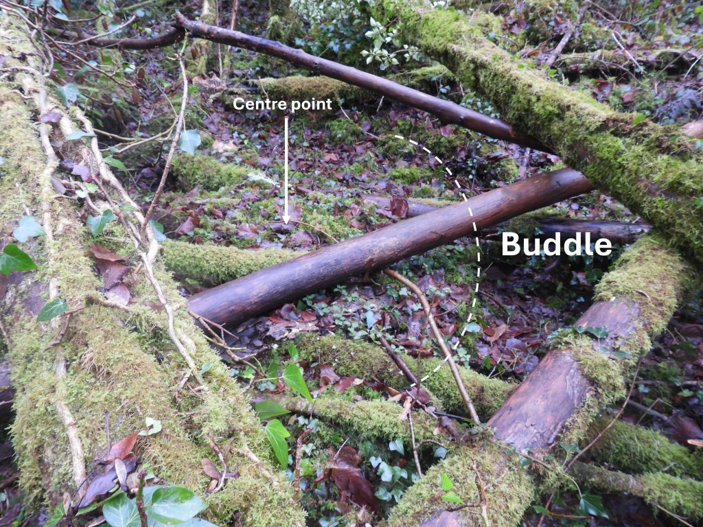
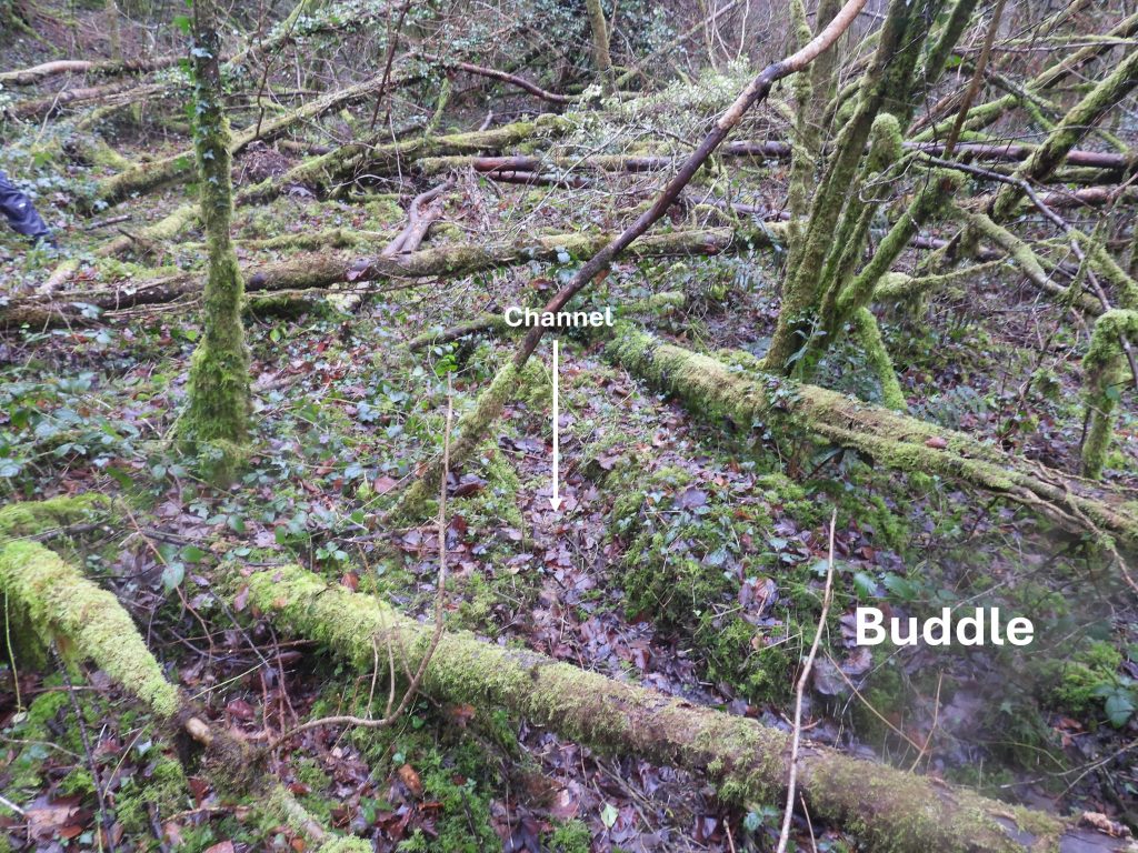
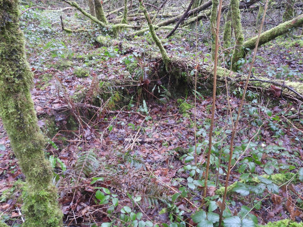
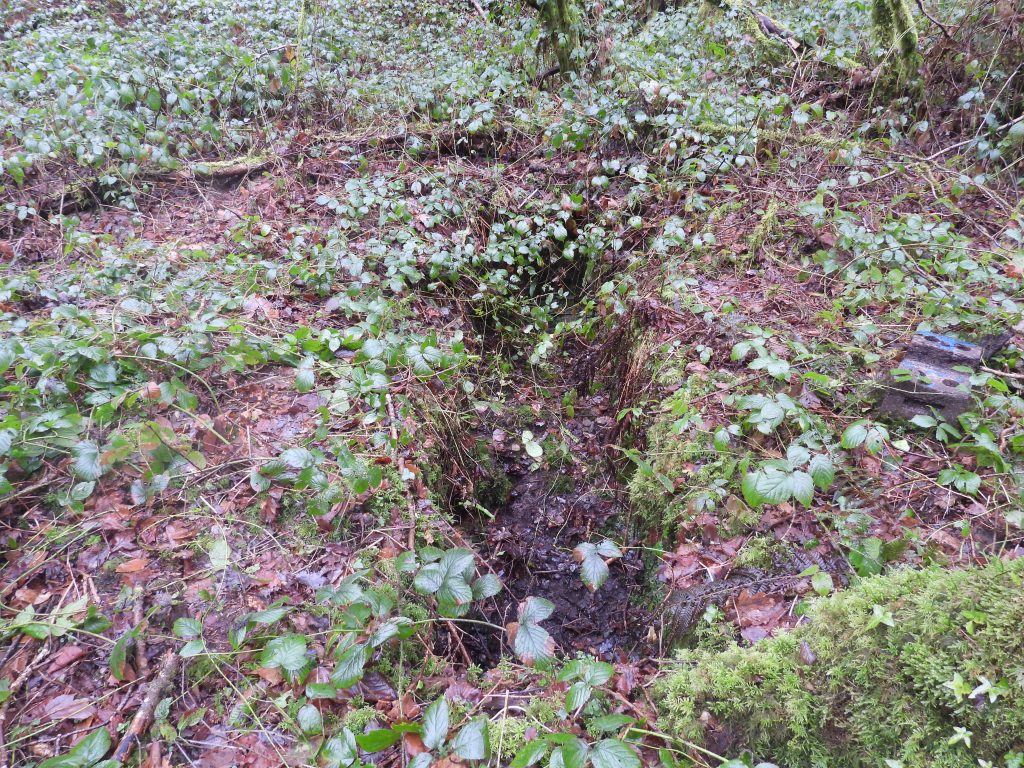
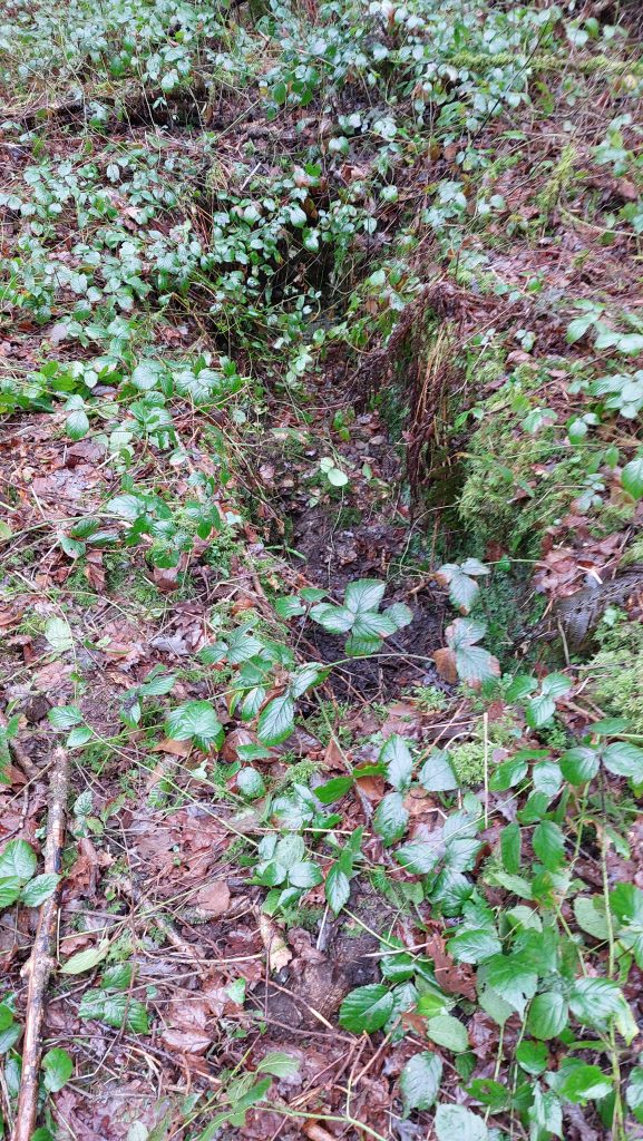
This wheelpit was the most north westerly of the three and was probably used to drive the buddle brushesThis wheelpit seems consistent in size for the wheel shown on the (AI) photograph. In the photograph, the launder feeding the waterwheel appears to come from an open building just a few metres away The exit lobby of the wheelpit. Picture courtesy of Matthew Johnson (DTRG member)The exit lobby of the wheelpit. Picture courtesy of Frank Collinson (DTRG member)Another structure on the dressing floor, possibly relating to the stamps. There was a set of four water-powered Cornish Stamps at the dressing floor.Overgrown circular buddle, which is better seen with the naked eye that through the lens of a camera. Located at SX49448 70558. Buddles being used as part of the process to separate the tin from the mined oreA channel, part of a second buddleA third buddleAnother channel, part of the buddle complex on the dressing floor.
This ‘slot’ is located at SX49436 70581, which is approx where the south east end of a settling pond (as shown on the map) was located
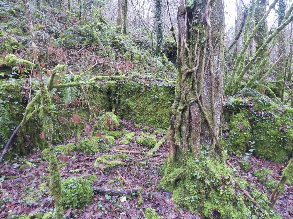
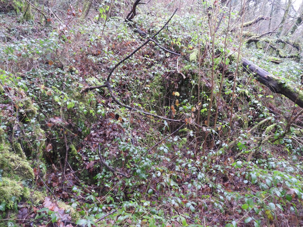
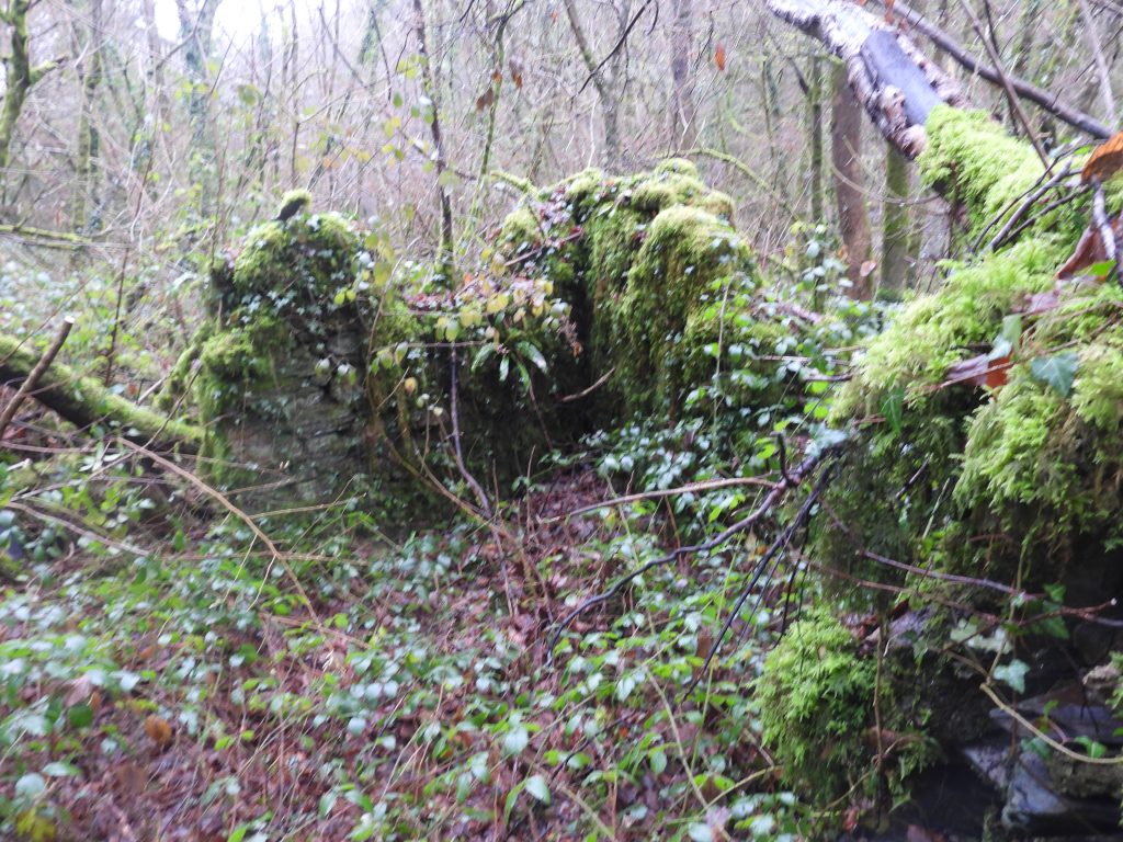
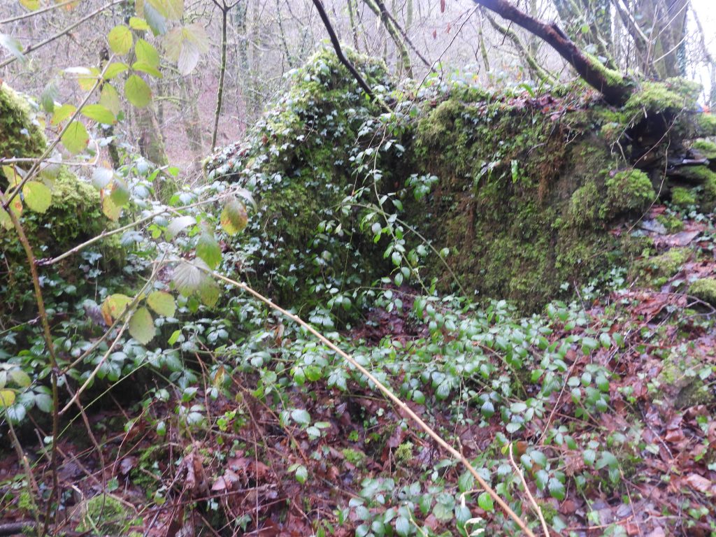
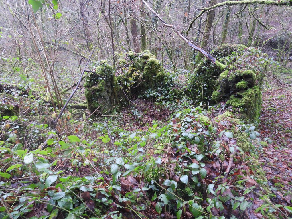
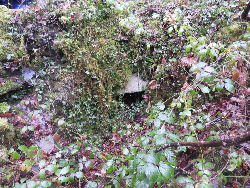
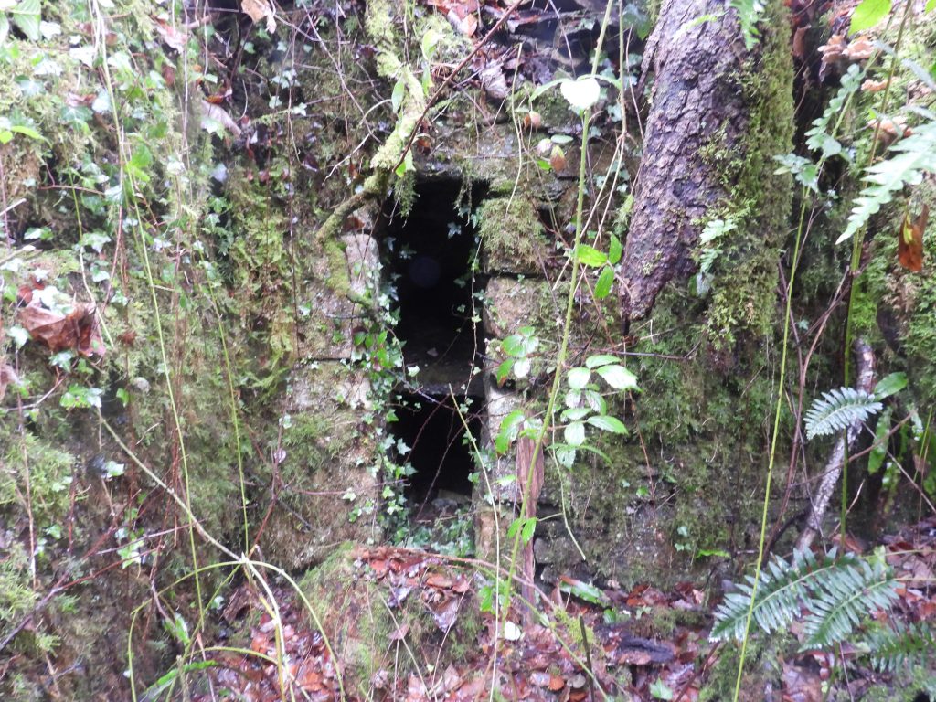
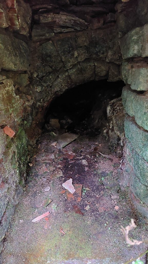
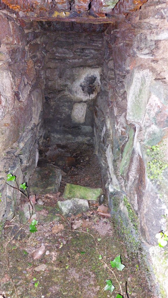
Another ruin in the vegetationThis ruin is believed to have been a Burning house (reverberatory calciner)The structure is very overgrown and internal features are difficult to discernThe Burning House was the last structure at the dressing floor located at the north west end. It is located at around SX49427 70587Small recess in the buildingTo the east end of the Burning House structure is a kiln (roasting oven) described as a reverberatory calciner (Newman). It is a rather small construction with both an upper and lower chamber
Lower Chamber
Upper Chamber
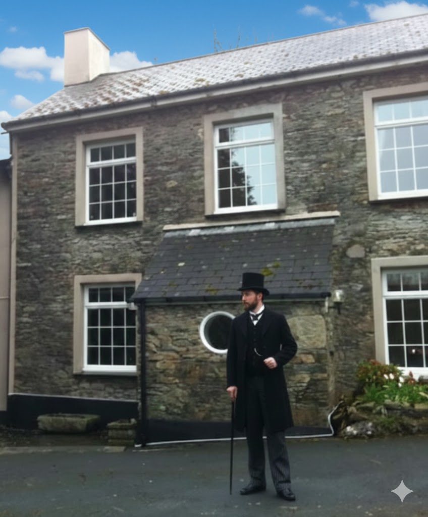
The modern Gem Cottage with (AI) Victorian gentleman – the original cottage was the Count House for Gem Mine. The bailiff would have taken a share for ore weighed, 1 shilling per ton