A collection of walks, discoveries, insights and pictures of exploring Dartmoor National Park
October 8, 2025
Hillbridge Consols
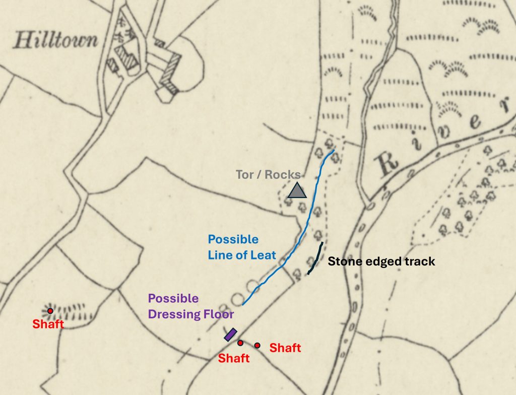
Mining operations near Hill Bridge were probably extant before 1809 when there is a record of a mine called Wheal Saturday, which is mentioned by both Dines and Lysons. It is probable that Wheal Saturday was formerly named but never worked (ref: Mining Journal). Wheal Saturday became North Wheal Friendship (a name synonymous with other mines in the area) as recorded in the 8th May 1847 Mining Journal. It is conjectured that the work undertaken by a John Spargo in this year, led to the formation of Wheal Creason. The workings mentioned by Spargo possibly might relate to some hollows shown on LiDAR plots which are close to the field boundary adjacent Chilly Wood (ref: Stephen Holley).
It is known these ventures adjoined the Hillbridge sett and most likely would have been south of Hill Bridge and it is presumed that all the ventures here would have been for tin and copper.
The main records for the Hillbridge sett and mine appear from December 1852 to 1st October 1859, when it was known as Hill Bridge Mining Company (Peter Tavy). It was also referred to as Hill Bridge Consols Mining Company, which appears to have been was formed by F.S. Thomas, who worked it for a short time as sole proprietor.
In spite of the recorded closure of the mine being in 1859, further records show that between 1859 and 1865 the Secretary was a Jos. Matthews, between 1859-1861 the Manager was Z. Williams and in 1859 the Chief Agent was F Kent. Does this suggest the mine continued after 1859 or was it just mothballed? The mine does not appear to have been successful as no production figures have ever been given!
The mine is located on private land between Hilltown Farm and Hill Bridge. The author has been able to obtain access to the mine to explore the shafts, possible dressing floor and leat. The author would like to thank Stephen Holley (DTRG Chairman) especially for providing much of the information contained in this post and to the owners of Hilltown Farm for allowing access.
Bibliography
H.G. Dines – (1956) – The Metalliferous Mining Region of South-West England
Lysons 1822 p. cclxxxi
Stephen Holley – Dartmoor Tinworking Research Group (Chairman) – Pers. Conv.
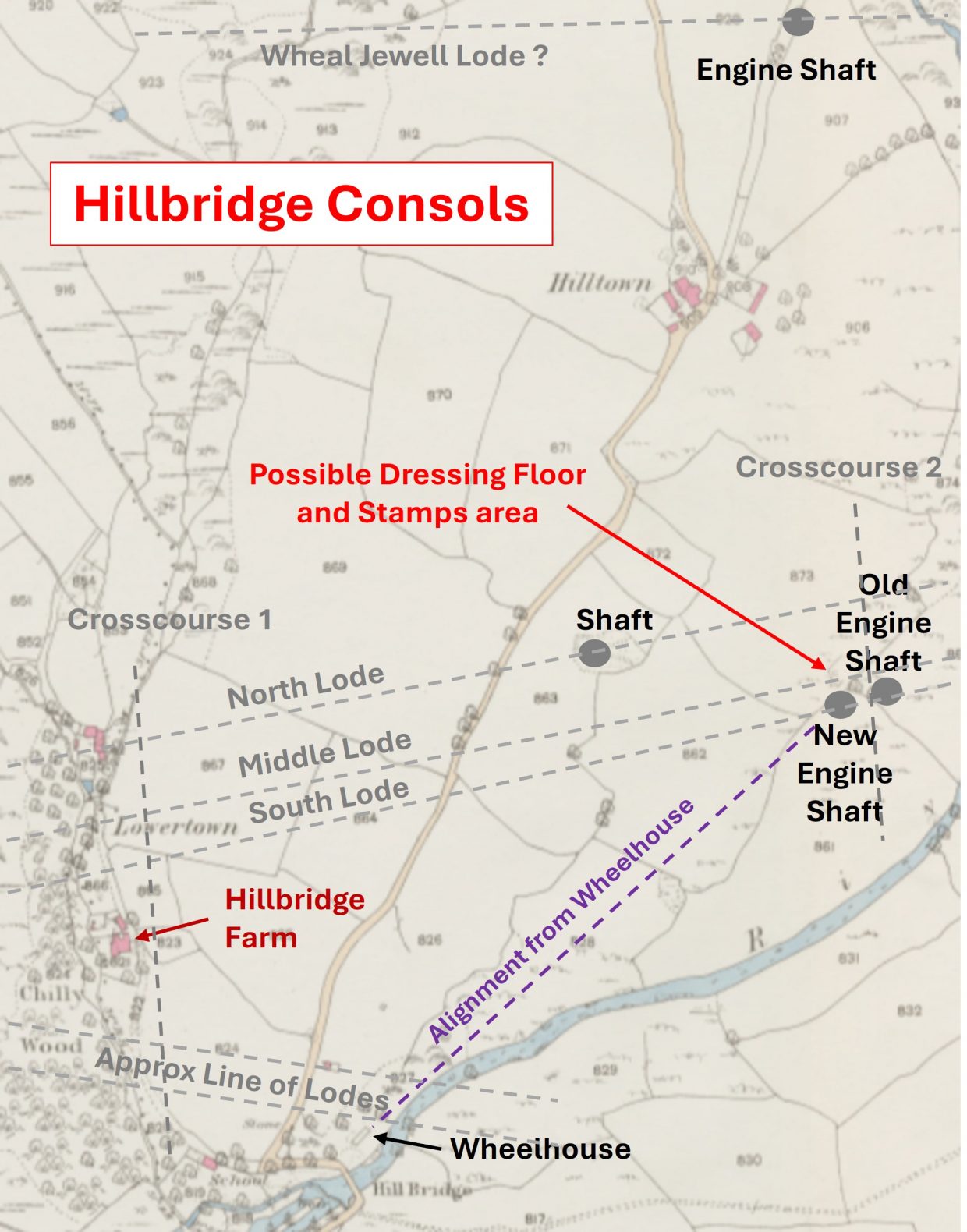
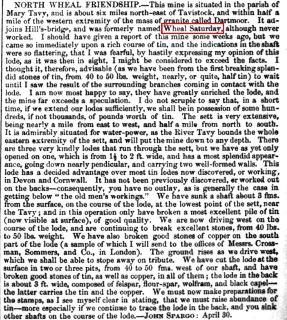
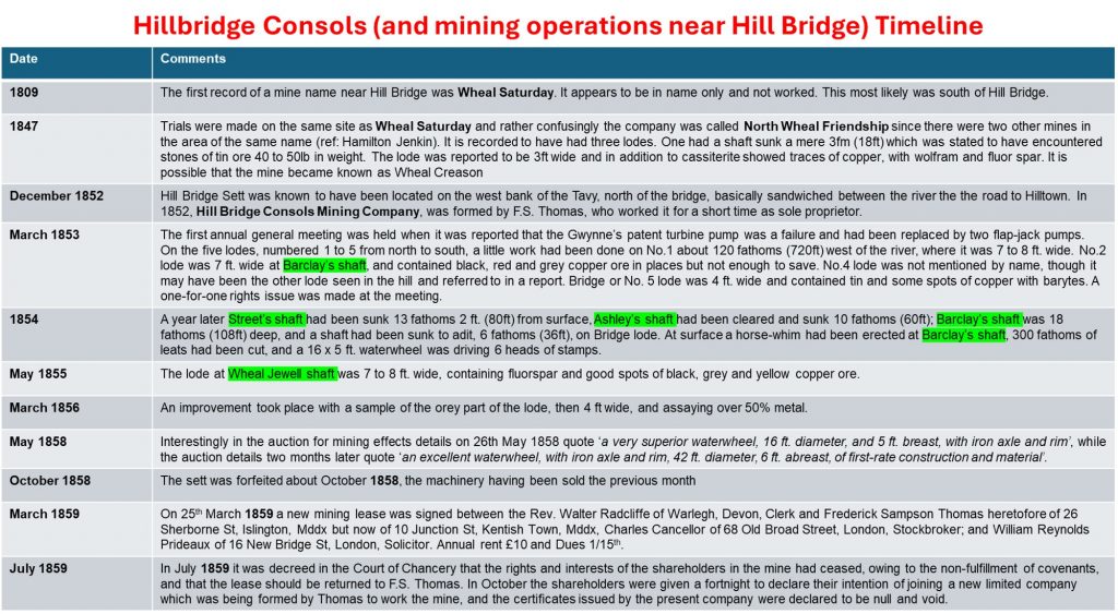
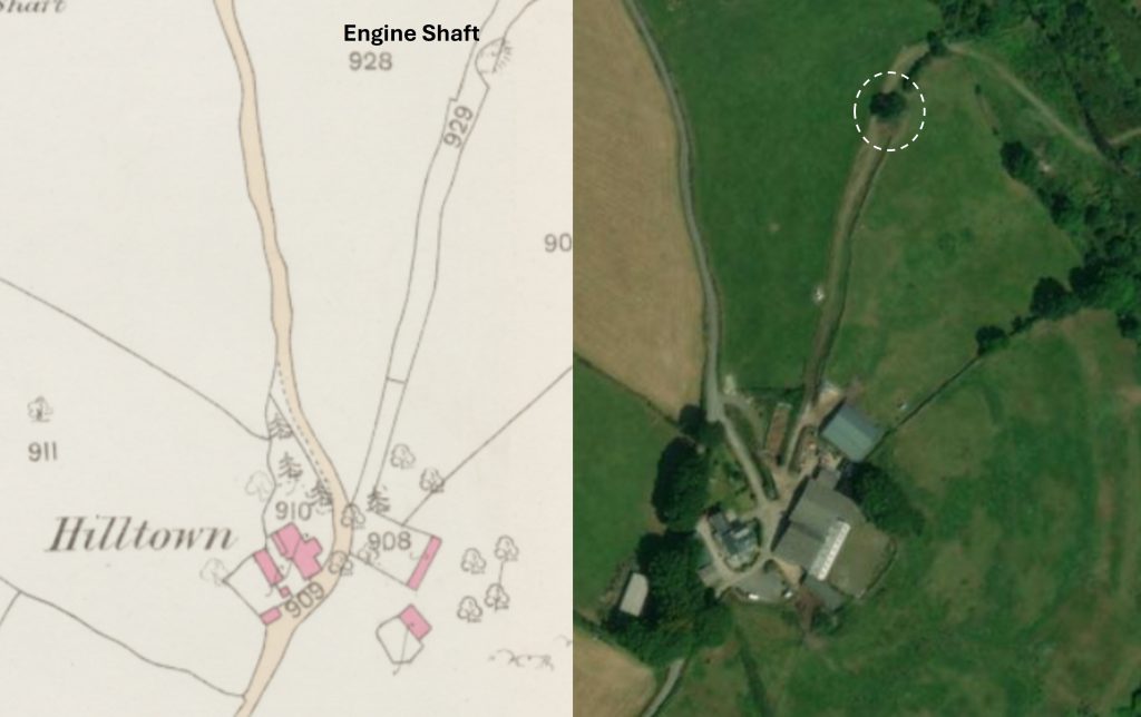
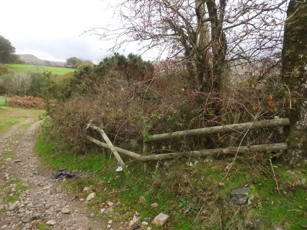
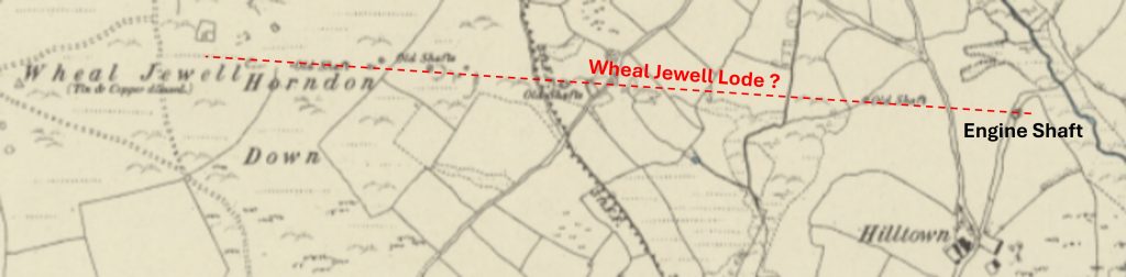
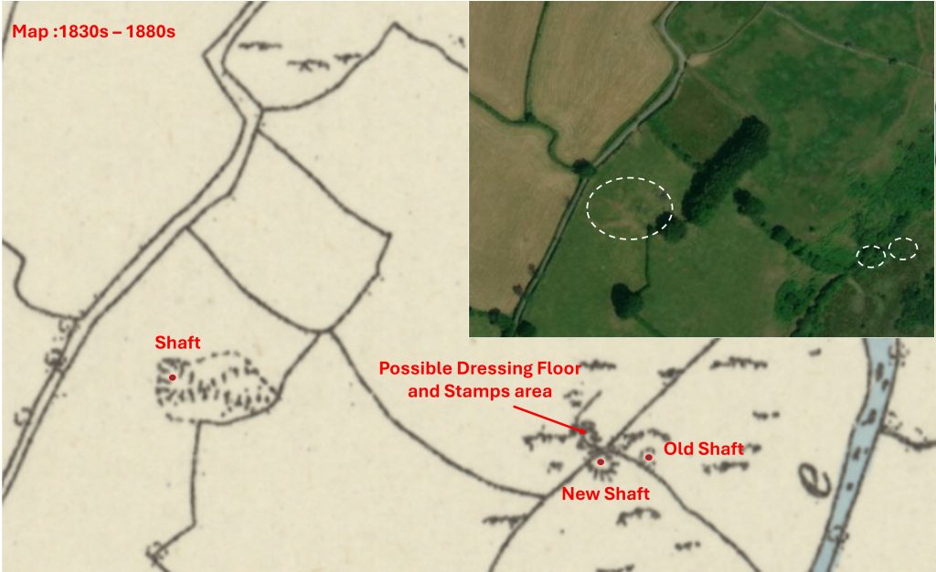
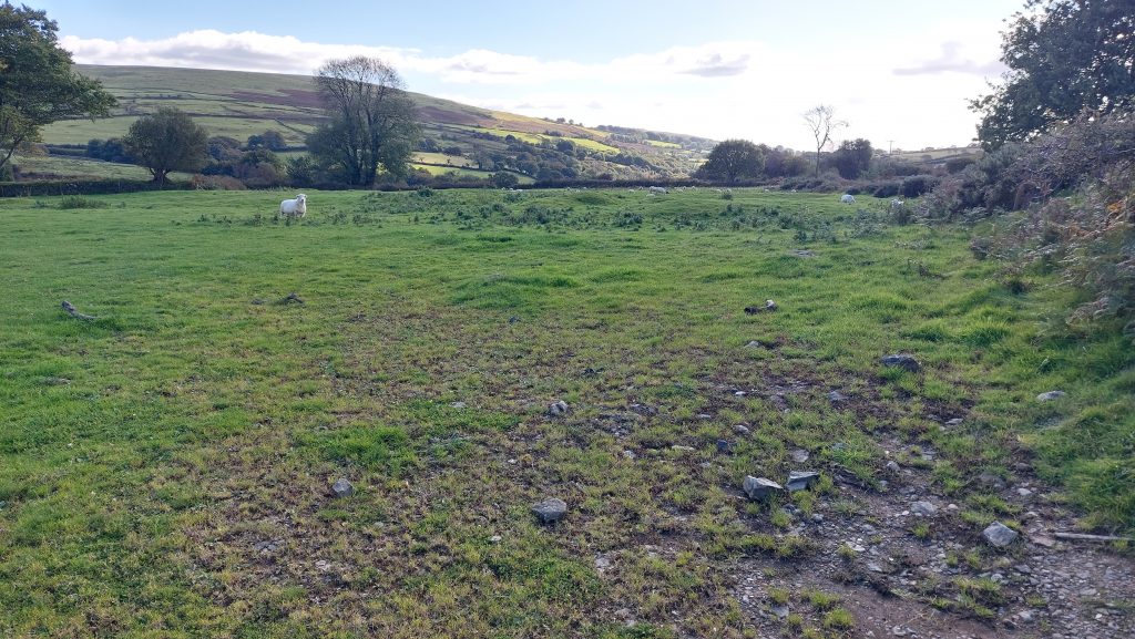
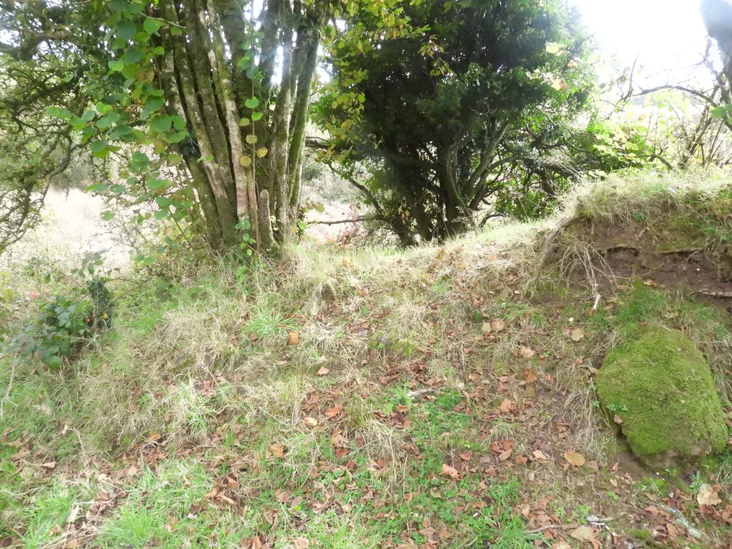
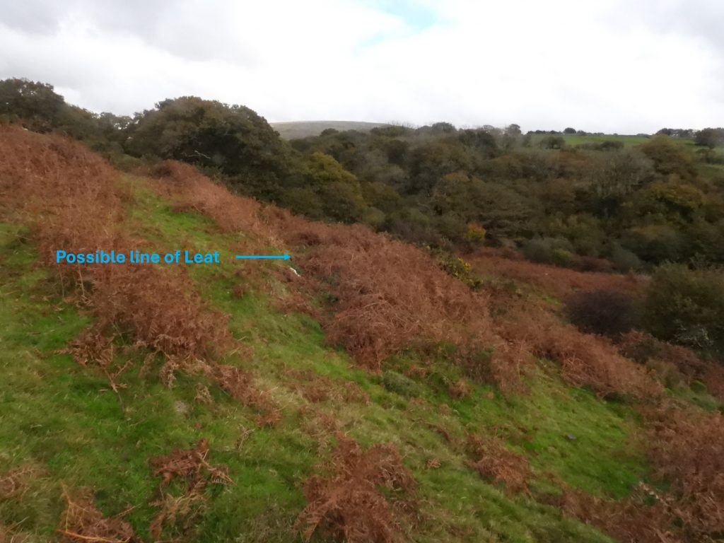
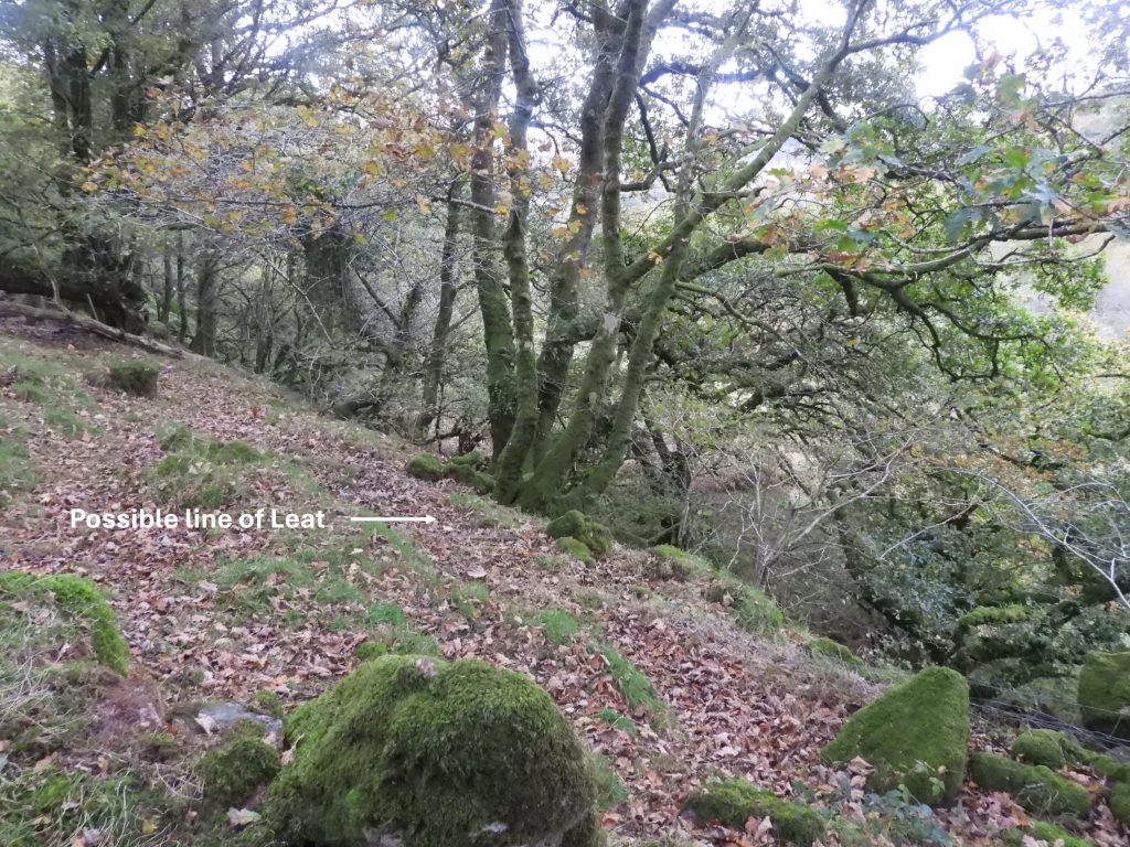
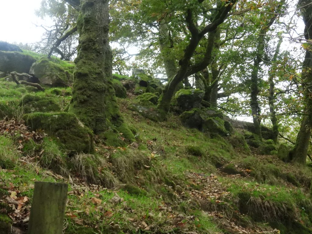
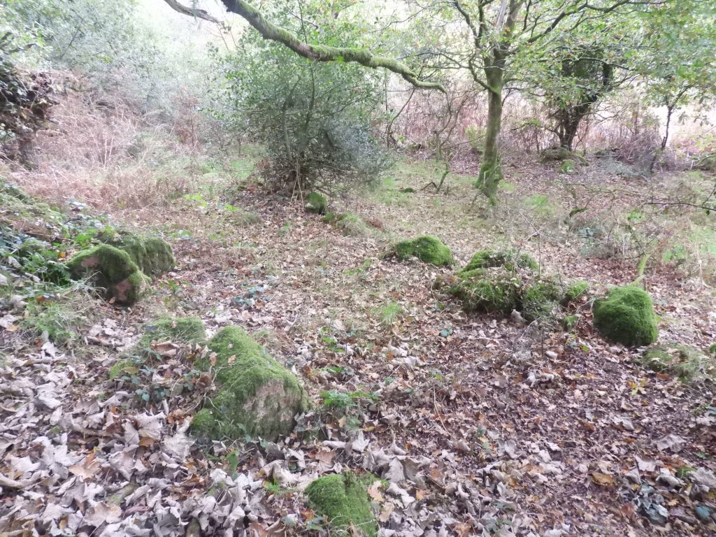
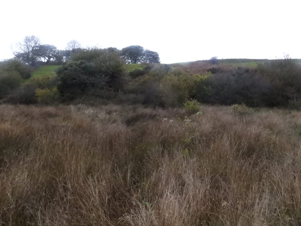
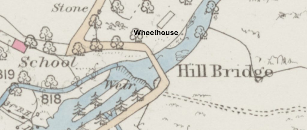
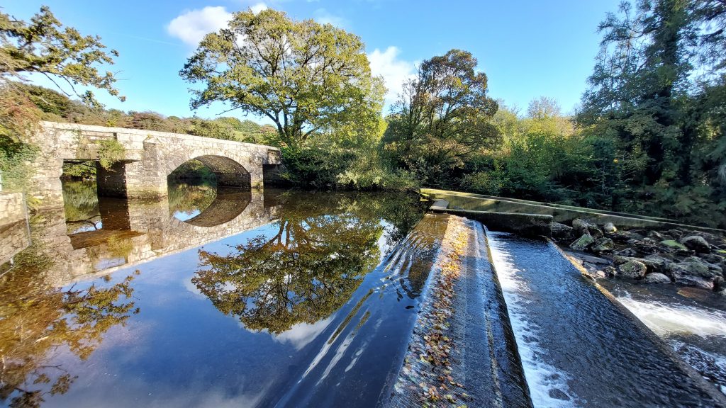
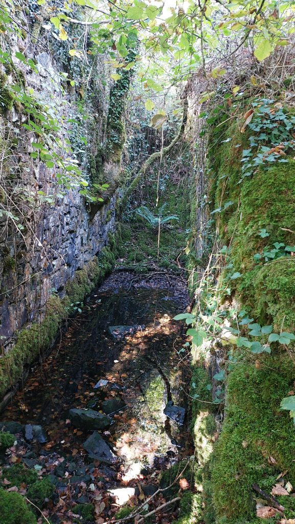
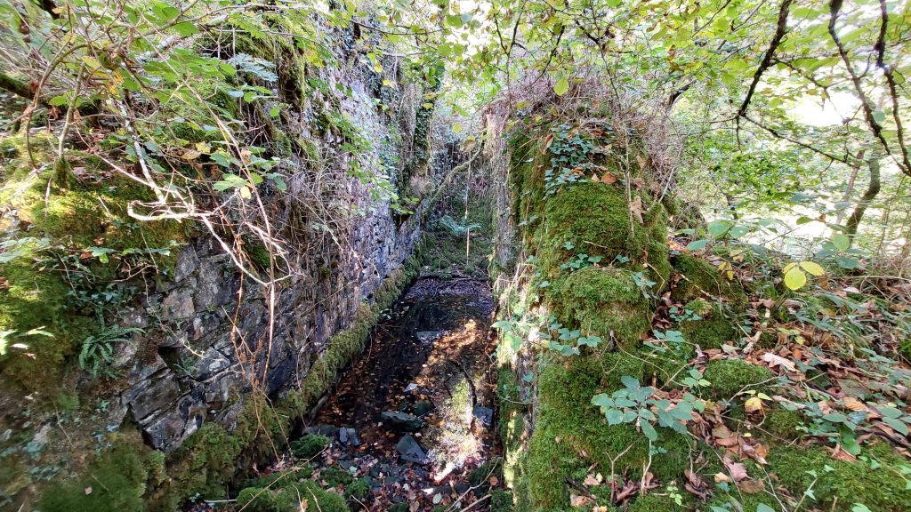
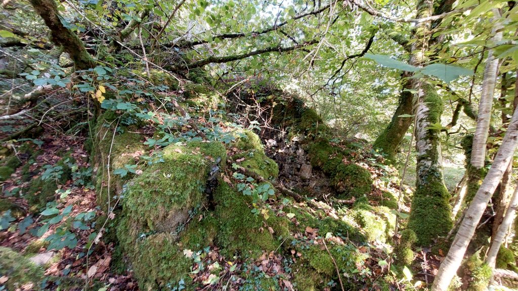
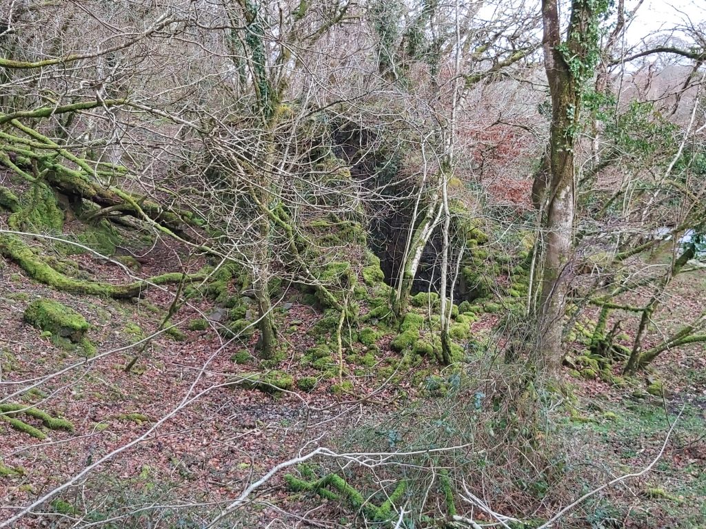
This annotated map shows the (most probable) locations of all the key features covered in this post. The shaft positions are based on 19th century map annotations and the lodes and crosscourse positions are based on information recorded by H.G. Dines on page 710 in ‘The Metalliferous Mining Region of South-West England’ (1956), viz; “Three E.-W. north-dipping tin lodes have been tried from three shafts, but there are no records concerning the underground workings. New Engine Shaft, 420 yds. N.E. of Hill Bridge and Old Engine Shaft nearby, are on the southernmost lode. The middle lode, which has no shaft, is 110 yds. N. of the south lode. The third shaft, 200 yds. N. by W. of New Engine Shaft is on the north lode. A N.-S. crosscourse, passing 80 yds. E. of New Engine Shaft, intersects the three lodes. The plan shows two other lodes in the field east of Chilly Wood and north-west of Hill Bridge. These course E. 18” S., underlie N. and are 70 yds. apart. They are intersected by a crosscourse 500 yds. W. of the one referred to above”.Extract from the Mining Journal dated 8th May 1847, which indicates a mine in the Hill Bridge area was once called North Wheal Friendship (a name shared with other locations)This table is a timeline of the historical activities known by the author relating to this mine. Many thanks to Stephen Holley (Dartmoor Tinworking Research Group Chairman) in supplying most of the above. Shaft names from 1853 / 1854 have been highlighted and are now considered in this postEngine Shaft is the most northerly of all the shafts in the mine sett. It lies on private land, along a lane which is part of Hilltown farm. It is clearly shown on late 19th century maps and on modern aerial photography there appears to be a tree at this locationThe fenced off Engine Shaft is still quite deep, lying on the Wheal Jewell lode. It is located at SX53545 81222This annotated 19th century map shows the probable lode from ‘Engine Shaft’ in Hillbridge Consols to Wheal Jewell in the west. The dotted red line joins up around half a dozen shafts. In May 1855, it has been recorded that “The lode at Wheal Jewell shaft was 7 to 8 ft. wide, containing fluorspar and good spots of black, grey and yellow copper ore”. The author assumes the ‘Engine Shaft’ must also have been referred to as ‘Wheal Jewell Shaft’This annotated 19th century map shows the probable locations of three of the shafts mentioned in 1853 and 1854. Without access to the land, it is difficult to confirm but the map appear to show a possible dressing floor next to (north west of) ‘New Shaft’. Information provided by DTRG (Stephen Holley) as shown in the earlier ‘timeline table’ indicates that : “Street’s shaft had been sunk 13 fathoms 2 ft. (80ft) from surface, Ashley’s shaft had been cleared and sunk 10 fathoms (60ft); Barclay’s shaft was 18 fathoms (108ft) deep, and a shaft had been sunk to adit, 6 fathoms (36ft), on Bridge lode. At surface a horse-whim had been erected at Barclay’s shaft, 300 fathoms of leats had been cut, and a 16 x 5 ft. waterwheel was driving 6 heads of stamps”. From these descriptions, the author speculates that Barclays Shaft is the ‘New Shaft’ as shown (due to mention of the waterwheel), Ashley’s Shaft was ‘Old Shaft’ as shown (as it was perhaps a cleared former worked shaft) and Street’s Shaft is the ‘Shaft’ as shownFrom the lane between Hilltown Farm and Hillbridge, the area marked ‘Shaft’ (possible Street’s Shaft) can be seenNear (probable) Street’s ShaftThe (probable) Street’s Shaft is located at SX53368 80775This annotated 19th century map shows where some of the features relating to Hillbridge Consols are located at Hilltown FarmPossible location of New Shaft at SX53575 80727. There is certainly some upthrust of soil hereA dressing floor with a possible 16ft x 5ft wheelpit couldn’t be located due to the large amount of vegetation. However, a little way north of where the location of the dressing floor was expected to be found the line of a possible leat was observed. This line did not extend beyond where the expected location of the dressing floor was and therefore with reasonable confidence could be considered as part of the recorded 300 fathoms of leat which was cut.The leat was followed north into a small copseWithin the copse was an area of rocks or a mini-tor. The rocks (which are un-named but could be called Hilltown Rocks) are centred near SX53643 80880On the western edge of the copse quite close to the River Tavy and possible old track was found (note the stone edges)Near the location of the ‘Old Shaft’ on a flat plain between the slopes of Hilltown Farm and the River Tavy looking towards ‘New Shaft’ and beyond to the possible dressing floor. There is minimal evidence of ground disturbance hereFrom near the possible location of the dressing floor looking across the ‘flat plain’ to the west of the River Tavy, there does appear to be some man-made ground disturbanceTo the north of Hill Bridge (and still shown on modern OS maps), is a very large Wheelhouse, which was part of the mine. It appear to align with the New Engine Shaft (possibly Barclays Shaft) which the author speculates may have been for the purpose to drive flat rods for pumping. If the flat rods were ever used here then the operation would have been for a maximum of around 5 years.Hill Bridge is considered only to have been built (in its current form) in the 19th century. In 1938, Henderson and Jervoise, recorded in a publication called ‘Old Devon Bridges’ that there were two clapper bridges near here, namely: “Higher Hill Bridge having four openings and Lower Hill Bridge with only two openings”.The weir at Hill Bridge is also from 19th century as it appears on maps, that said it could possibly be earlier
Inside the Wheelhouse. The wheel which would have been here is mentioned in 1858 as part of an auction, viz: ‘an excellent waterwheel, with iron axle and rim, 42 ft. diameter, 6 ft. abreast, of first-rate construction and material’.
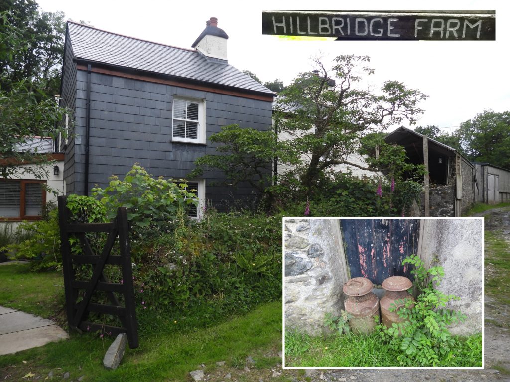
The remaining height of the walls in the Wheelhouse are around 20′ (estimate), which suggests the axle for a 42′ wheel would have been placed across the top of the wall The width of the wheel was 6′, which is consistent with the remains of the WheelhouseThe Wheelhouse cannot be seen from Hill Bridge very well in the Summer months due to foliage. However, as this picture depicts, it can be seen quite well in the Winter months‘Hillbridge Farm’ is shown on the modern OS mapping with a number of modern buildings having been added to the farm since the start of the 20th century. Historically, the farm was known as ‘Lower Hill Town’ being depicted on the Tithe map (19th century) as 801 on the Peter Tavy apportionment: ‘House and Lawn’. In the 18th century it was documented as ‘Hill Towne’ (circa 1720). Several of the Hillbridge Consols lodes pass close to the farm.