A collection of walks, discoveries, insights and pictures of exploring Dartmoor National Park
October 5, 2025
Un-named Tin Works between Devonport Leat and Long Plantation
On line tools such as the Devon Historic Environment Record (HER), old maps from National Library of Scotland, aerial photography and LiDAR plots often lead the researcher and Dartmoor enthusiast to discover new artefacts and features they had previously been unaware of.
This was the case when the author, whilst looking at a some aerial photography, found a ‘line of pits’ and the outline of a ruined building an area north of B3357 sandwiched between Devonport Leat and Long Plantation. These features were then checked on 19th century maps and on the HER. Both the building and the pits are mentioned on the HER but only the building is shown on any map. Unfortunately, these on line resources do not provide any detailed historic information as to why they are there, or indeed the date when they were active. With this in mind and having visited the area to photograph the features, the author has provided his own supposition in this post as to their date and their contextual relevance in the landscape.
Other features in the area and briefly covered in this post is a ‘cup-marked stone’ in the Long Plantation wall to the west and the Devonport Leat ‘fountain’ and aqueduct to the east.
Bibliography
Royal Commission on the Historical Monuments of England – (1985), Aerial Photograph Project (Interpretation).
JeremyButler (1991) – Dartmoor Atlas of Antiquities: Volume Two – The North, 65, Map 29, Feature ‘a’ (Monograph). SDV219155.
Royal Commission for the Historical Monuments of England, 1993-1998, Dartmoor Royal Forest Project (Report – Survey). SDV346608
Dr Tom Greeves – (1980) – Cup-marked stone (Worksheet). SDV278144.
S. Probert – (2002) , Stone west of Bear Down Farm, 4, fig (Report – Survey). SDV347518.
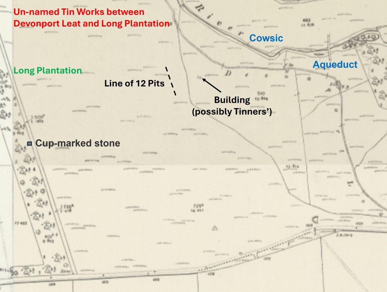
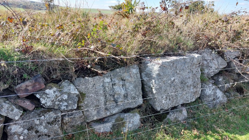
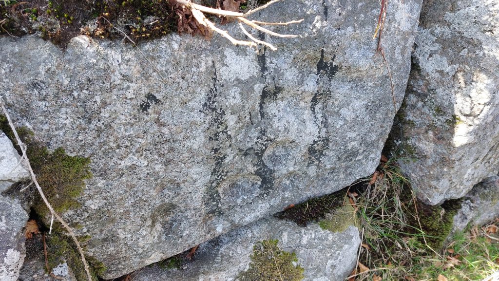
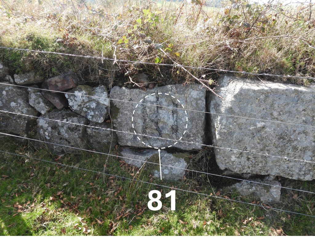
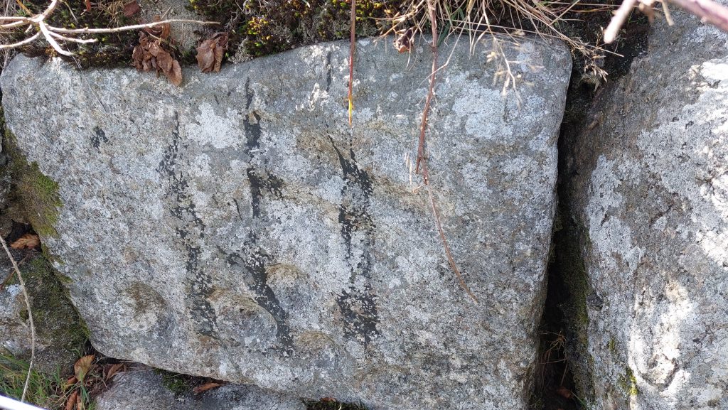
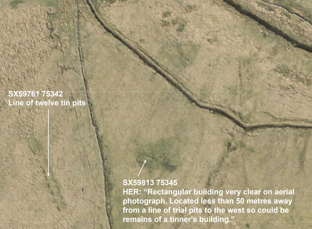
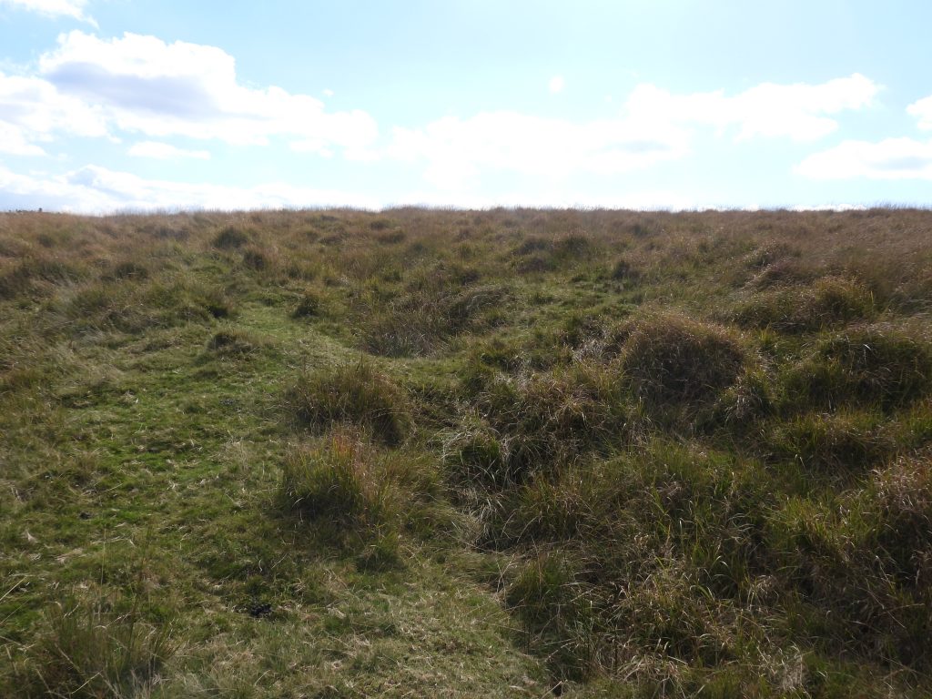
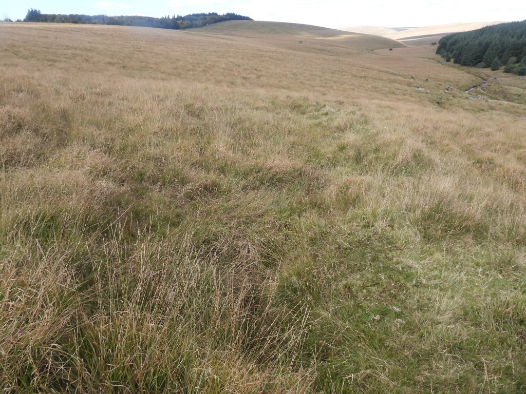
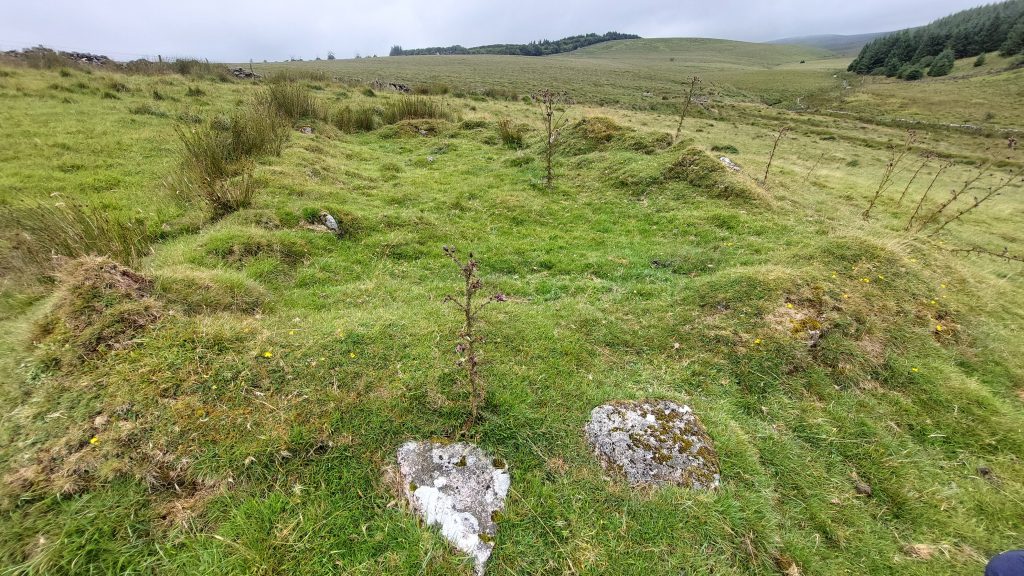
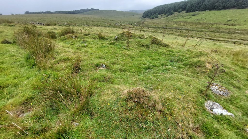
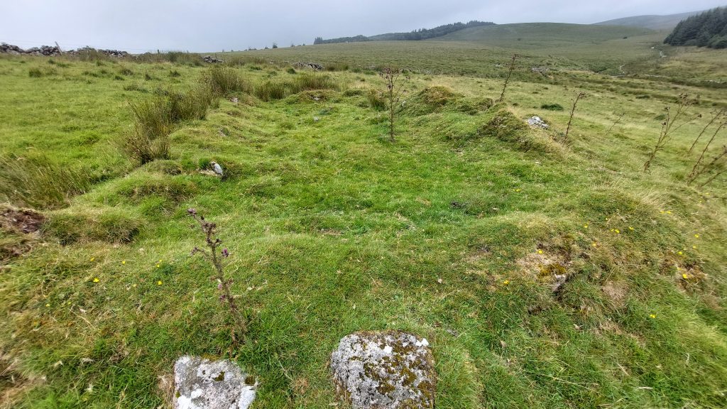
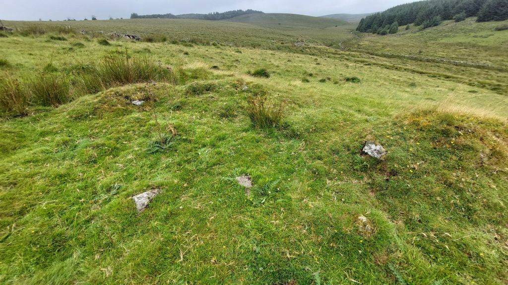
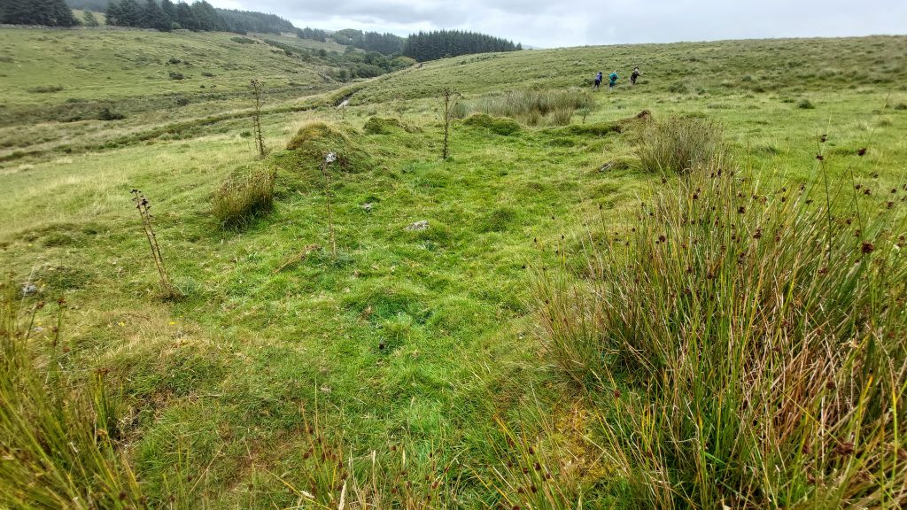
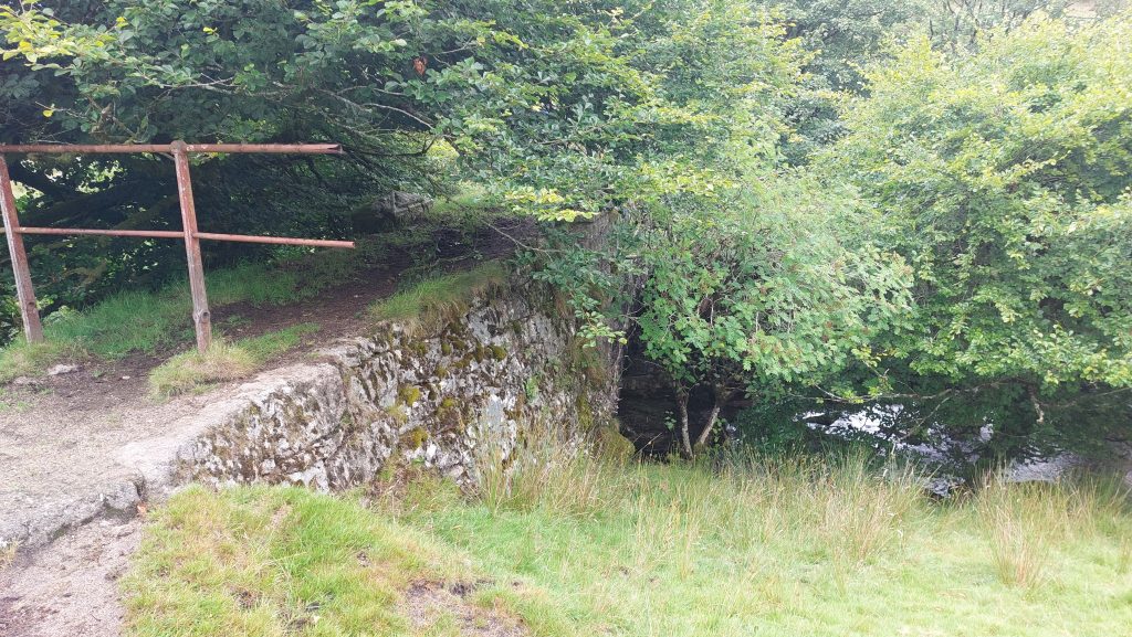
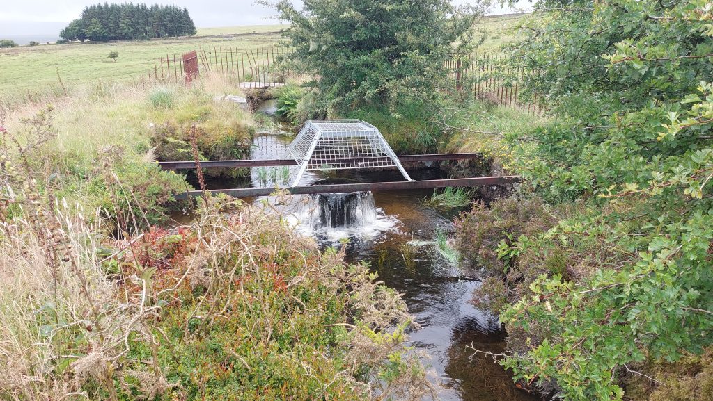
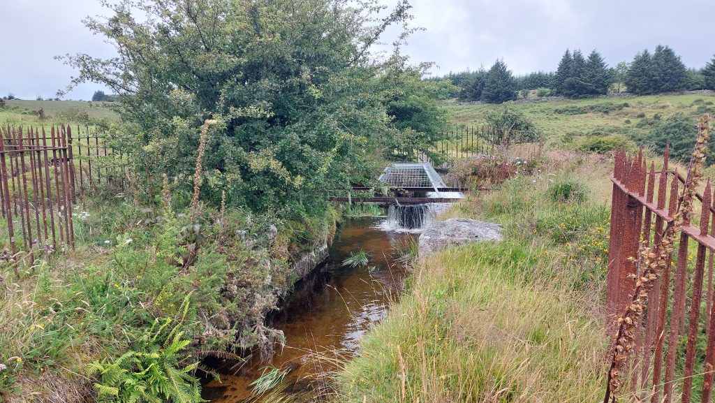
This annotated 19th century map shows the features covered in this post. It is interesting to note that the building was extant in the 19th century but the pits are not shown as a feature. The pits are orientated roughly SSE-NNW, which is unusual for the area since the tin lodes in the area (to the north) at Holming Beam Mine (Wheal Mistor) and at Beardown Mine (Wheal Virgin) were aligned E-W. Perhaps this indicates that the pits were an attempt to pick up an E-W lode and had it been successful a series of E-W pits would have ensuedThis post considers the features shown on the map from west to east and starts with this cup-marked stone. It is built into the wall at Long Plantation about 300m from B3357 and has variously been recorded as a Mortar Stone, a prehistoric Cup Marked Stone and a block from the old prison quarry. It is located at SX59486 75227 and has the number ’81’ marked on it.In 1980, Tom Greeves recorded this stone as : “A possible cup-marked stone ……of undressed granite with 14 cup shaped hollows…….” He recorded the dimensions of stone as “circa 0.8 meters by 0.53 meters, dimensions of hollows from 3.0 – 12.0 centimetres in diameter, and 2.5 – 4.0 centimetres deep”. He thought that the stone was more likely of prehistoric origin than a mortarstone.Pete Cruse (via Dartefacts) provides an alternative explanation for the stone block. He says that the stone is actually upside down and: “……was taken from the old prison quarry, where the prisoners would wield a 20lb hammer and smash up granite blocks, for dirt tracks within the prison ground. The cups are what has been left. The number is 1 of XX in this case was number 18 to ID the convict to a block”.Butler records there are 14 circular or oval ‘cups’ which can be identified on its exposed face, four of them are particularly well formed. The Royal Commission for the Historical Monuments of England (RCHME) in the 1990’s state and Probert (2002) state that it appears to be a mortar stone but each record only 12 circular depressions. RCHME state that the figure ’18’ painted on its eastern face suggests a previous use by the military or the prison authorities.The aerial view of the ‘tin pits’ and the building. The two tin mines immediately north from here are Holming Beam Mine (Wheal Mistor) and Beardown Mine (Wheal Virgin) which are known to have been worked around 1835 and circa 1800 respectively. The Newtake wall here which separates the building and the pits would have been built most likely in the 19th century. It may have been the case that the pits were dug around the time of the two other mines in an attempt to find a tin lode a little further south. The relationship between the pits, the wall and the building are interesting, geographically and in a possible working sense. The line of Tin Pits are not as defined on the ground as they are from aerial photography. The pits are only a few metres wide and deep and are very overgrown. In 1985,the Royal Commission on the Historical Monuments of England conducted an Aerial Photograph Project and interpretated this feature as : “Line of twelve trial pits”Contextual view of the pits in relation to the Cowsic Valley. The author believes these pits are circa 200 years old possibly moreTo the east of the pits (over a Newtake wall) is this ruined building. The ruins were not measured by the author but estimated as being circa 7m by 3mThe building is aligned with the slopeThe building foundations are quite substantial at around 1m wide. The question remains, for what purpose was it built? With it being located less than 50 metres away from a line of pits to the west, one could speculate that it is the remains of a tinner’s building – possibly accommodationClose up of the walling with view up Cowsic ValleyView looking east towards Beardown Farm. It would be nice think this building directly related to the tin pits and therefore was used by tinners. The issue the author has is its size. It seems rather large for a tinners hut, especially for such small nearby workings. It does not appear on the tithe map (circa 1840), neither does the Newtake wall. In spite of all the evidence the building may of course have been for agricultural use and not for the tinners – the author would welcome thoughts from anyone reading this post. The building is close to Beardown Warren, albeit that is located on the opposite side of the CowsicMoving west, the Devonport Leat single-arch granite aqueduct which was built either in 1888 (ref: Fletcher) or 1898 (ref: Trueman). This was built as a by pass for water from the West Dart to be directly channelled into the Leat above the Cowsic. It is centred at SX60066 75399The Devonport Leat ‘fountain’ where the water from the West Dart (via a pipe across the aqueduct) combines with water from the Cowsic, whose take off if via a weir near Beardown MineThe Devonport Leat Fountain at SX60079 75325