A collection of walks, discoveries, insights and pictures of exploring Dartmoor National Park
October 3, 2025
Tin Workings, Tin Pits & Tinners Huts East of Whiteworks
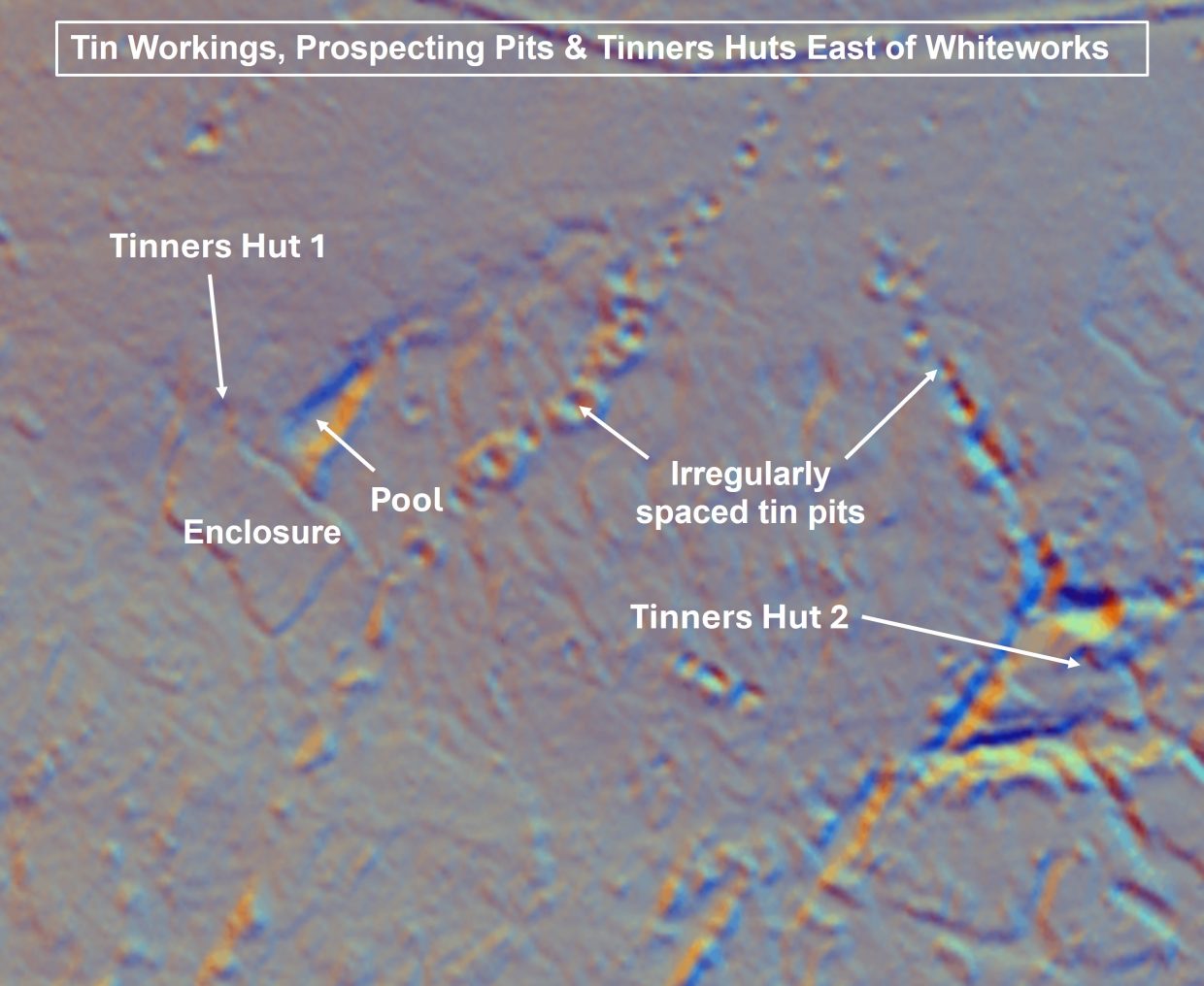
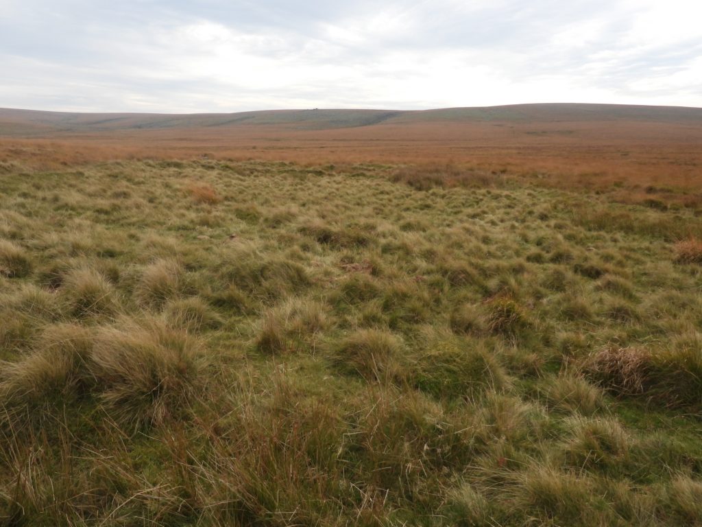
To the east of Whiteworks Mine and Cottages (beyond the Strane River) is a area of tin workings and tin pits which may well have begun in the Medieval period and almost certainly were reworked into the 18th and possibly 19th century. There are two parts, one centred at SX 6170 7100 where there are 8ha of openworks and tin pits, and a second part centred at SX6188 7093 of 1.5ha of extensive openworks. Each of the two areas has a Tinners Hut (or building) plus other features of interest which are covered in this post.
The author is grateful to Kate Butterworth from Whiteworks Cottages who guided him to the area and showed him features of interest
Royal Commission for the Historical Monuments of England, 1987-1993, Duchy Farms Project Survey Visit, M. J. Fletcher (Report – Survey). SDV350839
Dr Tom Greeves (2017) – Tinners’ Building 150m east of Strane River (Worksheet). SDV360362
Kate Butterworth – Pers. Conv.
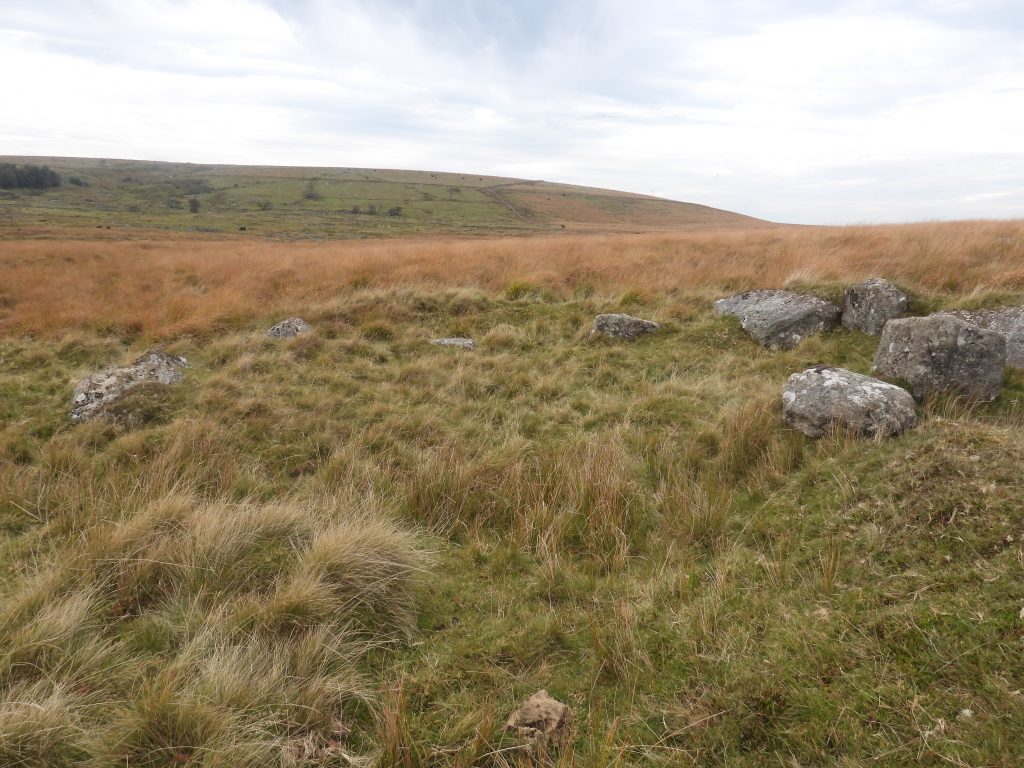
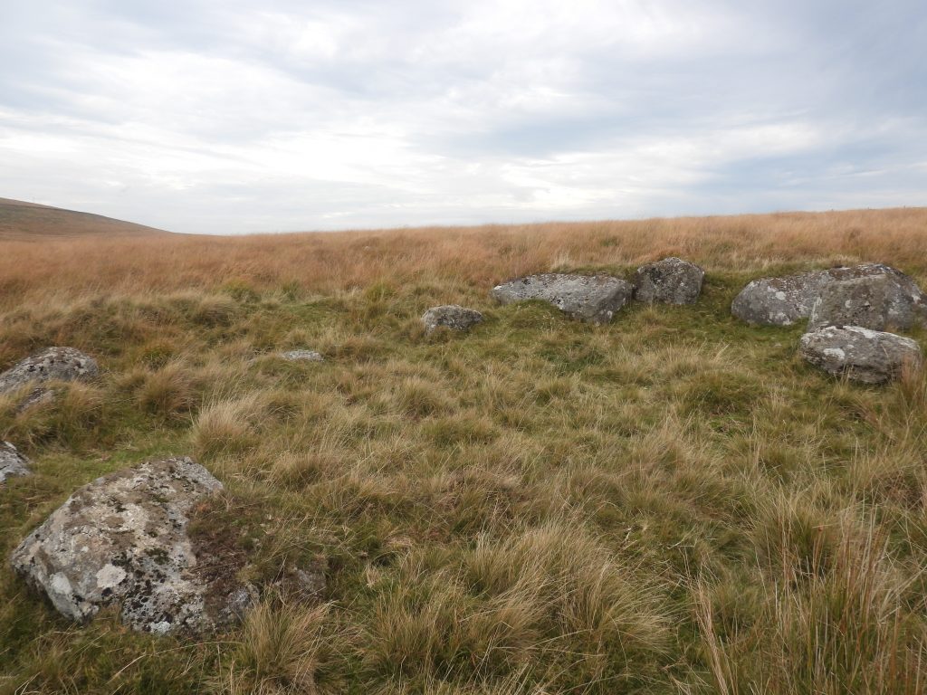
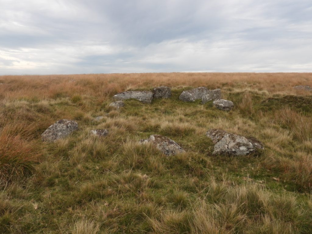
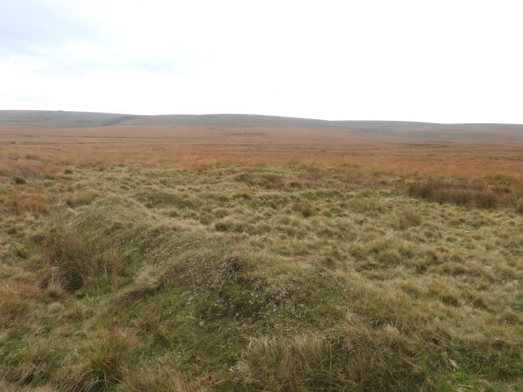
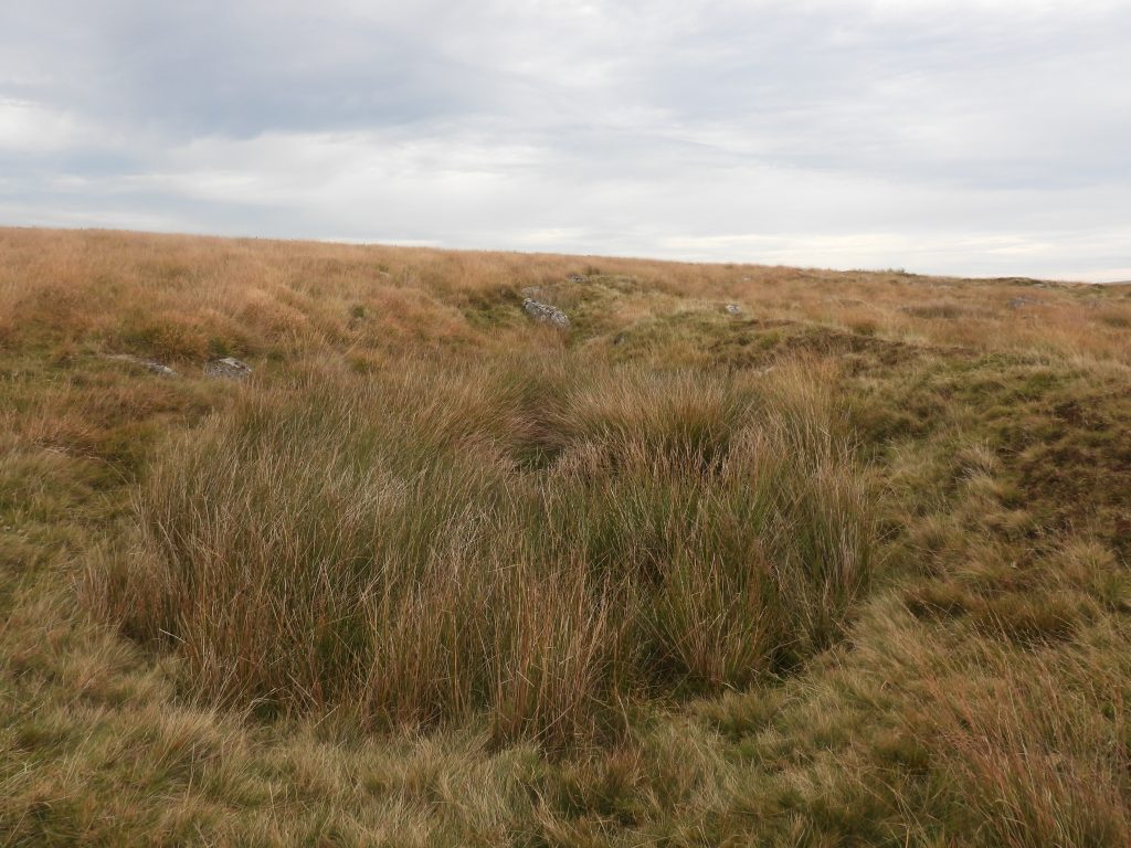
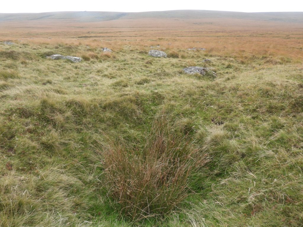
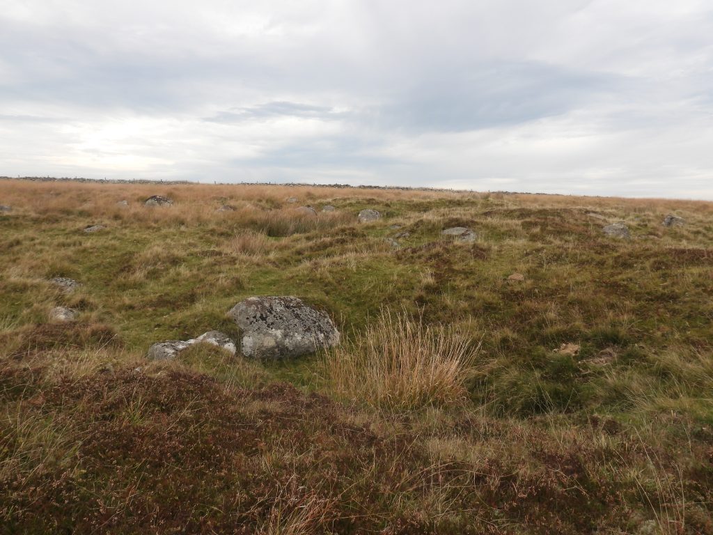
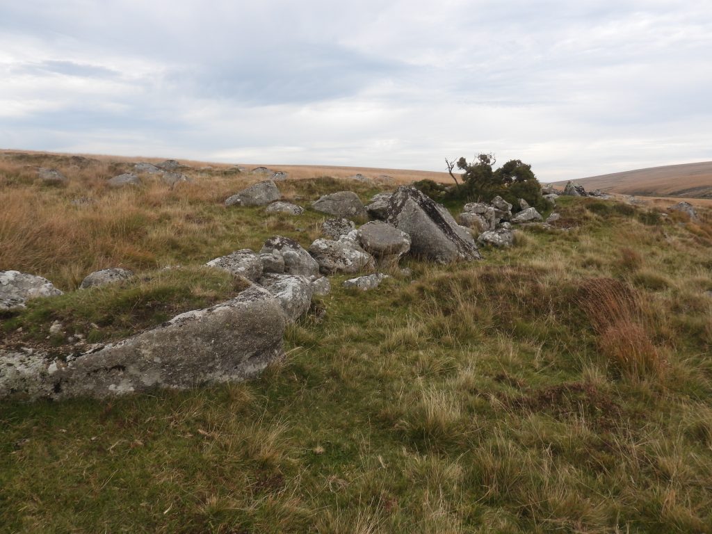
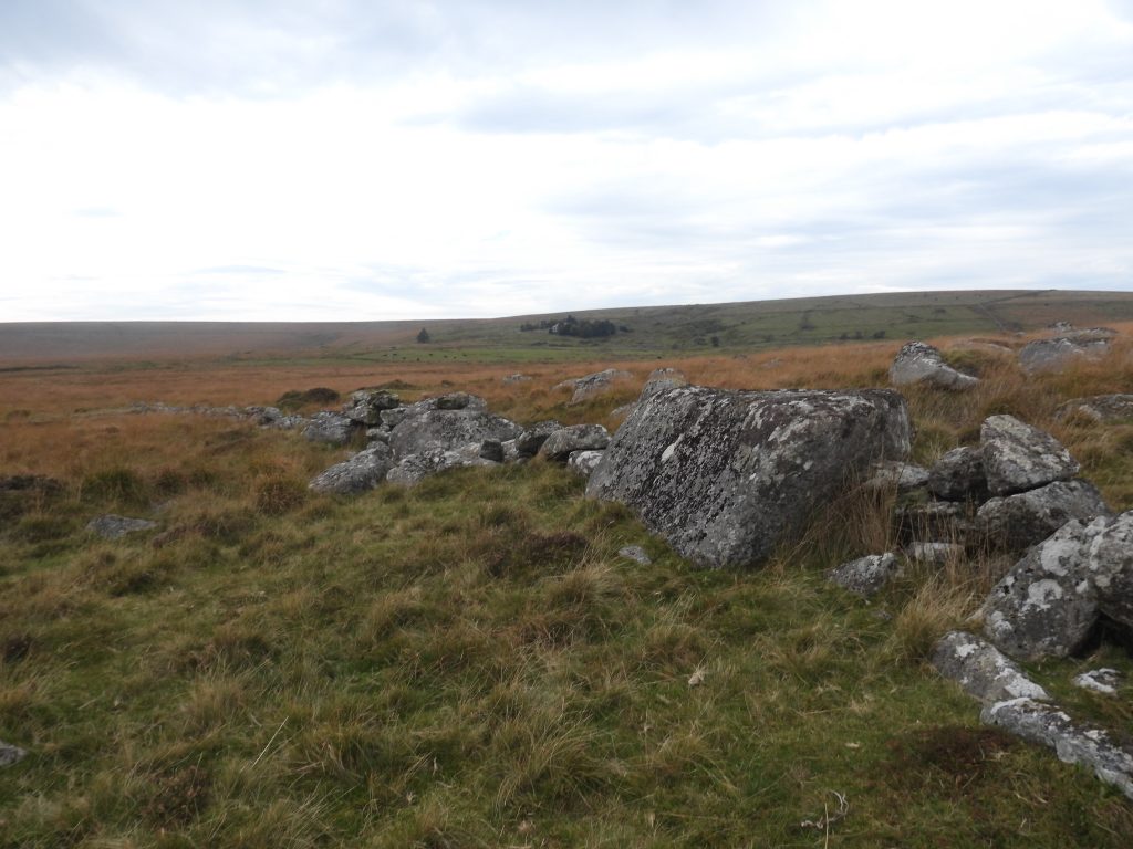
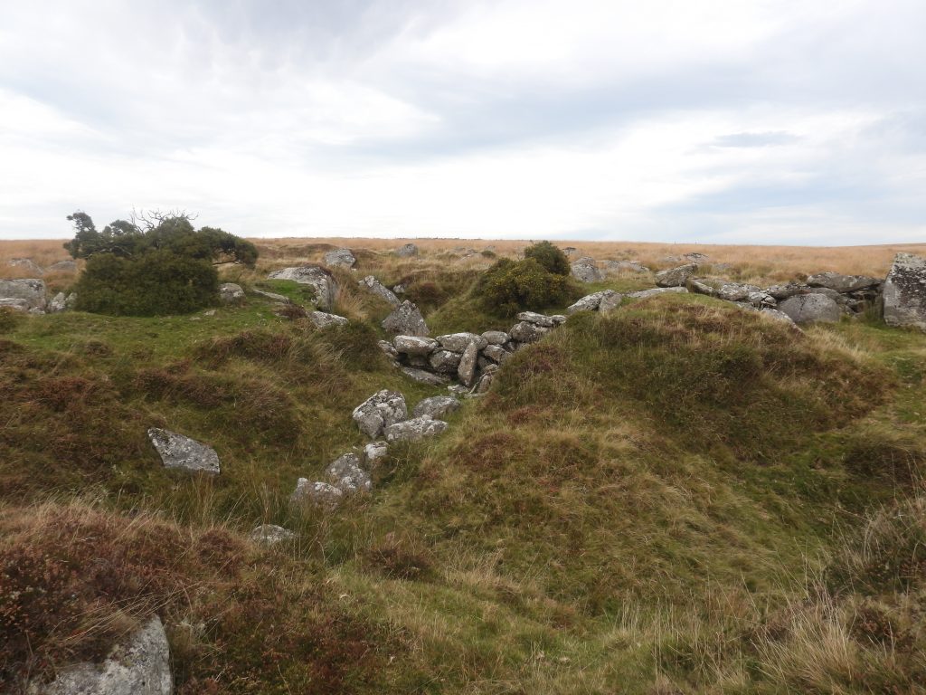
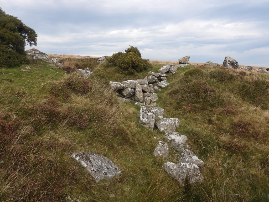
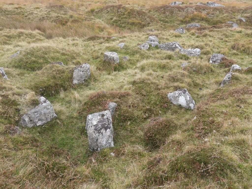
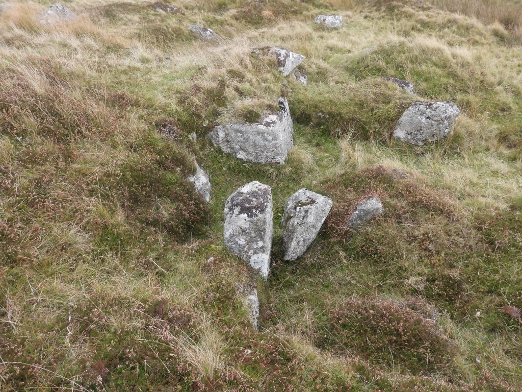
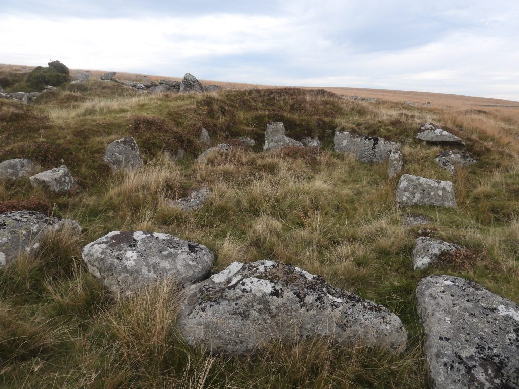
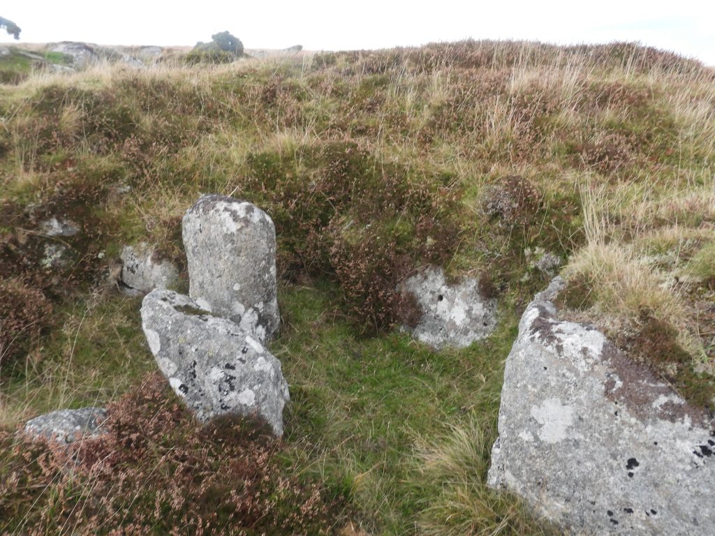
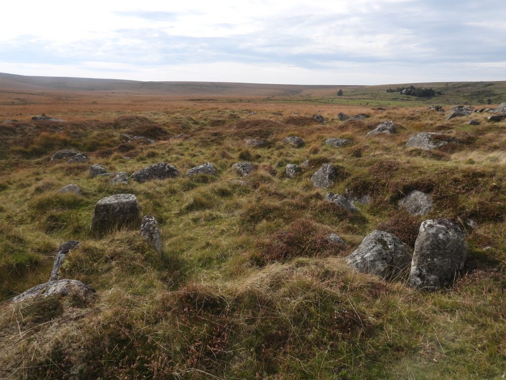
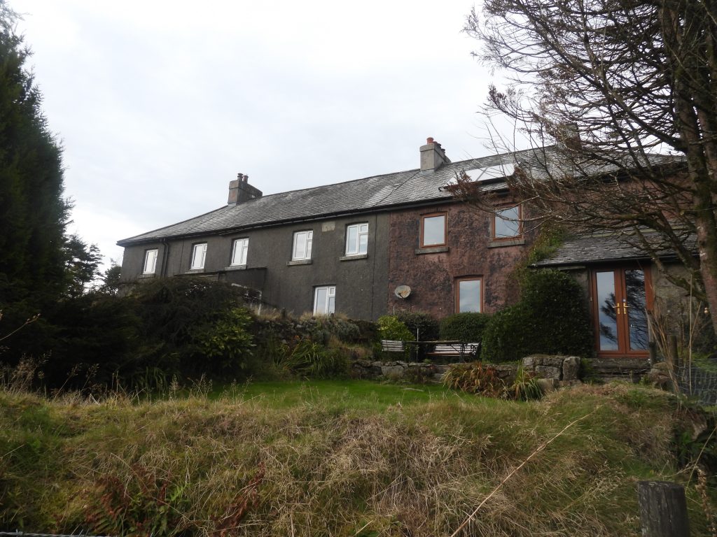
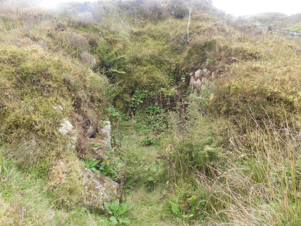
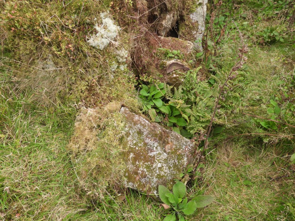
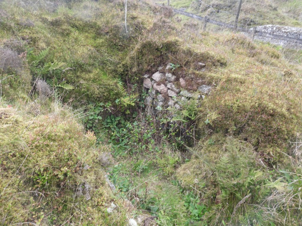
This annotated LiDAR plot shows the key features covered in this post. Note the inverted ‘V’ shape of the irregularly spaced tin pitsThis structure is annotated as Tinners Hut 1 on the LiDAR plot. Tom Greeves describes it as a “probable tinners’ building with enclosure attached to west and south first noted in approximately 1988”.Tinners Hut 1 lies at SX61694 71005 and is orientated roughly south-south-west by north-north-east. Tinners Hut 1 (or building) has foundation walls defined by large blocks of stone. The internal dimensions are 7.3 m by 3.7 m. It is suggested that it is likely to be of 18th century dateThe Enclosure to the south of Tinners Hut 1. It does not appear on the Tithe Map, unlike other fields at Whiteworks (pre-construction of the Miners Cottages)The Enclosure walls are quite distinct on the ground and clearly visible from both aerial photography and LiDAR plots. As Tinners Hut 1 (or Building) is thought by some to be 18th century in date, the enclosure may be similarly dated. That said, its absence from any maps (including Tithe) does make it difficult to dateImmediately to the east of Tinners Hut 1 and north of the Enclosure is this ‘teardrop’ shaped depression, which looks like a small Tinners’ pool. It doesn’t look like an exploratory pit like others in the area. Its exact original purpose remains a mystery to the authorTypical exploratory trial pit from the area to the immediate east of the Enclosure and Tinners Hut 1. There are two distinct lines of pits in the area which are shown on the LiDAR plot as an inverted ‘V’. The top of the ‘V’ lies next to a Newtake Wall at SX61814 71078More trial pits. These pits range from 2.0 to 5.5m in diameter and from 0.8 to 1.5m deep. This line of pits runs roughly NE to SW from the Newtake Wall down to the Swincombe River passing close by the EnclosureThis wall runs roughly east-west and is to the south of the main Newtake wall which runs from Whiteworks to Swincombe Intake Works. This smaller wall is crosses the NW – SE line of Trial Pits at around SX61858 70970, just north of Tinners Hut 2.The wall looking west towards WhiteworksThe point where the wall meets the trial pits and tinners’ workingsThere appears to be a spur of walling leading south (towards Tinners Hut 2)Tinners Hut 2 is oriented E-W, measuring 6.5m by 3.9m internally. The walling comprises a single course of large in-line boulders, on three sides (south, east and west).On the north side (rh side on the photograph) there is a slight platform. The Ordnance Survey Archaeology Division suggest: “It is probably a tinners hut but positive identity is impossible”. The structure is suspected as being of Medieval origin.In the Tinners Hut there is a well-defined fireplace at the east end which measures (internally) 1.9m by 0.9m with an 0.9m high granite pillarTinners Hut 2 lies in an area of intensive open-cast tin workings and prospecting pits. The walls are constructed from large boulders with a maximum height of 1m and thickness 1m. A large spoil heap, upcast from a deep tin pit, abuts the north side (left of photograph) and east side (far end of photograph) of the Hut. Close up of the fireplaceTinners Hut 2 looking west towards Whiteworks Cottages. According to OS, there are two or three possible small paddocks attached to the west, albeit RCHME suggest this is unlikely. The building is located at SX61867 70951Whiteworks Cottages were built around 1871. All three cottages were once covered in tar and were known as Black Cottages (ref: Kate Butterworth, 3 Miners Cottages)This structure is behind Whiteworks Cottages and was kindly shown to the author by Kate Butterworth. There are at leat 10 courses of blocks here on the east and west sides of the structure, which is built into a bank. Its purpose is unknown.At the front of the structure there is some shaped blocks which have evidence of Tare / Feather marks which would put a date of post 1800 on the structureThe structure is located at SX61081 70975. It is possible that it was used as a food store. If anyone reading this post has any further ideas, please do get in contact. Thank you