A collection of walks, discoveries, insights and pictures of exploring Dartmoor National Park
August 18, 2025
Belstone Tin Mill
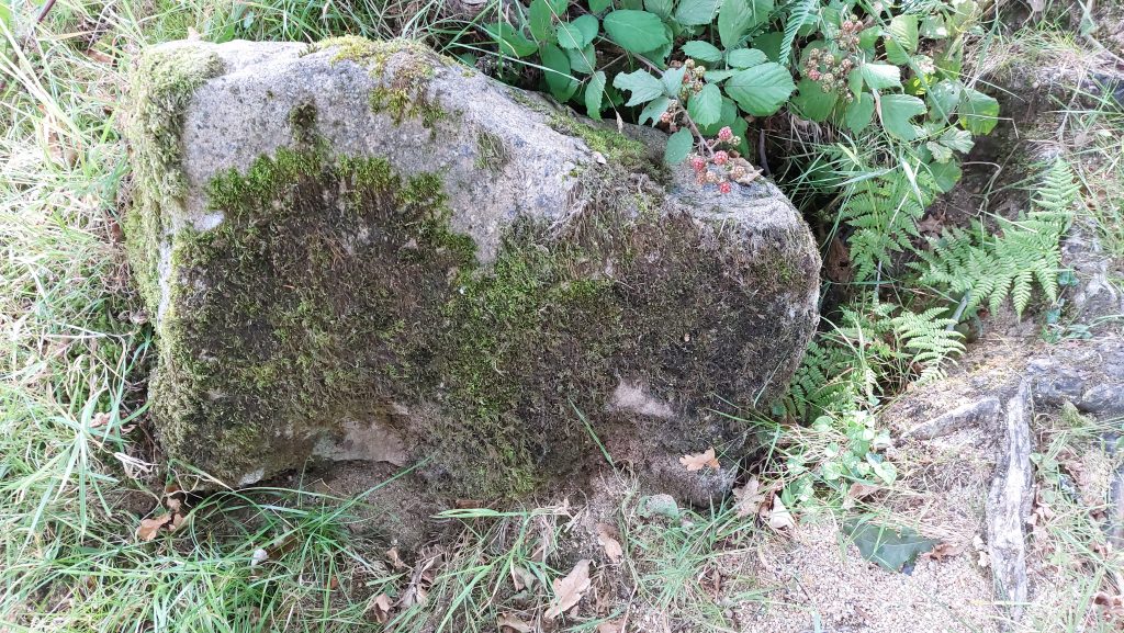
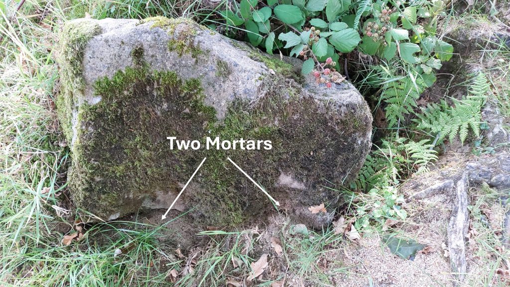
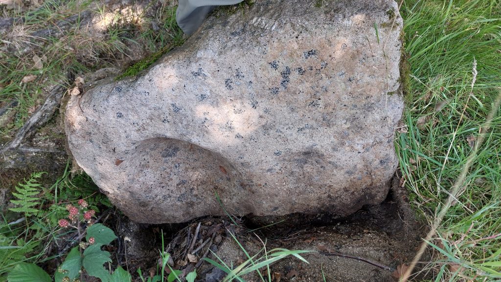
Belstone Tin Mill is recorded by Dr Tom Greeves in his table of early Tin Mills (pre-1750) as reference number 8 in the publication Dartmoor Tinworking Research Group (2016) – The Tinworking Landscape of Dartmoor in a European Context – Early Tin Mills (pre-1750). There is no remaining evidence of a structure, but there is a mortar stone and a mould stone which are located in the area which perhaps suggest that the mill might have been both a Stamping Mill and a Blowing House. These two stones, are considered to be particularly rare artefacts on this part of Dartmoor.
The mill location is thought might have existed against a tinner’s scarp some 30 metres SSW from the mortar stone (ref DRTG newletter – July 2003). Exactly, where the mill might have been located is unknown but is is thought, it is buried now beneath what is probably 19th and early 20th century Belstone village waste. This mill site together with the Thomas Takfield (Tuckfield) mill, further upstream, are the only two tin mills on the river Taw.
Bibliography
Dartmoor Tinworking Research Group (2016) – The Tinworking Landscape of Dartmoor in a European Context – Early Tin Mills (pre-1750) – page 66 (ref Mill No. 8)
Devon Historic Environment Record MDV20866 and MDV61876 – Findspots by Dr T. Greeves
Dartmoor Tinworking Research Group (DTRG) – (July 2003) – Newsletter page 2
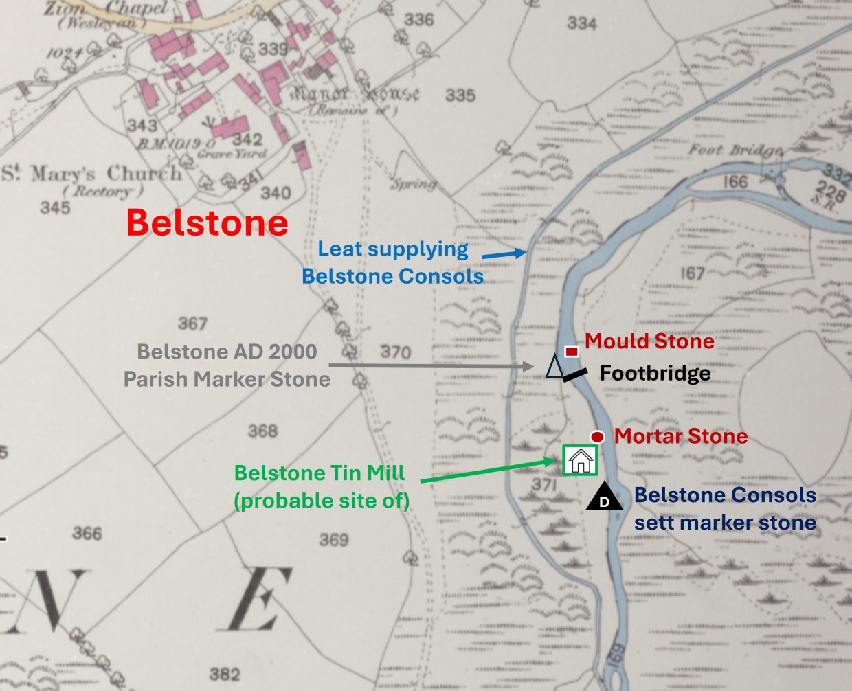
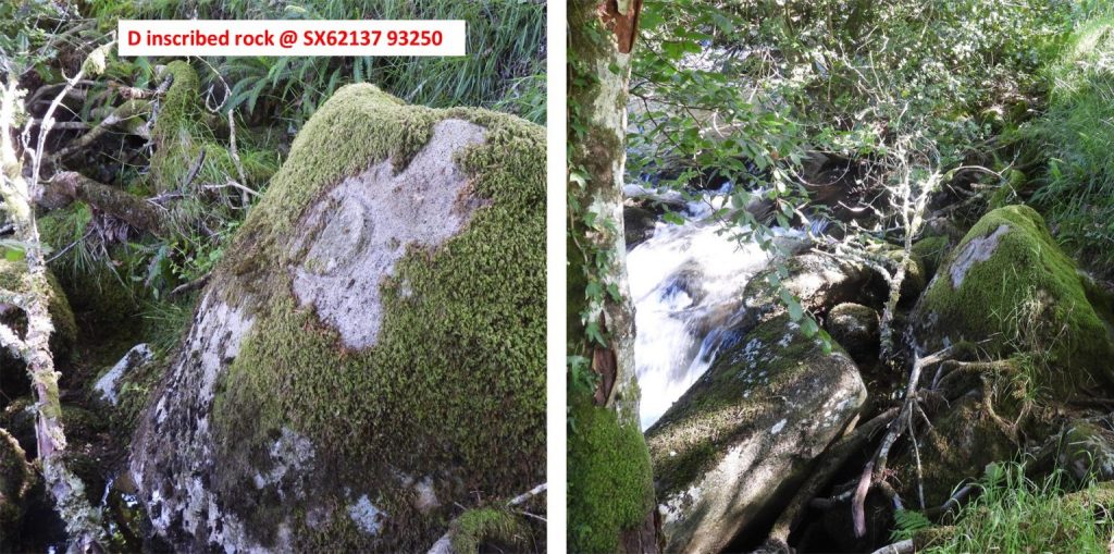
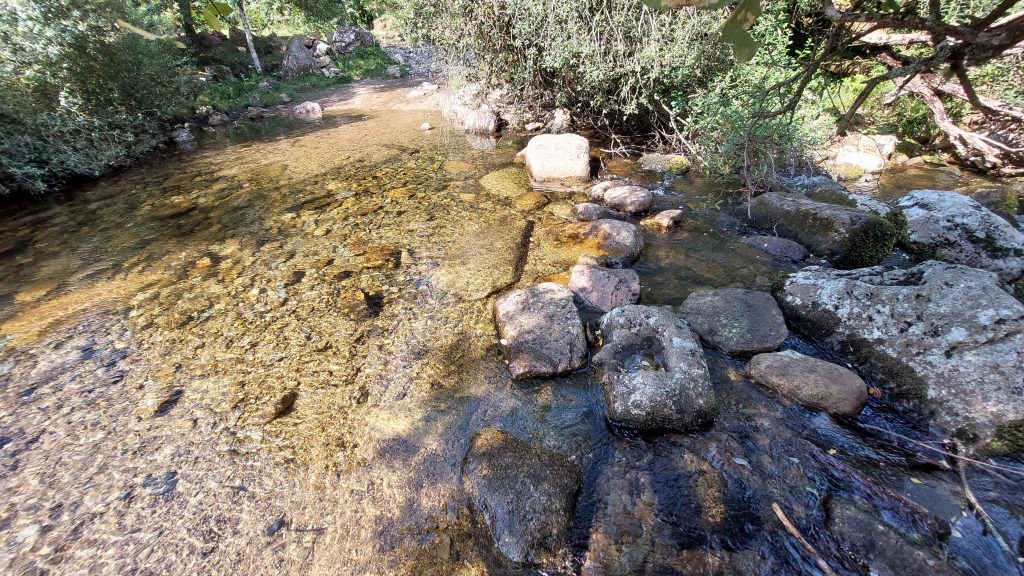
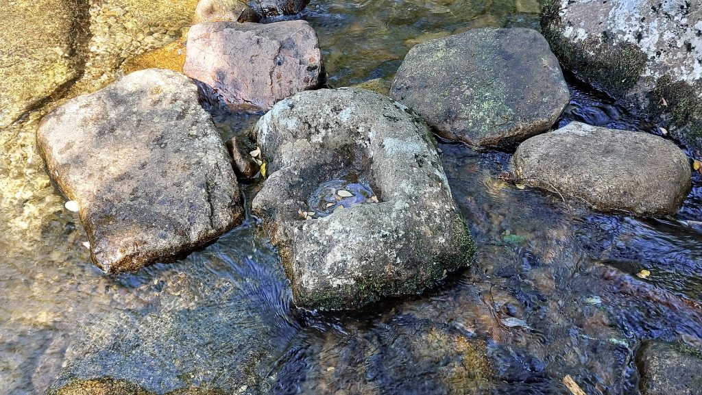
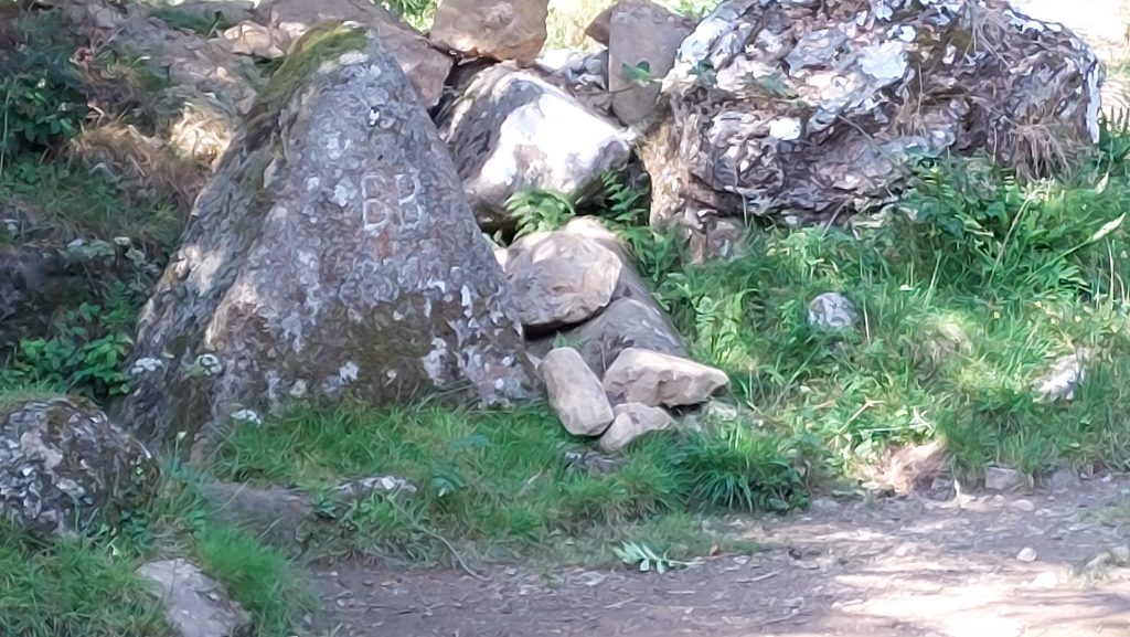
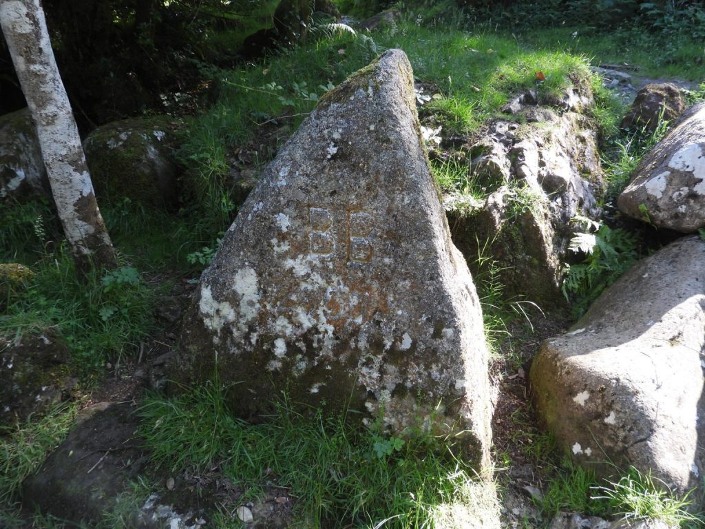
Sketch map showing the probable site of the Belstone Tin Mill plus possible associated mortar stone and mould stoneAbout 4m from the left (west) bank of River Taw, is this mortar stone, which is on edge and as such not in situ. Mortars visible on two opposing faces (two per side). That said, it is thought that it is unlikely not to have moved far and therefore must be close to where the Tin Mill would have been sited, which is thought to have been about 30m south south-westAnnotated picture of the mortar stone. The mortar stone is approx 25m upstream from a footbridge at SX62141 93323The reverse side of the mortar stone, with one well worn and one partially worn mortar. The stone measures 0.71m x 0.45m, x 0.20m thick and is broken along the top edge. One of three (known) inscribed rocks along the Taw denoting the boundary of Belstone Consols. It is inscribed “D” can be found approx 100m upstream from the footbridge across the Taw just below the village. This rock complements the “A” and “B” rocks further down the Taw. One assumes there is or was a “C” stone next to the Taw somewhere between the “B” and the “D” stones.This incomplete mould stone was first seen in the bed of the River Taw in 1974 by Tom GreevesThe mortar stone is located at SX62119 93365On 1st June 2000, the bounds of Belstone once more were beaten. Their first stop was to see the new boundary stone near the footbridge below the village. The stone is next to the ford where the mould stone is located. It is inscribed “BB” with “2000 AD” below. It was carved by Peter Cooper.The location of the “BB” / “2000 AD” boundstone next to the Taw is SX62111 93360