A collection of walks, discoveries, insights and pictures of exploring Dartmoor National Park
August 11, 2025
Newpark Wood and Newpark Waste
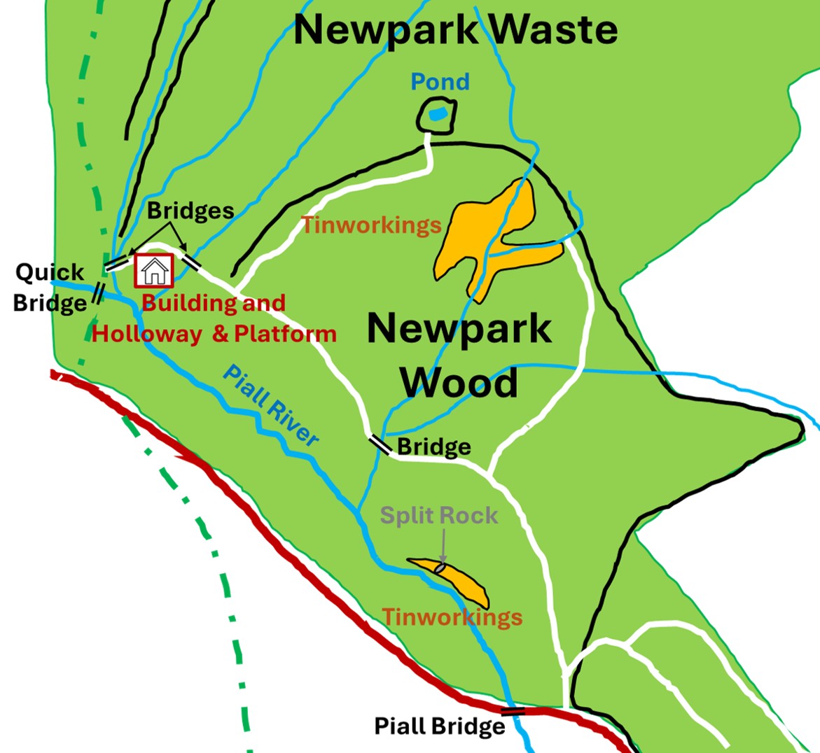
Newpark Wood and Newpark Waste are located to the north of the Piall River between Quick Bridge and Piall Bridge. The forestry tracks appears to be very popular with locals, dog walkers and joggers. The area is sandwiched between the Cornwood to Lee Moor Road and the open moor at Rook Tor and Penn Beacon. The woodland is both broad leaf and conifer and has a wide track which connects Quick Bridge and the area around Piall Bridge to the south east.
This ‘exploration’ considers some of the main features in the area, some along the main track and others most definitely ‘off piste’ in the sometimes dense woodland and undergrowth. There are two areas of what is most probably Medieval Tinworkings, several very well constructed granite bridges, a mystery holloway and adjacent platform, a mystery ruined building, a 20th century pond of unknown use and evidence of rock splitting (tare and feather) on a pink granite boulder
Bibliography
N. Berry and T. Simmonds (1996), An Archaeological Survey of Boro Wood (SX7571), Erme Wood (SX6357), Wistmans Wood (SX6177) and Newpark Waste (SX5961)
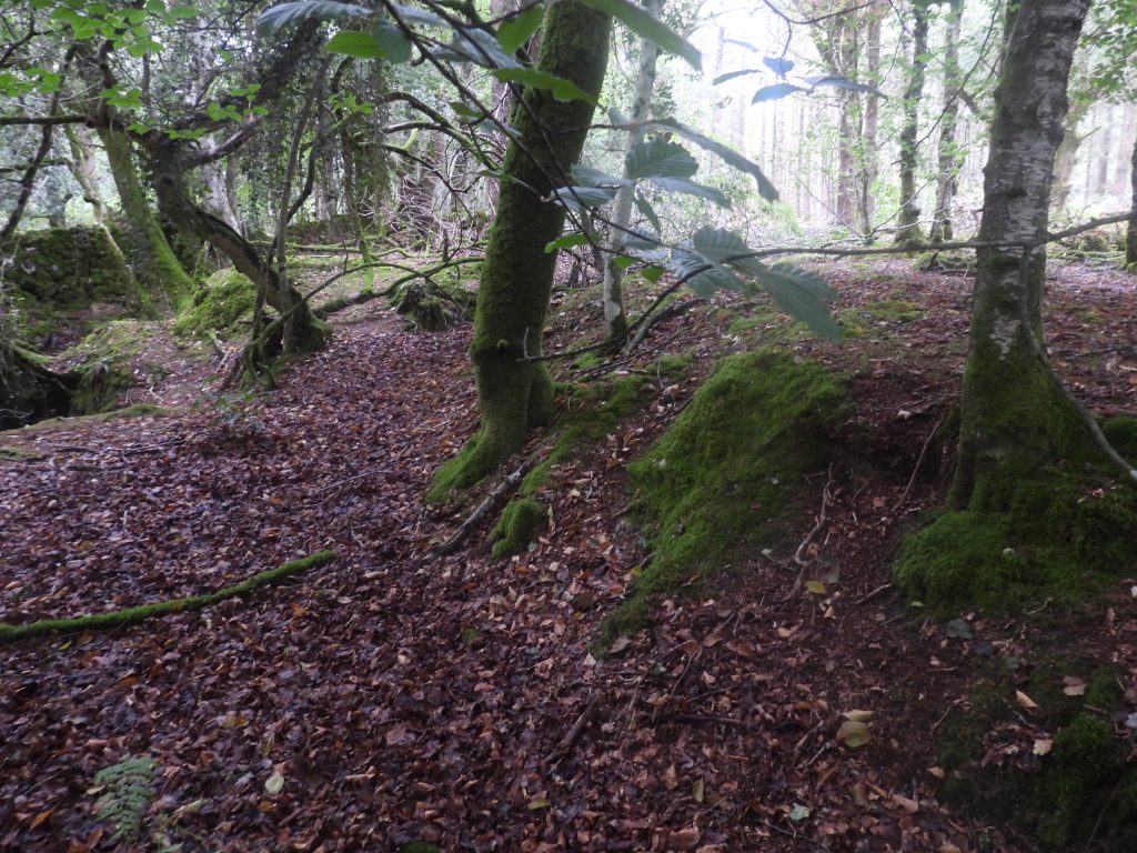
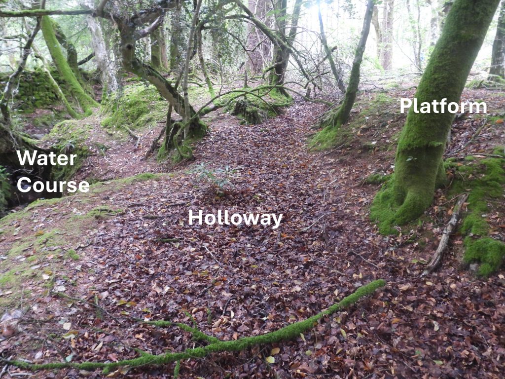
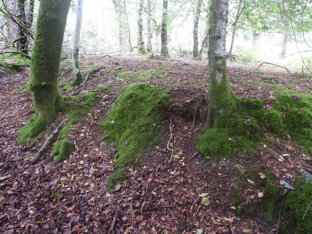
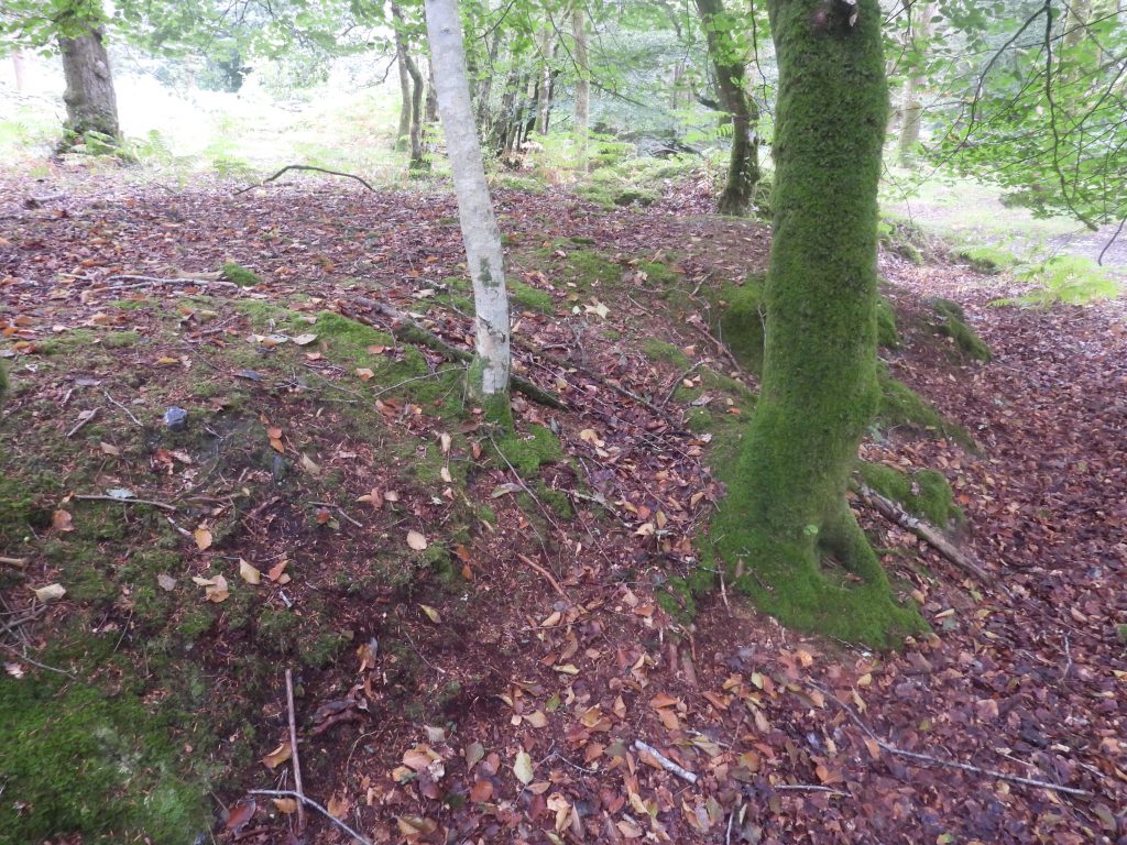
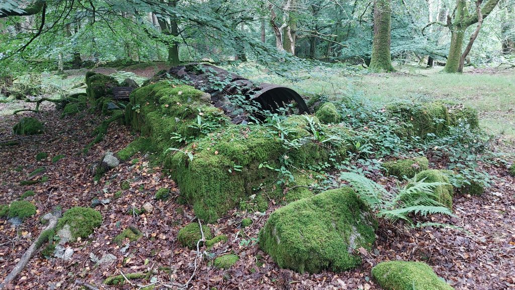
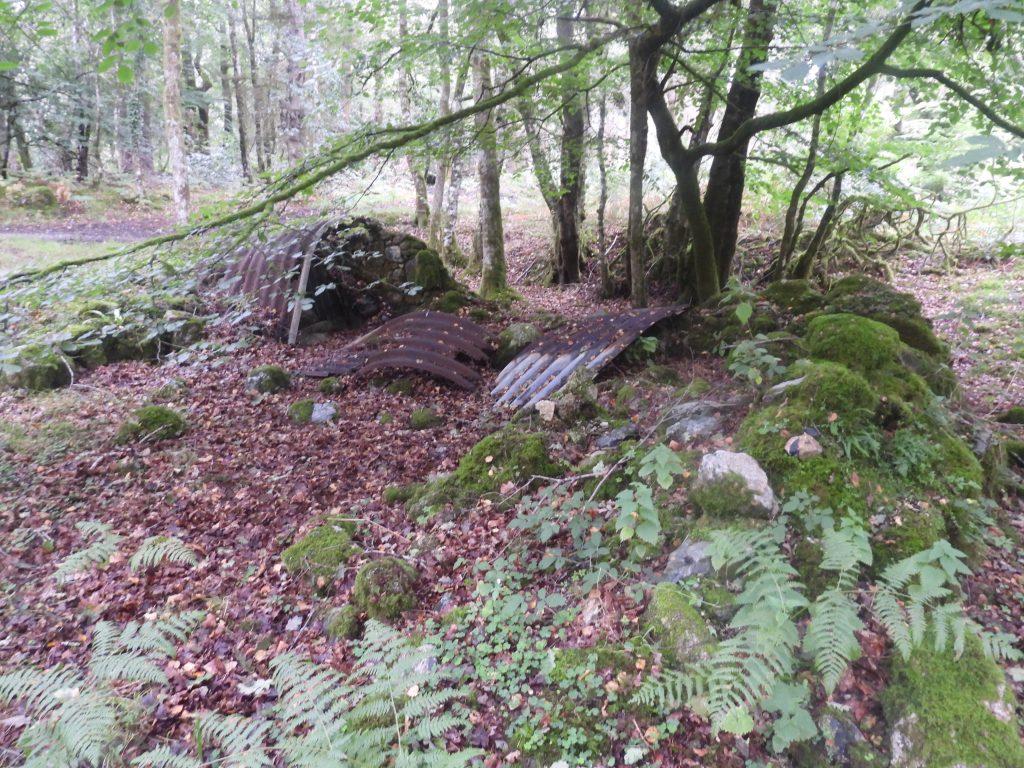
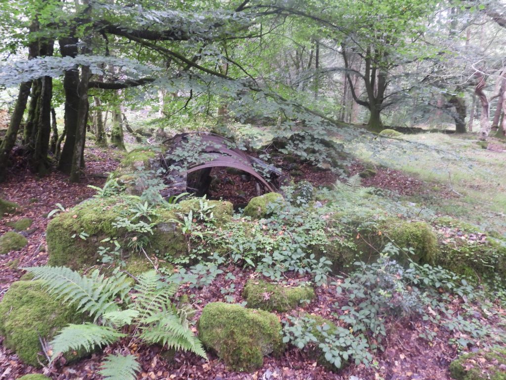
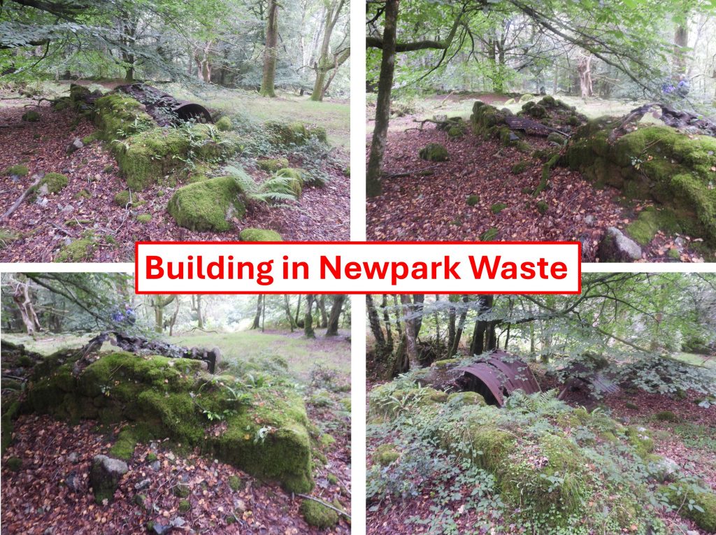
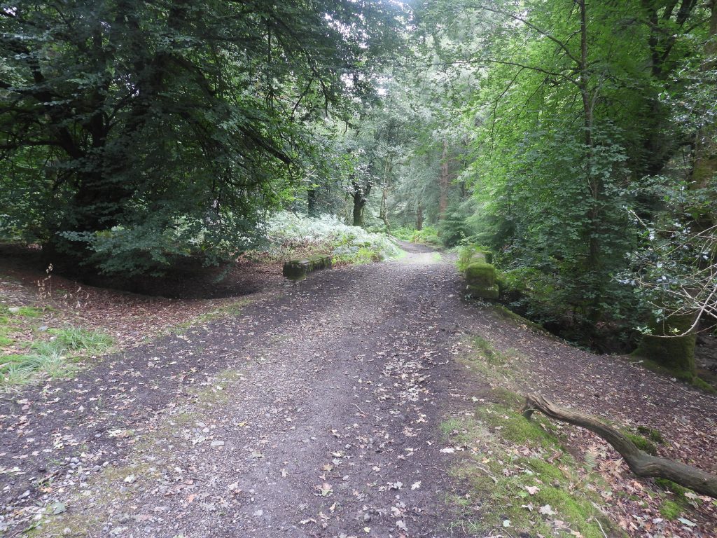
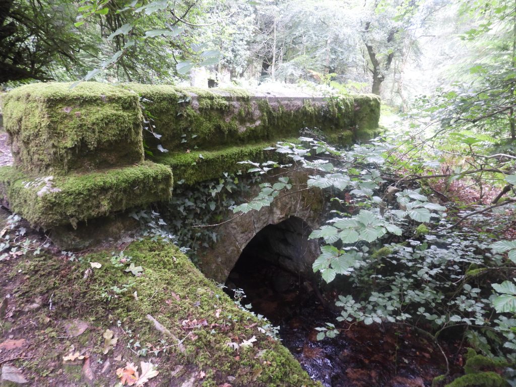
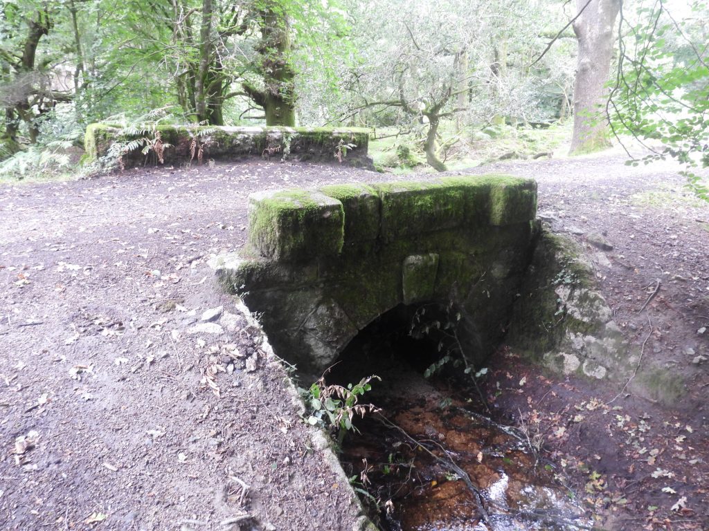
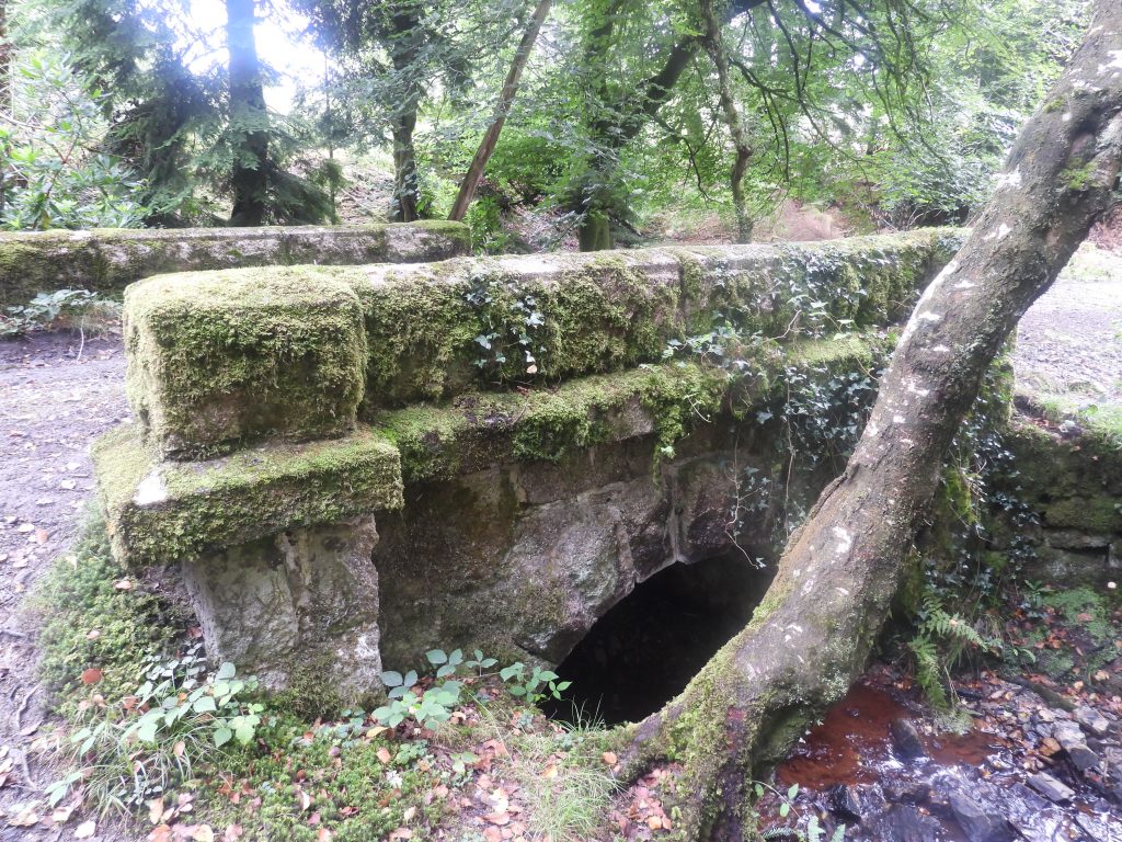
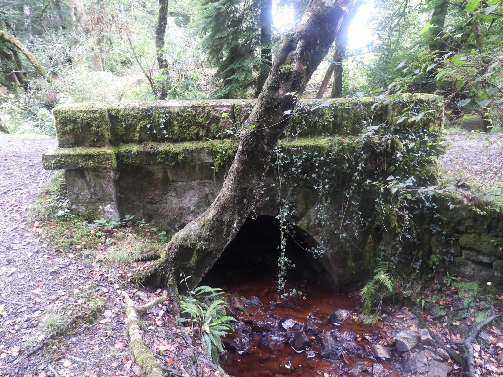
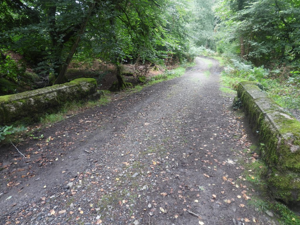
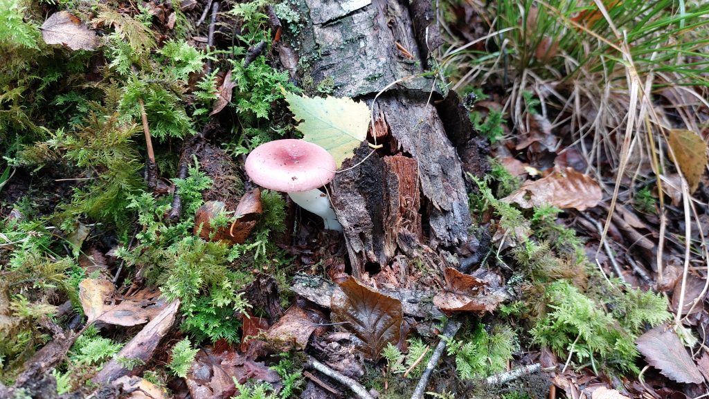
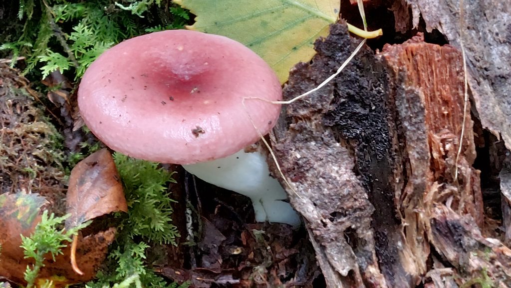
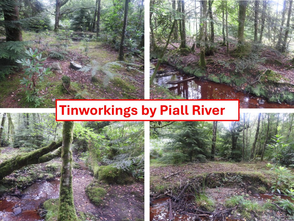
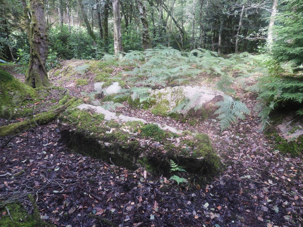
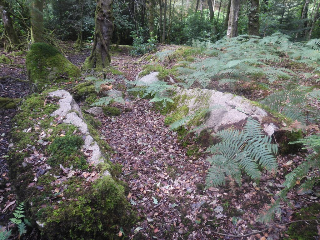
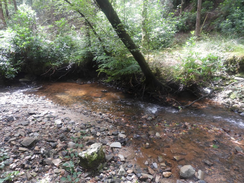
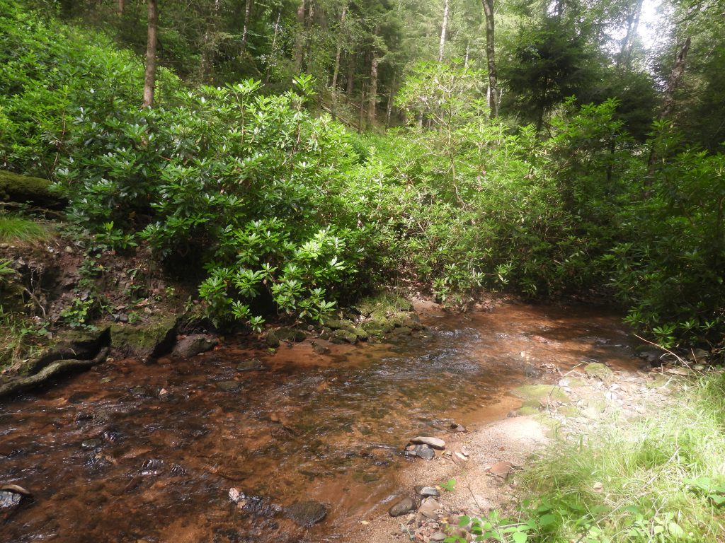
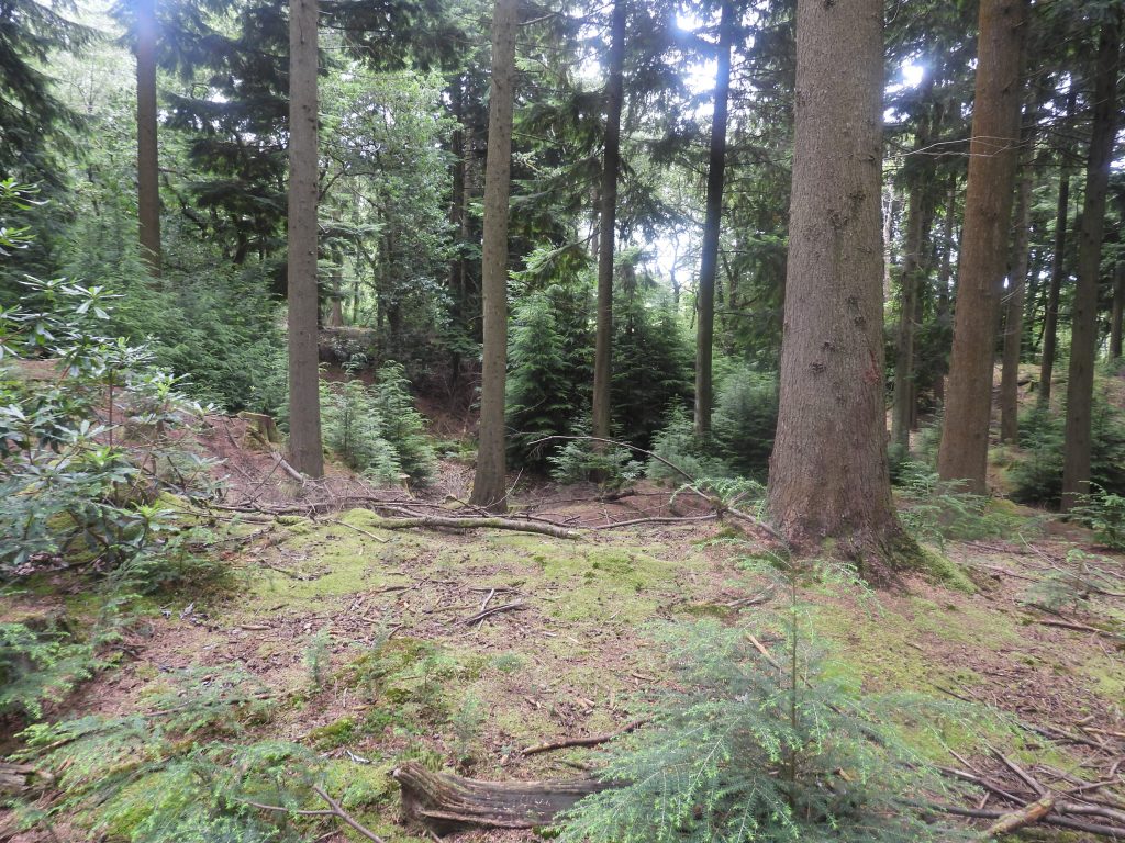
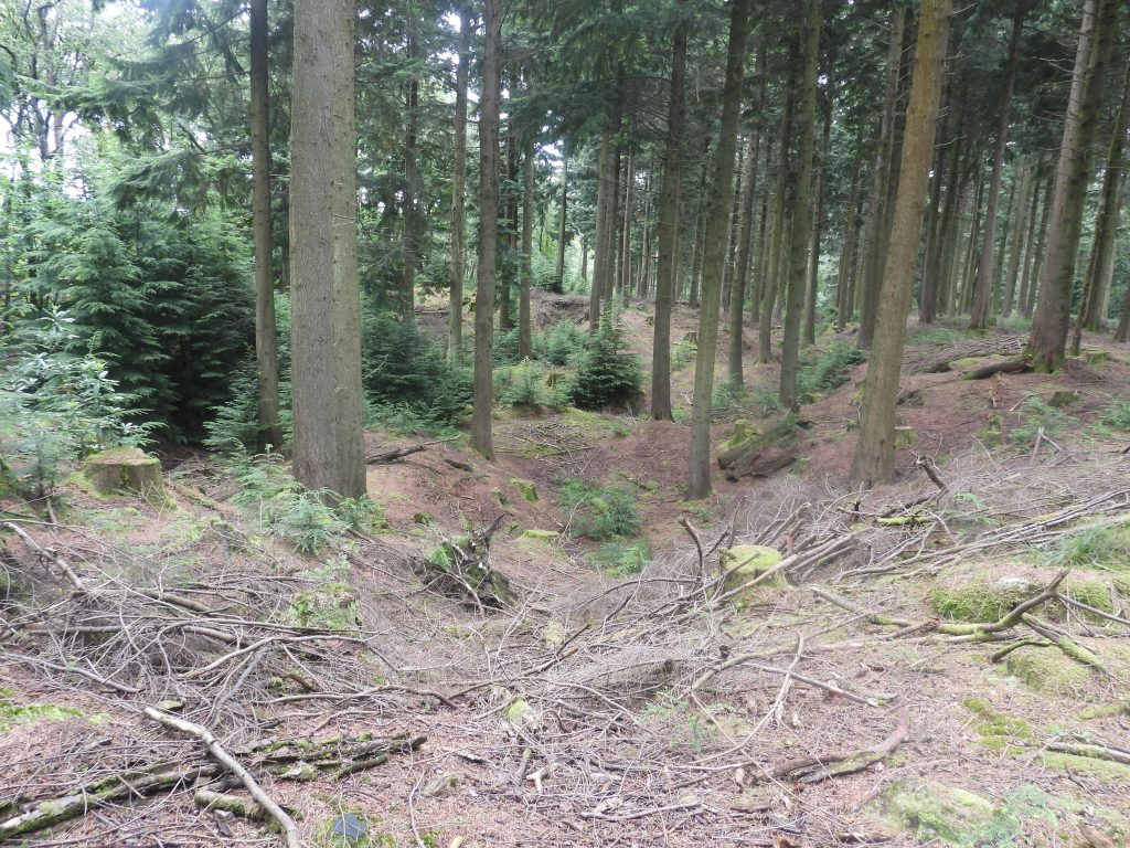
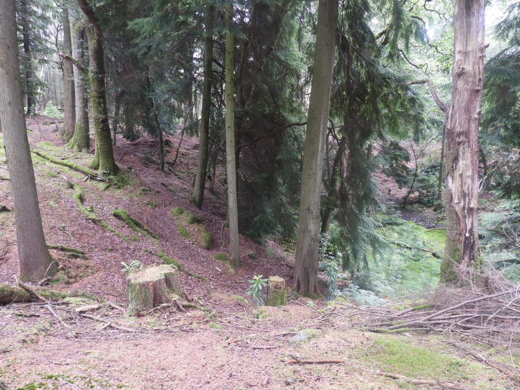
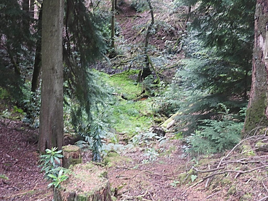
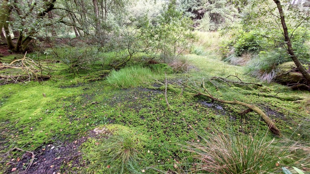
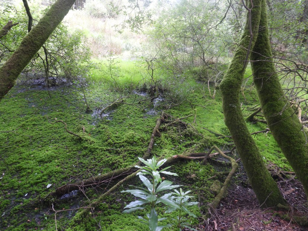
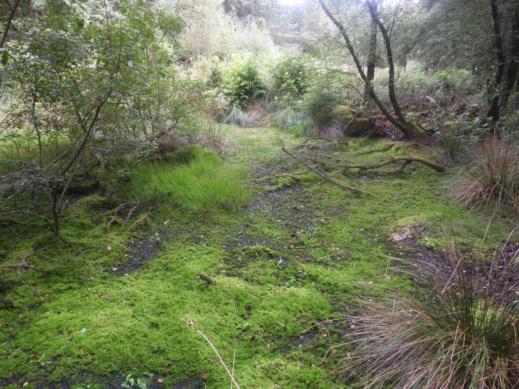
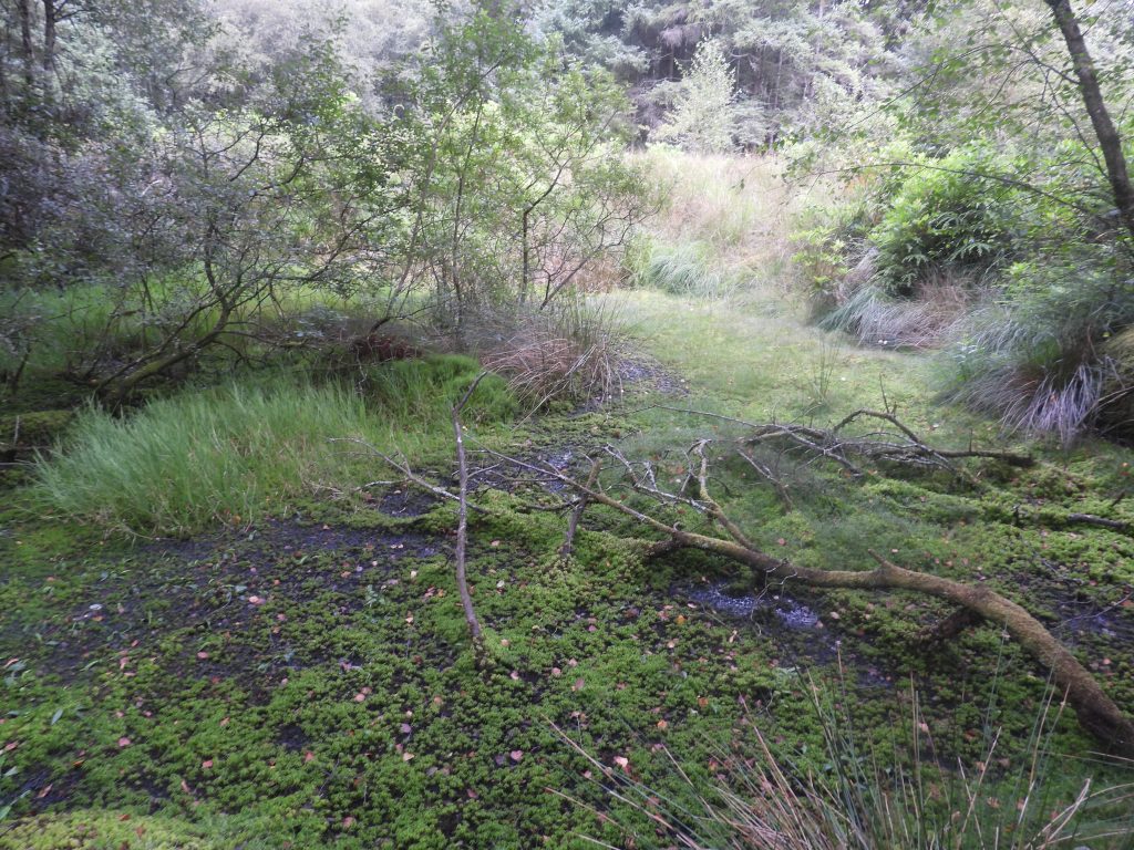
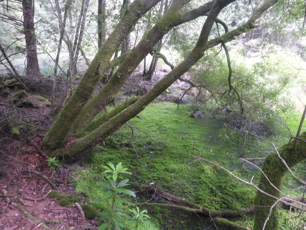
Sketch map of the area and features covered in this post. Note that any area away from the forest track (shown in white) are quite densely covered by trees and thick undergrowthHolloway and Platform. This unannotated picture looks like a typical woodland scene and doesn’t really convey what is hereHolloway and Platform annotated picture. These features are not far from Quick Bridge and just 20m away to the west, from a ruined building (also covered in this post). The platform appears man-made as there is some worked stone around but conceivably might be natural. The Holloway is between 1m-2.5m wide and around 25m longThe platform is around 5m square (ish). Its function alongside the holloway is unknownPlatform (left) and Holloway (right) were suggested by Berry and Simmonds in 1996 as possibly being related to the nearby bridge This ruin is located around 100 metres from Quick Bridge. Its original function is unknown and thought to date from 19th Century. There are old tin workings in Newpark Wood but not contemporary with the age of the structureThe building has external dimensions of 7.4 metres by 5.5 metres with the walls being 0.55 metres thick. There are no entrance or internal features visibleWithin the building ruins is a domed corrugated iron structure, which looks that it make have once been an animal shelter.Recorded in 1996, it was stated that north-west and south-east corners survived to a height of 1.9 metres and 2.4 metres respectively. The building has certainly deteriorated in the last 30 years or so. The building is located at SX59275 60858The main track which runs north west to south east is very wide, no doubt allowing logging to be undertaken with access for lorries and trailers. The picture shows the track leading to one of three small bridges in the woodThe three bridges in the wood are all very well-made with dressed and roughly faced stone. They comprise a single span with keyed arch. The construction of the bridges do suggest they were intended for ornamental effect as much as regular use. This bridge is located at SX59323 60854This bridge is slightly smaller than the two others in the wood and measures 2.5 metres wide by 3.0 metres span.This bridge is located at SX59485 60705Taking the route towards Piall River (south) through the woods either just before and just after the bridge will take the explorer to some old tin workings. Be prepared for the terrain to be overgrown and rough in placesFunghi found between the bridge and the Piall RiverZoomed in view of the funghi, the name is unknown to the authorThe tinworkings by the Piall River. Dr Tom Greeves writing in 1982 suggested the workings on the left bank of the Piall River were probably 16th century or possibly earlier. He also suggested that the workings maybe identified as the early 17th century called Peall Pyttes although this is uncertainThis boulder was an unusual find. It is Pink Granite and has been split, with evidence of tare and feather markings (which dates this to post 1800). Most of the granite on Dartmoor is grey with black and white speckles which came from when the magma solidified with a high percentage of quartz and amphibole. When magma cools and solidifies with a higher percentage of potassium feldspar compared to other minerals that are present, then chances are it will form a pink granite, as in this case. Of course, this location is on the fringes of high Dartmoor, which may be a factor as wellThe split pink granite boulder is an ideal place for a coffee or lunch stop. It is close to Piall River and with care can be accessed from the main track through the trees and undergrowth. It is located at SX59487 60628The Piall River has evidence of stony and sandy ‘beaches’ which may be testament to the Tinners’ activities in the area. The picture was taken not far from the split pink granite boulderAlongside the Piall River there are many very large Rhododendron trees / bushes which are a non-native invasive species in the UK. The National Trust state: “Generally it is neither vigorous nor invasive in its natural habitat, parts of the Iberian peninsula, eastern Europe and west Asia. However, cross breeding with frost-hardy rhododendron species from north east America has produced hybrid vigour and helped the plants adapt to colder temperatures. Together with its fertility and tolerance of shade, the plant has been able to thrive in our climate and out-compete native flora. Rhododendron became popular in policy woods around estate houses during the Victorian period. It was widely planted as a garden ornamental, and used as a shelter belt and for game cover. It was also a popular root stock for the many hybrid varieties of rhododendron. The pattern of invasion usually centres around these estates and some settlements”.To the north of the main forest track (taking a side north-south side track) some rather large tinworkings, can be foundDr Tom Greeves wrote in 1982 that this ‘deep-bowled’ excavation was medieval or possibly early modern periodThe large tin workings are now engulfed by trees and no doubt at one point would have been on open moorland. Dr Tom Greeves states that the area may have been artificially deepenedA small tributary of the Piall River flows through the workingsTaking a side track to the north alongside a wall will lead the explorer to this small pond / reservoirThe pond is very overgrown around edges and maps suggest there was once a wall surrounding it. The pond has banks around perimeter and most definitely of artificial construction. The reason for its construction is unclear as there does not appear to be any obvious inlet of outletThe pond is approx 3.0 – 4.0 metres wide, and there is a possible small island in the middle – does this give a clue as to its original use? Could the pond be ornamental ? It certainly doesn’t appear to have been for industrial or agricultural purposeThe pond can be found at SX59540 60989The pond is depicted on the mid-late 20th century historic mapping with a track leading directly to it. The track runs through some walling, but in 2025 the route is not as obvious as the map suggests and some walking through some overgrown vegetation and fallen branches is needed